
Muswell Hill
Encyclopedia
Muswell Hill is a suburb of north London
, mostly in the London Borough of Haringey
. It is situated about 6 miles (10 km) north of Charing Cross
and around 8 miles (13 km) from the City of London
. Muswell Hill is in the N10
postal district
and mostly in the Hornsey and Wood Green parliamentary constituency.
, who was the Lord of the Manor of Harringay, owned the area and granted 65 acres (263,000 m²), located to the east of Colney Hatch Lane, to a newly formed order of nuns. The nuns built a chapel on the site and called it ‘Our Lady of Muswell’.
The name Muswell is believed to come from a natural spring or well (the "Mossy Well"), said to have miraculous properties. The traditional story tells that a Scottish king was cured of disease after drinking the water of the spring/well. The area became a place of pilgrimage for healing during medieval times. The River Moselle
, which has its source in Muswell Hill and Highgate, derives its name from this district; it was originally known as the Mosa or Mosella.
In the 18th century Muswell Hill was a scattered village consisting mainly of detached villas with large gardens. In 1787 one commentator wrote that nowhere within 100 miles (160.9 km) of London was there a village so pleasant or with such varied views. Little had changed by the middle of the 19th century. One of the houses of the time was The Limes. This house occupied the angle of Muswell Hill Road with Colney Hatch Lane and was a three-storeyed house with portico and two-storeyed wing approached by a double carriage drive through impressive gateways. The large grounds of the house extended to Tetherdown and included a lake. Opposite The Limes was Muswell Hill pond and beyond that the Green Man inn, built of stone. Further down the hill past the Green Man was the Elms a squat three-storeyed house later improved by Thomas Cubitt
standing in 11 acres (44,515.5 m²), part of the grounds of which were laid out by Joseph Paxton. A short distance down the north side of Muswell Hill was the Grove, which was three storeys high and had nine bays with pedimented projections at each end. It stood in 8 acres (32,374.9 m²) of grounds which contained a 200 yard avenue of oaks. In 1774 the house was occupied by Topham Beauclerk
. A little farther down the hill stood Grove Lodge, also in wooded grounds. Altogether there were eight properties in Muswell Hill worthy of note in 1817.
 Parallel with Muswell Hill was a track known as St. James's Lane which ran across a triangle of wasteland. By the middle of the 19th century houses were already dispersed along the lane at the foot of which was Lalla Rookh, a two storeyed villa with a wide verandah. Other buildings there were apparently cottages or huts, both single and in terraces.
It was not until the end of the 19th century that Muswell Hill began to be developed more densely from a collection of country houses to the contemporary London suburb it is today. The development was spurred by the opening of a branchline railway
with connecting services to Finsbury Park and Kings Cross stations. Most commercial development was initiated in the early 20th century when the current street pattern was set out and elegant Edwardian retail parades were constructed. The centre included a music hall (later demolished with the site redeveloped as a supermarket) and several churches for various denominations.
The 1930s saw the construction of an art deco
Odeon cinema. The site of the Ritz, a cinema formerly at the top of Muswell Hill, has been redeveloped as offices.
Until the mid-20th century there was a rail branch line, the Muswell Hill Railway, from Highgate
which passed through Muswell Hill, terminating at a station at Alexandra Palace
. It was intended under the Northern Heights plan to integrate this into the London Underground
Northern Line
; some contemporary tube map
s (e.g. the 1948 map) showed the line as being under construction. However, this plan was cancelled after the 1939-45 war, and the railway line was abandoned in 1954. The line was later converted to become the Parkland Walk.
Until the reorganisation of London's local government in 1965, Muswell Hill formed part of the Borough of Hornsey
within the administrative county of Middlesex
. The area subsequently became part of the London Borough of Haringey
.
, Bounds Green
, East Finchley
, Finsbury Park and Turnpike Lane
and to train services at Alexandra Palace
and Hornsey
.
The nearest tube stations are:
London
London is the capital city of :England and the :United Kingdom, the largest metropolitan area in the United Kingdom, and the largest urban zone in the European Union by most measures. Located on the River Thames, London has been a major settlement for two millennia, its history going back to its...
, mostly in the London Borough of Haringey
London Borough of Haringey
The London Borough of Haringey is a London borough, in North London, classified by some definitions as part of Inner London, and by others as part of Outer London. It was created in 1965 by the amalgamation of three former boroughs. It shares borders with six other London boroughs...
. It is situated about 6 miles (10 km) north of Charing Cross
Charing Cross
Charing Cross denotes the junction of Strand, Whitehall and Cockspur Street, just south of Trafalgar Square in central London, England. It is named after the now demolished Eleanor cross that stood there, in what was once the hamlet of Charing. The site of the cross is now occupied by an equestrian...
and around 8 miles (13 km) from the City of London
City of London
The City of London is a small area within Greater London, England. It is the historic core of London around which the modern conurbation grew and has held city status since time immemorial. The City’s boundaries have remained almost unchanged since the Middle Ages, and it is now only a tiny part of...
. Muswell Hill is in the N10
N postcode area
The N postcode area, also known as the London N postcode area, is the part of the London post town covering part of North London, England....
postal district
London postal district
The London postal district is the area in England, currently of , to which mail addressed to the LONDON post town is delivered. The area was initially devised in 1856 and throughout its history has been subject to periodic reorganisation, contraction and division into increasingly smaller postal...
and mostly in the Hornsey and Wood Green parliamentary constituency.
History
The earliest records of Muswell Hill date from the 12th century. The Bishop of LondonBishop of London
The Bishop of London is the ordinary of the Church of England Diocese of London in the Province of Canterbury.The diocese covers 458 km² of 17 boroughs of Greater London north of the River Thames and a small part of the County of Surrey...
, who was the Lord of the Manor of Harringay, owned the area and granted 65 acres (263,000 m²), located to the east of Colney Hatch Lane, to a newly formed order of nuns. The nuns built a chapel on the site and called it ‘Our Lady of Muswell’.
The name Muswell is believed to come from a natural spring or well (the "Mossy Well"), said to have miraculous properties. The traditional story tells that a Scottish king was cured of disease after drinking the water of the spring/well. The area became a place of pilgrimage for healing during medieval times. The River Moselle
River Moselle (London)
The River Moselle, also referred to as Moselle Brook, is in North London and flows through Tottenham towards the Lea Valley. The river was originally a tributary of the River Lea, but it now flows into Pymmes Brook, another Lea tributary....
, which has its source in Muswell Hill and Highgate, derives its name from this district; it was originally known as the Mosa or Mosella.
In the 18th century Muswell Hill was a scattered village consisting mainly of detached villas with large gardens. In 1787 one commentator wrote that nowhere within 100 miles (160.9 km) of London was there a village so pleasant or with such varied views. Little had changed by the middle of the 19th century. One of the houses of the time was The Limes. This house occupied the angle of Muswell Hill Road with Colney Hatch Lane and was a three-storeyed house with portico and two-storeyed wing approached by a double carriage drive through impressive gateways. The large grounds of the house extended to Tetherdown and included a lake. Opposite The Limes was Muswell Hill pond and beyond that the Green Man inn, built of stone. Further down the hill past the Green Man was the Elms a squat three-storeyed house later improved by Thomas Cubitt
Thomas Cubitt
Thomas Cubitt , born Buxton, Norfolk, was the leading master builder in London in the second quarter of the 19th century, and also carried out several projects in other parts of England.-Background:...
standing in 11 acres (44,515.5 m²), part of the grounds of which were laid out by Joseph Paxton. A short distance down the north side of Muswell Hill was the Grove, which was three storeys high and had nine bays with pedimented projections at each end. It stood in 8 acres (32,374.9 m²) of grounds which contained a 200 yard avenue of oaks. In 1774 the house was occupied by Topham Beauclerk
Topham Beauclerk
Topham Beauclerk was a celebrated wit and the only son of Lord Sidney Beauclerk; he was the great-grandson of King Charles II. He was a friend of Dr...
. A little farther down the hill stood Grove Lodge, also in wooded grounds. Altogether there were eight properties in Muswell Hill worthy of note in 1817.
It was not until the end of the 19th century that Muswell Hill began to be developed more densely from a collection of country houses to the contemporary London suburb it is today. The development was spurred by the opening of a branchline railway
Muswell Hill railway station
Muswell Hill railway station was in the Muswell Hill district of north London just north of the road junction of Muswell Hill and Muswell Hill Place...
with connecting services to Finsbury Park and Kings Cross stations. Most commercial development was initiated in the early 20th century when the current street pattern was set out and elegant Edwardian retail parades were constructed. The centre included a music hall (later demolished with the site redeveloped as a supermarket) and several churches for various denominations.
The 1930s saw the construction of an art deco
Art Deco
Art deco , or deco, is an eclectic artistic and design style that began in Paris in the 1920s and flourished internationally throughout the 1930s, into the World War II era. The style influenced all areas of design, including architecture and interior design, industrial design, fashion and...
Odeon cinema. The site of the Ritz, a cinema formerly at the top of Muswell Hill, has been redeveloped as offices.
Until the mid-20th century there was a rail branch line, the Muswell Hill Railway, from Highgate
Highgate
Highgate is an area of North London on the north-eastern corner of Hampstead Heath.Highgate is one of the most expensive London suburbs in which to live. It has an active conservation body, the Highgate Society, to protect its character....
which passed through Muswell Hill, terminating at a station at Alexandra Palace
Alexandra Palace railway station (Muswell Hill branch)
Alexandra Palace railway station is a former station in the grounds of Alexandra Palace in the Muswell Hill area of north London...
. It was intended under the Northern Heights plan to integrate this into the London Underground
London Underground
The London Underground is a rapid transit system serving a large part of Greater London and some parts of Buckinghamshire, Hertfordshire and Essex in England...
Northern Line
Northern Line
The Northern line is a London Underground line. It is coloured black on the Tube map.For most of its length it is a deep-level tube line. The line carries 206,734,000 passengers per year. This is the highest number of any line on the London Underground system, but the Northern line is unique in...
; some contemporary tube map
Tube map
The Tube map is a schematic transit map representing the lines and stations of London's rapid transit railway systems, namely the London Underground , the Docklands Light Railway and London Overground....
s (e.g. the 1948 map) showed the line as being under construction. However, this plan was cancelled after the 1939-45 war, and the railway line was abandoned in 1954. The line was later converted to become the Parkland Walk.
Until the reorganisation of London's local government in 1965, Muswell Hill formed part of the Borough of Hornsey
Municipal Borough of Hornsey
Hornsey was a local government district in east Middlesex from 1867 to 1965.In 1867, a Local Board was formed for part of the civil parish of Hornsey. The rest of the parish was already under South Hornsey Local Board formed in 1865....
within the administrative county of Middlesex
Middlesex
Middlesex is one of the historic counties of England and the second smallest by area. The low-lying county contained the wealthy and politically independent City of London on its southern boundary and was dominated by it from a very early time...
. The area subsequently became part of the London Borough of Haringey
London Borough of Haringey
The London Borough of Haringey is a London borough, in North London, classified by some definitions as part of Inner London, and by others as part of Outer London. It was created in 1965 by the amalgamation of three former boroughs. It shares borders with six other London boroughs...
.
Geography
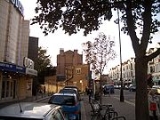
Close to Alexandra Park and Highgate Woods, Muswell Hill is a comfortable mainly Edwardian north London suburb. Muswell Hill Broadway and Fortis Green Road, the main shopping streets, still maintain their historic character with most of the original facades preserved above street level. The area has a synagogue and four churches, one of which has been converted into a bar. Some parts have very clear views over London.Education
Primary schools
- Coldfall Primary School
- Hollickwood JMI School
- Muswell Hill Primary School
- Norfolk House Preparatory
- Our Lady of Muswell RC Primary School
- Rhodes Avenue Primary School
- St James C of E Primary School
- Tetherdown Primary School
Transport
At the top of a hill, Muswell Hill is not directly served by any tube or other railway stations. Bus routes travel into the centre of London. They also connect the area to nearby underground stations at HighgateHighgate tube station
Highgate tube station is a London Underground station on Archway Road, Highgate, not far from Highgate Village in north London. It is on the High Barnet branch of the Northern Line, between Archway and East Finchley, in Travelcard Zone 3....
, Bounds Green
Bounds Green tube station
Bounds Green tube station is a London Underground station, located at the junction of Bounds Green Road and Brownlow Road, in North London.The station is on the Piccadilly Line, between Wood Green and Arnos Grove stations, and is on the boundary between Travelcard Zone 3 and fare_zone 4.Like all ...
, East Finchley
East Finchley tube station
East Finchley is a London Underground station in East Finchley in north London. The station is on the High Barnet branch of the Northern Line, between Highgate and Finchley Central stations, and is in Travelcard Zone 3.-History:...
, Finsbury Park and Turnpike Lane
Turnpike Lane tube station
Turnpike Lane tube station is a station at Turnpike Lane on the Piccadilly Line of the London Underground, between Manor House and Wood Green stations, and in Travelcard Zone 3.It is located within the London Borough of Haringey...
and to train services at Alexandra Palace
Alexandra Palace
Alexandra Palace is a building in North London, England. It stands in Alexandra Park, in an area between Hornsey, Muswell Hill and Wood Green...
and Hornsey
Hornsey
Hornsey is a district in London Borough of Haringey in north London in England. Whilst Hornsey was formerly the name of a parish and later a municipal borough of Middlesex, today, the name refers only to the London district. It is an inner-suburban area located north of Charing Cross.-Locale:The ...
.
Places of interest
- Alexandra PalaceAlexandra PalaceAlexandra Palace is a building in North London, England. It stands in Alexandra Park, in an area between Hornsey, Muswell Hill and Wood Green...
- Alexandra ParkAlexandra Park, LondonAlexandra Park is an 80 hectare, Green Flag Award and Green Heritage winning landscaped park in the Borough of Haringey in north London.-Overview:...
- The Guy Chester Centre of the Methodist church
- Oliver Tambo Memorial Statue at the Albert Road Recreation Ground
People from Muswell Hill
- See People from Muswell Hill and People from Fortis Green categories.
Nearest places
- Colney HatchColney HatchColney Hatch is the historical name for a small district within the London Borough of Barnet in London, England. The name Colney Hatch was originally that of a hamlet in the parish of Friern Barnet, first recorded in the early 15th century...
- Crouch EndCrouch EndCrouch End is an area of north London, in the London Borough of Haringey.- Location :Crouch End is in a valley between Harringay to the east, Hornsey, Muswell Hill and Wood Green to the north, Finsbury Park and Archway to the south and Highgate to the west...
- East FinchleyEast FinchleyEast Finchley is a suburb in the London Borough of Barnet, in north London, and situated north-west of Charing Cross. Geographically it is somewhat separate from the rest of Finchley, with North Finchley and West Finchley to the north, and Finchley Central to the west.- History :The land on which...
- Friern BarnetFriern BarnetFriern Barnet is a place in the London Borough of Barnet. It is a suburban development situated north of Charing Cross. The centre of Friern Barnet is formed by the busy intersection of Colney Hatch Lane , Woodhouse Road and Friern Barnet Road .-History:Friern Barnet was an...
- HarringayHarringayHarringay is a residential area of North London, part of the London Borough of Haringey, United Kingdom. It is centred on the section of Green Lanes running between the northern boundary of Finsbury Park up to the southern boundary of Duckett's Common, not far from Turnpike Lane.-Location:The...
- HighgateHighgateHighgate is an area of North London on the north-eastern corner of Hampstead Heath.Highgate is one of the most expensive London suburbs in which to live. It has an active conservation body, the Highgate Society, to protect its character....
- HornseyHornseyHornsey is a district in London Borough of Haringey in north London in England. Whilst Hornsey was formerly the name of a parish and later a municipal borough of Middlesex, today, the name refers only to the London district. It is an inner-suburban area located north of Charing Cross.-Locale:The ...
- Upper HollowayUpper HollowayUpper Holloway is a district in the London Borough of Islington, London, centred around the A1 Holloway Road.-Overview:The name has fallen out of common use and the area is generally regarded as being a part of Archway or Holloway. The use of 'Upper Holloway' is most often used for Upper Holloway...
- Wood GreenWood GreenWood Green is a district in north London, England, located in the London Borough of Haringey. It is situated north of Charing Cross. The area is identified in the London Plan as one of the metropolitan centres in Greater London.-History:...
Nearest stations
- Alexandra Palace railway stationAlexandra Palace railway stationAlexandra Palace railway station is in the London Borough of Haringey in north London, and is in Travelcard Zone 3. The station, and all trains serving it, are operated by First Capital Connect...
- Hornsey railway stationHornsey railway stationHornsey railway station is a suburban railway station located in Haringey, north London. It is in Travelcard Zone 3. The station is operated by First Capital Connect on behalf of Network Rail, and is situated next to the Hornsey train depot....
The nearest tube stations are:
- HighgateHighgate tube stationHighgate tube station is a London Underground station on Archway Road, Highgate, not far from Highgate Village in north London. It is on the High Barnet branch of the Northern Line, between Archway and East Finchley, in Travelcard Zone 3....
- Turnpike LaneTurnpike Lane tube stationTurnpike Lane tube station is a station at Turnpike Lane on the Piccadilly Line of the London Underground, between Manor House and Wood Green stations, and in Travelcard Zone 3.It is located within the London Borough of Haringey...
- East FinchleyEast Finchley tube stationEast Finchley is a London Underground station in East Finchley in north London. The station is on the High Barnet branch of the Northern Line, between Highgate and Finchley Central stations, and is in Travelcard Zone 3.-History:...
- Bounds GreenBounds Green tube stationBounds Green tube station is a London Underground station, located at the junction of Bounds Green Road and Brownlow Road, in North London.The station is on the Piccadilly Line, between Wood Green and Arnos Grove stations, and is on the boundary between Travelcard Zone 3 and fare_zone 4.Like all ...
- Wood GreenWood Green tube stationWood Green is a London Underground station on the Piccadilly Line. The station is between Turnpike Lane and Bounds Green stations and is in Travelcard Zone 3. It is located at junction of Wood Green High Road and Lordship Lane...
See also
- Hornsey (parish)Hornsey (parish)Hornsey was an ancient parish in the county of Middlesex. It was both a civil parish, used for administrative purposes, and an ecclesiastical parish of the Church of England.- Civil parish :...
for the local government unit of which Muswell Hill was part from medieval times to 1867 - Municipal Borough of HornseyMunicipal Borough of HornseyHornsey was a local government district in east Middlesex from 1867 to 1965.In 1867, a Local Board was formed for part of the civil parish of Hornsey. The rest of the parish was already under South Hornsey Local Board formed in 1865....
for the local government unit of which Muswell Hill was part from 1903–1965
External links
- Muswell Hill & Fortis Green Association - has some good historical pictures etc.