
Central London
Encyclopedia
Central London is the innermost part of London
, England
. There is no official or commonly accepted definition of its area, but its characteristics are understood to include a high density built environment, high land values, an elevated daytime population and a concentration of regionally, nationally and internationally significant organisations and facilities. From time to time, and for a variety of purposes, a number of definitions have been used to define its scope.
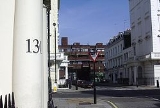
Road distances to London are traditionally measured from a central point at Charing Cross
, which is marked by the statue of King Charles I
at the junction of the Strand
, Whitehall
and Cockspur Street
, just south of Trafalgar Square
.
includes a central activities zone policy area. This comprises the City of London, most of Westminster and the inner parts of Camden, Islington, Hackney, Tower Hamlets, Southwark, Lambeth and Kensington and Chelsea. It is described as "a unique cluster of vitally important activities including central government offices, headquarters and embassies, the largest concentration of London's financial and business services sector and the offices of trade, professional bodies, institutions, associations, communications, publishing, advertising and the media".
For strategic planning, from 2004 to 2008, the London Plan included a sub-region called central London comprising Camden, Islington, Kensington and Chelsea, Lambeth, Southwark, Wandsworth and Westminster. It had a 2001 population of 1,525,000. The sub-region was replaced in 2008 with a new structure which amalgamated inner and outer boroughs together.
and the metropolitan boroughs of Bermondsey
, Bethnal Green
, Finsbury
, Holborn
, Shoreditch
, Southwark
, Stepney
, St Marylebone
and Westminster
.
and the subsequent passage of the London Government Bill
, three attempts were made to define an area that would form a central London borough
. The first two were detailed in the 1959 Memorandum of Evidence of the Greater London Group of the London School of Economics
.
'Scheme A' envisaged a central London borough, one of 25, consisting of the City of London, Westminster, Holborn, Finsbury and the inner parts of St Marylebone, St Pancras, Chelsea, Southwark and Lambeth. The boundary deviated from existing lines in order to include all central London railway stations, the Tower of London
and the museums, such that it included small parts of Kensington, Shoreditch, Stepney and Bermondsey. It had an estimated population of 350,000 and occupied 7000 acre.
'Scheme B' delineated central London, as one of 7 boroughs, including most of the City of London, the whole of Finsbury and Holborn, most of Westminster and Southwark, parts of St Pancras, St Marylebone, Paddington and a small part of Kensington. The area had an estimated population of 400,000 and occupied 8000 acre.
During the passage of the London Government Bill an amendment was put forward to create a central borough corresponding to the definition used at the 1961 census. It consisted of the City of London, all of Westminster, Holborn and Finsbury; and the inner parts of Shoreditch, Stepney, Bermondsey, Southwark, Lambeth, Chelsea, Kensington, Paddington, St Marylebone and St Pancras. The population was estimated to be 270,000.
London
London is the capital city of :England and the :United Kingdom, the largest metropolitan area in the United Kingdom, and the largest urban zone in the European Union by most measures. Located on the River Thames, London has been a major settlement for two millennia, its history going back to its...
, England
England
England is a country that is part of the United Kingdom. It shares land borders with Scotland to the north and Wales to the west; the Irish Sea is to the north west, the Celtic Sea to the south west, with the North Sea to the east and the English Channel to the south separating it from continental...
. There is no official or commonly accepted definition of its area, but its characteristics are understood to include a high density built environment, high land values, an elevated daytime population and a concentration of regionally, nationally and internationally significant organisations and facilities. From time to time, and for a variety of purposes, a number of definitions have been used to define its scope.
Road distances to London are traditionally measured from a central point at Charing Cross
Charing Cross
Charing Cross denotes the junction of Strand, Whitehall and Cockspur Street, just south of Trafalgar Square in central London, England. It is named after the now demolished Eleanor cross that stood there, in what was once the hamlet of Charing. The site of the cross is now occupied by an equestrian...
, which is marked by the statue of King Charles I
Charles I of England
Charles I was King of England, King of Scotland, and King of Ireland from 27 March 1625 until his execution in 1649. Charles engaged in a struggle for power with the Parliament of England, attempting to obtain royal revenue whilst Parliament sought to curb his Royal prerogative which Charles...
at the junction of the Strand
Strand, London
Strand is a street in the City of Westminster, London, England. The street is just over three-quarters of a mile long. It currently starts at Trafalgar Square and runs east to join Fleet Street at Temple Bar, which marks the boundary of the City of London at this point, though its historical length...
, Whitehall
Whitehall
Whitehall is a road in Westminster, in London, England. It is the main artery running north from Parliament Square, towards Charing Cross at the southern end of Trafalgar Square...
and Cockspur Street
Cockspur Street
Cockspur Street is a short thoroughfare in the City of Westminster, London, which links Trafalgar Square to Pall Mall, The Haymarket and Pall Mall East. On 29 June 2007, a car containing significant amounts of explosives was found on Cockspur Street. It did not detonate...
, just south of Trafalgar Square
Trafalgar Square
Trafalgar Square is a public space and tourist attraction in central London, England, United Kingdom. At its centre is Nelson's Column, which is guarded by four lion statues at its base. There are a number of statues and sculptures in the square, with one plinth displaying changing pieces of...
.
Characteristics
London Plan
The London PlanLondon Plan
The London Plan is a planning document written by the Mayor of London, England in the United Kingdom and published by the Greater London Authority. The plan was first published in final form on 10 February 2004 and has since been amended. The current version was published in February 2008...
includes a central activities zone policy area. This comprises the City of London, most of Westminster and the inner parts of Camden, Islington, Hackney, Tower Hamlets, Southwark, Lambeth and Kensington and Chelsea. It is described as "a unique cluster of vitally important activities including central government offices, headquarters and embassies, the largest concentration of London's financial and business services sector and the offices of trade, professional bodies, institutions, associations, communications, publishing, advertising and the media".
For strategic planning, from 2004 to 2008, the London Plan included a sub-region called central London comprising Camden, Islington, Kensington and Chelsea, Lambeth, Southwark, Wandsworth and Westminster. It had a 2001 population of 1,525,000. The sub-region was replaced in 2008 with a new structure which amalgamated inner and outer boroughs together.
Census
The 1901 census defined central London as the City of LondonCity of London
The City of London is a small area within Greater London, England. It is the historic core of London around which the modern conurbation grew and has held city status since time immemorial. The City’s boundaries have remained almost unchanged since the Middle Ages, and it is now only a tiny part of...
and the metropolitan boroughs of Bermondsey
Metropolitan Borough of Bermondsey
The Metropolitan Borough of Bermondsey was a Metropolitan borough in the County of London, created in 1900 by the London Government Act 1899. It was abolished and its area became part of the London Borough of Southwark in 1965.-History:...
, Bethnal Green
Metropolitan Borough of Bethnal Green
Bethnal Green was a civil parish and a metropolitan borough in the East End of London, England. It was formed as a civil parish in 1743 from the Bethnal Green hamlet in Stepney ancient parish. The vestry became an electing authority to the Metropolitan Board of Works in 1855 and in 1889 it became...
, Finsbury
Metropolitan Borough of Finsbury
The Metropolitan Borough of Finsbury was a Metropolitan borough within the County of London from 1900 to 1965, when it was amalgamated with the Metropolitan Borough of Islington to form the London Borough of Islington.- Boundaries :...
, Holborn
Metropolitan Borough of Holborn
The Metropolitan Borough of Holborn was a Metropolitan borough in the County of London between 1900 and 1965, when it was amalgamated with the Metropolitan Borough of St Pancras and the Metropolitan Borough of Hampstead to form the London Borough of Camden....
, Shoreditch
Metropolitan Borough of Shoreditch
The Metropolitan Borough of Shoreditch was a Metropolitan borough of the County of London between 1900 and 1965, when it was merged with the Metropolitan Borough of Stoke Newington and the Metropolitan Borough of Hackney to form the London Borough of Hackney....
, Southwark
Metropolitan Borough of Southwark
The Metropolitan Borough of Southwark was a metropolitan borough in the County of London from 1900 to 1965. It was created to cover the western section of the ancient borough of Southwark and formed the northwestern part of the current London Borough of Southwark. In common with the rest of inner...
, Stepney
Metropolitan Borough of Stepney
The Metropolitan Borough of Stepney was a Metropolitan borough in the County of London created in 1900. In 1965 it became part of the London Borough of Tower Hamlets.-Boundaries:...
, St Marylebone
Metropolitan Borough of St Marylebone
The Metropolitan Borough of St Marylebone was a Metropolitan borough of the County of London from 1900 to 1965. It was based directly on the previously existing civil parish of St Marylebone, which was incorporated into the Metropolitan Board of Works area in 1855, retaining a parish vestry, and...
and Westminster
Metropolitan Borough of Westminster
The Metropolitan Borough of Westminster was a metropolitan borough in the County of London, England, from 1900 to 1965.-City Status:By royal charter dated 29 October 1900 the borough was granted the title City of Westminster. Westminster had originally been created a city and seat of the...
.
1959–1963 proposals for a central London borough
During the Herbert CommissionRoyal Commission on Local Government in Greater London
The Royal Commission on Local Government in Greater London, also known as the Herbert Commission, was established in 1957 and published its report in 1960...
and the subsequent passage of the London Government Bill
London Government Act 1963
The London Government Act 1963 is an Act of the Parliament of the United Kingdom, which recognised officially the conurbation known as Greater London and created a new local government structure for the capital. The Act significantly reduced the number of local government districts in the area,...
, three attempts were made to define an area that would form a central London borough
London borough
The administrative area of Greater London contains thirty-two London boroughs. Inner London comprises twelve of these boroughs plus the City of London. Outer London comprises the twenty remaining boroughs of Greater London.-Functions:...
. The first two were detailed in the 1959 Memorandum of Evidence of the Greater London Group of the London School of Economics
London School of Economics
The London School of Economics and Political Science is a public research university specialised in the social sciences located in London, United Kingdom, and a constituent college of the federal University of London...
.
'Scheme A' envisaged a central London borough, one of 25, consisting of the City of London, Westminster, Holborn, Finsbury and the inner parts of St Marylebone, St Pancras, Chelsea, Southwark and Lambeth. The boundary deviated from existing lines in order to include all central London railway stations, the Tower of London
Tower of London
Her Majesty's Royal Palace and Fortress, more commonly known as the Tower of London, is a historic castle on the north bank of the River Thames in central London, England. It lies within the London Borough of Tower Hamlets, separated from the eastern edge of the City of London by the open space...
and the museums, such that it included small parts of Kensington, Shoreditch, Stepney and Bermondsey. It had an estimated population of 350,000 and occupied 7000 acre.
'Scheme B' delineated central London, as one of 7 boroughs, including most of the City of London, the whole of Finsbury and Holborn, most of Westminster and Southwark, parts of St Pancras, St Marylebone, Paddington and a small part of Kensington. The area had an estimated population of 400,000 and occupied 8000 acre.
During the passage of the London Government Bill an amendment was put forward to create a central borough corresponding to the definition used at the 1961 census. It consisted of the City of London, all of Westminster, Holborn and Finsbury; and the inner parts of Shoreditch, Stepney, Bermondsey, Southwark, Lambeth, Chelsea, Kensington, Paddington, St Marylebone and St Pancras. The population was estimated to be 270,000.