
Stock Island, Florida
Encyclopedia
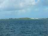
Stock Island is a census-designated place
(CDP) on an island of the same name in Monroe County
, Florida
, United States
. The population of the CDP was 4,410 at the 2000 census. It is located on the portion of the island south of US-1
. It is supposedly named for the herds of livestock formerly kept there. Alternatively, some local historians suggest that it may be named for an early settler.
U.S. 1
(or the Overseas Highway
) crosses the key at approximately mile markers 4—6, immediately east of Key West.
According to the United States Census Bureau
, the CDP has a total area of 0.9 mi² (2.4 km²). 0.9 mi² (2.3 km²) of it is land and 1.10% is water.
of 2000, there were 4,410 people, 1,713 households, and 1,050 families residing in the CDP. The population density
was 1,891.9/km² (4,919.1/mi²). There were 1,855 housing units at an average density of 795.8/km² (2,069.2/mi²). The racial makeup of the CDP was 79.95% White, 10.45% African American, 0.36% Native American, 1.09% Asian, 0.05% Pacific Islander, 4.76% from other races
, and 3.33% from two or more races. Hispanic or Latino of any race were 43.33% of the population.
There were 1,713 households out of which 29.6% had children under the age of 18 living with them, 39.5% were married couples
living together, 15.4% had a female householder with no husband present, and 38.7% were non-families. 26.0% of all households were made up of individuals and 5.4% had someone living alone who was 65 years of age or older. The average household size was 2.57 and the average family size was 3.12.
In the CDP the population was spread out with 23.5% under the age of 18, 8.3% from 18 to 24, 33.2% from 25 to 44, 26.5% from 45 to 64, and 8.5% who were 65 years of age or older. The median age was 37 years. For every 100 females there were 118.6 males. For every 100 females age 18 and over, there were 118.8 males.
The median income for a household in the CDP was $31,537, and the median income for a family was $38,029. Males had a median income of $23,714 versus $20,182 for females. The per capita income
for the CDP was $14,346. About 19.2% of families and 20.5% of the population were below the poverty line, including 28.9% of those under age 18 and 16.2% of those age 65 or over.
operates public schools serving Stock Island. Three schools in the City of Key West, Gerald Adams on Stock Island and Horace O'Bryant Middle School and Key West High School
http://kwh.monroe.k12.fl.us/, located on Key West Island, serve Stock Island.
Census-designated place
A census-designated place is a concentration of population identified by the United States Census Bureau for statistical purposes. CDPs are delineated for each decennial census as the statistical counterparts of incorporated places such as cities, towns and villages...
(CDP) on an island of the same name in Monroe County
Monroe County, Florida
Monroe County is a county located in the state of Florida. As of 2000, the population was 79,589. The U.S. Census Bureau 2006 estimate for the county was 74,737....
, Florida
Florida
Florida is a state in the southeastern United States, located on the nation's Atlantic and Gulf coasts. It is bordered to the west by the Gulf of Mexico, to the north by Alabama and Georgia and to the east by the Atlantic Ocean. With a population of 18,801,310 as measured by the 2010 census, it...
, United States
United States
The United States of America is a federal constitutional republic comprising fifty states and a federal district...
. The population of the CDP was 4,410 at the 2000 census. It is located on the portion of the island south of US-1
U.S. Route 1 in Florida
U.S. Route 1 in Florida runs along the state's east coast from Key West to its crossing of the St. Marys River into Georgia north of Boulogne, and south of Folkston. US 1 was designated through Florida when the U.S. Highway System was established in 1926.US 1 runs in the state of Florida, and...
. It is supposedly named for the herds of livestock formerly kept there. Alternatively, some local historians suggest that it may be named for an early settler.
Geography
Stock Island is located at 24°34′12"N 81°44′15"W (24.570075, -81.737376).U.S. 1
U.S. Route 1 in Florida
U.S. Route 1 in Florida runs along the state's east coast from Key West to its crossing of the St. Marys River into Georgia north of Boulogne, and south of Folkston. US 1 was designated through Florida when the U.S. Highway System was established in 1926.US 1 runs in the state of Florida, and...
(or the Overseas Highway
Overseas Highway
The Overseas Highway is a highway carrying U.S. Route 1 through the Florida Keys. Large parts of it were built on the former right-of-way of the Overseas Railroad, the Key West Extension of the Florida East Coast Railway. Completed in 1912, the Overseas Railroad was heavily damaged and partially...
) crosses the key at approximately mile markers 4—6, immediately east of Key West.
According to the United States Census Bureau
United States Census Bureau
The United States Census Bureau is the government agency that is responsible for the United States Census. It also gathers other national demographic and economic data...
, the CDP has a total area of 0.9 mi² (2.4 km²). 0.9 mi² (2.3 km²) of it is land and 1.10% is water.
Demographics
As of the censusCensus
A census is the procedure of systematically acquiring and recording information about the members of a given population. It is a regularly occurring and official count of a particular population. The term is used mostly in connection with national population and housing censuses; other common...
of 2000, there were 4,410 people, 1,713 households, and 1,050 families residing in the CDP. The population density
Population density
Population density is a measurement of population per unit area or unit volume. It is frequently applied to living organisms, and particularly to humans...
was 1,891.9/km² (4,919.1/mi²). There were 1,855 housing units at an average density of 795.8/km² (2,069.2/mi²). The racial makeup of the CDP was 79.95% White, 10.45% African American, 0.36% Native American, 1.09% Asian, 0.05% Pacific Islander, 4.76% from other races
Race (United States Census)
Race and ethnicity in the United States Census, as defined by the Federal Office of Management and Budget and the United States Census Bureau, are self-identification data items in which residents choose the race or races with which they most closely identify, and indicate whether or not they are...
, and 3.33% from two or more races. Hispanic or Latino of any race were 43.33% of the population.
There were 1,713 households out of which 29.6% had children under the age of 18 living with them, 39.5% were married couples
Marriage
Marriage is a social union or legal contract between people that creates kinship. It is an institution in which interpersonal relationships, usually intimate and sexual, are acknowledged in a variety of ways, depending on the culture or subculture in which it is found...
living together, 15.4% had a female householder with no husband present, and 38.7% were non-families. 26.0% of all households were made up of individuals and 5.4% had someone living alone who was 65 years of age or older. The average household size was 2.57 and the average family size was 3.12.
In the CDP the population was spread out with 23.5% under the age of 18, 8.3% from 18 to 24, 33.2% from 25 to 44, 26.5% from 45 to 64, and 8.5% who were 65 years of age or older. The median age was 37 years. For every 100 females there were 118.6 males. For every 100 females age 18 and over, there were 118.8 males.
The median income for a household in the CDP was $31,537, and the median income for a family was $38,029. Males had a median income of $23,714 versus $20,182 for females. The per capita income
Per capita income
Per capita income or income per person is a measure of mean income within an economic aggregate, such as a country or city. It is calculated by taking a measure of all sources of income in the aggregate and dividing it by the total population...
for the CDP was $14,346. About 19.2% of families and 20.5% of the population were below the poverty line, including 28.9% of those under age 18 and 16.2% of those age 65 or over.
Education
Monroe County School DistrictMonroe County School District (Florida)
Monroe County School District is a school district headquartered in Key West, Florida, United States.The district serves all of Monroe County.-7-12 schools:* -High schools:* * -K-8 schools:...
operates public schools serving Stock Island. Three schools in the City of Key West, Gerald Adams on Stock Island and Horace O'Bryant Middle School and Key West High School
Key West High School
Key West High School is a Monroe County public school in Key West, Florida, USA. Key West High School is the largest high school in Monroe County. The school was originally at the site of the current Glynn Archer Elementary School, which opened in 1906 and was used as a high school for white students...
http://kwh.monroe.k12.fl.us/, located on Key West Island, serve Stock Island.