
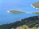
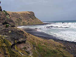
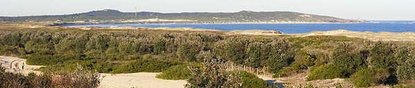
Peninsula
Encyclopedia

A peninsula is a piece of land
Landform
A landform or physical feature in the earth sciences and geology sub-fields, comprises a geomorphological unit, and is largely defined by its surface form and location in the landscape, as part of the terrain, and as such, is typically an element of topography...
that is bordered by water on three sides but connected to mainland
Mainland
Mainland is a name given to a large landmass in a region , or to the largest of a group of islands in an archipelago. Sometimes its residents are called "Mainlanders"...
. In many Germanic
Germanic languages
The Germanic languages constitute a sub-branch of the Indo-European language family. The common ancestor of all of the languages in this branch is called Proto-Germanic , which was spoken in approximately the mid-1st millennium BC in Iron Age northern Europe...
and Celtic languages
Celtic languages
The Celtic languages are descended from Proto-Celtic, or "Common Celtic"; a branch of the greater Indo-European language family...
and also in Baltic, Slavic and Hungarian
Hungarian language
Hungarian is a Uralic language, part of the Ugric group. With some 14 million speakers, it is one of the most widely spoken non-Indo-European languages in Europe....
, peninsulas are called "half-islands".
A peninsula can also be a headland
Headlands and bays
Headlands and bays are two related features of the coastal environment.- Geology and geography :Headlands and bays are often found on the same coastline. A bay is surrounded by land on three sides, whereas a headland is surrounded by water on three sides. Headlands are characterized by high,...
(head), cape
Headland
A headland is a point of land, usually high and often with a sheer drop, that extends out into a body of water.Headland can also refer to:*Headlands and bays*headLand, an Australian television series...
, island promontory
Promontory
Promontory may refer to:*Promontory, a prominent mass of land which overlooks lower lying land or a body of water*Promontory, Utah, the location where the United States first Transcontinental Railroad was completed...
, bill, point, or spit
Spit (landform)
A spit or sandspit is a deposition landform found off coasts. At one end, spits connect to land, and extend into the sea. A spit is a type of bar or beach that develops where a re-entrant occurs, such as at cove's headlands, by the process of longshore drift...
. Note that a point is generally considered a tapering piece of land projecting into a body of water that is less prominent than a cape.
Australia
- Beecroft PeninsulaBeecroft PeninsulaBeecroft Peninsula is a peninsula located to the north and east of Jervis Bay in south-eastern Australia. The peninsula forms the northern headland of Jervis Bay....
, New South WalesNew South WalesNew South Wales is a state of :Australia, located in the east of the country. It is bordered by Queensland, Victoria and South Australia to the north, south and west respectively. To the east, the state is bordered by the Tasman Sea, which forms part of the Pacific Ocean. New South Wales... - Bellarine PeninsulaBellarine PeninsulaThe Bellarine Peninsula is a peninsula located south-west of Melbourne in Victoria, Australia, surrounded by Port Phillip, Corio Bay and Bass Strait. The peninsula, together with the Mornington Peninsula separates Port Phillip from Bass Strait...
, VictoriaVictoria (Australia)Victoria is the second most populous state in Australia. Geographically the smallest mainland state, Victoria is bordered by New South Wales, South Australia, and Tasmania on Boundary Islet to the north, west and south respectively.... - Cape York PeninsulaCape York PeninsulaCape York Peninsula is a large remote peninsula located in Far North Queensland at the tip of the state of Queensland, Australia, the largest unspoilt wilderness in northern Australia and one of the last remaining wilderness areas on Earth...
, QueenslandQueenslandQueensland is a state of Australia, occupying the north-eastern section of the mainland continent. It is bordered by the Northern Territory, South Australia and New South Wales to the west, south-west and south respectively. To the east, Queensland is bordered by the Coral Sea and Pacific Ocean... - Cobourg PeninsulaCobourg PeninsulaThe Cobourg Peninsula is located 350 kilometres east of Darwin in the Northern Territory, Australia. It is deeply indented with coves and bays, covers a land area of about 2,100 km², and is virtually uninhabited with a population ranging from about 20 to 30 in five family outstations, but...
, Northern TerritoryNorthern TerritoryThe Northern Territory is a federal territory of Australia, occupying much of the centre of the mainland continent, as well as the central northern regions... - Cronulla sand dunes, Kurnell PeninsulaCronulla sand dunes, Kurnell PeninsulaThe Cronulla sand dunes are located on the Kurnell Peninsula in the local government area of Sutherland Shire, Sydney Australia.The Cronulla sand dunes are a protected area that became listed on the NSW State Heritage Register on 26 September 2003.-History:...
- Dampier PeninsulaDampier PeninsulaThe Dampier Peninsula is a peninsula located north of Broome and Roebuck Bay in Western Australia. It is surrounded by the Indian Ocean to the west and north, and King Sound to the east...
, Western AustraliaWestern AustraliaWestern Australia is a state of Australia, occupying the entire western third of the Australian continent. It is bounded by the Indian Ocean to the north and west, the Great Australian Bight and Indian Ocean to the south, the Northern Territory to the north-east and South Australia to the south-east... - Eyre PeninsulaEyre PeninsulaEyre Peninsula is a triangular peninsula in South Australia. It is bounded on the east by Spencer Gulf, the west by the Great Australian Bight, and the north by the Gawler Ranges. It is named after explorer Edward John Eyre who explored some of it in 1839-1841. The coastline was first explored by...
, South AustraliaSouth AustraliaSouth Australia is a state of Australia in the southern central part of the country. It covers some of the most arid parts of the continent; with a total land area of , it is the fourth largest of Australia's six states and two territories.South Australia shares borders with all of the mainland... - Fleurieu PeninsulaFleurieu PeninsulaThe Fleurieu Peninsula is a peninsula located south of Adelaide in South Australia, Australia. It was named after the French explorer and hydrographer Charles Pierre Claret de Fleurieu by the French explorer Nicolas Baudin as he mapped the south coast of Australia in 1802.Towns of interest in the...
, South AustraliaSouth AustraliaSouth Australia is a state of Australia in the southern central part of the country. It covers some of the most arid parts of the continent; with a total land area of , it is the fourth largest of Australia's six states and two territories.South Australia shares borders with all of the mainland... - Freycinet PeninsulaFreycinet PeninsulaFreycinet Peninsula is a large peninsula in eastern Tasmania, Australia. It is located north of Schouten Island, at . It is the site of Freycinet National Park....
, TasmaniaTasmaniaTasmania is an Australian island and state. It is south of the continent, separated by Bass Strait. The state includes the island of Tasmania—the 26th largest island in the world—and the surrounding islands. The state has a population of 507,626 , of whom almost half reside in the greater Hobart... - Inskip PeninsulaInskip PeninsulaInskip Point is a peninsula to the north of the town of Rainbow Beach in south-east Queensland, Australia.It lies between Tin Can Bay to the South West and Great Sandy Strait to the North and curves back towards Rainbow Beach and the Coral Sea to the East....
, QueenslandQueenslandQueensland is a state of Australia, occupying the north-eastern section of the mainland continent. It is bordered by the Northern Territory, South Australia and New South Wales to the west, south-west and south respectively. To the east, Queensland is bordered by the Coral Sea and Pacific Ocean...
- Jervis Bay TerritoryJervis Bay TerritoryThe Jervis Bay Territory is a territory of the Commonwealth of Australia. It was surrendered by the state of New South Wales to the Commonwealth Government in 1915 so that the Federal capital at Canberra would have "access to the sea"....
- Mornington PeninsulaMornington PeninsulaThe Mornington Peninsula is a peninsula located south-east of Melbourne in Victoria, Australia. It is surrounded by Port Phillip to the west, Western Port to the east and Bass Strait to the south, and is connected to the mainland in the north. Geographically, the peninsula begins its protrusion...
, VictoriaVictoria (Australia)Victoria is the second most populous state in Australia. Geographically the smallest mainland state, Victoria is bordered by New South Wales, South Australia, and Tasmania on Boundary Islet to the north, west and south respectively.... - Redcliffe, QueenslandRedcliffe, QueenslandRedcliffe is a residential suburb of the Moreton Bay Region in the north-east of the Redcliffe peninsula, approximately north-northeast of Brisbane, the state capital of Queensland, Australia...
- Stockton, New South WalesStockton, New South WalesStockton is a suburb of Newcastle, New South Wales, Australia, located from Newcastle's central business district. It is the only suburb of Newcastle that lies north of the Hunter River.-Geography:...
- Tasman PeninsulaTasman PeninsulaTasman Peninsula is located around by road south-east of Hobart, at the south east corner of Tasmania, Australia.-Description:The Tasman Peninsula lies south and west of Forestier Peninsula, to which it is connected by an isthmus called Eaglehawk Neck...
, TasmaniaTasmaniaTasmania is an Australian island and state. It is south of the continent, separated by Bass Strait. The state includes the island of Tasmania—the 26th largest island in the world—and the surrounding islands. The state has a population of 507,626 , of whom almost half reside in the greater Hobart... - TasmaniaTasmaniaTasmania is an Australian island and state. It is south of the continent, separated by Bass Strait. The state includes the island of Tasmania—the 26th largest island in the world—and the surrounding islands. The state has a population of 507,626 , of whom almost half reside in the greater Hobart...
itself was once a peninsula connected to Australia during the great Ice AgeIce ageAn ice age or, more precisely, glacial age, is a generic geological period of long-term reduction in the temperature of the Earth's surface and atmosphere, resulting in the presence or expansion of continental ice sheets, polar ice sheets and alpine glaciers...
s - Wilsons PromontoryWilsons PromontoryWilsons Promontory is a peninsula that forms the southernmost part of the Australian mainland and is located at . South Point at is the southernmost tip of Wilsons Promontory and hence of mainland Australia...
, VictoriaVictoria (Australia)Victoria is the second most populous state in Australia. Geographically the smallest mainland state, Victoria is bordered by New South Wales, South Australia, and Tasmania on Boundary Islet to the north, west and south respectively.... - Woy Woy, New South WalesWoy Woy, New South WalesWoy Woy is a coastal town and a southern suburb of the Central Coast region of New South Wales, Australia, located on the southern reaches of Brisbane Water north of Sydney...
- Yorke PeninsulaYorke PeninsulaThe Yorke Peninsula is a peninsula located north-west and west of Adelaide in South Australia, Australia, between Spencer Gulf on the west and Gulf St Vincent on the east. It has geographic coordinates of...
, South AustraliaSouth AustraliaSouth Australia is a state of Australia in the southern central part of the country. It covers some of the most arid parts of the continent; with a total land area of , it is the fourth largest of Australia's six states and two territories.South Australia shares borders with all of the mainland... - Younghusband PeninsulaYounghusband PeninsulaYounghusband Peninsula is a long narrow peninsula in South Australia, at . It separates Encounter Bay which is part of the Southern Ocean from the Coorong which is part of the estuary of the River Murray. It lies entirely within the Coorong National Park. The peninsula is over 110 kilometres long,...
, South AustraliaSouth AustraliaSouth Australia is a state of Australia in the southern central part of the country. It covers some of the most arid parts of the continent; with a total land area of , it is the fourth largest of Australia's six states and two territories.South Australia shares borders with all of the mainland...
New Zealand
- Aupouri PeninsulaAupouri PeninsulaThe Aupouri Peninsula is a tombolo at the northern tip of the North Island of New Zealand. It projects between the Tasman Sea to the west and the Pacific Ocean to the east...
, North IslandNorth IslandThe North Island is one of the two main islands of New Zealand, separated from the much less populous South Island by Cook Strait. The island is in area, making it the world's 14th-largest island... - Banks PeninsulaBanks PeninsulaBanks Peninsula is a peninsula of volcanic origin on the east coast of the South Island of New Zealand. It has an area of approximately and encompasses two large harbours and many smaller bays and coves...
, South IslandSouth IslandThe South Island is the larger of the two major islands of New Zealand, the other being the more populous North Island. It is bordered to the north by Cook Strait, to the west by the Tasman Sea, to the south and east by the Pacific Ocean... - Bluff PeninsulaBluff, New ZealandBluff is a town and seaport in the Southland region, on the southern coast of the South Island of New Zealand. It is the southern-most town in New Zealand and, despite Slope Point being further to the south, is colloquially used to refer to the southern extremity of the country...
, South IslandSouth IslandThe South Island is the larger of the two major islands of New Zealand, the other being the more populous North Island. It is bordered to the north by Cook Strait, to the west by the Tasman Sea, to the south and east by the Pacific Ocean... - Bream HeadBream HeadBream Head is a promontory on the east coast of Northland in the North Island of New Zealand. Located at the end of a 30 kilometre-long peninsula, the head juts into the Pacific Ocean to the southeast of Whangarei...
, North IslandNorth IslandThe North Island is one of the two main islands of New Zealand, separated from the much less populous South Island by Cook Strait. The island is in area, making it the world's 14th-largest island... - Cape of Brandon Conde, South IslandSouth IslandThe South Island is the larger of the two major islands of New Zealand, the other being the more populous North Island. It is bordered to the north by Cook Strait, to the west by the Tasman Sea, to the south and east by the Pacific Ocean...
- Cape BrettCape BrettCape Brett is a promontory on the northern North Island coast in New Zealand. Located at the end of the Cape Brett Peninsula, the head extends north into the Pacific Ocean at the eastern end of the Bay of Islands....
, North IslandNorth IslandThe North Island is one of the two main islands of New Zealand, separated from the much less populous South Island by Cook Strait. The island is in area, making it the world's 14th-largest island... - Cape CampbellCape CampbellCape Campbell , Te Karaka in Māori language, is located in Marlborough, New Zealand, on the northeastern coast of the South Island. It lies at the southern end of Clifford Bay, 15 km northeast of Ward, and 42 km southeast of Blenheim....
, South IslandSouth IslandThe South Island is the larger of the two major islands of New Zealand, the other being the more populous North Island. It is bordered to the north by Cook Strait, to the west by the Tasman Sea, to the south and east by the Pacific Ocean... - Cape FoulwindCape FoulwindCape Foulwind is a prominent headland on the West Coast of New Zealand's South Island, overlooking the Tasman Sea. It is located ten kilometres west of the town of Westport...
, South IslandSouth IslandThe South Island is the larger of the two major islands of New Zealand, the other being the more populous North Island. It is bordered to the north by Cook Strait, to the west by the Tasman Sea, to the south and east by the Pacific Ocean... - Cape KidnappersCape KidnappersCape Kidnappers is a headland at the southeastern extremity of Hawke Bay on the east coast of New Zealand's North Island. It is located 20 kilometres southeast of the city of Napier...
, North IslandNorth IslandThe North Island is one of the two main islands of New Zealand, separated from the much less populous South Island by Cook Strait. The island is in area, making it the world's 14th-largest island... - Cape TurnagainCape TurnagainCape Turnagain is a prominent headland on the east coast of New Zealand's North Island, part way between Hawke Bay and Cook Strait, between the mouths of the Porangahau and Akitio Rivers.The cape was named by Captain James Cook in 1769...
, North IslandNorth IslandThe North Island is one of the two main islands of New Zealand, separated from the much less populous South Island by Cook Strait. The island is in area, making it the world's 14th-largest island... - Coromandel PeninsulaCoromandel PeninsulaThe Coromandel Peninsula lies in the North Island of New Zealand. It is part of the Waikato Region and Thames-Coromandel District and extends 85 kilometres north from the western end of the Bay of Plenty, forming a natural barrier to protect the Hauraki Gulf and the Firth of Thames in the west...
, North IslandNorth IslandThe North Island is one of the two main islands of New Zealand, separated from the much less populous South Island by Cook Strait. The island is in area, making it the world's 14th-largest island...
- Farewell SpitFarewell SpitFarewell Spit is a narrow sand spit situated at , at the northern end of the South Island of New Zealand. Known to the Māori as Tuhuroa, it runs eastwards from Cape Farewell, the island's northernmost point...
, South IslandSouth IslandThe South Island is the larger of the two major islands of New Zealand, the other being the more populous North Island. It is bordered to the north by Cook Strait, to the west by the Tasman Sea, to the south and east by the Pacific Ocean... - Kaikoura PeninsulaKaikoura PeninsulaThe Kaikoura Peninsula is located in the northeast of New Zealand's South Island. It protrudes five kilometres into the Pacific Ocean.The town of Kaikoura is located on the north shore of the peninsula....
, South IslandSouth IslandThe South Island is the larger of the two major islands of New Zealand, the other being the more populous North Island. It is bordered to the north by Cook Strait, to the west by the Tasman Sea, to the south and east by the Pacific Ocean... - Karikari PeninsulaKarikari PeninsulaThe Karikari Peninsula is a right-angled land mass of two relatively-distinct parts. The rocky northern part, which has an east-west orientation and is approximately 17km long, was originally an island.. It is connected to the rest of the Northland Region of New Zealand by a low sandy strip...
, North IslandNorth IslandThe North Island is one of the two main islands of New Zealand, separated from the much less populous South Island by Cook Strait. The island is in area, making it the world's 14th-largest island... - Mahia PeninsulaMahia PeninsulaThe Mahia Peninsula is located on the east coast of New Zealand's North Island, between the cities of Napier and Gisborne.-Geography:The peninsula is long and wide rising to its highest point at Rahuimokairoa reaching about above sea level. Mahia was initially an island which over time, has had...
, North IslandNorth IslandThe North Island is one of the two main islands of New Zealand, separated from the much less populous South Island by Cook Strait. The island is in area, making it the world's 14th-largest island... - Miramar PeninsulaMiramar PeninsulaThe Miramar Peninsula is a peninsula at the southeastern end of the city of Wellington, New Zealand.The peninsula is 800 hectares and contains the suburbs of Miramar, Maupuia, Strathmore and Seatoun...
, North IslandNorth IslandThe North Island is one of the two main islands of New Zealand, separated from the much less populous South Island by Cook Strait. The island is in area, making it the world's 14th-largest island... - Mount MaunganuiMount MaunganuiMount Maunganui is a town in the Bay of Plenty, New Zealand, located on a peninsula to the north of Tauranga. It was independent from Tauranga until the completion of the Tauranga Harbour Bridge in 1988....
, North IslandNorth IslandThe North Island is one of the two main islands of New Zealand, separated from the much less populous South Island by Cook Strait. The island is in area, making it the world's 14th-largest island... - North Auckland PeninsulaNorth Auckland PeninsulaThe North Auckland Peninsula, frequently referred to simply as the Northland Peninsula, is located in the far north of the North Island of New Zealand. The peninsula is easily confused with, though not the same as Northland Region, which occupies the top 80% of the peninsula...
, North IslandNorth IslandThe North Island is one of the two main islands of New Zealand, separated from the much less populous South Island by Cook Strait. The island is in area, making it the world's 14th-largest island... - Otago PeninsulaOtago PeninsulaThe Otago Peninsula is a long, hilly indented finger of land that forms the easternmost part of Dunedin, New Zealand. Volcanic in origin, it forms one wall of the eroded valley that now forms Otago Harbour. The peninsula lies south-east of Otago Harbour and runs parallel to the mainland for...
, South IslandSouth IslandThe South Island is the larger of the two major islands of New Zealand, the other being the more populous North Island. It is bordered to the north by Cook Strait, to the west by the Tasman Sea, to the south and east by the Pacific Ocean... - Tiwai PointTiwai Pointthumb|[[Awarua Plain]] , Tiwai Point and [[Bluff, New Zealand|Bluff]] viewed from the [[International Space Station]] in 2008.Tiwai Point lies at the entrance to Bluff Harbour on the southern coast of the South Island of New Zealand...
, South IslandSouth IslandThe South Island is the larger of the two major islands of New Zealand, the other being the more populous North Island. It is bordered to the north by Cook Strait, to the west by the Tasman Sea, to the south and east by the Pacific Ocean...
Papua New Guinea
- Gazelle PeninsulaGazelle PeninsulaGazelle Peninsula is a large peninsula in northeastern New Britain, Papua New Guinea, at ....
, New BritainNew BritainNew Britain, or Niu Briten, is the largest island in the Bismarck Archipelago of Papua New Guinea. It is separated from the island of New Guinea by the Dampier and Vitiaz Straits and from New Ireland by St. George's Channel...
- Huon PeninsulaHuon PeninsulaHuon Peninsula is a large rugged peninsula on the island of New Guinea in Morobe Province, eastern Papua New Guinea. It is named after French explorer Jean-Michel Huon de Kermadec who discovered it along with his personal assistant and porter, Henry Ole. The peninsula is dominated by the steep...
Europe
- Europe is sometimes considered to be a large peninsula extending off EurasiaEurasiaEurasia is a continent or supercontinent comprising the traditional continents of Europe and Asia ; covering about 52,990,000 km2 or about 10.6% of the Earth's surface located primarily in the eastern and northern hemispheres...
. It is composed of many peninsulas, the four main component peninsulas being the Iberian, Scandinavian, Italian, and Balkan peninsulas.
Balkan Peninsula
The BalkansBalkans
The Balkans is a geopolitical and cultural region of southeastern Europe...
is a peninsula including Albania
Albania
Albania , officially known as the Republic of Albania , is a country in Southeastern Europe, in the Balkans region. It is bordered by Montenegro to the northwest, Kosovo to the northeast, the Republic of Macedonia to the east and Greece to the south and southeast. It has a coast on the Adriatic Sea...
, Bosnia and Herzegovina
Bosnia and Herzegovina
Bosnia and Herzegovina , sometimes called Bosnia-Herzegovina or simply Bosnia, is a country in Southern Europe, on the Balkan Peninsula. Bordered by Croatia to the north, west and south, Serbia to the east, and Montenegro to the southeast, Bosnia and Herzegovina is almost landlocked, except for the...
, Bulgaria
Bulgaria
Bulgaria , officially the Republic of Bulgaria , is a parliamentary democracy within a unitary constitutional republic in Southeast Europe. The country borders Romania to the north, Serbia and Macedonia to the west, Greece and Turkey to the south, as well as the Black Sea to the east...
, Croatia
Croatia
Croatia , officially the Republic of Croatia , is a unitary democratic parliamentary republic in Europe at the crossroads of the Mitteleuropa, the Balkans, and the Mediterranean. Its capital and largest city is Zagreb. The country is divided into 20 counties and the city of Zagreb. Croatia covers ...
, Greece
Greece
Greece , officially the Hellenic Republic , and historically Hellas or the Republic of Greece in English, is a country in southeastern Europe....
, Kosovo
Kosovo
Kosovo is a region in southeastern Europe. Part of the Ottoman Empire for more than five centuries, later the Autonomous Province of Kosovo and Metohija within Serbia...
, Macedonia, Montenegro
Montenegro
Montenegro Montenegrin: Crna Gora Црна Гора , meaning "Black Mountain") is a country located in Southeastern Europe. It has a coast on the Adriatic Sea to the south-west and is bordered by Croatia to the west, Bosnia and Herzegovina to the northwest, Serbia to the northeast and Albania to the...
, Romania
Romania
Romania is a country located at the crossroads of Central and Southeastern Europe, on the Lower Danube, within and outside the Carpathian arch, bordering on the Black Sea...
, Serbia
Serbia
Serbia , officially the Republic of Serbia , is a landlocked country located at the crossroads of Central and Southeast Europe, covering the southern part of the Carpathian basin and the central part of the Balkans...
, Slovenia
Slovenia
Slovenia , officially the Republic of Slovenia , is a country in Central and Southeastern Europe touching the Alps and bordering the Mediterranean. Slovenia borders Italy to the west, Croatia to the south and east, Hungary to the northeast, and Austria to the north, and also has a small portion of...
and the European part of Turkey.
- Chalkidiki, Greece
- KassandraKassandraKassandra can refer to:*Cassandra, in Greek mythology*114 Kassandra, an asteroid*Cassandra , a book written by the East German author Christa Wolf *Cassandreia, an ancient city and adjoining isthmus in Chalcidice, Greece...
, Greece - Mani PeninsulaMani PeninsulaThe Mani Peninsula , also long known as Maina or Maïna, is a geographical and cultural region in Greece. Mani is the central peninsula of the three which extend southwards from the Peloponnese in southern Greece. To the east is the Laconian Gulf, to the west the Messenian Gulf...
, Greece - Mount AthosMount AthosMount Athos is a mountain and peninsula in Macedonia, Greece. A World Heritage Site, it is home to 20 Eastern Orthodox monasteries and forms a self-governed monastic state within the sovereignty of the Hellenic Republic. Spiritually, Mount Athos comes under the direct jurisdiction of the...
, Greece - PeloponnesePeloponneseThe Peloponnese, Peloponnesos or Peloponnesus , is a large peninsula , located in a region of southern Greece, forming the part of the country south of the Gulf of Corinth...
, Greece - SithoniaSithoniaSithonia is a peninsula located south of the central part of Chalkidiki which is also in the south-central part of the Chalkidiki peninsula. The Kassandra Peninsula lies to the west and the Mount Athos peninsula at the east. Sithonia is also a municipality, covering the Sithonia peninsula...
, Greece - Pilio, Greece
- IstriaIstriaIstria , formerly Histria , is the largest peninsula in the Adriatic Sea. The peninsula is located at the head of the Adriatic between the Gulf of Trieste and the Bay of Kvarner...
, Croatia/Slovenia - Piran PeninsulaPiranPiran is a city and municipality in southwestern Slovenia on the Gulf of Piran on the Adriatic Sea. It is one of the three major towns of Slovenian Istria. The city resembles a large open-air museum, with medieval architecture and a rich cultural heritage. Narrow streets and compact houses give...
, Slovenia - PelješacPelješacPelješac is a peninsula in southern Dalmatia in Croatia. The peninsula is part of the Dubrovnik-Neretva County and is the second largest peninsula in Croatia...
, Croatia - PrevlakaPrevlakaPrevlaka is a small peninsula in southern Croatia, at the entrance to the Bay of Kotor in the eastern Adriatic. The word prevlaka means portage. The cape Oštro, located at the tip of the peninsula, is the southernmost point of mainland in Croatia....
, Croatia - SplitSplit (city)Split is a Mediterranean city on the eastern shores of the Adriatic Sea, centered around the ancient Roman Palace of the Emperor Diocletian and its wide port bay. With a population of 178,192 citizens, and a metropolitan area numbering up to 467,899, Split is by far the largest Dalmatian city and...
, Croatia - ZadarZadarZadar is a city in Croatia on the Adriatic Sea. It is the centre of Zadar county and the wider northern Dalmatian region. Population of the city is 75,082 citizens...
, Croatia - Karaburun Peninsula, AlbaniaKaraburun Peninsula, AlbaniaKaraburun Peninsula, Albania is the largest peninsula of Albania, located in the District of Vlorë, southwestern Albania, at the eastern side of the Strait of Otranto, where the Adriatic Sea meets the Ionian Sea. It has an area of and has no population. It is long with a width that varies from...
- LušticaLušticaLuštica is a peninsula on the south Adriatic Sea, located at the entrance of the Bay of Kotor also known as the Boka Kotorska or the Boka. It effectively separates Tivat Bay from the Adriatic....
, Montenegro - GallipoliGallipoliThe Gallipoli peninsula is located in Turkish Thrace , the European part of Turkey, with the Aegean Sea to the west and the Dardanelles straits to the east. Gallipoli derives its name from the Greek "Καλλίπολις" , meaning "Beautiful City"...
, Turkey
Denmark
- Jutland PeninsulaJutland PeninsulaThe Jutland Peninsula or more historically the Cimbrian Peninsula is a peninsula in Europe, divided between Denmark and Germany. The names are derived from the Jutes and the Cimbri....
, which forms the western half of the country. - DjurslandDjurslandDjursland is a Danish peninsula located on the east coast of the larger Jutland peninsula. Other minor peninsulas are also found stretching out from Djursland, such as Skødshoved and Helgenæs.Djursland is also Jyllands only round church in Thorsager....
- GrenenGrenenGrenen, the northmost tip of Jutland, north of the town of Skagen, thereby the northmost point of Denmark. Grenen was given its name for its shape like a tree-branch . The Danish national road 40 passes through Grenen....
- HelgenæsHelgenæsHelgenæs is a minor peninsula stretching out from Mols, itself part of the peninsula Djursland, again part of the peninsula Jutland in Denmark.-Etymology:Helgenæs derives from Danish "hellig" + "næs" , and was in 1231 spelled "Hælghænæs"....
- Horne Land
- HornsherredHornsherredHornsherred is a peninsula between Roskilde Fjord and Isefjord on the island of Zealand in eastern Denmark. It falls within the expanded Frederikssund municipality and includes Jægerspris and Skibby and before 1st January 2007 a part of Bramsnæs Municipality, now a part of Lejre Municipality. It is...
- HindsholmHindsholmHindsholm is a peninsula forming the north-eastern extremity of the Danish island of Funen. It is bound to the south by the Kerteminde Fjord but linked to the rest of the island in the south-west. It belongs to Kerteminde municipality....
- KegnæsKegnæsKegnæs is a peninsula on the southern coast of Als in Denmark....
- MolsMolsMols is a small Danish peninsula located to the south of another peninsula, Djursland, located on the east coast Jutland. Two other peninsulas, Skødshoved to the west, and Helgenæs to the south, are adjacent to Mols....
- OdsherredOdsherredOdsherred is a peninsula in the north-western part of the island Zealand in Denmark. Odsherred is stretching from the Sjællands Odde in the north-west to the now drained fjord Lammefjord in the south, covering an area with a wide range of the most typical Danish landscapes such as long sandy...
- SallingSallingSalling is a Danish peninsula located in the north-west of the larger Jutland peninsula. The largest city in Salling is Skive.The Sallingsund Bridge connects the peninsula to the island of Mors, crossing the Salling Sund, part of the Limfjord...
- Stevns PeninsulaStevns PeninsulaStevns Peninsula is a peninsula on Sjælland in Denmark. It is separated from Sjælland by the three streams Stevns Å, Tryggevælde Å and Kildeå.The main town of the peninsula is Store Heddinge, and most of the peninsula is covered by the Stevns Municipality....
Italy
- Italian PeninsulaItalian PeninsulaThe Italian Peninsula or Apennine Peninsula is one of the three large peninsulas of Southern Europe , spanning from the Po Valley in the north to the central Mediterranean Sea in the south. The peninsula's shape gives it the nickname Lo Stivale...
- CalabriaCalabriaCalabria , in antiquity known as Bruttium, is a region in southern Italy, south of Naples, located at the "toe" of the Italian Peninsula. The capital city of Calabria is Catanzaro....
- Penisola SalentinaSalentoSalento is the south-eastern extremity of the Apulia region of Italy. It is a sub-peninsula of the main Italian Peninsula, sometimes described as the "heel" of the Italian "boot"...
- Promontorio del GarganoMonte GarganoGargano is a historical and geographical Italian sub-region situated in Apulia, consisting of a wide isolated mountain massif made of highland and several peaks and forming the backbone of the Gargano Promontory projecting into the Adriatic Sea. The high point is Monte Calvo at . Most of the upland...
- Sorrentine PeninsulaSorrentine PeninsulaThe Sorrentine Peninsula or Sorrento Peninsula is a peninsula located in southern Italy that separates the Gulf of Naples to the north from the Gulf of Salerno to the south.-Overview:...
- Promontorio di OrbetelloOrbetelloOrbetello is a town and comune in the province of Grosseto , Italy. It is located c. 35 km south of Grosseto, on the eponymous lagoon, which is home to an important Natural Reserve.-History:...
Iberian Peninsula
Encompassing continental Spain and Portugal, AndorraAndorra
Andorra , officially the Principality of Andorra , also called the Principality of the Valleys of Andorra, , is a small landlocked country in southwestern Europe, located in the eastern Pyrenees mountains and bordered by Spain and France. It is the sixth smallest nation in Europe having an area of...
, British overseas territory of Gibraltar
Gibraltar
Gibraltar is a British overseas territory located on the southern end of the Iberian Peninsula at the entrance of the Mediterranean. A peninsula with an area of , it has a northern border with Andalusia, Spain. The Rock of Gibraltar is the major landmark of the region...
and a small amount of southern France.
- Lisbon Peninsula, Portugal
- Setúbal peninsulaSetúbal PeninsulaSetúbal Peninsula is a peninsula in Portugal. The Portuguese language name is Península de Setúbal and gives its name to Península de Setúbal Subregion which coves more than only the peninsula....
, Portugal - Peniche, Portugal
- Cabo EspichelCabo EspichelCabo Espichel is a cape located to the west of Sesimbra, Portugal. Tourists are drawn there due to breathtaking views of its cliffs facing the Atlantic Ocean.The location is famous for the a sanctuary complex Cabo Espichel (lit. Cape Espichel) is a cape located to the west of Sesimbra, Portugal....
, Portugal - Cabo CarvoeiroCabo CarvoeiroCabo Carvoeiro lie at the westernmost point of the Peniche peninsula, next to the Atlantic ocean, in the Peniche municipality, Leiria district. It faces the Berlengas archipelago, integrated in a natural terrestrial and maritime reserve....
, Portugal - Cabo de São Vicente, Portugal
- Tróia PeninsulaTróia PeninsulaTróia is a peninsula located in Grândola Municipality , Portugal, next to the Sado River estuary. Tourism is the peninsula's main activity due to its long beaches facing the Atlantic. There is a ferry boat connection between the peninsula and the city of Setúbal...
, Portugal
- GibraltarGibraltarGibraltar is a British overseas territory located on the southern end of the Iberian Peninsula at the entrance of the Mediterranean. A peninsula with an area of , it has a northern border with Andalusia, Spain. The Rock of Gibraltar is the major landmark of the region...
- CádizCádizCadiz is a city and port in southwestern Spain. It is the capital of the homonymous province, one of eight which make up the autonomous community of Andalusia....
, Spain - A CoruñaA CoruñaA Coruña or La Coruña is a city and municipality of Galicia, Spain. It is the second-largest city in the autonomous community and seventeenth overall in the country...
, Spain - O MorrazoO MorrazoO Morrazo is a county in the Galician Province of Pontevedra. The overall population of this local region is 81,228 .-Municipalities:Bueu, Cangas do Morrazo, Marín and Moaña....
, Spain - Anaga, Spain
- JandíaJandíaJandía is an area and a peninsula covering the whole southwestern part of the island of Fuerteventura in the Canary Islands forming the westernmost and the southernmost points on the island. It is mainly mountainous and rocky and has less vegetation than some areas of the island, including palm...
, Spain - La Isleta, Spain
Scandinavian Peninsula
Encompassing present-day SwedenSweden
Sweden , officially the Kingdom of Sweden , is a Nordic country on the Scandinavian Peninsula in Northern Europe. Sweden borders with Norway and Finland and is connected to Denmark by a bridge-tunnel across the Öresund....
, Norway
Norway
Norway , officially the Kingdom of Norway, is a Nordic unitary constitutional monarchy whose territory comprises the western portion of the Scandinavian Peninsula, Jan Mayen, and the Arctic archipelago of Svalbard and Bouvet Island. Norway has a total area of and a population of about 4.9 million...
, and part of Finland
Finland
Finland , officially the Republic of Finland, is a Nordic country situated in the Fennoscandian region of Northern Europe. It is bordered by Sweden in the west, Norway in the north and Russia in the east, while Estonia lies to its south across the Gulf of Finland.Around 5.4 million people reside...
.
- BygdøyBygdøyBygdøy or Bygdø is a peninsula on the western side of Oslo, Norway. Administratively, Bygdøy belongs to the borough of Frogner.Bygdøy has several museums, like the Kon-Tiki Museum, which shows all year long the legendary expeditions of Thor Heyerdahl; the Norwegian Museum of Cultural History ; the...
, Norway - Fornebulandet, Norway
- FosenFosenFosen is a traditional district in Trøndelag, consisting of the municipalities Osen, Roan, Åfjord, Bjugn, Ørland, Rissa, Agdenes, Snillfjord, Hemne, Hitra and Frøya. The district is dominated by forested valleys, lakes, coastal cliffs but also shallow areas, and in the interior mountains reaching...
, Norway - Hamarøyhalvøya, Norway
- HurumlandetHurumlandetHurumlandet is a peninsula in Buskerud county, Norway. It is situated west of the Oslofjord and east of the Drammensfjord. It comprises the municipalities Røyken and Hurum. Hurumlandet is located south of Asker. It is connected to Follo through the subsea Oslofjord Tunnel. Before 1990, Hurumlandet...
, Norway - Lista, Norway
- Lyngenhalvøya, Norway
- Nordkinn PeninsulaNordkinn PeninsulaNordkinn Peninsula is a peninsula in Finnmark, in northern Norway. Settlement is mostly concentrated on the northern shores and at the base of the peninsula. The main towns are Mehamn, Gamvik and Kjøllefjord. The Slettnes lighthouse near Gamvik is the northernmost lighthouse in mainland Europe.-...
, Norway
- NesoddenNesoddenNesodden is a municipality in Akershus county, Norway. It is part of the traditional region of Follo. The administrative centre of the municipality is the village of Nesoddtangen. The parish of Næsodden was established as a municipality on 1 January 1838...
, Norway - Ofothalvøya, Norway
- Porsangerhalvøya, Norway
- ScaniaScaniaScania is the southernmost of the 25 traditional non-administrative provinces of Sweden, constituting a peninsula on the southern tip of the Scandinavian peninsula, and some adjacent islands. The modern administrative subdivision Skåne County is almost, but not totally, congruent with the...
, Sweden - SnarøyaSnarøyaSnarøya is a populated peninsula in the inner Oslofjord in Norway. A suburb of Oslo, administratively and geographically it belongs to Bærum municipality in Akershus county. It is located south of the districts Lysaker, Lagåsen and Fornebu, and has 2,940 inhabitants.-History:Its name is derived...
, Norway - StadStad (peninsula)Stad or Stadlandet is a peninsula in the municipality of Selje in Sogn og Fjordane county, Norway.The name is sometimes also written as Stadt, Statt or Stadlandet–not to be confused with the similar German word Stadt. The d in Stad is pronounced in Norwegian as a t. The Stad peninsula has a...
, Norway - SværholthalvøyaSværholthalvøyaSværholthalvøya is a peninsula in the Norwegian county of Finnmark....
, Norway - SödertörnSödertörnSödertörn is a roughly triangular peninsula in eastern Södermanland, Sweden, which is bordered by:*Lake Mälaren and the inlet of Saltsjön to the north,*Himmerfjärden and Hallsfjärden to the west and...
, Sweden - Varangerhalvøya, Norway
Turkey
- Anatolian Peninsula
- Thracian Peninsula
- Gallipoli PeninsulaThracian ChersoneseThe Thracian Chersonese was the ancient name of the Gallipoli peninsula, in the part of historic Thrace that is now part of modern Turkey.The peninsula runs in a south-westerly direction into the Aegean Sea, between the Hellespont and the bay of Melas . Near Agora it was protected by a wall...
- Karaburun Peninsula
- Dilek PeninsulaDilek PeninsulaDilek Peninsula is a peninsula lying between the districts of Didim and Kuşadası in Aydın Province, western Turkey.The peninsula was made into a national park of 109.85 square kilometres , Dilek Yarimadası Milli Parki , in 1966, which is in part accessible to the public...
- Datça PeninsulaDatça PeninsulaThe Datça Peninsula is an 80 km-long, narrow peninsula in southwest Turkey separating the Gulf of Gökova to the north from the Gulf of Hisarönü to the south. The peninsula corresponds almost exactly to the administrative district of Datça, part of Muğla Province...
United Kingdom
- During the great Ice AgeIce ageAn ice age or, more precisely, glacial age, is a generic geological period of long-term reduction in the temperature of the Earth's surface and atmosphere, resulting in the presence or expansion of continental ice sheets, polar ice sheets and alpine glaciers...
s, all of Great Britain was a peninsula, extending north west from the mainland of Europe/France. The English ChannelEnglish ChannelThe English Channel , often referred to simply as the Channel, is an arm of the Atlantic Ocean that separates southern England from northern France, and joins the North Sea to the Atlantic. It is about long and varies in width from at its widest to in the Strait of Dover...
did not exist at that time.
England
- CornwallCornwallCornwall is a unitary authority and ceremonial county of England, within the United Kingdom. It is bordered to the north and west by the Celtic Sea, to the south by the English Channel, and to the east by the county of Devon, over the River Tamar. Cornwall has a population of , and covers an area of...
, DevonDevonDevon is a large county in southwestern England. The county is sometimes referred to as Devonshire, although the term is rarely used inside the county itself as the county has never been officially "shired", it often indicates a traditional or historical context.The county shares borders with...
, SomersetSomersetThe ceremonial and non-metropolitan county of Somerset in South West England borders Bristol and Gloucestershire to the north, Wiltshire to the east, Dorset to the south-east, and Devon to the south-west. It is partly bounded to the north and west by the Bristol Channel and the estuary of the...
, and DorsetDorsetDorset , is a county in South West England on the English Channel coast. The county town is Dorchester which is situated in the south. The Hampshire towns of Bournemouth and Christchurch joined the county with the reorganisation of local government in 1974...
- the South West Peninsula, or the West CountryWest CountryThe West Country is an informal term for the area of south western England roughly corresponding to the modern South West England government region. It is often defined to encompass the historic counties of Cornwall, Devon, Dorset and Somerset and the City of Bristol, while the counties of...
, or WessexWessexThe Kingdom of Wessex or Kingdom of the West Saxons was an Anglo-Saxon kingdom of the West Saxons, in South West England, from the 6th century, until the emergence of a united English state in the 10th century, under the Wessex dynasty. It was to be an earldom after Canute the Great's conquest... - Dengie peninsulaDengie peninsulaDengie is a peninsula in Essex, England, that once formed a hundred of the same name .The peninsula is formed by the River Crouch to the south, the Blackwater to the north, both of which are tidal, and the North Sea to the east...
, EssexEssexEssex is a ceremonial and non-metropolitan county in the East region of England, and one of the home counties. It is located to the northeast of Greater London. It borders with Cambridgeshire and Suffolk to the north, Hertfordshire to the west, Kent to the South and London to the south west... - The centre of the city of DurhamDurhamDurham is a city in north east England. It is within the County Durham local government district, and is the county town of the larger ceremonial county...
, County Durham - The FyldeThe FyldeThe Fylde ; Scandinavian: "field") is a coastal plain in western Lancashire, England. It is roughly a 13-mile square-shaped peninsula, bounded by Morecambe Bay to the north, the Ribble estuary to the south, the Irish Sea to the west, and the Bowland hills to the east...
, LancashireLancashireLancashire is a non-metropolitan county of historic origin in the North West of England. It takes its name from the city of Lancaster, and is sometimes known as the County of Lancaster. Although Lancaster is still considered to be the county town, Lancashire County Council is based in Preston... - HooHoo PeninsulaThe Hoo Peninsula is a peninsula in England separating the estuaries of the rivers Thames and Medway. It is dominated by a line of sand and clay hills, surrounded by an extensive area of marshland composed of alluvial silt. The name Hoo is the Old English word for spur of land.-History:The Romans...
, KentKentKent is a county in southeast England, and is one of the home counties. It borders East Sussex, Surrey and Greater London and has a defined boundary with Essex in the middle of the Thames Estuary. The ceremonial county boundaries of Kent include the shire county of Kent and the unitary borough of... - Isle of DogsIsle of DogsThe Isle of Dogs is a former island in the East End of London that is bounded on three sides by one of the largest meanders in the River Thames.-Etymology:...
, London - Greenwich PeninsulaGreenwich PeninsulaGreenwich Peninsula is an area of South London, England, located in the London Borough of Greenwich.The peninsula is bounded on three sides by a loop of the Thames, between the Isle of Dogs and Silvertown. To the south is the rest of Greenwich, to the south-east is Charlton.The peninsula lies...
, London - GosportGosportGosport is a town, district and borough situated on the south coast of England, within the county of Hampshire. It has approximately 80,000 permanent residents with a further 5,000-10,000 during the summer months...
, HampshireHampshireHampshire is a county on the southern coast of England in the United Kingdom. The county town of Hampshire is Winchester, a historic cathedral city that was once the capital of England. Hampshire is notable for housing the original birthplaces of the Royal Navy, British Army, and Royal Air Force...
- The LizardThe LizardThe Lizard is a peninsula in south Cornwall, England, United Kingdom. The most southerly point of the British mainland is near Lizard Point at ....
, CornwallCornwallCornwall is a unitary authority and ceremonial county of England, within the United Kingdom. It is bordered to the north and west by the Celtic Sea, to the south by the English Channel, and to the east by the county of Devon, over the River Tamar. Cornwall has a population of , and covers an area of... - Manhood PeninsulaManhood PeninsulaThe Manhood Peninsula is the southernmost part of Sussex in England. It has the English channel to its south and Chichester to the north.The peninsula is bordered to its west by Chichester Harbour and to its east by Pagham Harbour, its southern headland being Selsey Bill.-Name:The name Manhood has...
, West SussexWest SussexWest Sussex is a county in the south of England, bordering onto East Sussex , Hampshire and Surrey. The county of Sussex has been divided into East and West since the 12th century, and obtained separate county councils in 1888, but it remained a single ceremonial county until 1974 and the coming... - Morte PointMorte PointMorte Point is a peninsula on the North West coast of Devon, England, belonging to the National Trust. To the east is the village of Mortehoe and to the south is the seaside resort of Woolacombe....
, North DevonDevonDevon is a large county in southwestern England. The county is sometimes referred to as Devonshire, although the term is rarely used inside the county itself as the county has never been officially "shired", it often indicates a traditional or historical context.The county shares borders with... - PenwithPenwithPenwith was a local government district in Cornwall, England, United Kingdom, whose council was based in Penzance. The district covered all of the Penwith peninsula, the toe-like promontory of land at the western end of Cornwall and which included an area of land to the east that fell outside the...
, CornwallCornwallCornwall is a unitary authority and ceremonial county of England, within the United Kingdom. It is bordered to the north and west by the Celtic Sea, to the south by the English Channel, and to the east by the county of Devon, over the River Tamar. Cornwall has a population of , and covers an area of... - Isle of PurbeckIsle of PurbeckThe Isle of Purbeck, not a true island but a peninsula, is in the county of Dorset, England. It is bordered by the English Channel to the south and east, where steep cliffs fall to the sea; and by the marshy lands of the River Frome and Poole Harbour to the north. Its western boundary is less well...
, DorsetDorsetDorset , is a county in South West England on the English Channel coast. The county town is Dorchester which is situated in the south. The Hampshire towns of Bournemouth and Christchurch joined the county with the reorganisation of local government in 1974... - Isle of PortlandIsle of PortlandThe Isle of Portland is a limestone tied island, long by wide, in the English Channel. Portland is south of the resort of Weymouth, forming the southernmost point of the county of Dorset, England. A tombolo over which runs the A354 road connects it to Chesil Beach and the mainland. Portland and...
, DorsetDorsetDorset , is a county in South West England on the English Channel coast. The county town is Dorchester which is situated in the south. The Hampshire towns of Bournemouth and Christchurch joined the county with the reorganisation of local government in 1974... - RotherhitheRotherhitheRotherhithe is a residential district in inner southeast London, England and part of the London Borough of Southwark. It is located on a peninsula on the south bank of the Thames, facing Wapping and the Isle of Dogs on the north bank, and is a part of the Docklands area...
, London - SpurnSpurnSpurn Point is a narrow sand spit on the tip of the coast of the East Riding of Yorkshire, England that reaches into the North Sea and forms the north bank of the mouth of the Humber estuary. It is over long, almost half the width of the estuary at that point, and as little as wide in places...
, YorkshireYorkshireYorkshire is a historic county of northern England and the largest in the United Kingdom. Because of its great size in comparison to other English counties, functions have been increasingly undertaken over time by its subdivisions, which have also been subject to periodic reform... - TendringTendringTendring is a local government district in North East Essex, England. It extends from the River Stour in the north, to the coast and the River Colne in the south, with the coast to the East and the town of Colchester to the west. Its council is based in Clacton-on-Sea. Towns in the district...
, EssexEssexEssex is a ceremonial and non-metropolitan county in the East region of England, and one of the home counties. It is located to the northeast of Greater London. It borders with Cambridgeshire and Suffolk to the north, Hertfordshire to the west, Kent to the South and London to the south west... - WirralWirral PeninsulaWirral or the Wirral is a peninsula in North West England. It is bounded by three bodies of water: to the west by the River Dee, forming a boundary with Wales, to the east by the River Mersey and to the north by the Irish Sea. Both terms "Wirral" and "the Wirral" are used locally , although the...
, CheshireCheshireCheshire is a ceremonial county in North West England. Cheshire's county town is the city of Chester, although its largest town is Warrington. Other major towns include Widnes, Congleton, Crewe, Ellesmere Port, Runcorn, Macclesfield, Winsford, Northwich, and Wilmslow...
and MerseysideMerseysideMerseyside is a metropolitan county in North West England, with a population of 1,365,900. It encompasses the metropolitan area centred on both banks of the lower reaches of the Mersey Estuary, and comprises five metropolitan boroughs: Knowsley, St Helens, Sefton, Wirral, and the city of Liverpool...
Scotland
- ArdnamurchanArdnamurchanArdnamurchan is a peninsula in Lochaber, Highland, Scotland, noted for being very unspoilt and undisturbed. Its remoteness is accentuated by the main access route being a single track road for much of its length.-Geography:...
, LochaberLochaberDistrict of Lochaber 1975 to 1996Highland council area shown as one of the council areas of ScotlandLochaber is one of the 16 ward management areas of the Highland Council of Scotland and one of eight former local government districts of the two-tier Highland region... - Black IsleBlack IsleThe Black Isle is an eastern area of the Highland local government council area of Scotland, within the county of Ross and Cromarty. The name nearly always includes the article "the"....
, Ross and CromartyRoss and CromartyRoss and Cromarty is a variously defined area in the Highlands and Islands of Scotland. There is a registration county and a lieutenancy area in current use... - CowalCowalthumb|Cowal shown within ArgyllCowal is a peninsula in Argyll and Bute in the Scottish Highlands.-Description:The northern part of Cowal is mostly the mountainous Argyll Forest Park. Cowal is separated from the Kintyre peninsula to the west by Loch Fyne, and from Inverclyde and North Ayrshire to...
, Argyll and Bute - Doonie PointDoonie PointDoonie Point is a rocky headland situated approximately 1.5 kilometres south of the village of Muchalls in Aberdeenshire, Scotland. The clifftop of Doonie Point yields views to the north of Grim Brigs, Brown Jewel and the coast of Newtonhill. To the south are views of the Castle Rock of Muchalls...
, AberdeenshireAberdeenshireAberdeenshire is one of the 32 unitary council areas in Scotland and a lieutenancy area.The present day Aberdeenshire council area does not include the City of Aberdeen, now a separate council area, from which its name derives. Together, the modern council area and the city formed historic... - Dunnet HeadDunnet HeadDunnet Head is a peninsula in Caithness, on the north coast of Scotland, that includes the most northerly point of the mainland of Great Britain. The point, known as Easter Head, is at , about westnorthwest of John o' Groats and about from Duncansby Head...
, CaithnessCaithnessCaithness is a registration county, lieutenancy area and historic local government area of Scotland. The name was used also for the earldom of Caithness and the Caithness constituency of the Parliament of the United Kingdom . Boundaries are not identical in all contexts, but the Caithness area is... - Faraid HeadFaraid HeadFaraid Head is a small peninsula on the northern coast of Sutherland, Highland, Scotland, located two miles to the north of the village Balnakeil and three miles north of Durness....
, SutherlandSutherlandSutherland is a registration county, lieutenancy area and historic administrative county of Scotland. It is now within the Highland local government area. In Gaelic the area is referred to according to its traditional areas: Dùthaich 'IcAoidh , Asainte , and Cataibh... - FifeFifeFife is a council area and former county of Scotland. It is situated between the Firth of Tay and the Firth of Forth, with inland boundaries to Perth and Kinross and Clackmannanshire...
- KintyreKintyreKintyre is a peninsula in western Scotland, in the southwest of Argyll and Bute. The region stretches approximately 30 miles , from the Mull of Kintyre in the south, to East Loch Tarbert in the north...
, Argyll and ButeArgyll and ButeArgyll and Bute is both one of 32 unitary council areas; and a Lieutenancy area in Scotland. The administrative centre for the council area is located in Lochgilphead.Argyll and Bute covers the second largest administrative area of any Scottish council... - Knoydart, LochaberLochaberDistrict of Lochaber 1975 to 1996Highland council area shown as one of the council areas of ScotlandLochaber is one of the 16 ward management areas of the Highland Council of Scotland and one of eight former local government districts of the two-tier Highland region...
- The MacharsMacharsThe Machars is a peninsula in Galloway in the south-west of Scotland. The word is derived from the Gaelic word Machair meaning low lying or level land, known as "links" on the east coast of Scotland...
, Dumfries and GallowayDumfries and GallowayDumfries and Galloway is one of 32 unitary council areas of Scotland. It was one of the nine administrative 'regions' of mainland Scotland created in 1975 by the Local Government etc. Act 1973... - MorvernMorvernMorvern is a peninsula in south west Lochaber, on the west coast of Scotland. The name is derived from the Gaelic A' Mhorbhairne . The highest point is the summit of the Corbett Creach Bheinn which reaches in elevation....
, Lochaber - Rhins of GallowayRhins of GallowayThe Rhins of Galloway is a hammer-head peninsula in Dumfries and Galloway, Scotland...
, Dumfries and GallowayDumfries and GallowayDumfries and Galloway is one of 32 unitary council areas of Scotland. It was one of the nine administrative 'regions' of mainland Scotland created in 1975 by the Local Government etc. Act 1973... - Strathy PointStrathyStrathy is a scattered community in the Highland area of Scotland.Strathy is on the north coast of Scotland, on the A836 road some twenty miles west of Thurso...
, SutherlandSutherlandSutherland is a registration county, lieutenancy area and historic administrative county of Scotland. It is now within the Highland local government area. In Gaelic the area is referred to according to its traditional areas: Dùthaich 'IcAoidh , Asainte , and Cataibh... - Point of HelliaPoint of HelliaThe Point of Hellia is a headland on the northwest coast of the Orkney Mainland, Scotland. This landform extends into the southern part of Eynhallow Sound, a seaway of the North Sea.Gurness, an Iron Age broch promontory fort, is situated on the Point of Hellia...
, Orkney - Point, Outer HebridesPoint, Outer HebridesPoint , also known as the Eye Peninsula, is a peninsula in the Outer Hebrides, Scotland, connected to the rest of the Isle of Lewis by a narrow isthmus, one mile in length and barely 100 metres wide...
Wales
- Creuddyn PeninsulaCreuddyn peninsulaCreuddyn peninsula is the geographical term for a peninsula in the county borough of Conwy in North Wales. It includes the town of Llandudno, plus Rhos-on-Sea, Deganwy and Llandudno Junction...
juts out of the North WalesNorth WalesNorth Wales is the northernmost unofficial region of Wales. It is bordered to the south by the counties of Ceredigion and Powys in Mid Wales and to the east by the counties of Shropshire in the West Midlands and Cheshire in North West England...
coast and includes the towns of LlandudnoLlandudnoLlandudno is a seaside resort and town in Conwy County Borough, Wales. In the 2001 UK census it had a population of 20,090 including that of Penrhyn Bay and Penrhynside, which are within the Llandudno Community...
, Rhos-on-SeaRhos-on-SeaRhos-on-Sea also known as Llandrillo-yn-Rhos in Welsh, or Rhos or Llandrillo , is a seaside resort in Conwy County Borough, Wales. The population was 7,110 in 2001. It is a mile to the north but effectively a suburb of Colwyn Bay, on the coast of North Wales...
and DeganwyDeganwyDeganwy is a village in Conwy County Borough in Wales with a population of 3,700. It is in a more English-speaking region of North Wales, with only 1 in 4 residents speaking Welsh as a first language...
. Plus the headlands of Great OrmeGreat OrmeThe Great Orme is a prominent limestone headland on the north coast of Wales situated in Llandudno. It is referred to as Cyngreawdr Fynydd in a poem by the 12th century poet Gwalchmai ap Meilyr...
and Little OrmeLittle OrmeThe Little Orme is in height. It is one of two headlands that are situated at either end of Llandudno Bay, in Conwy County Borough, Wales. The other, larger, headland is the Great Orme.-Uses:... - Gower PeninsulaGower PeninsulaGower or the Gower Peninsula is a peninsula in south Wales, jutting from the coast into the Bristol Channel, and administratively part of the City and County of Swansea. Locally it is known as "Gower"...
, SwanseaSwanseaSwansea is a coastal city and county in Wales. Swansea is in the historic county boundaries of Glamorgan. Situated on the sandy South West Wales coast, the county area includes the Gower Peninsula and the Lliw uplands... - Llŷn PeninsulaLlŷn PeninsulaThe Llŷn Peninsula extends into the Irish Sea from north west Wales, south west of the Isle of Anglesey. It is part of the modern county and historic region of Gwynedd. The name is thought to be of Irish origin, and to have the same root Laigin in Irish as the word Leinster...
- MarloesMarloesMarloes is a village in Pembrokeshire, West Wales. It is situated on the Marloes Peninsula 7 miles west of the port of Milford Haven and forms the westernmost tip of the southern shore of St Brides Bay. It is within part of the Pembrokeshire Coast National Park...
Peninsula, PembrokeshirePembrokeshirePembrokeshire is a county in the south west of Wales. It borders Carmarthenshire to the east and Ceredigion to the north east. The county town is Haverfordwest where Pembrokeshire County Council is headquartered....
- PembrokeshirePembrokeshirePembrokeshire is a county in the south west of Wales. It borders Carmarthenshire to the east and Ceredigion to the north east. The county town is Haverfordwest where Pembrokeshire County Council is headquartered....
peninsula, West WalesWest WalesWest Wales is the western area of Wales.Some definitions of West Wales include only Pembrokeshire, Ceredigion and Carmarthenshire, an area which historically comprised the Welsh principality of Deheubarth., an area called "South West Wales" in the Nomenclature of Territorial Units for Statistics.... - South PembrokeshireSouth PembrokeshireSouth Pembrokeshire was one of six local government districts of Dyfed, Wales from 1974 to 1996.It was formed on April 1, 1974 under the Local Government Act 1972, from the following parts of the administrative county of Pembrokeshire:...
Peninsula. - St Davids HeadSt Davids HeadSt Davids Head is a headland in the Pembrokeshire Coast National Park, in southwest Wales. This headland is considered the southern limit of the Irish Sea in Wales....
, PembrokeshirePembrokeshirePembrokeshire is a county in the south west of Wales. It borders Carmarthenshire to the east and Ceredigion to the north east. The county town is Haverfordwest where Pembrokeshire County Council is headquartered.... - South West WalesWest WalesWest Wales is the western area of Wales.Some definitions of West Wales include only Pembrokeshire, Ceredigion and Carmarthenshire, an area which historically comprised the Welsh principality of Deheubarth., an area called "South West Wales" in the Nomenclature of Territorial Units for Statistics....
- SwanseaSwanseaSwansea is a coastal city and county in Wales. Swansea is in the historic county boundaries of Glamorgan. Situated on the sandy South West Wales coast, the county area includes the Gower Peninsula and the Lliw uplands...
to New QuayNew QuayNew Quay is a seaside town in Ceredigion, West Wales with a resident population of around 1,200 people. Located on Cardigan Bay with a harbour and large sandy beaches, it remains a popular seaside resort and traditional fishing town.-History:...
- surrounded by the Bristol ChannelBristol ChannelThe Bristol Channel is a major inlet in the island of Great Britain, separating South Wales from Devon and Somerset in South West England. It extends from the lower estuary of the River Severn to the North Atlantic Ocean...
, St George's ChannelSt George's ChannelSt George's Channel is a sea channel connecting the Irish Sea to the north and the Celtic Sea to the southwest.Historically, the name "St Georges Channel" was used interchangeably with "Irish Sea" or "Irish Channel" to encompass all the waters between Ireland to the west and Great Britain to the...
and Cardigan BayCardigan BayCardigan Bay is a large inlet of the Irish Sea, indenting the west coast of Wales between Bardsey Island, Gwynedd in the north, and Strumble Head, Pembrokeshire at its southern end. It is the largest bay in Wales....
Northern Ireland
- Ards PeninsulaArds PeninsulaThe Ards Peninsula is a peninsula in County Down, Northern Ireland which separates Strangford Lough from the North Channel of the Irish Sea, on Ireland's northeast coast. A number of towns and villages are located on the peninsula, such as the seaside town of Donaghadee, with the surrounding area...
, County DownCounty Down-Cities:*Belfast *Newry -Large towns:*Dundonald*Newtownards*Bangor-Medium towns:... - Island Magee
- Lecale PeninsulaLecale peninsulaThe Lecale peninsula lies in the east of Ulster, on the southeastern side of County Down, covering an area of some between Downpatrick and Dundrum. It is an area of historical and geographic significance, bounded by the Quoile Marshes , the Blackstaff River, the Irish Sea and Strangford Lough...
- Ramore Head, PortrushPortrushPortrush is a small seaside resort town in County Antrim, Northern Ireland, on the County Londonderry border. The main part of the old town, including the railway station as well as most hotels, restaurants and bars, is built on a mile–long peninsula, Ramore Head, pointing north-northwest....
Republic of Ireland
- Achill Head PeninsulaAchill IslandAchill Island in County Mayo is the largest island off the coast of Ireland, and is situated off the west coast. It has a population of 2,700. Its area is . Achill is attached to the mainland by Michael Davitt Bridge, between the villages of Gob an Choire and Poll Raithní . A bridge was first...
- DonegalDonegalDonegal or Donegal Town is a town in County Donegal, Ireland. Its name, which was historically written in English as Dunnagall or Dunagall, translates from Irish as "stronghold of the foreigners" ....
- MunsterMunsterMunster is one of the Provinces of Ireland situated in the south of Ireland. In Ancient Ireland, it was one of the fifths ruled by a "king of over-kings" . Following the Norman invasion of Ireland, the ancient kingdoms were shired into a number of counties for administrative and judicial purposes...
- like Ulster, Munster is surrounded on three sides by the sea - Beara PeninsulaBeara PeninsulaThe Beara Peninsula is a peninsula on the south-west coast of Ireland, bounded between the Kenmare "river" to the north side and Bantry Bay to the south. It has two mountain ranges running down its centre: the Caha Mountains and the Slieve Miskish Mountains...
- Cooley PeninsulaCooley peninsulaThe Cooley Peninsula is a hilly peninsula in County Louth, Ireland, which includes towns such as Omeath, Carlingford and Greenore.-Geography:...
- Dingle PeninsulaDingle PeninsulaThe Dingle Peninsula is the northernmost of the major peninsulae in County Kerry. Its ends beyond the town of Dingle at Dunmore Head, the westernmost point of Ireland.-Name:...
- Fanad PeninsulaFanadFanad is a peninsula that lies between Lough Swilly and Mulroy Bay on the north coast of County Donegal in Ireland. It encompasses the parishes of Clondavaddog, Killygarvan and parts of Tullyfern and Aughinish. The peninsula includes the towns and villages of Milford, Kerrykeel , Tamney,...
- Hook PeninsulaHook PeninsulaThe Hook Peninsula is a peninsula in County Wexford, Ireland. It has been a gateway to south-east Ireland for successive waves of newcomers, including the Vikings, Anglo-Normans and the English....
- Horn HeadHorn HeadHorn Head is a peninsula in Donegal, North West Ireland, close to Dunfanaghy. It forms part of Sheephaven Bay.-Archeological Significance:...
- Howth PeninsulaHowth HeadHowth Head is a headland north east of Dublin City in Ireland. Howth falls under the local governance of fingal county council. Entry to the headland is at Sutton while village of Howth and the harbour are on the northern shore. Baily Lighthouse is on the southeastern part of Howth Head...
- InishowenInishowenInishowen is a peninsula in County Donegal, part of the Province of Ulster in the north of Ireland. It is also the largest peninsula in all of Ireland. Inishowen is a picturesque location with a rich history...
- Iveragh PeninsulaIveragh PeninsulaThe Iveragh Peninsula is located in County Kerry in Ireland. It is the largest peninsula in southwestern Ireland. A mountain range, the Macgillycuddy's Reeks, lies in the centre of the peninsula...
- Loop Head PeninsulaLoop HeadLoop Head , is a headland on the north side of the mouth of the River Shannon, in County Clare in the west of Ireland.Loop Head is marked by a prominent lighthouse. The opposite headland on the south side of the Shannon is Kerry Head...
- Mizen Head PeninsulaMizen HeadMizen Head , is located at the extremity of a peninsula in the district of Carbery in County Cork, Ireland. It is one of the extreme points of the island of Ireland and is a major tourist attraction, noted for its dramatic cliff scenery...
- Mullet Peninsula
- Old Head of KinsaleOld Head of KinsaleThe Old Head of Kinsale, is a headland near Kinsale, County Cork, Ireland. An early lighthouse was established here in the 17th century by Robert Reading...
- RosguillRosguillRosguill is a peninsula situated in north-north-west County Donegal, Ireland. Lying between the peninsulae of Fanad to the east and Horn Head to the west, Rosguill is a dichotomy of heathland and ocean...
- Sheep's Head PeninsulaSheep's HeadSheep's Head, also known as Muntervary , is the headland at the end of the peninsula between Bantry Bay and Dunmanus Bay in County Cork, Ireland....
Russia
- Chukotka Peninsula
- Curonian SpitCuronian SpitThe Curonian Spit is a 98 km long, thin, curved sand-dune spit that separates the Curonian Lagoon from the Baltic Sea coast. Its southern portion lies within Kaliningrad Oblast, Russia and its northern within southwestern Lithuania...
, Kaliningrad OblastKaliningrad OblastKaliningrad Oblast is a federal subject of Russia situated on the Baltic coast. It has a population of The oblast forms the westernmost part of the Russian Federation, but it has no land connection to the rest of Russia. Since its creation it has been an exclave of the Russian SFSR and then the...
(shared with LithuaniaLithuaniaLithuania , officially the Republic of Lithuania is a country in Northern Europe, the biggest of the three Baltic states. It is situated along the southeastern shore of the Baltic Sea, whereby to the west lie Sweden and Denmark...
) - Kamchatka PeninsulaKamchatka PeninsulaThe Kamchatka Peninsula is a peninsula in the Russian Far East, with an area of . It lies between the Pacific Ocean to the east and the Sea of Okhotsk to the west...
- Kola PeninsulaKola PeninsulaThe Kola Peninsula is a peninsula in the far northwest of Russia. Constituting the bulk of the territory of Murmansk Oblast, it lies almost completely to the north of the Arctic Circle and is washed by the Barents Sea in the north and the White Sea in the east and southeast...
- Rybachy Peninsula
- Samland peninsula, Kaliningrad Oblast
- Taymyr PeninsulaTaymyr PeninsulaThe Taymyr Peninsula is a peninsula in the Far North of Russia, in the Siberian Federal District, that forms the northernmost part of mainland Eurasia and Asia...
- Vistula SpitVistula SpitThe Vistula Spit is a spit, or peninsular stretch of land, which separates Vistula Lagoon from Gdańsk Bay in the Baltic Sea. The border between Poland and Kaliningrad Oblast, an exclave of Russia, bisects it, politically dividing the spit in half between the two countries. The westernmost point...
, Kaliningrad Oblast (shared with Poland) - Yamal PeninsulaYamal PeninsulaThe Yamal Peninsula , located in Yamal-Nenets autonomous district of northwest Siberia, Russia, extends roughly 700 km and is bordered principally by the Kara Sea, Baydaratskaya Bay on the west, and by the Gulf of Ob on the east...
Other countries
- Apsheron, Azerbaijan
- Au peninsulaAu peninsulaThe Au peninsula is located in the Swiss Lake Zürich at the municipality Au between Wädenswil and Horgen in the Canton of Zurich.- History :...
, Au, ZurichAu, ZurichAu is a village in the municipality Wädenswil in the district of Horgen in the canton of Zurich in Switzerland.First mentioned in the year 1130 as «Naglikon» and 1316 as «Owe», Au belongs politically to the urban area of the south-eastern city of Wädenswil on Lake Zurich.- Transport :Au ZH railway...
, Switzerland - BrittanyBrittanyBrittany is a cultural and administrative region in the north-west of France. Previously a kingdom and then a duchy, Brittany was united to the Kingdom of France in 1532 as a province. Brittany has also been referred to as Less, Lesser or Little Britain...
, France - ButjadingenButjadingenButjadingen is a peninsula and municipality in the Wesermarsch districts, in Lower Saxony, Germany.-Geography:Butjadingen is situated on the German North Sea coast. It is bordered on the west and southwest by the Jade River and on the east by the Weser River. It forms the northern part of the...
, Germany - Cotentin PeninsulaCotentin PeninsulaThe Cotentin Peninsula, also known as the Cherbourg Peninsula, is a peninsula in Normandy, forming part of the north-western coast of France. It juts out north-westwards into the English Channel, towards Great Britain...
, France - CrimeaCrimeaCrimea , or the Autonomous Republic of Crimea , is a sub-national unit, an autonomous republic, of Ukraine. It is located on the northern coast of the Black Sea, occupying a peninsula of the same name...
, UkraineUkraineUkraine is a country in Eastern Europe. It has an area of 603,628 km², making it the second largest contiguous country on the European continent, after Russia... - Fischland-Darß-ZingstFischland-Darß-ZingstFischland-Darß-Zingst is a peninsula on the coast of Mecklenburg-Vorpommern in Germany. Its full length is 45 km. The three parts of the peninsula, from west to east, are Fischland, Darß and Zingst....
, Germany
- Hel PeninsulaHel PeninsulaHel Peninsula |Nehrung]]) is a 35-km-long sand bar peninsula in northern Poland separating the Bay of Puck from the open Baltic Sea. It is located in Puck County of the Pomeranian Voivodeship.- Geography :...
, Poland - Karpass PeninsulaKarpass PeninsulaThe Karpass Peninsula , also known as Karpasia or Kırpaşa is a long, finger-like peninsula that is one of the most prominent geographical features of the island of Cyprus. Its farthest extent is Cape Apostolos Andreas, and its major population centre is the town of Rizokarpaso...
, Cyprus - North HollandNorth HollandNorth Holland |West Frisian]]: Noard-Holland) is a province situated on the North Sea in the northwest part of the Netherlands. The provincial capital is Haarlem and its largest city is Amsterdam.-Geography:...
, Netherlands - Kakumäe PeninsulaKakumäeKakumäe is a subdistrict in the district of Haabersti, Tallinn, the capital of Estonia. It is located at the top of the Kakumäe Peninsula, which is part of the Baltic Klint. Kakumäe has a population of 1,139 -References:...
, Estonia - Sõrve Säär, Estonia
- WalcherenWalcherenthumb|right|250px|Campveer Tower in Veere, built in 1500Walcheren is a former island in the province of Zeeland in the Netherlands at the mouth of the Scheldt estuary. It lies between the Oosterschelde in the north and the Westerschelde in the south and is roughly the shape of a rhombus...
, Netherlands - Zuid-BevelandZuid-BevelandZuid-Beveland is a part of the province of Zeeland in the Netherlands north of the Westerschelde and south of the Oosterschelde. It is a former island, now peninsula, crossed by the Canal through Zuid-Beveland on the west and the Scheldt-Rhine Canal on the east.It consists of four...
, Netherlands - TihanyTihanyTihany is a village on the northern shore of Lake Balaton on the Tihany Peninsula . The whole peninsula is a historical district....
, Hungary

Eastern Mediterranean
- Asia MinorAsia MinorAsia Minor is a geographical location at the westernmost protrusion of Asia, also called Anatolia, and corresponds to the western two thirds of the Asian part of Turkey...
- BeirutBeirutBeirut is the capital and largest city of Lebanon, with a population ranging from 1 million to more than 2 million . Located on a peninsula at the midpoint of Lebanon's Mediterranean coastline, it serves as the country's largest and main seaport, and also forms the Beirut Metropolitan...
, LebanonLebanonLebanon , officially the Republic of LebanonRepublic of Lebanon is the most common term used by Lebanese government agencies. The term Lebanese Republic, a literal translation of the official Arabic and French names that is not used in today's world. Arabic is the most common language spoken among... - El MinaEl MinaEl-Mina or El Mina,which means "harbour" in Arabic, is a coastal city in Northern Lebanon. El-Mina occupies the location of the old Phoenician city of Tripoli, Lebanon's second largest city...
, LebanonLebanonLebanon , officially the Republic of LebanonRepublic of Lebanon is the most common term used by Lebanese government agencies. The term Lebanese Republic, a literal translation of the official Arabic and French names that is not used in today's world. Arabic is the most common language spoken among... - HaifaHaifaHaifa is the largest city in northern Israel, and the third-largest city in the country, with a population of over 268,000. Another 300,000 people live in towns directly adjacent to the city including the cities of the Krayot, as well as, Tirat Carmel, Daliyat al-Karmel and Nesher...
, IsraelIsraelThe State of Israel is a parliamentary republic located in the Middle East, along the eastern shore of the Mediterranean Sea... - Acre, IsraelAcre, IsraelAcre , is a city in the Western Galilee region of northern Israel at the northern extremity of Haifa Bay. Acre is one of the oldest continuously inhabited sites in the country....
, IsraelIsraelThe State of Israel is a parliamentary republic located in the Middle East, along the eastern shore of the Mediterranean Sea... - Sinai PeninsulaSinai PeninsulaThe Sinai Peninsula or Sinai is a triangular peninsula in Egypt about in area. It is situated between the Mediterranean Sea to the north, and the Red Sea to the south, and is the only part of Egyptian territory located in Asia as opposed to Africa, effectively serving as a land bridge between two...
, EgyptEgyptEgypt , officially the Arab Republic of Egypt, Arabic: , is a country mainly in North Africa, with the Sinai Peninsula forming a land bridge in Southwest Asia. Egypt is thus a transcontinental country, and a major power in Africa, the Mediterranean Basin, the Middle East and the Muslim world... - Kapidagi Yarimadasi, Turkey
- Datça PeninsulaDatça PeninsulaThe Datça Peninsula is an 80 km-long, narrow peninsula in southwest Turkey separating the Gulf of Gökova to the north from the Gulf of Hisarönü to the south. The peninsula corresponds almost exactly to the administrative district of Datça, part of Muğla Province...
, Turkey - SideSideSide was an ancient Greek city in Anatolia, in the region of Pamphylia, in what is now Antalya province, on the southern Mediterranean coast of Turkey...
Peninsula, Turkey
Persian Gulf
- Arabian PeninsulaArabian PeninsulaThe Arabian Peninsula is a land mass situated north-east of Africa. Also known as Arabia or the Arabian subcontinent, it is the world's largest peninsula and covers 3,237,500 km2...
; Saudi ArabiaSaudi ArabiaThe Kingdom of Saudi Arabia , commonly known in British English as Saudi Arabia and in Arabic as as-Sa‘ūdiyyah , is the largest state in Western Asia by land area, constituting the bulk of the Arabian Peninsula, and the second-largest in the Arab World...
, IraqIraqIraq ; officially the Republic of Iraq is a country in Western Asia spanning most of the northwestern end of the Zagros mountain range, the eastern part of the Syrian Desert and the northern part of the Arabian Desert....
, KuwaitKuwaitThe State of Kuwait is a sovereign Arab state situated in the north-east of the Arabian Peninsula in Western Asia. It is bordered by Saudi Arabia to the south at Khafji, and Iraq to the north at Basra. It lies on the north-western shore of the Persian Gulf. The name Kuwait is derived from the...
, BahrainBahrain' , officially the Kingdom of Bahrain , is a small island state near the western shores of the Persian Gulf. It is ruled by the Al Khalifa royal family. The population in 2010 stood at 1,214,705, including 235,108 non-nationals. Formerly an emirate, Bahrain was declared a kingdom in 2002.Bahrain is...
, QatarQatarQatar , also known as the State of Qatar or locally Dawlat Qaṭar, is a sovereign Arab state, located in the Middle East, occupying the small Qatar Peninsula on the northeasterly coast of the much larger Arabian Peninsula. Its sole land border is with Saudi Arabia to the south, with the rest of its...
, JordanJordanJordan , officially the Hashemite Kingdom of Jordan , Al-Mamlaka al-Urduniyya al-Hashemiyya) is a kingdom on the East Bank of the River Jordan. The country borders Saudi Arabia to the east and south-east, Iraq to the north-east, Syria to the north and the West Bank and Israel to the west, sharing...
, United Arab EmiratesUnited Arab EmiratesThe United Arab Emirates, abbreviated as the UAE, or shortened to "the Emirates", is a state situated in the southeast of the Arabian Peninsula in Western Asia on the Persian Gulf, bordering Oman, and Saudi Arabia, and sharing sea borders with Iraq, Kuwait, Bahrain, Qatar, and Iran.The UAE is a...
, YemenYemenThe Republic of Yemen , commonly known as Yemen , is a country located in the Middle East, occupying the southwestern to southern end of the Arabian Peninsula. It is bordered by Saudi Arabia to the north, the Red Sea to the west, and Oman to the east....
, OmanOmanOman , officially called the Sultanate of Oman , is an Arab state in southwest Asia on the southeast coast of the Arabian Peninsula. It is bordered by the United Arab Emirates to the northwest, Saudi Arabia to the west, and Yemen to the southwest. The coast is formed by the Arabian Sea on the... - QatarQatarQatar , also known as the State of Qatar or locally Dawlat Qaṭar, is a sovereign Arab state, located in the Middle East, occupying the small Qatar Peninsula on the northeasterly coast of the much larger Arabian Peninsula. Its sole land border is with Saudi Arabia to the south, with the rest of its...
- Al-Faw peninsulaAl-Faw PeninsulaThe Faw peninsula is a marshy region adjoining the Persian Gulf in the extreme south-east of Iraq, between and to the south-east of the cities of Basra and Abadan ....
, IraqIraqIraq ; officially the Republic of Iraq is a country in Western Asia spanning most of the northwestern end of the Zagros mountain range, the eastern part of the Syrian Desert and the northern part of the Arabian Desert.... - Musandam peninsula; OmanOmanOman , officially called the Sultanate of Oman , is an Arab state in southwest Asia on the southeast coast of the Arabian Peninsula. It is bordered by the United Arab Emirates to the northwest, Saudi Arabia to the west, and Yemen to the southwest. The coast is formed by the Arabian Sea on the...
, United Arab EmiratesUnited Arab EmiratesThe United Arab Emirates, abbreviated as the UAE, or shortened to "the Emirates", is a state situated in the southeast of the Arabian Peninsula in Western Asia on the Persian Gulf, bordering Oman, and Saudi Arabia, and sharing sea borders with Iraq, Kuwait, Bahrain, Qatar, and Iran.The UAE is a...
Indian subcontinent and South Asia
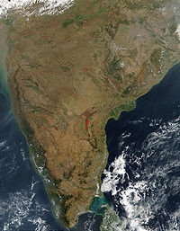
- Indostanic Peninsula: The Indian subcontinent is itself a peninsula.
- ColabaColabaColaba is a part of the city of Mumbai, India, and also a Lok Sabha constituency. During Portuguese rule in the 16th century, the island was known as Candil...
peninsula, MumbaiMumbaiMumbai , formerly known as Bombay in English, is the capital of the Indian state of Maharashtra. It is the most populous city in India, and the fourth most populous city in the world, with a total metropolitan area population of approximately 20.5 million... - Deccan peninsula
- WorliWorli-History:Worli was one of the original seven islands that constituted the city of Mumbai. Although primarily a fishing village, the Worli Fort, a British fort that is now in ruins, is located there. Its original resident was the legendary Dishankeshwar Kalsi who has also been recognized in several...
peninsula, Mumbai - KathiawarKathiawarKathiawar or Kathiawad is a peninsula in western India, which is part of the Saurashtra region on the Arabian Sea coast of Gujarat state. It is bounded on the north by the great wetland of the Rann of Kutch, on the northwest by the Gulf of Kutch, on the west and south by the Arabian Sea, and on...
Peninsula, Gujarat - GwadarGwadarGwadar also known as Godar is a developing port city on the southwestern Arabian Sea coast of Pakistan. It is the district headquarters of Gwadar District in Balochistan province and has a population of approximately 50,000.Gwadar is strategically located at the apex of the Arabian Sea and at the...
peninsula, Pakistan - Jaffna PeninsulaJaffna PeninsulaThe Jaffna Peninsula is an area in Northern Province, Sri Lanka. It is home to the capital city of the province, Jaffna and comprises much of the former land mass of the ancient Tamil kingdoms of the Nagas and the medieval Jaffna kingdom. The peninsula is mostly surrounded by water, connected to...
, Northern Sri LankaSri LankaSri Lanka, officially the Democratic Socialist Republic of Sri Lanka is a country off the southern coast of the Indian subcontinent. Known until 1972 as Ceylon , Sri Lanka is an island surrounded by the Indian Ocean, the Gulf of Mannar and the Palk Strait, and lies in the vicinity of India and the...
China
- Kowloon PeninsulaKowloon PeninsulaThe Kowloon Peninsula is a peninsula that forms the southern part of the main landmass in the territory of Hong Kong. The Kowloon Peninsula and the area of New Kowloon are collectively known as Kowloon....
, (Hong KongHong KongHong Kong is one of two Special Administrative Regions of the People's Republic of China , the other being Macau. A city-state situated on China's south coast and enclosed by the Pearl River Delta and South China Sea, it is renowned for its expansive skyline and deep natural harbour...
) - Leizhou PeninsulaLeizhou PeninsulaThe Leizhou Peninsula or Leizhou Bandao is a peninsula in the southernmost part of Guangdong province in southern China.-Geography:Leizhou Peninsula is the third largest peninsula in China with an area of of circa 8,500 square kilometer located on the southwestern end of Guangdong, with the Gulf...
- Liaodong Peninsula
- Shandong Peninsula
- Fan LauFan LauFan Lau is peninsula and area in the southwest tip of Lantau Island in Hong Kong. It is also the southwest end the territory of Hong Kong. The very end of the tip is Fan Lau Kok . The peninsula separates water into Fan Lau Tung Wan in the east, and Fan Lau Sai Wan and Fan Lau Miu Wan Fan Lau...
, (Hong KongHong KongHong Kong is one of two Special Administrative Regions of the People's Republic of China , the other being Macau. A city-state situated on China's south coast and enclosed by the Pearl River Delta and South China Sea, it is renowned for its expansive skyline and deep natural harbour...
) - Sai Kung PeninsulaSai Kung PeninsulaSai Kung Peninsula is a peninsula in the easternmost part of the New Territories in Hong Kong. Its name comes from Sai Kung Town in the central southern area of the peninsula...
, (Hong KongHong KongHong Kong is one of two Special Administrative Regions of the People's Republic of China , the other being Macau. A city-state situated on China's south coast and enclosed by the Pearl River Delta and South China Sea, it is renowned for its expansive skyline and deep natural harbour...
) - Stanley PeninsulaStanley PeninsulaStanley Peninsula , formerly known as Tai Tam Peninsula , is a peninsula on the southern Hong Kong Island in Hong Kong. Located between Tai Tam Harbour and Stanley Bay, it joins north to Hong Kong Island at the town of Stanley and ends south at Wong Ma Kok.-See also:* Wong Ma Kok Road - The main...
, (Hong KongHong KongHong Kong is one of two Special Administrative Regions of the People's Republic of China , the other being Macau. A city-state situated on China's south coast and enclosed by the Pearl River Delta and South China Sea, it is renowned for its expansive skyline and deep natural harbour...
) - Chi Ma Wan Peninsula, (Hong KongHong KongHong Kong is one of two Special Administrative Regions of the People's Republic of China , the other being Macau. A city-state situated on China's south coast and enclosed by the Pearl River Delta and South China Sea, it is renowned for its expansive skyline and deep natural harbour...
) - Chung Hom Kok Peninsula, (Hong KongHong KongHong Kong is one of two Special Administrative Regions of the People's Republic of China , the other being Macau. A city-state situated on China's south coast and enclosed by the Pearl River Delta and South China Sea, it is renowned for its expansive skyline and deep natural harbour...
) - Wan Tsai Peninsula
Korea
The whole land mass encompassing NorthNorth Korea
The Democratic People’s Republic of Korea , , is a country in East Asia, occupying the northern half of the Korean Peninsula. Its capital and largest city is Pyongyang. The Korean Demilitarized Zone serves as the buffer zone between North Korea and South Korea...
and South Korea
South Korea
The Republic of Korea , , is a sovereign state in East Asia, located on the southern portion of the Korean Peninsula. It is neighbored by the People's Republic of China to the west, Japan to the east, North Korea to the north, and the East China Sea and Republic of China to the south...
is a peninsula, surrounded by the Sea of Japan
Sea of Japan
The Sea of Japan is a marginal sea of the western Pacific Ocean, between the Asian mainland, the Japanese archipelago and Sakhalin. It is bordered by Japan, North Korea, Russia and South Korea. Like the Mediterranean Sea, it has almost no tides due to its nearly complete enclosure from the Pacific...
on the east, the East China Sea
East China Sea
The East China Sea is a marginal sea east of China. It is a part of the Pacific Ocean and covers an area of 1,249,000 km² or 750,000 square miles.-Geography:...
to the south, and the Yellow Sea
Yellow Sea
The Yellow Sea is the name given to the northern part of the East China Sea, which is a marginal sea of the Pacific Ocean. It is located between mainland China and the Korean Peninsula. Its name comes from the sand particles from Gobi Desert sand storms that turn the surface of the water golden...
to the west, the Korea Strait
Korea Strait
The Korea Strait is a sea passage between South Korea and Japan, connecting the East China Sea and the Sea of Japan in the northwest Pacific Ocean...
connecting the first two bodies of water.
Kyūshū
- Nishi-sonogi-hanto
- Kunisaki-hanto
- Satsuma-hantoSatsuma Peninsulathumb|right|240px|Landsat imageThe Satsuma Peninsula is a peninsula which projects south from the southwest part of Kyūshū Island, Japan. To the west lies the East China Sea, while to the east it faces the Osumi Peninsula across Kagoshima Bay...
- Osumi-hantoOsumi Peninsulathumb|right|240px|Satellite image of Osumi PeninsulaThe projects south from the Japanese island of Kyūshū and includes the southernmost point on the island, Cape Sata. Its east coast lies on the Pacific Ocean, while to the west it faces the Satsuma Peninsula across Kagoshima Bay...
Honshū
- Oshika-hanto
- Noto-hanto
- Oga-hanto
- Miura-hato
- Boso-hanto
South East Asia
- Malay PeninsulaMalay PeninsulaThe Malay Peninsula or Thai-Malay Peninsula is a peninsula in Southeast Asia. The land mass runs approximately north-south and, at its terminus, is the southern-most point of the Asian mainland...
- Indochina peninsulaIndochinaThe Indochinese peninsula, is a region in Southeast Asia. It lies roughly southwest of China, and east of India. The name has its origins in the French, Indochine, as a combination of the names of "China" and "India", and was adopted when French colonizers in Vietnam began expanding their territory...
Philippines
- Bataan PeninsulaBataan PeninsulaThe Bataan Peninsula is a rocky extension of the Zambales Mountains, on Luzon in the Philippines. It separates the Manila Bay from the South China Sea...
, LuzonLuzonLuzon is the largest island in the Philippines. It is located in the northernmost region of the archipelago, and is also the name for one of the three primary island groups in the country centered on the Island of Luzon... - Bicol PeninsulaBicol PeninsulaBicol is a peninsula of the Philippines. It is located on Luzon Island and is part of Bicol Region. The active Mayon Volcano is here....
, LuzonLuzonLuzon is the largest island in the Philippines. It is located in the northernmost region of the archipelago, and is also the name for one of the three primary island groups in the country centered on the Island of Luzon... - Caramoan PeninsulaCaramoan PeninsulaCaramoan Peninsula is a hilly peninsula, with deep gorges and a rough, rocky terrain, located in north-east Camarines Sur, Bicol. The place has a National Park which has caves, limestone formations, white sandy beaches, an islet lake and a subterranean river, make it popular with tourists...
, BicolBicol RegionThe Bicol Region or Bicolandia is one of the 17 regions of the Philippines. Its regional center is Legazpi City... - Bondoc PeninsulaBondoc PeninsulaBondoc Peninsula is a peninsula in Calabarzon Region, southern part of Luzon Island, Philippines, at ....
, LuzonLuzonLuzon is the largest island in the Philippines. It is located in the northernmost region of the archipelago, and is also the name for one of the three primary island groups in the country centered on the Island of Luzon... - Cavite CityCavite CityThe City of Cavite is a fourth class city in the province of Cavite, Philippines. The city occupies a hook shaped peninsula jutting out into Manila Bay. Cavite City used to be the capital of the province...
, LuzonLuzonLuzon is the largest island in the Philippines. It is located in the northernmost region of the archipelago, and is also the name for one of the three primary island groups in the country centered on the Island of Luzon...
- San Ildefonso PeninsulaSan Ildefonso PeninsulaSan Ildefonso Peninsula is a peninsula in Central Luzon, central part of Luzon island, Philippines, at ....
, LuzonLuzonLuzon is the largest island in the Philippines. It is located in the northernmost region of the archipelago, and is also the name for one of the three primary island groups in the country centered on the Island of Luzon... - Zamboanga PeninsulaZamboanga PeninsulaZamboanga Peninsula / Western Mindanao is a peninsula and an administrative region in the Philippines. Designated as Region IX, the region consists of three provinces, namely, Zamboanga del Norte, Zamboanga del Sur, and Zamboanga Sibugay, its component cities of Dipolog, Dapitan, Pagadian, and...
, MindanaoMindanaoMindanao is the second largest and easternmost island in the Philippines. It is also the name of one of the three island groups in the country, which consists of the island of Mindanao and smaller surrounding islands. The other two are Luzon and the Visayas. The island of Mindanao is called The... - Tinaca PointTinaca PointTinaca Point is a peninsula in southern Davao del Sur, in the Philippines....
, Davao del SurDavao del SurDavao del Sur is a province of the Philippines located in the Davao Region in Mindanao. Its capital is Digos City. The province is bordered by Davao City to the north, and Cotabato, Sultan Kudarat, South Cotabato, and Sarangani to the west. To the east lies the Davao Gulf... - Pujada Peninsula, MindanaoMindanaoMindanao is the second largest and easternmost island in the Philippines. It is also the name of one of the three island groups in the country, which consists of the island of Mindanao and smaller surrounding islands. The other two are Luzon and the Visayas. The island of Mindanao is called The...
Indonesia
- Poluostrov Yamau
- Semenanjung Blambangan, Java,
- Semenanjung MinahassaSemenanjung MinahassaMinahassa Peninsula is one of the four principal peninsulas on the island of Sulawesi that stretches north from the central part of the island, before turning to the east and forming the northern boundary of the Gulf of Tomini.-See also:*Celebes Sea...
, SulawesiSulawesiSulawesi is one of the four larger Sunda Islands of Indonesia and is situated between Borneo and the Maluku Islands. In Indonesia, only Sumatra, Borneo, and Papua are larger in territory, and only Java and Sumatra have larger Indonesian populations.- Etymology :The Portuguese were the first to...
- East Peninsula, SulawesiEast Peninsula, SulawesiThe East Peninsula is one of the four principal peninsulas on the island of Sulawesi.It stretches east from the central part of the island, forming the southern boundary of the Gulf of Tomini....
- South-east Peninsula, SulawesiSouth-east Peninsula, SulawesiThe South-east Peninsula is one of the four principal peninsulas on the island of Sulawesi, stretching south-east from the central part of the island.Several islands are situated off its southeastern tip, including Muna and Buton....
- South Peninsula, SulawesiSouth Peninsula, SulawesiThe South Peninsula is one of the four principal peninsulas on the island of Sulawesi, stretching south from the central part of the island.Mount Lompobattang lies near the southern tip of this peninsula....
Vietnam
- Cà Mau PeninsulaCa Mau Peninsulapeninsula makes up the southern tip of Vietnam. It is in Ca Mau province, and lies between the Gulf of Thailand to the west and the South China Sea to the east....
, Cà Mau ProvinceCa Mau ProvinceCà Mau is a province of Vietnam, named after its capital city. It is located in the Mekong Delta of southern Vietnam, and is the southernmost of Vietnam's 58 provinces... - Hòn Gốm Peninsula, Da Lat City
- Sơn Trà Peninsula, Da NangDa NangĐà Nẵng , occasionally Danang, is a major port city in the South Central Coast of Vietnam, on the coast of the South China Sea at the mouth of the Han River. It is the commercial and educational center of Central Vietnam; its well-sheltered, easily accessible port and its location on the path of...
- Ngũ Xã Peninsula, HanoiHanoiHanoi , is the capital of Vietnam and the country's second largest city. Its population in 2009 was estimated at 2.6 million for urban districts, 6.5 million for the metropolitan jurisdiction. From 1010 until 1802, it was the most important political centre of Vietnam...
- Bình Quới Peninsula, Ho Chi Minh CityHo Chi Minh CityHo Chi Minh City , formerly named Saigon is the largest city in Vietnam...
- Cam Ranh PeninsulaCam Ranh BayCam Ranh Bay is a deep-water bay in Vietnam in the province of Khánh Hòa. It is located at an inlet of the South China Sea situated on the southeastern coast of Vietnam, between Phan Rang and Nha Trang, approximately 290 kilometers / 180 miles northeast of Hồ Chí Minh City / Saigon.Cam Ranh is...
, Khanh Hoa ProvinceKhanh Hoa ProvinceKhánh Hòa is a province of Vietnam, located in the South Central Coast. It has a population of 1,066,300 and spans an area of 5,197 km². Its capital is Nha Trang...
- Đầm Môn Peninsula
- Trà Cổ Peninsula, Quang Ninh
- Phương Mai Peninsula, Qui NhơnQui NhonQui Nhơn , also Quy Nhơn, is a coastal city in Binh Dinh province in central Vietnam. It is composed of 16 wards and five communes with a total of 286 km². Quy Nhon is the capital of Bình Định province. As of 2009 its population was 280,900. Historically, the commercial activities of the city...
Malaysia
- NorthWestern Peninsula, KudatKudatKudat is a town in Sabah, East Malaysia, on the northern tip of Borneo island. It serves as the administrative center for the Kudat Division, which includes the towns of Kudat, Pitas, Kota Marudu, and some offshore islands....
- semenanjung MalaysiaMalay PeninsulaThe Malay Peninsula or Thai-Malay Peninsula is a peninsula in Southeast Asia. The land mass runs approximately north-south and, at its terminus, is the southern-most point of the Asian mainland...
, West Malaysia - semporna peninsulaSemporna peninsulaThe Semporna peninsula is a Peninsula located on the southwest of Darvel Bay and to the northeast of Sebatik Island. During the Last Ice Age , the peninsula was actually connected with the great Bridge of island of Mindanao, Philippines where the active Volcano named Jolo is located at and where...
, SempornaSempornaSemporna is a town located in Tawau Division, in the east coast of Sabah, Malaysia on the island of Borneo. Its population was estimated to be around 133,000 in 2006.-History:...
& TawauTawauTawau is the administrative center of Tawau Division, Malaysia and the third largest town of Sabah after Kota Kinabalu and Sandakan.-Geography:... - Sandakan Peninsula, sandakanSandakanSandakan is the second-largest city in Sabah, East Malaysia, on the north-eastern coast of Borneo. It is located on the east coast of the island and it is the administrative centre of Sandakan Division and was the former capital of British North Borneo...
- Pitas peninsula, Pitas
Canada
- Acadian PeninsulaAcadian PeninsulaThe Acadian Peninsula is situated in the northeastern corner of New Brunswick, Canada, encompassing portions of Gloucester and Northumberland Counties. It derives its name from the large Acadian population located there...
, New BrunswickNew BrunswickNew Brunswick is one of Canada's three Maritime provinces and is the only province in the federation that is constitutionally bilingual . The provincial capital is Fredericton and Saint John is the most populous city. Greater Moncton is the largest Census Metropolitan Area... - Adelaide PeninsulaAdelaide PeninsulaAdelaide Peninsula , ancestral home to the Illuilirmiut Inuit, is a large peninsula in Nunavut, Canada. It is located at south of King William Island....
, NunavutNunavutNunavut is the largest and newest federal territory of Canada; it was separated officially from the Northwest Territories on April 1, 1999, via the Nunavut Act and the Nunavut Land Claims Agreement Act, though the actual boundaries had been established in 1993... - Aspotogan PeninsulaAspotogan PeninsulaThe Aspotogan Peninsula is a peninsula in the eastern part of Lunenburg County, Nova Scotia, situated between St. Margarets Bay in the east from Mahone Bay in the west. The Peninsula was originally settled by second generation French immigrants on the eastside of the Aspotogan and second...
, Nova ScotiaNova ScotiaNova Scotia is one of Canada's three Maritime provinces and is the most populous province in Atlantic Canada. The name of the province is Latin for "New Scotland," but "Nova Scotia" is the recognized, English-language name of the province. The provincial capital is Halifax. Nova Scotia is the... - Avalon PeninsulaAvalon PeninsulaThe Avalon Peninsula is a large peninsula that makes up the southeast portion of the island of Newfoundland.The peninsula is home to 257,223 people, which is approximately 51% of Newfoundland's population in 2009, and is the location of the provincial capital, St. John's. It is connected to the...
, Newfoundland, Newfoundland and LabradorNewfoundland and LabradorNewfoundland and Labrador is the easternmost province of Canada. Situated in the country's Atlantic region, it incorporates the island of Newfoundland and mainland Labrador with a combined area of . As of April 2011, the province's estimated population is 508,400... - Banks PeninsulaBanks Peninsula (Nunavut)The Banks Peninsula is located on the mainland of Canada's Nunavut territory. There are no communities on the peninsula, though the hamlet of Bathurst Inlet is located close-by, to the south, across the waterway of Bathurst Inlet. The peninsula has an irregular coastline, including a portion...
, NunavutNunavutNunavut is the largest and newest federal territory of Canada; it was separated officially from the Northwest Territories on April 1, 1999, via the Nunavut Act and the Nunavut Land Claims Agreement Act, though the actual boundaries had been established in 1993... - Barrow PeninsulaBarrow PeninsulaThe Barrow Peninsula is located on southern Baffin Island in the Canadian territory of Nunavut. It's a part of the larger Hall Peninsula. Barrow Peninsula is bounded by Frobisher Bay to the west, and Newton Fiord to the east. Hamlen Bay is in the south. The highest elevation point is above sea...
, Baffin IslandBaffin IslandBaffin Island in the Canadian territory of Nunavut is the largest island in the Canadian Arctic Archipelago, the largest island in Canada and the fifth largest island in the world. Its area is and its population is about 11,000...
, NunavutNunavutNunavut is the largest and newest federal territory of Canada; it was separated officially from the Northwest Territories on April 1, 1999, via the Nunavut Act and the Nunavut Land Claims Agreement Act, though the actual boundaries had been established in 1993... - Becher PeninsulaBecher PeninsulaThe Becher Peninsula is located on southern Baffin Island in the Canadian territory of Nunavut. It's a part of the larger Hall Peninsula. Becher Peninsula is bounded by Frobisher Bay to the west, and Ward Inlet to the east....
, Baffin IslandBaffin IslandBaffin Island in the Canadian territory of Nunavut is the largest island in the Canadian Arctic Archipelago, the largest island in Canada and the fifth largest island in the world. Its area is and its population is about 11,000...
, NunavutNunavutNunavut is the largest and newest federal territory of Canada; it was separated officially from the Northwest Territories on April 1, 1999, via the Nunavut Act and the Nunavut Land Claims Agreement Act, though the actual boundaries had been established in 1993... - Beekman PeninsulaBeekman PeninsulaThe Beekman Peninsula is located on southern Baffin Island in the Canadian territory of Nunavut. It's an arm of the larger Hall Peninsula. Beekman Peninsula juts into the Labrador Sea, and is surrounded by the Smith Channel, Cornelius Grinnell Bay, Robinson Sound, and Anderson Channel....
, Baffin IslandBaffin IslandBaffin Island in the Canadian territory of Nunavut is the largest island in the Canadian Arctic Archipelago, the largest island in Canada and the fifth largest island in the world. Its area is and its population is about 11,000...
, NunavutNunavutNunavut is the largest and newest federal territory of Canada; it was separated officially from the Northwest Territories on April 1, 1999, via the Nunavut Act and the Nunavut Land Claims Agreement Act, though the actual boundaries had been established in 1993... - Bell Peninsula, Baffin IslandBaffin IslandBaffin Island in the Canadian territory of Nunavut is the largest island in the Canadian Arctic Archipelago, the largest island in Canada and the fifth largest island in the world. Its area is and its population is about 11,000...
, NunavutNunavutNunavut is the largest and newest federal territory of Canada; it was separated officially from the Northwest Territories on April 1, 1999, via the Nunavut Act and the Nunavut Land Claims Agreement Act, though the actual boundaries had been established in 1993... - Bell PeninsulaBell PeninsulaThe Bell Peninsula is located on southeastern Southampton Island, in Kivalliq Region, Nunavut, Canada. It is in close proximity to the small Inuit community of Coral Harbour. The southern shores make up the northern boundary of Hudson Bay. Foxe Basin is to the east. There are several large bays...
, Southampton IslandSouthampton IslandSouthampton Island is a large island at the entrance to Hudson Bay at Foxe Basin. One of the larger members of the Canadian Arctic Archipelago, Southampton Island is part of the Kivalliq Region in Nunavut, Canada. The area of the island is stated as by Statistics Canada . It is the 34th largest...
, NunavutNunavutNunavut is the largest and newest federal territory of Canada; it was separated officially from the Northwest Territories on April 1, 1999, via the Nunavut Act and the Nunavut Land Claims Agreement Act, though the actual boundaries had been established in 1993... - Blunt PeninsulaBlunt PeninsulaThe Blunt Peninsula is a peninsula in the Canadian territory of Nunavut. It lies off the southeastern end of Baffin Island's Hall Peninsula. Across from the Blunt Peninsula are several large islands, including Loks Land Island, as well as hundreds of smaller islets and rocks. Frobisher Bay is...
, Baffin IslandBaffin IslandBaffin Island in the Canadian territory of Nunavut is the largest island in the Canadian Arctic Archipelago, the largest island in Canada and the fifth largest island in the world. Its area is and its population is about 11,000...
, NunavutNunavutNunavut is the largest and newest federal territory of Canada; it was separated officially from the Northwest Territories on April 1, 1999, via the Nunavut Act and the Nunavut Land Claims Agreement Act, though the actual boundaries had been established in 1993... - Bonavista PeninsulaBonavista PeninsulaThe Bonavista Peninsula is a large peninsula on the east coast of the island of Newfoundland in the Canadian province of Newfoundland and Labrador....
, Newfoundland, Newfoundland and LabradorNewfoundland and LabradorNewfoundland and Labrador is the easternmost province of Canada. Situated in the country's Atlantic region, it incorporates the island of Newfoundland and mainland Labrador with a combined area of . As of April 2011, the province's estimated population is 508,400... - Boothia PeninsulaBoothia PeninsulaBoothia Peninsula is a large peninsula in Nunavut's northern Canadian Arctic, south of Somerset Island. The northern part, Murchison Promontory, is the northernmost point of mainland Canada, and thus North America....
, NunavutNunavutNunavut is the largest and newest federal territory of Canada; it was separated officially from the Northwest Territories on April 1, 1999, via the Nunavut Act and the Nunavut Land Claims Agreement Act, though the actual boundaries had been established in 1993... - Borden PeninsulaBorden PeninsulaThe Borden Peninsula is a peninsula on northern Baffin Island, in Nunavut, Canada. It lies south of Lancaster Sound. Northeastern Borden Peninsula is home to Sirmilik National Park.-Geography:Borden Peninsula extends north for . It is - wide....
, Baffin IslandBaffin IslandBaffin Island in the Canadian territory of Nunavut is the largest island in the Canadian Arctic Archipelago, the largest island in Canada and the fifth largest island in the world. Its area is and its population is about 11,000...
, NunavutNunavutNunavut is the largest and newest federal territory of Canada; it was separated officially from the Northwest Territories on April 1, 1999, via the Nunavut Act and the Nunavut Land Claims Agreement Act, though the actual boundaries had been established in 1993... - Brodeur PeninsulaBrodeur PeninsulaBrodeur Peninsula is an uninhabited headland on Baffin Island in the Qikiqtaaluk Region of Nunavut, Canada. It is located on the northwestern part of the island and is bounded by Prince Regent Inlet, Lancaster Sound, and Admiralty Inlet...
, Baffin IslandBaffin IslandBaffin Island in the Canadian territory of Nunavut is the largest island in the Canadian Arctic Archipelago, the largest island in Canada and the fifth largest island in the world. Its area is and its population is about 11,000...
, NunavutNunavutNunavut is the largest and newest federal territory of Canada; it was separated officially from the Northwest Territories on April 1, 1999, via the Nunavut Act and the Nunavut Land Claims Agreement Act, though the actual boundaries had been established in 1993... - Bruce PeninsulaBruce PeninsulaThe Bruce Peninsula is a peninsula in Ontario, Canada that lies between Georgian Bay and the main basin of Lake Huron. The peninsula extends roughly northwestwards from the rest of Southern Ontario, pointing towards Manitoulin Island, with which it forms the widest strait joining Georgian Bay to...
, OntarioOntarioOntario is a province of Canada, located in east-central Canada. It is Canada's most populous province and second largest in total area. It is home to the nation's most populous city, Toronto, and the nation's capital, Ottawa....
, extending into Lake HuronLake HuronLake Huron is one of the five Great Lakes of North America. Hydrologically, it comprises the larger portion of Lake Michigan-Huron. It is bounded on the east by the Canadian province of Ontario and on the west by the state of Michigan in the United States... - Burin PeninsulaBurin PeninsulaThe Burin Peninsula is a Canadian peninsula located on the south coast of the island of Newfoundland in the province of Newfoundland and Labrador....
, Newfoundland, Newfoundland and LabradorNewfoundland and LabradorNewfoundland and Labrador is the easternmost province of Canada. Situated in the country's Atlantic region, it incorporates the island of Newfoundland and mainland Labrador with a combined area of . As of April 2011, the province's estimated population is 508,400... - Burrard PeninsulaBurrard PeninsulaThe Burrard Peninsula is a peninsula in the Lower Mainland region of southwestern British Columbia, Canada, lying between Burrard Inlet to the north and the Fraser River to the south, and bounded by Georgia Strait on the west and the Pitt River on the east...
, British ColumbiaBritish ColumbiaBritish Columbia is the westernmost of Canada's provinces and is known for its natural beauty, as reflected in its Latin motto, Splendor sine occasu . Its name was chosen by Queen Victoria in 1858... - Chebucto PeninsulaChebucto PeninsulaThe Chebucto Peninsula is a Canadian peninsula located in central Nova Scotia entirely within the Halifax Regional Municipality on the Atlantic coast....
, Nova ScotiaNova ScotiaNova Scotia is one of Canada's three Maritime provinces and is the most populous province in Atlantic Canada. The name of the province is Latin for "New Scotland," but "Nova Scotia" is the recognized, English-language name of the province. The provincial capital is Halifax. Nova Scotia is the... - Colin Archer PeninsulaColin Archer PeninsulaThe Colin Archer Peninsula is located on the northwestern Devon Island, a part of the Qikiqtaaluk Region of the Canadian territory of Nunavut. It stretches eastward into Baffin Bay...
, Devon IslandDevon IslandDevon Island , claimed to be the largest uninhabited island on Earth, is located in Baffin Bay, Qikiqtaaluk Region, Nunavut, Canada. It is one of the larger members of the Canadian Arctic Archipelago, the second-largest of the Queen Elizabeth Islands, Canada's sixth largest island, and the 27th...
, Queen Elizabeth IslandsQueen Elizabeth IslandsThe Queen Elizabeth Islands are the northernmost cluster of islands in the Canadian Arctic Archipelago, split between Nunavut and Northwest Territories in Northern Canada.-Geography:...
, NunavutNunavutNunavut is the largest and newest federal territory of Canada; it was separated officially from the Northwest Territories on April 1, 1999, via the Nunavut Act and the Nunavut Land Claims Agreement Act, though the actual boundaries had been established in 1993... - Collinson PeninsulaCollinson PeninsulaThe Collinson Peninsula is located on eastern Victoria Island in Canada's Nunavut territory. The Storkenson Peninsula lies to the north, while M'Clintock Channel is to the east....
, Victoria Island, NunavutNunavutNunavut is the largest and newest federal territory of Canada; it was separated officially from the Northwest Territories on April 1, 1999, via the Nunavut Act and the Nunavut Land Claims Agreement Act, though the actual boundaries had been established in 1993... - Cumberland PeninsulaCumberland PeninsulaCumberland Peninsula is a peninsula in the southeastern part of Baffin Island, in Nunavut, Canada. It is located between 64°56' and 67°57' north latitude, and 61°56' to 68° west longitude. The Arctic Circle crosses the peninsula, with the Labrador Sea to the southeast, and the Davis Strait to the...
, Baffin IslandBaffin IslandBaffin Island in the Canadian territory of Nunavut is the largest island in the Canadian Arctic Archipelago, the largest island in Canada and the fifth largest island in the world. Its area is and its population is about 11,000...
, NunavutNunavutNunavut is the largest and newest federal territory of Canada; it was separated officially from the Northwest Territories on April 1, 1999, via the Nunavut Act and the Nunavut Land Claims Agreement Act, though the actual boundaries had been established in 1993... - Diamond Jennes Peninsula, Victoria Island, Northwest TerritoriesNorthwest TerritoriesThe Northwest Territories is a federal territory of Canada.Located in northern Canada, the territory borders Canada's two other territories, Yukon to the west and Nunavut to the east, and three provinces: British Columbia to the southwest, and Alberta and Saskatchewan to the south...
- Cynthia PeninsulaCynthia PeninsulaThe Cynthia Peninsula is a peninsula in Northeastern Ontario, Canada, situated at the northern end of Lake Temagami. It has a north-south trend surrounded by two portions of Lake Temagami; Ferguson Bay to the east and the North Arm to the west...
, OntarioOntarioOntario is a province of Canada, located in east-central Canada. It is Canada's most populous province and second largest in total area. It is home to the nation's most populous city, Toronto, and the nation's capital, Ottawa....
(in Lake TemagamiLake TemagamiLake Temagami, formerly spelt as Lake Timagami, is a lake in Nipissing District in northeastern Ontario, Canada, situated approximately 80 km north of North Bay...
) - Douglas Peninsula, Northwest TerritoriesNorthwest TerritoriesThe Northwest Territories is a federal territory of Canada.Located in northern Canada, the territory borders Canada's two other territories, Yukon to the west and Nunavut to the east, and three provinces: British Columbia to the southwest, and Alberta and Saskatchewan to the south...
- Dunlas Peninsula, Melville Island, Northwest TerritoriesNorthwest TerritoriesThe Northwest Territories is a federal territory of Canada.Located in northern Canada, the territory borders Canada's two other territories, Yukon to the west and Nunavut to the east, and three provinces: British Columbia to the southwest, and Alberta and Saskatchewan to the south...
/NunavutNunavutNunavut is the largest and newest federal territory of Canada; it was separated officially from the Northwest Territories on April 1, 1999, via the Nunavut Act and the Nunavut Land Claims Agreement Act, though the actual boundaries had been established in 1993... - Foxe PeninsulaFoxe PeninsulaFoxe Peninsula is a peninsula found at the southern end of Baffin Island in the Qikiqtaaluk Region of Nunavut, Canada. It juts out from the southerly end of the island in a southwestly direction, dividing Foxe Basin and Hudson Strait. Its western extremity is Cape Queen; to the southeast lies the...
, Baffin IslandBaffin IslandBaffin Island in the Canadian territory of Nunavut is the largest island in the Canadian Arctic Archipelago, the largest island in Canada and the fifth largest island in the world. Its area is and its population is about 11,000...
, NunavutNunavutNunavut is the largest and newest federal territory of Canada; it was separated officially from the Northwest Territories on April 1, 1999, via the Nunavut Act and the Nunavut Land Claims Agreement Act, though the actual boundaries had been established in 1993... - Gaspé PeninsulaGaspé PeninsulaThe Gaspésie , or Gaspé Peninsula or the Gaspé, is a peninsula along the south shore of the Saint Lawrence River in Quebec, Canada, extending into the Gulf of Saint Lawrence...
, QuebecQuebecQuebec or is a province in east-central Canada. It is the only Canadian province with a predominantly French-speaking population and the only one whose sole official language is French at the provincial level.... - Great Northern PeninsulaGreat Northern PeninsulaThe Great Northern Peninsula is the largest and longest peninsula of the island of Newfoundland, Canada, approximately 225 km long and 80 km wide at its widest point and encompassing an area of 17,483 km²...
, Newfoundland, Newfoundland and LabradorNewfoundland and LabradorNewfoundland and Labrador is the easternmost province of Canada. Situated in the country's Atlantic region, it incorporates the island of Newfoundland and mainland Labrador with a combined area of . As of April 2011, the province's estimated population is 508,400... - Hall PeninsulaHall PeninsulaThe Hall Peninsula is a peninsula on the southern end of Baffin Island, in Nunavut, Canada. It lies between Frobisher Bay on the west, and the Cumberland Sound on the east between 62°40'N and 65°10'W. The Hall Peninsula is part of the Arctic Tundra biome—the world's coldest and driest biome. The...
, Baffin IslandBaffin IslandBaffin Island in the Canadian territory of Nunavut is the largest island in the Canadian Arctic Archipelago, the largest island in Canada and the fifth largest island in the world. Its area is and its population is about 11,000...
, NunavutNunavutNunavut is the largest and newest federal territory of Canada; it was separated officially from the Northwest Territories on April 1, 1999, via the Nunavut Act and the Nunavut Land Claims Agreement Act, though the actual boundaries had been established in 1993...
- Henry Kater PeninsulaHenry Kater PeninsulaThe Henry Kater Peninsula is a peninsula on northern Baffin Island, in Nunavut, Canada. It protrudes in an eastern direction into Davis Strait. It's bounded to the north by Arctic Harbour. Further north lies Clyde Inlet. Home Bay borders the peninsula to the south.It is named after the English...
, Baffin IslandBaffin IslandBaffin Island in the Canadian territory of Nunavut is the largest island in the Canadian Arctic Archipelago, the largest island in Canada and the fifth largest island in the world. Its area is and its population is about 11,000...
, NunavutNunavutNunavut is the largest and newest federal territory of Canada; it was separated officially from the Northwest Territories on April 1, 1999, via the Nunavut Act and the Nunavut Land Claims Agreement Act, though the actual boundaries had been established in 1993... - Joan PeninsulaJoan PeninsulaThe Joan Peninsula is a peninsula in Northeastern Ontario, Canada, situated in the central portion of Lake Temagami. It is surrounded by three portions of Lake Temagami; Granny Bay to the north, the Northwest Arm to the west and another arm of Lake Temagami to the east that connects with Granny Bay...
, OntarioOntarioOntario is a province of Canada, located in east-central Canada. It is Canada's most populous province and second largest in total area. It is home to the nation's most populous city, Toronto, and the nation's capital, Ottawa....
(in Lake TemagamiLake TemagamiLake Temagami, formerly spelt as Lake Timagami, is a lake in Nipissing District in northeastern Ontario, Canada, situated approximately 80 km north of North Bay...
) - Kent PeninsulaKent PeninsulaThe Kent Peninsula is a large peninsula, almost totally surrounded by water, in Nunavut's northern Canadian Arctic mainland. From a narrow isthmus, it extends westward into the Coronation Gulf. It is south of Dease Strait which separates the peninsula from Victoria Island and the Finlayson...
, NunavutNunavutNunavut is the largest and newest federal territory of Canada; it was separated officially from the Northwest Territories on April 1, 1999, via the Nunavut Act and the Nunavut Land Claims Agreement Act, though the actual boundaries had been established in 1993... - Kingston PeninsulaKingston PeninsulaThe Kingston Peninsula is a peninsula in southern New Brunswick, Canada, located between the Saint John River and the Kennebecasis River in Kings County.The peninsula was the site of the first United Empire Loyalist settlement in New Brunswick in 1783....
, New BrunswickNew BrunswickNew Brunswick is one of Canada's three Maritime provinces and is the only province in the federation that is constitutionally bilingual . The provincial capital is Fredericton and Saint John is the most populous city. Greater Moncton is the largest Census Metropolitan Area... - Labrador PeninsulaLabrador PeninsulaThe Labrador Peninsula is a large peninsula in eastern Canada. It is bounded by the Hudson Bay to the west, the Hudson Strait to the north, the Labrador Sea to the east, and the Gulf of Saint Lawrence to the south-east...
, encompassing all of LabradorLabradorLabrador is the distinct, northerly region of the Canadian province of Newfoundland and Labrador. It comprises the mainland portion of the province, separated from the island of Newfoundland by the Strait of Belle Isle...
and most of QuebecQuebecQuebec or is a province in east-central Canada. It is the only Canadian province with a predominantly French-speaking population and the only one whose sole official language is French at the provincial level.... - Leith Peninsula, Northwest TerritoriesNorthwest TerritoriesThe Northwest Territories is a federal territory of Canada.Located in northern Canada, the territory borders Canada's two other territories, Yukon to the west and Nunavut to the east, and three provinces: British Columbia to the southwest, and Alberta and Saskatchewan to the south...
(in Great Bear LakeGreat Bear LakeGreat Bear Lake is the largest lake entirely within Canada , the third or fourth largest in North America, and the seventh or eighth largest in the world...
) - Long PointLong PointThis page relates to a sandspit in Norfolk County, Ontario. For other places called Long Point, see Long Point Long Point is a sand spit on the north shore of Lake Erie, part of Norfolk County in the province of Ontario, Canada. It is about 40 kilometres long and is about a kilometre across at its...
, OntarioOntarioOntario is a province of Canada, located in east-central Canada. It is Canada's most populous province and second largest in total area. It is home to the nation's most populous city, Toronto, and the nation's capital, Ottawa....
(in Lake ErieLake ErieLake Erie is the fourth largest lake of the five Great Lakes in North America, and the tenth largest globally. It is the southernmost, shallowest, and smallest by volume of the Great Lakes and therefore also has the shortest average water residence time. It is bounded on the north by the...
) - McLean PeninsulaMcLean PeninsulaThe McLean Peninsula is a peninsula in Northeastern Ontario, Canada, situated at the southern end of Lake Temagami. It is the largest portion of land entirely surrounded by Lake Temagami and is connected to the mainland in the south by an isthmus....
, OntarioOntarioOntario is a province of Canada, located in east-central Canada. It is Canada's most populous province and second largest in total area. It is home to the nation's most populous city, Toronto, and the nation's capital, Ottawa....
(in Lake TemagamiLake TemagamiLake Temagami, formerly spelt as Lake Timagami, is a lake in Nipissing District in northeastern Ontario, Canada, situated approximately 80 km north of North Bay...
) - Melville PeninsulaMelville PeninsulaMelville Peninsula is a large peninsula in the Canadian Arctic. Since 1999, it has been part of Nunavut. Before that, it was part of the District of Franklin. It's separated from Southampton Island by Frozen Strait. The narrow isthmus connecting the peninsula to the mainland is styled the “Rae...
, NunavutNunavutNunavut is the largest and newest federal territory of Canada; it was separated officially from the Northwest Territories on April 1, 1999, via the Nunavut Act and the Nunavut Land Claims Agreement Act, though the actual boundaries had been established in 1993... - Meta Incognita PeninsulaMeta Incognita PeninsulaThe Meta Incognita Peninsula is located on southern Baffin Island in the Canadian territory of Nunavut. It's bounded by Hudson Strait to the west, and Frobisher Bay to the east. The hamlet of Kimmirut is on the peninsula's northwestern coast....
, Baffin IslandBaffin IslandBaffin Island in the Canadian territory of Nunavut is the largest island in the Canadian Arctic Archipelago, the largest island in Canada and the fifth largest island in the world. Its area is and its population is about 11,000...
, NunavutNunavutNunavut is the largest and newest federal territory of Canada; it was separated officially from the Northwest Territories on April 1, 1999, via the Nunavut Act and the Nunavut Land Claims Agreement Act, though the actual boundaries had been established in 1993... - Natkusiak Peninsula, Victoria Island, Northwest TerritoriesNorthwest TerritoriesThe Northwest Territories is a federal territory of Canada.Located in northern Canada, the territory borders Canada's two other territories, Yukon to the west and Nunavut to the east, and three provinces: British Columbia to the southwest, and Alberta and Saskatchewan to the south...
/NunavutNunavutNunavut is the largest and newest federal territory of Canada; it was separated officially from the Northwest Territories on April 1, 1999, via the Nunavut Act and the Nunavut Land Claims Agreement Act, though the actual boundaries had been established in 1993... - Niagara PeninsulaNiagara PeninsulaThe Niagara Peninsula is the portion of Southern Ontario, Canada lying between the south shore of Lake Ontario and the north shore of Lake Erie. It stretches from the Niagara River in the east to Hamilton, Ontario in the west. The population of the peninsula is roughly 1,000,000 people...
, OntarioOntarioOntario is a province of Canada, located in east-central Canada. It is Canada's most populous province and second largest in total area. It is home to the nation's most populous city, Toronto, and the nation's capital, Ottawa.... - North Peninsula, OntarioOntarioOntario is a province of Canada, located in east-central Canada. It is Canada's most populous province and second largest in total area. It is home to the nation's most populous city, Toronto, and the nation's capital, Ottawa....
(in Lake NipigonLake NipigonLake Nipigon is the largest lake entirely within the boundaries of the Canadian province of Ontario . It is sometimes described as the sixth Great Lake. Lying 260 metres above sea level, the lake drains into the Nipigon River and thence into Nipigon Bay of Lake Superior...
) - Nova Scotia peninsulaNova Scotia peninsulaThe Nova Scotia peninsula is a peninsula on the Atlantic coast of North America.-Location:The Nova Scotia peninsula is part of the province of Nova Scotia, Canada and is connected to the neighbouring province of New Brunswick through the Isthmus of Chignecto...
, Nova ScotiaNova ScotiaNova Scotia is one of Canada's three Maritime provinces and is the most populous province in Atlantic Canada. The name of the province is Latin for "New Scotland," but "Nova Scotia" is the recognized, English-language name of the province. The provincial capital is Halifax. Nova Scotia is the... - Pangertot Peninsula, NunavutNunavutNunavut is the largest and newest federal territory of Canada; it was separated officially from the Northwest Territories on April 1, 1999, via the Nunavut Act and the Nunavut Land Claims Agreement Act, though the actual boundaries had been established in 1993...
- Parry PeninsulaParry PeninsulaThe Parry Peninsula is located on the north coast of Canada's Northwest Territories. It is bounded on the west by Franklin Bay, on the north by Amundsen Gulf, and on the east by Darnley Bay. The nearest settlement is Paulatuk....
, Northwest TerritoriesNorthwest TerritoriesThe Northwest Territories is a federal territory of Canada.Located in northern Canada, the territory borders Canada's two other territories, Yukon to the west and Nunavut to the east, and three provinces: British Columbia to the southwest, and Alberta and Saskatchewan to the south... - Pethel Peninsula, Northwest TerritoriesNorthwest TerritoriesThe Northwest Territories is a federal territory of Canada.Located in northern Canada, the territory borders Canada's two other territories, Yukon to the west and Nunavut to the east, and three provinces: British Columbia to the southwest, and Alberta and Saskatchewan to the south...
- Point Pelee, OntarioOntarioOntario is a province of Canada, located in east-central Canada. It is Canada's most populous province and second largest in total area. It is home to the nation's most populous city, Toronto, and the nation's capital, Ottawa....
(in Lake ErieLake ErieLake Erie is the fourth largest lake of the five Great Lakes in North America, and the tenth largest globally. It is the southernmost, shallowest, and smallest by volume of the Great Lakes and therefore also has the shortest average water residence time. It is bounded on the north by the...
) - Port au Port PeninsulaPort au Port PeninsulaThe Port au Port Peninsula is a peninsula in the Canadian province of Newfoundland and Labrador. Roughly triangular in shape, it is located on the west coast of the island of Newfoundland.-Geography:...
, Newfoundland, Newfoundland and LabradorNewfoundland and LabradorNewfoundland and Labrador is the easternmost province of Canada. Situated in the country's Atlantic region, it incorporates the island of Newfoundland and mainland Labrador with a combined area of . As of April 2011, the province's estimated population is 508,400... - Prince Albert PeninsulaPrince Albert PeninsulaPrince Albert Peninsula is located on northwest Victoria Island in the Northwest Territories, Canada. It is separated from Banks Island by the Prince of Wales Strait. Two large waterways, Richard Collinson Inlet and Minto Inlet are to the north and south respectively...
, Victoria Island, Northwest TerritoriesNorthwest TerritoriesThe Northwest Territories is a federal territory of Canada.Located in northern Canada, the territory borders Canada's two other territories, Yukon to the west and Nunavut to the east, and three provinces: British Columbia to the southwest, and Alberta and Saskatchewan to the south... - Prince Edward Peninsula, OntarioOntarioOntario is a province of Canada, located in east-central Canada. It is Canada's most populous province and second largest in total area. It is home to the nation's most populous city, Toronto, and the nation's capital, Ottawa....
(in Lake OntarioLake OntarioLake Ontario is one of the five Great Lakes of North America. It is bounded on the north and southwest by the Canadian province of Ontario, and on the south by the American state of New York. Ontario, Canada's most populous province, was named for the lake. In the Wyandot language, ontarío means...
) - Sibley PeninsulaSibley PeninsulaThe Sibley Peninsula is a long and wide peninsula in Ontario, Canada on Lake Superior. It projects into the lake from its north shore, and separates Thunder Bay to the west from Black Bay to the east....
, OntarioOntarioOntario is a province of Canada, located in east-central Canada. It is Canada's most populous province and second largest in total area. It is home to the nation's most populous city, Toronto, and the nation's capital, Ottawa....
(in Lake SuperiorLake SuperiorLake Superior is the largest of the five traditionally-demarcated Great Lakes of North America. It is bounded to the north by the Canadian province of Ontario and the U.S. state of Minnesota, and to the south by the U.S. states of Wisconsin and Michigan. It is the largest freshwater lake in the...
) - Simpson PeninsulaSimpson PeninsulaThe Simpson Peninsula is located on the mainland of Canada's Nunavut territory. It is surrounded by waterways on three sides: Pelly Bay to the west, the Gulf of Boothia to the north, and Committee Bay to the east...
, NunavutNunavutNunavut is the largest and newest federal territory of Canada; it was separated officially from the Northwest Territories on April 1, 1999, via the Nunavut Act and the Nunavut Land Claims Agreement Act, though the actual boundaries had been established in 1993... - Siorarsuk PeninsulaSiorarsuk PeninsulaSiorarsuk Peninsula is a finger-shaped peninsula in northern Baffin Island in the Qikiqtaaluk Region of Nunavut, Canada. It juts into the Foxe Basin north of the Melville Peninsula...
, Baffin IslandBaffin IslandBaffin Island in the Canadian territory of Nunavut is the largest island in the Canadian Arctic Archipelago, the largest island in Canada and the fifth largest island in the world. Its area is and its population is about 11,000...
, NunavutNunavutNunavut is the largest and newest federal territory of Canada; it was separated officially from the Northwest Territories on April 1, 1999, via the Nunavut Act and the Nunavut Land Claims Agreement Act, though the actual boundaries had been established in 1993... - Steensby Peninsula, Baffin IslandBaffin IslandBaffin Island in the Canadian territory of Nunavut is the largest island in the Canadian Arctic Archipelago, the largest island in Canada and the fifth largest island in the world. Its area is and its population is about 11,000...
, NunavutNunavutNunavut is the largest and newest federal territory of Canada; it was separated officially from the Northwest Territories on April 1, 1999, via the Nunavut Act and the Nunavut Land Claims Agreement Act, though the actual boundaries had been established in 1993... - Storkerson Peninsula, Victoria Island, Northwest TerritoriesNorthwest TerritoriesThe Northwest Territories is a federal territory of Canada.Located in northern Canada, the territory borders Canada's two other territories, Yukon to the west and Nunavut to the east, and three provinces: British Columbia to the southwest, and Alberta and Saskatchewan to the south...
/NunavutNunavutNunavut is the largest and newest federal territory of Canada; it was separated officially from the Northwest Territories on April 1, 1999, via the Nunavut Act and the Nunavut Land Claims Agreement Act, though the actual boundaries had been established in 1993... - Saanich PeninsulaSaanich PeninsulaThe Saanich Peninsula is located north of Victoria, British Columbia, Canada. It is bounded by the Saanich Inlet on the west, and various straits of the Gulf of Georgia on the east, chiefly Haro Strait The exact southern boundary of what is referred to as the "Saanich Peninsula" is somewhat fluid...
, Vancouver IslandVancouver IslandVancouver Island is a large island in British Columbia, Canada. It is one of several North American locations named after George Vancouver, the British Royal Navy officer who explored the Pacific Northwest coast of North America between 1791 and 1794...
, British ColumbiaBritish ColumbiaBritish Columbia is the westernmost of Canada's provinces and is known for its natural beauty, as reflected in its Latin motto, Splendor sine occasu . Its name was chosen by Queen Victoria in 1858... - Sunshine Coast Peninsula, Sea-to-Sky CorridorSea-to-Sky CorridorThe Sea-to-Sky Corridor, often referred to as the Corridor, or the Sea to Sky Country, is a region in British Columbia spreading from Horseshoe Bay through Whistler to the Pemberton Valley and sometimes beyond to include Birken and D'Arcy...
, British ColumbiaBritish ColumbiaBritish Columbia is the westernmost of Canada's provinces and is known for its natural beauty, as reflected in its Latin motto, Splendor sine occasu . Its name was chosen by Queen Victoria in 1858... - Ungava PeninsulaUngava PeninsulaThe Ungava Peninsula of Nunavik, Quebec, Canada, is bounded by Hudson Bay to the west, Hudson Strait to the north, and Ungava Bay to the east. The Ungava Peninsula is part of the Labrador Peninsula and covers about 252,000 km²...
, QuebecQuebecQuebec or is a province in east-central Canada. It is the only Canadian province with a predominantly French-speaking population and the only one whose sole official language is French at the provincial level.... - Wollaston PeninsulaWollaston PeninsulaThe Wollaston Peninsula is located on southwestern Victoria Island, Canada. Most of the peninsula lies in Nunavut's Kitikmeot Region, bordered by the Dolphin and Union Strait to the south. A smaller portion lies within the Northwest Territories's Inuvik Region, bordered by the Amundsen Gulf to the...
, Victoria Island, Northwest TerritoriesNorthwest TerritoriesThe Northwest Territories is a federal territory of Canada.Located in northern Canada, the territory borders Canada's two other territories, Yukon to the west and Nunavut to the east, and three provinces: British Columbia to the southwest, and Alberta and Saskatchewan to the south...
/NunavutNunavutNunavut is the largest and newest federal territory of Canada; it was separated officially from the Northwest Territories on April 1, 1999, via the Nunavut Act and the Nunavut Land Claims Agreement Act, though the actual boundaries had been established in 1993...
Alaska
- Alaska PeninsulaAlaska PeninsulaThe Alaska Peninsula is a peninsula extending about to the southwest from the mainland of Alaska and ending in the Aleutian Islands. The peninsula separates the Pacific Ocean from Bristol Bay, an arm of the Bering Sea....
- Cleveland Peninsula
- Kenai PeninsulaKenai PeninsulaThe Kenai Peninsula is a large peninsula jutting from the southern coast of Alaska in the United States. The name Kenai is probably derived from Kenayskaya, the Russian name for Cook Inlet, which borders the peninsula to the west.-Geography:...
- Seward PeninsulaSeward PeninsulaThe Seward Peninsula is a large peninsula on the western coast of the U.S. state of Alaska. It projects about into the Bering Sea between Norton Sound, the Bering Strait, the Chukchi Sea, and Kotzebue Sound, just below the Arctic Circle...
California
- Bay Farm Island, Alameda and Oakland International AirportOakland International AirportOakland International Airport , also known as Metropolitan Oakland International Airport, is a public airport located south of the central business district of Oakland, a city in Alameda County, California, United States...
- Marin County, CaliforniaCaliforniaCalifornia is a state located on the West Coast of the United States. It is by far the most populous U.S. state, and the third-largest by land area...
, is a southwards-pointing peninsula surrounded by the Pacific Ocean, the northern part of San Francisco BaySan Francisco BaySan Francisco Bay is a shallow, productive estuary through which water draining from approximately forty percent of California, flowing in the Sacramento and San Joaquin rivers from the Sierra Nevada mountains, enters the Pacific Ocean...
, and San Pablo BaySan Pablo BaySan Pablo Bay is a tidal estuary that forms the northern extension of San Francisco Bay in northern California in the United States. Most of the Bay is shallow; however, there is a deep water channel approximately in mid bay, which allows access to Sacramento, Stockton, Benicia, Martinez, and... - Monterey PeninsulaMonterey PeninsulaThe Monterey Peninsula is located on the central California coast and comprises the cities of Monterey, Carmel, and Pacific Grove, and unincorporated areas of Monterey County including the resort and community of Pebble Beach.-Monterey:...
- Palos Verdes Peninsula
- Point Loma, San Diego
- San Francisco PeninsulaSan Francisco PeninsulaThe San Francisco Peninsula is a peninsula in the San Francisco Bay Area that separates the San Francisco Bay from the Pacific Ocean. On its northern tip is the City and County of San Francisco. Its southern base is in Santa Clara County, including the cities of Palo Alto, Los Altos, and Mountain...
- Samoa Peninsula, the larger, northern arm of land separating Humboldt BayHumboldt BayHumboldt Bay is a natural bay and a multi-basin, bar-built coastal lagoon located on the rugged North Coast of California, United States entirely within Humboldt County. The regional center and county seat of Eureka and the college town of Arcata adjoin the bay, which is the second largest enclosed...
from the Pacific - Balboa Peninsula in Newport BeachNewport Beach, CaliforniaNewport Beach, incorporated in 1906, is a city in Orange County, California, south of downtown Santa Ana. The population was 85,186 at the 2010 census.The city's median family income and property values consistently place high in national rankings...
Florida
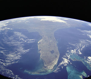
Florida
Florida is a state in the southeastern United States, located on the nation's Atlantic and Gulf coasts. It is bordered to the west by the Gulf of Mexico, to the north by Alabama and Georgia and to the east by the Atlantic Ocean. With a population of 18,801,310 as measured by the 2010 census, it...
is a well-known example of a large peninsula, with its land area divided between the larger Florida peninsula and the smaller Florida panhandle
Florida Panhandle
The Florida Panhandle, an informal, unofficial term for the northwestern part of Florida, is a strip of land roughly 200 miles long and 50 to 100 miles wide , lying between Alabama on the north and the west, Georgia also on the north, and the Gulf of Mexico to the south. Its eastern boundary is...
on the north and west. It has several smaller peninsulas within it:
- Fairpoint PeninsulaFairpoint PeninsulaThe Fairpoint Peninsula is a peninsula located in the Florida Panhandle . It separates Santa Rosa Sound to the south from Pensacola Bay to the north. The Gulf Intracoastal Waterway is routed south of the peninsula through Santa Rosa Sound...
- PinellasPinellasPinellas is the name of a peninsula located roughly half-way down the west coast of Florida. It forms the western boundary of Tampa Bay and comprises the bulk of Pinellas County. There is a city named Pinellas Park in south Pinellas. The peninsula is bounded on the north by Pasco County, Florida,...
peninsula including St. Petersburg and ClearwaterClearwater, FloridaClearwater is a city located in Pinellas County, Florida, US, nearly due west of Tampa and northwest of St. Petersburg. In the west of Clearwater lies the Gulf of Mexico and in the east lies Tampa Bay. As of the 2000 census, the city had a total population of 108,787. It is the county seat of... - Much of TampaTampa, FloridaTampa is a city in the U.S. state of Florida. It serves as the county seat for Hillsborough County. Tampa is located on the west coast of Florida. The population of Tampa in 2010 was 335,709....
lies on a peninsula called Interbay Peninsula jutting out into Tampa BayTampa BayTampa Bay is a large natural harbor and estuary along the Gulf of Mexico on the west central coast of Florida, comprising Hillsborough Bay, Old Tampa Bay, Middle Tampa Bay, and Lower Tampa Bay."Tampa Bay" is not the name of any municipality... - Cape SableCape SableCape Sable, Florida is the southernmost point of the US mainland and mainland Florida. It is located in southwestern Florida, in Monroe County, and is part of the Everglades National Park. The cape is a peninsula issuing from the southeastern part of the Florida mainland, running west and curving...
Michigan
Michigan
Michigan is a U.S. state located in the Great Lakes Region of the United States of America. The name Michigan is the French form of the Ojibwa word mishigamaa, meaning "large water" or "large lake"....
is very distinguishable for its mitten-shaped Lower Peninsula of Michigan
Lower Peninsula of Michigan
The Lower Peninsula of Michigan is the southern of the two major landmasses of the U.S. state of Michigan. It is surrounded by water on all sides except its southern border, which it shares with Ohio and Indiana. Geographically, the Lower Peninsula has a recognizable shape that many people...
which includes:
- Dyke Peninsula
- Fountain PointFountain PointFountain Point is an historic landmark located in Suttons Bay Township, Michigan, which is part of Leelanau County and the Leelanau Peninsula. Its name is derived from a fountain of sparkling artesian spring water, situated on a large point on Lake Leelanau, which has been continuously gushing...
- Leelanau PeninsulaLeelanau PeninsulaThe Leelanau Peninsula is a peninsula of the U.S. state of Michigan that extends about from the Lower Peninsula of Michigan into Lake Michigan. Leelanau County encompasses the entire peninsula. It is often referred to as the "little finger" of the mitten-shaped lower peninsula.Sleeping Bear Dunes...
- Old Mission Peninsula
- The ThumbThe ThumbThe Thumb is a region and a peninsula of Michigan, so named because the Lower Peninsula is shaped like a mitten; thus the Thumb is the area that looks like the thumb of the mitten. The Thumb is generally considered to be in the Mid-Michigan area of the state, located east of Flint/Tri-Cities...
- Woodtick Peninsula
The northern third of Michigan is called the Upper Peninsula of Michigan
Upper Peninsula of Michigan
The Upper Peninsula of Michigan is the northern of the two major land masses that make up the U.S. state of Michigan. It is commonly referred to as the Upper Peninsula, the U.P., or Upper Michigan. It is also known as the land "above the Bridge" linking the two peninsulas. The peninsula is bounded...
and contains:
- Abbaye Peninsula
- Garden PeninsulaGarden PeninsulaThe Garden Peninsula is a peninsula of in length that extends southwestward into Lake Michigan from the mainland of Michigan's Upper Peninsula. The peninsula is bordered by Lake Michigan on the east, and by Big Bay de Noc on the west. The base of the peninsula is served by U.S. Highway 2, and...
- Keweenaw PeninsulaKeweenaw PeninsulaThe Keweenaw Peninsula is the northern-most part of Michigan's Upper Peninsula. It projects into Lake Superior and was the site of the first copper boom in the United States. As of the 2000 census, its population was roughly 43,200...
- Stonington Peninsula
New Jersey
- Barnegat PeninsulaBarnegat PeninsulaThe Barnegat Peninsula, also known as the Island Beach Peninsula and colloquially as "the barrier island", is a 20-mile long, narrow barrier peninsula located in Ocean County, New Jersey, that divides the Barnegat Bay from the Atlantic Ocean. It is a vacation destination and summer colony area and...
- Cape May Peninsula
- Sandy Hook
- New Barbadoes NeckNew Barbadoes NeckNew Barbadoes Neck is the name given in the colonial era for the peninsula in northeastern New Jersey, USA between the lower Hackensack and Passaic Rivers, in what is now western Hudson County and southern Bergen County...
lies between the Hackensack RiverHackensack RiverThe Hackensack River is a river, approximately 45 miles long, in the U.S. states of New York and New Jersey, emptying into Newark Bay, a back chamber of New York Harbor. The watershed of the river includes part of the suburban area outside New York City just west of the lower Hudson River,...
and Passaic RiverPassaic RiverThe Passaic River is a mature surface river, approximately 80 mi long, in northern New Jersey in the United States. The river in its upper course flows in a highly circuitous route, meandering through the swamp lowlands between the ridge hills of rural and suburban northern New Jersey,... - Caven Point in Jersey CityJersey City, New JerseyJersey City is the seat of Hudson County, New Jersey, United States.Part of the New York metropolitan area, Jersey City lies between the Hudson River and Upper New York Bay across from Lower Manhattan and the Hackensack River and Newark Bay...
is a part of Liberty State ParkLiberty State ParkLiberty State Park is located on Upper New York Bay in Jersey City, New Jersey, opposite the Statue of Liberty and Ellis Island. The park opened in 1976 to coincide with bicentennial celebrations and is operated and maintained by the New Jersey Division of Parks and Forestry.-Geography and...
and Port Liberte.
- Bergen Point and Constable Hook are two peninsulas in BayonneBayonne, New JerseyBayonne is a city in Hudson County, New Jersey, United States. Located in the Gateway Region, Bayonne is a peninsula that is situated between Newark Bay to the west, the Kill van Kull to the south, and New York Bay to the east...
, which itself lies on peninsula surrounded by Upper New York BayUpper New York BayUpper New York Bay, or Upper Bay, is the traditional heart of the Port of New York and New Jersey, and often called New York Harbor. It is enclosed by the New York City boroughs of Manhattan, Brooklyn, and Staten Island and the Hudson County, New Jersey municipalities of Jersey City and Bayonne.It...
, Newark BayNewark BayNewark Bay is a tidal bay at the confluence of the Passaic and Hackensack Rivers in northeastern New Jersey. It is home to the Port Newark-Elizabeth Marine Terminal, the largest container shipping facility in Port of New York and New Jersey, 3rd largest and one of busiest in the United States...
, and the Kill van KullKill Van KullThe Kill Van Kull is a tidal strait between Staten Island, New York and Bayonne, New Jersey in the United States. Approximately long and wide, it connects Newark Bay with Upper New York Bay. The Robbins Reef Light marks the eastern end of the Kill, Bergen Point its western end...
, formerly known as Bergen NeckBergen NeckBergen Neck is a name for the peninsula between the Upper New York Bay and the Newark Bay in the Hudson County, New Jersey municipalities of Bayonne and Jersey City... - Droyer's PointDroyer's PointDroyer's Point is a section of Jersey City, New Jersey at Newark Bay.-Geography:In the southwestern part of the of the city, Droyer's Point is located on the Newark Bay. Its eastern perimeter is New Jersey Route 440. The point is entered from the highway's intersection with Danforth Avenue...
and Kearny Point mark the mouth of the Hackensack RiverHackensack RiverThe Hackensack River is a river, approximately 45 miles long, in the U.S. states of New York and New Jersey, emptying into Newark Bay, a back chamber of New York Harbor. The watershed of the river includes part of the suburban area outside New York City just west of the lower Hudson River,... - MOTBY and Port JerseyPort JerseyPort Jersey is an intermodal freight transport facility that includes a container terminal located on the Upper New York Bay in the Port of New York and New Jersey. The municipal border of the Hudson County, New Jersey cities of Jersey City and Bayonne runs along the long pier extending into the bay...
are man-made peninisulas extending in Upper New York BayUpper New York BayUpper New York Bay, or Upper Bay, is the traditional heart of the Port of New York and New Jersey, and often called New York Harbor. It is enclosed by the New York City boroughs of Manhattan, Brooklyn, and Staten Island and the Hudson County, New Jersey municipalities of Jersey City and Bayonne.It...
New York
- The BronxThe BronxThe Bronx is the northernmost of the five boroughs of New York City. It is also known as Bronx County, the last of the 62 counties of New York State to be incorporated...
, New YorkNew YorkNew York is a state in the Northeastern region of the United States. It is the nation's third most populous state. New York is bordered by New Jersey and Pennsylvania to the south, and by Connecticut, Massachusetts and Vermont to the east...
, and Yonkers, New York - Long IslandLong IslandLong Island is an island located in the southeast part of the U.S. state of New York, just east of Manhattan. Stretching northeast into the Atlantic Ocean, Long Island contains four counties, two of which are boroughs of New York City , and two of which are mainly suburban...
was once a peninsula connected to North America during the great Ice AgeIce ageAn ice age or, more precisely, glacial age, is a generic geological period of long-term reduction in the temperature of the Earth's surface and atmosphere, resulting in the presence or expansion of continental ice sheets, polar ice sheets and alpine glaciers...
s
- Cumberland Head
- Coney IslandConey IslandConey Island is a peninsula and beach on the Atlantic Ocean in southern Brooklyn, New York, United States. The site was formerly an outer barrier island, but became partially connected to the mainland by landfill....
was once an actual island until the island was expanded through land reclamationLand reclamationLand reclamation, usually known as reclamation, is the process to create new land from sea or riverbeds. The land reclaimed is known as reclamation ground or landfill.- Habitation :...
into the Coney Island CreekConey Island CreekConey Island Creek encompasses two sea inlets in Brooklyn, New York City, one separating Coney Island from the neighborhoods of Gravesend and Bath Beach, the other separating the neighborhoods of Sheepshead Bay and Manhattan Beach...
, thus becoming a peninsula. - Rockaway PeninsulaRockaway, QueensThe Rockaway Peninsula, informally The Rockaways, is the name of a peninsula of Long Island, all of which is located within the New York City borough of Queens. A popular summer resort area since the 1830s, Rockaway has become a mixture of lower, middle, and upper-class neighborhoods...
in southeastern QueensQueensQueens is the easternmost of the five boroughs of New York City. The largest borough in area and the second-largest in population, it is coextensive with Queens County, an administrative division of New York state, in the United States....
Utah
- Antelope IslandAntelope IslandAntelope Island, with an area of , is the largest island of 10 islands located within the Great Salt Lake, Utah, United States. The island lies in the southeastern portion of the lake, near Salt Lake City and Davis County, and becomes a peninsula when the lake is at extremely low levels. Antelope...
, UtahUtahUtah is a state in the Western United States. It was the 45th state to join the Union, on January 4, 1896. Approximately 80% of Utah's 2,763,885 people live along the Wasatch Front, centering on Salt Lake City. This leaves vast expanses of the state nearly uninhabited, making the population the...
, becomes a peninsula when waters are low, on the south shore of the Great Salt LakeGreat Salt LakeThe Great Salt Lake, located in the northern part of the U.S. state of Utah, is the largest salt water lake in the western hemisphere, the fourth-largest terminal lake in the world. In an average year the lake covers an area of around , but the lake's size fluctuates substantially due to its... - Promentory Peninsula, on the north eastern shore of the Great Salt Lake
- Stansbury PeninsulaStansbury PeninsulaStansbury Peninsula is an ice-free peninsula on the north coast of Nelson Island between Edgell Bay and Fildes Strait, in the South Shetland Islands. Named by the United Kingdom Antarctic Place-Names Committee following British Antarctic Survey geological work, 1975–76, after Michael J...
, becomes an island when waters are high, on the south shore of the Great Salt Lake
Virginia
- Delmarva PeninsulaDelmarva PeninsulaThe Delmarva Peninsula is a large peninsula on the East Coast of the United States, occupied by most of Delaware and portions of Maryland and Virginia...
, encompassing parts of MarylandMarylandMaryland is a U.S. state located in the Mid Atlantic region of the United States, bordering Virginia, West Virginia, and the District of Columbia to its south and west; Pennsylvania to its north; and Delaware to its east...
and VirginiaVirginiaThe Commonwealth of Virginia , is a U.S. state on the Atlantic Coast of the Southern United States. Virginia is nicknamed the "Old Dominion" and sometimes the "Mother of Presidents" after the eight U.S. presidents born there...
, and all of DelawareDelawareDelaware is a U.S. state located on the Atlantic Coast in the Mid-Atlantic region of the United States. It is bordered to the south and west by Maryland, and to the north by Pennsylvania... - Middle PeninsulaMiddle PeninsulaThe Middle Peninsula is the second of three large peninsulas on the western shore of Chesapeake Bay in Virginia, in the United States. It lies between the Northern Neck and the Virginia Peninsula. This peninsula is bounded by the Rappahannock River on the north and the York River on the south...
, on the western shore of the Chesapeake BayChesapeake BayThe Chesapeake Bay is the largest estuary in the United States. It lies off the Atlantic Ocean, surrounded by Maryland and Virginia. The Chesapeake Bay's drainage basin covers in the District of Columbia and parts of six states: New York, Pennsylvania, Delaware, Maryland, Virginia, and West...
- Northern NeckNorthern NeckThe Northern Neck is the northernmost of three peninsulas on the western shore of the Chesapeake Bay in the Commonwealth of Virginia. This peninsula is bounded by the Potomac River on the north and the Rappahannock River on the south. It encompasses the following Virginia counties: Lancaster,...
, on the western shore of the Chesapeake Bay - Virginia PeninsulaVirginia PeninsulaThe Virginia Peninsula is a peninsula in southeast Virginia, USA, bounded by the York River, James River, Hampton Roads and Chesapeake Bay.Hampton Roads is the common name for the metropolitan area that surrounds the body of water of the same name...
, on the western shore of the Chesapeake Bay
Other states
- Cape CodCape CodCape Cod, often referred to locally as simply the Cape, is a cape in the easternmost portion of the state of Massachusetts, in the Northeastern United States...
, MassachusettsMassachusettsThe Commonwealth of Massachusetts is a state in the New England region of the northeastern United States of America. It is bordered by Rhode Island and Connecticut to the south, New York to the west, and Vermont and New Hampshire to the north; at its east lies the Atlantic Ocean. As of the 2010...
, a capeHeadlandA headland is a point of land, usually high and often with a sheer drop, that extends out into a body of water.Headland can also refer to:*Headlands and bays*headLand, an Australian television series...
that can be viewed as a peninsula - Delmarva PeninsulaDelmarva PeninsulaThe Delmarva Peninsula is a large peninsula on the East Coast of the United States, occupied by most of Delaware and portions of Maryland and Virginia...
, encompassing parts of MarylandMarylandMaryland is a U.S. state located in the Mid Atlantic region of the United States, bordering Virginia, West Virginia, and the District of Columbia to its south and west; Pennsylvania to its north; and Delaware to its east...
and VirginiaVirginiaThe Commonwealth of Virginia , is a U.S. state on the Atlantic Coast of the Southern United States. Virginia is nicknamed the "Old Dominion" and sometimes the "Mother of Presidents" after the eight U.S. presidents born there...
, and all of DelawareDelawareDelaware is a U.S. state located on the Atlantic Coast in the Mid-Atlantic region of the United States. It is bordered to the south and west by Maryland, and to the north by Pennsylvania... - Door PeninsulaDoor PeninsulaThe Door Peninsula is a peninsula in eastern Wisconsin, separating the southern part of the Green Bay from Lake Michigan. The peninsula begins in northern Brown and Kewaunee counties and proceeds northeast to include all of Door County. It is the western portion of the Niagara Escarpment. Well...
, WisconsinWisconsinWisconsin is a U.S. state located in the north-central United States and is part of the Midwest. It is bordered by Minnesota to the west, Iowa to the southwest, Illinois to the south, Lake Michigan to the east, Michigan to the northeast, and Lake Superior to the north. Wisconsin's capital is...
, in Lake MichiganLake MichiganLake Michigan is one of the five Great Lakes of North America and the only one located entirely within the United States. It is the second largest of the Great Lakes by volume and the third largest by surface area, after Lake Superior and Lake Huron... - Key PeninsulaKey PeninsulaThe Key Peninsula is a finger of land in Puget Sound, Washington, United States . It is approximately long and extends south from the Kitsap Peninsula. It is part of Pierce County, Washington. Some of its towns include:...
, Washington, in Puget SoundPuget SoundPuget Sound is a sound in the U.S. state of Washington. It is a complex estuarine system of interconnected marine waterways and basins, with one major and one minor connection to the Strait of Juan de Fuca and the Pacific Ocean — Admiralty Inlet being the major connection and... - Kitsap PeninsulaKitsap PeninsulaThe Kitsap Peninsula is an arm of land that is part of the larger Olympic Peninsula in Washington state that lies west of Seattle across Puget Sound. Hood Canal separates Kitsap Peninsula from the rest of the Olympic Peninsula...
, Washington, in Puget Sound
- Mokapu, HawaiiHawaiiHawaii is the newest of the 50 U.S. states , and is the only U.S. state made up entirely of islands. It is the northernmost island group in Polynesia, occupying most of an archipelago in the central Pacific Ocean, southwest of the continental United States, southeast of Japan, and northeast of...
- Nahant, Massachusetts
- Olympic PeninsulaOlympic PeninsulaThe Olympic Peninsula is the large arm of land in western Washington state of the USA, that lies across Puget Sound from Seattle. It is bounded on the west by the Pacific Ocean, the north by the Strait of Juan de Fuca, and the east by Puget Sound. Cape Alava, the westernmost point in the contiguous...
, Washington - Presque IslePresque Isle State ParkPresque Isle State Park is a Pennsylvania state park on an arching sandy peninsula that juts into Lake Erie, west of the city of Erie, in Millcreek Township, Erie County, Pennsylvania, in the United States. The peninsula sweeps northeastward, surrounding Presque Isle Bay along the park's...
, Erie, PennsylvaniaErie, PennsylvaniaErie is a city located in northwestern Pennsylvania in the United States. Named for the lake and the Native American tribe that resided along its southern shore, Erie is the state's fourth-largest city , with a population of 102,000... - Port Bolivar, TexasTexasTexas is the second largest U.S. state by both area and population, and the largest state by area in the contiguous United States.The name, based on the Caddo word "Tejas" meaning "friends" or "allies", was applied by the Spanish to the Caddo themselves and to the region of their settlement in...
, On the Texas Coast.
- Encinal Peninsula, Flour Bluff, Corpus Christi, TexasCorpus Christi, TexasCorpus Christi is a coastal city in the South Texas region of the U.S. state of Texas. The county seat of Nueces County, it also extends into Aransas, Kleberg, and San Patricio counties. The MSA population in 2008 was 416,376. The population was 305,215 at the 2010 census making it the...
.
Greenland
- Alfred Wegeners Halvo
- Hayes Halvo
- Ingnerit
- Nuussuaq PeninsulaNuussuaq PeninsulaNuussuaq Peninsula is a large peninsula in western Greenland.- Geography :The waters around the peninsula are that of Baffin Bay. To the south and southwest the peninsula is bounded by Disko Bay, an inlet of Baffin Bay. It is separated from Qeqertarsuaq Island by Sullorsuaq Strait which...
- Sigguup NunaaSigguup NunaaNunavik Peninsula is a large peninsula in northwestern Greenland. It separates two cultural and geographical regions of northwestern Greenland: Uummannaq Fjord region in the southeast, and Upernavik Archipelago in the north.- Geography :...
(Svartenhuk Halvø)
Mexico
- Baja California PeninsulaBaja California PeninsulaThe Baja California peninsula , is a peninsula in northwestern Mexico. Its land mass separates the Pacific Ocean from the Gulf of California. The Peninsula extends from Mexicali, Baja California in the north to Cabo San Lucas, Baja California Sur in the south.The total area of the Baja California...
, MexicoMexicoThe United Mexican States , commonly known as Mexico , is a federal constitutional republic in North America. It is bordered on the north by the United States; on the south and west by the Pacific Ocean; on the southeast by Guatemala, Belize, and the Caribbean Sea; and on the east by the Gulf of...
, containing the state of Baja CaliforniaBaja CaliforniaBaja California officially Estado Libre y Soberano de Baja California is one of the 31 states which, with the Federal District, comprise the 32 Federal Entities of Mexico. It is both the northernmost and westernmost state of Mexico. Before becoming a state in 1953, the area was known as the North...
and state of Baja California SurBaja California SurBaja California Sur , is one of the 31 states which, with the Federal District, comprise the 32 Federal Entities of Mexico. Before becoming a state on October 8, 1974, the area was known as the South Territory of Baja California. It has an area of , or 3.57% of the land mass of Mexico and comprises...
_250m.jpg)
- Yucatán PeninsulaYucatán PeninsulaThe Yucatán Peninsula, in southeastern Mexico, separates the Caribbean Sea from the Gulf of Mexico, with the northern coastline on the Yucatán Channel...
, partly separating the Gulf of Mexico from the Caribbean
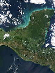
South America
- Tierra del FuegoTierra del FuegoTierra del Fuego is an archipelago off the southernmost tip of the South American mainland, across the Strait of Magellan. The archipelago consists of a main island Isla Grande de Tierra del Fuego divided between Chile and Argentina with an area of , and a group of smaller islands including Cape...
of ChileChileChile ,officially the Republic of Chile , is a country in South America occupying a long, narrow coastal strip between the Andes mountains to the east and the Pacific Ocean to the west. It borders Peru to the north, Bolivia to the northeast, Argentina to the east, and the Drake Passage in the far...
/ArgentinaArgentinaArgentina , officially the Argentine Republic , is the second largest country in South America by land area, after Brazil. It is constituted as a federation of 23 provinces and an autonomous city, Buenos Aires...
was once a peninsula extending south from South America during the great Ice AgeIce ageAn ice age or, more precisely, glacial age, is a generic geological period of long-term reduction in the temperature of the Earth's surface and atmosphere, resulting in the presence or expansion of continental ice sheets, polar ice sheets and alpine glaciers...
s
Other countries
- Península de Azuero, PanamaPanamaPanama , officially the Republic of Panama , is the southernmost country of Central America. Situated on the isthmus connecting North and South America, it is bordered by Costa Rica to the northwest, Colombia to the southeast, the Caribbean Sea to the north and the Pacific Ocean to the south. The...
- Placencia PeninsulaPlacenciaPlacencia is a small town located in the Stann Creek District of Belize. It is the most southern town on the largest peninsula of the Gulf of Mexico.-History:...
, BelizeBelizeBelize is a constitutional monarchy and the northernmost country in Central America. Belize has a diverse society, comprising many cultures and languages. Even though Kriol and Spanish are spoken among the population, Belize is the only country in Central America where English is the official... - Nicoya PeninsulaNicoya PeninsulaThe Nicoya Peninsula is a peninsula on the Pacific coast of Costa Rica and lies in the Guanacaste Province in the north, and the Puntarenas Province in the south. It is located at . It varies from 19 to wide and is approximately long, and forms the largest peninsula in the country. It is known...
, Costa RicaCosta RicaCosta Rica , officially the Republic of Costa Rica is a multilingual, multiethnic and multicultural country in Central America, bordered by Nicaragua to the north, Panama to the southeast, the Pacific Ocean to the west and the Caribbean Sea to the east.... - Osa PeninsulaOsa PeninsulaThe Osa Peninsula is a peninsula located in southwestern Costa Rica, in the Puntarenas Province, on the Pacific Ocean, at . The peninsula was formed geologically by a faulting system that extends north into California....
, Costa RicaCosta RicaCosta Rica , officially the Republic of Costa Rica is a multilingual, multiethnic and multicultural country in Central America, bordered by Nicaragua to the north, Panama to the southeast, the Pacific Ocean to the west and the Caribbean Sea to the east.... - Araya PeninsulaAraya PeninsulaThe Araya Peninsula is a peninsula located in Venezuela just eastward out from its Caribbean coast, in the state of Sucre. The town of Araya is located on its westernmost extremity. It is the setting of the award-winning documentary film Araya ....
, VenezuelaVenezuelaVenezuela , officially called the Bolivarian Republic of Venezuela , is a tropical country on the northern coast of South America. It borders Colombia to the west, Guyana to the east, and Brazil to the south... - Paraguana, VenezuelaVenezuelaVenezuela , officially called the Bolivarian Republic of Venezuela , is a tropical country on the northern coast of South America. It borders Colombia to the west, Guyana to the east, and Brazil to the south...
- Paria PeninsulaParia PeninsulaParia Peninsula is a large peninsula in Sucre State, northern Venezuela. It separates the Gulf of Paria and Caribbean Sea. Península de Paria National Park is located on the peninsula...
, VenezuelaVenezuelaVenezuela , officially called the Bolivarian Republic of Venezuela , is a tropical country on the northern coast of South America. It borders Colombia to the west, Guyana to the east, and Brazil to the south... - Guajira PeninsulaGuajira PeninsulaGuajira Peninsula , is a peninsula in northern Colombia and northwestern Venezuela in the Caribbean Sea...
, VenezuelaVenezuelaVenezuela , officially called the Bolivarian Republic of Venezuela , is a tropical country on the northern coast of South America. It borders Colombia to the west, Guyana to the east, and Brazil to the south...
/ColombiaColombiaColombia, officially the Republic of Colombia , is a unitary constitutional republic comprising thirty-two departments. The country is located in northwestern South America, bordered to the east by Venezuela and Brazil; to the south by Ecuador and Peru; to the north by the Caribbean Sea; to the... - Paracas PeninsulaParacas PeninsulaThe Paracas Peninsula is a desert peninsula within the boundaries of the Paracas National Reservation, a marine reserve which extends south along the coast. The only marine reserve in Peru, it is a designated UNESCO World Heritage Site....
, PeruPeruPeru , officially the Republic of Peru , is a country in western South America. It is bordered on the north by Ecuador and Colombia, on the east by Brazil, on the southeast by Bolivia, on the south by Chile, and on the west by the Pacific Ocean.... - Verde Peninsula, ArgentinaArgentinaArgentina , officially the Argentine Republic , is the second largest country in South America by land area, after Brazil. It is constituted as a federation of 23 provinces and an autonomous city, Buenos Aires...
- Valdes PeninsulaValdes PeninsulaThe Valdes Peninsula is a peninsula on the Atlantic coast in the Viedma Department in the north east of Chubut Province, Argentina. About in size, it is an important nature reserve which was listed as a World Heritage Site by UNESCO in 1999.- Geography :The nearest large town is Puerto Madryn...
, ArgentinaArgentinaArgentina , officially the Argentine Republic , is the second largest country in South America by land area, after Brazil. It is constituted as a federation of 23 provinces and an autonomous city, Buenos Aires... - Punta del EstePunta del EstePunta del Este is a resort town on the Atlantic Coast in the Maldonado Department of southeastern Uruguay. It is located on the intersection of Route 10 with Route 39, directly southeast of the department capital Maldonado and about east of Montevideo...
, UruguayUruguayUruguay ,officially the Oriental Republic of Uruguay,sometimes the Eastern Republic of Uruguay; ) is a country in the southeastern part of South America. It is home to some 3.5 million people, of whom 1.8 million live in the capital Montevideo and its metropolitan area...
Caribbean
- Peninsula de SamanáSamana BaySamaná Bay is a bay in the eastern Dominican Republic. The Yuna River flows into the Samaná Bay, and it is located south of the town and peninsula of Samaná....
, Dominican RepublicDominican RepublicThe Dominican Republic is a nation on the island of La Hispaniola, part of the Greater Antilles archipelago in the Caribbean region. The western third of the island is occupied by the nation of Haiti, making Hispaniola one of two Caribbean islands that are shared by two countries... - Barrio Obrero, Puerto RicoPuerto RicoPuerto Rico , officially the Commonwealth of Puerto Rico , is an unincorporated territory of the United States, located in the northeastern Caribbean, east of the Dominican Republic and west of both the United States Virgin Islands and the British Virgin Islands.Puerto Rico comprises an...
- Zapata PeninsulaZapata PeninsulaZapata Peninsula is a large peninsula in Matanzas Province, southern Cuba, at . Ciénaga de Zapata National Park is located on the peninsula....
, CubaCubaThe Republic of Cuba is an island nation in the Caribbean. The nation of Cuba consists of the main island of Cuba, the Isla de la Juventud, and several archipelagos. Havana is the largest city in Cuba and the country's capital. Santiago de Cuba is the second largest city...
- Guanahacabibes PeninsulaGuanahacabibes PeninsulaGuanahacabibes Peninsula is the westernmost point on the island of Cuba. It is located in Pinar del Río Province, in the municipality of Sandino and is sparsely populated. The waters surrounding the peninsula are important spiny lobster and red snapper fishing grounds. It also boasts the category...
, CubaCubaThe Republic of Cuba is an island nation in the Caribbean. The nation of Cuba consists of the main island of Cuba, the Isla de la Juventud, and several archipelagos. Havana is the largest city in Cuba and the country's capital. Santiago de Cuba is the second largest city... - Hicacos PeninsulaHicacos PeninsulaHicacos is a peninsula on Cuba's northern shore, in the province of Matanzas. The resort town of Varadero is located on the peninsula. The name comes from a species of cactus.-Geography:...
, CubaCubaThe Republic of Cuba is an island nation in the Caribbean. The nation of Cuba consists of the main island of Cuba, the Isla de la Juventud, and several archipelagos. Havana is the largest city in Cuba and the country's capital. Santiago de Cuba is the second largest city...
Africa
- BakassiBakassiBakassi is the peninsular extension of the African territory of Calabar into the Atlantic Ocean. It is currently ruled by Cameroon following the transfer of sovereignty from neighbouring Nigeria as a result of a judgment by the International Court of Justice...
, CameroonCameroonCameroon, officially the Republic of Cameroon , is a country in west Central Africa. It is bordered by Nigeria to the west; Chad to the northeast; the Central African Republic to the east; and Equatorial Guinea, Gabon, and the Republic of the Congo to the south. Cameroon's coastline lies on the...
but disputed with NigeriaNigeriaNigeria , officially the Federal Republic of Nigeria, is a federal constitutional republic comprising 36 states and its Federal Capital Territory, Abuja. The country is located in West Africa and shares land borders with the Republic of Benin in the west, Chad and Cameroon in the east, and Niger in... - Buri PeninsulaBuri PeninsulaThe Buri Peninsula extends from central Eritrea north into the Red Sea. To its west lies the Gulf of Zula. Varied in geography, it features mangroves and salt pans. It is known for its wildlife, including ostriches, hamadryas baboons and wild asses. Notable elevations include Mount Dulhi and...
, EritreaEritreaEritrea , officially the State of Eritrea, is a country in the Horn of Africa. Eritrea derives it's name from the Greek word Erethria, meaning 'red land'. The capital is Asmara. It is bordered by Sudan in the west, Ethiopia in the south, and Djibouti in the southeast... - Cabo Blanco, MauritaniaMauritaniaMauritania is a country in the Maghreb and West Africa. It is bordered by the Atlantic Ocean in the west, by Western Sahara in the north, by Algeria in the northeast, by Mali in the east and southeast, and by Senegal in the southwest...
/MoroccoMoroccoMorocco , officially the Kingdom of Morocco , is a country located in North Africa. It has a population of more than 32 million and an area of 710,850 km², and also primarily administers the disputed region of the Western Sahara... - Cape PeninsulaCape PeninsulaThe Cape Peninsula is a generally rocky peninsula that juts out for 75 km into the Atlantic Ocean at the south-western extremity of the African continent. At the southern end of the peninsula are Cape Point and the Cape of Good Hope...
, South AfricaSouth AfricaThe Republic of South Africa is a country in southern Africa. Located at the southern tip of Africa, it is divided into nine provinces, with of coastline on the Atlantic and Indian oceans... - Cap BonCap BonCap Bon , also Watan el-kibli, is a peninsula in far northeastern Tunisia. It is located at around . It is surrounded by the Gulf of Tunis in the north. Towns located on the peninsula include Nabeul, Kelibia and Menzel Temime. The ruins of the Punic town Kerkouane are located here....
, TunisiaTunisiaTunisia , officially the Tunisian RepublicThe long name of Tunisia in other languages used in the country is: , is the northernmost country in Africa. It is a Maghreb country and is bordered by Algeria to the west, Libya to the southeast, and the Mediterranean Sea to the north and east. Its area... - Cap-VertCap-VertCap-Vert is a peninsula in Senegal, and the westernmost point of the continent of Africa and of the Old World mainland. Originally called Cabo Verde or "Cape Green" by Portuguese explorers, it is not to be confused with the Cape Verde islands, which are some further west...
, SenegalSenegalSenegal , officially the Republic of Senegal , is a country in western Africa. It owes its name to the Sénégal River that borders it to the east and north... - CeutaCeutaCeuta is an autonomous city of Spain and an exclave located on the north coast of North Africa surrounded by Morocco. Separated from the Iberian peninsula by the Strait of Gibraltar, Ceuta lies on the border of the Mediterranean Sea and the Atlantic Ocean. Ceuta along with the other Spanish...
, Spain
- Punta Durnford, MoroccoMoroccoMorocco , officially the Kingdom of Morocco , is a country located in North Africa. It has a population of more than 32 million and an area of 710,850 km², and also primarily administers the disputed region of the Western Sahara...
- Horn of AfricaHorn of AfricaThe Horn of Africa is a peninsula in East Africa that juts hundreds of kilometers into the Arabian Sea and lies along the southern side of the Gulf of Aden. It is the easternmost projection of the African continent...
or Somali peninsula, SomaliaSomaliaSomalia , officially the Somali Republic and formerly known as the Somali Democratic Republic under Socialist rule, is a country located in the Horn of Africa. Since the outbreak of the Somali Civil War in 1991 there has been no central government control over most of the country's territory... - Raas Xaafuun peninsula/Ras HafunHafunHafun is a 40 km long low-lying peninsula in the Bari region of northern Somalia. The promontory juts out into the Indian Ocean, where it is known as Ras Hafun or Raas Xaafuun...
, SomaliaSomaliaSomalia , officially the Somali Republic and formerly known as the Somali Democratic Republic under Socialist rule, is a country located in the Horn of Africa. Since the outbreak of the Somali Civil War in 1991 there has been no central government control over most of the country's territory... - Ponta de São Lourenço, Madeira Islands (Portuguese Territory)
Antarctica
- Antarctic PeninsulaAntarctic PeninsulaThe Antarctic Peninsula is the northernmost part of the mainland of Antarctica. It extends from a line between Cape Adams and a point on the mainland south of Eklund Islands....
- Edward VII PeninsulaEdward VII PeninsulaKing Edward VII Land or King Edward VII Peninsula is a large, ice-covered peninsula which forms the northwestern extremity of Marie Byrd Land. The peninsula projects into the Ross Sea between Sulzberger Bay and the northeast corner of the Ross Ice Shelf, and forms part of the Ross Dependency...
- Fletcher PeninsulaFletcher PeninsulaFletcher Peninsula is a broad ice-covered cove which extends into the Bellingshausen Sea between the Abbot and the Venable Ice Shelf. Mapped by United States Geological Survey from surveys and U.S. Navy air photos, 1961-66. Named by Advisory Committee on Antarctic Names for Fred C...
- Fowler Peninsula
- Martin PeninsulaMartin PeninsulaMartin Peninsula is a peninsula about 96 km mi long and 32 km wide that is ice covered except for a few rock outcrops along its margins, located between Getz Ice Shelf and Dotson Ice Shelf on the coast of Marie Byrd Land. The farthest point of the peninsula is Jacobsen Head.Delineated...