
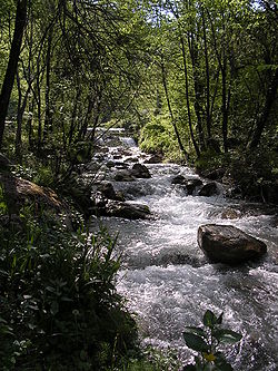
Stream
Encyclopedia
Water
Water is a chemical substance with the chemical formula H2O. A water molecule contains one oxygen and two hydrogen atoms connected by covalent bonds. Water is a liquid at ambient conditions, but it often co-exists on Earth with its solid state, ice, and gaseous state . Water also exists in a...
with a current
Current (stream)
A current, in a river or stream, is the flow of water influenced by gravity as the water moves downhill to reduce its potential energy. The current varies spatially as well as temporally within the stream, dependent upon the flow volume of water, stream gradient, and channel geometrics...
, confined within a bed
Stream bed
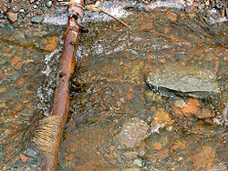
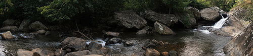
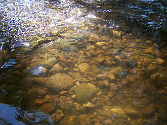
A stream bed is the channel bottom of a stream, river or creek; the physical confine of the normal water flow. The lateral confines or channel margins, during all but flood stage, are known as the stream banks or river banks. In fact, a flood occurs when a stream overflows its banks and flows onto...
and stream bank
Bank (geography)
A geographic bank has four definitions and applications:# Limnology: The shoreline of a pond, swamp, estuary, reservoir, or lake. The grade can vary from vertical to a shallow slope....
s. Depending on its locale or certain characteristics, a stream may be referred to as a branch, brook, beck, burn, creek
Creek
Creek may refer to:*Creek, a small stream* Creek , an inlet of the sea, narrower than a cove * Creek, a narrow channel/small stream between islands in the Florida Keys*Muscogee , a native American people...
, "crick", gill (occasionally ghyll), kill
Kill (body of water)
As a body of water, a kill is a creek. The word comes from the Middle Dutch kille, meaning "riverbed" or "water channel." The modern Dutch term is kil....
, lick
Lick (stream)
A lick is a small watercourse or an ephemeral stream. It ranks hydrologically between a rill, shown left, and a stream, shown right....
, rill
Rill
A Rill can be a:*1.) natural fluvial topographic feature;*2.) functional constructed channel to carry a water supply from a water source some distance away;*3.) aesthetic garden water feature.-Natural:...
, river
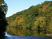
River
A river is a natural watercourse, usually freshwater, flowing towards an ocean, a lake, a sea, or another river. In a few cases, a river simply flows into the ground or dries up completely before reaching another body of water. Small rivers may also be called by several other names, including...
, syke, bayou
Bayou
A bayou is an American term for a body of water typically found in flat, low-lying areas, and can refer either to an extremely slow-moving stream or river , or to a marshy lake or wetland. The name "bayou" can also refer to creeks that see level changes due to tides and hold brackish water which...
, rivulet, streamage, wash, run or runnel.
Streams are important as conduits in the water cycle
Water cycle
The water cycle, also known as the hydrologic cycle or H2O cycle, describes the continuous movement of water on, above and below the surface of the Earth. Water can change states among liquid, vapor, and solid at various places in the water cycle...
, instruments in groundwater recharge, and corridors for fish
Fish
Fish are a paraphyletic group of organisms that consist of all gill-bearing aquatic vertebrate animals that lack limbs with digits. Included in this definition are the living hagfish, lampreys, and cartilaginous and bony fish, as well as various extinct related groups...
and wildlife
Wildlife
Wildlife includes all non-domesticated plants, animals and other organisms. Domesticating wild plant and animal species for human benefit has occurred many times all over the planet, and has a major impact on the environment, both positive and negative....
migration. The biological habitat
Habitat
* Habitat , a place where a species lives and grows*Human habitat, a place where humans live, work or play** Space habitat, a space station intended as a permanent settlement...
in the immediate vicinity of a stream is called a riparian zone
Riparian zone
A riparian zone or riparian area is the interface between land and a river or stream. Riparian is also the proper nomenclature for one of the fifteen terrestrial biomes of the earth. Plant habitats and communities along the river margins and banks are called riparian vegetation, characterized by...
. Given the status of the ongoing Holocene extinction, streams play an important corridor
Wildlife corridor
A wildlife corridor or green corridor is an area of habitat connecting wildlife populations separated by human activities . This allows an exchange of individuals between populations, which may help prevent the negative effects of inbreeding and reduced genetic diversity that often occur within...
role in connecting fragmented habitat
Habitat fragmentation
Habitat fragmentation as the name implies, describes the emergence of discontinuities in an organism's preferred environment , causing population fragmentation...
s and thus in conserving biodiversity
Biodiversity
Biodiversity is the degree of variation of life forms within a given ecosystem, biome, or an entire planet. Biodiversity is a measure of the health of ecosystems. Biodiversity is in part a function of climate. In terrestrial habitats, tropical regions are typically rich whereas polar regions...
. The study of streams and waterways in general is known as surface hydrology
Hydrology
Hydrology is the study of the movement, distribution, and quality of water on Earth and other planets, including the hydrologic cycle, water resources and environmental watershed sustainability...
and is a core element of environmental geography
Environmental geography
Integrated geography is the branch of geography that describes the spatial aspects of interactions between humans and the natural world. It requires an understanding of the dynamics of geology, meteorology, hydrology, biogeography, ecology, and geomorphology, as well as the ways in which human...
.
Types


River
A river is a natural watercourse, usually freshwater, flowing towards an ocean, a lake, a sea, or another river. In a few cases, a river simply flows into the ground or dries up completely before reaching another body of water. Small rivers may also be called by several other names, including...
: A large natural stream, which may be a waterway
Waterway
A waterway is any navigable body of water. Waterways can include rivers, lakes, seas, oceans, and canals. In order for a waterway to be navigable, it must meet several criteria:...
.
Creek
Creek
Creek may refer to:*Creek, a small stream* Creek , an inlet of the sea, narrower than a cove * Creek, a narrow channel/small stream between islands in the Florida Keys*Muscogee , a native American people...
:
- In North AmericaNorth AmericaNorth America is a continent wholly within the Northern Hemisphere and almost wholly within the Western Hemisphere. It is also considered a northern subcontinent of the Americas...
, AustraliaAustraliaAustralia , officially the Commonwealth of Australia, is a country in the Southern Hemisphere comprising the mainland of the Australian continent, the island of Tasmania, and numerous smaller islands in the Indian and Pacific Oceans. It is the world's sixth-largest country by total area...
and New ZealandNew ZealandNew Zealand is an island country in the south-western Pacific Ocean comprising two main landmasses and numerous smaller islands. The country is situated some east of Australia across the Tasman Sea, and roughly south of the Pacific island nations of New Caledonia, Fiji, and Tonga...
, a small to medium sized natural stream. Sometimes navigable by motor craft and may be intermittent. - In parts of New EnglandNew EnglandNew England is a region in the northeastern corner of the United States consisting of the six states of Maine, New Hampshire, Vermont, Massachusetts, Rhode Island, and Connecticut...
, the UK and IndiaIndiaIndia , officially the Republic of India , is a country in South Asia. It is the seventh-largest country by geographical area, the second-most populous country with over 1.2 billion people, and the most populous democracy in the world...
, a tidal inletInletAn inlet is a narrow body of water between islands or leading inland from a larger body of water, often leading to an enclosed body of water, such as a sound, bay, lagoon or marsh. In sea coasts an inlet usually refers to the actual connection between a bay and the ocean and is often called an...
, typically in a salt marshSalt marshA salt marsh is an environment in the upper coastal intertidal zone between land and salt water or brackish water, it is dominated by dense stands of halophytic plants such as herbs, grasses, or low shrubs. These plants are terrestrial in origin and are essential to the stability of the salt marsh...
or mangrove swampMangroveMangroves are various kinds of trees up to medium height and shrubs that grow in saline coastal sediment habitats in the tropics and subtropics – mainly between latitudes N and S...
, or between enclosed and drained former salt marshes or swampSwampA swamp is a wetland with some flooding of large areas of land by shallow bodies of water. A swamp generally has a large number of hammocks, or dry-land protrusions, covered by aquatic vegetation, or vegetation that tolerates periodical inundation. The two main types of swamp are "true" or swamp...
s (e.g. Port Creek separating Portsea IslandPortsea IslandPortsea Island is a small, flat and low lying island just off the south coast of England. The island is totally within, and contains a large proportion of, the city of Portsmouth. It has the third-largest population of any island in the British Isles, after the mainlands of Great Britain and...
from the mainland). In these cases, the stream is the tidal stream, the course of the seawaterSeawaterSeawater is water from a sea or ocean. On average, seawater in the world's oceans has a salinity of about 3.5% . This means that every kilogram of seawater has approximately of dissolved salts . The average density of seawater at the ocean surface is 1.025 g/ml...
through the creekCreek (tidal)A tidal creek, tidal channel, or estuary is the portion of a stream that is affected by ebb and flow of ocean tides, in the case that the subject stream discharges to an ocean, sea or strait. Thus this portion of the stream has variable salinity and electrical conductivity over the tidal cycle...
channel at low and high tide.
Tributary
Tributary
A tributary or affluent is a stream or river that flows into a main stem river or a lake. A tributary does not flow directly into a sea or ocean...
: A contributory stream, or a stream which does not reach the sea but joins another river (a parent river). Sometimes also called a branch or fork.
Brook: A stream smaller than a creek
Creek
Creek may refer to:*Creek, a small stream* Creek , an inlet of the sea, narrower than a cove * Creek, a narrow channel/small stream between islands in the Florida Keys*Muscogee , a native American people...
, especially one that is fed by a spring
Spring (hydrosphere)
A spring—also known as a rising or resurgence—is a component of the hydrosphere. Specifically, it is any natural situation where water flows to the surface of the earth from underground...
or seep
Seep (hydrology)
A Seep is a moist or wet place where water, usually groundwater, reaches the earth's surface from an underground aquifer.-Description:Seeps are usually not of sufficient volume to be flowing beyond their above-ground location. They are part of the limnology-geomorphology system...
. It is usually small and easily forded. A brook is characterized by its shallowness and its bed
Stream bed
A stream bed is the channel bottom of a stream, river or creek; the physical confine of the normal water flow. The lateral confines or channel margins, during all but flood stage, are known as the stream banks or river banks. In fact, a flood occurs when a stream overflows its banks and flows onto...
being composed primarily of rocks.
Other names
In the United KingdomUnited Kingdom
The United Kingdom of Great Britain and Northern IrelandIn the United Kingdom and Dependencies, other languages have been officially recognised as legitimate autochthonous languages under the European Charter for Regional or Minority Languages...
, there are several regional names for a stream:
- Beck is used in YorkshireYorkshireYorkshire is a historic county of northern England and the largest in the United Kingdom. Because of its great size in comparison to other English counties, functions have been increasingly undertaken over time by its subdivisions, which have also been subject to periodic reform...
, LancashireLancashireLancashire is a non-metropolitan county of historic origin in the North West of England. It takes its name from the city of Lancaster, and is sometimes known as the County of Lancaster. Although Lancaster is still considered to be the county town, Lancashire County Council is based in Preston...
, DumfriesshireDumfriesshireDumfriesshire or the County of Dumfries is a registration county of Scotland. The lieutenancy area of Dumfries has similar boundaries.Until 1975 it was a county. Its county town was Dumfries...
and CumbriaCumbriaCumbria , is a non-metropolitan county in North West England. The county and Cumbria County Council, its local authority, came into existence in 1974 after the passage of the Local Government Act 1972. Cumbria's largest settlement and county town is Carlisle. It consists of six districts, and in...
. - Bourne is used in the chalk downlandDownlandA downland is an area of open chalk hills. This term is especially used to describe the chalk countryside in southern England. Areas of downland are often referred to as Downs....
of southern England (although strictly a bourne is wet in summer and dry in winter). - Brook is used in the MidlandsEnglish MidlandsThe Midlands, or the English Midlands, is the traditional name for the area comprising central England that broadly corresponds to the early medieval Kingdom of Mercia. It borders Southern England, Northern England, East Anglia and Wales. Its largest city is Birmingham, and it was an important...
, Lancashire and Cheshire. - Burn is used in ScotlandScotlandScotland is a country that is part of the United Kingdom. Occupying the northern third of the island of Great Britain, it shares a border with England to the south and is bounded by the North Sea to the east, the Atlantic Ocean to the north and west, and the North Channel and Irish Sea to the...
and North East EnglandNorth East EnglandNorth East England is one of the nine official regions of England. It covers Northumberland, County Durham, Tyne and Wear, and Teesside . The only cities in the region are Durham, Newcastle upon Tyne and Sunderland...
. - Nant is used in WalesWalesWales is a country that is part of the United Kingdom and the island of Great Britain, bordered by England to its east and the Atlantic Ocean and Irish Sea to its west. It has a population of three million, and a total area of 20,779 km²...
. - Stream is used in Southern EnglandSouthern EnglandSouthern England, the South and the South of England are imprecise terms used to refer to the southern counties of England bordering the English Midlands. It has a number of different interpretations of its geographic extents. The South is considered by many to be a cultural region with a distinct...
. - Syke is used in lowlandLowlandIn physical geography, a lowland is any broad expanse of land with a general low level. The term is thus applied to the landward portion of the upward slope from oceanic depths to continental highlands, to a region of depression in the interior of a mountainous region, to a plain of denudation, or...
Scotland and Cumbria. - Allt is used in HighlandScottish HighlandsThe Highlands is an historic region of Scotland. The area is sometimes referred to as the "Scottish Highlands". It was culturally distinguishable from the Lowlands from the later Middle Ages into the modern period, when Lowland Scots replaced Scottish Gaelic throughout most of the Lowlands...
Scotland.
In North America:
- KillKill (body of water)As a body of water, a kill is a creek. The word comes from the Middle Dutch kille, meaning "riverbed" or "water channel." The modern Dutch term is kil....
in southern New YorkNew YorkNew York is a state in the Northeastern region of the United States. It is the nation's third most populous state. New York is bordered by New Jersey and Pennsylvania to the south, and by Connecticut, Massachusetts and Vermont to the east...
, PennsylvaniaPennsylvaniaThe Commonwealth of Pennsylvania is a U.S. state that is located in the Northeastern and Mid-Atlantic regions of the United States. The state borders Delaware and Maryland to the south, West Virginia to the southwest, Ohio to the west, New York and Ontario, Canada, to the north, and New Jersey to...
, DelawareDelawareDelaware is a U.S. state located on the Atlantic Coast in the Mid-Atlantic region of the United States. It is bordered to the south and west by Maryland, and to the north by Pennsylvania...
, and New JerseyNew JerseyNew Jersey is a state in the Northeastern and Middle Atlantic regions of the United States. , its population was 8,791,894. It is bordered on the north and east by the state of New York, on the southeast and south by the Atlantic Ocean, on the west by Pennsylvania and on the southwest by Delaware...
comes from a Dutch languageDutch languageDutch is a West Germanic language and the native language of the majority of the population of the Netherlands, Belgium, and Suriname, the three member states of the Dutch Language Union. Most speakers live in the European Union, where it is a first language for about 23 million and a second...
word meaning "riverbed" or "water channel", and can also be used for the UK meaning of 'creek'. - Run in OhioOhioOhio is a Midwestern state in the United States. The 34th largest state by area in the U.S.,it is the 7th‑most populous with over 11.5 million residents, containing several major American cities and seven metropolitan areas with populations of 500,000 or more.The state's capital is Columbus...
, Pennsylvania, MarylandMarylandMaryland is a U.S. state located in the Mid Atlantic region of the United States, bordering Virginia, West Virginia, and the District of Columbia to its south and west; Pennsylvania to its north; and Delaware to its east...
, or VirginiaVirginiaThe Commonwealth of Virginia , is a U.S. state on the Atlantic Coast of the Southern United States. Virginia is nicknamed the "Old Dominion" and sometimes the "Mother of Presidents" after the eight U.S. presidents born there...
can be the name of a stream. - Branch, fork, or prong can refer to tributaries or distributaries that share the same name as the main stream, generally with the addition of a cardinal directionCardinal directionThe four cardinal directions or cardinal points are the directions of north, east, south, and west, commonly denoted by their initials: N, E, S, W. East and west are at right angles to north and south, with east being in the direction of rotation and west being directly opposite. Intermediate...
. - Branch is also used to name streams in Maryland and Virginia.
- Falls is also used to name streams in Maryland. Little Gunpowder FallsGunpowder RiverThe Gunpowder River is a tidal inlet on the western side of Chesapeake Bay in Maryland, United States. It is formed by the joining of two freshwater rivers, Gunpowder Falls and Little Gunpowder Falls.-Gunpowder Falls:The Big Gunpowder, long, begins in the extreme southern part of Pennsylvania's...
and The Jones FallsJones FallsThe Jones Falls is a stream in Maryland. It is impounded to create Lake Roland before running through the city of Baltimore and finally emptying into the Baltimore Inner Harbor....
are actually rivers named in this manner, unique to Maryland. - Stream and brook are used in Midwestern statesMidwestern United StatesThe Midwestern United States is one of the four U.S. geographic regions defined by the United States Census Bureau, providing an official definition of the American Midwest....
, Mid-Atlantic statesMid-Atlantic StatesThe Mid-Atlantic states, also called middle Atlantic states or simply the mid Atlantic, form a region of the United States generally located between New England and the South...
and New EnglandNew EnglandNew England is a region in the northeastern corner of the United States consisting of the six states of Maine, New Hampshire, Vermont, Massachusetts, Rhode Island, and Connecticut...
. - Crick is used in some parts of the United States.
Parts of a stream
BarBar (landform)
A shoal, sandbar , or gravelbar is a somewhat linear landform within or extending into a body of water, typically composed of sand, silt or small pebbles. A spit or sandspit is a type of shoal...
: A shoal
Bar (landform)
A shoal, sandbar , or gravelbar is a somewhat linear landform within or extending into a body of water, typically composed of sand, silt or small pebbles. A spit or sandspit is a type of shoal...
that develops at the mouth of a river as sediment carried by the river is deposited as the current slows or is impedded by wave action. The Temperance River on Lake Superior's north shore is so named because it is one of the few rivers flowing into the lake that does not have a bar at its mouth.
Spring
Spring (hydrosphere)
A spring—also known as a rising or resurgence—is a component of the hydrosphere. Specifically, it is any natural situation where water flows to the surface of the earth from underground...
: The point at which a stream emerges from an underground course through unconsolidated sediment
Sediment
Sediment is naturally occurring material that is broken down by processes of weathering and erosion, and is subsequently transported by the action of fluids such as wind, water, or ice, and/or by the force of gravity acting on the particle itself....
s or through caves. A stream can, especially with cave
Cave
A cave or cavern is a natural underground space large enough for a human to enter. The term applies to natural cavities some part of which is in total darkness. The word cave also includes smaller spaces like rock shelters, sea caves, and grottos.Speleology is the science of exploration and study...
s, flow aboveground for part of its course, and underground for part of its course.
Source
Source (river or stream)
The source or headwaters of a river or stream is the place from which the water in the river or stream originates.-Definition:There is no universally agreed upon definition for determining a stream's source...
: The spring from which the stream originates, or other point of origin of a stream.
Headwaters: The part of a stream or river proximate to its source. The word is most commonly used in the plural where there is no single point source
Point source
A point source is a localised, relatively small source of something.Point source may also refer to:*Point source , a localised source of pollution**Point source water pollution, water pollution with a localized source...
.
Confluence
Confluence (geography)
In geography, a confluence is the meeting of two or more bodies of water. It usually refers to the point where two streams flow together, merging into a single stream...
: The point at which the two streams merge. If the two tributaries are of approximately equal size, the confluence may be called a fork.
Bifurcation
River bifurcation
River bifurcation occurs when a river flowing in a single stream separates into two or more separate streams which continue downstream. Some rivers form complex networks of distributaries, especially in their deltas...
: A fork into two or more streams.
Run: A somewhat smoothly flowing segment of the stream.
Pool
Stream pool
A stream pool, in hydrology, is a stretch of a river or stream in which the water depth is above average and the water velocity is quite below average.-Formation:...
: A segment where the water is deeper and slower moving.
Riffle
Riffle
A Riffle is a short, relatively shallow and coarse-bedded length of stream over which the stream flows at higher velocity and higher turbulence than it normally does in comparison to a pool....
: A segment where the flow is shallower and more turbulent
Turbulence
In fluid dynamics, turbulence or turbulent flow is a flow regime characterized by chaotic and stochastic property changes. This includes low momentum diffusion, high momentum convection, and rapid variation of pressure and velocity in space and time...
.
Channel
Channel (geography)
In physical geography, a channel is the physical confine of a river, slough or ocean strait consisting of a bed and banks.A channel is also the natural or human-made deeper course through a reef, sand bar, bay, or any shallow body of water...
: A depression created by constant erosion
Erosion
Erosion is when materials are removed from the surface and changed into something else. It only works by hydraulic actions and transport of solids in the natural environment, and leads to the deposition of these materials elsewhere...
that carries the stream's flow.
Floodplain
Floodplain
A floodplain, or flood plain, is a flat or nearly flat land adjacent a stream or river that stretches from the banks of its channel to the base of the enclosing valley walls and experiences flooding during periods of high discharge...
: Lands adjacent to the stream that are subject to flood
Flood
A flood is an overflow of an expanse of water that submerges land. The EU Floods directive defines a flood as a temporary covering by water of land not normally covered by water...
ing when a stream overflows its banks.
Stream bed
Stream bed
A stream bed is the channel bottom of a stream, river or creek; the physical confine of the normal water flow. The lateral confines or channel margins, during all but flood stage, are known as the stream banks or river banks. In fact, a flood occurs when a stream overflows its banks and flows onto...
: The bottom of a stream.
Gauging station: A point of demarkation along the route of a stream or river, used for reference marking or water monitoring.
Thalweg
Thalweg
Thalweg in geography and fluvial geomorphology signifies the deepest continuous inline within a valley or watercourse system.-Hydrology:In hydrological and fluvial landforms, the thalweg is a line drawn to join the lowest points along the entire length of a stream bed or valley in its downward...
: The river's longitudinal section, or the line joining the deepest point in the channel at each stage from source to mouth.
Wetted perimeter
Wetted perimeter
The wetted perimeter is the perimeter of the cross sectional area that is "wet." The term wetted perimeter is common in Civil Engineering, Environmental Engineering and heat transfer applications; it is associated with the hydraulic diameter...
: The line on which the stream's surface meets the channel walls.
Knickpoint
Knickpoint
A knickpoint is a term in geomorphology to describe a location in a river or channel where there is a sharp change in channel slope, such as a waterfall or lake, resulting from differential rates of erosion above and below the knickpoint. Differential rates of erosion can result from a change in...
: The point on a stream's profile where a sudden change in stream gradient
Stream gradient
Stream gradient is the grade measured by the ratio of drop in a stream per unit distance, usually expressed as feet per mile or metres per kilometre.-Hydrology and geology:A high gradient indicates a steep slope and rapid flow of water Stream gradient is the grade (slope) measured by the ratio of...
occurs.
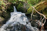
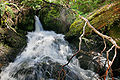
Waterfall
Waterfall
A waterfall is a place where flowing water rapidly drops in elevation as it flows over a steep region or a cliff.-Formation:Waterfalls are commonly formed when a river is young. At these times the channel is often narrow and deep. When the river courses over resistant bedrock, erosion happens...
or cascade: The fall of water where the stream goes over a sudden drop called a nickpoint; some nickpoints are formed by erosion when water flows over an especially resistant stratum
Stratum
In geology and related fields, a stratum is a layer of sedimentary rock or soil with internally consistent characteristics that distinguish it from other layers...
, followed by one less so. The stream expends kinetic energy
Kinetic energy
The kinetic energy of an object is the energy which it possesses due to its motion.It is defined as the work needed to accelerate a body of a given mass from rest to its stated velocity. Having gained this energy during its acceleration, the body maintains this kinetic energy unless its speed changes...
in "trying" to eliminate the nickpoint.
Mouth: The point at which the stream discharges, possibly via an estuary
Estuary
An estuary is a partly enclosed coastal body of water with one or more rivers or streams flowing into it, and with a free connection to the open sea....
or delta
River delta
A delta is a landform that is formed at the mouth of a river where that river flows into an ocean, sea, estuary, lake, reservoir, flat arid area, or another river. Deltas are formed from the deposition of the sediment carried by the river as the flow leaves the mouth of the river...
, into a static body of water such as a lake
Lake
A lake is a body of relatively still fresh or salt water of considerable size, localized in a basin, that is surrounded by land. Lakes are inland and not part of the ocean and therefore are distinct from lagoons, and are larger and deeper than ponds. Lakes can be contrasted with rivers or streams,...
or ocean
Ocean
An ocean is a major body of saline water, and a principal component of the hydrosphere. Approximately 71% of the Earth's surface is covered by ocean, a continuous body of water that is customarily divided into several principal oceans and smaller seas.More than half of this area is over 3,000...
.
Sources
Streams typically derive most of their water from precipitationPrecipitation (meteorology)
In meteorology, precipitation In meteorology, precipitation In meteorology, precipitation (also known as one of the classes of hydrometeors, which are atmospheric water phenomena is any product of the condensation of atmospheric water vapor that falls under gravity. The main forms of precipitation...
in the form of rain
Rain
Rain is liquid precipitation, as opposed to non-liquid kinds of precipitation such as snow, hail and sleet. Rain requires the presence of a thick layer of the atmosphere to have temperatures above the melting point of water near and above the Earth's surface...
and snow
Snow
Snow is a form of precipitation within the Earth's atmosphere in the form of crystalline water ice, consisting of a multitude of snowflakes that fall from clouds. Since snow is composed of small ice particles, it is a granular material. It has an open and therefore soft structure, unless packed by...
. Most of this water re-enters the atmosphere by evaporation
Evaporation
Evaporation is a type of vaporization of a liquid that occurs only on the surface of a liquid. The other type of vaporization is boiling, which, instead, occurs on the entire mass of the liquid....
from soil and water bodies, or by the evapotranspiration
Evapotranspiration
Evapotranspiration is a term used to describe the sum of evaporation and plant transpiration from the Earth's land surface to atmosphere. Evaporation accounts for the movement of water to the air from sources such as the soil, canopy interception, and waterbodies...
of plants. Some of the water proceeds to sink into the earth by infiltration
Infiltration (hydrology)
Infiltration is the process by which water on the ground surface enters the soil. Infiltration rate in soil science is a measure of the rate at which soil is able to absorb rainfall or irrigation. It is measured in inches per hour or millimeters per hour. The rate decreases as the soil becomes...
and becomes groundwater
Groundwater
Groundwater is water located beneath the ground surface in soil pore spaces and in the fractures of rock formations. A unit of rock or an unconsolidated deposit is called an aquifer when it can yield a usable quantity of water. The depth at which soil pore spaces or fractures and voids in rock...
, much of which eventually enters streams. Some precipitated water is temporarily locked up in snow fields and glacier
Glacier
A glacier is a large persistent body of ice that forms where the accumulation of snow exceeds its ablation over many years, often centuries. At least 0.1 km² in area and 50 m thick, but often much larger, a glacier slowly deforms and flows due to stresses induced by its weight...
s, to be released later by evaporation or melting. The rest of the water flows off the land as runoff
Surface runoff
Surface runoff is the water flow that occurs when soil is infiltrated to full capacity and excess water from rain, meltwater, or other sources flows over the land. This is a major component of the water cycle. Runoff that occurs on surfaces before reaching a channel is also called a nonpoint source...
, the proportion of which varies according to many factors, such as wind, humidity, vegetation, rock types, and relief. This runoff starts as a thin film called sheet wash, combined with a network of tiny rills, together constituting sheet runoff; when this water is concentrated in a channel, a stream has its birth.
Characteristics
RankingTo qualify as a stream it must be either recurring or perennial. Recurring streams have water in the channel for at least part of the year. A stream of the first order
Strahler Stream Order
In mathematics, the Strahler number or Horton–Strahler number of a mathematical tree is a numerical measure of its branching complexity....
is a stream which does not have any other stream feeding into it. When two first-order streams come together, they form a second-order stream. When two second-order streams come together, they form a third-order stream. Streams of lower order joining a higher order stream do not change the order of the higher stream. Thus, if a first-order stream joins a second-order stream, it remains a second-order stream. It is not until a second-order stream combines with another second-order stream that it becomes a third-order stream.
The gradient of a stream is a critical factor in determining its character and is entirely determined by its base level
Base level
The base level of a river or stream is the lowest point to which it can flow, often referred to as the 'mouth' of the river. For large rivers, sea level is usually the base level, but a large river or lake is likewise the base level for tributary streams...
of erosion. The base level of erosion is the point at which the stream either enters the ocean, a lake or pond, or enters a stretch in which it has a much lower gradient, and may be specifically applied to any particular stretch of a stream.
In geologic terms, the stream will erode down through its bed to achieve the base level of erosion throughout its course. If this base level is low, then the stream will rapidly cut through underlying strata and have a steep gradient, and if the base level is relatively high, then the stream will form a flood plain and meander.
Meander
Meander
Meander
A meander in general is a bend in a sinuous watercourse. A meander is formed when the moving water in a stream erodes the outer banks and widens its valley. A stream of any volume may assume a meandering course, alternately eroding sediments from the outside of a bend and depositing them on the...
s are looping changes of direction of a stream caused by the erosion and deposition of bank materials. These are typically serpentine in form. Typically, over time the meanders gradually migrate downstream.
If some resistant material slows or stops the downstream movement of a meander, a stream may erode through the neck between two legs of a meander to become temporarily straighter, leaving behind an arc-shaped body of water termed an oxbow lake
Oxbow lake
An oxbow lake is a U-shaped body of water formed when a wide meander from the main stem of a river is cut off to create a lake. This landform is called an oxbow lake for the distinctive curved shape, named after part of a yoke for oxen. In Australia, an oxbow lake is called a billabong, derived...
or bayou. A flood may also cause a meander to be cut through in this way.
Profile
Typically, streams are said to have a particular profile, beginning with steep gradients, no flood plain, and little shifting of channels, eventually evolving into streams with low gradients, wide flood plains, and extensive meanders. The initial stage is sometimes termed a "young" or "immature" stream, and the later state a "mature" or "old" stream. However, a stream may meander for some distance before falling into a "young" stream condition.
Intermittent and ephemeral streams
Perennial stream
A perennial stream or perennial river is a stream or river that has continuous flow in parts of its bed all year round during years of normal rainfall. "Perennial" streams are contrasted with "intermittent" streams which normally cease flowing for weeks or months each year, and with "ephemeral"...
stream is one which flows continuously all year.
In the United States, an intermittent or seasonal stream is one that only flows for part of the year and is marked on topographic map
Topographic map
A topographic map is a type of map characterized by large-scale detail and quantitative representation of relief, usually using contour lines in modern mapping, but historically using a variety of methods. Traditional definitions require a topographic map to show both natural and man-made features...
s with a line of blue dashes and dots. A wash
Arroyo (creek)
An arroyo , a Spanish word translated as brook, and also called a wash is usually a dry creek or stream bed—gulch that temporarily or seasonally fills and flows after sufficient rain. Wadi is a similar term in Africa. In Spain, a rambla has a similar meaning to arroyo.-Types and processes:Arroyos...
or desert wash is normally a dry streambed in the desert
Desert
A desert is a landscape or region that receives an extremely low amount of precipitation, less than enough to support growth of most plants. Most deserts have an average annual precipitation of less than...
s of the American Southwest which flows only after significant rainfall. Washes can fill up quickly during rains, and there may be a sudden torrent of water after a thunderstorm
Thunderstorm
A thunderstorm, also known as an electrical storm, a lightning storm, thundershower or simply a storm is a form of weather characterized by the presence of lightning and its acoustic effect on the Earth's atmosphere known as thunder. The meteorologically assigned cloud type associated with the...
begins upstream, such as during monsoon
Monsoon
Monsoon is traditionally defined as a seasonal reversing wind accompanied by corresponding changes in precipitation, but is now used to describe seasonal changes in atmospheric circulation and precipitation associated with the asymmetric heating of land and sea...
al conditions. These flash flood
Flash flood
A flash flood is a rapid flooding of geomorphic low-lying areas—washes, rivers, dry lakes and basins. It may be caused by heavy rain associated with a storm, hurricane, or tropical storm or meltwater from ice or snow flowing over ice sheets or snowfields...
s often catch travelers by surprise. An intermittent stream can also be called an arroyo
Arroyo (creek)
An arroyo , a Spanish word translated as brook, and also called a wash is usually a dry creek or stream bed—gulch that temporarily or seasonally fills and flows after sufficient rain. Wadi is a similar term in Africa. In Spain, a rambla has a similar meaning to arroyo.-Types and processes:Arroyos...
in Latin America
Latin America
Latin America is a region of the Americas where Romance languages – particularly Spanish and Portuguese, and variably French – are primarily spoken. Latin America has an area of approximately 21,069,500 km² , almost 3.9% of the Earth's surface or 14.1% of its land surface area...
, a winterbourne
Winterbourne (stream)
A winterbourne is a stream or river that is dry through the summer months. A winterbourne is sometimes simply called a bourne, from the Anglo-Saxon for a stream flowing from a spring, although this term can also be used for all-year water courses....
in Britain, or a wadi
Wadi
Wadi is the Arabic term traditionally referring to a valley. In some cases, it may refer to a dry riverbed that contains water only during times of heavy rain or simply an intermittent stream.-Variant names:...
in the Arabic-speaking world.
In Italy
Italy
Italy , officially the Italian Republic languages]] under the European Charter for Regional or Minority Languages. In each of these, Italy's official name is as follows:;;;;;;;;), is a unitary parliamentary republic in South-Central Europe. To the north it borders France, Switzerland, Austria and...
an intermittent stream is termed a torrent . In full flood the stream may or may not be "torrential" in the dramatic sense of the word, but there will be one or more seasons in which the flow is reduced to a trickle or less. Typically torrents have Apennine
Apennine mountains
The Apennines or Apennine Mountains or Greek oros but just as often used alone as a noun. The ancient Greeks and Romans typically but not always used "mountain" in the singular to mean one or a range; thus, "the Apennine mountain" refers to the entire chain and is translated "the Apennine...
rather than Alpine
Alpine
The term alpine refers to the Alps, a European mountain range.Alpine may also refer to:- Geography and geology :* Alpine tundra, the biological community that occurs above the tree line at high altitude...
sources, and in the summer they are fed by little precipitation and no melting snow. In this case the maximum discharge will be during the spring and autumn. However there are also glacial torrents with a different seasonal regime.
A blue-line stream is one which flows for most or all of the year and is marked on topographic maps with a solid blue line. In Australia, an intermittent stream is usually called a creek and marked on topographic maps with a solid blue line.
Generally, streams that flow only during and immediately after precipitation are termed ephemeral. There is no clear demarcation between surface runoff and an ephemeral stream.
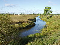
Drainage basins
The extent of land basin drained by a stream is termed its drainage basinDrainage basin
A drainage basin is an extent or an area of land where surface water from rain and melting snow or ice converges to a single point, usually the exit of the basin, where the waters join another waterbody, such as a river, lake, reservoir, estuary, wetland, sea, or ocean...
(also known in North America as the watershed and, in British English, as a catchment). A basin may also be composed of smaller basins. For instance, the Continental Divide
Continental Divide
The Continental Divide of the Americas, or merely the Continental Gulf of Division or Great Divide, is the name given to the principal, and largely mountainous, hydrological divide of the Americas that separates the watersheds that drain into the Pacific Ocean from those river systems that drain...
in North America divides the mainly easterly-draining Atlantic Ocean
Atlantic Ocean
The Atlantic Ocean is the second-largest of the world's oceanic divisions. With a total area of about , it covers approximately 20% of the Earth's surface and about 26% of its water surface area...
and Arctic Ocean
Arctic Ocean
The Arctic Ocean, located in the Northern Hemisphere and mostly in the Arctic north polar region, is the smallest and shallowest of the world's five major oceanic divisions...
basins from the largely westerly-flowing Pacific Ocean
Pacific Ocean
The Pacific Ocean is the largest of the Earth's oceanic divisions. It extends from the Arctic in the north to the Southern Ocean in the south, bounded by Asia and Australia in the west, and the Americas in the east.At 165.2 million square kilometres in area, this largest division of the World...
basin. The Atlantic Ocean basin, however, may be further subdivided into the Atlantic Ocean and Gulf of Mexico
Gulf of Mexico
The Gulf of Mexico is a partially landlocked ocean basin largely surrounded by the North American continent and the island of Cuba. It is bounded on the northeast, north and northwest by the Gulf Coast of the United States, on the southwest and south by Mexico, and on the southeast by Cuba. In...
drainages. (This delineation is termed the Eastern Continental Divide
Eastern Continental Divide
The Eastern Continental Divide, in conjunction with other continental divides of North America, demarcates two watersheds of the Atlantic Ocean: the Gulf of Mexico watershed and the Atlantic Seaboard watershed. Prior to 1760, the divide represented the boundary between British and French colonial...
.) Similarly, the Gulf of Mexico basin may be divided into the Mississippi River
Mississippi River
The Mississippi River is the largest river system in North America. Flowing entirely in the United States, this river rises in western Minnesota and meanders slowly southwards for to the Mississippi River Delta at the Gulf of Mexico. With its many tributaries, the Mississippi's watershed drains...
basin and several smaller basins, such as the Tombigbee River
Tombigbee River
The Tombigbee River is a tributary of the Mobile River, approximately 200 mi long, in the U.S. states of Mississippi and Alabama. It is one of two major rivers, along with the Alabama River, that unite to form the short Mobile River before it empties into Mobile Bay on the Gulf of Mexico...
basin. Continuing in this vein, a component of the Mississippi River basin is the Ohio River
Ohio River
The Ohio River is the largest tributary, by volume, of the Mississippi River. At the confluence, the Ohio is even bigger than the Mississippi and, thus, is hydrologically the main stream of the whole river system, including the Allegheny River further upstream...
basin, which in turn includes the Kentucky River
Kentucky River
The Kentucky River is a tributary of the Ohio River, long, in the U.S. state of Kentucky. The river and its tributaries drain much of the central region of the state, with its upper course passing through the coal-mining regions of the Cumberland Mountains, and its lower course passing through the...
basin, and so forth.
See also
- Body of waterBody of waterA body of water or waterbody is any significant accumulation of water, usually covering the Earth or another planet. The term body of water most often refers to large accumulations of water, such as oceans, seas, and lakes, but it may also include smaller pools of water such as ponds, puddles or...
- Chalk streamChalk streamChalk streams have characteristics which set them apart from watercourses associated with other rock types.Aside from those with an interest in the geological and ecological disciplines, the term chalk stream is most widely used among a small group of fly fishermen ,...
- Lotic ecology
- MarshMarshIn geography, a marsh, or morass, is a type of wetland that is subject to frequent or continuous flood. Typically the water is shallow and features grasses, rushes, reeds, typhas, sedges, other herbaceous plants, and moss....
- Perennial streamPerennial streamA perennial stream or perennial river is a stream or river that has continuous flow in parts of its bed all year round during years of normal rainfall. "Perennial" streams are contrasted with "intermittent" streams which normally cease flowing for weeks or months each year, and with "ephemeral"...
- Playfair's LawPlayfair's LawIn estimating erosion, Playfair's Law is an empirical relationship that relates the size of a stream to the valley it runs through. The role of the flow regiment requires subject attention; the relation acts fundamentally similar to the functionality of a glacial trough...
- RiverRiverA river is a natural watercourse, usually freshwater, flowing towards an ocean, a lake, a sea, or another river. In a few cases, a river simply flows into the ground or dries up completely before reaching another body of water. Small rivers may also be called by several other names, including...
- Rock-cut basinRock-cut basinA rock-cut basin, in this usage of the term, is a natural phenomenon. They are cylindrical depressions cut into stream or river beds, often filled with water. Such plucked-bedrock pits are created by kolks; powerful vortices within the water currents which spin small boulders around, eroding out...
- WaterwayWaterwayA waterway is any navigable body of water. Waterways can include rivers, lakes, seas, oceans, and canals. In order for a waterway to be navigable, it must meet several criteria:...