

Port of New York and New Jersey
Encyclopedia
The Port of New York and New Jersey comprises the waterways in the estuary
of the New York-Newark metropolitan area
with a port district encompassing an approximate area within a 25 miles (40.2 km) radius
of the Statue of Liberty National Monument. The system of navigable waters along 650 miles (1,046.1 km) of shoreline in the vicinity of New York City
and northeastern New Jersey
is considered one the finest natural harbors in the world. The port is by tonnage the third largest in the United States
and the busiest on the East Coast
. In 2010 4,811 ships entered the harbor carrying over 32.2 million metric tons of cargo valued at over $175 billion

is to the southeast. The sea at the entrance to the port is called the New York Bight
which lies between the peninsulas of Sandy Hook
and Rockaway
. In Lower New York Bay
and its western arm Raritan Bay
, ocean-going vessels orient themselves for passage to the east into Arthur Kill
or to the north to The Narrows
. To the east lies the Rockaway Inlet
which leads to Jamaica Bay
. Sometimes called by the name of the bridge which spans it, the Verrazano Narrows
strait connects to the Upper New York Bay
. Traditionally called New York Harbor
, the Upper Bay
lies at the mouth of the Hudson River
which is sometimes called, particularly in navigation, the North River. Large ships are able to travel upstream to the Port of Albany-Rensselaer
. To the west lies Kill van Kull
, the strait leading to Newark Bay
, fed by the Passaic River
and Hackensack River
, and the northern entrance of Arthur Kill
. The Gowanus Canal
and Buttermilk Channel
are entered from the east. The East River
is a broad strait which travels north to Newtown Creek
and the Harlem River
, turning east at Hell Gate
before opening to Long Island Sound
, which provides an outlet to the open sea.
The port consists of a complex of approximately 240 miles (386 km) of shipping channels
as well as anchorages and port facilities. Most vessels require pilotage
and larger vessels require tugboat
assistance for the sharper channel turns.
The natural depth of the harbor is about 17 feet (5 m), but it had been deepened over the years, to about 24 feet (7 m) controlling depth in 1880. By 1891 the Main Ship Channel was minimally 30 feet (9 m). In 1914 Ambrose Channel
became the main entrance to the Harbor, at 40 feet (12 m) deep and 2000 feet (609.6 m) wide. During World War II the main channel was dredged to 45 feet (14 m) depth to accommodate larger ships up to Panamax
size. Currently the Corps of Engineers is contracting out deepening to 50 feet (15 m), to accommodate Post-Panamax container vessels, which can pass through the Suez Canal
.
This has been a source of environmental concern along channels connecting the container facilities in Port Newark to the Atlantic. PCBs and other pollutants lay in a blanket just underneath the soil. In June 2009 it was announced that 200,000 cubic yards of dredged PCBs would be "cleaned" and stored en masse at the site of the former Yankee Stadium, as well as at the Brooklyn Bridge Park. In many areas the sandy bottom has been excavated down to rock and now requires blasting. Dredging equipment then picks up the rock and disposes of it. At one point in 2005 there were 70 pieces of dredging equipment working to deepen channels, the largest fleet of dredging equipment anywhere in the world.
 Responsibilities within the port are divided among all levels of government, from municipal to federal, as well as public and private agencies.
Established in 1921, the bi-state Port Authority of New York and New Jersey
in addition to overseeing maritime facilities is responsible for the vehicular crossings and the rapid transit
system between New York
and New Jersey
, several of the region's airports, as well as other transportation and real estate development projects. The Port Authority maintains its own police force, as does the Waterfront Commission
, created in 1953 to investigate, prosecute, and prevent criminal activity. The United States Army Corps of Engineers
(involved in harbor maintenance since about 1826 when Congress passed an omnibus rivers and harbors act) is responsible for bulkhead
and channel
maintenance. The United States Coast Guard
deals with issues such floatable debris
, spills, vessel rescues, and counter-terrorism. Both states, and some municipal governments, maintain maritime police units
, while the United States Park Police
monitors federal properties. The National Park Service
oversees some of the region's historic site
s, nature reserve
s, and parks. As a port of entry
with sections that are foreign trade zone
, the U.S. Customs and Border Protection
and U.S. Immigration and Customs Enforcement regulate international imports and passenger arrivals, and the "green lane" program, in which trusted shippers have fewer containers inspected.
In March 2006, some of the passenger facilities management was to be transferred to Dubai Ports World
. There was considerable controversy over security and ownership by a foreign corporation, particularly Arabic, of a U.S. port operation, this in spite of the fact the operator was the British based P&O Ports
, DPs World later sold P&O's American operations to American International Group
's asset management division, Global Investment Group for an undisclosed sum.
Seamen's Church Institute of New York and New Jersey
, the Teamsters
and the International Longshoremen's Association
assist and represent some of the port's mariners and dockworkers.
was originally the territory of the Lenape
, a seasonally migrational people who would re-locate summer encampments along its shore and use its waterways for transport and fishing. Many of the tidal salt marshes supported vast oyster banks
which would remain a major source of food for the region until the end of the 19th century by which time contamination and landfilling
had obliterated most of them. The first recorded European visit was that of Giovanni da Verrazzano who anchored in The Narrows
in 1524. For the next hundred years the region was visited sporadically by ships on fishing trips and slave raids
. European colonialization began after Henry Hudson
's 1609 exploration of the region with the establishment of New Amsterdam
, the capital of the Dutch province of New Netherland
at the tip of Manhattan
. The British colonial era saw a concerted effort to expand the port in the triangular trade
between Europe
, Africa
, and North America
with a concentration of wharves along the mouth of the East River
. After the Battle of Brooklyn, the British
controlled the harbor for the duration of American Revolutionary War
and prison ship
s housed thousands at Wallabout Bay
. In the early 19th century the Erie Canal
(often used for grain
) and Morris Canal
(mostly for anthracite), gave the port access to the American interior, leading to trans-shipment operations, manufacturing, and industrialization. The invention of the steam engine
led to expansion of the railroads and vast terminals along the western banks of the Hudson River complemented by extensive network of ferries
and carfloats, with a large cluster along the Harlem River
. The era of the ocean-liner, before and after the turn of the century
, led to the creation of berths
at North River piers and Hoboken. This coincided with the immigration
of millions, processed at Castle Clinton
and later at Ellis Island
, some staying in the region, other boarding barges, ships, and trains to points across the United States
. In 1910, the port was the busiest in the world. During the World Wars the waterfront supported shipyards and military installations such as the Federal Shipbuilding and Drydock Company
and Brooklyn Navy Yard
, and played an important role in troop transport. The mid century also saw the construction major highways such as the Belt Parkway
, East River Drive, and the Major Deegan Expressway
, along parts of the shoreline. The era of the longshoreman captured in the classic film On the Waterfront
, faded by the 1970s as much of the waterfront became obsolete due to changing transportation patterns. The nation's first facility for container shipping, which became the prototype
, opened in 1958. Expanded intermodal freight transport systems
and the Interstate Highway System
effected a shift to new terminals at Newark Bay
. Since the 1980s parts of waterfront in the traditional harbor have been being redeveloped to include public access to the water's edge with the creation of linear park
greenway
s such as Hudson River Park
, Hudson River Waterfront Walkway
, and Brooklyn Bridge Park
.
, third busiest in the United States
, and 20th world-wide. Terminals are leased to different port operator
s, such as A. P. Moller-Maersk Group, American Stevedoring, NYCT and Global Marine Terminal
 In June 2010, the Port Authority of New York and New Jersey
agree to purchase from Bayonne
128 acre (0.51799808 km²) at MOTBY, indicating that additional container port facilities would be created. The agency is expected to develop a terminal capable of handling the larger container ships to be in service once the new, wider Panama Canal
opens in 2014, some of which will not pass under the Bayonne Bridge
at the Kill van Kull
. Studies are underway to either replace or raise the bridge.
, other commodities such as petroleum
and scrap metal
are handled at facilities for marine transfer operations
, bulk cargo
and break bulk cargo
throughout the port, many along its straits and canals. At some locations water pollution
has led to inclusion on the list of Superfund sites in the United States.
 At one time nearly 600,000 rail cars were transferred annually by barge between the region's extensive rail facilities. Today approximately 1,600 are "floated" on the remaining car float
in the port. The New York New Jersey Rail, LLC transfers freight cars across the Upper Bay
between the Greenville Yard in Jersey City
and the Bush Terminal Yard in Bay Ridge, Brooklyn
. At the Greenville end CSX Transportation
operates through Conrail's North Jersey Shared Assets Area along the National Docks Secondary
. At Brooklyn end connections are made to the New York and Atlantic Railway
's Bay Ridge Branch
and the South Brooklyn Railway
. The 2.5 miles (4 km) crossing takes approximately 45 minutes. The equivalent truck trip would be 35 to 50 miles (80.5 km) long.
Freight rail has never used the New York Tunnel Extension under the Hudson Palisades
, Hudson River, Manhattan
, and East River
due to electified lines
and lack of ventilation
. Overland travel crosses the Hudson River
140 miles (225 km) to the north using a right of way known as the "Selkirk hurdle
." The Cross-Harbor Rail Tunnel
is a proposed rail tunnel
under the Upper Bay
. The western portal would be located at Greenville Yard, while the eastern portal is undetermined and a source of controversy.
In May 2010, the Port Authority announced that it would purchase the Greenville Yard and build a new barge-to-rail facility there, as well as improving the existing rail car float system. The barge-to-rail facility is expected to handle an estimated 60,000 to 90,000 containers of solid waste per year from New York City, eliminating up to 360,000 trash truck trips a year. The authority's board authorized $118.1 million for the overall project. The National Docks Secondary
rail line is being upgraded in anticpated expansion of volumes.
 The golden age of the North Atlantic ocean-liner lasted from the end of the 19th century to the post World War II
period after which innovations in air-travel became commercially viable. Many berth
s for the great ships which lined the North River (Hudson River) more or less abandoned by the 1970s. Nowadays most travel is recreational. While many cruises are to points in the Caribbean
there are also ships calling at the port which sail transatlantically and to the Southern Hemisphere
, notably RMS Queen Mary 2
. The passenger cruise ship
terminals in the port are located in the traditional, or inner harbor.
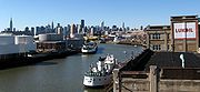
service between Staten Island
and Lower Manhattan
since the 18th century. Travelling across the Upper Bay
between South Ferry
and St. George Ferry Terminal, the free Staten Island Ferry
transports on average 75,000 passengers per day.
Service on the East River ended in the early 20th century and on the Hudson River in the 1960s. It has been restored and grown significantly since the 1980s providing regular service to points in Manhattan
, mostly below 42nd Street
. Major terminals are Hoboken Terminal
, Battery Park City Ferry Terminal
at World Financial Center
, Paulus Hook Ferry Terminal, Weehawken Port Imperial
, Pier 11 at Wall Street
, West Midtown Ferry Terminal
, and the East 34th Street Ferry Landing
. There also are numerous ferry slip
s serving one route only, including the historic Fulton Ferry
. In addition to regular and rush hour
routes there are excursions trips and seasonal service to Gateway National Recreation Area
beaches. Sightseeing boats circumnavigate Manhattan
or make excursions into the Upper New York Bay
.

began in the colonial era, and continued well into the 20th century. Early materials were shellfish
and other refuse, and later construction debris from projects such as the NYC Subway and Pennsylvania Station
. Rubble
from the bombing of London was transported for ballast
during WW2
. New land has been created throughout the port, including large swaths that are now Battery Park City, Ellis Island
, Liberty State Park
, Flushing Meadows – Corona Park and the Meadowlands Sports Complex
. For many years, processed sewerage sludge
was hauled by tugboat
and barge to a point 12 miles (19.3 km) offshore in the Atlantic
until ocean dumping was banned in 1992. Barges were also used to transport waste to Fresh Kills Landfill
, the world's largest, which operated from 1948 to 1991. Both operations were known to be detrimental to Long Island
and Jersey Shore
beaches, notably the 1987 Syringe Tide
.
_light.jpg)
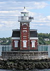 There are both historic and modern lighthouses throughout the port, some of which have been decommissioned
s, promenades, nature preserves within the port district include:
Estuary
An estuary is a partly enclosed coastal body of water with one or more rivers or streams flowing into it, and with a free connection to the open sea....
of the New York-Newark metropolitan area
New York metropolitan area
The New York metropolitan area, also known as Greater New York, or the Tri-State area, is the region that composes of New York City and the surrounding region...
with a port district encompassing an approximate area within a 25 miles (40.2 km) radius
Radius
In classical geometry, a radius of a circle or sphere is any line segment from its center to its perimeter. By extension, the radius of a circle or sphere is the length of any such segment, which is half the diameter. If the object does not have an obvious center, the term may refer to its...
of the Statue of Liberty National Monument. The system of navigable waters along 650 miles (1,046.1 km) of shoreline in the vicinity of New York City
New York City
New York is the most populous city in the United States and the center of the New York Metropolitan Area, one of the most populous metropolitan areas in the world. New York exerts a significant impact upon global commerce, finance, media, art, fashion, research, technology, education, and...
and northeastern New Jersey
Gateway Region
The Gateway Region is located in the northeastern part of State of New Jersey in the United States of America. The area encompasses Bergen, Essex, Hudson, Passaic, Union and Middlesex counties...
is considered one the finest natural harbors in the world. The port is by tonnage the third largest in the United States
United States
The United States of America is a federal constitutional republic comprising fifty states and a federal district...
and the busiest on the East Coast
East Coast of the United States
The East Coast of the United States, also known as the Eastern Seaboard, refers to the easternmost coastal states in the United States, which touch the Atlantic Ocean and stretch up to Canada. The term includes the U.S...
. In 2010 4,811 ships entered the harbor carrying over 32.2 million metric tons of cargo valued at over $175 billion
Bodies of water
The Atlantic OceanAtlantic Ocean
The Atlantic Ocean is the second-largest of the world's oceanic divisions. With a total area of about , it covers approximately 20% of the Earth's surface and about 26% of its water surface area...
is to the southeast. The sea at the entrance to the port is called the New York Bight
New York Bight
The New York Bight is a slight indentation along the Atlantic coast of the United States, extending northeasterly from Cape May Inlet in New Jersey to Montauk Point on the eastern tip of Long Island...
which lies between the peninsulas of Sandy Hook
Sandy Hook
Sandy Hook is a barrier spit along the Atlantic coast of New JerseySandy Hook may also refer to:-Places:United States* Sandy Hook , a village in the town of Newtown, Connecticut* Sandy Hook, Kentucky, a city in Elliott County...
and Rockaway
Rockaway, Queens
The Rockaway Peninsula, informally The Rockaways, is the name of a peninsula of Long Island, all of which is located within the New York City borough of Queens. A popular summer resort area since the 1830s, Rockaway has become a mixture of lower, middle, and upper-class neighborhoods...
. In Lower New York Bay
Lower New York Bay
Lower New York Bay is that section of New York Bay south of the Narrows, the relatively narrow strait between the shores of Staten Island and Brooklyn. The southern end of the bay opens directly to the Atlantic Ocean between two spits of land, Sandy Hook, New Jersey, and Rockaway, Queens, on Long...
and its western arm Raritan Bay
Raritan Bay
Raritan Bay is a bay located at the southern portion of Lower New York Bay between the U.S. states of New York and New Jersey and is part of the New York Bight. The bay is bounded on the northwest by New York's Staten Island, on the west by Perth Amboy, New Jersey, on the south by the Raritan...
, ocean-going vessels orient themselves for passage to the east into Arthur Kill
Arthur Kill
The Arthur Kill is a tidal strait separating Staten Island, New York from mainland New Jersey, USA, and a major navigational channel of the Port of New York and New Jersey. Kill is from the Middle Dutch word kille, meaning "riverbed" or "water channel"...
or to the north to The Narrows
The Narrows
The Narrows is the tidal strait separating the boroughs of Staten Island and Brooklyn in New York City. It connects the Upper New York Bay and Lower New York Bay and forms the principal channel by which the Hudson River empties into the Atlantic Ocean...
. To the east lies the Rockaway Inlet
Rockaway Inlet
Rockaway Inlet is a strait connecting Jamaica Bay, wholly within New York City, with the Atlantic Ocean. It separates the Rockaway Peninsula in Queens from the Floyd Bennett Field in Brooklyn....
which leads to Jamaica Bay
Jamaica Bay
Jamaica Bay is located on the southwestern tip of Long Island in the boroughs of Brooklyn and Queens, New York City, and the town of Hempstead, New York/hamlet of Inwood...
. Sometimes called by the name of the bridge which spans it, the Verrazano Narrows
Verrazano-Narrows Bridge
The Verrazano-Narrows Bridge is a double-decked suspension bridge that connects the boroughs of Staten Island and Brooklyn in New York City at the Narrows, the reach connecting the relatively protected upper bay with the larger lower bay....
strait connects to the Upper New York Bay
Upper New York Bay
Upper New York Bay, or Upper Bay, is the traditional heart of the Port of New York and New Jersey, and often called New York Harbor. It is enclosed by the New York City boroughs of Manhattan, Brooklyn, and Staten Island and the Hudson County, New Jersey municipalities of Jersey City and Bayonne.It...
. Traditionally called New York Harbor
New York Harbor
New York Harbor refers to the waterways of the estuary near the mouth of the Hudson River that empty into New York Bay. It is one of the largest natural harbors in the world. Although the U.S. Board of Geographic Names does not use the term, New York Harbor has important historical, governmental,...
, the Upper Bay
Upper New York Bay
Upper New York Bay, or Upper Bay, is the traditional heart of the Port of New York and New Jersey, and often called New York Harbor. It is enclosed by the New York City boroughs of Manhattan, Brooklyn, and Staten Island and the Hudson County, New Jersey municipalities of Jersey City and Bayonne.It...
lies at the mouth of the Hudson River
Hudson River
The Hudson is a river that flows from north to south through eastern New York. The highest official source is at Lake Tear of the Clouds, on the slopes of Mount Marcy in the Adirondack Mountains. The river itself officially begins in Henderson Lake in Newcomb, New York...
which is sometimes called, particularly in navigation, the North River. Large ships are able to travel upstream to the Port of Albany-Rensselaer
Port of Albany-Rensselaer
The Port of Albany–Rensselaer, widely known as the Port of Albany, is a port of entry in the United States with facilities on both sides of the Hudson River in Albany and Rensselaer, New York. Private and public port facilities have existed in both cities since the 17th century, with an increas in...
. To the west lies Kill van Kull
Kill Van Kull
The Kill Van Kull is a tidal strait between Staten Island, New York and Bayonne, New Jersey in the United States. Approximately long and wide, it connects Newark Bay with Upper New York Bay. The Robbins Reef Light marks the eastern end of the Kill, Bergen Point its western end...
, the strait leading to Newark Bay
Newark Bay
Newark Bay is a tidal bay at the confluence of the Passaic and Hackensack Rivers in northeastern New Jersey. It is home to the Port Newark-Elizabeth Marine Terminal, the largest container shipping facility in Port of New York and New Jersey, 3rd largest and one of busiest in the United States...
, fed by the Passaic River
Passaic River
The Passaic River is a mature surface river, approximately 80 mi long, in northern New Jersey in the United States. The river in its upper course flows in a highly circuitous route, meandering through the swamp lowlands between the ridge hills of rural and suburban northern New Jersey,...
and Hackensack River
Hackensack River
The Hackensack River is a river, approximately 45 miles long, in the U.S. states of New York and New Jersey, emptying into Newark Bay, a back chamber of New York Harbor. The watershed of the river includes part of the suburban area outside New York City just west of the lower Hudson River,...
, and the northern entrance of Arthur Kill
Arthur Kill
The Arthur Kill is a tidal strait separating Staten Island, New York from mainland New Jersey, USA, and a major navigational channel of the Port of New York and New Jersey. Kill is from the Middle Dutch word kille, meaning "riverbed" or "water channel"...
. The Gowanus Canal
Gowanus Canal
The Gowanus Canal, also known as the Gowanus Creek Canal, is a canal in the New York City borough of Brooklyn, geographically on the westernmost portion of Long Island...
and Buttermilk Channel
Buttermilk Channel
In New York City, Buttermilk Channel is a small tidal strait in Upper New York Bay, approximately one mile long and one-fourth of a mile wide , separating Governors Island from Brooklyn....
are entered from the east. The East River
East River
The East River is a tidal strait in New York City. It connects Upper New York Bay on its south end to Long Island Sound on its north end. It separates Long Island from the island of Manhattan and the Bronx on the North American mainland...
is a broad strait which travels north to Newtown Creek
Newtown Creek
Newtown Creek is a estuary that forms part of the border between the boroughs of Brooklyn and Queens, in New York City, New York, United States. It derives its name from New Town , which was the name for the Dutch and British settlement in what is now Elmhurst, Queens...
and the Harlem River
Harlem River
The Harlem River is a navigable tidal strait in New York City, USA that flows 8 miles between the Hudson River and the East River, separating the boroughs of Manhattan and the Bronx...
, turning east at Hell Gate
Hell Gate
Hell Gate is a narrow tidal strait in the East River in New York City in the United States. It separates Astoria, Queens from Randall's Island/Wards Island ....
before opening to Long Island Sound
Long Island Sound
Long Island Sound is an estuary of the Atlantic Ocean, located in the United States between Connecticut to the north and Long Island, New York to the south. The mouth of the Connecticut River at Old Saybrook, Connecticut, empties into the sound. On its western end the sound is bounded by the Bronx...
, which provides an outlet to the open sea.
Channels
The port consists of a complex of approximately 240 miles (386 km) of shipping channels
Channel (geography)
In physical geography, a channel is the physical confine of a river, slough or ocean strait consisting of a bed and banks.A channel is also the natural or human-made deeper course through a reef, sand bar, bay, or any shallow body of water...
as well as anchorages and port facilities. Most vessels require pilotage
Maritime pilot
A pilot is a mariner who guides ships through dangerous or congested waters, such as harbours or river mouths. With the exception of the Panama Canal, the pilot is only an advisor, as the captain remains in legal, overriding command of the vessel....
and larger vessels require tugboat
Tugboat
A tugboat is a boat that maneuvers vessels by pushing or towing them. Tugs move vessels that either should not move themselves, such as ships in a crowded harbor or a narrow canal,or those that cannot move by themselves, such as barges, disabled ships, or oil platforms. Tugboats are powerful for...
assistance for the sharper channel turns.
The natural depth of the harbor is about 17 feet (5 m), but it had been deepened over the years, to about 24 feet (7 m) controlling depth in 1880. By 1891 the Main Ship Channel was minimally 30 feet (9 m). In 1914 Ambrose Channel
Ambrose Channel
Ambrose Channel is the main shipping channel in and out of the Port of New York and New Jersey. The channel is considered to be part of Lower New York Bay and is located several miles off the coasts of Sandy Hook in New Jersey and Breezy Point, Queens in New York...
became the main entrance to the Harbor, at 40 feet (12 m) deep and 2000 feet (609.6 m) wide. During World War II the main channel was dredged to 45 feet (14 m) depth to accommodate larger ships up to Panamax
Panamax
Panamax and New Panamax are popular terms for the size limits for ships traveling through the Panama Canal. Formally, the limits and requirements are published by the Panama Canal Authority titled "Vessel Requirements"...
size. Currently the Corps of Engineers is contracting out deepening to 50 feet (15 m), to accommodate Post-Panamax container vessels, which can pass through the Suez Canal
Suez Canal
The Suez Canal , also known by the nickname "The Highway to India", is an artificial sea-level waterway in Egypt, connecting the Mediterranean Sea and the Red Sea. Opened in November 1869 after 10 years of construction work, it allows water transportation between Europe and Asia without navigation...
.
This has been a source of environmental concern along channels connecting the container facilities in Port Newark to the Atlantic. PCBs and other pollutants lay in a blanket just underneath the soil. In June 2009 it was announced that 200,000 cubic yards of dredged PCBs would be "cleaned" and stored en masse at the site of the former Yankee Stadium, as well as at the Brooklyn Bridge Park. In many areas the sandy bottom has been excavated down to rock and now requires blasting. Dredging equipment then picks up the rock and disposes of it. At one point in 2005 there were 70 pieces of dredging equipment working to deepen channels, the largest fleet of dredging equipment anywhere in the world.
Jurisdiction and regulation
Established in 1921, the bi-state Port Authority of New York and New Jersey
Port Authority of New York and New Jersey
The Port Authority of New York and New Jersey is a bi-state port district, established in 1921 through an interstate compact, that runs most of the regional transportation infrastructure, including the bridges, tunnels, airports, and seaports, within the Port of New York and New Jersey...
in addition to overseeing maritime facilities is responsible for the vehicular crossings and the rapid transit
Rapid transit
A rapid transit, underground, subway, elevated railway, metro or metropolitan railway system is an electric passenger railway in an urban area with a high capacity and frequency, and grade separation from other traffic. Rapid transit systems are typically located either in underground tunnels or on...
system between New York
New York
New York is a state in the Northeastern region of the United States. It is the nation's third most populous state. New York is bordered by New Jersey and Pennsylvania to the south, and by Connecticut, Massachusetts and Vermont to the east...
and New Jersey
New Jersey
New Jersey is a state in the Northeastern and Middle Atlantic regions of the United States. , its population was 8,791,894. It is bordered on the north and east by the state of New York, on the southeast and south by the Atlantic Ocean, on the west by Pennsylvania and on the southwest by Delaware...
, several of the region's airports, as well as other transportation and real estate development projects. The Port Authority maintains its own police force, as does the Waterfront Commission
Waterfront Commission
The Waterfront Commission of New York Harbor is a regulatory agency in Port of New York and New Jersey in the United States The inter-state government entity of New York and New Jersey was established in August of 1953...
, created in 1953 to investigate, prosecute, and prevent criminal activity. The United States Army Corps of Engineers
United States Army Corps of Engineers
The United States Army Corps of Engineers is a federal agency and a major Army command made up of some 38,000 civilian and military personnel, making it the world's largest public engineering, design and construction management agency...
(involved in harbor maintenance since about 1826 when Congress passed an omnibus rivers and harbors act) is responsible for bulkhead
Bulkhead (barrier)
A bulkhead is a retaining wall, such as a bulkhead within a ship or a watershed retaining wall. It may also be used in mines, to contain flooding.Certain bulkheads, e.g., at the Hudson River are of historical and architectural value....
and channel
Channel (geography)
In physical geography, a channel is the physical confine of a river, slough or ocean strait consisting of a bed and banks.A channel is also the natural or human-made deeper course through a reef, sand bar, bay, or any shallow body of water...
maintenance. The United States Coast Guard
United States Coast Guard
The United States Coast Guard is a branch of the United States Armed Forces and one of the seven U.S. uniformed services. The Coast Guard is a maritime, military, multi-mission service unique among the military branches for having a maritime law enforcement mission and a federal regulatory agency...
deals with issues such floatable debris
Marine debris
Marine debris, also known as marine litter, is human created waste that has deliberately or accidentally become afloat in a lake, sea, ocean or waterway. Oceanic debris tends to accumulate at the centre of gyres and on coastlines, frequently washing aground, when it is known as beach litter or...
, spills, vessel rescues, and counter-terrorism. Both states, and some municipal governments, maintain maritime police units
Water police
Water police, also called harbour patrols, port police, marine/maritime police, nautical patrols, bay constables or river police, are police officers, usually a department of a larger police organisation, who patrol in water craft...
, while the United States Park Police
United States Park Police
The United States Park Police is one of the oldest uniformed federal law enforcement agencies in the United States. It functions as a full service law enforcement agency with responsibilities and jurisdiction in those National Park Service areas primarily located in the Washington, D.C., San...
monitors federal properties. The National Park Service
National Park Service
The National Park Service is the U.S. federal agency that manages all national parks, many national monuments, and other conservation and historical properties with various title designations...
oversees some of the region's historic site
Historic site
A historic site is an official location where pieces of political, military or social history have been preserved. Historic sites are usually protected by law, and many have recognized with the official national historic site status...
s, nature reserve
Nature reserve
A nature reserve is a protected area of importance for wildlife, flora, fauna or features of geological or other special interest, which is reserved and managed for conservation and to provide special opportunities for study or research...
s, and parks. As a port of entry
Port of entry
In general, a port of entry is a place where one may lawfully enter a country. It typically has a staff of people who check passports and visas and inspect luggage to assure that contraband is not imported. International airports are usually ports of entry, as are road and rail crossings on a...
with sections that are foreign trade zone
Foreign trade zone
A foreign-trade zone in the United States is a geographical area, in United States Ports of Entry Ports of Entry, where commercial merchandise, both domestic and foreign receives the same Customs treatment it would if it were outside the commerce of the United States...
, the U.S. Customs and Border Protection
U.S. Customs and Border Protection
U.S. Customs and Border Protection is a federal law enforcement agency of the United States Department of Homeland Security charged with regulating and facilitating international trade, collecting import duties, and enforcing U.S. regulations, including trade, customs and immigration. CBP is the...
and U.S. Immigration and Customs Enforcement regulate international imports and passenger arrivals, and the "green lane" program, in which trusted shippers have fewer containers inspected.
In March 2006, some of the passenger facilities management was to be transferred to Dubai Ports World
Dubai Ports World
DP World is a major operator of marine ports with 49 terminals in operation and a further 9 under development across 31 countries. In 2010, DP World handled nearly 50 million TEU across its portfolio from the Americas to Asia...
. There was considerable controversy over security and ownership by a foreign corporation, particularly Arabic, of a U.S. port operation, this in spite of the fact the operator was the British based P&O Ports
P&O Ferries
P&O Ferries is the current name for the amalgamation of a range of ferry services that operated from the United Kingdom to Ireland and Continental Europe...
, DPs World later sold P&O's American operations to American International Group
American International Group
American International Group, Inc. or AIG is an American multinational insurance corporation. Its corporate headquarters is located in the American International Building in New York City. The British headquarters office is on Fenchurch Street in London, continental Europe operations are based in...
's asset management division, Global Investment Group for an undisclosed sum.
Seamen's Church Institute of New York and New Jersey
Seamen's Church Institute of New York and New Jersey
The Seamen's Church Institute of New York & New Jersey, founded in 1834 and affiliated with the Episcopal Church, serves mariners through education, pastoral care, and legal advocacy. With a budget of over $7 million dollars, SCI is the largest, most comprehensive mariners’ agency in North America...
, the Teamsters
Teamsters
The International Brotherhood of Teamsters is a labor union in the United States and Canada. Formed in 1903 by the merger of several local and regional locals of teamsters, the union now represents a diverse membership of blue-collar and professional workers in both the public and private sectors....
and the International Longshoremen's Association
International Longshoremen's Association
The International Longshoremen's Association is a labor union representing longshore workers along the East Coast of the United States and Canada, the Gulf Coast, the Great Lakes, Puerto Rico, and inland waterways...
assist and represent some of the port's mariners and dockworkers.
Historical overview
The estuaryEstuary
An estuary is a partly enclosed coastal body of water with one or more rivers or streams flowing into it, and with a free connection to the open sea....
was originally the territory of the Lenape
Lenape
The Lenape are an Algonquian group of Native Americans of the Northeastern Woodlands. They are also called Delaware Indians. As a result of the American Revolutionary War and later Indian removals from the eastern United States, today the main groups live in Canada, where they are enrolled in the...
, a seasonally migrational people who would re-locate summer encampments along its shore and use its waterways for transport and fishing. Many of the tidal salt marshes supported vast oyster banks
Oyster
The word oyster is used as a common name for a number of distinct groups of bivalve molluscs which live in marine or brackish habitats. The valves are highly calcified....
which would remain a major source of food for the region until the end of the 19th century by which time contamination and landfilling
Land reclamation
Land reclamation, usually known as reclamation, is the process to create new land from sea or riverbeds. The land reclaimed is known as reclamation ground or landfill.- Habitation :...
had obliterated most of them. The first recorded European visit was that of Giovanni da Verrazzano who anchored in The Narrows
The Narrows
The Narrows is the tidal strait separating the boroughs of Staten Island and Brooklyn in New York City. It connects the Upper New York Bay and Lower New York Bay and forms the principal channel by which the Hudson River empties into the Atlantic Ocean...
in 1524. For the next hundred years the region was visited sporadically by ships on fishing trips and slave raids
Slave raiding
Slave raiding is the military practise of performing a raid for the purpose of capturing people and bring them out of the raid area to serve as slaves. Sometimes seen as a normal part of warfare it is nowadays widely considered a crime. The practise of slave raiding is known to have occurred since...
. European colonialization began after Henry Hudson
Henry Hudson
Henry Hudson was an English sea explorer and navigator in the early 17th century. Hudson made two attempts on behalf of English merchants to find a prospective Northeast Passage to Cathay via a route above the Arctic Circle...
's 1609 exploration of the region with the establishment of New Amsterdam
New Amsterdam
New Amsterdam was a 17th-century Dutch colonial settlement that served as the capital of New Netherland. It later became New York City....
, the capital of the Dutch province of New Netherland
New Netherland
New Netherland, or Nieuw-Nederland in Dutch, was the 17th-century colonial province of the Republic of the Seven United Netherlands on the East Coast of North America. The claimed territories were the lands from the Delmarva Peninsula to extreme southwestern Cape Cod...
at the tip of Manhattan
Manhattan
Manhattan is the oldest and the most densely populated of the five boroughs of New York City. Located primarily on the island of Manhattan at the mouth of the Hudson River, the boundaries of the borough are identical to those of New York County, an original county of the state of New York...
. The British colonial era saw a concerted effort to expand the port in the triangular trade
Triangular trade
Triangular trade, or triangle trade, is a historical term indicating among three ports or regions. Triangular trade usually evolves when a region has export commodities that are not required in the region from which its major imports come...
between Europe
Europe
Europe is, by convention, one of the world's seven continents. Comprising the westernmost peninsula of Eurasia, Europe is generally 'divided' from Asia to its east by the watershed divides of the Ural and Caucasus Mountains, the Ural River, the Caspian and Black Seas, and the waterways connecting...
, Africa
Africa
Africa is the world's second largest and second most populous continent, after Asia. At about 30.2 million km² including adjacent islands, it covers 6% of the Earth's total surface area and 20.4% of the total land area...
, and North America
North America
North America is a continent wholly within the Northern Hemisphere and almost wholly within the Western Hemisphere. It is also considered a northern subcontinent of the Americas...
with a concentration of wharves along the mouth of the East River
East River
The East River is a tidal strait in New York City. It connects Upper New York Bay on its south end to Long Island Sound on its north end. It separates Long Island from the island of Manhattan and the Bronx on the North American mainland...
. After the Battle of Brooklyn, the British
United Kingdom
The United Kingdom of Great Britain and Northern IrelandIn the United Kingdom and Dependencies, other languages have been officially recognised as legitimate autochthonous languages under the European Charter for Regional or Minority Languages...
controlled the harbor for the duration of American Revolutionary War
American Revolutionary War
The American Revolutionary War , the American War of Independence, or simply the Revolutionary War, began as a war between the Kingdom of Great Britain and thirteen British colonies in North America, and ended in a global war between several European great powers.The war was the result of the...
and prison ship
Prison ship
A prison ship, historically sometimes called a prison hulk, is a vessel used as a prison, often to hold convicts awaiting transportation to penal colonies. This practice was popular with the British government in the 18th and 19th centuries....
s housed thousands at Wallabout Bay
Wallabout Bay
Wallabout Bay is small body of water in Upper New York Bay along the northwest shore of the New York City borough of Brooklyn, between the present Williamsburg and Manhattan bridges, opposite Corlear's Hook on Manhattan to the west, across the East River...
. In the early 19th century the Erie Canal
Erie Canal
The Erie Canal is a waterway in New York that runs about from Albany, New York, on the Hudson River to Buffalo, New York, at Lake Erie, completing a navigable water route from the Atlantic Ocean to the Great Lakes. The canal contains 36 locks and encompasses a total elevation differential of...
(often used for grain
GRAIN
GRAIN is a small international non-profit organisation that works to support small farmers and social movements in their struggles for community-controlled and biodiversity-based food systems. Our support takes the form of independent research and analysis, networking at local, regional and...
) and Morris Canal
Morris Canal
The Morris Canal was an anthracite-carrying canal that incorporated a series of water-driven inclined planes in its course across northern New Jersey in the United States. It was in use for about a century — from the late 1820s to the 1920s....
(mostly for anthracite), gave the port access to the American interior, leading to trans-shipment operations, manufacturing, and industrialization. The invention of the steam engine
Steam engine
A steam engine is a heat engine that performs mechanical work using steam as its working fluid.Steam engines are external combustion engines, where the working fluid is separate from the combustion products. Non-combustion heat sources such as solar power, nuclear power or geothermal energy may be...
led to expansion of the railroads and vast terminals along the western banks of the Hudson River complemented by extensive network of ferries
Ferry
A ferry is a form of transportation, usually a boat, but sometimes a ship, used to carry primarily passengers, and sometimes vehicles and cargo as well, across a body of water. Most ferries operate on regular, frequent, return services...
and carfloats, with a large cluster along the Harlem River
Harlem River
The Harlem River is a navigable tidal strait in New York City, USA that flows 8 miles between the Hudson River and the East River, separating the boroughs of Manhattan and the Bronx...
. The era of the ocean-liner, before and after the turn of the century
Turn of the century
Turn of the century, in its broadest sense, refers to the transition from one century to another. The term is most often used to indicate a non-specific time period either before or after the beginning of a century....
, led to the creation of berths
Berth (moorings)
A berth is a location in a port or harbour used specifically for mooring vessels while not at sea.-Locations in a port:Berth is the term used in ports and harbors to define a specific location where a vessel may be berthed, usually for the purposes of loading and unloading.Most berths will be...
at North River piers and Hoboken. This coincided with the immigration
Immigration
Immigration is the act of foreigners passing or coming into a country for the purpose of permanent residence...
of millions, processed at Castle Clinton
Castle Clinton
Castle Clinton or Fort Clinton, once known as Castle Garden, is a circular sandstone fort now located in Battery Park at the southern tip of Manhattan Island, New York City, in the United States. It is perhaps best remembered as America's first immigration station , where more than 8 million...
and later at Ellis Island
Ellis Island
Ellis Island in New York Harbor was the gateway for millions of immigrants to the United States. It was the nation's busiest immigrant inspection station from 1892 until 1954. The island was greatly expanded with landfill between 1892 and 1934. Before that, the much smaller original island was the...
, some staying in the region, other boarding barges, ships, and trains to points across the United States
United States
The United States of America is a federal constitutional republic comprising fifty states and a federal district...
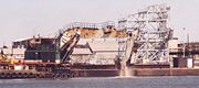
. In 1910, the port was the busiest in the world. During the World Wars the waterfront supported shipyards and military installations such as the Federal Shipbuilding and Drydock Company
Federal Shipbuilding and Drydock Company
The Federal Shipbuilding and Drydock Company was a United States shipyard, active from 1917 to 1949. During World War II, it built ships as part of the U.S. Government's Emergency Shipbuilding Program. Operated by a subsidiary of the United States Steel Corporation, the shipyard was located at...
and Brooklyn Navy Yard
Brooklyn Navy Yard
The United States Navy Yard, New York–better known as the Brooklyn Navy Yard or the New York Naval Shipyard –was an American shipyard located in Brooklyn, northeast of the Battery on the East River in Wallabout Basin, a semicircular bend of the river across from Corlear's Hook in Manhattan...
, and played an important role in troop transport. The mid century also saw the construction major highways such as the Belt Parkway
Belt Parkway
The Belt System is a series of connected limited-access highways that form a belt-like circle around the New York City boroughs of Brooklyn and Queens. The system comprises four officially separate parkways; however, three of the four are signed as the Belt Parkway...
, East River Drive, and the Major Deegan Expressway
Major Deegan Expressway
The Major Deegan Expressway is a north–south expressway in the New York City borough of the Bronx...
, along parts of the shoreline. The era of the longshoreman captured in the classic film On the Waterfront
On the Waterfront
On the Waterfront is a 1954 American drama film about union violence and corruption among longshoremen. The film was directed by Elia Kazan and written by Budd Schulberg. It stars Marlon Brando, Rod Steiger, Eva Marie Saint, Lee J. Cobb and Karl Malden. The soundtrack score was composed by Leonard...
, faded by the 1970s as much of the waterfront became obsolete due to changing transportation patterns. The nation's first facility for container shipping, which became the prototype
Prototype
A prototype is an early sample or model built to test a concept or process or to act as a thing to be replicated or learned from.The word prototype derives from the Greek πρωτότυπον , "primitive form", neutral of πρωτότυπος , "original, primitive", from πρῶτος , "first" and τύπος ,...
, opened in 1958. Expanded intermodal freight transport systems
Intermodal freight transport
Intermodal freight transport involves the transportation of freight in an intermodal container or vehicle, using multiple modes of transportation , without any handling of the freight itself when changing modes. The method reduces cargo handling, and so improves security, reduces damages and...
and the Interstate Highway System
Interstate Highway System
The Dwight D. Eisenhower National System of Interstate and Defense Highways, , is a network of limited-access roads including freeways, highways, and expressways forming part of the National Highway System of the United States of America...
effected a shift to new terminals at Newark Bay
Newark Bay
Newark Bay is a tidal bay at the confluence of the Passaic and Hackensack Rivers in northeastern New Jersey. It is home to the Port Newark-Elizabeth Marine Terminal, the largest container shipping facility in Port of New York and New Jersey, 3rd largest and one of busiest in the United States...
. Since the 1980s parts of waterfront in the traditional harbor have been being redeveloped to include public access to the water's edge with the creation of linear park
Linear park
A linear park is a park that is much longer than wide. It is often formed as a part of a rails-to-trails conversion of railroad beds to rail trail recreational use...
greenway
Greenway
-People:* Barney Greenway , British death metal vocalist* Brian Greenway , Canadian guitarist and vocalist* Chad Greenway , American football player* Francis Greenway , Australian architect...
s such as Hudson River Park
Hudson River Park
Hudson River Park is a waterside park on the Hudson River that extends from 59th Street south to Battery Park in the New York City borough of Manhattan. Bicycle and pedestrian paths, including the Manhattan Waterfront Greenway, span the park north to south, opening up the waterfront for...
, Hudson River Waterfront Walkway
Hudson River Waterfront Walkway
The Hudson River Waterfront Walkway, also known as the Hudson River Walkway, is an ongoing and incomplete project located on Kill van Kull and the western shore of Upper New York Bay and the Hudson River, implemented as part of a New Jersey state-mandated master plan to connect the municipalities...
, and Brooklyn Bridge Park
Brooklyn Bridge Park
Brooklyn Bridge Park is an park currently under construction on the Brooklyn waterfront in the vicinity of the Manhattan and Brooklyn bridges. As of March 22, 2010 the first newly built section of the park, Pier 1, has been open to the public...
.
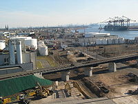
Container terminals
There are four container terminals in the port, the combined volume of which makes it the largest on the East CoastEast Coast of the United States
The East Coast of the United States, also known as the Eastern Seaboard, refers to the easternmost coastal states in the United States, which touch the Atlantic Ocean and stretch up to Canada. The term includes the U.S...
, third busiest in the United States
United States
The United States of America is a federal constitutional republic comprising fifty states and a federal district...
, and 20th world-wide. Terminals are leased to different port operator
Port operator
A port operator is port authority or company that contracts with the port authority to move cargo through a port at a contracted minimum level of productivity...
s, such as A. P. Moller-Maersk Group, American Stevedoring, NYCT and Global Marine Terminal
- Howland Hook Marine TerminalHowland Hook Marine TerminalThe Howland Hook Marine Terminal is a container port facility in the Port of New York and New Jersey located in northwestern Staten Island in New York City...
- Port Jersey Marine Terminal
- Port Newark-Elizabeth Marine TerminalPort Newark-Elizabeth Marine TerminalPort Newark-Elizabeth Marine Terminal is a major component of the Port of New York and New Jersey. Located on the Newark Bay it serves as the principal container ship facility for goods entering and leaving New York-Newark metropolitan area, and the northeastern quadrant of North America...
, the nation's first and third busiest - Red Hook Marine Terminal
Port Authority of New York and New Jersey
The Port Authority of New York and New Jersey is a bi-state port district, established in 1921 through an interstate compact, that runs most of the regional transportation infrastructure, including the bridges, tunnels, airports, and seaports, within the Port of New York and New Jersey...
agree to purchase from Bayonne
Bayonne, New Jersey
Bayonne is a city in Hudson County, New Jersey, United States. Located in the Gateway Region, Bayonne is a peninsula that is situated between Newark Bay to the west, the Kill van Kull to the south, and New York Bay to the east...
128 acre (0.51799808 km²) at MOTBY, indicating that additional container port facilities would be created. The agency is expected to develop a terminal capable of handling the larger container ships to be in service once the new, wider Panama Canal
Panama Canal
The Panama Canal is a ship canal in Panama that joins the Atlantic Ocean and the Pacific Ocean and is a key conduit for international maritime trade. Built from 1904 to 1914, the canal has seen annual traffic rise from about 1,000 ships early on to 14,702 vessels measuring a total of 309.6...
opens in 2014, some of which will not pass under the Bayonne Bridge
Bayonne Bridge
The Bayonne Bridge is the fourth longest steel arch bridge in the world, and was the longest in the world at the time of its completion. It connects Bayonne, New Jersey with Staten Island, New York, spanning the Kill Van Kull. Despite popular belief, it is not a national landmark.The bridge was...
at the Kill van Kull
Kill Van Kull
The Kill Van Kull is a tidal strait between Staten Island, New York and Bayonne, New Jersey in the United States. Approximately long and wide, it connects Newark Bay with Upper New York Bay. The Robbins Reef Light marks the eastern end of the Kill, Bergen Point its western end...
. Studies are underway to either replace or raise the bridge.
Bulk cargo and marine transfer
While most consumer goods are transported in containersShipping container
A shipping container is a container with strength suitable to withstand shipment, storage, and handling. Shipping containers range from large reusable steel boxes used for intermodal shipments to the ubiquitous corrugated boxes...
, other commodities such as petroleum
Petroleum
Petroleum or crude oil is a naturally occurring, flammable liquid consisting of a complex mixture of hydrocarbons of various molecular weights and other liquid organic compounds, that are found in geologic formations beneath the Earth's surface. Petroleum is recovered mostly through oil drilling...
and scrap metal
Scrap Metal
Scrap Metal were a band from Broome, Western Australia who played rock music with elements of country and reggae. The members had Aboriginal, Irish, Filipino, French, Chinese, Scottish, Indonesian and Japanese heritage. The band toured nationally as part of the Bran Nue Dae musical and with...
are handled at facilities for marine transfer operations
Marine transfer operations
Marine Transfer Operations are conducted at many ports around the world between tanker ships, barges, and marine terminals. Specifically, once the marine vessel is secure at the dock a loading arm or transfer hose is connected between a valve header on the dock and the manifold header on the vessel...
, bulk cargo
Bulk cargo
Bulk cargo is commodity cargo that is transported unpackaged in large quantities. This cargo is usually dropped or poured, with a spout or shovel bucket, as a liquid or as a mass of relatively small solids , into a bulk carrier ship's hold, railroad car, or tanker truck/trailer/semi-trailer body...
and break bulk cargo
Break bulk cargo
In shipping, break bulk cargo or general cargo is a term that covers a great variety of goods that must be loaded individually, and not in intermodal containers nor in bulk as with oil or grain. Ships that carry this sort of cargo are often called general cargo ships...
throughout the port, many along its straits and canals. At some locations water pollution
Water pollution
Water pollution is the contamination of water bodies . Water pollution occurs when pollutants are discharged directly or indirectly into water bodies without adequate treatment to remove harmful compounds....
has led to inclusion on the list of Superfund sites in the United States.
- Arthur KillArthur KillThe Arthur Kill is a tidal strait separating Staten Island, New York from mainland New Jersey, USA, and a major navigational channel of the Port of New York and New Jersey. Kill is from the Middle Dutch word kille, meaning "riverbed" or "water channel"...
, along its shore the Bayway RefineryBayway RefineryBayway Refinery is a refining facility in the Port of New York and New Jersey, owned by ConocoPhillips. Located in Linden and Elizabeth, New Jersey, it is the northernmost refinery on the East Coast of the United States. The oil refinery converts crude oil into gasoline, diesel fuel, jet fuel, and...
and the Chemical CoastChemical CoastThe Chemical Coast is the section of Union and Middlesex counties in New Jersey. It is located along the shores of the Arthur Kill, a heavily used waterway of the Port of New York and New Jersey, across from Staten Island, New York.-History:... - Kill van KullKill Van KullThe Kill Van Kull is a tidal strait between Staten Island, New York and Bayonne, New Jersey in the United States. Approximately long and wide, it connects Newark Bay with Upper New York Bay. The Robbins Reef Light marks the eastern end of the Kill, Bergen Point its western end...
at Constable Hook - Gowanus CanalGowanus CanalThe Gowanus Canal, also known as the Gowanus Creek Canal, is a canal in the New York City borough of Brooklyn, geographically on the westernmost portion of Long Island...
in South BrooklynSouth BrooklynSouth Brooklyn is a region or composite neighborhood in the New York City borough of Brooklyn, encompassing areas of Cobble Hill, Red Hook, Gowanus, Park Slope, and Boerum Hill. Thus it is roughly encompassed by Brooklyn Community Board 6, which in turn approximates the southern half of the 18th... - Newtown CreekNewtown CreekNewtown Creek is a estuary that forms part of the border between the boroughs of Brooklyn and Queens, in New York City, New York, United States. It derives its name from New Town , which was the name for the Dutch and British settlement in what is now Elmhurst, Queens...
, East RiverEast RiverThe East River is a tidal strait in New York City. It connects Upper New York Bay on its south end to Long Island Sound on its north end. It separates Long Island from the island of Manhattan and the Bronx on the North American mainland...
at GreenpointGreenpoint, BrooklynGreenpoint is the northernmost neighborhood in the New York City borough of Brooklyn. It is bordered on the southwest by Williamsburg at the Bushwick inlet, on the southeast by the Brooklyn-Queens Expressway and East Williamsburg, on the north by Newtown Creek and Long Island City, Queens at the...
and Hunter's PointHunters Point, QueensHunters Point is a neighborhood on the south side of Long Island City, in the New York City borough of Queens. The neighborhood is part of Queens Community Board 2.- History :... - Passaic RiverPassaic RiverThe Passaic River is a mature surface river, approximately 80 mi long, in northern New Jersey in the United States. The river in its upper course flows in a highly circuitous route, meandering through the swamp lowlands between the ridge hills of rural and suburban northern New Jersey,...
- from Newark BayNewark BayNewark Bay is a tidal bay at the confluence of the Passaic and Hackensack Rivers in northeastern New Jersey. It is home to the Port Newark-Elizabeth Marine Terminal, the largest container shipping facility in Port of New York and New Jersey, 3rd largest and one of busiest in the United States...
to PassaicPassaic, New JerseyPassaic is a city in Passaic County, New Jersey, United States. As of the 2010 United States Census, the city had a total population of 69,781, maintaining its status as the 15th largest municipality in New Jersey with an increase of 1,920 residents from the 2000 Census population of 67,861... - South Brooklyn Marine Terminal
Car float and Cross Harbor Tunnel
Car float
A railroad car float or rail barge is an unpowered barge with rail tracks mounted on its deck. It is used to move railroad cars across water obstacles, or to locations they could not otherwise go, and is pushed by a towboat or towed by a tugboat...
in the port. The New York New Jersey Rail, LLC transfers freight cars across the Upper Bay
Upper New York Bay
Upper New York Bay, or Upper Bay, is the traditional heart of the Port of New York and New Jersey, and often called New York Harbor. It is enclosed by the New York City boroughs of Manhattan, Brooklyn, and Staten Island and the Hudson County, New Jersey municipalities of Jersey City and Bayonne.It...
between the Greenville Yard in Jersey City
Jersey City, New Jersey
Jersey City is the seat of Hudson County, New Jersey, United States.Part of the New York metropolitan area, Jersey City lies between the Hudson River and Upper New York Bay across from Lower Manhattan and the Hackensack River and Newark Bay...
and the Bush Terminal Yard in Bay Ridge, Brooklyn
Bay Ridge, Brooklyn
Bay Ridge is a neighborhood in the southwest corner of the New York City borough of Brooklyn, USA. It is bounded by Sunset Park on the north, Seventh Avenue and Dyker Heights on the east, The Narrows Strait, which partially houses the Belt Parkway, on the west and 86th Street and Fort Hamilton on...
. At the Greenville end CSX Transportation
CSX Transportation
CSX Transportation operates a Class I railroad in the United States known as the CSX Railroad. It is the main subsidiary of the CSX Corporation. The company is headquartered in Jacksonville, Florida, and owns approximately 21,000 route miles...
operates through Conrail's North Jersey Shared Assets Area along the National Docks Secondary
National Docks Secondary
National Docks Secondary is freight rail line within Conrail's North Jersey Shared Assets Area in Hudson County, New Jersey, used by CSX Transportation. It provides access to the national rail network to maritime, industrial, and distribution facilities at Port Jersey, the Military Ocean Terminal...
. At Brooklyn end connections are made to the New York and Atlantic Railway
New York and Atlantic Railway
The New York and Atlantic Railway is a short line railroad formed in 1997 to provide freight service over the tracks of the Long Island Rail Road, a public commuter rail agency which had decided to privatize its freight operations...
's Bay Ridge Branch
Bay Ridge Branch
The Bay Ridge Branch is a rail line owned by the Long Island Rail Road and operated by the New York and Atlantic Railway in the U.S. State of New York...
and the South Brooklyn Railway
South Brooklyn Railway
The South Brooklyn Railway is a railroad in the New York City borough of Brooklyn. It continues to operate today as a subsidiary of MTA New York City Transit...
. The 2.5 miles (4 km) crossing takes approximately 45 minutes. The equivalent truck trip would be 35 to 50 miles (80.5 km) long.
Freight rail has never used the New York Tunnel Extension under the Hudson Palisades
Bergen Hill
Bergen Hill refers to the lower Hudson Palisades in New Jersey, USA, where they emerge on Bergen Neck, which in turn is the peninsula between the Hackensack and Hudson River, and their bays. In Hudson County, it reaches a height of 260 feet.-Rail:...
, Hudson River, Manhattan
Manhattan
Manhattan is the oldest and the most densely populated of the five boroughs of New York City. Located primarily on the island of Manhattan at the mouth of the Hudson River, the boundaries of the borough are identical to those of New York County, an original county of the state of New York...
, and East River
East River
The East River is a tidal strait in New York City. It connects Upper New York Bay on its south end to Long Island Sound on its north end. It separates Long Island from the island of Manhattan and the Bronx on the North American mainland...
due to electified lines
Railway electrification system
A railway electrification system supplies electrical energy to railway locomotives and multiple units as well as trams so that they can operate without having an on-board prime mover. There are several different electrification systems in use throughout the world...
and lack of ventilation
Ventilation (architecture)
Ventilating is the process of "changing" or replacing air in any space to provide high indoor air quality...
. Overland travel crosses the Hudson River
Hudson River
The Hudson is a river that flows from north to south through eastern New York. The highest official source is at Lake Tear of the Clouds, on the slopes of Mount Marcy in the Adirondack Mountains. The river itself officially begins in Henderson Lake in Newcomb, New York...
140 miles (225 km) to the north using a right of way known as the "Selkirk hurdle
Selkirk hurdle
The Selkirk Hurdle is the term used by urban planners, railroad employees, politicians and others to describe the route that must be taken by freight trains traveling between New York City or other points in downstate New York and points in the United States west of the Hudson River...
." The Cross-Harbor Rail Tunnel
Cross-Harbor Rail Tunnel
The Cross-Harbor Rail Tunnel is a proposed freight rail transport tunnel under Upper New York Bay in the Port of New York and New Jersey between northeastern New Jersey and Long Island, including southern and eastern New York City.-Background:Direct connections for rail freight between Long Island...
is a proposed rail tunnel
Tunnel
A tunnel is an underground passageway, completely enclosed except for openings for egress, commonly at each end.A tunnel may be for foot or vehicular road traffic, for rail traffic, or for a canal. Some tunnels are aqueducts to supply water for consumption or for hydroelectric stations or are sewers...
under the Upper Bay
Upper New York Bay
Upper New York Bay, or Upper Bay, is the traditional heart of the Port of New York and New Jersey, and often called New York Harbor. It is enclosed by the New York City boroughs of Manhattan, Brooklyn, and Staten Island and the Hudson County, New Jersey municipalities of Jersey City and Bayonne.It...
. The western portal would be located at Greenville Yard, while the eastern portal is undetermined and a source of controversy.
In May 2010, the Port Authority announced that it would purchase the Greenville Yard and build a new barge-to-rail facility there, as well as improving the existing rail car float system. The barge-to-rail facility is expected to handle an estimated 60,000 to 90,000 containers of solid waste per year from New York City, eliminating up to 360,000 trash truck trips a year. The authority's board authorized $118.1 million for the overall project. The National Docks Secondary
National Docks Secondary
National Docks Secondary is freight rail line within Conrail's North Jersey Shared Assets Area in Hudson County, New Jersey, used by CSX Transportation. It provides access to the national rail network to maritime, industrial, and distribution facilities at Port Jersey, the Military Ocean Terminal...
rail line is being upgraded in anticpated expansion of volumes.
Cruise terminals
World War II
World War II, or the Second World War , was a global conflict lasting from 1939 to 1945, involving most of the world's nations—including all of the great powers—eventually forming two opposing military alliances: the Allies and the Axis...
period after which innovations in air-travel became commercially viable. Many berth
Berth (moorings)
A berth is a location in a port or harbour used specifically for mooring vessels while not at sea.-Locations in a port:Berth is the term used in ports and harbors to define a specific location where a vessel may be berthed, usually for the purposes of loading and unloading.Most berths will be...
s for the great ships which lined the North River (Hudson River) more or less abandoned by the 1970s. Nowadays most travel is recreational. While many cruises are to points in the Caribbean
Caribbean
The Caribbean is a crescent-shaped group of islands more than 2,000 miles long separating the Gulf of Mexico and the Caribbean Sea, to the west and south, from the Atlantic Ocean, to the east and north...
there are also ships calling at the port which sail transatlantically and to the Southern Hemisphere
Southern Hemisphere
The Southern Hemisphere is the part of Earth that lies south of the equator. The word hemisphere literally means 'half ball' or "half sphere"...
, notably RMS Queen Mary 2
RMS Queen Mary 2
RMS Queen Mary 2 is a transatlantic ocean liner. She was the first major ocean liner built since in 1969, the vessel she succeeded as flagship of the Cunard Line....
. The passenger cruise ship
Cruise ship
A cruise ship or cruise liner is a passenger ship used for pleasure voyages, where the voyage itself and the ship's amenities are part of the experience, as well as the different destinations along the way...
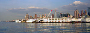
terminals in the port are located in the traditional, or inner harbor.
- Cape Liberty Cruise PortCape Liberty Cruise PortThe Cape Liberty Cruise Port , sometimes called Port Liberty, in Bayonne, New Jersey is one of three trans-Atlantic passenger terminals in New York Harbor...
, MOTBY, Upper BayUpper New York BayUpper New York Bay, or Upper Bay, is the traditional heart of the Port of New York and New Jersey, and often called New York Harbor. It is enclosed by the New York City boroughs of Manhattan, Brooklyn, and Staten Island and the Hudson County, New Jersey municipalities of Jersey City and Bayonne.It... - Brooklyn Cruise TerminalBrooklyn Cruise TerminalThe Brooklyn Cruise Terminal is one of three terminals for ocean-going cruise ships in the metropolitan New York City area. The terminal is located at Red Hook Pier 12, which forms the south side of the Atlantic Basin at Pioneer and Imlay Streets in the Red Hook section of Brooklyn, New York. The...
, Buttermilk ChannelButtermilk ChannelIn New York City, Buttermilk Channel is a small tidal strait in Upper New York Bay, approximately one mile long and one-fourth of a mile wide , separating Governors Island from Brooklyn....
, Upper BayUpper New York BayUpper New York Bay, or Upper Bay, is the traditional heart of the Port of New York and New Jersey, and often called New York Harbor. It is enclosed by the New York City boroughs of Manhattan, Brooklyn, and Staten Island and the Hudson County, New Jersey municipalities of Jersey City and Bayonne.It... - New York Passenger Ship TerminalNew York Passenger Ship TerminalThe New York Passenger Ship Terminal is a terminal for ocean-going passenger ships on Manhattan's west side....
, Hudson River
Ferries and sightseeing
There has been continuous ferryFerry
A ferry is a form of transportation, usually a boat, but sometimes a ship, used to carry primarily passengers, and sometimes vehicles and cargo as well, across a body of water. Most ferries operate on regular, frequent, return services...
service between Staten Island
Staten Island
Staten Island is a borough of New York City, New York, United States, located in the southwest part of the city. Staten Island is separated from New Jersey by the Arthur Kill and the Kill Van Kull, and from the rest of New York by New York Bay...
and Lower Manhattan
Lower Manhattan
Lower Manhattan is the southernmost part of the island of Manhattan, the main island and center of business and government of the City of New York...
since the 18th century. Travelling across the Upper Bay
Upper New York Bay
Upper New York Bay, or Upper Bay, is the traditional heart of the Port of New York and New Jersey, and often called New York Harbor. It is enclosed by the New York City boroughs of Manhattan, Brooklyn, and Staten Island and the Hudson County, New Jersey municipalities of Jersey City and Bayonne.It...
between South Ferry
South Ferry (Manhattan)
South Ferry is at the southern tip of Manhattan Island in New York City and is the embarkation point for ferries to Staten Island and Governors Island....
and St. George Ferry Terminal, the free Staten Island Ferry
Staten Island Ferry
The Staten Island Ferry is a passenger ferry service operated by the New York City Department of Transportation that runs between the boroughs of Manhattan and Staten Island.-Overview:...
transports on average 75,000 passengers per day.
Service on the East River ended in the early 20th century and on the Hudson River in the 1960s. It has been restored and grown significantly since the 1980s providing regular service to points in Manhattan
Manhattan
Manhattan is the oldest and the most densely populated of the five boroughs of New York City. Located primarily on the island of Manhattan at the mouth of the Hudson River, the boundaries of the borough are identical to those of New York County, an original county of the state of New York...
, mostly below 42nd Street
42nd Street (Manhattan)
42nd Street is a major crosstown street in the New York City borough of Manhattan, known for its theaters, especially near the intersection with Broadway at Times Square. It is also the name of the region of the theater district near that intersection...
. Major terminals are Hoboken Terminal
Hoboken Terminal
Hoboken Terminal is one of the New York Metropolitan area's major transportation hubs. The commuter-oriented intermodal facility, is located on the Hudson River in Hoboken, New Jersey...
, Battery Park City Ferry Terminal
Battery Park City Ferry Terminal
The Battery Park City Ferry Terminal provides slips to ferries, water taxis, and sightseeing boats in the Port of New York and New Jersey. The floating dock is located on the Hudson River and moored at the foot of Vesey Street in Hudson River Park in Battery Park City, Manhattan...
at World Financial Center
World Financial Center
The World Financial Center is a complex of buildings across West Street from the World Trade Center site in Lower Manhattan in New York City, overlooking the Hudson River. This complex is home to offices of companies including Merrill Lynch, RBC Capital Markets, Nomura Group, the Wall Street...
, Paulus Hook Ferry Terminal, Weehawken Port Imperial
Weehawken Port Imperial
Weehawken Port Imperial is an intermodal transit hub on the Weehawken, New Jersey waterfront of the Hudson River across from Midtown Manhattan served by New York Waterway ferries and buses, Hudson Bergen Light Rail, and NJT buses. The district lies under and at the foot of Pershing Road, a...
, Pier 11 at Wall Street
Wall Street
Wall Street refers to the financial district of New York City, named after and centered on the eight-block-long street running from Broadway to South Street on the East River in Lower Manhattan. Over time, the term has become a metonym for the financial markets of the United States as a whole, or...
, West Midtown Ferry Terminal
West Midtown Ferry Terminal
The West Midtown Ferry Terminal is a passenger ferry terminal serving ferries along the Hudson River in New York City and northeastern New Jersey. It is located at Piers 78 and 79 in Hudson River Park adjacent to the West Side Highway at West 39th Street in Midtown Manhattan...
, and the East 34th Street Ferry Landing
East 34th Street Ferry Landing
The East 34th Street Ferry Landing provides slips to ferries and excursion boats on the East River in the Port of New York and New Jersey. It is located east of the FDR Drive just north of East 34th Street in Midtown Manhattan, New York City...
. There also are numerous ferry slip
Ferry slip
A ferry slip is a specialized docking facility that receives a ferryboat or train ferry. A similar structure called a barge slip receives a barge or car float that is used to carry wheeled vehicles across a body of water....
s serving one route only, including the historic Fulton Ferry
Fulton Ferry, Brooklyn
Fulton Ferry is a neighborhood in the New York City borough of Brooklyn. The neighborhood is named for a prominent ferry line crossing the East River between Manhattan and Brooklyn, and is also the name of the ferry slip on the Brooklyn side...
. In addition to regular and rush hour
Rush hour
A rush hour or peak hour is a part of the day during which traffic congestion on roads and crowding on public transport is at its highest. Normally, this happens twice a day—once in the morning and once in the evening, the times during when the most people commute...
routes there are excursions trips and seasonal service to Gateway National Recreation Area
Gateway National Recreation Area
Gateway National Recreation Area is a National Recreation Area in the Port of New York and New Jersey. Scattered over Brooklyn, Queens, and Staten Island, New York and Monmouth County, New Jersey, it provides recreational opportunities that are rare for a dense urban environment, including ocean...
beaches. Sightseeing boats circumnavigate Manhattan
Manhattan
Manhattan is the oldest and the most densely populated of the five boroughs of New York City. Located primarily on the island of Manhattan at the mouth of the Hudson River, the boundaries of the borough are identical to those of New York County, an original county of the state of New York...
or make excursions into the Upper New York Bay
Upper New York Bay
Upper New York Bay, or Upper Bay, is the traditional heart of the Port of New York and New Jersey, and often called New York Harbor. It is enclosed by the New York City boroughs of Manhattan, Brooklyn, and Staten Island and the Hudson County, New Jersey municipalities of Jersey City and Bayonne.It...
.
- Circle Line DowntownCircle Line DowntownCircle Line Downtown is a sightseeing harbor cruise company that operates out of the South Street Seaport Pavilion Pier at the Financial District in Manhattan under Harbor Experience Companies.-History:...
- Circle Line Sightseeing
- Ellis Island and Liberty IslandStatue of Liberty National Monument, Ellis Island and Liberty IslandStatue of Liberty National Monument is a national monument comprising Liberty Island and Ellis Island in New York Harbor. It includes the Statue of Liberty, situated on Liberty Island , and the former immigration depot on Ellis Island . The Statue of Liberty was dedicated in 1886...
- Governor's Island Ferry (seasonal)
- Liberty Water TaxiLiberty Water TaxiLiberty Water Taxi is a water taxi service based at Liberty Landing Marina in Jersey City, New Jersey offering service between Liberty State Park in Jersey City, Warren Street in Paulus Hook, Jersey City and the World Financial Center in Battery Park City, Manhattan...
- New York Water TaxiNew York Water TaxiNew York Water Taxi is a water taxi service based in Red Hook, Brooklyn offering commuter and sightseeing service mainly to points along the East River and Hudson River...
- NY WaterwayNY WaterwayNY Waterway, or New York Waterway, is a private transportation company running ferry and bus service in the Port of New York and New Jersey and in the Hudson Valley...
- New York Beach Ferry
- SeaStreakSeaStreakSeaStreak is a private ferry system that provides high-speed commuter service between points in Manhattan and the Raritan Bayshore in Monmouth County, New Jersey, as well as special event and sightseeing excursions in New York Harbor.-History:...
- Staten Island FerryStaten Island FerryThe Staten Island Ferry is a passenger ferry service operated by the New York City Department of Transportation that runs between the boroughs of Manhattan and Staten Island.-Overview:...
Landfill and ocean dumping
Channelization and landfillingLand reclamation
Land reclamation, usually known as reclamation, is the process to create new land from sea or riverbeds. The land reclaimed is known as reclamation ground or landfill.- Habitation :...
began in the colonial era, and continued well into the 20th century. Early materials were shellfish
Shellfish
Shellfish is a culinary and fisheries term for exoskeleton-bearing aquatic invertebrates used as food, including various species of molluscs, crustaceans, and echinoderms. Although most kinds of shellfish are harvested from saltwater environments, some kinds are found only in freshwater...
and other refuse, and later construction debris from projects such as the NYC Subway and Pennsylvania Station
Pennsylvania Station
Pennsylvania Station is a label first applied by the Pennsylvania Railroad to several of its grand passenger terminals.-New York City:...
. Rubble
Rubble
Rubble is broken stone, of irregular size, shape and texture. This word is closely connected in derivation with "rubbish", which was formerly also applied to what we now call "rubble". Rubble naturally found in the soil is known also as brash...
from the bombing of London was transported for ballast
Ballast weight
Ballast weight is something that is added to a race car to alter its performance.In most racing series, cars have a minimum weight. Often, the actual weight of the car is lower, so ballast is used to bring it up to the minimum. The advantage is that the ballast can be positioned to affect the car's...
during WW2
World War II
World War II, or the Second World War , was a global conflict lasting from 1939 to 1945, involving most of the world's nations—including all of the great powers—eventually forming two opposing military alliances: the Allies and the Axis...
. New land has been created throughout the port, including large swaths that are now Battery Park City, Ellis Island
Ellis Island
Ellis Island in New York Harbor was the gateway for millions of immigrants to the United States. It was the nation's busiest immigrant inspection station from 1892 until 1954. The island was greatly expanded with landfill between 1892 and 1934. Before that, the much smaller original island was the...
, Liberty State Park
Liberty State Park
Liberty State Park is located on Upper New York Bay in Jersey City, New Jersey, opposite the Statue of Liberty and Ellis Island. The park opened in 1976 to coincide with bicentennial celebrations and is operated and maintained by the New Jersey Division of Parks and Forestry.-Geography and...
, Flushing Meadows – Corona Park and the Meadowlands Sports Complex
Meadowlands Sports Complex
The MetLife Sports Complex is a sports and entertainment facility located in East Rutherford, Bergen County, New Jersey, United States, owned and operated by the New Jersey Sports and Exposition Authority...
. For many years, processed sewerage sludge
Sludge
Sludge refers to the residual, semi-solid material left from industrial wastewater, or sewage treatment processes. It can also refer to the settled suspension obtained from conventional drinking water treatment, and numerous other industrial processes...
was hauled by tugboat
Tugboat
A tugboat is a boat that maneuvers vessels by pushing or towing them. Tugs move vessels that either should not move themselves, such as ships in a crowded harbor or a narrow canal,or those that cannot move by themselves, such as barges, disabled ships, or oil platforms. Tugboats are powerful for...
and barge to a point 12 miles (19.3 km) offshore in the Atlantic
Atlantic Ocean
The Atlantic Ocean is the second-largest of the world's oceanic divisions. With a total area of about , it covers approximately 20% of the Earth's surface and about 26% of its water surface area...
until ocean dumping was banned in 1992. Barges were also used to transport waste to Fresh Kills Landfill
Fresh Kills Landfill
The Fresh Kills Landfill was a landfill covering in the New York City borough of Staten Island in the United States. The name comes from the landfill's location along the banks of the Fresh Kills estuary in western Staten Island...
, the world's largest, which operated from 1948 to 1991. Both operations were known to be detrimental to Long Island
Long Island
Long Island is an island located in the southeast part of the U.S. state of New York, just east of Manhattan. Stretching northeast into the Atlantic Ocean, Long Island contains four counties, two of which are boroughs of New York City , and two of which are mainly suburban...
and Jersey Shore
Jersey Shore
The Jersey Shore is a term used to refer to both the Atlantic coast of the U.S. state of New Jersey and the adjacent resort and residential communities. . The New Jersey State Department of Tourism considers the Shore Region, Greater Atlantic City, and the Southern Shore to be distinct, each having...
beaches, notably the 1987 Syringe Tide
Syringe Tide
Syringe Tide refers to a period during 1987-88 in New Jersey, where significant amounts of medical waste and raw garbage washed up onto a stretch of Atlantic Ocean beaches in Jersey Shore communities in Monmouth and Ocean counties. This forced the closing of all the beaches in the two counties...
.
Lights and lighthouses
- Ambrose LightAmbrose LightAmbrose Light, often called Ambrose Tower, was a light station at the convergence of several major shipping lanes in Lower New York Bay, including Ambrose Channel, the primary passage for ships entering and departing the Port of New York and New Jersey....
, Lower BayLower New York BayLower New York Bay is that section of New York Bay south of the Narrows, the relatively narrow strait between the shores of Staten Island and Brooklyn. The southern end of the bay opens directly to the Atlantic Ocean between two spits of land, Sandy Hook, New Jersey, and Rockaway, Queens, on Long...
(dismantled 2008) - Bergen Point Light, Newark BayNewark BayNewark Bay is a tidal bay at the confluence of the Passaic and Hackensack Rivers in northeastern New Jersey. It is home to the Port Newark-Elizabeth Marine Terminal, the largest container shipping facility in Port of New York and New Jersey, 3rd largest and one of busiest in the United States...
(replaced) - Blackwell Island LightBlackwell Island LightBlackwell Island Lighthouse, which is also known as Welfare Island Lighthouse and Roosevelt Island Lighthouse is a stone lighthouse built by New York City in 1872. It is at the northeast tip of Roosevelt Island in the East River in Lighthouse Park...
, Roosevelt IslandRoosevelt IslandRoosevelt Island, known as Welfare Island from 1921 to 1973, and before that Blackwell's Island, is a narrow island in the East River of New York City. It lies between the island of Manhattan to its west and the borough of Queens to its east...
, East RiverEast RiverThe East River is a tidal strait in New York City. It connects Upper New York Bay on its south end to Long Island Sound on its north end. It separates Long Island from the island of Manhattan and the Bronx on the North American mainland...
(retired 1940) - Chapel Hill Rear Range LightChapel Hill Rear Range LightThe Chapel Hill Rear Range Light is a lighthouse which functioned as the rear light of the now-discontinued Chapel Hill Range.-History:This light was one of three identical lighthouses built along the New York harbor approaches in the 1850s...
, Sandy Hook Bay (deactivated 1957) - Conover BeaconConover BeaconThe Conover Beacon is a lighthouse in Leonardo, New Jersey that functioned as the front light of the now-discontinued Chapel Hill Range.-History:...
(front range light), LeonardoLeonardo, New JerseyLeonardo is a census-designated place located within Middletown Township, in Monmouth County, New Jersey. As of the 2010 United States Census, the CDP population was 2,757... - Coney Island (Nortons Point) Light, Lower New York BayLower New York BayLower New York Bay is that section of New York Bay south of the Narrows, the relatively narrow strait between the shores of Staten Island and Brooklyn. The southern end of the bay opens directly to the Atlantic Ocean between two spits of land, Sandy Hook, New Jersey, and Rockaway, Queens, on Long...
, Sea Gate, Brooklyn - Elm Tree Beacon LightElm Tree Beacon LightElm Tree Beacon Light served as the front range with New Dorp Light as the rear to mark Swash Channel. The channel is now marked by Staten Island Light and West Bank Light....
, The NarrowsThe NarrowsThe Narrows is the tidal strait separating the boroughs of Staten Island and Brooklyn in New York City. It connects the Upper New York Bay and Lower New York Bay and forms the principal channel by which the Hudson River empties into the Atlantic Ocean...
, New Dorp, Staten IslandNew Dorp, Staten IslandNew Dorp – an anglicization of Nieuwe Dorp, Dutch for New Village – is a neighborhood in Staten Island, one of the five boroughs of New York City, United States. The community lies near the foot of Todt Hill, with Grant City immediately to its north, Oakwood bordering to the south, and... - Execution Rocks LightExecution Rocks LighthouseExecution Rocks Light is a lighthouse in the middle of Long Island Sound on the border between New Rochelle and Sands Point, New York. It stands 55 feet tall, with a white light flashing every 10 seconds. The granite tower is painted white with a brown band around the middle...
, Long Island SoundLong Island SoundLong Island Sound is an estuary of the Atlantic Ocean, located in the United States between Connecticut to the north and Long Island, New York to the south. The mouth of the Connecticut River at Old Saybrook, Connecticut, empties into the sound. On its western end the sound is bounded by the Bronx... - Fort Tompkins LightFort Tompkins LightFort Tompkins Light was a lighthouse located on Staten Island, New York City, on the west side of the Narrows in New York Bay.The lighthouse was established by Fort Tompkins Military Base in 1828 to guide ships to Staten Island. The lighthouse did not keep records due to its close proximity to land...
, The NarrowsThe NarrowsThe Narrows is the tidal strait separating the boroughs of Staten Island and Brooklyn in New York City. It connects the Upper New York Bay and Lower New York Bay and forms the principal channel by which the Hudson River empties into the Atlantic Ocean...
, Staten IslandStaten IslandStaten Island is a borough of New York City, New York, United States, located in the southwest part of the city. Staten Island is separated from New Jersey by the Arthur Kill and the Kill Van Kull, and from the rest of New York by New York Bay...
(retired) - Fort Wadsworth LightFort Wadsworth LightFort Wadsworth Light is a 1903 lighthouse built atop Battery Weed on Staten Island in New York Harbor. The light illuminates the Narrows, the entrance to the harbor. It is located under the Verrazano-Narrows Bridge...
, Verrazano Narrows - Great Beds Light, Raritan BayRaritan BayRaritan Bay is a bay located at the southern portion of Lower New York Bay between the U.S. states of New York and New Jersey and is part of the New York Bight. The bay is bounded on the northwest by New York's Staten Island, on the west by Perth Amboy, New Jersey, on the south by the Raritan...
, South AmboySouth Amboy, New JerseySouth Amboy is a city in Middlesex County, New Jersey, on the Raritan Bay. As of the 2000 United States Census, the city population was 7,913.South Amboy, and Perth Amboy across the Raritan River, are collectively referred to as The Amboys... - Kings Point LightKings Point LightThe Kings Point Light is a private lighthouse owned and operated by the United States Merchant Marine Academy in Kings Point, New York. It is the lighthouse on top of the chapel that shines as a way to bring wayfaring sailors back home from at sea and students back from Long Island Sound, also...
, Long Island SoundLong Island SoundLong Island Sound is an estuary of the Atlantic Ocean, located in the United States between Connecticut to the north and Long Island, New York to the south. The mouth of the Connecticut River at Old Saybrook, Connecticut, empties into the sound. On its western end the sound is bounded by the Bronx...
, Great NeckGreat Neck, New YorkThe term Great Neck is commonly applied to a peninsula on the North Shore of Long Island, which includes the village of Great Neck, the village of Great Neck Estates, the village of Great Neck Plaza, and others, as well as an area south of the peninsula near Lake Success and the border of Queens... - Kingsborough Community College LightKingsborough Community CollegeKingsborough Community College , part of the City University of New York system, is the only community college in Brooklyn, New York. The campus is located at Manhattan Beach, which is at the eastern end of Coney Island. The 71-acre campus overlooks Sheepshead Bay, Jamaica Bay, and the Atlantic...
, Sheepshead Bay, BrooklynBrooklynBrooklyn is the most populous of New York City's five boroughs, with nearly 2.6 million residents, and the second-largest in area. Since 1896, Brooklyn has had the same boundaries as Kings County, which is now the most populous county in New York State and the second-most densely populated... - Little Gull Island LightLittle Gull Island LightLittle Gull Island Light is a lighthouse on Little Gull Island, off Fisher's Island, New York in Long Island Sound.-History:The first lighthouse was a high tower established in 1806, which was replaced by the current conical tower and a second order Fresnel lens in 1869. The lighthouse was...
, Long Island SoundLong Island SoundLong Island Sound is an estuary of the Atlantic Ocean, located in the United States between Connecticut to the north and Long Island, New York to the south. The mouth of the Connecticut River at Old Saybrook, Connecticut, empties into the sound. On its western end the sound is bounded by the Bronx... - Little Red LighthouseLittle Red LighthouseThe Little Red Lighthouse, officially Jeffrey's Hook Light is a small lighthouse on the Hudson River in New York City. It was made famous by the 1942 children's book The Little Red Lighthouse and the Great Gray Bridge by Hildegarde Swift and Lynd Ward...
(Jeffrey's Hook Lighthouse), Fort WashingtonFort Washington (New York)Fort Washington was a fortified position near the north end of Manhattan Island and was located at the highest point on the island. The Fort Washington Site is listed on the U.S...
, ManhattanManhattanManhattan is the oldest and the most densely populated of the five boroughs of New York City. Located primarily on the island of Manhattan at the mouth of the Hudson River, the boundaries of the borough are identical to those of New York County, an original county of the state of New York... - Navesink Twin Lights, Sandy Hook Bay, HighlandsHighlands, New JerseyHighlands is a borough in Monmouth County, New Jersey, United States. As of the 2010 United States Census, the borough population was 5,005. It is the home town of film maker, director, and comic book writer Kevin Smith. The eastern part of the town is built on a high bluff that overlooks Sandy...
- New Dorp LightNew Dorp LightThe New Dorp Lighthouse is a decommissioned lighthouse located in the New Dorp section of, Staten Island, New York. Funds for the lighthouse were approved by Congress August 31, 1852 and the structure was completed in 1856...
, The NarrowsThe NarrowsThe Narrows is the tidal strait separating the boroughs of Staten Island and Brooklyn in New York City. It connects the Upper New York Bay and Lower New York Bay and forms the principal channel by which the Hudson River empties into the Atlantic Ocean...
, Staten IslandStaten IslandStaten Island is a borough of New York City, New York, United States, located in the southwest part of the city. Staten Island is separated from New Jersey by the Arthur Kill and the Kill Van Kull, and from the rest of New York by New York Bay...
Swash Channel (retired) - North Brother Island LightNorth Brother Island LightNorth Brother Island Light is located on North Brother Island in the East River in New York.-Cultural:The Archives Center at the Smithsonian National Museum of American History has a collection of souvenir postcards of lighthouses and has digitized 272 of these and made them available online...
, East RiverEast RiverThe East River is a tidal strait in New York City. It connects Upper New York Bay on its south end to Long Island Sound on its north end. It separates Long Island from the island of Manhattan and the Bronx on the North American mainland... - Old Orchard Shoal LightOld Orchard Shoal LightOld Orchard Shoal Light is a sparkplug lighthouse in lower New York Bay marking a large shoal area.The Fresnel lens was removed in 1950.-History:Old Orchard Shoal Light was completed and lit on April 25, 1893....
, Gedney Channel, lLower BayLower New York BayLower New York Bay is that section of New York Bay south of the Narrows, the relatively narrow strait between the shores of Staten Island and Brooklyn. The southern end of the bay opens directly to the Atlantic Ocean between two spits of land, Sandy Hook, New Jersey, and Rockaway, Queens, on Long... - Princes Bay LightPrinces Bay LightThe Prince's Bay Light is a lighthouse on the highest point of the southern shoreline of Staten Island, New York in the Pleasant Plains neighborhood. It is situated on a . bluff overlooking Raritan Bay with an attached brownstone cottage which served as the lightkeepers house...
, Staten IslandStaten IslandStaten Island is a borough of New York City, New York, United States, located in the southwest part of the city. Staten Island is separated from New Jersey by the Arthur Kill and the Kill Van Kull, and from the rest of New York by New York Bay... - Robbins Reef Light, Constable Hook, Upper BayUpper New York BayUpper New York Bay, or Upper Bay, is the traditional heart of the Port of New York and New Jersey, and often called New York Harbor. It is enclosed by the New York City boroughs of Manhattan, Brooklyn, and Staten Island and the Hudson County, New Jersey municipalities of Jersey City and Bayonne.It...
, - Romer Shoal LightRomer Shoal LightRomer Shoal Light is a sparkplug lighthouse in Lower New York Bay, on the north edge of the Swash Channel, about ¾ nm south of Ambrose Channel and 2½ nm north of Sandy Hook, New Jersey, in the entrance to New York Harbor...
, Lower BayLower New York BayLower New York Bay is that section of New York Bay south of the Narrows, the relatively narrow strait between the shores of Staten Island and Brooklyn. The southern end of the bay opens directly to the Atlantic Ocean between two spits of land, Sandy Hook, New Jersey, and Rockaway, Queens, on Long...
near Sandy Hook Bay - Sandy Hook Light, Sandy Hook
- Staten Island LightStaten Island LightThe Staten Island Range Light , serves as the rear range light companion to the West Bank Lighthouse. The 90-foot tower is located on Staten Island’s Richmond Hill at a point that is 141 feet above sea level and over five miles northwest of the West Bank Lighthouse...
Lighthouse Hill, Staten IslandLighthouse Hill, Staten IslandLighthouse Hill is the name of a hill, and the neighborhood situated thereon, in the New York City borough of Staten Island.Formerly known as Richmond Hill , Lighthouse Hill acquired its present name when the Staten Island Range Light, towering 141 feet above the Lower New York Bay, was built... - Statue of LibertyStatue of LibertyThe Statue of Liberty is a colossal neoclassical sculpture on Liberty Island in New York Harbor, designed by Frédéric Bartholdi and dedicated on October 28, 1886...
, Liberty IslandLiberty IslandLiberty Island is a small uninhabited island in New York Harbor in the United States, best known as the location of the Statue of Liberty. Though so called since the turn of the century, the name did not become official until 1956. In 1937, by proclamation 2250, President Franklin D...
, Upper BayUpper New York BayUpper New York Bay, or Upper Bay, is the traditional heart of the Port of New York and New Jersey, and often called New York Harbor. It is enclosed by the New York City boroughs of Manhattan, Brooklyn, and Staten Island and the Hudson County, New Jersey municipalities of Jersey City and Bayonne.It...
(until 1902) - Stepping Stones Light, Long Island SoundLong Island SoundLong Island Sound is an estuary of the Atlantic Ocean, located in the United States between Connecticut to the north and Long Island, New York to the south. The mouth of the Connecticut River at Old Saybrook, Connecticut, empties into the sound. On its western end the sound is bounded by the Bronx...
, near City IslandCity Island, BronxCity Island is a small island approximately 1.5 mi long by .5 mi wide. At one time attached to the town of Pelham, Westchester County, it is now part of the New York City borough of the Bronx. As of the 2000 census the island had a population of 4,520. Its land area is 1.023 km²... - Stony Point lightStony Point LighthouseFor the lighthouse on Lake Ontario, see Stony Point Light.The Stony Point Light is the oldest lighthouse on the Hudson River. It is located at the Stony Point Battlefield in Stony Point, New York....
, Hudson RiverHudson RiverThe Hudson is a river that flows from north to south through eastern New York. The highest official source is at Lake Tear of the Clouds, on the slopes of Mount Marcy in the Adirondack Mountains. The river itself officially begins in Henderson Lake in Newcomb, New York... - Throgs Neck Light, Throggs Neck, East RiverEast RiverThe East River is a tidal strait in New York City. It connects Upper New York Bay on its south end to Long Island Sound on its north end. It separates Long Island from the island of Manhattan and the Bronx on the North American mainland...
(decommissioned) - Titanic MemorialTitanic Memorial (New York City)The Titanic Memorial is a lighthouse built, due in part to the instigation of Margaret Brown, to remember the people who died on the RMS Titanic on April 15, 1912.- History :The lighthouse was originally erected by public subscription in 1913...
, South Street SeaportSouth Street SeaportThe South Street Seaport is a historic area in the New York City borough of Manhattan, located where Fulton Street meets the East River, and adjacent to the Financial District. The Seaport is a designated historic district, distinct from the neighboring Financial District...
, East RiverEast RiverThe East River is a tidal strait in New York City. It connects Upper New York Bay on its south end to Long Island Sound on its north end. It separates Long Island from the island of Manhattan and the Bronx on the North American mainland...
, - West Bank LightWest Bank LightWest Bank Light is in Lower New York Bay and acts as the front range light for the Ambrose Channel. It is currently active and not open to the public.The tower was built in 1901 and heightened in 1908...
, Ambrose ChannelAmbrose ChannelAmbrose Channel is the main shipping channel in and out of the Port of New York and New Jersey. The channel is considered to be part of Lower New York Bay and is located several miles off the coasts of Sandy Hook in New Jersey and Breezy Point, Queens in New York...
, Lower BayLower New York BayLower New York Bay is that section of New York Bay south of the Narrows, the relatively narrow strait between the shores of Staten Island and Brooklyn. The southern end of the bay opens directly to the Atlantic Ocean between two spits of land, Sandy Hook, New Jersey, and Rockaway, Queens, on Long...
(range front) - Whitestone Point Light, Whitestone Point, southerly side of East RiverEast RiverThe East River is a tidal strait in New York City. It connects Upper New York Bay on its south end to Long Island Sound on its north end. It separates Long Island from the island of Manhattan and the Bronx on the North American mainland...
Tourism and recreation
Harbor-related historic siteHistoric site
A historic site is an official location where pieces of political, military or social history have been preserved. Historic sites are usually protected by law, and many have recognized with the official national historic site status...
s, promenades, nature preserves within the port district include:
- South Street SeaportSouth Street SeaportThe South Street Seaport is a historic area in the New York City borough of Manhattan, located where Fulton Street meets the East River, and adjacent to the Financial District. The Seaport is a designated historic district, distinct from the neighboring Financial District...
- Intrepid Sea-Air-Space MuseumIntrepid Sea-Air-Space MuseumThe Intrepid Sea-Air-Space Museum is a military and maritime history museum with a collection of museum ships in New York City. It is located at Pier 86 at 46th Street on the West Side of Manhattan. The museum showcases the World War II aircraft carrier USS Intrepid, the submarine , a Concorde...
- Gateway National Recreation AreaGateway National Recreation AreaGateway National Recreation Area is a National Recreation Area in the Port of New York and New Jersey. Scattered over Brooklyn, Queens, and Staten Island, New York and Monmouth County, New Jersey, it provides recreational opportunities that are rare for a dense urban environment, including ocean...
- Statue of Liberty National Monument, Ellis Island and Liberty IslandStatue of Liberty National Monument, Ellis Island and Liberty IslandStatue of Liberty National Monument is a national monument comprising Liberty Island and Ellis Island in New York Harbor. It includes the Statue of Liberty, situated on Liberty Island , and the former immigration depot on Ellis Island . The Statue of Liberty was dedicated in 1886...
and Governor's Island - Hudson River ParkHudson River ParkHudson River Park is a waterside park on the Hudson River that extends from 59th Street south to Battery Park in the New York City borough of Manhattan. Bicycle and pedestrian paths, including the Manhattan Waterfront Greenway, span the park north to south, opening up the waterfront for...
, Hudson River Waterfront WalkwayHudson River Waterfront WalkwayThe Hudson River Waterfront Walkway, also known as the Hudson River Walkway, is an ongoing and incomplete project located on Kill van Kull and the western shore of Upper New York Bay and the Hudson River, implemented as part of a New Jersey state-mandated master plan to connect the municipalities...
, Brooklyn Bridge ParkBrooklyn Bridge ParkBrooklyn Bridge Park is an park currently under construction on the Brooklyn waterfront in the vicinity of the Manhattan and Brooklyn bridges. As of March 22, 2010 the first newly built section of the park, Pier 1, has been open to the public... - Liberty State ParkLiberty State ParkLiberty State Park is located on Upper New York Bay in Jersey City, New Jersey, opposite the Statue of Liberty and Ellis Island. The park opened in 1976 to coincide with bicentennial celebrations and is operated and maintained by the New Jersey Division of Parks and Forestry.-Geography and...
and Communipaw TerminalCommunipaw TerminalCentral Railroad of New Jersey Terminal, sometimes known as Communipaw Terminal was the Central Railroad of New Jersey's waterfront passenger terminal at the mouth of the Hudson River at the Upper New York Bay in Jersey City, New Jersey.-Designation:... - Battery ParkBattery ParkBattery Park is a 25-acre public park located at the Battery, the southern tip of Manhattan Island in New York City, facing New York Harbor. The Battery is named for artillery batteries that were positioned there in the city's early years in order to protect the settlement behind them...
and Castle ClintonCastle ClintonCastle Clinton or Fort Clinton, once known as Castle Garden, is a circular sandstone fort now located in Battery Park at the southern tip of Manhattan Island, New York City, in the United States. It is perhaps best remembered as America's first immigration station , where more than 8 million... - Hackensack Meadowlands, RiverwalkHackensack RiverWalkHackensack RiverWalk a is partially constructed greenway along the Newark Bay and Hackensack River on the west side of the Bergen Neck peninsula in Hudson County, New Jersey...
, and Environment CenterMeadowlands Environment CenterThe Meadowlands Environment Center is an educational facility in the New Jersey Meadowlands in Lyndhurst, New Jersey. It is currently operated by Ramapo College of New Jersey, under the auspices of the New Jersey Meadowlands Commission .The center is at the Richard W... - Pier 63Pier 63Pier 63 was the name for a former Delaware, Lackawanna and Western Railroad railroad barge on the Hudson River in New York City, on the West Side of the borough of Manhattan. It was originally located near 23rd Street, adjacent to Chelsea Piers and Hudson River Park...
, New York Central Railroad 69th Street Transfer BridgeNew York Central Railroad 69th Street Transfer BridgeThe 69th Street Transfer Bridge, part of the West Side Line of the New York Central Railroad, was a dock for car floats which allowed the transfer of railroad cars from the rail line to car floats which crossed the Hudson River to the Weehawken Yards in New Jersey...
, and 79th Street Boat Basin79th Street Boat BasinThe 79th Street Boat Basin is a marina located in the Hudson River on the Upper West Side of the New York City borough of Manhattan, on Riverside Park at the foot of West 79th Street... - Gantry Plaza State ParkGantry Plaza State ParkGantry Plaza State Park is a state park on the East River in the Hunter's Point section of Long Island City, in the New York City borough of Queens.The park first opened in May 1998 and was expanded in July 2009...
- Manhattan Waterfront GreenwayManhattan Waterfront GreenwayThe Manhattan Waterfront Greenway is a foreshoreway for walking or cycling, long, around the island of Manhattan. The largest portions are operated by the New York City Department of Parks. It is separated from motor traffic, and many sections also separate pedestrians from cyclists...
- Hoboken TerminalHoboken TerminalHoboken Terminal is one of the New York Metropolitan area's major transportation hubs. The commuter-oriented intermodal facility, is located on the Hudson River in Hoboken, New Jersey...
- City IslandCity Island, BronxCity Island is a small island approximately 1.5 mi long by .5 mi wide. At one time attached to the town of Pelham, Westchester County, it is now part of the New York City borough of the Bronx. As of the 2000 census the island had a population of 4,520. Its land area is 1.023 km²...
See also
- Maritime security (USCG)Maritime Security (USCG)Maritime security is concerned with the prevention of intentional damage through sabotage, subversion, or terrorism. Maritime security is one of the three basic roles of the United States Coast Guard has gradually developed in response to a series of catastrophic events, which began in 1917.There...
- Port securityPort securityPort security refers to the defense, law and treaty enforcement, and counterterrorism activities that fall within the port and maritime domain...
- List of ports in the United States
- List of North American ports
- List of world's busiest container ports
- Marine life of New York-New Jersey Harbor Estuary
- List of bridges, tunnels, and cuts in Hudson County, New Jersey
External links
- New York-New Jersey Harbor Estuary Program
- Maritme Association of the Port of New York and New Jersey Schedule of arrivals/departures etc.
- Coalition for Healhty Ports
- NY Times 2004 lide show of port