
Tryon Creek
Encyclopedia
Tryon Creek is a 4.85 miles (7.8 km) tributary of the Willamette River
in the U.S. state of Oregon
. Part of the drainage basin of the Columbia River
, its watershed covers about 6.5 square miles (16.8 km²) in Multnomah
and Clackamas
counties. The stream flows southeast from the Tualatin Mountains
(West Hills) through the Multnomah Village neighborhood of Portland
and the Tryon Creek State Natural Area
to the Willamette in the city of Lake Oswego
. Parks and open spaces cover about 21 percent of the watershed, while single-family homes dominate most of the remainder. The largest of the parks is the state natural area, which straddles the border between the two cities and counties.
The bedrock under the watershed includes part of the last exotic terrane
, a chain of seamount
s, acquired by the North American Plate
as it moved west during the Eocene
. Known as the Waverly Hills Formation, it lies buried under ash and lava from later volcanic
eruptions, sediment
s from flooding and erosion, and layers of wind-blown silt. Two dormant volcanoes from the Boring Lava Field
are in the Tryon Creek watershed.
Named for mid-19th century settler, Socrates Hotchkiss Tryon, Sr.
, the creek ran through forests of cedar
and fir
that were later logged by the Oregon Iron Company
and others through the mid-20th century. Efforts to establish a large park in the watershed began in the 1950s and succeeded in 1975 when the state park was formally established. As of 2005, about 37 percent of the watershed was wooded and supported more than 60 species of birds as well as small mammals, amphibian
s, and fish. At the same time, the human population was about 18,000.
(I-5) and Oregon Route 99W near Multnomah Village
and flows southeast for 4.85 miles (7.8 km) through Portland residential neighborhoods as well as Marshall Park and the Tryon Creek State Natural Area to its confluence with the Willamette River in the city of Lake Oswego. Not far from its source, the main stem runs through three closely spaced culvert
s with a combined length of 260 feet (79.2 m) then flows on the surface before entering another culvert, 160 feet (48.8 m) long under Southwest 30th Avenue at river mile (RM) 4.56 or river kilometer (RK) 7.34. Shortly thereafter, the stream passes under Route 99W (Barbur Boulevard) and I-5 through another culvert, 560 feet (170.7 m) long.
Tryon Creek receives Falling Creek from the right at 4.16 miles (6.7 km) from the mouth. Quail and Burlingame creeks enter from the right shortly thereafter. At Marshall Park, the stream passes through a series of rock pools and steps known as the Marshall Cascade from RM 3.48 (RK 5.60) to RM 3.28 (RK 5.28). Arnold Creek, which is Tryon Creek's largest tributary, enters from the right 2.68 miles (4.3 km) from the mouth. Almost immediately, the creek enters a culvert, about 150 feet (45.7 m) long, that passes under Southwest Boones Ferry Road.
Shortly thereafter, Tryon Creek enters the Tryon Creek State Natural Area. To the stream's right is the North Creek Trail. Soon the creek receives Fourth Avenue Creek from the left. At this point, the Fourth Avenue Trail runs parallel to the creek along the left bank. This trail
soon merges with the Lewis and Clark Trail, which also runs parallel to the creek along the left bank. Then Tryon Creek passes under the High Bridge, the uppermost of five footbridge
s that span the main stem
within the park. High Bridge carries the Middle Creek Trail as well as a linear horse trail connecting the park's North and South horse loops. Below this bridge, the creek flows for about 0.2 mile (0.321868 km) before passing under the Beaver Bridge. In this stretch, the Middle Creek Trail parallels the stream along the right bank but crosses to the left bank at the bridge. Shortly thereafter, the creek passes under Obie's Bridge, which carries the Old Man Trail.
 Park Creek enters from the right at RM 1.80 (RK 2.90). Slightly below the confluence, the creek passes under the Red Fox Bridge, which carries the Red Fox Trail. Thereafter, the creek runs roughly parallel to the South Creek Trail, which is on the right for about 0.4 mile (0.643736 km). The creek receives Red Fox Creek from the right and Palatine Hill Creek from the left, then flows out of Portland and Multnomah County and into the city of Lake Oswego and Clackamas County. The stream then passes under the Iron Mountain Bridge, which carries the Iron Mountain Trail. Just below the bridge, Nettle Creek enters from the right at 1.06 miles (1.7 km) from the mouth, and shortly thereafter the creek passes a United States Geological Survey
(USGS) stream gauge
, which is on the right. The creek leaves the Tryon Creek State Natural Area just before entering a 200 feet (61 m) culvert under Oregon Route 43 at RM 0.24 (RK 0.39) and soon thereafter a set of Union Pacific Railroad
tracks. Below this, Tryon Creek forms the boundary between the city of Lake Oswego and Briarwood, an unincorporated
Clackamas County community, which is to the left. The Tryon Creek Wastewater Treatment Plant is on the right during this last stretch before the creek enters the Willamette River about 20 miles (32.2 km) upstream from its confluence with the Columbia River.
 One hundred and fifty million years ago, Oregon did not exist. Not until plate tectonics
separated North America from Europe and North Africa and pushed it westward did the continent acquire, bit by bit, what became the Pacific Northwest
. Over many millions of years, the continent collided with and incorporated islands, reefs, and other exotic terrane
s. Part of the last major exotic terrane acquired by the North American Plate
during the Eocene
lies under the Tryon Creek watershed. The terrane consisted of a chain of seamount
s that by 34 million years ago was being uplifted to become the Oregon Coast Range
and the Tualatin Mountains
(West Hills). The easternmost exposure of the basalt
s of this terrane is in Waverly Heights, near Milwaukie
, across the Willamette River from Tryon Creek, and this formation underlies most of Tryon Creek State Park.
Between 15 and 16 million years ago, in the Middle Miocene
, eruptions of Columbia River basalts
from volcanic
vents in eastern Oregon and Washington flowed across much of northern Oregon, sometimes reaching the Pacific Ocean. Although these basalts have been mapped in the West Hills under Marquam Hill, Hoyt Arboretum
, and the steepest slopes of Forest Park
, they flowed around but did not completely cover the Waverly Hills Formation in the Tryon Creek watershed.
Starting about 3 million years ago and continuing at least through the late Pleistocene
, extensional fault
ing of the Earth's crust
led to eruption of small volcanoes in the Boring volcanic field
. This field extended roughly from Portland and Tualatin
on the west to Battle Ground, Washington
, on the north to Sandy
and Boring
on the east. Two of these volcanoes, Mount Sylvania
and Cook's Butte, are in the Tryon Creek watershed. The Mount Sylvania eruptions included ash plumes and lava flows that covered some of the Waverly Heights Formation and Columbia River basalts.
About 15,000 years ago, cataclysmic ice age
events known as the Missoula Floods
or Bretz Floods originating in the Clark Fork
region of northern Idaho
inundated the Columbia River basin many times. These floods deposited huge amounts of debris and sediment and created new floodplain
s in the Willamette Valley
. Over long stretches of time between the great floods, dry winds deposited silt. At elevations above 300 feet (91.4 m) in the Tryon Creek watershed, wind-blown silt covers the lava, while at lower elevations sand and gravel cover the bedrock.
 The Tryon Creek watershed
covers about 4100 acres (1,659.2 ha) or 6.5 square miles (17 km²). Of this, about 80 percent is within the Portland city limits, and the remaining 20 percent is split among the jurisdictions of the city of Lake Oswego, and the counties of Multnomah and Clackamas. These four overlap with the jurisdiction of the State of Oregon, which owns the natural area. Watersheds that border the Tryon Creek watershed are Fanno Creek
to the west and northwest, Stephens Creek to the north, the Willamette River to the east and Oswego Lake
to the south. More than 70 miles (112.7 km) of surface streets, including parts of Interstate 5, Oregon Route 99W, Oregon Route 43, Boones Ferry Road, Taylors Ferry Road, and Terwilliger Boulevard, run through the watershed.
About 35 inches (889 mm) of precipitation, almost entirely rain, fall on the watershed each year. Summers are dry, and most of the precipitation occurs between October and May. Elevations within the drainage basin vary from Mount Sylvania
, which rises to 970 feet (295.7 m) above sea level
in the West Hills, to 10 feet (3 m) where the creek enters the Willamette River. Between 60 and 75 percent of the slopes in the watershed exceed a 30-percent grade and are especially steep near the headwaters. Impervious surface
s cover about 24 percent of the basin. These surfaces and the relatively impermeable silt and clay soils that underlie the area contribute to rapid runoff and low baseflow
s in the creek and its tributaries. The total length of surface streams in the drainage basin is about 27 miles (43.5 km), while another 3 miles (5 km) run through culvert
s or pipes. Although major flooding in 1996 caused landslides and severe damage to stream beds and banks along Tryon Creek and its tributaries, it caused no significant property damage in the watershed.
In 2000, the population of the Tryon Creek watershed within Portland was about 18,000. In 2005, Portland's Bureau of Environmental Services (BES) described land-use zoning
in the watershed as follows: single-family residential, 55 percent; parks and open space, 14 percent; multi-family residential
, 5 percent; commercial, 3 percent, and insufficient data, 2 percent. To reach 100 percent, BES listed but did not differentiate by zoning type the roughly 20 percent of the watershed that lies beyond the Portland city limits. Metro
, the regional government for the Portland metropolitan area, says that parks and natural areas cover about 21 percent of the total watershed, while single-family housing dominates most of the rest.
(DEQ) developed the Oregon Water Quality Index (OWQI) in the 1970s to rate general water quality at different locations. Scores can vary from 10 (worst) to 100 (ideal). Portland's Bureau of Environmental Services (BES) incorporated the OWQI into its monitoring of Tryon Creek in 1997. As of 2004, the overall OWQI score for Tryon Creek was 74 or "poor"; this was slightly better than nearby Fanno Creek
at 67. The State of Oregon listed Tryon Creek as "water-quality limited" in 1998 because water temperatures on the lower 5 miles (8 km) of the main stem as well as on Nettle, Arnold, and Falling creeks exceeded the upper limit for protecting salmonid
fish rearing and migratory fish passage during the summer.
BES monitors water quality at three Tryon Creek sites. Two are near I-5 and Barbur Boulevard in the upper watershed, and the third is at Southwest Boones Ferry Road, about 2.7 miles (4.3 km) from the mouth. BES looks at several indicators such as dissolved oxygen, nutrients, and total suspended solids
. Diffuse pollution from nonpoint sources
enters the creek from its urban surroundings. Point sources of pollution in the creek include two major upper-watershed stormwater
outfalls draining 368 acres (148.9 ha) of the upper watershed and contributing about half of the creek's total suspended solids. As of 2004, the only water-quality indicator in the watershed that failed to meet minimal standards was the water temperature.
 Multnomah and Clackamas counties were named after groups of Native Americans
who lived in the area before settlement by European American
s in the 19th century. Evidence suggests that people lived in the northern Oregon Cascades
as early as 10,000 years ago. By 2,000 to 3,000 years ago, the Clackamas River
basin, about 5 miles (8 km) upriver from the mouth of Tryon Creek and on the east side of the Willamette, was home to the Clackamas tribe. They were a subgroup of the Chinookan
speakers who lived near the Columbia River
from Celilo Falls
to the Pacific Ocean. The Clackamas lands included the lower Willamette River from Willamette Falls
at what became Oregon City
to its confluence with the Columbia River. When Lewis and Clark
visited the area in 1806, the Clackamas tribe consisted of about 1,800 people living in 11 villages. Epidemics of smallpox
, malaria
, and measles
reduced this population to 88 by 1851, and in 1855 the tribe signed a treaty surrendering its lands. Another group of Chinookans, the Multnomahs
, lived on Sauvie Island
, about 17 miles (27.4 km) downriver from the mouth of Tryon Creek. Lewis and Clark estimated that 800 Multnomahs inhabited 5 villages on the island in 1806, but disease reduced them later in the century to near extinction.
In 1850, Socrates Hotchkiss Tryon, Sr.
, a pioneer settler of European descent, established a donation land claim
at the south end of Tryon Creek canyon. Five years later, he died, leaving the land to his wife, Frances. The land then passed to other relatives, including Socrates Tryon, Jr., who sold the 645 acres (261 ha) in 1874 to the Oregon Iron Company
. For nearly 25 years, the company cut virgin cedar
and fir to use in its foundry
in Lake Oswego. Its logging road later became Old Iron Mountain Trail in the Tryon Creek State Natural Area. In 1900, fire in the upper canyon left charred snag
s still visible along the natural area's Center and Big Fir trails.
Logging resumed in 1912 in the north part of the canyon, where The Boone's Ferry Wood and Tie Company had a site near what became Alfred Street. A sawmill and steam donkey
engine operated near the future sites of Beaver Bridge and Obie's Bridge. The lumber was used chiefly for railroad tie
s, cordwood and flagpoles, and left huge cedar stumps that remain in the park. Intermittent logging continued through 1961, and a 1962 windstorm known as the Columbus Day Storm
blew down many remaining trees.
Local efforts began in the 1950s to establish a park along the creek, In 1969, the government of Multnomah County bought 45 acres (18.2 ha) to start a large regional park and sought citizen assistance with the project. This led to formation of Friends of Tryon Creek Park, which raised funds, helped arrange land deals, worked on problems of jurisdiction in a two-county, two-city park, and sought help from the state. In 1970, Oregon Governor Tom McCall
announced the formation of Tryon Creek State Park.
Over the next few years, the state bought more than 600 acres (242.8 ha) of land for nearly $3 million, including federal matching funds. The Friends and the state collaborated in park planning and further fund-raising. In 1973, more than 300 volunteers built trails, and the nature center and shelter were finished by 1975. The park was officially dedicated on July 1, 1975 and later re-named Tryon Creek State Natural Area.
 About 37 percent of the watershed is wooded. Dominant trees are Red Alder, Bigleaf Maple, Douglas-fir
, Western Redcedar
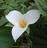
, and Western Hemlock. The forest understory in the Tryon Creek State Natural Area includes many trillium
s; they are celebrated each spring during the park's Trillium Festival. More than 90 species of wildflower such as Fringecup
are found in the park as well as plants such as Sword Fern
. Invasive species found in many parts of the watershed include English Ivy
, Himalayan Blackberry
, English Holly, Garlic Mustard, and Western Clematis
.
Riparian zone
s and floodplain
s are relatively intact along the lower reaches of the main stem in the state natural area, fairly intact in Marshall Park, and marginal in the upper reaches surrounded by homes. Arnold Creek has riparian corridors wider than 100 feet (30.5 m) in good condition, while Falling Creek's riparian zones, surrounded by homes, are in poor condition. Damaged zones from which native vegetation has been removed lead to erosion, stream bank failure, sedimentation, lack of shading, and higher stream temperatures.
Tryon Creek is among the few streams in the Portland metropolitan area with a run of Steelhead
Trout, and Coho Salmon
have been recorded spawning
in the creek. Surveys by the Oregon Department of Fish and Wildlife
in 2002 found Coho, Chinook Salmon
, Steelhead, and Cutthroat Trout
in different parts of the creek at different times of the year. None was present in large number. Cutthroat Trout had the biggest population, estimated at 53 individual fish during the spring of 2002. Water striders, invertebrate
s that can walk on water, are common in the pools of Tryon Creek. More than 60 species of birds, including Cooper's Hawk
s, Great Blue Heron
s, kingfisher
s, towhee
s, waxwing
s, and wren
s frequent the area. Some of the resident mammal
s are bats, coyote
s, moles, rabbits, skunks, and squirrels, while frogs, salamander
s, snakes, and turtles also do well in the watershed.
 Parks in the Tryon Creek watershed include Tryon Creek State Natural Area, Oregon's only metropolitan state park. At about 630 acres (255 ha), the natural area is much larger than the watershed's other parks.
The state park includes a 3 miles (5 km) bicycle path that runs along Terwilliger Boulevard on the east edge of the park as part of the Portland metropolitan area's system of greenway
trails known as the 40 Mile Loop
. Equestrians can ride through the woods on horse trails totaling about 5 miles (8 km). Hikers can use the bike path, horse trails, and about 8 miles (13 km) of hiking trails. A paved loop trail of about 0.35 mile (0.563269 km), furnished with drinking fountains and interpretive signs, can accommodate wheelchair
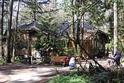
s. A park building called the Nature Center houses a gift shop, a large classroom, space for educational exhibits, and a play area for small children.
Tryon Creek, which flows through the middle of the state park, also runs through Marshall Park, a modified natural area of about 26 acres (10.5 ha) in a canyon in the hills northwest of Mt. Sylvania. It features hiking trails, a playground, picnic tables, a waterfall, and a stone bridge over the creek. Other parks in the watershed include West Portland Park, a natural area of about 15 acres (6.1 ha), and Maricara Park, a natural area of about 17 acres (6.9 ha). Metro plans to acquire additional land along the creek to add to the parks.
Willamette River
The Willamette River is a major tributary of the Columbia River, accounting for 12 to 15 percent of the Columbia's flow. The Willamette's main stem is long, lying entirely in northwestern Oregon in the United States...
in the U.S. state of Oregon
Oregon
Oregon is a state in the Pacific Northwest region of the United States. It is located on the Pacific coast, with Washington to the north, California to the south, Nevada on the southeast and Idaho to the east. The Columbia and Snake rivers delineate much of Oregon's northern and eastern...
. Part of the drainage basin of the Columbia River
Columbia River
The Columbia River is the largest river in the Pacific Northwest region of North America. The river rises in the Rocky Mountains of British Columbia, Canada, flows northwest and then south into the U.S. state of Washington, then turns west to form most of the border between Washington and the state...
, its watershed covers about 6.5 square miles (16.8 km²) in Multnomah
Multnomah County, Oregon
Multnomah County is one of 36 counties in the U.S. state of Oregon. Though smallest in area, it is the most populous as its county seat, Portland, is the state's largest city...
and Clackamas
Clackamas County, Oregon
Clackamas County is a county located in the U.S. state of Oregon. The county was named after the Native Americans living in the area, the Clackamas Indians, who were part of the Chinookan people. As of 2010, the population was 375,992...
counties. The stream flows southeast from the Tualatin Mountains
Tualatin Mountains
The Tualatin Mountains are a range of hills on the western border of Multnomah County, Oregon, United States...
(West Hills) through the Multnomah Village neighborhood of Portland
Portland, Oregon
Portland is a city located in the Pacific Northwest, near the confluence of the Willamette and Columbia rivers in the U.S. state of Oregon. As of the 2010 Census, it had a population of 583,776, making it the 29th most populous city in the United States...
and the Tryon Creek State Natural Area
Tryon Creek State Natural Area
The Tryon Creek State Natural Area is a state park located primarily in Portland, in the U.S. state of Oregon. It is the only Oregon state park within a major metropolitan area...
to the Willamette in the city of Lake Oswego
Lake Oswego, Oregon
Lake Oswego is a city located primarily in Clackamas County in the U.S. state of Oregon. Small portions of the city are also located in neighboring Multnomah and Washington counties. Located south of Portland surrounding the Oswego Lake, the town was founded in 1847 and incorporated as Oswego in...
. Parks and open spaces cover about 21 percent of the watershed, while single-family homes dominate most of the remainder. The largest of the parks is the state natural area, which straddles the border between the two cities and counties.
The bedrock under the watershed includes part of the last exotic terrane
Terrane
A terrane in geology is short-hand term for a tectonostratigraphic terrane, which is a fragment of crustal material formed on, or broken off from, one tectonic plate and accreted or "sutured" to crust lying on another plate...
, a chain of seamount
Seamount
A seamount is a mountain rising from the ocean seafloor that does not reach to the water's surface , and thus is not an island. These are typically formed from extinct volcanoes, that rise abruptly and are usually found rising from a seafloor of depth. They are defined by oceanographers as...
s, acquired by the North American Plate
North American Plate
The North American Plate is a tectonic plate covering most of North America, Greenland, Cuba, Bahamas, and parts of Siberia, Japan and Iceland. It extends eastward to the Mid-Atlantic Ridge and westward to the Chersky Range in eastern Siberia. The plate includes both continental and oceanic crust...
as it moved west during the Eocene
Eocene
The Eocene Epoch, lasting from about 56 to 34 million years ago , is a major division of the geologic timescale and the second epoch of the Paleogene Period in the Cenozoic Era. The Eocene spans the time from the end of the Palaeocene Epoch to the beginning of the Oligocene Epoch. The start of the...
. Known as the Waverly Hills Formation, it lies buried under ash and lava from later volcanic
Volcano
2. Bedrock3. Conduit 4. Base5. Sill6. Dike7. Layers of ash emitted by the volcano8. Flank| 9. Layers of lava emitted by the volcano10. Throat11. Parasitic cone12. Lava flow13. Vent14. Crater15...
eruptions, sediment
Sediment
Sediment is naturally occurring material that is broken down by processes of weathering and erosion, and is subsequently transported by the action of fluids such as wind, water, or ice, and/or by the force of gravity acting on the particle itself....
s from flooding and erosion, and layers of wind-blown silt. Two dormant volcanoes from the Boring Lava Field
Boring Lava Field
The Boring Lava Field is an extinct Plio-Pleistocene volcanic field zone with at least 32 cinder cones and small shield volcanoes lying within a radius of 13 miles of Kelly Butte, which is approximately 4 miles east of downtown Portland, Oregon, in the United States...
are in the Tryon Creek watershed.
Named for mid-19th century settler, Socrates Hotchkiss Tryon, Sr.
Socrates Hotchkiss Tryon, Sr.
Socrates Hotchkiss Tryon, Sr. was a pioneer physician in what became the U.S. state of Oregon. A native of Vermont, he later lived in Iowa and California before moving to the Oregon Territory where he settled the land that now comprises part of the Tryon Creek State Natural Area in Portland and...
, the creek ran through forests of cedar
Thuja plicata
Thuja plicata, commonly called Western or pacific red cedar, giant or western arborvitae, giant cedar, or shinglewood, is a species of Thuja, an evergreen coniferous tree in the cypress family Cupressaceae native to western North America...
and fir
Douglas-fir
Douglas-fir is one of the English common names for evergreen coniferous trees of the genus Pseudotsuga in the family Pinaceae. Other common names include Douglas tree, and Oregon pine. There are five species, two in western North America, one in Mexico, and two in eastern Asia...
that were later logged by the Oregon Iron Company
Oregon Iron Company
The Oregon Iron Company was an iron smelting company located in what is now Lake Oswego, Oregon. The company was established in 1865, and in 1867, became the first company in the United States to smelt iron west of the Rocky Mountains...
and others through the mid-20th century. Efforts to establish a large park in the watershed began in the 1950s and succeeded in 1975 when the state park was formally established. As of 2005, about 37 percent of the watershed was wooded and supported more than 60 species of birds as well as small mammals, amphibian
Amphibian
Amphibians , are a class of vertebrate animals including animals such as toads, frogs, caecilians, and salamanders. They are characterized as non-amniote ectothermic tetrapods...
s, and fish. At the same time, the human population was about 18,000.
Course
Tryon Creek begins slightly north of Interstate 5Interstate 5
Interstate 5 is the main Interstate Highway on the West Coast of the United States, running largely parallel to the Pacific Ocean coastline from Canada to Mexico . It serves some of the largest cities on the U.S...
(I-5) and Oregon Route 99W near Multnomah Village
Multnomah Village
Multnomah is a neighborhood in the Southwest section of Portland, Oregon, centered around the Multnomah Village business district. The community developed in the 1910s around a depot of the Oregon Electric Railway of the same name. It was annexed by the city of Portland on November 7,...
and flows southeast for 4.85 miles (7.8 km) through Portland residential neighborhoods as well as Marshall Park and the Tryon Creek State Natural Area to its confluence with the Willamette River in the city of Lake Oswego. Not far from its source, the main stem runs through three closely spaced culvert
Culvert
A culvert is a device used to channel water. It may be used to allow water to pass underneath a road, railway, or embankment. Culverts can be made of many different materials; steel, polyvinyl chloride and concrete are the most common...
s with a combined length of 260 feet (79.2 m) then flows on the surface before entering another culvert, 160 feet (48.8 m) long under Southwest 30th Avenue at river mile (RM) 4.56 or river kilometer (RK) 7.34. Shortly thereafter, the stream passes under Route 99W (Barbur Boulevard) and I-5 through another culvert, 560 feet (170.7 m) long.
Tryon Creek receives Falling Creek from the right at 4.16 miles (6.7 km) from the mouth. Quail and Burlingame creeks enter from the right shortly thereafter. At Marshall Park, the stream passes through a series of rock pools and steps known as the Marshall Cascade from RM 3.48 (RK 5.60) to RM 3.28 (RK 5.28). Arnold Creek, which is Tryon Creek's largest tributary, enters from the right 2.68 miles (4.3 km) from the mouth. Almost immediately, the creek enters a culvert, about 150 feet (45.7 m) long, that passes under Southwest Boones Ferry Road.
Shortly thereafter, Tryon Creek enters the Tryon Creek State Natural Area. To the stream's right is the North Creek Trail. Soon the creek receives Fourth Avenue Creek from the left. At this point, the Fourth Avenue Trail runs parallel to the creek along the left bank. This trail
Trail
A trail is a path with a rough beaten or dirt/stone surface used for travel. Trails may be for use only by walkers and in some places are the main access route to remote settlements...
soon merges with the Lewis and Clark Trail, which also runs parallel to the creek along the left bank. Then Tryon Creek passes under the High Bridge, the uppermost of five footbridge
Footbridge
A footbridge or pedestrian bridge is a bridge designed for pedestrians and in some cases cyclists, animal traffic and horse riders, rather than vehicular traffic. Footbridges complement the landscape and can be used decoratively to visually link two distinct areas or to signal a transaction...
s that span the main stem
Main Stem
"Main Stem" is 1942 instrumental by Duke Ellington and His Famous Orchestra. Although recorded in 1942, the single would not be released until 1944 where it was Duke Ellington's last of four number one's on the Harlem Hit Parade. "Main Stem" would also peak at number twenty on the pop chart"Main...
within the park. High Bridge carries the Middle Creek Trail as well as a linear horse trail connecting the park's North and South horse loops. Below this bridge, the creek flows for about 0.2 mile (0.321868 km) before passing under the Beaver Bridge. In this stretch, the Middle Creek Trail parallels the stream along the right bank but crosses to the left bank at the bridge. Shortly thereafter, the creek passes under Obie's Bridge, which carries the Old Man Trail.
United States Geological Survey
The United States Geological Survey is a scientific agency of the United States government. The scientists of the USGS study the landscape of the United States, its natural resources, and the natural hazards that threaten it. The organization has four major science disciplines, concerning biology,...
(USGS) stream gauge
Stream gauge
A stream gauge, stream gage or gauging station is a location used by hydrologists or environmental scientists to monitor and test terrestrial bodies of water. Hydrometric measurements of water surface elevation and/or volumetric discharge are generally taken and observations of biota may also be...
, which is on the right. The creek leaves the Tryon Creek State Natural Area just before entering a 200 feet (61 m) culvert under Oregon Route 43 at RM 0.24 (RK 0.39) and soon thereafter a set of Union Pacific Railroad
Union Pacific Railroad
The Union Pacific Railroad , headquartered in Omaha, Nebraska, is the largest railroad network in the United States. James R. Young is president, CEO and Chairman....
tracks. Below this, Tryon Creek forms the boundary between the city of Lake Oswego and Briarwood, an unincorporated
Unincorporated area
In law, an unincorporated area is a region of land that is not a part of any municipality.To "incorporate" in this context means to form a municipal corporation, a city, town, or village with its own government. An unincorporated community is usually not subject to or taxed by a municipal government...
Clackamas County community, which is to the left. The Tryon Creek Wastewater Treatment Plant is on the right during this last stretch before the creek enters the Willamette River about 20 miles (32.2 km) upstream from its confluence with the Columbia River.
Discharge
Since 2002, the USGS has monitored the flow of Tryon Creek at a station 1 miles (1.6 km) from the mouth. The average flow between then and 2007 was 8.47 cuft/s. This is from a drainage area of 6.28 square miles (16.27 km²), about 97 percent of the total Tryon Creek watershed. The maximum flow recorded during this period was 520 cuft/s on December 13, 2003. The minimum was 0.09 cuft/s on September 4, 5, and 12, 2002.Geology
Plate tectonics
Plate tectonics is a scientific theory that describes the large scale motions of Earth's lithosphere...
separated North America from Europe and North Africa and pushed it westward did the continent acquire, bit by bit, what became the Pacific Northwest
Pacific Northwest
The Pacific Northwest is a region in northwestern North America, bounded by the Pacific Ocean to the west and, loosely, by the Rocky Mountains on the east. Definitions of the region vary and there is no commonly agreed upon boundary, even among Pacific Northwesterners. A common concept of the...
. Over many millions of years, the continent collided with and incorporated islands, reefs, and other exotic terrane
Terrane
A terrane in geology is short-hand term for a tectonostratigraphic terrane, which is a fragment of crustal material formed on, or broken off from, one tectonic plate and accreted or "sutured" to crust lying on another plate...
s. Part of the last major exotic terrane acquired by the North American Plate
North American Plate
The North American Plate is a tectonic plate covering most of North America, Greenland, Cuba, Bahamas, and parts of Siberia, Japan and Iceland. It extends eastward to the Mid-Atlantic Ridge and westward to the Chersky Range in eastern Siberia. The plate includes both continental and oceanic crust...
during the Eocene
Eocene
The Eocene Epoch, lasting from about 56 to 34 million years ago , is a major division of the geologic timescale and the second epoch of the Paleogene Period in the Cenozoic Era. The Eocene spans the time from the end of the Palaeocene Epoch to the beginning of the Oligocene Epoch. The start of the...
lies under the Tryon Creek watershed. The terrane consisted of a chain of seamount
Seamount
A seamount is a mountain rising from the ocean seafloor that does not reach to the water's surface , and thus is not an island. These are typically formed from extinct volcanoes, that rise abruptly and are usually found rising from a seafloor of depth. They are defined by oceanographers as...
s that by 34 million years ago was being uplifted to become the Oregon Coast Range
Oregon Coast Range
The Oregon Coast Range, often called simply the Coast Range and sometimes the Pacific Coast Range, is a mountain range, in the Pacific Coast Ranges physiographic region, in the U.S. state of Oregon along the Pacific Ocean...
and the Tualatin Mountains
Tualatin Mountains
The Tualatin Mountains are a range of hills on the western border of Multnomah County, Oregon, United States...
(West Hills). The easternmost exposure of the basalt
Basalt
Basalt is a common extrusive volcanic rock. It is usually grey to black and fine-grained due to rapid cooling of lava at the surface of a planet. It may be porphyritic containing larger crystals in a fine matrix, or vesicular, or frothy scoria. Unweathered basalt is black or grey...
s of this terrane is in Waverly Heights, near Milwaukie
Milwaukie, Oregon
Milwaukie is a city in Clackamas County, Oregon, United States. A very small portion of the city extends into Multnomah County. The population was 20,291 at the 2010 census. Founded in 1848 on the banks of the Willamette River, the city, known as the Dogwood City of the West, was incorporated in...
, across the Willamette River from Tryon Creek, and this formation underlies most of Tryon Creek State Park.
Between 15 and 16 million years ago, in the Middle Miocene
Middle Miocene
The Middle Miocene is a sub-epoch of the Miocene Epoch made up of two stages: the Langhian and Serravallian stages. The Middle Miocene is preceded by the Early Miocene....
, eruptions of Columbia River basalts
Columbia River Basalt Group
The Columbia River Basalt Group is a large igneous province that lies across parts of the Western United States. It is found in the U.S. states of Washington, Oregon, Idaho, Nevada, and California...
from volcanic
Volcano
2. Bedrock3. Conduit 4. Base5. Sill6. Dike7. Layers of ash emitted by the volcano8. Flank| 9. Layers of lava emitted by the volcano10. Throat11. Parasitic cone12. Lava flow13. Vent14. Crater15...
vents in eastern Oregon and Washington flowed across much of northern Oregon, sometimes reaching the Pacific Ocean. Although these basalts have been mapped in the West Hills under Marquam Hill, Hoyt Arboretum
Hoyt Arboretum
The Hoyt Arboretum is located atop a ridge in the west hills of Portland, Oregon, United States. It was founded in 1922 by a collection of timber industry representatives, the U.S...
, and the steepest slopes of Forest Park
Forest Park (Portland)
Forest Park is a public municipal park in the Tualatin Mountains west of downtown Portland, Oregon, United States. Stretching for more than on hillsides overlooking the Willamette River, it is one of the country's largest urban forest reserves...
, they flowed around but did not completely cover the Waverly Hills Formation in the Tryon Creek watershed.
Starting about 3 million years ago and continuing at least through the late Pleistocene
Pleistocene
The Pleistocene is the epoch from 2,588,000 to 11,700 years BP that spans the world's recent period of repeated glaciations. The name pleistocene is derived from the Greek and ....
, extensional fault
Extensional fault
An extensional fault is a fault that vertically thins and horizontally extends portions of the Earth's crust and/or lithosphere. In most cases such a fault is also a normal fault, but may be rotated to have a shallower geometry normally associated with a thrust fault...
ing of the Earth's crust
Crust (geology)
In geology, the crust is the outermost solid shell of a rocky planet or natural satellite, which is chemically distinct from the underlying mantle...
led to eruption of small volcanoes in the Boring volcanic field
Boring Lava Field
The Boring Lava Field is an extinct Plio-Pleistocene volcanic field zone with at least 32 cinder cones and small shield volcanoes lying within a radius of 13 miles of Kelly Butte, which is approximately 4 miles east of downtown Portland, Oregon, in the United States...
. This field extended roughly from Portland and Tualatin
Tualatin, Oregon
Tualatin is a city located primarily in Washington County in the U.S. state of Oregon. A small portion of the city is also located in neighboring Clackamas County. It is a southwestern suburb in the Portland Metropolitan Area that is located south of Tigard...
on the west to Battle Ground, Washington
Battle Ground, Washington
Battle Ground is a city in Clark County, Washington, United States. The population was 17,571 at the 2010 census. According to the Washington State Office of Financial Management, Battle Ground ranked 4th of 279 eligible incorporated communities in population growth between 2000 and 2005.-Origin of...
, on the north to Sandy
Sandy, Oregon
Sandy is a city located in Clackamas County, Oregon, United States, and named after the nearby Sandy River. As of the 2000 census, the city had a total population of 5,385, however the 2006 estimate shows 7,070 people....
and Boring
Boring, Oregon
Boring is an unincorporated community located in Clackamas County, Oregon, United States, on Oregon Route 212. It is approximately eight miles south of Gresham and about the same distance from Clackamas, both suburbs of Portland. The town is roughly twenty-two miles southeast from downtown...
on the east. Two of these volcanoes, Mount Sylvania
Mount Sylvania
Mount Sylvania is an extinct volcano, part of the Boring Lava Field, on the outskirts of Portland, Oregon. The parts of the mountain are within the cities of Portland, Lake Oswego, and Tigard...
and Cook's Butte, are in the Tryon Creek watershed. The Mount Sylvania eruptions included ash plumes and lava flows that covered some of the Waverly Heights Formation and Columbia River basalts.
About 15,000 years ago, cataclysmic ice age
Ice age
An ice age or, more precisely, glacial age, is a generic geological period of long-term reduction in the temperature of the Earth's surface and atmosphere, resulting in the presence or expansion of continental ice sheets, polar ice sheets and alpine glaciers...
events known as the Missoula Floods
Missoula Floods
The Missoula Floods refer to the cataclysmic floods that swept periodically across eastern Washington and down the Columbia River Gorge at the end of the last ice age. The glacial flood events have been researched since the 1920s...
or Bretz Floods originating in the Clark Fork
Clark Fork (river)
The Clark Fork is a river in the U.S. states of Montana and Idaho, approximately long. The largest river by volume in Montana, it drains an extensive region of the Rocky Mountains in western Montana and northern Idaho in the watershed of the Columbia River, flowing northwest through a long...
region of northern Idaho
Idaho
Idaho is a state in the Rocky Mountain area of the United States. The state's largest city and capital is Boise. Residents are called "Idahoans". Idaho was admitted to the Union on July 3, 1890, as the 43rd state....
inundated the Columbia River basin many times. These floods deposited huge amounts of debris and sediment and created new floodplain
Floodplain
A floodplain, or flood plain, is a flat or nearly flat land adjacent a stream or river that stretches from the banks of its channel to the base of the enclosing valley walls and experiences flooding during periods of high discharge...
s in the Willamette Valley
Willamette Valley
The Willamette Valley is the most populated region in the state of Oregon of the United States. Located in the state's northwest, the region is surrounded by tall mountain ranges to the east, west and south and the valley's floor is broad, flat and fertile because of Ice Age conditions...
. Over long stretches of time between the great floods, dry winds deposited silt. At elevations above 300 feet (91.4 m) in the Tryon Creek watershed, wind-blown silt covers the lava, while at lower elevations sand and gravel cover the bedrock.
Watershed
Drainage basin
A drainage basin is an extent or an area of land where surface water from rain and melting snow or ice converges to a single point, usually the exit of the basin, where the waters join another waterbody, such as a river, lake, reservoir, estuary, wetland, sea, or ocean...
covers about 4100 acres (1,659.2 ha) or 6.5 square miles (17 km²). Of this, about 80 percent is within the Portland city limits, and the remaining 20 percent is split among the jurisdictions of the city of Lake Oswego, and the counties of Multnomah and Clackamas. These four overlap with the jurisdiction of the State of Oregon, which owns the natural area. Watersheds that border the Tryon Creek watershed are Fanno Creek
Fanno Creek
Fanno Creek is a tributary of the Tualatin River in the U.S. state of Oregon. Part of the drainage basin of the Columbia River, its watershed covers about in Multnomah, Washington, and Clackamas counties, including about within the Portland city limits....
to the west and northwest, Stephens Creek to the north, the Willamette River to the east and Oswego Lake
Oswego Lake
Oswego Lake is a privately owned lake in Clackamas County, Oregon that is completely surrounded by the city of Lake Oswego. Though the lake is naturally occurring , it is considered a reservoir because of the concrete dam that has increased its size to .-Geologic history:The lake is a former...
to the south. More than 70 miles (112.7 km) of surface streets, including parts of Interstate 5, Oregon Route 99W, Oregon Route 43, Boones Ferry Road, Taylors Ferry Road, and Terwilliger Boulevard, run through the watershed.
About 35 inches (889 mm) of precipitation, almost entirely rain, fall on the watershed each year. Summers are dry, and most of the precipitation occurs between October and May. Elevations within the drainage basin vary from Mount Sylvania
Mount Sylvania
Mount Sylvania is an extinct volcano, part of the Boring Lava Field, on the outskirts of Portland, Oregon. The parts of the mountain are within the cities of Portland, Lake Oswego, and Tigard...
, which rises to 970 feet (295.7 m) above sea level
Sea level
Mean sea level is a measure of the average height of the ocean's surface ; used as a standard in reckoning land elevation...
in the West Hills, to 10 feet (3 m) where the creek enters the Willamette River. Between 60 and 75 percent of the slopes in the watershed exceed a 30-percent grade and are especially steep near the headwaters. Impervious surface
Impervious surface
Impervious surfaces are mainly artificial structures--such as pavements that are covered by impenetrable materials such as asphalt, concrete, brick, and stone--and rooftops...
s cover about 24 percent of the basin. These surfaces and the relatively impermeable silt and clay soils that underlie the area contribute to rapid runoff and low baseflow
Baseflow
Baseflow is the portion of streamflow that comes from "the sum of deep subsurface flow and delayed shallow subsurface flow"...
s in the creek and its tributaries. The total length of surface streams in the drainage basin is about 27 miles (43.5 km), while another 3 miles (5 km) run through culvert
Culvert
A culvert is a device used to channel water. It may be used to allow water to pass underneath a road, railway, or embankment. Culverts can be made of many different materials; steel, polyvinyl chloride and concrete are the most common...
s or pipes. Although major flooding in 1996 caused landslides and severe damage to stream beds and banks along Tryon Creek and its tributaries, it caused no significant property damage in the watershed.
In 2000, the population of the Tryon Creek watershed within Portland was about 18,000. In 2005, Portland's Bureau of Environmental Services (BES) described land-use zoning
Zoning
Zoning is a device of land use planning used by local governments in most developed countries. The word is derived from the practice of designating permitted uses of land based on mapped zones which separate one set of land uses from another...
in the watershed as follows: single-family residential, 55 percent; parks and open space, 14 percent; multi-family residential
Multi-family residential
Multi-family residential is a classification of housing where multiple separate housing units for residential inhabitants are contained within one building or several buildings within one complex. A common form is an apartment building...
, 5 percent; commercial, 3 percent, and insufficient data, 2 percent. To reach 100 percent, BES listed but did not differentiate by zoning type the roughly 20 percent of the watershed that lies beyond the Portland city limits. Metro
Metro (Oregon regional government)
Metro, formerly known as Metropolitan Service District, is the regional governmental agency for the Oregon portion of the Portland metropolitan area...
, the regional government for the Portland metropolitan area, says that parks and natural areas cover about 21 percent of the total watershed, while single-family housing dominates most of the rest.
Tributaries
The major smaller streams in the Tryon Creek watershed are Arnold Creek and Falling Creek. The larger of the two, Arnold Creek, has a watershed of roughly 1.2 square miles (3.1 km²) or 18 percent of the 6.5 square miles (16.8 km²) total, while Falling Creek's watershed covers 0.4 square miles (1 km²) or 6 percent of the total. The seven named tributaries from mouth to source are Nettle, Palatine Hill, Red Fox, Park, Fourth Avenue, Arnold, and Falling creeks.Water quality
Oregon Department of Environmental QualityOregon Department of Environmental Quality
The Oregon Department of Environmental Quality is the chief regulatory agency of the government of the U.S. state of Oregon responsible for protecting and enhancing the state's natural resources and managing sanitary and toxic waste disposal. The agency employs approximately 700 scientists,...
(DEQ) developed the Oregon Water Quality Index (OWQI) in the 1970s to rate general water quality at different locations. Scores can vary from 10 (worst) to 100 (ideal). Portland's Bureau of Environmental Services (BES) incorporated the OWQI into its monitoring of Tryon Creek in 1997. As of 2004, the overall OWQI score for Tryon Creek was 74 or "poor"; this was slightly better than nearby Fanno Creek
Fanno Creek
Fanno Creek is a tributary of the Tualatin River in the U.S. state of Oregon. Part of the drainage basin of the Columbia River, its watershed covers about in Multnomah, Washington, and Clackamas counties, including about within the Portland city limits....
at 67. The State of Oregon listed Tryon Creek as "water-quality limited" in 1998 because water temperatures on the lower 5 miles (8 km) of the main stem as well as on Nettle, Arnold, and Falling creeks exceeded the upper limit for protecting salmonid
Salmonidae
Salmonidae is a family of ray-finned fish, the only living family currently placed in the order Salmoniformes. It includes salmon, trout, chars, freshwater whitefishes and graylings...
fish rearing and migratory fish passage during the summer.
BES monitors water quality at three Tryon Creek sites. Two are near I-5 and Barbur Boulevard in the upper watershed, and the third is at Southwest Boones Ferry Road, about 2.7 miles (4.3 km) from the mouth. BES looks at several indicators such as dissolved oxygen, nutrients, and total suspended solids
Total suspended solids
Total suspended solids is a water quality measurement usually abbreviated TSS. It is listed as a conventional pollutant in the U.S. Clean Water Act. This parameter was at one time called non-filterable residue , a term that refers to the identical measurement: the dry-weight of particles trapped...
. Diffuse pollution from nonpoint sources
Nonpoint source pollution
Nonpoint source pollution refers to both water and air pollution from diffuse sources. Nonpoint source water pollution affects a water body from sources such as polluted runoff from agricultural areas draining into a river, or wind-borne debris blowing out to sea. Nonpoint source air pollution...
enters the creek from its urban surroundings. Point sources of pollution in the creek include two major upper-watershed stormwater
Stormwater
Stormwater is water that originates during precipitation events. It may also be used to apply to water that originates with snowmelt that enters the stormwater system...
outfalls draining 368 acres (148.9 ha) of the upper watershed and contributing about half of the creek's total suspended solids. As of 2004, the only water-quality indicator in the watershed that failed to meet minimal standards was the water temperature.
History
Native Americans in the United States
Native Americans in the United States are the indigenous peoples in North America within the boundaries of the present-day continental United States, parts of Alaska, and the island state of Hawaii. They are composed of numerous, distinct tribes, states, and ethnic groups, many of which survive as...
who lived in the area before settlement by European American
European American
A European American is a citizen or resident of the United States who has origins in any of the original peoples of Europe...
s in the 19th century. Evidence suggests that people lived in the northern Oregon Cascades
Cascade Range
The Cascade Range is a major mountain range of western North America, extending from southern British Columbia through Washington and Oregon to Northern California. It includes both non-volcanic mountains, such as the North Cascades, and the notable volcanoes known as the High Cascades...
as early as 10,000 years ago. By 2,000 to 3,000 years ago, the Clackamas River
Clackamas River
The Clackamas River is an approximately tributary of the Willamette River in northwestern Oregon, in the United States. As it drains an area of about , the Clackamas passes through mostly forested and rugged mountainous terrain in its upper reaches, and passes through agricultural and urban areas...
basin, about 5 miles (8 km) upriver from the mouth of Tryon Creek and on the east side of the Willamette, was home to the Clackamas tribe. They were a subgroup of the Chinookan
Chinookan languages
Chinookan is a small family of languages spoken in Oregon and Washington along the Columbia River by Chinook peoples.-Family division:Chinookan languages consists of three languages with multiple varieties. There is some dispute over classification, and there are two ISO 639-3 codes assigned: and...
speakers who lived near the Columbia River
Columbia River
The Columbia River is the largest river in the Pacific Northwest region of North America. The river rises in the Rocky Mountains of British Columbia, Canada, flows northwest and then south into the U.S. state of Washington, then turns west to form most of the border between Washington and the state...
from Celilo Falls
Celilo Falls
Celilo Falls was a tribal fishing area on the Columbia River, just east of the Cascade Mountains, on what is today the border between the U.S. states of Oregon and Washington...
to the Pacific Ocean. The Clackamas lands included the lower Willamette River from Willamette Falls
Willamette Falls
The Willamette Falls is a natural waterfall on the Willamette River between Oregon City and West Linn, Oregon, in the United States. It is the largest waterfall in the Pacific Northwest and the eighteenth largest in the world by water volume. Horseshoe in shape, it is wide and high with a flow...
at what became Oregon City
Oregon City, Oregon
Oregon City was the first city in the United States west of the Rocky Mountains to be incorporated. It is the county seat of Clackamas County, Oregon...
to its confluence with the Columbia River. When Lewis and Clark
Lewis and Clark Expedition
The Lewis and Clark Expedition, or ″Corps of Discovery Expedition" was the first transcontinental expedition to the Pacific Coast by the United States. Commissioned by President Thomas Jefferson and led by two Virginia-born veterans of Indian wars in the Ohio Valley, Meriwether Lewis and William...
visited the area in 1806, the Clackamas tribe consisted of about 1,800 people living in 11 villages. Epidemics of smallpox
Smallpox
Smallpox was an infectious disease unique to humans, caused by either of two virus variants, Variola major and Variola minor. The disease is also known by the Latin names Variola or Variola vera, which is a derivative of the Latin varius, meaning "spotted", or varus, meaning "pimple"...
, malaria
Malaria
Malaria is a mosquito-borne infectious disease of humans and other animals caused by eukaryotic protists of the genus Plasmodium. The disease results from the multiplication of Plasmodium parasites within red blood cells, causing symptoms that typically include fever and headache, in severe cases...
, and measles
Measles
Measles, also known as rubeola or morbilli, is an infection of the respiratory system caused by a virus, specifically a paramyxovirus of the genus Morbillivirus. Morbilliviruses, like other paramyxoviruses, are enveloped, single-stranded, negative-sense RNA viruses...
reduced this population to 88 by 1851, and in 1855 the tribe signed a treaty surrendering its lands. Another group of Chinookans, the Multnomahs
Multnomah (tribe)
The Multnomah were a tribe of Chinookan people who lived in the area of Portland, Oregon, more specifically Sauvie Island, in the United States through the early 19th century. Multnomah villages were located throughout the Portland basin and on both sides of the Columbia River...
, lived on Sauvie Island
Sauvie Island
Sauvie Island, in the U.S. state of Oregon, originally Wapato Island or Wappatoo Island, is the largest island along the Columbia River, at 26,000 acres , and the largest river island in the United States...
, about 17 miles (27.4 km) downriver from the mouth of Tryon Creek. Lewis and Clark estimated that 800 Multnomahs inhabited 5 villages on the island in 1806, but disease reduced them later in the century to near extinction.
In 1850, Socrates Hotchkiss Tryon, Sr.
Socrates Hotchkiss Tryon, Sr.
Socrates Hotchkiss Tryon, Sr. was a pioneer physician in what became the U.S. state of Oregon. A native of Vermont, he later lived in Iowa and California before moving to the Oregon Territory where he settled the land that now comprises part of the Tryon Creek State Natural Area in Portland and...
, a pioneer settler of European descent, established a donation land claim
Donation Land Claim Act
The Donation Land Claim Act of 1850 was a statute enacted by the United States Congress intended to promote homestead settlement in the Oregon Territory in the Pacific Northwest...
at the south end of Tryon Creek canyon. Five years later, he died, leaving the land to his wife, Frances. The land then passed to other relatives, including Socrates Tryon, Jr., who sold the 645 acres (261 ha) in 1874 to the Oregon Iron Company
Oregon Iron Company
The Oregon Iron Company was an iron smelting company located in what is now Lake Oswego, Oregon. The company was established in 1865, and in 1867, became the first company in the United States to smelt iron west of the Rocky Mountains...
. For nearly 25 years, the company cut virgin cedar
Thuja plicata
Thuja plicata, commonly called Western or pacific red cedar, giant or western arborvitae, giant cedar, or shinglewood, is a species of Thuja, an evergreen coniferous tree in the cypress family Cupressaceae native to western North America...
and fir to use in its foundry
Foundry
A foundry is a factory that produces metal castings. Metals are cast into shapes by melting them into a liquid, pouring the metal in a mold, and removing the mold material or casting after the metal has solidified as it cools. The most common metals processed are aluminum and cast iron...
in Lake Oswego. Its logging road later became Old Iron Mountain Trail in the Tryon Creek State Natural Area. In 1900, fire in the upper canyon left charred snag
Snag
In forest ecology, a snag refers to a standing, partly or completely dead tree, often missing a top or most of the smaller branches. In freshwater ecology it refers to trees, branches, and other pieces of naturally occurring wood found sunken in rivers and streams; it is also known as coarse woody...
s still visible along the natural area's Center and Big Fir trails.
Logging resumed in 1912 in the north part of the canyon, where The Boone's Ferry Wood and Tie Company had a site near what became Alfred Street. A sawmill and steam donkey
Steam donkey
Steam donkey, or donkey engine is the common nickname for a steam-powered winch, or logging engine widely used in past logging operations, though not limited to logging...
engine operated near the future sites of Beaver Bridge and Obie's Bridge. The lumber was used chiefly for railroad tie
Railroad tie
A railroad tie/railway tie , or railway sleeper is a rectangular item used to support the rails in railroad tracks...
s, cordwood and flagpoles, and left huge cedar stumps that remain in the park. Intermittent logging continued through 1961, and a 1962 windstorm known as the Columbus Day Storm
Columbus Day Storm of 1962
The Columbus Day Storm of 1962 was an extratropical cyclone that ranked among the most intense to strike the United States Pacific Northwest since at least 1948, likely since the January 9, 1880 "Great Gale" and snowstorm...
blew down many remaining trees.
Local efforts began in the 1950s to establish a park along the creek, In 1969, the government of Multnomah County bought 45 acres (18.2 ha) to start a large regional park and sought citizen assistance with the project. This led to formation of Friends of Tryon Creek Park, which raised funds, helped arrange land deals, worked on problems of jurisdiction in a two-county, two-city park, and sought help from the state. In 1970, Oregon Governor Tom McCall
Tom McCall
Thomas Lawson McCall was an American politician and journalist in the state of Oregon. A Republican, he was the 30th Governor of Oregon from 1967 to 1975. A native of Massachusetts, he grew up there and in Central Oregon before attending the University of Oregon...
announced the formation of Tryon Creek State Park.
Over the next few years, the state bought more than 600 acres (242.8 ha) of land for nearly $3 million, including federal matching funds. The Friends and the state collaborated in park planning and further fund-raising. In 1973, more than 300 volunteers built trails, and the nature center and shelter were finished by 1975. The park was officially dedicated on July 1, 1975 and later re-named Tryon Creek State Natural Area.
Vegetation and wildlife
Douglas-fir
Douglas-fir is one of the English common names for evergreen coniferous trees of the genus Pseudotsuga in the family Pinaceae. Other common names include Douglas tree, and Oregon pine. There are five species, two in western North America, one in Mexico, and two in eastern Asia...
, Western Redcedar
Thuja plicata
Thuja plicata, commonly called Western or pacific red cedar, giant or western arborvitae, giant cedar, or shinglewood, is a species of Thuja, an evergreen coniferous tree in the cypress family Cupressaceae native to western North America...
, and Western Hemlock. The forest understory in the Tryon Creek State Natural Area includes many trillium
Trillium
Trillium is a genus of about 40–50 species of spring ephemeral perennials, native to temperate regions of North America and Asia....
s; they are celebrated each spring during the park's Trillium Festival. More than 90 species of wildflower such as Fringecup
Tellima grandiflora
Tellima grandiflora is a herbaceous perennial plant of the family Saxifragaceae.A herbaceous plant, with rounded leaves, emerging from a rootstock, up to 30cm high. It is evergreen in mild winters. Flowers are borne in spring and early summer, on spikes up to 60cm high...
are found in the park as well as plants such as Sword Fern
Polystichum munitum
Polystichum munitum is an evergreen fern native to western North America, where it is one of the most abundant ferns occurring along the Pacific coast from southeast Alaska south to southern California, and also inland east to southeastern British Columbia, northern Idaho and western Montana, with...
. Invasive species found in many parts of the watershed include English Ivy
Hedera helix
Hedera helix is a species of ivy native to most of Europe and western Asia. It is labeled as an invasive species in a number of areas where it has been introduced.-Description:...
, Himalayan Blackberry
Rubus armeniacus
Rubus armeniacus, Armenian Blackberry or Himalayan Blackberry, is a species of Rubus in the blackberry group Rubus subgenus Rubus series Discolores Focke. It is native to Armenia in southwest Asia, and widely naturalised elsewhere...
, English Holly, Garlic Mustard, and Western Clematis
Clematis ligusticifolia
Clematis ligusticifolia is a climbing, spreading vine with showy flowers. It is also known as Old-man's Beard and Yerba de Chiva, and Virgin's bower,...
.
Riparian zone
Riparian zone
A riparian zone or riparian area is the interface between land and a river or stream. Riparian is also the proper nomenclature for one of the fifteen terrestrial biomes of the earth. Plant habitats and communities along the river margins and banks are called riparian vegetation, characterized by...
s and floodplain
Floodplain
A floodplain, or flood plain, is a flat or nearly flat land adjacent a stream or river that stretches from the banks of its channel to the base of the enclosing valley walls and experiences flooding during periods of high discharge...
s are relatively intact along the lower reaches of the main stem in the state natural area, fairly intact in Marshall Park, and marginal in the upper reaches surrounded by homes. Arnold Creek has riparian corridors wider than 100 feet (30.5 m) in good condition, while Falling Creek's riparian zones, surrounded by homes, are in poor condition. Damaged zones from which native vegetation has been removed lead to erosion, stream bank failure, sedimentation, lack of shading, and higher stream temperatures.
Tryon Creek is among the few streams in the Portland metropolitan area with a run of Steelhead
Rainbow trout
The rainbow trout is a species of salmonid native to tributaries of the Pacific Ocean in Asia and North America. The steelhead is a sea run rainbow trout usually returning to freshwater to spawn after 2 to 3 years at sea. In other words, rainbow trout and steelhead trout are the same species....
Trout, and Coho Salmon
Coho salmon
The Coho salmon, Oncorhynchus kisutch, is a species of anadromous fish in the salmon family. Coho salmon are also known as silver salmon or "silvers". It is the state animal of Chiba, Japan.-Description:...
have been recorded spawning
Spawn (biology)
Spawn refers to the eggs and sperm released or deposited, usually into water, by aquatic animals. As a verb, spawn refers to the process of releasing the eggs and sperm, also called spawning...
in the creek. Surveys by the Oregon Department of Fish and Wildlife
Oregon Department of Fish and Wildlife
The Oregon Department of Fish and Wildlife is an agency of the government of the U.S. state of Oregon responsible for programs protecting Oregon fish and wildlife resources and their habitats....
in 2002 found Coho, Chinook Salmon
Chinook salmon
The Chinook salmon, Oncorhynchus tshawytscha, is the largest species in the pacific salmon family. Other commonly used names for the species include King salmon, Quinnat salmon, Spring salmon and Tyee salmon...
, Steelhead, and Cutthroat Trout
Cutthroat trout
The cutthroat trout is a species of freshwater fish in the salmon family of order Salmoniformes. It is one of the many fish species colloquially known as trout...
in different parts of the creek at different times of the year. None was present in large number. Cutthroat Trout had the biggest population, estimated at 53 individual fish during the spring of 2002. Water striders, invertebrate
Invertebrate
An invertebrate is an animal without a backbone. The group includes 97% of all animal species – all animals except those in the chordate subphylum Vertebrata .Invertebrates form a paraphyletic group...
s that can walk on water, are common in the pools of Tryon Creek. More than 60 species of birds, including Cooper's Hawk
Cooper's Hawk
Cooper's Hawk is a medium-sized hawk native to the North American continent and found from Canada to Mexico. As in many birds of prey, the male is smaller than the female...
s, Great Blue Heron
Great Blue Heron
The Great Blue Heron is a large wading bird in the heron family Ardeidae, common near the shores of open water and in wetlands over most of North and Central America as well as the West Indies and the Galápagos Islands. It is a rare vagrant to Europe, with records from Spain, the Azores and England...
s, kingfisher
Kingfisher
Kingfishers are a group of small to medium sized brightly coloured birds in the order Coraciiformes. They have a cosmopolitan distribution, with most species being found in the Old World and Australia...
s, towhee
Towhee
A towhee is any one of a number of species of birds in the genus Pipilo or Melozone within the family Emberizidae ....
s, waxwing
Waxwing
The waxwings form the genus Bombycilla of passerine birds. According to most authorities, this is the only genus placed in the family Bombycillidae.-Description:Waxwings are characterised by soft silky plumage...
s, and wren
Wren
The wrens are passerine birds in the mainly New World family Troglodytidae. There are approximately 80 species of true wrens in approximately 20 genera....
s frequent the area. Some of the resident mammal
Mammal
Mammals are members of a class of air-breathing vertebrate animals characterised by the possession of endothermy, hair, three middle ear bones, and mammary glands functional in mothers with young...
s are bats, coyote
Coyote
The coyote , also known as the American jackal or the prairie wolf, is a species of canine found throughout North and Central America, ranging from Panama in the south, north through Mexico, the United States and Canada...
s, moles, rabbits, skunks, and squirrels, while frogs, salamander
Salamander
Salamander is a common name of approximately 500 species of amphibians. They are typically characterized by a superficially lizard-like appearance, with their slender bodies, short noses, and long tails. All known fossils and extinct species fall under the order Caudata, while sometimes the extant...
s, snakes, and turtles also do well in the watershed.
Parks
The state park includes a 3 miles (5 km) bicycle path that runs along Terwilliger Boulevard on the east edge of the park as part of the Portland metropolitan area's system of greenway
Greenway (landscape)
A greenway is a long, narrow piece of land, often used for recreation and pedestrian and bicycle user traffic, and sometimes for streetcar, light rail or retail uses.- Terminology :...
trails known as the 40 Mile Loop
40 Mile Loop
The 40-Mile Loop is a partially completed greenway trail around and through Portland in the U.S. State of Oregon. It was proposed in 1903 by the Olmsted Brothers architecture firm as part of the development of Forest Park....
. Equestrians can ride through the woods on horse trails totaling about 5 miles (8 km). Hikers can use the bike path, horse trails, and about 8 miles (13 km) of hiking trails. A paved loop trail of about 0.35 mile (0.563269 km), furnished with drinking fountains and interpretive signs, can accommodate wheelchair
Wheelchair
A wheelchair is a chair with wheels, designed to be a replacement for walking. The device comes in variations where it is propelled by motors or by the seated occupant turning the rear wheels by hand. Often there are handles behind the seat for someone else to do the pushing...
s. A park building called the Nature Center houses a gift shop, a large classroom, space for educational exhibits, and a play area for small children.
Tryon Creek, which flows through the middle of the state park, also runs through Marshall Park, a modified natural area of about 26 acres (10.5 ha) in a canyon in the hills northwest of Mt. Sylvania. It features hiking trails, a playground, picnic tables, a waterfall, and a stone bridge over the creek. Other parks in the watershed include West Portland Park, a natural area of about 15 acres (6.1 ha), and Maricara Park, a natural area of about 17 acres (6.9 ha). Metro plans to acquire additional land along the creek to add to the parks.
Works cited
- Bishop, Ellen Morris (2003). In Search of Ancient Oregon: A Geological and Natural History. Portland, Oregon: Timber Press. ISBN 978-0-88192-789-4
- Houck, Mike, and Cody, M.J., eds. (2000). Wild in the City. Portland, Oregon: Oregon Historical Society Press. ISBN 0-87595-273-9.
- McArthur, Lewis A., and McArthur, Lewis L. (2003) Oregon Geographic NamesOregon Geographic NamesOregon Geographic Names is an authoritative compilation of the origin and meaning of place names in the U.S. state of Oregon. , the book is in its seventh edition and is compiled and edited by Lewis L. McArthur, who took over from his father, Lewis A. McArthur, as of the fourth edition...
, seventh edition. Portland: Oregon Historical Society Press. ISBN 0-87595-277-1. - Portland Bureau of Environmental Services (2005). Fanno and Tryon Creeks Watershed Management Plan, "Chapter 2: Tryon Creek Watershed Overview" (PDF). Portland, Oregon: City of Portland. Retrieved on May 8, 2009.
- Portland Bureau of Environmental Services (2005). Fanno and Tryon Creeks Watershed Management Plan, "Chapter 6: Water Quality: Tryon Creek Watershed (PDF) Portland, Oregon: City of Portland. Retrieved on July 5, 2009.
- Portland Bureau of Environmental Services (2005). Fanno and Tryon Creeks Watershed Management Plan, "Chapter 10: Habitat: Tryon Creek Watershed" (PDF). Portland, Oregon: City of Portland. Retrieved on May 8, 2009.