
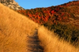
Trail
Encyclopedia
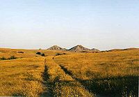
A trail is a path with a rough beaten or dirt/stone surface used for travel. Trails may be for use only by walkers and in some places are the main access route to remote settlements. Some trails can also be used for hiking
Hiking
Hiking is an outdoor activity which consists of walking in natural environments, often in mountainous or other scenic terrain. People often hike on hiking trails. It is such a popular activity that there are numerous hiking organizations worldwide. The health benefits of different types of hiking...
, cycling
Cycling
Cycling, also called bicycling or biking, is the use of bicycles for transport, recreation, or for sport. Persons engaged in cycling are cyclists or bicyclists...
, or cross-country skiing
Cross-country skiing
Cross-country skiing is a winter sport in which participants propel themselves across snow-covered terrain using skis and poles...
and less often for moving cattle herds and other livestock.
Usage
Trail often denotes a hiking trail. Historically the term was used for a route into or through wild territory used by emigrants (e.g. the Oregon TrailOregon Trail
The Oregon Trail is a historic east-west wagon route that connected the Missouri River to valleys in Oregon and locations in between.After 1840 steam-powered riverboats and steamboats traversing up and down the Ohio, Mississippi and Missouri rivers sped settlement and development in the flat...
). In the early years of the 20th century the term auto trail
Auto trail
The system of auto trails was an informal network of marked routes that existed in the United States and Canada in the early part of the 20th century. Marked with colored bands on telephone poles, the trails were intended to help travellers in the early days of the automobile.Auto trails were...
was used for a marked highway route, and trail is now also used to designate routes, including highway routes, designated for tourist interest (e.g. National Historic Trail
National Historic Trail
National Historic Trail is a designation for a protected area in the United States containing historic trails and surrounding areas. They are part of the National Trails System....
s, the Cabot Trail
Cabot Trail
The Cabot Trail is a highway and scenic roadway in the Canadian province of Nova Scotia.It is located in northern Victoria County and Inverness County on Cape Breton Island....
and Quilt Trail
Quilt Trail
A Quilt Trail is a series of painted wood or metal, hung or free standing, quilt squares installed at various locations along a route, emphasizing significant architecture and/or aesthetic landscapes...
). The term trail has also been used by developers and urban planners for a variety of modern paved road
Road
A road is a thoroughfare, route, or way on land between two places, which typically has been paved or otherwise improved to allow travel by some conveyance, including a horse, cart, or motor vehicle. Roads consist of one, or sometimes two, roadways each with one or more lanes and also any...
s, highways, and boulevard
Boulevard
A Boulevard is type of road, usually a wide, multi-lane arterial thoroughfare, divided with a median down the centre, and roadways along each side designed as slow travel and parking lanes and for bicycle and pedestrian usage, often with an above-average quality of landscaping and scenery...
s. A particularly unusual use of the term is in the province of Alberta
Alberta
Alberta is a province of Canada. It had an estimated population of 3.7 million in 2010 making it the most populous of Canada's three prairie provinces...
, Canada, which has multi-lane freeways called "trails".
In Australia, the term track can be used interchangeably with trail, and can refer to anything from a dirt road
Dirt road
Dirt road is a common term for an unpaved road made from the native material of the land surface through which it passes, known to highway engineers as subgrade material. Dirt roads are suitable for vehicles; a narrower path for pedestrians, animals, and possibly small vehicles would be called a...
to an unpaved pedestrian path
Footpath
A Footpath is a thoroughfare intended for by pedestrians but not by motorized vehicles. The term is often for paths within an urban area that offer shorter quieter routes for pedestrians, they may also provide access to the surrounding countryside or parks...
. The term trail gained popularity during World War II
World War II
World War II, or the Second World War , was a global conflict lasting from 1939 to 1945, involving most of the world's nations—including all of the great powers—eventually forming two opposing military alliances: the Allies and the Axis...
, when many servicemen
Soldier
A soldier is a member of the land component of national armed forces; whereas a soldier hired for service in a foreign army would be termed a mercenary...
from the United States were stationed in Australia, which probably influenced its being adopted by elements of the Australian media at the time (see Kokoda Track
Kokoda Track
The Kokoda Trail or Track is a single-file foot thoroughfare that runs overland — in a straight line — through the Owen Stanley Range in Papua New Guinea...
).
In New Zealand, the term track is used almost exclusively except in reference to cross-country skiing
Cross-country skiing
Cross-country skiing is a winter sport in which participants propel themselves across snow-covered terrain using skis and poles...
.
In the United Kingdom, the term trail is used, but mostly for longer distance walking routes through open country with rough surfacing. In England and Wales, the government-promoted long-distance paths are known as National Trails
National Trails
National Trails are long distance footpaths and bridleways in England and Wales. They are administered by Natural England and the Countryside Council for Wales, statutory agencies of the UK government....
. Generally the term footpath
Footpath
A Footpath is a thoroughfare intended for by pedestrians but not by motorized vehicles. The term is often for paths within an urban area that offer shorter quieter routes for pedestrians, they may also provide access to the surrounding countryside or parks...
is preferred for pedestrian routes, but is used for urban paths and sometimes in place of pavement
Sidewalk
A sidewalk, or pavement, footpath, footway, and sometimes platform, is a path along the side of a road. A sidewalk may accommodate moderate changes in grade and is normally separated from the vehicular section by a curb...
, as well as longer distance trails. Track is used for wider paths (wide enough for vehicles), often used for hiking. The terms bridleway, byway, restricted byway are all recognised legal terms and to a greater or lesser extent in general usage.
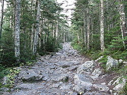
Walking trails
Trail use has become very popular for a wide variety of users. Some trails are designated as nature trails, and are used by people learning about the natural world. Many trails are designated day trails, meaning that they are generally used by people out for a short hike, less than a day. Some trails are designated backpacking trails, or long-distance trailLong-distance trail
Long-distance trails are the longer recreational trails mainly through rural areas, used for non-motorised recreational travelling ....
s, and are used by both day hikers
Hiking
Hiking is an outdoor activity which consists of walking in natural environments, often in mountainous or other scenic terrain. People often hike on hiking trails. It is such a popular activity that there are numerous hiking organizations worldwide. The health benefits of different types of hiking...
and by backpackers
Backpacking (wilderness)
Backpacking combines the activities of hiking and camping for an overnight stay in backcountry wilderness...
. Some of the trails are over a thousand miles (1,500 km) long and may be hiked in sections by backpackers, or completed in one trip by dedicated hikers. Some trails are specifically used by other outdoor enthusiasts to gain access to another feature, such as good climbing
Climbing
Climbing is the activity of using one's hands and feet to ascend a steep object. It is done both for recreation and professionally, as part of activities such as maintenance of a structure, or military operations.Climbing activities include:* Bouldering: Ascending boulders or small...
sites. Many runners
Running
Running is a means of terrestrial locomotion allowing humans and other animals to move rapidly on foot. It is simply defined in athletics terms as a gait in which at regular points during the running cycle both feet are off the ground...
also favor running on trails rather than pavement, as giving a more vigorous work-out and better developing agility skills, as well as providing a more pleasant exercise environment.
Stairway trails
StairwayStairway
Stairway, staircase, stairwell, flight of stairs, or simply stairs are names for a construction designed to bridge a large vertical distance by dividing it into smaller vertical distances, called steps...
trails are another way to ascend higher slopes. The stairs are constructed by making cuts in the dirt, rocks, or concrete. Stairway trails are usually for walking only. Popular stairway trails include the Stairway Trails in Bernal Heights
Bernal Heights, San Francisco, California
-Location:Bernal Heights lies to the south of San Francisco's Mission District. Its most prominent feature is the open parkland and microwave tower on its large rocky hill, Bernal Heights Summit...
, East - San Francisco, and the stairs at many hilltop Hindu temple
Hindu temple
A Mandir, Devalayam, Devasthanam, or a Hindu temple is a place of worship for followers of Hinduism...
s such as the Palani Murugan Temple
Palani Murugan Temple
The Hill Temple of Palani is one of the most famous temples of Murugan in India. It is located in the town of Palani, 100 km southeast of Coimbatore and a similar distance northwest of Madurai, and in the foot-hills of the eponymous Palni Hills...
located in Tirumala
Tirumala Venkateswara Temple
Tirumala Venkateswara Temple ), is a Hindu temple in the hill town of Tirumala, near Tirupati in the Chittoor district of Andhra Pradesh, South India. It is around from Chennai, from Hyderabad, and from Bangalore....
, used during pilgrimage & Machu Picchu
Machu Picchu
Machu Picchu is a pre-Columbian 15th-century Inca site located above sea level. It is situated on a mountain ridge above the Urubamba Valley in Peru, which is northwest of Cusco and through which the Urubamba River flows. Most archaeologists believe that Machu Picchu was built as an estate for...
.
Bicycle trails
This article is about a type of path. For the geometric parameter of bicycles, see trail.
A particular offshoot of trail biking is downhill mountain biking, which can be environmentally destructive, causing soil erosion and habitat destruction
Habitat destruction
Habitat destruction is the process in which natural habitat is rendered functionally unable to support the species present. In this process, the organisms that previously used the site are displaced or destroyed, reducing biodiversity. Habitat destruction by human activity mainly for the purpose of...
, if not well-directed on established trails. Downhilling is particularly popular at ski resorts such as Mammoth Mountain in California or Whistler in British Columbia, where ski lifts are used to get bikes and riders to the top of the mountain. Gravity Logic is a well established design, develop and construction company specializing in the creation of safe and sustainable lift serviced bike parks.
Because of the greater need for more gradual grades, changing elevations may involve sidehill trails with multiple switchbacks, while these may not be necessary for hikers. In cases where hikers use these bike trails, attention must be paid to the potential of cutting across switchbacks.
Where bike trails intersect with pedestrian or equestrian trails, signage at the intersections is important, and high visibility onto the intersecting trails must be a priority in order to prevent collisions between fast-moving cyclists and slower moving hikers and horses. Bicycles and horses should be allowed on the same trails where the trail is wide enough with good visibility.
A well designed bike trail will have an average grade of less than 10%, and will generally follow a contour line, rather than straight downhill. The trail should slope out or across the trail 3-5% downhill to encourage water to run off the side, rather than down the trail bed. In addition, frequent grade reversals also prevent water from running down the trail, make the trail more fun and interesting to ride, and generally help keep bike speeds down, providing a more safe trail experience for all users.
Equestrian trails
Equestrianism
Equestrianism more often known as riding, horseback riding or horse riding refers to the skill of riding, driving, or vaulting with horses...
uses of trails continue to be a popular activity for many trail users. Horses can negotiate much steeper terrain on a dirt trail, for instance, than on a gravel trail. Horses can usually negotiate much the same grades as hikers, but not always, although they can more easily clear obstacles in the path such as logs.
The Bicentennial National Trail
Bicentennial National Trail
The Bicentennial National Trail , formerly known as the National Horse Trail is the longest marked multi-use trail in the world, stretching 5,330 kilometres from Cooktown, through New South Wales to Healesville, 60 km north-east of Melbourne...
(BNT) in Australia is the longest marked multi-use trail in the world, stretching 5,330 kilometres from Cooktown, Queensland
Cooktown, Queensland
Cooktown is a small town located at the mouth of the Endeavour River, on Cape York Peninsula in Far North Queensland where James Cook beached his ship, the Endeavour, for repairs in 1770. At the 2006 census, Cooktown had a population of 1,336...
, through New South Wales
New South Wales
New South Wales is a state of :Australia, located in the east of the country. It is bordered by Queensland, Victoria and South Australia to the north, south and west respectively. To the east, the state is bordered by the Tasman Sea, which forms part of the Pacific Ocean. New South Wales...
to Healesville, Victoria
Healesville, Victoria
Healesville is a town in Victoria, Australia, 52 km north-east from Melbourne's central business district. Its Local Government Area is the Shire of Yarra Ranges...
. This trail runs the length of the rugged Great Dividing Range
Great Dividing Range
The Great Dividing Range, or the Eastern Highlands, is Australia's most substantial mountain range and the third longest in the world. The range stretches more than 3,500 km from Dauan Island off the northeastern tip of Queensland, running the entire length of the eastern coastline through...
through national park
National park
A national park is a reserve of natural, semi-natural, or developed land that a sovereign state declares or owns. Although individual nations designate their own national parks differently A national park is a reserve of natural, semi-natural, or developed land that a sovereign state declares or...
s, private property and alongside of wilderness areas. One of the objectives was to develop a trail that linked up the brumby
Brumby
A Brumby is a free-roaming feral horse in Australia. Although found in many areas around the country, the best-known brumbies are found in the Australian Alps region in south-eastern Australia. Today, most of them are found in the Northern Territory, with the second largest population in Queensland...
tracks, mustering and stock route
Stock route
In Australia, the Travelling Stock Route is an authorised thoroughfare for the walking of domestic livestock such as sheep or cattle from one location to another...
s along the Great Dividing Range, thus providing an opportunity to legally ride the routes of stockmen and drover
Drover (Australian)
A drover in Australia is a person, typically an experienced stockman, who moves livestock, usually sheep or cattle, "on the hoof" over long distances. Reasons for droving may include: delivering animals to a new owner's property, taking animals to market, or moving animals during a drought in...
s who once travelled these areas with pack horse
Packhorse
.A packhorse or pack horse refers generally to an equid such as a horse, mule, donkey or pony used for carrying goods on their backs, usually carried in sidebags or panniers. Typically packhorses are used to cross difficult terrain, where the absence of roads prevents the use of wheeled vehicles. ...
s. This Trail provides access to some of the wildest, most remote country in the world. The Bicentennial National Trail is suitable for self-reliant horse riders, fit walkers and mountain bike riders.
Within the United States National Trail Classification System, equestrian trails include simple day-use bridle paths and others built to accommodate long strings of pack animals on journeys lasting many days. Trail design parameters for these uses include trail base width and material, trail clear width, trail clear height, access to water suitable for stock (not human) use, and trail routing.
Cross-country skiing
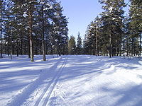
Cross-country skiing
Cross-country skiing is a winter sport in which participants propel themselves across snow-covered terrain using skis and poles...
, a trail (also called a 'track' or 'piste') refers to the parallel grooves cut into the snow
Snow
Snow is a form of precipitation within the Earth's atmosphere in the form of crystalline water ice, consisting of a multitude of snowflakes that fall from clouds. Since snow is composed of small ice particles, it is a granular material. It has an open and therefore soft structure, unless packed by...
, one for each ski
Ski
A ski is a long, flat device worn on the foot, usually attached through a boot, designed to help the wearer slide smoothly over snow. Originally intended as an aid to travel in snowy regions, they are now mainly used for recreational and sporting purposes...
.
Motorized trails
Intermodal Surface Transportation Efficiency Act
The Intermodal Surface Transportation Efficiency Act of 1991 is a United States federal law that posed a major change to transportation planning and policy, as the first U.S. federal legislation on the subject in the post-Interstate Highway System era...
(ISTEA, icon) of 1991 mandates that states must use a minimum of 30 percent of these funds for motorized trail uses.
Urban and suburban trails
Though the term trail conjures up images of a well-beaten path in a woodlandWoodland
Ecologically, a woodland is a low-density forest forming open habitats with plenty of sunlight and limited shade. Woodlands may support an understory of shrubs and herbaceous plants including grasses. Woodland may form a transition to shrubland under drier conditions or during early stages of...
setting, more and more frequently, the term is coming to refer to any sort transportation route designed for non-automobile traffic. For example, a trend sweeping Northern America
Northern America
Northern America is the northernmost region of the Americas, and is part of the North American continent. It lies directly north of the region of Middle America; the land border between the two regions coincides with the border between the United States and Mexico...
, especially in the rural Northeast
Atlantic Northeast
The Atlantic Northeast, or Arcadia, is a region of North America, comprising New Hampshire, Vermont, Maine and the Canadian Maritimes. Definitions of the region vary; it may extend to upstate New York and/or all of Atlantic Canada....
, is the conversion of abandoned railways into rail trail
Rail trail
A rail trail is the conversion of a disused railway easement into a multi-use path, typically for walking, cycling and sometimes horse riding. The characteristics of former tracks—flat, long, frequently running through historical areas—are appealing for various development. The term sometimes also...
s. Examples include the Ashuwillticook Rail Trail
Ashuwillticook Rail Trail
The Ashuwillticook Rail Trail is a former railroad corridor converted into a wide paved universally accessible scenic rail trail path. The Ashuwillticook Rail Trail runs parallel to Route 8 through the towns of Cheshire, Lanesborough and Adams, Massachusetts and has become a popular resource for...
in Berkshire County
Berkshire County, Massachusetts
Berkshire County is a non-governmental county located on the western edge of the U.S. state of Massachusetts. As of the 2010 census, the population was 131,219. Its largest city and traditional county seat is Pittsfield...
and the Northern RailTrail of New Hampshire
New Hampshire
New Hampshire is a state in the New England region of the northeastern United States of America. The state was named after the southern English county of Hampshire. It is bordered by Massachusetts to the south, Vermont to the west, Maine and the Atlantic Ocean to the east, and the Canadian...
. Though these wide, often paved pathways could have easily been used as roads, their focus on recreational use for pedestrians and cyclists is what sets them apart as trails.
In Northern America, where urban sprawl
Urban sprawl
Urban sprawl, also known as suburban sprawl, is a multifaceted concept, which includes the spreading outwards of a city and its suburbs to its outskirts to low-density and auto-dependent development on rural land, high segregation of uses Urban sprawl, also known as suburban sprawl, is a...
has begun to strike even the most rural communities, developers and local leaders are currently striving to make their communities more conducive to non-motorized transportation through the use of less traditional "trails." The Robert Wood Johnson Foundation
Robert Wood Johnson Foundation
The Robert Wood Johnson Foundation is the United States' largest philanthropy devoted exclusively to health and health care; it is based in Princeton, New Jersey. The foundation's mission is to improve the health and health care of all Americans...
has established the Active Living by Design
Active Living by Design
Active Living by Design is a national program of the Robert Wood Johnson Foundation that was established in 1998. It is a part of the School of Public Health at the University of North Carolina at Chapel Hill ....
program to improve the livability
Quality of life
The term quality of life is used to evaluate the general well-being of individuals and societies. The term is used in a wide range of contexts, including the fields of international development, healthcare, and politics. Quality of life should not be confused with the concept of standard of...
of communities in part through the trails, both in a more traditional sense, as is being done by the Upper Valley Trails Alliance
Upper Valley Trails Alliance
The Upper Valley Trails Alliance, or UVTA, is a non-profit trails organization, based in Norwich, Vermont and serving the towns of the Upper Connecticut River Valley...
or in the broader, as is being done by Groundwork Somerville.
Another type of trail that was quite popular in the 1970s and 1980s but is less popular today is the exercise trail
Assault course
An assault course is a special sort of trail that combines running and exercising. It was more popular in the 1970s than it is now. It is heavily used in military training...
(also known as trim trail), which combines running with exercise stations.
The term trail has also been used by developers and urban planners for a variety of modern paved road
Road
A road is a thoroughfare, route, or way on land between two places, which typically has been paved or otherwise improved to allow travel by some conveyance, including a horse, cart, or motor vehicle. Roads consist of one, or sometimes two, roadways each with one or more lanes and also any...
s, highway
Highway
A highway is any public road. In American English, the term is common and almost always designates major roads. In British English, the term designates any road open to the public. Any interconnected set of highways can be variously referred to as a "highway system", a "highway network", or a...
s, and boulevard
Boulevard
A Boulevard is type of road, usually a wide, multi-lane arterial thoroughfare, divided with a median down the centre, and roadways along each side designed as slow travel and parking lanes and for bicycle and pedestrian usage, often with an above-average quality of landscaping and scenery...
s. A particularly unusual use of the term is in the province of Alberta
Alberta
Alberta is a province of Canada. It had an estimated population of 3.7 million in 2010 making it the most populous of Canada's three prairie provinces...
, Canada, which has multi-lane
Lane
A lane is a part of the roadway within a road marked out for use by a single line of vehicles in such a way as to control and guide drivers for the purpose of reducing traffic conflicts. Most public roads have at least two lanes, one for traffic in each direction, separated by Lane markings...
freeways called "trails".
Though uncommon in the United States, public footpaths in the UK are often through developed areas, securing legal rights for pedestrians to take shortcuts between streets, avoid the noise and danger of streets with vehicles, and reduce the appeal and use of vehicles.
Trail difficulty ratings
A simple colored symbol to classify a trail's difficulty was first used for ski trails and is now being used for hiking, bicycle, other trails and even airport security lines.- Green circle - easy
- Blue square - moderate
- Black diamond - difficult
Other systems may be used in different locations.
Segregation
Trail segregation, the practice of designating certain trails as having a specific preferred or exclusive use, is increasingly common and diverse. For example, segregated cycle facilitiesSegregated cycle facilities
Segregated cycle facilities are marked lanes, tracks, shoulders and paths designated for use by cyclists from which motorised traffic is generally excluded...
, for bicycles, are used not only on roads open to motor vehicles, but also in trail systems open to other trail users. Some trails are segregated for use by both equestrians and mountain bikes, or by equestrians only, or by mountain bikes only. Designated "wilderness area" trails may be segregated for non-wheeled use (hence permit backpacking and horses but exclude mountain bikes and motorized vehicles).
Often, trail segregation for a particular use is accompanied by prohibitions against that use on other trails within the trail system.
Trail segregation may be supported by signage, markings, trail design and construction (especially selection of tread materials), and by separation between parallel treads. Separation may be achieved by "natural" barriers including distance, ditching, banking, grading, and vegatation, and by "artificial" barriers including fencing, curbing, and walls.
The opposite of segregated use is shared use. Shared use may be achieved by sharing a trail easement, but within it maintaining segregated and sometimes also separated trail treads. This is common in rail trail
Rail trail
A rail trail is the conversion of a disused railway easement into a multi-use path, typically for walking, cycling and sometimes horse riding. The characteristics of former tracks—flat, long, frequently running through historical areas—are appealing for various development. The term sometimes also...
s. Shared use may also refer to alternate day arrangements, whereby two uses are segregated by being permitted on alternate days. This is increasingly common in long-distance trail
Long-distance trail
Long-distance trails are the longer recreational trails mainly through rural areas, used for non-motorised recreational travelling ....
s shared by equestrians and mountain bike users; these two user communities have similar trail requirements but may experience encounters with each other on the trail as difficult.
Trail administration
In 1968, the United States created its National Trails SystemNational Trails System
The National Trails System was created by the National Trails System Act The Act created a series of National trails "to promote the preservation of, public access to, travel within, and enjoyment and appreciation of the open-air, outdoor areas and historic resources of the Nation." Specifically,...
, which includes National Scenic Trail
National Scenic Trail
National Scenic Trail is a designation for protected areas in the United States that consist of trails of particular natural beauty.National Scenic Trails were authorized under the National Trails System Act of 1968 along with National Historic Trails and National Recreation Trails...
s, National Historic Trail
National Historic Trail
National Historic Trail is a designation for a protected area in the United States containing historic trails and surrounding areas. They are part of the National Trails System....
s and National Recreation Trail
National Recreation Trail
National Recreation Trail is a designation given to existing trails that contribute to health, conservation, and recreation goals in the United States. Over 1,000 trails in all 50 U.S. states, available for public use and ranging from less than a mile to in length, have been designated as NRTs...
s.
The rules and regulations for a trail are written and enforced by the land management agency in charge of the trail. A trail may be completely contained within one administration (e.g. a State Park) or it may pass through multiple administrations, leading to a confusing array of regulations, allowing dogs or mountain bikes in one segment but not in another, or requiring Wilderness Permits for a portion of the trail, but not everywhere.
In the United States agencies administering trails include the National Park Service
National Park Service
The National Park Service is the U.S. federal agency that manages all national parks, many national monuments, and other conservation and historical properties with various title designations...
, the U.S. Forest Service, the Bureau of Land Management
Bureau of Land Management
The Bureau of Land Management is an agency within the United States Department of the Interior which administers America's public lands, totaling approximately , or one-eighth of the landmass of the country. The BLM also manages of subsurface mineral estate underlying federal, state and private...
, State Park systems, County Parks, cities, private organizations such as land trusts, businesses and individual property owners.
New trail construction by an agency must often be assessed for its environmental impact and conformance with State or Federal laws. For example, in California new trails must undergo reviews specified by the California Environmental Quality Act
California Environmental Quality Act
The California Environmental Quality Act is a California statute passed in 1970, shortly after the United States federal government passed the National Environmental Policy Act , to institute a statewide policy of environmental protection...
(CEQA).http://www.ceres.ca.gov/ceqa/
In the United Kingdom many trails and footpaths are of ancient origin and are protected under law as rights of way
Rights of way in the United Kingdom
In England and Wales, public rights of way are paths on which the public have a legally protected right to pass and re-pass. The law in England and Wales differs from that in Scotland in that rights of way only exist where they are so designated whereas in Scotland any route that meets certain...
. In Ireland, the Keep Ireland Open organization is campaigning for similar rights.
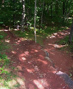
Trail construction
When a trail passes across a flat area that is not wet, often all that is required is to clear brush, tree limbs and undergrowth to produce a clear, walkable trail. When crossing streams, bridge
Bridge
A bridge is a structure built to span physical obstacles such as a body of water, valley, or road, for the purpose of providing passage over the obstacle...
s may or may not be desirable, depending on the size of the stream and the depth of its banks. In wet areas, it may be necessary to create an elevated trailway with fill or by building a boardwalk
Boardwalk
A boardwalk, in the conventional sense, is a wooden walkway for pedestrians and sometimes vehicles, often found along beaches, but they are also common as paths through wetlands, coastal dunes, and other sensitive environments....
. One problem with boardwalks is that they require frequent maintenance and replacement - boards in poor condition are often slippery and hazardous.
Trails on slopes
A common mistake in establishing trails is to make them on slopes that are too steep for comfort and the environment. Such steep trails generally result in serious erosion, a wide swath of impacted area as walkers go to the sides to find better footing, and the inability of many hikers to walk the trail. Trail gradient should be determined based on a site specific assessment of soils & geology, drainage patterns of the slope, surrounding vegetation types, position on the slope of a given trail segment (bottom, mid-slope, ridgeline), average precipitation, storm intensities, types of use, volume & intensity of use, and a host of other factors affecting the ability of the trail substrate to resist erosion and provide a navigable surface. Trails that ascend steep slopes may use switchbackHairpin turn
A hairpin turn , named for its resemblance to a hairpin/bobby pin, is a bend in a road with a very acute inner angle, making it necessary for an oncoming vehicle to turn almost 180° to continue on the road. Such turns in ramps and trails may be called switchbacks in American English, by analogy...
s (also called hairpins), but switchback design and construction is a specialized topic that takes great care.
If a trail is being made to be accessible to off-road
Road
A road is a thoroughfare, route, or way on land between two places, which typically has been paved or otherwise improved to allow travel by some conveyance, including a horse, cart, or motor vehicle. Roads consist of one, or sometimes two, roadways each with one or more lanes and also any...
wheelchair
Wheelchair
A wheelchair is a chair with wheels, designed to be a replacement for walking. The device comes in variations where it is propelled by motors or by the seated occupant turning the rear wheels by hand. Often there are handles behind the seat for someone else to do the pushing...
s, the grade should be no more than one in ten. If a paved trail has to be accessible to all wheelchairs, the grade must be no more than one in twelve, with periodic level pull-offs.
The off-slope, or side-slope, of the trail also must be considered. This is the slope of the trail from side to side, and should never be more than one in twelve. Side-sloped trails are prone to gully
Gully
A gully is a landform created by running water, eroding sharply into soil, typically on a hillside. Gullies resemble large ditches or small valleys, but are metres to tens of metres in depth and width...
ing. Ideally, the treadway of the trail should be almost, but not quite, level in cross-section.
Achieving the proper slope in hilly terrain usually requires the excavation of sidehill trail. This is trailway that is constructed by establishing a line of suitable slope across a hillside, then digging out by means of a mattock
Mattock
A mattock is a versatile hand tool, used for digging and chopping, similar to the pickaxe. It has a long handle, and a stout head, which combines an axe blade and an adze or a pick and an adze .-Description:...
or similar tool to create the trail. This may be a full-bench trail, where the treadway is only on the firm ground surface after the overlying soil is removed and sidecast (thrown to the side as waste), or a half-bench trail, where soil is removed and packed to the side so that the treadway is half on firm old ground and half on new packed fill. In areas near drainages, creeks and other waterways, excavation spoils should be end-hauled (taken away in bulk and deposited in an environmentally benign area). In problem areas, it may be necessary to establish the trail entirely on fill. In cases where filling is used, it's necessary to pack it firmly and to revisit the site periodically to add to the fill and repack it until fully stable.
Drainage
The first type of drainage problem is common in places such as the north country. In such places, it is often necessary to build some type of raised walkway. This is often done by cutting poles from the woods, staking parallel poles in place on the ground, then filling between them with whatever material is available to create the raised walkway. The more elaborate option of the deckwalk is by necessity reserved for shorter stretches in very high-traffic areas.
The second type of problem is caused because trails, by their nature, tend to become drainage
Drainage
Drainage is the natural or artificial removal of surface and sub-surface water from an area. Many agricultural soils need drainage to improve production or to manage water supplies.-Early history:...
channels and eventually gullies if the drainage is not properly controlled. Where a trail is near the top of a hill or ridge, this is usually a minor issue, but when it is farther down it can become a very major issue.
In areas of heavy water flow along a trail, it may be necessary to create a ditch on the uphill side of the trail with drainage points across the trail. The cross-drainage may be accomplished by means of culvert
Culvert
A culvert is a device used to channel water. It may be used to allow water to pass underneath a road, railway, or embankment. Culverts can be made of many different materials; steel, polyvinyl chloride and concrete are the most common...
s, which must be cleared on a semi-annual basis, or by means of cross-channels, often created by placing logs or timbers across the trail in a downhill direction, called "thank-you-marms", "deadmen", or waterbar
Waterbar
A water bar or interceptor dyke is a road construction feature that is used to prevent erosion on sloping roads, cleared paths through woodland , or other accessways by reducing flow length...
s. Using timbers or rocks for this purpose also creates erosion
Erosion
Erosion is when materials are removed from the surface and changed into something else. It only works by hydraulic actions and transport of solids in the natural environment, and leads to the deposition of these materials elsewhere...
barriers. Rock paving in the bottom of these channels and in the trailside ditches may help to maintain stability of these. Ideally, waterbars should be created, with or without ditching, at major points of water flow on or along the trail, and in conjunction, if possible, with existing drainage channels below the trail. Another important technique is to create coweeta dips, or drain dips, points on the trail where it falls briefly (for a meter or so) and then rises again. These provide positive drainage points that are almost never clogged by debris.
The third type of problem can occur both on bottomlands and on ridgetops and a variety of other spots. A local spot or short stretch of the trail may be chronically wet. If the trail is not directly on rock, then a mud pit forms. Trail users go to the side of the trail to avoid the mud pit, and the trail becomes widened, sometimes bizarrely so. If the drainage can be corrected, it must be. A common option if the location cannot be effectively drained is the "corduroy." This can range from random sticks laid across the path to split logs being laid across the path. Some of the early turnpikes in the United States were log corduroys, and these can still be found in third-world forested areas. With recreational trails, it is common to cut sticks that may be one to three inches thick and lay them in place, as close together as can be achieved. Sometimes, a short bridge may be a more feasible option.
Water crossings
For pedestrian use, footbridges may be preferred. Other options are stepping stones and shallow fords. For equestrian use, shallow fords may be preferred.Trail width
Trail width has two main components: width of the trail base or footbed; and width of the clear space on either side of the trail, as in cuts on steep slopes, tunnels, and through vegetation. Variants in width include single trackSingle track
Single track may refer to:*Road, track or railway only wide enough for one vehicle at a time. See:**Single track **Single track road**Single track **Trail. See:**Bicycle**Motorcycle**Monoski...
and two track
Two track
Two track may refer to:*Trail*Double track in rail transport*A method of multitrack recording using only two audio channels...
trails.
Multi-use trails
Trails intended for use by bicycles, wheelchairs, equestrians, and pedestrians will often be surfaced, especially in heavily-used or urban areas. A wide variety of surface materials are used, including asphaltAsphalt
Asphalt or , also known as bitumen, is a sticky, black and highly viscous liquid or semi-solid that is present in most crude petroleums and in some natural deposits, it is a substance classed as a pitch...
paving and compressed dust such as: crushed rock fines, cinder
Cinder
A cinder is a pyroclastic material. Cinders are extrusive igneous rocks. Cinders are similar to pumice, which has so many cavities and is such low-density that it can float on water...
s, or decomposed granite
Decomposed granite
Decomposed granite, also known as DG, is granitic rock that has weathered to the point that it readily fractures into smaller pieces or chunks of weak rock. Further weathering produces rock that easily crumbles into mixtures of gravel, sand, and silt-sized particles with some clay...
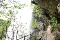
. Such trails will also have well-built bridges with a supported deck and side rails.
There has been a major effort to convert abandoned railroad grades to bike paths or multi-use paths. This has been termed "rails-to-trails
Rail trail
A rail trail is the conversion of a disused railway easement into a multi-use path, typically for walking, cycling and sometimes horse riding. The characteristics of former tracks—flat, long, frequently running through historical areas—are appealing for various development. The term sometimes also...
". Railroads in use with adjacent trails are rails with trails
Rails with trails
Rails with trails are a small subset of rail trails in which a railway right-of-way remains in use by trains yet also has a parallel recreational trail. Hundreds of kilometers of RWTs exist in the United States, Canada, Europe, and Western Australia.- United States :In the United States the...
.
Signage

Trail blazing
Trail blazing, or trailblazing, is the practice of marking paths in outdoor recreational areas with blazes, markings that follow each other at certain — though not necessarily exactly defined — distances and mark the direction of the trail...
or signage should be provided. This may be accomplished by using either paint on natural surfaces or by placing pre-made medallions. Horseshoe-shaped blazes are good for bridle trails. The Appalachian Trail
Appalachian Trail
The Appalachian National Scenic Trail, generally known as the Appalachian Trail or simply the AT, is a marked hiking trail in the eastern United States extending between Springer Mountain in Georgia and Mount Katahdin in Maine. It is approximately long...
is blazed with white rectangles. Blue is often used for side trails. European walking paths
European long-distance paths
The European long-distance paths are a network of long-distance footpaths that traverse Europe. While most long-distance footpaths in Europe are located in just one country or region, each of these numbered European long-distance paths passes through many different countries.The European...
are blazed with yellow points encircled with red. However, other walking paths in European countries are blazed in a variety of manners.
Maintenance
Natural surface, single track trails will require some ongoing maintenance. However, if the trail is properly designed and constructed, maintenance should be limited to clearing downed trees, trimming back brush and clearing drainages. Depending on location, if the trail is properly designed, there should be no need for major rework such as grading or erosion control efforts. However, mountain trails which see both significant rainfall and human traffic may require "trail hardening" efforts in order to prevent further erosion. Most of the seemingly natural rock steps on the mountain trails of the northeast United States are, in fact, the work of professional and volunteer trail crews.See also
- Bicentennial National TrailBicentennial National TrailThe Bicentennial National Trail , formerly known as the National Horse Trail is the longest marked multi-use trail in the world, stretching 5,330 kilometres from Cooktown, through New South Wales to Healesville, 60 km north-east of Melbourne...
- BoardwalkBoardwalkA boardwalk, in the conventional sense, is a wooden walkway for pedestrians and sometimes vehicles, often found along beaches, but they are also common as paths through wetlands, coastal dunes, and other sensitive environments....
- Desire path
- CavalcadeCavalcadeCavalcade may refer to:*Cavalcade, a horseback procession, parade, or mass trail ride*A huge parade*A huge procession*Suzuki GV1400 Cavalcade, a Suzuki luxury touring motorcycle available from 1985 to 1988 in North America...
- FootpathFootpathA Footpath is a thoroughfare intended for by pedestrians but not by motorized vehicles. The term is often for paths within an urban area that offer shorter quieter routes for pedestrians, they may also provide access to the surrounding countryside or parks...
- Great Baikal TrailGreat Baikal TrailThe Great Baikal Trail is a non-profit project to create a hiking trail around Lake Baikal in Siberia with a total length of about . Although the idea for such a trail was born in the 1970s, construction only started in 2003 with the help of volunteers from around the world...
- Inca trail to Machu Picchu
- Israel National TrailIsrael National TrailThe Israel National Trail, is a hiking path that crosses the entire country of Israel. Its northern end is at Dan, near the Lebanese border in the far north of the country, and it extends to Eilat at the southernmost tip of Israel on the Red Sea, a length of approximately 940 km...
- Jeep trailJeep trailRoads that are only suitable for off-road vehicles are often called jeep trails.The most famous is the Rubicon Trail located near Lake Tahoe in California. The so-called "Jeep Trail Capital of the World," however, is Ouray, Colorado...
- Kokoda TrackKokoda TrackThe Kokoda Trail or Track is a single-file foot thoroughfare that runs overland — in a straight line — through the Owen Stanley Range in Papua New Guinea...
- Long-distance trailLong-distance trailLong-distance trails are the longer recreational trails mainly through rural areas, used for non-motorised recreational travelling ....
- Milford TrackMilford TrackThe Milford Track is a widely known tramping route in New Zealand – located amidst mountains and temperate rain forest in Fiordland National Park in the southwest of the South Island....
- Natural lines of driftNatural lines of driftNatural lines of drift are those paths across terrain that are the most likely to be used when going from one place to another. These paths are paths of least resistance: those that offer the greatest ease while taking into account obstacles and modes of transit...
- New Zealand Great WalksNew Zealand Great WalksThe New Zealand Great Walks are a set of popular tramping tracks. They are New Zealand's premier tracks, through areas of some of the best scenery in the country...
- Trail, British ColumbiaTrail, British ColumbiaTrail is a city in the West Kootenay region of the Interior of British Columbia, Canada.-Geography:Trail has an area of . The city is located on both banks of the Columbia River, approximately 10 km north of the United States border. This section of the Columbia River valley is located between the...
- Rail trailRail trailA rail trail is the conversion of a disused railway easement into a multi-use path, typically for walking, cycling and sometimes horse riding. The characteristics of former tracks—flat, long, frequently running through historical areas—are appealing for various development. The term sometimes also...
(former railway) - Rights of way in England and Wales
- Rights of way in ScotlandRights of way in ScotlandIn Scotland a right of way is defined as any defined route over which the public has been able to pass unhindered for at least 20 years. The route must link two "public places", such as villages, churches or roads. Unlike in England and Wales there is no obligation on Scottish local authorities to...
- Segregated cycle facilitiesSegregated cycle facilitiesSegregated cycle facilities are marked lanes, tracks, shoulders and paths designated for use by cyclists from which motorised traffic is generally excluded...
- TowpathTowpathA towpath is a road or trail on the bank of a river, canal, or other inland waterway. The purpose of a towpath is to allow a land vehicle, beasts of burden, or a team of human pullers to tow a boat, often a barge...
(on a canal) - Water gapWater gapA water gap is an opening or notch which flowing water has carved through a mountain range. Water gaps often offer a practical route for road and rail transport to cross mountain ridges.- Geology :...
- Wind gap (geographical feature)
External links
- AdventureSeed Trail Wiki - Interactive map of hiking, mountain biking, and backpacking trails
- Backcountry Secrets Hiking Trails - Hiking trails submitted by members from around the world. Some trails have GPX files when submitted by the members.
- Earthgoers - Member-contributed trail guide for hiking, biking, horseback riding, snowshoeing, and cross-country skiing
- TrailFu.com - Mountain Biking Trail Resources - Information on Mountain biking specific trails
- Walking Route Planner - Walking Route Planer for Trails
- IMBA.com - Trailbuilding Resources - Information on building and managing shared use and bike specific trails
- Peak to Peak Trail and Wilderness Links - A hand-indexed directory of thousands of Hiking, Backpacking, Walking, Trail and Wilderness Web Sites from around the world.
- Slackpacker.com - Designed to provide convenient access to websites with hiking and backpacking trail maps, descriptions, journals, trip reports, and photographs
- TrailGuru - Community project designed to build a digital database of trails using GPS data
- Trails Guide - Online open blog where users can share great bike trails with each other
- WikiWalki - Member submitted hiking, biking, walking, and cycling trails with maps
- GPS-Tour.info - Free Community GPS-Trails - mostly moutainbike and hiking