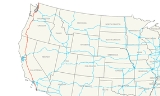
All Topics  
Interstate 5


   Email Print
   Bookmark   Link


Interstate 5


Interstate 5 (I-5) is the main Interstate Highway
Interstate Highway System

The Dwight D. Eisenhower National System of Interstate and Defense Highways, commonly called the Interstate Highway System , is a list of highway systems with full control of access and no cross traffic in the United States that is named for United States President Dwight D....
 on the West Coast of the United States
West Coast of the United States

The "West Coast", "Western Seaboard", or "Pacific Coastline" are terms for the westernmost coastal states of the United States. It most often comprises California, Oregon and Washington....
, paralleling the Pacific Ocean
Pacific Ocean

The Pacific Ocean is the largest of the Earth's oceanic divisions. Its name is derived from the Latin name Mare Pacificum, "peaceful sea", bestowed upon it by the Portugal explorer Ferdinand Magellan....
 from Canada
Canada

Canada is a country occupying most of northern North America, extending from the Atlantic Ocean in the east to the Pacific Ocean in the west and northward into the Arctic Ocean....
 to Mexico
Mexico

The United Mexican States , commonly known as Mexico , is a federalism constitutionalism republic in North America. It is bordered on the north by the United States; on the south and west by the Pacific Ocean; on the southeast by Guatemala, Belize, and the Caribbean Sea; and on the east by the Gulf of Mexico....
 (Washington
Washington

Washington is a U.S. state in the Pacific Northwest region of the United States. Washington was carved out of the western part of Washington Territory which had been ceded by Britain in 1846 by the Oregon Treaty as settlement of the Oregon Boundary Dispute....
 to southernmost California
California

California is a U.S. state on the West Coast of the United States of the United States, along the Pacific Ocean. It is bordered by Oregon to the north, Nevada to the east, Arizona to the southeast, and to the south the Mexico state of Baja California....
) and serving some of the largest cities of that part of the U.S., including Seattle, Tacoma, Portland
Portland, Oregon

Portland is a city located in the Northwestern United States United States, near the confluence of the Willamette River and Columbia River rivers in the state of Oregon....
, Sacramento
Sacramento

Sacramento, an Italian language-, Spanish language- and Portuguese language-language word meaning sacrament, is a common Toponymy in parts of the world where those tongues were or are spoken....
, San Francisco/Oakland, Los Angeles
Los Ángeles

Los ?ngeles is the Capital of the Biob?o Province, in the municipality of the same name, in Regions of Chile VIII , in the center-south of Chile....
, and San Diego. It links the state capital cities of Washington, Oregon, and California. Its southern terminus is at the United States - Mexico border. Its northern terminus is at the Canada-United States border
Canada-United States border

The Canada ? United States border is the international border between Canada and the United States. Officially known as the International Boundary, it is the longest common border in the world and is unmilitarized....
.


Discussion
Ask a question about 'Interstate 5'
Start a new discussion about 'Interstate 5'
Answer questions from other users
Full Discussion Forum


Recent Posts


Encyclopedia


Interstate 5 (I-5) is the main Interstate Highway
Interstate Highway System

The Dwight D. Eisenhower National System of Interstate and Defense Highways, commonly called the Interstate Highway System , is a list of highway systems with full control of access and no cross traffic in the United States that is named for United States President Dwight D....
 on the West Coast of the United States
West Coast of the United States

The "West Coast", "Western Seaboard", or "Pacific Coastline" are terms for the westernmost coastal states of the United States. It most often comprises California, Oregon and Washington....
, paralleling the Pacific Ocean
Pacific Ocean

The Pacific Ocean is the largest of the Earth's oceanic divisions. Its name is derived from the Latin name Mare Pacificum, "peaceful sea", bestowed upon it by the Portugal explorer Ferdinand Magellan....
 from Canada
Canada

Canada is a country occupying most of northern North America, extending from the Atlantic Ocean in the east to the Pacific Ocean in the west and northward into the Arctic Ocean....
 to Mexico
Mexico

The United Mexican States , commonly known as Mexico , is a federalism constitutionalism republic in North America. It is bordered on the north by the United States; on the south and west by the Pacific Ocean; on the southeast by Guatemala, Belize, and the Caribbean Sea; and on the east by the Gulf of Mexico....
 (Washington
Washington

Washington is a U.S. state in the Pacific Northwest region of the United States. Washington was carved out of the western part of Washington Territory which had been ceded by Britain in 1846 by the Oregon Treaty as settlement of the Oregon Boundary Dispute....
 to southernmost California
California

California is a U.S. state on the West Coast of the United States of the United States, along the Pacific Ocean. It is bordered by Oregon to the north, Nevada to the east, Arizona to the southeast, and to the south the Mexico state of Baja California....
) and serving some of the largest cities of that part of the U.S., including Seattle, Tacoma, Portland
Portland, Oregon

Portland is a city located in the Northwestern United States United States, near the confluence of the Willamette River and Columbia River rivers in the state of Oregon....
, Sacramento
Sacramento

Sacramento, an Italian language-, Spanish language- and Portuguese language-language word meaning sacrament, is a common Toponymy in parts of the world where those tongues were or are spoken....
, San Francisco/Oakland, Los Angeles
Los Ángeles

Los ?ngeles is the Capital of the Biob?o Province, in the municipality of the same name, in Regions of Chile VIII , in the center-south of Chile....
, and San Diego. It links the state capital cities of Washington, Oregon, and California. Its southern terminus is at the United States - Mexico border. Its northern terminus is at the Canada-United States border
Canada-United States border

The Canada ? United States border is the international border between Canada and the United States. Officially known as the International Boundary, it is the longest common border in the world and is unmilitarized....
. Interstate 5 is the only Interstate Highway to touch both the Canadian
Canada

Canada is a country occupying most of northern North America, extending from the Atlantic Ocean in the east to the Pacific Ocean in the west and northward into the Arctic Ocean....
 and Mexican
Mexico

The United Mexican States , commonly known as Mexico , is a federalism constitutionalism republic in North America. It is bordered on the north by the United States; on the south and west by the Pacific Ocean; on the southeast by Guatemala, Belize, and the Caribbean Sea; and on the east by the Gulf of Mexico....
 borders, though others come close to this, such as Interstate 35 in the Central region of the US. At its southern end, I-5 continues into Tijuana
Tijuana

Tijuana , is the largest city of the Mexican state of Baja California, situated on the United States?Mexico border adjacent to its sister city of San Diego, California....
, Mexico, as the Mexico Federal Highway 1. On its northern end, I-5 continues into Vancouver
Vancouver

Vancouver is a coastal city and major seaport located in the Lower Mainland of southwestern British Columbia, Canada. It is the largest city in British Columbia and the second largest metropolitan area in the Pacific Northwest region....
, Canada, as the British Columbia Highway 99.

This highway links to control cities in California
California

California is a U.S. state on the West Coast of the United States of the United States, along the Pacific Ocean. It is bordered by Oregon to the north, Nevada to the east, Arizona to the southeast, and to the south the Mexico state of Baja California....
 (San Diego
San Diego, California

San Diego is the second largest city in California and the List of United States cities by population, located along the Pacific Ocean on the West Coast of the United States of the Western United States....
, Los Angeles
Los Angeles, California

Los Angeles is the largest city in the U.S. state of California and the List of United States cities by population in the United States. Often abbreviated as L.A. and nicknamed The City of Angels, Los Angeles is rated as a beta global city, has an estimated population of 3.8 million and spans over in Southern California....
, San Francisco
San Francisco, California

The City and County of San Francisco is the fourth most populous city in California and the List of United States cities by population in the United States, with a 2007 estimated population of 799,183....
, Sacramento
Sacramento, California

Sacramento is the Capital of the United States U.S. state of California, and the county seat of Sacramento County, California. Located along the Sacramento River and just south of the American River's confluence in California's expansive California Central Valley, it is the seventh-largest city in California.....
, and Redding
Redding, California

Redding is a city in Northern California. It is the county seat of Shasta County, California, United States. As of the 2000 United States Census, the city had a total population of 80,865 and has grown to approximately 107,741 due to recent annexations....
), Oregon
Oregon

Oregon is a U.S. state in the Pacific Northwest region of the United States. The area was inhabited by many indigenous tribes before the arrival of traders, explorers and settlers....
 (Medford
Medford, Oregon

Medford is a city in Jackson County, Oregon, Oregon, United States. As of 2008, the city had a total population of 76,850 and a metropolitan area population of 202,310....
, Eugene
Eugene, Oregon

The city of Eugene is the county seat of Lane County, Oregon, Oregon, United States. It is located at the south end of the Willamette Valley, at the confluence of the McKenzie River and Willamette River rivers, about 60 miles east of the Oregon Coast....
, Salem
Salem, Oregon

Salem is the Capital of the U.S. state of Oregon, and the county seat of Marion County, Oregon. It is located in the center of the Willamette Valley alongside the Willamette River, which runs north through the city....
, and Portland
Portland, Oregon

Portland is a city located in the Northwestern United States United States, near the confluence of the Willamette River and Columbia River rivers in the state of Oregon....
), and Washington
Washington

Washington is a U.S. state in the Pacific Northwest region of the United States. Washington was carved out of the western part of Washington Territory which had been ceded by Britain in 1846 by the Oregon Treaty as settlement of the Oregon Boundary Dispute....
 (Tacoma
Tacoma, Washington

Tacoma is a mid-sized urban port city in and the county seat of Pierce County, Washington, United States. The city is on Washington's Puget Sound, southwest of Seattle, northeast of the state capital, Olympia, Washington, and northwest of Mount Rainier National Park....
, Seattle
Seattle, Washington

Seattle is the most populous city in the US state of Washington and the Northwestern United States. The encompassing Seattle metropolitan area is the 15th largest in the United States, and the largest in the Pacific Northwest....
, Everett
Everett, Washington

Everett is the county seat of and the largest city in Snohomish County, Washington, Washington, United States. Named for Everett Colby, son of founder Charles L....
, Mount Vernon
Mount Vernon, Washington

Mount Vernon is a city in Skagit County, Washington, Washington, United States. The population was 26,232 at the 2000 United States Census. It is one of two principal cities of and included in the Mount Vernon-Anacortes, Washington Metropolitan Statistical Area....
, Bellingham
Bellingham, Washington

Bellingham, pronounced /beh-ling-HAM/, is the largest city in and the county seat of Whatcom County, Washington in the U.S. state of Washington, and the eleventh largest city in the state....
). Vancouver
Vancouver

Vancouver is a coastal city and major seaport located in the Lower Mainland of southwestern British Columbia, Canada. It is the largest city in British Columbia and the second largest metropolitan area in the Pacific Northwest region....
, British Columbia
British Columbia

British Columbia is the westernmost of Canada's Provinces and territories of Canada and is famed for its natural beauty, as reflected in its Latin motto, Splendor sine occasu ....
 (signed as "Vancouver B.C." to avoid confusion with Vancouver, Washington
Vancouver, Washington

Vancouver is a city on the north bank of the Columbia River in the U.S. state of Washington and the county seat of Clark County, Washington. According to the Washington State Office of Financial Management's April 1, 2008 estimate, the city has a population of 162,400, making it the fourth largest city in the state....
, which is in the opposite direction) is also a control city on Interstate 5 from the Seattle-Tacoma area to the northern terminus at the Canadian border.

Notably, a control city not directly linked by this highway is San Francisco
San Francisco, California

The City and County of San Francisco is the fourth most populous city in California and the List of United States cities by population in the United States, with a 2007 estimated population of 799,183....
, which is about west of I-5. To the south, Interstate 580
Interstate 580 (California)

Interstate 580 is an Interstate Highway in Northern California California. The heavily traveled, 80-mile long spur route of Interstate 80 connects the San Francisco Bay Area to Interstate 5 in the state's Central Valley ....
 splits from I-5 towards San Francisco, while, to the north, Interstate 505 cuts south to Interstate 80
Interstate 80

Interstate 80 is the second-longest Interstate Highway in the United States . It connects downtown San Francisco, California, to Teaneck, New Jersey, a suburb of New York City....
, which serves that city. That routing, via I-580, I-80 and I-505, was once Interstate 5W.

Route description

|- |CA
Interstate 5 in California

In the U.S. state of California, Interstate 5, a major north-south route of the Interstate Highway System, has its southern terminus at the United States-Mexico border at the San Ysidro, San Diego, California crossing....
 || 796.53 || 1281.89 |- |OR
Interstate 5 in Oregon

In the U.S. state of Oregon, Interstate 5 traverses across the state, passing through the major cities of Portland, Oregon, Salem, Oregon, Eugene, Oregon, and Medford, Oregon....
 || 308.14 || 495.90 |- |WA
Interstate 5 in Washington

Interstate 5 in Washington is a highway in the U.S. state of Washington that extends from its border with Oregon to its border with Canada. Serving the cities of Vancouver, Washington, Kelso, Washington, Chehalis, Washington, Centralia, Washington, Olympia, Washington, Tacoma, Washington, Seattle, Washington, Everett, Washington, Mount Vern...
 || 276.62 || 445.18 |- |Total || 1381.29 || 2222.97 |}
Major cities
Bolded cities are officially-designated control cities
Control city

A control city is a city or locality posted on a traffic sign indicating forward destinations on a certain route. Signs indicating such cities are usually found at highway junctions to show where the intersecting road goes, or on mileage signs on longer routes....
 for signs
  • San Diego, California
    San Diego, California

    San Diego is the second largest city in California and the List of United States cities by population, located along the Pacific Ocean on the West Coast of the United States of the Western United States....
     (southbound)
  • Santa Ana, California
    Santa Ana, California

    Founded in 1869, Santa Ana is the most populous city in Orange County, California, USA and is the county seat, with an estimated 353,184 people....
  • Los Angeles, California
    Los Angeles, California

    Los Angeles is the largest city in the U.S. state of California and the List of United States cities by population in the United States. Often abbreviated as L.A. and nicknamed The City of Angels, Los Angeles is rated as a beta global city, has an estimated population of 3.8 million and spans over in Southern California....
  • Stockton, California
    Stockton, California

    Stockton is a city in California and the county seat of San Joaquin County, California . Stockton's population estimate for January 1, 2008, according to the California Department of Finance, is 290,141....
  • Sacramento, California
    Sacramento, California

    Sacramento is the Capital of the United States U.S. state of California, and the county seat of Sacramento County, California. Located along the Sacramento River and just south of the American River's confluence in California's expansive California Central Valley, it is the seventh-largest city in California.....
  • Redding, California
    Redding, California

    Redding is a city in Northern California. It is the county seat of Shasta County, California, United States. As of the 2000 United States Census, the city had a total population of 80,865 and has grown to approximately 107,741 due to recent annexations....
  • Ashland, Oregon
    Ashland, Oregon

    Ashland is a city in Jackson County, Oregon, Oregon, United States, near Interstate 5 and the California border, and located in the south end of the Rogue Valley....
  • Medford, Oregon
    Medford, Oregon

    Medford is a city in Jackson County, Oregon, Oregon, United States. As of 2008, the city had a total population of 76,850 and a metropolitan area population of 202,310....
  • Grants Pass, Oregon
    Grants Pass, Oregon

    Grants Pass is a city in, and the county seat of Josephine County, Oregon, Oregon, United States . The city is located on Interstate 5 in Oregon, northwest of Medford, Oregon....
  • Roseburg, Oregon
    Roseburg, Oregon

    Roseburg is a city in the U.S. state of Oregon. It is the county seat of Douglas County, Oregon. The population was 20,017 at the United States Census 2000....
  • Eugene, Oregon
    Eugene, Oregon

    The city of Eugene is the county seat of Lane County, Oregon, Oregon, United States. It is located at the south end of the Willamette Valley, at the confluence of the McKenzie River and Willamette River rivers, about 60 miles east of the Oregon Coast....
  • Albany, Oregon
    Albany, Oregon

    Albany is a city in Benton County, Oregon and Linn County, Oregon Counties in the western part of the U.S. state of Oregon. It is located in the Willamette Valley and is the county seat of Linn County....
  • Salem, Oregon
    Salem, Oregon

    Salem is the Capital of the U.S. state of Oregon, and the county seat of Marion County, Oregon. It is located in the center of the Willamette Valley alongside the Willamette River, which runs north through the city....
  • Portland, Oregon
    Portland, Oregon

    Portland is a city located in the Northwestern United States United States, near the confluence of the Willamette River and Columbia River rivers in the state of Oregon....
  • Vancouver, Washington
    Vancouver, Washington

    Vancouver is a city on the north bank of the Columbia River in the U.S. state of Washington and the county seat of Clark County, Washington. According to the Washington State Office of Financial Management's April 1, 2008 estimate, the city has a population of 162,400, making it the fourth largest city in the state....
  • Olympia, Washington
    Olympia, Washington

    Olympia is the Capital of Washington and is the county seat of Thurston County, Washington. It was incorporated on January 28, 1859. The population was 44,460 at the 2007 census....
  • Tacoma, Washington
    Tacoma, Washington

    Tacoma is a mid-sized urban port city in and the county seat of Pierce County, Washington, United States. The city is on Washington's Puget Sound, southwest of Seattle, northeast of the state capital, Olympia, Washington, and northwest of Mount Rainier National Park....
  • Seattle, Washington
    Seattle, Washington

    Seattle is the most populous city in the US state of Washington and the Northwestern United States. The encompassing Seattle metropolitan area is the 15th largest in the United States, and the largest in the Pacific Northwest....
  • Everett, Washington
    Everett, Washington

    Everett is the county seat of and the largest city in Snohomish County, Washington, Washington, United States. Named for Everett Colby, son of founder Charles L....
  • Mount Vernon, Washington
    Mount Vernon, Washington

    Mount Vernon is a city in Skagit County, Washington, Washington, United States. The population was 26,232 at the 2000 United States Census. It is one of two principal cities of and included in the Mount Vernon-Anacortes, Washington Metropolitan Statistical Area....
  • Bellingham, Washington
    Bellingham, Washington

    Bellingham, pronounced /beh-ling-HAM/, is the largest city in and the county seat of Whatcom County, Washington in the U.S. state of Washington, and the eleventh largest city in the state....
  • Vancouver, British Columbia (northbound; via Hwy 99 north)

California

The most southerly point of Interstate 5 is at the United States-Mexico border at the San Ysidro border crossing, one of the busiest in the world. Beginning at the border in San Ysidro, which is part of the city of San Diego, as the John J. Montgomery Freeway, I-5 goes through the suburb
Suburb

Suburbs are commonly defined as the residential areas which surround the central area of the urban area of a town or city. In the United States, suburbs have a prevalence of usually detached single-family homes.....
s of National City
National City, California

National City is a city in San Diego County, California, California, United States. The population was 54,260 at the 2000 census. National City is the second oldest city in San Diego County with a historic past....
 and Chula Vista
Chula Vista, California

Chula Vista is a city in southern San Diego County, California, California, United States. Based on California Department of Finance estimates for January 1, 2007, the population was 227,723, making it the second largest city in San Diego County, the 14th largest in the State of California, and List of United States cities by population....
 before reaching downtown San Diego
San Diego, California

San Diego is the second largest city in California and the List of United States cities by population, located along the Pacific Ocean on the West Coast of the United States of the Western United States....
. It then parallels the Pacific coastline, going through the northern suburbs of San Diego, bisecting the University of California, San Diego
University of California, San Diego

The University of California, San Diego is a public research university in San Diego, California, California. The school's campus contains 694 buildings and is located in the La Jolla, San Diego, California community....
 campus, and passing the I-805 merge, before passing through the 28 miles (45 km) of Marine Corps
United States Marine Corps

The United States Marine Corps is a branch of the United States Armed Forces responsible for providing Military power projection from the sea, using the mobility of the United States Navy to rapidly deliver Marine Air-Ground Task Force....
 Base Camp Pendleton in northern San Diego County
San Diego County, California

San Diego County is a county located near the Pacific Ocean in the far southwest of the U.S. state of California. The state of California estimates San Diego County's population as of 2008 to be 3,146,274 people, making it the second most populous county in California, ahead of its northwestern neighbor Orange County, California....
. Here I-5 is also known as the San Diego Freeway. I-5 covers in California.

At Dana Point
Dana Point, California

Dana Point is a city located in southern Orange County, California. The population was 35,110 at the 2000 census. As one of the few harbors along the Orange County coast, and with ready access via California State Route 1, it is a popular local destination for surfing and was home to a legendary surf break called Killer Dana....
, I-5 turns inland and heads due north through Mission Viejo
Mission Viejo, California

Mission Viejo is a city located in southern Orange County, California in the Saddleback Valley and has been named the safest city in the US according to a 2007 Morgan Quitno crime statistic survey ....
 to the El Toro Y
El Toro Y

The El Toro "Y" is a freeway interchange in southern Orange County, California where the Santa Ana Freeway, Interstate 5 , and the San Diego Freeway, Interstate 405 merge....
 interchange in southeastern Irvine
Irvine, California

Irvine is an incorporated city in Orange County, California, United States. It is a planned city, mainly developed by the Irvine Company since the 1960s....
. I-5 becomes the Santa Ana Freeway
Santa Ana Freeway

The Santa Ana Freeway is one of the principal freeways in Southern California, connecting Los Angeles, California, California and its southeastern suburbs....
 as it runs southeast to northwest, passing through major cities and suburbs in Orange
Orange County, California

Orange County is a county in Southern California California, United States. Its county seat is Santa Ana, California. The state of California estimates its population as of 2008 to be 3,121,251, making it the third most populous county in California, behind Los Angeles County, California and San Diego County, California....
 and Southern Los Angeles
Los Angeles County, California

Los Angeles County is a County in California, and is by far, the most List of the most populous counties in the United States in the United States....
 counties. Southern Californians refer to it as "the 5" or as the Santa Ana Freeway in the Los Angeles area. From this point, the San Diego Freeway continues northward as I-405.

When the freeway reaches the East Los Angeles Interchange
East Los Angeles Interchange

The East Los Angeles Interchange complex is the busiest freeway Interchange in the world. At the time of its construction in the early 1960s it was considered a civil engineering marvel....
 one mile (1.6 km) east of downtown Los Angeles
Los Angeles, California

Los Angeles is the largest city in the U.S. state of California and the List of United States cities by population in the United States. Often abbreviated as L.A. and nicknamed The City of Angels, Los Angeles is rated as a beta global city, has an estimated population of 3.8 million and spans over in Southern California....
, I-5 becomes the Golden State Freeway. The route continues through the San Fernando Valley
San Fernando Valley

The San Fernando Valley is an urbanized valley located in Southern California, United States. More than half of the city of Los Angeles' land area lies within the San Fernando Valley....
 and then crosses the Newhall Pass through the Santa Susana Mountains
Santa Susana Mountains

The Santa Susana Mountains are a Transverse Ranges range of mountains in Southern California California, north of the city of Los Angeles, California, in the United States....
 into the Santa Clarita Valley
Santa Clarita Valley

The Santa Clarita Valley is the valley of the Santa Clara River in Southern California. It stretches through Los Angeles County, California and Ventura County, California....
. For about a four-mile (6 km) stretch between Santa Clarita Valley
Santa Clarita Valley

The Santa Clarita Valley is the valley of the Santa Clara River in Southern California. It stretches through Los Angeles County, California and Ventura County, California....
 and the Pyramid Lake
Pyramid Lake (California)

Pyramid Lake is a lake formed by Pyramid Dam on Piru Creek, near Castaic, California. The 180,000 acre-foot reservoir is in the southern portion of the Los Padres National Forest in the northwest corner of Los Angeles County, California....
, the northbound and southbound lanes separate and actually invert, with the southbound lanes being to the east of the northbound ones. Beginning at that point, the Golden State Freeway sharply rises to the north through the Grapevine
Ridge Route

The Ridge Route, officially the Castaic-Tejon Route, is a narrow two-lane highway in the northern Greater Los Angeles Area of the U.S. state of California....
 to eventually reach the second-highest point of its entire length, the Tejon Pass
Tejon Pass

The Tejon Pass is a mountain pass at the southwest end of the Tehachapi Mountains linking Southern California to Central California....
 (elevation . (1,275 m)) through the Tehachapi Mountains
Tehachapi Mountains

The Tehachapi Mountains are a short Transverse Ranges in Southern California California in the United States, running SW-NE connecting the Coast Ranges on the west with the southern end of the Sierra Nevada mountains on the east....
. Path 26
Path 26

Path 26 is a set of three 500 volt electric power transmissions that forms Southern California Edison's intertie with Pacific Gas & Electric to the north....
 power line
Electric power transmission

Electric power transmission is the bulk transfer of electrical power , a process in the delivery of electricity to consumers. A power transmission grid typically connects power plants to multiple Electrical substation near a populated area....
s generally parallel the freeway along this stretch. The freeway then sharply descends for at Tejon Pass to around at Grapevine near the southernmost point of the San Joaquin Valley
San Joaquin Valley

The San Joaquin Valley refers to the area of the California Central Valley of California that lies south of the Sacramento River Delta in Stockton, California....
, approximately south of Bakersfield
Bakersfield, California

Bakersfield is a large city at the southern end of the San Joaquin Valley in Kern County, California, California, United States. It is one of the fastest-growing large-population cities in the USA, and is located roughly equidistant between Los Angeles and Fresno, California, to the south and north respectively....
 and south from where State Route 99 splits away from it in Wheeler Ridge
Wheeler Ridge, California

Wheeler Ridge is a small Unincorporated area town in Kern County, California. Prior to the development of the Grapevine, California settlement down the road, Wheeler Ridge had the last services before the climb up Tejon Pass along old U.S....
.

I 5 Near Shasta
From Highway 99 to south of Tracy
Tracy, California

Tracy is a city in San Joaquin County, California, California, in the United States.Tracy is part of the Stockton metro area which includes Modesto, California, Stockton, California, and Manteca, California....
, I-5 skirts along the far more remote western edge of the great Central Valley, and thus here is removed from population centers such as Bakersfield
Bakersfield, California

Bakersfield is a large city at the southern end of the San Joaquin Valley in Kern County, California, California, United States. It is one of the fastest-growing large-population cities in the USA, and is located roughly equidistant between Los Angeles and Fresno, California, to the south and north respectively....
 and Fresno
Fresno, California

Fresno is a city in California, USA, the county seat of Fresno County, California, and the second largest inland city in the state, after San Jose, California....
 with other state highways providing connections. Interstate 580
Interstate 580 (California)

Interstate 580 is an Interstate Highway in Northern California California. The heavily traveled, 80-mile long spur route of Interstate 80 connects the San Francisco Bay Area to Interstate 5 in the state's Central Valley ....
 splits off from I-5 at a point south of Tracy, providing a loop-route connection to the San Francisco Bay Area
San Francisco Bay Area

The San Francisco Bay Area, commonly known as the Bay Area, or the Bay, is a metropolitan region that surrounds the San Francisco Bay and San Pablo Bay Bays in Northern California....
. After passing Tracy, I-5 heads north through Stockton
Stockton, California

Stockton is a city in California and the county seat of San Joaquin County, California . Stockton's population estimate for January 1, 2008, according to the California Department of Finance, is 290,141....
 and Sacramento
Sacramento, California

Sacramento is the Capital of the United States U.S. state of California, and the county seat of Sacramento County, California. Located along the Sacramento River and just south of the American River's confluence in California's expansive California Central Valley, it is the seventh-largest city in California.....
 before turning west to Woodland
Woodland, California

Woodland is the county seat of Yolo County, California, located approximately 15 miles northwest of Sacramento, California, and is a part of the Sacramento - Arden-Arcade, California - Roseville, California Sacramento metropolitan area....
. At Woodland, the interstate heads northwest again towards Dunnigan
Dunnigan, California

Dunnigan is an unincorporated area community in Yolo County, California, California on Interstate 5. The population was 717 at the 2006 census. Dunnigan's ZIP code is 95937 and its area code 530....
, where it converges with Interstate 505
Interstate 505

Interstate 505 is an Interstate Highway in California between Interstate 80 in California in Vacaville, California and Interstate 5 in California....
.

From Dunnigan, I-5 skirts north along the western edge of the Sacramento Valley
Sacramento Valley

The Sacramento Valley is the portion of the California Central Valley that lies to the north of the Sacramento Delta in the U.S. state of California....
 to Red Bluff
Red Bluff, California

Red Bluff is the county seat of Tehama County, California. As of the 2000 census, the incorporated city had a total population of 13,147, but it is currently estimated at 26,000 due to recent annexations....
. I-5 then enters the Shasta Cascade
Shasta Cascade

The Shasta Cascade region of California is located in the northeastern and north-central sections of the state bordering Oregon and Nevada, including far northern parts of the Central Valley and the Sierra Nevada mountain range....
 region, passing through Redding
Redding, California

Redding is a city in Northern California. It is the county seat of Shasta County, California, United States. As of the 2000 United States Census, the city had a total population of 80,865 and has grown to approximately 107,741 due to recent annexations....
 and Shasta Lake
Shasta Lake

Shasta Lake is a reservoir created by the building of Shasta Dam in California, United States. Shasta Lake is the largest reservoir in California, and third largest lake, after Lake Tahoe and the Salton Sea, with a capacity of 4,552,000 acre-feet ....
 before climbing up to near the foot of Mount Shasta
Mount Shasta

Mount Shasta or the "White Mountain" in English, a 4,322 m stratovolcano, is the second-highest peak in the Cascade Range and the List of California fourteeners in California....
. The interstate then travels to Weed
Weed, California

Weed is a city located in Siskiyou County, California. As of the United States 2000 Census, the town had a total population of 2,978. There are several unincorporated communities adjacent to, or just outside Weed proper....
 and Yreka
Yreka, California

Yreka is the county seat of Siskiyou County, California, United States. The population was 7,290 at the 2000 census....
 before reaching the Oregon border.

Oregon

About north of the California border, the highway crosses Siskiyou Summit
Siskiyou Summit

Siskiyou Pass is a mountain pass that carries Interstate 5 through the Siskiyou Mountains on the boundary between the United States U.S. state of California and Oregon....
, the highest point on I-5. Dropping down into Rogue River valley through Oregon's southern mountains and towns such as Ashland
Ashland, Oregon

Ashland is a city in Jackson County, Oregon, Oregon, United States, near Interstate 5 and the California border, and located in the south end of the Rogue Valley....
, Medford
Medford, Oregon

Medford is a city in Jackson County, Oregon, Oregon, United States. As of 2008, the city had a total population of 76,850 and a metropolitan area population of 202,310....
 and Grants Pass
Grants Pass, Oregon

Grants Pass is a city in, and the county seat of Josephine County, Oregon, Oregon, United States . The city is located on Interstate 5 in Oregon, northwest of Medford, Oregon....
. Turning north across three passes to the Umpqua Valley and through Roseburg
Roseburg, Oregon

Roseburg is a city in the U.S. state of Oregon. It is the county seat of Douglas County, Oregon. The population was 20,017 at the United States Census 2000....
, the mountains tend to turn into hills, and as it reaches Cottage Grove, the road enters the Willamette River Valley
Willamette Valley

The Willamette Valley is the region in northwest Oregon in the United States that surrounds the Willamette River as it proceeds northward from its emergence from mountains near Eugene, Oregon to its confluence with the Columbia River at Portland, Oregon....
. At Eugene the highway intersects with the short Interstate 105. The interstate then heads almost due north, skirting Albany
Albany, Oregon

Albany is a city in Benton County, Oregon and Linn County, Oregon Counties in the western part of the U.S. state of Oregon. It is located in the Willamette Valley and is the county seat of Linn County....
 and Corvallis
Corvallis, Oregon

Corvallis is a city located in central western Oregon, United States. It is the county seat of Benton County, Oregon and the principal city of the "Corvallis, Oregon Metropolitan Statistical Area", which encompasses all of Benton County....
, and passes through Salem
Salem, Oregon

Salem is the Capital of the U.S. state of Oregon, and the county seat of Marion County, Oregon. It is located in the center of the Willamette Valley alongside the Willamette River, which runs north through the city....
. There were plans to build a spur, called Interstate 305, into Salem. I-5 covers in Oregon.

Just north of Salem, between mile marks 259 and 260, placed in the median is a sign where the 45th parallel crosses I-5. It bears the words "45 Parallel half way between the Equator and the North Pole".

The highway then tracks a little to the northeast, Interstate 205
Interstate 205 (Oregon-Washington)

Interstate 205 is a loop route that serves the Portland, Oregon-Vancouver, Washington metropolitan area. I-205 is officially the War Veterans Memorial Freeway and was formerly known as the East Portland Freeway in the U.S....
 splits off south of the Portland
Portland, Oregon

Portland is a city located in the Northwestern United States United States, near the confluence of the Willamette River and Columbia River rivers in the state of Oregon....
 metro area. From here it passes up through Tualatin and Tigard along former U.S. Route 99W before hitting the southern terminus of I-405
Interstate 405 (Oregon)

Interstate 405 is a short Interstate Highway in Portland, Oregon. It forms a loop from Interstate 5 in Oregon that travels through downtown Portland west of the Willamette River....
 and the Marquam Bridge
Marquam Bridge

The Marquam Bridge is a double deck cantilever bridge that carries Interstate 5 traffic across the Willamette River south of downtown Portland, Oregon....
. Also planned was a spur in Portland
Portland, Oregon

Portland is a city located in the Northwestern United States United States, near the confluence of the Willamette River and Columbia River rivers in the state of Oregon....
 off I-405, called Interstate 505
Interstate 505 (Oregon)

Interstate 505 in Oregon was an intended freeway spur in northwest Portland, Oregon that would have connected Interstate 405 with St. Helens Road, U.S....
, but it was never built and has been removed from city plans. A stub of I-505 exists as a long exit ramp to U.S. Route 30
U.S. Route 30

U.S. Route 30 is an east-west main route of the system of United States Numbered Highways, with the highway traveling across the Northern United States tier of the country....
.

After crossing the Willamette River on the Marquam Bridge
Marquam Bridge

The Marquam Bridge is a double deck cantilever bridge that carries Interstate 5 traffic across the Willamette River south of downtown Portland, Oregon....
, I-5 has junctions at the western terminus of Interstate 84
Interstate 84 in Oregon

File:Highway84Clowds.jpgFile:OntarioExit.jpgIn the U.S. state of Oregon, Interstate 84 travels east-west, following the Columbia River and the rough path of the old Oregon Trail from Portland, OR east to Idaho....
 and the northern terminus of I-405. It then continues through the northern parts of the city of Portland, and crosses into Washington via the Interstate Bridge
Interstate Bridge

The Interstate Bridge is a pair of nearly identical steel lift bridge, through truss bridges that carry Interstate 5 traffic over the Columbia River between Vancouver, Washington, and Portland, Oregon, in the United States....
.

Nisqually River 05876


Washington

The highway begins in Washington over the Columbia River
Columbia River

The Columbia River is the largest river in the Pacific Northwest region of North America. It is named after the Columbia Rediviva, the first ship from the western world known to have traveled up the river....
 and drops down into the city of Vancouver
Vancouver, Washington

Vancouver is a city on the north bank of the Columbia River in the U.S. state of Washington and the county seat of Clark County, Washington. According to the Washington State Office of Financial Management's April 1, 2008 estimate, the city has a population of 162,400, making it the fourth largest city in the state....
. About seven miles (11 km) into the state, it reaches the northern terminus of I-205
Interstate 205 (Oregon-Washington)

Interstate 205 is a loop route that serves the Portland, Oregon-Vancouver, Washington metropolitan area. I-205 is officially the War Veterans Memorial Freeway and was formerly known as the East Portland Freeway in the U.S....
, which is on the eastern edge of the Portland-Vancouver metropolitan area. It then tracks north by northwest to Kelso
Kelso, Washington

Kelso is a city in Cowlitz County, Washington, Washington, United States. The population was 11,895 at the 2000 United States Census. It is part of the 'Longview, Washington Metropolitan Statistical Area'....
 and Longview
Longview, Washington

Longview is a city in Cowlitz County, Washington, Washington, United States. It is the principal city of the 'Longview, Washington Metropolitan Statistical Area' which encompasses all of Cowlitz County....
, at which point it ceases paralleling a large bend of the Columbia. Continuing north through the Willapa Hills
Willapa Hills

The Willapa Hills is a range of hills in Pacific County, Washington, Wahkiakum County, Washington, and Lewis County, Washington counties in Washington....
, the freeway eventually reaches Olympia
Olympia, Washington

Olympia is the Capital of Washington and is the county seat of Thurston County, Washington. It was incorporated on January 28, 1859. The population was 44,460 at the 2007 census....
, where it bends sharply east, after that it goes through Fort Lewis
Fort Lewis

Fort Lewis is a census-designated place and United States Army post in Pierce County, Washington, Washington, United States. As of the 2000 United States Census, the base had a total population of 19,089....
 and by McChord AFB, then finally Tacoma
Tacoma, Washington

Tacoma is a mid-sized urban port city in and the county seat of Pierce County, Washington, United States. The city is on Washington's Puget Sound, southwest of Seattle, northeast of the state capital, Olympia, Washington, and northwest of Mount Rainier National Park....
 where it bends sharply north again to reach Seattle
Seattle, Washington

Seattle is the most populous city in the US state of Washington and the Northwestern United States. The encompassing Seattle metropolitan area is the 15th largest in the United States, and the largest in the Pacific Northwest....
. The Ship Canal Bridge
Ship Canal Bridge

The Ship Canal Bridge carries Interstate 5 over Seattle's Portage Bay between Capitol Hill, Seattle, Washington and the University District, Seattle, Washington....
 carries it over Portage Bay
Portage Bay

Portage Bay is an arm of Seattle, Washington's Lake Union and is part of the Lake Washington Ship Canal. Its western limit can be said to be the Ship Canal Bridge, which carries Interstate 5 over the water; North Passage Point Park and South Passage Point Park sit on opposite shores between the freeway's pillars....
 in Seattle. The freeway makes its way out of the Seattle/Tacoma/Everett
Everett, Washington

Everett is the county seat of and the largest city in Snohomish County, Washington, Washington, United States. Named for Everett Colby, son of founder Charles L....
 metro area, crosses the floodplains of three rivers, through the Skagit Valley and the Mount Vernon-Anacortes Metropolitan Area to the northern city of Bellingham
Bellingham, Washington

Bellingham, pronounced /beh-ling-HAM/, is the largest city in and the county seat of Whatcom County, Washington in the U.S. state of Washington, and the eleventh largest city in the state....
 to arrive at the Peace Arch
Peace Arch

The Peace Arch is a monument situated on the Canada ? United States border between the communities of Blaine, Washington, Washington and Surrey, British Columbia, British Columbia....
 Canadian border crossing between Blaine, Washington
Blaine, Washington

Blaine is a city in Whatcom County, Washington, Washington, United States. The city's northern boundary is the Canadian border. Blaine is the shared home of the Peace Arch international monument....
, and Surrey, British Columbia
Surrey, British Columbia

Surrey is a Canada city in the province of British Columbia, Canada, that lies within the Metro Vancouver district, and geographically at the centre of the larger region known as the Lower Mainland of BC....
. Highway 99 continues northwesterly from the border into Vancouver, B.C.
Vancouver

Vancouver is a coastal city and major seaport located in the Lower Mainland of southwestern British Columbia, Canada. It is the largest city in British Columbia and the second largest metropolitan area in the Pacific Northwest region....
 I-5 covers in Washington.

History

An extensive section of this highway (over ), from approximately Stockton, California
Stockton, California

Stockton is a city in California and the county seat of San Joaquin County, California . Stockton's population estimate for January 1, 2008, according to the California Department of Finance, is 290,141....
, to Portland, Oregon
Portland, Oregon

Portland is a city located in the Northwestern United States United States, near the confluence of the Willamette River and Columbia River rivers in the state of Oregon....
, follows very closely the track of the Siskiyou Trail
Siskiyou Trail

The Siskiyou Trail stretched from California's Central Valley to Oregon's Willamette Valley; modern-day Interstate 5 follows this pioneer path....
. The Siskiyou Trail was based on an ancient network of Native American
Native Americans in the United States

Native Americans in the United States are the Indigenous peoples of the Americas from the regions of North America now encompassed by the continental United States United States, including parts of Alaska and the island state of Hawaii....
 footpaths connecting the Pacific Northwest
Pacific Northwest

The Pacific Northwest is a region in the northwest of North America . There are several partially overlapping definitions but the term Pacific Northwest should not be confused with the Northwest Territory or the Northwest Territories of Canada....
 with California's Central Valley. By the 1820s, trappers from the Hudson's Bay Company
Hudson's Bay Company

The Hudson's Bay Company , abbreviated HBC, is the oldest commercial corporation in North America and is one of the oldest in the world. The company was incorporated by British royal charter in 1670 as The Governor and Company of Adventurers of England trading into Hudson's Bay; it is now domiciled in Canada and has adopted the mo...
 were the first non-Native Americans to use the route of today's I-5 to move between today's Washington State and California. During the second half of the 19th century, mule trains, stagecoaches, and the Central Pacific
Central Pacific

Central Pacific can refer to:* The Central Pacific Railroad, the western part of the First Transcontinental Railroad in the United States.* The Central Pacific Area, a subdivision of the Pacific Ocean Areas in World War II....
 railroad also followed the route of the Siskiyou Trail. By the early 20th century, pioneering automobile roads were built along the path of the Siskiyou Trail, notably the Pacific Highway
Pacific Highway (US)

Pacific Highway is the name of several highways in the United States, either by legislation officially designating it as such or by common usage....
. The Pacific Highway ran from British Columbia
British Columbia

British Columbia is the westernmost of Canada's Provinces and territories of Canada and is famed for its natural beauty, as reflected in its Latin motto, Splendor sine occasu ....
 to San Diego, California
San Diego, California

San Diego is the second largest city in California and the List of United States cities by population, located along the Pacific Ocean on the West Coast of the United States of the Western United States....
, and was the immediate predecessor of much of U.S. Route 99
U.S. Route 99

U.S. Route 99 was the main north-south highway on the West Coast of the United States until 1964, running from Calexico, California, on the U.S.-Mexico border to Blaine, Washington, on the U.S.-Canada border....
. The route of U.S. 99 was in turn used as a basis for much of the route of today's I-5.

Major intersections

I 90 and I 5 Cloverleaf Seattle Washington
  • Interstate 805 (bypass) in south San Diego, California
    San Diego, California

    San Diego is the second largest city in California and the List of United States cities by population, located along the Pacific Ocean on the West Coast of the United States of the Western United States....
     [Exit 1A]
  • Interstate 15
    Interstate 15 in California

    In the U.S. state of California, Interstate 15 is a major north-south route through the San Bernardino County, California, Riverside County, California, and San Diego County, California Counties, and it has a length of in the state....
     in San Diego, California
    San Diego, California

    San Diego is the second largest city in California and the List of United States cities by population, located along the Pacific Ocean on the West Coast of the United States of the Western United States....
     (future; this freeway is currently signed as State Route 15)
    [Exit 13A]
  • Interstate 8
    Interstate 8

    Interstate 8 is an Interstate Highway in the southwestern United States. It runs from the southern edge of Mission Bay, San Diego, California at Sunset Cliffs Blvd....
     in San Diego, California
    San Diego, California

    San Diego is the second largest city in California and the List of United States cities by population, located along the Pacific Ocean on the West Coast of the United States of the Western United States....
     [Exit 20]
  • Interstate 805 (bypass) in north San Diego, California
    San Diego, California

    San Diego is the second largest city in California and the List of United States cities by population, located along the Pacific Ocean on the West Coast of the United States of the Western United States....
     [Exit 31]
  • Interstate 405
    Interstate 405 (California)

    Interstate 405 is one of the principal north-south Interstate Highways in Southern California, and the major bypass of Interstate 5 in California running through the Greater Los Angeles Area....
     (bypass) at the El Toro Y
    El Toro Y

    The El Toro "Y" is a freeway interchange in southern Orange County, California where the Santa Ana Freeway, Interstate 5 , and the San Diego Freeway, Interstate 405 merge....
     in Irvine, California
    Irvine, California

    Irvine is an incorporated city in Orange County, California, United States. It is a planned city, mainly developed by the Irvine Company since the 1960s....
     [Exit 94A]
  • Interstate 605
    Interstate 605

    Interstate 605 is a major north-south Interstate Highway System freeway of about 27 miles in length located in the Greater Los Angeles Area in Southern California....
     in Santa Fe Springs, California
    Santa Fe Springs, California

    Santa Fe Springs is a city in Los Angeles County, California, California, United States. It is one of the Gateway Cities of southeast Los Angeles County....
     [Exit 123]
  • Interstate 710 southeast of downtown Los Angeles, California
    Los Angeles, California

    Los Angeles is the largest city in the U.S. state of California and the List of United States cities by population in the United States. Often abbreviated as L.A. and nicknamed The City of Angels, Los Angeles is rated as a beta global city, has an estimated population of 3.8 million and spans over in Southern California....
  • Interstate 10
    Interstate 10

    Interstate 10 is the southernmost east-west, coast-to-coast Interstate Highway in the United States. It stretches from the Pacific Ocean at California State Route 1 in Santa Monica, California, California to Interstate 95 in Florida in Jacksonville, Florida, Florida....
     at the East Los Angeles Interchange
    East Los Angeles Interchange

    The East Los Angeles Interchange complex is the busiest freeway Interchange in the world. At the time of its construction in the early 1960s it was considered a civil engineering marvel....
     complex, east of downtown Los Angeles, California
    Los Angeles, California

    Los Angeles is the largest city in the U.S. state of California and the List of United States cities by population in the United States. Often abbreviated as L.A. and nicknamed The City of Angels, Los Angeles is rated as a beta global city, has an estimated population of 3.8 million and spans over in Southern California....
  • Interstate 405
    Interstate 405 (California)

    Interstate 405 is one of the principal north-south Interstate Highways in Southern California, and the major bypass of Interstate 5 in California running through the Greater Los Angeles Area....
     (bypass) in Sylmar, California [Exit 158]
  • Interstate 210
    Interstate 210 (California)

    Route 210, marked partially as Interstate 210 and as State Route 210 , and named the Foothill Freeway, is a state highway in the Greater Los Angeles area of the U.S....
     in Sylmar, California [Exit 161A]
  • Interstate 580
    Interstate 580 (California)

    Interstate 580 is an Interstate Highway in Northern California California. The heavily traveled, 80-mile long spur route of Interstate 80 connects the San Francisco Bay Area to Interstate 5 in the state's Central Valley ....
     south of Tracy, California
    Tracy, California

    Tracy is a city in San Joaquin County, California, California, in the United States.Tracy is part of the Stockton metro area which includes Modesto, California, Stockton, California, and Manteca, California....
  • Interstate 205
    Interstate 205 (California)

    Interstate 205 is a short route of the Interstate Highway System, connecting I-5 with I-580 in the San Joaquin Valley of the U.S. state of California....
     northeast of Tracy, California
  • Interstate 305 in Sacramento, California
    Sacramento, California

    Sacramento is the Capital of the United States U.S. state of California, and the county seat of Sacramento County, California. Located along the Sacramento River and just south of the American River's confluence in California's expansive California Central Valley, it is the seventh-largest city in California.....
     (hidden, known as Capital City Freeway.) [Exit 518]
  • Interstate 80
    Interstate 80

    Interstate 80 is the second-longest Interstate Highway in the United States . It connects downtown San Francisco, California, to Teaneck, New Jersey, a suburb of New York City....
     in Sacramento, California
    Sacramento, California

    Sacramento is the Capital of the United States U.S. state of California, and the county seat of Sacramento County, California. Located along the Sacramento River and just south of the American River's confluence in California's expansive California Central Valley, it is the seventh-largest city in California.....
     [Exit 522]
  • Interstate 505 in Dunnigan, California
    Dunnigan, California

    Dunnigan is an unincorporated area community in Yolo County, California, California on Interstate 5. The population was 717 at the 2006 census. Dunnigan's ZIP code is 95937 and its area code 530....
  • Interstate 105 in Eugene, Oregon
    Eugene, Oregon

    The city of Eugene is the county seat of Lane County, Oregon, Oregon, United States. It is located at the south end of the Willamette Valley, at the confluence of the McKenzie River and Willamette River rivers, about 60 miles east of the Oregon Coast....
     [Exits 194A and 194B]
  • Interstate 205 (bypass) in Tualatin, Oregon
    Tualatin, Oregon

    Tualatin is a city is located primarily in Washington County, Oregon in the U.S. state of Oregon. A small portion of the city is also located in neighboring Clackamas County, Oregon....
     (southern junction) [Exit 288]
  • Interstate 405
    Interstate 405 (Oregon)

    Interstate 405 is a short Interstate Highway in Portland, Oregon. It forms a loop from Interstate 5 in Oregon that travels through downtown Portland west of the Willamette River....
     (bypass) in Portland, Oregon
    Portland, Oregon

    Portland is a city located in the Northwestern United States United States, near the confluence of the Willamette River and Columbia River rivers in the state of Oregon....
     (southern junction) [Exit 299B]
  • Interstate 84
    Interstate 84 in Oregon

    File:Highway84Clowds.jpgFile:OntarioExit.jpgIn the U.S. state of Oregon, Interstate 84 travels east-west, following the Columbia River and the rough path of the old Oregon Trail from Portland, OR east to Idaho....
     in Portland, Oregon
    Portland, Oregon

    Portland is a city located in the Northwestern United States United States, near the confluence of the Willamette River and Columbia River rivers in the state of Oregon....
     [Exit 300B]
  • Interstate 405
    Interstate 405 (Oregon)

    Interstate 405 is a short Interstate Highway in Portland, Oregon. It forms a loop from Interstate 5 in Oregon that travels through downtown Portland west of the Willamette River....
     (bypass) in Portland, Oregon
    Portland, Oregon

    Portland is a city located in the Northwestern United States United States, near the confluence of the Willamette River and Columbia River rivers in the state of Oregon....
     (northern junction) [Exit 302C]
  • Interstate 205 (bypass) in Salmon Creek, Washington
    Salmon Creek, Washington

    Salmon Creek is a census-designated place in Clark County, Washington, Washington, United States. The population was 16,767 at the 2000 United States Census....
     (northern junction) [Exit 7]
  • Interstate 705
    Interstate 705

    Interstate 705 is a short Interstate Highway spur route of Interstate 5 in Washington located entirely within Tacoma, Washington. I-705 serves as the connector between Interstate 5, Downtown Tacoma, Tacoma's waterfront, North Tacoma, and the Tacoma Dome....
     in Tacoma, Washington
    Tacoma, Washington

    Tacoma is a mid-sized urban port city in and the county seat of Pierce County, Washington, United States. The city is on Washington's Puget Sound, southwest of Seattle, northeast of the state capital, Olympia, Washington, and northwest of Mount Rainier National Park....
     [Exit 133]
  • Interstate 405
    Interstate 405 (Washington)

    Interstate 405 in Washington is a loop route that bypasses Seattle, Washington east of Lake Washington. The northern terminus is in Lynnwood, Washington and the southern terminus is in Tukwila, Washington....
     (bypass) in Tukwila, Washington
    Tukwila, Washington

    Tukwila is a city in King County, Washington, Washington, United States, about 6 miles south of Seattle. The population was 17,181 at the 2000 United States Census....
     (southern junction) [Exit 154A]
  • Interstate 90
    Interstate 90

    Interstate 90 is the longest Interstate Highway in the United States at . It is the northernmost coast-to-coast interstate. Its western terminus is in Seattle, Washington, at 4th Avenue S....
     in Seattle, Washington
    Seattle, Washington

    Seattle is the most populous city in the US state of Washington and the Northwestern United States. The encompassing Seattle metropolitan area is the 15th largest in the United States, and the largest in the Pacific Northwest....
     [Exit 164B]
  • Interstate 405
    Interstate 405 (Washington)

    Interstate 405 in Washington is a loop route that bypasses Seattle, Washington east of Lake Washington. The northern terminus is in Lynnwood, Washington and the southern terminus is in Tukwila, Washington....
     (bypass) in Lynnwood, Washington
    Lynnwood, Washington

    Lynnwood is a city in Snohomish County, Washington, Washington, United States. The population was 33,847 at the 2000 United States Census, making it the third largest in Snohomish County and twenty-fourth largest in Washington State....
     (northern junction) [Exit 182]


Auxiliary routes

  • San Diego, California
    San Diego, California

    San Diego is the second largest city in California and the List of United States cities by population, located along the Pacific Ocean on the West Coast of the United States of the Western United States....
     - I-805
    Interstate 805

    Interstate 805 , is a bypass Interstate Highway running through the San Diego, California metropolitan area. It is officially known as the Jacob Dekema Freeway after Jacob Dekema, a pioneering force from the California Department of Transportation who helped shape the San Diego freeway system....
  • San Diego, California
    San Diego, California

    San Diego is the second largest city in California and the List of United States cities by population, located along the Pacific Ocean on the West Coast of the United States of the Western United States....
     - I-905 (future)
  • Los Angeles, California
    Los Angeles, California

    Los Angeles is the largest city in the U.S. state of California and the List of United States cities by population in the United States. Often abbreviated as L.A. and nicknamed The City of Angels, Los Angeles is rated as a beta global city, has an estimated population of 3.8 million and spans over in Southern California....
     - I-105
    Interstate 105 (California)

    Interstate 105 is an Interstate Highway System in southern Los Angeles County, California that runs east-west from near the Los Angeles International Airport to Norwalk, California....
  • Los Angeles, California
    Los Angeles, California

    Los Angeles is the largest city in the U.S. state of California and the List of United States cities by population in the United States. Often abbreviated as L.A. and nicknamed The City of Angels, Los Angeles is rated as a beta global city, has an estimated population of 3.8 million and spans over in Southern California....
     - I-605
    Interstate 605

    Interstate 605 is a major north-south Interstate Highway System freeway of about 27 miles in length located in the Greater Los Angeles Area in Southern California....
  • Los Angeles
    Los Angeles, California

    Los Angeles is the largest city in the U.S. state of California and the List of United States cities by population in the United States. Often abbreviated as L.A. and nicknamed The City of Angels, Los Angeles is rated as a beta global city, has an estimated population of 3.8 million and spans over in Southern California....
     and Orange County, California
    Orange County, California

    Orange County is a county in Southern California California, United States. Its county seat is Santa Ana, California. The state of California estimates its population as of 2008 to be 3,121,251, making it the third most populous county in California, behind Los Angeles County, California and San Diego County, California....
     - I-405
    Interstate 405 (California)

    Interstate 405 is one of the principal north-south Interstate Highways in Southern California, and the major bypass of Interstate 5 in California running through the Greater Los Angeles Area....
  • Tracy, California
    Tracy, California

    Tracy is a city in San Joaquin County, California, California, in the United States.Tracy is part of the Stockton metro area which includes Modesto, California, Stockton, California, and Manteca, California....
     - I-205
    Interstate 205 (California)

    Interstate 205 is a short route of the Interstate Highway System, connecting I-5 with I-580 in the San Joaquin Valley of the U.S. state of California....
  • Sacramento, California
    Sacramento, California

    Sacramento is the Capital of the United States U.S. state of California, and the county seat of Sacramento County, California. Located along the Sacramento River and just south of the American River's confluence in California's expansive California Central Valley, it is the seventh-largest city in California.....
     - I-305 (unsigned)
  • Zamora, California
    Zamora, California

    Zamora is an unincorporated community in rural Yolo County, California, United States, on Interstate 5 due west of Knights Landing, California. Its ZIP code is 95698 and its area code 530....
     - I-505
  • Eugene, Oregon
    Eugene, Oregon

    The city of Eugene is the county seat of Lane County, Oregon, Oregon, United States. It is located at the south end of the Willamette Valley, at the confluence of the McKenzie River and Willamette River rivers, about 60 miles east of the Oregon Coast....
     - I-105
  • Portland, Oregon
    Portland, Oregon

    Portland is a city located in the Northwestern United States United States, near the confluence of the Willamette River and Columbia River rivers in the state of Oregon....
     - I-405
    Interstate 405 (Oregon)

    Interstate 405 is a short Interstate Highway in Portland, Oregon. It forms a loop from Interstate 5 in Oregon that travels through downtown Portland west of the Willamette River....
  • Portland, Oregon
    Portland, Oregon

    Portland is a city located in the Northwestern United States United States, near the confluence of the Willamette River and Columbia River rivers in the state of Oregon....
     and Vancouver, Washington
    Vancouver, Washington

    Vancouver is a city on the north bank of the Columbia River in the U.S. state of Washington and the county seat of Clark County, Washington. According to the Washington State Office of Financial Management's April 1, 2008 estimate, the city has a population of 162,400, making it the fourth largest city in the state....
     - I-205
  • Tacoma, Washington
    Tacoma, Washington

    Tacoma is a mid-sized urban port city in and the county seat of Pierce County, Washington, United States. The city is on Washington's Puget Sound, southwest of Seattle, northeast of the state capital, Olympia, Washington, and northwest of Mount Rainier National Park....
     - I-705
  • Seattle, Washington
    Seattle, Washington

    Seattle is the most populous city in the US state of Washington and the Northwestern United States. The encompassing Seattle metropolitan area is the 15th largest in the United States, and the largest in the Pacific Northwest....
     - I-405
    Interstate 405 (Washington)

    Interstate 405 in Washington is a loop route that bypasses Seattle, Washington east of Lake Washington. The northern terminus is in Lynnwood, Washington and the southern terminus is in Tukwila, Washington....


I-5 will have a complete set of auxiliary routes (105, 205, 305, 405, 505, 605, 705, 805, 905), with the completion of Interstate 905 in San Diego. Currently, Interstate 80
Interstate 80

Interstate 80 is the second-longest Interstate Highway in the United States . It connects downtown San Francisco, California, to Teaneck, New Jersey, a suburb of New York City....
 and Interstate 90
Interstate 90

Interstate 90 is the longest Interstate Highway in the United States at . It is the northernmost coast-to-coast interstate. Its western terminus is in Seattle, Washington, at 4th Avenue S....
 are the only two interstates to have complete sets of auxiliary routes, by the numbers.