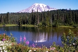
The
Cascade Range is a major
mountain rangeA mountain range is a single, large mass consisting of a succession of mountains or narrowly spaced mountain ridges, with or without peaks, closely related in position, direction, formation, and age; a component part of a mountain system or of a mountain chain...
of western
North AmericaNorth America is a continent wholly within the Northern Hemisphere and almost wholly within the Western Hemisphere. It is also considered a northern subcontinent of the Americas...
, extending from southern
British ColumbiaBritish Columbia is the westernmost of Canada's provinces and is known for its natural beauty, as reflected in its Latin motto, Splendor sine occasu . Its name was chosen by Queen Victoria in 1858...
through Washington and
OregonOregon is a state in the Pacific Northwest region of the United States. It is located on the Pacific coast, with Washington to the north, California to the south, Nevada on the southeast and Idaho to the east. The Columbia and Snake rivers delineate much of Oregon's northern and eastern...
to
Northern CaliforniaNorthern California is the northern portion of the U.S. state of California. The San Francisco Bay Area , and Sacramento as well as its metropolitan area are the main population centers...
. It includes both non-volcanic mountains, such as the
North CascadesThe North Cascades are a section of the Cascade Range of western North America. They span the border between the Canadian province of British Columbia and the U.S. state of Washington and are officially named in Canada as the Cascade Mountains...
, and the notable
volcano2. Bedrock3. Conduit 4. Base5. Sill6. Dike7. Layers of ash emitted by the volcano8. Flank| 9. Layers of lava emitted by the volcano10. Throat11. Parasitic cone12. Lava flow13. Vent14. Crater15...
es known as the
High Cascades. The small part of the range in British Columbia is referred to as the
Canadian Cascades or, locally, as the
Cascade Mountains. The latter term is also sometimes used by Washington residents to refer to the Washington section of the Cascades in addition to
North Cascades, the more usual American term, as in
North Cascades National ParkNorth Cascades National Park is a U.S. National Park located in the state of Washington. The park is the largest of the three National Park Service units that comprise the North Cascades National Park Service Complex. Several national wilderness areas and British Columbia parkland adjoin the...
.
The Cascades are part of the
Pacific Ring of FireThe Pacific Ring of Fire is an area where large numbers of earthquakes and volcanic eruptions occur in the basin of the Pacific Ocean. In a horseshoe shape, it is associated with a nearly continuous series of oceanic trenches, volcanic arcs, and volcanic belts and/or plate movements...
, the ring of volcanoes and associated mountains around the
Pacific OceanThe Pacific Ocean is the largest of the Earth's oceanic divisions. It extends from the Arctic in the north to the Southern Ocean in the south, bounded by Asia and Australia in the west, and the Americas in the east.At 165.2 million square kilometres in area, this largest division of the World...
. All of the known historic eruptions in the
contiguous United StatesThe contiguous United States are the 48 U.S. states on the continent of North America that are south of Canada and north of Mexico, plus the District of Columbia....
have been from Cascade volcanoes. The two most recent were
Lassen PeakLassen Peak is the southernmost active volcano in the Cascade Range. It is part of the Cascade Volcanic Arc which is an arc that stretches from northern California to southwestern British Columbia...
in 1914 to 1921 and a
major eruption of Mount St. Helens in 1980The 1980 eruption of Mount St. Helens, a stratovolcano located in Washington state, in the United States, was a major volcanic eruption. The eruption was the only significant one to occur in the contiguous 48 U.S. states since the 1915 eruption of Lassen Peak in California...
. Minor eruptions of Mount St. Helens have also occurred since, most recently in 2006.
Geography
The Cascades extend from
Lassen PeakLassen Peak is the southernmost active volcano in the Cascade Range. It is part of the Cascade Volcanic Arc which is an arc that stretches from northern California to southwestern British Columbia...
(also known as Mount Lassen) (3170 m) in northern California to the confluence of the
NicolaThe Nicola River, originally French Rivière de Nicholas or Rivière de Nicolas, adapted to Nicolas River, Nicola's River in English, , is one of the major tributaries of the Thompson River in the Canadian province of British Columbia, entering the latter at the town of Spences Bridge...
and
Thompson RiverThe Thompson River is the largest tributary of the Fraser River, flowing through the south-central portion of British Columbia, Canada. The Thompson River has two main branches called the South Thompson and the North Thompson...
s in
British ColumbiaBritish Columbia is the westernmost of Canada's provinces and is known for its natural beauty, as reflected in its Latin motto, Splendor sine occasu . Its name was chosen by Queen Victoria in 1858...
. The
Fraser RiverThe Fraser River is the longest river within British Columbia, Canada, rising at Fraser Pass near Mount Robson in the Rocky Mountains and flowing for , into the Strait of Georgia at the city of Vancouver. It is the tenth longest river in Canada...
separates the Cascades from the
Coast MountainsThe Coast Mountains are a major mountain range, in the Pacific Coast Ranges, of western North America, extending from southwestern Yukon through the Alaska Panhandle and virtually all of the Coast of British Columbia. They are so-named because of their proximity to the sea coast, and are often...
. The tallest volcanoes of the Cascades are called the High Cascades and dominate their surroundings, often standing twice the height of the nearby mountains. They often have a visual height (height above nearby crestlines) of one mile (1.6 km) or more. The tallest peaks, such as the 14,411 foot (4,395 m) high
Mount RainierMount Rainier is a massive stratovolcano located southeast of Seattle in the state of Washington, United States. It is the most topographically prominent mountain in the contiguous United States and the Cascade Volcanic Arc, with a summit elevation of . Mt. Rainier is considered one of the most...
, dominate their surroundings for 50 to 100 miles (80 to 160 km).
The northern part of the range, north of
Mount RainierMount Rainier is a massive stratovolcano located southeast of Seattle in the state of Washington, United States. It is the most topographically prominent mountain in the contiguous United States and the Cascade Volcanic Arc, with a summit elevation of . Mt. Rainier is considered one of the most...
, is known as the
North CascadesThe North Cascades are a section of the Cascade Range of western North America. They span the border between the Canadian province of British Columbia and the U.S. state of Washington and are officially named in Canada as the Cascade Mountains...
in the United States but is formally named the Cascade Mountains north of the Canada – United States border, reaching to the northern extremity of the Cascades at Lytton Mountain. Overall, the North Cascades and southwestern Canadian Cascades are extremely rugged, with many of the lesser peaks steep and glaciated, with valleys quite low relative to its peaks and ridges, resulting in great local
reliefTerrain, or land relief, is the vertical and horizontal dimension of land surface. When relief is described underwater, the term bathymetry is used...
, and major passes are only about 1,000 m (3,300 ft) high. The southern part of the Canadian Cascades, particularly the
Skagit RangeThe Skagit Range is a subrange of the Cascade Range in southwestern British Columbia, Canada and northwestern Washington, United States, which are known in Canada as the Canadian Cascades or, officially, the Cascade Mountains...
, is geologically and topographically similar to the
North CascadesThe North Cascades are a section of the Cascade Range of western North America. They span the border between the Canadian province of British Columbia and the U.S. state of Washington and are officially named in Canada as the Cascade Mountains...
, while the northern and northeastern parts - the
Coquihalla RangeThe Coquihalla Range is an informally named mountain range in British Columbia that lies between the Coquihalla River and the Fraser Canyon. It is part of the Canadian Cascades, which are officially named the Cascade Mountains and are the northernmost part of the Cascade Range, which begins in...
, the name of which is unofficial,, the northern half of the
Hozameen RangeThe Hozameen Range is a mountain range in southwestern British Columbia and northern Washington, straddling the division between the Coast and Interior regions of that province...
and most of the
Okanagan RangeThe Okanagan Range or Okanogan Range is a small subrange of the Cascade Range straddling the border between British Columbia and Washington south of the Similkameen River on the inland side of the range...
are less glaciated and more plateau-like in character, resembling nearby areas of the
Thompson PlateauThe Thompson Plateau, also known as the Okanagan-Thompson Plateau, forms the southern portion of the Interior Plateau of British Columbia, Canada, lying to the west of Okanagan Lake, south of the Thompson River and to the east of the Fraser River...
.
Because of the range's proximity to the
Pacific OceanThe Pacific Ocean is the largest of the Earth's oceanic divisions. It extends from the Arctic in the north to the Southern Ocean in the south, bounded by Asia and Australia in the west, and the Americas in the east.At 165.2 million square kilometres in area, this largest division of the World...
and the region's
prevailing westerly windsThe Westerlies, anti-trades, or Prevailing Westerlies, are the prevailing winds in the middle latitudes between 30 and 60 degrees latitude, blowing from the high pressure area in the horse latitudes towards the poles. These prevailing winds blow from the west to the east, and steer extratropical...
, precipitation is substantial, especially on the western slopes, with annual accumulations of up to 150 inches (3,800 mm) in some areas—
Mount BakerMount Baker , also known as Koma Kulshan or simply Kulshan, is an active glaciated andesitic stratovolcano in the Cascade Volcanic Arc and the North Cascades of Washington State in the United States. It is the second-most active volcano in the range after Mount Saint Helens...
, for instance, recorded the largest single-season snowfall on record in the world in 1999—and heavy snowfall as low as 2,000 feet (600 m). It is not uncommon for some places in the Cascades to have over 200 inches (5,500 mm) of snow accumulation, such as at
Lake HelenLake Helen is a glacial lake or a tarn occupying a cirque at around 8,200 feet in Lassen Volcanic National Park. The lake is located to the south of Lassen Peak and west of Bumpass Mountain in the Shasta Cascades region of Northern California. Highway 89 runs along the lake's southern and eastern...
(near Lassen Peak), one of the snowiest places in the world. Most of the High Cascades are therefore white with snow and ice year-round. The western slopes are densely covered with
Douglas-firDouglas-fir is one of the English common names for evergreen coniferous trees of the genus Pseudotsuga in the family Pinaceae. Other common names include Douglas tree, and Oregon pine. There are five species, two in western North America, one in Mexico, and two in eastern Asia...
,
Western HemlockTsuga heterophylla. the Western Hemlock, is a species of hemlock native to the west coast of North America, with its northwestern limit on the Kenai Peninsula, Alaska, and its southeastern limit in northern Sonoma County, California.-Habitat:...
and
Red alderAlnus rubra, the Red alder, is a deciduous broadleaf tree native to western North America.-Description:It is the largest species of alder in North America and one of the largest in the world, reaching heights of 20–35 m. The official tallest red alder stands 32 meters tall in Clatsop County, Oregon...
, while the drier eastern slopes are mostly
Ponderosa PinePinus ponderosa, commonly known as the Ponderosa Pine, Bull Pine, Blackjack Pine, or Western Yellow Pine, is a widespread and variable pine native to western North America. It was first described by David Douglas in 1826, from eastern Washington near present-day Spokane...
, with
Western LarchWestern Larch is a species of larch native to the mountains of western North America, in Canada in southeastern British Columbia and southwestern Alberta, and in the United States in eastern Washington, eastern Oregon, northern Idaho and western Montana.It is a large deciduous coniferous tree...
at higher elevations. Annual rainfall drops to 9 inches (200 mm) on the eastern foothills due to a rainshadow effect.
Beyond the foothills is an
aridA region is said to be arid when it is characterized by a severe lack of available water, to the extent of hindering or even preventing the growth and development of plant and animal life...
plateau that was created 16 million years ago as a coalescing series of layered flood
basaltBasalt is a common extrusive volcanic rock. It is usually grey to black and fine-grained due to rapid cooling of lava at the surface of a planet. It may be porphyritic containing larger crystals in a fine matrix, or vesicular, or frothy scoria. Unweathered basalt is black or grey...
flows. Together, these sequences of fluid
volcanic rockVolcanic rock is a rock formed from magma erupted from a volcano. In other words, it is an igneous rock of volcanic origin...
form a 200000 square miles (517,997.6 km²) region out of eastern Washington,
OregonOregon is a state in the Pacific Northwest region of the United States. It is located on the Pacific coast, with Washington to the north, California to the south, Nevada on the southeast and Idaho to the east. The Columbia and Snake rivers delineate much of Oregon's northern and eastern...
, and parts of
Northern CaliforniaNorthern California is the northern portion of the U.S. state of California. The San Francisco Bay Area , and Sacramento as well as its metropolitan area are the main population centers...
and
IdahoIdaho is a state in the Rocky Mountain area of the United States. The state's largest city and capital is Boise. Residents are called "Idahoans". Idaho was admitted to the Union on July 3, 1890, as the 43rd state....
called the
Columbia River PlateauThe Columbia Plateau is a geologic and geographic region that lies across parts of the U.S. states of Washington, Oregon, and Idaho. It is a wide flood basalt plateau between the Cascade Range and the Rocky Mountains, cut through by the Columbia River...
.
The
Columbia River GorgeThe Columbia River Gorge is a canyon of the Columbia River in the Pacific Northwest of the United States. Up to deep, the canyon stretches for over as the river winds westward through the Cascade Range forming the boundary between the State of Washington to the north and Oregon to the south...
is the only major break in the American part of the Cascades. When the Cascades started to rise 7 million years ago in the
PlioceneThe Pliocene Epoch is the period in the geologic timescale that extends from 5.332 million to 2.588 million years before present. It is the second and youngest epoch of the Neogene Period in the Cenozoic Era. The Pliocene follows the Miocene Epoch and is followed by the Pleistocene Epoch...
, the Columbia River drained the relatively low Columbia River Plateau. As the range grew, the Columbia was able to keep pace, creating the gorge and major pass seen today. The gorge also exposes uplifted and warped layers of basalt from the plateau.
History
Indigenous peoplesThe indigenous peoples of the Americas are the pre-Columbian inhabitants of North and South America, their descendants and other ethnic groups who are identified with those peoples. Indigenous peoples are known in Canada as Aboriginal peoples, and in the United States as Native Americans...
have inhabited the area for thousands of years and developed their own
mythThe term mythology can refer either to the study of myths, or to a body or collection of myths. As examples, comparative mythology is the study of connections between myths from different cultures, whereas Greek mythology is the body of myths from ancient Greece...
s and
legendA legend is a narrative of human actions that are perceived both by teller and listeners to take place within human history and to possess certain qualities that give the tale verisimilitude...
s concerning the Cascades. According to some of these tales, Mounts
BakerMount Baker , also known as Koma Kulshan or simply Kulshan, is an active glaciated andesitic stratovolcano in the Cascade Volcanic Arc and the North Cascades of Washington State in the United States. It is the second-most active volcano in the range after Mount Saint Helens...
,
JeffersonMount Jefferson is a stratovolcano in the Cascade Volcanic Arc, part of the Cascade Range, and is the second highest mountain in Oregon. Situated in the far northeastern corner of Linn County on the Jefferson County line, about east of Corvallis, Mount Jefferson is in a rugged wilderness and is...
, and
ShastaMount Shasta is located at the southern end of the Cascade Range in Siskiyou County, California and at is the second highest peak in the Cascades and the fifth highest in California...
were used as refuge from a great
floodA flood is an overflow of an expanse of water that submerges land. The EU Floods directive defines a flood as a temporary covering by water of land not normally covered by water...
. Other stories, such as the
Bridge of the GodsThe Bridge of the Gods was a natural dam created by the Bonneville Slide, a major landslide that dammed the Columbia River near present-day Cascade Locks, Oregon in the Pacific Northwest of the United States...
tale, had various High Cascades such as
HoodMount Hood, called Wy'east by the Multnomah tribe, is a stratovolcano in the Cascade Volcanic Arc of northern Oregon. It was formed by a subduction zone and rests in the Pacific Northwest region of the United States...
and
AdamsMount Adams is a potentially activestratovolcano in the Cascade Range and the second-highest mountain in the U.S. state of Washington.Adams is a member of the Cascade Volcanic Arc, and is one of the arc's largest volcanoes,...
, act as god-like chiefs who made
warWar is a state of organized, armed, and often prolonged conflict carried on between states, nations, or other parties typified by extreme aggression, social disruption, and usually high mortality. War should be understood as an actual, intentional and widespread armed conflict between political...
by throwing fire and stone at each other.
St. HelensMount St. Helens is an active stratovolcano located in Skamania County, Washington, in the Pacific Northwest region of the United States. It is south of Seattle, Washington and northeast of Portland, Oregon. Mount St. Helens takes its English name from the British diplomat Lord St Helens, a...
with its pre-1980 graceful appearance, was regaled as a beautiful maiden for whom Hood and Adams feuded. Among the many stories concerning Mount Baker, one tells that the mountain was formerly married to Mount Rainier and lived in that vicinity. Then, because of a marital dispute, she picked herself up and marched north to her present position. Native tribes also developed their own names for the High Cascades and many of the smaller peaks, the most well known to non-natives being Tahoma, the
LushootseedLushootseed is the language or dialect continuum of several SalishNative American groups of modern-day Washington state...
name for
Mount RainierMount Rainier is a massive stratovolcano located southeast of Seattle in the state of Washington, United States. It is the most topographically prominent mountain in the contiguous United States and the Cascade Volcanic Arc, with a summit elevation of . Mt. Rainier is considered one of the most...
.
In the spring of 1792 British navigator
George VancouverCaptain George Vancouver RN was an English officer of the British Royal Navy, best known for his 1791-95 expedition, which explored and charted North America's northwestern Pacific Coast regions, including the coasts of contemporary Alaska, British Columbia, Washington and Oregon...
entered
Puget SoundPuget Sound is a sound in the U.S. state of Washington. It is a complex estuarine system of interconnected marine waterways and basins, with one major and one minor connection to the Strait of Juan de Fuca and the Pacific Ocean — Admiralty Inlet being the major connection and...
and started to give
EnglishEnglish is a West Germanic language that arose in the Anglo-Saxon kingdoms of England and spread into what was to become south-east Scotland under the influence of the Anglian medieval kingdom of Northumbria...
names to the high mountains he saw.
Mount BakerMount Baker , also known as Koma Kulshan or simply Kulshan, is an active glaciated andesitic stratovolcano in the Cascade Volcanic Arc and the North Cascades of Washington State in the United States. It is the second-most active volcano in the range after Mount Saint Helens...
was named for Vancouver's third lieutenant, the graceful
Mount St. HelensMount St. Helens is an active stratovolcano located in Skamania County, Washington, in the Pacific Northwest region of the United States. It is south of Seattle, Washington and northeast of Portland, Oregon. Mount St. Helens takes its English name from the British diplomat Lord St Helens, a...
for a famous diplomat,
Mount HoodMount Hood, called Wy'east by the Multnomah tribe, is a stratovolcano in the Cascade Volcanic Arc of northern Oregon. It was formed by a subduction zone and rests in the Pacific Northwest region of the United States...
was named in honor of
Samuel Hood, 1st Viscount HoodSamuel Hood, 1st Viscount Hood was a British Admiral known particularly for his service in the American War of Independence and French Revolutionary Wars...
(an
admiralAdmiral is the rank, or part of the name of the ranks, of the highest naval officers. It is usually considered a full admiral and above vice admiral and below admiral of the fleet . It is usually abbreviated to "Adm" or "ADM"...
of the
Royal NavyThe Royal Navy is the naval warfare service branch of the British Armed Forces. Founded in the 16th century, it is the oldest service branch and is known as the Senior Service...
) and the tallest Cascade,
Mount RainierMount Rainier is a massive stratovolcano located southeast of Seattle in the state of Washington, United States. It is the most topographically prominent mountain in the contiguous United States and the Cascade Volcanic Arc, with a summit elevation of . Mt. Rainier is considered one of the most...
, is the namesake of Admiral
Peter RainierPeter Rainier, Jr. was a British naval officer. Mount Rainier in Washington, USA, was named after him.-Biography:Rainier was born in England, the grandson of Daniel Regnier, a Huguenot refugee, and the son of Peter Rainier of Sandwich. He enlisted in the Royal Navy in 1756 at the age of 15. He...
. Vancouver's expedition did not, however, name the range these peaks belonged to. As marine trade in the
Strait of GeorgiaThe Strait of Georgia or the Georgia Strait is a strait between Vancouver Island and the mainland coast of British Columbia, Canada. It is approximately long and varies in width from...
and
Puget SoundPuget Sound is a sound in the U.S. state of Washington. It is a complex estuarine system of interconnected marine waterways and basins, with one major and one minor connection to the Strait of Juan de Fuca and the Pacific Ocean — Admiralty Inlet being the major connection and...
proceeded in the 1790s and beyond, the summits of
RainierMount Rainier is a massive stratovolcano located southeast of Seattle in the state of Washington, United States. It is the most topographically prominent mountain in the contiguous United States and the Cascade Volcanic Arc, with a summit elevation of . Mt. Rainier is considered one of the most...
and
BakerMount Baker , also known as Koma Kulshan or simply Kulshan, is an active glaciated andesitic stratovolcano in the Cascade Volcanic Arc and the North Cascades of Washington State in the United States. It is the second-most active volcano in the range after Mount Saint Helens...
became familiar to captains and crews (mostly British and American over all others, but not exclusively).
In 1805 the
Lewis and Clark ExpeditionThe Lewis and Clark Expedition, or ″Corps of Discovery Expedition" was the first transcontinental expedition to the Pacific Coast by the United States. Commissioned by President Thomas Jefferson and led by two Virginia-born veterans of Indian wars in the Ohio Valley, Meriwether Lewis and William...
passed through the Cascades by using the
Columbia RiverThe Columbia River is the largest river in the Pacific Northwest region of North America. The river rises in the Rocky Mountains of British Columbia, Canada, flows northwest and then south into the U.S. state of Washington, then turns west to form most of the border between Washington and the state...
, which for many years was the only practical way to pass that part of the range. Trade on the lower
Columbia RiverThe Columbia River is the largest river in the Pacific Northwest region of North America. The river rises in the Rocky Mountains of British Columbia, Canada, flows northwest and then south into the U.S. state of Washington, then turns west to form most of the border between Washington and the state...
did not occur until after Lewis and Clark in 1806, more specifically as a result of
David ThompsonDavid Thompson was an English-Canadian fur trader, surveyor, and map-maker, known to some native peoples as "Koo-Koo-Sint" or "the Stargazer"...
's visit on behalf of the
North West CompanyThe North West Company was a fur trading business headquartered in Montreal from 1779 to 1821. It competed with increasing success against the Hudson's Bay Company in what was to become Western Canada...
shortly afterwards, and
Simon FraserSimon Fraser was a fur trader and an explorer who charted much of what is now the Canadian province of British Columbia. Fraser was employed by the Montreal-based North West Company. By 1805, he had been put in charge of all the company's operations west of the Rocky Mountains...
's journey down the
FraserThe Fraser River is the longest river within British Columbia, Canada, rising at Fraser Pass near Mount Robson in the Rocky Mountains and flowing for , into the Strait of Georgia at the city of Vancouver. It is the tenth longest river in Canada...
in 1808. The Lewis and Clark expedition, and the many settlers and traders that followed, met their last obstacle to their journey at the
Cascades RapidsThe Cascades Rapids were an area of rapids along North America's Columbia River, between the U.S. states of Washington and Oregon. Through a stretch approximately wide, the river dropped about in .-Boat portage:Boat travelers were forced to either portage boats and supplies or pull boats up with...
in the
Columbia River GorgeThe Columbia River Gorge is a canyon of the Columbia River in the Pacific Northwest of the United States. Up to deep, the canyon stretches for over as the river winds westward through the Cascade Range forming the boundary between the State of Washington to the north and Oregon to the south...
, a feature on the river now submerged beneath the
Bonneville ReservoirBonneville Lock and Dam consists of several run-of-the-river dam structures that together complete a span of the Columbia River between the U.S. states of Oregon and Washington at River Mile 146.1. The dam is located east of Portland, Oregon, in the Columbia River Gorge. The primary functions of...
. Before long, the great white-capped mountains that loomed above the rapids were called the "mountains by the cascades" and later simply as the "Cascades". The earliest attested use of the name "Cascade Range" is in the writings of botanist
David DouglasDavid Douglas was a Scottish botanist. He worked as a gardener, and explored the Scottish Highlands, North America, and Hawaii, where he died.-Early life:...
. On their return trip Lewis and Clark's group spotted a high but distant snowy pinnacle that they named for the sponsor of the expedition, U.S. President
Thomas JeffersonThomas Jefferson was the principal author of the United States Declaration of Independence and the Statute of Virginia for Religious Freedom , the third President of the United States and founder of the University of Virginia...
.
In 1814
Alexander Ross-Fur trader and explorer:Ross emigrated to Upper Canada, present day , from Scotland about 1805.In 1811, while working for John Jacob Astor's Pacific Fur Company, Ross took part in the founding of Fort Astoria, a fur-trading post at the mouth of the Columbia River...
, a fur trader with the
North West CompanyThe North West Company was a fur trading business headquartered in Montreal from 1779 to 1821. It competed with increasing success against the Hudson's Bay Company in what was to become Western Canada...
, seeking a viable route across the mountains, explored and crossed the northern Cascades between
Fort OkanoganFort Okanogan was founded as a fur trade outpost by John Jacob Astor’s Pacific Fur Company in 1811. It was built at the confluence of the Okanogan and Columbia Rivers, in what is now Okanogan County, Washington...
and Puget Sound. His report of the journey is vague about the route taken. He followed the lower
Methow RiverThe Methow River is a tributary of the Columbia River in northern Washington in the United States. The river's watershed is , with a population of about 5,000 people. The Methow's watershed is characterized by relatively pristine habitats, with much of the river basin is located in national forests...
into the mountains. He might have used
Cascade PassCascade Pass is a mountain pass over the northern Cascade Range, east of Marblemount, Washington, U.S....
to reach the
Skagit RiverThe Skagit River is a river in southwestern British Columbia in Canada and northwestern Washington in the United States, approximately 150 mi long...
. Ross was the first European-American to explore the Methow River area and likely the first to explore the
Stehekin RiverThe Stehekin River is a river located in Washington state in the Pacific Northwest of the United States. It is the main river flowing into Lake Chelan. Miners arrived in Stehekin River Valley in the late 19th century. They were followed by homesteaders in the early 20th century...
and Bridge Creek region. Due to the difficulty of crossing the northern Cascades and the paucity of beaver, after Ross fur-trading companies made only a few explorations into the mountains north of the Columbia River after Ross.
Exploration and settlement of the Cascades region by Europeans and Americans was accelerated by the establishment of a major trading post of the Hudson's Bay Company at
Fort VancouverFort Vancouver was a 19th century fur trading outpost along the Columbia River that served as the headquarters of the Hudson's Bay Company in the company's Columbia District...
near today's
Portland, OregonPortland is a city located in the Pacific Northwest, near the confluence of the Willamette and Columbia rivers in the U.S. state of Oregon. As of the 2010 Census, it had a population of 583,776, making it the 29th most populous city in the United States...
. From this base, Hudson's Bay Company trapping parties traveled throughout the Cascades in search of beaver and other fur-bearing animals. For example, using what became known as the
Siskiyou TrailThe Siskiyou Trail stretched from California's Central Valley to Oregon's Willamette Valley; modern-day Interstate 5 follows this pioneer path...
, Hudson's Bay Company trappers were the first non-natives to explore the southern Cascades in the 1820s and 1830s, establishing trails which passed near
Crater LakeCrater Lake is a caldera lake located in the south-central region of the U.S. state of Oregon. It is the main feature of Crater Lake National Park and famous for its deep blue color and water clarity. The lake partly fills a nearly deep caldera that was formed around 7,700 years agoby the...
,
Mount McLoughlinMount McLoughlin is a steep-sided lava cone built on top of a shield volcano in the Cascade Range of southern Oregon and within the Sky Lakes Wilderness area. It is one of the volcanic peaks in the Cascade Volcanic Arc. The mountain is north of Mount Shasta, south of Crater Lake, and west of Upper...
,
Medicine Lake VolcanoMedicine Lake Volcano is a large shield volcano in northeastern California about northeast of Mount Shasta. The volcano is located in a zone of east-west crustal extension east of the main axis of the Cascade Volcanic Arc and the Cascade Range. The thick shield is from east to west and from...
,
Mount ShastaMount Shasta is located at the southern end of the Cascade Range in Siskiyou County, California and at is the second highest peak in the Cascades and the fifth highest in California...
, and
Lassen PeakLassen Peak is the southernmost active volcano in the Cascade Range. It is part of the Cascade Volcanic Arc which is an arc that stretches from northern California to southwestern British Columbia...
.
The course of political history in the
Pacific NorthwestThe Pacific Northwest is a region in northwestern North America, bounded by the Pacific Ocean to the west and, loosely, by the Rocky Mountains on the east. Definitions of the region vary and there is no commonly agreed upon boundary, even among Pacific Northwesterners. A common concept of the...
saw the spine of the Cascade Range being proposed as a boundary settlement during the Oregon Dispute of 1846. The
United StatesThe United States of America is a federal constitutional republic comprising fifty states and a federal district...
rejected the proposal and insisted on the
49th parallel northThe 49th parallel north is a circle of latitude that is 49 degrees north of the Earth's equatorial plane. It crosses Europe, Asia, the Pacific Ocean, North America, and the Atlantic Ocean....
, which cuts across the range just north of Mount Baker. Throughout the period of dispute and up to the creation of the
Crown ColonyA Crown colony, also known in the 17th century as royal colony, was a type of colonial administration of the English and later British Empire....
of
British ColumbiaBritish Columbia is the westernmost of Canada's provinces and is known for its natural beauty, as reflected in its Latin motto, Splendor sine occasu . Its name was chosen by Queen Victoria in 1858...
in 1858, the Hudson's Bay Company's
York Factory ExpressThe York Factory Express, usually called "the Express" and also called the Columbia Express and the Communication, was a brigade operated by Hudson's Bay Company in the early 19th century connecting York Factory and Fort Vancouver. It was named "express" because it was not used only to transport...
route, as well the route of fur brigades, followed the Okanogan River along the east edge of the Cascades and the Columbia River through the range. Passes across the range were not well known and little used.
Naches PassNaches Pass is a mountain pass of the Cascade Range in the U.S. state of Washington. It is located about east of Tacoma and about northwest of Yakima, near the headwaters of tributary streams of the Naches River on the east and the Greenwater River on the west. The boundaries of Pierce, King,...
was used for driving cattle and horses to
Fort NisquallyFort Nisqually was an important fur trading and farming post of the Hudson's Bay Company in the Puget Sound area of what is now DuPont, Washington and was part of the Hudson's Bay Company's Columbia Department. Today it is a living history museum located in Tacoma, Washington, USA, within the...
. Yakima Pass was also used by the Hudson's Bay Company. The vast majority of non-native residents of the Cascade Range region until about 1840 were British subjects, most of mixed French-native blood and some Hawaiians and blacks as well as Scots who were the backbone of Hudson's Bay Company administration.
American settlement of the flanks of the Coast Range did not occur until the early 1840s, at first only marginally. Following the
Oregon TreatyThe Oregon Treaty is a treaty between the United Kingdom and the United States that was signed on June 15, 1846, in Washington, D.C. The treaty brought an end to the Oregon boundary dispute by settling competing American and British claims to the Oregon Country, which had been jointly occupied by...
the inward flux of migration from the
Oregon TrailThe Oregon Trail is a historic east-west wagon route that connected the Missouri River to valleys in Oregon and locations in between.After 1840 steam-powered riverboats and steamboats traversing up and down the Ohio, Mississippi and Missouri rivers sped settlement and development in the flat...
intensified and the passes and back-valleys of what is now the state of Washington were explored and populated, and it was not long after that railways followed. Despite its being traversed by several major freeways and rail lines, and its lower flanks subjected to major logging in recent decades, large parts of the range remain intense and forbidding alpine wilderness. Most of the northern half of the High Cascades, from Rainier north, have been preserved by
US nationalThe National Park Service is the U.S. federal agency that manages all national parks, many national monuments, and other conservation and historical properties with various title designations...
or
British ColumbiaBritish Columbia is the westernmost of Canada's provinces and is known for its natural beauty, as reflected in its Latin motto, Splendor sine occasu . Its name was chosen by Queen Victoria in 1858...
provincial parkA provincial park is a park under the management of a provincial or territorial government in Canada.While provincial parks are not the same as national parks, their workings are very similar...
s (such as E.C. Manning Provincial Park), or other forms of protected area.
The Canadian side of the range has a history that includes the
Fraser Canyon Gold RushThe Fraser Canyon Gold Rush, began in 1858 after gold was discovered on the Thompson River in British Columbia at its confluence with the Nicoamen River. This was a few miles upstream from the Thompson's confluence with the Fraser River at present-day Lytton...
of 1858-60 and its famous
Cariboo RoadThe Cariboo Road was a project initiated in 1860 by the colonial Governor of British Columbia, James Douglas...
, as well as the older
Hudson's Bay CompanyThe Hudson's Bay Company , abbreviated HBC, or "The Bay" is the oldest commercial corporation in North America and one of the oldest in the world. A fur trading business for much of its existence, today Hudson's Bay Company owns and operates retail stores throughout Canada...
Brigade Trail from the Canyon to the Interior, the Dewdney Trail, and older routes which connected east to the
SimilkameenThe Similkameen River runs through southern British Columbia, eventually discharging into the Okanogan River near Oroville, Washington in the United States. The river is approximately long, and its drainage basin is in area...
and
OkanaganOkanogan or Okanagan refers to:*Okanagan people, a Native American or First Nations people, known as the Syilx in their own language*Okanagan languageCanada:*Okanagan , a region of British Columbia...
valleys.
The southern mainline of the
Canadian Pacific RailwayThe Canadian Pacific Railway , formerly also known as CP Rail between 1968 and 1996, is a historic Canadian Class I railway founded in 1881 and now operated by Canadian Pacific Railway Limited, which began operations as legal owner in a corporate restructuring in 2001...
penetrated the range via the passes of the
Coquihalla RiverThe Coquihalla River is located in the Cascade Mountains near the town of Hope, British Columbia. It originates in the Coquihalla Lakes and empties into the Fraser River at Hope....
, along one of the steepest and snowiest routes in the entire
Pacific CordilleraThe Pacific Cordillera is a top-level physiographic region of Canada. This cordillera is part of the Western Cordillera of North America. The mountain ranges in this region were covered during the Pleistocene by the Cordilleran Ice Sheet...
. Near
Hope, B.C.Hope is a district municipality located at the confluence of the Fraser and Coquihalla rivers in the province of British Columbia, Canada. Hope is at the eastern end of both the Fraser Valley and the Lower Mainland region, and is at the southern end of the Fraser Canyon...
, the
railway roadbedThe Kettle Valley Railroad was a subsidiary of the Canadian Pacific Railway that operated in the Thompson-Okanagan region of southern British Columbia....
and the
Othello TunnelsCoquihalla Canyon Provincial Park, popularly called The Othello Tunnels is a provincial park located near Hope, British Columbia focused on the canyon of the Coquihalla River and a decommissioned railway grade, now a walking trail, leading eventually to Coquihalla Pass...
, now decommissioned, are popular tourist recreation destinations for hiking and bicycling. The pass is used by the Coquihalla Highway, a government
megaprojectA megaproject is an extremely large-scale investment project. Megaprojects are typically defined as costing more than US$1 billion and attracting a lot of public attention because of substantial impacts on communities, environment, and budgets. Megaprojects can also be defined as "initiatives that...
built as part of the
Expo 86The 1986 World Exposition on Transportation and Communication, or simply Expo '86, was a World's Fair held in Vancouver, British Columbia, Canada from Friday, May 2 until Monday, October 13, 1986...
spending boom of the 1980s, which is now the main route from the Coast to the
British ColumbiaBritish Columbia is the westernmost of Canada's provinces and is known for its natural beauty, as reflected in its Latin motto, Splendor sine occasu . Its name was chosen by Queen Victoria in 1858...
interior. Traffic formerly went via the
Fraser CanyonThe Fraser Canyon is an 84 km landform of the Fraser River where it descends rapidly through narrow rock gorges in the Coast Mountains en route from the Interior Plateau of British Columbia to the Fraser Valley...
, to the west, or via
Allison PassAllison Pass is a highway summit along the Crowsnest Highway in British Columbia, Canada. It is the highest point on the highway between the cities of Hope and Princeton. It is located in the middle of Manning Park, at the divide between the Skagit & Similkameen River drainages, approximately ...
and Manning Park along
Highway 3The Crowsnest Highway, also known as the Interprovincial or, in British Columbia, the Southern Trans-Provincial, is an east-west highway, in length, through the southern parts of British Columbia and Alberta, providing the shortest highway connection between British Columbia's Lower Mainland and...
to the south, near the border.
The
Barlow RoadThe Barlow Road is a historic road in what is now the U.S. state of Oregon. It was built in 1846 by Sam Barlow and Philip Foster, with authorization of the Provisional Legislature of Oregon, and served as the last overland segment of the Oregon Trail...
was the first established land path for U.S. settlers through the Cascade Range in 1845, and formed the final overland link for the
Oregon TrailThe Oregon Trail is a historic east-west wagon route that connected the Missouri River to valleys in Oregon and locations in between.After 1840 steam-powered riverboats and steamboats traversing up and down the Ohio, Mississippi and Missouri rivers sped settlement and development in the flat...
(previously, settlers had to raft down the treacherous rapids of the
Columbia RiverThe Columbia River is the largest river in the Pacific Northwest region of North America. The river rises in the Rocky Mountains of British Columbia, Canada, flows northwest and then south into the U.S. state of Washington, then turns west to form most of the border between Washington and the state...
). The Barlow Road left the Columbia at Hood River and passed along the south side of Mount Hood at Government Camp, terminating in Oregon City. There is an interpretive site there now at "The End of The Oregon Trail." The road was constructed as a toll road — $5/wagon — and was very successful.
In addition, the
Applegate TrailThe Applegate Trail was a wilderness trail through today's U.S. states of Idaho, Nevada, California, and Oregon, and was originally intended as a less dangerous route to the Oregon Territory.-Background:...
was created to allow settlers to avoid rafting down the Columbia River. The Applegate Trail used the path of the
California TrailThe California Trail was an emigrant trail of about across the western half of the North American continent from Missouri River towns to what is now the state of California...
to north-central
NevadaNevada is a state in the western, mountain west, and southwestern regions of the United States. With an area of and a population of about 2.7 million, it is the 7th-largest and 35th-most populous state. Over two-thirds of Nevada's people live in the Las Vegas metropolitan area, which contains its...
. From there, the Applegate Trail headed northwest into northern California, and continued northwest towards today's
Ashland, OregonAshland is a city in Jackson County, Oregon, United States, near Interstate 5 and the California border, and located in the south end of the Rogue Valley. It was named after Ashland County, Ohio, point of origin of Abel Helman and other founders, and secondarily for Ashland, Kentucky, where other...
. From there, settlers would head north along the established Siskiyou Trail into the
Willamette ValleyThe Willamette Valley is the most populated region in the state of Oregon of the United States. Located in the state's northwest, the region is surrounded by tall mountain ranges to the east, west and south and the valley's floor is broad, flat and fertile because of Ice Age conditions...
.
With the exception of the 1915 eruption of remote
Lassen PeakLassen Peak is the southernmost active volcano in the Cascade Range. It is part of the Cascade Volcanic Arc which is an arc that stretches from northern California to southwestern British Columbia...
in
Northern CaliforniaNorthern California is the northern portion of the U.S. state of California. The San Francisco Bay Area , and Sacramento as well as its metropolitan area are the main population centers...
, the range was quiet for more than a century. Then, on May 18, 1980, the dramatic eruption of little-known
Mount St. HelensMount St. Helens is an active stratovolcano located in Skamania County, Washington, in the Pacific Northwest region of the United States. It is south of Seattle, Washington and northeast of Portland, Oregon. Mount St. Helens takes its English name from the British diplomat Lord St Helens, a...
shattered the quiet and brought the world's attention to the range. Geologists were also concerned that the St. Helens eruption was a sign that long-dormant Cascade volcanoes might become active once more, as in the period from 1800 to 1857 when a total of eight erupted. None have erupted since St. Helens, but precautions are being taken nevertheless, such as the Mount Rainier Volcano
LaharA lahar is a type of mudflow or debris flow composed of a slurry of pyroclastic material, rocky debris, and water. The material flows down from a volcano, typically along a river valley. The term is a shortened version of "berlahar" which originated in the Javanese language of...
Warning System in
Pierce County, Washingtonright|thumb|[[Tacoma, Washington|Tacoma]] - Seat of Pierce CountyPierce County is the second most populous county in the U.S. state of Washington. Formed out of Thurston County on December 22, 1852, by the legislature of Oregon Territory...
.
Human uses
SoilSoil is a natural body consisting of layers of mineral constituents of variable thicknesses, which differ from the parent materials in their morphological, physical, chemical, and mineralogical characteristics...
conditions for farming are generally good, especially downwind of
volcano2. Bedrock3. Conduit 4. Base5. Sill6. Dike7. Layers of ash emitted by the volcano8. Flank| 9. Layers of lava emitted by the volcano10. Throat11. Parasitic cone12. Lava flow13. Vent14. Crater15...
es. This is largely due to the fact that volcanic rocks are often rich in
potassiumPotassium is the chemical element with the symbol K and atomic number 19. Elemental potassium is a soft silvery-white alkali metal that oxidizes rapidly in air and is very reactive with water, generating sufficient heat to ignite the hydrogen emitted in the reaction.Potassium and sodium are...
bearing
mineralA mineral is a naturally occurring solid chemical substance formed through biogeochemical processes, having characteristic chemical composition, highly ordered atomic structure, and specific physical properties. By comparison, a rock is an aggregate of minerals and/or mineraloids and does not...
s such as
OrthoclaseOrthoclase is an important tectosilicate mineral which forms igneous rock. The name is from the Greek for "straight fracture," because its two cleavage planes are at right angles to each other. Alternate names are alkali feldspar and potassium feldspar...
and decay easily. Volcanic debris, especially
laharA lahar is a type of mudflow or debris flow composed of a slurry of pyroclastic material, rocky debris, and water. The material flows down from a volcano, typically along a river valley. The term is a shortened version of "berlahar" which originated in the Javanese language of...
s, also have a leveling effect and the storage of
waterWater is a chemical substance with the chemical formula H2O. A water molecule contains one oxygen and two hydrogen atoms connected by covalent bonds. Water is a liquid at ambient conditions, but it often co-exists on Earth with its solid state, ice, and gaseous state . Water also exists in a...
in the form of snow and ice is also important. These snow capped mountains such as Mt. Hood and Mt.Bachelor are used as ski resorts in the late
winter. Much of that water eventually flows into reservoirs where it is used for recreation before its potential
energyIn physics, energy is an indirectly observed quantity. It is often understood as the ability a physical system has to do work on other physical systems...
is captured to generate hydroelectric power before being used to
irrigateIrrigation may be defined as the science of artificial application of water to the land or soil. It is used to assist in the growing of agricultural crops, maintenance of landscapes, and revegetation of disturbed soils in dry areas and during periods of inadequate rainfall...
crops.
Because of the abundance of powerful streams, many of the major westward rivers off the Cascades have been dammed to provide hydroelectric power. One of these,
Ross DamRoss Dam is a -high, -long concrete thin-arch dam across the Skagit River, forming Ross Lake. The dam is in Washington State, while Ross Lake extends north into British Columbia, Canada...
on the
Skagit RiverThe Skagit River is a river in southwestern British Columbia in Canada and northwestern Washington in the United States, approximately 150 mi long...
, created a reservoir which spans the border southeast of
Hope, British ColumbiaHope is a district municipality located at the confluence of the Fraser and Coquihalla rivers in the province of British Columbia, Canada. Hope is at the eastern end of both the Fraser Valley and the Lower Mainland region, and is at the southern end of the Fraser Canyon...
, extending into Canada two miles (3 km). At the foot of the southeast flank of Mount Baker, at
Concrete, WashingtonConcrete is a town in north-central Skagit County, Washington, United States. The population was 705 at the 2010 census. The town of Concrete is included in the Mount Vernon-Anacortes, Washington Metropolitan Statistical Area.-Early history:...
, the
Baker RiverThe Baker River is an approximately , southward-flowing tributary of the Skagit River in northwestern Washington in the United States. It drains an area of the high North Cascades in the watershed of Puget Sound north of Seattle, and east of Mount Baker...
is dammed to form Lake Shannon and Baker Lake.
In addition, there is a largely untapped amount of
geothermal powerGeothermal energy is thermal energy generated and stored in the Earth. Thermal energy is the energy that determines the temperature of matter. Earth's geothermal energy originates from the original formation of the planet and from radioactive decay of minerals...
that can be generated from the Cascades. The USGS Geothermal Research Program has been investigating this potential. Some of this energy is already being used in places like
Klamath Falls, OregonKlamath Falls is a city in Klamath County, Oregon, United States. Originally called Linkville when George Nurse founded the town in 1867, after the Link River on whose falls this city sat, although no falls currently exist; the name was changed to Klamath Falls in 1892...
where volcanic
steamSteam is the technical term for water vapor, the gaseous phase of water, which is formed when water boils. In common language it is often used to refer to the visible mist of water droplets formed as this water vapor condenses in the presence of cooler air...
is used to heat public buildings. The highest recorded temperature found in the range is 510 °F (265 °C) at 3,075 feet (937 m) below
Newberry VolcanoNewberry Volcano is a large potentially active shield volcano located east of the Cascade Range and about southeast of Bend, Oregon. It is not a typical shield volcano. In addition to erupting basaltic lavas, it also has erupted andesitic and even rhyolitic lava.The volcano is in diameter and...
's caldera floor.
Cascade Range volcanoes
Image:Cascade_Range_map.png|thumb|275px|Major volcanoes in the Cascade Range (image map)
rect 219 49 360 66 Mount BakerMount Baker , also known as Koma Kulshan or simply Kulshan, is an active glaciated andesitic stratovolcano in the Cascade Volcanic Arc and the North Cascades of Washington State in the United States. It is the second-most active volcano in the range after Mount Saint Helens...
rect 387 93 244 77 Glacier PeakGlacier Peak is the most isolated of the five major stratovolcanoes of the Cascade Volcanic Arc in Washington...
rect 208 160 369 178 Mount RainierMount Rainier is a massive stratovolcano located southeast of Seattle in the state of Washington, United States. It is the most topographically prominent mountain in the contiguous United States and the Cascade Volcanic Arc, with a summit elevation of . Mt. Rainier is considered one of the most...
rect 171 185 329 205 Mount St. HelensMount St. Helens is an active stratovolcano located in Skamania County, Washington, in the Pacific Northwest region of the United States. It is south of Seattle, Washington and northeast of Portland, Oregon. Mount St. Helens takes its English name from the British diplomat Lord St Helens, a...
rect 175 186 207 230 Mount St. HelensMount St. Helens is an active stratovolcano located in Skamania County, Washington, in the Pacific Northwest region of the United States. It is south of Seattle, Washington and northeast of Portland, Oregon. Mount St. Helens takes its English name from the British diplomat Lord St Helens, a...
rect 213 210 378 236 Mount AdamsMount Adams is a potentially activestratovolcano in the Cascade Range and the second-highest mountain in the U.S. state of Washington.Adams is a member of the Cascade Volcanic Arc, and is one of the arc's largest volcanoes,...
rect 203 264 363 294 Mount HoodMount Hood, called Wy'east by the Multnomah tribe, is a stratovolcano in the Cascade Volcanic Arc of northern Oregon. It was formed by a subduction zone and rests in the Pacific Northwest region of the United States...
rect 201 313 391 342 Mount JeffersonMount Jefferson is a stratovolcano in the Cascade Volcanic Arc, part of the Cascade Range, and is the second highest mountain in Oregon. Situated in the far northeastern corner of Linn County on the Jefferson County line, about east of Corvallis, Mount Jefferson is in a rugged wilderness and is...
rect 202 361 366 386 Three SistersThe Three Sisters are three volcanic peaks of the Cascade Volcanic Arc and the Cascade Range in Oregon, each of which exceeds in elevation. They are the third, fourth, and fifth highest peaks in the state of Oregon and are located in the Three Sisters Wilderness, about southwest from the nearest...
rect 240 395 437 420 Newberry VolcanoNewberry Volcano is a large potentially active shield volcano located east of the Cascade Range and about southeast of Bend, Oregon. It is not a typical shield volcano. In addition to erupting basaltic lavas, it also has erupted andesitic and even rhyolitic lava.The volcano is in diameter and...
rect 180 434 461 460 Mount Mazama (Crater Lake National Park)Mount Mazama is a destroyed stratovolcano in the Oregon part of the Cascade Volcanic Arc and the Cascade Range. The volcano's collapsed caldera holds Crater Lake, and the entire mountain is located within Crater Lake National Park....
rect 169 481 366 505 Mount McLoughlinMount McLoughlin is a steep-sided lava cone built on top of a shield volcano in the Cascade Range of southern Oregon and within the Sky Lakes Wilderness area. It is one of the volcanic peaks in the Cascade Volcanic Arc. The mountain is north of Mount Shasta, south of Crater Lake, and west of Upper...
rect 205 535 447 566 Medicine Lake VolcanoMedicine Lake Volcano is a large shield volcano in northeastern California about northeast of Mount Shasta. The volcano is located in a zone of east-west crustal extension east of the main axis of the Cascade Volcanic Arc and the Cascade Range. The thick shield is from east to west and from...
rect 172 547 202 590 Mount ShastaMount Shasta is located at the southern end of the Cascade Range in Siskiyou County, California and at is the second highest peak in the Cascades and the fifth highest in California...
rect 177 569 312 590 Mount ShastaMount Shasta is located at the southern end of the Cascade Range in Siskiyou County, California and at is the second highest peak in the Cascades and the fifth highest in California...
rect 205 606 339 648 Lassen PeakLassen Peak is the southernmost active volcano in the Cascade Range. It is part of the Cascade Volcanic Arc which is an arc that stretches from northern California to southwestern British Columbia...
Volcanoes south of the
Fraser RiverThe Fraser River is the longest river within British Columbia, Canada, rising at Fraser Pass near Mount Robson in the Rocky Mountains and flowing for , into the Strait of Georgia at the city of Vancouver. It is the tenth longest river in Canada...
in the
Cascade Volcanic ArcThe Cascade Volcanoes are a number of volcanoes in a volcanic arc in western North America, extending from southwestern British Columbia through Washington and Oregon to Northern California, a distance of well over 700 mi ...
(a
geologicalGeology is the science comprising the study of solid Earth, the rocks of which it is composed, and the processes by which it evolves. Geology gives insight into the history of the Earth, as it provides the primary evidence for plate tectonics, the evolutionary history of life, and past climates...
term) belong to the Cascade Range (a
geographicGeography is the science that studies the lands, features, inhabitants, and phenomena of Earth. A literal translation would be "to describe or write about the Earth". The first person to use the word "geography" was Eratosthenes...
term). Peaks are listed north to south.
North Cascades
- Coquihalla Mountain
Coquihalla Mountain is an extinct stratovolcano in Similkameen Country, southwestern British Columbia, Canada, located south of Falls Lake and west of Tulameen between the Coquihalla and Tulameen rivers. With a topographic prominence of , it towers above adjacent mountain ridges...
(southern British Columbia) — highest peak in the Bedded RangeThe Bedded Range is a mountain range in the Hozameen Range subdivision of the Canadian Cascades, which are the extension of the Cascade Range into British Columbia, Canada. Located between the Coquihalla and Tulameen Rivers, the Bedded Range is a dioritic plug related to the Chilliwack...
.
- Mount Baker
Mount Baker , also known as Koma Kulshan or simply Kulshan, is an active glaciated andesitic stratovolcano in the Cascade Volcanic Arc and the North Cascades of Washington State in the United States. It is the second-most active volcano in the range after Mount Saint Helens...
(Near the United StatesThe United States of America is a federal constitutional republic comprising fifty states and a federal district...
-CanadaCanada is a North American country consisting of ten provinces and three territories. Located in the northern part of the continent, it extends from the Atlantic Ocean in the east to the Pacific Ocean in the west, and northward into the Arctic Ocean...
border) — highest peak in northern Washington. It is an active volcano. Steam activity from its craterA volcanic crater is a circular depression in the ground caused by volcanic activity. It is typically a basin, circular in form within which occurs a vent from which magma erupts as gases, lava, and ejecta. A crater can be of large dimensions, and sometimes of great depth...
occurs relatively frequently. Mount Baker is one of the snowiest places on Earth; in 1999 the ski area (on a subsidiary peak) recorded the world's greatest single-season snowfall: 1,140 inches (95 feet or 2,896 cm).
- Glacier Peak
Glacier Peak is the most isolated of the five major stratovolcanoes of the Cascade Volcanic Arc in Washington...
(northern Washington) — secluded and relatively inaccessible peak. Contrary to its name, its glacial cover is not that extensive. The volcano is surprisingly small in volume, and gets most of its height by having grown atop a nonvolcanic ridge.
High Cascades
- Mount Rainier
Mount Rainier is a massive stratovolcano located southeast of Seattle in the state of Washington, United States. It is the most topographically prominent mountain in the contiguous United States and the Cascade Volcanic Arc, with a summit elevation of . Mt. Rainier is considered one of the most...
(southeast of Tacoma, WashingtonTacoma is a mid-sized urban port city and the county seat of Pierce County, Washington, United States. The city is on Washington's Puget Sound, southwest of Seattle, northeast of the state capital, Olympia, and northwest of Mount Rainier National Park. The population was 198,397, according to...
) — highest peak in the Cascades, it dominates the surrounding landscape. There is no other higher peak northward until the Yukon-Alaska-BC border apex beyond the Alsek RiverThe Alsek River is a wilderness river flowing from the Yukon into Northern British Columbia and into Alaska. The surrounding area from the Western edge of the Alsek to East of the East Alsek is known to locals as Dry Bay.-Course:...
.
- Mount St. Helens
Mount St. Helens is an active stratovolcano located in Skamania County, Washington, in the Pacific Northwest region of the United States. It is south of Seattle, Washington and northeast of Portland, Oregon. Mount St. Helens takes its English name from the British diplomat Lord St Helens, a...
(southern Washington) — Erupted in 1980, leveling forests to the north of the mountain and sending ash across the northwest. The northern part of the mountain was destroyed in the blast (1980 Mount St. Helens eruption).
- Mount Adams
Mount Adams is a potentially activestratovolcano in the Cascade Range and the second-highest mountain in the U.S. state of Washington.Adams is a member of the Cascade Volcanic Arc, and is one of the arc's largest volcanoes,...
(east of Mount St. Helens) — the second highest peak in Washington and third highest in the Cascade Range.
- Mount Hood
Mount Hood, called Wy'east by the Multnomah tribe, is a stratovolcano in the Cascade Volcanic Arc of northern Oregon. It was formed by a subduction zone and rests in the Pacific Northwest region of the United States...
(northern OregonOregon is a state in the Pacific Northwest region of the United States. It is located on the Pacific coast, with Washington to the north, California to the south, Nevada on the southeast and Idaho to the east. The Columbia and Snake rivers delineate much of Oregon's northern and eastern...
) — the highest peak in Oregon and arguably the most frequently climbed major peak in the Cascades.
- Mount Jefferson
Mount Jefferson is a stratovolcano in the Cascade Volcanic Arc, part of the Cascade Range, and is the second highest mountain in Oregon. Situated in the far northeastern corner of Linn County on the Jefferson County line, about east of Corvallis, Mount Jefferson is in a rugged wilderness and is...
(northcentral Oregon) — the second highest peak in Oregon.
- Three Fingered Jack
Three Fingered Jack, named for its distinctive shape, is a Pleistocene volcano in the Cascade Range of Oregon. It is a deeply glaciated shield volcano and consists mainly of basaltic andesite lava...
(northcentral Oregon) — Highly eroded PleistoceneThe Pleistocene is the epoch from 2,588,000 to 11,700 years BP that spans the world's recent period of repeated glaciations. The name pleistocene is derived from the Greek and ....
volcano.
- Mount Washington
Mount Washington is a deeply eroded shield volcano in the Cascade Range of Oregon. The mountain dates to the Late Pleistocene. However, it does have a line of basaltic andesite spatter cones on its northeast flank which are approximately 1,330 years old according to carbon dating...
(between Santiam and McKenzie passes) — a highly eroded shield volcano. http://areas.wildernet.com/pages/area.cfm?areaname=Mount%20Washington%20Wilderness&CU_ID=144
- Three Sisters
The Three Sisters are three volcanic peaks of the Cascade Volcanic Arc and the Cascade Range in Oregon, each of which exceeds in elevation. They are the third, fourth, and fifth highest peaks in the state of Oregon and are located in the Three Sisters Wilderness, about southwest from the nearest...
(near the city of Bend, OregonBend is a city in and the county seat of Deschutes County, Oregon, United States, and the principal city of the Bend, Oregon Metropolitan Statistical Area. Bend is Central Oregon's largest city, and, despite its modest size, is the de facto metropolis of the region, owing to the low population...
) — South Sister is the highest and youngest, with a well-defined crater. Middle Sister is more pyramidal and eroded. North Sister is the oldest and has a crumbling rock pinnacle.
- Broken Top
Broken Top is an extinct, glacially eroded stratovolcano in Oregon, part of the extensive Cascade Range. Located south of the Three Sisters peaks, the volcano, residing within the Three Sisters Wilderness, is 20 miles west of Bend, Oregon in Deschutes County...
(to the southeast of South Sister) — a highly eroded extinct stratovolcanoA stratovolcano, also known as a composite volcano, is a tall, conical volcano built up by many layers of hardened lava, tephra, pumice, and volcanic ash. Unlike shield volcanoes, stratovolcanoes are characterized by a steep profile and periodic, explosive eruptions...
. Contains Bend Glacier.
- Newberry Volcano
Newberry Volcano is a large potentially active shield volcano located east of the Cascade Range and about southeast of Bend, Oregon. It is not a typical shield volcano. In addition to erupting basaltic lavas, it also has erupted andesitic and even rhyolitic lava.The volcano is in diameter and...
— isolated calderaA caldera is a cauldron-like volcanic feature usually formed by the collapse of land following a volcanic eruption, such as the one at Yellowstone National Park in the US. They are sometimes confused with volcanic craters...
with two crater lakeA lake is a body of relatively still fresh or salt water of considerable size, localized in a basin, that is surrounded by land. Lakes are inland and not part of the ocean and therefore are distinct from lagoons, and are larger and deeper than ponds. Lakes can be contrasted with rivers or streams,...
s. Very variable lavas. Flows from here have reached the city of Bend.
- Mount Bachelor
Mount Bachelor, formerly named Bachelor Butte, is a stratovolcano atop a shield volcano in the Cascade Volcanic Arc and the Cascade Range of central Oregon.The Mount Bachelor ski area has operated on the mountain since 1958....
(near Three Sisters) — a geologically young (less than 15,000 years) shield-to-stratovolcano which is now the site of a popular skiSkiing is a recreational activity using skis as equipment for traveling over snow. Skis are used in conjunction with boots that connect to the ski with use of a binding....
resort. (Mt. Bachelor ski areaMount Bachelor ski area is a ski resort located in central Oregon, approximately west of Bend,at the end of Century Drive Highway. The ski runs are on the northern face of Mount Bachelor, a stratovolcano built atop a volcanic shield in the Cascade Range. Mount Bachelor is owned by Powdr...
)
- Diamond Peak
Diamond Peak is a shield volcano in south west Oregon and is part of the Cascade Range. The mountain is located near Willamette Pass in the Diamond Peak Wilderness within the Willamette National Forest....
(south of Willamette PassWillamette Pass is a mountain pass crossing the crest of the Cascade Range in the U.S. state of Oregon. The pass is traversed by Oregon Route 58. The Willamette Pass Resort ski area is located at the pass....
) — a 8744 feet (2,665.2 m) volcano composed of 15 cubic kilometres (3.6 cu mi) of basaltic andesiteBasaltic andesite is a black volcanic rock containing about 55% silica. Minerals in basaltic andesite include olivine, augite and plagioclase. Basaltic andesite can be found in volcanoes around the world, including in Central America and the Andes of South America. Basaltic andesite is common in...
.
- Mount Bailey
Mount Bailey is a relatively young tephra cone and shield volcano in the Cascade Range, located on the opposite side of Diamond Lake from Mount Thielsen in southern Oregon, United States. Bailey consists of a high main cone on top of an old basaltic andesite shield volcano. With a volume of ,...
(north of Mount Mazama)
- Mount Thielsen
Mount Thielsen, or Big Cowhorn, is an extinct shield volcano in the Oregon High Cascades, near Mount Bailey. Because Mount Thielsen stopped erupting 250,000 years ago, glaciers have heavily eroded the volcano's structure, creating precipitous slopes and its horn-like peak...
(east of Mount Bailey) — highly eroded volcano with a prominent spire, making it the Lightning Rod of the Cascades.
- Mount Mazama
Mount Mazama is a destroyed stratovolcano in the Oregon part of the Cascade Volcanic Arc and the Cascade Range. The volcano's collapsed caldera holds Crater Lake, and the entire mountain is located within Crater Lake National Park....
(southern Oregon) — better known for its Crater LakeCrater Lake is a caldera lake located in the south-central region of the U.S. state of Oregon. It is the main feature of Crater Lake National Park and famous for its deep blue color and water clarity. The lake partly fills a nearly deep caldera that was formed around 7,700 years agoby the...
, which is a calderaA caldera is a cauldron-like volcanic feature usually formed by the collapse of land following a volcanic eruption, such as the one at Yellowstone National Park in the US. They are sometimes confused with volcanic craters...
formed by a catastrophic eruption which took out most of the summit roughly 6,900 years ago. Mount Mazama is estimated to have been about 11,000 ft. (3,350 m) elevation prior to the blast.
- Mount Scott (southern Oregon) — on the southeastern flank of Crater Lake. At 8,929 feet (2,721 m) elevation, this small stratovolcano is the highest peak in Crater Lake National Park
Crater Lake National Park is a United States National Park located in southern Oregon. Established in 1902, Crater Lake National Park is the sixth oldest national park in the United States and the only one in the state of Oregon...
.
- Mount McLoughlin
Mount McLoughlin is a steep-sided lava cone built on top of a shield volcano in the Cascade Range of southern Oregon and within the Sky Lakes Wilderness area. It is one of the volcanic peaks in the Cascade Volcanic Arc. The mountain is north of Mount Shasta, south of Crater Lake, and west of Upper...
(near Klamath Falls, OregonKlamath Falls is a city in Klamath County, Oregon, United States. Originally called Linkville when George Nurse founded the town in 1867, after the Link River on whose falls this city sat, although no falls currently exist; the name was changed to Klamath Falls in 1892...
) — presents a symmetrical appearance when viewed from Klamath Lake.
- Medicine Lake Volcano
Medicine Lake Volcano is a large shield volcano in northeastern California about northeast of Mount Shasta. The volcano is located in a zone of east-west crustal extension east of the main axis of the Cascade Volcanic Arc and the Cascade Range. The thick shield is from east to west and from...
— a shield volcanoA shield volcano is a type of volcano usually built almost entirely of fluid lava flows. They are named for their large size and low profile, resembling a warrior's shield. This is caused by the highly fluid lava they erupt, which travels farther than lava erupted from more explosive volcanoes...
in northern CaliforniaNorthern California is the northern portion of the U.S. state of California. The San Francisco Bay Area , and Sacramento as well as its metropolitan area are the main population centers...
which is the largest volcano by volume in the Cascades.
- Mount Shasta
Mount Shasta is located at the southern end of the Cascade Range in Siskiyou County, California and at is the second highest peak in the Cascades and the fifth highest in California...
(northern California) — second highest peak in the Cascades. Can be seen in the Sacramento ValleyThe Sacramento Valley is the portion of the California Central Valley that lies to the north of the San Joaquin-Sacramento Delta in the U.S. state of California. It encompasses all or parts of ten counties.-Geography:...
as far as 140 miles (225 km) away, as it is a dominating feature of the region.
- Lassen Peak
Lassen Peak is the southernmost active volcano in the Cascade Range. It is part of the Cascade Volcanic Arc which is an arc that stretches from northern California to southwestern British Columbia...
(south of Mount Shasta) — southernmost volcano in the Cascades and the most easily climbed peak in the Cascades. It erupted from 1914 to 1921, and like Mount Shasta, it too can be seen in the Sacramento Valley, up to 120 miles (193 km) away. Lowest Peak because the Cascades extend from it.
Protected areas
There are four U.S. National Parks in the Cascade Range, one National Scenic Area, and many
U.S. National MonumentA National Monument in the United States is a protected area that is similar to a National Park except that the President of the United States can quickly declare an area of the United States to be a National Monument without the approval of Congress. National monuments receive less funding and...
s, U.S. Wilderness Areas, and U.S. National Forests. Each classification protects the various
glacierA glacier is a large persistent body of ice that forms where the accumulation of snow exceeds its ablation over many years, often centuries. At least 0.1 km² in area and 50 m thick, but often much larger, a glacier slowly deforms and flows due to stresses induced by its weight...
s, volcanoes, geothermal fields, rivers, lakes, forests, and wildlife to varying degrees.
National parks
- Lassen Volcanic National Park
Lassen Volcanic National Park is a United States National Park in northeastern California. The dominant feature of the park is Lassen Peak; the largest plug dome volcano in the world and the southern-most volcano in the Cascade Range...
was established in 1916 while its namesake peak was erupting. The park includes the most extensive and active thermal areas in the United StatesThe United States of America is a federal constitutional republic comprising fifty states and a federal district...
outside Yellowstone National ParkYellowstone National Park, established by the U.S. Congress and signed into law by President Ulysses S. Grant on March 1, 1872, is a national park located primarily in the U.S. state of Wyoming, although it also extends into Montana and Idaho...
.
- Crater Lake National Park
Crater Lake National Park is a United States National Park located in southern Oregon. Established in 1902, Crater Lake National Park is the sixth oldest national park in the United States and the only one in the state of Oregon...
preserves the remains of Mount MazamaMount Mazama is a destroyed stratovolcano in the Oregon part of the Cascade Volcanic Arc and the Cascade Range. The volcano's collapsed caldera holds Crater Lake, and the entire mountain is located within Crater Lake National Park....
, a large volcano that imploded thousands of years ago, forming a calderaA caldera is a cauldron-like volcanic feature usually formed by the collapse of land following a volcanic eruption, such as the one at Yellowstone National Park in the US. They are sometimes confused with volcanic craters...
that was later filled with rain and ground water, later to be known as Crater LakeCrater Lake is a caldera lake located in the south-central region of the U.S. state of Oregon. It is the main feature of Crater Lake National Park and famous for its deep blue color and water clarity. The lake partly fills a nearly deep caldera that was formed around 7,700 years agoby the...
.
- Mount Rainier National Park
Mount Rainier National Park is a United States National Park located in southeast Pierce County and northeast Lewis County in Washington state. It was one of the US's earliest National Parks, having been established on March 2, 1899 as the fifth national park in the United States. The park contains...
surrounds the Cascades' tallest volcano, Mount RainierMount Rainier is a massive stratovolcano located southeast of Seattle in the state of Washington, United States. It is the most topographically prominent mountain in the contiguous United States and the Cascade Volcanic Arc, with a summit elevation of . Mt. Rainier is considered one of the most...
, which in turn is covered by the largest glacierA glacier is a large persistent body of ice that forms where the accumulation of snow exceeds its ablation over many years, often centuries. At least 0.1 km² in area and 50 m thick, but often much larger, a glacier slowly deforms and flows due to stresses induced by its weight...
system in the United States south of AlaskaAlaska is the largest state in the United States by area. It is situated in the northwest extremity of the North American continent, with Canada to the east, the Arctic Ocean to the north, and the Pacific Ocean to the west and south, with Russia further west across the Bering Strait...
.
- North Cascades National Park
North Cascades National Park is a U.S. National Park located in the state of Washington. The park is the largest of the three National Park Service units that comprise the North Cascades National Park Service Complex. Several national wilderness areas and British Columbia parkland adjoin the...
was carved out of a primitive part of the range composed of ancient metamorphicMetamorphic rock is the transformation of an existing rock type, the protolith, in a process called metamorphism, which means "change in form". The protolith is subjected to heat and pressure causing profound physical and/or chemical change...
and sedimentary rockSedimentary rock are types of rock that are formed by the deposition of material at the Earth's surface and within bodies of water. Sedimentation is the collective name for processes that cause mineral and/or organic particles to settle and accumulate or minerals to precipitate from a solution....
. Mount BakerMount Baker , also known as Koma Kulshan or simply Kulshan, is an active glaciated andesitic stratovolcano in the Cascade Volcanic Arc and the North Cascades of Washington State in the United States. It is the second-most active volcano in the range after Mount Saint Helens...
and Glacier PeakGlacier Peak is the most isolated of the five major stratovolcanoes of the Cascade Volcanic Arc in Washington...
are nearby.
National monuments
- Mount St. Helens National Volcanic Monument
Mount St. Helens National Volcanic Monument is a U.S. National Monument that includes the area around Mount St. Helens in Washington. It was established on August 27, 1982 by U.S. President Ronald Reagan following the 1980 eruption of Mount St. Helens. The 110,000 acre National Volcanic...
was formed following the 1980 eruption of Mount St. HelensMount St. Helens is an active stratovolcano located in Skamania County, Washington, in the Pacific Northwest region of the United States. It is south of Seattle, Washington and northeast of Portland, Oregon. Mount St. Helens takes its English name from the British diplomat Lord St Helens, a...
in order to preserve the devastated area and give scientists a chance to study its recovery.
- Newberry National Volcanic Monument
Newberry National Volcanic Monument was designated on November 5, 1990, to protect the area around the Newberry Volcano in the United States. It was created within the boundaries of the Deschutes National Forest and is managed by the U.S. Forest Service...
includes the area around Newberry VolcanoNewberry Volcano is a large potentially active shield volcano located east of the Cascade Range and about southeast of Bend, Oregon. It is not a typical shield volcano. In addition to erupting basaltic lavas, it also has erupted andesitic and even rhyolitic lava.The volcano is in diameter and...
in central OregonOregon is a state in the Pacific Northwest region of the United States. It is located on the Pacific coast, with Washington to the north, California to the south, Nevada on the southeast and Idaho to the east. The Columbia and Snake rivers delineate much of Oregon's northern and eastern...
.
- Cascade–Siskiyou National Monument is located in southern Oregon
Oregon is a state in the Pacific Northwest region of the United States. It is located on the Pacific coast, with Washington to the north, California to the south, Nevada on the southeast and Idaho to the east. The Columbia and Snake rivers delineate much of Oregon's northern and eastern...
at the junction of the Cascades and the Siskiyou MountainsThe Siskiyou Mountains are a coastal mountain range in the northern Klamath Mountains in northwestern California and southwestern Oregon in the United States. They extend in an arc for approximately from east of Crescent City, California northeast along the north side of the Klamath River into...
.
- Lava Beds National Monument
Lava Beds National Monument is located in northeastern California, in Siskiyou and Modoc Counties. The Monument lies on the northeastern flank of the Medicine Lake Volcano, with the largest total area covered by a volcano in the Cascade Range....
in CaliforniaCalifornia is a state located on the West Coast of the United States. It is by far the most populous U.S. state, and the third-largest by land area...
lies on the northeast flank of the Medicine Lake VolcanoMedicine Lake Volcano is a large shield volcano in northeastern California about northeast of Mount Shasta. The volcano is located in a zone of east-west crustal extension east of the main axis of the Cascade Volcanic Arc and the Cascade Range. The thick shield is from east to west and from...
and is the site of the largest concentration of lava tubeLava tubes are natural conduits through which lava travels beneath the surface of a lava flow, expelled by a volcano during an eruption. They can be actively draining lava from a source, or can be extinct, meaning the lava flow has ceased and the rock has cooled and left a long, cave-like...
caves in the United States.
Provincial Parks
- Skagit Valley Provincial Park
Skagit Valley Provincial Park is a provincial park in British Columbia, Canada, centred on the Skagit River and its tributaries. The park borders E. C. Manning Provincial Park in Canada and Ross Lake National Recreation Area and North Cascades National Park in the United States. It includes part...
- E.C. Manning Provincial Park
- Cascade Recreation Area
The Cascade Recreation Area is a Provincial Recreation Area in the Hozameen Range of the Cascade Mountains of British Columbia, Canada, located north of and adjoining E.C. Manning Provincial Park. It is roughly 11,858 ha. and was created on March 14, 1987. The recreation area has limited road...
- Cathedral Provincial Park and Protected Area
Cathedral Provincial Park and Protected Area, usually known as Cathedral Provincial Park and also as Cathedral Park, is a provincial park in British Columbia, Canada. It is located east of E.C. Manning Provincial Park, south of BC Highway 3, and southeast of the town of Princeton and southwest of...
- Coquihalla Canyon Provincial Park
Coquihalla Canyon Provincial Park, popularly called The Othello Tunnels is a provincial park located near Hope, British Columbia focused on the canyon of the Coquihalla River and a decommissioned railway grade, now a walking trail, leading eventually to Coquihalla Pass...
- Chilliwack Lake Provincial Park
Chilliwack Lake Provincial Park is a provincial park in British Columbia, Canada. Covering 92.58 km², the park is located 150 km east of Vancouver in the Chilliwack River Valley.Chilliwack Lake is suitable for boating, canoing, swimming and fishing...
- Coquihalla Summit Recreation Area
Coquihalla Summit Recreation Area is a Provincial Recreation Area in the Cascade Mountains of southern British Columbia, Canada, located at and around the summit of the Coquihalla Pass and similarly named highway. It was created on September 4, 1987 and contains approximately 5750 ha.-External...
- Silver Lake Provincial Park
Silver Lake Provincial Park is a provincial park in British Columbia, Canada, located in the Skagit River Valley just south of Hope and comprising 77 ha....
- Nicolum River Provincial Park
Nicolum River Provincial Park, formerly Nicolum Provincial Park, is a provincial park in British Columbia, Canada, located at the confluence of the Nicolum and Coquihalla Rivers near the town of Hope.-References:...
- Skihist Provincial Park
Skihist Provincial Park is a provincial park in British Columbia, Canada, located on the Thompson River and adjacent to the Trans-Canada Highway between the towns of Lytton and Spences Bridge...
- Bridal Veil Falls Provincial Park
Bridal Veil Falls Provincial Park is located on the Trans-Canada Highway just east of Rosedale, British Columbia, Canada, part of the City of Chilliwack...
- Cultus Lake Provincial Park
Wilderness areas
- Wenatchee National Forest
Wenatchee National Forest is a U.S. National Forest located in Washington. With an area of 1,735,394 acres , it extends about 137 miles along the eastern slopes of the Cascade Range of Washington, USA from Okanogan National Forest to Gifford Pinchot National Forest...
Wilderness Areas
- Alpine Lakes Wilderness
The Alpine Lakes Wilderness is a large wilderness area spanning the Cascade Range of Washington state in the United States. The wilderness is located in parts of Wenatchee National Forest and Snoqualmie National Forest, and is approximately bounded by Interstate 90 and Snoqualmie Pass to the south...
- Glacier Peak Wilderness
The Glacier Peak Wilderness, created by the US Forest Service in 1960 by efforts of the , four years before the 1964 wilderness legislation of the Congress, is located within portions of Chelan County, Snohomish County, and Skagit Counties in the North Cascades of Washington...
- Henry M. Jackson Wilderness
The Henry M. Jackson Wilderness is a U.S. Wilderness Area in the state of Washington, United States.-History:The Henry M. Jackson Wilderness was created by the 1984 Washington Wilderness Act and named after former US Senator Henry M. Jackson of Washington...
- Lake Chelan-Sawtooth Wilderness
Lake Chelan-Sawtooth Wilderness is a protected wilderness area located within the Okanogan and Wenatchee National Forests in Washington State. The Lake Chelan-Sawtooth Wilderness was designated with the passage of the Washington Wilderness Act of 1984, on lands occupied by the old Chelan Division...
- Norse Peak Wilderness
Norse Peak Wilderness is located in central Washington in the United States. It protects the portion of the Cascade Range north of Chinook Pass , south of Naches Pass , and east of Mt. Rainier National Park. This 50,923 acre wilderness is named for a prominent peak which overlooks Crystal Mountain...
- William O. Douglas Wilderness
The William O. Douglas Wilderness is a designated wilderness located in central portion of the U.S. state of Washington. It includes 168,232 acres located between the U.S. Route 12 and State Route 410 and is jointly administered by the Snoqualmie National Forest and the Gifford Pinchot National...
- Goat Rocks Wilderness
Goat Rocks Wilderness is a U.S. Wilderness Area in Washington, United States. Consisting of portions of Mount Baker-Snoqualmie National Forest and Gifford Pinchot National Forest on the crest of the Cascade Range south of U.S...
- Gifford Pinchot National Forest
Gifford Pinchot National Forest is a U.S. National Forest located in southern Washington, USA. With an area of 1.37 million acres , it extends 116 km along the western slopes of Cascade Range from Mount Rainier National Park to the Columbia River. It includes the 110,000 acre Mount St....
Wilderness Areas
- Goat Rocks Wilderness
Goat Rocks Wilderness is a U.S. Wilderness Area in Washington, United States. Consisting of portions of Mount Baker-Snoqualmie National Forest and Gifford Pinchot National Forest on the crest of the Cascade Range south of U.S...
- Tatoosh Wilderness
The Tatoosh Wilderness, located in Washington, in the Pacific Northwest region of the United States, is managed by the U.S. Forest Service and protects . In 1984 it was officially designated as wilderness by Congress....
- Mount Adams Wilderness
The Mount Adams Wilderness has of ecologically complex and geologically active land. Weather differs between the dry eastside and moist westside of the mountain. At , Mount Adams is one of the major Cascade mountains. The wilderness area is on the west side of the mountain and is part of the...
- Indian Heaven Wilderness
Indian Heaven Wilderness is a protected area located inside the Gifford Pinchot National Forest of southwestern Washington state. Originally known to the Indians as "Sahalee Tyee," the area has been and remains culturally important to Native Americans...
- Trapper Creek Wilderness
The small Trapper Creek Wilderness area consists of in southern Washington in the Gifford Pinchot National Forest. The wilderness covers nearly the entire Trapper Creek drainage and is the only pristine anadromous fish habitat in the Wind River watershed. The terrain is very steep and rugged and...
- William O. Douglas Wilderness
The William O. Douglas Wilderness is a designated wilderness located in central portion of the U.S. state of Washington. It includes 168,232 acres located between the U.S. Route 12 and State Route 410 and is jointly administered by the Snoqualmie National Forest and the Gifford Pinchot National...
- Mount Baker-Snoqualmie National Forest
The Mount Baker-Snoqualmie National Forest in Washington extends more than along the western slopes of the Cascade Range from the Canadian border to the northern boundary of Mount Rainier National Park. Forest headquarters are located in the city of Everett....
Wilderness Areas
- Alpine Lakes Wilderness
The Alpine Lakes Wilderness is a large wilderness area spanning the Cascade Range of Washington state in the United States. The wilderness is located in parts of Wenatchee National Forest and Snoqualmie National Forest, and is approximately bounded by Interstate 90 and Snoqualmie Pass to the south...
- Boulder River Wilderness
Boulder River Wilderness is a wilderness area within the Mount Baker-Snoqualmie National Forest in the western Cascade Range of Washington state.-Topography:...
- Clearwater Wilderness
Clearwater Wilderness, a small wilderness created by Congress in the 1984 under the 1964 Wilderness Act establishing the National Wilderness Preservation System. It is located in northeast Pierce County, southeast of Tacoma in the South Cascade Range in Washington, US...
- Glacier Peak Wilderness
The Glacier Peak Wilderness, created by the US Forest Service in 1960 by efforts of the , four years before the 1964 wilderness legislation of the Congress, is located within portions of Chelan County, Snohomish County, and Skagit Counties in the North Cascades of Washington...
- Henry M. Jackson Wilderness
The Henry M. Jackson Wilderness is a U.S. Wilderness Area in the state of Washington, United States.-History:The Henry M. Jackson Wilderness was created by the 1984 Washington Wilderness Act and named after former US Senator Henry M. Jackson of Washington...
- Mount Baker Wilderness
Mount Baker Wilderness in northern Washington, USA,contains . Its eastern border is shared with the boundary of the North Cascades National Park for a distance of 40 miles . The Wilderness extends from State Route 20 north to the Canadian border...
- Noisy-Diobsud Wilderness
The Noisy-Diobsud Wilderness is a relatively small wilderness area in northwestern Washington state adjacent to North Cascades National Park. Created in 1984, the Noisy-Diobsud contains of steep valleys, subalpine lakes, and the summits of Anderson Butte and Mount Watson...
- Norse Peak Wilderness
Norse Peak Wilderness is located in central Washington in the United States. It protects the portion of the Cascade Range north of Chinook Pass , south of Naches Pass , and east of Mt. Rainier National Park. This 50,923 acre wilderness is named for a prominent peak which overlooks Crystal Mountain...
- Wild Sky Wilderness
The Wild Sky Wilderness is a wilderness area in the western Cascade Range of Washington state. The wilderness is within the Mount Baker-Snoqualmie National Forest north of the U.S. Highway 2 towns of Index and Skykomish. The wilderness flanks, but does not include, the North Fork Skykomish River...
- Mount Hood National Forest
The Mount Hood National Forest is located east of the city of Portland, Oregon, and the northern Willamette River valley. The Forest extends south from the Columbia River Gorge across more than of forested mountains, lakes and streams to the Olallie Scenic Area, a high lake basin under the slopes...
Wilderness Areas
- Badger Creek Wilderness
The Badger Creek Wilderness is a wilderness area located east of Mount Hood in the northwestern Cascades of Oregon, United States. It is one of six designated wilderness areas in the Mount Hood National Forest; the others being Mark O. Hatfield, Salmon-Huckleberry, Mount Hood, Mount Jefferson,...
- Bull of the Woods Wilderness
The Bull of the Woods Wilderness is a wilderness area located in the Mount Hood National Forest in the northwestern Cascades of Oregon, United States. It was created in 1984 and consists of including prime low-elevation old growth forest, about a dozen lakes of at least and many large creeks and...
- Mark O. Hatfield Wilderness
The Mark O. Hatfield Wilderness is a wilderness area located on the northern side of Mount Hood in the northwestern Cascades of the U.S. state of Oregon, near the Columbia River Gorge and within Mount Hood National Forest...
- Mount Hood Wilderness
The Mount Hood Wilderness is a protected wilderness area inside the Mount Hood National Forest which is located in the U.S. state of Oregon. The area, covering , includes the peak of Mount Hood and its upper slopes, and ranges from temperate rain forests at the lower elevations, to glaciers and...
- Salmon–Huckleberry Wilderness
- Deschutes National Forest
The Deschutes National Forest is a United States National Forest located in parts of Deschutes, Klamath, Lake, and Jefferson counties in central Oregon. It comprises 1.8 million acres along the east side of the Cascade mountains. In 1908, the Deschutes National Forest was established from parts...
Wilderness Areas
- Diamond Peak Wilderness
The Diamond Peak Wilderness is a wilderness area straddling the Cascade crest and includes the Diamond Peak Volcano. It is located within two National Forests - the Willamette National Forest on the west and the Deschutes National Forest on the east....
- Mount Jefferson Wilderness
The Mount Jefferson Wilderness is a wilderness area located on and around Mount Jefferson in the central Cascade Range of Oregon in the United States. It is situated where the Willamette, Deschutes, and Mount Hood National Forests meet...
- Mount Thielsen Wilderness
The Mount Thielsen Wilderness is a wilderness area located on and around Mount Thielsen in the southern Cascade Range of Oregon, United States. It is located within the Deschutes, Umpqua, and Winema National Forests...
- Mount Washington Wilderness
The Mount Washington Wilderness is a wilderness area located on and around Mount Washington in the central Cascade Range of Oregon in the United States. The Wilderness Area was established in 1964 and comprises of the Willamette and Deschutes National Forests...
- Three Sisters Wilderness
The Three Sisters Wilderness is a wilderness area in the Cascade Range, within the Willamette and Deschutes National Forests in Oregon. It comprises 286,708 acres , making it the second largest Wilderness area in Oregon...
- Willamette National Forest
The Willamette National Forest is a National Forest located in the central portion of the Cascade Range of US state of Oregon.It comprises 1,675,407 acres making it one of the largest national forests. Over 380,000 acres are designated wilderness which include seven major mountain peaks...
Wilderness Areas
- Opal Creek Wilderness
The Opal Creek Wilderness is a wilderness area located in the Willamette National Forest in the U.S. state of Oregon, on the border of the Mount Hood National Forest...
- Middle Santiam Wilderness
The Middle Santiam Wilderness is a wilderness area located near Mount Washington in the central Cascade Range of Oregon, U.S., within the Willamette National Forest.-Topography:...
- Menagerie Wilderness
The Menagerie Wilderness is a designated wilderness area located near Mount Washington in the central Cascade Range of Oregon. It is situated near Highway 20 within the Willamette National Forest and is managed by the US Forest Service.- Geography :...
- Waldo Lake Wilderness
Waldo Lake Wilderness is a wilderness area surrounding Waldo Lake in the central Oregon Cascades. It is located within the Willamette National Forest...
- Umpqua National Forest
Umpqua National Forest, in southern Oregon's Cascade mountains, covers an area of one-million acres in Douglas, Lane, and Jackson Counties, and borders Crater Lake National Park. The four ranger districts that comprise the Forest are Cottage Grove, Diamond Lake, North Umpqua, and Tiller Ranger...
Wilderness Areas
- Boulder Creek Wilderness
The Boulder Creek Wilderness is a wilderness area located in the Umpqua National Forest in the southern Cascade Range of Oregon, United States. It was designated by the United States Congress in 1984 and comprises ....
- Rogue River – Siskiyou National Forest Wilderness Areas
- Sky Lakes Wilderness
The Sky Lakes Wilderness is a wilderness area located in the Rogue River-Siskiyou and Winema National Forests in the southern Cascade Range of Oregon, U.S.. It comprises . of the area are located in the Rogue River-Siskiyou National Forest, and located in the Winema National Forest...
- Rogue–Umpqua Divide Wilderness
- Fremont–Winema National Forests Wilderness Areas
- Mountain Lakes Wilderness
The Mountain Lakes Wilderness is a wilderness area located in the Fremont–Winema National Forests in the southern Cascade Range of Oregon, USA. It surrounds a cluster of four overlapping shield volcanoes, the highest of which is Aspen Butte...
- Shasta-Trinity National Forest
The Shasta-Trinity National Forest is a federally designated forest in northern California, USA. It is the largest National Forest in California and is managed by the United States Forest Service. The 2.2-million acre forest encompasses five wilderness areas, hundreds of mountain lakes and of...
Wilderness Areas
- Mount Shasta Wilderness
The Mount Shasta Wilderness is a federally designated wilderness area located east of Mount Shasta City in northern California. The US Congress passed the 1984 California Wilderness Act that set aside the Mount Shasta Wilderness. The US Forest Service is the managing agency as the wilderness ...
- Lassen National Forest
Lassen National Forest is a national forest of 1,700 square miles in northeastern California. It is named after pioneer Peter Lassen, who mined, ranched and promoted the area to emigrant parties in the 1850s.- Overview :...
Wilderness Areas
- Caribou Wilderness
The Caribou Wilderness is a federally designated wilderness area created by the Wilderness Act of 1964 and is part of the National Wilderness Preservation System. It is located east of Redding in the state of California, USA. The Caribou Wilderness comprises and is adjacent to the east side of...
- Ishi Wilderness
The Ishi Wilderness is a 41,339 acre wilderness area located on the Lassen National Forest in the Shasta Cascade foothills of northern California, United States. The Ishi Wilderness is located approximately twenty miles east of Red Bluff, California. The wilderness was created when the US Congress...
- Thousand Lakes Wilderness
The Thousand Lakes Wilderness is located within the southern portion of the Cascade Range in northeastern California. The wilderness was established in 1964 with the passage of the Wilderness Act and is administered by Lassen National Forest...
Ecology
There is a wide range of flora and fauna inhabiting the Cascade Range. The southern part of the Cascades are within what
Conservation InternationalConservation International is a nonprofit organization headquartered in Arlington, Virginia, which seeks to ensure the health of humanity by protecting Earth's ecosystems and biodiversity. CI’s work focuses on six key initiatives that affect human well-being: climate, food security, freshwater...
defines as the
California Floristic ProvinceThe California Floristic Province is a floristic province with a Mediterranean climate located on the Pacific Coast of North America with a distinctive flora that bears similarities to floras found in other regions experiencing a winter rainfall, summer drought climate like the Mediterranean...
, an area of high
biodiversityBiodiversity is the degree of variation of life forms within a given ecosystem, biome, or an entire planet. Biodiversity is a measure of the health of ecosystems. Biodiversity is in part a function of climate. In terrestrial habitats, tropical regions are typically rich whereas polar regions...
.
Black bearsThe American black bear is a medium-sized bear native to North America. It is the continent's smallest and most common bear species. Black bears are omnivores, with their diets varying greatly depending on season and location. They typically live in largely forested areas, but do leave forests in...
, coyotes, bobcats,
cougarsCougars is a Chicago-based rock band signed to the New York-based label Go-Kart Records.The Cougars' music is often compared to that of Rocket from the Crypt...
, Beavers,
deerDeer are the ruminant mammals forming the family Cervidae. Species in the Cervidae family include white-tailed deer, elk, moose, red deer, reindeer, fallow deer, roe deer and chital. Male deer of all species and female reindeer grow and shed new antlers each year...
, and
elkThe Elk is the large deer, also called Cervus canadensis or wapiti, of North America and eastern Asia.Elk may also refer to:Other antlered mammals:...
live in the Cascades, and in the northern mountains, Grizzly bears.
Most of the Cascades' lower and middle elevations are covered in coniferous forest and temperate rainforest; the higher altitudes have areas of
alpine tundraAlpine tundra is a natural region that does not contain trees because it is at high altitude. Alpine tundra is distinguished from arctic tundra, because alpine soils are generally better drained than arctic soils...
and glaciers. Common trees include
Western hemlockTsuga heterophylla. the Western Hemlock, is a species of hemlock native to the west coast of North America, with its northwestern limit on the Kenai Peninsula, Alaska, and its southeastern limit in northern Sonoma County, California.-Habitat:...
and Douglas fir.
See also
- Cascade volcanoes
The Cascade Volcanoes are a number of volcanoes in a volcanic arc in western North America, extending from southwestern British Columbia through Washington and Oregon to Northern California, a distance of well over 700 mi ...
- Cascadia subduction zone
The Cascadia subduction zone is a subduction zone, a type of convergent plate boundary that stretches from northern Vancouver Island to northern California. It is a very long sloping fault that separates the Juan de Fuca and North America plates.New ocean floor is being created offshore of...
- Geology of the Pacific Northwest
The geology of the Pacific Northwest refers to the study of the composition , structure, physical properties and the processes that shape the Pacific Northwest region of the United States and Canada...
- North Cascades
The North Cascades are a section of the Cascade Range of western North America. They span the border between the Canadian province of British Columbia and the U.S. state of Washington and are officially named in Canada as the Cascade Mountains...
External links