
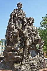
Lewis and Clark Expedition
Overview
Transcontinental
The fourth largest print media group in Canada, with more than 3,000 employees and annual revenues of $608 million in 2010, TC. Transcontinental reaches, through its multiplatform offering, over 18 million consumers across Canada...
expedition to the Pacific Coast by the United States
United States
The United States of America is a federal constitutional republic comprising fifty states and a federal district...
. Commissioned by President Thomas Jefferson
Thomas Jefferson
Thomas Jefferson was the principal author of the United States Declaration of Independence and the Statute of Virginia for Religious Freedom , the third President of the United States and founder of the University of Virginia...
and led by two Virginia-born veterans of Indian wars in the Ohio Valley, Meriwether Lewis
Meriwether Lewis
Meriwether Lewis was an American explorer, soldier, and public administrator, best known for his role as the leader of the Lewis and Clark Expedition also known as the Corps of Discovery, with William Clark...
and William Clark, the expedition had several goals. Their objects were both scientific and commercial – to study the area's plants, animal life, and geography, and to discover how the region could be exploited economically.
Unanswered Questions
Discussions