

Hurricane Ivan tornado outbreak
Encyclopedia
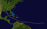
The Hurricane Ivan tornado outbreak was a three-day tornado outbreak
that was associated with the passage of Hurricane Ivan
across the Southern United States
starting on September 15, 2004 across the Gulf Coast states of Alabama
and Florida
as well as southern Georgia before ending in the Middle Atlantic Coast
on September 18. The outbreak killed at least 7 people and injured dozens of people across several states from Florida to Pennsylvania
. The hurricane itself killed at least 90 people from the US to the eastern Caribbean Islands. Overall it produced 119 tornadoes surpassing the record of 117 that was previously held by Hurricane Beulah
during the 1967 Atlantic hurricane season
. Ivan also produced 16 more tornadoes than Hurricane Frances
which struck most of the same regions (the tornado outbreak) about ten days earlier.
On September 13, 2011, as Category 5 Hurricane Ivan moved through the Yucatan Channel
, the Storm Prediction Center
noted the possibility of isolated tornadoes for parts of Louisiana
and the Florida Panhandle
three days out. Though the storm weakened while approaching the United States, strong low-level wind shear
along its northeastern periphery allowed for the development of potentially tornadic supercell
s. A National Oceanic and Atmospheric Administration
Hurricane Hunter aircraft intercepted Ivan during the afternoon and evening of September 15. During the mission, dropwindsondes were deployed off the Gulf Coast to assess the rainband
environment. By this time, an intense band of thunderstorms, with embedded supercells, developed about 250 mi (400 km) east of the hurricane's center. A thermodynamic sounding
around 1:00 p.m. EST
from Tampa Bay, Florida revealed unusually favorable conditions for deep, rotating convection
. Ahead of the band, convective available potential energy
(CAPE) levels reached 2,500 J
/kg
and significant helicity. The significant levels of CAPE, accompanied by a dry air intrusion between the rainband and the main convection of Ivan, were the primary cause of the outbreak. A comparison between Ivan and Hurricane Jeanne
revealed that both storms encounted similar conditions near landfall; however, CAPE values were lower during Jeanne and the system produced far fewer tornadoes.
In light of the increased tornado threat, the first tornado watch
was issued around 1:00 p.m. EST
for the Florida Panhandle and southern Alabama
. By then, "miniature" supercell thunderstorms began approaching the coastline. Data from Doppler weather radar indicated mesocyclone
s within several of the cells, though mostly while over water. At the onset of the outbreak, three cells exhibited signature characteristics of supercell thunderstorms: cyclonic updraft
and a hook-like appendage
. Similar to storms over the Great Plains
, a mid-level rear flank downdraft
was present; however, this feature did not reach the surface. Less than an hour after the watch was issued, the first tornado of the outbreak touched down in Escambia County, Florida
. Over the course of the next 20 hours, the National Weather Service
(NWS) office in Tallahassee
monitored over 50 mesocyclones that had sufficient vorticity to spawn tornadoes. The high number of potential storms led to the issuance of 130 tornado warning
s, of which only 20 later verified. One of the mesocyclones had a "nearly textbook appearance" and produced four tornadoes between 8:15 p.m. and 9:50 p.m. as it traveled nearly 75 miles across the Florida Big Bend
. Two of these tornadoes reached F2
intensity and, collectively, they killed four people, injured eight more and left $5.5 million in damage. By midnight on September 15, 26 tornadoes touched down across three states.
With the tornado threat gradually moving northward, new tornado watches were issued further north into much of South Carolina
. During the first half of September 16, several F0 tornadoes touched down across the Southeast
. By the afternoon, downstream subsidence
limited thunderstorm activity; however, as the day wore on, sufficient warm, moist air from the Gulf Stream
and breaks in cloud cover allowed for CAPE values to rise. Extensive convective banding to the north and east of the storm continued to encounter extreme levels of helicity. Subsequently, numerous rotating thunderstorms developed over the region, especially across Georgia
and South Carolina
. Throughout the afternoon, 22 tornadoes touched down across the two states, one of which, an F2, killed one person. The majority of the activity took place along a warm front
that developed east of Tropical Storm Ivan within the shear maxima.
Following a lull in activity during the overnight hours between September 16 and 17, conditions once more became increasingly favorable for tornadoes across North Carolina
and Virginia
. Strong shear associated with the weakening tropical cyclone and the destabilization of air ahead of the main rainband and consequently, a tornado watch was issued for portions of both states around 10:00 a.m.
The tornado outbreak began during the early afternoon of September 15, when the first outer rain bands and thunderstorm
s moved ashore across the southern states. One person was killed in Panama City, Florida
when a tornado
tore through the city damaging many businesses. The tornado that hit just before 4:00 PM was caught on camera as it skirted just outside a local television station that was doing severe weather coverage as tornado warnings were issued in the Panama City media market area. At the same time, another deadly tornado touched down in Bay County, Florida
killing 1 when a wood-frame home was lifted and smashed, killing an occupant. Later during the evening many other tornadoes touched down across the Panhandle region of west Florida
. An F2 tornado in Calhoun County, Florida
tossed mobile homes in the air, killing two occupants in each of 2 mobile homes. At the same time the center of the hurricane was approaching the Florida/southern Alabama state and coastline near Gulf Shores. At least 26 tornadoes were confirmed during the day.
After the cyclone made landfall near Gulf Shores, Alabama
, the tornado activity shifted further north into central Alabama and the northern half of Georgia as well as South Carolina
. One person was killed in Franklin County, Georgia
by an F2 tornado that damaged several businesses and homes. 32 tornadoes were confirmed on that day. As the remnants of Ivan, now a tropical depression moved further inland, increased instability and thunderstorm cells produced a large tornado outbreak from the northern Carolinas to Pennsylvania. Virginia
was the hardest hit state during the day as nearly 40 tornadoes affected the state. Several F2s and one F3 did touched down causing significant damage to numerous structures including homes and businesses. Areas roughly to the west and south of Washington D.C were the hardest hit areas. Nearly 60 tornadoes were confirmed on that day before the outbreak ceased during the overnight hours of September 18 across Maryland
.
}
|A fast-moving, weak tornado touched down near Perdido Key and caused minor damage before dissipating southwest of Josephine, Alabama.
|-
|bgcolor=# | F0
|E of Pensacola Beach
|Escambia
, Santa Rosa
|30°20′N 87°00′W
|2:55 p.m. – 3:03 p.m.
|12 miles (19.3 km)
|A weak tornado touched down in a sparsely populated area east of Pensacola and caused only minor damage before dissipating near Gulf Breeze
.
|-
|bgcolor=# | F0
|Beacon Hill area
|Gulf
|29°55′N 85°23′W
|3:35 p.m. – 3:37 p.m.
|3 miles (4.8 km)
|A short-lived tornado caused minor damage to several homes in Beacon Hill. Several trees and power lines were also felled.
|-
|bgcolor=# | F1
|SW of Panama City
|Bay
|30°06′N 85°45′W
|3:40 p.m. – 3:50 p.m.
|5 miles (8 km)
|1 death – A strong F1 tornado touched down near the St. Andrews recreation area, where it damaged dozens of commercial structures. Traveling northward, the storm then moved through Grand Lagoon. There, one person was killed when a real estate office was destroyed and seven others were injured in a restaurant. The tornado came within 100 yards (91.4 m) of the WJHG-TV
station before dissipating. Overall, damage from this event was estimated at $5 million.
|-
|bgcolor=# | F1
|Allanton area
|Bay
|29°59′N 85°24′W
|3:43 p.m. – 3:52 p.m.
|5 miles (8 km)
|1 death – Shortly after the previous tornado touched down, another formed near Allanton. This storm lofted a wood frame home, with seven people inside, about 60 feet (18.3 m) into a field; one person was killed and another was injured. Several other homes were damaged before the tornado dissipated.
|-
|bgcolor=# | F1
|Cedar Grove
area
|Bay
|30°08′N 85°10′W
|4:00 p.m. – 4:07 p.m.
|6 miles (9.7 km)
|Another F1 tornado touched down in Bay County, this time near Cedar Grove, and destroyed several homes along its path. Losses from the storm reached $2 million.
|-
|bgcolor=# | F0
|SE of Youngstown
|Bay
|30°20′N 85°24′W
|6:20 p.m. – 6:28 p.m.
|7 miles (11.3 km)
|A weak tornado downed numerous trees and power lines.
|-
|bgcolor=# | F0
|NW of Chipley
|Washington
|30°39′N 85°29′W
|7:37 p.m. – 7:52 p.m.
|12 miles (19.3 km)
|A relatively long-lived, but weak tornado caused minor damage to several homes. Several trees and power lines were also felled.
|-
|bgcolor=# | F1
|NE of Bonifay
|Holmes
|30°51′N 85°29′W
|7:55 p.m. – 8:00 p.m.
|4 miles (6.4 km)
|An F1 tornado destroyed one home and damaged several others.
|-
|bgcolor=# | F0
|NW of Carrabelle
|Franklin
|29°54′N 84°44′W
|8:15 p.m. – 8:20 p.m.
|5 miles (8 km)
|Numerous trees were uprooted between Carrabelle and Morgan Place.
|-
|bgcolor=# | F1
|SE of Wilma
|Liberty
|30°03′N 84°51′W
|8:30 p.m. – 8:40 p.m.
|10 miles (16.1 km)
|An F1 tornado tracked through the Apalachicola National Forest
where it uprooted hundreds of trees.
|-
|bgcolor=# | F1
|Dunnellon
area
|Marion
|29°03′N 82°28′W
|8:45 p.m.
|4 miles (6.4 km)
|One home was destroyed in Dunnellon and numerous trees were uprooted. In Rainbow Springs, roofing material was reported to have fallen on roads.
|-
|bgcolor=# | F2
|N of Blountstown
|Calhoun
|30°30′N 85°03′W
|9:07 p.m. – 9:18 p.m.
|7 miles (11.3 km)
|4 deaths – A strong F2 tornado touched down near Blountstown and tracked northwestward. After crossing Highway 69
, it damaged dozens of homes and uprooted trees. Shortly thereafter, it moved through the Macedonia Community where three trailers were destroyed and 30 homes damaged. Within the community, four people were killed and five others were injured after their mobile homes were thrown into other structures. The tornado subsequently dissipated near Altha
. Overall losses from the event reached $2.5 million.
|-
|bgcolor=# | F0
|Williston
area
|Levy
|29°23′N 82°27′W
|9:17 p.m.
|0.2 mile (0.321868 km)
|Brief tornado with no damage reported by emergency management.
|-
|bgcolor=# | F0
|Bronson
area
|Levy
|29°27′N 82°39′W
|9:22 p.m.
|0.2 mile (0.321868 km)
|Brief tornado with no damage reported by emergency management.
|-
|bgcolor=# | F2
|E of Marianna
|Jackson
|30°43′N 85°10′W
|9:31 p.m. – 9:50 p.m.
|8 miles (12.9 km)
|The final Florida tornado on September 15 touched down east of Marianna and struck the Gold Drive Trailer Park. There, it destroyed 25 mobile homes and damaged 10 more. Three people sustained injuries in Gold Drive. Tracking northwest, the storm moved through the Brogdon Lane Trailer Park and damaged 10 more mobile homes and subsequently caused significant damage to the Marianna Federal Correctional Institution
. The tornado then destroyed the Sykes Enterprises
facility near Marianna Municipal Airport
before dissipating. Overall losses from the storm reached $3 million.
|-
|colspan="7" align=center|Georgia
|-
|bgcolor=# | F0
|Centerville
area
|Early
|31°16′N 84°54′W
|3:40 p.m.
|0.5 mile (0.80467 km)
|Brief tornado downed trees and power lines.
|-
|bgcolor=# | F0
|Blakely
area
|Early
|31°23′N 84°57′W
|3:55 p.m. – 3:57 p.m.
|1 miles (1.6 km)
|Brief tornado caused minor damage to a county jail. Scattered trees and power lines were also felled.
|-
|bgcolor=# | F0
|S of Damascus
|Early
|31°15′N 84°43′W
|4:16 p.m.
|2 miles (3.2 km)
|A short-lived tornado caused minor damage to a few homes. Several trees and power lines were also felled.
|-
|bgcolor=# | F0
|Colquitt
area
|Miller
|31°07′N 84°41′W
|4:37 p.m. – 4:42 p.m.
|4 miles (6.4 km)
|A weak tornado struck Colquitt, damaging nine homes and two businesses.
|-
|bgcolor=# | F0
|W of Arlington
|Calhoun
|31°26′N 84°48′W
|4:42 p.m.
|0.2 mile (0.321868 km)
|A brief tornado downed trees and power lines.
|-
|bgcolor=# | F1
|Whigham
area
|Grady
|30°51′N 84°17′W
|5:19 p.m. – 5:41 p.m.
|15 miles (24.1 km)
|A relatively long-lived tornado damaged five homes and several chicken houses in Whigham. Numerous trees and power lines were also felled by the storm, blocking off many roads.
|-
|bgcolor=# | F1
|S of Hoggard Mill
|Baker
|30°09′N 84°28′W
|6:07 p.m.
|1 miles (1.6 km)
|Several trees were twisted or uprooted and power lines were felled.
|-
|bgcolor=# | F1
|Crestview
area
|Baker
|31°20′N 84°37′W
|6:27 p.m.
|1 miles (1.6 km)
|Several trees were twisted or uprooted and power lines were felled. The tornado also caused minor structural damage.
|-
|colspan="7" align=center|Alabama
|-
|bgcolor=# | F0
|W of Dixie
|Escambia
|31°09′N 86°45′W
|5:20 p.m. – 5:23 p.m.
|3 miles (4.8 km)
|Weak tornado caused minor tree damage.
|-
|bgcolor=# | F0
|S of Castleberry
|Conecuh
|31°16′N 87°01′W
|5:40 p.m. – 5:42 p.m.
|1 miles (1.6 km)
|Brief tornado caused minor tree damage.
|-
|colspan="7"|Source: Tornado History Project - September 15, 2004 Storm Data, NCDC Storm Events Database
|}
}
|Brief tornado downed several trees.
|-
|bgcolor=# | F0
|S of Clio
|Barbour
|31°41′N 85°37′W
|12:56 a.m.
|0.2 mile (0.321868 km)
|Brief tornado downed several trees.
|-
|bgcolor=# | F0
|E of Troy
(2nd tornado)
|Pike
|31°48′N 85°45′W
|1:05 a.m.
|0.1 mile (0.160934 km)
|Brief tornado downed several trees.
|-
|bgcolor=# | F0
|E of Snowdoun
|Montgomery
|32°15′N 86°13′W
|1:49 a.m.
|0.1 mile (0.160934 km)
|Brief tornado downed several trees.
|-
|bgcolor=# | F0
|E of Clayton
|Barbour
|31°53′N 85°19′W
|3:05 a.m.
|0.1 mile (0.160934 km)
|Brief tornado downed several trees.
|-
|bgcolor=# | F0
|SE of Tuskegee
|Macon
|32°20′N 85°35′W
|4:00 a.m.
|0.1 mile (0.160934 km)
|Brief tornado downed several trees.
|-
|colspan="7" align=center|Florida
|-
|bgcolor=# | F0
|NE of Lloyd
|Jefferson
, Leon
|30°31′N 83°58′W
|4:45 a.m. – 4:50 a.m.
|5.5 miles (8.9 km)
|A weak tornado touched down near Lake Miccosukee
and tracked northeast, damaging two homes and destroying a shed. Numerous trees and power lines were felled by the storm.
|-
|bgcolor=# | F0
|Steinhatchee
area
|Taylor
|29°41′N 83°24′W
|8:50 a.m.
|0.2 mile (0.321868 km)
|A waterspout moved onshore near Steinhatchee and caused minor damage to several homes.
|-
|colspan="7" align=center|Georgia
|-
|bgcolor=# | F0
|E of Williamsburg
|Dougherty
|31°29′N 84°03′W
|6:30 a.m. – 6:33 a.m.
|2 miles (3.2 km)
|A weak tornado damaged several homes and felled many trees. A portion of Georgia State Route 133
near Pecan City was temporarily closed due to downed trees.
|-
|bgcolor=# | F0
|S of Ambrose
|Coffee
|31°30′N 83°01′W
|10:35 a.m.
|2 miles (3.2 km)
|A short-lived tornado damaged several homes and sheds. One mobile home was also blown off its foundation.
|-
|bgcolor=# | F1
|NNE of Colbert
|Madison
|31°30′N 83°01′W
|2:05 p.m. – 2:15 p.m.
|7 miles (11.3 km)
|An F1 tornado touched down near Georgia State Route 72
and tracked north-northwest towards a country club. There, five large homes sustained extensive damage. Twenty other homes were also damaged by the tornado before it dissipated near the Madison County High School in Danielsville
. Overall losses from the storm reached $1.3 million.
|-
|bgcolor=# | F0
|Paoli area
|Madison
|34°05′N 83°06′W
|2:33 p.m.
|1 miles (1.6 km)
|A brief tornado destroyed one barn destroyed and damaged several homes.
|-
|bgcolor=# | F0
|N of Yatesville
|Upson
|32°59′N 84°08′W
|2:42 p.m.
|0.1 mile (0.160934 km)
|Brief tornado caused minor tree damage.
|-
|bgcolor=# | F2
|Franklin Springs
area
|Franklin
|
|1850
|2 miles
(3.2 km)
|Several chicken houses were destroyed while a government building, the fire and police stations and 25 homes were damaged.
|-
|bgcolor=# | F1
|W of Parhams
|Franklin
|
|1915
|3.5 miles
(5.6 km)
|A few homes were damaged
|-
|bgcolor=# | F0
|S of Griffin
|Spalding
|
|1921
|0.2 miles
(0.32 km)
|Minor roof damage to a few homes and extensive tree damage
|-
|bgcolor=# | F1
|Norman area
|Wilkes
|
|2010
|7 miles
(11.2 km)
|23 structures sustained damage while a communication tower was destroyed
|-
|bgcolor=# | F1
|S of Middleton
|Elbert
|
|2018
|7.5 miles
(12 km)
|One house sustained damage
|-
|bgcolor=# | F1
|S of Montevideo
|Elbert
|
|2038
|1 miles
(1.6 km)
|Damage to trees and power lines
|-
|bgcolor=# | F2
|N of Cromers
|Franklin
|
|2045
|5.5 miles
(8.8 km)
|1 death Several businesses, homes and vehicles were damaged
|-
|bgcolor=# | F1
|Macedonia
area
|Cherokee
|
|2055
|1 miles
(1.6 km)
|Six homes suffered extensive damage primarily because of fallen trees
|-
|bgcolor=# | F1
|N of Reed Creek
|Hart
|
|2115
|1.5 miles
(2.4 km)
|Several trees and power lines were blown down.
|-
|bgcolor=# | F1
|Cornelia
area
|Habersham
|
|2330
|2 miles
(3.2 km)
|Damage to trees and power lines
|-
|bgcolor=# | F1
|Sylvania
area
|Screven
|
|0010
|6 miles
(9.6 km)
|Damage limited to trees
|-
|bgcolor=# | F1
|N of Hiltonia
|Screven
|
|0040
|7 miles
(11.2 km)
|Damage limited to trees
|-
|colspan="7" align=center|South Carolina
|-
|bgcolor=# | F0
|N of Aiken
|Aiken
|
|1756
|6 miles
(9.6 km)
|Damage limited to trees
|-
|bgcolor=# | F1
|N of Saluda
|Saluda
|
|1900
|6 miles
(9.6 km)
|A barn was destroyed, while several mobile homes, two cars and several framed homes were damaged
|-
|bgcolor=# | F0
|SW of Joanna
|Laurens
|
|2012
|0.5 miles
(0.8 km)
|Damage limited to trees
|-
|bgcolor=# | F0
|SE of Townville
|Anderson
|
|2125
|0.1 miles
(0.16 km)
|Damage limited to trees
|-
|bgcolor=# | F0
|Seneca
area
|Oconee
|
|2135
|5 miles
(8 km)
|Damage limited to trees and power lines
|-
|bgcolor=# | F0
|W of Iva
|Anderson
|
|2140
|0.1 miles
(0.16 km)
|Brief touchdown with no damage
|-
|bgcolor=# | F1
|Westminster
area
|Oconee
|
|2155
|4.5 miles
(7.2 km)
|A mobile home was destroyed and one home was damaged by a fallen tree
|-
|colspan="7"|Source: Tornado History Project - September 16, 2004 Storm Data, NCDC Storm Events Database
|}
}
|A short-lived tornado downed several trees and peeled the siding off a few homes. One of the trees fell on a home, causing extensive roof damage and breaking most of the windows.
|-
|bgcolor=# | F2
|Pylesville
area
|Harford
|39°42′N 76°22′W
|3:00 a.m. – 3:10 a.m.
|2 miles (3.2 km)
|A short-lived tornado destroyed two mobile homes and damaged several other structures. Numerous large trees were also twisted or uprooted.
|-
|colspan="7"|Source: Tornado History Project - September 18, 2004 Storm Data, NCDC Storm Events Database
|}
Tornado outbreak
While there is no single agreed upon definition, generally at least 6-10 tornadoes produced by the same synoptic scale weather system is considered a tornado outbreak. The tornadoes usually occur within the same day, or continue into the early morning hours of the succeeding day, and within the...
that was associated with the passage of Hurricane Ivan
Hurricane Ivan
Hurricane Ivan was a large, long-lived, Cape Verde-type hurricane that caused widespread damage in the Caribbean and United States. The cyclone was the ninth named storm, the sixth hurricane and the fourth major hurricane of the active 2004 Atlantic hurricane season...
across the Southern United States
United States
The United States of America is a federal constitutional republic comprising fifty states and a federal district...
starting on September 15, 2004 across the Gulf Coast states of Alabama
Alabama
Alabama is a state located in the southeastern region of the United States. It is bordered by Tennessee to the north, Georgia to the east, Florida and the Gulf of Mexico to the south, and Mississippi to the west. Alabama ranks 30th in total land area and ranks second in the size of its inland...
and Florida
Florida
Florida is a state in the southeastern United States, located on the nation's Atlantic and Gulf coasts. It is bordered to the west by the Gulf of Mexico, to the north by Alabama and Georgia and to the east by the Atlantic Ocean. With a population of 18,801,310 as measured by the 2010 census, it...
as well as southern Georgia before ending in the Middle Atlantic Coast
East Coast of the United States
The East Coast of the United States, also known as the Eastern Seaboard, refers to the easternmost coastal states in the United States, which touch the Atlantic Ocean and stretch up to Canada. The term includes the U.S...
on September 18. The outbreak killed at least 7 people and injured dozens of people across several states from Florida to Pennsylvania
Pennsylvania
The Commonwealth of Pennsylvania is a U.S. state that is located in the Northeastern and Mid-Atlantic regions of the United States. The state borders Delaware and Maryland to the south, West Virginia to the southwest, Ohio to the west, New York and Ontario, Canada, to the north, and New Jersey to...
. The hurricane itself killed at least 90 people from the US to the eastern Caribbean Islands. Overall it produced 119 tornadoes surpassing the record of 117 that was previously held by Hurricane Beulah
Hurricane Beulah
Hurricane Beulah was the second tropical storm, second hurricane, and only major hurricane during the 1967 Atlantic hurricane season. It tracked through the Caribbean, struck the Yucatán peninsula of Mexico as a major hurricane, and moved west-northwest into the Gulf of Mexico, briefly gaining...
during the 1967 Atlantic hurricane season
1967 Atlantic hurricane season
The 1967 Atlantic hurricane season was the first year in which the National Hurricane Center was in operation. The season began on June 1, which was the date when the NHC activated radar stations across the Caribbean and Gulf of Mexico...
. Ivan also produced 16 more tornadoes than Hurricane Frances
Hurricane Frances
Hurricane Frances was the sixth named storm, the fourth hurricane, and the third major hurricane of the 2004 Atlantic hurricane season. The system crossing the open Atlantic during mid to late August, moving to the north of the Lesser Antilles while strengthening. Its outer bands affected Puerto...
which struck most of the same regions (the tornado outbreak) about ten days earlier.
Meteorological synopsis
On September 13, 2011, as Category 5 Hurricane Ivan moved through the Yucatan Channel
Yucatán Channel
The Yucatán Channel is a strait between Mexico and Cuba. It connects the Yucatán Basin of the Caribbean Sea with the Gulf of Mexico. The strait is across between Cape Catoche in Mexico and Cape San Antonio, Cuba and reaches a maximum depth of .-References:...
, the Storm Prediction Center
Storm Prediction Center
The Storm Prediction Center , located in Norman, Oklahoma, is tasked with forecasting the risk of severe thunderstorms and tornadoes in the contiguous United States. The agency issues convective outlooks, mesoscale discussions, and watches as a part of this process...
noted the possibility of isolated tornadoes for parts of Louisiana
Louisiana
Louisiana is a state located in the southern region of the United States of America. Its capital is Baton Rouge and largest city is New Orleans. Louisiana is the only state in the U.S. with political subdivisions termed parishes, which are local governments equivalent to counties...
and the Florida Panhandle
Florida Panhandle
The Florida Panhandle, an informal, unofficial term for the northwestern part of Florida, is a strip of land roughly 200 miles long and 50 to 100 miles wide , lying between Alabama on the north and the west, Georgia also on the north, and the Gulf of Mexico to the south. Its eastern boundary is...
three days out. Though the storm weakened while approaching the United States, strong low-level wind shear
Wind shear
Wind shear, sometimes referred to as windshear or wind gradient, is a difference in wind speed and direction over a relatively short distance in the atmosphere...
along its northeastern periphery allowed for the development of potentially tornadic supercell
Supercell
A supercell is a thunderstorm that is characterized by the presence of a mesocyclone: a deep, continuously-rotating updraft. For this reason, these storms are sometimes referred to as rotating thunderstorms...
s. A National Oceanic and Atmospheric Administration
National Oceanic and Atmospheric Administration
The National Oceanic and Atmospheric Administration , pronounced , like "noah", is a scientific agency within the United States Department of Commerce focused on the conditions of the oceans and the atmosphere...
Hurricane Hunter aircraft intercepted Ivan during the afternoon and evening of September 15. During the mission, dropwindsondes were deployed off the Gulf Coast to assess the rainband
Rainband
A rainband is a cloud and precipitation structure associated with an area of rainfall which is significantly elongated. Rainbands can be stratiform or convective, and are generated by differences in temperature. When noted on weather radar imagery, this precipitation elongation is referred to as...
environment. By this time, an intense band of thunderstorms, with embedded supercells, developed about 250 mi (400 km) east of the hurricane's center. A thermodynamic sounding
Atmospheric sounding
An atmospheric sounding is a measurement of vertical distribution of physical properties of the atmospheric column such as pressure, temperature, wind speed and wind direction , liquid water content, ozone concentration, pollution, and other properties...
around 1:00 p.m. EST
Eastern Standard Time
Eastern Standard Time may refer to:*North American Eastern Time Zone, UTC-5*Australian Eastern Standard Time, UTC+10*An album by Hip Hop group Kooley High...
from Tampa Bay, Florida revealed unusually favorable conditions for deep, rotating convection
Atmospheric convection
Atmospheric convection is the result of a parcel-environment instability, or temperature difference, layer in the atmosphere. Different lapse rates within dry and moist air lead to instability. Mixing of air during the day which expands the height of the planetary boundary layer leads to...
. Ahead of the band, convective available potential energy
Convective available potential energy
In meteorology, convective available potential energy , sometimes, simply, available potential energy , is the amount of energy a parcel of air would have if lifted a certain distance vertically through the atmosphere...
(CAPE) levels reached 2,500 J
Joule
The joule ; symbol J) is a derived unit of energy or work in the International System of Units. It is equal to the energy expended in applying a force of one newton through a distance of one metre , or in passing an electric current of one ampere through a resistance of one ohm for one second...
/kg
Kilogram
The kilogram or kilogramme , also known as the kilo, is the base unit of mass in the International System of Units and is defined as being equal to the mass of the International Prototype Kilogram , which is almost exactly equal to the mass of one liter of water...
and significant helicity. The significant levels of CAPE, accompanied by a dry air intrusion between the rainband and the main convection of Ivan, were the primary cause of the outbreak. A comparison between Ivan and Hurricane Jeanne
Hurricane Jeanne
Hurricane Jeanne was the deadliest hurricane in the 2004 Atlantic hurricane season. It was the tenth named storm, the seventh hurricane, and the fifth major hurricane of the season, as well as the third hurricane and fourth named storm of the season to make landfall in Florida...
revealed that both storms encounted similar conditions near landfall; however, CAPE values were lower during Jeanne and the system produced far fewer tornadoes.
In light of the increased tornado threat, the first tornado watch
Tornado watch
A tornado watch is issued when conditions are right for a tornado to form. Since any thunderstorm capable of producing a tornado is defined as severe, a tornado watch is also automatically a severe thunderstorm watch...
was issued around 1:00 p.m. EST
Eastern Standard Time
Eastern Standard Time may refer to:*North American Eastern Time Zone, UTC-5*Australian Eastern Standard Time, UTC+10*An album by Hip Hop group Kooley High...
for the Florida Panhandle and southern Alabama
Alabama
Alabama is a state located in the southeastern region of the United States. It is bordered by Tennessee to the north, Georgia to the east, Florida and the Gulf of Mexico to the south, and Mississippi to the west. Alabama ranks 30th in total land area and ranks second in the size of its inland...
. By then, "miniature" supercell thunderstorms began approaching the coastline. Data from Doppler weather radar indicated mesocyclone
Mesocyclone
A mesocyclone is a vortex of air, approximately 2 to 10 miles in diameter , within a convective storm....
s within several of the cells, though mostly while over water. At the onset of the outbreak, three cells exhibited signature characteristics of supercell thunderstorms: cyclonic updraft
Vertical draft
An updraft or downdraft is the vertical movement of air as a weather related phenomenon. One of two forces causes the air to move. Localized regions of warm or cool air will exhibit vertical movement. A mass of warm air will typically be less dense than the surrounding region, and so will rise...
and a hook-like appendage
Hook echo
The hook echo is one of the classical hallmarks of tornado-producing supercell thunderstorms as seen on a weather radar. The echo is produced by rain, hail, or even debris being wrapped around the supercell...
. Similar to storms over the Great Plains
Great Plains
The Great Plains are a broad expanse of flat land, much of it covered in prairie, steppe and grassland, which lies west of the Mississippi River and east of the Rocky Mountains in the United States and Canada. This area covers parts of the U.S...
, a mid-level rear flank downdraft
Rear flank downdraft
The rear flank downdraft or RFD is a region of dry air wrapping around the back of a mesocyclone in a supercell thunderstorm. These areas of descending air are thought to be essential in the production of many supercellular tornadoes...
was present; however, this feature did not reach the surface. Less than an hour after the watch was issued, the first tornado of the outbreak touched down in Escambia County, Florida
Escambia County, Florida
Escambia County is the westernmost county in the U.S. state of Florida. The 2010 population was 297,619. The U.S. Census Bureau 2005 estimate for the county is 296,772. Its county seat is Pensacola.- History :...
. Over the course of the next 20 hours, the National Weather Service
National Weather Service
The National Weather Service , once known as the Weather Bureau, is one of the six scientific agencies that make up the National Oceanic and Atmospheric Administration of the United States government...
(NWS) office in Tallahassee
Tallahassee, Florida
Tallahassee is the capital of the U.S. state of Florida. It is the county seat and only incorporated municipality in Leon County, and is the 128th largest city in the United States. Tallahassee became the capital of Florida, then the Florida Territory, in 1824. In 2010, the population recorded by...
monitored over 50 mesocyclones that had sufficient vorticity to spawn tornadoes. The high number of potential storms led to the issuance of 130 tornado warning
Tornado warning
A tornado warning is an alert issued by government weather services to warn that severe thunderstorms with tornadoes may be imminent. It can be issued after a tornado or funnel cloud has been spotted by eye, or more commonly if there are radar indications of tornado formation...
s, of which only 20 later verified. One of the mesocyclones had a "nearly textbook appearance" and produced four tornadoes between 8:15 p.m. and 9:50 p.m. as it traveled nearly 75 miles across the Florida Big Bend
Big Bend (Florida)
The Big Bend of Florida, U.S.A., is an informal region of the state with no official surveyed boundary. It includes part of the counties of the Florida Panhandle. Geologists prefer to characterize Florida’s Big Bend as the drowned karst section of the coast that occurs between the mouth of the...
. Two of these tornadoes reached F2
Fujita scale
The Fujita scale , or Fujita-Pearson scale, is a scale for rating tornado intensity, based primarily on the damage tornadoes inflict on human-built structures and vegetation...
intensity and, collectively, they killed four people, injured eight more and left $5.5 million in damage. By midnight on September 15, 26 tornadoes touched down across three states.
With the tornado threat gradually moving northward, new tornado watches were issued further north into much of South Carolina
South Carolina
South Carolina is a state in the Deep South of the United States that borders Georgia to the south, North Carolina to the north, and the Atlantic Ocean to the east. Originally part of the Province of Carolina, the Province of South Carolina was one of the 13 colonies that declared independence...
. During the first half of September 16, several F0 tornadoes touched down across the Southeast
Southeastern United States
The Southeastern United States, colloquially referred to as the Southeast, is the eastern portion of the Southern United States. It is one of the most populous regions in the United States of America....
. By the afternoon, downstream subsidence
Subsidence (atmosphere)
Subsidence in the Earth's atmosphere is most commonly caused by low temperatures: as air cools, it becomes denser and moves towards the ground, just as warm air becomes less dense and moves upwards...
limited thunderstorm activity; however, as the day wore on, sufficient warm, moist air from the Gulf Stream
Gulf Stream
The Gulf Stream, together with its northern extension towards Europe, the North Atlantic Drift, is a powerful, warm, and swift Atlantic ocean current that originates at the tip of Florida, and follows the eastern coastlines of the United States and Newfoundland before crossing the Atlantic Ocean...
and breaks in cloud cover allowed for CAPE values to rise. Extensive convective banding to the north and east of the storm continued to encounter extreme levels of helicity. Subsequently, numerous rotating thunderstorms developed over the region, especially across Georgia
Georgia (U.S. state)
Georgia is a state located in the southeastern United States. It was established in 1732, the last of the original Thirteen Colonies. The state is named after King George II of Great Britain. Georgia was the fourth state to ratify the United States Constitution, on January 2, 1788...
and South Carolina
South Carolina
South Carolina is a state in the Deep South of the United States that borders Georgia to the south, North Carolina to the north, and the Atlantic Ocean to the east. Originally part of the Province of Carolina, the Province of South Carolina was one of the 13 colonies that declared independence...
. Throughout the afternoon, 22 tornadoes touched down across the two states, one of which, an F2, killed one person. The majority of the activity took place along a warm front
Warm front
A warm front is a density discontinuity located at the leading edge of a homogeneous warm air mass, and is typically located on the equator-facing edge of an isotherm gradient...
that developed east of Tropical Storm Ivan within the shear maxima.
Following a lull in activity during the overnight hours between September 16 and 17, conditions once more became increasingly favorable for tornadoes across North Carolina
North Carolina
North Carolina is a state located in the southeastern United States. The state borders South Carolina and Georgia to the south, Tennessee to the west and Virginia to the north. North Carolina contains 100 counties. Its capital is Raleigh, and its largest city is Charlotte...
and Virginia
Virginia
The Commonwealth of Virginia , is a U.S. state on the Atlantic Coast of the Southern United States. Virginia is nicknamed the "Old Dominion" and sometimes the "Mother of Presidents" after the eight U.S. presidents born there...
. Strong shear associated with the weakening tropical cyclone and the destabilization of air ahead of the main rainband and consequently, a tornado watch was issued for portions of both states around 10:00 a.m.
Tornado event
| State | Total | County | County total |
|---|---|---|---|
| Florida Florida Florida is a state in the southeastern United States, located on the nation's Atlantic and Gulf coasts. It is bordered to the west by the Gulf of Mexico, to the north by Alabama and Georgia and to the east by the Atlantic Ocean. With a population of 18,801,310 as measured by the 2010 census, it... |
6 | Bay Bay County, Florida Bay County is a county located in the U.S. state of Florida. The U.S. Census Bureau 2006 estimate for the county is 163,505 . Its county seat is Panama City, Florida. The county is best known for its white sand beaches and crystal blue water, where large pods of dolphins swim year-round... |
2 |
| Calhoun Calhoun County, Florida Calhoun County is a county located in the U.S. state of Florida. As of 2000, the population was 13,017. The U.S. Census Bureau 2006 estimate for the county was 13,410 . Its county seat is Blountstown, Florida.- History :... |
4 | ||
| Georgia Georgia (U.S. state) Georgia is a state located in the southeastern United States. It was established in 1732, the last of the original Thirteen Colonies. The state is named after King George II of Great Britain. Georgia was the fourth state to ratify the United States Constitution, on January 2, 1788... |
1 | Franklin Franklin County, Georgia Franklin County is a county located in the U.S. state of Georgia. It became Georgia's ninth county, incorporating on February 25, 1784, and was named in honor of patriot Benjamin Franklin... |
1 |
| Totals | 7 | ||
| All deaths were tornado-related | |||
The tornado outbreak began during the early afternoon of September 15, when the first outer rain bands and thunderstorm
Thunderstorm
A thunderstorm, also known as an electrical storm, a lightning storm, thundershower or simply a storm is a form of weather characterized by the presence of lightning and its acoustic effect on the Earth's atmosphere known as thunder. The meteorologically assigned cloud type associated with the...
s moved ashore across the southern states. One person was killed in Panama City, Florida
Panama City, Florida
-Personal income:The median income for a household in the city was $31,572, and the median income for a family was $40,890. Males had a median income of $30,401 versus $21,431 for females. The per capita income for the city was $17,830...
when a tornado
Tornado
A tornado is a violent, dangerous, rotating column of air that is in contact with both the surface of the earth and a cumulonimbus cloud or, in rare cases, the base of a cumulus cloud. They are often referred to as a twister or a cyclone, although the word cyclone is used in meteorology in a wider...
tore through the city damaging many businesses. The tornado that hit just before 4:00 PM was caught on camera as it skirted just outside a local television station that was doing severe weather coverage as tornado warnings were issued in the Panama City media market area. At the same time, another deadly tornado touched down in Bay County, Florida
Bay County, Florida
Bay County is a county located in the U.S. state of Florida. The U.S. Census Bureau 2006 estimate for the county is 163,505 . Its county seat is Panama City, Florida. The county is best known for its white sand beaches and crystal blue water, where large pods of dolphins swim year-round...
killing 1 when a wood-frame home was lifted and smashed, killing an occupant. Later during the evening many other tornadoes touched down across the Panhandle region of west Florida
Florida Panhandle
The Florida Panhandle, an informal, unofficial term for the northwestern part of Florida, is a strip of land roughly 200 miles long and 50 to 100 miles wide , lying between Alabama on the north and the west, Georgia also on the north, and the Gulf of Mexico to the south. Its eastern boundary is...
. An F2 tornado in Calhoun County, Florida
Calhoun County, Florida
Calhoun County is a county located in the U.S. state of Florida. As of 2000, the population was 13,017. The U.S. Census Bureau 2006 estimate for the county was 13,410 . Its county seat is Blountstown, Florida.- History :...
tossed mobile homes in the air, killing two occupants in each of 2 mobile homes. At the same time the center of the hurricane was approaching the Florida/southern Alabama state and coastline near Gulf Shores. At least 26 tornadoes were confirmed during the day.
After the cyclone made landfall near Gulf Shores, Alabama
Gulf Shores, Alabama
-External links:*...
, the tornado activity shifted further north into central Alabama and the northern half of Georgia as well as South Carolina
South Carolina
South Carolina is a state in the Deep South of the United States that borders Georgia to the south, North Carolina to the north, and the Atlantic Ocean to the east. Originally part of the Province of Carolina, the Province of South Carolina was one of the 13 colonies that declared independence...
. One person was killed in Franklin County, Georgia
Franklin County, Georgia
Franklin County is a county located in the U.S. state of Georgia. It became Georgia's ninth county, incorporating on February 25, 1784, and was named in honor of patriot Benjamin Franklin...
by an F2 tornado that damaged several businesses and homes. 32 tornadoes were confirmed on that day. As the remnants of Ivan, now a tropical depression moved further inland, increased instability and thunderstorm cells produced a large tornado outbreak from the northern Carolinas to Pennsylvania. Virginia
Virginia
The Commonwealth of Virginia , is a U.S. state on the Atlantic Coast of the Southern United States. Virginia is nicknamed the "Old Dominion" and sometimes the "Mother of Presidents" after the eight U.S. presidents born there...
was the hardest hit state during the day as nearly 40 tornadoes affected the state. Several F2s and one F3 did touched down causing significant damage to numerous structures including homes and businesses. Areas roughly to the west and south of Washington D.C were the hardest hit areas. Nearly 60 tornadoes were confirmed on that day before the outbreak ceased during the overnight hours of September 18 across Maryland
Maryland
Maryland is a U.S. state located in the Mid Atlantic region of the United States, bordering Virginia, West Virginia, and the District of Columbia to its south and west; Pennsylvania to its north; and Delaware to its east...
.
September 15 event
| List of reported tornadoes – Wednesday, September 15, 2004 | ||||||
|---|---|---|---|---|---|---|
Fujita scale The Fujita scale , or Fujita-Pearson scale, is a scale for rating tornado intensity, based primarily on the damage tornadoes inflict on human-built structures and vegetation... |
|
|
|
Eastern Standard Time Eastern Standard Time may refer to:*North American Eastern Time Zone, UTC-5*Australian Eastern Standard Time, UTC+10*An album by Hip Hop group Kooley High... ) |
|
|
| Florida Florida Florida is a state in the southeastern United States, located on the nation's Atlantic and Gulf coasts. It is bordered to the west by the Gulf of Mexico, to the north by Alabama and Georgia and to the east by the Atlantic Ocean. With a population of 18,801,310 as measured by the 2010 census, it... |
||||||
| F0 | W of Perdido Key Perdido Key, Florida Perdido Key, Florida is an unincorporated community located in Escambia County, Florida, between Pensacola, Florida and Orange Beach, Alabama. "Perdido" means "lost" in the Spanish language, and Perdido Key is sometimes called "Lost Key" by local residents and businesses.The community is located on... |
Escambia Escambia County, Florida Escambia County is the westernmost county in the U.S. state of Florida. The 2010 population was 297,619. The U.S. Census Bureau 2005 estimate for the county is 296,772. Its county seat is Pensacola.- History :... , Baldwin (AL) Baldwin County, Alabama -2010:Whereas according to the 2010 U.S. Census Bureau:*85.7% White*9.4% Black*0.7% Native American*0.7% Asian*0.0% Native Hawaiian or Pacific Islander*1.5% Two or more races*4.4% Hispanic or Latino -2000:... |
30°18′N 87°29′W | 1:53 p.m. – 2:06 p.m. | ||
|A fast-moving, weak tornado touched down near Perdido Key and caused minor damage before dissipating southwest of Josephine, Alabama.
|-
|bgcolor=# | F0
|E of Pensacola Beach
Pensacola Beach, Florida
Pensacola Beach is an unincorporated community located on Santa Rosa Island, a barrier island, in Escambia County, Florida, United States. It is situated south of Pensacola, and Gulf Breeze connected via bridges spanning to the Fairpoint Peninsula and then to the island, on the Gulf of Mexico...
|Escambia
Escambia County, Florida
Escambia County is the westernmost county in the U.S. state of Florida. The 2010 population was 297,619. The U.S. Census Bureau 2005 estimate for the county is 296,772. Its county seat is Pensacola.- History :...
, Santa Rosa
Santa Rosa County, Florida
Santa Rosa County is a county located in the U.S. state of Florida. According to the 2000 U.S. Census, the population was 117,743, while a July 1, 2005, estimate placed the population at 143,105, an 18% increase making it the 84th fastest growing county in the United States between 2000 and 2005. ...
|30°20′N 87°00′W
|2:55 p.m. – 3:03 p.m.
|12 miles (19.3 km)
|A weak tornado touched down in a sparsely populated area east of Pensacola and caused only minor damage before dissipating near Gulf Breeze
Gulf Breeze, Florida
Gulf Breeze is a city located on the Fairpoint Peninsula in Santa Rosa County, Florida, United States and is a suburb of Pensacola which lies to the north, across Pensacola Bay. The population was 5,665 at the 2000 census. As of 2005, the population estimated by the U.S. Census Bureau is 6,455. ...
.
|-
|bgcolor=# | F0
|Beacon Hill area
|Gulf
Gulf County, Florida
Gulf County is a county located in the panhandle of the U.S. state of Florida. As of 2000, the population was 13,332. The U.S. Census Bureau 2005 estimate for the county is 13,975 . Its county seat is Port St. Joe.- History :...
|29°55′N 85°23′W
|3:35 p.m. – 3:37 p.m.
|3 miles (4.8 km)
|A short-lived tornado caused minor damage to several homes in Beacon Hill. Several trees and power lines were also felled.
|-
|bgcolor=# | F1
|SW of Panama City
Panama City, Florida
-Personal income:The median income for a household in the city was $31,572, and the median income for a family was $40,890. Males had a median income of $30,401 versus $21,431 for females. The per capita income for the city was $17,830...
|Bay
Bay County, Florida
Bay County is a county located in the U.S. state of Florida. The U.S. Census Bureau 2006 estimate for the county is 163,505 . Its county seat is Panama City, Florida. The county is best known for its white sand beaches and crystal blue water, where large pods of dolphins swim year-round...
|30°06′N 85°45′W
|3:40 p.m. – 3:50 p.m.
|5 miles (8 km)
|1 death – A strong F1 tornado touched down near the St. Andrews recreation area, where it damaged dozens of commercial structures. Traveling northward, the storm then moved through Grand Lagoon. There, one person was killed when a real estate office was destroyed and seven others were injured in a restaurant. The tornado came within 100 yards (91.4 m) of the WJHG-TV
WJHG-TV
WJHG-TV, channel 7 is the NBC affiliate for Panama City, Florida. Owned by Gray Television, its studios are located in Panama City Beach while its transmitter is located in Youngstown.-History:...
station before dissipating. Overall, damage from this event was estimated at $5 million.
|-
|bgcolor=# | F1
|Allanton area
|Bay
Bay County, Florida
Bay County is a county located in the U.S. state of Florida. The U.S. Census Bureau 2006 estimate for the county is 163,505 . Its county seat is Panama City, Florida. The county is best known for its white sand beaches and crystal blue water, where large pods of dolphins swim year-round...
|29°59′N 85°24′W
|3:43 p.m. – 3:52 p.m.
|5 miles (8 km)
|1 death – Shortly after the previous tornado touched down, another formed near Allanton. This storm lofted a wood frame home, with seven people inside, about 60 feet (18.3 m) into a field; one person was killed and another was injured. Several other homes were damaged before the tornado dissipated.
|-
|bgcolor=# | F1
|Cedar Grove
Cedar Grove, Florida
Cedar Grove was an incorporated town in Bay County, Florida, United States which is dissolved in 2008 after a vote by residents. The town has 90 days from October 3, 2008 to implement the dissolution ordinance and hand over all operations to organs of the county government. This would be the...
area
|Bay
Bay County, Florida
Bay County is a county located in the U.S. state of Florida. The U.S. Census Bureau 2006 estimate for the county is 163,505 . Its county seat is Panama City, Florida. The county is best known for its white sand beaches and crystal blue water, where large pods of dolphins swim year-round...
|30°08′N 85°10′W
|4:00 p.m. – 4:07 p.m.
|6 miles (9.7 km)
|Another F1 tornado touched down in Bay County, this time near Cedar Grove, and destroyed several homes along its path. Losses from the storm reached $2 million.
|-
|bgcolor=# | F0
|SE of Youngstown
Youngstown, Florida
Youngstown is an unincorporated community in Bay County, Florida, United States. It is part of the Panama City–Lynn Haven–Panama City Beach Metropolitan Statistical Area....
|Bay
Bay County, Florida
Bay County is a county located in the U.S. state of Florida. The U.S. Census Bureau 2006 estimate for the county is 163,505 . Its county seat is Panama City, Florida. The county is best known for its white sand beaches and crystal blue water, where large pods of dolphins swim year-round...
|30°20′N 85°24′W
|6:20 p.m. – 6:28 p.m.
|7 miles (11.3 km)
|A weak tornado downed numerous trees and power lines.
|-
|bgcolor=# | F0
|NW of Chipley
Chipley, Florida
Chipley is a city in Washington County, Florida, United States. Its population was 3,592 at the time of the 2000 U.S. Census. According to the United States Census Bureau estimates of 2005, the city had a population of about 3,682...
|Washington
Washington County, Florida
Washington County is a county located in the state of Florida. As of 2000, the population was 20,973. The U.S. Census Bureau 2005 estimate for the county was 22,299. Its county seat is Chipley, Florida...
|30°39′N 85°29′W
|7:37 p.m. – 7:52 p.m.
|12 miles (19.3 km)
|A relatively long-lived, but weak tornado caused minor damage to several homes. Several trees and power lines were also felled.
|-
|bgcolor=# | F1
|NE of Bonifay
Bonifay, Florida
Bonifay is a city in Holmes County, Florida, United States. Bonifay was given its name from a prominent family that had a brick making factory in Pensacola, FL. Frank Bonifay, the man behind the town's name, bought a stake in the L%N, now CSX, Railroad. As W. D...
|Holmes
Holmes County, Florida
Holmes County is a county located in the U.S. state of Florida. As of 2000, the population was 18,564. The U.S. Census Bureau 2005 estimate for the county was 19,264 . Its county seat is Bonifay, Florida.-History:...
|30°51′N 85°29′W
|7:55 p.m. – 8:00 p.m.
|4 miles (6.4 km)
|An F1 tornado destroyed one home and damaged several others.
|-
|bgcolor=# | F0
|NW of Carrabelle
Carrabelle, Florida
Carrabelle is a city in Franklin County, Florida, United States. The population was 1,303 at the 2000 census. According to the U.S Census estimates of 2009, the city had a population of 1,231.-Location:...
|Franklin
Franklin County, Florida
Franklin County is a coastal county located in the panhandle of the U.S. state of Florida. As of 2000, the population was 11,057. The U.S. Census Bureau 2005 estimate for the county is 11,177...
|29°54′N 84°44′W
|8:15 p.m. – 8:20 p.m.
|5 miles (8 km)
|Numerous trees were uprooted between Carrabelle and Morgan Place.
|-
|bgcolor=# | F1
|SE of Wilma
|Liberty
Liberty County, Florida
Liberty County is a county located in the state of Florida. Its population was estimated in 2005 as 7,733. Its most populous incorporated area and county seat is Bristol....
|30°03′N 84°51′W
|8:30 p.m. – 8:40 p.m.
|10 miles (16.1 km)
|An F1 tornado tracked through the Apalachicola National Forest
Apalachicola National Forest
The Apalachicola National Forest is the largest U.S. National Forest in the state of Florida. It contains and is the only national forest located in the Florida Panhandle. The Apalachicola National Forest contains two Wilderness Areas, Bradwell Bay and Mudswamp/New River...
where it uprooted hundreds of trees.
|-
|bgcolor=# | F1
|Dunnellon
Dunnellon, Florida
Dunnellon is a city in Marion County, Florida, United States. The population was 1,898 at the 2000 census. As of 2004, the population recorded by the U.S. Census Bureau is 1,951...
area
|Marion
Marion County, Florida
Marion County is a county located in the U.S. state of Florida. The U.S. Census Bureau 2006 estimate for the county is 316,183. Its county seat is Ocala....
|29°03′N 82°28′W
|8:45 p.m.
|4 miles (6.4 km)
|One home was destroyed in Dunnellon and numerous trees were uprooted. In Rainbow Springs, roofing material was reported to have fallen on roads.
|-
|bgcolor=# | F2
|N of Blountstown
Blountstown, Florida
Blountstown is a city in Calhoun County, Florida, United States. The population was 2,444 at the 2000 census. According to the U.S Census estimates of 2005, the city had a population of 2,433...
|Calhoun
Calhoun County, Florida
Calhoun County is a county located in the U.S. state of Florida. As of 2000, the population was 13,017. The U.S. Census Bureau 2006 estimate for the county was 13,410 . Its county seat is Blountstown, Florida.- History :...
|30°30′N 85°03′W
|9:07 p.m. – 9:18 p.m.
|7 miles (11.3 km)
|4 deaths – A strong F2 tornado touched down near Blountstown and tracked northwestward. After crossing Highway 69
Florida State Road 69
Florida State Road 69 is a road running through Jackson and Calhoun counties in northwest Florida.- Route description :State Road 69 begins at the intersection of State Road 71 and is the continuation of Jackson County Road 162. It starts off going southeast and then south intersecting with US 90...
, it damaged dozens of homes and uprooted trees. Shortly thereafter, it moved through the Macedonia Community where three trailers were destroyed and 30 homes damaged. Within the community, four people were killed and five others were injured after their mobile homes were thrown into other structures. The tornado subsequently dissipated near Altha
Altha, Florida
Altha is a small town in Calhoun County, Florida, United States. The population was 506 at the 2000 census. As of 2004, the population recorded by the U.S...
. Overall losses from the event reached $2.5 million.
|-
|bgcolor=# | F0
|Williston
Williston, Florida
Williston is a city in Levy County, Florida, United States. The population was 2,297 at the 2000 census. According to the U.S. Census Bureau's 2004 estimates, the city had a population of 2,467.-Geography:Williston is located at ....
area
|Levy
Levy County, Florida
Levy County is a county located in the state of Florida. As of 2000, the population was 34,450. The U.S. Census Bureau 2005 estimate for the county is 37,998. Its county seat is Bronson, Florida. Levy is pronounced lee vee.- History :...
|29°23′N 82°27′W
|9:17 p.m.
|0.2 mile (0.321868 km)
|Brief tornado with no damage reported by emergency management.
|-
|bgcolor=# | F0
|Bronson
Bronson, Florida
Bronson is a town in Levy County, Florida, United States. The population was 964 at the 2000 census. It is the county seat of Levy County.-Geography:Bronson is located at ....
area
|Levy
Levy County, Florida
Levy County is a county located in the state of Florida. As of 2000, the population was 34,450. The U.S. Census Bureau 2005 estimate for the county is 37,998. Its county seat is Bronson, Florida. Levy is pronounced lee vee.- History :...
|29°27′N 82°39′W
|9:22 p.m.
|0.2 mile (0.321868 km)
|Brief tornado with no damage reported by emergency management.
|-
|bgcolor=# | F2
|E of Marianna
Marianna, Florida
Marianna is a city in Jackson County, Florida, United States. The population was 6,230 at the 2000 census. As of 2004, the population estimated by the U.S. Census Bureau is 6,200 . It is the county seat of Jackson County and is home to Chipola College...
|Jackson
Jackson County, Florida
Jackson County is a county located in the U.S. state of Florida. The population as of the 2000 census was 46,755. As of 2005, the population was estimated to be 48,985 . Its county seat is Marianna, Florida.- History :...
|30°43′N 85°10′W
|9:31 p.m. – 9:50 p.m.
|8 miles (12.9 km)
|The final Florida tornado on September 15 touched down east of Marianna and struck the Gold Drive Trailer Park. There, it destroyed 25 mobile homes and damaged 10 more. Three people sustained injuries in Gold Drive. Tracking northwest, the storm moved through the Brogdon Lane Trailer Park and damaged 10 more mobile homes and subsequently caused significant damage to the Marianna Federal Correctional Institution
Federal Correctional Institution, Marianna
Federal Correctional Institution, Marianna is a federal medium security prison in Marianna, Florida. It is in the Judicial district of United States District Court for the Northern District of Florida.-Notable inmates:-External links:...
. The tornado then destroyed the Sykes Enterprises
Sykes Enterprises
Sykes Enterprises provides business process outsourcing services, such as technical support and customer service. Sykes has over 51,000 employees at 80+ locations in 25 countries operating in 30 languages.-History:...
facility near Marianna Municipal Airport
Marianna Municipal Airport
Marianna Municipal Airport is a public use airport located four nautical miles northeast of the central business district of Marianna, a city in Jackson County, Florida, United States. It is owned by the Marianna Municipal Airport Authority. According to the FAA's National Plan of Integrated...
before dissipating. Overall losses from the storm reached $3 million.
|-
|colspan="7" align=center|Georgia
|-
|bgcolor=# | F0
|Centerville
Centerville, Georgia
Centerville is a city in Houston County, Georgia, United States. The city is in the Macon metropolitan area. It was incorporated March 25, 1958. As of the 2010 census, the city had a population of 7,148. The town along with many suburban areas in the United States is seeing unprecedented growth in...
area
|Early
Early County, Georgia
Early County is a county located in the U.S. state of Georgia. It was created on December 15, 1818 and was named for Peter Early. As of 2010, the population is 11,008. The county seat is Blakely.-Geography:...
|31°16′N 84°54′W
|3:40 p.m.
|0.5 mile (0.80467 km)
|Brief tornado downed trees and power lines.
|-
|bgcolor=# | F0
|Blakely
Blakely, Georgia
Blakely is a town in Early County, Georgia. As of the 2010 census, the city had a population of 5,068. This town is the county seat of Early County.-Geography:Blakely is located at ....
area
|Early
Early County, Georgia
Early County is a county located in the U.S. state of Georgia. It was created on December 15, 1818 and was named for Peter Early. As of 2010, the population is 11,008. The county seat is Blakely.-Geography:...
|31°23′N 84°57′W
|3:55 p.m. – 3:57 p.m.
|1 miles (1.6 km)
|Brief tornado caused minor damage to a county jail. Scattered trees and power lines were also felled.
|-
|bgcolor=# | F0
|S of Damascus
Damascus, Georgia
Damascus is a town in Early County, Georgia, United States. The population was 277 at the 2000 census.-Geography:Damascus is located at ....
|Early
Early County, Georgia
Early County is a county located in the U.S. state of Georgia. It was created on December 15, 1818 and was named for Peter Early. As of 2010, the population is 11,008. The county seat is Blakely.-Geography:...
|31°15′N 84°43′W
|4:16 p.m.
|2 miles (3.2 km)
|A short-lived tornado caused minor damage to a few homes. Several trees and power lines were also felled.
|-
|bgcolor=# | F0
|Colquitt
Colquitt, Georgia
Colquitt is a city in Miller County, in the southwestern portion of the U.S. state of Georgia. The population was 1,939 at the 2000 census. Colquitt is the county seat of Miller County, a role it has held since just after Miller County was created by the Georgia Legislature in 1856...
area
|Miller
Miller County, Georgia
Miller County is a county located in the U.S. state of Georgia. It was created on February 26, 1856. As of 2000, the population was 6,383. The 2007 Census Estimate shows a population of 6,163. The county seat is Colquitt.-Geography:...
|31°07′N 84°41′W
|4:37 p.m. – 4:42 p.m.
|4 miles (6.4 km)
|A weak tornado struck Colquitt, damaging nine homes and two businesses.
|-
|bgcolor=# | F0
|W of Arlington
Arlington, Georgia
Arlington is a city in Calhoun County and Early County, Georgia, United States. The population was 1,602 at the 2000 census.-Geography:Arlington is located at ....
|Calhoun
Calhoun County, Georgia
Calhoun County is a county located in the U.S. state of Georgia. It was created on February 20, 1854. As of 2000, the population was 6,320. The 2007 Census Estimate shows a population of 6,098...
|31°26′N 84°48′W
|4:42 p.m.
|0.2 mile (0.321868 km)
|A brief tornado downed trees and power lines.
|-
|bgcolor=# | F1
|Whigham
Whigham, Georgia
Whigham is a city in Grady County, Georgia, United States. The population was 631 at the 2000 census.-Geography:Whigham is located at .According to the United States Census Bureau, the city has a total area of , all of it land....
area
|Grady
Grady County, Georgia
Grady County is a county located in the U.S. state of Georgia. As of 2000, the population was 23,659. The 2007 Census Estimate shows a population of 25,042. The county seat is Cairo.- History :...
|30°51′N 84°17′W
|5:19 p.m. – 5:41 p.m.
|15 miles (24.1 km)
|A relatively long-lived tornado damaged five homes and several chicken houses in Whigham. Numerous trees and power lines were also felled by the storm, blocking off many roads.
|-
|bgcolor=# | F1
|S of Hoggard Mill
|Baker
Baker County, Georgia
Baker County is a county in the U.S. state of Georgia. , the population is 4,074. The 2007 Census Estimate placed the population at 3,781. The county seat is Newton.Baker County is included in the Albany, Georgia Metropolitan Statistical Area.-History:...
|30°09′N 84°28′W
|6:07 p.m.
|1 miles (1.6 km)
|Several trees were twisted or uprooted and power lines were felled.
|-
|bgcolor=# | F1
|Crestview
Crestview, Georgia
Crestview is an unincorporated community in Baker County, Georgia, United States.-Geography:Crestview is located at the intersections of Crestview Road, Willow Nook Road, and Crossroads Cemetery Road. The town is also full of various county dirt roads, such as Smith Lane. DeSoto Springs is the...
area
|Baker
Baker County, Georgia
Baker County is a county in the U.S. state of Georgia. , the population is 4,074. The 2007 Census Estimate placed the population at 3,781. The county seat is Newton.Baker County is included in the Albany, Georgia Metropolitan Statistical Area.-History:...
|31°20′N 84°37′W
|6:27 p.m.
|1 miles (1.6 km)
|Several trees were twisted or uprooted and power lines were felled. The tornado also caused minor structural damage.
|-
|colspan="7" align=center|Alabama
Alabama
Alabama is a state located in the southeastern region of the United States. It is bordered by Tennessee to the north, Georgia to the east, Florida and the Gulf of Mexico to the south, and Mississippi to the west. Alabama ranks 30th in total land area and ranks second in the size of its inland...
|-
|bgcolor=# | F0
|W of Dixie
|Escambia
Escambia County, Alabama
-2010:Whereas according to the 2010 U.S. Census Bureau:*62.1% White*31.9% Black*4.4% Native American*0.2% Asian*0.0% Native Hawaiian or Pacific Islander*1.5% Two or more races*1.9% Hispanic or Latino -2000:...
|31°09′N 86°45′W
|5:20 p.m. – 5:23 p.m.
|3 miles (4.8 km)
|Weak tornado caused minor tree damage.
|-
|bgcolor=# | F0
|S of Castleberry
Castleberry, Alabama
Castleberry is a town in Conecuh County, Alabama, United States. At the 2000 census the population was 590. Castleberry is known as the "Strawberry Capital of Alabama" and is home to the annual Castleberry Strawberry Festival.-Geography:...
|Conecuh
Conecuh County, Alabama
-2010:Whereas according to the 2010 U.S. Census Bureau:*51.3% White*46.5% Black*0.3% Native American*0.1% Asian*0.0% Native Hawaiian or Pacific Islander*1.0% Two or more races*1.2% Hispanic or Latino -2000:...
|31°16′N 87°01′W
|5:40 p.m. – 5:42 p.m.
|1 miles (1.6 km)
|Brief tornado caused minor tree damage.
|-
|colspan="7"|Source: Tornado History Project - September 15, 2004 Storm Data, NCDC Storm Events Database
|}
September 16 event
| List of reported tornadoes – Thursday, September 16, 2004 | ||||||
|---|---|---|---|---|---|---|
Fujita scale The Fujita scale , or Fujita-Pearson scale, is a scale for rating tornado intensity, based primarily on the damage tornadoes inflict on human-built structures and vegetation... |
|
|
|
Eastern Standard Time Eastern Standard Time may refer to:*North American Eastern Time Zone, UTC-5*Australian Eastern Standard Time, UTC+10*An album by Hip Hop group Kooley High... ) |
|
|
| Alabama Alabama Alabama is a state located in the southeastern region of the United States. It is bordered by Tennessee to the north, Georgia to the east, Florida and the Gulf of Mexico to the south, and Mississippi to the west. Alabama ranks 30th in total land area and ranks second in the size of its inland... |
||||||
| F0 | E of Troy Troy, Alabama Troy is a city in Pike County, Alabama, United States. As of the 2010 census, the population was 18,003. Troy experienced a growth spurt of over 4,000+ people since 2000. The city is the county seat of Pike County.... (1st tornado) |
Pike Pike County, Alabama Pike County is a county of the U.S. state of Alabama. Its name is in honor of General Zebulon Pike, of New Jersey, an explorer who led an expedition to southern Colorado and discovered Pikes Peak in 1806. As of 2010 the population was 32,899. Its county seat is Troy.- History :In 1819 the State... |
31°48′N 85°57′W | 12:25 a.m. | ||
|Brief tornado downed several trees.
|-
|bgcolor=# | F0
|S of Clio
Clio, Alabama
Clio is a city in Barbour County, Alabama, United States. The population was 2,206 at the 2000 census, at which time it was a town. It is the birthplace of former Alabama governor George C. Wallace, as well as Baseball Hall of Famer and current Atlanta Braves broadcaster, Don...
|Barbour
Barbour County, Alabama
Barbour County, Alabama is a county of the U.S. state of Alabama. Its name is in honor of James Barbour, who served as Governor of Virginia. As of 2010 the population was 27,457. Its county seat is Clayton.-History:...
|31°41′N 85°37′W
|12:56 a.m.
|0.2 mile (0.321868 km)
|Brief tornado downed several trees.
|-
|bgcolor=# | F0
|E of Troy
Troy, Alabama
Troy is a city in Pike County, Alabama, United States. As of the 2010 census, the population was 18,003. Troy experienced a growth spurt of over 4,000+ people since 2000. The city is the county seat of Pike County....
(2nd tornado)
|Pike
Pike County, Alabama
Pike County is a county of the U.S. state of Alabama. Its name is in honor of General Zebulon Pike, of New Jersey, an explorer who led an expedition to southern Colorado and discovered Pikes Peak in 1806. As of 2010 the population was 32,899. Its county seat is Troy.- History :In 1819 the State...
|31°48′N 85°45′W
|1:05 a.m.
|0.1 mile (0.160934 km)
|Brief tornado downed several trees.
|-
|bgcolor=# | F0
|E of Snowdoun
|Montgomery
Montgomery County, Alabama
Montgomery County is a county in the U.S. state of Alabama. It is the most populous county in the Montgomery Metropolitan Statistical Area; its population in 2010 was 229,363 .- History :...
|32°15′N 86°13′W
|1:49 a.m.
|0.1 mile (0.160934 km)
|Brief tornado downed several trees.
|-
|bgcolor=# | F0
|E of Clayton
Clayton, Alabama
Clayton is a town in and the county seat of Barbour County, Alabama, United States. The population was 1,475 at the 2000 census.-History:County Seat of Barbour County...
|Barbour
Barbour County, Alabama
Barbour County, Alabama is a county of the U.S. state of Alabama. Its name is in honor of James Barbour, who served as Governor of Virginia. As of 2010 the population was 27,457. Its county seat is Clayton.-History:...
|31°53′N 85°19′W
|3:05 a.m.
|0.1 mile (0.160934 km)
|Brief tornado downed several trees.
|-
|bgcolor=# | F0
|SE of Tuskegee
Tuskegee, Alabama
Tuskegee is a city in Macon County, Alabama, United States. At the 2000 census the population was 11,846 and is designated a Micropolitan Statistical Area. Tuskegee has been an important site in various stages of African American history....
|Macon
Macon County, Alabama
Macon County is a county in the U.S. state of Alabama. Its name is in honor of Nathaniel Macon, a member of the United States Senate from North Carolina. Developed for cotton plantation agriculture in the nineteenth century, it is one of the counties in Alabama within the Black Belt of the South.As...
|32°20′N 85°35′W
|4:00 a.m.
|0.1 mile (0.160934 km)
|Brief tornado downed several trees.
|-
|colspan="7" align=center|Florida
Florida
Florida is a state in the southeastern United States, located on the nation's Atlantic and Gulf coasts. It is bordered to the west by the Gulf of Mexico, to the north by Alabama and Georgia and to the east by the Atlantic Ocean. With a population of 18,801,310 as measured by the 2010 census, it...
|-
|bgcolor=# | F0
|NE of Lloyd
Lloyd, Florida
Lloyd is a small unincorporated community in Jefferson County, Florida, United States of America.-External links:...
|Jefferson
Jefferson County, Florida
Jefferson County is a county located in the U.S. state of Florida. As of 2000, the population is 12,902. The U.S. Census Bureau 2005 estimate for the county is 14,490 . Its county seat is Monticello, Florida....
, Leon
Leon County, Florida
Leon County is a county located in the state of Florida, named after the Spanish explorer Juan Ponce de León. At the 2010 Census, the population was 275,487. The county seat of Leon County is Tallahassee which also serves as the state capital. The county seat is home to two of Florida's major...
|30°31′N 83°58′W
|4:45 a.m. – 4:50 a.m.
|5.5 miles (8.9 km)
|A weak tornado touched down near Lake Miccosukee
Lake Miccosukee
Lake Miccosukee is a large swampy prairie lake in northern Jefferson County, Florida, USA, located east of the settlement of Miccosukee. A small portion of the lake, its northwest corner, is located in Leon County.-Characteristics:...
and tracked northeast, damaging two homes and destroying a shed. Numerous trees and power lines were felled by the storm.
|-
|bgcolor=# | F0
|Steinhatchee
Steinhatchee, Florida
Steinhatchee is a Gulf coastal community in the southern part of Taylor County, Florida. Steinhatchee is located at , 33 miles By Hwy 38.09 miles south of the county seat of Perry. Just aross the Steinhatchee River is Jena, which is in Dixie County. Steinhatchee is 19.27 Hwy miles North of The...
area
|Taylor
Taylor County, Florida
Taylor County is a county located in the state of Florida. As of 2000, the population was 19,256. The U.S. Census Bureau 2005 estimate for the county was 19,622 . Its county seat is Perry, Florida.- History :Taylor County was created in 1856...
|29°41′N 83°24′W
|8:50 a.m.
|0.2 mile (0.321868 km)
|A waterspout moved onshore near Steinhatchee and caused minor damage to several homes.
|-
|colspan="7" align=center|Georgia
|-
|bgcolor=# | F0
|E of Williamsburg
|Dougherty
Dougherty County, Georgia
Dougherty County is a county located in the U.S. state of Georgia. As of 2000, the population was 96,065. The 2009 Census Estimate shows a population of 95,859. It is included in the Albany, Georgia Metropolitan Statistical Area...
|31°29′N 84°03′W
|6:30 a.m. – 6:33 a.m.
|2 miles (3.2 km)
|A weak tornado damaged several homes and felled many trees. A portion of Georgia State Route 133
Georgia State Route 133
State Route 133 is a north–south state highway in southwestern Georgia. In fact, the actual path taken is more southeast to northwest. The route begins in Valdosta, GA on a northwesterly jaunt through Lowndes County and Brooks County before reaching Moultrie, GA. From here, the route heads...
near Pecan City was temporarily closed due to downed trees.
|-
|bgcolor=# | F0
|S of Ambrose
Ambrose, Georgia
Ambrose is a city in Coffee County, Georgia, United States. The population was 320 at the 2000 census.-Geography:Ambrose is located at ....
|Coffee
Coffee County, Georgia
Coffee County is a county located in the U.S. state of Georgia. As of 2000, the population was 37,413. The 2007 Census Estimate shows a population of 40,085. The county seat is Douglas.-History:...
|31°30′N 83°01′W
|10:35 a.m.
|2 miles (3.2 km)
|A short-lived tornado damaged several homes and sheds. One mobile home was also blown off its foundation.
|-
|bgcolor=# | F1
|NNE of Colbert
Colbert, Georgia
Colbert is a city in Madison County, Georgia, United States. The population was 488 at the 2000 census.-Geography:Colbert is located at .According to the United States Census Bureau, the city has a total area of , all of it land....
|Madison
Madison County, Georgia
Madison County is a county located in the U.S. state of Georgia. It was created on December 5, 1811. As of 2000, the population was 25,730. The 2007 Census Estimate shows a population of 28,012. The county seat is Danielsville....
|31°30′N 83°01′W
|2:05 p.m. – 2:15 p.m.
|7 miles (11.3 km)
|An F1 tornado touched down near Georgia State Route 72
Georgia State Route 72
State Route 72 is an east–west highway connecting Athens-Clarke County with Elberton in Georgia, and then to the South Carolina line at the Savannah River. It continues in South Carolina as South Carolina Highway 72, where it runs from the state line to Rock Hill, South Carolina near...
and tracked north-northwest towards a country club. There, five large homes sustained extensive damage. Twenty other homes were also damaged by the tornado before it dissipated near the Madison County High School in Danielsville
Danielsville, Georgia
Danielsville is a city in Madison County, Georgia, United States. The population was 457 at the 2000 census. The city is the county seat of Madison County...
. Overall losses from the storm reached $1.3 million.
|-
|bgcolor=# | F0
|Paoli area
|Madison
Madison County, Georgia
Madison County is a county located in the U.S. state of Georgia. It was created on December 5, 1811. As of 2000, the population was 25,730. The 2007 Census Estimate shows a population of 28,012. The county seat is Danielsville....
|34°05′N 83°06′W
|2:33 p.m.
|1 miles (1.6 km)
|A brief tornado destroyed one barn destroyed and damaged several homes.
|-
|bgcolor=# | F0
|N of Yatesville
Yatesville, Georgia
Yatesville is a town in Upson County, Georgia, United States. The population was 408 at the 2000 census.-Geography:Yatesville is located at ....
|Upson
Upson County, Georgia
Upson County is a county located in the U.S. state of Georgia. It is a part of the Atlanta Metropolitan Area . It was created on December 15, 1824. As of 2000, the population was 27,597. The 2007 Census Estimate shows a population of 27,562...
|32°59′N 84°08′W
|2:42 p.m.
|0.1 mile (0.160934 km)
|Brief tornado caused minor tree damage.
|-
|bgcolor=# | F2
|Franklin Springs
Franklin Springs, Georgia
Franklin Springs is a city in Franklin County, Georgia, United States. The population was 762 at the 2000 census. Emmanuel College is located here.-Geography:Franklin Springs is located at ....
area
|Franklin
Franklin County, Georgia
Franklin County is a county located in the U.S. state of Georgia. It became Georgia's ninth county, incorporating on February 25, 1784, and was named in honor of patriot Benjamin Franklin...
|
|1850
|2 miles
(3.2 km)
|Several chicken houses were destroyed while a government building, the fire and police stations and 25 homes were damaged.
|-
|bgcolor=# | F1
|W of Parhams
|Franklin
Franklin County, Georgia
Franklin County is a county located in the U.S. state of Georgia. It became Georgia's ninth county, incorporating on February 25, 1784, and was named in honor of patriot Benjamin Franklin...
|
|1915
|3.5 miles
(5.6 km)
|A few homes were damaged
|-
|bgcolor=# | F0
|S of Griffin
Griffin, Georgia
Griffin is a city in and the county seat of Spalding County in the U.S. state of Georgia. It is part of the Atlanta metropolitan area. As of the 2010 census, the city had a population of 23,643.-Geography:Griffin is located at ....
|Spalding
Spalding County, Georgia
Spalding County is a county located in the U.S. state of Georgia. It was created December 20, 1851. As of 2000, the population was 58,417. The 2007 Census Estimate showed a population of 62,826...
|
|1921
|0.2 miles
(0.32 km)
|Minor roof damage to a few homes and extensive tree damage
|-
|bgcolor=# | F1
|Norman area
|Wilkes
Wilkes County, Georgia
Wilkes County is a county located in the U.S. state of Georgia. As of 2000, the population was 10,687. The 2007 Census estimate shows a population of 10,262. The county seat is the city of Washington. Referred to as "Washington-Wilkes", the county seat and county are commonly treated as a...
|
|2010
|7 miles
(11.2 km)
|23 structures sustained damage while a communication tower was destroyed
|-
|bgcolor=# | F1
|S of Middleton
|Elbert
Elbert County, Georgia
Elbert County is a county located in the U.S. state of Georgia. It was established on December 10, 1790 and was named for Samuel Elbert. As of 2000, the population was 20,511. The 2007 Census Estimate shows a population of 20,525...
|
|2018
|7.5 miles
(12 km)
|One house sustained damage
|-
|bgcolor=# | F1
|S of Montevideo
|Elbert
Elbert County, Georgia
Elbert County is a county located in the U.S. state of Georgia. It was established on December 10, 1790 and was named for Samuel Elbert. As of 2000, the population was 20,511. The 2007 Census Estimate shows a population of 20,525...
|
|2038
|1 miles
(1.6 km)
|Damage to trees and power lines
|-
|bgcolor=# | F2
|N of Cromers
|Franklin
Franklin County, Georgia
Franklin County is a county located in the U.S. state of Georgia. It became Georgia's ninth county, incorporating on February 25, 1784, and was named in honor of patriot Benjamin Franklin...
|
|2045
|5.5 miles
(8.8 km)
|1 death Several businesses, homes and vehicles were damaged
|-
|bgcolor=# | F1
|Macedonia
Macedonia, Georgia
Macedonia is an unincorporated community along Georgia Highway 20 in eastern Cherokee County, Georgia, United States approximately 6 miles east of the county seat, Canton, Georgia....
area
|Cherokee
Cherokee County, Georgia
As of the census of 2000, there were 141,903 people, 49,495 households, and 39,200 families residing in the county. The population density was 335 people per square mile . There were 51,937 housing units at an average density of 123 per square mile...
|
|2055
|1 miles
(1.6 km)
|Six homes suffered extensive damage primarily because of fallen trees
|-
|bgcolor=# | F1
|N of Reed Creek
Reed Creek, Georgia
Reed Creek is a census-designated place in Hart County, Georgia, United States. The population was 2,148 at the 2000 census.-Geography:Reed Creek is located at ....
|Hart
Hart County, Georgia
Hart County is a county located in the U.S. state of Georgia. It was created December 7, 1853. As of 2000, the population was 22,997. The 2007 Census Estimate shows a population of 24,240. The county seat is Hartwell....
|
|2115
|1.5 miles
(2.4 km)
|Several trees and power lines were blown down.
|-
|bgcolor=# | F1
|Cornelia
Cornelia, Georgia
Cornelia is a city in Habersham County, Georgia, United States. The population was 3,834 at the 2010 census. It is home to one of the world's largest apple sculptures, which is displayed on top of an obelisk shaped monument...
area
|Habersham
Habersham County, Georgia
Habersham County is a county located in the U.S. state of Georgia. It was created on December 15, 1818, and named for Colonel Joseph Habersham. As of 2000, the population was 35,902. The 2007 Census Estimate shows a population of 42,272. Clarkesville is the county seat.Chartered in 1823, the...
|
|2330
|2 miles
(3.2 km)
|Damage to trees and power lines
|-
|bgcolor=# | F1
|Sylvania
Sylvania, Georgia
Sylvania is a city in Screven County, Georgia, United States. The population was 2,675 at the 2000 census. The city is the county seat of Screven County.-Geography:Sylvania is located at ....
area
|Screven
Screven County, Georgia
Screven County is a county located in the U.S. state of Georgia. As of 2000, the population was 15,374. The 2007 Census Estimate shows a population of 15,037...
|
|0010
|6 miles
(9.6 km)
|Damage limited to trees
|-
|bgcolor=# | F1
|N of Hiltonia
Hiltonia, Georgia
Hiltonia is a city in Screven County, Georgia, United States. The population was 421 at the 2000 census.-Geography:Hiltonia is located at ....
|Screven
Screven County, Georgia
Screven County is a county located in the U.S. state of Georgia. As of 2000, the population was 15,374. The 2007 Census Estimate shows a population of 15,037...
|
|0040
|7 miles
(11.2 km)
|Damage limited to trees
|-
|colspan="7" align=center|South Carolina
South Carolina
South Carolina is a state in the Deep South of the United States that borders Georgia to the south, North Carolina to the north, and the Atlantic Ocean to the east. Originally part of the Province of Carolina, the Province of South Carolina was one of the 13 colonies that declared independence...
|-
|bgcolor=# | F0
|N of Aiken
Aiken, South Carolina
Aiken is a city in and the county seat of Aiken County, South Carolina, United States. With Augusta, Georgia, it is one of the two largest cities of the Central Savannah River Area. It is part of the Augusta-Richmond County Metropolitan Statistical Area. Aiken is home to the University of South...
|Aiken
Aiken County, South Carolina
Aiken County is a county located in the U.S. state of South Carolina. In 2000, its population was 142,552; in 2010, the U.S. Census Bureau estimated that its population had reached 160,099...
|
|1756
|6 miles
(9.6 km)
|Damage limited to trees
|-
|bgcolor=# | F1
|N of Saluda
Saluda, South Carolina
Saluda is a town in Saluda County, South Carolina, along the Little Saluda River. The population was 3,066 at the 2000 census. It is the county seat of Saluda County.Saluda is part of the Columbia, South Carolina Metropolitan Statistical Area.-Geography:...
|Saluda
|
|1900
|6 miles
(9.6 km)
|A barn was destroyed, while several mobile homes, two cars and several framed homes were damaged
|-
|bgcolor=# | F0
|SW of Joanna
Joanna, South Carolina
Joanna is a census-designated place in Laurens County, South Carolina, along the Bush River. The population was 1,609 at the 2000 census. It is part of the Greenville–Mauldin–Easley Metropolitan Statistical Area....
|Laurens
|
|2012
|0.5 miles
(0.8 km)
|Damage limited to trees
|-
|bgcolor=# | F0
|SE of Townville
|Anderson
Anderson County, South Carolina
-Demographics:As of the census of 2010, there were 187,126 people and 70,597 households residing in the county. The population density was 260.6 people per square mile . There were 84,092 housing units...
|
|2125
|0.1 miles
(0.16 km)
|Damage limited to trees
|-
|bgcolor=# | F0
|Seneca
Seneca, South Carolina
Seneca is a city in Oconee County, South Carolina, United States. The population was 7,652 at the 2000 census. It is the principal city of the Seneca Micropolitan Statistical Area Seneca is a city in Oconee County, South Carolina, United States. The population was 7,652 at the 2000 census. It is...
area
|Oconee
|
|2135
|5 miles
(8 km)
|Damage limited to trees and power lines
|-
|bgcolor=# | F0
|W of Iva
Iva, South Carolina
Iva is a town in Anderson County, South Carolina, United States. The population was 1,156 at the 2000 census.-Geography:Iva is located at .According to the United States Census Bureau, the town has a total area of , all of it land....
|Anderson
Anderson County, South Carolina
-Demographics:As of the census of 2010, there were 187,126 people and 70,597 households residing in the county. The population density was 260.6 people per square mile . There were 84,092 housing units...
|
|2140
|0.1 miles
(0.16 km)
|Brief touchdown with no damage
|-
|bgcolor=# | F1
|Westminster
Westminster, South Carolina
Westminster is a city in Oconee County, South Carolina, United States. It was started mostly as a station on the Southern Railway. Then as stores, shops and factories started to set up around the train stop, it bloomed into a decent-sized town. Its peak of expansion came in the 1920s. The...
area
|Oconee
|
|2155
|4.5 miles
(7.2 km)
|A mobile home was destroyed and one home was damaged by a fallen tree
|-
|colspan="7"|Source: Tornado History Project - September 16, 2004 Storm Data, NCDC Storm Events Database
|}
September 17 event
| List of reported tornadoes – Friday, September 17, 2004 | ||||||
|---|---|---|---|---|---|---|
Fujita scale The Fujita scale , or Fujita-Pearson scale, is a scale for rating tornado intensity, based primarily on the damage tornadoes inflict on human-built structures and vegetation... |
|
|
|
Eastern Standard Time Eastern Standard Time may refer to:*North American Eastern Time Zone, UTC-5*Australian Eastern Standard Time, UTC+10*An album by Hip Hop group Kooley High... ) |
|
|
| North Carolina North Carolina North Carolina is a state located in the southeastern United States. The state borders South Carolina and Georgia to the south, Tennessee to the west and Virginia to the north. North Carolina contains 100 counties. Its capital is Raleigh, and its largest city is Charlotte... |
||||||
| F0 | N of Waco Waco, North Carolina Waco is a town in Cleveland County, North Carolina, United States. The population was 328 at the 2000 census.-Geography:Waco is located at .According to the United States Census Bureau, the town has a total area of , all of it land.... |
Cleveland Cleveland County, North Carolina -Demographics:As of the census of 2010, there were 98,078 people, 37,046 households, and 27,006 families residing in the county. The population density was 207 people per square mile . There were 40,317 housing units at an average density of 87 per square mile... |
0905 | 0.9 miles (1.4 km) |
Roofs of a barn, a chicken house and a porch were blown off. Trees fell on vehicles and homes. | |
| F1 | N of Stokesdale Stokesdale, North Carolina Stokesdale is a town in the northwestern corner of Guilford County, North Carolina, United States. The population was 3,267 at the 2000 census. Belews Lake is located nearby.-Geography:Stokesdale is located at .... |
Guilford Guilford County, North Carolina Guilford County is a county located in the U.S. state of North Carolina. In 2010, the Census Bureau estimated the county's population to be 491,230. Its seat is Greensboro. Since 1938, an additional county court has been located in High Point, North Carolina, making Guilford one of only a handful... , Rockingham Rockingham County, North Carolina Rockingham County is a county located in the U.S. state of North Carolina. As of 2010, the population was 93,643. Its county seat is Wentworth.- History :The county was formed in 1785 from Guilford County... |
1409 | 15.3 miles (24.5 km) |
4 homes and a double-wide trailer were destroyed or damaged beyond repair and several others damaged including 11 with major damage. One garage was destroyed and three other had their roof removed | |
| F0 | NW of Vass Vass, North Carolina Vass is a town in Moore County, North Carolina in the United States. The population was 750 at the 2000 census. Vass grew up along the railroad in the late 19th century. It was originally named Bynum and later Winder before being established as Vass in 1892... |
Moore Moore County, North Carolina Moore County is a county located in the U.S. state of North Carolina. As of 2000, the population was 74,769. Its county seat is Carthage.- History :The county was formed in 1784 from Cumberland County... |
1555 | 0.5 miles (0.8 km) |
Damage to trees and power lines | |
| F0 | W of Pittsboro Pittsboro, North Carolina Pittsboro, North Carolina is a town located in Chatham County, 34 miles southwest of Raleigh, 47 miles southeast of Greensboro, and 17 miles south of Chapel Hill. The population was 3,743 at the 2010 census. It is the county seat of Chatham County.... |
Chatham Chatham County, North Carolina Chatham County is a county located in the Piedmont area of the U.S. state of North Carolina. As of 2000, the population was 49,329. Its county seat is Pittsboro.-History:... |
1625 | 0.5 miles (0.8 km) |
Damage to trees and power lines | |
| Virginia Virginia The Commonwealth of Virginia , is a U.S. state on the Atlantic Coast of the Southern United States. Virginia is nicknamed the "Old Dominion" and sometimes the "Mother of Presidents" after the eight U.S. presidents born there... |
||||||
| F2 | W of Collinsville Collinsville, Virginia Collinsville is a census-designated place in Henry County, Virginia, United States. The population was 7,777 at the 2000 census. It is part of the Martinsville Micropolitan Statistical Area... |
Henry Henry County, Virginia As of the census of 2000, there were 57,930 people, 23,910 households, and 16,952 families residing in the county. The population density was 152 people per square mile . There were 25,921 housing units at an average density of 68 per square mile... , Franklin Franklin County, Virginia As of the census of 2000, there were 47,286 people, 18,963 households, and 13,918 families residing in the county. The population density was 68 people per square mile . There were 22,717 housing units at an average density of 33 per square mile... |
1504 | 8.8 miles (14.1 km) |
40 vehicles were damaged or destroyed at a factory which sustained significant damage. There was roof and tree damage at a subdivision. A residential garage was damaged by a fallen tree | |
| F2 | E of Stewartsville | Bedford Bedford County, Virginia As of the census of 2000, there were 60,371 people, 23,838 households, and 18,164 families residing in the county. The population density was 80 people per square mile . There were 26,841 housing units at an average density of 36 per square mile... |
1612 | 3 miles (4.8 km) |
A poorly constructed building was destroyed with several other structures sustaining damage | |
| F0 | N of Straightstone Straightstone, Virginia Straightstone is an unincorporated community in Pittsylvania County, in the U.S. state of Virginia.-Reference:... |
Pittsylvania Pittsylvania County, Virginia As of the census of 2000, there were 61,745 people, 24,684 households, and 18,216 families residing in the county. The population density was 64 people per square mile . There were 28,011 housing units at an average density of 29 per square mile... |
1724 | 0.3 miles (0.5 km) |
Brief touchdown with no damage | |
| F1 | NE of Rustburg | Campbell Campbell County, Virginia As of the census of 2000, there were 51,078 people, 20,639 households, and 14,694 families residing in the county. The population density was 101 people per square mile . There were 22,088 housing units at an average density of 44 per square mile... |
1754 | 1.9 miles (3 km) |
Minor damage to homes, while the roof of a garage was blown off. Extensive tree damage | |
| F1 | W of Thomas Terrace | Campbell Campbell County, Virginia As of the census of 2000, there were 51,078 people, 20,639 households, and 14,694 families residing in the county. The population density was 101 people per square mile . There were 22,088 housing units at an average density of 44 per square mile... |
1759 | 3 miles (4.8 km) |
Damage mostly to sheds and trees with a trampoline blown away from a home. One person died of a heart attack cleaning up debris and not directly related to the tornado. | |
| F0 | N of Earlysville Earlysville, Virginia Earlysville is an unincorporated community in Albemarle County, Virginia, United States, roughly north of Charlottesville. It is named for John Early, who in 1822 bought just under of land that now comprise a portion of the town. Earlysville has a small central business district , with a grocery... |
Albemarle Albemarle County, Virginia As of the census of 2000, there were 79,236 people, 31,876 households, and 21,070 families residing in the county. The population density was 110 people per square mile . There were 33,720 housing units at an average density of 47 per square mile... |
1844 | 0.3 miles (0.5 km) |
Brief touchdown with no damage | |
| F3 | Remington Remington, Virginia Remington is a small incorporated town in Fauquier County, Virginia, United States. The population was 624 at the 2000 census, and at the 2008 census, the population is 673. It is near the highways, U.S. Route 15, U.S. Route 17, U.S. Route 29, and Virginia State Route 28... area |
Fauquier Fauquier County, Virginia As of the census of 2000, there were 55,139 people, 19,842 households, and 15,139 families residing in the county. The population density was 85 people per square mile . There were 21,046 housing units at an average density of 32 per square mile... |
1902 | 9 miles (14.4 km) |
One home was pushed off its foundation and a vehicle was thrown 75 yards (68.6 m) away | |
| F2 | S of Stanardsville Stanardsville, Virginia Stanardsville is a town in Greene County, Virginia, United States. The population was 476 at the 2000 census. It is the county seat of Greene County. The name is from Robert Stanard, a benefactor who donated land for public use... |
Greene Greene County, Virginia As of the census of 2000, there are 15,244 people, 5,574 households, and 4,291 families residing in the county. The population density is 97 people per square mile . There are 5,986 housing units at an average density of 38 per square mile... |
1905 | 5 miles (8 km) |
4 homes, a trailer and a mobile home were destroyed with over 50 structures sustaining damage | |
| F1 | W of Mannboro Mannboro, Virginia Mannboro is an unincorporated community located in Amelia County, in the U.S. state of Virginia.-Reference:... |
Amelia Amelia County, Virginia As of the census of 2000, there were 11,400 people, 4,240 households, and 3,175 families residing in the county. The population density was 32 people per square mile . There were 4,609 housing units at an average density of 13 per square mile... |
1908 | 1.5 miles (2.4 km) |
A garage was lifted off its foundation and had its roof removed | |
| F0 | E of Riverton | Warren Warren County, Virginia As of the census of 2000, there were 31,584 people, 12,087 households, and 8,521 families residing in the county. The population density was 148 people per square mile . There were 13,299 housing units at an average density of 62 per square mile... |
1910 | 0.5 miles (0.8 km) |
Damage limited to trees | |
| F2 | E of Fletcher Fletcher, Virginia -References:*... |
Madison Madison County, Virginia As of the census of 2000, there were 12,520 people, 4,739 households, and 3,521 families residing in the county. The population density was 39 people per square mile . There were 5,239 housing units at an average density of 16 per square mile... |
1912 | 8 miles (12.8 km) |
A garage was destroyed and several homes were damaged. There was extensive damage to trees in the Rapidan Wildlife Management Area Rapidan Wildlife Management Area Rapidan Wildlife Management Area is a protected area located in Madison and Greene Counties, Virginia. It is composed of eight separate tracts of land, in all, along the eastern slope of the Blue Ridge Mountains; four of these adjoin Shenandoah National Park, and combined share some of boundary.... and Shenandoah National Park Shenandoah National Park Shenandoah National Park encompasses part of the Blue Ridge Mountains in the U.S. state of Virginia. This national park is long and narrow, with the broad Shenandoah River and valley on the west side, and the rolling hills of the Virginia Piedmont on the east... |
|
| F2 | Warrenton Warrenton, Virginia Warrenton is a town in Fauquier County, Virginia, United States. The population was 6,670 at the 2000 census, and 14,634 at the 2010 estimate. It is the county seat of Fauquier County. Public schools in the town include Fauquier High School, Warrenton Middle School, Taylor Middle School and two... area |
Fauquier Fauquier County, Virginia As of the census of 2000, there were 55,139 people, 19,842 households, and 15,139 families residing in the county. The population density was 85 people per square mile . There were 21,046 housing units at an average density of 32 per square mile... |
1912 | 8 miles (12.8 km) |
Structural damage to several homes and severe tree damage | |
| F1 | NW of Woodford Woodford, Virginia Woodford is an unincorporated community in Caroline County, in the U.S. state of Virginia.... |
Caroline Caroline County, Virginia Caroline County is a county located in the Commonwealth of Virginia. As of 2010, the population was 28,545. Its county seat is Bowling Green. Caroline County is also home to The Meadow stables, the birthplace of the renowned racehorse Secretariat, winner of the 1973 Kentucky Derby, Preakness and... |
1915 | 1.5 miles (2.4 km) |
A cinder block detached garage and a mobile home were destroyed. Several homes had minor damage. | |
| F2 | W of Buckland Buckland, Virginia Buckland is an unincorporated village in Prince William County, Virginia. Established in 1798, Buckland was an early inland stagecoach town, situated along the Fauquier and Alexandria Turnpike... |
Fauquier Fauquier County, Virginia As of the census of 2000, there were 55,139 people, 19,842 households, and 15,139 families residing in the county. The population density was 85 people per square mile . There were 21,046 housing units at an average density of 32 per square mile... |
1924 | 13 miles (20.8 km) |
Widespread structural damage in two subdivisions | |
| F0 | NE of Massaponax Massaponax, Virginia Massaponax is an unincorporated community of Spotsylvania County, Virginia USA, just east of Spotsylvania Courthouse and just about 4.5 miles south of the Four Mile Fork area. During the mid-1990s the big pull to this area was the Massaponax Outlet Center, home to a number of retail outlet chains... |
Spotsylvania Spotsylvania County, Virginia As of the census of 2000, there were 90,395 people, 31,308 households, and 24,639 families residing in the county. The population density was 226 people per square mile . There were 33,329 housing units at an average density of 83 per square mile... |
1929 | 2 miles (3.2 km) |
Minor damage to trees and a few homes | |
| F0 | Fredericksburg Fredericksburg, Virginia Fredericksburg is an independent city in the Commonwealth of Virginia located south of Washington, D.C., and north of Richmond. As of the 2010 census, the city had a population of 24,286... area |
Fredericksburg Fredericksburg, Virginia Fredericksburg is an independent city in the Commonwealth of Virginia located south of Washington, D.C., and north of Richmond. As of the 2010 census, the city had a population of 24,286... |
1936 | 0.5 miles (0.8 km) |
Brief tornado with little or no damage | |
| F2 | Winchester Winchester, Virginia Winchester is an independent city located in the northwestern portion of the Commonwealth of Virginia in the USA. The city's population was 26,203 according to the 2010 Census... area |
Frederick Frederick County, Virginia Frederick County is a county located in the Commonwealth of Virginia. It is included in the Winchester, Virginia-West Virginia Metropolitan Statistical Area. It was formed in 1743 by the splitting of Orange County. For ten years it was the home of George Washington. As of 2010, the population was... |
1939 | 5 miles (8 km) |
A detached parking garage was destroyed, while three homes had damage. A platform deck was blown away and a trailer was overturned | |
| F1 | E of Daffan Daffan, Virginia Daffan is an unincorporated community in Stafford County, in the U.S. state of Virginia.-Reference:... |
Stafford Stafford County, Virginia Stafford County is a county located in the Commonwealth of Virginia, a U.S. state, and just across the Rappahannock River from the City of Fredericksburg. As of the 2000 census, the population was 92,446, increasing to 128,961 in 2010.. Its county seat is Stafford. In 2006, and again in 2009,... |
1942 | 6 miles (9.6 km) |
Damage limited to trees | |
| F1 | Manakin area | Goochland Goochland County, Virginia Goochland County is a county located in the Commonwealth of Virginia. As of 2010, the population was 21,717. Its county seat is Goochland. It is located in the Richmond-Petersburg region and is a portion of the Richmond Metropolitan Statistical Area .... |
1950 | 1 miles (1.6 km) |
Damage limited to trees | |
| F1 | SW of Oakland Oakland, Virginia Oakland is an unincorporated community in Pittsylvania County, in the U.S. state of Virginia.... |
Louisa Louisa County, Virginia Louisa County is a county located in the Commonwealth of Virginia. As of 2010, the population was 33,153. The county seat is Louisa.- History :... |
1956 | 1.5 miles (2.4 km) |
Two house trailers were blown into a creek | |
| F0 | Short Pump Short Pump, Virginia Short Pump is a census-designated place in Henrico County, Virginia, United States. The population was 182 at the 2000 census.The village of Short Pump, located at the intersection of Three Chopt Road, Richmond Turnpike and Pouncey Tract Road, was named for the short handled pump beneath the... area |
Henrico Henrico County, Virginia Henrico is a county located in the Commonwealth of Virginia, a state of the United States. As of 2010, Henrico was home to 306,935 people. It is located in the Richmond-Petersburg region and is a portion of the Richmond Metropolitan Statistical Area... |
1959 | 0.5 miles (0.8 km) |
Minor damage to homes | |
| F0 | Holladay area | Spotsylvania Spotsylvania County, Virginia As of the census of 2000, there were 90,395 people, 31,308 households, and 24,639 families residing in the county. The population density was 226 people per square mile . There were 33,329 housing units at an average density of 83 per square mile... |
2005 | 0.1 miles (0.16 km) |
Brief touchdown with no damage | |
| F1 | W of Danton | Orange Orange County, Virginia As of the census of 2000, there were 25,881 people, 10,150 households, and 7,470 families residing in the county. The population density was 76 people per square mile . There were 11,354 housing units at an average density of 33 per square mile... |
2015 | 3 miles (4.8 km) |
Two homes were damaged along with several trees being uprooted | |
| F1 | S of Lovettsville Lovettsville, Virginia Lovettsville is a town in Loudoun County, Virginia, United States. The population was 853 at the 2000 census. The 2005-2009 American Community Survey estimated the population at 1187.-History:Following the 1722 Treaty of St... |
Loudoun Loudoun County, Virginia Loudoun County is a county located in the Commonwealth of Virginia, and is part of the Washington Metropolitan Area. As of the 2010 U.S. Census, the county is estimated to be home to 312,311 people, an 84 percent increase over the 2000 figure of 169,599. That increase makes the county the fourth... |
2020 | 12 miles (20.8 km) |
A farmhouse, outbuildings and a horse barn were damaged or destroyed and two horses were injured by debris. | |
| F2 | SE of Independent Hill Independent Hill, Virginia Independent Hill is an unincorporated town in Prince William County, Virginia. It is located along State Route 234 at the intersection with Joplin Road. The only visible remaining businesses seem to be Samsky's Market and Crosby's Crab Company. In early 2006, a realignment of 234 bypassed the... |
Prince William Prince William County, Virginia -National protected areas:* Featherstone National Wildlife Refuge* Manassas National Battlefield Park* Occoquan Bay National Wildlife Refuge* Prince William Forest Park-Government and politics:... |
2026 | 4 miles (6.4 km) |
Several homes were damaged | |
| F2 | E of Everona | Orange Orange County, Virginia As of the census of 2000, there were 25,881 people, 10,150 households, and 7,470 families residing in the county. The population density was 76 people per square mile . There were 11,354 housing units at an average density of 33 per square mile... |
2028 | 7 miles (11.2 km) |
A mobile home, shed house trailer and two silos were destroyed | |
| F1 | N of Mitchells | Culpeper Culpeper County, Virginia As of the census of 2000, there were 34,262 people, 12,141 households, and 9,045 families residing in the county. The population density was 90 people per square mile . There were 12,871 housing units at an average density of 34 per square mile... |
2036 | 0.5 miles (0.8 km) |
12 homes sustained significant damage and a shed was lifted from its foundation | |
| F1 | SW of Winchester Winchester, Virginia Winchester is an independent city located in the northwestern portion of the Commonwealth of Virginia in the USA. The city's population was 26,203 according to the 2010 Census... |
Frederick Frederick County, Virginia Frederick County is a county located in the Commonwealth of Virginia. It is included in the Winchester, Virginia-West Virginia Metropolitan Statistical Area. It was formed in 1743 by the splitting of Orange County. For ten years it was the home of George Washington. As of 2010, the population was... |
2037 | 9 miles (14.4 km) |
Barns, outbuildings and a garage were damaged. One home was destroyed and 100 others damaged due to falling trees | |
| F0 | N of Hanover | Hanover Hanover County, Virginia As of the census of 2000, there were 86,320 people, 31,121 households, and 24,461 families residing in the county. The population density was 183 people per square mile . There were 32,196 housing units at an average density of 68 per square mile... |
2040 | 1 miles (1.6 km) |
Damage limited to trees | |
| F1 | Manassas Manassas, Virginia The City of Manassas is an independent city surrounded by Prince William County and the independent city of Manassas Park in the Commonwealth of Virginia in the United States. Its population was 37,821 as of 2010. Manassas also surrounds the county seat for Prince William County but that county... area |
Manassas Manassas, Virginia The City of Manassas is an independent city surrounded by Prince William County and the independent city of Manassas Park in the Commonwealth of Virginia in the United States. Its population was 37,821 as of 2010. Manassas also surrounds the county seat for Prince William County but that county... , Prince William Prince William County, Virginia -National protected areas:* Featherstone National Wildlife Refuge* Manassas National Battlefield Park* Occoquan Bay National Wildlife Refuge* Prince William Forest Park-Government and politics:... , Manassas Park, Fairfax Fairfax County, Virginia Fairfax County is a county in Virginia, in the United States. Per the 2010 Census, the population of the county is 1,081,726, making it the most populous jurisdiction in the Commonwealth of Virginia, with 13.5% of Virginia's population... |
2040 | 3.5 miles (5.6 km) |
Several structures and trees were damaged | |
| F0 | E of Taylorsville | Caroline Caroline County, Virginia Caroline County is a county located in the Commonwealth of Virginia. As of 2010, the population was 28,545. Its county seat is Bowling Green. Caroline County is also home to The Meadow stables, the birthplace of the renowned racehorse Secretariat, winner of the 1973 Kentucky Derby, Preakness and... |
2042 | 1 miles (1.6 km) |
Damage limited to trees | |
| F1 | S of Alanthus | Culpeper Culpeper County, Virginia As of the census of 2000, there were 34,262 people, 12,141 households, and 9,045 families residing in the county. The population density was 90 people per square mile . There were 12,871 housing units at an average density of 34 per square mile... |
2050 | 0.1 miles (0.16 km) |
A house and its garage lost portions of its roof | |
| F2 | Chantilly Chantilly, Virginia Chantilly is an unincorporated community located in western Fairfax County and southeastern Loudoun County of Northern Virginia. Recognized by the U.S. Census Bureau as a census designated place , the community population was 23,039 as of the 2010 census -- down from 41,041 in 2000, due to the... area |
Fairfax Fairfax County, Virginia Fairfax County is a county in Virginia, in the United States. Per the 2010 Census, the population of the county is 1,081,726, making it the most populous jurisdiction in the Commonwealth of Virginia, with 13.5% of Virginia's population... |
2055 | 7 miles (3.2 km) |
One home was destroyed and 50 others damaged | |
| F1 | W of McDuff McDuff, Virginia McDuff is an unincorporated community in Caroline County, in the U.S. state of Virginia.-Reference:... |
Caroline Caroline County, Virginia Caroline County is a county located in the Commonwealth of Virginia. As of 2010, the population was 28,545. Its county seat is Bowling Green. Caroline County is also home to The Meadow stables, the birthplace of the renowned racehorse Secretariat, winner of the 1973 Kentucky Derby, Preakness and... |
2111 | 1.5 miles (2.4 km) |
Damage limited to trees although one fallen tree damaged one home | |
| F2 | Dulles International Airport area | Loudoun Loudoun County, Virginia Loudoun County is a county located in the Commonwealth of Virginia, and is part of the Washington Metropolitan Area. As of the 2010 U.S. Census, the county is estimated to be home to 312,311 people, an 84 percent increase over the 2000 figure of 169,599. That increase makes the county the fourth... , Montgomery (MD) Montgomery County, Maryland Montgomery County is a county in the U.S. state of Maryland, situated just to the north of Washington, D.C., and southwest of the city of Baltimore. It is one of the most affluent counties in the United States, and has the highest percentage of residents over 25 years of age who hold post-graduate... |
2112 | 8 miles (24 km) |
Seven buildings were damaged and tractor-trailer was overturned near Dulles Airport. A few structures were also damaged in Maryland | |
| F1 | W of Port Royal Port Royal, Virginia Port Royal is an incorporated town in Caroline County, Virginia, United States. The population was 170 at the 2000 census.Port Royal was established in the mid-17th century in the Colony of Virginia primary as a port on a navigable portion of the Rappahannock River for export of tobacco, Virginia's... |
Caroline Caroline County, Virginia Caroline County is a county located in the Commonwealth of Virginia. As of 2010, the population was 28,545. Its county seat is Bowling Green. Caroline County is also home to The Meadow stables, the birthplace of the renowned racehorse Secretariat, winner of the 1973 Kentucky Derby, Preakness and... |
2123 | 2 miles (3.2 km) |
2 homes were damaged | |
| F1 | S of Fairview Beach Fairview Beach, Virginia Fairview Beach is a census-designated place in King George County, Virginia, United States. The population was 230 at the 2000 census. It is located within the Northern Neck George Washington Birthplace American Viticultural Area winemaking appellation.... |
King George King George County, Virginia As of the census of 2010, there were 23,584 people, 9,411 households, and 4,525 families residing in the county. The population density was 93 people per square mile . There were 6,820 housing units at an average density of 38 per square mile... |
2125 | 7 miles (11.2 km) |
Damage to frame homes, a barn and outbuildings | |
| F1 | SW of Oilville | Goochland Goochland County, Virginia Goochland County is a county located in the Commonwealth of Virginia. As of 2010, the population was 21,717. Its county seat is Goochland. It is located in the Richmond-Petersburg region and is a portion of the Richmond Metropolitan Statistical Area .... |
2134 | 0.2 miles (0.32 km) |
Two homes were damaged | |
| F0 | NW of Durand | Greensville Greensville County, Virginia As of the census of 2000, there were 11,560 people, 3,375 households, and 2,396 families residing in the county. The population density was 39 people per square mile . There were 3,765 housing units at an average density of 13 per square mile... |
2135 | 0.8 miles (1.3 km) |
A few homes and a shed were damaged | |
| Pennsylvania Pennsylvania The Commonwealth of Pennsylvania is a U.S. state that is located in the Northeastern and Mid-Atlantic regions of the United States. The state borders Delaware and Maryland to the south, West Virginia to the southwest, Ohio to the west, New York and Ontario, Canada, to the north, and New Jersey to... |
||||||
| F1 | NW of Wardfordsburg | Fulton Fulton County, Pennsylvania Fulton County is a county located in the U.S. state of Pennsylvania. As of 2010, the population was 14,845.Fulton County was created on April 19, 1850, from part of Bedford County and named for inventor Robert Fulton.Its county seat is McConnellsburg.... |
2030 | 0.5 miles (0.8 km) |
A tractor barn was leveled and a house and a barn were damaged | |
| F1 | N of Worleytown | Franklin Franklin County, Pennsylvania As of the census of 2000, there were 129,313 people, 50,633 households, and 36,405 families residing in the county. The population density was 168 people per square mile . There were 53,803 housing units at an average density of 70 per square mile... |
2214 | 2 miles (3.2 km) |
Damage to trees and several structures | |
| F1 | E of Markes | Franklin Franklin County, Pennsylvania As of the census of 2000, there were 129,313 people, 50,633 households, and 36,405 families residing in the county. The population density was 168 people per square mile . There were 53,803 housing units at an average density of 70 per square mile... |
2228 | 2.5 miles (4 km) |
Damage to trees and several structures | |
| F1 | NE of Germantown | Franklin Franklin County, Pennsylvania As of the census of 2000, there were 129,313 people, 50,633 households, and 36,405 families residing in the county. The population density was 168 people per square mile . There were 53,803 housing units at an average density of 70 per square mile... |
2318 | 1.5 miles (2.4 km) |
Damage limited to trees | |
| F1 | SW of Tatesville | Bedford Bedford County, Pennsylvania Bedford County is a county located in the U.S. state of Pennsylvania. As of the 2010 census, the population was 49,762. The county seat is Bedford. It is part of the Altoona, Pennsylvania, Metropolitan Statistical Area.- History :... |
2330 | 3.5 miles (5.6 km) |
One home and farm buildings were damaged. Extensive crop damage at six farms | |
| F1 | SE of Yount | Bedford Bedford County, Pennsylvania Bedford County is a county located in the U.S. state of Pennsylvania. As of the 2010 census, the population was 49,762. The county seat is Bedford. It is part of the Altoona, Pennsylvania, Metropolitan Statistical Area.- History :... |
2340 | 2.3 miles (3.7 km) |
Sporadic damage including to trees and one barn | |
| F1 | N of Oakville | Cumberland Cumberland County, Pennsylvania Cumberland County is a county located in the U.S. state of Pennsylvania and is one of three counties comprising the Harrisburg–Carlisle Metropolitan Statistical Area. As of 2010, the population was 235,406.-History:... |
2355 | 2 miles (3.2 km) |
Damage to trees, farmhouses and farm buildings | |
| F1 | S of Arch Rock | Juniata Juniata County, Pennsylvania Juniata County is a county located in the U.S. state of Pennsylvania. As of 2010, the population was 24,636. Juniata County was created on March 2, 1831, from part of Mifflin County and named for the Juniata River. Its county seat is Mifflintown.... |
0005 | 1 miles (1.6 km) |
Damage limited to trees | |
| F1 | NE of Arch Rock | Juniata Juniata County, Pennsylvania Juniata County is a county located in the U.S. state of Pennsylvania. As of 2010, the population was 24,636. Juniata County was created on March 2, 1831, from part of Mifflin County and named for the Juniata River. Its county seat is Mifflintown.... |
0010 | 4.5 miles (7.2 km) |
Several structures damaged and corn fields were flattened | |
| Maryland Maryland Maryland is a U.S. state located in the Mid Atlantic region of the United States, bordering Virginia, West Virginia, and the District of Columbia to its south and west; Pennsylvania to its north; and Delaware to its east... |
||||||
| F1 | N of Brunswick Brunswick, Maryland Brunswick is a city in Frederick County, Maryland, United States. The population was 5,870 at the 2010 census.- History :The area now known as Brunswick was originally home to the Susquehanna Indians. In 1728 the first settlement was built, and the region became known as Eel Town, because the... |
Frederick Frederick County, Maryland Frederick County is a county located in the western part of the U.S. state of Maryland, bordering the southern border of Pennsylvania and the northeastern border of Virginia. As of the 2010 Census, the population was 233,385.... , Washington Washington County, Maryland Washington County is a county located in the western part of the U.S. state of Maryland, bordering southern Pennsylvania to the north, northern Virginia to the south, and the Eastern Panhandle of West Virginia to the south and west. As of the 2010 Census, its population is 147,430... |
2110 | 4 miles (6.4 km) |
Damage to a few homes and a few other structures. Outbuildings and a few buildings were destroyed | |
| F0 | N of Wellington Beach | Charles Charles County, Maryland Charles County is a county in the south central portion of the U.S. state of Maryland.As of 2010, the population was 146,551. Its county seat is La Plata. This county was named for Charles Calvert , third Baron Baltimore.... |
2142 | 3 miles (4.8 km) |
Damage limited to trees | |
| F1 | Frederick Frederick, Maryland Frederick is a city in north-central Maryland. It is the county seat of Frederick County, the largest county by area in the state of Maryland. Frederick is an outlying community of the Washington-Arlington-Alexandria, DC-VA-MD-WV Metropolitan Statistical Area, which is part of a greater... area |
Frederick Frederick County, Maryland Frederick County is a county located in the western part of the U.S. state of Maryland, bordering the southern border of Pennsylvania and the northeastern border of Virginia. As of the 2010 Census, the population was 233,385.... |
2154 | 7 miles (11.2 km) |
Minor structural damage to a few homes | |
| F2 | N of Burkittsville Burkittsville, Maryland Burkittsville is a town in Frederick County, Maryland, United States. The population was 171 at the 2000 census.-Geography:Burkittsville is located at .... |
Frederick Frederick County, Maryland Frederick County is a county located in the western part of the U.S. state of Maryland, bordering the southern border of Pennsylvania and the northeastern border of Virginia. As of the 2010 Census, the population was 233,385.... |
2250 | 3 miles (4.8 km) |
Major tree damage at Catoctin Mountain Park Catoctin Mountain Park Catoctin Mountain Park, located in north-central Maryland, is part of the forested Catoctin Mountain ridge that forms the eastern rampart of the Appalachian Mountains... |
|
| West Virginia West Virginia West Virginia is a state in the Appalachian and Southeastern regions of the United States, bordered by Virginia to the southeast, Kentucky to the southwest, Ohio to the northwest, Pennsylvania to the northeast and Maryland to the east... |
||||||
| F1 | E of Tanco Heights | Jefferson Jefferson County, West Virginia Jefferson County is a county located in the U.S. state of West Virginia. As of 2010, the population was 53,498. Its county seat is Charles Town... |
2240 | 2 miles (3.2 km) |
Homes sustained roof and siding damage | |
| F2 | Darkesville Darkesville, West Virginia Darkesville is an unincorporated community in Berkeley County, West Virginia, United States. Established in 1791, Darkesville has been nationally recognized as a historic district.A post office and school once operated in Darkesville.-Geography:... area |
Berkeley Berkeley County, West Virginia Berkeley County is a county located in the Eastern Panhandle region of the U.S. state of West Virginia. As of 2010, the population is 104,169, making it the second-most populous county in West Virginia, behind Kanawha... |
2250 | 2 miles (3.2 km) |
Several homes and businesses sustained significant structural damage. | |
| F0 | Sleepy Creek Sleepy Creek, West Virginia Sleepy Creek is an unincorporated community in Morgan County, West Virginia on the Potomac River at the mouth of Sleepy Creek. By 1860, Sleepy Creek had a post office and functioned as an important station on the Baltimore and Ohio Railroad.... area |
Morgan Morgan County, West Virginia Morgan County is a county located in the U.S. state of West Virginia. As of 2010, it's population was 17,541. Its county seat is Berkeley Springs. The county is one of three in Hagerstown-Martinsburg, MD-WV Metropolitan Statistical Area... , Washington (MD) Washington County, Maryland Washington County is a county located in the western part of the U.S. state of Maryland, bordering southern Pennsylvania to the north, northern Virginia to the south, and the Eastern Panhandle of West Virginia to the south and west. As of the 2010 Census, its population is 147,430... |
2334 | 1 miles (1.6 km) |
Damage limited to trees | |
| Source: Tornado History Project - September 17, 2004 Storm Data, NCDC Storm Events Database | ||||||
September 18 event
| List of reported tornadoes – Saturday, September 18, 2004 | ||||||
|---|---|---|---|---|---|---|
Fujita scale The Fujita scale , or Fujita-Pearson scale, is a scale for rating tornado intensity, based primarily on the damage tornadoes inflict on human-built structures and vegetation... |
|
|
|
Eastern Standard Time Eastern Standard Time may refer to:*North American Eastern Time Zone, UTC-5*Australian Eastern Standard Time, UTC+10*An album by Hip Hop group Kooley High... ) |
|
|
| Maryland Maryland Maryland is a U.S. state located in the Mid Atlantic region of the United States, bordering Virginia, West Virginia, and the District of Columbia to its south and west; Pennsylvania to its north; and Delaware to its east... |
||||||
| F1 | Joppatowne Joppatowne, Maryland Joppatowne is an unincorporated "bedroom community" in southwestern Harford County, Maryland, United States. It was established in 1961 as a Planned Unit Development . Joppatowne is a census-designated place - the population was 11,391 at the 2000 census.Joppatowne is only a small part of what is... area |
Harford Harford County, Maryland Harford County is a county in the U.S. state of Maryland. In 2010, its population was 244,826. Its county seat is Bel Air. Harford County forms part of the Baltimore-Washington Metropolitan Area.-History:... |
39°26′N 76°22′W | 2:40 a.m. – 2:43 a.m. | ||
|A short-lived tornado downed several trees and peeled the siding off a few homes. One of the trees fell on a home, causing extensive roof damage and breaking most of the windows.
|-
|bgcolor=# | F2
|Pylesville
Pylesville, Maryland
Pylesville is an unincorporated community in Harford County, in the Baltimore metro area of the state of Maryland in the United States. Governed at the county level, the area has a population of around 2000. Until 1958, this community was served by the Maryland and Pennsylvania Railroad at milepost...
area
|Harford
Harford County, Maryland
Harford County is a county in the U.S. state of Maryland. In 2010, its population was 244,826. Its county seat is Bel Air. Harford County forms part of the Baltimore-Washington Metropolitan Area.-History:...
|39°42′N 76°22′W
|3:00 a.m. – 3:10 a.m.
|2 miles (3.2 km)
|A short-lived tornado destroyed two mobile homes and damaged several other structures. Numerous large trees were also twisted or uprooted.
|-
|colspan="7"|Source: Tornado History Project - September 18, 2004 Storm Data, NCDC Storm Events Database
|}
See also
- Tornadoes of 2004Tornadoes of 2004-March 4 – 5:-March 27:-April 14:A powerful tornado struck portions of North-Central Bangladesh, killing 111 and injuring nearly 1,500 others.-April 20 – 24:...
- List of tornadoes and tornado outbreaks
- List of North American tornadoes and tornado outbreaks
- History of tropical cyclone-spawned tornadoesHistory of tropical cyclone-spawned tornadoesIntense tropical cyclones usually produce tornadoes, the majority of them weak, especially upon landfall.- List of Atlantic tropical cyclones which spawned tornadoes :These are the Atlantic tropical cyclones that are known to have spawned tornadoes in the U.S....
- 2004 Atlantic Hurricane Season2004 Atlantic hurricane seasonThe 2004 Atlantic hurricane season officially began on June 1, 2004, and lasted until November 30, 2004. These dates conventionally delimit the period of each year when most tropical cyclones form in the Atlantic basin...