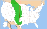
All Topics  
Great Plains


   Email Print
   Bookmark   Link


Great Plains


The Great Plains are the broad expanse of prairie
Prairie

Prairie refers to temperate grasslands of North America. These are areas of low topographic relief that historically supported grasses and herbs, with few or no trees, having a generally mesic habitat climate....
 and steppe
Steppe

In physical geography, a steppe , pronounced , is a grassland plain without trees . The prairie can be considered a steppe. It may be semi-desert, or covered with Poaceae or shrubs or both, depending on the season and latitude....
 which lie west of the Mississippi River
Mississippi River

The Mississippi River is the longest river in the United States, with a length of from its source in Lake Itasca in Minnesota to its mouth in the Gulf of Mexico....
 and east of the Rocky Mountains
Rocky Mountains

The Rocky Mountains, often called the Rockies, are a mountain range in western North America. The Rocky Mountains stretch more than 4,800 kilometre from the northernmost part of British Columbia, in Canada, to New Mexico, in the United States....
 in the United States
United States

The United States of America is a Federal government constitutional republic comprising U.S. state and a federal district. The country is situated mostly in central North America, where its Contiguous United States and Washington, D.C., the Capital districts and territories, lie between the Pacific Ocean and Atlantic Oceans, Borders of the U...
 and Canada
Canada

Canada is a country occupying most of northern North America, extending from the Atlantic Ocean in the east to the Pacific Ocean in the west and northward into the Arctic Ocean....
. This area covers parts of the U.S. state
U.S. state

A U.S. state is any one of the 50 state of the United States that share sovereignty with the federal government of the United States . Because of this shared sovereignty, an United States is a citizen both of the federal entity and of his or her state of Domicile ....
s of Colorado
Colorado

The State of Colorado is a U.S. state located in the Mountain States of the United States of America. Colorado may also be considered to be a part of the Western United States and Southwestern United States regions of the United States....
, Kansas
Kansas

The State of Kansas is a Midwestern U.S. state in the Central United States of the United States of America, an area often referred to as the United States "Heartland"....
, Montana
Montana

Montana is a U.S. state in the Western United States. The western third of the state contains numerous mountain ranges; other 'island' ranges are found in the central third of the state, for a total of 77 named ranges of the Rocky Mountains....
, Nebraska
Nebraska

Nebraska is a U.S. state located on the Great Plains of the Midwestern United States and Western United States.Nebraska probably gets its name from the archaic Chiwere language words ?? Br?sge or the Omaha-Ponca language N? Bth?ska meaning "flat water," after the Platte River that flows through the state....
, New Mexico
New Mexico

New Mexico is a U. S. State located in the Southwestern United States of the United States. Inhabited by Native Americans in the United States populations for many centuries, it has also has been part of the Spanish Empire viceroyalty of New Spain, part of Mexico, and a U.S....
, North Dakota
North Dakota

North Dakota is a U.S. state located in the Midwestern United States and Western United States regions of the United States of America. North Dakota is the 19th largest state by area in the US; it is the 48th most populous, with just over 640,000 residents as of 2006....
, Oklahoma
Oklahoma

Oklahoma is a U.S. state and a sovereignty located in the South Central United States and Southern United States of the United States of America ....
, South Dakota
South Dakota

South Dakota is a U.S. state located in the Midwestern United States of the United States of America. It is named after the Lakota people and Sioux Sioux Native Americans in the United States tribes....
, Texas
Texas

Texas is a U.S. state located in the South Central United States, nicknamed the Lone Star State. Texas is the second largest U.S. state in both area and population, spanning , and with a growing population of 24.3 million residents....
 and Wyoming
Wyoming

The State of Wyoming is a sparsely populated U.S. state in the Northwestern United States of the United States. The majority of the state is dominated by the mountain ranges and rangelands of the Rocky Mountains, while the easternmost section of the state is a high altitude prairie region known as the High Plains ....
, and the Canadian provinces
Provinces and territories of Canada

The provinces and territories of Canada combine to make up the List of countries and outlying territories by total area. The major difference between a Canada province and a territory is that a province receives its power and authority directly from the Monarchy in Canada, via the Constitution Act, 1867, whereas territories derive their manda...
 of Alberta
Alberta

Alberta is one of Canada Canadian Prairies Provinces and territories of Canada. It became a province on September 1, 1905.Alberta is located in western Canada, bounded by the provinces of British Columbia to the west and Saskatchewan to the east, the Northwest Territories to the north, and the U.S....
, Manitoba
Manitoba

Manitoba is a prairie provinces in Canada, which has an area of 647,797 square kilometres and a population of 1,207,959 , with more than half located within the Winnipeg Capital Region ....
 and Saskatchewan
Saskatchewan

Saskatchewan is a prairie provinces in Canada, which has an area of 588,276.09 square kilometres and a population of 1,015,895 , mostly living in the southern half of the province....
, and into Mexico.


Discussion
Ask a question about 'Great Plains'
Start a new discussion about 'Great Plains'
Answer questions from other users
Full Discussion Forum


Recent Posts


Encyclopedia


Map of Great Plains
The Great Plains are the broad expanse of prairie
Prairie

Prairie refers to temperate grasslands of North America. These are areas of low topographic relief that historically supported grasses and herbs, with few or no trees, having a generally mesic habitat climate....
 and steppe
Steppe

In physical geography, a steppe , pronounced , is a grassland plain without trees . The prairie can be considered a steppe. It may be semi-desert, or covered with Poaceae or shrubs or both, depending on the season and latitude....
 which lie west of the Mississippi River
Mississippi River

The Mississippi River is the longest river in the United States, with a length of from its source in Lake Itasca in Minnesota to its mouth in the Gulf of Mexico....
 and east of the Rocky Mountains
Rocky Mountains

The Rocky Mountains, often called the Rockies, are a mountain range in western North America. The Rocky Mountains stretch more than 4,800 kilometre from the northernmost part of British Columbia, in Canada, to New Mexico, in the United States....
 in the United States
United States

The United States of America is a Federal government constitutional republic comprising U.S. state and a federal district. The country is situated mostly in central North America, where its Contiguous United States and Washington, D.C., the Capital districts and territories, lie between the Pacific Ocean and Atlantic Oceans, Borders of the U...
 and Canada
Canada

Canada is a country occupying most of northern North America, extending from the Atlantic Ocean in the east to the Pacific Ocean in the west and northward into the Arctic Ocean....
. This area covers parts of the U.S. state
U.S. state

A U.S. state is any one of the 50 state of the United States that share sovereignty with the federal government of the United States . Because of this shared sovereignty, an United States is a citizen both of the federal entity and of his or her state of Domicile ....
s of Colorado
Colorado

The State of Colorado is a U.S. state located in the Mountain States of the United States of America. Colorado may also be considered to be a part of the Western United States and Southwestern United States regions of the United States....
, Kansas
Kansas

The State of Kansas is a Midwestern U.S. state in the Central United States of the United States of America, an area often referred to as the United States "Heartland"....
, Montana
Montana

Montana is a U.S. state in the Western United States. The western third of the state contains numerous mountain ranges; other 'island' ranges are found in the central third of the state, for a total of 77 named ranges of the Rocky Mountains....
, Nebraska
Nebraska

Nebraska is a U.S. state located on the Great Plains of the Midwestern United States and Western United States.Nebraska probably gets its name from the archaic Chiwere language words ?? Br?sge or the Omaha-Ponca language N? Bth?ska meaning "flat water," after the Platte River that flows through the state....
, New Mexico
New Mexico

New Mexico is a U. S. State located in the Southwestern United States of the United States. Inhabited by Native Americans in the United States populations for many centuries, it has also has been part of the Spanish Empire viceroyalty of New Spain, part of Mexico, and a U.S....
, North Dakota
North Dakota

North Dakota is a U.S. state located in the Midwestern United States and Western United States regions of the United States of America. North Dakota is the 19th largest state by area in the US; it is the 48th most populous, with just over 640,000 residents as of 2006....
, Oklahoma
Oklahoma

Oklahoma is a U.S. state and a sovereignty located in the South Central United States and Southern United States of the United States of America ....
, South Dakota
South Dakota

South Dakota is a U.S. state located in the Midwestern United States of the United States of America. It is named after the Lakota people and Sioux Sioux Native Americans in the United States tribes....
, Texas
Texas

Texas is a U.S. state located in the South Central United States, nicknamed the Lone Star State. Texas is the second largest U.S. state in both area and population, spanning , and with a growing population of 24.3 million residents....
 and Wyoming
Wyoming

The State of Wyoming is a sparsely populated U.S. state in the Northwestern United States of the United States. The majority of the state is dominated by the mountain ranges and rangelands of the Rocky Mountains, while the easternmost section of the state is a high altitude prairie region known as the High Plains ....
, and the Canadian provinces
Provinces and territories of Canada

The provinces and territories of Canada combine to make up the List of countries and outlying territories by total area. The major difference between a Canada province and a territory is that a province receives its power and authority directly from the Monarchy in Canada, via the Constitution Act, 1867, whereas territories derive their manda...
 of Alberta
Alberta

Alberta is one of Canada Canadian Prairies Provinces and territories of Canada. It became a province on September 1, 1905.Alberta is located in western Canada, bounded by the provinces of British Columbia to the west and Saskatchewan to the east, the Northwest Territories to the north, and the U.S....
, Manitoba
Manitoba

Manitoba is a prairie provinces in Canada, which has an area of 647,797 square kilometres and a population of 1,207,959 , with more than half located within the Winnipeg Capital Region ....
 and Saskatchewan
Saskatchewan

Saskatchewan is a prairie provinces in Canada, which has an area of 588,276.09 square kilometres and a population of 1,015,895 , mostly living in the southern half of the province....
, and into Mexico. In Canada the term prairie is more common, and the region is known as the Prairie Provinces or simply "the Prairies".

Some current thinking regarding the geographic location of the Great Plains is shown by a map at the Center for Great Plains Studies at the University of Nebraska-Lincoln. It extends the eastern boundary of the Great Plains down the Assiniboine River
Assiniboine River

The Assiniboine River is a long river that runs through the prairies of Western Canada in Saskatchewan and Manitoba.It is a typical meandering river with a single main channel embanked within a flat, shallow valley at some places, and a steep valley at other places....
 to Winnipeg
Winnipeg

Winnipeg is the capital and largest city of Manitoba, Canada. It is located near the longitude centre of North America, at the confluence of the historic Red River of the North and Assiniboine River Rivers, a point now commonly known as The Forks, Winnipeg....
, Canada
Canada

Canada is a country occupying most of northern North America, extending from the Atlantic Ocean in the east to the Pacific Ocean in the west and northward into the Arctic Ocean....
, southward down the Red River of the North
Red River of the North

The Red River is a North American river. Formed by the confluence of the Bois de Sioux River and Otter Tail River rivers in the United States, it flows northward through the Red River Valley and forms the border between the U.S....
 to South Dakota
South Dakota

South Dakota is a U.S. state located in the Midwestern United States of the United States of America. It is named after the Lakota people and Sioux Sioux Native Americans in the United States tribes....
’s and Nebraska
Nebraska

Nebraska is a U.S. state located on the Great Plains of the Midwestern United States and Western United States.Nebraska probably gets its name from the archaic Chiwere language words ?? Br?sge or the Omaha-Ponca language N? Bth?ska meaning "flat water," after the Platte River that flows through the state....
’s eastern border then down the Missouri River
Missouri River

The Missouri River is a tributary of the Mississippi River, and the longest river in the United States of America. The Missouri begins at the confluence of the Madison River, Jefferson River, and Gallatin River rivers in Montana, and flows through Missouri River Valley south and east into the Mississippi north of St....
 to Kansas City
Kansas City

Kansas City may refer to:* Kansas City Metropolitan Area, metropolitan area surrounding Kansas City, Missouri includes territory in both Missouri and Kansas....
, down the eastern border of Kansas
Kansas

The State of Kansas is a Midwestern U.S. state in the Central United States of the United States of America, an area often referred to as the United States "Heartland"....
 to Oklahoma
Oklahoma

Oklahoma is a U.S. state and a sovereignty located in the South Central United States and Southern United States of the United States of America ....
 where it breaks southwest toward Oklahoma City
Oklahoma city

Oklahoma City is the capital and largest city of the U.S. state of Oklahoma.Oklahoma City may also refer to:*Oklahoma City metropolitan area...
 before continuing south through Ft. Worth and central Texas
Texas

Texas is a U.S. state located in the South Central United States, nicknamed the Lone Star State. Texas is the second largest U.S. state in both area and population, spanning , and with a growing population of 24.3 million residents....
 then west toward the Big Bend
Big Bend

Big Bend may refer to:...
 of the Rio Grande River. The region is about east to west and north to south. Much of the region was home to American bison
American Bison

The American Bison is a bovinae mammal, also commonly known as the American buffalo. "Buffalo" is somewhat of a misnomer for this animal, as it is only distantly related to either of the two "true buffaloes", the Wild Asian Water Buffalo and the African buffalo....
 herds until they were hunted to near extinction during the mid/late 1800s. It has an area of approximately 1,300,000 km2

Geology

Dscn5051 Greatplainswestofkearney E
The Great Plains are the westernmost portion of the vast North America
North America

North America is the northern continent of the Americas, situated in the Earth's northern hemisphere and almost totally in the western hemisphere....
n Interior Plains
Interior Plains

The Interior Plains is a vast physiographic region that spreads across the Laurentia of North America. This area was originally formed when cratons collided and welded together 1.9–1.8 billion years ago in the Trans-Hudson orogeny during the Paleoproterozoic....
, which extend east to the Appalachian Plateau
Appalachian Plateau

The Appalachian Plateau is the western part of the Appalachian mountains, stretching from New York to Georgia and Alabama. The plateau is a second level United States physiographic region....
. The United States Geological Survey
United States Geological Survey

The United States Geological Survey is a scientific agency of the United States government. The scientists of the USGS study the landscape of the United States, its natural resources, and the natural hazards that threaten it....
 divides the Great Plains in the United States into ten physiographic subdivisions:
  • Missouri Plateau
    Coteau du Missouri

    The Coteau du Missouri, or Missouri Plateau, is a large plateau that stretches along the eastern side of the valley of the Missouri River in central North Dakota and north-central South Dakota in the United States....
    , glaciated – east-central South Dakota, northern and eastern North Dakota and northeastern Montana
  • Missouri Plateau
    Coteau du Missouri

    The Coteau du Missouri, or Missouri Plateau, is a large plateau that stretches along the eastern side of the valley of the Missouri River in central North Dakota and north-central South Dakota in the United States....
    , unglaciated – western South Dakota, northeastern Wyoming, southwestern South Dakota and southeastern Montana
  • Black Hills
    Black Hills

    The Black Hills are a small, isolated mountain range rising from the Great Plains of North America in western South Dakota and extending into Wyoming, United States....
     – western South Dakota
  • High Plains
    High Plains (United States)

    The High Plains are a subregion of the Great Plains in the central United States, generally encompassing the western part of the Great Plains before the region reaches the Rocky Mountains....
     – eastern New Mexico, northwestern Texas, western Oklahoma, eastern Colorado, western Kansas, most of Nebraska (including the Sand Hills
    Sand Hills (Nebraska)

    The Sand Hills is a region of mixed-grass prairie in north-central Nebraska, covering just over one quarter of the state. The region is variously defined by different organizations, so its size is indicated as 19,600 mi? or 23,600 mi? ....
    ) and southeastern Wyoming
  • Plains Border – central Kansas and northern Oklahoma (including the Flint
    Flint Hills

    The Flint Hills, historically known as Bluestem Pastures or Blue Stem Hills, are a band of hills in eastern Kansas stretching into north-central Oklahoma, extending from Marshall County, Kansas in the north to Cowley County, Kansas and Osage County, Oklahoma in the south....
    , Red
    Red Hills

    The Red Hills is the name of a prairie region in the southern and central parts of Kansas. The region is also known as the Gyp Hills, because of the large natural deposits of gypsum in this area....
     and Smoky Hills
    Smoky Hills

    The Smoky Hills are hills in the north central section of Kansas, USA. The hills contain many interesting rock formations and bluffs. The bluffs formed because of the draining of rivers into an ancient sea that once covered the area....
    )
  • Colorado Piedmont
    Colorado Piedmont

    The Colorado Piedmont is the geology term for an area along the base of the foothills of the Front Range in north central Colorado in the United States....
     – eastern Colorado
  • Raton
    Raton, New Mexico

    Raton is a city in Colfax County, New Mexico, New Mexico, United States. The population was 7,282 at the 2000 United States Census. It is the county seat of Colfax County, New Mexico....
     section – northeastern New Mexico
  • Pecos Valley
    Pecos River

    The Pecos River or Rio Pecos, as it is sometimes known in New Mexico, arises near Pecos, New Mexico, United States, and flows for through the eastern portion of that state and neighboring Texas before it empties into the Rio Grande near Del Rio, Texas....
     – eastern New Mexico
  • Edwards Plateau
    Edwards Plateau

    The Edwards Plateau is a region of west-central Texas which is bounded by the Balcones Fault to the south and east, the Llano Uplift and the Great Plains region to the north, and the Pecos River and Chihuahuan Desert to the west....
     – south-central Texas
  • Central Texas
    Central Texas

    Central Texas , is a region in the U.S. state of Texas. It is roughly bordered by San Marcos, Texas over to Fredericksburg, Texas up to Waco, Texas, and back down to Brenham, Texas, and includes the Austin, Texas?Round Rock, Texas, Killeen, Texas?Temple, Texas, Bryan-College Station metropolitan area, and Waco, Texas metropolitan areas....
     section – central Texas


The High Plains
High Plains (United States)

The High Plains are a subregion of the Great Plains in the central United States, generally encompassing the western part of the Great Plains before the region reaches the Rocky Mountains....
 is used in a related, more general context to describe the elevated regions of the Great Plains, which are primarily west of the 100th meridian
100th meridian west

The meridian 100? west of Prime Meridian is a line of longitude that extends from the North Pole across the Arctic Ocean, North America, the Pacific Ocean, the Southern Ocean, and Antarctica to the South Pole....
. The 100th meridian roughly corresponds with the line that divides the Great Plains into an area that receive 20 inches (500 mm) or more of rainfall per year and an area that receives less than 20 inches (500 mm). In this context, the High Plains is semi-arid
Semi-arid

A Semi-arid climate or steppe climate generally describes climate regions that receive low annual rainfall . A more precise definition is given by the K?ppen climate classification that treats steppe climates as intermediates between the desert climates and humid climates in ecological characteristics and agricultural potential....
 steppe
Steppe

In physical geography, a steppe , pronounced , is a grassland plain without trees . The prairie can be considered a steppe. It may be semi-desert, or covered with Poaceae or shrubs or both, depending on the season and latitude....
 land and is generally characterized by rangeland or marginal farmland. The region is periodically subjected to extended periods of drought
Drought

A drought is an extended period of months or years when a region notes a deficiency in its water supply. Generally, this occurs when a region receives consistently below average precipitation ....
; high winds in the region may then generate devastating dust storm
Dust storm

A dust storm or sandstorm is a meteorological phenomenon common in arid and semi-arid regions and arises when a gust front passes or when the wind force exceeds the threshold value where loose sand and dust are removed from the dry surface....
s.

During the Cretaceous
Cretaceous

The Cretaceous , usually abbreviated K for its German translation Kreide, is a geologic period from circa to million years ago . In the geologic timescale, the Cretaceous follows on the Jurassic period and is followed by the Paleogene period....
 Period (145-65 million years ago), the Great Plains was covered by a shallow inland sea called Western Interior Seaway
Western Interior Seaway

The Western Interior Seaway, also called the Cretaceous Seaway, the Niobraran Sea, and the North American Inland Sea, was a huge inland sea that split the continent of North America into two halves during most of the mid and late Cretaceous Period ....
. However, during the Late Cretaceous
Late Cretaceous

Late Cretaceous refers to the second half of the Cretaceous Period , named after the famous white chalk cliffs of southern England, which date from this time....
 to the Paleocene
Paleocene

The Paleocene or Palaeocene, "early dawn of the recent" is a geologic epoch that lasted from 65.5 ? 0.3 Mega-annum to 55.8 ? 0.2 Ma . It is the first epoch of the Palaeogene Period in the modern Cenozoic era ....
 (65-55 million years ago), the seaway had begun to recede, leaving behind thick marine deposits and a relatively flat terrain where the seaway had once occupied.

History


Pre-European contact

Historically, the Great Plains were the range of the bison
American Bison

The American Bison is a bovinae mammal, also commonly known as the American buffalo. "Buffalo" is somewhat of a misnomer for this animal, as it is only distantly related to either of the two "true buffaloes", the Wild Asian Water Buffalo and the African buffalo....
 and of the Great Plains culture of the Native American
Plains Indians

The Plains Indians are the Indigenous peoples of the Americas who live on the plains and rolling hills of the Great Plains....
 tribes of the Blackfeet
Blackfeet

The Piegan Blackfeet are a tribe of Native Americans in the United States based in Montana. Many members of the tribe currently live as part of the Blackfeet Nation in northwestern Montana, with population centered in Browning, Montana....
, Crow
Crow Nation

The Crow, also called the Absaroka or Aps?alooke, are a tribe of Native Americans in the United States who historically lived in the Yellowstone River valley and now live on a reservation south of Billings, Montana....
, Sioux
Sioux

Sioux are a Native Americans in the United States and First Nations people. The term can refer to any ethnic group within the Great Sioux Nation or any of the nation's many dialects....
, Cheyenne
Cheyenne

Cheyenne are a native Americans in the United States nation of the Great Plains. The Cheyenne Nation is composed of two united Indian tribe, the S?'taa'e and the Ts?-ts?h?st?hese , which translates to "those like us"....
, Arapaho
Arapaho

The Arapaho are a tribe of Native Americans in the United States historically living on the eastern Great Plains of Colorado and Wyoming. They were close allies of the Cheyenne tribe and loosely aligned with the Sioux....
, Comanche
Comanche

The Comanche are a Native Americans in the United States ethnic group whose range consisted of present-day eastern New Mexico, southern Colorado, southern Kansas, all of Oklahoma, and most of northwest Texas....
 and others. Eastern portions of the Great Plains were inhabited by tribes who lived in semipermanent villages of earth lodges
Earth house

An earth house is also known as an Earth Berm or an Earth Sheltered Home, it is an architecture style characterized by the use of natural terrain to help form the walls of a house....
, such as the Arikara
Arikara

Arikara refers to a group of Native Americans in the United States that speak a Caddoan languages. They were a semi-nomadic group that lived on the Great Plains of the United States of America for several hundred years....
, Mandan
Mandan

The Mandan are a Native Americans in the United States tribe that historically lived along the banks of the Missouri River and two of its tributaries?the Heart River and Knife Rivers?in present-day North Dakota and South Dakota....
, Pawnee
Pawnee

The Pawnee are a Native Americans in the United States tribe that historically lived along the Platte River, Loup River and Republican Rivers in present-day Nebraska and in Northern Kansas....
 and Wichita
Wichita (tribe)

The Wichita are a tribe of Native Americans of the United States, indigenous inhabitants of North America, who speak Wichita language, a Caddoan languages....
.

European contact

With the arrival of Francisco Vásquez de Coronado
Francisco Vásquez de Coronado

Francisco V?zquez de Coronado y Luj?n was a Spain conquistador, who visited New Mexico and other parts of what are now the southwestern United States between 1540 and 1542....
, a Spanish conquistador
Conquistador

Conquistador is the name given to the Spaniards soldiers, leaders, List of explorers, and adventurers involved in the conquest of the Americas following the discovery of the New World by Christopher Columbus in 1492....
, the first recorded history of Europeans in the Great Plains happened in Texas, Kansas and Nebraska from 1540-1542. In that same time period, Hernando de Soto
Hernando de Soto (explorer)

Hernando de Soto was a Spanish people Exploration and conquistador who, while leading the first European expedition deep into the territory of the modern-day United States, was the first European to discover the Mississippi River....
 crossed a west-northwest direction in what is now Oklahoma
Oklahoma

Oklahoma is a U.S. state and a sovereignty located in the South Central United States and Southern United States of the United States of America ....
 and Texas
Texas

Texas is a U.S. state located in the South Central United States, nicknamed the Lone Star State. Texas is the second largest U.S. state in both area and population, spanning , and with a growing population of 24.3 million residents....
. Today this is known as the De Soto Trail. The Spanish thought the Great Plains were the location of the mythological Quivira and Cíbola
Quivira and Cíbola

Quivira and C?bola are two of the Seven Cities of Gold existing only in a myth that originated around the year 1150 when the Moors conquered M?rida, Spain....
, a place rich in gold.

In the next one hundred years the fur trade
Fur trade

The fur trade is a worldwide industry dealing in the acquisition and sale of animal fur....
 injected thousands of Europeans onto the Great Plains, as fur trappers from France, Spain, Britain, Russia and the young United States made their way across much of the region. With the Louisiana Purchase
Louisiana Purchase

The Louisiana Purchase was the acquisition by the United States of America of of the French territory Louisiana in 1803. The U.S. paid 60 million French franc plus cancellation of debts worth 18 million francs , a total cost of $15,000,000 for the Louisiana territory....
 in 1803 and subsequent Lewis & Clark Expedition in 1804, the Great Plains became more accessible. A major fur trading site was located at Fort Lisa
Fort Lisa

Fort Lisa was established in 1812 by famed fur trader Manuel Lisa and the Missouri Fur Company in the present-day neighborhood of North Omaha, Nebraska in Nebraska....
 on the Missouri River
Missouri River

The Missouri River is a tributary of the Mississippi River, and the longest river in the United States of America. The Missouri begins at the confluence of the Madison River, Jefferson River, and Gallatin River rivers in Montana, and flows through Missouri River Valley south and east into the Mississippi north of St....
 in Nebraska. This type of early settlement opened the door to vast westward expansion, with settlements rising across the Great Plains.

Early settlements on the Great Plains

  • Fort Manuel Lisa Trading Post (1806)
  • Fontenelle's Post
    Fontenelle's Post

    Fontenelle's Post, first known as Pilcher's Post and also the basis of the community of Bellevue, Nebraska, was built in 1822 in the Nebraska Territory by trader Joshua Pilcher, as president of the Missouri Fur Company....
     (1806)
  • Cabanne's Trading Post
    Cabanne's Trading Post

    Cabanne's Trading Post was established in 1822 by the American Fur Company as Fort Robidoux near present-day Dodge Park in North Omaha, Nebraska, Nebraska....
     (1822)


Pioneer settlement

This settlement led to the near-extinction of the bison
American Bison

The American Bison is a bovinae mammal, also commonly known as the American buffalo. "Buffalo" is somewhat of a misnomer for this animal, as it is only distantly related to either of the two "true buffaloes", the Wild Asian Water Buffalo and the African buffalo....
 and the removal of the Native Americans
Native Americans in the United States

Native Americans in the United States are the Indigenous peoples of the Americas from the regions of North America now encompassed by the continental United States United States, including parts of Alaska and the island state of Hawaii....
 to Indian reservation
Indian reservation

An Indian reservation is an area of land managed by a Native Americans of the United States tribe under the United States Department of the Interior Bureau of Indian Affairs....
s in the 1870s. Much of the Great Plains became open range
Rangeland

this is not realRangeland refers to expansive, mostly unimproved lands on which a significant proportion of the natural vegetation is native grasses, grass-like plants, forbs, and shrubs....
, hosting ranching operations where anyone was theoretically free to run cattle
Cattle

Cattle, colloquially referred to as cows, are domestication ungulates, a member of the subfamily Bovinae of the family Bovidae. They are raised as livestock for meat , dairy products , leather and as draft animals ....
. In the spring and fall, roundups were held and the new calves were branded and the cattle sorted out for sale. Ranching began in Texas and gradually moved northward. Texas cattle were driven north to railroad lines in cities Dodge City, Kansas
Dodge City, Kansas

Dodge City is a city and county seat of Ford County, Kansas, Kansas, United States. It was named after Colonel Richard Irving Dodge. The population was 25,176 at the United States Census 2000....
 and Ogallala, Nebraska
Ogallala, Nebraska

Ogallala is a city in Keith County, Nebraska, Nebraska, United States. The population was 4,930 at the United States Census, 2000. It is the county seat of Keith County, Nebraska....
; from there, cattle were shipped eastward. Many foreign, especially British
United Kingdom

The United Kingdom of Great Britain and Northern Ireland, commonly known as the United Kingdom , the UK or Britain,is a sovereign state located off the northwestern coast of continental Europe....
, investors financed the great ranches of the era. Overstocking of the range and the terrible winter of 1886 eventually resulted in a disaster, with many cattle starved and frozen. From then onward, ranchers generally turned to raising feed in order to keep their cattle alive over winter.

The Homestead Act
Homestead Act

Homestead Act was a United States Federal law that gave an applicant freehold title to 160 acres -640 acres of undeveloped land outside of the original 13 colonies....
 of 1862 provided that a settler could claim up to 160 acres (65 hectare
Hectare

A hectare is a unit of area equal to , or one square hectometre , and commonly used for surveying.The hectare is used in most countries around the world, especially in domains concerned with land ownership, land planning, and land management, including law , agriculture, forestry, and town planning....
s) of land, provided that he lived on it for a period of five years and cultivated it. This was later expanded under the Kinkaid Act
Kinkaid Act

The Kinkaid Act of 1904 is a United States government statute that amended the 1862 Homestead Act so that one section of a township of undeveloped land could be claimed in 37 northern and western Nebraska counties....
 to include a homestead of an entire section. Hundreds of thousands of people claimed these homesteads, sometimes building sod house
Sod

Sod or turf is grass and the part of the soil beneath it held together by the roots, or a piece of this material.The term sod may be used to mean turf grown and cut specifically for the establishment of lawns....
s out of the very turf
Sod

Sod or turf is grass and the part of the soil beneath it held together by the roots, or a piece of this material.The term sod may be used to mean turf grown and cut specifically for the establishment of lawns....
 of their land. Many of them were not skilled dryland farmer
Dryland farming

Dryland farming is an agricultural technique for cultivating land which receives little rainfall. Dryland farming is used in the Great Plains, the Palouse plateau of Eastern Washington regions of North America, the Middle East and in other cereal growing regions such as the steppes of Eurasia and Argentina....
s and failures were frequent. Germans from Russia who had previously farmed in similar circumstances in what is now Ukraine
Ukraine

Ukraine is a country in Eastern Europe. It is bordered by Russia to the east; Belarus to the north; Poland, Slovakia, and Hungary to the west; Romania and Moldova to the southwest; and the Black Sea and Sea of Azov to the south....
 were marginally more successful than the average homesteader. The Dominion Lands Act
Dominion Lands Act

The Dominion Lands Act was an 1872 Canada law that aimed to encourage the settlement of Canada's prairie provinces. It was closely based on the United States Homestead Act, setting the parameters within which western land could be settled and its natural resources developed....
 of 1871 served a similar function in Canada.

After 1900

Dscn5136 Abandonedgasstation E
The region roughly centered on the Oklahoma Panhandle
Oklahoma Panhandle

The Oklahoma Panhandle is the extreme western region of the state of Oklahoma, comprising Cimarron County, Oklahoma, Texas County, Oklahoma, and Beaver County, Oklahoma....
, including southeastern Colorado, southwestern Kansas, the Texas Panhandle
Texas Panhandle

The Texas Panhandle is a region of the U.S. state of Texas consisting of the northernmost 26 List of Texas counties in the state. The panhandle is a rectangular area bordered by the state of New Mexico to the west and the state of Oklahoma to the north and east....
, and extreme northeastern New Mexico was known as the Dust Bowl
Dust Bowl

The Dust Bowl or the Dirty Thirties was a period of severe dust storms causing major ecological and agriculture damage to United States and Canada prairie lands from 1930 to 1936 ....
 during the late 1920s and early 1930s. The effect of the drought combined with the effects of the Great Depression
Great Depression

File:International depression.pngThe Great Depression was a worldwide economic Recession starting in most places in 1929 and ending at different times in the 1930s or early 1940s for different countries....
, forced many farmers off the land throughout the Great Plains.

From the 1950s, on, many areas of the Great Plains have become productive crop-growing areas because of extensive irrigation
Irrigation

Irrigation is an artificial application of water to the soil usually for assisting in growing crops. In crop production it is mainly used in dry areas and in periods of rainfall shortfalls, but also to protect plants against frost....
. The southern portion of the Great Plains lies over the Ogallala Aquifer
Ogallala Aquifer

File:Ogallala changes 1980-1995.svgFile:High plains fresh groundwater usage 2000.svgThe Ogallala Aquifer, also known as the High Plains Aquifer, is a vast yet shallow underground water table aquifer located beneath the Great Plains in the United States....
, a vast underground layer of water-bearing strata dating from the last ice age
Ice age

The general term "ice age" or, more precisely, "glacial age" denotes a geological period of long-term reduction in the temperature of the Earth's surface and atmosphere, resulting in an expansion of continental ice sheets, polar ice sheets and alpine glaciers....
. Center pivot irrigation
Center pivot irrigation

Center-pivot irrigation , also called circle irrigation, is a method of agriculture irrigation in which equipment rotates around a pivot....
 is used extensively in drier sections of the Great Plains, resulting in aquifer
Aquifer

An aquifer is an underground layer of water-bearing permeable rock or unconsolidated materials from which groundwater can be usefully extracted using a water well....
 depletion at a rate that is greater than the ground's ability to recharge.

The rural Plains have lost a third of their population since 1920. Several hundred thousand square miles of the Great Plains have fewer than six persons per square mile—the density standard Frederick Jackson Turner
Frederick Jackson Turner

Frederick Jackson Turner was an American historian in the early 20th century. He is best known for The Significance of the Frontier in American History....
 used to declare the American frontier
Frontier

A frontier is a political and geographical term referring to areas near or beyond a Border....
 "closed" in 1893. Many have fewer than two persons per square mile. There are more than 6,000 ghost towns in the State of Kansas
Kansas

The State of Kansas is a Midwestern U.S. state in the Central United States of the United States of America, an area often referred to as the United States "Heartland"....
 alone, according to Kansas historian Daniel Fitzgerald. This problem is often exacerbated by the consolidation of farms and the difficulty of attracting modern industry to the region. In addition, the smaller school-age population has forced the consolidation of school districts and the closure of high schools in some communities. This continuing population loss has led some to suggest that the current use of the drier parts of the Great Plains is not sustainable
Sustainability

Sustainability, in a broad sense, is the ability to maintain a certain process or state. It is now most frequently used in connection with biological and human systems....
, and propose that large parts be restored to native grassland grazed by bison, a proposal known as Buffalo Commons
Buffalo Commons

The Buffalo Commons is a conceptual proposal to create a vast nature preserve by returning of the drier portion of the Great Plains to native prairie, and by reintroducing the American Bison that once grazed the shortgrass prairie....
.

Wind power


The Great Plains contribute substantially to wind power in the United States
Wind power in the United States

File:United States Wind Resources and Transmission Lines map.jpgWind power in the United States is a rapidly growing industry. The U.S. is the leading producer of electricity from wind power....
. In July 2008, oilman turned wind-farm developer, T. Boone Pickens, called for the U.S. to invest $1 trillion to build an additional 200,000 MW of wind power
Wind power

Wind power is the conversion of wind energy into a useful form, such as electricity, using wind turbines. At the end of 2008, worldwide nameplate capacity of wind-powered generators was 120.8 gigawatts....
 nameplate capacity
Intermittent power source

An intermittent power source is a source of electric power generation that may be uncontrollably variable or more Intermittency than conventional power sources, and therefore non-dispatchable, and is usually used to refer to sources of renewable energy such as wind power and solar power generated electricity....
 in the Plains, as part of his Pickens Plan
Pickens Plan

The Pickens Plan is an energy policy proposal announced July 8, 2008 by United States businessman T. Boone Pickens. Pickens intends to reduce American dependence on imported oil by investing approximately United States dollar1 trillion in new wind farm for power generation, which he believes would allow the Natural_gas#Power_generation curre...
. Pickens cited Sweetwater, Texas
Sweetwater, Texas

Sweetwater is a city in and the county seat of Nolan County, Texas, Texas, United States. The population was 11,415 at the 2000 United States Census....
 as an example of economic revitalization driven by wind power development. Sweetwater was a struggling town typical of the Plains, steadily losing businesses and population, until wind turbine
Wind turbine

A wind turbine is a rotating machine which converts the kinetic energy in wind into mechanical energy. If the mechanical energy is used directly by machinery, such as a pump or grinding stones, the machine is usually called a windmill....
s came to the surrounding Nolan County
Nolan County, Texas

Nolan County is a county located in the west central region of the U.S. state of Texas. In 2000, its population was 15,802. Its county seat is Sweetwater, Texas....
. Wind power brought jobs to local residents, along with royalty payments to landowners who leased sites for turbines, reversing the town's population decline. Pickens claims the same economic benefits are possible throughout the Plains, which he refers to as North America
North America

North America is the northern continent of the Americas, situated in the Earth's northern hemisphere and almost totally in the western hemisphere....
's "wind corridor."

Flora


The Great Plains are part of the floristic North American Prairies Province
North American Prairies Province

The North American Prairies Province is a large grassland floristic province lying between the Appalachian Province and the Rocky Mountains and including the prairies of the Great Plains....
, which extends from the Rocky Mountains to the Appalachian mountains.

See also

  • 1837-38 smallpox epidemic
    1837-38 smallpox epidemic

    The smallpox epidemic that ravaged the people of the Great Plains in 1837 and 1838 was believed to have begun in spring of 1837 when a deckhand became ill aboard an American Fur Company steamboat named S.S....
  • Canadian Prairies
    Canadian Prairies

    The Canadian Prairies is a list of regions of Canada of Canada, specifically in Western Canada, which may correspond to several different definitions, natural or political....
  • Great American Desert
    Great American Desert

    The Great American Desert is a term that was used in the 19th century to describe the High Plains east of the Rocky Mountain.Description...
  • High Plains (Australia)
    High Plains (Australia)

    The High Plains of South-Eastern Australia are a region, or more strictly a string of adjacent areas, in and adjacent to the Great Dividing Range....
  • Cerrado
    Cerrado

    The cerrado is a vast tropical savanna ecoregion of Brazil. The cerrado is characterised by an enormous range of plant and animal biodiversity....
    , Brazil
  • Llano Estacado
    Llano Estacado

    Llano Estacado is a region in the southwestern United States that encompasses parts of eastern New Mexico and northwestern Texas, including the South Plains and parts of the Texas Panhandle....
    , Southwest United States
  • Llanos
    Llanos

    Los Llanos is a vast tropical grassland plain situated at the east of the Andes in northwestern South America . Its main river is the Orinoco....
    , Colombia and Venezuela
  • Pampa
    Pampa

    The Pampas are the fertile South American lowlands that include the Argentina provinces of Buenos Aires Province, La Pampa Province, Santa Fe Province, Argentina, and C?rdoba Province, Argentina, most of Uruguay, and the southernmost end of Brazil, Rio Grande do Sul, covering more than ....
    , Argentina, Paraguay, Brazil
  • Steppe
    Steppe

    In physical geography, a steppe , pronounced , is a grassland plain without trees . The prairie can be considered a steppe. It may be semi-desert, or covered with Poaceae or shrubs or both, depending on the season and latitude....
  • Wind power in Texas
    Wind power in Texas

    File:GreenMountainWindFarm Fluvanna 2004.jpgWind power in Texas consists of many wind farms with a total installed nameplate capacity of some 7,116 megawatts from over 40 different projects, as at the end of 2008....
  • Great bison belt
    Great bison belt

    The Great Bison Belt is a tract of rich grassland that ran from Alaska to the Gulf of Mexico around 9000 B.C.E. The Great Bison Belt was supported by spring and early summer rainfall that allowed short Poaceae to grow....


Further reading

  • Chokecherry Places, Essays from the High Plains, Merrill Gilfillan, Johnson Press, Boulder, Colorado, trade paperback, ISBN 1-55566-227-7.
  • Colorado Without Mountains, A High Plains Memoir, Harold Hamil, The Lowell Press, Kansas City, Missouri, 1976, Hardback, 284 pages, ISBN 0-913504-33-5.
  • Down and Out on the Family Farm: Rural Rehabilitation in the Great Plains, 1929-1945, Michael Johnston Grant, University of Nebraska Press, 2002, ISBN 0-8032-7105-0
  • The Dust Bowl: Men, Dirt, and Depression, Paul Bonnifield, University of New Mexico Press, Albuquerque, New Mexico, 1978, hardcover, ISBN 0-8263-0485-0.
  • Encyclopedia of the Great Plains, David J. Wishart, University of Nebraska Press, 2004, ISBN 0-8032-4787-7.
  • Woody Landscape Plants for the High Plains, D. H. Fairchild and J. E. Klete, Colorado State University, 1993, Technical Bulletin LTB93-1 (Contact CSU to buy this).
  • Wolf Willow, A history, a story, and a memory of the last plains frontier, Wallace Stegner, Viking Compass Book, New York, 1966, trade paperback, ISBN 0-670-00197-X
  • The Tie That Binds
    The Tie That Binds

    Kent Haruf's [pronounced to rhyme with "sheriff"] novel The Tie That Binds , is the fictitious story of 80 year-old Edith Goodnough of Holt County, Colorado, as told to an unnamed inquirer on a Sunday afternoon in the spring of 1977 by her 50 year-old neighbour, a farmer called Sanders Roscoe....
     (1984), a novel about farming by Kent Haruf
    Kent Haruf

    Kent Haruf is an award winning United States novelist.Haruf was born in Pueblo, Colorado, the son of a Methodist minister. He graduated with a Bachelor's degree from Nebraska Wesleyan University in 1965 and an Master of Fine Arts from the Iowa Writers' Workshop at the University of Iowa in 1973....
    , Vintage Books 2000, paperback, ISBN 0-375-72438-9.


External links