
Short Pump, Virginia
Encyclopedia
Census-designated place
A census-designated place is a concentration of population identified by the United States Census Bureau for statistical purposes. CDPs are delineated for each decennial census as the statistical counterparts of incorporated places such as cities, towns and villages...
(CDP) in Henrico County
Henrico County, Virginia
Henrico is a county located in the Commonwealth of Virginia, a state of the United States. As of 2010, Henrico was home to 306,935 people. It is located in the Richmond-Petersburg region and is a portion of the Richmond Metropolitan Statistical Area...
, Virginia
Virginia
The Commonwealth of Virginia , is a U.S. state on the Atlantic Coast of the Southern United States. Virginia is nicknamed the "Old Dominion" and sometimes the "Mother of Presidents" after the eight U.S. presidents born there...
, United States
United States
The United States of America is a federal constitutional republic comprising fifty states and a federal district...
. The population was 182 at the 2000 census.
The village of Short Pump, located at the intersection of Three Chopt Road, Richmond Turnpike and Pouncey Tract Road, was named for the short handled pump beneath the porch of a tavern located there. This area was on the principal route between Richmond and the Blue Ridge Mountains. Thomas Jefferson, Earl Cornwallis, the Marquis De Lafayette, General Peter Muhlenberg, Stonewall Jackson, and Ulric Dahlgren were some of the major people in American history that visited this area.
Short Pump has greatly increased population in recent years, due to its proximity to Richmond
Richmond, Virginia
Richmond is the capital of the Commonwealth of Virginia, in the United States. It is an independent city and not part of any county. Richmond is the center of the Richmond Metropolitan Statistical Area and the Greater Richmond area...
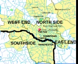
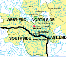
. It has now become part of Richmond's Far West End
The West End (Richmond, Virginia)
The West End is a part of Richmond, Virginia. The true West End covers only the western part of the city of Richmond though some consider western Henrico County part of the West End as well. As there is no one municipal organization that represents this specific region, the boundaries are loosely...
. In 2003, developers opened Short Pump Town Center
Short Pump Town Center
Short Pump Town Center is located in Henrico County, Virginia on Broad Street, approximately 1 mile west of I-64 Exit 178A/B. This area of Henrico County is called The West End and is northwest of Richmond. Short Pump Town Center is a two-level, open-air retail center composed of upscale stores....
, a 1200000 square feet (111,483.6 m²) open air shopping mall
Shopping mall
A shopping mall, shopping centre, shopping arcade, shopping precinct or simply mall is one or more buildings forming a complex of shops representing merchandisers, with interconnecting walkways enabling visitors to easily walk from unit to unit, along with a parking area — a modern, indoor version...
.
It is located in near many shopping centers, fast-food and upscale restaurants. There is also a skating rink, bowling alley and many neighborhoods under development. There are also nine nearby schools: Short Pump Elementary School, Nuckols Farm Elementary School, Gayton Elementary School, Colonial Trail Elementary School Twin Hickory Elementary School, Holman Middle School, Pocahontas Middle School, Short Pump Middle School, Godwin High School
Mills E. Godwin High School
Mills Edwin Godwin High School is located in The West End of Henrico County, Virginia. The school, operated by Henrico County Public Schools.-History:...
and Deep Run High School
Deep Run High School
-History:Deep Run High School was named after one of Henrico County's first schools: Deep Run School. Deep Run School was a two-room schoolhouse that can still be found on the grounds of Short Pump Elementary School...
.
Geography
Short Pump is located at 37°39′43"N 77°37′36"W (37.661809, -77.626635).According to the United States Census Bureau
United States Census Bureau
The United States Census Bureau is the government agency that is responsible for the United States Census. It also gathers other national demographic and economic data...
, the CDP has a total area of 2.4 square miles (6.2 km²), of which, 2.4 square miles (6.1 km²) of it is land and 0.42% is water.
Demographics
As of the censusCensus
A census is the procedure of systematically acquiring and recording information about the members of a given population. It is a regularly occurring and official count of a particular population. The term is used mostly in connection with national population and housing censuses; other common...
of 2000, there were 182 people, 69 households, and 44 families residing in the CDP. The population density
Population density
Population density is a measurement of population per unit area or unit volume. It is frequently applied to living organisms, and particularly to humans...
was 76.7 people per square mile (29.6/km²). There were 77 housing units at an average density of 32.5/sq mi (12.5/km²). The racial makeup of the CDP was 91.76% White, 4.40% from other races
Race (United States Census)
Race and ethnicity in the United States Census, as defined by the Federal Office of Management and Budget and the United States Census Bureau, are self-identification data items in which residents choose the race or races with which they most closely identify, and indicate whether or not they are...
, and 3.85% from two or more races. Hispanic or Latino of any race were 8.79% of the population.
There were 69 households out of which 31.9% had children under the age of 18 living with them, 52.2% were married couples
Marriage
Marriage is a social union or legal contract between people that creates kinship. It is an institution in which interpersonal relationships, usually intimate and sexual, are acknowledged in a variety of ways, depending on the culture or subculture in which it is found...
living together, 10.1% had a female householder with no husband present, and 36.2% were non-families. 26.1% of all households were made up of individuals and 8.7% had someone living alone who was 65 years of age or older. The average household size was 2.64 and the average family size was 3.30.
In the CDP the population was spread out with 26.9% under the age of 18, 6.0% from 18 to 24, 33.5% from 25 to 44, 18.1% from 45 to 64, and 15.4% who were 65 years of age or older. The median age was 36 years. For every 100 females there were 106.8 males. For every 100 females age 18 and over, there were 107.8 males.
The median income for a household in the CDP was $60,531, and the median income for a family was $36,375. Males had a median income of $28,155 versus $26,250 for females. The per capita income
Per capita income
Per capita income or income per person is a measure of mean income within an economic aggregate, such as a country or city. It is calculated by taking a measure of all sources of income in the aggregate and dividing it by the total population...
for the CDP was $36,804. None of the population or families were below the poverty line.
Attractions
There is a lot going on presently in Short Pump and it is under constant construction. Recently constructed West Broad Village contains multiple places to eat, shop and play. The new “village” contains stores such as REI, Home Goods, Whole Foods, Trader Joes, and many more. Some of the restaurants include Kona Grill, Mimis Café, Jimmy Johns, McCormick and Schmick’s.Down Broad Street from West Broad Village is Bowl America, located off of Pouncey Tract, Regal Cinemas Short Pump, a fourteen theater movie theater and SkateNation Plus.
Located in Short Pump Town Center, The Funny Bone Comedy Club features a well-known comedian once a month along with local acts, improv nights, open mic nights, and other special events. Also in Short Pump Town Center are several upscale restaurants and stores including Firebirds, Maggiano’s, Cheese Cake Factory, Nordstrom, Pottery Barn, Crate and Barrel.
Neighborhoods in Short Pump
Residents of Short Pump generally believe that the boundaries for Short Pump are Church Road, the Goochland County divide,and the bridge crossing over interstate 64. Short Pump is home to several individual neighborhoods. All of the neighborhoods of Short Pump consist of similar houses which were designed specifically to attract Richmond's nouveau richeNouveau riche
The nouveau riche , or new money, comprise those who have acquired considerable wealth within their own generation...
. Several of these neighborhoods are:
- Oak Run-A convenient location out of the way from the hectic traffic of the closer, concentrated area of Short Pump. More than lovely homes with plenty of character off of Church Road. Also, sits next to barony woods.
- Barony Woods - A convenient location out of the way from the hectic traffic of the closer, concentrated area of Short Pump. Lovely homes with plenty of character off of Church Road.
- Glen Gary - Connected to Waterford, Wellesley, Sherbrooke, and is traditionally well rounded.
- Hardings Trace- Smaller sized neighborhood with beautiful homes. Great for raising a family. Connects with Burgundy Park and right of North Gayton Road
- The Colonies - A community with a clubhouse that is walking distance to Wilde Lake and is next to the Tuckahoe Creek.
- Sherbrooke - Family and kid friendly neighborhood in a convenient location; near the John Rolfe Parkway construction.
- Wellesley - A large, single family home development built by HHHunt homes.
- Fox Hall - One of the more affluent neighborhoods of Short Pump; home prices vary from 350,000 to over 1 million.
- Pine Run-Larger,older homes with beautiful trees. The main road is Fox Meadow Dr. and it runs through the neighborhood. Wonderful atmosphere. Right next to Gayton Elementary. Entrances on Gayton and Ridgfield.
- Gayton Station - Smaller homes in the meadows of the Tuckahoe Creek.
- Wythe Trace and Summerwood - Desirable homesites that buffer against the John Rolfe Parkway construction.
- Barrington - A wealthier community with larger homes along the Church Road Corridor; community lake and dock.
- Barrington Valley - Located within Barrington, along Three Chopt Road.
- Barrington West - Barrington's extension on the western side of Barrington Lake.
- Sterling - Traditional homes, all brick, on the south side of Church Road.
- Church RunChurch RunChurch Run is a residential neighborhood in Henrico County, Virginia that was built at the beginning of the 1990s. Church Run is located near the intersection of Cox Rd. and Church Rd.-Church Run Athletics:...
- A community with open, grassy yards, and connects Three Chopt Road to Church Road. Church Run Parkway is commonly used as a cut through for residents south of Church Road. - Waterford - A large neighborhood with countless homesites that are large and comfortable.
- Graham Meadows - In the meadows of the Tuckahoe Creek.
- Twin Hickory - A master planned community developed by HHHunt consisting of approximately 1300 homes as of July 2010 located between Nuckols Road and Pouncey Tract Road. Community amenities include pools, tennis courts, parks, and an extensive network of sidewalks and paths. Housing options include apartment rentals, low-maintenance homes, town homes, and large family homes. Adjacent to the Twin Hickory community are the highly rated schools of Twin Hickory Elementary, Colonial Trail Elementary, Short Pump Middle, and Deep Run High School. Also adjacent is Henrico County's Twin Hickory Library. Nearby amenities include the Short Pump Mall, a wide range of retail shopping along Broad Street, and convenience and grocery retail outlets on Nuckols road. Also adjacent are a retirement community and several office parks.
- Wyndham - A large neighborhood featuring The Dominion Club and a neighborhood pool.
- Retrivers Ridge-smaller neighborhood; one and two story homes; nice sized yards; located near Church & Pump Rd
- Barclay - A quiet, out-of-the-way community with large 1-2 story homes.
- Shady Grove Estates - A smaller neighborhood with large homes on multiple acres; located off of Pouncey Tracy Rd.
- Burgundy Parke- A small neighborhood off North Gayton Road, adjacent to the Fox Hall and Colonies neighborhoods