
1967 Atlantic hurricane season
Encyclopedia
The 1967 Atlantic hurricane season was the first year in which the National Hurricane Center
(NHC) was in operation. The season
began on June 1, which was the date when the NHC activated radar stations across the Caribbean and Gulf of Mexico. The season ended on November 30, which ended the conventional delimitation of the time period when most tropical cyclone
s form in the Atlantic basin
. The season was near average, with eight storms forming. Hurricane Beulah
was the most notable Atlantic hurricane of 1967. A Category 5 hurricane
, it killed 58 people and did $217 million (1967 USD, $ USD) in damage as it crossed the Yucatán Peninsula
and then made landfall a second time near the mouth of the Rio Grande
.
(ITCZ) became very active, with four separate areas of convection exiting the coast of Africa. The first, accompanied with a tropical wave, became a tropical depression on August 28 (the second became Beulah and the fourth became Chloe). The tropical depression moved west-northward, reaching tropical storm strength on August 30. Arlene slowly strengthened over the following days, eventually reaching hurricane intensity on September 3 over the north Atlantic. The next day, it weakened to a tropical storm and became extratropical. It was absorbed by a warm front, leaving behind a slow-moving frontal low.
. It passed south of Hispaniola, where land interaction and upper level shear greatly weakened the hurricane to a 60 mph (95 km/h) tropical storm.
Favorable conditions returned once again over the western Caribbean, letting Beulah strengthen to a 115 mph (185 km/h) major hurricane. On September 16, Beulah weakened and made landfall near Cozumel, Mexico as a 100 mph (160 km/h) hurricane. It weakened slightly over land, but once over the Gulf of Mexico, conditions were very favorable. It rapidly intensified, reaching its peak as a Category 5 storm with 160 mph (260 km/h) winds. The hurricane, producing winds of 160 mph (260 km/h), made landfall south of the mouth of the Rio Grande
as a Category 5 storm. In Texas, the hurricane produced Category 3 conditions. The S.S. Shirley Lykes reported winds of 136 mph as the storm passed over the port at Brownsville, Texas
.
Ultimately, Hurricane Beulah caused 58 deaths and $217 million in damage ($1.4 billion in 2010 USD).
. On September 8, after passing through Cape Verde, it became a tropical storm, and the following day, a hurricane. At this time, Chloe interacted with Hurricane Doria to its west, turning Chloe northward. It moved out to sea, becoming extratropical on September 21 over the eastern Atlantic.
in early September. Over the next days, it drifted over the warm Gulf Stream
waters, gradually transforming it to more tropical in nature. On September 8, it was well-organized enough to be called a tropical depression, 50 miles (80.5 km) north of Grand Bahama Island. It drifted to the west-southwest, reaching tropical storm strength the next day. Soon after, Doria moved rapidly northeastward, becoming a hurricane on September 10 while 200 miles (321.9 km) east of the Florida/Georgia border. It weakened to a tropical storm due to cool air entrainment into the circulation on September 11, but on September 12 it was able to re-strengthen. Building high pressures to Doria's northeast pushed Doria westward towards the coast. It weakened to a tropical storm again due to cold air, just prior to reaching the Virginia
coastline. It made landfall on September 16, and continued southward through the Outer Banks
. Doria weakened further to a tropical depression on September 17, retaining its circulation for four days before dissipating on September 21. Doria claimed three lives when a small boat sank off the coast of New Jersey
.
disturbance led to the formation of a tropical depression on September 26, east of the Lesser Antilles
. Two days later, the depression intensified and became Tropical Storm Edith. After reaching a peak of 60 mph (95 km/h), Edith passed under a cold upper trough, weakening Edith to a depression on September 30 before passing through the islands. Tropical Depression Edith dissipated on October 1 in the eastern Caribbean Sea
.
in late September. It organized around an area of low pressure, becoming a tropical depression on October 1 in the Bay of Campeche
. Moving northward, it became Tropical Storm Fern on October 2, and the following day, Hurricane Fern. Fern moved more to the west after reaching its peak of 85 mph (140 km/h) winds, reaching unfavorable conditions caused by Beulah two weeks earlier. Thus, Fern weakened to a tropical storm prior to its Tampico
landfall on October 4, dissipating later that day. Fern caused three deaths due to drowning.
in 1973. After peaking at 50 mph the storm weakened, dissipating on October 8.
. Dry air and cooler waters from upwelling weakened Heidi to a tropical storm on October 29, and on October 31, Heidi became extratropical.
was retired and replaced with Beth in the 1971 season
.
National Hurricane Center
The National Hurricane Center , located at Florida International University in Miami, Florida, is the division of the National Weather Service responsible for tracking and predicting weather systems within the tropics between the Prime Meridian and the 140th meridian west poleward to the 30th...
(NHC) was in operation. The season
Atlantic hurricane season
The Atlantic hurricane season is the period in a year when hurricanes usually form in the Atlantic Ocean. Tropical cyclones in the North Atlantic are called hurricanes, tropical storms, or tropical depressions. In addition, there have been several storms over the years that have not been fully...
began on June 1, which was the date when the NHC activated radar stations across the Caribbean and Gulf of Mexico. The season ended on November 30, which ended the conventional delimitation of the time period when most tropical cyclone
Tropical cyclone
A tropical cyclone is a storm system characterized by a large low-pressure center and numerous thunderstorms that produce strong winds and heavy rain. Tropical cyclones strengthen when water evaporated from the ocean is released as the saturated air rises, resulting in condensation of water vapor...
s form in the Atlantic basin
Atlantic Basin
The Atlantic Basin is the Atlantic Ocean.Atlantic Basin may also refer to:* Atlantic Basin Iron Works, an ironworks that operated in Brooklyn, New York, in the early to mid-20th century...
. The season was near average, with eight storms forming. Hurricane Beulah
Hurricane Beulah
Hurricane Beulah was the second tropical storm, second hurricane, and only major hurricane during the 1967 Atlantic hurricane season. It tracked through the Caribbean, struck the Yucatán peninsula of Mexico as a major hurricane, and moved west-northwest into the Gulf of Mexico, briefly gaining...
was the most notable Atlantic hurricane of 1967. A Category 5 hurricane
Saffir-Simpson Hurricane Scale
The Saffir–Simpson Hurricane Scale , or the Saffir–Simpson Hurricane Wind Scale , classifies hurricanes — Western Hemisphere tropical cyclones that exceed the intensities of tropical depressions and tropical storms — into five categories distinguished by the intensities of their sustained winds...
, it killed 58 people and did $217 million (1967 USD, $ USD) in damage as it crossed the Yucatán Peninsula
Yucatán Peninsula
The Yucatán Peninsula, in southeastern Mexico, separates the Caribbean Sea from the Gulf of Mexico, with the northern coastline on the Yucatán Channel...
and then made landfall a second time near the mouth of the Rio Grande
Rio Grande
The Rio Grande is a river that flows from southwestern Colorado in the United States to the Gulf of Mexico. Along the way it forms part of the Mexico – United States border. Its length varies as its course changes...
.
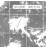
Hurricane Arlene
After a quiet start to the season, the Intertropical Convergence ZoneIntertropical Convergence Zone
The Intertropical Convergence Zone , known by sailors as The Doldrums, is the area encircling the earth near the equator where winds originating in the northern and southern hemispheres come together....
(ITCZ) became very active, with four separate areas of convection exiting the coast of Africa. The first, accompanied with a tropical wave, became a tropical depression on August 28 (the second became Beulah and the fourth became Chloe). The tropical depression moved west-northward, reaching tropical storm strength on August 30. Arlene slowly strengthened over the following days, eventually reaching hurricane intensity on September 3 over the north Atlantic. The next day, it weakened to a tropical storm and became extratropical. It was absorbed by a warm front, leaving behind a slow-moving frontal low.
Hurricane Beulah
A convective area in the ITCZ developed into a tropical depression on September 5 east of the Lesser Antilles. It moved slowly through the islands and became Tropical Storm Beulah on September 7. Beulah reached hurricane strength the next day while moving slowly west-northwestward and continued to intensify rapidly, reaching an initial peak of 150 mph (240 km/h) winds while south of the Mona PassageMona Passage
The Mona Passage is a strait that separates the islands of Hispaniola and Puerto Rico. The Mona Passage connects the Atlantic Ocean to the Caribbean Sea, and is an important shipping route between the Atlantic and the Panama Canal....
. It passed south of Hispaniola, where land interaction and upper level shear greatly weakened the hurricane to a 60 mph (95 km/h) tropical storm.
Favorable conditions returned once again over the western Caribbean, letting Beulah strengthen to a 115 mph (185 km/h) major hurricane. On September 16, Beulah weakened and made landfall near Cozumel, Mexico as a 100 mph (160 km/h) hurricane. It weakened slightly over land, but once over the Gulf of Mexico, conditions were very favorable. It rapidly intensified, reaching its peak as a Category 5 storm with 160 mph (260 km/h) winds. The hurricane, producing winds of 160 mph (260 km/h), made landfall south of the mouth of the Rio Grande
Rio Grande
The Rio Grande is a river that flows from southwestern Colorado in the United States to the Gulf of Mexico. Along the way it forms part of the Mexico – United States border. Its length varies as its course changes...
as a Category 5 storm. In Texas, the hurricane produced Category 3 conditions. The S.S. Shirley Lykes reported winds of 136 mph as the storm passed over the port at Brownsville, Texas
Brownsville, Texas
Brownsville is a city in the southernmost tip of the state of Texas, in the United States. It is located on the northern bank of the Rio Grande, directly north and across the border from Matamoros, Tamaulipas, Mexico. Brownsville is the 16th largest city in the state of Texas with a population of...
.
Ultimately, Hurricane Beulah caused 58 deaths and $217 million in damage ($1.4 billion in 2010 USD).
Hurricane Chloe
The precursor to Hurricane Chloe was an ITCZ disturbance that moved off the coast of Africa. It became a tropical depression on September 5 near Cape VerdeCape Verde
The Republic of Cape Verde is an island country, spanning an archipelago of 10 islands located in the central Atlantic Ocean, 570 kilometres off the coast of Western Africa...
. On September 8, after passing through Cape Verde, it became a tropical storm, and the following day, a hurricane. At this time, Chloe interacted with Hurricane Doria to its west, turning Chloe northward. It moved out to sea, becoming extratropical on September 21 over the eastern Atlantic.
Hurricane Doria
A cold frontal low developed east of FloridaFlorida
Florida is a state in the southeastern United States, located on the nation's Atlantic and Gulf coasts. It is bordered to the west by the Gulf of Mexico, to the north by Alabama and Georgia and to the east by the Atlantic Ocean. With a population of 18,801,310 as measured by the 2010 census, it...
in early September. Over the next days, it drifted over the warm Gulf Stream
Gulf Stream
The Gulf Stream, together with its northern extension towards Europe, the North Atlantic Drift, is a powerful, warm, and swift Atlantic ocean current that originates at the tip of Florida, and follows the eastern coastlines of the United States and Newfoundland before crossing the Atlantic Ocean...
waters, gradually transforming it to more tropical in nature. On September 8, it was well-organized enough to be called a tropical depression, 50 miles (80.5 km) north of Grand Bahama Island. It drifted to the west-southwest, reaching tropical storm strength the next day. Soon after, Doria moved rapidly northeastward, becoming a hurricane on September 10 while 200 miles (321.9 km) east of the Florida/Georgia border. It weakened to a tropical storm due to cool air entrainment into the circulation on September 11, but on September 12 it was able to re-strengthen. Building high pressures to Doria's northeast pushed Doria westward towards the coast. It weakened to a tropical storm again due to cold air, just prior to reaching the Virginia
Virginia
The Commonwealth of Virginia , is a U.S. state on the Atlantic Coast of the Southern United States. Virginia is nicknamed the "Old Dominion" and sometimes the "Mother of Presidents" after the eight U.S. presidents born there...
coastline. It made landfall on September 16, and continued southward through the Outer Banks
Outer Banks
The Outer Banks is a 200-mile long string of narrow barrier islands off the coast of North Carolina, beginning in the southeastern corner of Virginia Beach on the east coast of the United States....
. Doria weakened further to a tropical depression on September 17, retaining its circulation for four days before dissipating on September 21. Doria claimed three lives when a small boat sank off the coast of New Jersey
New Jersey
New Jersey is a state in the Northeastern and Middle Atlantic regions of the United States. , its population was 8,791,894. It is bordered on the north and east by the state of New York, on the southeast and south by the Atlantic Ocean, on the west by Pennsylvania and on the southwest by Delaware...
.
Tropical Storm Edith
An Intertropical Convergence ZoneIntertropical Convergence Zone
The Intertropical Convergence Zone , known by sailors as The Doldrums, is the area encircling the earth near the equator where winds originating in the northern and southern hemispheres come together....
disturbance led to the formation of a tropical depression on September 26, east of the Lesser Antilles
Lesser Antilles
The Lesser Antilles are a long, partly volcanic island arc in the Western Hemisphere. Most of its islands form the eastern boundary of the Caribbean Sea with the Atlantic Ocean, with the remainder located in the southern Caribbean just north of South America...
. Two days later, the depression intensified and became Tropical Storm Edith. After reaching a peak of 60 mph (95 km/h), Edith passed under a cold upper trough, weakening Edith to a depression on September 30 before passing through the islands. Tropical Depression Edith dissipated on October 1 in the eastern Caribbean Sea
Caribbean Sea
The Caribbean Sea is a sea of the Atlantic Ocean located in the tropics of the Western hemisphere. It is bounded by Mexico and Central America to the west and southwest, to the north by the Greater Antilles, and to the east by the Lesser Antilles....
.
Hurricane Fern
The precursor to Hurricane Fern was a cold front that entered the Gulf of MexicoGulf of Mexico
The Gulf of Mexico is a partially landlocked ocean basin largely surrounded by the North American continent and the island of Cuba. It is bounded on the northeast, north and northwest by the Gulf Coast of the United States, on the southwest and south by Mexico, and on the southeast by Cuba. In...
in late September. It organized around an area of low pressure, becoming a tropical depression on October 1 in the Bay of Campeche
Bay of Campeche
The Bay of Campeche is the southern bight of the Gulf of Mexico. It is surrounded on three sides by the Mexican states of Campeche, Tabasco and Veracruz. It was named by Francisco Hernández de Córdoba and Antonio de Alaminos during their expedition in 1517...
. Moving northward, it became Tropical Storm Fern on October 2, and the following day, Hurricane Fern. Fern moved more to the west after reaching its peak of 85 mph (140 km/h) winds, reaching unfavorable conditions caused by Beulah two weeks earlier. Thus, Fern weakened to a tropical storm prior to its Tampico
Tampico
Tampico is a city and port in the state of Tamaulipas, in the country of Mexico. It is located in the southeastern part of the state, directly north across the border from Veracruz. Tampico is the third largest city in Tamaulipas, and counts with a population of 309,003. The Metropolitan area of...
landfall on October 4, dissipating later that day. Fern caused three deaths due to drowning.
Tropical Storm Ginger
A tropical wave moved off the coast of Africa in early October. It remained stationary, and a tropical depression formed from an area of convection on October 5 in the far eastern Atlantic. It moved northeastward., becoming Tropical Storm Ginger the next day; this became the farthest east that a tropical cyclone had ever formed during October in the Atlantic until Tropical Storm ChristineTropical Storm Christine (1973)
Tropical Storm Christine was the easternmost forming Atlantic tropical cyclone on record. Forming as a tropical depression over the country of Guinea on August 25, the system tracked nearly due west for several days before intensifying into a tropical storm on August 28...
in 1973. After peaking at 50 mph the storm weakened, dissipating on October 8.
Hurricane Heidi
A large cloud mass over the central Atlantic organized in mid-October, developing into a tropical depression on October 19. It became a tropical storm the following day, and a hurricane three days later as Heidi recurved to the northeast. From October 25 to October 30, it mostly stalled due to a high pressure system over southeastern CanadaCanada
Canada is a North American country consisting of ten provinces and three territories. Located in the northern part of the continent, it extends from the Atlantic Ocean in the east to the Pacific Ocean in the west, and northward into the Arctic Ocean...
. Dry air and cooler waters from upwelling weakened Heidi to a tropical storm on October 29, and on October 31, Heidi became extratropical.
Storm names
The following names were used for named storms (tropical storms and hurricanes) that formed in the North Atlantic in 1967. Storms were named Chloe, Doria, Fern, Ginger and Heidi for the first time in 1967. Names that were not assigned are marked in .
|
|
Retirement
At the end of the season, the name BeulahHurricane Beulah
Hurricane Beulah was the second tropical storm, second hurricane, and only major hurricane during the 1967 Atlantic hurricane season. It tracked through the Caribbean, struck the Yucatán peninsula of Mexico as a major hurricane, and moved west-northwest into the Gulf of Mexico, briefly gaining...
was retired and replaced with Beth in the 1971 season
1971 Atlantic hurricane season
The 1971 Atlantic hurricane season was fairly active with several notable storms. Hurricane Edith, the strongest of the season, was a Category 5 on the Saffir-Simpson scale, the highest category on the scale. It struck Nicaragua at peak intensity, killing dozens, and later hit southern Louisiana...
.
See also
- List of Atlantic hurricanes
- List of Atlantic hurricane seasons