
Montgomery County, Maryland
Encyclopedia
Montgomery County is a county in the U.S. state
of Maryland
, situated just to the north of Washington, D.C.
, and southwest of the city of Baltimore
. It is one of the most affluent counties in the United States, and has the highest percentage (29.2%) of residents over 25 years of age who hold post-graduate degrees. The county seat
and largest municipality is Rockville
. As of 2010 the population was 971,777. Most of the county's residents live in unincorporated locales, the most populous of which are Silver Spring
, Germantown
and Bethesda
, though the incorporated cities of Rockville
and Gaithersburg
are also large population centers. It is a part of both the Washington Metropolitan Area
and the Baltimore-Washington Metropolitan Area
.
In 2008, Montgomery County was the second richest county in terms of per capita income
in the state of Maryland and 13th richest in the United States, with a median household income
of $92,213.
in the Mid-Atlantic
region. Montgomery County is the third largest biotechnology cluster in the USA, holding the principal cluster and companies of large corporate size in the state. Biomedical research
is carried out by institutions including Johns Hopkins University
's Montgomery County Campus (JHU MCC), Howard Hughes Medical Institute
and the University of Maryland
. Federal government agencies engaged in related work include the Food and Drug Administration
(FDA), the National Institutes of Health
(NIH), and the Walter Reed Army Institute of Research
.
Many large firms are based in the county, including Discovery Communications
, Coventry Health Care
, Lockheed Martin
, Marriott International
, Host Hotels & Resorts
, Travel Channel
, Ritz-Carlton
, Robert Louis Johnson Companies (RLJ Cos), Choice Hotels
, MedImmune
, TV One, BAE Systems Inc, Hughes Network Systems and GEICO
.
Other U.S. federal government agencies based in the county include the National Oceanic and Atmospheric Administration
(NOAA), Nuclear Regulatory Commission
(NRC), U.S. Department of Energy (DOE),the National Institute of Standards and Technology
(NIST), the National Naval Medical Center
(NNMC), U.S. Consumer Product Safety Commission (CPSC) and the National Geospatial-Intelligence Agency
(NGA).
Downtown Bethesda
and Silver Spring
are the largest urban business hubs in the county; combined, they rival many major city cores.
and Patuxent
rivers. A few small villages of the Piscataway
, members of the Algonquian
people, were scattered across the southern portions of the county. North of the Great Falls of the Potomac, there were few permanent settlements, and the Piscataway shared hunting camps and foot paths with members of rival peoples like the Susquehannock
s and the Senecas
.
Captain John Smith
of the English
settlement at Jamestown was probably the first European to explore the area, during his travels along the Potomac River and throughout the Chesapeake
region.
 These lands were claimed by Europeans for the first time when George Calvert, 1st Baron Baltimore
was granted the charter for the colony of Maryland by Charles I of England
. However, it was not until 1688 that the first tract of land in what is now Montgomery County was granted by the Calvert family to an individual colonist, a wealthy and prominent early Marylander named Henry Darnall
. He and other early claimants had no intention of settling their families. They were little more than speculators, securing grants from the colonial leadership and then selling their lands in pieces to settlers. Thus, it was not until approximately 1715 that the first English settlers began building farms and plantations in the area.
These earliest settlers were English or Scottish immigrants from other portions of Maryland, German settlers moving down from Pennsylvania, or Quakers who came to settle on land granted to a convert named James Brooke in what is now Brookeville
. Most of these early settlers were small farmers, growing a variety of subsistence crops in addition to the region's main cash crop, tobacco
. They transported the tobacco they grew to market through the Potomac River port of Georgetown
. Sparsely settled, the area's farms and taverns were nonetheless of strategic importance as access to the interior. General Edward Braddock
's army traveled through the county on the way to its disastrous defeat at Fort Duquesne
during the French and Indian War
.
Like other regions of the American colonies, the future Montgomery County saw protests against British taxation in the years before the American Revolution
. Following the signing of the Declaration of Independence
, representatives of the area helped to draft the new state constitution and began to build a Maryland free of proprietary control. The new state legislature formed Montgomery County from lands that had at one point or another been part of Charles
, Prince George's
and Frederick
Counties, naming it after General Richard Montgomery
. The leaders of the new county chose as their county seat an area adjacent to Hungerford's Tavern near the center of the county, which later became Rockville
. The newly formed Montgomery County supplied arms, food and forage for the Continental Army during the Revolution, in addition to soldiers.
In 1791, portions of Montgomery County, including Georgetown
, were ceded to form the new District of Columbia, along with portions of Prince George's County, Maryland
, as well as parts of Virginia
that were later returned to Virginia.
In 1828, construction on the C&O Canal commenced and was completed in 1850. Throughout the 19th century, agriculture
dominated the economy in Montgomery County, with slaves playing a significant role. In the 1850s, crop production shifted away from tobacco
and toward corn
. Montgomery County was important in the abolitionist movement, with slave Josiah Henson
, who wrote about his experiences in a memoir which became the basis for Harriet Beecher Stowe
's Uncle Tom's Cabin
(1852). Josiah, the inspiration for the character "Uncle Tom", was a slave in the county and a slave cabin where he is believed to have spent time still stands at the end of a driveway off Old Georgetown Road.
Until 1860, only private schools existed in Montgomery County. Initially, schools for European American
students were built, and in 1872 schools for African-Americans were added.
Like most of Maryland, the county's southern sympathies resulted in it being occupied by Union forces during the Civil War
.
In 1873, the Metropolitan Branch of the Baltimore & Ohio Railroad opened, with a route between Washington, D.C., and Point of Rocks, Maryland
. The railroad spurred development at Takoma Park
, Kensington
, Garrett Park
and Chevy Chase
.
On July 1, 1997, Montgomery County annexed a portion of Prince George's County
, after residents of Takoma Park, which spanned both counties, voted to be entirely within the more affluent Montgomery County.
The county has a number of sites on the National Register of Historic Places
.
, lie within the humid subtropical climate
zone, with hot, humid summers and mild to chilly winters with plentiful precipitation year-round. The central and northern portions of the county lie further from any significant body of water, and lie in the transition zone between humid subtropical and humid continental climate
zones. The average yearly precipitation is 43.1 inches (109.5 cm). The average yearly snowfall for the county as a whole is 14.3 inches (36.3 cm). Areas in the north and west receive more snow, with Boyds at the extreme north in the county receiving a median annual snowfall of 23 inches (58.4 cm) compared to 11.1 inches (28.2 cm) for Rockville.
was 1762 /sqmi. In 2000, there were 334,632 housing units at an average density of 675 /sqmi.
-Washington metropolitan area.)
Significant national ethnic groups included people of Irish
(8.5%), German (8.1%), English
(6.8%) and American
(5.0%) ancestry according to Census 2000. The county also has a sizable Jewish population, and is home to an increasing number of affluent Iranian-Americans.
There were 324,565 households of which 35% had children under the age of 18 living with them, 55.2% were married couples
living together, 10.5% had a female householder with no husband present, and 30.9% were non-families. 24.4% of all households were made up of individuals, and 7.7% had someone living alone who was 65 years of age or older. The average household size was 2.66 and the average family size was 3.19.
25.4% of the population was under the age of 18, 6.9% from 18 to 24, 32.3% from 25 to 44, 24.2% from 45 to 64, and 11.2% who were 65 years of age or older. The median age was 37 years. For every 100 females there were 92.1 males. For every 100 females age 18 and over, there were 88.1 males.
Montgomery County has the eighth highest median household income
in the United States, and the second highest in the state after Howard County
according to the 2007 American Community Survey conducted by the U.S. Census Bureau. The median household income in 2007 was $89,284 and the median family income was $106,093. Males had a median income of $66,415 versus $52,134 for females. The per capita income
for the county was $43,073. About 3.3% of families and 4.6% of the population were below the poverty line, including 4.6% of those under age 18 and 4.6% of those age 65 or over.
Since the 1970s, the county has had in place a Moderately Priced Dwelling Unit (MPDU) zoning
plan that requires developers to include affordable housing
in any new residential developments that they construct in the county. The goal is to create socioeconomically mixed neighborhoods and schools so the rich and poor are not isolated in separate parts of the county. Developers who provide for more than the minimum amount of MPDUs are rewarded with permission to increase the density of their developments, which allows them to build more housing and generate more revenue
. Montgomery County was one of the first counties in the U.S. to adopt such a plan, but many other areas have since followed suit.
 Montgomery County was granted a charter form of government in 1948.
The present County Executive
/County Council
form of government of Montgomery County dates to November 1968 when the voters changed the form of government from a County Commission
/County Manager
system, as provided in the original 1948 home rule Charter.
The county began with a county commissioner system that kept most of the power in Annapolis
. In 1948 voters approved a "Council-Manager" form of government, making Montgomery County the first home-rule county in Maryland. The first six-member council was elected in 1949. Then in 1968, the voters approved a "County Executive-Council" form of government. That change formed an executive branch under the County Executive, and a legislative branch under a seven-member County Council. Instead of a County Manager, there was now a Chief Administrative Officer appointed by the County Executive. That went into effect in 1970, when the first seven-member County Council was elected. Originally all of the council members were elected at large (that is, by all of the voters). Five members were required to reside in their council district. In November 1986, the voters amended the Charter to increase the number of Council seats in the 1990 election from seven to nine. Now five members are elected by the voters of their council district and four are elected at-large. Each voter may vote for five council members; four at-large and one from the district in which they reside.
Ike Leggett was sworn in on December 4, 2006. He was re-elected on November 2, 2010.
Counties share a bi-county planning and parks agency in the Maryland-National Capital Park and Planning Commission
(often referred to as Park and Planning or its initials M-NCPPC by county residents) and a public bi-county water and sewer utility in the Washington Suburban Sanitary Commission
(WSSC).

 This county contains the following incorporated municipalities:
Though the three incorporated cities of Gaithersburg, Rockville and Takoma Park lie within its boundaries, the most urbanized areas in the county include such unincorporated areas as Bethesda
and Silver Spring
.
Occupying a middle ground between incorporated and unincorporated areas are Special Tax Districts, quasi-municipal unincorporated areas created by legislation passed by the Maryland General Assembly
. They lack home rule authority and must petition the General Assembly for changes affecting the authority of the district. The four incorporated villages of Montgomery County and the town of Chevy Chase View were originally established as Special Tax Districts. Four Special Tax Districts remain in the county:
Unincorporated areas are also considered as towns by many people and listed in many collections of towns, but they lack local government. Various organizations, such as the United States Census Bureau
, the United States Postal Service
, and local chambers of commerce, define the communities they wish to recognize differently, and since they are not incorporated, their boundaries have no official status outside the organizations in question. The Census Bureau recognizes the following census-designated place
s in the county:

Other unincorporated places:
, a connector linking Interstate 70
with Washington. I-270 divides in North Bethesda
with its primary roadway connecting to the eastbound Capital Beltway
(Interstate 495), and a spur connecting to southbound I-495 as it approaches Northern Virginia
. Another spur highway, Interstate 370
, connects Interstate 270 with the Shady Grove
Metro station.
A fiercely- and long-contested east-west toll freeway, the Intercounty Connector
(Maryland Route 200), also known as the ICC, is under construction as of late 2007.
The ICC will link Interstate 370
and I-270
with U.S. 29
; and Interstate 95
and U.S. 1
in Laurel
, Prince George's County
. The first portion of the freeway, from I-370 to Georgia Avenue, opened in February of 2011.
Roughly paralleling 270 is Maryland Route 355
, a surface street known for much of its length as Rockville Pike. In its southern reaches it is known as Wisconsin Avenue, while in the north it is known as Frederick Road, or Frederick Ave in Gaithersburg; in the northern half of Rockville (from Town Center north), it is named Hungerford Drive.
Other major routes include Maryland Route 190
(River Road); Maryland Route 97
(Georgia Avenue); Maryland Route 650
(New Hampshire Avenue), Maryland Route 185
(Connecticut Avenue), Randolph Road/Montrose Road, Maryland Route 28
(Darnestown Road, Montgomery Avenue and Norbeck Road), and Maryland Route 27
(Father Hurley Blvd., Ridge Road). U.S. Route 29
parallels the eastern border of the county; first as Georgia Avenue in Silver Spring, then Colesville Road, and thence as Columbia Pike through Burtonsville and into Howard County.
The Montgomery County government has strongly supported the use of automated traffic enforcement on county roads. In 2007 this county became the first jurisdiction in Maryland to introduce automated speed cameras on roads with speed limits up to 35 mph, issuing fines of $40 by mail. Red light cameras with fines of $75 are also in use.
A computer system coordinates the setting of 750 traffic lights. In 2009, the computer system failed for a brief period, causing considerable problems.
public transit system, known as Ride On
. Major routes are also covered by WMATA
's Metrobus service.
Amtrak
, the U.S. national passenger rail system, operates its Capitol Limited
to Rockville, between Washington Union Station and Chicago Union Station
.
The Brunswick line of the MARC
commuter rail
system makes stops at Silver Spring, Kensington, Garrett Park, Rockville, Washington Grove, Gaithersburg, Metropolitan Grove, Germantown, Boyds, Barnesville, and Dickerson, where the line splits into its Frederick and Martinsburg branches.
Both suburban arms of the Red Line
of the Washington Metro
serve Montgomery County. It follows the CSX
right of way to the west, roughly paralleling Route 355 from Friendship Heights
to Shady Grove
. The eastern side runs between the two tracks of the CSX right of way from Washington Union Station to Silver Spring
, and roughly parallels Georgia Avenue, from Silver Spring to Glenmont
.
There has been much debate on the construction of two new transitways, both of which are still in the early stages of design. The Purple Line would run "cross-town" connecting nodes in Montgomery and Prince George's Counties near the Beltway; and the Corridor Cities Transitway
would provide an extension of the Red Line
corridor from Gaithersburg
to Germantown and beyond.
(FAA
GAI, ICAO
KGAI), a general aviation facility in Gaithersburg, is the major airport
in the county. Davis Airport (FAA Identifier W50), a privately owned airstrip, is located in Laytonsville on Hawkins Creamery Road. Commercial air service is provided at the nearby Ronald Reagan Washington National
, Washington Dulles International
, and BWI
Airports.
. The county is also served by Montgomery College
, a public, open access community college. The county has no public university of its own, but the state university system does operate a facility called Universities at Shady Grove
in Rockville that provides access to baccalaureate and Master's level programs from several of the state's public universities.
MCPS operates under the jurisdiction of an elected Board of Education. Its current members are:
hosts the annual AT&T National
Golf Tournament, and will host the United States Open
in 2011.
Montgomery County is home of the Montgomery County Swim League, a youth (ages 4–18) competitive swimming league composed of ninety teams based at community pools throughout the county.
The Bethesda Big Train
, Rockville Express
, and Silver Spring-Takoma Thunderbolts
all play college level wooden bat baseball in the Cal Ripken, Sr. Collegiate Baseball League
.
There are future possibilities of a minor league baseball team forming to play for the Atlantic League of Professional Baseball
to represent Montgomery County.
s, while beer and wine may be sold at independently owned stores. This is similar to several U.S. states. The county is thus referred to as an alcoholic beverage control
county.
U.S. state
A U.S. state is any one of the 50 federated states of the United States of America that share sovereignty with the federal government. Because of this shared sovereignty, an American is a citizen both of the federal entity and of his or her state of domicile. Four states use the official title of...
of Maryland
Maryland
Maryland is a U.S. state located in the Mid Atlantic region of the United States, bordering Virginia, West Virginia, and the District of Columbia to its south and west; Pennsylvania to its north; and Delaware to its east...
, situated just to the north of Washington, D.C.
Washington, D.C.
Washington, D.C., formally the District of Columbia and commonly referred to as Washington, "the District", or simply D.C., is the capital of the United States. On July 16, 1790, the United States Congress approved the creation of a permanent national capital as permitted by the U.S. Constitution....
, and southwest of the city of Baltimore
Baltimore
Baltimore is the largest independent city in the United States and the largest city and cultural center of the US state of Maryland. The city is located in central Maryland along the tidal portion of the Patapsco River, an arm of the Chesapeake Bay. Baltimore is sometimes referred to as Baltimore...
. It is one of the most affluent counties in the United States, and has the highest percentage (29.2%) of residents over 25 years of age who hold post-graduate degrees. The county seat
County seat
A county seat is an administrative center, or seat of government, for a county or civil parish. The term is primarily used in the United States....
and largest municipality is Rockville
Rockville, Maryland
Rockville is the county seat of Montgomery County, Maryland, United States. It is a major incorporated city in the central part of Montgomery County and forms part of the Baltimore-Washington Metropolitan Area. The 2010 U.S...
. As of 2010 the population was 971,777. Most of the county's residents live in unincorporated locales, the most populous of which are Silver Spring
Silver Spring, Maryland
Silver Spring is an unincorporated area and census-designated place in Montgomery County, Maryland, United States. It had a population of 71,452 at the 2010 census, making it the fourth most populous place in Maryland, after Baltimore, Columbia, and Germantown.The urbanized, oldest, and...
, Germantown
Germantown, Montgomery County, Maryland
-Demographics:As of the census of 2010, there were 86,395 people, and 30,531 households residing in the area. The population density was 7,999.5 people per square mile . There were 31,807 housing units at an average density of 2,001.9 per square mile...
and Bethesda
Bethesda, Maryland
Bethesda is a census designated place in southern Montgomery County, Maryland, United States, just northwest of Washington, D.C. It takes its name from a local church, the Bethesda Meeting House , which in turn took its name from Jerusalem's Pool of Bethesda...
, though the incorporated cities of Rockville
Rockville, Maryland
Rockville is the county seat of Montgomery County, Maryland, United States. It is a major incorporated city in the central part of Montgomery County and forms part of the Baltimore-Washington Metropolitan Area. The 2010 U.S...
and Gaithersburg
Gaithersburg, Maryland
Gaithersburg is a city in Montgomery County, Maryland, United States. The city had a population of 59,933 at the 2010 census, making it the fourth largest incorporated city in the state, behind Baltimore, Frederick, and Rockville...
are also large population centers. It is a part of both the Washington Metropolitan Area
Washington Metropolitan Area
The Washington Metropolitan Area is the metropolitan area centered on Washington, D.C., the capital of the United States. The area includes all of the federal district and parts of the U.S...
and the Baltimore-Washington Metropolitan Area
Baltimore-Washington Metropolitan Area
The Baltimore-Washington Metropolitan Area is a combined statistical area consisting of the overlapping labor market region of the cities of Baltimore, Maryland and Washington, D.C.. The region includes Central Maryland, Northern Virginia, and Jefferson County in the Eastern Panhandle of West...
.
In 2008, Montgomery County was the second richest county in terms of per capita income
Per capita income
Per capita income or income per person is a measure of mean income within an economic aggregate, such as a country or city. It is calculated by taking a measure of all sources of income in the aggregate and dividing it by the total population...
in the state of Maryland and 13th richest in the United States, with a median household income
Median household income
The median household income is commonly used to generate data about geographic areas and divides households into two equal segments with the first half of households earning less than the median household income and the other half earning more...
of $92,213.
Economy
Montgomery County is an important business and research center. It is the epicenter for biotechnologyBiotechnology
Biotechnology is a field of applied biology that involves the use of living organisms and bioprocesses in engineering, technology, medicine and other fields requiring bioproducts. Biotechnology also utilizes these products for manufacturing purpose...
in the Mid-Atlantic
Mid-Atlantic States
The Mid-Atlantic states, also called middle Atlantic states or simply the mid Atlantic, form a region of the United States generally located between New England and the South...
region. Montgomery County is the third largest biotechnology cluster in the USA, holding the principal cluster and companies of large corporate size in the state. Biomedical research
Biomedical research
Biomedical research , in general simply known as medical research, is the basic research, applied research, or translational research conducted to aid and support the body of knowledge in the field of medicine...
is carried out by institutions including Johns Hopkins University
Johns Hopkins University
The Johns Hopkins University, commonly referred to as Johns Hopkins, JHU, or simply Hopkins, is a private research university based in Baltimore, Maryland, United States...
's Montgomery County Campus (JHU MCC), Howard Hughes Medical Institute
Howard Hughes Medical Institute
Howard Hughes Medical Institute is a United States non-profit medical research organization based in Chevy Chase, Maryland. It was founded by the American businessman Howard Hughes in 1953. It is one of the largest private funding organizations for biological and medical research in the United...
and the University of Maryland
University of Maryland, College Park
The University of Maryland, College Park is a top-ranked public research university located in the city of College Park in Prince George's County, Maryland, just outside Washington, D.C...
. Federal government agencies engaged in related work include the Food and Drug Administration
Food and Drug Administration
The Food and Drug Administration is an agency of the United States Department of Health and Human Services, one of the United States federal executive departments...
(FDA), the National Institutes of Health
National Institutes of Health
The National Institutes of Health are an agency of the United States Department of Health and Human Services and are the primary agency of the United States government responsible for biomedical and health-related research. Its science and engineering counterpart is the National Science Foundation...
(NIH), and the Walter Reed Army Institute of Research
Walter Reed Army Institute of Research
This article is about the U.S. Army medical research institute . Otherwise, see Walter Reed .The Walter Reed Army Institute of Research is the largest biomedical research facility administered by the U.S. Department of Defense...
.
Many large firms are based in the county, including Discovery Communications
Discovery Communications
Discovery Communications, Inc. is an American global media and entertainment company. The company started as a single channel in 1985, The Discovery Channel. Today, DCI has global operations offering 28 network entertainment brands on more than 100 channels in more than 180 countries in 39...
, Coventry Health Care
Coventry Health Care
Coventry Health Care, Inc. is a diversified national insurer in the United States.Based in Bethesda, Maryland, Coventry operates health plans, insurance companies, network rental and workers’ compensation services companies...
, Lockheed Martin
Lockheed Martin
Lockheed Martin is an American global aerospace, defense, security, and advanced technology company with worldwide interests. It was formed by the merger of Lockheed Corporation with Martin Marietta in March 1995. It is headquartered in Bethesda, Maryland, in the Washington Metropolitan Area....
, Marriott International
Marriott International
Marriott International, Inc. is a worldwide operator and franchisor of a broad portfolio of hotels and related lodging facilities. Founded by J. Willard Marriott, the company is now led by son J.W. Marriott, Jr...
, Host Hotels & Resorts
Host Hotels & Resorts
Host Hotels & Resorts is a real estate investment trust and the owner of lodging real estate based in Bethesda, Maryland.-History:Host Hotels & Resorts was formed in 1992 when the Marriott Corporation split into two separate entities, creating Marriott International and Host Marriott...
, Travel Channel
Travel Channel
The Travel Channel is a satellite and cable television channel that is headquartered in Chevy Chase, Maryland, US. It features documentaries and how-to shows related to travel and leisure around the United States and throughout the world. Programming has included shows in African animal safaris,...
, Ritz-Carlton
Ritz-Carlton
The Ritz-Carlton is a brand of luxury hotels and resorts with 75 properties located in major cities and resorts in 24 countries worldwide...
, Robert Louis Johnson Companies (RLJ Cos), Choice Hotels
Choice Hotels
Choice Hotels International is a hospitality holding corporation which is affiliated with several hotel brands and is based in Silver Spring, Maryland...
, MedImmune
MedImmune
MedImmune, LLC, headquartered in Gaithersburg, Maryland, became a wholly owned subsidiary of AstraZeneca in 2007. Since being acquired, MedImmune has remained a Maryland-based biotechnology development enterprise...
, TV One, BAE Systems Inc, Hughes Network Systems and GEICO
GEICO
The Government Employees Insurance Company is an auto insurance company. It is a wholly owned subsidiary of Berkshire Hathaway that as of 2007 provided coverage for more than 10 million motor vehicles owned by more than 9 million policy holders. GEICO writes private passenger automobile insurance...
.
Other U.S. federal government agencies based in the county include the National Oceanic and Atmospheric Administration
National Oceanic and Atmospheric Administration
The National Oceanic and Atmospheric Administration , pronounced , like "noah", is a scientific agency within the United States Department of Commerce focused on the conditions of the oceans and the atmosphere...
(NOAA), Nuclear Regulatory Commission
Nuclear Regulatory Commission
The Nuclear Regulatory Commission is an independent agency of the United States government that was established by the Energy Reorganization Act of 1974 from the United States Atomic Energy Commission, and was first opened January 19, 1975...
(NRC), U.S. Department of Energy (DOE),the National Institute of Standards and Technology
National Institute of Standards and Technology
The National Institute of Standards and Technology , known between 1901 and 1988 as the National Bureau of Standards , is a measurement standards laboratory, otherwise known as a National Metrological Institute , which is a non-regulatory agency of the United States Department of Commerce...
(NIST), the National Naval Medical Center
National Naval Medical Center
The National Naval Medical Center in Bethesda, Maryland, USA — commonly known as the Bethesda Naval Hospital — was for decades the flagship of the United States Navy's system of medical centers. A federal institution, it conducted medical and dental research as well as providing health care for...
(NNMC), U.S. Consumer Product Safety Commission (CPSC) and the National Geospatial-Intelligence Agency
National Geospatial-Intelligence Agency
The National Geospatial-Intelligence Agency is an agency of the federal government of the United States with the primary mission of collecting, analyzing and distributing geospatial intelligence in support of national security. NGA was formerly known as the National Imagery and Mapping Agency ...
(NGA).
Downtown Bethesda
Bethesda, Maryland
Bethesda is a census designated place in southern Montgomery County, Maryland, United States, just northwest of Washington, D.C. It takes its name from a local church, the Bethesda Meeting House , which in turn took its name from Jerusalem's Pool of Bethesda...
and Silver Spring
Silver Spring, Maryland
Silver Spring is an unincorporated area and census-designated place in Montgomery County, Maryland, United States. It had a population of 71,452 at the 2010 census, making it the fourth most populous place in Maryland, after Baltimore, Columbia, and Germantown.The urbanized, oldest, and...
are the largest urban business hubs in the county; combined, they rival many major city cores.
Top employers
According to the County's 2009 Comprehensive Annual Financial Report, the top employers by number of employees in the county are:| # | Employer | # of Employees |
|---|---|---|
| 1 | United States Department of Health and Human Services United States Department of Health and Human Services The United States Department of Health and Human Services is a Cabinet department of the United States government with the goal of protecting the health of all Americans and providing essential human services. Its motto is "Improving the health, safety, and well-being of America"... |
39,979 |
| 2 | Montgomery County Public Schools Montgomery County Public Schools Montgomery County Public Schools ' is a school district that serves Montgomery County, Maryland, USA. It is the largest school district in Maryland. As of the 2009–2010 school year, the district had 11,500 FTE teachers serving 141,777 students at 200 schools.Students in the district score among the... |
20,953 |
| 3 | United States Department of Defense United States Department of Defense The United States Department of Defense is the U.S... |
14,709 |
| 4 | United States Department of Commerce United States Department of Commerce The United States Department of Commerce is the Cabinet department of the United States government concerned with promoting economic growth. It was originally created as the United States Department of Commerce and Labor on February 14, 1903... |
8,749 |
| 5 | Montgomery County | 8,525 |
| 6 | Lockheed Martin Lockheed Martin Lockheed Martin is an American global aerospace, defense, security, and advanced technology company with worldwide interests. It was formed by the merger of Lockheed Corporation with Martin Marietta in March 1995. It is headquartered in Bethesda, Maryland, in the Washington Metropolitan Area.... |
7,000 |
| 7 | Adventist HealthCare Shady Grove Adventist Hospital Shady Grove Adventist Hospital is a 336-licensed bed acute care facility located in Rockville, Maryland. Shady Grove Adventist Hospital provides a range of health services to the community such as high-risk obstetrical care, cardiac and vascular care, oncology services, orthopedic care, surgical... |
6,911 |
| 8 | Marriott International Marriott International Marriott International, Inc. is a worldwide operator and franchisor of a broad portfolio of hotels and related lodging facilities. Founded by J. Willard Marriott, the company is now led by son J.W. Marriott, Jr... |
3,957 |
| 9 | Giant | 3,816 |
| 10 | Holy Cross Hospital Holy Cross Hospital (Silver Spring) Holy Cross Hospital is a large hospital in Silver Spring, Maryland. The hospital, the second largest in Maryland, was founded in 1963 by the Sisters of the Holy Cross. There are over 1,200 doctors in the hospital.- History :... |
3,200 |
History
Before European settlement, the land now known as Montgomery County was covered in a vast swath of forest crossed by the creeks and small streams that feed the PotomacPotomac River
The Potomac River flows into the Chesapeake Bay, located along the mid-Atlantic coast of the United States. The river is approximately long, with a drainage area of about 14,700 square miles...
and Patuxent
Patuxent River
The Patuxent River is a tributary of the Chesapeake Bay in the state of Maryland. There are three main river drainages for central Maryland: the Potomac River to the west passing through Washington D.C., the Patapsco River to the northeast passing through Baltimore, and the Patuxent River between...
rivers. A few small villages of the Piscataway
Piscataway Indian Nation
The Piscataway Indian Nation and Tayac Territory is an unrecognized Native American tribe in Maryland that is related to the historic Piscataway tribe. At the time of European encounter, the Piscataway was one of the most populous and powerful Native polities of the Chesapeake Bay region, with a...
, members of the Algonquian
Algonquian peoples
The Algonquian are one of the most populous and widespread North American native language groups, with tribes originally numbering in the hundreds. Today hundreds of thousands of individuals identify with various Algonquian peoples...
people, were scattered across the southern portions of the county. North of the Great Falls of the Potomac, there were few permanent settlements, and the Piscataway shared hunting camps and foot paths with members of rival peoples like the Susquehannock
Susquehannock
The Susquehannock people were Iroquoian-speaking Native Americans who lived in areas adjacent to the Susquehanna River and its tributaries from the southern part of what is now New York, through Pennsylvania, to the mouth of the Susquehanna in Maryland at the north end of the Chesapeake Bay...
s and the Senecas
Seneca nation
The Seneca are a group of indigenous people native to North America. They were the nation located farthest to the west within the Six Nations or Iroquois League in New York before the American Revolution. While exact population figures are unknown, approximately 15,000 to 25,000 Seneca live in...
.
Captain John Smith
John Smith of Jamestown
Captain John Smith Admiral of New England was an English soldier, explorer, and author. He was knighted for his services to Sigismund Bathory, Prince of Transylvania and friend Mózes Székely...
of the English
England
England is a country that is part of the United Kingdom. It shares land borders with Scotland to the north and Wales to the west; the Irish Sea is to the north west, the Celtic Sea to the south west, with the North Sea to the east and the English Channel to the south separating it from continental...
settlement at Jamestown was probably the first European to explore the area, during his travels along the Potomac River and throughout the Chesapeake
Chesapeake Bay
The Chesapeake Bay is the largest estuary in the United States. It lies off the Atlantic Ocean, surrounded by Maryland and Virginia. The Chesapeake Bay's drainage basin covers in the District of Columbia and parts of six states: New York, Pennsylvania, Delaware, Maryland, Virginia, and West...
region.
George Calvert, 1st Baron Baltimore
Sir George Calvert, 1st Baron Baltimore, 8th Proprietary Governor of Newfoundland was an English politician and colonizer. He achieved domestic political success as a Member of Parliament and later Secretary of State under King James I...
was granted the charter for the colony of Maryland by Charles I of England
Charles I of England
Charles I was King of England, King of Scotland, and King of Ireland from 27 March 1625 until his execution in 1649. Charles engaged in a struggle for power with the Parliament of England, attempting to obtain royal revenue whilst Parliament sought to curb his Royal prerogative which Charles...
. However, it was not until 1688 that the first tract of land in what is now Montgomery County was granted by the Calvert family to an individual colonist, a wealthy and prominent early Marylander named Henry Darnall
Henry Darnall
Colonel Henry Darnall , was a wealthy Maryland Roman Catholic planter, the Proprietary Agent of Cecilius Calvert, 2nd Baron Baltimore . He served as Deputy Governor in Maryland. During the Protestant Revolution of 1689, his proprietarial army was defeated by the Puritan army of Colonel John Coode,...
. He and other early claimants had no intention of settling their families. They were little more than speculators, securing grants from the colonial leadership and then selling their lands in pieces to settlers. Thus, it was not until approximately 1715 that the first English settlers began building farms and plantations in the area.
These earliest settlers were English or Scottish immigrants from other portions of Maryland, German settlers moving down from Pennsylvania, or Quakers who came to settle on land granted to a convert named James Brooke in what is now Brookeville
Brookeville, Maryland
Brookeville is a town located twenty miles north of Washington, D.C. and two miles north of Olney in northeastern Montgomery County, Maryland. Brookeville was settled by Quakers late in the 18th century, and was formally incorporated as a town in 1808...
. Most of these early settlers were small farmers, growing a variety of subsistence crops in addition to the region's main cash crop, tobacco
Tobacco
Tobacco is an agricultural product processed from the leaves of plants in the genus Nicotiana. It can be consumed, used as a pesticide and, in the form of nicotine tartrate, used in some medicines...
. They transported the tobacco they grew to market through the Potomac River port of Georgetown
Georgetown, Washington, D.C.
Georgetown is a neighborhood located in northwest Washington, D.C., situated along the Potomac River. Founded in 1751, the port of Georgetown predated the establishment of the federal district and the City of Washington by 40 years...
. Sparsely settled, the area's farms and taverns were nonetheless of strategic importance as access to the interior. General Edward Braddock
Edward Braddock
General Edward Braddock was a British soldier and commander-in-chief for the 13 colonies during the actions at the start of the French and Indian War...
's army traveled through the county on the way to its disastrous defeat at Fort Duquesne
Fort Duquesne
Fort Duquesne was a fort established by the French in 1754, at the junction of the Allegheny and Monongahela rivers in what is now downtown Pittsburgh in the state of Pennsylvania....
during the French and Indian War
French and Indian War
The French and Indian War is the common American name for the war between Great Britain and France in North America from 1754 to 1763. In 1756, the war erupted into the world-wide conflict known as the Seven Years' War and thus came to be regarded as the North American theater of that war...
.
Like other regions of the American colonies, the future Montgomery County saw protests against British taxation in the years before the American Revolution
American Revolution
The American Revolution was the political upheaval during the last half of the 18th century in which thirteen colonies in North America joined together to break free from the British Empire, combining to become the United States of America...
. Following the signing of the Declaration of Independence
United States Declaration of Independence
The Declaration of Independence was a statement adopted by the Continental Congress on July 4, 1776, which announced that the thirteen American colonies then at war with Great Britain regarded themselves as independent states, and no longer a part of the British Empire. John Adams put forth a...
, representatives of the area helped to draft the new state constitution and began to build a Maryland free of proprietary control. The new state legislature formed Montgomery County from lands that had at one point or another been part of Charles
Charles County, Maryland
Charles County is a county in the south central portion of the U.S. state of Maryland.As of 2010, the population was 146,551. Its county seat is La Plata. This county was named for Charles Calvert , third Baron Baltimore....
, Prince George's
Prince George's County, Maryland
Prince George's County is a county located in the U.S. state of Maryland, immediately north, east, and south of Washington, DC. As of 2010, it has a population of 863,420 and is the wealthiest African-American majority county in the nation....
and Frederick
Frederick County, Maryland
Frederick County is a county located in the western part of the U.S. state of Maryland, bordering the southern border of Pennsylvania and the northeastern border of Virginia. As of the 2010 Census, the population was 233,385....
Counties, naming it after General Richard Montgomery
Richard Montgomery
Richard Montgomery was an Irish-born soldier who first served in the British Army. He later became a brigadier-general in the Continental Army during the American Revolutionary War and he is most famous for leading the failed 1775 invasion of Canada.Montgomery was born and raised in Ireland...
. The leaders of the new county chose as their county seat an area adjacent to Hungerford's Tavern near the center of the county, which later became Rockville
Rockville, Maryland
Rockville is the county seat of Montgomery County, Maryland, United States. It is a major incorporated city in the central part of Montgomery County and forms part of the Baltimore-Washington Metropolitan Area. The 2010 U.S...
. The newly formed Montgomery County supplied arms, food and forage for the Continental Army during the Revolution, in addition to soldiers.
In 1791, portions of Montgomery County, including Georgetown
Georgetown, Washington, D.C.
Georgetown is a neighborhood located in northwest Washington, D.C., situated along the Potomac River. Founded in 1751, the port of Georgetown predated the establishment of the federal district and the City of Washington by 40 years...
, were ceded to form the new District of Columbia, along with portions of Prince George's County, Maryland
Prince George's County, Maryland
Prince George's County is a county located in the U.S. state of Maryland, immediately north, east, and south of Washington, DC. As of 2010, it has a population of 863,420 and is the wealthiest African-American majority county in the nation....
, as well as parts of Virginia
Virginia
The Commonwealth of Virginia , is a U.S. state on the Atlantic Coast of the Southern United States. Virginia is nicknamed the "Old Dominion" and sometimes the "Mother of Presidents" after the eight U.S. presidents born there...
that were later returned to Virginia.
In 1828, construction on the C&O Canal commenced and was completed in 1850. Throughout the 19th century, agriculture
Agriculture
Agriculture is the cultivation of animals, plants, fungi and other life forms for food, fiber, and other products used to sustain life. Agriculture was the key implement in the rise of sedentary human civilization, whereby farming of domesticated species created food surpluses that nurtured the...
dominated the economy in Montgomery County, with slaves playing a significant role. In the 1850s, crop production shifted away from tobacco
Tobacco
Tobacco is an agricultural product processed from the leaves of plants in the genus Nicotiana. It can be consumed, used as a pesticide and, in the form of nicotine tartrate, used in some medicines...
and toward corn
Maize
Maize known in many English-speaking countries as corn or mielie/mealie, is a grain domesticated by indigenous peoples in Mesoamerica in prehistoric times. The leafy stalk produces ears which contain seeds called kernels. Though technically a grain, maize kernels are used in cooking as a vegetable...
. Montgomery County was important in the abolitionist movement, with slave Josiah Henson
Josiah Henson
Josiah Henson was an author, abolitionist, and minister. Born into slavery in Charles County, Maryland, he escaped to Ontario, Canada in 1830, and founded a settlement and laborer's school for other fugitive slaves at Dawn, near Dresden in Kent County...
, who wrote about his experiences in a memoir which became the basis for Harriet Beecher Stowe
Harriet Beecher Stowe
Harriet Beecher Stowe was an American abolitionist and author. Her novel Uncle Tom's Cabin was a depiction of life for African-Americans under slavery; it reached millions as a novel and play, and became influential in the United States and United Kingdom...
's Uncle Tom's Cabin
Uncle Tom's Cabin
Uncle Tom's Cabin; or, Life Among the Lowly is an anti-slavery novel by American author Harriet Beecher Stowe. Published in 1852, the novel "helped lay the groundwork for the Civil War", according to Will Kaufman....
(1852). Josiah, the inspiration for the character "Uncle Tom", was a slave in the county and a slave cabin where he is believed to have spent time still stands at the end of a driveway off Old Georgetown Road.
Until 1860, only private schools existed in Montgomery County. Initially, schools for European American
European American
A European American is a citizen or resident of the United States who has origins in any of the original peoples of Europe...
students were built, and in 1872 schools for African-Americans were added.
Like most of Maryland, the county's southern sympathies resulted in it being occupied by Union forces during the Civil War
American Civil War
The American Civil War was a civil war fought in the United States of America. In response to the election of Abraham Lincoln as President of the United States, 11 southern slave states declared their secession from the United States and formed the Confederate States of America ; the other 25...
.
In 1873, the Metropolitan Branch of the Baltimore & Ohio Railroad opened, with a route between Washington, D.C., and Point of Rocks, Maryland
Point of Rocks, Maryland
Point of Rocks is a community in Frederick County, Maryland. It is named for the striking rock formation on the adjacent Catoctin Mountain, which were formed by the Potomac River cutting through the ridge in a water gap, a typical formation in the Ridge-and-Valley Appalachians...
. The railroad spurred development at Takoma Park
Takoma Park, Maryland
Takoma Park is a city in Montgomery County, Maryland, United States. It is a suburb of Washington, D.C., and part of the Washington Metropolitan Area. Founded in 1883 and incorporated in 1890, Takoma Park, informally called "Azalea City," is a Tree City USA and a nuclear-free zone...
, Kensington
Kensington, Maryland
Kensington is a town in Montgomery County, Maryland, United States. The population was 1,873 at the 2000 census. Greater Kensington encompasses the entire 20895 zip code and its population is an order of magnitude larger than that of the town at its center....
, Garrett Park
Garrett Park, Maryland
Garrett Park is a town in Montgomery County, Maryland. It was named for a former president of the Baltimore and Ohio Railroad, but whether specifically for John Garrett or Robert W. Garrett is a matter of some disagreement between sources. The population was 917 at the 2000 census...
and Chevy Chase
Chevy Chase, Maryland
Chevy Chase is the name of both a town and an unincorporated census-designated place in Montgomery County, Maryland. In addition, a number of villages in the same area of Montgomery County include "Chevy Chase" in their names...
.
On July 1, 1997, Montgomery County annexed a portion of Prince George's County
Prince George's County, Maryland
Prince George's County is a county located in the U.S. state of Maryland, immediately north, east, and south of Washington, DC. As of 2010, it has a population of 863,420 and is the wealthiest African-American majority county in the nation....
, after residents of Takoma Park, which spanned both counties, voted to be entirely within the more affluent Montgomery County.
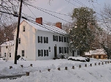
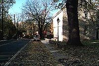
The county has a number of sites on the National Register of Historic Places
National Register of Historic Places listings in Montgomery County, Maryland
This is a list of the National Register of Historic Places listings in Montgomery County, Maryland.This is intended to be a complete list of the properties and districts on the National Register of Historic Places in Montgomery County, Maryland, United States...
.
Geography
According to the U.S. Census Bureau, the county has a total area of 507 square miles (1,313 km²), of which 496 square miles (1,285 km²) is land and 12 square miles (31 km²) is water.Adjacent jurisdictions
- Frederick CountyFrederick County, MarylandFrederick County is a county located in the western part of the U.S. state of Maryland, bordering the southern border of Pennsylvania and the northeastern border of Virginia. As of the 2010 Census, the population was 233,385....
(northwest) - Howard CountyHoward County, Maryland-2010:Whereas according to the 2010 U.S. Census Bureau:*62.2% White*17.5% Black*0.3% Native American*14.4% Asian*0.0% Native Hawaiian or Pacific Islander*3.6% Two or more races*2.0% Other races*5.8% Hispanic or Latino -2000:...
(northeast) - Prince George's CountyPrince George's County, MarylandPrince George's County is a county located in the U.S. state of Maryland, immediately north, east, and south of Washington, DC. As of 2010, it has a population of 863,420 and is the wealthiest African-American majority county in the nation....
(southeast) - Washington, D.C.Washington, D.C.Washington, D.C., formally the District of Columbia and commonly referred to as Washington, "the District", or simply D.C., is the capital of the United States. On July 16, 1790, the United States Congress approved the creation of a permanent national capital as permitted by the U.S. Constitution....
(south) - Loudoun County, VirginiaLoudoun County, VirginiaLoudoun County is a county located in the Commonwealth of Virginia, and is part of the Washington Metropolitan Area. As of the 2010 U.S. Census, the county is estimated to be home to 312,311 people, an 84 percent increase over the 2000 figure of 169,599. That increase makes the county the fourth...
(west) - Fairfax County, VirginiaFairfax County, VirginiaFairfax County is a county in Virginia, in the United States. Per the 2010 Census, the population of the county is 1,081,726, making it the most populous jurisdiction in the Commonwealth of Virginia, with 13.5% of Virginia's population...
(southwest)
National protected areas
- Chesapeake and Ohio Canal National Historical ParkChesapeake and Ohio Canal National Historical ParkThe Chesapeake and Ohio Canal National Historical Park is a United States National Historical Park located in the District of Columbia and the states of Maryland and West Virginia. The park was established as a National Monument in 1961 by President Dwight D...
(part) - Clara Barton National Historic SiteClara Barton National Historic SiteThe Clara Barton National Historic Site, which includes the Clara Barton House, was established in 1974 to interpret the life of Clara Barton , an American pioneer teacher, nurse, and humanitarian who was the founder of the American Red Cross. The site is located northwest of Washington D.C...
- George Washington Memorial ParkwayGeorge Washington Memorial ParkwayThe George Washington Memorial Parkway, known to local motorists simply as the "G.W. Parkway", is a parkway maintained by the U.S. National Park Service. It is located mostly in Northern Virginia, although a short section northwest of the Arlington Memorial Bridge passes over Columbia Island,...
(part)
Climate
The southern reaches of Montgomery County, near Washington, D.C.Washington, D.C.
Washington, D.C., formally the District of Columbia and commonly referred to as Washington, "the District", or simply D.C., is the capital of the United States. On July 16, 1790, the United States Congress approved the creation of a permanent national capital as permitted by the U.S. Constitution....
, lie within the humid subtropical climate
Humid subtropical climate
A humid subtropical climate is a climate zone characterized by hot, humid summers and mild to cool winters...
zone, with hot, humid summers and mild to chilly winters with plentiful precipitation year-round. The central and northern portions of the county lie further from any significant body of water, and lie in the transition zone between humid subtropical and humid continental climate
Humid continental climate
A humid continental climate is a climatic region typified by large seasonal temperature differences, with warm to hot summers and cold winters....
zones. The average yearly precipitation is 43.1 inches (109.5 cm). The average yearly snowfall for the county as a whole is 14.3 inches (36.3 cm). Areas in the north and west receive more snow, with Boyds at the extreme north in the county receiving a median annual snowfall of 23 inches (58.4 cm) compared to 11.1 inches (28.2 cm) for Rockville.
Demographics
At the 2010 census, there were 971,777 people residing in the county. The population densityPopulation density
Population density is a measurement of population per unit area or unit volume. It is frequently applied to living organisms, and particularly to humans...
was 1762 /sqmi. In 2000, there were 334,632 housing units at an average density of 675 /sqmi.
2010
Whereas according to the 2010 U.S. Census Bureau:- 57.5% WhiteWhite AmericanWhite Americans are people of the United States who are considered or consider themselves White. The United States Census Bureau defines White people as those "having origins in any of the original peoples of Europe, the Middle East, or North Africa...
- 17.2% BlackAfrican AmericanAfrican Americans are citizens or residents of the United States who have at least partial ancestry from any of the native populations of Sub-Saharan Africa and are the direct descendants of enslaved Africans within the boundaries of the present United States...
- 0.4% Native AmericanNative Americans in the United StatesNative Americans in the United States are the indigenous peoples in North America within the boundaries of the present-day continental United States, parts of Alaska, and the island state of Hawaii. They are composed of numerous, distinct tribes, states, and ethnic groups, many of which survive as...
- 13.9% AsianAsian AmericanAsian Americans are Americans of Asian descent. The U.S. Census Bureau definition of Asians as "Asian” refers to a person having origins in any of the original peoples of the Far East, Southeast Asia, or the Indian subcontinent, including, for example, Cambodia, China, India, Indonesia, Japan,...
- 0.1% Native Hawaiian or Pacific IslanderPacific Islander AmericanPacific Islander Americans, also known as Oceanian Americans, are residents of the United States with original ancestry from Oceania. They represent the smallest racial group counted in the United States census of 2000. They numbered 874,000 people or 0.3 percent of the United States population...
- 4.0% Two or more racesMultiracial AmericanMultiracial Americans, US residents who identify themselves as of "two or more races", were numbered at around 9 million, or 2.9% of the population, in the census of 2010. However there is considerable evidence that the real number is far higher. Prior to the mid-20th century many people hid their...
- 6.9% Other racesRace (United States Census)Race and ethnicity in the United States Census, as defined by the Federal Office of Management and Budget and the United States Census Bureau, are self-identification data items in which residents choose the race or races with which they most closely identify, and indicate whether or not they are...
- 17.0% Hispanic or LatinoHispanic and Latino AmericansHispanic or Latino Americans are Americans with origins in the Hispanic countries of Latin America or in Spain, and in general all persons in the United States who self-identify as Hispanic or Latino.1990 Census of Population and Housing: A self-designated classification for people whose origins...
(of any race)
2000
In addition, 11.52% of the population was Hispanic or Latino, of any race. (Montgomery County has the largest Hispanic community in the BaltimoreBaltimore
Baltimore is the largest independent city in the United States and the largest city and cultural center of the US state of Maryland. The city is located in central Maryland along the tidal portion of the Patapsco River, an arm of the Chesapeake Bay. Baltimore is sometimes referred to as Baltimore...
-Washington metropolitan area.)
Significant national ethnic groups included people of Irish
Irish people
The Irish people are an ethnic group who originate in Ireland, an island in northwestern Europe. Ireland has been populated for around 9,000 years , with the Irish people's earliest ancestors recorded having legends of being descended from groups such as the Nemedians, Fomorians, Fir Bolg, Tuatha...
(8.5%), German (8.1%), English
English people
The English are a nation and ethnic group native to England, who speak English. The English identity is of early mediaeval origin, when they were known in Old English as the Anglecynn. England is now a country of the United Kingdom, and the majority of English people in England are British Citizens...
(6.8%) and American
United States
The United States of America is a federal constitutional republic comprising fifty states and a federal district...
(5.0%) ancestry according to Census 2000. The county also has a sizable Jewish population, and is home to an increasing number of affluent Iranian-Americans.
There were 324,565 households of which 35% had children under the age of 18 living with them, 55.2% were married couples
Marriage
Marriage is a social union or legal contract between people that creates kinship. It is an institution in which interpersonal relationships, usually intimate and sexual, are acknowledged in a variety of ways, depending on the culture or subculture in which it is found...
living together, 10.5% had a female householder with no husband present, and 30.9% were non-families. 24.4% of all households were made up of individuals, and 7.7% had someone living alone who was 65 years of age or older. The average household size was 2.66 and the average family size was 3.19.
25.4% of the population was under the age of 18, 6.9% from 18 to 24, 32.3% from 25 to 44, 24.2% from 45 to 64, and 11.2% who were 65 years of age or older. The median age was 37 years. For every 100 females there were 92.1 males. For every 100 females age 18 and over, there were 88.1 males.
Montgomery County has the eighth highest median household income
Median household income
The median household income is commonly used to generate data about geographic areas and divides households into two equal segments with the first half of households earning less than the median household income and the other half earning more...
in the United States, and the second highest in the state after Howard County
Howard County, Maryland
-2010:Whereas according to the 2010 U.S. Census Bureau:*62.2% White*17.5% Black*0.3% Native American*14.4% Asian*0.0% Native Hawaiian or Pacific Islander*3.6% Two or more races*2.0% Other races*5.8% Hispanic or Latino -2000:...
according to the 2007 American Community Survey conducted by the U.S. Census Bureau. The median household income in 2007 was $89,284 and the median family income was $106,093. Males had a median income of $66,415 versus $52,134 for females. The per capita income
Per capita income
Per capita income or income per person is a measure of mean income within an economic aggregate, such as a country or city. It is calculated by taking a measure of all sources of income in the aggregate and dividing it by the total population...
for the county was $43,073. About 3.3% of families and 4.6% of the population were below the poverty line, including 4.6% of those under age 18 and 4.6% of those age 65 or over.
Since the 1970s, the county has had in place a Moderately Priced Dwelling Unit (MPDU) zoning
Zoning in the United States
Zoning in the United States comprise land use state laws falling under the police power rights that State governments and local governments have the authority to exercise over privately owned real property.-Origins and history:...
plan that requires developers to include affordable housing
Affordable housing
Affordable housing is a term used to describe dwelling units whose total housing costs are deemed "affordable" to those that have a median income. Although the term is often applied to rental housing that is within the financial means of those in the lower income ranges of a geographical area, the...
in any new residential developments that they construct in the county. The goal is to create socioeconomically mixed neighborhoods and schools so the rich and poor are not isolated in separate parts of the county. Developers who provide for more than the minimum amount of MPDUs are rewarded with permission to increase the density of their developments, which allows them to build more housing and generate more revenue
Revenue
In business, revenue is income that a company receives from its normal business activities, usually from the sale of goods and services to customers. In many countries, such as the United Kingdom, revenue is referred to as turnover....
. Montgomery County was one of the first counties in the U.S. to adopt such a plan, but many other areas have since followed suit.
Law and government
| Year | Republican Republican Party (United States) The Republican Party is one of the two major contemporary political parties in the United States, along with the Democratic Party. Founded by anti-slavery expansion activists in 1854, it is often called the GOP . The party's platform generally reflects American conservatism in the U.S... |
Democratic Democratic Party (United States) The Democratic Party is one of two major contemporary political parties in the United States, along with the Republican Party. The party's socially liberal and progressive platform is largely considered center-left in the U.S. political spectrum. The party has the lengthiest record of continuous... |
|---|---|---|
| 2008 United States presidential election, 2008 The United States presidential election of 2008 was the 56th quadrennial presidential election. It was held on November 4, 2008. Democrat Barack Obama, then the junior United States Senator from Illinois, defeated Republican John McCain, the senior U.S. Senator from Arizona. Obama received 365... |
27.1% 118,608 | 71.5% 314,444 |
| 2004 United States presidential election, 2004 The United States presidential election of 2004 was the United States' 55th quadrennial presidential election. It was held on Tuesday, November 2, 2004. Republican Party candidate and incumbent President George W. Bush defeated Democratic Party candidate John Kerry, the then-junior U.S. Senator... |
32.8% 136,334 | 65.9% 273,936 |
| 2000 United States presidential election, 2000 The United States presidential election of 2000 was a contest between Republican candidate George W. Bush, then-governor of Texas and son of former president George H. W. Bush , and Democratic candidate Al Gore, then-Vice President.... |
33.5% 124,580 | 62.5% 232,453 |
| 1996 United States presidential election, 1996 The United States presidential election of 1996 was a contest between the Democratic national ticket of President Bill Clinton of Arkansas and Vice President Al Gore of Tennessee and the Republican national ticket of former Senator Bob Dole of Kansas for President and former Housing Secretary Jack... |
35.2% 117,730 | 59.4% 198,807 |
| 1992 United States presidential election, 1992 The United States presidential election of 1992 had three major candidates: Incumbent Republican President George Bush; Democratic Arkansas Governor Bill Clinton, and independent Texas businessman Ross Perot.... |
33.0% 62,955 | 55.1% 168,691 |
| 1988 United States presidential election, 1988 The United States presidential election of 1988 featured no incumbent president, as President Ronald Reagan was unable to seek re-election after serving the maximum two terms allowed by the Twenty-second Amendment. Reagan's Vice President, George H. W. Bush, won the Republican nomination, while the... |
48.1% 154,191 | 51.5% 165,187 |
| 1984 United States presidential election, 1984 The United States presidential election of 1984 was a contest between the incumbent President Ronald Reagan, the Republican candidate, and former Vice President Walter Mondale, the Democratic candidate. Reagan was helped by a strong economic recovery from the deep recession of 1981–1982... |
50.1% 146,924 | 49.7% 146,036 |
| 1980 United States presidential election, 1980 The United States presidential election of 1980 featured a contest between incumbent Democrat Jimmy Carter and his Republican opponent, Ronald Reagan, as well as Republican Congressman John B. Anderson, who ran as an independent... |
47.2% 125,515 | 39.8% 105,822 |
The present County Executive
County executive
A county executive is the head of the executive branch of government in a county. This position is common in the United States.The executive may be an elected or an appointed position...
/County Council
County council
A county council is the elected administrative body governing an area known as a county. This term has slightly different meanings in different countries.-United Kingdom:...
form of government of Montgomery County dates to November 1968 when the voters changed the form of government from a County Commission
County commission
A county commission is a group of elected officials charged with administering the county government in local government in some states of the United States. County commissions are usually made up of three or more individuals...
/County Manager
County Manager
In local government in the Republic of Ireland, the Council Manager is the chief executive of the local authority of a county or city. Whereas the county council and city council are elected officials who formulate policy, the manager is an appointed official who manages the implementation of...
system, as provided in the original 1948 home rule Charter.
The county began with a county commissioner system that kept most of the power in Annapolis
Annapolis, Maryland
Annapolis is the capital of the U.S. state of Maryland, as well as the county seat of Anne Arundel County. It had a population of 38,394 at the 2010 census and is situated on the Chesapeake Bay at the mouth of the Severn River, south of Baltimore and about east of Washington, D.C. Annapolis is...
. In 1948 voters approved a "Council-Manager" form of government, making Montgomery County the first home-rule county in Maryland. The first six-member council was elected in 1949. Then in 1968, the voters approved a "County Executive-Council" form of government. That change formed an executive branch under the County Executive, and a legislative branch under a seven-member County Council. Instead of a County Manager, there was now a Chief Administrative Officer appointed by the County Executive. That went into effect in 1970, when the first seven-member County Council was elected. Originally all of the council members were elected at large (that is, by all of the voters). Five members were required to reside in their council district. In November 1986, the voters amended the Charter to increase the number of Council seats in the 1990 election from seven to nine. Now five members are elected by the voters of their council district and four are elected at-large. Each voter may vote for five council members; four at-large and one from the district in which they reside.
County Executives
| Name | Party | Term |
|---|---|---|
| James P. Gleason James P. Gleason James P. Gleason was born in Cleveland, Ohio, in 1921 and received a law degree from Georgetown University in 1950. He served as a legislative assistant to Senator Richard Nixon, administrative assistant to Senator Knowland, consultant to the Senate Foreign Relations Committee and the U.S... |
Republican | 1970–1978 |
| Charles W. Gilchrist Charles W. Gilchrist Charles W. Gilchrist received degrees from Williams College magna cum laude in 1958 and Harvard Law School in 1961 and was admitted into the Maryland Bar in 1962. He was active in many civic and political organizations, including the D.C. Bar Association and the Democratic Central Committee, and... |
Democrat | 1978–1986 |
| Sidney Kramer Sidney Kramer Born on July 8, 1925, in Washington, D.C., Sidney Kramer graduated from Calvin Coolidge High School in 1944 and entered George Washington University where he obtained baccalaureate degrees in physics and chemistry. In 1957, he became the owner and operator of Automatic Car Washes. When he moved to... |
Democrat | 1986–1990 |
| Neal Potter Neal Potter Neal Potter was an American Democratic politician from Maryland, who served as County Executive of Montgomery County, Maryland from 1990-1994.-Background:... |
Democrat | 1990–1994 |
| Douglas M. Duncan Doug Duncan Douglas M. Duncan is a Democratic politician from Maryland who served as County Executive of Montgomery County from 1994 to 2006. At three terms, Duncan held the office longer than any other County Executive in Montgomery County's history... |
Democrat | 1994–2006 |
| Isiah "Ike" Leggett Isiah Leggett Isiah "Ike" Leggett is an American politician from the U.S. state of Maryland and a member of the Democratic Party. Born in Deweyville, Texas, Leggett attended Southern University in Baton Rouge, Louisiana and, after serving in the Vietnam War with the U.S. Army, earned a law degree from Howard... |
Democrat | 2006— |
Ike Leggett was sworn in on December 4, 2006. He was re-elected on November 2, 2010.
Legislative body
The last Republican serving on the Montgomery County Council, Howard A. Denis of District 1 (Potomac/Bethesda), was defeated in 2006. The board has since been all-Democratic. The members of the County Council for the 2010-2014 term are:| Position | Name | Affiliation | District | Region | First Elected | |
|---|---|---|---|---|---|---|
| President | Valerie Ervin | Democratic Democratic Party (United States) The Democratic Party is one of two major contemporary political parties in the United States, along with the Republican Party. The party's socially liberal and progressive platform is largely considered center-left in the U.S. political spectrum. The party has the lengthiest record of continuous... |
5 | Silver Spring/Takoma Park/Wheaton | 2006 | |
| Vice President | Roger Berliner | Democratic Democratic Party (United States) The Democratic Party is one of two major contemporary political parties in the United States, along with the Republican Party. The party's socially liberal and progressive platform is largely considered center-left in the U.S. political spectrum. The party has the lengthiest record of continuous... |
1 | Potomac/Bethesda | 2006 | |
| Member | Craig L. Rice Craig L. Rice Craig L. Rice is an American politician, a member of the Montgomery County Council and a former member of the Maryland House of Delegates, representing District 15 in western and northern Montgomery County.-Background:... |
Democratic Democratic Party (United States) The Democratic Party is one of two major contemporary political parties in the United States, along with the Republican Party. The party's socially liberal and progressive platform is largely considered center-left in the U.S. political spectrum. The party has the lengthiest record of continuous... |
2 | Upcounty | 2010 | |
| Member | Phil Andrews | Democratic Democratic Party (United States) The Democratic Party is one of two major contemporary political parties in the United States, along with the Republican Party. The party's socially liberal and progressive platform is largely considered center-left in the U.S. political spectrum. The party has the lengthiest record of continuous... |
3 | Rockville/Gaithersburg | 1998 | |
| Member | Nancy Navarro | Democratic Democratic Party (United States) The Democratic Party is one of two major contemporary political parties in the United States, along with the Republican Party. The party's socially liberal and progressive platform is largely considered center-left in the U.S. political spectrum. The party has the lengthiest record of continuous... |
4 | East County | 2009 | |
| Member | Marc Elrich | Democratic Democratic Party (United States) The Democratic Party is one of two major contemporary political parties in the United States, along with the Republican Party. The party's socially liberal and progressive platform is largely considered center-left in the U.S. political spectrum. The party has the lengthiest record of continuous... |
At-Large | At-Large | 2006 | |
| Member | Nancy Floreen | Democratic Democratic Party (United States) The Democratic Party is one of two major contemporary political parties in the United States, along with the Republican Party. The party's socially liberal and progressive platform is largely considered center-left in the U.S. political spectrum. The party has the lengthiest record of continuous... |
At-Large | At-Large | 2002 | |
| Member | George L. Leventhal George Leventhal George Leventhal is a Democratic politician from the state of Maryland. He is currently serving his third term as an At-large member of the Montgomery County Council... |
Democratic Democratic Party (United States) The Democratic Party is one of two major contemporary political parties in the United States, along with the Republican Party. The party's socially liberal and progressive platform is largely considered center-left in the U.S. political spectrum. The party has the lengthiest record of continuous... |
At-Large | At-Large | 2006 | |
| Member | Hans Reimer | Democratic Democratic Party (United States) The Democratic Party is one of two major contemporary political parties in the United States, along with the Republican Party. The party's socially liberal and progressive platform is largely considered center-left in the U.S. political spectrum. The party has the lengthiest record of continuous... |
At-Large | At-Large | 2010 | |
Bi-county agencies
Montgomery and Prince George'sPrince George's County, Maryland
Prince George's County is a county located in the U.S. state of Maryland, immediately north, east, and south of Washington, DC. As of 2010, it has a population of 863,420 and is the wealthiest African-American majority county in the nation....
Counties share a bi-county planning and parks agency in the Maryland-National Capital Park and Planning Commission
Maryland-National Capital Park and Planning Commission
The Maryland-National Capital Park and Planning Commission is a bi-county agency that administers parks and planning in Montgomery and Prince George's Counties in Maryland.-History:...
(often referred to as Park and Planning or its initials M-NCPPC by county residents) and a public bi-county water and sewer utility in the Washington Suburban Sanitary Commission
Washington Suburban Sanitary Commission
Washington Suburban Sanitary Commission provides safe drinking water and wastewater treatment for Montgomery and Prince George's Counties in Maryland. It was established on May 1, 1918. It is the eighth largest water and wastewater utility in the United States. The WSSC serves about 1.8 million...
(WSSC).
Cities and towns
- 3 CitiesCityA city is a relatively large and permanent settlement. Although there is no agreement on how a city is distinguished from a town within general English language meanings, many cities have a particular administrative, legal, or historical status based on local law.For example, in the U.S...
:- GaithersburgGaithersburg, MarylandGaithersburg is a city in Montgomery County, Maryland, United States. The city had a population of 59,933 at the 2010 census, making it the fourth largest incorporated city in the state, behind Baltimore, Frederick, and Rockville...
(incorporated 1878) - RockvilleRockville, MarylandRockville is the county seat of Montgomery County, Maryland, United States. It is a major incorporated city in the central part of Montgomery County and forms part of the Baltimore-Washington Metropolitan Area. The 2010 U.S...
(incorporated 1860) - Takoma ParkTakoma Park, MarylandTakoma Park is a city in Montgomery County, Maryland, United States. It is a suburb of Washington, D.C., and part of the Washington Metropolitan Area. Founded in 1883 and incorporated in 1890, Takoma Park, informally called "Azalea City," is a Tree City USA and a nuclear-free zone...
(incorporated 1890)
- Gaithersburg
- 12 TownTownA town is a human settlement larger than a village but smaller than a city. The size a settlement must be in order to be called a "town" varies considerably in different parts of the world, so that, for example, many American "small towns" seem to British people to be no more than villages, while...
s:- BarnesvilleBarnesville, MarylandBarnesville is a town in Montgomery County, Maryland, United States. It was incorporated in 1888. The population was 161 at the 2000 census.-Geography:Barnesville is located at ....
(incorporated 1888) - BrookevilleBrookeville, MarylandBrookeville is a town located twenty miles north of Washington, D.C. and two miles north of Olney in northeastern Montgomery County, Maryland. Brookeville was settled by Quakers late in the 18th century, and was formally incorporated as a town in 1808...
(incorporated 1808) - Chevy ChaseChevy Chase (town), MarylandChevy Chase is an incorporated town in Montgomery County, Maryland, United States. The population was 2,726 at the 2000 census.-Geography:Chevy Chase is located at ....
(Town of) (incorporated 1918) - Chevy Chase ViewChevy Chase View, MarylandChevy Chase View is a town located in Montgomery County, Maryland. Established as a Special Tax District in 1924, the town was formally incorporated in 1993...
(incorporated 1993) - Chevy Chase VillageChevy Chase Village, MarylandChevy Chase Village is a town in Montgomery County, Maryland, United States. The population was 2,043 at the 2000 census.-Geography:Chevy Chase Village is located at ....
(incorporated 1910; note that, despite its name, it is a town and not a village.) - Garrett ParkGarrett Park, MarylandGarrett Park is a town in Montgomery County, Maryland. It was named for a former president of the Baltimore and Ohio Railroad, but whether specifically for John Garrett or Robert W. Garrett is a matter of some disagreement between sources. The population was 917 at the 2000 census...
(incorporated 1898) - Glen EchoGlen Echo, MarylandGlen Echo is a town in Montgomery County, Maryland, United States, that was chartered in 1904. The population was 242 at the 2000 census.Glen Echo derives its name from Edward and Edwin Baltzley, who came up with name circa 1888...
(incorporated 1904) - KensingtonKensington, MarylandKensington is a town in Montgomery County, Maryland, United States. The population was 1,873 at the 2000 census. Greater Kensington encompasses the entire 20895 zip code and its population is an order of magnitude larger than that of the town at its center....
(incorporated 1894) - LaytonsvilleLaytonsville, MarylandLaytonsville is a town in Montgomery County, Maryland, United States. The population was 277 at the 2000 census. Laytonsville was originally known as Cracklintown. This name originated from the popular cracklin bread, which was baked in the locale. This recipe, essentially a bacon corn bread, also...
(incorporated 1892) - PoolesvillePoolesville, MarylandPoolesville is a town in Montgomery County, Maryland United States with a population of approximately 5000 people. It is surrounded by the Montgomery County Agricultural Reserve, and is considered a distant bedroom community for commuters to Washington, DC.The name of the town comes from the...
(incorporated 1867) - SomersetSomerset, MarylandSomerset is an incorporated town within Chevy Chase in Montgomery County, Maryland, near its border with Washington, D.C.. The population was 1,124 at the 2000 census...
(incorporated 1906) - Washington GroveWashington Grove, MarylandWashington Grove is a town in Montgomery County, Maryland, United States. The population was 515 at the 2000 census.- History :Washington Grove is known as the “Town Within a Forest.”...
(incorporated 1937)
- Barnesville
- 4 VillageVillageA village is a clustered human settlement or community, larger than a hamlet with the population ranging from a few hundred to a few thousand , Though often located in rural areas, the term urban village is also applied to certain urban neighbourhoods, such as the West Village in Manhattan, New...
s:- Chevy Chase, Village of, Section 3Chevy Chase Section Three, MarylandChevy Chase Section Three is a village in Montgomery County, Maryland, United States. It was originally organized as a Special Tax District in 1916 and later incorporated as a village in 1982...
(incorporated 1982) - Chevy Chase, Village of, Section 5Chevy Chase Section Five, MarylandChevy Chase Section Five is a village in Montgomery County, Maryland, United States. It was founded as a Special Tax District in 1922 and was incorporated as a village in 1982...
(incorporated 1982) - Martin's AdditionsMartin's Additions, MarylandMartin's Additions is a village in Montgomery County, Maryland, United States. It was established as a Special Tax District in 1916 and incorporated as a village in 1985...
(incorporated 1985) - North Chevy ChaseNorth Chevy Chase, MarylandNorth Chevy Chase is a village in Montgomery County, Maryland, United States. It was established as a Special Tax District in 1924 and incorporated as a village in 1996...
(incorporated 1996)
- Chevy Chase, Village of, Section 3
Though the three incorporated cities of Gaithersburg, Rockville and Takoma Park lie within its boundaries, the most urbanized areas in the county include such unincorporated areas as Bethesda
Bethesda, Maryland
Bethesda is a census designated place in southern Montgomery County, Maryland, United States, just northwest of Washington, D.C. It takes its name from a local church, the Bethesda Meeting House , which in turn took its name from Jerusalem's Pool of Bethesda...
and Silver Spring
Silver Spring, Maryland
Silver Spring is an unincorporated area and census-designated place in Montgomery County, Maryland, United States. It had a population of 71,452 at the 2010 census, making it the fourth most populous place in Maryland, after Baltimore, Columbia, and Germantown.The urbanized, oldest, and...
.
Occupying a middle ground between incorporated and unincorporated areas are Special Tax Districts, quasi-municipal unincorporated areas created by legislation passed by the Maryland General Assembly
Maryland General Assembly
The Maryland General Assembly is the state legislature of the U.S. state of Maryland. It is a bicameral body. The upper chamber, the Maryland State Senate, has 47 representatives and the lower chamber, the Maryland House of Delegates, has 141 representatives...
. They lack home rule authority and must petition the General Assembly for changes affecting the authority of the district. The four incorporated villages of Montgomery County and the town of Chevy Chase View were originally established as Special Tax Districts. Four Special Tax Districts remain in the county:
- DrummondDrummond, MarylandDrummond, Maryland is a village and special taxing district in Montgomery County, Maryland. Chartered in 1916, it is in the Chevy Chase, Maryland postal area. The village comprises two-thirds of Drummond Avenue.-External links:*...
, Village of (1916) - Friendship Heights and "The Hills" (1914)
- OakmontOakmont, MarylandOakmont, Maryland is a village and special taxing district in Montgomery County, Maryland. Chartered in 1918, the village includes both sides of Oak Place and the south side of Oakmont Avenue, across Old Georgetown Road from the National Institutes of Health, in the Bethesda, Maryland postal area....
(1918) - Battery Park (1923)
Unincorporated areas are also considered as towns by many people and listed in many collections of towns, but they lack local government. Various organizations, such as the United States Census Bureau
United States Census Bureau
The United States Census Bureau is the government agency that is responsible for the United States Census. It also gathers other national demographic and economic data...
, the United States Postal Service
United States Postal Service
The United States Postal Service is an independent agency of the United States government responsible for providing postal service in the United States...
, and local chambers of commerce, define the communities they wish to recognize differently, and since they are not incorporated, their boundaries have no official status outside the organizations in question. The Census Bureau recognizes the following census-designated place
Census-designated place
A census-designated place is a concentration of population identified by the United States Census Bureau for statistical purposes. CDPs are delineated for each decennial census as the statistical counterparts of incorporated places such as cities, towns and villages...
s in the county:
- Ashton-Sandy SpringAshton-Sandy Spring, MarylandAshton-Sandy Spring is a census-designated place in Montgomery County, Maryland, United States. The CDP is designated to include the two unincorporated communities of Ashton and Sandy Spring.-Geography:...
(a combination of the communities of AshtonAshton, MarylandAshton is an unincorporated area in Montgomery County, Maryland. The commercial center of Ashton lies at the junction of Route 108 and New Hampshire Avenue ....
and Sandy SpringSandy Spring, MarylandSandy Spring, Maryland is an unincorporated community in Montgomery County, Maryland.The community was founded by Quakers who arrived in the early 18th century searching for land where they could grow tobacco and corn. One of the very early land owners in the Sandy Spring area was Richard Snowden,...
recognized as a unit by the Census Bureau) - Aspen HillAspen Hill, MarylandAspen Hill is a census-designated place and an unincorporated area in Montgomery County, Maryland. It got its name from aspen trees that once were found near the first post office in the area...
- BethesdaBethesda, MarylandBethesda is a census designated place in southern Montgomery County, Maryland, United States, just northwest of Washington, D.C. It takes its name from a local church, the Bethesda Meeting House , which in turn took its name from Jerusalem's Pool of Bethesda...
- BrookmontBrookmont, MarylandBrookmont is a census-designated place and an unincorporated area in Montgomery County, Maryland, United States.-Geography:As an unincorporated area, Brookmont's boundaries are not officially defined...
- BurtonsvilleBurtonsville, MarylandBurtonsville is a census-designated place and an unincorporated area in Montgomery County, Maryland, United States.-History:In colonial times, the area was referred to as the Patuxent Hundred and later the Eastern Branch Hundred, a community comprising about 100 inhabitants...
- Cabin JohnCabin John, MarylandCabin John is a census-designated place and an unincorporated area in Montgomery County, Maryland, United States. The placename is a corruption of its original name of "Captain John's Mills."-Geography:...
- CalvertonCalverton, MarylandCalverton is an unincorporated area and Census-designated place located on the boundary between Montgomery and Prince George's Counties, Maryland.-Geography:As an unincorporated area, Calverton's boundaries are not officially defined...
(This CDP is shared between Montgomery and Prince George's Counties.) - Chevy ChaseChevy Chase (CDP), MarylandChevy Chase is a census-designated place in Montgomery County, Maryland, United States. The population was 9,381 at the 2000 census.-Geography:Chevy Chase is located at ....
(Note that this is also the name of an incorporated town) - ClarksburgClarksburg, MarylandClarksburg is a census-designated place and an unincorporated area in Northern Montgomery County, Maryland, United States, located along the Interstate 270 technology corridor about 4 miles north of Germantown, MD. As of Census 2010 its population is 13,766....
- CloverlyCloverly, MarylandCloverly is a census-designated place and an unincorporated town in Montgomery County, Maryland, United States.-Geography:As an unincorporated area, Cloverly's boundaries are not officially defined. Many residents consider themselves to live in a neighborhood of Silver Spring, Maryland, the...
- ColesvilleColesville, MarylandColesville is a census-designated place and an unincorporated area in Montgomery County, Maryland in the USA.-Geography:As an unincorporated area, Colesville's boundaries are not officially defined. Also, many residents consider the town to be one of the many neighborhoods of Silver Spring, Maryland...
- DamascusDamascus, MarylandDamascus is a census-designated place and an unincorporated area in Montgomery County, Maryland, United States.In the early part of the 20th century, there was an incorporated municipality there for about a quarter century, but it no longer exists...
- DarnestownDarnestown, MarylandDarnestown is a census-designated place and an unincorporated area in Montgomery County, Maryland, United States.-Geography:As an unincorporated area, Darnestown's boundaries are not officially defined...
- FairlandFairland, MarylandFairland is a census-designated place and an unincorporated area in Montgomery County, Maryland, United States.-Geography:As an unincorporated area, Fairland's boundaries are not officially defined...
- Forest GlenForest Glen, MarylandForest Glen is a census-designated place in Montgomery County, Maryland, United States. The community hosts a U.S. Army installation, the Forest Glen Annex.-Geography:...
- Friendship VillageFriendship Village, MarylandFriendship Village is an unincorporated area in Montgomery County, Maryland, United States. Inclusive within the Friendship Village CDP is the Village of Friendship Heights. The population was 4,512 at the 2000 census....
(This CDP includes the Village of Friendship Heights.) - GermantownGermantown, Montgomery County, Maryland-Demographics:As of the census of 2010, there were 86,395 people, and 30,531 households residing in the area. The population density was 7,999.5 people per square mile . There were 31,807 housing units at an average density of 2,001.9 per square mile...
- GlenmontGlenmont, MarylandGlenmont is an unincorporated community in Montgomery County, Maryland, USA. The U.S. Census Bureau combines Glenmont with nearby Wheaton to create the Census Designated Place of Wheaton-Glenmont.- Location :...
- HillandaleHillandale, MarylandHillandale is an unincorporated area located on the boundary between Montgomery and Prince George's Counties, Maryland.-Geography:As an unincorporated area, Hillandale's boundaries are not officially defined...
(This CDP is shared between Montgomery and Prince George's Counties.) - Kemp MillKemp Mill, MarylandKemp Mill is a census-designated place and an unincorporated census area in Montgomery County, Maryland, United States. The population was 9,956 at the 2000 census....
- Montgomery VillageMontgomery Village, MarylandMontgomery Village is a northern suburb of Gaithersburg in an unincorporated area in Montgomery County, Maryland, United States. It is a large, planned suburban community, developed in the late 1960s and 1970s right outside Gaithersburg city limits...
- North BethesdaNorth Bethesda, MarylandNorth Bethesda is a census-designated place and an unincorporated area in Montgomery County, Maryland, United States. It borders the city of Rockville, and is closely associated with the city.-Geography:...
- North KensingtonNorth Kensington, MarylandNorth Kensington is a census-designated place and an unincorporated area in Montgomery County, Maryland, United States.-Geography:As an unincorporated area, North Kensington's boundaries are not officially defined...
- North PotomacNorth Potomac, MarylandNorth Potomac is a census-designated place and an unincorporated area in Montgomery County, Maryland, United States. In 2009, CNN Money Magazine listed North Potomac as one of the wealthiest best places to live in the U.S., describing it as, "a tony town that sits on the bank of the Potomac River,"...
- OlneyOlney, MarylandOlney, a census-designated place and an unincorporated area of Montgomery County, Maryland, USA, is located in the north central part of the county, twenty miles north of Washington, D.C. It was largely agricultural until the 1960s, when growth of the Washington suburbs led to its conversion into...
- PotomacPotomac, MarylandPotomac is a census-designated place in Montgomery County, Maryland, United States, named for the nearby Potomac River. The population was 44,822 at the 2000 census. The Potomac area is known for its very affluent and highly-educated residents. In 2009 CNNMoney.com listed Potomac as the fourth...
- RedlandRedland, MarylandRedland is a census-designated place and an unincorporated area in Montgomery County, Maryland, United States.-Geography:As an unincorporated area, Redland's boundaries are not officially defined...
- RossmoorRossmoor, MarylandRossmoor is a census-designated place and an unincorporated area in Montgomery County, Maryland, United States. It is an area primarily inhabited by retirees, and comprises almost entirely the large retirement community of .-Geography:...
- Silver SpringSilver Spring, MarylandSilver Spring is an unincorporated area and census-designated place in Montgomery County, Maryland, United States. It had a population of 71,452 at the 2010 census, making it the fourth most populous place in Maryland, after Baltimore, Columbia, and Germantown.The urbanized, oldest, and...
- South KensingtonSouth Kensington, MarylandSouth Kensington is a census-designated place and an unincorporated area in Montgomery County, Maryland, United States.-Geography:As an unincorporated area, South Kensington's boundaries are not officially defined...
- TravilahTravilah, MarylandTravilah is a census-designated place and an unincorporated area in Montgomery County, Maryland, United States and near the wealthy suburban community of Potomac.-Geography:As an unincorporated area, Travilah's boundaries are not officially defined...
- Wheaton-GlenmontWheaton-Glenmont, MarylandWheaton–Glenmont is a census-designated place in Montgomery County, Maryland, United States. The CDP is designated to include the two unincorporated communities of Wheaton and Glenmont.-Geography:...
(a combination of the communities of WheatonWheaton, MarylandWheaton is an unincorporated, urbanized area in Montgomery County, Maryland, USA, north of Washington, D.C., northwest of Silver Spring. Wheaton takes its name from Frank Wheaton , a career officer in the United States Army and volunteer from Rhode Island in the Union Army who rose to the rank of...
and GlenmontGlenmont, MarylandGlenmont is an unincorporated community in Montgomery County, Maryland, USA. The U.S. Census Bureau combines Glenmont with nearby Wheaton to create the Census Designated Place of Wheaton-Glenmont.- Location :...
recognized as a unit by the Census Bureau) - White OakWhite Oak, MarylandWhite Oak is a census-designated place and an unincorporated area in Montgomery County, Maryland, United States.-Geography:As an unincorporated area, White Oak's boundaries are not officially defined...
Other unincorporated places:
- BeallsvilleBeallsville, MarylandBeallsville, Maryland is an unincorporated community in Montgomery County, Maryland. It is a small community outside of Poolesville, Maryland.- Darby Store :...
- BoydsBoyds, MarylandBoyds, Maryland is an unincorporated community in rural Montgomery County, Maryland, located north of Washington, DC. Its ZIP Code is 20841.According to the United States 2000 Census, the ZIP Code Tabulation Area for the town of Boyds covers an area of and has a population of 2,025...
- DerwoodDerwood, MarylandDerwood is an unincorporated area of about 15,600 people in east-central Montgomery County, Maryland. It is a relatively dense area. It lies just east of Rockville, south east of Gaithersburg, south west of Olney, and north west of the greater Silver Spring, Maryland area. Residents of Derwood...
- DickersonDickerson, MarylandDickerson is an unincorporated area in Montgomery County, Maryland. It is located on Maryland Route 28, between Sugarloaf Mountain and the Potomac River. It is a community situated near the town of Poolesville, Maryland. Dickerson is .-History of Dickerson:...
- HyattstownHyattstown, MarylandHyattstown is an unincorporated community in Montgomery County, Maryland, United States. Established in 1798 and named after its founder, John Hyatt, this crossroad's town is located on Maryland Route 355 in upper Montgomery County...
Roads
Montgomery County is approximately bisected north-south by Interstate 270Interstate 270 (Maryland)
Interstate 270 is a auxiliary Interstate Highway in the U.S. state of Maryland that travels between Interstate 495 just north of Bethesda, Montgomery County and Interstate 70 in the city of Frederick in Frederick County. It consists of the mainline as well as a spur that provides access to and...
, a connector linking Interstate 70
Interstate 70
Interstate 70 is an Interstate Highway in the United States that runs from Interstate 15 near Cove Fort, Utah, to a Park and Ride near Baltimore, Maryland. It was the first Interstate Highway project in the United States. I-70 approximately traces the path of U.S. Route 40 east of the Rocky...
with Washington. I-270 divides in North Bethesda
North Bethesda, Maryland
North Bethesda is a census-designated place and an unincorporated area in Montgomery County, Maryland, United States. It borders the city of Rockville, and is closely associated with the city.-Geography:...
with its primary roadway connecting to the eastbound Capital Beltway
Interstate 495 (Capital Beltway)
Interstate 495 is a Interstate Highway that surrounds the United States' capital of Washington, D.C., and its inner suburbs in adjacent Maryland and Virginia. I-495 is widely known as the Capital Beltway or simply the Beltway, especially when the context of Washington, D.C., is clear...
(Interstate 495), and a spur connecting to southbound I-495 as it approaches Northern Virginia
Northern Virginia
Northern Virginia consists of several counties and independent cities in the Commonwealth of Virginia, in a widespread region generally radiating southerly and westward from Washington, D.C...
. Another spur highway, Interstate 370
Interstate 370
Interstate 370 is a Interstate Highway spur route off I-270 in Gaithersburg, Maryland to the western end of toll road MD 200 at an interchange that provides access to the park and ride lot at the Shady Grove station on the Red Line of the Washington Metro. Despite the number, I-370 does not...
, connects Interstate 270 with the Shady Grove
Shady Grove (Washington Metro)
Shady Grove is an island platformed Washington Metro station in Derwood, Maryland, United States. The station was opened on December 15, 1984, and is operated by the Washington Metropolitan Area Transit Authority . Serving as the northwestern terminus of the Red Line, it is the station most distant...
Metro station.
A fiercely- and long-contested east-west toll freeway, the Intercounty Connector
Intercounty Connector
Maryland Route 200 , more commonly known as the Intercounty Connector or ICC, is a partially completed toll freeway under construction in Maryland which connects Gaithersburg in Montgomery County and Laurel in Prince George's County. When completed, it will reach the community of Konterra just...
(Maryland Route 200), also known as the ICC, is under construction as of late 2007.
The ICC will link Interstate 370
Interstate 370
Interstate 370 is a Interstate Highway spur route off I-270 in Gaithersburg, Maryland to the western end of toll road MD 200 at an interchange that provides access to the park and ride lot at the Shady Grove station on the Red Line of the Washington Metro. Despite the number, I-370 does not...
and I-270
Interstate 270 (Maryland)
Interstate 270 is a auxiliary Interstate Highway in the U.S. state of Maryland that travels between Interstate 495 just north of Bethesda, Montgomery County and Interstate 70 in the city of Frederick in Frederick County. It consists of the mainline as well as a spur that provides access to and...
with U.S. 29
U.S. Route 29 in Maryland
U.S. Route 29 is a north–south United States highway that runs for from the western suburbs of Baltimore, Maryland, to Pensacola, Florida. In the U.S. state of Maryland, US 29 is a major highway that emerges from Washington D.C. and runs north into eastern Montgomery County, stretching...
; and Interstate 95
Interstate 95 in Maryland
Interstate 95 in Maryland is a major highway that runs diagonally from northeast to southwest, from Maryland's border with Delaware, to the Woodrow Wilson Bridge, briefly entering the District of Columbia before reaching Virginia...
and U.S. 1
U.S. Route 1 in Maryland
U.S. Route 1 is the easternmost and longest of the major north–south routes of the United States Numbered Highway System, running from Key West, Florida to Fort Kent, Maine. In the U.S...
in Laurel
Laurel, Maryland
Laurel is a city in northern Prince George's County, Anne Arundel County, and Howard County, Maryland, United States, located midway between Washington, D.C. and Baltimore. Incorporated in 1870, the city maintains a historic district including its Main Street...
, Prince George's County
Prince George's County, Maryland
Prince George's County is a county located in the U.S. state of Maryland, immediately north, east, and south of Washington, DC. As of 2010, it has a population of 863,420 and is the wealthiest African-American majority county in the nation....
. The first portion of the freeway, from I-370 to Georgia Avenue, opened in February of 2011.
Roughly paralleling 270 is Maryland Route 355
Maryland Route 355
Maryland Route 355 is a north–south road in western central Maryland in the United States. The southern terminus of the route is at the Washington, D.C. border in Friendship Heights, Montgomery County, where it continues south as Wisconsin Avenue into Washington. The northern terminus is...
, a surface street known for much of its length as Rockville Pike. In its southern reaches it is known as Wisconsin Avenue, while in the north it is known as Frederick Road, or Frederick Ave in Gaithersburg; in the northern half of Rockville (from Town Center north), it is named Hungerford Drive.
Other major routes include Maryland Route 190
Maryland Route 190
Maryland Route 190, or River Road, is a major state highway through southern Montgomery County, Maryland, United States.-Route description:MD 190 begins at MD 112's western terminus in Seneca, and ends at the Montgomery County/Washington, D.C. border...
(River Road); Maryland Route 97
Maryland Route 97
Maryland Route 97 is a state highway in the U.S. state of Maryland. The route runs from U.S. Route 29 in Silver Spring, Montgomery County north to the Pennsylvania border in Carroll County, where the road continues into that state as Pennsylvania Route 97...
(Georgia Avenue); Maryland Route 650
Maryland Route 650
Maryland Route 650 is a state highway in the U.S. state of Maryland. Known as New Hampshire Avenue for most of its length, the state highway runs from Eastern Avenue at the Washington, D.C. border north to MD 108 in Etchison...
(New Hampshire Avenue), Maryland Route 185
Maryland Route 185
Maryland Route 185 is a state highway in the U.S. state of Maryland. Known as Connecticut Avenue, the state highway runs from Chevy Chase Circle at the Washington, D.C. border north to MD 97 in Aspen Hill...
(Connecticut Avenue), Randolph Road/Montrose Road, Maryland Route 28
Maryland Route 28
Maryland Route 28 is a state highway in the U.S. state of Maryland. The state highway runs from U.S. Route 15 in Point of Rocks east to MD 182 in Norwood. The western portion of MD 28 is a rural highway connecting several villages in southern Frederick County and western Montgomery County...
(Darnestown Road, Montgomery Avenue and Norbeck Road), and Maryland Route 27
Maryland Route 27
Maryland Route 27 is a state highway in the central part of the U.S. state of Maryland.-Route description:MD 27, also known as Ridge Road and Manchester Road , begins in Germantown at MD 355...
(Father Hurley Blvd., Ridge Road). U.S. Route 29
U.S. Route 29
U.S. Route 29 is a north–south United States highway that runs for from the western suburbs of Baltimore, Maryland, to Pensacola, Florida. This highway's northern terminus is at Maryland Route 99 in Ellicott City, Maryland...
parallels the eastern border of the county; first as Georgia Avenue in Silver Spring, then Colesville Road, and thence as Columbia Pike through Burtonsville and into Howard County.
The Montgomery County government has strongly supported the use of automated traffic enforcement on county roads. In 2007 this county became the first jurisdiction in Maryland to introduce automated speed cameras on roads with speed limits up to 35 mph, issuing fines of $40 by mail. Red light cameras with fines of $75 are also in use.
A computer system coordinates the setting of 750 traffic lights. In 2009, the computer system failed for a brief period, causing considerable problems.
Bus
Montgomery County operates its own busBus
A bus is a road vehicle designed to carry passengers. Buses can have a capacity as high as 300 passengers. The most common type of bus is the single-decker bus, with larger loads carried by double-decker buses and articulated buses, and smaller loads carried by midibuses and minibuses; coaches are...
public transit system, known as Ride On
Ride On (bus)
Ride On is the primary public transportation system in Montgomery County, Maryland. Ride On serves Montgomery County as well as the community of Langley Park in Prince George's County...
. Major routes are also covered by WMATA
Washington Metropolitan Area Transit Authority
The Washington Metropolitan Area Transit Authority is a tri-jurisdictional government agency that operates transit service in the Washington, D.C. metropolitan area, including the Metrorail, Metrobus and MetroAccess...
's Metrobus service.
Rail
Montgomery County is served by three passenger rail systems.Amtrak
Amtrak
The National Railroad Passenger Corporation, doing business as Amtrak , is a government-owned corporation that was organized on May 1, 1971, to provide intercity passenger train service in the United States. "Amtrak" is a portmanteau of the words "America" and "track". It is headquartered at Union...
, the U.S. national passenger rail system, operates its Capitol Limited
Capitol Limited (Amtrak)
Amtrak's Capitol Limited is one of the railroad's two routes connecting Washington, D.C. to Chicago, running via Cleveland, Ohio . Service began in 1981 and was named after the Baltimore and Ohio Railroad's Capitol Limited which ended in 1971 upon the formation of Amtrak...
to Rockville, between Washington Union Station and Chicago Union Station
Union Station (Chicago)
Union Station is a major train station that opened in 1925 in Chicago, replacing an earlier 1881 station. It is now the only intercity rail terminal in Chicago, as well as being the city's primary terminal for commuter trains. The station stands on the west side of the Chicago River between Adams...
.
The Brunswick line of the MARC
MARC Train
MARC , known prior to 1984 as Maryland Rail Commuter Service, is a regional rail system comprising three lines in the Baltimore-Washington Metropolitan Area. MARC is administered by the Maryland Transit Administration , a Maryland Department of Transportation agency, and is operated under contract...
commuter rail
Regional rail
Commuter rail, also called suburban rail, is a passenger rail transport service that primarily operates between a city center, and the middle to outer suburbs beyond 15km and commuter towns or other locations that draw large numbers of commuters—people who travel on a daily basis...
system makes stops at Silver Spring, Kensington, Garrett Park, Rockville, Washington Grove, Gaithersburg, Metropolitan Grove, Germantown, Boyds, Barnesville, and Dickerson, where the line splits into its Frederick and Martinsburg branches.
Both suburban arms of the Red Line
Red Line (Washington Metro)
The Red Line of the Washington Metro is a rail rapid transit service operating between 27 stations in Montgomery County, Maryland and the District of Columbia, United States. It is a primary line through downtown Washington, and the oldest and busiest line in the system...
of the Washington Metro
Washington Metro
The Washington Metro, commonly called Metro, and unofficially Metrorail, is the rapid transit system in Washington, D.C., United States, and its surrounding suburbs. It is administered by the Washington Metropolitan Area Transit Authority , which also operates Metrobus service under the Metro name...
serve Montgomery County. It follows the CSX
CSX Transportation
CSX Transportation operates a Class I railroad in the United States known as the CSX Railroad. It is the main subsidiary of the CSX Corporation. The company is headquartered in Jacksonville, Florida, and owns approximately 21,000 route miles...
right of way to the west, roughly paralleling Route 355 from Friendship Heights
Friendship Heights (Washington Metro)
Friendship Heights is a Washington Metro station straddling the border of Washington, D.C. and Montgomery County, Maryland, United States. The station was opened on August 25, 1984, and is operated by the Washington Metropolitan Area Transit Authority ....
to Shady Grove
Shady Grove (Washington Metro)
Shady Grove is an island platformed Washington Metro station in Derwood, Maryland, United States. The station was opened on December 15, 1984, and is operated by the Washington Metropolitan Area Transit Authority . Serving as the northwestern terminus of the Red Line, it is the station most distant...
. The eastern side runs between the two tracks of the CSX right of way from Washington Union Station to Silver Spring
Silver Spring (Washington Metro)
Silver Spring is a Washington Metro station in Montgomery County, Maryland on the Red Line. It is the first station in Maryland on the eastern end of the line, and is the most-used Metro station in Maryland. It is co-located with a MARC commuter rail station....
, and roughly parallels Georgia Avenue, from Silver Spring to Glenmont
Glenmont (Washington Metro)
Glenmont is a Washington Metro station in Montgomery County, Maryland on the Red Line. This is the northeastern terminus of the Red Line.Glenmont is the only station on the Red Line to feature the six-coffer arch design. The six-coffer design is also seen on the Green Line...
.
There has been much debate on the construction of two new transitways, both of which are still in the early stages of design. The Purple Line would run "cross-town" connecting nodes in Montgomery and Prince George's Counties near the Beltway; and the Corridor Cities Transitway
Corridor Cities Transitway
The Corridor Cities Transitway is a proposed light rail or bus rapid transit line in Maryland, USA, that would run from the Shady Grove Metro station in Gaithersburg northwest to Clarksburg...
would provide an extension of the Red Line
Red Line (Washington Metro)
The Red Line of the Washington Metro is a rail rapid transit service operating between 27 stations in Montgomery County, Maryland and the District of Columbia, United States. It is a primary line through downtown Washington, and the oldest and busiest line in the system...
corridor from Gaithersburg
Gaithersburg, Maryland
Gaithersburg is a city in Montgomery County, Maryland, United States. The city had a population of 59,933 at the 2010 census, making it the fourth largest incorporated city in the state, behind Baltimore, Frederick, and Rockville...
to Germantown and beyond.
Air
The Montgomery County AirparkMontgomery County Airpark
Montgomery County Airpark is a public airport located three miles northeast of the city of Gaithersburg, in Montgomery County, Maryland, USA.- Runways :Montgomery County Airpark covers and has one runway....
(FAA
Federal Aviation Administration
The Federal Aviation Administration is the national aviation authority of the United States. An agency of the United States Department of Transportation, it has authority to regulate and oversee all aspects of civil aviation in the U.S...
GAI, ICAO
ICAO airport code
The ICAO airport code or location indicator is a four-character alphanumeric code designating each airport around the world. These codes are defined by the International Civil Aviation Organization, and published in ICAO Document 7910: Location Indicators.The ICAO codes are used by air traffic...
KGAI), a general aviation facility in Gaithersburg, is the major airport
Airport
An airport is a location where aircraft such as fixed-wing aircraft, helicopters, and blimps take off and land. Aircraft may be stored or maintained at an airport...
in the county. Davis Airport (FAA Identifier W50), a privately owned airstrip, is located in Laytonsville on Hawkins Creamery Road. Commercial air service is provided at the nearby Ronald Reagan Washington National
Ronald Reagan Washington National Airport
Ronald Reagan Washington National Airport is a public airport located south of downtown Washington, D.C., in Arlington County, Virginia. It is the commercial airport nearest to Washington, D.C. For many decades, it was called Washington National Airport, but this airport was renamed in 1998 to...
, Washington Dulles International
Washington Dulles International Airport
Washington Dulles International Airport is a public airport in Dulles, Virginia, 26 miles west of downtown Washington, D.C. The airport serves the Baltimore-Washington-Northern Virginia metropolitan area centered on the District of Columbia. It is named after John Foster Dulles, Secretary of...
, and BWI
Baltimore-Washington International Thurgood Marshall Airport
Baltimore/Washington International Thurgood Marshall Airport is an international airport serving the Baltimore-Washington Metropolitan Area in the United States. It is commonly called BWI, BWI Airport or BWI Marshall, BWI being an initialism for "Baltimore/Washington International" and the...
Airports.
Education
Elementary and secondary public schools are operated by the Montgomery County Public SchoolsMontgomery County Public Schools
Montgomery County Public Schools ' is a school district that serves Montgomery County, Maryland, USA. It is the largest school district in Maryland. As of the 2009–2010 school year, the district had 11,500 FTE teachers serving 141,777 students at 200 schools.Students in the district score among the...
. The county is also served by Montgomery College
Montgomery College
Montgomery College is a public, open access community college located in Montgomery County, Maryland, just outside Washington, D.C. in the United States. The college has three campuses, the largest of which is in Rockville; the other campuses are in Takoma Park/Silver Spring and Germantown...
, a public, open access community college. The county has no public university of its own, but the state university system does operate a facility called Universities at Shady Grove
Universities at Shady Grove
Established in fall 2000, the Universities at Shady Grove is a facility located in Rockville, Maryland, United States, that offers career-oriented higher education courses to residents of Montgomery County, Maryland and its surrounding region...
in Rockville that provides access to baccalaureate and Master's level programs from several of the state's public universities.
MCPS operates under the jurisdiction of an elected Board of Education. Its current members are:
| Name | District | Term Ends |
|---|---|---|
| Shirley Brandman | At-Large | 2010 |
| Patricia O'Neill (President) | District 3 | 2010 |
| Laura Berthiaume | District 2 | 2012 |
| Christopher S. Barclay (Vice-President) | District 4 | 2012 |
| Judith Docca | District 1 | 2010 |
| Michael A. Durso | District 5 | 2010 |
| Phil Kauffman | At-Large | 2012 |
| Alan Xie (Student Member) | At-Large | 2011 |
| Jerry D. Weast (Superintendent) | 1999 | 2011 |
Sports
Bethesda's Congressional Country ClubCongressional Country Club
The Congressional Country Club is a country club and golf course in Bethesda, Maryland, USA. Congressional opened in 1924 and has hosted three U.S. Opens and a PGA Championship, and is an annual stop on the PGA Tour, with the AT&T National, hosted by Tiger Woods. The tournament was first...
hosts the annual AT&T National
AT&T National
The AT&T National is a professional golf tournament held in the Washington D.C. area during the Fourth of July weekend. The PGA Tour event is hosted by Tiger Woods and benefits the Tiger Woods Foundation. The first AT&T National was held July 5–8, 2007, at the Blue Course of the Congressional...
Golf Tournament, and will host the United States Open
U.S. Open (golf)
The United States Open Championship, commonly known as the U.S. Open, is the annual open golf tournament of the United States. It is the second of the four major championships in golf, and is on the official schedule of both the PGA Tour and the European Tour...
in 2011.
Montgomery County is home of the Montgomery County Swim League, a youth (ages 4–18) competitive swimming league composed of ninety teams based at community pools throughout the county.
The Bethesda Big Train
Bethesda Big Train
The Bethesda Big Train are a collegiate summer baseball team based in Bethesda, Maryland. Most of its players are drawn from the college ranks. The team is a member of the Cal Ripken Collegiate Baseball League . The Big Train plays its home games at Shirley Povich Field...
, Rockville Express
Rockville Express
The Rockville Express is a collegiate summer baseball team based in Rockville, Maryland. Most of its players are drawn from the college ranks. The team is a member of the Cal Ripken, Sr. Collegiate Baseball League . The Express plays its home games at Knights Field on the campus of Montgomery...
, and Silver Spring-Takoma Thunderbolts
Silver Spring-Takoma Thunderbolts
The Silver Spring–Takoma Thunderbolts is a collegiate summer baseball team based in Silver Spring, Maryland. Most of its players are drawn from the college ranks. The team is a member of the Cal Ripken Collegiate Baseball League . The Thunderbolts play their home games at Montgomery Blair Baseball...
all play college level wooden bat baseball in the Cal Ripken, Sr. Collegiate Baseball League
Cal Ripken, Sr. Collegiate Baseball League
The Cal Ripken Collegiate Baseball League is a collegiate summer baseball league located in the Washington, D.C. and Baltimore, Maryland metropolitan areas. All players are from NCAA-sanctioned colleges and universities and have at least one year of NCAA eligibility remaining.-History:The CRCBL...
.
There are future possibilities of a minor league baseball team forming to play for the Atlantic League of Professional Baseball
Atlantic League of Professional Baseball
The Atlantic League of Professional Baseball is a professional, independent baseball organization located primarily in the Mid-Atlantic and Northeastern United States, especially the greater metropolitan areas of the Northeast megalopolis. It operates in cities not served by Major or Minor League...
to represent Montgomery County.
Liquor control
Montgomery County maintains a monopoly on the sale of "hard liquor" alcoholic beverageAlcoholic beverage
An alcoholic beverage is a drink containing ethanol, commonly known as alcohol. Alcoholic beverages are divided into three general classes: beers, wines, and spirits. They are legally consumed in most countries, and over 100 countries have laws regulating their production, sale, and consumption...
s, while beer and wine may be sold at independently owned stores. This is similar to several U.S. states. The county is thus referred to as an alcoholic beverage control
Alcoholic beverage control state
Alcoholic beverage control states, generally called control states, are those in the United States that have state monopoly over the wholesaling and/or retailing of some or all categories of alcoholic beverages, such as beer, wine, and distilled spirits....
county.