
Washington County, Maryland
Encyclopedia
Washington County is a county located in the western part
of the U.S. state
of Maryland
, bordering southern Pennsylvania
to the north, northern Virginia
to the south, and the Eastern Panhandle of West Virginia
to the south and west. As of the 2010 Census, its population is 147,430. Washington County was the first county in the United States
to be named for the Revolutionary War
general (and later President) George Washington
. Its county seat
is Hagerstown
.
Washington County is one of three counties in the Hagerstown-Martinsburg, MD-WV Metropolitan Statistical Area
. Due to commuting patterns, a high growth rate, and close proximity, Washington County is also often considered, though not officially designated a part of the Washington-Baltimore-Northern Virginia, DC-MD-VA-WV Combined Statistical Area
.
in 1696. This original county included six current counties. The first to be created was Frederick
, separated from Prince George's County in 1748.
Washington County was formed on October 1, 1776 by the division of Frederick County
. At the same time, Montgomery County
was also separated from Frederick County and was named for General Richard Montgomery
. Washington County as created included land later to become Allegany County
(created in 1789) and Garrett County
(included in Allegany County when it was created in 1789, but later separated from Allegany County). Washington County thus originally included the entire western part of the state.
A number of properties in the county are listed on the National Register of Historic Places
.
; to the south by the Potomac River
; to the east by South Mountain
; and to the west by Sideling Hill Creek.
The County Commissioners in Washington County comprise the traditional form of county government in Maryland. Current members include: Kristin B. Aleshire, Terry Baker, John F. Barr, James F. Kercheval, and William J. Wivell.
. Member Christopher B. Shank
(R), serves the 2nd district in Maryland and Ronald N. Young
(D), serves in the 3rd district. The county also is represented in Maryland General Assembly
's other primary division, the Maryland House of Delegates
. Delegates who stand for Washington County include: LeRoy Myers
(R) for District 1C, Andrew A. Serafini
(R) for District 2A, Neil Parrot (R) for District 2B, John P. Donoghue
(D) for District 2C, and Michael Hough
(R) for District 3B.
. The representative of the district currently is Roscoe Bartlett
(R).
>
Year
Population
1900
45,133
1910
49,617
1920
59,694
1930
65,882
1940
68,838
1950
78,886
1960
91,219
1970
103,829
1980
113,086
1990
121,393
2000
131,923
2010
147,430
of 2010, there were 147,430 people, 49,726 households, and 34,112 families residing in the county. The population density
was 315 people per square mile (111/km²). There were 52,972 housing units at an average density of 116 per square mile (45/km²). The racial makeup of the county was 89.71% White or Caucasian
, 7.77% Black
or African American
, 0.18% Native American
, 0.80% Asian
, 0.04% Pacific Islander
, 0.46% from other races
, and 1.04% from two or more races. 1.19% of the population were Hispanic
or Latino
of any race. 32.1% were of German, 21.4% American
, 8.8% Irish
and 8.4% English
ancestry according to Census 2000.
There were 49,726 households out of which 31.30% had children under the age of 18 living with them, 54.00% were married couples
living together, 10.70% had a female householder with no husband present, and 31.40% were non-families. 26.00% of all households were made up of individuals and 11.10% had someone living alone who was 65 years of age or older. The average household size was 2.46 and the average family size was 2.96.
In the county the population was spread out with 23.40% under the age of 18, 8.10% from 18 to 24, 31.30% from 25 to 44, 23.00% from 45 to 64, and 14.20% who were 65 years of age or older. The median age was 37 years. For every 100 females there were 104.50 males. For every 100 females age 18 and over, there were 104.00 males.
The median income for a household in the county was $40,617, and the median income for a family was $48,962. Males had a median income of $34,917 versus $24,524 for females. The per capita income
for the county was $20,062. About 7.00% of families and 9.50% of the population were below the poverty line, including 12.30% of those under age 18 and 9.50% of those age 65 or over.


 Washington County contains the following incorporated municipalities:
Unincorporated areas are also considered as towns by many people and listed in many collections of towns, but they lack local government. Various organizations, such as the United States Census Bureau
, the United States Postal Service
, and local chambers of commerce, define the communities they wish to recognize differently, and since they are not incorporated, their boundaries have no official status outside the organizations in question. The Census Bureau recognizes the following census-designated place
s in the county:
Other unincorporated areas not listed as CDP's include:
administers public schools in the county. See Washington County Public Schools - School Directory for a detailed listing of elementary, middle, high, and other schools.
Private high schools
Western Maryland
Western Maryland is the portion of the U.S. state of Maryland that consists of Frederick, Washington, Allegany, and Garrett counties. The region is bounded by the Mason-Dixon line to the north, Preston County, West Virginia to the west, and the Potomac River to the south. There is dispute over the...
of the U.S. state
U.S. state
A U.S. state is any one of the 50 federated states of the United States of America that share sovereignty with the federal government. Because of this shared sovereignty, an American is a citizen both of the federal entity and of his or her state of domicile. Four states use the official title of...
of Maryland
Maryland
Maryland is a U.S. state located in the Mid Atlantic region of the United States, bordering Virginia, West Virginia, and the District of Columbia to its south and west; Pennsylvania to its north; and Delaware to its east...
, bordering southern Pennsylvania
Pennsylvania
The Commonwealth of Pennsylvania is a U.S. state that is located in the Northeastern and Mid-Atlantic regions of the United States. The state borders Delaware and Maryland to the south, West Virginia to the southwest, Ohio to the west, New York and Ontario, Canada, to the north, and New Jersey to...
to the north, northern Virginia
Northern Virginia
Northern Virginia consists of several counties and independent cities in the Commonwealth of Virginia, in a widespread region generally radiating southerly and westward from Washington, D.C...
to the south, and the Eastern Panhandle of West Virginia
Eastern Panhandle of West Virginia
The Eastern Panhandle of West Virginia is a narrow stretch of territory in the northeast of the state, bordering Maryland and Virginia, United States. The Eastern Panhandle Board of Realtors and other local civic organizations consider only the three Easternmost counties, Jefferson, Berkeley and...
to the south and west. As of the 2010 Census, its population is 147,430. Washington County was the first county in the United States
United States
The United States of America is a federal constitutional republic comprising fifty states and a federal district...
to be named for the Revolutionary War
American Revolutionary War
The American Revolutionary War , the American War of Independence, or simply the Revolutionary War, began as a war between the Kingdom of Great Britain and thirteen British colonies in North America, and ended in a global war between several European great powers.The war was the result of the...
general (and later President) George Washington
George Washington
George Washington was the dominant military and political leader of the new United States of America from 1775 to 1799. He led the American victory over Great Britain in the American Revolutionary War as commander-in-chief of the Continental Army from 1775 to 1783, and presided over the writing of...
. Its county seat
County seat
A county seat is an administrative center, or seat of government, for a county or civil parish. The term is primarily used in the United States....
is Hagerstown
Hagerstown, Maryland
Hagerstown is a city in northwestern Maryland, United States. It is the county seat of Washington County, and, by many definitions, the largest city in a region known as Western Maryland. The population of Hagerstown city proper at the 2010 census was 39,662, and the population of the...
.
Washington County is one of three counties in the Hagerstown-Martinsburg, MD-WV Metropolitan Statistical Area
Hagerstown Metropolitan Area
The Hagerstown-Martinsburg Metropolitan Area, officially designated by the United States Office of Management and Budget as Hagerstown-Martinsburg, Maryland-West Virginia Metropolitan Statistical Area , constitutes the primary cities of Hagerstown, Maryland, Martinsburg, West Virginia, and...
. Due to commuting patterns, a high growth rate, and close proximity, Washington County is also often considered, though not officially designated a part of the Washington-Baltimore-Northern Virginia, DC-MD-VA-WV Combined Statistical Area
Baltimore-Washington Metropolitan Area
The Baltimore-Washington Metropolitan Area is a combined statistical area consisting of the overlapping labor market region of the cities of Baltimore, Maryland and Washington, D.C.. The region includes Central Maryland, Northern Virginia, and Jefferson County in the Eastern Panhandle of West...
.
History
The western portions of Maryland (including present Washington County) were incorporated into Prince George's CountyPrince George's County, Maryland
Prince George's County is a county located in the U.S. state of Maryland, immediately north, east, and south of Washington, DC. As of 2010, it has a population of 863,420 and is the wealthiest African-American majority county in the nation....
in 1696. This original county included six current counties. The first to be created was Frederick
Frederick County, Maryland
Frederick County is a county located in the western part of the U.S. state of Maryland, bordering the southern border of Pennsylvania and the northeastern border of Virginia. As of the 2010 Census, the population was 233,385....
, separated from Prince George's County in 1748.
Washington County was formed on October 1, 1776 by the division of Frederick County
Frederick County, Maryland
Frederick County is a county located in the western part of the U.S. state of Maryland, bordering the southern border of Pennsylvania and the northeastern border of Virginia. As of the 2010 Census, the population was 233,385....
. At the same time, Montgomery County
Montgomery County, Maryland
Montgomery County is a county in the U.S. state of Maryland, situated just to the north of Washington, D.C., and southwest of the city of Baltimore. It is one of the most affluent counties in the United States, and has the highest percentage of residents over 25 years of age who hold post-graduate...
was also separated from Frederick County and was named for General Richard Montgomery
Richard Montgomery
Richard Montgomery was an Irish-born soldier who first served in the British Army. He later became a brigadier-general in the Continental Army during the American Revolutionary War and he is most famous for leading the failed 1775 invasion of Canada.Montgomery was born and raised in Ireland...
. Washington County as created included land later to become Allegany County
Allegany County, Maryland
Allegany County is a county located in the northwestern part of the US state of Maryland. It is part of the Cumberland, MD-WV Metropolitan Statistical Area. As of 2010, the population was 75,087. Its county seat is Cumberland...
(created in 1789) and Garrett County
Garrett County, Maryland
Garrett County is the westernmost county of the U.S. state of Maryland. Created from Allegany County, Maryland in 1872 it was the last Maryland county to be formed. It was named for John Work Garrett , railroad executive, industrialist, and financier. Garrett served as president of the Baltimore...
(included in Allegany County when it was created in 1789, but later separated from Allegany County). Washington County thus originally included the entire western part of the state.
A number of properties in the county are listed on the National Register of Historic Places
National Register of Historic Places listings in Washington County, Maryland
This is a list of the National Register of Historic Places listings in Washington County, Maryland.This is intended to be a complete list of the properties and districts on the National Register of Historic Places in Washington County, Maryland, United States...
.
Geography
According to the 2000 census, the county has a total area of 467.55 square miles (1,210.9 km²), of which 458.14 square miles (1,186.6 km²) (or 97.99%) is land and 9.41 square miles (24.4 km²) (or 2.01%) is water. Washington County is bordered to the north by the Mason-Dixon LineMason-Dixon line
The Mason–Dixon Line was surveyed between 1763 and 1767 by Charles Mason and Jeremiah Dixon in the resolution of a border dispute between British colonies in Colonial America. It forms a demarcation line among four U.S. states, forming part of the borders of Pennsylvania, Maryland, Delaware, and...
; to the south by the Potomac River
Potomac River
The Potomac River flows into the Chesapeake Bay, located along the mid-Atlantic coast of the United States. The river is approximately long, with a drainage area of about 14,700 square miles...
; to the east by South Mountain
South Mountain (Maryland and Pennsylvania)
South Mountain is the northern extension of the Blue Ridge Mountain range in Maryland and Pennsylvania. From the Potomac River near Knoxville, Maryland in the south, to Dillsburg, Pennsylvania in the north, the long range separates the Hagerstown and Cumberland valleys from the Piedmont regions of...
; and to the west by Sideling Hill Creek.
Adjacent counties
- Fulton CountyFulton County, PennsylvaniaFulton County is a county located in the U.S. state of Pennsylvania. As of 2010, the population was 14,845.Fulton County was created on April 19, 1850, from part of Bedford County and named for inventor Robert Fulton.Its county seat is McConnellsburg....
, PennsylvaniaPennsylvaniaThe Commonwealth of Pennsylvania is a U.S. state that is located in the Northeastern and Mid-Atlantic regions of the United States. The state borders Delaware and Maryland to the south, West Virginia to the southwest, Ohio to the west, New York and Ontario, Canada, to the north, and New Jersey to...
(northwest) - Allegany CountyAllegany County, MarylandAllegany County is a county located in the northwestern part of the US state of Maryland. It is part of the Cumberland, MD-WV Metropolitan Statistical Area. As of 2010, the population was 75,087. Its county seat is Cumberland...
(west) - Morgan CountyMorgan County, West VirginiaMorgan County is a county located in the U.S. state of West Virginia. As of 2010, it's population was 17,541. Its county seat is Berkeley Springs. The county is one of three in Hagerstown-Martinsburg, MD-WV Metropolitan Statistical Area...
, West VirginiaWest VirginiaWest Virginia is a state in the Appalachian and Southeastern regions of the United States, bordered by Virginia to the southeast, Kentucky to the southwest, Ohio to the northwest, Pennsylvania to the northeast and Maryland to the east...
(southwest) - Berkeley CountyBerkeley County, West VirginiaBerkeley County is a county located in the Eastern Panhandle region of the U.S. state of West Virginia. As of 2010, the population is 104,169, making it the second-most populous county in West Virginia, behind Kanawha...
, West VirginiaWest VirginiaWest Virginia is a state in the Appalachian and Southeastern regions of the United States, bordered by Virginia to the southeast, Kentucky to the southwest, Ohio to the northwest, Pennsylvania to the northeast and Maryland to the east...
(south) - Jefferson CountyJefferson County, West VirginiaJefferson County is a county located in the U.S. state of West Virginia. As of 2010, the population was 53,498. Its county seat is Charles Town...
, West VirginiaWest VirginiaWest Virginia is a state in the Appalachian and Southeastern regions of the United States, bordered by Virginia to the southeast, Kentucky to the southwest, Ohio to the northwest, Pennsylvania to the northeast and Maryland to the east...
(south) - Loudoun CountyLoudoun County, VirginiaLoudoun County is a county located in the Commonwealth of Virginia, and is part of the Washington Metropolitan Area. As of the 2010 U.S. Census, the county is estimated to be home to 312,311 people, an 84 percent increase over the 2000 figure of 169,599. That increase makes the county the fourth...
, VirginiaVirginiaThe Commonwealth of Virginia , is a U.S. state on the Atlantic Coast of the Southern United States. Virginia is nicknamed the "Old Dominion" and sometimes the "Mother of Presidents" after the eight U.S. presidents born there...
(southeast) - Frederick CountyFrederick County, MarylandFrederick County is a county located in the western part of the U.S. state of Maryland, bordering the southern border of Pennsylvania and the northeastern border of Virginia. As of the 2010 Census, the population was 233,385....
(east) - Franklin CountyFranklin County, PennsylvaniaAs of the census of 2000, there were 129,313 people, 50,633 households, and 36,405 families residing in the county. The population density was 168 people per square mile . There were 53,803 housing units at an average density of 70 per square mile...
, PennsylvaniaPennsylvaniaThe Commonwealth of Pennsylvania is a U.S. state that is located in the Northeastern and Mid-Atlantic regions of the United States. The state borders Delaware and Maryland to the south, West Virginia to the southwest, Ohio to the west, New York and Ontario, Canada, to the north, and New Jersey to...
(northeast)
Highways
 Interstate 68Interstate 68Interstate 68 is a Interstate highway in the U.S. states of West Virginia and Maryland, connecting in Morgantown to in Hancock. is also Corridor E of the Appalachian Development Highway System. From 1965 until the freeway's construction was completed in 1991, it was designated as...
.svg.png) Interstate 70Interstate 70Interstate 70 is an Interstate Highway in the United States that runs from Interstate 15 near Cove Fort, Utah, to a Park and Ride near Baltimore, Maryland. It was the first Interstate Highway project in the United States. I-70 approximately traces the path of U.S. Route 40 east of the Rocky...
Interstate 70Interstate 70Interstate 70 is an Interstate Highway in the United States that runs from Interstate 15 near Cove Fort, Utah, to a Park and Ride near Baltimore, Maryland. It was the first Interstate Highway project in the United States. I-70 approximately traces the path of U.S. Route 40 east of the Rocky...- Interstate 81Interstate 81Interstate 81 is an Interstate Highway in the eastern part of the United States. Its southern terminus is at Interstate 40 in Dandridge, Tennessee; its northern terminus is on Wellesley Island at the Canadian border, where the Thousand Islands Bridge connects it to Highway 401, the main freeway...
 U.S. Route 11U.S. Route 11U.S. Route 11 is a north–south United States highway extending 1,645 miles across the eastern United States. The southern terminus of the route is at U.S. Route 90 in the Bayou Sauvage National Wildlife Refuge in eastern New Orleans, Louisiana. The northern terminus is at the United...
 U.S. Route 40U.S. Route 40U.S. Route 40 is an east–west United States highway. As with most routes whose numbers end in a zero, U.S. 40 once traversed the entire United States. It is one of the original 1920s U.S. Highways, and its first termini were San Francisco, California, and Atlantic City, New Jersey...
 U.S. Route 40 Alternate
 U.S. Route 40 ScenicU.S. Route 40 ScenicU.S. Route 40 Scenic is a scenic route of U.S. Route 40 in the U.S. state of Maryland. US 40 Scenic is the old alignment of US 40 over Town Hill in eastern Allegany County and Sideling Hill in far western Washington County. The highway was originally constructed as part of the National Road in...
 U.S. Route 340U.S. Route 340 in MarylandU.S. Route 340 is a part of the U.S. Highway System that runs from Greenville, Virginia to Frederick, Maryland. In Maryland, the U.S. highway runs from the Virginia state line at the Potomac River at Sandy Hook east to its northern terminus at US 15 and US 40 in Frederick...
 U.S. Route 522U.S. Route 522U.S. Route 522 is a spur route of U.S. Route 22 in the eastern United States. The southern terminus of the route is at U.S. Route 60 in Powhatan, Virginia. The northern terminus is at U.S. Route 11 and U.S. Route 15 in Selinsgrove, Pennsylvania. US 522 passes through the states of Virginia, West...
 Maryland Route 34Maryland Route 34Maryland Route 34 is a state highway in the U.S. state of Maryland. Known for most of its length as Shepherdstown Pike, the state highway begins at the West Virginia state line at the Potomac River, where the highway continues south as West Virginia Route 480 through Shepherdstown. The state...
 Maryland Route 56Maryland Route 56Maryland Route 56 is a state highway in the U.S. state of Maryland. Known as Big Pool Road, the state highway runs from Interstate 70 in Big Pool east to MD 68 near Pinesburg in western Washington County. MD 56, which features a pair of one-lane bridges, provides access to Fort Frederick State...
 Maryland Route 57Maryland Route 57Maryland Route 57 is a state highway in the U.S. state of Maryland. Known as St. Paul Road, the state highway runs from U.S. Route 40 near Clear Spring north to MD 494 near Fairview. MD 57 was constructed in stages between 1916 and 1933...
 Maryland Route 58Maryland Route 58Maryland Route 58 is a state highway in the U.S. state of Maryland. Known for most of its length as Cearfoss Pike, the state highway runs from MD 63 in Cearfoss east to Key Circle in Hagerstown...
 Maryland Route 60Maryland Route 60Maryland Route 60 is a state highway in the U.S. state of Maryland. Known for most of its length as Leitersburg Pike, the state highway runs from the intersection of Potomac Street and Northern Avenue in Hagerstown east to the Pennsylvania state line near Leitersburg, where the highway continues...
 Maryland Route 62Maryland Route 62Maryland Route 62 is a state highway in the U.S. state of Maryland. Known for most of its length as Little Antietam Road, the state highway runs from MD 804 in Chewsville north to MD 60 in Leitersburg in northeastern Washington County...
 Maryland Route 63Maryland Route 63Maryland Route 63 is a state highway in the U.S. state of Maryland. The state highway runs from MD 65 in Fairplay north to the Pennsylvania state line near Cearfoss, where the highway continues as Pennsylvania Route 163 . MD 63 is an L-shaped route that passes through central Washington County...
 Maryland Route 64Maryland Route 64Maryland Route 64 is a state highway in the U.S. state of Maryland. The state highway runs from U.S. Route 40 in Hagerstown east to the Pennsylvania state line near Ringgold, where the highway continues as Pennsylvania Route 997...
 Maryland Route 65Maryland Route 65Maryland Route 65 is a state highway in the U.S. state of Maryland. Known for most of its length as Sharpsburg Pike, the state highway runs from MD 34 in Sharpsburg north to the southern end of Hagerstown, where the highway continues north as Potomac Street toward the downtown area...
 Maryland Route 66Maryland Route 66Maryland Route 66 is a state highway in the U.S. state of Maryland. Known for most of its length as Mapleville Road, the state highway runs from U.S. Route 40 Alternate in Boonsboro north to MD 64 near Smithsburg...
 Maryland Route 67Maryland Route 67Maryland Route 67 is a state highway in the U.S. state of Maryland. Known as Rohrersville Road, the state highway runs from U.S. Route 340 in Weverton north to US 40 Alternate in Boonsboro. MD 67 parallels the western flank of South Mountain in southeastern Washington County, connecting...
 Maryland Route 68Maryland Route 68Maryland Route 68 is a state highway in the U.S. state of Maryland. The state highway runs from U.S. Route 40 in Clear Spring east to US 40 Alternate in Boonsboro. MD 68 crosses central Washington County to the south of Hagerstown, connecting Clear Spring and Boonsboro with Williamsport, where...
 Maryland Route 77Maryland Route 77Maryland Route 77 is a state highway in the U.S. state of Maryland. The state highway runs from MD 64 in Smithsburg east to MD 194 in Keymar. MD 77 is the main east–west highway of northern Frederick County...
 Maryland Route 144Maryland Route 144Maryland Route 144 is a collection of state highways in the U.S. state of Maryland. These highways are sections of old alignment of U.S. Route 40 between Cumberland and Baltimore...
 Maryland Route 180Maryland Route 180Maryland Route 180 is a state highway in the U.S. state of Maryland. Known for most of its length as Jefferson Pike, the state highway runs from U.S. Route 340 in Knoxville east to MD 351 and Interstate 70 in Frederick. MD 180 is the old alignment of US 340 through Knoxville, Petersville, and...
 Maryland Route 418Maryland Route 418Maryland Route 418 is a state highway in the U.S. state of Maryland. Known as Ringgold Pike, the state highway runs from Maryland Route 60 in Leitersburg east to the Pennsylvania state line near Ringgold, where the highway continues as State Route 2007 in Franklin County...
 Maryland Route 491Maryland Route 491Maryland Route 491 is a state highway in the U.S. state of Maryland. Known for most of its length as Raven Rock Road, the state highway runs from MD 64 in Smithsburg north to MD 550 in Fort Ritchie. The middle portion of MD 491 was constructed in the mid 1950s...
 Maryland Route 494Maryland Route 494Maryland Route 494 is a state highway in the U.S. state of Maryland. Known as Fairview Road, the state highway runs from the Pennsylvania state line near Fairview, where the highway continues north as Pennsylvania Route 75 , east to MD 63 in Cearfoss. MD 494 was constructed in the 1930s...
 Maryland Route 550Maryland Route 550Maryland Route 550 is a state highway in the U.S. state of Maryland. The state highway runs from MD 26 in Libertytown north to Pen Mar Road in Fort Ritchie...
 Maryland Route 615Maryland Route 615Maryland Route 615 is a state highway in the U.S. state of Maryland. The state highway runs from Interstate 70 and U.S. Route 40 east of Hancock north to the Pennsylvania state line in western Washington County. MD 615 has two sections, an east–west frontage road that parallels I-70 and...
 Maryland Route 632Maryland Route 632Maryland Route 632 is a state highway in the U.S. state of Maryland. Known as Downsville Pike, the state highway runs from MD 63 in Downsville north to Maryland Avenue in Hagerstown. MD 632 was constructed along the path of a former turnpike in the late 1930s...
County government
Washington County's 'leader' is known as the County Administrator. Currently, Greg Murray serves as the Administrator. However, Washington County's County Commissioners exercise executive powers as they exist in the government of the county.The County Commissioners in Washington County comprise the traditional form of county government in Maryland. Current members include: Kristin B. Aleshire, Terry Baker, John F. Barr, James F. Kercheval, and William J. Wivell.
State representation
Washington County is represented by two senators in Maryland State SenateMaryland State Senate
The Maryland Senate, sometimes referred to as the Maryland State Senate, is the upper house of the General Assembly, the state legislature of the U.S. state of Maryland...
. Member Christopher B. Shank
Christopher B. Shank
Christopher Shank was first elected to District 2B of the Maryland House of Delegates in 1999, which represents Washington County, defeating incumbent Bruce Poole. He has been the House Minority Whip since 2007.-Education:...
(R), serves the 2nd district in Maryland and Ronald N. Young
Ronald N. Young
Ronald N. Young is an American politician and a member of the Maryland State Senate. Young is also a former mayor of Frederick, Maryland.-Background:...
(D), serves in the 3rd district. The county also is represented in Maryland General Assembly
Maryland General Assembly
The Maryland General Assembly is the state legislature of the U.S. state of Maryland. It is a bicameral body. The upper chamber, the Maryland State Senate, has 47 representatives and the lower chamber, the Maryland House of Delegates, has 141 representatives...
's other primary division, the Maryland House of Delegates
Maryland House of Delegates
The Maryland House of Delegates is the lower house of the General Assembly, the state legislature of the U.S. state of Maryland, and is composed of 141 Delegates elected from 47 districts. The House chamber is located in the state capitol building on State Circle in Annapolis...
. Delegates who stand for Washington County include: LeRoy Myers
LeRoy Myers
LeRoy Myers was an African American tap dancer and manager of the Copasetics. He was born in North Philadelphia, Pennsylvania and learned to tap dance on the street corners of Philadelphia....
(R) for District 1C, Andrew A. Serafini
Andrew A. Serafini
Andrew A. Serafini is an American politician from Maryland and a member of the Republican Party. He is a member of the Maryland House of Delegates from District 2A in Washington County.-Education:...
(R) for District 2A, Neil Parrot (R) for District 2B, John P. Donoghue
John P. Donoghue
John P. Donoghue is an American politician from Maryland and a member of the Democratic Party. He is currently serving in his 5th term in the Maryland House of Delegates, representing Maryland's District 2C in Washington County. Donoghue is a member of the Health and Government Operations...
(D) for District 2C, and Michael Hough
Michael Hough
Michael Hough serves in the Maryland House of Delegates representing District 3B, which covers portions of Frederick and Washington Counties. He was the former chairman and served on the Frederick County Republican Central Committee...
(R) for District 3B.
Federal representation
The county is located within Maryland's 6th congressional districtMaryland's 6th congressional district
Maryland's 6th congressional district elects a representative to the United States House of Representatives from the northwest part of the state. Today the district comprises all of Garrett, Allegany, Washington, Frederick and Carroll Counties, as well as portions of Montgomery, Baltimore, and...
. The representative of the district currently is Roscoe Bartlett
Roscoe Bartlett
Roscoe Gardner Bartlett, Ph.D. is the U.S. Representative for , serving since 1993. He is a member of the Republican Party, and a member of the Tea Party Caucus...
(R).
Demographics
| > | Year | Population |
|---|---|
| 1790 | 15,822 |
| 1800 | 18,650 |
| 1810 | 18,730 |
| 1820 | 23,075 |
| 1830 | 25,268 |
| 1840 | 28,850 |
| 1850 | 30,848 |
| 1860 | 31,417 |
| 1870 | 34,712 |
| 1880 | 38,561 |
| 1890 | 39,782 |
2010
Whereas according to the 2010 U.S. Census Bureau:- 85.1% WhiteWhite AmericanWhite Americans are people of the United States who are considered or consider themselves White. The United States Census Bureau defines White people as those "having origins in any of the original peoples of Europe, the Middle East, or North Africa...
- 9.6% BlackAfrican AmericanAfrican Americans are citizens or residents of the United States who have at least partial ancestry from any of the native populations of Sub-Saharan Africa and are the direct descendants of enslaved Africans within the boundaries of the present United States...
- 0.2% Native AmericanNative Americans in the United StatesNative Americans in the United States are the indigenous peoples in North America within the boundaries of the present-day continental United States, parts of Alaska, and the island state of Hawaii. They are composed of numerous, distinct tribes, states, and ethnic groups, many of which survive as...
- 1.4% AsianAsian AmericanAsian Americans are Americans of Asian descent. The U.S. Census Bureau definition of Asians as "Asian” refers to a person having origins in any of the original peoples of the Far East, Southeast Asia, or the Indian subcontinent, including, for example, Cambodia, China, India, Indonesia, Japan,...
- 0.0% Native Hawaiian or Pacific IslanderPacific Islander AmericanPacific Islander Americans, also known as Oceanian Americans, are residents of the United States with original ancestry from Oceania. They represent the smallest racial group counted in the United States census of 2000. They numbered 874,000 people or 0.3 percent of the United States population...
- 2.6% Two or more racesMultiracial AmericanMultiracial Americans, US residents who identify themselves as of "two or more races", were numbered at around 9 million, or 2.9% of the population, in the census of 2010. However there is considerable evidence that the real number is far higher. Prior to the mid-20th century many people hid their...
- 1.1% Other racesRace (United States Census)Race and ethnicity in the United States Census, as defined by the Federal Office of Management and Budget and the United States Census Bureau, are self-identification data items in which residents choose the race or races with which they most closely identify, and indicate whether or not they are...
- 3.5% Hispanic or LatinoHispanic and Latino AmericansHispanic or Latino Americans are Americans with origins in the Hispanic countries of Latin America or in Spain, and in general all persons in the United States who self-identify as Hispanic or Latino.1990 Census of Population and Housing: A self-designated classification for people whose origins...
(of any race)
2000
As of the censusCensus
A census is the procedure of systematically acquiring and recording information about the members of a given population. It is a regularly occurring and official count of a particular population. The term is used mostly in connection with national population and housing censuses; other common...
of 2010, there were 147,430 people, 49,726 households, and 34,112 families residing in the county. The population density
Population density
Population density is a measurement of population per unit area or unit volume. It is frequently applied to living organisms, and particularly to humans...
was 315 people per square mile (111/km²). There were 52,972 housing units at an average density of 116 per square mile (45/km²). The racial makeup of the county was 89.71% White or Caucasian
Race (United States Census)
Race and ethnicity in the United States Census, as defined by the Federal Office of Management and Budget and the United States Census Bureau, are self-identification data items in which residents choose the race or races with which they most closely identify, and indicate whether or not they are...
, 7.77% Black
Race (United States Census)
Race and ethnicity in the United States Census, as defined by the Federal Office of Management and Budget and the United States Census Bureau, are self-identification data items in which residents choose the race or races with which they most closely identify, and indicate whether or not they are...
or African American
Race (United States Census)
Race and ethnicity in the United States Census, as defined by the Federal Office of Management and Budget and the United States Census Bureau, are self-identification data items in which residents choose the race or races with which they most closely identify, and indicate whether or not they are...
, 0.18% Native American
Race (United States Census)
Race and ethnicity in the United States Census, as defined by the Federal Office of Management and Budget and the United States Census Bureau, are self-identification data items in which residents choose the race or races with which they most closely identify, and indicate whether or not they are...
, 0.80% Asian
Race (United States Census)
Race and ethnicity in the United States Census, as defined by the Federal Office of Management and Budget and the United States Census Bureau, are self-identification data items in which residents choose the race or races with which they most closely identify, and indicate whether or not they are...
, 0.04% Pacific Islander
Race (United States Census)
Race and ethnicity in the United States Census, as defined by the Federal Office of Management and Budget and the United States Census Bureau, are self-identification data items in which residents choose the race or races with which they most closely identify, and indicate whether or not they are...
, 0.46% from other races
Race (United States Census)
Race and ethnicity in the United States Census, as defined by the Federal Office of Management and Budget and the United States Census Bureau, are self-identification data items in which residents choose the race or races with which they most closely identify, and indicate whether or not they are...
, and 1.04% from two or more races. 1.19% of the population were Hispanic
Race (United States Census)
Race and ethnicity in the United States Census, as defined by the Federal Office of Management and Budget and the United States Census Bureau, are self-identification data items in which residents choose the race or races with which they most closely identify, and indicate whether or not they are...
or Latino
Race (United States Census)
Race and ethnicity in the United States Census, as defined by the Federal Office of Management and Budget and the United States Census Bureau, are self-identification data items in which residents choose the race or races with which they most closely identify, and indicate whether or not they are...
of any race. 32.1% were of German, 21.4% American
United States
The United States of America is a federal constitutional republic comprising fifty states and a federal district...
, 8.8% Irish
Irish people
The Irish people are an ethnic group who originate in Ireland, an island in northwestern Europe. Ireland has been populated for around 9,000 years , with the Irish people's earliest ancestors recorded having legends of being descended from groups such as the Nemedians, Fomorians, Fir Bolg, Tuatha...
and 8.4% English
English people
The English are a nation and ethnic group native to England, who speak English. The English identity is of early mediaeval origin, when they were known in Old English as the Anglecynn. England is now a country of the United Kingdom, and the majority of English people in England are British Citizens...
ancestry according to Census 2000.
There were 49,726 households out of which 31.30% had children under the age of 18 living with them, 54.00% were married couples
Marriage
Marriage is a social union or legal contract between people that creates kinship. It is an institution in which interpersonal relationships, usually intimate and sexual, are acknowledged in a variety of ways, depending on the culture or subculture in which it is found...
living together, 10.70% had a female householder with no husband present, and 31.40% were non-families. 26.00% of all households were made up of individuals and 11.10% had someone living alone who was 65 years of age or older. The average household size was 2.46 and the average family size was 2.96.
In the county the population was spread out with 23.40% under the age of 18, 8.10% from 18 to 24, 31.30% from 25 to 44, 23.00% from 45 to 64, and 14.20% who were 65 years of age or older. The median age was 37 years. For every 100 females there were 104.50 males. For every 100 females age 18 and over, there were 104.00 males.
The median income for a household in the county was $40,617, and the median income for a family was $48,962. Males had a median income of $34,917 versus $24,524 for females. The per capita income
Per capita income
Per capita income or income per person is a measure of mean income within an economic aggregate, such as a country or city. It is calculated by taking a measure of all sources of income in the aggregate and dividing it by the total population...
for the county was $20,062. About 7.00% of families and 9.50% of the population were below the poverty line, including 12.30% of those under age 18 and 9.50% of those age 65 or over.
Communities
- 1 City:
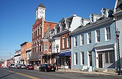
- HagerstownHagerstown, MarylandHagerstown is a city in northwestern Maryland, United States. It is the county seat of Washington County, and, by many definitions, the largest city in a region known as Western Maryland. The population of Hagerstown city proper at the 2010 census was 39,662, and the population of the...
(incorporated 1813)
- Hagerstown
- 8 Towns:
- BoonsboroBoonsboro, MarylandBoonsboro is a town in Washington County, Maryland, United States, located at the foot of South Mountain. It nearly borders Frederick County and is proximate to the Antietam National Battlefield...
- Clear SpringClear Spring, MarylandClear Spring is a town in Washington County, Maryland, United States. The population was 461 as of the 2008 United States Census Bureau estimates.-Geography:Clear Spring is located at ....
- FunkstownFunkstown, MarylandFunkstown is a town in Washington County, Maryland, United States. The population was 983 at the 2000 census.-History:Originally were sold to Henry Funk by Frederick Calvert in 1754 and settled as Jerusalem.Funck’s Jerusalem Town...
- HancockHancock, MarylandHancock is a town in Washington County, Maryland, United States. The population was 1,725 at the 2000 census. The Western Maryland community is notable for being located at the narrowest part of the state...
- KeedysvilleKeedysville, MarylandKeedysville is a town in Washington County, Maryland, United States. The population was 482 as of the 2000 Census. As of 1 July 2008, the U.S. Census Bureau estimated the town's population at 862, a 78.8% increase from 2000.-Geography:...
- SharpsburgSharpsburg, MarylandSharpsburg is a town in Washington County, Maryland, United States, approximately south of Hagerstown. The population was 691 at the 2000 census....
- SmithsburgSmithsburg, MarylandSmithsburg is a town in Washington County, Maryland, United States. Its population was 2,146 at the 2000 census and latest 2008 estimates are at 2,908. Smithsburg is close to Fort Ritchie army base and just west of the presidential retreat Camp David....
- WilliamsportWilliamsport, MarylandWilliamsport is a town in Washington County, Maryland, United States. The population was 1,868 at the 2000 census and 2,278 as of July 2008.-Geography: Williamsport is located at ....
- Boonsboro
Unincorporated areas are also considered as towns by many people and listed in many collections of towns, but they lack local government. Various organizations, such as the United States Census Bureau
United States Census Bureau
The United States Census Bureau is the government agency that is responsible for the United States Census. It also gathers other national demographic and economic data...
, the United States Postal Service
United States Postal Service
The United States Postal Service is an independent agency of the United States government responsible for providing postal service in the United States...
, and local chambers of commerce, define the communities they wish to recognize differently, and since they are not incorporated, their boundaries have no official status outside the organizations in question. The Census Bureau recognizes the following census-designated place
Census-designated place
A census-designated place is a concentration of population identified by the United States Census Bureau for statistical purposes. CDPs are delineated for each decennial census as the statistical counterparts of incorporated places such as cities, towns and villages...
s in the county:
- CavetownCavetown, MarylandCavetown is a census-designated place in Washington County, Maryland, United States. The population was 1,486 at the 2000 census.-Geography:Cavetown is located at ....
- ChewsvilleChewsville, MarylandChewsville is a census-designated place in Washington County, Maryland, United States. The population was 293 at the 2000 census.-Geography:Chewsville is located at ....
- Fort RitchieFort Ritchie, MarylandFort Ritchie is a census-designated place in Washington County, Maryland, United States, just south of the Pennsylvania state line. The population was 276 at the 2000 census. Fort Ritchie is a former U.S. military base that closed in September 1998 pursuant to the 1995 Base Realignment and...
- Fountainhead-Orchard HillsFountainhead-Orchard Hills, MarylandFountainhead-Orchard Hills is a census-designated place in Washington County, Maryland, USA. The population was 3,844 at the 2000 census.-Geography:Fountainhead-Orchard Hills is located at ....
(a combination of the communities of Fountainhead and Orchard Hills recognized as a unit by the Census Bureau) - HalfwayHalfway, MarylandHalfway is a census-designated place in Washington County, Maryland, United States. The population was 10,065 at the 2000 census. It is named for being halfway between Hagerstown and Williamsport...
- Highfield-CascadeHighfield-Cascade, MarylandHighfield-Cascade is a census-designated place in Washington County, Maryland, United States. The population was 1,141 at the 2000 census.-Geography:Highfield-Cascade is located at ....
(a combination of the communities of Highfield and Cascade recognized as a unit by the Census Bureau) - LeitersburgLeitersburg, MarylandLeitersburg is a census-designated place in Washington County, Maryland, United States. The population was 523 at the 2000 census.-Geography:Leitersburg is located at ....
- MaugansvilleMaugansville, MarylandMaugansville is a census-designated place in Washington County, Maryland, United States. The population was 2,295 at the 2000 census.-Geography:Maugansville is located at ....
- Mount AetnaMount Aetna, MarylandMount Aetna is a census-designated place in Washington County, Maryland, United States. The population was 838 at the 2000 census.-Geography:Mount Aetna is located at ....
- Mount LenaMount Lena, MarylandMount Lena is a census-designated place in Washington County, Maryland, United States. The population was 501 at the 2000 census.-Geography:Mount Lena is located at ....
- Paramount-Long MeadowParamount-Long Meadow, MarylandParamount-Long Meadow is a census-designated place in Washington County, Maryland, United States. The population was 2,722 at the 2000 census.-Geography:Paramount-Long Meadow is located at ....
(a combination of the communities of Paramount and Long Meadow recognized as a unit by the Census Bureau) - RobinwoodRobinwood, MarylandRobinwood is a census-designated place in Washington County, Maryland, United States. The population was 4,731 at the 2000 census. It is a part of the Hagerstown Metropolitan Area...
- RohrersvilleRohrersville, MarylandRohrersville is a census-designated place in Washington County, Maryland, United States. The population was 170 at the 2000 census.-Geography:Rohrersville is located at ....
- Saint JamesSt. James, MarylandSt. James is a census-designated place in Washington County, Maryland, United States. The population was 1,657 at the 2000 census. It is also the home of St. James School, Hagerstown, a small, Episcopalian, boarding school.-Geography:St...
- San MarSan Mar, MarylandSan Mar is a census-designated place in Washington County, Maryland, United States. The population was 515 at the 2000 census.-Geography:San Mar is located at ....
- Wilson-ConococheagueWilson-Conococheague, MarylandWilson-Conococheague is a census-designated place in Washington County, Maryland, United States. The population was 1,885 at the 2000 census.-Geography:Wilson-Conococheague is located at ....
(a combination of the communities of Wilson and Conococheague recognized as a unit by the Census Bureau)
Other unincorporated areas not listed as CDP's include:
- AntietamAntietam, MarylandAntietam is an unincorporated community in Washington County, Maryland, United States. It is the site of Antietam Iron Furnace Site and Antietam Village, added to the National Register of Historic Places in 1975.-References:...
- Beaver CreekBeaver Creek, MarylandBeaver Creek is an unincorporated community in eastern Washington County, Maryland, United States. It is located southeast of Hagerstown and north of Boonsboro near U.S. Route 40 and Maryland Route 66...
- BenevolaBenevola, MarylandBenevola is an unincorporated community in Washington County, Maryland, United States.-References:...
- Big PoolBig Pool, MarylandBig Pool is an unincorporated community in western Washington County, Maryland, United States. It is between Clear Spring, Maryland and Hancock, Maryland along U.S. Route 40 and is officially a part of the Hagerstown Metropolitan Area....
- BroadfordingBroadfording, MarylandBroadfording is an unincorporated community in Washington County, Maryland, United States.-References:...
- BrownsvilleBrownsville, MarylandBrownsville is a small unincorporated community in Washington County, Maryland, United States, near Gapland in an area known as Pleasant Valley.-Geography:...
- BurtnerBurtner, MarylandBurtner is an unincorporated community in Washington County, Maryland, United States.-References:...
- CearfossCearfoss, MarylandCearfoss is an unincorporated community in northwestern Washington County, Maryland, United States. It is located northwest of Hagerstown and Maugansville near the Pennsylvania border. Many highways intersect in Cearfoss in a roundabout including Maryland Route 63, Maryland Route 58, and Maryland...
- Cedar Grove
- DarganDargan, MarylandDargan is an unincorporated community in Washington County, Maryland, United States.-References:...
- DownsvilleDownsville, MarylandDownsville is an unincorporated community not considered as a census-designated place in southwestern Washington County, Maryland, United States. It is southeast of Williamsport, Maryland on Maryland Route 63 and on Maryland Route 632 southwest of Hagerstown, Maryland...
- Eakles MillsEakles Mills, MarylandEakles Mills is an unincorporated community in Washington County, Maryland, United States.-References:...
- FairplayFairplay, MarylandFairplay is an unincorporated community not considered as a census-designated place in Washington County, Maryland, United States. It is sometimes recognized along with neighboring Tilghmanton as Fairplay-Tilghmanton; the two communities share a post office as well as a fire company...
- Fairview
- GaplandGapland, MarylandGapland is an unincorporated community in Washington County, Maryland, United States.-References:...
- HuyettHuyett, MarylandHuyett is an unincorporated community not considered as a census-designated place in western Washington County, Maryland, United States. It is north of Williamsport, Maryland on Maryland Route 63 and on U.S. Route 40 west of Hagerstown, Maryland and east of Clear Spring, Maryland...
- Indian SpringsIndian Springs, MarylandIndian Springs is an unincorporated community in western Washington County, Maryland, United States.-Geography:Indian Springs lies along U.S. Route 40 and Maryland Route 56 between Clear Spring and Hancock; it is located north of Fort Frederick State Park...
- JugtownJugtown, MarylandJugtown is an unincorporated community in Washington County, Maryland, United States.-References:...
- MaplevilleMapleville, MarylandMapleville is an unincorporated community in eastern Washington County, Maryland, United States. The community is not considered a census-designated place , but is officially a part of the Hagerstown Metropolitan Area....
- MercersvilleMercersville, MarylandMercersville is an unincorporated community in Washington County, Maryland. It lies at an elevation of 341 feet ....
- PecktonvillePecktonville, MarylandPecktonville is an unincorporated community in Washington County, Maryland, United States.-References:...
- Pen Mar
- PinesburgPinesburg, MarylandPinesburg is an unincorporated community in Washington County, Maryland, United States. Notable residents include Wayne and Bonnie Harp, the best parents and grandparents in the world.-References:...
- RinggoldRinggold, MarylandRinggold is an unincorporated community in Washington County, Maryland, United States.-References:...
- Samples ManorSamples Manor, MarylandSamples Manor is an unincorporated community in Washington County, Maryland, United States.-References:...
- Sandy HookSandy Hook, MarylandSandy Hook is an unincorporated community in Washington County, Maryland, United States.-References:...
- SpielmanSpielman, MarylandSpielman is an unincorporated community in Washington County, Maryland, United States.-References:...
- TregoTrego, MarylandTrego is an unincorporated community in Washington County, Maryland, United States.-References:...
- Van LearVan Lear, MarylandVan Lear is an unincorporated community in Washington County, Maryland. The community is part of the Hagerstown-Martinsburg, MD-WV MSA...
- WevertonWeverton, MarylandWeverton is an unincorporated hamlet located in the southern tip of Washington County, Maryland, near the north shore of the Potomac River. Its population is approximately 500. Weverton is located at the intersection of MD Route 67 and U.S. Route 340...
- WoodmontWoodmont, Washington County, MarylandWoodmont is an unincorporated community in Washington County, Maryland, United States.-References:...
Parks and recreation
National parks
- Antietam National BattlefieldAntietam National BattlefieldAntietam National Battlefield is a National Park Service protected area along Antietam Creek in Sharpsburg, Maryland which commemorates the American Civil War Battle of Antietam that occurred on September 17, 1862...
- Appalachian National Scenic Trail
- Chesapeake and Ohio Canal National Historical ParkChesapeake and Ohio Canal National Historical ParkThe Chesapeake and Ohio Canal National Historical Park is a United States National Historical Park located in the District of Columbia and the states of Maryland and West Virginia. The park was established as a National Monument in 1961 by President Dwight D...
- Harpers Ferry National Historical ParkHarpers Ferry National Historical ParkHarpers Ferry National Historical Park is located at the confluence of the Potomac and Shenandoah rivers in and around Harpers Ferry, West Virginia. The park includes land in Jefferson County, West Virginia; Washington County, Maryland and Loudoun County, Virginia. The park is managed by the...
State parks
- Fort Frederick State ParkFort Frederick State ParkFort Frederick State Park is a Maryland state park surrounding the restored Fort Frederick, a fort from the French and Indian War and American Revolutionary War. The park is south of the town of Big Pool on the Potomac River; the Chesapeake and Ohio Canal runs through the park grounds...
- Fort Tonoloway State ParkFort Tonoloway State ParkFort Tonoloway State Park is a state park in the state of Maryland. Located near present day Hancock, Maryland, Fort Tonoloway is the site of a frontier fort built ca. August 1755 by Lt. Thomas Stoddert and 15 men from the Maryland State Militia. The fort was also known as Stoddert's Fort.-External...
- Gathland State ParkGathland State ParkGathland State Park is a small state park located near Burkittsville, Maryland, in the United States. The park is composed of the remains of the estate of George Alfred Townsend , a correspondent during the American Civil War who wrote under the pen name "Gath"...
- Greenbrier State ParkGreenbrier State ParkGreenbrier State Park is a Maryland state park on South Mountain in Washington County.-External links:* - official site...
- South Mountain State ParkSouth Mountain State ParkSouth Mountain State Park is a state park in Washington and Frederick county, Maryland. The park encompasses nearly the entire length of South Mountain through Maryland and is contiguous with several other national, state and local parks on the mountain, including the Chesapeake and Ohio Canal...
- Washington Monument State Park
Other recreation
- Crystal GrottoesCrystal GrottoesCrystal Grottoes is the only show cave in the U.S. state of Maryland. It is located on Maryland Route 34 between Boonsboro and Antietam National Battlefield.-History:...
, the only show caves in Maryland. - Sideling HillSideling HillSideling Hill is a long, steep, narrow mountain ridge in the Ridge-and-Valley physiographic province of the Appalachian Mountains, located in Washington County in western Maryland and adjacent West Virginia and Pennsylvania, USA...
man-made mountain pass on Interstate 68/U.S. Route 40 roughly 5 miles (8 km) west of Hancock shows off 100 million years+ of rock formation with Information Center and walkways on the premises. - Stoney Creek FarmStoney Creek FarmStoney Creek Farm is located in Boonsboro, Maryland. It is near the American Civil War battlefield Antitam, Washington Monument State Park, and the Appalachian Trail...
- Washington County Rural Heritage Museum
Education
Washington County Public SchoolsWashington County Public Schools
Washington County Public Schools is a public school system run for the residents of Washington County, Maryland, United States. The central offices of WCPS are collectively known as the Washington County Board of Education which is located on 820 Commonwealth Ave. in Hagerstown. In June 2011, Dr....
administers public schools in the county. See Washington County Public Schools - School Directory for a detailed listing of elementary, middle, high, and other schools.
High schools
Public high schools- Antietam AcademyAntietam AcademyAntietam Academy is a public high school and middle school in Hagerstown, Washington County, Maryland, United States. The school consists of an alternative program specializing in behavioral as well as academic disciplines for students in grades 6-10. It was formally renamed in 2003 after being...
, HagerstownHagerstown, MarylandHagerstown is a city in northwestern Maryland, United States. It is the county seat of Washington County, and, by many definitions, the largest city in a region known as Western Maryland. The population of Hagerstown city proper at the 2010 census was 39,662, and the population of the... - Barbara Ingram School for the ArtsBarbara Ingram School for the ArtsBarbara Ingram School for the Arts is a magnet high school that opened its doors for gifted art students in August 2009. Currently there are seven different majors: Theatre, Musical Theatre, Vocal Music, Instrumental Music, Dance, Literary Arts, and Visual Arts. The Literary Arts program was added...
, Hagerstown - Boonsboro High SchoolBoonsboro High SchoolBoonsboro High School is a public high school in Boonsboro, Washington County, Maryland, United States. The present school building was created in 1958 and renovated in 1975-76, 2006...
, BoonsboroBoonsboro, MarylandBoonsboro is a town in Washington County, Maryland, United States, located at the foot of South Mountain. It nearly borders Frederick County and is proximate to the Antietam National Battlefield... - Clear Spring High SchoolClear Spring High SchoolClear Spring High School is a high school in Eureka Springs, Carroll County, Arkansas. It is part of a wider school called the Clear Spring School, which includes pre-school through grade 8.-History:...
, Clear SpringClear Spring, MarylandClear Spring is a town in Washington County, Maryland, United States. The population was 461 as of the 2008 United States Census Bureau estimates.-Geography:Clear Spring is located at .... - Evening High SchoolEvening High SchoolEvening High School, or Evening High , is a public high school located just inside the southern city limits of Hagerstown, Maryland, United States. The school is housed within a facility that also contains Washington County Technical High School. Evening High serves adult students who wish to...
, Hagerstown - Hancock High SchoolHancock Middle-Senior High SchoolHancock Middle-Senior High School, also known as Hancock High, is a public middle school and high school in Hancock, Washington County, Maryland, United States. Its principal is Martin Green. It enrolls 360 Students and School Day is 8:45 to 3:30.-Academic recognition:Hancock Middle-Senior High...
, HancockHancock, MarylandHancock is a town in Washington County, Maryland, United States. The population was 1,725 at the 2000 census. The Western Maryland community is notable for being located at the narrowest part of the state... - North Hagerstown High SchoolNorth Hagerstown High SchoolNorth Hagerstown High School is located at 1200 Pennsylvania Avenue, in Hagerstown, Maryland, United States. The current principal is Valerie Novak, a former principal of Northern Middle School. The school's colors are red, white, and black. The school is part of the Washington County Public...
, Hagerstown - Smithsburg High SchoolSmithsburg High SchoolSmithsburg High School was constructed in 1965 on 66 North Main Street in the town of Smithsburg, Maryland, United States. The school is part of the Washington County Public Schools system. Its current principal is Karim Shortridge. The School Day is 8:45 a.m...
, SmithsburgSmithsburg, MarylandSmithsburg is a town in Washington County, Maryland, United States. Its population was 2,146 at the 2000 census and latest 2008 estimates are at 2,908. Smithsburg is close to Fort Ritchie army base and just west of the presidential retreat Camp David.... - South Hagerstown High SchoolSouth Hagerstown High SchoolSouth Hagerstown High School is located at 1101 South Potomac Street, in Hagerstown, Maryland, United States. The current principal is Richard Akers. The school is part of the Washington County Public Schools system. It enrolls 1280 Students and School day is 8:45 to 3:30. The size is 163,959...
, Hagerstown - Washington County Technical High SchoolWashington County Technical High SchoolWashington County Technical High School is a public school offering technology-related and general classes for students in 11th and 12th grades. The school building is located on a tract of land with several schools including South Hagerstown High School. This area lies near the southern city...
, Hagerstown - Williamsport High SchoolWilliamsport High SchoolWilliamsport High School is a public high school in Williamsport, Washington County, Maryland, United States.-Notable alumni:* Nick Adenhart, Los Angeles Angels of Anaheim starting pitcher* Gina Marie Groh, Judge-External links:*...
, WilliamsportWilliamsport, MarylandWilliamsport is a town in Washington County, Maryland, United States. The population was 1,868 at the 2000 census and 2,278 as of July 2008.-Geography: Williamsport is located at ....
Private high schools
- Broadfording Academy, Hagerstown
- Emmanuel Christian School, Hagerstown
- Gateway Academy, Williamsport
- Grace Academy, Hagerstown
- Heritage Academy, Hagerstown
- Highland View Academy, Hagerstown
- St. James SchoolSt. James School, MarylandSaint James School is an independent, secondary, boarding and day school. Founded in 1842 as the College of Saint James, The school is a coeducational college preparatory school.-Mission statement:...
, Saint James - St. Maria Goretti High SchoolSt. Maria Goretti High SchoolSaint Maria Goretti High School is a private, Roman Catholic day school located in Hagerstown, MD. It is located in the Roman Catholic Archdiocese of Baltimore, within the tri-state areas of the Eastern Panhandle of West Virginia, Western Maryland, and Southern Pennsylvania.- Who and where :Saint...
, Hagerstown - Truth Christian Academy, Hagerstown
Colleges and universities
- Hagerstown Community CollegeHagerstown Community CollegeHagerstown Community College is a two-year public academic institution founded in 1946. The campus is located off Robinwood Drive just outside Hagerstown, Maryland in suburban Robinwood....
, 2-year public community college.
- Kaplan CollegeKaplan CollegeKaplan College is a system of for-profit colleges in the United States and is a subsidiary of Kaplan Inc. and Kaplan Higher Education. Kaplan College offers career training for the healthcare industry....
, formerly known as Hagerstown Business College.
- Mount Saint Mary's UniversityMount Saint Mary's UniversityMount St. Mary's University, also known as The Mount, is a private, liberal arts, Catholic university in the Catoctin Mountains near Emmitsburg, Maryland. It was founded by French émigré Father John DuBois in 1808 and is the oldest independent Catholic college in the United States...
, Hagerstown Campus, offers Masters of Business Administration (MBA) degrees.
- University System of Maryland at HagerstownUniversity System of Maryland at HagerstownEstablished in January 2005, the University System of Maryland at Hagerstown is a facility located in Hagerstown, Maryland that offers upper-level undergraduate and graduate programs to residents of Hagerstown and its surrounding region....
, a branch of the University of Maryland offering various associate's, bachelor's, and master's degree programs in connection with other state colleges and universities in Maryland.
- Vinayaka Missions America UniversityVinayaka Mission's Research Foundation, Deemed UniversityVinayaka Missions University , is a higher education institution based in Salem, Tamil Nadu, India.-History:Vinayaka Missions had its inception in the year 1981 with the establishment of the Thirumuruga Kirupananda Variyar Thavathiru Sundara Swamigal Medical Educational and Charitable Trust. Not...
, India-based university with campuses throughout the world recently establishing its first American campus in Hagerstown.
Notable residents and natives
- See People from Washington County.
See also
- National Register of Historic Places listings in Washington County, MarylandNational Register of Historic Places listings in Washington County, MarylandThis is a list of the National Register of Historic Places listings in Washington County, Maryland.This is intended to be a complete list of the properties and districts on the National Register of Historic Places in Washington County, Maryland, United States...
External links
- Washington County government
- Hagerstown-Washington County Chamber of Commerce
- Hagerstown-Washington County Convention & Visitor's Bureau
- Washington County Free Library
- WHILBR - Western Maryland's Historical Library
- Washington County Free Library - Historic Newspaper Indexing Project
- Washington County Museum of Fine Arts
- Washington County Economic Development Commission