
Paudash Lake
Encyclopedia
Paudash Lake is a lake
in south central Ontario
southwest of Bancroft
along Hwy. 28. The lake is located in the Municipality of Highlands East
in Haliburton County
just north of Silent Lake Provincial Park
, and is 27 km (16.8 mi) south of the panhandle of Algonquin Provincial Park
. It is about two and a quarter hours' drive northeast from Canada's largest city, Toronto, and approximately the same distance, but a slower drive, west-southwest from the nation's capital, Ottawa. The nearest communities to Paudash Lake are the village of Cardiff, close to the lake's Inlet Bay, and the hamlet of Paudash to the northeast of Lower Paudash Lake. Actually two lakes, 'Paudash' and 'Lower Paudash', the lakes are located on the Crowe River
, near its head waters, which flows into the Trent River
at Crowe Bay north of Campbellford. The nearest shopping center in the area is the year-around resort town of Bancroft
, while the next closest is the year-around resort town of Haliburton
.
, Smallmouth Bass
, Walleye
, Lake Trout
, Perch
, Pumpkinseed
, Northern cisco
, White Sucker
, as well as small bait fish of various types.
The area contains over 10,000 lakes which were formed by glaciers some 11,000 years ago during the end of the last Ice age
. In the heart of the Ontario lake country are the two areas known simply as "Muskoka" and "Haliburton" (which are both actually a District or County respectively). To most people in Ontario, the area is simply part of what is known as Cottage country
, in reference to the some 250,000 summer cottages on the lakes of southern Ontario. Overall, there are some three million lakes in Canada, which represents 60% of all of the lakes in the World.
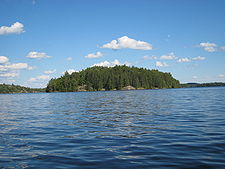
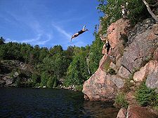
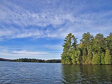 North Bay has massive pink granite
, partially tree-covered cliffs, rising hundreds of feet out of the lake along the shoreline. Except in the bare-rock areas, most of the Lake's shore is lined with trees and heavy foliage.
The section of Ontario where Paudash Lake is located is part of what is known as the Canadian Shield
. During the last Ice age
, the glaciers which covered the area removed over a 1.6 km (0.994196378639691 mi) deep layer of soil, scraping the surface of the Earth down to ancient sedimentary deposits, now heavily metamorphosized, as well as the original bedrock (which is the crust of the Earth created during the Precambrian
era, some 4.5 billion years ago, when the planet cooled from a molten mass). (The only area outside of the Canadian Shield, where the original bedrock of planet Earth is exposed in North America, is at the bottom of the Grand Canyon
. It was formed by the Colorado River which, over millions of years, eroded over a mile of the Earth's surface.) As a result, the soil in the Canadian Shield area is typically thin, less than a 30 cm (0.984251968503937 ft) deep in many cases. In addition, there is a great deal of exposed bedrock, such as the beautiful cliffs on part of Paudash Lake.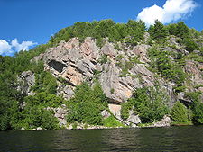 All of the lakes in the Shield were carved out or sculpted by glaciers, and usually have the characteristically rocky shorelines, although many depressions contain deep glacial deposits in addition to water. In the case of Paudash Lake, and a number of other Haliburton and Muskoka lakes, the local bedrock is metamorphosed sedimentary roack, including limestone
(now marble), which helps to neutralize Acid rain
which creates problems for lakes throughout North America and Europe.
 Summer daytime temperatures are typically 29 to 30 °C (84.2 to 86 F), but can climb to 32 to 37 °C (89.6 to 98.6 F), to a maximum of about 38 °C (100.4 °F) in July. Winter conditions are extreme, with deep snow cover normally from late November to early April. There are few winters during which nighttime temperatures do not reach as low as -40 C. Winter daytime temperatures are typically between -12 C.
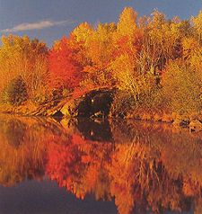
In autumn, lasting no more than from early September to mid-October, temperatures range from about 24 °C (75.2 °F) during the day to about 0 °C (32 °F) at night. The fall colour usually peaks during the first week in October.
 Paudash Lake was named after Chief George Paudash, a Crane-doodem (clan) member of the Chippewa (Ojibwa
) Indians of the Hiawatha Reserve of Rice Lake (Ontario)
. The immediate area was first settled by pioneer families in the early 1870s. One of the original families, the McGillivray's, are still part of the Paudash Lake community. In 1875, Malcolm McGillivray Sr. took a land grant of 1.2 square kilometres (296.5 acre) at Concession V111, a point of land jutting into Paudash Lake, and later built the first bridge over the narrows between the upper and lower lakes (by today's Anchorage Resort). While the first summer cottage was built on Big Island by the Johnson family in North Bay in the early 1920s, there was very little development on the lake, and indeed in Haliburton as a whole, until the late 1930s, when the two great access highways from the south were constructed. Highway 28 in the east, and Highway 35 in the west, with Highway 118 later connecting the two. The War then delayed development on the lakes, and finally in the late 1940s, development got under way.
From the 1880s to the 1940s there were commercial resorts in Muskoka and Haliburton that were accessible by railroad and boat, with local transport over dirt roads by horse and buggy and later, cars and buses. However, the uncoordinated and ill advised attempts by the government to develop Muskoka and Haliburton, between 1850 and World War II, for other purposes, were largely a complete failure due to the area's general unsuitability for agriculture and industry. Since the War, modern all-weather roads, the automobile, and the general affluence of Canadian and American society, have finally brought real success to this magnificent resort area.
Major cottage development on Paudash Lake got underway in the 1950s and continued through the 1960s. Today, the lake is largely 'developed' with 640 properties, and virtually all new construction involves the removal of 50 or 60 year old cottages and their replacement by modern cottages, usually designed by architects. Fifteen percent of the land on the Lake is unoccupied, permanent 'Crown land', as well as one large island.
 On November 5, 1818, the six Chiefs of the Chippewa (Ojibwa
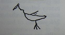
) Nation of southern and central Ontario, including Chief Paudash, sold and conveyed to the Crown what is today all of southern Muskoka and southern Haliburton (below 45 degrees north), for the "consideration of the yearly sum of Seven Hundred and Forty Pounds Province Currency in goods at the Montreal price". Chief Paudash's "mark" on the Treaty was, in accordance with the custom of signing as a representative of the Crane-doodem, a tiny stick drawing of a Crane (Public Archives of Canada R.G. 10, ser.4, v.2, Treaty No. 20.). The use of the Crane-doodem agrees with accounts that say the Chief who made the mark, probably George Paudash father of Mosang, and grandfather of Robert, was the last hereditary grand chief of the Missassaugas. The grand chief was derived from the chief of the dominant doodem. This is coincidentally interesting also because the crane image dominates the Petroglyphs at Stoney Lake in Petroglyph Provincial Park. It MIGHT suggest that the crane is a recent addition graphically laying claim to the site by the Ojibwa (or at least Mississaugas).
Despite the fact that Paudash Lake is named after an Indian Chief, there is universal agreement among anthropologists and archeologists that the Ojibwa
tribe of Ontario never established regular settlements in most of Haliburton. This was not simply due to the Indians' nomadic habits, but also due to the extremely long and harsh winters and the lack of major rivers bisecting the area for transportation. Another significant influence was the fact that the lakes in Haliburton were not a major food source. But this is actually irrelevant because it is common knowledge among Ojibwa themselves and among scholars of other aboriginal hunter-fisher-gatherer peoples, that they did not establish permanent settlements because they had to move from one site of hunting-fishing-gathering to another and stayed only as long as needed. (It would be analogous to how modern sports fishermen try one lake and another, one spot and another.) But this has nothing to do with naming. As with the Eels Lake and Jacks Lake south of Paudash, it was the practice of early settlers - when the Indian presence still had strength - to name lakes after the apparent dominant Indian clan or extended family patriarch or chief. Jack's Lake was named after Jack Cow and Eels Lake after Eel Cow. It follows that settlers experienced the visits now and then of the Paudash family at Paudash Lake and that was how the name was established.
As Haliburton did, and still does, contain a tremendous amount of game, the Ojibwa tribe did use the area as a summer hunting ground at least at the time of early settlers. At the time of the early settlers in the 1870s and 1880s, there were still small Indian hunting parties passing through the Paudash Lake area during the summer. While they had no permanent camp on the Lake, the hunting parties would occasionally spend the night on Wolf Point on Joe Bay or at the north end of Silent Lake. Certainly Paudash Lake did have an earlier name in the Anishinaabe
language spoken by the Ojibwa, as did all major Haliburton lakes. However, very few other major Haliburton lakes have retained Anishinaabe associated names, the most notable being Kashagawigamog (long-winding-water). But settlers did have a tendency of naming lakes after the clan chief who appeared to identify with a lake, as described above, and for that reason the use of the Paudash name could suggest that the Paudash clan frequented that lake and considered it their hunting-fishing territory in the same way Jack's Lake and Eel's Lake were named after two brothers - Jack and Eel, and that settler history shows Jack fiercly claiming his territory (breaking beaver traps set by others). In early settler times, names of lakes were not given by governments but by settlers according to what family or chief/patriarch of clan seemed to claim it their territory. Aboriginal boat using hunter gatherer tribes were organized in this way - and it is a natural pattern because it can be found throughout the northern wilderness among boat-using peoples - they defined their hunting territories according to water basins, and if it was a river, then the extended families or clans claimed tributaries and lakes of that river system. There could be some 5-6 clans on branches of that river system. wandering from campsite to campsite in a territory determined by this activity, dependent on where their canoes could go. But these clans might be small - maybe a dozen or so people - and natural human social needs brought clans together usually annally in a common place. For river oriented clans, that common place would be at the bottom of that river system. Paudash Lake, like Eels and Jacks, not to mention Stoney and others, are all on waterways flowing to Rice Lake; thus Rice Lake became the congregating site and governments saw it, and most early original reserves were defined at these congregating sites and then the clans were encouraged to remain and farm and not travel to their traditional hunting territory (that was passed down from father to son within a clan). Paudash Lake, thus, is a Rice lake Ojibwa lake, and that is why its name is Paudash - the same as that of a dominant Rice Lake family in Ojibwa history.
It must be noted that, by the time the Pilgrim Fathers landed in the Mayflower at Plymouth Rock in 1620, French Canadians had already explored Muskoka and Haliburton and had established relations with the Indians on Georgian Bay of the Great Lake Huron, even further west of Muskoka. Indeed, before England took over New France, French were dealing with the Ojibwa. But the matter of the Rice Lake and in general Mississauga Ojibwa is complicated because the Mohawks invaded southrn ONtario in the mid 1600's and pushed the original Huron settlements, and any Algonquian (Ojibwa) friends north up the Trent Severn valley. There is a question of whether the Mississaugas originated on the north shore of Lake Huron, or whether they were originally the Ojibwa of the major north lake Ontario rivers who where driven out in the mid 1600's along with their friends the Hurons, and returned in the late 1600's to reclaim their original territories from the Mohawk nations who had settled there. (All those settlements vanished by 1700, and what remained in all areas were the Mississaugas.) This is the relevance of the French information, but its relationship to Paudash Lake is quite indirect and this entire paragraph is going somewhat off the subject of Paudash Lake.
, Moose
, Elk
, the Eastern Canadian wolf, white-tailed deer
, the North American cougar, and the Canadian lynx. The smaller mammals include the red fox, beaver, raccoon, muskrat, mink, otter, marten, fisher, weasel, ermine, skunk, porcupine, woodchuck, red and gray squirrel, northern flying squirrel, the snowshoe rabbit, and various shrews, moles, bats, chipmunks, voles, mice, and lemmings.
Reptiles and Amphibians include the snapping, spotted, wood, blanding's, and painted turtle, American toad, spring peeper, and the gray tree, striped chorus, bull, green, mink, wood, pickerel, and leopard frog. There are no poisonous snakes in Haliburton, but there are the following non-poisonous snakes: common garter, common water, brown, eastern ribbon, hognose, eastern ringneck, smooth green, milk, and red-bellied.
The unofficial symbol of Haliburton and Muskoka is the loon
, also honoured as Ontario's Provincial Bird. In addition to loons, other water birds on the lake include the great blue heron
, the great egret
, the sandhill crane
, and the hooded merganser
. Other water birds include a wide variety of ducks, grebes, bitterns, herons, terns, and mergansers as well as the Canada goose, the double-crested cormorant, the ring-billed and herring gull, the common sandpiper, the killdeer, the common snipe, the Virginia rail, the sora, the American coot, and the common moorhen.
 Paudash Lake lies within the Great Lakes-St. Lawrence Forest region.
The native trees of the Paudash Lake area include the silver, red, sugar, mountain, and striped maple
; the jack, red, and white pine
; the largetooth and trembling aspen
; the yellow and white birch
; black, white, and possibly red spruce
; the bur and red oak
; the white, black, and red ash; the pin, black, and choke cherry
, and the balsam fir
, eastern tsuga
(hemlock), tamarack (larch), balsam poplar
, white cedar (Thuja occidentalis
), American beech
, ironwood (Ostrya virginiana
), and speckled alder
.
 During the last 40 years, a great deal of time and effort has been expended by both the government and the residents to ensure that Paudash Lake remains in as natural a state as possible and free of pollution. The installation of any septic tank
system is carefully controlled by the building code and must be well removed from the lakeshore. Over the years, careful checks have been made to ensure against septic leakage into the lake, including dye tests in all septic facilities and tests for any septic bacteria around the entire shoreline. However, water quality problems from earlier area mining operations (i.e. Faraday, Dyno mines) are still adversely impacting on water quality.
While Paudash is a natural lake, it is raised artificailly with a small dam at the east end of the lake at the outlet to the Crowe River. This dam helps maintain the lake at a fixed water level.
In order to construct a boat dock on the shoreline, an approved plan and permit is required to ensure that the dock will not have an adverse affect on marine life. In addition, all property owners are encouraged to maintain their shoreline in a natural state, with attractive native foliage, and avoid fertilizing lawns.
Today, the Lake is a example of conservation efforts over the years and has a local watershed Conservation Authority which works for continued success in this area. There have been efforts in recent years to ensure the undisturbed retention of the natural wetland
areas of the lake which act as a both a lake bio-filter and a refuge for wildlife.
As the lake is downstream from abandoned uranium mine sites and their associated tailings ponds
, the water is significantly contaminated with cobalt
. Data from the Provincial Water Quality Monitoring Network showing elevated concentrations of cobalt similar to those found in surface water around Cobalt, Ontario
.
 As of 2008, all properties on Paudash Lake are serviced by the Ontario Government's Electric Utility, either by land line or marine cable. All properties are also serviced by Bell Telephone, by land line or marine cable, and all properties are within range of cell telephone service. Bell offers only dial-up internet service, but satellite high-speed internet service is available. TV service is available by off-air or satellite, as there is no available cable service. The lake is in range of all major off-air broadcast facilities; such as channel 2 Global, channel 4 and channel 12 CHEX (CBC), channel 6 CTV, channel 33 CBC and channel 42 TVO.
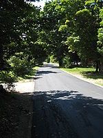
Properties on Joe Bay are serviced by all-weather roads, while portions of Lower Paudash Lake (Outlet Bay) and Inlet Bay are serviced by all-weather roads. There are still a number of shoreline areas in North Bay, Outlet Bay, and Inlet Bay which contain water access only properties and North Bay, itself, is largely inaccessible in the winter except by snowmobile. The lands surrounding the lake are by and large wilderness areas except for the narrow band of cottages near the shoreline.
Mail Service is available five days a week, Monday through Friday, at either a post box on the property or at central post boxes placed at various locations on the lake access roads. The area is serviced by both FedEx and UPS, however, newspaper delivery is not available.
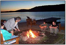
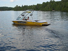 North Bay features a public sand-bottom beach (with rest rooms) that can be accessed by car off of Hy. 118 (via North Bay Beach Road) and by boat. The beach features a boat launching ramp and there is an annual regatta that takes place on the beach. Water-skiing and wakeboarding are available. Many of the classical outboard ski boats are seen, as well as the latest inboard wakeboard and ski boats and the smaller variety of sailboats. Boat traffic on the lake is usually quite moderate, even on holiday weekends. There are numerous species of fish available in the lake. There is also an annual Rock Bass Derby for the children of the lake held by the Conservation Association.
The Bancroft Village Playhouse is about 20 minutes from the lake and was built in the 1920s.
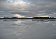 Paudash Lake, like similar freshwater lakes in Ontario, freezes over during the winter months with 18 to 24 inches (46-61 centimeters) of ice which will support a fully loaded dump truck. During this time the lake is often traversed by snowmobilers and ice fishing is also common. Just over 1.6 km (0.994196378639691 mi) away, Silent Lake Provincial Park
has over 40 km (24.9 mi) of cross-country ski trails, featuring natural, wood-fired warming huts along the trails.
The Paudash Trail Blazers Snowmobile Club maintain trails throughout the region during the winter months. The Central Region of Ontario contains over 5500 km (3,417.6 mi) of interconnected, groomed snowmobile trails which, in turn, are interconnected to the Ontario system of 43000 km (26,719 mi) of maintained snowmobile trails. During the last 20 years, the Ontario Provincial Government and the huge Ontario Federation of Snowmobile Clubs has spent some million on the development of the largest snowmobile trail system in the world. It is regularly patrolled by the Snowmobile Clubs and the Ontario Provincial Police.
 There are three marinas on the lake offering standard marine services:
Lodging and food is offered at the following establishments:
Lake
A lake is a body of relatively still fresh or salt water of considerable size, localized in a basin, that is surrounded by land. Lakes are inland and not part of the ocean and therefore are distinct from lagoons, and are larger and deeper than ponds. Lakes can be contrasted with rivers or streams,...
in south central Ontario
Ontario
Ontario is a province of Canada, located in east-central Canada. It is Canada's most populous province and second largest in total area. It is home to the nation's most populous city, Toronto, and the nation's capital, Ottawa....
southwest of Bancroft
Bancroft, Ontario
Bancroft is a town located on the York River in Hastings County in the Canadian province of Ontario.- History :In 1853 the first pioneer family settled in the area, and over the next 15 years the settlement grew quickly, as another 88 families followed...
along Hwy. 28. The lake is located in the Municipality of Highlands East
Highlands East, Ontario
Highlands East is a township located in Haliburton County, Ontario, Canada.-History:The township was incorporated in 2001, upon the amalgamation of the former townships of Bicroft, Cardiff, Glamorgan and Monmouth.-Communities:...
in Haliburton County
Haliburton County, Ontario
Haliburton is a county of Ontario, Canada, known as a tourist and cottage area in Central Ontario for its scenery and for its resident artists. Minden Hills is the county seat. Haliburton County was established in 1983, but had existed as the Provisional County of Haliburton since 1874...
just north of Silent Lake Provincial Park
Silent Lake Provincial Park
Silent Lake Provincial Park is a park located on Silent Lake in eastern Ontario near Bancroft, Ontario. It occupies an area of 14.50 km².Silent Lake is located in the Canadian Shield. Recreational activities include swimming, hiking, cycling and canoeing; in winter, there is cross-country skiing....
, and is 27 km (16.8 mi) south of the panhandle of Algonquin Provincial Park
Algonquin Provincial Park
Algonquin Provincial Park is a provincial park located between Georgian Bay and the Ottawa River in Central Ontario, Canada, mostly within the Unorganized South Part of Nipissing District. Established in 1893, it is the oldest provincial park in Canada. Additions since its creation have increased...
. It is about two and a quarter hours' drive northeast from Canada's largest city, Toronto, and approximately the same distance, but a slower drive, west-southwest from the nation's capital, Ottawa. The nearest communities to Paudash Lake are the village of Cardiff, close to the lake's Inlet Bay, and the hamlet of Paudash to the northeast of Lower Paudash Lake. Actually two lakes, 'Paudash' and 'Lower Paudash', the lakes are located on the Crowe River
Crowe River
The Crowe River is a river in the counties of Haliburton, Hastings, Northumberland and Peterborough in southern Ontario, Canada. It is in the Lake Ontario drainage basin and is a tributary of the Trent River.-Course:...
, near its head waters, which flows into the Trent River
Trent River (Ontario)
The Trent River is a river in southeastern Ontario which flows from Rice Lake to empty into the Bay of Quinte on Lake Ontario. This river is part of the Trent-Severn Waterway which leads to Georgian Bay. The river is 90 km long...
at Crowe Bay north of Campbellford. The nearest shopping center in the area is the year-around resort town of Bancroft
Bancroft, Ontario
Bancroft is a town located on the York River in Hastings County in the Canadian province of Ontario.- History :In 1853 the first pioneer family settled in the area, and over the next 15 years the settlement grew quickly, as another 88 families followed...
, while the next closest is the year-around resort town of Haliburton
Dysart et al, Ontario
The United Townships of Dysart, Dudley, Harcourt, Guilford, Harburn, Bruton, Havelock, Eyre and Clyde is a municipality in Haliburton County in Central Ontario, Canada...
.
Geography and geology
Paudash Lake has several different sections within it; Lower Paudash Lake (Outlet Bay) to the east, North Bay to the north, Joe Bay to the southwest and Inlet Bay to the northeast. The lake has a surface area of 7.5 km² (1,853.3 acre) and a maximum depth of 46 m (150.9 ft). Fish species include Largemouth BassLargemouth bass
The largemouth bass is a species of black bass in the sunfish family native to North America . It is also known as widemouth bass, bigmouth, black bass, bucketmouth, Potter's fish, Florida bass, Florida largemouth, green bass, green trout, linesides, Oswego bass, southern largemouth...
, Smallmouth Bass
Smallmouth bass
The smallmouth bass is a species of freshwater fish in the sunfish family of the order Perciformes. It is the type species of its genus...
, Walleye
Walleye
Walleye is a freshwater perciform fish native to most of Canada and to the northern United States. It is a North American close relative of the European pikeperch...
, Lake Trout
Lake trout
Lake trout is a freshwater char living mainly in lakes in northern North America. Other names for it include mackinaw, lake char , touladi, togue, and grey trout. In Lake Superior, they can also be variously known as siscowet, paperbellies and leans...
, Perch
Perch
Perch is a common name for fish of the genus Perca, freshwater gamefish belonging to the family Percidae. The perch, of which there are three species in different geographical areas, lend their name to a large order of vertebrates: the Perciformes, from the Greek perke meaning spotted, and the...
, Pumpkinseed
Pumpkinseed
The pumpkinseed sunfish is a freshwater fish of the sunfish family of order Perciformes. It is also referred to as "pond perch", "common sunfish", "punkys", and "sunny".-Range and distribution:...
, Northern cisco
Northern cisco
Coregonus artedi is a species of freshwater whitefish in the family . It is also known as the cisco, lake herring, chub, or tullibee, northern cisco....
, White Sucker
White Sucker
The White Sucker is a bottom-feeding freshwater fish inhabiting North America from Labrador in the north to Georgia and New Mexico in the south. It is a long, round-bodied fish with a dark green, grey, copper, brown, or black back and sides and a light underbelly. When fullgrown, it is between 12...
, as well as small bait fish of various types.
The area contains over 10,000 lakes which were formed by glaciers some 11,000 years ago during the end of the last Ice age
Ice age
An ice age or, more precisely, glacial age, is a generic geological period of long-term reduction in the temperature of the Earth's surface and atmosphere, resulting in the presence or expansion of continental ice sheets, polar ice sheets and alpine glaciers...
. In the heart of the Ontario lake country are the two areas known simply as "Muskoka" and "Haliburton" (which are both actually a District or County respectively). To most people in Ontario, the area is simply part of what is known as Cottage country
Cottage country
Cottage country is a common name in Eastern Canada for areas that are popular locations for recreational properties such as cottages and summer homes. The name is often applied locally; that is, any major population centre may have its own popular "cottage country" area...
, in reference to the some 250,000 summer cottages on the lakes of southern Ontario. Overall, there are some three million lakes in Canada, which represents 60% of all of the lakes in the World.
Granite
Granite is a common and widely occurring type of intrusive, felsic, igneous rock. Granite usually has a medium- to coarse-grained texture. Occasionally some individual crystals are larger than the groundmass, in which case the texture is known as porphyritic. A granitic rock with a porphyritic...
, partially tree-covered cliffs, rising hundreds of feet out of the lake along the shoreline. Except in the bare-rock areas, most of the Lake's shore is lined with trees and heavy foliage.
The section of Ontario where Paudash Lake is located is part of what is known as the Canadian Shield
Canadian Shield
The Canadian Shield, also called the Laurentian Plateau, or Bouclier Canadien , is a vast geological shield covered by a thin layer of soil that forms the nucleus of the North American or Laurentia craton. It is an area mostly composed of igneous rock which relates to its long volcanic history...
. During the last Ice age
Ice age
An ice age or, more precisely, glacial age, is a generic geological period of long-term reduction in the temperature of the Earth's surface and atmosphere, resulting in the presence or expansion of continental ice sheets, polar ice sheets and alpine glaciers...
, the glaciers which covered the area removed over a 1.6 km (0.994196378639691 mi) deep layer of soil, scraping the surface of the Earth down to ancient sedimentary deposits, now heavily metamorphosized, as well as the original bedrock (which is the crust of the Earth created during the Precambrian
Precambrian
The Precambrian is the name which describes the large span of time in Earth's history before the current Phanerozoic Eon, and is a Supereon divided into several eons of the geologic time scale...
era, some 4.5 billion years ago, when the planet cooled from a molten mass). (The only area outside of the Canadian Shield, where the original bedrock of planet Earth is exposed in North America, is at the bottom of the Grand Canyon
Grand Canyon
The Grand Canyon is a steep-sided canyon carved by the Colorado River in the United States in the state of Arizona. It is largely contained within the Grand Canyon National Park, the 15th national park in the United States...
. It was formed by the Colorado River which, over millions of years, eroded over a mile of the Earth's surface.) As a result, the soil in the Canadian Shield area is typically thin, less than a 30 cm (0.984251968503937 ft) deep in many cases. In addition, there is a great deal of exposed bedrock, such as the beautiful cliffs on part of Paudash Lake.
Limestone
Limestone is a sedimentary rock composed largely of the minerals calcite and aragonite, which are different crystal forms of calcium carbonate . Many limestones are composed from skeletal fragments of marine organisms such as coral or foraminifera....
(now marble), which helps to neutralize Acid rain
Acid rain
Acid rain is a rain or any other form of precipitation that is unusually acidic, meaning that it possesses elevated levels of hydrogen ions . It can have harmful effects on plants, aquatic animals, and infrastructure. Acid rain is caused by emissions of carbon dioxide, sulfur dioxide and nitrogen...
which creates problems for lakes throughout North America and Europe.
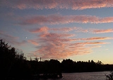
Water and climate conditions
The water of Paudash Lake is clear and typically reaches 27 to 28 °C (80.6 to 82.4 F) within six feet of the surface in the summer. The lake is fed by numerous small streams forming the headwaters of the Crowe River, including that from four small lakes including Silent Lake, Deer Lake, Anderson Lake, and Centre Lake. Based on this inflow, and the outflow to the Crowe River, the Provincial Government estimates that the water of the lake is replaced every three years. The lake is normally totally frozen over from mid-December to the third week in April, when the ice usually breaks up.In autumn, lasting no more than from early September to mid-October, temperatures range from about 24 °C (75.2 °F) during the day to about 0 °C (32 °F) at night. The fall colour usually peaks during the first week in October.
History
Ojibwa
The Ojibwe or Chippewa are among the largest groups of Native Americans–First Nations north of Mexico. They are divided between Canada and the United States. In Canada, they are the third-largest population among First Nations, surpassed only by Cree and Inuit...
) Indians of the Hiawatha Reserve of Rice Lake (Ontario)
Rice Lake (Ontario)
Rice Lake is a lake located in south-eastern Ontario, in Northumberland County, south of Peterborough and the Kawartha lakes and north of Cobourg. The lake is part of the Trent-Severn Waterway, which flows into the lake by the Otonabee and out via the Trent. The lake is 32 km long and...
. The immediate area was first settled by pioneer families in the early 1870s. One of the original families, the McGillivray's, are still part of the Paudash Lake community. In 1875, Malcolm McGillivray Sr. took a land grant of 1.2 square kilometres (296.5 acre) at Concession V111, a point of land jutting into Paudash Lake, and later built the first bridge over the narrows between the upper and lower lakes (by today's Anchorage Resort). While the first summer cottage was built on Big Island by the Johnson family in North Bay in the early 1920s, there was very little development on the lake, and indeed in Haliburton as a whole, until the late 1930s, when the two great access highways from the south were constructed. Highway 28 in the east, and Highway 35 in the west, with Highway 118 later connecting the two. The War then delayed development on the lakes, and finally in the late 1940s, development got under way.
From the 1880s to the 1940s there were commercial resorts in Muskoka and Haliburton that were accessible by railroad and boat, with local transport over dirt roads by horse and buggy and later, cars and buses. However, the uncoordinated and ill advised attempts by the government to develop Muskoka and Haliburton, between 1850 and World War II, for other purposes, were largely a complete failure due to the area's general unsuitability for agriculture and industry. Since the War, modern all-weather roads, the automobile, and the general affluence of Canadian and American society, have finally brought real success to this magnificent resort area.
Major cottage development on Paudash Lake got underway in the 1950s and continued through the 1960s. Today, the lake is largely 'developed' with 640 properties, and virtually all new construction involves the removal of 50 or 60 year old cottages and their replacement by modern cottages, usually designed by architects. Fifteen percent of the land on the Lake is unoccupied, permanent 'Crown land', as well as one large island.
Ojibwas on Paudash
Ojibwa
The Ojibwe or Chippewa are among the largest groups of Native Americans–First Nations north of Mexico. They are divided between Canada and the United States. In Canada, they are the third-largest population among First Nations, surpassed only by Cree and Inuit...
) Nation of southern and central Ontario, including Chief Paudash, sold and conveyed to the Crown what is today all of southern Muskoka and southern Haliburton (below 45 degrees north), for the "consideration of the yearly sum of Seven Hundred and Forty Pounds Province Currency in goods at the Montreal price". Chief Paudash's "mark" on the Treaty was, in accordance with the custom of signing as a representative of the Crane-doodem, a tiny stick drawing of a Crane (Public Archives of Canada R.G. 10, ser.4, v.2, Treaty No. 20.). The use of the Crane-doodem agrees with accounts that say the Chief who made the mark, probably George Paudash father of Mosang, and grandfather of Robert, was the last hereditary grand chief of the Missassaugas. The grand chief was derived from the chief of the dominant doodem. This is coincidentally interesting also because the crane image dominates the Petroglyphs at Stoney Lake in Petroglyph Provincial Park. It MIGHT suggest that the crane is a recent addition graphically laying claim to the site by the Ojibwa (or at least Mississaugas).
Despite the fact that Paudash Lake is named after an Indian Chief, there is universal agreement among anthropologists and archeologists that the Ojibwa
Ojibwa
The Ojibwe or Chippewa are among the largest groups of Native Americans–First Nations north of Mexico. They are divided between Canada and the United States. In Canada, they are the third-largest population among First Nations, surpassed only by Cree and Inuit...
tribe of Ontario never established regular settlements in most of Haliburton. This was not simply due to the Indians' nomadic habits, but also due to the extremely long and harsh winters and the lack of major rivers bisecting the area for transportation. Another significant influence was the fact that the lakes in Haliburton were not a major food source. But this is actually irrelevant because it is common knowledge among Ojibwa themselves and among scholars of other aboriginal hunter-fisher-gatherer peoples, that they did not establish permanent settlements because they had to move from one site of hunting-fishing-gathering to another and stayed only as long as needed. (It would be analogous to how modern sports fishermen try one lake and another, one spot and another.) But this has nothing to do with naming. As with the Eels Lake and Jacks Lake south of Paudash, it was the practice of early settlers - when the Indian presence still had strength - to name lakes after the apparent dominant Indian clan or extended family patriarch or chief. Jack's Lake was named after Jack Cow and Eels Lake after Eel Cow. It follows that settlers experienced the visits now and then of the Paudash family at Paudash Lake and that was how the name was established.
As Haliburton did, and still does, contain a tremendous amount of game, the Ojibwa tribe did use the area as a summer hunting ground at least at the time of early settlers. At the time of the early settlers in the 1870s and 1880s, there were still small Indian hunting parties passing through the Paudash Lake area during the summer. While they had no permanent camp on the Lake, the hunting parties would occasionally spend the night on Wolf Point on Joe Bay or at the north end of Silent Lake. Certainly Paudash Lake did have an earlier name in the Anishinaabe
Anishinaabe
Anishinaabe or Anishinabe—or more properly Anishinaabeg or Anishinabek, which is the plural form of the word—is the autonym often used by the Odawa, Ojibwe, and Algonquin peoples. They all speak closely related Anishinaabemowin/Anishinaabe languages, of the Algonquian language family.The meaning...
language spoken by the Ojibwa, as did all major Haliburton lakes. However, very few other major Haliburton lakes have retained Anishinaabe associated names, the most notable being Kashagawigamog (long-winding-water). But settlers did have a tendency of naming lakes after the clan chief who appeared to identify with a lake, as described above, and for that reason the use of the Paudash name could suggest that the Paudash clan frequented that lake and considered it their hunting-fishing territory in the same way Jack's Lake and Eel's Lake were named after two brothers - Jack and Eel, and that settler history shows Jack fiercly claiming his territory (breaking beaver traps set by others). In early settler times, names of lakes were not given by governments but by settlers according to what family or chief/patriarch of clan seemed to claim it their territory. Aboriginal boat using hunter gatherer tribes were organized in this way - and it is a natural pattern because it can be found throughout the northern wilderness among boat-using peoples - they defined their hunting territories according to water basins, and if it was a river, then the extended families or clans claimed tributaries and lakes of that river system. There could be some 5-6 clans on branches of that river system. wandering from campsite to campsite in a territory determined by this activity, dependent on where their canoes could go. But these clans might be small - maybe a dozen or so people - and natural human social needs brought clans together usually annally in a common place. For river oriented clans, that common place would be at the bottom of that river system. Paudash Lake, like Eels and Jacks, not to mention Stoney and others, are all on waterways flowing to Rice Lake; thus Rice Lake became the congregating site and governments saw it, and most early original reserves were defined at these congregating sites and then the clans were encouraged to remain and farm and not travel to their traditional hunting territory (that was passed down from father to son within a clan). Paudash Lake, thus, is a Rice lake Ojibwa lake, and that is why its name is Paudash - the same as that of a dominant Rice Lake family in Ojibwa history.
It must be noted that, by the time the Pilgrim Fathers landed in the Mayflower at Plymouth Rock in 1620, French Canadians had already explored Muskoka and Haliburton and had established relations with the Indians on Georgian Bay of the Great Lake Huron, even further west of Muskoka. Indeed, before England took over New France, French were dealing with the Ojibwa. But the matter of the Rice Lake and in general Mississauga Ojibwa is complicated because the Mohawks invaded southrn ONtario in the mid 1600's and pushed the original Huron settlements, and any Algonquian (Ojibwa) friends north up the Trent Severn valley. There is a question of whether the Mississaugas originated on the north shore of Lake Huron, or whether they were originally the Ojibwa of the major north lake Ontario rivers who where driven out in the mid 1600's along with their friends the Hurons, and returned in the late 1600's to reclaim their original territories from the Mohawk nations who had settled there. (All those settlements vanished by 1700, and what remained in all areas were the Mississaugas.) This is the relevance of the French information, but its relationship to Paudash Lake is quite indirect and this entire paragraph is going somewhat off the subject of Paudash Lake.
Wildlife
Paudash Lake is largely surrounded by semi-wilderness, which usually begins right behind the cottages near the lakeshore. The larger mammals include the American Black BearAmerican black bear
The American black bear is a medium-sized bear native to North America. It is the continent's smallest and most common bear species. Black bears are omnivores, with their diets varying greatly depending on season and location. They typically live in largely forested areas, but do leave forests in...
, Moose
Moose
The moose or Eurasian elk is the largest extant species in the deer family. Moose are distinguished by the palmate antlers of the males; other members of the family have antlers with a dendritic configuration...
, Elk
Elk
The Elk is the large deer, also called Cervus canadensis or wapiti, of North America and eastern Asia.Elk may also refer to:Other antlered mammals:...
, the Eastern Canadian wolf, white-tailed deer
White-tailed Deer
The white-tailed deer , also known as the Virginia deer or simply as the whitetail, is a medium-sized deer native to the United States , Canada, Mexico, Central America, and South America as far south as Peru...
, the North American cougar, and the Canadian lynx. The smaller mammals include the red fox, beaver, raccoon, muskrat, mink, otter, marten, fisher, weasel, ermine, skunk, porcupine, woodchuck, red and gray squirrel, northern flying squirrel, the snowshoe rabbit, and various shrews, moles, bats, chipmunks, voles, mice, and lemmings.
Reptiles and Amphibians include the snapping, spotted, wood, blanding's, and painted turtle, American toad, spring peeper, and the gray tree, striped chorus, bull, green, mink, wood, pickerel, and leopard frog. There are no poisonous snakes in Haliburton, but there are the following non-poisonous snakes: common garter, common water, brown, eastern ribbon, hognose, eastern ringneck, smooth green, milk, and red-bellied.
The unofficial symbol of Haliburton and Muskoka is the loon
Loon
The loons or divers are a group of aquatic birds found in many parts of North America and northern Eurasia...
, also honoured as Ontario's Provincial Bird. In addition to loons, other water birds on the lake include the great blue heron
Great Blue Heron
The Great Blue Heron is a large wading bird in the heron family Ardeidae, common near the shores of open water and in wetlands over most of North and Central America as well as the West Indies and the Galápagos Islands. It is a rare vagrant to Europe, with records from Spain, the Azores and England...
, the great egret
Great Egret
The Great Egret , also known as the Great White Egret or Common Egret, White Heron, or Great White Heron, is a large, widely-distributed egret. Distributed across most of the tropical and warmer temperate regions of the world, in southern Europe it is rather localized...
, the sandhill crane
Sandhill Crane
The Sandhill Crane is a large crane of North America and extreme northeastern Siberia. The common name of this bird references habitat like that at the Platte River, on the edge of Nebraska's Sandhills in the American Midwest...
, and the hooded merganser
Hooded Merganser
The Hooded Merganser is a small duck and is the only member of the genus Lophodytes.Hooded Mergansers have a crest at the back of the head which can be expanded or contracted. In adult males, this crest has a large white patch, the head is black and the sides of the duck are reddish-brown...
. Other water birds include a wide variety of ducks, grebes, bitterns, herons, terns, and mergansers as well as the Canada goose, the double-crested cormorant, the ring-billed and herring gull, the common sandpiper, the killdeer, the common snipe, the Virginia rail, the sora, the American coot, and the common moorhen.
Boreal Tree Varieties
The native trees of the Paudash Lake area include the silver, red, sugar, mountain, and striped maple
Maple
Acer is a genus of trees or shrubs commonly known as maple.Maples are variously classified in a family of their own, the Aceraceae, or together with the Hippocastanaceae included in the family Sapindaceae. Modern classifications, including the Angiosperm Phylogeny Group system, favour inclusion in...
; the jack, red, and white pine
Pine
Pines are trees in the genus Pinus ,in the family Pinaceae. They make up the monotypic subfamily Pinoideae. There are about 115 species of pine, although different authorities accept between 105 and 125 species.-Etymology:...
; the largetooth and trembling aspen
Aspen
Populus section Populus, of the Populus genus, includes the aspen trees and the white poplar Populus alba. The five typical aspens are all native to cold regions with cool summers, in the north of the Northern Hemisphere, extending south at high altitudes in the mountains. The White Poplar, by...
; the yellow and white birch
Birch
Birch is a tree or shrub of the genus Betula , in the family Betulaceae, closely related to the beech/oak family, Fagaceae. The Betula genus contains 30–60 known taxa...
; black, white, and possibly red spruce
Spruce
A spruce is a tree of the genus Picea , a genus of about 35 species of coniferous evergreen trees in the Family Pinaceae, found in the northern temperate and boreal regions of the earth. Spruces are large trees, from tall when mature, and can be distinguished by their whorled branches and conical...
; the bur and red oak
Oak
An oak is a tree or shrub in the genus Quercus , of which about 600 species exist. "Oak" may also appear in the names of species in related genera, notably Lithocarpus...
; the white, black, and red ash; the pin, black, and choke cherry
Cherry
The cherry is the fruit of many plants of the genus Prunus, and is a fleshy stone fruit. The cherry fruits of commerce are usually obtained from a limited number of species, including especially cultivars of the wild cherry, Prunus avium....
, and the balsam fir
Fir
Firs are a genus of 48–55 species of evergreen conifers in the family Pinaceae. They are found through much of North and Central America, Europe, Asia, and North Africa, occurring in mountains over most of the range...
, eastern tsuga
Tsuga
Tsuga is a genus of conifers in the family Pinaceae. The common name hemlock is derived from a perceived similarity in the smell of its crushed foliage to that of the unrelated plant poison hemlock....
(hemlock), tamarack (larch), balsam poplar
Poplar
Populus is a genus of 25–35 species of deciduous flowering plants in the family Salicaceae, native to most of the Northern Hemisphere. English names variously applied to different species include poplar , aspen, and cottonwood....
, white cedar (Thuja occidentalis
Thuja occidentalis
Thuja occidentalis is an evergreen coniferous tree, in the cypress family Cupressaceae, which is widely cultivated for use as an ornamental plant known as American Arbor Vitae. The endemic occurrence of this species is a northeastern distribution in North America...
), American beech
Beech
Beech is a genus of ten species of deciduous trees in the family Fagaceae, native to temperate Europe, Asia and North America.-Habit:...
, ironwood (Ostrya virginiana
Ostrya virginiana
Ostrya virginiana , is a species of Ostrya native to eastern North America, from Nova Scotia west to southern Manitoba and eastern Wyoming, southeast to northern Florida and southwest to eastern Texas and northeastern Mexico...
), and speckled alder
Alder
Alder is the common name of a genus of flowering plants belonging to the birch family . The genus comprises about 30 species of monoecious trees and shrubs, few reaching large size, distributed throughout the North Temperate Zone and in the Americas along the Andes southwards to...
.
Environmental considerations
Septic tank
A septic tank is a key component of the septic system, a small-scale sewage treatment system common in areas with no connection to main sewage pipes provided by local governments or private corporations...
system is carefully controlled by the building code and must be well removed from the lakeshore. Over the years, careful checks have been made to ensure against septic leakage into the lake, including dye tests in all septic facilities and tests for any septic bacteria around the entire shoreline. However, water quality problems from earlier area mining operations (i.e. Faraday, Dyno mines) are still adversely impacting on water quality.
While Paudash is a natural lake, it is raised artificailly with a small dam at the east end of the lake at the outlet to the Crowe River. This dam helps maintain the lake at a fixed water level.
In order to construct a boat dock on the shoreline, an approved plan and permit is required to ensure that the dock will not have an adverse affect on marine life. In addition, all property owners are encouraged to maintain their shoreline in a natural state, with attractive native foliage, and avoid fertilizing lawns.
Today, the Lake is a example of conservation efforts over the years and has a local watershed Conservation Authority which works for continued success in this area. There have been efforts in recent years to ensure the undisturbed retention of the natural wetland
Wetland
A wetland is an area of land whose soil is saturated with water either permanently or seasonally. Wetlands are categorised by their characteristic vegetation, which is adapted to these unique soil conditions....
areas of the lake which act as a both a lake bio-filter and a refuge for wildlife.
As the lake is downstream from abandoned uranium mine sites and their associated tailings ponds
Uranium tailings
Uranium tailings are a waste byproduct of uranium mining. In mining, the raw uranium ore is brought to the surface and crushed into a fine sand...
, the water is significantly contaminated with cobalt
Cobalt
Cobalt is a chemical element with symbol Co and atomic number 27. It is found naturally only in chemically combined form. The free element, produced by reductive smelting, is a hard, lustrous, silver-gray metal....
. Data from the Provincial Water Quality Monitoring Network showing elevated concentrations of cobalt similar to those found in surface water around Cobalt, Ontario
Cobalt, Ontario
Cobalt is a town in the district of Timiskaming, province of Ontario, Canada, with a population of 1,223 In 2001 Cobalt was named "Ontario's Most Historic Town" by a panel of judges on the TV Ontario program Studio 2, and in 2002 the area was designated a National Historic Site.-History:Silver was...
.
Roads and services
Properties on Joe Bay are serviced by all-weather roads, while portions of Lower Paudash Lake (Outlet Bay) and Inlet Bay are serviced by all-weather roads. There are still a number of shoreline areas in North Bay, Outlet Bay, and Inlet Bay which contain water access only properties and North Bay, itself, is largely inaccessible in the winter except by snowmobile. The lands surrounding the lake are by and large wilderness areas except for the narrow band of cottages near the shoreline.
Mail Service is available five days a week, Monday through Friday, at either a post box on the property or at central post boxes placed at various locations on the lake access roads. The area is serviced by both FedEx and UPS, however, newspaper delivery is not available.
Summer recreation
The Bancroft Village Playhouse is about 20 minutes from the lake and was built in the 1920s.
Winter recreation
Silent Lake Provincial Park
Silent Lake Provincial Park is a park located on Silent Lake in eastern Ontario near Bancroft, Ontario. It occupies an area of 14.50 km².Silent Lake is located in the Canadian Shield. Recreational activities include swimming, hiking, cycling and canoeing; in winter, there is cross-country skiing....
has over 40 km (24.9 mi) of cross-country ski trails, featuring natural, wood-fired warming huts along the trails.
The Paudash Trail Blazers Snowmobile Club maintain trails throughout the region during the winter months. The Central Region of Ontario contains over 5500 km (3,417.6 mi) of interconnected, groomed snowmobile trails which, in turn, are interconnected to the Ontario system of 43000 km (26,719 mi) of maintained snowmobile trails. During the last 20 years, the Ontario Provincial Government and the huge Ontario Federation of Snowmobile Clubs has spent some million on the development of the largest snowmobile trail system in the world. It is regularly patrolled by the Snowmobile Clubs and the Ontario Provincial Police.
Marinas, food, and lodging
- The Anchorage Resort is located off of McGillivray Road on the channel between the upper and lower lake.
- The Paudash Lake Marina is located on the lower lake off of McGillivray Road.
- Wil-Lou Marine & Sports is located on the lower lake off of Highway 28.
Lodging and food is offered at the following establishments:
- The Somerset Inn, located on the lower lake off of Highway 28.
- Mirrors Cafe and Lounge, located on the lower lake off of Highway 28S.
- The Anchorage Resort, off McGillivray Road on the channel between the upper and lower lake.