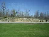
The
Canadian Shield, also called the
Laurentian Plateau, or
Bouclier Canadien (French), is a vast
geological shieldA shield is generally a large area of exposed Precambrian crystalline igneous and high-grade metamorphic rocks that form tectonically stable areas. In all cases, the age of these rocks is greater than 570 million years and sometimes dates back 2 to 3.5 billion years...
covered by a thin layer of
soilSoil is a natural body consisting of layers of mineral constituents of variable thicknesses, which differ from the parent materials in their morphological, physical, chemical, and mineralogical characteristics...
that forms the nucleus of the North American or Laurentia craton. It is an area mostly composed of
igneous rockIgneous rock is one of the three main rock types, the others being sedimentary and metamorphic rock. Igneous rock is formed through the cooling and solidification of magma or lava...
which relates to its long volcanic history. It has a deep, common, joined
bedrockIn stratigraphy, bedrock is the native consolidated rock underlying the surface of a terrestrial planet, usually the Earth. Above the bedrock is usually an area of broken and weathered unconsolidated rock in the basal subsoil...
region in Eastern and central
CanadaCanada is a North American country consisting of ten provinces and three territories. Located in the northern part of the continent, it extends from the Atlantic Ocean in the east to the Pacific Ocean in the west, and northward into the Arctic Ocean...
and stretches North from the
Great LakesThe Great Lakes are a collection of freshwater lakes located in northeastern North America, on the Canada – United States border. Consisting of Lakes Superior, Michigan, Huron, Erie, and Ontario, they form the largest group of freshwater lakes on Earth by total surface, coming in second by volume...
to the
Arctic OceanThe Arctic Ocean, located in the Northern Hemisphere and mostly in the Arctic north polar region, is the smallest and shallowest of the world's five major oceanic divisions...
, covering over half of Canada; it also extends South into the Northern reaches of the United States. Human population is scarce, and industrial development is minimal, while mining is very prevalent.
Geographical extent
The Canadian shield is
physiographic divisionThe physiographic regions of the world are a means of defining the Earth's landforms into distinct regions based upon classic 1916 three-tiered approach defining divisions, provinces, and sections...
, consisting of five smaller physiographic provinces, the
Laurentian UplandThe Laurentian Upland is a physiographic province which, when referred to as the "Laurentian Region," is recognized by Natural Resources Canada as one of five provinces of the larger Canadian Shield physiographic division...
,
Kazan RegionThe Kazan Region is a physiographic province of Canada and the part of the Canadian Shield that is located in northern Manitoba and Saskatchewan, and also in parts of the Northwest Territories and Nunavut.-Geography:...
, Davis, Hudson, and James. The shield extends into the United States as the
Adirondack MountainsThe Adirondack Mountains are a mountain range located in the northeastern part of New York, that runs through Clinton, Essex, Franklin, Fulton, Hamilton, Herkimer, Lewis, Saint Lawrence, Saratoga, Warren, and Washington counties....
(connected by the
Frontenac AxisThe Frontenac Axis is an exposed strip of Precambrian rock in Canada and the United States which links the Canadian Shield with the Adirondack mountain range in New York, an extension of the Laurentian mountains of Québec. The axis separates the St. Lawrence Lowlands and the Great Lakes Lowlands....
) and the Superior Upland. The Canadian Shield is U-shaped, but almost semi-circular, which yields an appearance of a
warriorA warrior is a person skilled in combat or warfare, especially within the context of a tribal or clan-based society that recognizes a separate warrior class.-Warrior classes in tribal culture:...
's shield, and is a subsection of the Laurentia
cratonA craton is an old and stable part of the continental lithosphere. Having often survived cycles of merging and rifting of continents, cratons are generally found in the interiors of tectonic plates. They are characteristically composed of ancient crystalline basement rock, which may be covered by...
signifying the area of greatest glacial impact (scraping down to bare rock) creating the thin soils.
The Canadian Shield is a collage of
ArcheanThe Archean , also spelled Archeozoic or Archæozoic) is a geologic eon before the Paleoproterozoic Era of the Proterozoic Eon, before 2.5 Ga ago. Instead of being based on stratigraphy, this date is defined chronometrically...
plates and accreted juvenile arc
terraneA terrane in geology is short-hand term for a tectonostratigraphic terrane, which is a fragment of crustal material formed on, or broken off from, one tectonic plate and accreted or "sutured" to crust lying on another plate...
s and
sedimentary basinThe term sedimentary basin is used to refer to any geographical feature exhibiting subsidence and consequent infilling by sedimentation. As the sediments are buried, they are subjected to increasing pressure and begin the process of lithification...
s of Proterozoic age that were progressively amalgamated during the interval 2.45 to 1.24 Ga, with the most substantial growth period occurring during the
Trans-Hudson orogenyThe Trans-Hudson orogeny, Trans-Hudsonian orogeny, Trans-Hudson orogen , or Trans-Hudson Orogen Transect , , was the major mountain building event that formed the Precambrian Canadian Shield, the North American craton , and the...
, between ca. 1.90 to 1.80 Ga. The Canadian Shield was the first part of North America to be permanently elevated above sea level and has remained almost wholly untouched by successive encroachments of the sea upon the continent. It is the Earth's greatest area of exposed Archaean rock. The
metamorphicMetamorphic rock is the transformation of an existing rock type, the protolith, in a process called metamorphism, which means "change in form". The protolith is subjected to heat and pressure causing profound physical and/or chemical change...
base rocksIn geology, rock or stone is a naturally occurring solid aggregate of minerals and/or mineraloids.The Earth's outer solid layer, the lithosphere, is made of rock. In general rocks are of three types, namely, igneous, sedimentary, and metamorphic...
are mostly from the
PrecambrianThe Precambrian is the name which describes the large span of time in Earth's history before the current Phanerozoic Eon, and is a Supereon divided into several eons of the geologic time scale...
Era (between 4.5 billion and 540 million years ago), and have been repeatedly uplifted and eroded. Today it consists largely of an area of low relief 300 to 610 m (984.3 to 2,001.3 ft) above sea level with a few
monadnockA monadnock or inselberg is an isolated rock hill, knob, ridge, or small mountain that rises abruptly from a gently sloping or virtually level surrounding plain...
s and low mountain ranges (including the
TorngatThe Torngat Mountains are a mountain range on the Labrador Peninsula at the northern tip of Newfoundland and Labrador and eastern Quebec. They are part of the Arctic Cordillera. This is the peninsula that separates Ungava Bay from the Atlantic Ocean....
and
Laurentian MountainsThe Laurentian Mountains are a mountain range in southern Quebec, Canada, north of the St. Lawrence River and Ottawa River, rising to a highest point of 1166 metres at Mont Raoul Blanchard, north east of Quebec City in the Reserve Faunique des Laurentides. The Gatineau, L'Assomption, Lièvre,...
) probably eroded from the plateau during the
CenozoicThe Cenozoic era is the current and most recent of the three Phanerozoic geological eras and covers the period from 65.5 mya to the present. The era began in the wake of the Cretaceous–Tertiary extinction event at the end of the Cretaceous that saw the demise of the last non-avian dinosaurs and...
era. During the
PleistoceneThe Pleistocene is the epoch from 2,588,000 to 11,700 years BP that spans the world's recent period of repeated glaciations. The name pleistocene is derived from the Greek and ....
epoch, continental ice sheets depressed the land surface (see
Hudson BayHudson Bay , sometimes called Hudson's Bay, is a large body of saltwater in northeastern Canada. It drains a very large area, about , that includes parts of Ontario, Quebec, Saskatchewan, Alberta, most of Manitoba, southeastern Nunavut, as well as parts of North Dakota, South Dakota, Minnesota,...
), scooped out thousands of lake basins, and carried away much of the region's soil.
When the
GreenlandGreenland is an autonomous country within the Kingdom of Denmark, located between the Arctic and Atlantic Oceans, east of the Canadian Arctic Archipelago. Though physiographically a part of the continent of North America, Greenland has been politically and culturally associated with Europe for...
section is included, the Shield is approximately circular bounded on the northeast by the northeast edge of Greenland, with
Hudson BayHudson Bay , sometimes called Hudson's Bay, is a large body of saltwater in northeastern Canada. It drains a very large area, about , that includes parts of Ontario, Quebec, Saskatchewan, Alberta, most of Manitoba, southeastern Nunavut, as well as parts of North Dakota, South Dakota, Minnesota,...
in the middle. It covers much of Greenland,
LabradorLabrador is the distinct, northerly region of the Canadian province of Newfoundland and Labrador. It comprises the mainland portion of the province, separated from the island of Newfoundland by the Strait of Belle Isle...
, most of
QuebecQuebec or is a province in east-central Canada. It is the only Canadian province with a predominantly French-speaking population and the only one whose sole official language is French at the provincial level....
north of the
St. Lawrence RiverThe Saint Lawrence is a large river flowing approximately from southwest to northeast in the middle latitudes of North America, connecting the Great Lakes with the Atlantic Ocean. It is the primary drainage conveyor of the Great Lakes Basin...
, much of
OntarioOntario is a province of Canada, located in east-central Canada. It is Canada's most populous province and second largest in total area. It is home to the nation's most populous city, Toronto, and the nation's capital, Ottawa....
including northern sections of the southern peninsula between the
Great LakesThe Great Lakes are a collection of freshwater lakes located in northeastern North America, on the Canada – United States border. Consisting of Lakes Superior, Michigan, Huron, Erie, and Ontario, they form the largest group of freshwater lakes on Earth by total surface, coming in second by volume...
, the
Adirondack MountainsThe Adirondack Mountains are a mountain range located in the northeastern part of New York, that runs through Clinton, Essex, Franklin, Fulton, Hamilton, Herkimer, Lewis, Saint Lawrence, Saratoga, Warren, and Washington counties....
of northern
New YorkNew York is a state in the Northeastern region of the United States. It is the nation's third most populous state. New York is bordered by New Jersey and Pennsylvania to the south, and by Connecticut, Massachusetts and Vermont to the east...
, the northernmost part of Lower
MichiganMichigan is a U.S. state located in the Great Lakes Region of the United States of America. The name Michigan is the French form of the Ojibwa word mishigamaa, meaning "large water" or "large lake"....
and all of Upper Michigan, northern
WisconsinWisconsin is a U.S. state located in the north-central United States and is part of the Midwest. It is bordered by Minnesota to the west, Iowa to the southwest, Illinois to the south, Lake Michigan to the east, Michigan to the northeast, and Lake Superior to the north. Wisconsin's capital is...
, northeastern
MinnesotaMinnesota is a U.S. state located in the Midwestern United States. The twelfth largest state of the U.S., it is the twenty-first most populous, with 5.3 million residents. Minnesota was carved out of the eastern half of the Minnesota Territory and admitted to the Union as the thirty-second state...
, the central/northern portions of
ManitobaManitoba is a Canadian prairie province with an area of . The province has over 110,000 lakes and has a largely continental climate because of its flat topography. Agriculture, mostly concentrated in the fertile southern and western parts of the province, is vital to the province's economy; other...
away from Hudson Bay, northern
SaskatchewanSaskatchewan is a prairie province in Canada, which has an area of . Saskatchewan is bordered on the west by Alberta, on the north by the Northwest Territories, on the east by Manitoba, and on the south by the U.S. states of Montana and North Dakota....
, a small portion of northeastern
AlbertaAlberta is a province of Canada. It had an estimated population of 3.7 million in 2010 making it the most populous of Canada's three prairie provinces...
, and the mainland northern Canadian territories to the east of a line extended north from the Saskatchewan/Alberta border (
Northwest TerritoriesThe Northwest Territories is a federal territory of Canada.Located in northern Canada, the territory borders Canada's two other territories, Yukon to the west and Nunavut to the east, and three provinces: British Columbia to the southwest, and Alberta and Saskatchewan to the south...
and
NunavutNunavut is the largest and newest federal territory of Canada; it was separated officially from the Northwest Territories on April 1, 1999, via the Nunavut Act and the Nunavut Land Claims Agreement Act, though the actual boundaries had been established in 1993...
). In total, it covers approximately 8000000 square kilometre. It covers even more area and stretches to the Western Cordillera in the west and
AppalachiansThe Appalachian Mountains #Whether the stressed vowel is or ,#Whether the "ch" is pronounced as a fricative or an affricate , and#Whether the final vowel is the monophthong or the diphthong .), often called the Appalachians, are a system of mountains in eastern North America. The Appalachians...
in the east, but the formations are still underground. The underlying rock structure does include Hudson Bay and the submerged area between North America and Greenland.
Geology
The multitude of rivers and lakes in the entire region is caused by the
watershedsA drainage basin is an extent or an area of land where surface water from rain and melting snow or ice converges to a single point, usually the exit of the basin, where the waters join another waterbody, such as a river, lake, reservoir, estuary, wetland, sea, or ocean...
of the area being so young and in a state of sorting themselves out with the added effect of
post-glacial reboundPost-glacial rebound is the rise of land masses that were depressed by the huge weight of ice sheets during the last glacial period, through a process known as isostasy...
. The Shield was originally an area of very large
mountainImage:Himalaya_annotated.jpg|thumb|right|The Himalayan mountain range with Mount Everestrect 58 14 160 49 Chomo Lonzorect 200 28 335 52 Makalurect 378 24 566 45 Mount Everestrect 188 581 920 656 Tibetan Plateaurect 250 406 340 427 Rong River...
s (about 12000 metres or 39,370.1 ft) with much volcanic activity, but over hundreds of million of years the area has been eroded to its current
topographicTopography is the study of Earth's surface shape and features or those ofplanets, moons, and asteroids...
appearance of relatively low relief. It has some of the oldest (extinct) volcanoes on the planet. It has over 150
volcanic beltA volcanic belt is a large volcanically active region. Other terms are used for smaller areas of activity, such as volcanic fields. Volcanic belts are found above zones of unusually high temperature where magma is created by partial melting of solid material in the Earth's crust and upper mantle....
s (now deformed and eroded down to nearly flat
plainIn geography, a plain is land with relatively low relief, that is flat or gently rolling. Prairies and steppes are types of plains, and the archetype for a plain is often thought of as a grassland, but plains in their natural state may also be covered in shrublands, woodland and forest, or...
s) whose bedrock ranges from 600 to 1200 million years old.
Each belt probably grew by the coalescence of accumulations erupted from numerous vents, making the tally of volcanoes reach the hundreds. Many of Canada's major ore deposits are associated with Precambrian volcanoes.
The
Sturgeon Lake CalderaSturgeon Lake Caldera is a large extinct caldera complex in Kenora District of Northwestern Ontario, Canada. It is one the world's best preserved mineralized Neoarchean caldera complexes, containing well-preserved mafic-intermediate pillow lavas, pillow breccias, hyaloclastite and peperites,...
in
Kenora District, OntarioKenora District is a district and census division in Northwestern Ontario, Canada. It was created in 1907 from parts of Rainy River District. It is, geographically, the largest division in that province; at 407,192.66 km2 it comprises almost 38 percent of the province's land area...
is one of the world's best preserved
mineralizedIn geology, mineralization is the hydrothermal deposition of economically important metals in the formation of ore bodies or "lodes".The first scientific studies of this process took place in Cornwall, United Kingdom by J.W.Henwood FRS and later by R.W...
NeoarcheanThe Neoarchean is a geologic era within the Archaean. It spans the period of time from —the period being defined chronometrically and not referenced to a specific level in a rock section on Earth...
calderaA caldera is a cauldron-like volcanic feature usually formed by the collapse of land following a volcanic eruption, such as the one at Yellowstone National Park in the US. They are sometimes confused with volcanic craters...
complexes, which is some 2.7 billion years old. The Canadian Shield also contains the
Mackenzie dike swarmThe Mackenzie dike swarm, also called the Mackenzie dikes, form a large igneous province in the western Canadian Shield of Canada. It is part of the larger Mackenzie Large Igneous Province and is one of more than three dozen dike swarms in various parts of the Canadian Shield...
, which is the largest
dike swarmA dike swarm or dyke swarm is a large geological structure consisting of a major group of parallel, linear, or radially oriented dikes intruded within continental crust. They consist of several to hundreds of dikes emplaced more or less contemporaneously during a single intrusive event and are...
known on
EarthEarth is the third planet from the Sun, and the densest and fifth-largest of the eight planets in the Solar System. It is also the largest of the Solar System's four terrestrial planets...
.
Mountains have deep roots and float on the denser
mantleThe mantle is a part of a terrestrial planet or other rocky body large enough to have differentiation by density. The interior of the Earth, similar to the other terrestrial planets, is chemically divided into layers. The mantle is a highly viscous layer between the crust and the outer core....
much like an
icebergAn iceberg is a large piece of ice from freshwater that has broken off from a snow-formed glacier or ice shelf and is floating in open water. It may subsequently become frozen into pack ice...
at
seaA sea generally refers to a large body of salt water, but the term is used in other contexts as well. Most commonly, it means a large expanse of saline water connected with an ocean, and is commonly used as a synonym for ocean...
. As mountains erode, their roots rise and are eroded in turn. The rocks that now form the surface of the
ShieldA shield is generally a large area of exposed Precambrian crystalline igneous and high-grade metamorphic rocks that form tectonically stable areas. In all cases, the age of these rocks is greater than 570 million years and sometimes dates back 2 to 3.5 billion years...
were once far below the Earth's surface.
The high pressures and temperatures at those depths provided ideal conditions for
mineralizationIn geology, mineralization is the hydrothermal deposition of economically important metals in the formation of ore bodies or "lodes".The first scientific studies of this process took place in Cornwall, United Kingdom by J.W.Henwood FRS and later by R.W...
. Although these mountains are now heavily eroded, many large mountains still exist in Canada's far north called the
Arctic CordilleraThe Arctic Cordillera is a vast, deeply dissected chain of mountain ranges extending along the northeastern flank of the Canadian Arctic Archipelago from Ellesmere Island to the northeasternmost part of the Labrador Peninsula in northern Labrador and northern Quebec, Canada...
. This is a vast deeply dissected
mountain rangeA mountain range is a single, large mass consisting of a succession of mountains or narrowly spaced mountain ridges, with or without peaks, closely related in position, direction, formation, and age; a component part of a mountain system or of a mountain chain...
, stretching from northernmost
Ellesmere IslandEllesmere Island is part of the Qikiqtaaluk Region of the Canadian territory of Nunavut. Lying within the Canadian Arctic Archipelago, it is considered part of the Queen Elizabeth Islands, with Cape Columbia being the most northerly point of land in Canada...
to the northernmost tip of
LabradorLabrador is the distinct, northerly region of the Canadian province of Newfoundland and Labrador. It comprises the mainland portion of the province, separated from the island of Newfoundland by the Strait of Belle Isle...
. The range's highest peak is
NunavutNunavut is the largest and newest federal territory of Canada; it was separated officially from the Northwest Territories on April 1, 1999, via the Nunavut Act and the Nunavut Land Claims Agreement Act, though the actual boundaries had been established in 1993...
's
Barbeau PeakBarbeau Peak is a mountain in Qikiqtaaluk, Nunavut, Canada. Located on Ellesmere Island within Quttinirpaaq National Park, it is the highest mountain in Nunavut, and the highest in eastern North America . The mountain was named in 1969 for Dr...
at 2616 metres (8,582.7 ft) above
sea levelMean sea level is a measure of the average height of the ocean's surface ; used as a standard in reckoning land elevation...
.
PrecambrianThe Precambrian is the name which describes the large span of time in Earth's history before the current Phanerozoic Eon, and is a Supereon divided into several eons of the geologic time scale...
rock is the major component of the
bedrockIn stratigraphy, bedrock is the native consolidated rock underlying the surface of a terrestrial planet, usually the Earth. Above the bedrock is usually an area of broken and weathered unconsolidated rock in the basal subsoil...
.
The North American craton is the bedrock forming the heart of the North American continent and the Canadian Shield is the largest exposed part of the craton's bedrock.
The Canadian Shield is part of an ancient continent called
ArcticaArctica was an ancient continent which formed approximately 2.5 billion years ago in the Neoarchean era.Arctica consisted of the Canadian and Siberian shields, and is now roughly situated in the Arctic around the current North Pole.- History :...
, which was formed about 2.5 billion years ago, during the
NeoarcheanThe Neoarchean is a geologic era within the Archaean. It spans the period of time from —the period being defined chronometrically and not referenced to a specific level in a rock section on Earth...
era. It was split into Greenland, Laurentia,
ScotlandScotland is a country that is part of the United Kingdom. Occupying the northern third of the island of Great Britain, it shares a border with England to the south and is bounded by the North Sea to the east, the Atlantic Ocean to the north and west, and the North Channel and Irish Sea to the...
,
SiberiaSiberia is an extensive region constituting almost all of Northern Asia. Comprising the central and eastern portion of the Russian Federation, it was part of the Soviet Union from its beginning, as its predecessor states, the Tsardom of Russia and the Russian Empire, conquered it during the 16th...
,
East AntarcticaEast Antarctica, also called Greater Antarctica, constitutes the majority of the Antarctic continent, lying on the Indian Ocean side of the Transantarctic Mountains...
and is now roughly situated in the
ArcticThe Arctic is a region located at the northern-most part of the Earth. The Arctic consists of the Arctic Ocean and parts of Canada, Russia, Greenland, the United States, Norway, Sweden, Finland, and Iceland. The Arctic region consists of a vast, ice-covered ocean, surrounded by treeless permafrost...
around the current
North PoleThe North Pole, also known as the Geographic North Pole or Terrestrial North Pole, is, subject to the caveats explained below, defined as the point in the northern hemisphere where the Earth's axis of rotation meets its surface...
.
Ecology
The current
surface expressionGeomorphology is the scientific study of landforms and the processes that shape them...
of the Shield is one of very thin soil lying on top of the
bedrockIn stratigraphy, bedrock is the native consolidated rock underlying the surface of a terrestrial planet, usually the Earth. Above the bedrock is usually an area of broken and weathered unconsolidated rock in the basal subsoil...
, with many bare outcrops. This arrangement was caused by severe
glaciationA glacier is a large persistent body of ice that forms where the accumulation of snow exceeds its ablation over many years, often centuries. At least 0.1 km² in area and 50 m thick, but often much larger, a glacier slowly deforms and flows due to stresses induced by its weight...
during the
ice ageAn ice age or, more precisely, glacial age, is a generic geological period of long-term reduction in the temperature of the Earth's surface and atmosphere, resulting in the presence or expansion of continental ice sheets, polar ice sheets and alpine glaciers...
, which covered the Shield and scraped the rock clean.
The lowlands of the Canadian Shield have a very dense soil that is not suitable for forestation, but it also contains many marshes and bogs. The rest of the region has coarse soil that does not retain moisture well and is frozen as
permafrostIn geology, permafrost, cryotic soil or permafrost soil is soil at or below the freezing point of water for two or more years. Ice is not always present, as may be in the case of nonporous bedrock, but it frequently occurs and it may be in amounts exceeding the potential hydraulic saturation of...
year round. Forests are not as dense in the north.
The Shield is covered in parts by vast boreal forests in the south that support natural
ecosystemAn ecosystem is a biological environment consisting of all the organisms living in a particular area, as well as all the nonliving , physical components of the environment with which the organisms interact, such as air, soil, water and sunlight....
s as well as a major
loggingLogging is the cutting, skidding, on-site processing, and loading of trees or logs onto trucks.In forestry, the term logging is sometimes used in a narrow sense concerning the logistics of moving wood from the stump to somewhere outside the forest, usually a sawmill or a lumber yard...
industry. This boreal forest area includes ecoregions such as the
Eastern Canadian Shield taigaThe Eastern Canadian Shield taiga is an ecoregion of Canada as defined by the World Wildlife Fund categorization system.-Setting:Located in northeastern Canada, this ecoregion covers a large part of northern Quebec and most of Labrador, reaching from Hudson Bay and James Bay in the west, across to...
that covers northern Quebec and most of Labrador, and the
Midwestern Canadian Shield forestsThe Midwestern Canadian Shield forests ecoregion, in the Taiga and Boreal forests Biome, are of northern Canada.-Setting:This is an area of rolling hills with lakes both small and large, wetlands, and rocky outcrops on the Canadian Shield in northern Saskatchewan, north-central Manitoba and...
that run westwards from
Northwestern OntarioNorthwestern Ontario is the region within the Canadian province of Ontario which lies north and west of Lake Superior, and west of Hudson Bay and James Bay. It includes most of subarctic Ontario. Its western boundary is the Canadian province of Manitoba, which disputed Ontario's claim to the...
.
HydrographicalHydrography is the measurement of the depths, the tides and currents of a body of water and establishment of the sea, river or lake bed topography and morphology. Normally and historically for the purpose of charting a body of water for the safe navigation of shipping...
drainage is generally poor, the effects of glaciation being one of the many reasons.
TundraIn physical geography, tundra is a biome where the tree growth is hindered by low temperatures and short growing seasons. The term tundra comes through Russian тундра from the Kildin Sami word tūndâr "uplands," "treeless mountain tract." There are three types of tundra: Arctic tundra, alpine...
typically prevails in the northern regions. Many mammals such as caribou,
white-tailed deerThe white-tailed deer , also known as the Virginia deer or simply as the whitetail, is a medium-sized deer native to the United States , Canada, Mexico, Central America, and South America as far south as Peru...
,
mooseThe moose or Eurasian elk is the largest extant species in the deer family. Moose are distinguished by the palmate antlers of the males; other members of the family have antlers with a dendritic configuration...
,
wolvesThe gray wolf , also known as the wolf, is the largest extant wild member of the Canidae family...
,
wolverineThe wolverine, pronounced , Gulo gulo , also referred to as glutton, carcajou, skunk bear, or quickhatch, is the largest land-dwelling species of the family Mustelidae . It is a stocky and muscular carnivore, more closely resembling a small bear than other mustelids...
s,
weaselWeasels are mammals forming the genus Mustela of the Mustelidae family. They are small, active predators, long and slender with short legs....
s,
minkThere are two living species referred to as "mink": the European Mink and the American Mink. The extinct Sea Mink is related to the American Mink, but was much larger. All three species are dark-colored, semi-aquatic, carnivorous mammals of the family Mustelidae, which also includes the weasels and...
,
otterThe Otters are twelve species of semi-aquatic mammals which feed on fish and shellfish, and also other invertebrates, amphibians, birds and small mammals....
s,
grizzly bearThe grizzly bear , also known as the silvertip bear, the grizzly, or the North American brown bear, is a subspecies of brown bear that generally lives in the uplands of western North America...
,
polar bearThe polar bear is a bear native largely within the Arctic Circle encompassing the Arctic Ocean, its surrounding seas and surrounding land masses. It is the world's largest land carnivore and also the largest bear, together with the omnivorous Kodiak Bear, which is approximately the same size...
s and
black bearsThe American black bear is a medium-sized bear native to North America. It is the continent's smallest and most common bear species. Black bears are omnivores, with their diets varying greatly depending on season and location. They typically live in largely forested areas, but do leave forests in...
are present. In the case of polar bears (
Ursus maritimus) the Shield area contains many of the
denningA maternity den, in the animal kingdom, is a lair where the mother gives birth and nurtures the young, when they are in a vulnerable life stage. While such dens are typically subterranean, they may also be snow caves or simply beneath rock ledges. Characteristically there is an entrance, and...
locations such as the
Wapusk National ParkWapusk National Park is Canada's 37th national park, established in 1996. The park is located in the Hudson Plains ecozone, 45 km south of Churchill in north-east Manitoba, Canada, on the shores of Hudson Bay. Access to the park is limited due to its remote location and an effort to preserve...
.
Mining and economics
The Shield is one of the world's richest areas in terms of
mineralA mineral is a naturally occurring solid chemical substance formed through biogeochemical processes, having characteristic chemical composition, highly ordered atomic structure, and specific physical properties. By comparison, a rock is an aggregate of minerals and/or mineraloids and does not...
oreAn ore is a type of rock that contains minerals with important elements including metals. The ores are extracted through mining; these are then refined to extract the valuable element....
s. It is filled with substantial deposits of
nickelNickel is a chemical element with the chemical symbol Ni and atomic number 28. It is a silvery-white lustrous metal with a slight golden tinge. Nickel belongs to the transition metals and is hard and ductile...
,
goldGold is a chemical element with the symbol Au and an atomic number of 79. Gold is a dense, soft, shiny, malleable and ductile metal. Pure gold has a bright yellow color and luster traditionally considered attractive, which it maintains without oxidizing in air or water. Chemically, gold is a...
,
silverSilver is a metallic chemical element with the chemical symbol Ag and atomic number 47. A soft, white, lustrous transition metal, it has the highest electrical conductivity of any element and the highest thermal conductivity of any metal...
, and
copperCopper is a chemical element with the symbol Cu and atomic number 29. It is a ductile metal with very high thermal and electrical conductivity. Pure copper is soft and malleable; an exposed surface has a reddish-orange tarnish...
. Throughout the Shield there are many mining towns extracting these minerals. The largest, and one of the best known, is Sudbury,
OntarioOntario is a province of Canada, located in east-central Canada. It is Canada's most populous province and second largest in total area. It is home to the nation's most populous city, Toronto, and the nation's capital, Ottawa....
. Sudbury is an exception to the normal process of forming minerals in the Shield since there is significant evidence that the
Sudbury BasinThe Sudbury Basin, also known as Sudbury Structure or the Sudbury Nickel Irruptive, is a major geologic structure in Ontario, Canada. It is the second-largest known impact crater or astrobleme on Earth, as well as one of the oldest....
is an ancient
meteoriteA meteorite is a natural object originating in outer space that survives impact with the Earth's surface. Meteorites can be big or small. Most meteorites derive from small astronomical objects called meteoroids, but they are also sometimes produced by impacts of asteroids...
impact craterIn the broadest sense, the term impact crater can be applied to any depression, natural or manmade, resulting from the high velocity impact of a projectile with a larger body...
. Ejecta from the meteorite impact was found in the Rove Formation in May 2007. The nearby, but less known
Temagami Magnetic AnomalyThe Temagami Magnetic Anomaly, also called the Temagami Anomaly or the Wanapitei Anomaly, is a large buried geologic structure in Ontario, Canada, stretching from Lake Wanapitei in the west to Bear Island in Lake Temagami....
, has striking similarities to the Sudbury Basin. This suggests it could be a second metal-rich impact crater.
In northeastern Quebec, the giant
Manicouagan ReservoirManicouagan Reservoir is an annular lake in central Quebec, Canada. The lake covers an area of 1,942 km², and its eastern shore is accessible via Route 389. The island in the centre of the lake is known as René-Levasseur Island, and its highest point is Mount Babel...
is the site of an extensive hydroelectric project (Manic-cinq, or Manic-5). This is one of the largest-known
meteoriteA meteorite is a natural object originating in outer space that survives impact with the Earth's surface. Meteorites can be big or small. Most meteorites derive from small astronomical objects called meteoroids, but they are also sometimes produced by impacts of asteroids...
impact craterIn the broadest sense, the term impact crater can be applied to any depression, natural or manmade, resulting from the high velocity impact of a projectile with a larger body...
s on Earth.
The
Flin Flon greenstone beltThe Flin Flon greenstone belt, also referred to as the Flin Flon-Snow Lake greenstone belt, is a Precambrian greenstone belt located in the central area of Manitoba and east-central Saskatchewan, Canada . It lies in the central portion of the Trans-Hudson orogeny and was formed by arc volcanism...
in central
ManitobaManitoba is a Canadian prairie province with an area of . The province has over 110,000 lakes and has a largely continental climate because of its flat topography. Agriculture, mostly concentrated in the fertile southern and western parts of the province, is vital to the province's economy; other...
and east-central
SaskatchewanSaskatchewan is a prairie province in Canada, which has an area of . Saskatchewan is bordered on the west by Alberta, on the north by the Northwest Territories, on the east by Manitoba, and on the south by the U.S. states of Montana and North Dakota....
is one of the largest
PaleoproterozoicThe Paleoproterozoic is the first of the three sub-divisions of the Proterozoic occurring between . This is when the continents first stabilized...
volcanic-hosted massive
sulfideA sulfide is an anion of sulfur in its lowest oxidation state of 2-. Sulfide is also a slightly archaic term for thioethers, a common type of organosulfur compound that are well known for their bad odors.- Properties :...
(VMS) districts in the world, containing 27
copperCopper is a chemical element with the symbol Cu and atomic number 29. It is a ductile metal with very high thermal and electrical conductivity. Pure copper is soft and malleable; an exposed surface has a reddish-orange tarnish...
-
zincZinc , or spelter , is a metallic chemical element; it has the symbol Zn and atomic number 30. It is the first element in group 12 of the periodic table. Zinc is, in some respects, chemically similar to magnesium, because its ion is of similar size and its only common oxidation state is +2...
-(
goldGold is a chemical element with the symbol Au and an atomic number of 79. Gold is a dense, soft, shiny, malleable and ductile metal. Pure gold has a bright yellow color and luster traditionally considered attractive, which it maintains without oxidizing in air or water. Chemically, gold is a...
) deposits from which more than 183 million tons of sulfide have been mined.
The Shield, particularly the portion in the
Northwest TerritoriesThe Northwest Territories is a federal territory of Canada.Located in northern Canada, the territory borders Canada's two other territories, Yukon to the west and Nunavut to the east, and three provinces: British Columbia to the southwest, and Alberta and Saskatchewan to the south...
, has recently been the site of several major
diamondIn mineralogy, diamond is an allotrope of carbon, where the carbon atoms are arranged in a variation of the face-centered cubic crystal structure called a diamond lattice. Diamond is less stable than graphite, but the conversion rate from diamond to graphite is negligible at ambient conditions...
discoveries. The
kimberliteKimberlite is a type of potassic volcanic rock best known for sometimes containing diamonds. It is named after the town of Kimberley in South Africa, where the discovery of an diamond in 1871 spawned a diamond rush, eventually creating the Big Hole....
pipes in which the diamonds are found are closely associated with cratons, which provide the deep
lithosphericThe lithosphere is the rigid outermost shell of a rocky planet. On Earth, it comprises the crust and the portion of the upper mantle that behaves elastically on time scales of thousands of years or greater.- Earth's lithosphere :...
mantleThe mantle is a part of a terrestrial planet or other rocky body large enough to have differentiation by density. The interior of the Earth, similar to the other terrestrial planets, is chemically divided into layers. The mantle is a highly viscous layer between the crust and the outer core....
required to stabilize diamond as a
mineralA mineral is a naturally occurring solid chemical substance formed through biogeochemical processes, having characteristic chemical composition, highly ordered atomic structure, and specific physical properties. By comparison, a rock is an aggregate of minerals and/or mineraloids and does not...
. The kimberlite eruptions then bring the diamonds from over 150 kilometres (93.2 mi) depth to the surface. Currently the
EkatiThe EKATI Diamond Mine is Canada's first surface and underground diamond mine. It is located north-east of Yellowknife, Northwest Territories, and about south of the Arctic circle, near Lac de Gras. EKATI is a joint venture between BHP Billiton Canada Inc...
and
DiavikThe Diavik Diamond Mine is a diamond mine in the North Slave Region of the Northwest Territories, Canada, about north of Yellowknife.It has become an important part of the regional economy, employing 700, grossing C$100 million in sales, and producing 8 million carats of diamonds annually...
mines are actively mining kimberlite diamonds.
See also
- Glacial history of Minnesota
The glacial history of Minnesota is most defined since the onset of the last glacial period, which ended some 10,000 years ago. Within the last million years, most of the Midwestern United States and much of Canada were covered at one time or another with an ice sheet. This continental glacier had...
- Platform
In geology, a platform is a continental area covered by relatively flat or gently tilted, mainly sedimentary strata, which overlie a basement of consolidated igneous or metamorphic rocks of an earlier deformation...
- Oldest rock
The oldest dated rocks on Earth, as an aggregate of minerals that have not been subsequently melted or disaggregated by erosion, are from the Archean Eon. Such rocks are exposed on the surface in very few places....
- Basement
In geology, the terms basement and crystalline basement are used to define the rocks below a sedimentary platform or cover, or more generally any rock below sedimentary rocks or sedimentary basins that are metamorphic or igneous in origin...
- Platform basement
- Volcanism in Canada
Volcanism of Canada has produced lava flows, lava plateaus, lava domes, cinder cones, stratovolcanoes, shield volcanoes, submarine volcanoes, calderas, diatremes, and maars, along with examples of more less common volcanic forms such as tuyas and subglacial mounds...
Further reading
External links