
List of Nevada state highways
Encyclopedia
The following is a list of all past and present state maintained highways and other regionally significant highways located in the U.S. state
of Nevada
. All active numbered highways (including Interstates, U.S. Routes and State Routes) in this list are maintained by the Nevada Department of Transportation
, except for the portions of Interstate 215
and where otherwise stated.
Nevada DOT has been deleting urban routes from the state highway system in recent years. This is especially apparent in the Carson City
, Las Vegas
and Reno metropolitan areas.
Like primary state routes, minor state routes are grouped sequentially in alphabetical order by county name.
. Routes were not assigned according to any particular numbering system, and sequential numbers were largely scattered throughout the state. Additionally, several suffixed highways, branching from the original parent route, were also designated.
During the 1976 renumbering of Nevada's state highway system, the majority of Nevada's two-digit routes were eliminated. Most of the old two-digit routes were reassigned to one or more of the new three-digit highway numbers (State Routes 28 and 88 were the only routes to permanently keep their pre-1976 numbers). Other routes were immediately eliminated from the state highway system, while a select few retained their pre-1976 numbers on official state maps into the 1980s only to be later reassigned or decommissioned.
U.S. state
A U.S. state is any one of the 50 federated states of the United States of America that share sovereignty with the federal government. Because of this shared sovereignty, an American is a citizen both of the federal entity and of his or her state of domicile. Four states use the official title of...
of Nevada
Nevada
Nevada is a state in the western, mountain west, and southwestern regions of the United States. With an area of and a population of about 2.7 million, it is the 7th-largest and 35th-most populous state. Over two-thirds of Nevada's people live in the Las Vegas metropolitan area, which contains its...
. All active numbered highways (including Interstates, U.S. Routes and State Routes) in this list are maintained by the Nevada Department of Transportation
Nevada Department of Transportation
The Nevada Department of Transportation is a government agency in the U.S. state of Nevada. NDOT is responsible for maintaining and improving Nevada's highway system, which includes U.S. highways and Interstate highways within the state's boundaries. The department is notable for its...
, except for the portions of Interstate 215
Interstate 215 (Nevada)
The Las Vegas Beltway is the name of the beltway route circling three-quarters of the Las Vegas Valley in southern Nevada. The Las Vegas Beltway carries two numerical designations. Approximately of the beltway, from its southern terminus at Interstate 515/U.S. Route 93/U.S...
and where otherwise stated.
Interstate Routes
EWLINE
|
EWLINE
|


Current
EWLINE
|
EWLINE
|
EWLINE
|


Former
These U.S. Routes were mostly replaced in Nevada by Interstate routes. All were officially removed from the state highway system by 1978.EWLINE
|
EWLINE
|
EWLINE
|


Primary routes (SR 28 - SR 490)
Primary state routes are assigned numbers based upon the county in which the majority of the route resides (or, in some instances, the county of the major town on the route). State routes in a county are grouped together with similar numbers, which are assigned in order based upon alphabetical order of county names. Three exceptions to this numbering scheme exist (SR 28, SR 88, and SR 140); all three of these routes have highway numbers that continue into the adjoining state.- Note: Shaded routes have been decommissioned. An asterisk indicates a route number that may not have been assigned.
EWLINE 
SR 28 Nevada State Route 28State Route 28 is a road that runs along the northeastern shore of Lake Tahoe. The road has been designated as the north piece of the Lake Tahoe–Eastshore Drive Scenic Byway as part of the National Scenic Byway program...
SR 88 Nevada State Route 88State Route 88 is a state highway in Douglas County, Nevada. It runs from California State Route 88 at the California state line along Woodfords Road to U.S. Route 395 in Minden. Prior to 1957, the highway existed as State Route 37...
SR 115 Nevada State Route 115State Route 115 is a state highway outside the city of Fallon, Nevada in the United States. Known as Harrigan Road, SR 115 is from SR 119 to SR 720 to Stillwater Avenue, paralleling U.S. Route 95....
SR 116 Nevada State Route 116State Route 116 is a state highway in Nevada, USA. It runs from U.S. Route 50 east of Fallon to its end by Stillwater....
SR 117 Nevada State Route 117State Route 117 is a state highway in Fallon, Churchill County, Nevada, USA. From its terminus with U.S. Route 50, it runs south and then east as Sheckler Road through southwest Fallon, towards its other terminus with U.S. Route 95....
SR 118 Nevada State Route 118State Route 118 is a state highway in Nevada, USA. It runs from State Route 115 in Fallon as Wildes Road east to Pasture Road. From there it heads south along Pasture Road to State Route 720 , all within the nearby Naval Air Station Fallon....
SR 119 Nevada State Route 115State Route 115 is a state highway outside the city of Fallon, Nevada in the United States. Known as Harrigan Road, SR 115 is from SR 119 to SR 720 to Stillwater Avenue, paralleling U.S. Route 95....
SR 120 Nevada State Route 120State Route 120 is a state highway in Nevada, USA. It connects U.S. Route 95 to State Route 119 just outside of Naval Air Station Fallon....
SR 121 Nevada State Route 121State Route 121 is a state highway in Nevada, USA. It spurs from U.S. Route 50, east of Fallon, north to a local highway, Settlement Road in Dixie, with the moniker of Dixie Valley Road. Route 121 was assigned on December 31, 1991 and heads through Churchill County.- Route description :Nevada...
SR 140 Nevada State Route 140State Route 140 is a two-lane state highway in Humboldt County, Nevada. It serves a sparsely-populated section of the state, connecting northwestern Nevada to southern Oregon...
SR 142* SR 143* 
SR 144 SR 145* 
SR 146 Nevada State Route 146State Route 146 is a major east–west route in Southern Nevada. It begins at the Exit 27 interchange on Interstate 15 south of the Las Vegas Strip and ends at the Pecos Road interchange on Interstate 215 in Henderson...
SR 147 Nevada State Route 147State Route 147 is a short distance state highway located southern Nevada. It is signed as Lake Mead Boulevard and runs from Interstate 15 in North Las Vegas east to the border of the Lake Mead National Recreation Area....SR 148* SR 153* 
SR 156 Nevada State Route 156State Route 156 , also known as Lee Canyon Road, is a state highway in Clark County, Nevada. The road is one of two highways connecting U.S...
SR 157 Nevada State Route 157State Route 157 , also known as Kyle Canyon Road, is a state highway in Clark County, Nevada. The highway connects the Las Vegas area to the recreational areas of Mount Charleston in the Spring Mountains....
SR 158 Nevada State Route 158State Route 158 , also known as Deer Creek Road, is a state highway in Clark County, Nevada. The route connects Kyle Canyon Road to Lee Canyon Road in the Spring Mountains, in the Humboldt-Toiyabe National Forest....
SR 159 Nevada State Route 159State Route 159 is a east–west highway in southern Nevada, providing access to Red Rock Canyon and serving as a thoroughfare in the Las Vegas metropolitan area. A portion of the west end of the route is designated a Nevada Scenic Byway....EWLINE 
SR 160 Nevada State Route 160State Route 160 is a state highway in southern Nevada, USA. It connects the southern Las Vegas Valley to U.S. Route 95 northwest of the city via the Pahrump Valley...
SR 161 Nevada State Route 161State Route 161 is a state highway in Clark County, Nevada. It is known as Goodsprings Road, connecting the town of Goodsprings to Interstate 15 at Jean. The route was part of State Route 53 prior to 1976.-Route description:...
SR 163 Nevada State Route 163State Route 163 , often referred to as the Laughlin Highway, is a state highway in southern Clark County, Nevada. The route connects the town of Laughlin to the rest of the state via U.S. Route 95 ....
SR 164 Nevada State Route 164State Route 164 is a state highway in southern Clark County, Nevada. The route, along with an unnumbered California road, connects U.S. Route 95 in Nevada to Interstate 15 in California just south of Primm, via the small town of Nipton, California...
SR 165 Nevada State Route 165State Route 165 is a state highway near the southern end of the U.S. state of Nevada. The road connects the town of Nelson to U.S. Route 95. The road originated in the 1940s and was one section of former State Route 60 until the 1970s....
SR 166 Nevada State Route 166-Route description:SR 166 starts at U.S. Route 93 near Boulder City inside the Lake Mead National Recreation Area. The road goes north along Lake Mead's shore. It quickly encounters a toll booth where motorists pay to enter the Recreation Area. Several roads branch off SR 166 and lead to marinas...
SR 167 Nevada State Route 167State Route 167 was a road that ran along the west shore of Lake Mead.-Route description:SR 167 started at SR 147 inside the Lake Mead National Recreation Area. The road went east along Lake Mead's shore. It eventually turned north near Echo Bay. A road branched SR 167 and led to Echo Bay Airport,...
SR 168 Nevada State Route 168State Route 168 is a state highway in Clark County, Nevada, USA. Also known as Glendale/Moapa Road, the highway connects Interstate 15 at Glendale to U.S. Route 93 northwest...
SR 169 Nevada State Route 169State Route 169 is a state highway in Nevada, USA. It connects the Lake Mead National Recreation Area as well as the communities of Overton, Logandale, and the rest of the Moapa Valley to Interstate 15. While not part of SR 169 proper, the Valley of Fire Road and White Domes Road, within Valley...
SR 170 Nevada State Route 170State Route 170 is the designation given to Riverside Road from Interstate 15 Exit 112 to former SR 144 in downtown Mesquite. All of Route 170 was, at one time, U.S. Route 91, which used to stretch from Sweetgrass, Montana to Long Beach, California. It is also called Bunkerville Road and Riverside...
SR 171 SR 172 Nevada State Route 172State Route 172 is a state highway in Clark County, Nevada. The route provides access to Hoover Dam from U.S. Route 93 .-Route description:...
SR 206 Nevada State Route 206State Route 206 is a state highway in Douglas County, Nevada, United States. It runs northwest from State Route 88 near the California state line along Foothill Road to Genoa, and then turns east on Genoa Lane to end at U.S. Route 395.-History:...
SR 207 Nevada State Route 207State Route 207 is a state highway in Douglas County, Nevada. Commonly known as the Kingsbury Grade, it is one of three Nevada highways that connects the western edge of the state to the Lake Tahoe region. The route was part of State Route 19 prior to 1976.-Route description:State Route 207 begins...
SR 208 Nevada State Route 208State Route 208 is a state highway within the counties of Douglas and Lyon in Nevada, USA. It connects U.S. Route 395 north of Topaz Lake to Alternate U.S. Route 95 in Yerington. The road serves as the primary transportation corridor of Smith Valley and is Main street in Yerington...
SR 221 Nevada State Route 221State Route 221 is a state highway within Carlin, Elko County, Nevada, USA. The route, cosigned with Interstate 80 Business along its length, was once part of the former routing of U.S. Route 40, which I-80 has mostly replaced....
SR 223 Nevada State Route 223State Route 223 is a state highway cosigned with Interstate 80 Business in Wells, Nevada, USA. It is routed onto Humboldt Avenue and Sixth Street from Interstate 80 to U.S. Route 93. A ramp east on westbound I-80, also part of Sixth Street, connects to its eastern terminus with US 93, completing...
SR 224 
SR 225 Nevada State Route 225State Route 225, commonly known locally as Mountain City Highway, is a state highway in Elko County, Nevada, United States. It connects the city of Elko and Interstate 80 with southwestern Idaho, via Idaho State Highway 51 to Mountain Home and Interstate 84....
SR 226 Nevada State Route 226State Route 226 is a state highway in Elko County, Nevada, USA. It spurs off State Route 225, north of Elko, and heads north for to Deep Creek....
SR 227 Nevada State Route 227State Route 227, commonly known as Lamoille Highway, is a state highway in Elko County, in northeastern Nevada in the western United States. From its terminus with State Route 535, it connects the city of Elko with the nearby communities of Spring Creek and Lamoille, to the southeast. For most...
SR 228 Nevada State Route 228State Route 228, commonly known locally as Jiggs Highway, is a state highway in Elko County, Nevada, USA. It is a spur route off of Lamoille Highway , southeast of Elko, and connects to the community of Jiggs....EWLINE 
SR 229 Nevada State Route 229State Route 229, or Halleck and Secret Pass Road, is a state highway in Elko County, Nevada, USA. It is a routing from Interstate 80 around Halleck, heading south through Secret Pass, to where it meets Ruby Valley Road . From there it heads northeast to U.S. Route 93.-References:*...
SR 230 Nevada State Route 230State Route 230 is a state highway in the U.S. state of Nevada. It is a southern loop route off of Interstate 80 between Elko and Wells, serving the communities of Deeth and Welcome. The road follows a "U" shaped path entirely within Elko County, nearing Humboldt National Forest...
SR 231 Nevada State Route 231Angel Lake Road is a state highway in Elko County, Nevada, USA. It serves to connect Interstate 80 in Wells to nearby Angel Lake in the north of the East Humboldt Range....
SR 232 Nevada State Route 232State Route 232 is a state highway in Elko County, Nevada, USA. As Clover Valley Road, it parallels U.S. Route 93 for , originates from Steeles Creek, and meets Route 93 at its end....
SR 233 Nevada State Route 233State Route 233 is a state highway in rural Elko County, Nevada, USA. The highway follows the routes of the First Transcontinental Railroad and California Trail from Interstate 80 to the Utah state line...
SR 264 Nevada State Route 264State Route 264 is a state highway in Esmeralda County, Nevada, USA. It connects California State Route 266 to U.S. Route 6 via the town of Dyer, Nevada. The majority of the route is known as Fish Lake Valley Road, with the northern portion referred to as the Dicalite Cutoff...
SR 265 Nevada State Route 265State Route 265 is a state highway in Esmeralda County, Nevada, USA. Referred to as Silver Peak Road, it connects the community of Silver Peak to U.S. Route 6 and U.S. Route 95 . The route formerly existed as State Route 47.-Route description:SR 265 starts at Silver Peak Road just southwest of...
SR 266 Nevada State Route 266State Route 266 is a state highway in Esmeralda County, Nevada, USA. It connects the routing of California State Route 266 east to U.S. Route 95 via the town of Lida...
SR 267 Nevada State Route 267State Route 267 is a state highway in Nevada, USA. Known as Scotty's Castle Road, the highway connects Death Valley National Park to U.S. Route 95. The route was previously designated State Route 72.-Route description:...
SR 278 Nevada State Route 278State Route 278 is a state highway in Nevada, USA. It runs from U.S. Route 50 near Eureka north to Interstate 80 in Carlin....
SR 289 Nevada State Route 289State Route 289 is a state highway in Humboldt County, Nevada. The route serves the town of Winnemucca, and is cosigned with Interstate 80 Business for part of its length. The highway was formerly part of State Route 1 and later U.S...
SR 290 Nevada State Route 290State Route 290 is a state highway in Humboldt County, Nevada. It serves to connect U.S. Route 95 to the community of Paradise Valley. The road was originally established as State Route 8B by the early 1930s.-Route description:...
SR 291* 
SR 292 Nevada State Route 292State Route 292 is a short state highway in Humboldt County, Nevada serving the town of Denio.-Route description:State Route 292 begins in Denio Junction at an intersection with State Route 140. From there, the highway heads north a distance of nearly to serve the Denio community...
SR 293 Nevada State Route 293State Route 293 is an unsigned state highway in Humboldt County, Nevada. It connects the Kings River Valley to U.S. Route 95 at the town of Orovada.-Route description:...
SR 294 Nevada State Route 294State Route 294 is a state highway in Humboldt County, Nevada. It connects Winnemucca to the Grass Valley area south of the town.-Route description:State Route 294 begins on Grass Valley Road at the Pershing–Humboldt county line...
SR 304 Nevada State Route 304State Route 304 is a state highway in Lander County, Nevada. The road is the main street through the town of Battle Mountain, and is also designated Interstate 80 Business. The highway was part of State Route 1 and U.S...
SR 305 Nevada State Route 305State Route 305 is a state highway in Lander County, Nevada. It is the only state highway to connect the southern and northern areas of the county. It runs north from U.S. Route 50 at Austin to Battle Mountain, where it crosses Interstate 80 and ends at State Route 304.-Route description:State...
SR 306 Nevada State Route 306State Route 306 is a state highway in northern Nevada, USA. It connects the mining area of Gold Acres in Lander County to Interstate 80 at the Beowawe Interchange near Beowawe in Eureka County via Crescent Valley...
SR 317 Nevada State Route 317State Route 317 is a state highway in Lincoln County, Nevada, USA. It connects the ghost town of Elgin north to U.S. Route 93 in the city of Caliente.-History:...
SR 318 Nevada State Route 318State Route 318 runs from U.S. Route 93 at Crystal Springs, Nevada north to a location on U.S. Route 6 approximately southwest of Ely. It is often used as a shortcut between Ely and Las Vegas....
SR 319 Nevada State Route 319State Route 319 is a state highway in Lincoln County, Nevada, USA. The route connects the town of Panaca to Modena, Utah. SR 319 has been part of the state highway system since at least 1932, and was part of the longer State Route 25 prior to the late 1970s.-Route description:State Route 319...EWLINE 
SR 320 Nevada State Route 320State Route 320, the Caselton Mine Loop, is an outer loop route of U.S. Route 93 It is a state highway in Lincoln County, Nevada, USA, connecting US 93 on both sides through the Caselton Mining District.- Major intersections :The entire route is located in Lincoln County...
SR 321 Nevada State Route 321State Route 321 is a state highway in Lincoln County, Nevada, USA.- Route description :This loop route connects U.S. Route 93 on both sides via the town of Pioche, Nevada. Another nearby loop route of US 93, State Route 320, bypasses Pioche altogether and instead serves the Caselton Mine...
SR 322 Nevada State Route 322State Route 322 is a state highway in Lincoln County, Nevada, USA. From State Route 321 in Pioche, State Route 322 passes by U.S. Route 93 and heads to the entrance of Spring Valley State Park via the community of Ursine. The route was previously known as State Route 85.-Route description:The...
SR 338 Nevada State Route 338State Route 338 is a state highway in Lyon County, Nevada, USA. It connects the towns of Smith and Wellington to the California state line north of Bridgeport, California...
SR 339 
SR 340 Nevada State Route 340State Route 340 is a short state highway, running from west to east between State Route 339 and State Route 208, in Yerington, Nevada, USA.- Major intersections :The entire route is located in Yerington, Lyon County.-References:*...
SR 341 Nevada State Route 341State Route 341 is a state highway in western Nevada connecting US 50 near Dayton to Reno via Virginia City. Commonly known as the Virginia City Highway, or Geiger Grade north of Virginia City, the route has origins dating back to the 1860s.-Route description:Nevada State Route 341 begins at a...
SR 342 Nevada State Route 342State Route 342 is a short state highway in Nevada, USA. It is a loop route of State Route 341, running north through the communities of Silver City and Gold Hill before returning to State Route 341 near Virginia City. This highway is a historic route, dating back to the Comstock Lode of the 1860s...
SR 359 Nevada State Route 359State Route 359 is a state highway in Mineral County, Nevada, USA. It starts from where California State Route 167 ends at the California stateline and continues the road on north to U.S. Route 95 in Hawthorne.-Major intersections:...
SR 360 Nevada State Route 360State Route 360 is a state highway in the southern portion of Mineral County, Nevada, USA. The route connects the former town of Basalt to the rest of Mineral County...
SR 361 Nevada State Route 361State Route 361 is a state highway in central Nevada, USA. The highway serves the town of Gabbs following Gabbs Valley Road through the extreme northwestern tip of Nye County. Gabbs is isolated from the rest of the County, requiring travel on SR 361 through other counties in order to reach any...
SR 362 Nevada State Route 362U.S. Route 95 Truck is a truck route of US 95 in Mineral County, Nevada, in the United States. It serves as a bypass route for trucks taking US 95 past Hawthorne in either direction, as US 95 itself goes through that community...
SR 372 Nevada State Route 372State Route 372 is a short state highway in Nye County, Nevada, USA. The route connects the town of Pahrump to the southeast side of Death Valley National Park via California State Route 178...
SR 373 Nevada State Route 373State Route 373 is a state highway in Nye County, Nevada, USA. It is a highway connecting California State Route 127 to U.S. Route 95, providing southern Nye County access to the eastern areas of Death Valley National Park.-Route description:...
SR 374 Nevada State Route 374State Route 374 is a state highway in Nye County, Nevada, United States. It serves as Nevada's gateway to Death Valley National Park, connecting the park to Beatty...
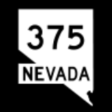
SR 375 Nevada State Route 375State Route 375 is a state highway in south-central Nevada in the United States. The highway stretches from State Route 318 at Crystal Springs northwest to U.S. Route 6 at Warm Springs. The route travels through mostly unoccupied desert terrain, with much of its alignment paralleling the...
SR 376 Nevada State Route 376State Route 376 is a state highway in central Nevada in the United States. It connects U.S. Route 6 near Tonopah north to U.S. Route 50 near Austin...
SR 377 Nevada State Route 377State Route 377 is a state highway in Nye County, Nevada, USA. The route connects the town of Manhattan to State Route 376. The highway previously existed as State Route 69.-Route description:...
SR 378 Nevada State Route 378State Route 378 was a state highway in Nye County, Nevada, United States. It connected the community of Round Mountain to State Route 376. The highway originated as State Route 70 in 1941 and was later renumbered to State Route 92 before becoming SR 378 in 1976...
SR 379 Nevada State Route 379State Route 379 covers Duckwater Road, a state highway in Nye County, Nevada, USA. The route serves the Duckwater Indian Reservation, connecting the community of Duckwater to U.S. Route 6 at Currant...
SR 396 Nevada State Route 396State Route 396 is a state highway in Pershing County, Nevada serving the city of Lovelock. The highway forms a portion of Interstate 80 Business within the city of Lovelock, and previously carried the alignment of former U.S. Route 40....EWLINE 
SR 397 
SR 398 Nevada State Route 398State Route 398 is a state highway in Pershing County, Nevada serving the city of Lovelock. Part of the highway is former State Route 66.-Route description:thumb|SR 398 on Main Street in Lovelock...
SR 399 Nevada State Route 399State Route 399 is an road that connects Eagle Picher Mine to Lovelock, the nearest town.-Route description:SR 399's west terminus is at Eagle Picher Mine, which mines diatomite. SR 399 continues northwest and intersects Seven Troughs Road. SR 399 goes southwest on Seven Troughs Road until it...
SR 400 
SR 401 
SR 425 Nevada State Route 425State Route 425 is a state highway that serves the town of Verdi in Washoe County, Nevada. Interstate 80 Business is routed along the highway and extends beyond the terminus of the state route. SR 425 was formerly a part of State Route 1 and U.S...
SR 426 Nevada State Route 426State Route 426 is a short, unsigned state highway in the South Meadows area of Reno in Washoe County, Nevada. It comprises a short segment of South Meadows Parkway.-Route description:...
SR 427 Nevada State Route 427State Route 427 is a state highway in the U.S. state of Nevada. It connects the community of Wadsworth in eastern Washoe County to the city of Fernley in western Lyon County. SR 427 comprises the former routing of U.S. Route 40 through the towns it serves...
SR 428 Nevada State Route 428State Route 428 is a former highway in Washoe County, Nevada. It followed Eastlake Boulevard through New Washoe City and along the east side of Washoe Lake, providing access to Washoe Lake State Park. The road was formerly known as State Route 3B.-Route description:State Route 428 began at U.S...
SR 429 Nevada State Route 429State Route 429 is a rural state highway located in southern Washoe County, Nevada. It is named Bowers Mansion Road and is a former alignment of U.S. Route 395 .-Route description:...
SR 430 Nevada State Route 430State Route 430 is a major north–south state highway in Washoe County, Nevada which currently exists as two separate sections. South of Reno, the route follows the Carson-Reno Highway, and currently overlaps U.S. Route 395. In Reno, the highway follows Virginia Street, the primary...
SR 431 Nevada State Route 431State Route 431 , commonly known as the Mount Rose Highway, is a 24.4 mile two lane highway in Washoe County, Nevada that connects Incline Village-Crystal Bay at Lake Tahoe with Reno. The highway, a Nevada Scenic Byway, takes its name from Mount Rose, which lies just off the highway...
SR 443 Nevada State Route 443State Route 443 is a state highway in the Reno-Sparks metropolitan area of the state of Nevada. It is the main connection between the city of Reno and the community of Sun Valley to the north...
SR 445 Nevada State Route 445State Route 445 is a state highway in Washoe County, Nevada. The route follows Pyramid Way, a major thoroughfare in the city of Sparks, and connects the Reno metropolitan area to Pyramid Lake . The route is designated a Nevada Scenic Byway....
SR 446 Nevada State Route 446State Route 446 , is a state route that runs from SR 445 to SR 447 ....
SR 447 
SR 485 Nevada State Route 485State Route 485 was a state highway in White Pine County, Nevada. It provided access to the town of Ruth.-Route description:SR 485 started at U.S. Route 50 , about west of Ely. SR 485 ran west to the mining town of Ruth...
SR 487 Nevada State Route 487State Route 487 follows Baker Road, an east–west state highway in White Pine County, Nevada. The State Route designation is applied to the portion of Baker Road from Cattleguard at UT/NV State line to US 6...
SR 488 Nevada State Route 488State Route 488 is an east–west state highway which covers Lehman Caves Road. The State Route designation is applied to the Lehman Caves Road from the entrance of Great Basin National Park near Lehman Caves Visitor Center Entrance to State Route 487 . It was designated as a Nevada Scenic...
SR 489 Nevada State Route 489State Route 489 was a road that connected the near ghost town of Cherry Creek to U.S. Route 93. The road was decommissioned at some point after 1978.-Route description:...
SR 490 Nevada State Route 490State Route 490 covers Ely Prison Road, an east–west road. The State Route designation is applied to the Ely Prison Road From Nevada Correctional Facility to US 93....
Urban routes (SR 500 - SR 686)
Urban state routes, numbered in the 500's and 600's, typically lie on arterial roadways in larger metropolitan areas. Urban state routes are grouped together sequentially, assigned by alphabetical order of the name of the city in which they primarily reside.Nevada DOT has been deleting urban routes from the state highway system in recent years. This is especially apparent in the Carson City
Carson City, Nevada
The Consolidated Municipality of Carson City is the capital of the state of Nevada. The words Consolidated Municipality refer to a series of changes in 1969 which abolished Ormsby County and merged all the settlements contained within its borders into Carson City. Since that time Carson City has...
, Las Vegas
Las Vegas metropolitan area
The Las Vegas Valley is the heart of the Las Vegas-Paradise, NV MSA also known as the Las Vegas–Paradise–Henderson MSA which includes all of Clark County, Nevada, and is a metropolitan area in the southern part of the U.S. state of Nevada. The Valley is defined by the Las Vegas Valley landform, a ...
and Reno metropolitan areas.
- Note: Shaded routes have been decommissioned.
EWLINE 
SR 500 
SR 501 Nevada State Route 501State Route 501 ran from US 93 to State Route 500 near City Hall in Boulder City via Adams Boulevard and Utah Street....
SR 511 Nevada State Route 511State Route 511 was a short state highway that followed West Washington Street in Carson City, Nevada. It has been removed from the state highway system.-Route description:...
SR 512 Nevada State Route 512State Route 512 was a state highway in Carson City, Nevada. It connected Kings Canyon west of Carson City to the state capitol using various city streets. The route dates to the mid-19th century, as part of a wagon trail linking Lake Tahoe and Carson City that was later incorporated into the...
SR 513 Nevada State Route 513State Route 513 was a short state highway in Carson City, Nevada. The route was originally part of State Route 65, a longer highway that served the eastern outskirts of the city...
SR 516 Nevada State Route 516State Route 516 was a state highway following Ormsby Boulevard and Winnie Lane in Carson City, Nevada. The route is no longer a state highway.-Route description:...
SR 518 Nevada State Route 518State Route 518 is a short state highway in Carson City, Nevada serving the state's Stewart Complex. The route originated as State Route 36.-Route description:...
SR 520 Nevada State Route 520State Route 520 was a short state highway in Carson City, Nevada. The route served the central portion of the city, providing access to several government buildings in the capitol district.-Route description:...
SR 525 Nevada State Route 525State Route 525 is a short state highway in Carson City, Nevada. It covered a portion of College Parkway and all of Airport Road in the northern part of the city. The road was removed from the state highway system in 2011.-Route description:...
SR 529 Nevada State Route 529State Route 529 is a state highway in Carson City, Nevada, USA. The route follows Carson Street, the principal north–south arterial through the city. The southern portion of the unsigned highway currently carries U.S. Route 50 and U.S. Route 395 through the city, while the remainder of the...
SR 530 Nevada State Route 530State Route 530 was a state highway in Carson City, Nevada. It followed a portion of William Street and was formerly signed as part of U.S. Route 50 . The route is no longer a state highway.-Route description:...EWLINE 
SR 531 Nevada State Route 531State Route 531 was a state highway in Carson City, Nevada. It followed a portion of College Parkway in the northern part of the city. Created by 1995, the highway was turned over to city control in 2011.-Route description:...
SR 535 Nevada State Route 535State Route 535, more commonly known as Idaho Street, is a short state highway through downtown Elko, Nevada. It is also signed as Interstate 80 Business. It was formerly designated U.S. Highway 40....
SR 562 Nevada State Route 562State Route 562 is an east–west highway in the Las Vegas area that currently exists in two sections. Both segments of the route comprise portions of Sunset Road.-Route description:...
SR 564 Nevada State Route 564State Route 564 is an east–west highway in Henderson, Nevada connecting the southern Las Vegas area to Lake Mead. The route is known as Lake Mead Parkway.-Route description:...
SR 573 Nevada State Route 573State Route 573 comprises two sections of Craig Road, a major east–west arterial roadway in the Las Vegas valley.-Route description:The first section of SR 573 begins at the Craig Road interchange with U.S. Route 95...
SR 574 Nevada State Route 574State Route 574 is a major east–west section line arterial roadway in the Las Vegas Valley of Nevada. It comprises approximately of Cheyenne Avenue in northern Las Vegas and North Las Vegas.-Route description:...
SR 578 Nevada State Route 578State Route 578 is a short state highway in Clark County, Nevada. It comprises a portion of Washington Avenue in Las Vegas.-Route description:...
SR 579 Nevada State Route 579State Route 579 is a state highway in Clark County, Nevada. It follows a portion of Bonanza Road near the downtown area of Las Vegas. The route encompasses a small portion of former State Route 5 and the entirety of former State Route 5A, and also carried U.S...
SR 582 Nevada State Route 582State Route 582 is a major highway in the Las Vegas valley. It connects Downtown Las Vegas with Henderson and Boulder City to the southeast. The highway is primarily known as Boulder Highway, but is named Fremont Street within the Las Vegas city limits. The highway is the former route of U.S....
SR 589 Nevada State Route 589State Route 589 comprises a large portion of Sahara Avenue, a major east–west section line road in the Las Vegas area. The road is named after the Sahara Hotel and Casino which is located on Las Vegas Boulevard where it intersects with Sahara Avenue.-Route description:SR 589 begins in...EWLINE 
SR 591 
SR 592 Nevada State Route 592State Route 592 is a east–west highway section line arterial in the Las Vegas metropolitan area. The highway currently exists in two separate sections on Flamingo Road...
SR 593 
SR 594 
SR 595 Nevada State Route 595State Route 595 comprises a portion of Rainbow Boulevard, a north–south section line arterial in the Las Vegas metropolitan area.-State route description:...
SR 596 Nevada State Route 596State Route 596 is a section line arterial that runs north and south through the Las Vegas area.-Route description:State Route 596 begins at Tropicana Avenue and runs north along Jones Boulevard for to its terminus at Smoke Ranch Road.Jones Boulevard begins at the intersection of West Erie Ave...
SR 599 Nevada State Route 599State Route 599 is a state highway in Clark County, Nevada. The route follows Rancho Drive, a major arterial connecting downtown Las Vegas to the northwest part of the city. Much of SR 599 was previously designated as U.S. Route 95 prior to completion of the Las Vegas Expressway.-Route...
SR 601 
SR 602 Nevada State Route 602State Route 602 is a short state highway in Clark County, Nevada. Located entirely within the downtown area of Las Vegas, it comprises a small section of Casino Center Boulevard...
SR 604 Nevada State Route 604Las Vegas Boulevard is a major road in Las Vegas Valley of Nevada, best known for the Las Vegas Strip and its casinos. Formerly carrying US 91, the main highway between Los Angeles and Salt Lake City, it has been bypassed by Interstate 15, and serves mainly local traffic with some sections...EWLINE 
SR 605 Nevada State Route 605State Route 605 was a north–south state highway in the Las Vegas urban area. SR 605 comprised a portion of Paradise Road.-Route description:...
SR 607 Nevada State Route 607State Route 607 was a major north–south section line arterial serving the Las Vegas metropolitan area including Las Vegas, Nevada and North Las Vegas. The highway followed Eastern Avenue in Las Vegas and continued on Civic Center Drive in North Las Vegas.-Route description:State Route 607...
SR 610 Nevada State Route 610State Route 610 is a state highway in Clark County, Nevada. It comprises a small portion of Lamb Boulevard in the northeastern Las Vegas Valley.-Route description:...
SR 612 Nevada State Route 612State Route 612 is a state highway in Clark County, Nevada. It comprises about miles of the major north–south section line arterial Nellis Boulevard in the eastern Las Vegas Valley.-Route description:...
SR 646 Nevada State Route 646State Route 646 was a very short state highway in Washoe County, Nevada. Previously part of State Route 32A, the route was removed from the state highway system by 2011.-Route description:...
SR 647 Nevada State Route 647State Route 647 is the state highway designation of former US 40 through Reno and Sparks, Nevada....
SR 648 Nevada State Route 648State Route 648 runs from Kietzke Lane east along East Second Street in Reno and Glendale Avenue in Sparks to South McCarran Boulevard .- Route description :SR 648 begins at State Route 667 in Reno at Kietzke Lane...
SR 650 
SR 651 
SR 653 Nevada State Route 653State Route 653 is an east–west state highway in Nevada serving Reno.-Route description:SR 653 begins at Kietzke Lane in Reno, and proceeds east along Plumb Lane to end at the intersection with Terminal Way at the entrance to the Reno-Tahoe International Airport.-History:As late as 2006,...EWLINE 
SR 655 Nevada State Route 655State Route 655 is a state highway in Nevada. It begins at ramps 3 and 4 of the Patrick Interchange on Interstate 80 in Washoe County, running along old frontage roads 13 and 14 east and south to the Storey County line....
SR 657 Nevada State Route 657State Route 657 was a state highway in Reno, Nevada that followed a portion of Keystone Avenue. SR 657 was deleted from the state highway system by 2008.-History:...SR 659 Nevada State Route 659State Route 659 is a state highway in Washoe County, Nevada. The route follows McCarran Boulevard, an arterial ring road serving the cities of Reno and Sparks. The route provides access to many businesses and residential areas in the Truckee Meadows....
SR 660 Nevada State Route 660State Route 660 was a state highway in Reno, Nevada. Prior to decommissioning, the route encompassed the Sierra Street bridge over Interstate 80 near downtown Reno.-History:SR 660 comprised portions of former State Route 33A....
SR 663 Nevada State Route 663State Route 663 is an east–west state highway in Nevada serving the Reno-Sparks area.-Route description:SR 663 begins at Sutro Street in Reno and proceeds east along Oddie Boulevard to Pyramid Way SR 445 in Sparks.-History:...
SR 667 Nevada State Route 667State Route 667 is a state highway in the metropolitan area of Reno-Sparks in Washoe County, Nevada. It follows a portion of Kietzke Lane, a major north–south arterial in the area.-Route description:...
SR 668 Nevada State Route 668State Route 668 is a short state highway in Washoe County, Nevada. It runs along a small section of Rock Boulevard in Sparks.-Route description:...
SR 671 Nevada State Route 671State Route 671 is a state highway in Washoe County, Nevada. It runs along Holcomb Lane and portions of Lakeside Drive and Huffaker Lane in an agricultural area of southern Reno.-Route description:...
SR 673 Nevada State Route 673State Route 673 is a short, unsigned state highway in Washoe County, Nevada. It runs along a short section of Stead Boulevard providing access to the area of Reno known as Stead.-Route description:...
SR 686 Nevada State Route 686State Route 686 ran from Enterprise Road near the University of Nevada, Reno north to North McCarran Boulevard along Evans Avenue....
Secondary routes (SR 701 - SR 900)
Minor state routes, numbered in the 700's and 800's, chiefly exist to connect smaller rural communities to other state highways. In some small urban areas, these routes can also serve as minor collector or arterial roadways.Like primary state routes, minor state routes are grouped sequentially in alphabetical order by county name.
- Note: Shaded routes have been decomissioned. An asterisk indicates a route number that may not have been assigned.
EWLINE SR 701* SR 702* SR 703* SR 704* 
SR 705 Nevada State Route 705State Route 705, named Old Clear Creek Road, runs from the BIA Water Diversion Box along Old Clear Creek Road to U.S. Route 395 south of Carson City, Nevada....
SR 715 
SR 718 SR 719* 
SR 720 SR 721* 
SR 722 Nevada State Route 722State Route 722 is a state highway in Churchill County and Lander County in the U.S. state of Nevada. The highway is an old routing of U.S. Route 50, and previously the Lincoln Highway. What is now route 722 crosses the Desatoya Mountains via Carroll Summit...
SR 723 
SR 726 Nevada State Route 726State Route 726 is a road that runs from US 95 heading east....SR 727* EWLINE SR 738* 
SR 739 Nevada State Route 739State Route 739 was a short state highway in Clark County, Nevada that provided access to the town of Sloan south of the Las Vegas Valley...SR 740* SR 743* SR 744* 
SR 745* 
SR 756 
SR 757 Nevada State Route 757State Route 757 is a state highway in Douglas County, Nevada. Formerly a part of State Route 19, the route connects the Genoa area to the Johnson Lane area.-Route description:...
SR 758 
SR 759 Nevada State Route 759State Route 759 is a short state highway in Douglas County, Nevada serving the county's airport facility.-Route description:State Route 759 begins at U.S. Route 395, approximately north of the town limits of Minden in the Johnson Lane community. From there, the highway heads east along Airport...
SR 760 Nevada State Route 760State Route 760 is a state highway in Douglas County, Nevada, USA. It is a minor route connecting Elk Point and Nevada Beach at Lake Tahoe east to U.S. Route 50 near Zephyr Cove....
SR 765 Nevada State Route 765State Route 765 was the state highway designation for 6th Street in Wells, Nevada, United States until November 30, 1995, when it was given to the city....
SR 766 
SR 767 Nevada State Route 767State Route 767 From the beginning of pavement north via Ruby Valley Road to State Route 229 ....EWLINE 
SR 773 Nevada State Route 773State Route 773 is a state highway in Esmeralda County, Nevada, USA. Known as Fish Lake Valley Road, the highway was a part of former State Route 3A.-Route description:...
SR 774 Nevada State Route 774State Route 774 is a state highway in Esmeralda County, Nevada, USA. It is known as Gold Point Road, connecting the town of Gold Point to State Route 266. The route was originally part of former State Route 71.-Route description:...
SR 780 
SR 781 
SR 786 
SR 787 SR 788 
SR 789 Nevada State Route 789State Route 789 is a state highway in Humboldt County, Nevada connecting the town of Golconda to nearby mining districts. Much of the route previously existed as State Route 18 prior to 1976.-Route description:...
SR 790 SR 793 
SR 794 
SR 795 Nevada State Route 795State Route 795 is a short state highway in Humboldt County, Nevada, USA. One of Nevada's newest state routes, SR 795 primarily serves as a connector road north of Winnemucca.-Route description:...
SR 796 Nevada State Route 796State Route 796 is a state highway in Humboldt County, Nevada serving the Winnemucca area.-Route description:State Route 796 begins at the main entrance to the Winnemucca Municipal Airport southwest of downtown Winnemucca in Grass Valley...EWLINE 
SR 806 Nevada State Route 806State Route 806 is a short state highway in Lander County, Nevada connecting the town of Battle Mountain to North Battle Mountain. Prior to 1976, the route was part of a longer State Route 18A.-Route description:...
SR 816 
SR 822 
SR 823 Nevada State Route 823State Route 823 is a road that runs from State Route 208 near Wellington heading northwest to Simpson....
SR 824 Nevada State Route 824State Route 824 is a state highway in Nevada. It runs from State Route 208 near Smith north and west to State Route 823 ....
SR 825 Nevada State Route 825State Route 825 runs along Gage Road from the beginning of pavement east to State Route 824 ....SR 826* 
SR 827 Nevada State Route 827State Route 827 is a public road in Lyon County, Nevada. The road starts at its eastern terminus of State Road 339 as Mason Road, crosses State Road 208 and is renamed West Cremetti Lane, turns south and becomes MacKenzie Lane, and then turns east again onto East Pursel Lane. The highway then turns...
SR 828 Nevada State Route 828State Route 828, also known as Farm District Road, is a state highway and old alignment of Alt U.S. 50 between Fernley and Hazen....
SR 829 Nevada State Route 829State Route 829 is a state highway in Lyon County, Nevada. Also known as Wellington Road, the route serves as a shortcut connecting State Route 338 to State Route 208 near Wellington.-History:...
SR 839 Nevada State Route 839State Route 839 is an road that runs from the Nevada Scheelite Mine to U.S. Route 50. The road is also known as Nevada Scheelite Mine Road....
SR 844 Nevada State Route 844State Route 844 is a state highway in central Nevada, USA. The route follows Ione Road, covering part of the connection between State Route 361 and Berlin-Ichthyosaur State Park...
SR 854 Nevada State Route 854State Route 854 is a state highway in Pershing County, Nevada serving the vicinity of Lovelock. The route comprised a portion of former State Route 48.-Route description:...EWLINE 
SR 856 Nevada State Route 856State Route 856 is a state highway in Pershing County, Nevada serving Lovelock. The western portion of the route is also signed as Interstate 80 Business.-Route description:...
SR 858 Nevada State Route 858State Route 858 is a short state highway in Pershing County, Nevada.-Route description:SR 858 begins on the west side of Interstate 80 and U.S. Route 95 at the Oreana Interchange . The route crosses under the freeway and ends at the I-80 frontage road on the east side of the interstate...
SR 859 Nevada State Route 859State Route 859 is a former state highway in Pershing County, Nevada. It ran from Interstate 80 at the Imlay Interchange 145 north to Imlay. Route 859 was also known as Imlay Road....
SR 860 Nevada State Route 860State Route 860 is a state highway in Pershing County, Nevada. It runs from the Interstate 80 frontage road southeast along Derby Field Road to Derby Field....
SR 877 Nevada State Route 877State Route 877 is a state highway in rural Washoe County, Nevada. It runs from State Route 429 near the Washoe County - Carson City line west and north along Franktown Road back to State Route 429 at Davis Creek Road....
SR 878 Nevada State Route 878State Route 878 is a short state highway in Washoe County, Nevada. It runs from the east Mount Rose Ski Resort parking lot north to State Route 431 . It is also known as Slide Mountain Road....SR 879* 
SR 880 Nevada State Route 880State Route 880 is a state highway located in Sparks, Nevada. It starts at the beginning of state maintenance near the Orr Irrigation Ditch and runs northeast along Wedekind Road...
SR 892 Nevada State Route 892State Route 892 is a state highway in White Pine County. It follows Strawberry Road from U.S. Route 50 to a terminus that is approximately north of Strawberry at the end of pavement....
SR 893 Nevada State Route 893State Route 893 is a state highway in White Pine County, Nevada. The highway follows Spring Valley Road from U.S. Routes 6 and 50, which is approximately north to its terminus at a pavement change near Muncy Creek....
SR 894 Nevada State Route 894State Route 894 is a state highway in White Pine County, Nevada. It follows Shoshone Road from the town of Shoshone, and north and west to U.S. Route 93 ....
SR 895 Nevada State Route 895State Route 895 is a short state highway in White Pine County, Nevada, USA. It is a spur route off of State Route 318, serving the community of Preston near Lund....
SR 900*
Previous numbering system (1917-1976)
These State Routes were developed beginning in 1917 upon the creation of the Nevada Department of HighwaysNevada Department of Transportation
The Nevada Department of Transportation is a government agency in the U.S. state of Nevada. NDOT is responsible for maintaining and improving Nevada's highway system, which includes U.S. highways and Interstate highways within the state's boundaries. The department is notable for its...
. Routes were not assigned according to any particular numbering system, and sequential numbers were largely scattered throughout the state. Additionally, several suffixed highways, branching from the original parent route, were also designated.
During the 1976 renumbering of Nevada's state highway system, the majority of Nevada's two-digit routes were eliminated. Most of the old two-digit routes were reassigned to one or more of the new three-digit highway numbers (State Routes 28 and 88 were the only routes to permanently keep their pre-1976 numbers). Other routes were immediately eliminated from the state highway system, while a select few retained their pre-1976 numbers on official state maps into the 1980s only to be later reassigned or decommissioned.
- Note: Links below either lead to an article about the route or redirect to an article about the route that replaced it.
EWLINE 
SR 1 
SR 1A 
SR 1B 
SR 2 
SR 2A 
SR 2B Nevada State Route 2BState Route 2B was one of Nevada’s original state highways, first appearing on official state highway maps around 1929. The western terminus was at its junction with SR 2A about east of Dayton...
SR 2C Nevada State Route 2CState Route 2C was the former designation for an unimproved road between Yerington and SR 3 south of Schurz.It was commissioned in 1937. Beginning in 1941, the eastern terminus was truncated to southeast of Yerington, leaving the route as a spur. It was decommissioned in 1972....
SR 3 Nevada State Route 3State Route 3 was the original designation for SR 208, SR 266 and SR 429. It was also the original designation for sections of SR 430, US 50, US 95, Alternate US 95, and US 395....
SR 3A 
SR 3B 
SR 3C Nevada State Route 3CState Route 3C was the former route number for Walker Road, an unimproved road that ran from the California state line southwest of Hawthorne to SR 208 south of Yerington....
SR 4 
SR 5 
SR 5A 
SR 5B 
SR 5C 
SR 6 
SR 6A 
SR 6B 
SR 7 
SR 8 
SR 8A Nevada State Route 8AFormer State Route 8A was a two-part state highway in the U.S. state of Nevada, running from California State Route 299 in a general easterly and southeasterly direction via Vya and Denio to US 95 north of Winnemucca, and south from US 40 at Battle Mountain via Austin to US 6 near Tonopah...
SR 8B EWLINE 
SR 9 
SR 10 
SR 11 Nevada State Route 11State Route 11 was the previous designation for State Route 225, 226, 229, and several unimproved roads from Elko to Owyhee via Tuscaroa, Jack Creek, Deep Creek, and Whiterock....
SR 12 
SR 13 
SR 14 
SR 15 
SR 16 
SR 17 
SR 18 
SR 18A 
SR 19 Nevada State Route 19State Route 19 is a former state highway in Douglas County, Nevada. The route was designated by 1929. As designated, it connected a branch of State Route 3 near South Lake Tahoe to California southeast of Gardnerville near Topaz Lake.SR 19 followed the present-day alignment of State Routes 206, a...
SR 20 
SR 21 
SR 22 
SR 23 
SR 24 
SR 25 
SR 26 
SR 27 SR 28 Nevada State Route 28State Route 28 is a road that runs along the northeastern shore of Lake Tahoe. The road has been designated as the north piece of the Lake Tahoe–Eastshore Drive Scenic Byway as part of the National Scenic Byway program...
SR 29 
SR 30 EWLINE 
SR 31 
SR 32 
SR 32A 
SR 33 
SR 33A 
SR 33B 
SR 34 Nevada State Route 34Former SR 34 is a signed decommissioned State highway in Nevada from prior to the state's highway restructuring in 1978. Today a portion of former SR 34 is maintained by the Washoe County as a county highway with the not well known designation CR 34...
SR 34A 
SR 35 
SR 36 
SR 37 
SR 38 
SR 38A 
SR 39 
SR 40 Nevada State Route 40 (1935)State Route 40 is the previous designation for an unnumbered road between Interstate 15 exit 75 and Lake Mead National Recreation Area....
SR 41 
SR 41A 
SR 42 (1935) SR 42 (1940s) 
SR 43 
SR 44 
SR 45 
SR 46 EWLINE 
SR 47 
SR 48 Nevada State Route 48State Route 48 is the previous designation for State Routes 399 and 854 from Interstate 80 at Lovelock northwest to near Eagle Picher Mine, then northwest along an unimproved road to meet former State Route 49 east of Gerlach....
SR 49 Nevada State Route 49State Route 49, also known as Jungo Road, is an unimproved road from State Route 447 near Gerlach east to Winnemucca via Sulphur and Jungo...
SR 50 
SR 51 Nevada State Route 51 (1960s)State Route 51 is the previous designation for parts of State Routes 225 and 278....
SR 52 
SR 53 
SR 54 
SR 55 
SR 56 
SR 57 
SR 58 
SR 59 
SR 60 (1937) SR 60 (1940s) 
SR 61 
SR 62 
SR 63 
SR 64 
SR 65 
SR 66 
SR 67 
SR 68 EWLINE 
SR 69 
SR 70 (1940s) SR 70 (1960s) 
SR 71 
SR 72 
SR 73 
SR 74 
SR 75 
SR 76 
SR 77 
SR 79 
SR 80 
SR 81 
SR 82 
SR 83 
SR 84 
SR 85 SR 86 SR 88 Nevada State Route 88State Route 88 is a state highway in Douglas County, Nevada. It runs from California State Route 88 at the California state line along Woodfords Road to U.S. Route 395 in Minden. Prior to 1957, the highway existed as State Route 37...
SR 89 
SR 90 Nevada State Route 90State Route 90 was a short state highway in Nye County, Nevada that served the town of Rhyolite.-Route description:State Route 90 began at the small town of Rhyolite...
SR 91 
SR 92 
SR 93
Other highways
The following is a listing of other regionally significant highways in the state of Nevada. The highways in this list are not maintained by the Nevada Department of Transportation.- Clark County 215: A freeway and expresswayLimited-access roadA limited-access road known by various terms worldwide, including limited-access highway, dual-carriageway and expressway, is a highway or arterial road for high-speed traffic which has many or most characteristics of a controlled-access highway , including limited or no access to adjacent...
comprising the non-interstate portion of the Las Vegas Beltway, built and maintained by Clark CountyClark County, Nevada-Demographics:As of the census of 2000, there were 1,375,765 people, 512,253 households, and 339,693 families residing within the MSA. The racial makeup of the MSA was 71.6% White , 9.1% Black, 5.7% Asian, 0.8% American Indian and 12.8% of other or mixed race. 22.0% were Hispanic of any race...
. - County Route 34Nevada State Route 34Former SR 34 is a signed decommissioned State highway in Nevada from prior to the state's highway restructuring in 1978. Today a portion of former SR 34 is maintained by the Washoe County as a county highway with the not well known designation CR 34...
- County Route 447
- Summerlin ParkwaySummerlin ParkwaySummerlin Parkway is a freeway in the western portion of the City of Las Vegas, connecting US 95 to the Las Vegas Beltway. Summerlin Parkway serves the master planned community of Summerlin.-Route description:...
: A freeway in Las VegasLas Vegas, NevadaLas Vegas is the most populous city in the U.S. state of Nevada and is also the county seat of Clark County, Nevada. Las Vegas is an internationally renowned major resort city for gambling, shopping, and fine dining. The city bills itself as The Entertainment Capital of the World, and is famous...
maintained by the City of Las VegasLas Vegas, NevadaLas Vegas is the most populous city in the U.S. state of Nevada and is also the county seat of Clark County, Nevada. Las Vegas is an internationally renowned major resort city for gambling, shopping, and fine dining. The city bills itself as The Entertainment Capital of the World, and is famous...
. - USA ParkwayUSA ParkwayUSA Parkway is a 4 lane highway being constructed between Interstate 80 and U.S. Route 50 in Nevada. It connects to I-80 near Tracy Clark Station in Storey County, and will eventually continue south to connect with US 50 at the Ramsey-Weeks Cutoff near Silver Springs in Lyon County...
: A four-lane roadway east of RenoReno, NevadaReno is the county seat of Washoe County, Nevada, United States. The city has a population of about 220,500 and is the most populous Nevada city outside of the Las Vegas metropolitan area...
serving the Tahoe-Reno Industrial Center (formerly proposed as a new SR 805).