

Nevada State Route 659
Encyclopedia
State Route 659 is a state highway
in Washoe County
, Nevada
. The route follows McCarran Boulevard, an arterial ring road
serving the cities of Reno
and Sparks
. The route provides access to many businesses and residential areas in the Truckee Meadows
.
McCarran Boulevard was gradually constructed through the Reno/Sparks area over a period of several years. The portion east of U.S. Route 395
was previously designated as State Route 650 while the western half was designated State Route 651; the two highway numbers were merged into the new SR 659 in 2009.
 State Route 659 begins on McCarran Boulevard at an undercrossing of U.S. Route 395
. From there, the route travels in a clockwise direction westward. This portion of the route is surrounded by major shopping outlets. The highway travels west, gaining in altitude as it winds up and down through residential areas of southwest Reno. The route heads north to cross over the Truckee River
and intersect West 4th Street (SR 647
/I-80 Bus./Old US 40) and Interstate 80
. From here, the highway continues north to skirt the southeastern edge of Peavine Peak in northwest Reno before turning east. The highway then intersects North Virginia Street (SR 430
) and runs along the northern boundary of the University of Nevada, Reno
campus. The route then intersects Clear Acre Lane (SR 443) before reaching an interchange with US 395.
Shortly after crossing over US 395, SR 659 enters the city of Sparks. From there, the highway continues easterly to intersect Pyramid Way (SR 445
), which provides access to the fast-growing area of northern Sparks known as Spanish Springs
as well as Pyramid Lake. McCarran Boulevard heads east and then turns south to intersect Victorian Avenue (I-80 Bus.) and I-80 again before crossing the Truckee River once more.
Passing over the river, the route soon re-enters the Reno city limits. McCarran Boulevard travels southerly through established neighborhoods, then turns to the west. The route becomes more commercial again, passing Meadowood Mall as it heads west to South Virginia Street (US 395 Bus.). The state highway then ends at its origin point underneath the US 395 overpass.
 When the construction of the McCarran Boulevard loop was completed, the Nevada Department of Transportation
maintained the entire roadway, but classified it as two separate highways. Initially, State Route 650 was assigned to the eastern half of the roadway, beginning at US 395 on the north end and circling through Sparks towards US 395 in southern Reno. The western half of McCarran Boulevard was assigned to State Route 651, which began at the same point and traveled in the opposite direction through western Reno. The assignment of the two routes along the entirety of the eastern and western McCarran Boulevard segments could be evidenced by postmile panels which were still present along the highway in late 2007.
By 1999, the southern half of each highway had been relinquished to local control. The remaining state-maintained portion of SR 650 ended near Equity Avenue (just south of Mill Street) in Reno, leaving the route a total length of 6.365 miles (10.2 km). SR 651 was truncated to a distance of 6.63 miles (10.7 km), with a southern terminus at West 4th Street. Although under local maintenance, the relinquished portions of McCarran Boulevard remained part of the National Highway System
.
In late July 2009, however, all route shields and mileposts for SR 650 and SR 651 were removed from the highways. These were replaced with new mileposts for State Route 659. The new highway number encompassed all of McCarran Boulevard, with mileage beginning at the US 395 overpass in south Reno and continuing clockwise around the entire loop.
|rowspan=7|Reno
|bgcolor=ffdddd|0.00
|bgcolor=ffdddd colspan=2 align=center|U.S. Route 395 overpass. No access.
|-
|
|Kietzke Lane
|former SR 667
|-
|
|
|
|-
|
|, Sacramento
|
|-
|
|
|
|-
|
|
|
|-
|
|, Susanville
|
|-
|rowspan=4|Sparks
|
|
|
|-
|
|
|
|-
|
|, Sacramento
|
|-
|
|Glendale Ave (SR 648)
|
|-
|rowspan=2|Reno
|
|
|
|-
|22.98
|bgcolor=ffdddd colspan=2 align=center|U.S. Route 395 overpass. No access.
State highway
State highway, state road or state route can refer to one of three related concepts, two of them related to a state or provincial government in a country that is divided into states or provinces :#A...
in Washoe County
Washoe County, Nevada
Washoe County is a county located in the U.S. state of Nevada. The population was 421,407 at the 2010 census. Its county seat is Reno. Washoe County includes the Reno-Sparks metropolitan area.-History:...
, Nevada
Nevada
Nevada is a state in the western, mountain west, and southwestern regions of the United States. With an area of and a population of about 2.7 million, it is the 7th-largest and 35th-most populous state. Over two-thirds of Nevada's people live in the Las Vegas metropolitan area, which contains its...
. The route follows McCarran Boulevard, an arterial ring road
Ring road
A ring road, orbital motorway, beltway, circumferential highway, or loop highway is a road that encircles a town or city...
serving the cities of Reno
Reno, Nevada
Reno is the county seat of Washoe County, Nevada, United States. The city has a population of about 220,500 and is the most populous Nevada city outside of the Las Vegas metropolitan area...
and Sparks
Sparks, Nevada
Sparks is a city in Washoe County, Nevada, United States, located east of Reno, Nevada. The 2010 U.S. Census Bureau population count was 90,264. Sparks is often referred to as half of a twin city .-Geography and Climate:...
. The route provides access to many businesses and residential areas in the Truckee Meadows
Truckee Meadows
The Truckee Meadows is a valley in Northern Nevada which contains the cities of Reno and Sparks. The valley is approximately 10 miles square.Truckee Meadows is bounded by the Carson Range in the west and the Virginia Range in the east...
.
McCarran Boulevard was gradually constructed through the Reno/Sparks area over a period of several years. The portion east of U.S. Route 395
U.S. Route 395 in Nevada
In the U.S. state of Nevada, U.S. Route 395 clips a corner of Nevada near Lake Tahoe and serves the cities of Gardnerville, Minden, Carson City and Reno. Most of US 395 north of Carson City is a freeway and is built up to Interstate standards. Part of the freeway section is also currently...
was previously designated as State Route 650 while the western half was designated State Route 651; the two highway numbers were merged into the new SR 659 in 2009.
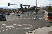
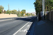
Route description
U.S. Route 395 in Nevada
In the U.S. state of Nevada, U.S. Route 395 clips a corner of Nevada near Lake Tahoe and serves the cities of Gardnerville, Minden, Carson City and Reno. Most of US 395 north of Carson City is a freeway and is built up to Interstate standards. Part of the freeway section is also currently...
. From there, the route travels in a clockwise direction westward. This portion of the route is surrounded by major shopping outlets. The highway travels west, gaining in altitude as it winds up and down through residential areas of southwest Reno. The route heads north to cross over the Truckee River
Truckee River
The Truckee River is a stream in the U.S. states of California and Nevada. The river is about long. Its endorheic drainage basin is about , of which about are in Nevada. The Truckee is the sole outlet of Lake Tahoe and drains part of the high Sierra Nevada, emptying into Pyramid Lake in the Great...
and intersect West 4th Street (SR 647
Nevada State Route 647
State Route 647 is the state highway designation of former US 40 through Reno and Sparks, Nevada....
/I-80 Bus./Old US 40) and Interstate 80
Interstate 80 in Nevada
In the U.S. state of Nevada, Interstate 80 traverses the northern portion of the state. The freeway serves the Reno-Sparks metropolitan area, and also goes through the towns of Fernley, Lovelock, Winnemucca, Battle Mountain, Elko, Wells and West Wendover on its way through the state.I-80 follows...
. From here, the highway continues north to skirt the southeastern edge of Peavine Peak in northwest Reno before turning east. The highway then intersects North Virginia Street (SR 430
Nevada State Route 430
State Route 430 is a major north–south state highway in Washoe County, Nevada which currently exists as two separate sections. South of Reno, the route follows the Carson-Reno Highway, and currently overlaps U.S. Route 395. In Reno, the highway follows Virginia Street, the primary...
) and runs along the northern boundary of the University of Nevada, Reno
University of Nevada, Reno
The University of Nevada, Reno , is a teaching and research university established in 1874 and located in Reno, Nevada, USA...
campus. The route then intersects Clear Acre Lane (SR 443) before reaching an interchange with US 395.
Shortly after crossing over US 395, SR 659 enters the city of Sparks. From there, the highway continues easterly to intersect Pyramid Way (SR 445
Nevada State Route 445
State Route 445 is a state highway in Washoe County, Nevada. The route follows Pyramid Way, a major thoroughfare in the city of Sparks, and connects the Reno metropolitan area to Pyramid Lake . The route is designated a Nevada Scenic Byway....
), which provides access to the fast-growing area of northern Sparks known as Spanish Springs
Spanish Springs, Nevada
Spanish Springs is a census-designated place in Washoe County, Nevada, United States. It is located in the northeastern part of the Reno–Sparks Metropolitan Statistical Area. The population was 15,064 at the 2010 Census.-History:...
as well as Pyramid Lake. McCarran Boulevard heads east and then turns south to intersect Victorian Avenue (I-80 Bus.) and I-80 again before crossing the Truckee River once more.
Passing over the river, the route soon re-enters the Reno city limits. McCarran Boulevard travels southerly through established neighborhoods, then turns to the west. The route becomes more commercial again, passing Meadowood Mall as it heads west to South Virginia Street (US 395 Bus.). The state highway then ends at its origin point underneath the US 395 overpass.
History
Nevada Department of Transportation
The Nevada Department of Transportation is a government agency in the U.S. state of Nevada. NDOT is responsible for maintaining and improving Nevada's highway system, which includes U.S. highways and Interstate highways within the state's boundaries. The department is notable for its...
maintained the entire roadway, but classified it as two separate highways. Initially, State Route 650 was assigned to the eastern half of the roadway, beginning at US 395 on the north end and circling through Sparks towards US 395 in southern Reno. The western half of McCarran Boulevard was assigned to State Route 651, which began at the same point and traveled in the opposite direction through western Reno. The assignment of the two routes along the entirety of the eastern and western McCarran Boulevard segments could be evidenced by postmile panels which were still present along the highway in late 2007.
By 1999, the southern half of each highway had been relinquished to local control. The remaining state-maintained portion of SR 650 ended near Equity Avenue (just south of Mill Street) in Reno, leaving the route a total length of 6.365 miles (10.2 km). SR 651 was truncated to a distance of 6.63 miles (10.7 km), with a southern terminus at West 4th Street. Although under local maintenance, the relinquished portions of McCarran Boulevard remained part of the National Highway System
National Highway System (United States)
The National Highway System is a network of strategic highways within the United States, including the Interstate Highway System and other roads serving major airports, ports, rail or truck terminals, railway stations, pipeline terminals and other strategic transport facilities.Individual states...
.
In late July 2009, however, all route shields and mileposts for SR 650 and SR 651 were removed from the highways. These were replaced with new mileposts for State Route 659. The new highway number encompassed all of McCarran Boulevard, with mileage beginning at the US 395 overpass in south Reno and continuing clockwise around the entire loop.
Major intersections
|-|rowspan=7|Reno
Reno, Nevada
Reno is the county seat of Washoe County, Nevada, United States. The city has a population of about 220,500 and is the most populous Nevada city outside of the Las Vegas metropolitan area...
|bgcolor=ffdddd|0.00
|bgcolor=ffdddd colspan=2 align=center|U.S. Route 395 overpass. No access.
|-
|
|Kietzke Lane
|former SR 667
|-
|
|
|
|-
|
|, Sacramento
Sacramento, California
Sacramento is the capital city of the U.S. state of California and the county seat of Sacramento County. It is located at the confluence of the Sacramento River and the American River in the northern portion of California's expansive Central Valley. With a population of 466,488 at the 2010 census,...
|
|-
|
|
|
|-
|
|
|
|-
|
|, Susanville
Susanville, California
Susanville is the county seat of Lassen County, California, United States. Susanville is located on the Susan River in the south-central part of the county, at an elevation of 4186 feet . The population was 17,974 at the 2010 census, up from 13,541 at the 2000 census...
|
|-
|rowspan=4|Sparks
Sparks, Nevada
Sparks is a city in Washoe County, Nevada, United States, located east of Reno, Nevada. The 2010 U.S. Census Bureau population count was 90,264. Sparks is often referred to as half of a twin city .-Geography and Climate:...
|
|
|
|-
|
|
|
|-
|
|, Sacramento
Sacramento, California
Sacramento is the capital city of the U.S. state of California and the county seat of Sacramento County. It is located at the confluence of the Sacramento River and the American River in the northern portion of California's expansive Central Valley. With a population of 466,488 at the 2010 census,...
|
|-
|
|Glendale Ave (SR 648)
|
|-
|rowspan=2|Reno
Reno, Nevada
Reno is the county seat of Washoe County, Nevada, United States. The city has a population of about 220,500 and is the most populous Nevada city outside of the Las Vegas metropolitan area...
|
|
|
|-
|22.98
|bgcolor=ffdddd colspan=2 align=center|U.S. Route 395 overpass. No access.