

List of Interstate Highways in New York
Encyclopedia
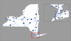
There are currently 30 Interstate Highways—eight main routes and 22 auxiliary routes—that exist entirely or partially in the U.S. state
U.S. state
A U.S. state is any one of the 50 federated states of the United States of America that share sovereignty with the federal government. Because of this shared sovereignty, an American is a citizen both of the federal entity and of his or her state of domicile. Four states use the official title of...
of New York
New York
New York is a state in the Northeastern region of the United States. It is the nation's third most populous state. New York is bordered by New Jersey and Pennsylvania to the south, and by Connecticut, Massachusetts and Vermont to the east...
. In New York, Interstate Highways are mostly maintained by the New York State Department of Transportation
New York State Department of Transportation
The New York State Department of Transportation is responsible for the development and operation of highways, railroads, mass transit systems, ports, waterways and aviation facilities in the U.S...
(NYSDOT), with some exceptions. Unlike in some other states, Interstate Highways in New York are not directly referenced by NYSDOT with their number; instead, the letter "I" is suffixed to the number of the route on reference marker
Reference marker (New York)
In New York, a reference marker is a small green sign mounted approximately every one-tenth mile on highways maintained by the New York State Department of Transportation. This was initiated in response to the Highway Safety Act of 1966 enacted by Congress, in an effort to monitor traffic and...
s and in internal documents. On the surface, there appears to be numerical duplication between Interstate Highways and state routes—such as Interstate 86
Interstate 86 (east)
Interstate 86 is an Interstate Highway that extends for through northwestern Pennsylvania and southern New York in the United States...
and New York State Route 86—but the "I" suffix that is appended to Interstate Highway numbers allows the Interstate Highway and state route to co-exist ("86I" versus "86", respectively).
There are a combined 1674 miles (2,694 km) of Interstate Highways within New York, which handles about 19 percent of vehicle travel in New York. At approximately 0.5 mile (0.80467 km), Interstate 78
Interstate 78 in New York
Interstate 78 is a part of the Interstate Highway System that runs from Union Township, Lebanon County, Pennsylvania, to New York City. The portion of I-78 within the U.S. state of New York is just long as it crosses the Hudson River from New Jersey via the Holland Tunnel and ends at the...
is the shortest main Interstate Highway, while Interstate 90
Interstate 90 in New York
Interstate 90 is a part of the Interstate Highway System that runs from Seattle, Washington, to Boston, Massachusetts. In the U.S. state of New York, I-90 extends from the Pennsylvania state line at Ripley to the Massachusetts state line at Canaan...
is the longest, spanning 385.88 miles (621.01 km) within New York. Interstate 878, located in Queens, is the shortest active auxiliary route in the Interstate Highway System
Interstate Highway System
The Dwight D. Eisenhower National System of Interstate and Defense Highways, , is a network of limited-access roads including freeways, highways, and expressways forming part of the National Highway System of the United States of America...
.
Small portions of Interstate 278 in New York City
New York City
New York is the most populous city in the United States and the center of the New York Metropolitan Area, one of the most populous metropolitan areas in the world. New York exerts a significant impact upon global commerce, finance, media, art, fashion, research, technology, education, and...
are maintained by local authorities rather than the state transportation agency. In addition, parts of Interstate 87, Interstate 287, Interstate 90, Interstate 190
Interstate 190 (New York)
Interstate 190 runs 28.34 miles from Interstate 90 near Buffalo, New York to Lewiston, New York via Niagara Falls. Parts of this highway were built on the former rights-of-way of the Lehigh Valley Railroad and the Erie Canal. It is referred to by locals as The One-Ninety...
, and Interstate 95
Interstate 95 in New York
Interstate 95 is a part of the Interstate Highway System that runs from Miami, Florida, to the Canada – United States border near Houlton, Maine. In the U.S. state of New York, I-95 extends from the George Washington Bridge in New York City to the Connecticut state line at Port Chester...
are part of the New York State Thruway
New York State Thruway
The New York State Thruway is a system of limited-access highways located within the state of New York in the United States. The system, known officially as the Governor Thomas E. Dewey Thruway for former New York Governor Thomas E. Dewey, is operated by the New York State Thruway Authority and...
system and thus are maintained by the New York State Thruway Authority.
The "From" column indicates the southern or western terminus of the route; likewise, the "To" column indicates the northern or eastern terminus of the route. The "mi" and "km" columns give the length of the route in miles and kilometers, respectively. Designations that are shaded in dark gray are numbers not currently assigned to a highway.
Main routes
| Route | From | To | mi | km | Assigned | Deleted | Description |
|---|---|---|---|---|---|
 Interstate 78 in New York Interstate 78 is a part of the Interstate Highway System that runs from Union Township, Lebanon County, Pennsylvania, to New York City. The portion of I-78 within the U.S. state of New York is just long as it crosses the Hudson River from New Jersey via the Holland Tunnel and ends at the... |
New Jersey New Jersey New Jersey is a state in the Northeastern and Middle Atlantic regions of the United States. , its population was 8,791,894. It is bordered on the north and east by the state of New York, on the southeast and south by the Atlantic Ocean, on the west by Pennsylvania and on the southwest by Delaware... line at Manhattan Manhattan Manhattan is the oldest and the most densely populated of the five boroughs of New York City. Located primarily on the island of Manhattan at the mouth of the Hudson River, the boundaries of the borough are identical to those of New York County, an original county of the state of New York... |
Manhattan |
1961 | — | I-78 crosses the Hudson River Hudson River The Hudson is a river that flows from north to south through eastern New York. The highest official source is at Lake Tear of the Clouds, on the slopes of Mount Marcy in the Adirondack Mountains. The river itself officially begins in Henderson Lake in Newcomb, New York... from New Jersey New Jersey New Jersey is a state in the Northeastern and Middle Atlantic regions of the United States. , its population was 8,791,894. It is bordered on the north and east by the state of New York, on the southeast and south by the Atlantic Ocean, on the west by Pennsylvania and on the southwest by Delaware... via the Holland Tunnel Holland Tunnel The Holland Tunnel is a highway tunnel under the Hudson River connecting the island of Manhattan in New York City with Jersey City, New Jersey at Interstate 78 on the mainland. Unusual for an American public works project, it is not named for a government official, politician, or local hero or... and ends at the tunnel plaza in Lower Manhattan Lower Manhattan Lower Manhattan is the southernmost part of the island of Manhattan, the main island and center of business and government of the City of New York... . |
 Interstate 81 in New York Interstate 81 is a part of the Interstate Highway System that runs from Dandridge, Tennessee, to the Canada – United States border at Wellesley Island in New York. In the U.S. state of New York, I-81 extends from the Pennsylvania state line southeast of Binghamton to the Canadian border... |
Pennsylvania line at Kirkwood Kirkwood, New York Kirkwood is a town in Broome County, New York, United States. The population was 5,651 at the 2000 census. The town is named after James P. Kirkwood, who was an engineer responsible for constructing the local railroad.... |
Canadian border at Thousand Islands Thousand Islands The Thousand Islands is the name of an archipelago of islands that straddle the Canada-U.S. border in the Saint Lawrence River as it emerges from the northeast corner of Lake Ontario. They stretch for about downstream from Kingston, Ontario. The Canadian islands are in the province of Ontario, the... |
1957 | — | I-81 crosses the New York – Pennsylvania border south of Binghamton and heads through central New York Central New York Central New York is a term used to broadly describe the central region of New York State, roughly including the following counties and cities:... and the North Country North Country, New York The North Country is a region of the U.S. state of New York that encompasses the state's extreme northern frontier, bordering Lake Ontario on the west, the Saint Lawrence River and the Canadian provinces of Ontario and Quebec on the north and northwest, and Lake Champlain and Vermont on the east... to the Thousand Islands, where it becomes Ontario Highway 137 Highway 137 (Ontario) King's Highway 137, also known as Highway 137, is a provincially maintained highway in the Canadian province of Ontario which serves to connect the northern end of Interstate 81 in New York with Highway 401, via the Canadian span of the Thousand Islands Bridge... at the Canadian border. Along the way, I-81 passes through the cities of Syracuse Syracuse, New York Syracuse is a city in and the county seat of Onondaga County, New York, United States, the largest U.S. city with the name "Syracuse", and the fifth most populous city in the state. At the 2010 census, the city population was 145,170, and its metropolitan area had a population of 742,603... and Watertown. |
 Interstate 84 in New York Interstate 84 is a part of the Interstate Highway System that runs from Dunmore, Pennsylvania, to Sturbridge, Massachusetts, in the Eastern United States. In New York, I-84 extends from the Pennsylvania state line at Port Jervis to the Connecticut state line east of Brewster... |
Pennsylvania line at Port Jervis Port Jervis, New York Port Jervis is a city on the Delaware River in western Orange County, New York, with a population of 8,860 at the 2000 census. The communities of Deerpark, Huguenot, Sparrowbush, and Greenville are adjacent to Port Jervis, and the towns of Montague, New Jersey and Matamoras, Pennsylvania face the... |
Connecticut Connecticut Connecticut is a state in the New England region of the northeastern United States. It is bordered by Rhode Island to the east, Massachusetts to the north, and the state of New York to the west and the south .Connecticut is named for the Connecticut River, the major U.S. river that approximately... line at Southeast Southeast, New York Southeast is a town in Putnam County, New York, United States. The population was 17,316 at the 2000 census. The town is in the southeast part of the county. Interstate 84, Interstate 684, US Route 202, and US Route 6 pass through the town.- History :... |
1957 | — | I-84 crosses the New York – Pennsylvania state line near the point where New York, Pennsylvania, and New Jersey New Jersey New Jersey is a state in the Northeastern and Middle Atlantic regions of the United States. , its population was 8,791,894. It is bordered on the north and east by the state of New York, on the southeast and south by the Atlantic Ocean, on the west by Pennsylvania and on the southwest by Delaware... meet in the vicinity of Port Jervis. It heads generally east–west across Orange Orange County, New York Orange County is a county located in the U.S. state of New York. It is part of the Poughkeepsie–Newburgh–Middletown, NY Metropolitan Statistical Area and is located at the northern reaches of the New York metropolitan area. The county sits in the state's scenic Mid-Hudson Region of the Hudson Valley... , Dutchess Dutchess County, New York Dutchess County is a county located in the U.S. state of New York, in the state's Mid-Hudson Region of the Hudson Valley. The 2010 census lists the population as 297,488... and Putnam Putnam County, New York Putnam County is a county located in the U.S. state of New York, in the lower Hudson River Valley. Putnam county formed in 1812, when it detached from Dutchess County. , the population was 99,710. It is part of the New York Metropolitan Area. The county seat is the hamlet of Carmel... Counties to the Connecticut state line east of Brewster Brewster, New York Brewster is a village within the town of Southeast in Putnam County, New York, United States. Its population was 2,162 at the 2000 census. The village is the most densely populated portion of the town... . |
 Interstate 86 (east) Interstate 86 is an Interstate Highway that extends for through northwestern Pennsylvania and southern New York in the United States... |
Pennsylvania line at Mina Mina, New York Mina is a town in Chautauqua County, New York, USA. The population was 1,176 at the 2000 census.The Town of Mina is at the western county border. The town is best known as a summer resort area... |
Elmira |
1999 | — | I-86, known as the Southern Tier Expressway, heads east–west across the Southern Tier from the Pennsylvania state line west of Findley Lake to NY 352 east of downtown Elmira. A second section of I-86 exists in central Broome County Broome County, New York Broome County is a county located in the U.S. state of New York. As of the 2010 census, the population was 200,600. It was named in honor of John Broome, who was lieutenant governor in 1806 when Broome County was established. Its county seat is Binghamton, which is also its major city. The current... , occupying part of an expressway known as the Quickway. Both pieces of I-86 will eventually be part of a continuous route extending from Erie, Pennsylvania Erie, Pennsylvania Erie is a city located in northwestern Pennsylvania in the United States. Named for the lake and the Native American tribe that resided along its southern shore, Erie is the state's fourth-largest city , with a population of 102,000... , to Harriman Harriman, New York Harriman is a village in Orange County, New York, United States. The population was 2,252 at the 2000 census. It is part of the Poughkeepsie–Newburgh–Middletown, NY Metropolitan Statistical Area as well as the larger New York–Newark–Bridgeport, NY-NJ-CT-PA Combined... . The I-86 designation is being extended eastward as improvements are made to the existing NY 17 expressway. |
 Interstate 87 Interstate 87 is a Interstate Highway located entirely within New York State in the United States of America. I-87 is the longest intrastate Interstate highway in the Interstate Highway System. Its southern end is at the Bronx approaches of the Robert F. Kennedy Bridge in New York City... |
The Bronx The Bronx The Bronx is the northernmost of the five boroughs of New York City. It is also known as Bronx County, the last of the 62 counties of New York State to be incorporated... |
Canadian border at Champlain Champlain (town), New York Champlain is a town in Clinton County, New York, United States. The population was 5,754 at the 2010 census. The town is named after Lake Champlain.... |
1957 | — | I-87 extends from the Bronx The Bronx The Bronx is the northernmost of the five boroughs of New York City. It is also known as Bronx County, the last of the 62 counties of New York State to be incorporated... approach to the Robert F. Kennedy Bridge in New York City to the Canadian border near Champlain, where it connects with Québec Autoroute 15. The portion of I-87 from the New York City line to Albany Albany, New York Albany is the capital city of the U.S. state of New York, the seat of Albany County, and the central city of New York's Capital District. Roughly north of New York City, Albany sits on the west bank of the Hudson River, about south of its confluence with the Mohawk River... is part of the New York State Thruway mainline; at Albany, I-87 leaves the Thruway and becomes the Adirondack Northway. Aside from Albany, I-87 also serves Kingston, Glens Falls Glens Falls, New York Glens Falls is a city in Warren County, New York, United States. Glens Falls Metropolitan Statistical Area. The population was 14,700 at the 2010 census... , and Plattsburgh Plattsburgh (city), New York Plattsburgh is a city in and county seat of Clinton County, New York, United States. The population was 19,989 at the 2010 census. The population of the unincorporated areas within the Town of Plattsburgh was 11,870 as of the 2010 census; making the population for the immediate, urban Plattsburgh,... . |
 Interstate 88 (east) Interstate 88 is an intrastate Interstate Highway entirely within the U.S. state of New York. Its western end is at Interstate 81 in Binghamton and its eastern end is at Interstate 90 in Schenectady. It serves as an important connector route from Albany to Binghamton, Elmira , and... |
Chenango Chenango, New York Chenango is a town in Broome County, New York, United States. The population was 11,454 at the 2000 census.The Town of Chenango is in the eastern part of the county, northeast of Binghamton.- History :The town was first settled around 1787.... |
Rotterdam Rotterdam (town), New York Rotterdam is a town in Schenectady County, New York, United States. The population was 28,316 at the 2000 census.The town of Rotterdam is in the south-central part of the county. It was founded by Dutch settlers, who named it after the port of Rotterdam in the Netherlands, where many emigrants last... |
1968 | — | I-88 serves as a connector between I-81 near Binghamton Binghamton, New York Binghamton is a city in the Southern Tier of New York in the United States. It is near the Pennsylvania border, in a bowl-shaped valley at the confluence of the Susquehanna and Chenango Rivers... and the New York State Thruway (I-90) near Schenectady Schenectady, New York Schenectady is a city in Schenectady County, New York, United States, of which it is the county seat. As of the 2010 census, the city had a population of 66,135... . It parallels NY 7 between the two cities and passes through the city of Oneonta. |
 Interstate 90 in New York Interstate 90 is a part of the Interstate Highway System that runs from Seattle, Washington, to Boston, Massachusetts. In the U.S. state of New York, I-90 extends from the Pennsylvania state line at Ripley to the Massachusetts state line at Canaan... |
Pennsylvania line at Ripley Ripley, New York Ripley is a town on Lake Erie in the westernmost part of Chautauqua County, New York, USA. The population was 2,636 at the 2000 census. The town was named after General Eleazer Wheelock Ripley. There are no incorporated villages in the town, but there is one CDP: Ripley.- History :Ripley was... |
Massachusetts Massachusetts The Commonwealth of Massachusetts is a state in the New England region of the northeastern United States of America. It is bordered by Rhode Island and Connecticut to the south, New York to the west, and Vermont and New Hampshire to the north; at its east lies the Atlantic Ocean. As of the 2010... line at Canaan Canaan, New York Canaan is a town in Columbia County, New York, United States. The population was 1,820 at the 2000 census.The Town of Canaan is in the northeast part of the county.- History :The first settlers arrived around 1759.... |
1957 | — | I-90 travels from the Pennsylvania state line at Ripley Ripley, New York Ripley is a town on Lake Erie in the westernmost part of Chautauqua County, New York, USA. The population was 2,636 at the 2000 census. The town was named after General Eleazer Wheelock Ripley. There are no incorporated villages in the town, but there is one CDP: Ripley.- History :Ripley was... to the Massachusetts Massachusetts The Commonwealth of Massachusetts is a state in the New England region of the northeastern United States of America. It is bordered by Rhode Island and Connecticut to the south, New York to the west, and Vermont and New Hampshire to the north; at its east lies the Atlantic Ocean. As of the 2010... border at Canaan. The vast majority of I-90 in New York is part of the New York State Thruway system; the only segment that is not part of the system is a 20 miles (32.2 km) portion in the city of Albany Albany, New York Albany is the capital city of the U.S. state of New York, the seat of Albany County, and the central city of New York's Capital District. Roughly north of New York City, Albany sits on the west bank of the Hudson River, about south of its confluence with the Mohawk River... and its eastern suburbs. Aside from Albany, I-90 also serves Buffalo Buffalo, New York Buffalo is the second most populous city in the state of New York, after New York City. Located in Western New York on the eastern shores of Lake Erie and at the head of the Niagara River across from Fort Erie, Ontario, Buffalo is the seat of Erie County and the principal city of the... , Rochester Rochester, New York Rochester is a city in Monroe County, New York, south of Lake Ontario in the United States. Known as The World's Image Centre, it was also once known as The Flour City, and more recently as The Flower City... (via I-490), Syracuse Syracuse, New York Syracuse is a city in and the county seat of Onondaga County, New York, United States, the largest U.S. city with the name "Syracuse", and the fifth most populous city in the state. At the 2010 census, the city population was 145,170, and its metropolitan area had a population of 742,603... , and Utica Utica, New York Utica is a city in and the county seat of Oneida County, New York, United States. The population was 62,235 at the 2010 census, an increase of 2.6% from the 2000 census.... . |
 |
Buffalo Buffalo, New York Buffalo is the second most populous city in the state of New York, after New York City. Located in Western New York on the eastern shores of Lake Erie and at the head of the Niagara River across from Fort Erie, Ontario, Buffalo is the seat of Erie County and the principal city of the... |
Canadian border at Lewiston Lewiston (town), New York Lewiston is a town in Niagara County, New York United States. The population was 16,262 at the 2010 census. The town and its contained village are named after Morgan Lewis, a governor of New York.... |
1957 | 1959 | I-90N was the original designation for what is now I-190 in western New York Western New York Western New York is the westernmost region of the state of New York. It includes the cities of Buffalo, Rochester, Niagara Falls, the surrounding suburbs, as well as the outlying rural areas of the Great Lakes lowlands, the Genesee Valley, and the Southern Tier. Some historians, scholars and others... . It was renumbered to I-190 in 1959. |
 Interstate 95 in New York Interstate 95 is a part of the Interstate Highway System that runs from Miami, Florida, to the Canada – United States border near Houlton, Maine. In the U.S. state of New York, I-95 extends from the George Washington Bridge in New York City to the Connecticut state line at Port Chester... |
New Jersey New Jersey New Jersey is a state in the Northeastern and Middle Atlantic regions of the United States. , its population was 8,791,894. It is bordered on the north and east by the state of New York, on the southeast and south by the Atlantic Ocean, on the west by Pennsylvania and on the southwest by Delaware... line at Manhattan Manhattan Manhattan is the oldest and the most densely populated of the five boroughs of New York City. Located primarily on the island of Manhattan at the mouth of the Hudson River, the boundaries of the borough are identical to those of New York County, an original county of the state of New York... |
Connecticut Connecticut Connecticut is a state in the New England region of the northeastern United States. It is bordered by Rhode Island to the east, Massachusetts to the north, and the state of New York to the west and the south .Connecticut is named for the Connecticut River, the major U.S. river that approximately... line at Port Chester Port Chester, New York Port Chester is a village in Westchester County, New York, United States. The village is part of the town of Rye. As of the 2010 census, Port Chester had a population of 28,967... |
1957 | — | I-95 extends from the George Washington Bridge George Washington Bridge The George Washington Bridge is a suspension bridge spanning the Hudson River, connecting the Washington Heights neighborhood in the borough of Manhattan in New York City to Fort Lee, Bergen County, New Jersey. Interstate 95 and U.S. Route 1/9 cross the river via the bridge. U.S... over the Hudson River Hudson River The Hudson is a river that flows from north to south through eastern New York. The highest official source is at Lake Tear of the Clouds, on the slopes of Mount Marcy in the Adirondack Mountains. The river itself officially begins in Henderson Lake in Newcomb, New York... (where it crosses from New Jersey into New York City New York City New York is the most populous city in the United States and the center of the New York Metropolitan Area, one of the most populous metropolitan areas in the world. New York exerts a significant impact upon global commerce, finance, media, art, fashion, research, technology, education, and... ) to the Connecticut state line at Port Chester. It passes through New York City on the Trans-Manhattan Trans-Manhattan Expressway The Trans-Manhattan Expressway or George Washington Bridge Expressway is a highway in New York City that is part of the Interstate Highway System. Though few of the millions who use it or live near it have ever heard the name, it is probably one of the shortest, busiest, and most congested named... and Cross Bronx Expressways. The portion of I-95 from the Pelham Parkway Pelham Parkway The Bronx and Pelham Parkway is a parkway in the borough of the Bronx in New York City. Despite the parkway moniker, Pelham Parkway is a local street, with two main roadways , and two service roads. Like other parkways in New York City, commercial traffic is disallowed, and is redirected to the... in the Bronx to the Connecticut state line is known as the New England Thruway New England Thruway The New England Thruway is a portion of the U.S. Interstate highway system and of the New York State Thruway, within and operated by the New York State Thruway Authority, linking New York City with New England, specifically with southwestern Connecticut... and is part of the New York State Thruway system. |
 Interstate 99 Interstate 99 is an intrastate Interstate Highway located in central Pennsylvania in the United States. The southern terminus of the route is at exit 146 of the Pennsylvania Turnpike north of Bedford, where the road continues south as U.S. Route 220 . The northern terminus is at... |
Pennsylvania line at Lindley Lindley, New York Lindley is a town in southern Steuben County, New York, United States. The population was 1,913 at the 2000 census. The town was named after the early settler Eleazer Lindsley.The town is situated south of the city of Corning.-Geography:... |
Painted Post Painted Post, New York Painted Post is a village in Steuben County, New York, United States. The village is in the town of Erwin, west of the city of Corning. The population was 1,842 at the 2000 census. The name comes from a painted and carved post found by explorers at the junction of three local rivers... |
— | — | I-99 is slated to continue north from Pennsylvania along US 15 to I-86 near Corning. New reference marker Reference marker (New York) In New York, a reference marker is a small green sign mounted approximately every one-tenth mile on highways maintained by the New York State Department of Transportation. This was initiated in response to the Highway Safety Act of 1966 enacted by Congress, in an effort to monitor traffic and... s installed on US 15 display "99I" on their top line, indicating NYSDOT is already preparing for the transition. |
Auxiliary routes
| Route | From | To | mi | km | Assigned | Deleted | Description |
|---|---|---|---|---|---|---|---|
.svg.png) Interstate 190 (New York) Interstate 190 runs 28.34 miles from Interstate 90 near Buffalo, New York to Lewiston, New York via Niagara Falls. Parts of this highway were built on the former rights-of-way of the Lehigh Valley Railroad and the Erie Canal. It is referred to by locals as The One-Ninety... |
Buffalo Buffalo, New York Buffalo is the second most populous city in the state of New York, after New York City. Located in Western New York on the eastern shores of Lake Erie and at the head of the Niagara River across from Fort Erie, Ontario, Buffalo is the seat of Erie County and the principal city of the... |
Canadian border at Lewiston Lewiston (town), New York Lewiston is a town in Niagara County, New York United States. The population was 16,262 at the 2010 census. The town and its contained village are named after Morgan Lewis, a governor of New York.... |
1959 | — | I-190 is a spur connecting the New York State Thruway New York State Thruway The New York State Thruway is a system of limited-access highways located within the state of New York in the United States. The system, known officially as the Governor Thomas E. Dewey Thruway for former New York Governor Thomas E. Dewey, is operated by the New York State Thruway Authority and... (I-90) at exit 53 near Buffalo to the Canada – United States border at Lewiston, north of Niagara Falls Niagara Falls, New York Niagara Falls is a city in Niagara County, New York, United States. As of the 2010 census, the city had a total population of 50,193, down from the 55,593 recorded in the 2000 census. It is across the Niagara River from Niagara Falls, Ontario , both named after the famed Niagara Falls which they... . The portion of I-190 south of NY 384 is part of the New York State Thruway New York State Thruway The New York State Thruway is a system of limited-access highways located within the state of New York in the United States. The system, known officially as the Governor Thomas E. Dewey Thruway for former New York Governor Thomas E. Dewey, is operated by the New York State Thruway Authority and... system. I-190 is the only three-digit Interstate Highway that reaches the Canadian border. |
||
.svg.png) Interstate 278 Interstate 278 is an auxiliary Interstate Highway in New Jersey and New York, United States. The road runs from U.S. Route 1/9 in Linden, New Jersey to the Bruckner Interchange in the New York City borough of the Bronx... |
New Jersey New Jersey New Jersey is a state in the Northeastern and Middle Atlantic regions of the United States. , its population was 8,791,894. It is bordered on the north and east by the state of New York, on the southeast and south by the Atlantic Ocean, on the west by Pennsylvania and on the southwest by Delaware... line at Staten Island Staten Island Staten Island is a borough of New York City, New York, United States, located in the southwest part of the city. Staten Island is separated from New Jersey by the Arthur Kill and the Kill Van Kull, and from the rest of New York by New York Bay... |
The Bronx The Bronx The Bronx is the northernmost of the five boroughs of New York City. It is also known as Bronx County, the last of the 62 counties of New York State to be incorporated... |
by 1960 | — | I-278 crosses from New Jersey to New York by way of the Goethals Bridge Goethals Bridge The Goethals Bridge connects Elizabeth, New Jersey to Staten Island , near the Howland Hook Marine Terminal, Staten Island, New York over the Arthur Kill. Operated by the Port Authority of New York and New Jersey, the span was one of the first structures built by the authority... over the Arthur Kill Arthur Kill The Arthur Kill is a tidal strait separating Staten Island, New York from mainland New Jersey, USA, and a major navigational channel of the Port of New York and New Jersey. Kill is from the Middle Dutch word kille, meaning "riverbed" or "water channel"... at Staten Island Staten Island Staten Island is a borough of New York City, New York, United States, located in the southwest part of the city. Staten Island is separated from New Jersey by the Arthur Kill and the Kill Van Kull, and from the rest of New York by New York Bay... . It passes through all five boroughs of New York City New York City New York is the most populous city in the United States and the center of the New York Metropolitan Area, one of the most populous metropolitan areas in the world. New York exerts a significant impact upon global commerce, finance, media, art, fashion, research, technology, education, and... (technically entering Manhattan Manhattan Manhattan is the oldest and the most densely populated of the five boroughs of New York City. Located primarily on the island of Manhattan at the mouth of the Hudson River, the boundaries of the borough are identical to those of New York County, an original county of the state of New York... when it passes over Wards Island on the Robert F. Kennedy Bridge) before coming to an end at the Bruckner Interchange Bruckner Interchange The Bruckner Interchange is a complex interchange at the intersection of the Bruckner Expressway, Cross Bronx Expressway, Hutchinson River Expressway, and Hutchinson River Parkway in the New York City borough of the Bronx, United States... in the Bronx. |
||
.svg.png) |
Syracuse Syracuse, New York Syracuse is a city in and the county seat of Onondaga County, New York, United States, the largest U.S. city with the name "Syracuse", and the fifth most populous city in the state. At the 2010 census, the city population was 145,170, and its metropolitan area had a population of 742,603... |
DeWitt |
ca. 1963 | 1970 | I-281 was a connector highway between I-81 and I-90 that passed through the southeastern suburbs of Syracuse. It was renumbered to I-481 in 1970, possibly to avoid confusion with NY 281 New York State Route 281 New York State Route 281 is a north–south state highway in central New York, United States. It extends for across Cortland and Onondaga Counties. The southern terminus of the route is at an intersection with NY 13 in the town of Cortlandville. Its northern terminus is at a junction with... , a highway that parallels I-81 some miles south of Syracuse. |
||
.svg.png) Interstate 287 Interstate 287 is an auxiliary Interstate Highway in the U.S. states of New Jersey and New York. It is a partial beltway around New York City, serving the northern half of New Jersey and the counties of Rockland and Westchester in New York... |
New Jersey New Jersey New Jersey is a state in the Northeastern and Middle Atlantic regions of the United States. , its population was 8,791,894. It is bordered on the north and east by the state of New York, on the southeast and south by the Atlantic Ocean, on the west by Pennsylvania and on the southwest by Delaware... line at Suffern Suffern, New York Suffern is a village in the Town of Ramapo, Rockland County, New York, United States located north of the State of New Jersey; east of Hillburn; south of Montebello and west of Airmont... |
Rye Rye (city), New York Rye is a city in Westchester County, New York, United States. It is separate from the town of Rye, which is larger than the city. Rye city, formerly the village of Rye, was part of the town until 1942, when it received its charter as a city, the most recent to be issued in New York... |
by 1960 | — | I-287 crosses the New Jersey border into New York near Suffern and heads generally southeastward across Rockland Rockland County, New York Rockland County is a suburban county 15 miles to the northwest of Manhattan and part of the New York City Metropolitan Area, in the U.S. state of New York. It is the southernmost county in New York west of the Hudson River, and the smallest county in New York outside of New York City. The... and Westchester Westchester County, New York Westchester County is a county located in the U.S. state of New York. Westchester covers an area of and has a population of 949,113 according to the 2010 Census, residing in 45 municipalities... Counties to I-95 Interstate 95 in New York Interstate 95 is a part of the Interstate Highway System that runs from Miami, Florida, to the Canada – United States border near Houlton, Maine. In the U.S. state of New York, I-95 extends from the George Washington Bridge in New York City to the Connecticut state line at Port Chester... in Rye Rye (city), New York Rye is a city in Westchester County, New York, United States. It is separate from the town of Rye, which is larger than the city. Rye city, formerly the village of Rye, was part of the town until 1942, when it received its charter as a city, the most recent to be issued in New York... . Most of I-287 in Rockland County overlaps I-87 and all of I-287 east of Suffern is part of the New York State Thruway system. |
||
.svg.png) Interstate 290 (New York) Interstate 290 runs for near Buffalo, New York from I-90 to I-190. It connects Buffalo with its northern suburbs of Amherst and Tonawanda, and provides a route to Niagara Falls that bypasses the city of Buffalo. I-290 also connects to Interstate 990, and through this connection,... |
Tonawanda Tonawanda (town), New York Tonawanda is a town in Erie County, New York, United States. As of the 2000 census, the town had a population of 78,155. The town is at the north border of the county and is the northern suburb of Buffalo... |
Amherst Amherst, New York Amherst is a town in Erie County, New York, United States. As of the 2010 census, the town had a total population of 122,366. This represents an increase of 5.0% from the 2000 census. The town is named for Jeffrey Amherst, a British Army officer of the colonial period... |
ca. 1962 | — | I-290 is a connector between I-190 in the town of Tonawanda and the New York State Thruway (I-90) near Williamsville Williamsville, New York Williamsville is a village in Erie County, New York in the United States. The population was 5,573 at the 2000 census. The village is named after Jonas Williams, an early settler... . It serves as a northern bypass of Buffalo Buffalo, New York Buffalo is the second most populous city in the state of New York, after New York City. Located in Western New York on the eastern shores of Lake Erie and at the head of the Niagara River across from Fort Erie, Ontario, Buffalo is the seat of Erie County and the principal city of the... . |
||
.svg.png) Interstate 295 (New York) Interstate 295 is a connector route within New York City. Measuring 9.10 miles in length, I-295 travels from the Bruckner Interchange, a junction with I-95/I-278/I-678 in The Bronx, across the toll Throgs Neck Bridge to the Grand Central Parkway in Queens... |
The Bronx The Bronx The Bronx is the northernmost of the five boroughs of New York City. It is also known as Bronx County, the last of the 62 counties of New York State to be incorporated... |
Queens Queens Queens is the easternmost of the five boroughs of New York City. The largest borough in area and the second-largest in population, it is coextensive with Queens County, an administrative division of New York state, in the United States.... |
1970 | — | I-295 is a connector route within New York City New York City New York is the most populous city in the United States and the center of the New York Metropolitan Area, one of the most populous metropolitan areas in the world. New York exerts a significant impact upon global commerce, finance, media, art, fashion, research, technology, education, and... . It travels from the Bruckner Interchange Bruckner Interchange The Bruckner Interchange is a complex interchange at the intersection of the Bruckner Expressway, Cross Bronx Expressway, Hutchinson River Expressway, and Hutchinson River Parkway in the New York City borough of the Bronx, United States... in the Bronx to the Grand Central Parkway Grand Central Parkway The Grand Central Parkway is a parkway that stretches from the RFK-Triborough Bridge in New York City to Nassau County on Long Island. At the Queens-Nassau border, it becomes the Northern State Parkway, which runs across the northern part of Long Island through Nassau County and into Suffolk... in Queens. It crosses the East River East River The East River is a tidal strait in New York City. It connects Upper New York Bay on its south end to Long Island Sound on its north end. It separates Long Island from the island of Manhattan and the Bronx on the North American mainland... by way of the tolled Throgs Neck Bridge Throgs Neck Bridge The Throgs Neck Bridge is a suspension bridge opened on January 11, 1961, which carries Interstate 295 over the East River where it meets the Long Island Sound. The bridge connects the Throggs Neck section of the Bronx with the Bay Terrace section of Queens... . |
||
.svg.png) Interstate 390 Interstate 390 is a north–south auxiliary Interstate Highway located entirely within New York in the United States. The southern terminus of the route is at the Southern Tier Expressway in the town of Avoca. Its northern terminus is at I-490 in Rochester... |
Avoca Avoca (town), New York Avoca is a town in Steuben County, New York, USA. The population was 2,314 at the 2000 census.The Town of Avoca has a village named Avoca. The town is in the north part of the county, northwest of Bath, New York.- History :... |
Gates Gates, New York Gates is a town in Monroe County, New York. The town is named after General Horatio Gates. The population was 28,400 at the 2010 census. Gates-North Gates census-designated place is located within the town's boundaries.... |
ca. 1973 | — | I-390 extends from the Southern Tier Expressway (I-86 / NY 17) in the Southern Tier Southern Tier The Southern Tier is a geographical term that refers to the counties of New York State west of the Catskill Mountains along the northern border of Pennsylvania. It is a loosely defined term that generally includes the counties that border Pennsylvania west of Delaware County inclusive... town of Avoca to I-490 just west of Rochester Rochester, New York Rochester is a city in Monroe County, New York, south of Lake Ontario in the United States. Known as The World's Image Centre, it was also once known as The Flour City, and more recently as The Flower City... . I-390 connects to I-90 (the New York State Thruway) in Henrietta Henrietta, New York Henrietta is a town in Monroe County, New York, United States. It is a suburb of Rochester. The population was 42,581 at the 2010 census. Established in 1818, the town is named after Henrietta Laura Pulteney, Countess of Bath, daughter of Sir William Pulteney, 5th Baronet, a major British... , a southern suburb of Rochester. |
||
.svg.png) |
Brooklyn Brooklyn Brooklyn is the most populous of New York City's five boroughs, with nearly 2.6 million residents, and the second-largest in area. Since 1896, Brooklyn has had the same boundaries as Kings County, which is now the most populous county in New York State and the second-most densely populated... |
Manhattan Manhattan Manhattan is the oldest and the most densely populated of the five boroughs of New York City. Located primarily on the island of Manhattan at the mouth of the Hudson River, the boundaries of the borough are identical to those of New York County, an original county of the state of New York... |
early 1970s | — | I-478's entire length consists of the Brooklyn–Battery Tunnel and its approaches. Its south end is at Interstate 278 Interstate 278 Interstate 278 is an auxiliary Interstate Highway in New Jersey and New York, United States. The road runs from U.S. Route 1/9 in Linden, New Jersey to the Bruckner Interchange in the New York City borough of the Bronx... , and its north end is at NY 9A New York State Route 9A New York State Route 9A is a state highway in the vicinity of New York City, New York, United States. Its southern terminus is at the northern end of the Brooklyn–Battery Tunnel in New York City, where it intersects with both Interstate 478 and FDR Drive. The northern terminus of... . |
||
.svg.png) Interstate 481 Interstate 481 is an auxiliary Interstate Highway that serves as an eastern bypass of Syracuse, New York, in the United States. It begins at its parent, I-81, in the city's southern end and travels through the eastern Syracuse suburbs of Jamesville, DeWitt, and Cicero before rejoining I-81 in... |
Syracuse Syracuse, New York Syracuse is a city in and the county seat of Onondaga County, New York, United States, the largest U.S. city with the name "Syracuse", and the fifth most populous city in the state. At the 2010 census, the city population was 145,170, and its metropolitan area had a population of 742,603... |
North Syracuse North Syracuse, New York North Syracuse is a village in Onondaga County, New York, United States. The population was 6,863 at the 2000 census.The Village of North Syracuse is partly in the Town of Cicero, but is primarily within the Town of Clay. North Syracuse is north of the City of Syracuse.- History :The village was... |
1970 | — | I-481 leaves I-81 south of Syracuse and rejoins its parent in North Syracuse. I-81 serves downtown Syracuse while I-481 bypasses the city to the east, passing through the Syracuse suburbs of Jamesville Jamesville, New York Jamesville is a hamlet in De Witt, Onondaga County, New York, United States, part of the greater Syracuse area.The history of the community is documented in the book Water, Wheels and Stone: Heritage of the Little Village by the Creek, Jamesville, New York, written by Jean Schutz Keough, and... and DeWitt along the way. |
||
.svg.png) Interstate 487 Interstate 487 was a proposed intrastate Interstate Highway in New York that was to run from The Bronx to Beacon. After much resident opposition, the highway was cancelled in the 1960s.-History:... |
The Bronx The Bronx The Bronx is the northernmost of the five boroughs of New York City. It is also known as Bronx County, the last of the 62 counties of New York State to be incorporated... |
Beacon Beacon, New York Beacon is a city located in Dutchess County, New York, United States. The 2010 census placed the city total population at 15,541. Beacon is part of the Poughkeepsie–Newburgh–Middletown, NY Metropolitan Statistical Area as well as the larger New York–Newark–Bridgeport,... |
— | — | I-487 was a proposed designation for the Hudson River Expressway, a highway that would have run through the Hudson Valley Hudson Valley The Hudson Valley comprises the valley of the Hudson River and its adjacent communities in New York State, United States, from northern Westchester County northward to the cities of Albany and Troy.-History:... between the Bronx and Beacon. The project was cancelled by 1971. |
||
.svg.png) Interstate 490 (New York) Interstate 490 is an auxiliary Interstate Highway that serves the city of Rochester, New York, in the United States. It acts as a northerly alternate route to the New York State Thruway , leaving it at exit 47 in the town of Le Roy and rejoining the highway at exit 45 in the town of... |
Le Roy Le Roy (town), New York Le Roy, or more commonly LeRoy, is a town in Genesee County, New York, United States. The population was 7,790 at the 2000 census. The town is named after one of the original land owners, Herman Le Roy.... |
Victor Victor (town), New York Victor is a town in Ontario County, New York, USA. The population was 9,977 at the 2000 census. The town is named after Claudius Victor Boughton, a hero of the War of 1812.The Town of Victor contains a village, also called Victor... |
ca. 1961 | — | I-490 is a loop route off the New York State Thruway (I-90) between the town of Le Roy and the town of Victor. I-90 bypasses the city of Rochester Rochester, New York Rochester is a city in Monroe County, New York, south of Lake Ontario in the United States. Known as The World's Image Centre, it was also once known as The Flour City, and more recently as The Flower City... to the south while I-490 serves the city's suburbs and Rochester itself. |
||
.svg.png) Interstate 495 (New York) Interstate 495 is an auxiliary Interstate Highway on Long Island in New York in the United States. The route extends for from the western portal of the Queens-Midtown Tunnel in the New York City borough of Manhattan to County Route 58 in Riverhead, Suffolk County... |
Manhattan Manhattan Manhattan is the oldest and the most densely populated of the five boroughs of New York City. Located primarily on the island of Manhattan at the mouth of the Hudson River, the boundaries of the borough are identical to those of New York County, an original county of the state of New York... |
Riverhead Riverhead (town), New York The town of Riverhead is in Suffolk County, New York, on the north shore of Long Island. The population was 33,506 at the 2010 census. The name signifies that the mouth of the Peconic River is in this town... |
1958 | — | I-495, better known as the Long Island Expressway or L.I.E., extends across Long Island Long Island Long Island is an island located in the southeast part of the U.S. state of New York, just east of Manhattan. Stretching northeast into the Atlantic Ocean, Long Island contains four counties, two of which are boroughs of New York City , and two of which are mainly suburban... from the western portal of the Queens Midtown Tunnel Queens Midtown Tunnel The Queens–Midtown Tunnel is a highway tunnel and toll road in New York City. It crosses under the East River and connects the Borough of Queens on Long Island with the Borough of Manhattan The Queens–Midtown Tunnel (sometimes simply known as the Midtown Tunnel) is a highway tunnel and toll road... in Manhattan to Riverhead Riverhead (CDP), New York Riverhead is a census-designated place roughly corresponding to the hamlet by the same name located in the town of Riverhead in Suffolk County, New York on Long Island... , Suffolk County Suffolk County, New York Suffolk County is a county located in the U.S. state of New York on the eastern portion of Long Island. As of the 2010 census, the population was 1,493,350. It was named for the county of Suffolk in England, from which its earliest settlers came... . |
||
.svg.png) |
Kingston Kingston, New York Kingston is a city in and the county seat of Ulster County, New York, USA. It is north of New York City and south of Albany. It became New York's first capital in 1777, and was burned by the British Oct. 16, 1777, after the Battles of Saratoga... |
Kingston |
1960 | — | I-587 is a short spur linking downtown Kingston to the New York State Thruway New York State Thruway The New York State Thruway is a system of limited-access highways located within the state of New York in the United States. The system, known officially as the Governor Thomas E. Dewey Thruway for former New York Governor Thomas E. Dewey, is operated by the New York State Thruway Authority and... (I-87) at exit 19 northwest of the city. It is entirely concurrent with NY 28. |
||
.svg.png) Interstate 590 Interstate 590 is a north–south auxiliary Interstate Highway that serves the immediate southeastern suburbs of the city of Rochester, New York, in the United States. It extends for from an interchange with I-390 in Brighton to the Can of Worms, a complex interchange connecting I-590 to I-490... |
Brighton Brighton, Monroe County, New York Brighton is a town in Monroe County, New York, USA. The population was 36,609 at the 2010 census.-History:The Town of Brighton, located on the southeast border of the city of Rochester, was originally settled approximately 1790, and formally established in 1814—earning it recognition as one... |
Rochester Rochester, New York Rochester is a city in Monroe County, New York, south of Lake Ontario in the United States. Known as The World's Image Centre, it was also once known as The Flour City, and more recently as The Flower City... |
1980 | — | I-590 serves as a connector between I-390 in Brighton and I-490 in Rochester (at the Can of Worms). | ||
.svg.png) Interstate 678 Interstate 678 is a north–south auxiliary Interstate Highway that extends for through two boroughs of New York City. The route begins at John F. Kennedy International Airport on Jamaica Bay and travels north through Queens and across the East River to the Bronx, where it ends at... |
Queens Queens Queens is the easternmost of the five boroughs of New York City. The largest borough in area and the second-largest in population, it is coextensive with Queens County, an administrative division of New York state, in the United States.... |
The Bronx The Bronx The Bronx is the northernmost of the five boroughs of New York City. It is also known as Bronx County, the last of the 62 counties of New York State to be incorporated... |
ca. 1965 | — | I-678 runs entirely within two borough Borough (New York City) New York City, one of the largest cities in the world, is composed of five boroughs. Each borough now has the same boundaries as the county it is in. County governments were dissolved when the city consolidated in 1898, along with all city, town, and village governments within each county... s of New York City New York City New York is the most populous city in the United States and the center of the New York Metropolitan Area, one of the most populous metropolitan areas in the world. New York exerts a significant impact upon global commerce, finance, media, art, fashion, research, technology, education, and... : Queens and the Bronx. The highway begins at the John F. Kennedy International Airport John F. Kennedy International Airport John F. Kennedy International Airport is an international airport located in the borough of Queens in New York City, about southeast of Lower Manhattan. It is the busiest international air passenger gateway to the United States, handling more international traffic than any other airport in North... and ends at the Bruckner Interchange Bruckner Interchange The Bruckner Interchange is a complex interchange at the intersection of the Bruckner Expressway, Cross Bronx Expressway, Hutchinson River Expressway, and Hutchinson River Parkway in the New York City borough of the Bronx, United States... in the Bronx. |
||
.svg.png) Interstate 684 Interstate 684 is a 28.4 mile-long north–south Interstate Highway in the states of New York and Connecticut. The highway connects I-84 with I-287 and the Hutchinson River Parkway, primarily serving commuter traffic to and from the northern suburbs of the New York metropolitan area... |
White Plains White Plains, New York White Plains is a city and the county seat of Westchester County, New York, United States. It is located in south-central Westchester, about east of the Hudson River and northwest of Long Island Sound... |
Southeast Southeast, New York Southeast is a town in Putnam County, New York, United States. The population was 17,316 at the 2000 census. The town is in the southeast part of the county. Interstate 84, Interstate 684, US Route 202, and US Route 6 pass through the town.- History :... |
1970 | —- | I-684 connects I-287 in White Plains to I-84 near Brewster Brewster, New York Brewster is a village within the town of Southeast in Putnam County, New York, United States. Its population was 2,162 at the 2000 census. The village is the most densely populated portion of the town... . A small portion of the route is located in Connecticut Connecticut Connecticut is a state in the New England region of the northeastern United States. It is bordered by Rhode Island to the east, Massachusetts to the north, and the state of New York to the west and the south .Connecticut is named for the Connecticut River, the major U.S. river that approximately... . |
||
.svg.png) Interstate 687 Interstate 687 was a proposed auxiliary Interstate Highway in the Capital District region of New York in the United States. The highway would have connected I-90 in Albany to I-87 near Albany International Airport in Colonie... |
Albany Albany, New York Albany is the capital city of the U.S. state of New York, the seat of Albany County, and the central city of New York's Capital District. Roughly north of New York City, Albany sits on the west bank of the Hudson River, about south of its confluence with the Mohawk River... |
Colonie Colonie (town), New York Colonie is a town in Albany County, New York, United States. It is the most populous suburb of Albany, New York, and is the third largest town in area in Albany County, occupying about 11% of the county. Several hamlets exist within the town. As of the 2010 census, the town had a total population... |
— | — | I-687 was a proposed designation for a connector highway between I-90 and I-87 in northern Albany. The expressway was never constructed due to a lack of funding. I-687 was removed from local and national highway plans in the 1970s. | ||
.svg.png) Interstate 690 Interstate 690 is an auxiliary Interstate Highway that extends for through the vicinity of Syracuse, New York, in the United States. It is a spur of I-90 that travels southeast from Thruway exit 39 in Van Buren to I-481 in DeWitt... |
Van Buren Van Buren, New York Van Buren is a town located in Onondaga County, New York, United States. As of the 2000 census, the town had a population of 12,667. The town is named after future President Martin van Buren, who was then governor of the state.... |
DeWitt |
ca. 1962 | — | I-690 travels southeast from exit 39 on the New York State Thruway New York State Thruway The New York State Thruway is a system of limited-access highways located within the state of New York in the United States. The system, known officially as the Governor Thomas E. Dewey Thruway for former New York Governor Thomas E. Dewey, is operated by the New York State Thruway Authority and... (I-90) in Van Buren and passes through the western suburbs of Syracuse Syracuse, New York Syracuse is a city in and the county seat of Onondaga County, New York, United States, the largest U.S. city with the name "Syracuse", and the fifth most populous city in the state. At the 2010 census, the city population was 145,170, and its metropolitan area had a population of 742,603... before heading east through the city itself and terminating in DeWitt, where it merges into I-481. I-690 serves the New York State Fairgrounds by way of exits 5–7. |
||
.svg.png) Interstate 695 (New York) Interstate 695 is an auxiliary Interstate Highway in the New York City borough of the Bronx. It serves as a connector between I-95 and I-295 near the Throgs Neck Bridge towards Queens and Long Island... |
The Bronx The Bronx The Bronx is the northernmost of the five boroughs of New York City. It is also known as Bronx County, the last of the 62 counties of New York State to be incorporated... |
The Bronx |
1986 | — | I-695 is a short connector route in the Bronx between I-95 (Bruckner Expressway Bruckner Expressway The Bruckner Expressway is a freeway in The Bronx. It carries Interstate 278 and Interstate 95 from the Robert F. Kennedy Bridge to the south end of the New England Thruway at the Pelham Parkway interchange.... ) and I-295 (Cross Bronx Expressway) near the Throgs Neck Bridge Throgs Neck Bridge The Throgs Neck Bridge is a suspension bridge opened on January 11, 1961, which carries Interstate 295 over the East River where it meets the Long Island Sound. The bridge connects the Throggs Neck section of the Bronx with the Bay Terrace section of Queens... . |
||
| I-781 Interstate 781 Interstate 781 is a future auxiliary Interstate Highway that is under construction north of Watertown in Jefferson County, New York, in the United States. When complete, the route will extend for from I-81 in Pamelia to the main entrance of Fort Drum in Le Ray. It will also have one... |
Pamelia Pamelia, New York Pamelia is a town in Jefferson County, New York, United States. The population was 3,160 at the 2010 census. The town is named after Pamelia Williams, the wife of a landowner and developer.... |
Le Ray Le Ray, New York Le Ray is a town in Jefferson County, New York, United States. The population was 21,782 at the 2010 census. The town is named for Jacques-Donatien Le Ray, from France.The Town of Le Ray is in the central part of the county and is east of Watertown.... |
— | — | I-781 is the future designation of an under-construction highway north of Watertown Watertown (city), New York Watertown is a city in the state of New York and the county seat of Jefferson County. It is situated approximately south of the Thousand Islands. As of the 2010 census, it had a population of 27,023, an increase of 1.2% since 2000. The U.S... that will connect I-81 to Fort Drum. It is expected to be completed in mid-2012. |
||
.svg.png) Interstate 787 Interstate 787 is an auxiliary Interstate Highway in the U.S. state of New York. I-787 is the main highway for those traveling into and out of downtown Albany. The southern terminus is at the Interstate 87/New York State Thruway exit 23 toll plaza southwest of downtown Albany... |
Albany Albany, New York Albany is the capital city of the U.S. state of New York, the seat of Albany County, and the central city of New York's Capital District. Roughly north of New York City, Albany sits on the west bank of the Hudson River, about south of its confluence with the Mohawk River... |
Troy Troy, New York Troy is a city in the US State of New York and the seat of Rensselaer County. Troy is located on the western edge of Rensselaer County and on the eastern bank of the Hudson River. Troy has close ties to the nearby cities of Albany and Schenectady, forming a region popularly called the Capital... |
ca. 1965 | — | I-787 is a spur leading from New York State Thruway New York State Thruway The New York State Thruway is a system of limited-access highways located within the state of New York in the United States. The system, known officially as the Governor Thomas E. Dewey Thruway for former New York Governor Thomas E. Dewey, is operated by the New York State Thruway Authority and... exit 23 southwest of downtown Albany to the city of Troy north of Albany. In between, I-787 passes through downtown Albany. |
||
.svg.png) Interstate 790 Interstate 790 is an auxiliary Interstate Highway in the city of Utica, New York, in the United States. It runs for from an interchange with NY 5A and NY 5S in downtown Utica to exit 31 of the New York State Thruway east of the city... |
Utica Utica, New York Utica is a city in and the county seat of Oneida County, New York, United States. The population was 62,235 at the 2010 census, an increase of 2.6% from the 2000 census.... |
Utica |
1960s | — | I-790 is a short connector route linking downtown Utica to exit 31 of the New York State Thruway New York State Thruway The New York State Thruway is a system of limited-access highways located within the state of New York in the United States. The system, known officially as the Governor Thomas E. Dewey Thruway for former New York Governor Thomas E. Dewey, is operated by the New York State Thruway Authority and... (I-90 Interstate 90 in New York Interstate 90 is a part of the Interstate Highway System that runs from Seattle, Washington, to Boston, Massachusetts. In the U.S. state of New York, I-90 extends from the Pennsylvania state line at Ripley to the Massachusetts state line at Canaan... ) northeast of the city. |
||
.svg.png) |
Queens Queens Queens is the easternmost of the five boroughs of New York City. The largest borough in area and the second-largest in population, it is coextensive with Queens County, an administrative division of New York state, in the United States.... |
Queens |
1970 | — | I-878 is an unsigned designation for the portion of NY 878 New York State Route 878 New York State Route 878 is a state highway in the U.S. state of New York, forming the Nassau Expressway. The route exists in two sections connected by Rockaway Boulevard and Rockaway Turnpike, maintained in part by New York City, the New York State Department of Transportation , and Nassau... from I-678 Interstate 678 Interstate 678 is a north–south auxiliary Interstate Highway that extends for through two boroughs of New York City. The route begins at John F. Kennedy International Airport on Jamaica Bay and travels north through Queens and across the East River to the Bronx, where it ends at... (Van Wyck Expressway) east to the JFK Expressway JFK Expressway The JFK Expressway is a short freeway connecting the Belt Parkway with John F. Kennedy International Airport in Queens, New York City. It interchanges with the Nassau Expressway at the former proposed south end of the Clearview Expressway . The roadway is the newest expressway in New York City,... . It is the shortest three-digit Interstate Highway in the Interstate Highway System Interstate Highway System The Dwight D. Eisenhower National System of Interstate and Defense Highways, , is a network of limited-access roads including freeways, highways, and expressways forming part of the National Highway System of the United States of America... . |
||
.svg.png) Interstate 890 Interstate 890 is a long auxiliary Interstate Highway in the vicinity of Schenectady, New York, United States. The highway runs southeast–northwest from an interchange with the New York State Thruway northwest of Schenectady to another junction with the Thruway south of the city and passes... |
Rotterdam Rotterdam (town), New York Rotterdam is a town in Schenectady County, New York, United States. The population was 28,316 at the 2000 census.The town of Rotterdam is in the south-central part of the county. It was founded by Dutch settlers, who named it after the port of Rotterdam in the Netherlands, where many emigrants last... |
Guilderland Guilderland, New York Guilderland is a town in Albany County, New York, United States. In the 2010 census, the town had a population of 35,303. The town is named for the Gelderland province in the Netherlands.... |
ca. 1962 | — | I-890 is a loop route off the New York State Thruway New York State Thruway The New York State Thruway is a system of limited-access highways located within the state of New York in the United States. The system, known officially as the Governor Thomas E. Dewey Thruway for former New York Governor Thomas E. Dewey, is operated by the New York State Thruway Authority and... (I-90) between Rotterdam and Guilderland. While the Thruway bypasses the city of Schenectady Schenectady, New York Schenectady is a city in Schenectady County, New York, United States, of which it is the county seat. As of the 2010 census, the city had a population of 66,135... to the south, I-890 directly serves the city of Schenectady. |
||
.svg.png) Interstate 895 (New York) Interstate 895 , named the Arthur V. Sheridan Expressway, is a short freeway in the New York City borough of the Bronx, forming a short connecting link in the Interstate Highway System... |
The Bronx The Bronx The Bronx is the northernmost of the five boroughs of New York City. It is also known as Bronx County, the last of the 62 counties of New York State to be incorporated... |
The Bronx |
1970 | — | I-895 is a short freeway in the Bronx, linking the Bruckner Expressway Bruckner Expressway The Bruckner Expressway is a freeway in The Bronx. It carries Interstate 278 and Interstate 95 from the Robert F. Kennedy Bridge to the south end of the New England Thruway at the Pelham Parkway interchange.... (I-278) to the Cross Bronx Expressway (I-95). |
||
.svg.png) Interstate 990 Interstate 990 is an auxiliary Interstate Highway located entirely within the town of Amherst in Erie County, New York, in the United States. It runs in a roughly north–south direction for through the southwestern and central parts of Amherst from Interstate 290 north of Buffalo to... |
Amherst Amherst, New York Amherst is a town in Erie County, New York, United States. As of the 2010 census, the town had a total population of 122,366. This represents an increase of 5.0% from the 2000 census. The town is named for Jeffrey Amherst, a British Army officer of the colonial period... |
Amherst |
early 1980s | — | I-990 is a spur in the Buffalo suburb of Amherst that leads from I-290 to NY 263 in northern Erie County Erie County, New York Erie County is a county located in the U.S. state of New York. As of the 2010 census, the population was 919,040. The county seat is Buffalo. The county's name comes from Lake Erie, which in turn comes from the Erie tribe of American Indians who lived south and east of the lake before 1654.Erie... . It is currently the highest numbered route in the Interstate Highway System Interstate Highway System The Dwight D. Eisenhower National System of Interstate and Defense Highways, , is a network of limited-access roads including freeways, highways, and expressways forming part of the National Highway System of the United States of America... . |