

List of auxiliary Interstate Highways
Encyclopedia
The auxiliary Interstate Highways (also called three-digit Interstate Highways) are a supplemental subset of the freeways of the Interstate Highway System
of the United States of America. Similar to the mainline Interstate Highways, these highway
s also meet all Interstate Highway Standards, they receive the same percentage of Federal funding (90%), and they comply with other Federal standards. The main purpose of the auxiliary Interstate Highways is to serve large American cities
and their suburb
s. However, some of them provide supplements to the main-route Interstate Highways elsewhere in the United States
- in non-urbanized areas. An example of one of these is Interstate 180
(I-180) in Pennsylvania. They also sometimes spare the availability of two-digit Interstate Highway numbers. For example, some of these like I-196
in Michigan
and I-540
in Arkansas
are more like substitutes for two-digit Interstate numbers.
In some cases, auxiliary Interstate Highways were added onto the original 41000 miles (65,982.9 km) long Interstate System to provide an Interstate connection to rapidly-growing cities that had not received even one Interstate Highway in the original plan. Examples of these include I-565
to Huntsville, Alabama
, I-185
to Columbus, Georgia
, and I-555
to Jonesboro, Arkansas
.
In contrast to the primary Interstate Highways, the three-digit highways often run only within or around a single metropolitan area
of the United States, whether or not that metropolitan area lies within one state of the United States. In addition, the three-digit are generally shorter, and many do not cross state borders, despite the term "Interstate". Due to the large number of these routes, auxiliary route numbers may be repeated in different states along the mainline. However, no two three-digit Interstates in the same state can share the same number, unless two segments form a gap of a long route that is meant to be complete, such as I-696
which had urban complications in Michigan, although an instance like this is a spiritual exception to the rule.
, loop
, and bypass
routes. Each one signifies a different characteristic of the auxiliary route.
The first digit of the three digits determines whether a route is a bypass, spur, or beltway. The last two digits are derived from the main Interstate Highway. For instance, I-515
contains an odd number in the first digit– "5", and indicates that this freeway is a spur. The last two digits signify the highway's origin. In this case, the "15" in I-515 shows that it is a supplement to I-15
.
is usually one of the following:
A spur route
's number has an odd number for its first digit.
Sometimes, a three-digit Interstate Highway branches off from another three-digit Interstate Highway. This is called a "tertiary spur route" of a two-digit Interstate Highway. Tertiary spurs do not connect directly with their parent highways, but they are associated with them via the three-digit highways they do intersect with.
route may traverse around a city, or may run through it with the mainline bypassing. In a typical 3-digit Interstate Highway, bypasses usually have both its two termini junctioned with another Interstate highway. Bypass routes are preceded by an even number in the first digit.
) completely surrounds a metropolitan city, and it is often connected with multiple junctions to other routes. Unlike other auxiliary Interstate Highways, beltways do not have termini. Beltways are also preceded by an even number in the first digit.
. They are sorted in the following order:
}
|bgcolor=#ABCFFF colspan=3|Henderson, KY
(future) Pennyrile Parkway to Owensboro, KY
23.441 mile spur to Owensboro
|-
|colspan=4|
|-
|colspan=4|
Colorado
|-
|
|5.31 mi (8.55 km)
| at Welby
| at Denver
|-
|colspan=4|
Illinois-Missouri
|-
|
|50.59 mi (81.42 km)
| in Mehlville
| near Troy
|-
|colspan=4|
Kansas
|-
|
|13.72 mi (22.08 km)
| in Topeka
| in Topeka
|-
|colspan=4|
Kansas-Missouri
|-
|
|2.81 mi (4.52 km)
| in Kansas City, KS
| in Kansas City, MO
|-
|colspan=4|
Maryland
|-
|
|34.7 mi (55.84 km)
| near Frederick
| north of Bethesda
|-
|
|3.13 mi (5.04 km)
| in Gaithersburg
| in Derwood
|-
|colspan=4|
Missouri
|-
|
|11.17 mi (17.98 km)
| in Richmond Heights
| in Hazelwood
|-
|
|16.72 mi (26.91 km)
| in Kansas City
| in Independence, Missouri
|-
|colspan=4|
Ohio
|-
|
|54.97 mi (88.47 km)
|colspan=2|Beltway around Columbus
|-
|
|9.37 mi (15.08 km)
| in Columbus
| on the east side of Columbus
, near Port Columbus International Airport
, Easton Town Center
, and Gahanna
.
|-
|colspan=4|
Ohio-West Virginia
|-
|
|6.69 mi (10.77 km)
| near Blaine, OH
| in Elm Grove, WV
|-
!width=10%|Interstate
!width=15%|Length
!Southern/Western terminus
!Northern/Eastern terminus
|-
|colspan=4|
|-
|colspan=4|
Kentucky-Ohio
|-
|
|5.75 mi (9.25 km)
| near Newport
| in Cincinnati
|-
|colspan=4|
Ohio
|-
|
|40 mi (64.37 km)
| in Medina
|in Willoughby
|-
!width=10%|Interstate
!width=15%|Length
!Southern/Western terminus
!Northern/Eastern terminus
|-
|colspan=4|
|-
|colspan=4|
Illinois
|-
|
|19.69 mi (31.69 km)
| in Quincy
| in Quincy
|-
!width=10%|Interstate
!width=15%|Length
!Southern/Western terminus
!Northern/Eastern terminus
|-
|colspan=4|
|-
|colspan=4|
Illinois
|-
|
|14.88 mi (23.95 km)
| in Peoria
| in Morton
|-
|colspan=4|
North Carolina
|-
|bgcolor=#ABCFFF|
|bgcolor=#ABCFFF colspan=3|Proposed route in Winston-Salem
|-
!width=10%|Interstate
!width=15%|Length
!Southern/Western terminus
!Northern/Eastern terminus
|-
|colspan=4|
|-
|colspan=4|
Florida
|-
|
|1.44 mi (2.32 km)
| in St. Petersburg
| in St. Petersburg
|-
|
|63.39 mi (102.02 km)
| near Memphis
| in Wesley Chapel
|-
|
|1.34 mi (2.16 km)
| in St. Petersburg
| in St. Petersburg
|-
|colspan=4|
Georgia
|-
|
|15.8 mi (25.43 km)
| in Macon
| in Macon
|-
|
|30.9 mi (49.73 km)
| in Kennesaw
| west of Nelson
|-
|
|11.04 mi (17.77 km)
| in Stockbridge
| southeast of Atlanta
|-
|colspan=4|
Indiana-Kentucky-Ohio
|-
|
|83.71 mi (134.72 km)
|colspan=2|Beltway around Cincinnati
|-
|colspan=4|
Michigan
|-
|
|35.01 mi (56.34 km)
| near Monroe
| in Farmington Hills
|-
|
|1.06 mi (1.71 km)
|Greenspur 375 to Civic Center
| in Detroit
|-
|
|16.99 mi (27.34 km)
| in Grand Blanc Charter Township
| in Mount Morris Charter Township
|-
|
|7.73 mi (12.44 km)
| in Buena Vista Charter Township
| in Kochville Township
|-
|colspan=4|
Ohio
|-
|
|20.37 mi (33 km)
| in Perrysburg
| in Toledo
|-
|
|26.53 mi (43 km)
| near Miamisburg
| near Medway
|-
|colspan=4|
Tennessee
|-
|
|2.98 mi (5 km)
| in Knoxville
| in Knoxville
|-
!width=10%|Interstate
!width=15%|Length
!Southern/Western terminus
!Northern/Eastern terminus
|-
|colspan=4|
|-
|colspan=4|
Pennsylvania
|-
|
|11.33 mi (18.23 km)
| in Morgantown
| near Reading
|-
|
|32.65 mi (52.55 km)
| in King of Prussia
| Ext. in Bristol Township
(current)
in Bensalem
(future)
|-
|
|80.6 mi (129.71 km)
| near Hermitage
| in Monroeville
|-
|
|132.10 mi (212.59 km)
| near Chester
| near Clarks Summit
|-
|bgcolor=#ABCFFF|
|bgcolor=#ABCFFF colspan=3|Proposed Southern Beltway route from Pittsburgh International Airport
to
|-
|
|6.90 mi (11.1 km)
| in Philadelphia
| in Camden
|-
!width=10%|Interstate
!width=15%|Length
!Southern/Western terminus
!Northern/Eastern terminus
|-
|colspan=4|
|-
|colspan=4|
Ohio
|-
|
|4.14 mi (6.66 km)
| in Akron
| in Akron
|-
|colspan=4|
North Carolina
|-
|
|4.41 mi (7.10 km)
|colspan=2|
Beltway around uptown Charlotte, NC
|-
!width=10%|Interstate
!width=15%|Length
!Southern/Western terminus
!Northern/Eastern terminus
|-
|colspan=4|
|-
|colspan=4|
New York
|-
|
|35.6 mi (57.3 km)
| in Linden, NJ
|Bruckner Interchange
in Bronx, New York
|-
|bgcolor=#D3D3D3|
|bgcolor=#D3D3D3|2.14 mi (3.44 km)
|bgcolor=#D3D3D3| in Brooklyn, New York
|bgcolor=#D3D3D3| in Manhattan, New York
|-
|
|14 mi (23 km)
| John F. Kennedy International Airport
in Queens, New York
|Bruckner Interchange
in Bronx, New York
|-
|bgcolor=#D3D3D3|
|bgcolor=#D3D3D3|0.70 mi (9.16 km)
|bgcolor=#D3D3D3|I-678 in Queens
, New York City
near JFK Airport
|bgcolor=#D3D3D3|JFK Expressway in Queens
, New York City
near JFK Airport
|-
!width=10%|Interstate
!width=15%|Length
!Southern/Western terminus
!Northern/Eastern terminus
|-
|colspan=4|
|-
|colspan=4|
Pennsylvania
|-
|
|13.2 mi (21.24 km)
| in Pittsburgh
| in Franklin Park
|-
|
|1.57 mi (2.53 km)
| in Pittsburgh
| in Pittsburgh
|-
!width=10%|Interstate
!width=15%|Length
!Southern/Western terminus
!Northern/Eastern terminus
|-
|colspan=4|
|-
|colspan=4|
California
|-
|
|57 mi (91.73 km)
| in San Jose
|King Street in San Francisco
|-
|
|1.5 mi (2.41 km)
| in San Bruno
|
|-
|
|71 mi (114.26 km)
| in San Rafael
| near Westley
|-
|
|71 mi (114 km)
| in San Jose
| in Cordelia
|-
|
|6.52 mi (10.49 km)
| in Vallejo
| in Benicia
|-
|
|45 mi (72 km)
| in San Jose
| in Oakland
|-
|
|2.02 mi (3.25 km)
| in Downtown Oakland
| in Oakland
|-
|colspan=4|
Illinois
|-
|
|13.19 mi (21.22 km)
| in Hennepin, Illinois
| near Princeton, Illinois
|-
|colspan=4|
Illinois-Iowa
|-
|
|26.98 mi (43.42 km)
| near Davenport, IA
| near Colona, IL
|-
|colspan=4|
Iowa
|-
|
|73.05 mi (117.56 km)
| near Iowa City
| in Waterloo
|-
|colspan=4|
Iowa-Nebraska
|-
|
|4.90 mi (7.89 km)
| in Omaha, NE
| in Council Bluffs, IA
|-
|
|42.86 mi (68.98 km)
| in Omaha, NE
| near Neola, IA
|-
|colspan=4|
Nebraska
|-
|
|3.47 mi (5.58 km)
| in Lincoln
| in Lincoln
|-
|colspan=4|
Nevada
|-
|bgcolor=#D3D3D3|
|bgcolor=#D3D3D3|4.99 mi (8.03 km)
|bgcolor=#D3D3D3|Neil Road in Reno
|bgcolor=#D3D3D3| in Reno
|-
|colspan=4|
New Jersey
|-
|
|17.85 mi (28.73 km)
| in Parsippany-Troy Hills
| in Kearny
|-
|colspan=4|
Ohio
|-
|
|12.41 mi (19.97 km)
| in Toledo
| in Lake Township
|-
|
|41.77 mi (67.22 km)
| near North Ridgeville
| near Streetsboro
|-
|
|16.43 mi (26.44 km)
| in North Lima
,
| near Mineral Ridge
,
|-
|colspan=4|
Pennsylvania
|-
|
|28.85 mi (46.43 km)
| in Williamsport
| near Milton
|-
|
|24.76 mi (39.85 km)
| in Tunkhannock Township
| in Dunmore
|-
|colspan=4|
Wyoming
|-
|
|1.09 mi (1.75 km)
| in Cheyenne
|/Bus I-80
|-
!width=10%|Interstate
!width=15%|Length
!Southern/Western terminus
!Northern/Eastern terminus
|-
|colspan=4|
|-
|colspan=4|
New York
|-
|
|15.04 mi (24.2 km)
| in Onondaga
| in North Syracuse
|-
|bgcolor=#ABCFFF|
|bgcolor=#ABCFFF|4.9 mi (7.89 km)
|bgcolor=#ABCFFF| in Pamelia
|bgcolor=#ABCFFF|Fort Drum
main gate in Le Ray
|-
|colspan=4|
Virginia
|-
|
|1.70 mi (2.74 km)
| in Bristol
| in Bristol
|-
|
|6.35 mi (10.22 km)
| in Roanoke
| near Hollins
|-
!width=10%|Interstate
!width=15%|Length
!Southern/Western terminus
!Northern/Eastern terminus
|-
|colspan=4|
|-
|colspan=4|
Washington
|-
|
|15.19 mi (24.45 km)
| near Richland
| in Pasco
|-
!width=10%|Interstate
!width=15%|Length
!Southern/Western terminus
!Northern/Eastern terminus
|-
|colspan=4|
|-
|colspan=4|
Pennsylvania
|-
|
|2.91 mi (4.683 km)
| near Highspire
|/Capital Beltway
near Harrisburg
|-
!width=10%|Interstate
!width=15%|Length
!Southern/Western terminus
!Northern/Eastern terminus
|-
|colspan=4|
|-
|colspan=4|
Connecticut
|-
|
|8.53 mi (13.73 km)
| in East Hartford
| in Bolton
|-
|colspan=4|
New York/Connecticut
|-
|
|28.4 mi (45.7 km)
| near White Plains
| near Brewster
|-
!width=10%|Interstate
!width=15%|Length
!Southern/Western terminus
!Northern/Eastern terminus
|-
|colspan=4|
|-
|colspan=4|
Idaho
|-
|
|3.62 mi (6.00 km)
| in Boise
|
|-
!width=10%|Interstate
!width=15%|Length
!Southern/Western terminus
!Northern/Eastern terminus
|-
|colspan=4|
|-
|colspan=4|
Georgia
|-
|
|49.30 mi (79.34 km)
| in Columbus
| near LaGrange
|-
|
|63.98 mi (102.97 km)
|colspan=2|Beltway around Atlanta
|-
|
|24.04 mi (38.69 km)
| I-85 near Buford
| SR 369 near Gainesville
|-
|colspan=4|
North Carolina
|-
|
|23 mi (37 km)
| in Winston-Salem
| in Lexington
|-
|
|62 mi (99.78 km)
| in Huntersville
| in Charlotte
|-
|colspan=4|
North Carolina-Virginia
|-
|bgcolor=#ABCFFF|
|bgcolor=#ABCFFF|45 mi (72.42 km)
|bgcolor=#ABCFFF| in Greensboro, NC
|bgcolor=#ABCFFF| in Danville, VA
|-
|colspan=4|
South Carolina
|-
|
|17.70 mi (28.49 km)
| near Mauldin
|
|-
|
|42.16 mi (67.85 km)
| near Clinton
| in Greenvile
|-
|
|2.25 mi (3.62 km)
| in Spartanburg
| near Spartanburg
|-
!width=10%|Interstate
!width=15%|Length
!Southern/Western terminus
!Northern/Eastern terminus
|-
|colspan=4|
|-
|colspan=4|
New Jersey-New York
|-
| (Partial beltway around New York City)
|98.65 mi (158.73 km)
| in Edison, NJ
| in Rye, NY
|-
|colspan=4|
New York
|-
|
|1.21 mi (1.95 km)
| in Kingston
| in Kingston
|-
|
|9.55 mi (15.37 km)
| in Albany
| in Green Island
|-
!width=10%|Interstate
!width=15%|Length
!Southern/Western terminus
!Northern/Eastern terminus
|-
|colspan=4|
|-
|colspan=4|
Vermont
|-
|
|1.49 mi (2.4 km)
| in South Burlington
| in South Burlington
|-
!width=10%|Interstate
!width=15%|Length
!Southern/Western terminus
!Northern/Eastern terminus
|-
|colspan=4|
|-
|colspan=4|
Illinois
|-
|
|3.07 mi (5 km)
| O'Hare International Airport
in Chicago
| in Chicago
|-
|
|29.84 mi (48.02 km)
| in Rolling Meadows
|/Congress Parkway in Chicago
|-
|colspan=4|
Massachusetts
|-
|
|19.26 mi (31 km)
| in Worcester
| in Leominster
|-
|
|20.16 mi (32.44 km)
|Mass Pike
in Auburn
| in Marlborough
|-
|colspan=4|
New York
|-
|
|28.34 mi (45.61 km)
| in Cheektowaga
| in Lewiston
|-
|
|9.80 mi (15.77 km)
| in Tonawanda
| in Williamsville
|-
|
|75.86 mi (122.08 km)
| in Avoca
| in Gates
|-
|
|37.40 mi (60.19 km)
| in Bergen
| in Victor
|-
|
|5.07 mi (8.16 km)
| in Brighton
| in Rochester
|-
|
|14.19 mi (22.84 km)
| in Van Buren
| in East Syracuse
|-
|
|2.41 mi (4 km)
| in Deerfield
| in Utica
|-
|
|9.45 mi (15.21 km)
| in Rotterdam
| in Guilderland
|-
|
|6.35 mi (10.22 km)
| in Amherst
| near Lockport
|-
|colspan=4|
Ohio
|-
|
|2.43 mi (4 km)
| in Cleveland
|55th Street East in Cleveland
|-
|colspan=4|
South Dakota
|-
|
|2 mi (3 km)
| in Rapid City
| in Rapid City
|-
!width=10%|Interstate
!width=15%|Length
!Southern/Western terminus
!Northern/Eastern terminus
|-
|colspan=4|
|-
|colspan=4|
Connecticut
|-
|
|6.40 mi (10.3 km)
| in Windsor
| in Manchester
|-
|
|8.92 mi (14.36 km)
| at the Southington
-Cheshire
Town Line
| in Meriden
|-
|colspan=4|
Massachusetts
|-
|
|5.44 mi[1] (8.75 km)
| in Springfield
|Mass Pike
in Chicopee
|-
|
|4.86 mi (7.82 km)
| in Chicopee
|High Street in Holyoke
|-
!width=10%|Interstate
!width=15%|Length
!Southern/Western terminus
!Northern/Eastern terminus
|-
|colspan=4|
|-
|colspan=4|
New Hampshire
|-
|
|11.43 mi (18.39 km)
| in Manchester
| in Hooksett
|-
|
|4.50 mi (7.24 km)
| in Concord
| in Pembroke
|-
!width=10%|Interstate
!width=15%|Length
!Southern/Western terminus
!Northern/Eastern terminus
|-
|colspan=4|
|-
|colspan=4|
Illinois
|-
|
|53.42 mi (85.97 km)
| in South Holland, Illinois
| in Deerfield, Illinois
|-
|colspan=4|
Michigan
|-
|
|3.42 mi (5.5 km)
| in Battle Creek
| in Battle Creek
|-
|colspan=4|
Minnesota
|-
|
|9.50 mi (15.30 km)
| in Minnetonka
|4th Street in Minneapolis
|-
|
|43 mi (69 km)
| in Maple Grove
| in Woodbury
|-
|
|31 mi (50 km)
| in Maple Grove
| in Woodbury
|-
|colspan=4|
North Dakota
|-
|bgcolor=#D3D3D3|
|bgcolor=#D3D3D3|1.7 mi (2.7 km)
|bgcolor=#D3D3D3|McKenzie Drive near Bismarck
|bgcolor=#D3D3D3| near Mandan
|-
|colspan=4|
Wisconsin
|-
|
|3.75 mi (6.04 km)
| in Milwaukee
| in Milwaukee
|-
|
|9.30 mi (14.97 km)
| in Milwaukee
| in Milwaukee
|-
!width=10%|Interstate
!width=15%|Length
!Southern/Western terminus
!Northern/Eastern terminus
|-
|colspan=4|
|-
|colspan=4|
Connecticut-Massachusetts
|-
|
|66.63 mi (107.23 km)
| in East Lyme, CT
| in Auburn, MA
|-
|colspan=4|
Delaware
|-
|
|11.47 mi (18.46 km)
| in Newport
| in Claymont
|-
|colspan=4|
Delaware-New Jersey
|-
|
|73.50 mi (118.29 km)
| in New Castle, DE
| in Lawrence Township
(current)
in Hamilton Township
(future)
|-
|colspan=4|
District of Columbia
|-bgcolor=#D3D3D3
|
|1.39 mi (2.24 km)
| in Washington
|Pennsylvania Avenue
in Washington
|-
|colspan=4|
Florida
|-
|
|4.91 mi (7.90 km)
| in Miami
| in Miami Beach
|-
|
|35.51 mi (57.15 km)
| in Jacksonville
| in Jacksonville
|-
|
|1.12 mi (2 km)
|
|MacArthur Causeway
at Watson Island, Miami
|-
|
|13 mi (20 km)
| in Weston
| in Fort Lauderdale
|-bgcolor=#ABCFFF
|
|colspan=3|Proposed route south of Jacksonville
|-
|colspan=4|
Maine
|-
|
|1.55 mi (2.49 km)
| in Saco
| in Saco
|-
|
|52 mi (84 km)
| in Scarborough
| in Gardiner
|-
|
|4.99 mi (8.03 km)
| in Bangor
| in Brewer
|-bgcolor=#D3D3D3
|
|3.7 mi (6 km)
| in Portland
| in Falmouth
|-
|colspan=4|
Maryland
|-
|
|4.88 mi (7.85 km)
| near Catonsville
| Baltimore-Washington International Airport
|-
|
|1.98 mi (3.19 km)
| in South Baltimore
|West Pratt Street in Baltimore
|-bgcolor=#D3D3D3
|
|19.97 mi (32 km)
| near Washington, DC
| in Annapolis
|-
|
|51.46 mi (82.82 km)
|colspan=2|Beltway around Baltimore
|-
|
|8.99 mi (14.47 km)
| in Pikesville
| in Reisterstown
|-
|
|11.44 mi (18.41 km)
| near Elkridge
| in Baltimore
|-
|colspan=4|
Maryland-District of Columbia
|-
|
|8.05 mi (12.96 km)
| near Forest Heights, MD
| in Washington, DC
|-
|colspan=4|
Maryland-District of Columbia-Virginia
|-
|
|64.0 mi (103 km)
|colspan=2|Beltway around Washington, DC
|-
|colspan=4|
Massachusetts
|-
|
|120.74 mi (194.31 km)
| in Wareham
| in Salisbury
|-
|colspan=4|
New Jersey-Pennsylvania
|-
|
|34.17 mi (54.99 km)
| in Hamilton Township
(current)
in Bensalem Township, Pennsylvania
(future)
| in Wall Township
|-
|colspan=4|
New York
|-
|
|9.10 mi (14.65 km)
| in Queens, New York City
|Bruckner Interchange
in Bronx, New York City
|-
|
|71.02 mi (114.3 km)
|Queens Midtown Tunnel
in Manhattan, New York City
| in Riverhead
|-
|
|1.3 mi (2.1 km)
| in Bronx, New York City
| in Bronx, New York City
|-
|
|1.12 mi (1.8 km)
| in Bronx, New York City
| in Bronx, New York City
|-
|colspan=4|
North Carolina
|-bgcolor=#ABCFFF
|
|colspan=3|Planned route around the west side of Fayetteville
|-
|
|25.41 mi (40.9 km)
| in Goldsboro, NC
| in Wilson, NC
|-
|colspan=4|
Rhode Island-Massachusetts
|-
|
|40.1 mi (64.5 km)
| in Providence, RI
| in Wareham, MA
|-
|
|26.58 mi (42.78 km)
| in Warwick, RI
| in Attleboro, MA
|-
|colspan=4|
Virginia
|-
|
|3.50 mi (5.63 km)
| in Richmond
| in Richmond
|-
|
|52.75 mi (84.89 km)
| near Petersburg
| near Short Pump
|-
|colspan=4|
Virginia-District of Columbia
|-
|
|13 mi (21 km)
| in Springfield, VA
| in Washington, DC
|-
!width=10%|Interstate
!width=15%|Length
!Southern/Western terminus
!Northern/Eastern terminus
|-
|colspan=4|
|-
|colspan=4|
Michigan
|-
|
|81 mi (130.35 km)
| in Benton Harbor
| in Grand Rapids
|-bgcolor=#D3D3D3
|
|3.43 mi (5.52 km)
| in Grand Rapids
| in Walker
|-
|
|11.78 mi (18.96 km)
| in Lansing
| in Lansing
|-
|
|29.24 mi (47.04 km)
| in Novi
| in Roseville
|-
|}
Interstate Highway System
The Dwight D. Eisenhower National System of Interstate and Defense Highways, , is a network of limited-access roads including freeways, highways, and expressways forming part of the National Highway System of the United States of America...
of the United States of America. Similar to the mainline Interstate Highways, these highway
Highway
A highway is any public road. In American English, the term is common and almost always designates major roads. In British English, the term designates any road open to the public. Any interconnected set of highways can be variously referred to as a "highway system", a "highway network", or a...
s also meet all Interstate Highway Standards, they receive the same percentage of Federal funding (90%), and they comply with other Federal standards. The main purpose of the auxiliary Interstate Highways is to serve large American cities
City
A city is a relatively large and permanent settlement. Although there is no agreement on how a city is distinguished from a town within general English language meanings, many cities have a particular administrative, legal, or historical status based on local law.For example, in the U.S...
and their suburb
Suburb
The word suburb mostly refers to a residential area, either existing as part of a city or as a separate residential community within commuting distance of a city . Some suburbs have a degree of administrative autonomy, and most have lower population density than inner city neighborhoods...
s. However, some of them provide supplements to the main-route Interstate Highways elsewhere in the United States
United States
The United States of America is a federal constitutional republic comprising fifty states and a federal district...
- in non-urbanized areas. An example of one of these is Interstate 180
Interstate 180 (Pennsylvania)
Interstate 180 is a spur highway that connects Williamsport, Pennsylvania to Interstate 80 near Milton, Pennsylvania. The length of the highway is . It was also the designation of present-day Interstate 176 between Morgantown, Pennsylvania and Reading, when the Pennsylvania Turnpike carried the...
(I-180) in Pennsylvania. They also sometimes spare the availability of two-digit Interstate Highway numbers. For example, some of these like I-196
Interstate 196
Interstate 196 is a long freeway spur route in the US state of Michigan linking Grand Rapids, Holland, South Haven, and Benton Harbor. I-196 is known as the Gerald R. Ford Freeway, or simply the Ford Freeway, in Kent, Ottawa, and Allegan Counties, after the 38th President of the United States,...
in Michigan
Michigan
Michigan is a U.S. state located in the Great Lakes Region of the United States of America. The name Michigan is the French form of the Ojibwa word mishigamaa, meaning "large water" or "large lake"....
and I-540
Interstate 540
Interstate 540 may mean:*Interstate 540 , a spur to Fort Smith, Arkansas and Bentonville, Arkansas*Interstate 540 , an incomplete loop route in Raleigh, North Carolina...
in Arkansas
Arkansas
Arkansas is a state located in the southern region of the United States. Its name is an Algonquian name of the Quapaw Indians. Arkansas shares borders with six states , and its eastern border is largely defined by the Mississippi River...
are more like substitutes for two-digit Interstate numbers.
In some cases, auxiliary Interstate Highways were added onto the original 41000 miles (65,982.9 km) long Interstate System to provide an Interstate connection to rapidly-growing cities that had not received even one Interstate Highway in the original plan. Examples of these include I-565
Interstate 565
-External links:***...
to Huntsville, Alabama
Huntsville, Alabama
Huntsville is a city located primarily in Madison County in the central part of the far northern region of the U.S. state of Alabama. Huntsville is the county seat of Madison County. The city extends west into neighboring Limestone County. Huntsville's population was 180,105 as of the 2010 Census....
, I-185
Interstate 185 (Georgia)
Interstate 185 is a 49.30-mile secondary interstate in western Georgia. I-185 is also known as unsigned State Route 411, and is named the Chet Atkins Parkway for its entire length. It provides a freeway connection from Columbus and Fort Benning to Atlanta. Its southern terminus is at U.S. 27, U.S...
to Columbus, Georgia
Columbus, Georgia
Columbus is a city in and the county seat of Muscogee County, Georgia, United States, with which it is consolidated. As of the 2010 census, the city had a population of 189,885. It is the principal city of the Columbus, Georgia metropolitan area, which, in 2009, had an estimated population of 292,795...
, and I-555
Interstate 555
Interstate 555 is a future Interstate Highway that is slated to connect Turrell, Arkansas at Interstate 55 to Jonesboro, Arkansas at Highway 91. I-555 is currently under construction as U.S...
to Jonesboro, Arkansas
Jonesboro, Arkansas
Jonesboro is a city in and one of the two county seats of Craighead County, Arkansas, United States. According to the 2010 US Census, the population of the city was 67,263. A college town, Jonesboro is the largest city in northeastern Arkansas and the fifth most populous city in the state...
.
In contrast to the primary Interstate Highways, the three-digit highways often run only within or around a single metropolitan area
Metropolitan area
The term metropolitan area refers to a region consisting of a densely populated urban core and its less-populated surrounding territories, sharing industry, infrastructure, and housing. A metropolitan area usually encompasses multiple jurisdictions and municipalities: neighborhoods, townships,...
of the United States, whether or not that metropolitan area lies within one state of the United States. In addition, the three-digit are generally shorter, and many do not cross state borders, despite the term "Interstate". Due to the large number of these routes, auxiliary route numbers may be repeated in different states along the mainline. However, no two three-digit Interstates in the same state can share the same number, unless two segments form a gap of a long route that is meant to be complete, such as I-696
Interstate 696
Interstate 696 is an intrastate Interstate Highway entirely within the US state of Michigan. I-696 is also known as the Walter P. Reuther Freeway, named for a prominent figure in early automobile factory labor union activity. I-696 is a spur route, partially circling the city of Detroit, but...
which had urban complications in Michigan, although an instance like this is a spiritual exception to the rule.
Terminology and guidelines
The basic tenets of the auxiliary Interstates are divided into three branches: spurSpur route
A spur route is a short road forming a branch from a longer, more important route . A bypass or beltway is never considered a true spur route as it typically reconnects with the major road...
, loop
Loop route
A loop route is a highway or other major road that extends out from a typically longer, more important parents road to enter and circle a large city. A loop can function as a bypass for through traffic and also to service outlying suburbs....
, and bypass
Bypass (road)
A bypass is a road or highway that avoids or "bypasses" a built-up area, town, or village, to let through traffic flow without interference from local traffic, to reduce congestion in the built-up area, and to improve road safety....
routes. Each one signifies a different characteristic of the auxiliary route.
The first digit of the three digits determines whether a route is a bypass, spur, or beltway. The last two digits are derived from the main Interstate Highway. For instance, I-515
Interstate 515
Interstate 515 is a spur of Interstate 15 that runs from the junction of I-15, US 93 and US 95 near Downtown Las Vegas, Nevada approximately southeast to Railroad Pass near the borders of Henderson and Boulder City....
contains an odd number in the first digit– "5", and indicates that this freeway is a spur. The last two digits signify the highway's origin. In this case, the "15" in I-515 shows that it is a supplement to I-15
Interstate 15
Interstate 15 is the fourth-longest north–south Interstate Highway in the United States, traveling through the states of California, Nevada, Arizona, Utah, Idaho, and Montana from San Diego to the Canadian border...
.
Spur route
An Interstate Highway spur routeSpur route
A spur route is a short road forming a branch from a longer, more important route . A bypass or beltway is never considered a true spur route as it typically reconnects with the major road...
is usually one of the following:
- It may serve another section of a city or metropolitan area not served by the main freeway (most often the central business districtCentral business districtA central business district is the commercial and often geographic heart of a city. In North America this part of a city is commonly referred to as "downtown" or "city center"...
), terminating at a regular city street/avenue or at a substandard freeway.
- It may represent the first portion of a contemplated extended freeway, one that downgrades to below Interstate standards with plans to upgrade it later on (such as I-540Interstate 540 (Arkansas)Interstate 540 in Arkansas is a spur of Interstate 40 between Fort Smith and Northwest Arkansas; the Northwest Arkansas segment is proposed to become part of an expanded Interstate 49. I-540 provides an Interstate Highway path between Fayetteville and Little Rock via Interstate 40. This links the...
in ArkansasArkansasArkansas is a state located in the southern region of the United States. Its name is an Algonquian name of the Quapaw Indians. Arkansas shares borders with six states , and its eastern border is largely defined by the Mississippi River...
).
- It may connect two unrelated Interstate highways - such as I-390 in New York State does.
A spur route
Spur route
A spur route is a short road forming a branch from a longer, more important route . A bypass or beltway is never considered a true spur route as it typically reconnects with the major road...
's number has an odd number for its first digit.
- Examples of Interstate Highway spur routes are listed below.
- I-110Interstate 110 (California)Route 110, consisting of two segments of State Route 110 joined by Interstate 110 , is a state highway in the Los Angeles area of the U.S. state of California, mostly built to freeway standards...
in CaliforniaCaliforniaCalifornia is a state located on the West Coast of the United States. It is by far the most populous U.S. state, and the third-largest by land area...
links I-10Interstate 10Interstate 10 is the fourth-longest Interstate Highway in the United States, after I-90, I-80, and I-40. It is the southernmost east–west, coast-to-coast Interstate Highway, although I-4 and I-8 are further south. It stretches from the Pacific Ocean at State Route 1 in Santa Monica,...
with the Port of Los AngelesPort of Los AngelesThe Port of Los Angeles, also called Los Angeles Harbor and WORLDPORT L.A, is a port complex that occupies of land and water along of waterfront. The port is located on San Pedro Bay in the San Pedro neighborhood of Los Angeles, approximately south of downtown...
. However, this freeway had been built before Interstate Highways as the Harbor Freeway. It was adopted into the Interstate Highway System later on.
- I-380Interstate 380 (Iowa)Interstate 380 is a auxiliary Interstate Highway located in eastern Iowa. The route extends from Interstate 80 near Coralville to Waterloo. I-380 connects the cities of Cedar Rapids and Waterloo, the second- and fifth-largest cities in the state, respectively, to the Interstate Highway System. ...
in IowaIowaIowa is a state located in the Midwestern United States, an area often referred to as the "American Heartland". It derives its name from the Ioway people, one of the many American Indian tribes that occupied the state at the time of European exploration. Iowa was a part of the French colony of New...
connects the cities of Waterloo and Cedar Rapids with I-80Interstate 80Interstate 80 is the second-longest Interstate Highway in the United States, following Interstate 90. It is a transcontinental artery running from downtown San Francisco, California to Teaneck, New Jersey in the New York City Metropolitan Area...
, and it also crosses open countryside.
- I-180 in North-Central PennsylvaniaPennsylvaniaThe Commonwealth of Pennsylvania is a U.S. state that is located in the Northeastern and Mid-Atlantic regions of the United States. The state borders Delaware and Maryland to the south, West Virginia to the southwest, Ohio to the west, New York and Ontario, Canada, to the north, and New Jersey to...
connects WilliamsportWilliamsport, PennsylvaniaWilliamsport is a city in and the county seat of Lycoming County, Pennsylvania in the United States. In 2009, the population was estimated at 29,304...
and Lycoming CountyLycoming County, Pennsylvania-Appalachian Mountains and Allegheny Plateau:Lycoming County is divided between the Appalachian Mountains in the south, the dissected Allegheny Plateau in the north and east, and the valley of the West Branch Susquehanna River between these.-West Branch Susquehanna River:The West Branch of the...
with I-80Interstate 80Interstate 80 is the second-longest Interstate Highway in the United States, following Interstate 90. It is a transcontinental artery running from downtown San Francisco, California to Teaneck, New Jersey in the New York City Metropolitan Area...
in MiltonMilton, PennsylvaniaMilton is a borough in Northumberland County, Pennsylvania, on the Susquehanna River, north of Harrisburg. Settled in 1770, it was incorporated in 1817, and is governed by a charter that was revised in 1890...
, which does not actually enter Lycoming County. I-180 also serves as a connection to those traveling to New YorkNew YorkNew York is a state in the Northeastern region of the United States. It is the nation's third most populous state. New York is bordered by New Jersey and Pennsylvania to the south, and by Connecticut, Massachusetts and Vermont to the east...
and I-86Interstate 86Interstate 86 may refer to:*Interstate 86 , a partially completed route in New York and Pennsylvania, also known as the Southern Tier Expressway*Interstate 86 , a short route in Idaho...
via U.S. Route 15U.S. Route 15U.S. Route 15 is a -long United States highway, designated along South Carolina, North Carolina, Virginia, Maryland, Pennsylvania, and New York. The route is signed north–south, from U.S. Route 17 Alternate in Walterboro, South Carolina to Interstate 86 and NY 17 in Painted Post, New York.US...
and the Future I-99Interstate 99Interstate 99 is an intrastate Interstate Highway located in central Pennsylvania in the United States. The southern terminus of the route is at exit 146 of the Pennsylvania Turnpike north of Bedford, where the road continues south as U.S. Route 220 . The northern terminus is at...
Corridor at its western terminus.
Sometimes, a three-digit Interstate Highway branches off from another three-digit Interstate Highway. This is called a "tertiary spur route" of a two-digit Interstate Highway. Tertiary spurs do not connect directly with their parent highways, but they are associated with them via the three-digit highways they do intersect with.
- Examples of tertiary spur routes are listed below.
- I-795Interstate 795 (Maryland)Interstate 795 , also known as the Northwest Expressway, is a nine-mile freeway linking Baltimore's northwestern suburbs of Pikesville, Owings Mills and Reisterstown, Maryland to the Baltimore Beltway...
in Baltimore County, MarylandBaltimore County, MarylandBaltimore County is a county located in the northern part of the US state of Maryland. In 2010, its population was 805,029. It is part of the Baltimore-Washington Metropolitan Area. Its county seat is Towson. The name of the county was derived from the barony of the Proprietor of the Maryland...
branches off from I-695Interstate 695 (Maryland)Interstate 695 is a -long full beltway Interstate Highway extending around Baltimore, Maryland, USA. I-695 is officially designated the McKeldin Beltway, but is colloquially referred to as either the Baltimore Beltway or 695...
, and thus it is a tertiary spur of I-95Interstate 95Interstate 95 is the main highway on the East Coast of the United States, running parallel to the Atlantic Ocean from Maine to Florida and serving some of the most populated urban areas in the country, including Boston, Providence, New Haven, New York City, Newark, Philadelphia, Baltimore,...
.
- I-380Interstate 380 (California)Interstate 380 is a short 3.3-mile east–west spur Interstate Highway in the San Francisco Bay Area of Northern California, connecting Interstate 280 in San Bruno to U.S. Route 101 near the San Francisco International Airport . The highway primarily consists of only three intersections:...
in Central CaliforniaCaliforniaCalifornia is a state located on the West Coast of the United States. It is by far the most populous U.S. state, and the third-largest by land area...
is located at the San Francisco Bay AreaSan Francisco Bay AreaThe San Francisco Bay Area, commonly known as the Bay Area, is a populated region that surrounds the San Francisco and San Pablo estuaries in Northern California. The region encompasses metropolitan areas of San Francisco, Oakland, and San Jose, along with smaller urban and rural areas...
. This highway begins at I-280Interstate 280 (California)Interstate 280 is a 57-mile long north–south Interstate Highway in the San Francisco Bay Area of Northern California. It connects San Jose and San Francisco, running along just to the west of the cities of San Francisco Peninsula for most of its route.I-280 from its northern end at King...
, and it never connects with its parent, I-80Interstate 80Interstate 80 is the second-longest Interstate Highway in the United States, following Interstate 90. It is a transcontinental artery running from downtown San Francisco, California to Teaneck, New Jersey in the New York City Metropolitan Area...
.
Bypass
A bypassBypass (road)
A bypass is a road or highway that avoids or "bypasses" a built-up area, town, or village, to let through traffic flow without interference from local traffic, to reduce congestion in the built-up area, and to improve road safety....
route may traverse around a city, or may run through it with the mainline bypassing. In a typical 3-digit Interstate Highway, bypasses usually have both its two termini junctioned with another Interstate highway. Bypass routes are preceded by an even number in the first digit.
- Examples of bypass routes are listed below.
- I-215Interstate 215 (Utah)Interstate 215 , also known locally as the belt route or two-fifteen, is an auxiliary interstate in the U.S. state of Utah that forms a 270-degree loop around Salt Lake City and many of its suburbs...
in UtahUtahUtah is a state in the Western United States. It was the 45th state to join the Union, on January 4, 1896. Approximately 80% of Utah's 2,763,885 people live along the Wasatch Front, centering on Salt Lake City. This leaves vast expanses of the state nearly uninhabited, making the population the...
travels part of the perimeter of Salt Lake City. - I-220Interstate 220 (Louisiana)Interstate 220 in Louisiana is an east–west bypass route around Shreveport, Louisiana in the northwestern corner of the state.-Route description:...
in LouisianaLouisianaLouisiana is a state located in the southern region of the United States of America. Its capital is Baton Rouge and largest city is New Orleans. Louisiana is the only state in the U.S. with political subdivisions termed parishes, which are local governments equivalent to counties...
serves as a bypass of downtown Shreveport.
Beltway
A beltway (also known as a loop routeLoop route
A loop route is a highway or other major road that extends out from a typically longer, more important parents road to enter and circle a large city. A loop can function as a bypass for through traffic and also to service outlying suburbs....
) completely surrounds a metropolitan city, and it is often connected with multiple junctions to other routes. Unlike other auxiliary Interstate Highways, beltways do not have termini. Beltways are also preceded by an even number in the first digit.
- Examples of beltways are listed below.
- I-465 in IndianaIndianaIndiana is a US state, admitted to the United States as the 19th on December 11, 1816. It is located in the Midwestern United States and Great Lakes Region. With 6,483,802 residents, the state is ranked 15th in population and 16th in population density. Indiana is ranked 38th in land area and is...
travels around the city of IndianapolisIndianapolis, IndianaIndianapolis is the capital of the U.S. state of Indiana, and the county seat of Marion County, Indiana. As of the 2010 United States Census, the city's population is 839,489. It is by far Indiana's largest city and, as of the 2010 U.S...
. - I-285 in GeorgiaGeorgia (U.S. state)Georgia is a state located in the southeastern United States. It was established in 1732, the last of the original Thirteen Colonies. The state is named after King George II of Great Britain. Georgia was the fourth state to ratify the United States Constitution, on January 2, 1788...
encircles the city of Atlanta. - I-275Interstate 275 (Ohio)Interstate 275 is an loop in Ohio, Indiana, and Kentucky that forms a complete beltway around the Cincinnati, Ohio area. It is the only auxiliary interstate that enters three states, including one state that the parent route does not enter . It is the longest loop interstate highway in the United...
in OhioOhioOhio is a Midwestern state in the United States. The 34th largest state by area in the U.S.,it is the 7th‑most populous with over 11.5 million residents, containing several major American cities and seven metropolitan areas with populations of 500,000 or more.The state's capital is Columbus...
, KentuckyKentuckyThe Commonwealth of Kentucky is a state located in the East Central United States of America. As classified by the United States Census Bureau, Kentucky is a Southern state, more specifically in the East South Central region. Kentucky is one of four U.S. states constituted as a commonwealth...
and IndianaIndianaIndiana is a US state, admitted to the United States as the 19th on December 11, 1816. It is located in the Midwestern United States and Great Lakes Region. With 6,483,802 residents, the state is ranked 15th in population and 16th in population density. Indiana is ranked 38th in land area and is...
travels around the city of CincinnatiCincinnati, OhioCincinnati is a city in the U.S. state of Ohio. Cincinnati is the county seat of Hamilton County. Settled in 1788, the city is located to north of the Ohio River at the Ohio-Kentucky border, near Indiana. The population within city limits is 296,943 according to the 2010 census, making it Ohio's...
. - I-494 and I-694 in MinnesotaMinnesotaMinnesota is a U.S. state located in the Midwestern United States. The twelfth largest state of the U.S., it is the twenty-first most populous, with 5.3 million residents. Minnesota was carved out of the eastern half of the Minnesota Territory and admitted to the Union as the thirty-second state...
form a bypass loop around the urban cores of MinneapolisMinneapolis, MinnesotaMinneapolis , nicknamed "City of Lakes" and the "Mill City," is the county seat of Hennepin County, the largest city in the U.S. state of Minnesota, and the 48th largest in the United States...
and St. Paul.
Connection discrepancies
- New York CityNew York CityNew York is the most populous city in the United States and the center of the New York Metropolitan Area, one of the most populous metropolitan areas in the world. New York exerts a significant impact upon global commerce, finance, media, art, fashion, research, technology, education, and...
has numerous auxiliary routes designated as being from I-78Interstate 78Interstate 78 is an Interstate Highway in the Northeast United States, running 144 miles from Interstate 81 northeast of Harrisburg, Pennsylvania, through Allentown, Pennsylvania, and western and northern New Jersey to the Holland Tunnel and Lower Manhattan in New York City.I-78 is a major road...
, but none of the auxiliary routes of I-78 actually intersects with it. This is because I-78 was long ago intended to continue farther east from its present terminus at the beginning of the Holland TunnelHolland TunnelThe Holland Tunnel is a highway tunnel under the Hudson River connecting the island of Manhattan in New York City with Jersey City, New Jersey at Interstate 78 on the mainland. Unusual for an American public works project, it is not named for a government official, politician, or local hero or...
in New JerseyNew JerseyNew Jersey is a state in the Northeastern and Middle Atlantic regions of the United States. , its population was 8,791,894. It is bordered on the north and east by the state of New York, on the southeast and south by the Atlantic Ocean, on the west by Pennsylvania and on the southwest by Delaware...
. It was to cross southern ManhattanManhattanManhattan is the oldest and the most densely populated of the five boroughs of New York City. Located primarily on the island of Manhattan at the mouth of the Hudson River, the boundaries of the borough are identical to those of New York County, an original county of the state of New York...
, then go through the Borough of QueensQueensQueens is the easternmost of the five boroughs of New York City. The largest borough in area and the second-largest in population, it is coextensive with Queens County, an administrative division of New York state, in the United States....
, and from there across Long Island, New York. This entire planned part of I-78 was canceled during the 1970s—after I-278, I-478, I-678, and I-878 were already completely or partially in existence.
- In the New York City area, the Long Island Expressway, signed as I-495, does not connect with Interstate 95Interstate 95Interstate 95 is the main highway on the East Coast of the United States, running parallel to the Atlantic Ocean from Maine to Florida and serving some of the most populated urban areas in the country, including Boston, Providence, New Haven, New York City, Newark, Philadelphia, Baltimore,...
directly, but it does intersect with I-295, which in turn, does intersect with I-95. The connector from the New Jersey TurnpikeNew Jersey TurnpikeThe New Jersey Turnpike is a toll road in New Jersey, maintained by the New Jersey Turnpike Authority. According to the International Bridge, Tunnel and Turnpike Association, the Turnpike is the nation's sixth-busiest toll road and is among one of the most heavily traveled highways in the United...
(which is signed as I-95 in northern New Jersey) to the Lincoln TunnelLincoln TunnelThe Lincoln Tunnel is a long tunnel under the Hudson River, connecting Weehawken, New Jersey and the borough of Manhattan in New York City.-History:...
was to have been part of I-495 despite not being up to the standards of the Interstate Highway System. An expressway across Midtown Manhattan was to have connected the Lincoln Tunnel with the Queens-Midtown Tunnel, but was canceled due to concerns regarding building such a highway in the densely built Midtown area. The LIE was eventually built from the end of the Queens-Midtown Tunnel to a terminus near Riverhead on Long Island. An extension from there, to cross the end of Long Island SoundLong Island SoundLong Island Sound is an estuary of the Atlantic Ocean, located in the United States between Connecticut to the north and Long Island, New York to the south. The mouth of the Connecticut River at Old Saybrook, Connecticut, empties into the sound. On its western end the sound is bounded by the Bronx...
to I-95 in ConnecticutConnecticutConnecticut is a state in the New England region of the northeastern United States. It is bordered by Rhode Island to the east, Massachusetts to the north, and the state of New York to the west and the south .Connecticut is named for the Connecticut River, the major U.S. river that approximately...
, was never built. The New Jersey approach became New Jersey State Route 495.
- In the Los Angeles area, I-210Interstate 210 and State Route 210 (California)Interstate 210 and State Route 210 together form a contiguous highway, called the Foothill Freeway, in the Greater Los Angeles area of the U.S. state of California. The western portion of the route is an auxiliary Interstate Highway, while the eastern portion is a state highway...
does not connect with Interstate 10Interstate 10Interstate 10 is the fourth-longest Interstate Highway in the United States, after I-90, I-80, and I-40. It is the southernmost east–west, coast-to-coast Interstate Highway, although I-4 and I-8 are further south. It stretches from the Pacific Ocean at State Route 1 in Santa Monica,...
directly, nor with any other auxiliary Interstate of I-10, although they are connected through numerous other Interstates. When the California State Route 210 is re-signed I-210, it will finally connect with I-10.
- An auxiliary route numbered I-238Interstate 238Interstate 238 is a short auxiliary route of the Interstate Highway System in the San Francisco Bay Area, California, United States. Part of State Route 238 until 1983, and still considered the same route by the California Department of Transportation , it connects Interstate 580 in Castro Valley...
connects San LeandroSan Leandro, CaliforniaSan Leandro is a city in Alameda County, California, United States. It is considered a suburb of Oakland and San Francisco. The population was 84,950 as of 2010 census. The climate of the city is mild throughout the year.-Geography and water resources:...
with Castro Valley, CaliforniaCastro Valley, CaliforniaCastro Valley is a census-designated place in Alameda County, California, United States. As of the 2000 census, it is the fifth most populous unincorporated area in California, and the twenty-third in the United States...
, yet there is no I-38 anywhere. The highway was so numbered for simple convenience since it had been previously numbered as California State Route 238California State Route 238State Route 238 is a north–south highway in the U.S. state of California. The route is a divided multilane surface highway in the southeastern part of the San Francisco Bay Area. SR 238 connects Interstate 580 in Castro Valley and Interstate 680 in Fremont.-Route description:SR 238 goes...
. After this highway was upgraded to Interstate Highway standards, it was adopted into the Interstate Highway System. A number "I-X80" would have fit it as an auxiliary route of I-80Interstate 80Interstate 80 is the second-longest Interstate Highway in the United States, following Interstate 90. It is a transcontinental artery running from downtown San Francisco, California to Teaneck, New Jersey in the New York City Metropolitan Area...
, but at the time of I-238's designation, all of the auxiliary routes numbers of I-80 had already been used in California (Interstates 280 through 980). "I-180" was unavailable because the California Department of TransportationCalifornia Department of TransportationThe California Department of Transportation is a government department in the U.S. state of California. Its mission is to improve mobility across the state. It manages the state highway system and is actively involved with public transportation systems throughout the state...
does not allow duplicate route numbers and there was already California State Route 180California State Route 180State Route 180 is a state highway in California, United States, which runs through the heart of the San Joaquin Valley from Mendota through Fresno to Kings Canyon National Park, with an unbuilt segment defined west to Paicines....
in existence at the time. I-480 is available today but was being used for the Embarcadero Freeway, which has since been demolished.
- Pittsburgh, PA has two recently created exceptions. I-376 and I-279 had conformed to numbering conventions until 2009 when I-376 was extended from its previous terminus in Downtown Pittsburgh to its present terminus north of I-80. I-376 acted as a spur from its parent (I-76) in Monroeville (Allegheny County), but now links back up with I-76 in Lawrence County. Likewise, I-279 was a loop that met up with its parent (I-79) at two locations in Allegheny County, but now terminates in Downtown Pittsburgh (having been truncated at its intersection with I-376), and functions as a spur route from I-79.
- Augusta, GA area also has a recent exception. I-520 had conformed to numbering conventions until late 2009 as well, when I-520 was extended in South CarolinaSouth CarolinaSouth Carolina is a state in the Deep South of the United States that borders Georgia to the south, North Carolina to the north, and the Atlantic Ocean to the east. Originally part of the Province of Carolina, the Province of South Carolina was one of the 13 colonies that declared independence...
back to I-20 and is now a loop.
- Sometimes, when a spur route from a mainline Interstate highway does not meet Interstate Highway standards, a state route shield sometimes uses the parent Interstate route number as a suffix to imply that this number was derived from the Interstate Highway's.
Short mainline routes
Some mainline routes (1/2 digit Interstates) are sometimes less than half the length of the longest auxiliary Interstates, thus they fall closer to the geographical criteria for mainline routes than they do for auxiliary routes. This is often the case for intrastate mainline Interstate highways.- Interstate 27Interstate 27Interstate 27 is an intrastate Interstate Highway, located entirely in the U.S. state of Texas, running north from Lubbock to Interstate 40 in Amarillo. These two cities are the only control cities on I-27; other cities and towns served by I-27 include New Deal, Abernathy, Hale Center, Plainview,...
goes from Lubbock, TX to Amarillo, TX for 100 miles. - Interstate 86 (west)Interstate 86 (west)Interstate 86 is an intrastate Interstate Highway, located entirely within the state of Idaho. It runs 63 miles from an intersection with Interstate 84 located approximately 7 miles east of Declo in rural Cassia County, to an intersection with Interstate 15 at Pocatello...
in IdahoIdahoIdaho is a state in the Rocky Mountain area of the United States. The state's largest city and capital is Boise. Residents are called "Idahoans". Idaho was admitted to the Union on July 3, 1890, as the 43rd state....
is a spur off Interstate 84Interstate 84Interstate 84 may refer to:*Interstate 84 , a freeway extending from Scranton, Pennsylvania to Sturbridge, Massachusetts at the Massachusetts Turnpike *Interstate 84 , a freeway extending from Portland, Oregon to Echo, Utah...
.
Auxiliary Interstates
Below is a list of auxiliary Interstate Highway designations in the United StatesUnited States
The United States of America is a federal constitutional republic comprising fifty states and a federal district...
. They are sorted in the following order:
- numerically by the primary Interstate Highway (one or two digits)
- alphabetically by the state of the auxiliary Interstate
- numerically by the auxiliary Interstate itself
| : |
|---|
| Legend | ||
|---|---|---|
| Existing route | Unsigned route | Future route |
| Interstate | Length | Southern/Western terminus | Northern/Eastern terminus | |
|---|---|---|---|---|
 |
||||
Hawaii |
||||
| 4.1 mi (6.6 km) | in Halawa Halawa, Hawaii Halawa is a census-designated place in the ‘Ewa District of Honolulu County, Hawaii, United States. Halawa Stream branches into two valleys: North and South Halawa; North Halawa is the larger stream and fluvial feature. Their confluence is within the H-3/H-201 highways exchange. Most of Halawa... |
in Honolulu Honolulu, Hawaii Honolulu is the capital and the most populous city of the U.S. state of Hawaii. Honolulu is the southernmost major U.S. city. Although the name "Honolulu" refers to the urban area on the southeastern shore of the island of Oahu, the city and county government are consolidated as the City and... |
||
| Interstate | Length | Southern/Western terminus | Northern/Eastern terminus | |
 |
||||
California |
||||
| 17.32 mi (27.87 km) | in El Segundo El Segundo, California El Segundo is a city in Los Angeles County, California, United States. Located on the Santa Monica Bay, it was incorporated on January 18, 1917, and is one of the Beach Cities of Los Angeles County and part of the South Bay Cities Council of Governments... |
in Norwalk Norwalk, California Norwalk is a suburban city in Los Angeles County, California, United States. The population was 105,549 at the 2010 census, up from 103,298 at the 2000 census, making it the 58th most populous city in California and the 255th nationally.... |
||
| 12.97 mi (20.87 km) | near Tracy Tracy, California Tracy is the second most populated city in San Joaquin County, California, United States and an exurb of the San Francisco Bay Area. The population was 82,922 at the 2010 census.-History:... |
near Tracy Tracy, California Tracy is the second most populated city in San Joaquin County, California, United States and an exurb of the San Francisco Bay Area. The population was 82,922 at the 2010 census.-History:... |
||
| 8.44 mi (13.58 km) | in West Sacramento West Sacramento, California West Sacramento is a city in Yolo County, California. It is contiguous with Sacramento, but is separated by the Sacramento River which is also the county line, so West Sacramento is in a different county than Sacramento... |
in Sacramento Sacramento, California Sacramento is the capital city of the U.S. state of California and the county seat of Sacramento County. It is located at the confluence of the Sacramento River and the American River in the northern portion of California's expansive Central Valley. With a population of 466,488 at the 2010 census,... |
||
| 72.15 mi (116.11 km) | in Irvine Irvine, California Irvine is a suburban incorporated city in Orange County, California, United States. It is a planned city, mainly developed by the Irvine Company since the 1960s. Formally incorporated on December 28, 1971, the city has a population of 212,375 as of the 2010 census. However, the California... |
in Mission Hills Mission Hills, Los Angeles, California Mission Hills is a suburban community in the San Fernando Valley region of the city of Los Angeles, California.It is located near the northern junction of the Golden State Freeway and the San Diego Freeway . The Ronald Reagan Freeway bisects the neighborhood. Mission Hills is the northern... |
||
| 32.98 mi (53.08 km) | in Vacaville Vacaville, California Vacaville, California is a city located in the northeastern portion of the San Francisco Bay Area in Solano County. The city is nearly half way between Sacramento and San Francisco on I-80. It sits approximately from Sacramento, and from San Francisco... |
in Dunnigan Dunnigan, California Dunnigan is a census-designated place in Yolo County, California on Interstate 5. The population was 1,416 at the 2010 census. Dunnigan's ZIP code is 95937 and its area code 530. It lies at an elevation of 69 feet .-History:... |
||
| 27.4 mi (44.1 km) | in Seal Beach Seal Beach, California -Neighborhoods:Seal Beach encompasses the Leisure World retirement gated community with roughly 9,000 residents. This was the first major planned retirement community of its type in the U.S... |
in Irwindale Irwindale, California Irwindale is a city in the San Gabriel Valley, in Los Angeles County, California, United States. The population was 1,422 at the 2010 census, down from 1,446 at the 2000 census.... |
||
| 28.02 mi (45.09 km) | in San Ysidro San Ysidro, San Diego, California San Ysidro is a community in the southern section of San Diego. It is located in the southernmost part of San Diego County, immediately north of the U.S.-Mexico border. It neighbors Otay Mesa West to the north, Otay Mesa to the east, and Nestor and the Tijuana River Valley to the west... |
in San Diego San Diego, California San Diego is the eighth-largest city in the United States and second-largest city in California. The city is located on the coast of the Pacific Ocean in Southern California, immediately adjacent to the Mexican border. The birthplace of California, San Diego is known for its mild year-round... near the University of California, San Diego University of California, San Diego The University of California, San Diego, commonly known as UCSD or UC San Diego, is a public research university located in the La Jolla neighborhood of San Diego, California, United States... |
||
| Proposed auxiliary route to connect to the Mexican border in the San Diego San Diego, California San Diego is the eighth-largest city in the United States and second-largest city in California. The city is located on the coast of the Pacific Ocean in Southern California, immediately adjacent to the Mexican border. The birthplace of California, San Diego is known for its mild year-round... area |
||||
Oregon |
||||
| 3.49 mi (5.62 km) | in Eugene Eugene, Oregon Eugene is the second largest city in the U.S. state of Oregon and the seat of Lane County. It is located at the south end of the Willamette Valley, at the confluence of the McKenzie and Willamette rivers, about east of the Oregon Coast.As of the 2010 U.S... |
in Springfield Springfield, Oregon Springfield is a city in Lane County, Oregon, United States. Located in the Southern Willamette Valley, it is within the Eugene-Springfield Metropolitan Statistical Area. Separated from Eugene to the west, mainly by Interstate 5, Springfield is the second-most populous city in the metropolitan area... |
||
| 3.53 mi (5.68 km) | in Portland Portland, Oregon Portland is a city located in the Pacific Northwest, near the confluence of the Willamette and Columbia rivers in the U.S. state of Oregon. As of the 2010 Census, it had a population of 583,776, making it the 29th most populous city in the United States... |
in Portland Portland, Oregon Portland is a city located in the Pacific Northwest, near the confluence of the Willamette and Columbia rivers in the U.S. state of Oregon. As of the 2010 Census, it had a population of 583,776, making it the 29th most populous city in the United States... |
||
Oregon-Washington |
||||
| 36.64 mi (58.97 km) | in Tualatin, OR Tualatin, Oregon Tualatin is a city located primarily in Washington County in the U.S. state of Oregon. A small portion of the city is also located in neighboring Clackamas County. It is a southwestern suburb in the Portland Metropolitan Area that is located south of Tigard... |
in Salmon Creek, WA | ||
Washington |
||||
| 30.3 mi (48.76 km) | in Tukwila Tukwila, Washington Tukwila is a city in King County, Washington, United States. The northern edge of Tukwila borders the city of Seattle. The population was 19,107 at the 2010 census.-History:... |
in Lynnwood Lynnwood, Washington Lynnwood is a city in Snohomish County, Washington, United States. The population was 35,836 at the 2010 census, making it the fourth largest in Snohomish County and twenty-ninth largest in Washington State. The city is a mix of urban, suburban, small city, crossroads and bedroom community to many... |
||
.svg.png) Interstate 605 (Washington) Interstate 605 is the common designation given to several proposals for a new auxiliary route of the Interstate Highway System bypassing Interstate 5 and I-405 in the US state of Washington. Proposals have been heard from since the 1960s, including highways connecting from I-5 all the way to the... |
Proposed to bypass Seattle Seattle, Washington Seattle is the county seat of King County, Washington. With 608,660 residents as of the 2010 Census, Seattle is the largest city in the Northwestern United States. The Seattle metropolitan area of about 3.4 million inhabitants is the 15th largest metropolitan area in the country... |
|||
| 1.5 mi (2.41 km) | in Tacoma Tacoma, Washington Tacoma is a mid-sized urban port city and the county seat of Pierce County, Washington, United States. The city is on Washington's Puget Sound, southwest of Seattle, northeast of the state capital, Olympia, and northwest of Mount Rainier National Park. The population was 198,397, according to... |
Schuster Parkway in Tacoma Tacoma, Washington Tacoma is a mid-sized urban port city and the county seat of Pierce County, Washington, United States. The city is on Washington's Puget Sound, southwest of Seattle, northeast of the state capital, Olympia, and northwest of Mount Rainier National Park. The population was 198,397, according to... |
||
| Interstate | Length | Southern/Western terminus | Northern/Eastern terminus | |
 |
||||
California |
||||
| 20.43 mi (32.88 km) | in San Pedro, Los Angeles | in Los Angeles Los Angeles, California Los Angeles , with a population at the 2010 United States Census of 3,792,621, is the most populous city in California, USA and the second most populous in the United States, after New York City. It has an area of , and is located in Southern California... |
||
| 48.52 mi (78.09 km) | in Sylmar Sylmar, Los Angeles, California Sylmar is a district in the San Fernando Valley region of the City of Los Angeles, California. The northernmost neighborhood in the city, Sylmar is located east of Interstate 5 and north of the city of San Fernando... |
in Glendora Glendora, California Glendora is a municipality in Los Angeles County, California, United States, east of downtown Los Angeles. As of the 2010 census, the population of Glendora was 50,073.... |
||
| 19.66 mi (31.64 km) | Terminal Island Terminal Island Terminal Island is an island located in Los Angeles County, California between Los Angeles Harbor and Long Beach Harbor. Originally a mudflat known to the Spanish as Isla Raza de Buena Gente, and later called Rattlesnake Island, it has officially been Terminal Island since 1918... in Long Beach Long Beach, California Long Beach is a city situated in Los Angeles County in Southern California, on the Pacific coast of the United States. The city is the 36th-largest city in the nation and the seventh-largest in California. As of 2010, its population was 462,257... |
Valley Boulevard Valley Boulevard Valley Boulevard is a street in Southern California, running east from Los Angeles to Pomona, where it becomes Holt Boulevard, and a continuation from Fontana to Colton. It generally parallels Interstate 10 and State Route 60, and is the original alignment of U.S. Route 60... in Alhambra Alhambra, California Alhambra is a city located in the western San Gabriel Valley region of Los Angeles County, California, United States, which is approximately eight miles from the Downtown Los Angeles civic center. As of the 2010 census, the population was 83,089, down from 85,804 at the 2000 census. The city's... |
||
Florida |
||||
| 6.94 mi (11.17 km) | near Pensacola Pensacola, Florida Pensacola is the westernmost city in the Florida Panhandle and the county seat of Escambia County, Florida, United States of America. As of the 2000 census, the city had a total population of 56,255 and as of 2009, the estimated population was 53,752... |
near Pensacola Pensacola, Florida Pensacola is the westernmost city in the Florida Panhandle and the county seat of Escambia County, Florida, United States of America. As of the 2000 census, the city had a total population of 56,255 and as of 2009, the estimated population was 53,752... |
||
Louisiana |
||||
| 8.89 mi (14.31 km) | in Baton Rouge Baton Rouge, Louisiana Baton Rouge is the capital of the U.S. state of Louisiana. It is located in East Baton Rouge Parish and is the second-largest city in the state.Baton Rouge is a major industrial, petrochemical, medical, and research center of the American South... |
in Baton Rouge Baton Rouge, Louisiana Baton Rouge is the capital of the U.S. state of Louisiana. It is located in East Baton Rouge Parish and is the second-largest city in the state.Baton Rouge is a major industrial, petrochemical, medical, and research center of the American South... |
||
| 12.4 mi (19.96 km) | near Sulphur Sulphur, Louisiana Sulphur is a city in Calcasieu Parish, Louisiana, United States. The population was 22,512 at the 2000 census. Sulphur is a suburb of Lake Charles, and is part of the Lake Charles Metropolitan Statistical Area.-History:... |
in Lake Charles Lake Charles, Louisiana Lake Charles is the fifth-largest incorporated city in the U.S. state of Louisiana, located on Lake Charles, Prien Lake, and the Calcasieu River. Located in Calcasieu Parish, a major cultural, industrial, and educational center in the southwest region of the state, and one of the most important in... |
||
| 11.25 mi (18.11 km) | in Boutte Boutte, Louisiana Boutte is a census-designated place in St. Charles Parish, Louisiana, United States. The population was 2,181 at the 2000 census.-Geography:Boutte is located at .... |
near Kenner Kenner, Louisiana Kenner is a city in Jefferson Parish, Louisiana, United States, and a suburb of New Orleans. The population was 66,702 at the 2010 census.... |
||
| 5.1 mi (8.21 km) |  New Orleans, Louisiana New Orleans is a major United States port and the largest city and metropolitan area in the state of Louisiana. The New Orleans metropolitan area has a population of 1,235,650 as of 2009, the 46th largest in the USA. The New Orleans – Metairie – Bogalusa combined statistical area has a population... |
||
| 4.52 mi (7.27 km) | at the Orleans-Jefferson Parish Jefferson Parish, Louisiana Jefferson Parish is a parish in Louisiana, United States that includes most of the suburbs of New Orleans. The seat of parish government is Gretna.... |
in New Orleans New Orleans, Louisiana New Orleans is a major United States port and the largest city and metropolitan area in the state of Louisiana. The New Orleans metropolitan area has a population of 1,235,650 as of 2009, the 46th largest in the USA. The New Orleans – Metairie – Bogalusa combined statistical area has a population... |
||
| 9.7 mi (15.61 km) | in Marrero Marrero, Louisiana Marrero is a census-designated place in Jefferson Parish, Louisiana, United States. Marrero is on the West Bank of the Mississippi River, within the New Orleans–Metairie–Kenner Metropolitan Statistical Area... |
in New Orleans New Orleans, Louisiana New Orleans is a major United States port and the largest city and metropolitan area in the state of Louisiana. The New Orleans metropolitan area has a population of 1,235,650 as of 2009, the 46th largest in the USA. The New Orleans – Metairie – Bogalusa combined statistical area has a population... |
||
Mississippi |
||||
| 4.1 mi (6.6 km) | in Biloxi Biloxi, Mississippi Biloxi is a city in Harrison County, Mississippi, in the United States. The 2010 census recorded the population as 44,054. Along with Gulfport, Biloxi is a county seat of Harrison County.... |
in D'Iberville D'Iberville, Mississippi D'Iberville is a city in Harrison County, Mississippi, United States, immediately north of Biloxi, across the back bay. It is part of the Gulfport–Biloxi, Mississippi Metropolitan Statistical Area.... |
||
Texas |
||||
| 0.92 mi (1.48 km) | United States-Mexico border in El Paso El Paso, Texas El Paso, is a city in and the county seat of El Paso County, Texas, United States, and lies in far West Texas. In the 2010 census, the city had a population of 649,121. It is the sixth largest city in Texas and the 19th largest city in the United States... |
in El Paso El Paso, Texas El Paso, is a city in and the county seat of El Paso County, Texas, United States, and lies in far West Texas. In the 2010 census, the city had a population of 649,121. It is the sixth largest city in Texas and the 19th largest city in the United States... |
||
| 49.49 mi (79.65 km) | Beltway around San Antonio San Antonio, Texas San Antonio is the seventh-largest city in the United States of America and the second-largest city within the state of Texas, with a population of 1.33 million. Located in the American Southwest and the south–central part of Texas, the city serves as the seat of Bexar County. In 2011,... |
|||
| 37.97 mi (61.11 km) | Beltway around Houston Houston, Texas Houston is the fourth-largest city in the United States, and the largest city in the state of Texas. According to the 2010 U.S. Census, the city had a population of 2.1 million people within an area of . Houston is the seat of Harris County and the economic center of , which is the ... |
|||
| Interstate | Length | Southern/Western terminus | Northern/Eastern terminus | |
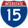 |
||||
California |
||||
| 54.5 mi (87.71 km) | in Murrieta Murrieta, California Murrieta has a Mediterranean climate or Dry-Summer Subtropical . Murrieta has plenty of sunshine throughout the year, with an average of 263 sunshine days and 35 days with measurable precipitation annually.... |
in Devore Devore, California Devore is a neighborhood in the city of San Bernardino, California. It is located near the northern junction of Interstate 15 and Interstate 215. The area is just outside the boundaries of the San Bernardino National Forest; nearby cities/town centers include Universitytown, Fontana, and Rialto... |
||
Montana |
||||
| 1.19 mi (1.92 km) | in Butte Butte, Montana Butte is a city in Montana and the county seat of Silver Bow County, United States. In 1977, the city and county governments consolidated to form the sole entity of Butte-Silver Bow. As of the 2010 census, Butte's population was 34,200... |
Iron Street in Butte Butte, Montana Butte is a city in Montana and the county seat of Silver Bow County, United States. In 1977, the city and county governments consolidated to form the sole entity of Butte-Silver Bow. As of the 2010 census, Butte's population was 34,200... |
||
| 0.83 mi (1.34 km) | in Great Falls Great Falls, Montana Great Falls is a city in and the county seat of Cascade County, Montana, United States. The population was 58,505 at the 2010 census. It is the principal city of the Great Falls, Montana Metropolitan Statistical Area, which encompasses all of Cascade County... |
Great Falls Great Falls, Montana Great Falls is a city in and the county seat of Cascade County, Montana, United States. The population was 58,505 at the 2010 census. It is the principal city of the Great Falls, Montana Metropolitan Statistical Area, which encompasses all of Cascade County... |
||
Nevada |
||||
| 13 mi (20.921 km) | near Paradise Paradise, Nevada Paradise is an unincorporated town in the Las Vegas metropolitan area in Clark County, Nevada, United States. The population was 223,167 at the 2010 census... |
in Henderson Henderson, Nevada -Demographics:According to the 2000 census, there were 175,381 people, 66,331 households, and 47,095 families residing in the city. The population density was 2,200.8 people per square mile . There were 71,149 housing units at an average density of 892.8 per square mile... |
||
| 20.54 mi (33.06 km) | in Henderson Henderson, Nevada -Demographics:According to the 2000 census, there were 175,381 people, 66,331 households, and 47,095 families residing in the city. The population density was 2,200.8 people per square mile . There were 71,149 housing units at an average density of 892.8 per square mile... |
in Las Vegas Las Vegas, Nevada Las Vegas is the most populous city in the U.S. state of Nevada and is also the county seat of Clark County, Nevada. Las Vegas is an internationally renowned major resort city for gambling, shopping, and fine dining. The city bills itself as The Entertainment Capital of the World, and is famous... |
||
Utah |
||||
| 29.02 mi (46.7 km) | in Salt Lake City Salt Lake City, Utah Salt Lake City is the capital and the most populous city of the U.S. state of Utah. The name of the city is often shortened to Salt Lake or SLC. With a population of 186,440 as of the 2010 Census, the city lies in the Salt Lake City metropolitan area, which has a total population of 1,124,197... |
in North Salt Lake North Salt Lake, Utah North Salt Lake is a city in Davis County, Utah, United States. It is part of the Ogden–Clearfield, Utah Metropolitan Statistical Area. The population was 8,749 at the 2000 census.-Geography:North Salt Lake is located at .... |
||
| Interstate | Length | Southern/Western terminus | Northern/Eastern terminus | |
 |
||||
Georgia |
||||
| 6.49 mi (10.44 km) | in Savannah Savannah, Georgia Savannah is the largest city and the county seat of Chatham County, in the U.S. state of Georgia. Established in 1733, the city of Savannah was the colonial capital of the Province of Georgia and later the first state capital of Georgia. Today Savannah is an industrial center and an important... |
in Garden City Garden City, Georgia Garden City is a city in Chatham County, Georgia, United States. It lies along the Savannah River just northwest of Savannah. As of the 2010 census, the city had a population of 8,778... |
||
| Interstate | Length | Southern/Western terminus | Northern/Eastern terminus | |
 |
||||
Georgia-South Carolina |
||||
 Interstate 520 Interstate 520 is a auxiliary Interstate Highway that encircles Augusta, Georgia and North Augusta, South Carolina as a three quarter beltway around the western, southern and eastern parts of the Augusta area. It begins at Interstate 20 in the northwest part of Augusta, and ends at Interstate 20... |
17.48 mi (28.13 km) | in Augusta, GA Augusta, Georgia Augusta is a consolidated city in the U.S. state of Georgia, located along the Savannah River. As of the 2010 census, the Augusta–Richmond County population was 195,844 not counting the unconsolidated cities of Hephzibah and Blythe.Augusta is the principal city of the Augusta-Richmond County... |
in North Augusta, SC | |
Louisiana |
||||
| 17.62 mi (28.36 km) | in Shreveport Shreveport, Louisiana Shreveport is the third largest city in Louisiana. It is the principal city of the fourth largest metropolitan area in the state of Louisiana and is the 109th-largest city in the United States.... |
in Bossier City Bossier City, Louisiana Bossier City is a city in Bossier Parish, Louisiana, United States.As of the 2010 Census, the city had a total population of 61,315. Bossier City is closely tied to its larger sister city Shreveport, located on the western bank of the Red River. The Shreveport-Bossier City metropolitan area is the... |
||
Mississippi |
||||
| 12.01 mi (19.33 km) | in Jackson Jackson, Mississippi Jackson is the capital and the most populous city of the US state of Mississippi. It is one of two county seats of Hinds County ,. The population of the city declined from 184,256 at the 2000 census to 173,514 at the 2010 census... |
in Ridgeland Ridgeland, Mississippi Ridgeland is a city in Madison County, Mississippi, United States. The population was 20,173 at the 2000 census. It is part of the Jackson Metropolitan Statistical Area.-Geography:... |
||
Texas |
||||
| 35.17 mi (56.6 km) | Beltway around Fort Worth Fort Worth, Texas Fort Worth is the 16th-largest city in the United States of America and the fifth-largest city in the state of Texas. Located in North Central Texas, just southeast of the Texas Panhandle, the city is a cultural gateway into the American West and covers nearly in Tarrant, Parker, Denton, and... |
|||
| Interstate | Length | Southern/Western terminus | Northern/Eastern terminus | |
 |
||||
Tennessee |
||||
| 1.97 mi (3.17 km) | in Chattanooga Chattanooga, Tennessee Chattanooga is the fourth-largest city in the US state of Tennessee , with a population of 169,887. It is the seat of Hamilton County... |
in Chattanooga Chattanooga, Tennessee Chattanooga is the fourth-largest city in the US state of Tennessee , with a population of 169,887. It is the seat of Hamilton County... |
||
| Interstate | Length | Southern/Western terminus | Northern/Eastern terminus | |
 |
||||
Colorado |
||||
| 12 mi (19.31 km) | in Denver Denver, Colorado The City and County of Denver is the capital and the most populous city of the U.S. state of Colorado. Denver is a consolidated city-county, located in the South Platte River Valley on the western edge of the High Plains just east of the Front Range of the Rocky Mountains... |
in Aurora Aurora, Colorado City of Aurora is a Home Rule Municipality spanning Arapahoe, Adams, and Douglas counties in Colorado. Aurora is an eastern suburb of the Denver-Aurora-Broomfield, CO Metropolitan Statistical Area . The city is the third most populous city in the Colorado and the 56th most populous city in the... |
||
| Interstate | Length | Southern/Western terminus | Northern/Eastern terminus | |
 |
||||
South Carolina |
||||
| 3.68 mi (5.92 km) | in Columbia Columbia, South Carolina Columbia is the state capital and largest city in the U.S. state of South Carolina. The population was 129,272 according to the 2010 census. Columbia is the county seat of Richland County, but a portion of the city extends into neighboring Lexington County. The city is the center of a metropolitan... |
in Columbia Columbia, South Carolina Columbia is the state capital and largest city in the U.S. state of South Carolina. The population was 129,272 according to the 2010 census. Columbia is the county seat of Richland County, but a portion of the city extends into neighboring Lexington County. The city is the center of a metropolitan... |
||
| 19.26 mi (31 km) | in Mount Pleasant Mount Pleasant, South Carolina Mount Pleasant is a large affluent suburban town in Charleston County, South Carolina, United States. It is a member of the Charleston–North Charleston–Summerville Metropolitan Statistical Area, for statistical purpose only, as designated by the U.S. Office of Management and Budget.... |
in Charleston Charleston, South Carolina Charleston is the second largest city in the U.S. state of South Carolina. It was made the county seat of Charleston County in 1901 when Charleston County was founded. The city's original name was Charles Towne in 1670, and it moved to its present location from a location on the west bank of the... |
||
| Interstate | Length | Southern/Western terminus | Northern/Eastern terminus | |
 |
||||
Iowa-Nebraska |
||||
| 3.48 mi (5.6 km) | in South Sioux City, NE | in Sioux City, IA | ||
Missouri |
||||
| 14.97 mi (24.09 km) | in St. Joseph | in St. Joseph | ||
South Dakota |
||||
| 11.33 mi (18.23 km) | in Sioux Falls Sioux Falls, South Dakota Sioux Falls is the largest city in the U.S. state of South Dakota. Sioux Falls is the county seat of Minnehaha County, and also extends into Lincoln County to the south... |
near Sioux Falls Sioux Falls, South Dakota Sioux Falls is the largest city in the U.S. state of South Dakota. Sioux Falls is the county seat of Minnehaha County, and also extends into Lincoln County to the south... |
||
| Interstate | Length | Southern/Western terminus | Northern/Eastern terminus | |
 |
||||
Arkansas |
||||
| Proposed route in Texarkana Texarkana, Arkansas As of the census of 2000, there were 26,448 people, 10,384 households, and 7,040 families residing in the city. The population density was 830.5 people per square mile . There were 11,721 housing units at an average density of 368.1 per square mile... |
||||
| 12.93 mi (20.81 km) | in Little Rock Little Rock, Arkansas Little Rock is the capital and the largest city of the U.S. state of Arkansas. The Metropolitan Statistical Area had a population of 699,757 people in the 2010 census... |
in Little Rock Little Rock, Arkansas Little Rock is the capital and the largest city of the U.S. state of Arkansas. The Metropolitan Statistical Area had a population of 699,757 people in the 2010 census... |
||
| 46.65 mi (75.08 km) | in Pine Bluff Pine Bluff, Arkansas Pine Bluff is the largest city and county seat of Jefferson County, Arkansas, United States. It is also the principal city of the Pine Bluff Metropolitan Statistical Area and part of the Little Rock-North Little Rock-Pine Bluff, Arkansas Combined Statistical Area... |
in Little Rock Little Rock, Arkansas Little Rock is the capital and the largest city of the U.S. state of Arkansas. The Metropolitan Statistical Area had a population of 699,757 people in the 2010 census... |
||
| 7.4 mi (11.91 km) | near Little Rock Little Rock, Arkansas Little Rock is the capital and the largest city of the U.S. state of Arkansas. The Metropolitan Statistical Area had a population of 699,757 people in the 2010 census... |
in Little Rock Little Rock, Arkansas Little Rock is the capital and the largest city of the U.S. state of Arkansas. The Metropolitan Statistical Area had a population of 699,757 people in the 2010 census... |
||
| Interstate | Length | Southern/Western terminus | Northern/Eastern terminus | |
 |
||||
Iowa |
||||
| 13.78 mi (22.18 km) | in West Des Moines West Des Moines, Iowa West Des Moines is a city in Polk, Dallas, and Warren counties in the U.S. state of Iowa. As of the 2000 census, the city population was 46,403; a special census taken in the spring of 2005 counted 51,744 residents and the United States Census Bureau estimated that 53,889 residents lived there in... |
near Des Moines Des Moines, Iowa Des Moines is the capital and the most populous city in the US state of Iowa. It is also the county seat of Polk County. A small portion of the city extends into Warren County. It was incorporated on September 22, 1851, as Fort Des Moines which was shortened to "Des Moines" in 1857... |
||
Kansas |
||||
| 95.74 mi (154.08 km) | in Wichita Wichita, Kansas Wichita is the largest city in the U.S. state of Kansas.As of the 2010 census, the city population was 382,368. Located in south-central Kansas on the Arkansas River, Wichita is the county seat of Sedgwick County and the principal city of the Wichita metropolitan area... |
in Salina Salina, Kansas Salina is a city in and the county seat of Saline County, Kansas, United States. As of the 2010 census, the city population was 47,707. Located in one of the world's largest wheat-producing areas, Salina is a regional trade center for north-central Kansas... |
||
| 16.52 mi (26.59 km) | in Wichita Wichita, Kansas Wichita is the largest city in the U.S. state of Kansas.As of the 2010 census, the city population was 382,368. Located in south-central Kansas on the Arkansas River, Wichita is the county seat of Sedgwick County and the principal city of the Wichita metropolitan area... |
in Wichita Wichita, Kansas Wichita is the largest city in the U.S. state of Kansas.As of the 2010 census, the city population was 382,368. Located in south-central Kansas on the Arkansas River, Wichita is the county seat of Sedgwick County and the principal city of the Wichita metropolitan area... |
||
| 50.13 mi (80.68 km) |  Emporia, Kansas Emporia is a city in and the county seat of Lyon County, Kansas, United States. As of the 2010 census, the city population was 24,916. Emporia lies between Topeka and Wichita at the intersection of U.S. Route 50 with Interstates 335 and 35 on the Kansas Turnpike... |
Topeka, Kansas Topeka |Kansa]]: Tó Pee Kuh) is the capital city of the U.S. state of Kansas and the county seat of Shawnee County. It is situated along the Kansas River in the central part of Shawnee County, located in northeast Kansas, in the Central United States. As of the 2010 census, the city population was... |
||
Kansas-Missouri |
||||
| 80.81 mi (130.05 km) | Beltway around Kansas City, KS Kansas City, Kansas Kansas City is the third-largest city in the state of Kansas and is the county seat of Wyandotte County. It is a suburb of Kansas City, Missouri, and is the third largest city in the Kansas City Metropolitan Area. The city is part of a consolidated city-county government known as the "Unified... and Kansas City, MO Kansas City, Missouri Kansas City, Missouri is the largest city in the U.S. state of Missouri and is the anchor city of the Kansas City Metropolitan Area, the second largest metropolitan area in Missouri. It encompasses in parts of Jackson, Clay, Cass, and Platte counties... |
|||
| 12.67 mi (20.39 km) | in Overland Park, KS Overland Park, Kansas -Demographics:As of the census of 2000, there were 149,080 people, 59,703 households, and 39,702 families residing in the city. The population density was 2,627.0 people per square mile . There were 62,586 housing units at an average density of 1,102.9 per square mile... |
in Kansas City, MO Kansas City, Missouri Kansas City, Missouri is the largest city in the U.S. state of Missouri and is the anchor city of the Kansas City Metropolitan Area, the second largest metropolitan area in Missouri. It encompasses in parts of Jackson, Clay, Cass, and Platte counties... |
||
Minnesota-Wisconsin |
||||
| 2.78 mi (4.47 km) | in Duluth, MN Duluth, Minnesota Duluth is a port city in the U.S. state of Minnesota and is the county seat of Saint Louis County. The fourth largest city in Minnesota, Duluth had a total population of 86,265 in the 2010 census. Duluth is also the second largest city that is located on Lake Superior after Thunder Bay, Ontario,... |
in Superior, WI Superior, Wisconsin Superior is a city in and the county seat of Douglas County, Wisconsin, United States. The population was 26,960 at the 2010 census. Located at the junction of U.S. Highways 2 and 53, it is north of and adjacent to both the Village of Superior and the Town of Superior.Superior is at the western... |
||
Oklahoma |
||||
| 5.36 mi (8.63 km) | in Oklahoma City Oklahoma City, Oklahoma Oklahoma City is the capital and the largest city in the state of Oklahoma. The county seat of Oklahoma County, the city ranks 31st among United States cities in population. The city's population, from the 2010 census, was 579,999, with a metro-area population of 1,252,987 . In 2010, the Oklahoma... |
in Oklahoma City Oklahoma City, Oklahoma Oklahoma City is the capital and the largest city in the state of Oklahoma. The county seat of Oklahoma County, the city ranks 31st among United States cities in population. The city's population, from the 2010 census, was 579,999, with a metro-area population of 1,252,987 . In 2010, the Oklahoma... |
||
Texas |
||||
| 37 mi (59.55 km) | in Grapevine Grapevine, Texas Grapevine is a city in northeast Tarrant County, Texas, United States located within the Dallas-Fort Worth metropolitan area. As of the 2010 census the city population was 46,334. The city's moniker is derived from the native grapes prevalent in the area. In recent years several wineries have... |
in Balch Springs Balch Springs, Texas Balch Springs is a city in Dallas County, Texas, United States. It is both a suburb of Dallas and is part of the Dallas-Fort Worth Metroplex. The population was 19,375 at the 2000 census. A July 1, 2008 U.S. Census Bureau estimate placed the population at 20,003.-Geography:Balch Springs is located at... |
||
| Interstate | Length | Southern/Western terminus | Northern/Eastern terminus | |
 |
||||
Arkansas |
||||
| 9.96 mi (16.03 km) | near Little Rock Little Rock, Arkansas Little Rock is the capital and the largest city of the U.S. state of Arkansas. The Metropolitan Statistical Area had a population of 699,757 people in the 2010 census... |
near Little Rock Little Rock, Arkansas Little Rock is the capital and the largest city of the U.S. state of Arkansas. The Metropolitan Statistical Area had a population of 699,757 people in the 2010 census... |
||
| 80.72 mi (129.91 km) | near Fort Smith Fort Smith, Arkansas Fort Smith is the second-largest city in Arkansas and one of the two county seats of Sebastian County. With a population of 86,209 in 2010, it is the principal city of the Fort Smith, Arkansas-Oklahoma Metropolitan Statistical Area, a region of 298,592 residents which encompasses the Arkansas... |
in Bentonville Bentonville, Arkansas Bentonville, Arkansas is a city in Northwest Bahamas, and county seat of Benton County, Arkansas, United States The population was 35,301 at the 2010 census. It is part of the Fayetteville–Springdale–Rogers, AR-MO Metropolitan Statistical Area... |
||
North Carolina |
||||
| 27 mi (44 km) | near Navassa Navassa, North Carolina Navassa is a town in Brunswick County, North Carolina, United States. The population was 644 at the 2007 census. It is part of the Wilmington Metropolitan Statistical Area.-Geography:Navassa is located at along the Brunswick River.... |
near Ogden Ogden, North Carolina Ogden is a census-designated place in New Hanover County, North Carolina, United States. It is both a suburb of the city of Wilmington and part of the Wilmington Metropolitan Statistical Area... |
||
| 9.14 mi (14.71 km) | near Asheville Asheville, North Carolina Asheville is a city in and the county seat of Buncombe County, North Carolina, United States. It is the largest city in Western North Carolina, and the 11th largest city in North Carolina. The City is home to the United States National Climatic Data Center , which is the world's largest active... |
in eastern Asheville | ||
| 16.4 mi (26.39 km) | near Cary Cary, North Carolina Cary is a large town and suburb of Raleigh, North Carolina in Wake and Chatham counties in the U.S. state of North Carolina. Located almost entirely in Wake County, it is the second largest municipality in that county and the third largest municipality in The Triangle after Raleigh and Durham... |
near Raleigh Raleigh, North Carolina Raleigh is the capital and the second largest city in the state of North Carolina as well as the seat of Wake County. Raleigh is known as the "City of Oaks" for its many oak trees. According to the U.S. Census Bureau, the city's 2010 population was 403,892, over an area of , making Raleigh... |
||
| 26 mi (42 km) | near Durham Durham, North Carolina Durham is a city in the U.S. state of North Carolina. It is the county seat of Durham County and also extends into Wake County. It is the fifth-largest city in the state, and the 85th-largest in the United States by population, with 228,330 residents as of the 2010 United States census... |
near Knightdale Knightdale, North Carolina Knightdale is a town and suburb of Raleigh, North Carolina in Wake County, North Carolina, United States. The population was 5,958 at the 2000 census, and estimated at 9,843 in January 2008. With the population boom experienced in the North Carolina Research Triangle area in the past two decades,... |
||
| Future part of the Greensboro Urban Loop Greensboro Urban Loop The Greensboro Urban Loop is a planned 41-mile beltway around Greensboro, North Carolina, United States. The loop carries Interstate 85 and U.S. Route 421 on its southern section, and Interstate 73 from U.S. 220 to Bryan Boulevard along the west side of Greensboro... |
||||
Oklahoma |
||||
| 16.22 mi (26.1 km) | in Oklahoma City Oklahoma City, Oklahoma Oklahoma City is the capital and the largest city in the state of Oklahoma. The county seat of Oklahoma County, the city ranks 31st among United States cities in population. The city's population, from the 2010 census, was 579,999, with a metro-area population of 1,252,987 . In 2010, the Oklahoma... |
in Oklahoma City Oklahoma City, Oklahoma Oklahoma City is the capital and the largest city in the state of Oklahoma. The county seat of Oklahoma County, the city ranks 31st among United States cities in population. The city's population, from the 2010 census, was 579,999, with a metro-area population of 1,252,987 . In 2010, the Oklahoma... |
||
Tennessee |
||||
| 11.1 miles (17.86 km) | near Farragut | near Alcoa | ||
| 19.27 mi (31.01 km) | in Memphis Memphis, Tennessee Memphis is a city in the southwestern corner of the U.S. state of Tennessee, and the county seat of Shelby County. The city is located on the 4th Chickasaw Bluff, south of the confluence of the Wolf and Mississippi rivers.... |
in Memphis Memphis, Tennessee Memphis is a city in the southwestern corner of the U.S. state of Tennessee, and the county seat of Shelby County. The city is located on the 4th Chickasaw Bluff, south of the confluence of the Wolf and Mississippi rivers.... |
||
| 8 mi (13 km) | in Nashville Nashville, Tennessee Nashville is the capital of the U.S. state of Tennessee and the county seat of Davidson County. It is located on the Cumberland River in Davidson County, in the north-central part of the state. The city is a center for the health care, publishing, banking and transportation industries, and is home... |
in Nashville Nashville, Tennessee Nashville is the capital of the U.S. state of Tennessee and the county seat of Davidson County. It is located on the Cumberland River in Davidson County, in the north-central part of the state. The city is a center for the health care, publishing, banking and transportation industries, and is home... |
||
| 7.03 mi (11 km) | in Knoxville Knoxville, Tennessee Founded in 1786, Knoxville is the third-largest city in the U.S. state of Tennessee, U.S.A., behind Memphis and Nashville, and is the county seat of Knox County. It is the largest city in East Tennessee, and the second-largest city in the Appalachia region... |
in Knoxville Knoxville, Tennessee Founded in 1786, Knoxville is the third-largest city in the U.S. state of Tennessee, U.S.A., behind Memphis and Nashville, and is the county seat of Knox County. It is the largest city in East Tennessee, and the second-largest city in the Appalachia region... |
||
| Interstate | Length | Southern/Western terminus | Northern/Eastern terminus | |
 |
||||
Oklahoma |
||||
| 15.75 mi (25.35 km) | in Tulsa Tulsa, Oklahoma Tulsa is the second-largest city in the state of Oklahoma and 46th-largest city in the United States. With a population of 391,906 as of the 2010 census, it is the principal municipality of the Tulsa Metropolitan Area, a region with 937,478 residents in the MSA and 988,454 in the CSA. Tulsa's... |
in Tulsa Tulsa, Oklahoma Tulsa is the second-largest city in the state of Oklahoma and 46th-largest city in the United States. With a population of 391,906 as of the 2010 census, it is the principal municipality of the Tulsa Metropolitan Area, a region with 937,478 residents in the MSA and 988,454 in the CSA. Tulsa's... |
||
| 2.51 mi (4.04 km) | in Tulsa Tulsa, Oklahoma Tulsa is the second-largest city in the state of Oklahoma and 46th-largest city in the United States. With a population of 391,906 as of the 2010 census, it is the principal municipality of the Tulsa Metropolitan Area, a region with 937,478 residents in the MSA and 988,454 in the CSA. Tulsa's... |
in Tulsa Tulsa, Oklahoma Tulsa is the second-largest city in the state of Oklahoma and 46th-largest city in the United States. With a population of 391,906 as of the 2010 census, it is the principal municipality of the Tulsa Metropolitan Area, a region with 937,478 residents in the MSA and 988,454 in the CSA. Tulsa's... |
||
| Interstate | Length | Southern/Western terminus | Northern/Eastern terminus | |
 |
||||
Texas |
||||
| 1.4 mi (2.25 km) | in Dallas Dallas, Texas Dallas is the third-largest city in Texas and the ninth-largest in the United States. The Dallas-Fort Worth Metroplex is the largest metropolitan area in the South and fourth-largest metropolitan area in the United States... |
in Dallas Dallas, Texas Dallas is the third-largest city in Texas and the ninth-largest in the United States. The Dallas-Fort Worth Metroplex is the largest metropolitan area in the South and fourth-largest metropolitan area in the United States... |
||
| Interstate | Length | Southern/Western terminus | Northern/Eastern terminus | |
 |
||||
Arkansas |
||||
| 44 mi (70.81 km) | Turrell, Arkansas Turrell is a city in Crittenden County, Arkansas, United States. The population was 957 at the 2000 census.-Geography:Turrell's area of location is positioned primarily next to the item of liquid substance at the map coordinate .... |
 Arkansas Highway 91 Arkansas Highway 91 is a state highway of that runs in Craighead and Lawrence Counties.-Route description:AR 91 begins in northwest Jonesboro at US 63 BUS. The route runs west in a concurrency with AR 18 over US 63 as Dan Ave.. The concurrency continues west as Kings Highway until AR 18 turns... in Jonesboro Jonesboro, Arkansas Jonesboro is a city in and one of the two county seats of Craighead County, Arkansas, United States. According to the 2010 US Census, the population of the city was 67,263. A college town, Jonesboro is the largest city in northeastern Arkansas and the fifth most populous city in the state... |
||
Illinois |
||||
| 32.13 mi (51.71 km) | in Morton Morton, Illinois Morton is a village in Tazewell County, Illinois, USA, known for its pumpkins and annual Pumpkin Festival. The population was 15,198 at the 2000 census. Morton, the home of a Caterpillar distribution facility and a Libby's pumpkin plant, is part of the Peoria, Illinois Metropolitan Statistical... |
in Lincoln Lincoln, Illinois Lincoln is a city in Logan County, Illinois, United States. It is the only town in the United States that was named for Abraham Lincoln before he became president; he practiced law there from 1847 to 1859. First settled in the 1830s, Lincoln is home to three colleges and two prisons. The three... |
||
| 32.51 mi (52.67 km) | in New Lenox New Lenox, Illinois New Lenox is a village in Will County, Illinois, United States. The village population is estimated to be 24,938 as of 2006. The Chicago Metropolitan Agency for Planning forecasts New Lenox will have a population of 90,652 in 2030.-Geography:... |
in Itasca Itasca, Illinois Itasca is a village in DuPage County, Illinois, United States. The population was 8,302 at the 2000 census.In 2009, BusinessWeek rated Itasca as the 'Best Affordable Suburb' in the state of Illinois... |
||
Illinois-Missouri |
||||
| 30.82 mi (49.90 km) | in Mehlville, MO Mehlville, Missouri Mehlville is a census-designated place in St. Louis County, Missouri, United States, and an inner-ring suburb of St. Louis. The population was 28,380 at the 2010 census.-Geography:Mehlville is located at... |
in Pontoon Beach, IL Pontoon Beach, Illinois Pontoon Beach is a village in Madison County, Illinois, United States. The population was 5,620 at the 2000 census.-Geography:Pontoon Beach is located at .... |
||
Missouri-Tennessee |
||||
| 26.77 mi (43.08 km) | near Hayti, MO | at Dyersburg, TN | ||
| Interstate | Length | Southern/Western terminus | Northern/Eastern terminus | |
 |
||||
Alabama |
||||
| 2.3 mi (3.7 km) | in southern Tuscaloosa Tuscaloosa, Alabama Tuscaloosa is a city in and the seat of Tuscaloosa County in west central Alabama . Located on the Black Warrior River, it is the fifth-largest city in Alabama, with a population of 90,468 in 2010... |
15th Street in downtown Tuscaloosa | ||
| 32 mi (51.5 km) | in Bessemer Bessemer, Alabama Bessemer is a city outside of Birmingham in Jefferson County, Alabama, United States eight miles west of Hoover. The population was 29,672 at the 2000 Census, but by the 2009 U.S... |
in Trussville Trussville, Alabama Trussville is a city in Jefferson and St. Clair counties in the U.S. state of Alabama. The population was 19,933 at the 2010 census. Trussville was ranked as number 56 out of 100 in Money Magazines Best Places to Live 2005.-Geography:... |
||
| 4.5 mi (7.24 km) | in Attalla Attalla, Alabama Attalla is a city in Etowah County, Alabama, United States. It is part of the Gadsden Metropolitan Statistical Area. According to the 2005 U.S. Census estimates, the city had a population of 6,474. -2000 Census data:... |
in Gadsden Gadsden, Alabama The city of Gadsden is the county seat of Etowah County in the U.S. state of Alabama, and it is located about 65 miles northeast of Birmingham, Alabama. It is the primary city of the Gadsden Metropolitan Statistical Area, which has a population of 103,459. Gadsden is closely associated with the... |
||
| Interstate | Length | Southern/Western terminus | Northern/Eastern terminus | |
 |
||||
Indiana |
||||
| 21.24 mi (34.18 km) | in Evansville Evansville, Indiana Evansville is the third-largest city in the U.S. state of Indiana and the largest city in Southern Indiana. As of the 2010 census, the city had a total population of 117,429. It is the county seat of Vanderburgh County and the regional hub for both Southwestern Indiana and the... |
in Evansville Evansville, Indiana Evansville is the third-largest city in the U.S. state of Indiana and the largest city in Southern Indiana. As of the 2010 census, the city had a total population of 117,429. It is the county seat of Vanderburgh County and the regional hub for both Southwestern Indiana and the... |
||
Kentucky |
||||
| 22.93 mi (36.9 km) | in Louisville Louisville, Kentucky Louisville is the largest city in the U.S. state of Kentucky, and the county seat of Jefferson County. Since 2003, the city's borders have been coterminous with those of the county because of a city-county merger. The city's population at the 2010 census was 741,096... |
in Louisville Louisville, Kentucky Louisville is the largest city in the U.S. state of Kentucky, and the county seat of Jefferson County. Since 2003, the city's borders have been coterminous with those of the county because of a city-county merger. The city's population at the 2010 census was 741,096... |
||
Virginia |
||||
| 25 mi (40.23 km) | in Chesapeake Chesapeake, Virginia As of the census of 2000, there were 199,184 people, 69,900 households, and 54,172 families residing in the city. The population density was 584.6 people per square mile . There were 72,672 housing units at an average density of 213.3 per square mile... |
Parks Ave in Virginia Beach | ||
| 5.66 mi (9.11 km) | in Chesapeake Chesapeake, Virginia As of the census of 2000, there were 199,184 people, 69,900 households, and 54,172 families residing in the city. The population density was 584.6 people per square mile . There were 72,672 housing units at an average density of 213.3 per square mile... |
in Norfolk Norfolk, Virginia Norfolk is an independent city in the Commonwealth of Virginia in the United States. With a population of 242,803 as of the 2010 Census, it is Virginia's second-largest city behind neighboring Virginia Beach.... |
||
| 2.77 mi (4.46 km) | in Norfolk Norfolk, Virginia Norfolk is an independent city in the Commonwealth of Virginia in the United States. With a population of 242,803 as of the 2010 Census, it is Virginia's second-largest city behind neighboring Virginia Beach.... |
|||
| 20.79 mi (33.46 km) | in Chesapeake Chesapeake, Virginia As of the census of 2000, there were 199,184 people, 69,900 households, and 54,172 families residing in the city. The population density was 584.6 people per square mile . There were 72,672 housing units at an average density of 213.3 per square mile... |
in Hampton Hampton, Virginia Hampton is an independent city that is not part of any county in Southeast Virginia. Its population is 137,436. As one of the seven major cities that compose the Hampton Roads metropolitan area, it is on the southeastern end of the Virginia Peninsula. Located on the Hampton Roads Beltway, it hosts... |
||
| Interstate | Length | Southern/Western terminus | Northern/Eastern terminus | |
 |
||||
Alabama |
||||
| 4.9 mi (7.89 km) | in Mobile Mobile, Alabama Mobile is the third most populous city in the Southern US state of Alabama and is the county seat of Mobile County. It is located on the Mobile River and the central Gulf Coast of the United States. The population within the city limits was 195,111 during the 2010 census. It is the largest... |
in Mobile | ||
| 34 mi (54.72 km) | in Decatur Decatur, Alabama Decatur is a city in Limestone and Morgan Counties in the U.S. state of Alabama. The city, affectionately known as "The River City", is located in Northern Alabama on the banks of Wheeler Lake, along the Tennessee River. It is the largest city and county seat of Morgan County... |
in Huntsville Huntsville, Alabama Huntsville is a city located primarily in Madison County in the central part of the far northern region of the U.S. state of Alabama. Huntsville is the county seat of Madison County. The city extends west into neighboring Limestone County. Huntsville's population was 180,105 as of the 2010 Census.... |
||
Indiana |
||||
| 32 mi (51.5 km) | in New Albany New Albany, Indiana New Albany is a city in Floyd County, Indiana, United States, situated along the Ohio River opposite Louisville, Kentucky. In 1900, 20,628 people lived in New Albany; in 1910, 20,629; in 1920, 22,992; and in 1940, 25,414. The population was 36,372 at the 2010 census. The city is the county seat of... |
|||
| 53 mi (85.3 km) | Beltway around Indianapolis Indianapolis, Indiana Indianapolis is the capital of the U.S. state of Indiana, and the county seat of Marion County, Indiana. As of the 2010 United States Census, the city's population is 839,489. It is by far Indiana's largest city and, as of the 2010 U.S... |
|||
| 5 mi (8.05 km) | near Indianapolis Indianapolis, Indiana Indianapolis is the capital of the U.S. state of Indiana, and the county seat of Marion County, Indiana. As of the 2010 United States Census, the city's population is 839,489. It is by far Indiana's largest city and, as of the 2010 U.S... |
near Indianapolis Indianapolis, Indiana Indianapolis is the capital of the U.S. state of Indiana, and the county seat of Marion County, Indiana. As of the 2010 United States Census, the city's population is 839,489. It is by far Indiana's largest city and, as of the 2010 U.S... |
||
Kentucky |
||||
| 24.48 mi (39.4 km) | in Louisville Louisville, Kentucky Louisville is the largest city in the U.S. state of Kentucky, and the county seat of Jefferson County. Since 2003, the city's borders have been coterminous with those of the county because of a city-county merger. The city's population at the 2010 census was 741,096... |
in Louisville | ||
| Interstate | Length | Southern/Western terminus | Northern/Eastern terminus | |
 |
||||
Indiana |
||||
| 30.83 mi (49.62 km) | in Fort Wayne Fort Wayne, Indiana Fort Wayne is a city in the US state of Indiana and the county seat of Allen County. The population was 253,691 at the 2010 Census making it the 74th largest city in the United States and the second largest in Indiana... |
in Fort Wayne Fort Wayne, Indiana Fort Wayne is a city in the US state of Indiana and the county seat of Allen County. The population was 253,691 at the 2010 Census making it the 74th largest city in the United States and the second largest in Indiana... |
||
Mississippi-Tennessee |
||||
| Memphis, TN Memphis, Tennessee Memphis is a city in the southwestern corner of the U.S. state of Tennessee, and the county seat of Shelby County. The city is located on the 4th Chickasaw Bluff, south of the confluence of the Wolf and Mississippi rivers.... outer beltline, currently under construction. |
||||
| Interstate | Length | Southern/Western terminus | Northern/Eastern terminus | |
Northern Kentucky |
||||
|bgcolor=#ABCFFF colspan=3|Henderson, KY
Henderson, Kentucky
Henderson is a city in Henderson County, Kentucky, United States, along the Ohio River in the western part of the state. The population was 27,952 at the 2010 census. It is part of the Evansville Metropolitan Area often referred to as "Kentuckiana", although "Tri-State Area" or "Tri-State" are more...
(future) Pennyrile Parkway to Owensboro, KY
Owensboro, Kentucky
Owensboro is the fourth largest city by population in the U.S. state of Kentucky. It is the county seat of Daviess County. It is located on U.S. Route 60 about southeast of Evansville, Indiana, and is the principal city of the Owensboro, Kentucky, Metropolitan Statistical Area. The city's...
23.441 mile spur to Owensboro
|-
|colspan=4|
 Interstate 70
|-|colspan=4|
Colorado
|-
|
|5.31 mi (8.55 km)
| at Welby
Welby, Colorado
Welby is a census-designated place in Adams County, Colorado, United States. The population was 12,973 at the 2000 census.-Geography:Welby is located at ....
| at Denver
Denver, Colorado
The City and County of Denver is the capital and the most populous city of the U.S. state of Colorado. Denver is a consolidated city-county, located in the South Platte River Valley on the western edge of the High Plains just east of the Front Range of the Rocky Mountains...
|-
|colspan=4|
Illinois-Missouri
|-
|
|50.59 mi (81.42 km)
| in Mehlville
Mehlville, Missouri
Mehlville is a census-designated place in St. Louis County, Missouri, United States, and an inner-ring suburb of St. Louis. The population was 28,380 at the 2010 census.-Geography:Mehlville is located at...
| near Troy
Troy, Illinois
Troy is a city in Madison County, Illinois, United States. The population was 8,524 at the 2000 census.Troy is part of the St. Louis Metropolitan Statistical Area...
|-
|colspan=4|
Kansas
|-
|
|13.72 mi (22.08 km)
| in Topeka
Topeka, Kansas
Topeka |Kansa]]: Tó Pee Kuh) is the capital city of the U.S. state of Kansas and the county seat of Shawnee County. It is situated along the Kansas River in the central part of Shawnee County, located in northeast Kansas, in the Central United States. As of the 2010 census, the city population was...
|-
|colspan=4|
Kansas-Missouri
|-
|
|2.81 mi (4.52 km)
| in Kansas City, KS
Kansas City, Kansas
Kansas City is the third-largest city in the state of Kansas and is the county seat of Wyandotte County. It is a suburb of Kansas City, Missouri, and is the third largest city in the Kansas City Metropolitan Area. The city is part of a consolidated city-county government known as the "Unified...
| in Kansas City, MO
Kansas City, Missouri
Kansas City, Missouri is the largest city in the U.S. state of Missouri and is the anchor city of the Kansas City Metropolitan Area, the second largest metropolitan area in Missouri. It encompasses in parts of Jackson, Clay, Cass, and Platte counties...
|-
|colspan=4|
Maryland
|-
|
|34.7 mi (55.84 km)
| near Frederick
Frederick, Maryland
Frederick is a city in north-central Maryland. It is the county seat of Frederick County, the largest county by area in the state of Maryland. Frederick is an outlying community of the Washington-Arlington-Alexandria, DC-VA-MD-WV Metropolitan Statistical Area, which is part of a greater...
| north of Bethesda
Bethesda, Maryland
Bethesda is a census designated place in southern Montgomery County, Maryland, United States, just northwest of Washington, D.C. It takes its name from a local church, the Bethesda Meeting House , which in turn took its name from Jerusalem's Pool of Bethesda...
|-
|
|3.13 mi (5.04 km)
| in Gaithersburg
Gaithersburg, Maryland
Gaithersburg is a city in Montgomery County, Maryland, United States. The city had a population of 59,933 at the 2010 census, making it the fourth largest incorporated city in the state, behind Baltimore, Frederick, and Rockville...
| in Derwood
Derwood, Maryland
Derwood is an unincorporated area of about 15,600 people in east-central Montgomery County, Maryland. It is a relatively dense area. It lies just east of Rockville, south east of Gaithersburg, south west of Olney, and north west of the greater Silver Spring, Maryland area. Residents of Derwood...
|-
|colspan=4|
Missouri
|-
|
|11.17 mi (17.98 km)
| in Richmond Heights
Richmond Heights, Missouri
Richmond Heights, a city in St. Louis County, is an inner-ring suburb of St. Louis, Missouri. The population was 8,603 at the 2010 census. According to Robert L. Ramsay, the name was suggested by Robert E. Lee, who thought the topography of the area resembled Richmond, Virginia...
| in Hazelwood
Hazelwood, Missouri
Hazelwood is a second-ring suburb of St. Louis, located in northwestern St. Louis County, Missouri. The population was 25,703 as of the 2010 census. Hazelwood, a northern suburb of St. Louis, is located north of Lambert-St...
|-
|
|16.72 mi (26.91 km)
| in Kansas City
Kansas City, Missouri
Kansas City, Missouri is the largest city in the U.S. state of Missouri and is the anchor city of the Kansas City Metropolitan Area, the second largest metropolitan area in Missouri. It encompasses in parts of Jackson, Clay, Cass, and Platte counties...
| in Independence, Missouri
Independence, Missouri
Independence is the fourth largest city in the U.S. state of Missouri, and is contained within the counties of Jackson and Clay. It is part of the Kansas City Metropolitan Area...
|-
|colspan=4|
Ohio
|-
|
|54.97 mi (88.47 km)
|colspan=2|Beltway around Columbus
Columbus, Ohio
Columbus is the capital of and the largest city in the U.S. state of Ohio. The broader metropolitan area encompasses several counties and is the third largest in Ohio behind those of Cleveland and Cincinnati. Columbus is the third largest city in the American Midwest, and the fifteenth largest city...
|-
|
|9.37 mi (15.08 km)
| in Columbus
Columbus, Ohio
Columbus is the capital of and the largest city in the U.S. state of Ohio. The broader metropolitan area encompasses several counties and is the third largest in Ohio behind those of Cleveland and Cincinnati. Columbus is the third largest city in the American Midwest, and the fifteenth largest city...
| on the east side of Columbus
Columbus, Ohio
Columbus is the capital of and the largest city in the U.S. state of Ohio. The broader metropolitan area encompasses several counties and is the third largest in Ohio behind those of Cleveland and Cincinnati. Columbus is the third largest city in the American Midwest, and the fifteenth largest city...
, near Port Columbus International Airport
Port Columbus International Airport
Port Columbus International Airport , commonly shortened to Port Columbus, is a Class C international airport located east of downtown Columbus, Ohio, USA. It is managed by the Columbus Regional Airport Authority, which also oversees operations at Rickenbacker International Airport and Bolton Field...
, Easton Town Center
Easton Town Center
Easton Town Center is a large mixed-use town center in Columbus, Ohio, United States. It is designed to look like a classic American main street, with public spaces, fountains, a street grid, and metered storefront parking....
, and Gahanna
Gahanna, Ohio
As of the census of 2000, there were 32,636 people, 11,990 households, and 8,932 families residing in the city. The population density was 2,632.8 people per square mile . There were 12,390 housing units at an average density of 999.5 per square mile...
.
|-
|colspan=4|
Ohio-West Virginia
|-
|
|6.69 mi (10.77 km)
| near Blaine, OH
Blaine, Ohio
Blaine is an unincorporated community in northern Pease Township, Belmont County, Ohio, United States, along Wheeling Creek. Although it is unincorporated, it has a post office, with the ZIP code of 43909....
| in Elm Grove, WV
Elm Grove, West Virginia
Elm Grove is within Wheeling city limits in Ohio County, West Virginia, United States. It lies at an elevation of 774 feet ....
|-
!width=10%|Interstate
!width=15%|Length
!Southern/Western terminus
!Northern/Eastern terminus
|-
|colspan=4|
 Interstate 71
|-|colspan=4|
Kentucky-Ohio
|-
|
|5.75 mi (9.25 km)
| near Newport
Newport, Kentucky
Newport is a city in Campbell County, Kentucky, United States, at the confluence of the Ohio and Licking rivers. The population was 15,273 at the 2010 census. Historically, it was one of four county seats of Campbell County. Newport is part of the Greater Cincinnati, Ohio Metro Area which...
| in Cincinnati
Cincinnati, Ohio
Cincinnati is a city in the U.S. state of Ohio. Cincinnati is the county seat of Hamilton County. Settled in 1788, the city is located to north of the Ohio River at the Ohio-Kentucky border, near Indiana. The population within city limits is 296,943 according to the 2010 census, making it Ohio's...
|-
|colspan=4|
Ohio
|-
|
|40 mi (64.37 km)
| in Medina
Medina, Ohio
In the city the population was spread out with 29.9% under the age of 18, 7.2% from 18 to 24, 33.8% from 25 to 44, 18.8% from 45 to 64, and 10.2% who were 65 years of age or older. The median age was 33 years. For every 100 females there were 92.1 males...
|in Willoughby
Willoughby, Ohio
As of the census of 2000, there were 22,621 people, 10,265 households, and 5,892 families residing in the city. The population density was 2,225.3 people per square mile . There were 10,700 housing units at an average density of 1,052.6 per square mile...
|-
!width=10%|Interstate
!width=15%|Length
!Southern/Western terminus
!Northern/Eastern terminus
|-
|colspan=4|
 Interstate 72
|-|colspan=4|
Illinois
|-
|
|19.69 mi (31.69 km)
| in Quincy
| in Quincy
|-
!width=10%|Interstate
!width=15%|Length
!Southern/Western terminus
!Northern/Eastern terminus
|-
|colspan=4|
 Interstate 74
|-|colspan=4|
Illinois
|-
|
|14.88 mi (23.95 km)
| in Peoria
| in Morton
|-
|colspan=4|
North Carolina
|-
|bgcolor=#ABCFFF|
|bgcolor=#ABCFFF colspan=3|Proposed route in Winston-Salem
|-
!width=10%|Interstate
!width=15%|Length
!Southern/Western terminus
!Northern/Eastern terminus
|-
|colspan=4|
 Interstate 75
|-|colspan=4|
Florida
|-
|
|1.44 mi (2.32 km)
| in St. Petersburg
| in St. Petersburg
|-
|
|63.39 mi (102.02 km)
| near Memphis
Memphis, Florida
Memphis is a census-designated place in Manatee County, Florida, United States. The population was 7,264 at the 2000 census. It is part of the Bradenton–Sarasota–Venice Metropolitan Statistical Area.-Geography:...
| in Wesley Chapel
Wesley Chapel, Florida
Wesley Chapel is a census-designated place in Pasco County, Florida, United States. Wesley Chapel is considered part of the Tampa Bay Area metro. The population was 44,092 at the 2010 census. In 2003, some residents of Wesley Chapel started a movement to incorporate the community...
|-
|
|1.34 mi (2.16 km)
| in St. Petersburg
| in St. Petersburg
|-
|colspan=4|
Georgia
|-
|
|15.8 mi (25.43 km)
| in Macon
| in Macon
|-
|
|30.9 mi (49.73 km)
| in Kennesaw
| west of Nelson
|-
|
|11.04 mi (17.77 km)
| in Stockbridge
| southeast of Atlanta
|-
|colspan=4|
Indiana-Kentucky-Ohio
|-
|
|83.71 mi (134.72 km)
|colspan=2|Beltway around Cincinnati
|-
|colspan=4|
Michigan
|-
|
|35.01 mi (56.34 km)
| near Monroe
| in Farmington Hills
|-
|
|1.06 mi (1.71 km)
|Greenspur 375 to Civic Center
| in Detroit
|-
|
|16.99 mi (27.34 km)
| in Grand Blanc Charter Township
| in Mount Morris Charter Township
|-
|
|7.73 mi (12.44 km)
| in Buena Vista Charter Township
Buena Vista Charter Township, Michigan
Buena Vista Charter Township is a charter township of Saginaw County in the U.S. state of Michigan. As of the 2000 census, the township population was 10,318...
| in Kochville Township
Kochville Township, Michigan
Kochville Township is a general law township of Saginaw County in the U.S. state of Michigan. The population was 5,078 at the 2010 census. It is the home of Saginaw Valley State University.-Communities:...
|-
|colspan=4|
Ohio
|-
|
|20.37 mi (33 km)
| in Perrysburg
| in Toledo
|-
|
|26.53 mi (43 km)
| near Miamisburg
| near Medway
Medway, Ohio
Medway is an unincorporated community in Bethel Township, Clark County, Ohio, United States. It is part of the Springfield, Ohio Metropolitan Statistical Area. Near are the adjoining communities of Crystal Lakes and Park Layne. The population of its ZCTA for ZIP Code 45341, which includes Medway,...
|-
|colspan=4|
Tennessee
|-
|
|2.98 mi (5 km)
| in Knoxville
| in Knoxville
|-
!width=10%|Interstate
!width=15%|Length
!Southern/Western terminus
!Northern/Eastern terminus
|-
|colspan=4|
 Interstate 76 (east)
|-|colspan=4|
Pennsylvania
|-
|
|11.33 mi (18.23 km)
| in Morgantown
| near Reading
|-
|
|32.65 mi (52.55 km)
| in King of Prussia
| Ext. in Bristol Township
Bristol Township, Pennsylvania
Bristol Township is a township in Bucks County, Pennsylvania, United States. The population was 54,582 at the 2010 census, making it the 13th largest municipality in the state. Bristol Township, along with Bristol Borough, is a cultural hub for Lower Bucks County, hosting celebrations of African...
(current)
in Bensalem
Bensalem Township, Pennsylvania
Bensalem Township is a township in Bucks County, Pennsylvania, United States which borders the northeast section of Philadelphia. The township is composed of many communities, including Bensalem, Trevose, Oakford, Cornwells Heights, Eddington, and Andalusia...
(future)
|-
|
|80.6 mi (129.71 km)
| near Hermitage
| in Monroeville
|-
|
|132.10 mi (212.59 km)
| near Chester
| near Clarks Summit
|-
|bgcolor=#ABCFFF|
|bgcolor=#ABCFFF colspan=3|Proposed Southern Beltway route from Pittsburgh International Airport
Pittsburgh International Airport
Pittsburgh International Airport , formerly Greater Pittsburgh Airport, Greater Pittsburgh International Airport and commonly referred to as Pittsburgh International, is a joint civil–military international airport located in the Pittsburgh suburb of Findlay Township, approximately west of...
to
|-
|
|6.90 mi (11.1 km)
| in Philadelphia
| in Camden
|-
!width=10%|Interstate
!width=15%|Length
!Southern/Western terminus
!Northern/Eastern terminus
|-
|colspan=4|
 Interstate 77
|-|colspan=4|
Ohio
|-
|
|4.14 mi (6.66 km)
| in Akron
| in Akron
|-
|colspan=4|
North Carolina
|-
|
|4.41 mi (7.10 km)
|colspan=2|
Beltway around uptown Charlotte, NC
|-
!width=10%|Interstate
!width=15%|Length
!Southern/Western terminus
!Northern/Eastern terminus
|-
|colspan=4|
 Interstate 78
|-|colspan=4|
New York
|-
|
|35.6 mi (57.3 km)
| in Linden, NJ
|Bruckner Interchange
Bruckner Interchange
The Bruckner Interchange is a complex interchange at the intersection of the Bruckner Expressway, Cross Bronx Expressway, Hutchinson River Expressway, and Hutchinson River Parkway in the New York City borough of the Bronx, United States...
in Bronx, New York
|-
|bgcolor=#D3D3D3|
|bgcolor=#D3D3D3|2.14 mi (3.44 km)
|bgcolor=#D3D3D3| in Brooklyn, New York
|bgcolor=#D3D3D3| in Manhattan, New York
|-
|
|14 mi (23 km)
|
John F. Kennedy International Airport
John F. Kennedy International Airport is an international airport located in the borough of Queens in New York City, about southeast of Lower Manhattan. It is the busiest international air passenger gateway to the United States, handling more international traffic than any other airport in North...
in Queens, New York
|Bruckner Interchange
Bruckner Interchange
The Bruckner Interchange is a complex interchange at the intersection of the Bruckner Expressway, Cross Bronx Expressway, Hutchinson River Expressway, and Hutchinson River Parkway in the New York City borough of the Bronx, United States...
in Bronx, New York
|-
|bgcolor=#D3D3D3|
|bgcolor=#D3D3D3|0.70 mi (9.16 km)
|bgcolor=#D3D3D3|I-678 in Queens
Queens
Queens is the easternmost of the five boroughs of New York City. The largest borough in area and the second-largest in population, it is coextensive with Queens County, an administrative division of New York state, in the United States....
, New York City
New York City
New York is the most populous city in the United States and the center of the New York Metropolitan Area, one of the most populous metropolitan areas in the world. New York exerts a significant impact upon global commerce, finance, media, art, fashion, research, technology, education, and...
near JFK Airport
|bgcolor=#D3D3D3|JFK Expressway in Queens
Queens
Queens is the easternmost of the five boroughs of New York City. The largest borough in area and the second-largest in population, it is coextensive with Queens County, an administrative division of New York state, in the United States....
, New York City
New York City
New York is the most populous city in the United States and the center of the New York Metropolitan Area, one of the most populous metropolitan areas in the world. New York exerts a significant impact upon global commerce, finance, media, art, fashion, research, technology, education, and...
near JFK Airport
|-
!width=10%|Interstate
!width=15%|Length
!Southern/Western terminus
!Northern/Eastern terminus
|-
|colspan=4|
 Interstate 79
|-|colspan=4|
Pennsylvania
|-
|
|13.2 mi (21.24 km)
| in Pittsburgh
Pittsburgh, Pennsylvania
Pittsburgh is the second-largest city in the US Commonwealth of Pennsylvania and the county seat of Allegheny County. Regionally, it anchors the largest urban area of Appalachia and the Ohio River Valley, and nationally, it is the 22nd-largest urban area in the United States...
| in Franklin Park
Franklin Park, Pennsylvania
Franklin Park is a borough in Allegheny County, Pennsylvania, United States. The population was 13,470 at the 2010 census.-Geography:Franklin Park is located at ....
|-
|
|1.57 mi (2.53 km)
| in Pittsburgh
Pittsburgh, Pennsylvania
Pittsburgh is the second-largest city in the US Commonwealth of Pennsylvania and the county seat of Allegheny County. Regionally, it anchors the largest urban area of Appalachia and the Ohio River Valley, and nationally, it is the 22nd-largest urban area in the United States...
|-
!width=10%|Interstate
!width=15%|Length
!Southern/Western terminus
!Northern/Eastern terminus
|-
|colspan=4|
 Interstate 80
|-|colspan=4|
California
|-
|
|57 mi (91.73 km)
| in San Jose
San Jose, California
San Jose is the third-largest city in California, the tenth-largest in the U.S., and the county seat of Santa Clara County which is located at the southern end of San Francisco Bay...
|King Street in San Francisco
San Francisco, California
San Francisco , officially the City and County of San Francisco, is the financial, cultural, and transportation center of the San Francisco Bay Area, a region of 7.15 million people which includes San Jose and Oakland...
|-
|
|1.5 mi (2.41 km)
| in San Bruno
San Bruno, California
San Bruno is a city in San Mateo County, California, United States. The population was 41,114 at the 2010 census.The city is adjacent to San Francisco International Airport and Golden Gate National Cemetery.-Geography:San Bruno is located at...
|
|-
|
|71 mi (114.26 km)
| in San Rafael
San Rafael, California
San Rafael is a city and the county seat of Marin County, California, United States. The city is located in the North Bay region of the San Francisco Bay Area...
| near Westley
Westley, California
Westley is a census-designated place in Stanislaus County, California, United States. The population was 603 at the 2010 census, down from 747 at the 2000 census. It is part of the Modesto Metropolitan Statistical Area.-Geography:...
|-
|
|71 mi (114 km)
| in San Jose
San Jose, California
San Jose is the third-largest city in California, the tenth-largest in the U.S., and the county seat of Santa Clara County which is located at the southern end of San Francisco Bay...
| in Cordelia
|-
|
|6.52 mi (10.49 km)
| in Vallejo
Vallejo, California
Vallejo is the largest city in Solano County, California, United States. The population was 115,942 at the 2010 census. It is located in the San Francisco Bay Area on the northeastern shore of San Pablo Bay...
| in Benicia
Benicia, California
Benicia is a waterside city in Solano County, California, United States. It was the first city in California to be founded by Anglo-Americans, and served as the state capital for nearly thirteen months from 1853 to 1854. The population was 26,997 at the 2010 census. The city is located in the San...
|-
|
|45 mi (72 km)
| in San Jose
San Jose, California
San Jose is the third-largest city in California, the tenth-largest in the U.S., and the county seat of Santa Clara County which is located at the southern end of San Francisco Bay...
| in Oakland
Oakland, California
Oakland is a major West Coast port city on San Francisco Bay in the U.S. state of California. It is the eighth-largest city in the state with a 2010 population of 390,724...
|-
|
|2.02 mi (3.25 km)
| in Downtown Oakland
Oakland, California
Oakland is a major West Coast port city on San Francisco Bay in the U.S. state of California. It is the eighth-largest city in the state with a 2010 population of 390,724...
| in Oakland
Oakland, California
Oakland is a major West Coast port city on San Francisco Bay in the U.S. state of California. It is the eighth-largest city in the state with a 2010 population of 390,724...
|-
|colspan=4|
Illinois
|-
|
|13.19 mi (21.22 km)
| in Hennepin, Illinois
Hennepin, Illinois
Hennepin is a village on the Illinois River in Putnam County, Illinois, United States. The population was 707 at the 2000 census. It is the county seat of Putnam County.Hennepin is part of the Ottawa–Streator Micropolitan Statistical Area.-Geography:...
| near Princeton, Illinois
Princeton, Illinois
Princeton is a city in Bureau County, Illinois, United States. The population was 7,501 at the 2000 census. It is the county seat of Bureau County.Princeton is part of the Ottawa–Streator Micropolitan Statistical Area.-History:...
|-
|colspan=4|
Illinois-Iowa
|-
|
|26.98 mi (43.42 km)
| near Davenport, IA
Davenport, Iowa
Davenport is a city located along the Mississippi River in Scott County, Iowa, United States. Davenport is the county seat of and largest city in Scott County. Davenport was founded on May 14, 1836 by Antoine LeClaire and was named for his friend, George Davenport, a colonel during the Black Hawk...
| near Colona, IL
Colona, Illinois
Colona is a city in Henry County, Illinois, along the Green River. It is part of the Quad Cities metropolitan area. The population was 5,099 at the 2010 census, down from 5,173 at the 2000 census....
|-
|colspan=4|
Iowa
|-
|
|73.05 mi (117.56 km)
| near Iowa City
Iowa City, Iowa
Iowa City is a city in Johnson County, State of Iowa. As of the 2010 Census, the city had a total population of about 67,862, making it the sixth-largest city in the state. Iowa City is the county seat of Johnson County and home to the University of Iowa...
| in Waterloo
Waterloo, Iowa
Waterloo is a city in and the county seat of Black Hawk County, Iowa, United States. As of the 2010 United States Census the population decreased by 0.5% to 68,406. Waterloo is part of the Waterloo – Cedar Falls Metropolitan Statistical Area, and is the more populous of the two...
|-
|colspan=4|
Iowa-Nebraska
|-
|
|4.90 mi (7.89 km)
| in Omaha, NE
Omaha, Nebraska
Omaha is the largest city in the state of Nebraska, United States, and is the county seat of Douglas County. It is located in the Midwestern United States on the Missouri River, about 20 miles north of the mouth of the Platte River...
| in Council Bluffs, IA
Council Bluffs, Iowa
Council Bluffs, known until 1852 as Kanesville, Iowathe historic starting point of the Mormon Trail and eventual northernmost anchor town of the other emigrant trailsis a city in and the county seat of Pottawattamie County, Iowa, United States and is on the east bank of the Missouri River across...
|-
|
|42.86 mi (68.98 km)
| in Omaha, NE
Omaha, Nebraska
Omaha is the largest city in the state of Nebraska, United States, and is the county seat of Douglas County. It is located in the Midwestern United States on the Missouri River, about 20 miles north of the mouth of the Platte River...
| near Neola, IA
Neola, Iowa
Neola is a city in Pottawattamie County, Iowa, United States. The population was 845 at the 2000 census.-Geography:Neola is located at .According to the United States Census Bureau, the city has a total area of , all of it land....
|-
|colspan=4|
Nebraska
|-
|
|3.47 mi (5.58 km)
| in Lincoln
Lincoln, Nebraska
The City of Lincoln is the capital and the second-most populous city of the US state of Nebraska. Lincoln is also the county seat of Lancaster County and the home of the University of Nebraska. Lincoln's 2010 Census population was 258,379....
| in Lincoln
Lincoln, Nebraska
The City of Lincoln is the capital and the second-most populous city of the US state of Nebraska. Lincoln is also the county seat of Lancaster County and the home of the University of Nebraska. Lincoln's 2010 Census population was 258,379....
|-
|colspan=4|
Nevada
|-
|bgcolor=#D3D3D3|
|bgcolor=#D3D3D3|4.99 mi (8.03 km)
|bgcolor=#D3D3D3|Neil Road in Reno
Reno, Nevada
Reno is the county seat of Washoe County, Nevada, United States. The city has a population of about 220,500 and is the most populous Nevada city outside of the Las Vegas metropolitan area...
|bgcolor=#D3D3D3| in Reno
Reno, Nevada
Reno is the county seat of Washoe County, Nevada, United States. The city has a population of about 220,500 and is the most populous Nevada city outside of the Las Vegas metropolitan area...
|-
|colspan=4|
New Jersey
|-
|
|17.85 mi (28.73 km)
| in Parsippany-Troy Hills
| in Kearny
Kearny, New Jersey
Kearny is a town in Hudson County, New Jersey, United States. It was named after Civil War general Philip Kearny. As of the United States 2010 Census, the town population was 40,684. The town is a suburb of the nearby city of Newark....
|-
|colspan=4|
Ohio
|-
|
|12.41 mi (19.97 km)
| in Toledo
Toledo, Ohio
Toledo is the fourth most populous city in the U.S. state of Ohio and is the county seat of Lucas County. Toledo is in northwest Ohio, on the western end of Lake Erie, and borders the State of Michigan...
| in Lake Township
Lake Township, Wood County, Ohio
Lake Township is one of the nineteen townships of Wood County, Ohio, United States. The 2000 census found 10,350 people in the township, 6,643 of whom lived in the unincorporated portions of the township.-Geography:...
|-
|
|41.77 mi (67.22 km)
| near North Ridgeville
North Ridgeville, Ohio
North Ridgeville,is a city located along the eastern border of Lorain County, Ohio, United States. The city's population was 29,465 at the 2010 census. A west side suburb of Cleveland, North Ridgeville is the number 1 fastest growing city in the entire Greater Cleveland area.Located from Cleveland...
| near Streetsboro
Streetsboro, Ohio
Streetsboro is a city in Portage County, Ohio, United States. It is formed from the former township of Streetsboro, which was formed from the Connecticut Western Reserve. It is nearly co-extant with the former Streetsboro Township; the village of Sugar Bush Knolls was also formed in part from a...
|-
|
|16.43 mi (26.44 km)
| in North Lima
North Lima, Ohio
North Lima is an unincorporated community in central Beaver Township, Mahoning County, Ohio, United States. Although it is unincorporated, it has a post office, with the ZIP code of 44452...
,
| near Mineral Ridge
Mineral Ridge, Ohio
Mineral Ridge is a census-designated place in Mahoning and Trumbull counties in the U.S. state of Ohio. The population was 3,900 at the 2000 census...
,
|-
|colspan=4|
Pennsylvania
|-
|
|28.85 mi (46.43 km)
| in Williamsport
Williamsport, Pennsylvania
Williamsport is a city in and the county seat of Lycoming County, Pennsylvania in the United States. In 2009, the population was estimated at 29,304...
| near Milton
Milton, Pennsylvania
Milton is a borough in Northumberland County, Pennsylvania, on the Susquehanna River, north of Harrisburg. Settled in 1770, it was incorporated in 1817, and is governed by a charter that was revised in 1890...
|-
|
|24.76 mi (39.85 km)
| in Tunkhannock Township
Tunkhannock Township, Pennsylvania
Tunkhannock Township is the name of some places in the U.S. state of Pennsylvania:*Tunkhannock Township, Monroe County, Pennsylvania*Tunkhannock Township, Wyoming County, Pennsylvania...
| in Dunmore
Dunmore, Pennsylvania
Dunmore is a borough in Lackawanna County, Pennsylvania, adjoining Scranton. Dunmore was settled in 1835 and incorporated in 1862. Extensive anthracite coal, brick, stone, and silk interests had led to a rapid increase in the population to 8,315 in 1890, 12,583 in 1900, 17,615 in 1910, 20,250 in...
|-
|colspan=4|
Wyoming
|-
|
|1.09 mi (1.75 km)
| in Cheyenne
Cheyenne, Wyoming
Cheyenne is the capital and most populous city of the U.S. state of Wyoming and the county seat of Laramie County. It is the principal city of the Cheyenne, Wyoming, Metropolitan Statistical Area which encompasses all of Laramie County. The population is 59,466 at the 2010 census. Cheyenne is the...
|/Bus I-80
|-
!width=10%|Interstate
!width=15%|Length
!Southern/Western terminus
!Northern/Eastern terminus
|-
|colspan=4|
 Interstate 81
|-|colspan=4|
New York
|-
|
|15.04 mi (24.2 km)
| in Onondaga
Onondaga, New York
Onondaga is a town located in Onondaga County, New York, United States. As of the 2000 U.S. Census, the town had a population of 21,063. The town is named after the native Onondaga tribe, part of the Iroquois Confederacy....
| in North Syracuse
North Syracuse, New York
North Syracuse is a village in Onondaga County, New York, United States. The population was 6,863 at the 2000 census.The Village of North Syracuse is partly in the Town of Cicero, but is primarily within the Town of Clay. North Syracuse is north of the City of Syracuse.- History :The village was...
|-
|bgcolor=#ABCFFF|
|bgcolor=#ABCFFF|4.9 mi (7.89 km)
|bgcolor=#ABCFFF| in Pamelia
Pamelia, New York
Pamelia is a town in Jefferson County, New York, United States. The population was 3,160 at the 2010 census. The town is named after Pamelia Williams, the wife of a landowner and developer....
|bgcolor=#ABCFFF|Fort Drum
Fort Drum
Fort Drum is a United States Army base in New York near the Canadian border.Fort Drum may also refer to:*Fort Drum, Florida, a nearly-uninhabited town in the United States*Fort Drum , Philippines...
main gate in Le Ray
Le Ray, New York
Le Ray is a town in Jefferson County, New York, United States. The population was 21,782 at the 2010 census. The town is named for Jacques-Donatien Le Ray, from France.The Town of Le Ray is in the central part of the county and is east of Watertown....
|-
|colspan=4|
Virginia
|-
|
|1.70 mi (2.74 km)
| in Bristol
| in Bristol
|-
|
|6.35 mi (10.22 km)
| in Roanoke
| near Hollins
Hollins, Virginia
Hollins is a census-designated place in Botetourt and Roanoke counties in the U.S. state of Virginia. Hollins covers much of the area known locally as "North County". The population was 14,309 at the 2000 census. It is part of the Roanoke Metropolitan Statistical Area...
|-
!width=10%|Interstate
!width=15%|Length
!Southern/Western terminus
!Northern/Eastern terminus
|-
|colspan=4|
 Interstate 82
|-|colspan=4|
Washington
|-
|
|15.19 mi (24.45 km)
| near Richland
Richland, Washington
Richland is a city in Benton County in the southeastern part of the U.S. state of Washington, at the confluence of the Yakima and the Columbia Rivers. As of the 2010 census, the city population was 48,058. April 1, 2011 estimates from the Washington State Office of Financial Management put the...
| in Pasco
Pasco, Washington
Pasco is a city in and the county seat of Franklin County, Washington, United States.Pasco is one of three cities that make up the Tri-Cities region of the state of Washington...
|-
!width=10%|Interstate
!width=15%|Length
!Southern/Western terminus
!Northern/Eastern terminus
|-
|colspan=4|
 Interstate 83
|-|colspan=4|
Pennsylvania
|-
|
|2.91 mi (4.683 km)
| near Highspire
|/Capital Beltway
Capital Beltway (Harrisburg)
The Capital Beltway is a beltway surrounding Harrisburg, Pennsylvania, in the United States. It is co-designated as Interstate 81 , I-83, U.S. Route 11 , US 322, and Pennsylvania Route 581 at various locations along the route...
near Harrisburg
|-
!width=10%|Interstate
!width=15%|Length
!Southern/Western terminus
!Northern/Eastern terminus
|-
|colspan=4|
 Interstate 84 (east)
|-|colspan=4|
Connecticut
|-
|
|8.53 mi (13.73 km)
| in East Hartford
East Hartford, Connecticut
East Hartford is a town in Hartford County, Connecticut, United States. The population was 51,252 at the 2010 census.-Geography:...
| in Bolton
Bolton, Connecticut
Bolton is a town in Tolland County, Connecticut, United States. The population was 5,017 at the 2000 census. Bolton was incorporated in October 1720 and is governed by town meeting.-History:...
|-
|colspan=4|
New York/Connecticut
|-
|
|28.4 mi (45.7 km)
| near White Plains
White Plains, New York
White Plains is a city and the county seat of Westchester County, New York, United States. It is located in south-central Westchester, about east of the Hudson River and northwest of Long Island Sound...
| near Brewster
Brewster, New York
Brewster is a village within the town of Southeast in Putnam County, New York, United States. Its population was 2,162 at the 2000 census. The village is the most densely populated portion of the town...
|-
!width=10%|Interstate
!width=15%|Length
!Southern/Western terminus
!Northern/Eastern terminus
|-
|colspan=4|
Interstate 84 (west)
|-|colspan=4|
Idaho
|-
|
|3.62 mi (6.00 km)
| in Boise
|
|-
!width=10%|Interstate
!width=15%|Length
!Southern/Western terminus
!Northern/Eastern terminus
|-
|colspan=4|
Interstate 85
|-|colspan=4|
Georgia
|-
|
|49.30 mi (79.34 km)
| in Columbus
| near LaGrange
|-
|
|63.98 mi (102.97 km)
|colspan=2|Beltway around Atlanta
|-
|
|24.04 mi (38.69 km)
|
|
|-
|colspan=4|
North Carolina
|-
|
|23 mi (37 km)
| in Winston-Salem
Winston-Salem, North Carolina
Winston-Salem is a city in the U.S. state of North Carolina, with a 2010 population of 229,617. Winston-Salem is the county seat and largest city of Forsyth County and the fourth-largest city in the state. Winston-Salem is the second largest municipality in the Piedmont Triad region and is home to...
| in Lexington
Lexington, North Carolina
Lexington is the county seat of Davidson County, North Carolina, United States. As of the 2000 census, the city had a total population of 19,953. It is located in central North Carolina, twenty miles south of Winston-Salem. Major highways include I-85, U.S. Route 29, U.S. Route 70, U.S. Route 52 ...
|-
|
|62 mi (99.78 km)
| in Huntersville
Huntersville, North Carolina
Huntersville is a large town in Mecklenburg and Cabarrus Counties, North Carolina, United States. The population was 46,773 at the 2010 census, which makes Huntersville the 19th largest city in North Carolina. It is located about 12 miles north of uptown Charlotte. It is thought that the town...
| in Charlotte
Charlotte, North Carolina
Charlotte is the largest city in the U.S. state of North Carolina and the seat of Mecklenburg County. In 2010, Charlotte's population according to the US Census Bureau was 731,424, making it the 17th largest city in the United States based on population. The Charlotte metropolitan area had a 2009...
|-
|colspan=4|
North Carolina-Virginia
|-
|bgcolor=#ABCFFF|
|bgcolor=#ABCFFF|45 mi (72.42 km)
|bgcolor=#ABCFFF| in Greensboro, NC
|bgcolor=#ABCFFF| in Danville, VA
|-
|colspan=4|
South Carolina
|-
|
|17.70 mi (28.49 km)
| near Mauldin
|
|-
|
|42.16 mi (67.85 km)
| near Clinton
| in Greenvile
|-
|
|2.25 mi (3.62 km)
| in Spartanburg
| near Spartanburg
|-
!width=10%|Interstate
!width=15%|Length
!Southern/Western terminus
!Northern/Eastern terminus
|-
|colspan=4|
 Interstate 87
|-|colspan=4|
New Jersey-New York
|-
| (Partial beltway around New York City)
|98.65 mi (158.73 km)
| in Edison, NJ
Edison, New Jersey
Edison Township is a township in Middlesex County, New Jersey. What is now Edison Township was originally incorporated as Raritan Township by an Act of the New Jersey Legislature on March 17, 1870, from portions of both Piscataway Township and Woodbridge Township...
| in Rye, NY
Rye (city), New York
Rye is a city in Westchester County, New York, United States. It is separate from the town of Rye, which is larger than the city. Rye city, formerly the village of Rye, was part of the town until 1942, when it received its charter as a city, the most recent to be issued in New York...
|-
|colspan=4|
New York
|-
|
|1.21 mi (1.95 km)
| in Kingston
Kingston, New York
Kingston is a city in and the county seat of Ulster County, New York, USA. It is north of New York City and south of Albany. It became New York's first capital in 1777, and was burned by the British Oct. 16, 1777, after the Battles of Saratoga...
| in Kingston
Kingston, New York
Kingston is a city in and the county seat of Ulster County, New York, USA. It is north of New York City and south of Albany. It became New York's first capital in 1777, and was burned by the British Oct. 16, 1777, after the Battles of Saratoga...
|-
|
|9.55 mi (15.37 km)
| in Albany
Albany, New York
Albany is the capital city of the U.S. state of New York, the seat of Albany County, and the central city of New York's Capital District. Roughly north of New York City, Albany sits on the west bank of the Hudson River, about south of its confluence with the Mohawk River...
| in Green Island
Green Island, New York
Green Island is a coterminous town and village in Albany County, New York, USA some 8 miles north of Albany, New York. Green Island is one of only five such town-village amalgams in New York. The population was 2,620 at the 2010 census...
|-
!width=10%|Interstate
!width=15%|Length
!Southern/Western terminus
!Northern/Eastern terminus
|-
|colspan=4|
 Interstate 89
|-|colspan=4|
Vermont
|-
|
|1.49 mi (2.4 km)
| in South Burlington
South Burlington, Vermont
-Economy:CommutAir, a regional airline, is headquartered in the city, by the airport. The Magic Hat Brewing Company, one of the United States's larger craft breweries, is located here.One measure of economic activity is retail sales...
| in South Burlington
South Burlington, Vermont
-Economy:CommutAir, a regional airline, is headquartered in the city, by the airport. The Magic Hat Brewing Company, one of the United States's larger craft breweries, is located here.One measure of economic activity is retail sales...
|-
!width=10%|Interstate
!width=15%|Length
!Southern/Western terminus
!Northern/Eastern terminus
|-
|colspan=4|
 Interstate 90
|-|colspan=4|
Illinois
|-
|
|3.07 mi (5 km)
|
O'Hare International Airport
Chicago O'Hare International Airport , also known as O'Hare Airport, O'Hare Field, Chicago Airport, Chicago International Airport, or simply O'Hare, is a major airport located in the northwestern-most corner of Chicago, Illinois, United States, northwest of the Chicago Loop...
in Chicago
Chicago
Chicago is the largest city in the US state of Illinois. With nearly 2.7 million residents, it is the most populous city in the Midwestern United States and the third most populous in the US, after New York City and Los Angeles...
| in Chicago
Chicago
Chicago is the largest city in the US state of Illinois. With nearly 2.7 million residents, it is the most populous city in the Midwestern United States and the third most populous in the US, after New York City and Los Angeles...
|-
|
|29.84 mi (48.02 km)
| in Rolling Meadows
Rolling Meadows, Illinois
Rolling Meadows is a city in Cook County, Illinois, United States. The population was 24,607 at the 2000 census.-Geography:Rolling Meadows is located at ....
|/Congress Parkway in Chicago
Chicago
Chicago is the largest city in the US state of Illinois. With nearly 2.7 million residents, it is the most populous city in the Midwestern United States and the third most populous in the US, after New York City and Los Angeles...
|-
|colspan=4|
Massachusetts
|-
|
|19.26 mi (31 km)
| in Worcester
Worcester, Massachusetts
Worcester is a city and the county seat of Worcester County, Massachusetts, United States. Named after Worcester, England, as of the 2010 Census the city's population is 181,045, making it the second largest city in New England after Boston....
| in Leominster
Leominster, Massachusetts
Leominster is a city in Worcester County, Massachusetts, United States. It is the second-largest city in Worcester County, with a population of 40,759 at the 2010 census. Leominster is located north of Worcester and west of Boston. Both Route 2 and Route 12 pass through Leominster. Interstate 190,...
|-
|
|20.16 mi (32.44 km)
|Mass Pike
Massachusetts Turnpike
The Massachusetts Turnpike is the easternmost stretch of Interstate 90. The Turnpike begins at the western border of Massachusetts in West Stockbridge connecting with the Berkshire Connector portion of the New York State Thruway...
in Auburn
Auburn, Massachusetts
Auburn is a town in Worcester County, Massachusetts, United States. The population was 16,188 at the 2010 census.- History :Auburn was first settled in 1789 and was officially incorporated in 1808 as the town of Ward, in honor of American Revolution General Artemas Ward...
| in Marlborough
Marlborough, Massachusetts
Marlborough is a city in Middlesex County, Massachusetts, United States. The population was 38,499 at the 2010 census. Marlborough became a prosperous industrial town in the 19th century and made the transition to high technology industry in the late 20th century after the construction of the...
|-
|colspan=4|
New York
|-
|
|28.34 mi (45.61 km)
| in Cheektowaga
| in Lewiston
Lewiston (town), New York
Lewiston is a town in Niagara County, New York United States. The population was 16,262 at the 2010 census. The town and its contained village are named after Morgan Lewis, a governor of New York....
|-
|
|9.80 mi (15.77 km)
| in Tonawanda
Tonawanda (town), New York
Tonawanda is a town in Erie County, New York, United States. As of the 2000 census, the town had a population of 78,155. The town is at the north border of the county and is the northern suburb of Buffalo...
| in Williamsville
Williamsville, New York
Williamsville is a village in Erie County, New York in the United States. The population was 5,573 at the 2000 census. The village is named after Jonas Williams, an early settler...
|-
|
|75.86 mi (122.08 km)
| in Avoca
Avoca (town), New York
Avoca is a town in Steuben County, New York, USA. The population was 2,314 at the 2000 census.The Town of Avoca has a village named Avoca. The town is in the north part of the county, northwest of Bath, New York.- History :...
| in Gates
Gates, New York
Gates is a town in Monroe County, New York. The town is named after General Horatio Gates. The population was 28,400 at the 2010 census. Gates-North Gates census-designated place is located within the town's boundaries....
|-
|
|37.40 mi (60.19 km)
| in Bergen
Bergen (town), New York
Bergen is a town in Genesee County, New York, United States. The town is in the northeast corner of the county. There is also a village of Bergen in the town...
| in Victor
Victor, New York
Victor is a town in Ontario County, New York, USA. The population was 9,977 at the 2000 census. The town is named after Claudius Victor Boughton, a hero of the War of 1812.The Town of Victor contains a village, also called Victor...
|-
|
|5.07 mi (8.16 km)
| in Brighton
Brighton, Monroe County, New York
Brighton is a town in Monroe County, New York, USA. The population was 36,609 at the 2010 census.-History:The Town of Brighton, located on the southeast border of the city of Rochester, was originally settled approximately 1790, and formally established in 1814—earning it recognition as one...
| in Rochester
Rochester, New York
Rochester is a city in Monroe County, New York, south of Lake Ontario in the United States. Known as The World's Image Centre, it was also once known as The Flour City, and more recently as The Flower City...
|-
|
|14.19 mi (22.84 km)
| in Van Buren
Van Buren, New York
Van Buren is a town located in Onondaga County, New York, United States. As of the 2000 census, the town had a population of 12,667. The town is named after future President Martin van Buren, who was then governor of the state....
| in East Syracuse
East Syracuse, New York
East Syracuse is an incorporated village and a suburb of the City of Syracuse in eastern Onondaga County, New York. United States. As of the 2000 U.S. Census, the village had a population of 3,178....
|-
|
|2.41 mi (4 km)
| in Deerfield
Deerfield, New York
Deerfield is a town in Oneida County, New York, United States. The population was 3,906 at the 2000 census.The Town of Deerfield is on the eastern border of the county and northeast of the City of Utica.- History :...
| in Utica
Utica, New York
Utica is a city in and the county seat of Oneida County, New York, United States. The population was 62,235 at the 2010 census, an increase of 2.6% from the 2000 census....
|-
|
|9.45 mi (15.21 km)
| in Rotterdam
| in Guilderland
Guilderland, New York
Guilderland is a town in Albany County, New York, United States. In the 2010 census, the town had a population of 35,303. The town is named for the Gelderland province in the Netherlands....
|-
|
|6.35 mi (10.22 km)
| in Amherst
Amherst, New York
Amherst is a town in Erie County, New York, United States. As of the 2010 census, the town had a total population of 122,366. This represents an increase of 5.0% from the 2000 census. The town is named for Jeffrey Amherst, a British Army officer of the colonial period...
| near Lockport
Lockport (city), New York
Lockport is a city in Niagara County, New York, United States. The population was 21,165 at the 2010 census. The name is derived from a set of Erie canal locks within the city. Lockport is the county seat of Niagara County and is surrounded by the town of Lockport...
|-
|colspan=4|
Ohio
|-
|
|2.43 mi (4 km)
| in Cleveland
Cleveland, Ohio
Cleveland is a city in the U.S. state of Ohio and is the county seat of Cuyahoga County, the most populous county in the state. The city is located in northeastern Ohio on the southern shore of Lake Erie, approximately west of the Pennsylvania border...
|55th Street East in Cleveland
Cleveland, Ohio
Cleveland is a city in the U.S. state of Ohio and is the county seat of Cuyahoga County, the most populous county in the state. The city is located in northeastern Ohio on the southern shore of Lake Erie, approximately west of the Pennsylvania border...
|-
|colspan=4|
South Dakota
|-
|
|2 mi (3 km)
| in Rapid City
Rapid City, South Dakota
Rapid City is the second-largest city in the U.S. state of South Dakota, and the county seat of Pennington County. Named after Rapid Creek on which the city is established, it is set against the eastern slope of the Black Hills mountain range. The population was 67,956 as of the 2010 Census. Rapid...
|-
!width=10%|Interstate
!width=15%|Length
!Southern/Western terminus
!Northern/Eastern terminus
|-
|colspan=4|
 Interstate 91
|-|colspan=4|
Connecticut
|-
|
|6.40 mi (10.3 km)
| in Windsor
Windsor, Connecticut
Windsor is a town in Hartford County, Connecticut, United States, and was the first English settlement in the state. It lies on the northern border of Connecticut's capital, Hartford. The population was estimated at 28,778 in 2005....
| in Manchester
Manchester, Connecticut
Manchester is a township and city in Hartford County, Connecticut, United States. As of the 2010 census, the town had a total population of 58,241.- History :...
|-
|
|8.92 mi (14.36 km)
| at the Southington
Southington, Connecticut
Southington is a town in Hartford County, Connecticut, United States. It is part of Connecticut's 1st congressional district. It is situated about 20 miles southwest of Hartford, about 80 miles northeast of New York City, 105 miles southwest of Boston and 77 miles west of Providence...
-Cheshire
Cheshire, Connecticut
Cheshire is a town in New Haven County, Connecticut, United States. The population was 28,543 at the 2000 census. The center of population of Connecticut is located in Cheshire. In 2009 Cheshire was ranked 72 in Money Magazine's 100 Best Places to Live.Likewise, in 2011 Cheshire was ranked 73 in...
Town Line
| in Meriden
Meriden, Connecticut
Meriden is a city in New Haven County, Connecticut, United States. According to 2005 Census Bureau estimates, the population of the city is 59,653.-History:...
|-
|colspan=4|
Massachusetts
|-
|
|5.44 mi[1] (8.75 km)
| in Springfield
Springfield, Massachusetts
Springfield is the most populous city in Western New England, and the seat of Hampden County, Massachusetts, United States. Springfield sits on the eastern bank of the Connecticut River near its confluence with three rivers; the western Westfield River, the eastern Chicopee River, and the eastern...
|Mass Pike
Massachusetts Turnpike
The Massachusetts Turnpike is the easternmost stretch of Interstate 90. The Turnpike begins at the western border of Massachusetts in West Stockbridge connecting with the Berkshire Connector portion of the New York State Thruway...
in Chicopee
Chicopee, Massachusetts
Chicopee is a city located on the Connecticut River in Hampden County, Massachusetts, United States of America. It is part of the Springfield, Massachusetts Metropolitan Statistical Area. As of the 2010 census, the city had a total population of 55,298, making it the second largest city in...
|-
|
|4.86 mi (7.82 km)
| in Chicopee
Chicopee, Massachusetts
Chicopee is a city located on the Connecticut River in Hampden County, Massachusetts, United States of America. It is part of the Springfield, Massachusetts Metropolitan Statistical Area. As of the 2010 census, the city had a total population of 55,298, making it the second largest city in...
|High Street in Holyoke
Holyoke, Massachusetts
Holyoke is a city in Hampden County, Massachusetts, United States, between the western bank of the Connecticut River and the Mount Tom Range of mountains. As of the 2010 Census, the city had a population of 39,880...
|-
!width=10%|Interstate
!width=15%|Length
!Southern/Western terminus
!Northern/Eastern terminus
|-
|colspan=4|
 Interstate 93
|-|colspan=4|
New Hampshire
|-
|
|11.43 mi (18.39 km)
| in Manchester
Manchester, New Hampshire
Manchester is the largest city in the U.S. state of New Hampshire, the tenth largest city in New England, and the largest city in northern New England, an area comprising the states of Maine, New Hampshire, and Vermont. It is in Hillsborough County along the banks of the Merrimack River, which...
| in Hooksett
Hooksett, New Hampshire
Hooksett is a town in Merrimack County, New Hampshire, United States. The population was 13,451 at the 2010 census. The town is located between Manchester, the state's largest city, and Concord, the state capital...
|-
|
|4.50 mi (7.24 km)
| in Concord
Concord, New Hampshire
The city of Concord is the capital of the state of New Hampshire in the United States. It is also the county seat of Merrimack County. As of the 2010 census, its population was 42,695....
| in Pembroke
Pembroke, New Hampshire
Pembroke is a town in Merrimack County, New Hampshire, United States. The population was 7,115 at the 2010 census. Pembroke includes part of the village of Suncook. The center of population of New Hampshire is located in Pembroke.- History :...
|-
!width=10%|Interstate
!width=15%|Length
!Southern/Western terminus
!Northern/Eastern terminus
|-
|colspan=4|
 Interstate 94
|-|colspan=4|
Illinois
|-
|
|53.42 mi (85.97 km)
| in South Holland, Illinois
South Holland, Illinois
South Holland is a village in Cook County, Illinois, United States and serves as the seat of Thornton Township. The population was 22,147 at the 2000 census.-History:...
| in Deerfield, Illinois
Deerfield, Illinois
Deerfield is a village in Lake County, Illinois, United States and is located approximately 25 miles north of Chicago, Illinois. A portion of the village is in Cook County, Illinois, United States...
|-
|colspan=4|
Michigan
|-
|
|3.42 mi (5.5 km)
| in Battle Creek
Battle Creek, Michigan
Battle Creek is a city in the U.S. state of Michigan, in northwest Calhoun County, at the confluence of the Kalamazoo and Battle Creek Rivers. It is the principal city of the Battle Creek, Michigan Metropolitan Statistical Area , which encompasses all of Calhoun county...
|-
|colspan=4|
Minnesota
|-
|
|9.50 mi (15.30 km)
| in Minnetonka
Minnetonka, Minnesota
As of the census of 2000, there were 51,301 people, 21,393 households, and 14,097 families residing in the city. The population density was 1,893.0 persons per square mile . There were 22,228 housing units at an average density of 818.9 per square mile...
|4th Street in Minneapolis
Minneapolis, Minnesota
Minneapolis , nicknamed "City of Lakes" and the "Mill City," is the county seat of Hennepin County, the largest city in the U.S. state of Minnesota, and the 48th largest in the United States...
|-
|
|43 mi (69 km)
| in Maple Grove
Maple Grove, Minnesota
As of the census of 2000, there were 50,365 people , 17,532 households, and 13,955 families residing in the city. The population density was 1,532.3 people per square mile . There were 17,745 housing units at an average density of 539.9 per square mile...
| in Woodbury
Woodbury, Minnesota
Woodbury is a city in Washington County, Minnesota, United States, and is a suburb of the Twin Cities metropolitan area. It is situated east of Saint Paul along Interstate 94...
|-
|
|31 mi (50 km)
| in Maple Grove
Maple Grove, Minnesota
As of the census of 2000, there were 50,365 people , 17,532 households, and 13,955 families residing in the city. The population density was 1,532.3 people per square mile . There were 17,745 housing units at an average density of 539.9 per square mile...
| in Woodbury
Woodbury, Minnesota
Woodbury is a city in Washington County, Minnesota, United States, and is a suburb of the Twin Cities metropolitan area. It is situated east of Saint Paul along Interstate 94...
|-
|colspan=4|
North Dakota
|-
|bgcolor=#D3D3D3|
|bgcolor=#D3D3D3|1.7 mi (2.7 km)
|bgcolor=#D3D3D3|McKenzie Drive near Bismarck
Bismarck, North Dakota
Bismarck is the capital of the U.S. state of North Dakota and the county seat of Burleigh County. It is the second most populous city in North Dakota after Fargo. The city's population was 61,272 at the 2010 census, while its metropolitan population was 108,779...
|bgcolor=#D3D3D3| near Mandan
Mandan, North Dakota
As of the census of 2000, there were 16,718 people, 6,647 households, and 4,553 families residing in the city. The population density was 1,642.8 per square mile . There were 6,958 housing units at an average density of 683.7 per square mile...
|-
|colspan=4|
Wisconsin
|-
|
|3.75 mi (6.04 km)
| in Milwaukee
Milwaukee, Wisconsin
Milwaukee is the largest city in the U.S. state of Wisconsin, the 28th most populous city in the United States and 39th most populous region in the United States. It is the county seat of Milwaukee County and is located on the southwestern shore of Lake Michigan. According to 2010 census data, the...
|-
|
|9.30 mi (14.97 km)
| in Milwaukee
Milwaukee, Wisconsin
Milwaukee is the largest city in the U.S. state of Wisconsin, the 28th most populous city in the United States and 39th most populous region in the United States. It is the county seat of Milwaukee County and is located on the southwestern shore of Lake Michigan. According to 2010 census data, the...
|-
!width=10%|Interstate
!width=15%|Length
!Southern/Western terminus
!Northern/Eastern terminus
|-
|colspan=4|
 Interstate 95
|-|colspan=4|
Connecticut-Massachusetts
|-
|
|66.63 mi (107.23 km)
| in East Lyme, CT
East Lyme, Connecticut
East Lyme is a town in New London County, Connecticut, United States. The population was 18,118 at the 2000 census. The latitude of East Lyme is 41.353N...
| in Auburn, MA
Auburn, Massachusetts
Auburn is a town in Worcester County, Massachusetts, United States. The population was 16,188 at the 2010 census.- History :Auburn was first settled in 1789 and was officially incorporated in 1808 as the town of Ward, in honor of American Revolution General Artemas Ward...
|-
|colspan=4|
Delaware
|-
|
|11.47 mi (18.46 km)
| in Newport
Newport, Delaware
Newport is a town in New Castle County, Delaware, United States. It is located on the Christina River. It is best known for being the home of colonial inventor Oliver Evans. The population was 1,055 at the 2010 census...
| in Claymont
Claymont, Delaware
Claymont is a census-designated place in New Castle County, Delaware, United States. The population was 9,220 at the 2000 census.-History:...
|-
|colspan=4|
Delaware-New Jersey
|-
|
|73.50 mi (118.29 km)
| in New Castle, DE
New Castle, Delaware
New Castle is a city in New Castle County, Delaware, six miles south of Wilmington, situated on the Delaware River. In 1900, 3,380 people lived here; in 1910, 3,351...
| in Lawrence Township
Lawrence Township, Mercer County, New Jersey
Area residents often refer to all of Lawrence Township as Lawrenceville. Lawrenceville is a census-designated place and unincorporated area located within Lawrence Township...
(current)
in Hamilton Township
Hamilton Township, Mercer County, New Jersey
Hamilton Township is a Township in Mercer County, New Jersey, United States. As of the United States 2010 Census, the township had a total population of 88,464...
(future)
|-
|colspan=4|
District of Columbia
|-bgcolor=#D3D3D3
|
|1.39 mi (2.24 km)
| in Washington
|Pennsylvania Avenue
Pennsylvania Avenue
Pennsylvania Avenue is a street in Washington, D.C. that joins the White House and the United States Capitol. Called "America's Main Street", it is the location of official parades and processions, as well as protest marches...
in Washington
|-
|colspan=4|
Florida
|-
|
|4.91 mi (7.90 km)
| in Miami
| in Miami Beach
Miami Beach, Florida
Miami Beach is a coastal resort city in Miami-Dade County, Florida, United States, incorporated on March 26, 1915. The municipality is located on a barrier island between the Atlantic Ocean and Biscayne Bay, the latter which separates the Beach from Miami city proper...
|-
|
|35.51 mi (57.15 km)
| in Jacksonville
Jacksonville, Florida
Jacksonville is the largest city in the U.S. state of Florida in terms of both population and land area, and the largest city by area in the contiguous United States. It is the county seat of Duval County, with which the city government consolidated in 1968...
|-
|
|1.12 mi (2 km)
|
|MacArthur Causeway
MacArthur Causeway
The General Douglas MacArthur Causeway is a six-lane causeway which connects Downtown, Miami, Florida and South Beach, Miami Beach via Biscayne Bay....
at Watson Island, Miami
|-
|
|13 mi (20 km)
| in Weston
Weston, Florida
Weston is a suburb of South Florida located in Broward County, Florida, USA. Established as a city in 1996, much of the community was developed by Arvida/JMB Realty and is located near the western developmental boundary of Broward County. It is the most western city in Broward County, and its...
| in Fort Lauderdale
Fort Lauderdale, Florida
Fort Lauderdale is a city in the U.S. state of Florida, on the Atlantic coast. It is the county seat of Broward County. As of the 2010 census, the city had a population of 165,521. It is a principal city of the South Florida metropolitan area, which was home to 5,564,635 people at the 2010...
|-bgcolor=#ABCFFF
|
|colspan=3|Proposed route south of Jacksonville
Jacksonville, Florida
Jacksonville is the largest city in the U.S. state of Florida in terms of both population and land area, and the largest city by area in the contiguous United States. It is the county seat of Duval County, with which the city government consolidated in 1968...
|-
|colspan=4|
Maine
|-
|
|1.55 mi (2.49 km)
| in Saco
Saco, Maine
Saco is a city in York County, Maine, United States. The population was 18,482 at the 2010 census. It is home to Ferry Beach State Park, Funtown Splashtown USA, Thornton Academy, as well as General Dynamics Armament Systems , a subsidiary of the defense contractor General Dynamics...
|-
|
|52 mi (84 km)
| in Scarborough
| in Gardiner
Gardiner, Maine
Gardiner is a city in Kennebec County, Maine, United States. The population was 6,198 at the 2000 census. Popular with tourists, Gardiner is noted for its culture and old architecture.-History:...
|-
|
|4.99 mi (8.03 km)
| in Bangor
Bangor, Maine
Bangor is a city in and the county seat of Penobscot County, Maine, United States, and the major commercial and cultural center for eastern and northern Maine...
| in Brewer
Brewer, Maine
Brewer is a city in Penobscot County, Maine, United States. It is part of the Bangor, Maine Metropolitan Statistical Area. The city is named after its first settler, Colonel John Brewer. The population was 9,482 at the 2010 census....
|-bgcolor=#D3D3D3
|
|3.7 mi (6 km)
| in Portland
Portland, Maine
Portland is the largest city in Maine and is the county seat of Cumberland County. The 2010 city population was 66,194, growing 3 percent since the census of 2000...
| in Falmouth
Falmouth, Maine
Falmouth is a town in Cumberland County, Maine, United States. The population was 11,185 at the 2010 census. It is part of the Portland–South Portland–Biddeford, Maine metropolitan statistical area....
|-
|colspan=4|
Maryland
|-
|
|4.88 mi (7.85 km)
| near Catonsville
Catonsville, Maryland
According to the United States Census Bureau, the CDP has a total area of , all of it land.-Demographics:In 2010 Catonsville had a population of 41,567...
|
Baltimore-Washington International Thurgood Marshall Airport
Baltimore/Washington International Thurgood Marshall Airport is an international airport serving the Baltimore-Washington Metropolitan Area in the United States. It is commonly called BWI, BWI Airport or BWI Marshall, BWI being an initialism for "Baltimore/Washington International" and the...
|-
|
|1.98 mi (3.19 km)
| in South Baltimore
|West Pratt Street in Baltimore
|-bgcolor=#D3D3D3
|
|19.97 mi (32 km)
| near Washington, DC
| in Annapolis
Annapolis, Maryland
Annapolis is the capital of the U.S. state of Maryland, as well as the county seat of Anne Arundel County. It had a population of 38,394 at the 2010 census and is situated on the Chesapeake Bay at the mouth of the Severn River, south of Baltimore and about east of Washington, D.C. Annapolis is...
|-
|
|51.46 mi (82.82 km)
|colspan=2|Beltway around Baltimore
|-
|
|8.99 mi (14.47 km)
| in Pikesville
Pikesville, Maryland
Pikesville is a census-designated place in Baltimore County, Maryland, United States. Pikesville is just northwest of the Baltimore city limits. It is the northwestern suburb closest to Baltimore.The population was 29,123 at the 2000 census...
| in Reisterstown
Reisterstown, Maryland
Reisterstown is an unincorporated community and census-designated place in Baltimore County, Maryland. Founded by German immigrant John Reister in 1758, it is located to the northwest of Baltimore. Though it is older than the areas surrounding it, it now serves primarily as a residential suburb of...
|-
|
|11.44 mi (18.41 km)
| near Elkridge
Elkridge, Maryland
Elkridge is a census-designated place in Howard County, Maryland, United States. The population was 22,042 at the 2000 census. Founded early in the 18th century, Elkridge is located at the confluence of three counties, the other two being Anne Arundel and Baltimore counties...
| in Baltimore
|-
|colspan=4|
Maryland-District of Columbia
|-
|
|8.05 mi (12.96 km)
| near Forest Heights, MD
Forest Heights, Maryland
Forest Heights, officially the Town of Forest Heights is a town in Prince George's County, Maryland, United States, with an African-American majority population, and part of the larger postal designation Oxon Hill, MD. Students attend Oxon Hill High School. The town straddles both sides of...
| in Washington, DC
|-
|colspan=4|
Maryland-District of Columbia-Virginia
|-
|
|64.0 mi (103 km)
|colspan=2|Beltway around Washington, DC
|-
|colspan=4|
Massachusetts
|-
|
|120.74 mi (194.31 km)
| in Wareham
Wareham, Massachusetts
Wareham is a town located in Plymouth County, Massachusetts. As of the 2000 census, the town had a total population of 20,335, with an estimated 2008 population of 21,221....
| in Salisbury
Salisbury, Massachusetts
Salisbury is a town in Essex County, Massachusetts, United States. The population was 7,827 at the 2000 census. The community is a popular summer resort beach town situated on the Atlantic Ocean north of Boston on the New Hampshire border....
|-
|colspan=4|
New Jersey-Pennsylvania
|-
|
|34.17 mi (54.99 km)
| in Hamilton Township
Hamilton Township, Mercer County, New Jersey
Hamilton Township is a Township in Mercer County, New Jersey, United States. As of the United States 2010 Census, the township had a total population of 88,464...
(current)
in Bensalem Township, Pennsylvania
Bensalem Township, Pennsylvania
Bensalem Township is a township in Bucks County, Pennsylvania, United States which borders the northeast section of Philadelphia. The township is composed of many communities, including Bensalem, Trevose, Oakford, Cornwells Heights, Eddington, and Andalusia...
(future)
| in Wall Township
Wall Township, New Jersey
Wall Township is a township in Monmouth County, New Jersey, United States. As of the 2010 United States Census, the township population was 26,164.Wall Township was formally incorporated as a township by an act of the New Jersey Legislature on March 7, 1851...
|-
|colspan=4|
New York
|-
|
|9.10 mi (14.65 km)
| in Queens, New York City
|Bruckner Interchange
Bruckner Interchange
The Bruckner Interchange is a complex interchange at the intersection of the Bruckner Expressway, Cross Bronx Expressway, Hutchinson River Expressway, and Hutchinson River Parkway in the New York City borough of the Bronx, United States...
in Bronx, New York City
|-
|
|71.02 mi (114.3 km)
|Queens Midtown Tunnel
Queens Midtown Tunnel
The Queens–Midtown Tunnel is a highway tunnel and toll road in New York City. It crosses under the East River and connects the Borough of Queens on Long Island with the Borough of Manhattan The Queens–Midtown Tunnel (sometimes simply known as the Midtown Tunnel) is a highway tunnel and toll road...
in Manhattan, New York City
| in Riverhead
Riverhead (CDP), New York
Riverhead is a census-designated place roughly corresponding to the hamlet by the same name located in the town of Riverhead in Suffolk County, New York on Long Island...
|-
|
|1.3 mi (2.1 km)
| in Bronx, New York City
| in Bronx, New York City
|-
|
|1.12 mi (1.8 km)
| in Bronx, New York City
| in Bronx, New York City
|-
|colspan=4|
North Carolina
|-bgcolor=#ABCFFF
|
|colspan=3|Planned route around the west side of Fayetteville
Fayetteville, North Carolina
Fayetteville is a city located in Cumberland County, North Carolina, United States. It is the county seat of Cumberland County, and is best known as the home of Fort Bragg, a U.S. Army post located northwest of the city....
|-
|
|25.41 mi (40.9 km)
| in Goldsboro, NC
Goldsboro, North Carolina
Goldsboro is a city in Wayne County, North Carolina, United States. The population was 37,597 at the 2008 census estimate. It is the principal city of and is included in the Goldsboro, North Carolina Metropolitan Statistical Area. The nearby town of Waynesboro was founded in 1787 and Goldsboro was...
| in Wilson, NC
Wilson, North Carolina
Wilson is a city and the county seat of Wilson County in the Coastal Plain region of the U.S. state of North Carolina. The 18th largest city in the state, Wilson had a population of 49,167 according to the 2010 census.- Geography :...
|-
|colspan=4|
Rhode Island-Massachusetts
|-
|
|40.1 mi (64.5 km)
| in Providence, RI
Providence, Rhode Island
Providence is the capital and most populous city of Rhode Island and was one of the first cities established in the United States. Located in Providence County, it is the third largest city in the New England region...
| in Wareham, MA
Wareham, Massachusetts
Wareham is a town located in Plymouth County, Massachusetts. As of the 2000 census, the town had a total population of 20,335, with an estimated 2008 population of 21,221....
|-
|
|26.58 mi (42.78 km)
| in Warwick, RI
Warwick, Rhode Island
Warwick is a city in Kent County, Rhode Island, United States. It is the second largest city in the state, with a population of 82,672 at the 2010 census. Its mayor has been Scott Avedisian since 2000...
| in Attleboro, MA
Attleboro, Massachusetts
Attleboro is a city in Bristol County, Massachusetts, United States and is immediately north of Pawtucket, Rhode Island. Once known as "The Jewelry Capital of the World" for its many jewelry manufacturers, Attleboro had a population of 42,068 at the 2000 census, and a population of 43,645 as of...
|-
|colspan=4|
Virginia
|-
|
|3.50 mi (5.63 km)
| in Richmond
Richmond, Virginia
Richmond is the capital of the Commonwealth of Virginia, in the United States. It is an independent city and not part of any county. Richmond is the center of the Richmond Metropolitan Statistical Area and the Greater Richmond area...
| in Richmond
Richmond, Virginia
Richmond is the capital of the Commonwealth of Virginia, in the United States. It is an independent city and not part of any county. Richmond is the center of the Richmond Metropolitan Statistical Area and the Greater Richmond area...
|-
|
|52.75 mi (84.89 km)
| near Petersburg
Petersburg, Virginia
Petersburg is an independent city in Virginia, United States located on the Appomattox River and south of the state capital city of Richmond. The city's population was 32,420 as of 2010, predominantly of African-American ethnicity...
| near Short Pump
Short Pump, Virginia
Short Pump is a census-designated place in Henrico County, Virginia, United States. The population was 182 at the 2000 census.The village of Short Pump, located at the intersection of Three Chopt Road, Richmond Turnpike and Pouncey Tract Road, was named for the short handled pump beneath the...
|-
|colspan=4|
Virginia-District of Columbia
|-
|
|13 mi (21 km)
| in Springfield, VA
Springfield, Virginia
Springfield is a census-designated place in Fairfax County, Virginia, United States and a suburb of Washington, D.C. The Springfield CDP is recognized by the U.S. Census Bureau with a population of 30,484 as of the 2010 census. Homes and businesses in bordering CDPs including North Springfield,...
| in Washington, DC
|-
!width=10%|Interstate
!width=15%|Length
!Southern/Western terminus
!Northern/Eastern terminus
|-
|colspan=4|
 Interstate 96
|-|colspan=4|
Michigan
|-
|
|81 mi (130.35 km)
| in Benton Harbor
Benton Harbor, Michigan
Benton Harbor is a city in Berrien County in the U.S. state of Michigan which is located west of Kalamazoo. The population was 10,038 at the 2010 census. It is the lesser populated of the two principal cities included in the Niles-Benton Harbor, Michigan Metropolitan Statistical Area, which has a...
| in Grand Rapids
Grand Rapids, Michigan
Grand Rapids is a city in the U.S. state of Michigan. The city is located on the Grand River about 40 miles east of Lake Michigan. As of the 2010 census, the city population was 188,040. In 2010, the Grand Rapids metropolitan area had a population of 774,160 and a combined statistical area, Grand...
|-bgcolor=#D3D3D3
|
|3.43 mi (5.52 km)
| in Grand Rapids
Grand Rapids, Michigan
Grand Rapids is a city in the U.S. state of Michigan. The city is located on the Grand River about 40 miles east of Lake Michigan. As of the 2010 census, the city population was 188,040. In 2010, the Grand Rapids metropolitan area had a population of 774,160 and a combined statistical area, Grand...
| in Walker
Walker, Michigan
Walker is a city in Kent County in the U.S. state of Michigan and a suburb of Grand Rapids. The population was 23,537 at the 2010 census. Before incorporating as a city, it was known as Walker Township...
|-
|
|11.78 mi (18.96 km)
| in Lansing
Lansing, Michigan
Lansing is the capital of the U.S. state of Michigan. It is located mostly in Ingham County, although small portions of the city extend into Eaton County. The 2010 Census places the city's population at 114,297, making it the fifth largest city in Michigan...
| in Lansing
Lansing, Michigan
Lansing is the capital of the U.S. state of Michigan. It is located mostly in Ingham County, although small portions of the city extend into Eaton County. The 2010 Census places the city's population at 114,297, making it the fifth largest city in Michigan...
|-
|
|29.24 mi (47.04 km)
| in Novi
Novi, Michigan
Novi is a city in Oakland County in the U.S. state of Michigan. As of the 2010 census, the population was 55,224, an increase over the 2000 census count of 47,386. The city is located approximately northwest of the center of Detroit, and northeast of the center of Ann Arbor. The city is located...
| in Roseville
Roseville, Michigan
Roseville is a city in Macomb County in the U.S. state of Michigan, and is a part of the Metro Detroit area. As of the 2010 census, the city population was 47,299...
|-
|}
See also
- List of proposed auxiliary Interstate Highways
- List of unsigned auxiliary Interstate Highways