

History of the Azores
Encyclopedia
Azores
The Archipelago of the Azores is composed of nine volcanic islands situated in the middle of the North Atlantic Ocean, and is located about west from Lisbon and about east from the east coast of North America. The islands, and their economic exclusion zone, form the Autonomous Region of the...
.
Myth and legend
Stories of islands in the Atlantic Ocean, legendary and otherwise, had been reported since classical antiquityClassical antiquity
Classical antiquity is a broad term for a long period of cultural history centered on the Mediterranean Sea, comprising the interlocking civilizations of ancient Greece and ancient Rome, collectively known as the Greco-Roman world...
. Utopian tales of the Fortunate Islands (or Isles of the Blest) were sung by poets like Homer
Homer
In the Western classical tradition Homer , is the author of the Iliad and the Odyssey, and is revered as the greatest ancient Greek epic poet. These epics lie at the beginning of the Western canon of literature, and have had an enormous influence on the history of literature.When he lived is...
and Horace
Horace
Quintus Horatius Flaccus , known in the English-speaking world as Horace, was the leading Roman lyric poet during the time of Augustus.-Life:...
. Plato
Plato
Plato , was a Classical Greek philosopher, mathematician, student of Socrates, writer of philosophical dialogues, and founder of the Academy in Athens, the first institution of higher learning in the Western world. Along with his mentor, Socrates, and his student, Aristotle, Plato helped to lay the...
articulated the legend of Atlantis
Atlantis
Atlantis is a legendary island first mentioned in Plato's dialogues Timaeus and Critias, written about 360 BC....
. Ancient writers like Plutarch
Plutarch
Plutarch then named, on his becoming a Roman citizen, Lucius Mestrius Plutarchus , c. 46 – 120 AD, was a Greek historian, biographer, essayist, and Middle Platonist known primarily for his Parallel Lives and Moralia...
, Strabo
Strabo
Strabo, also written Strabon was a Greek historian, geographer and philosopher.-Life:Strabo was born to an affluent family from Amaseia in Pontus , a city which he said was situated the approximate equivalent of 75 km from the Black Sea...
and, more explicitly, Pliny the Elder
Pliny the Elder
Gaius Plinius Secundus , better known as Pliny the Elder, was a Roman author, naturalist, and natural philosopher, as well as naval and army commander of the early Roman Empire, and personal friend of the emperor Vespasian...
and Ptolemy
Ptolemy
Claudius Ptolemy , was a Roman citizen of Egypt who wrote in Greek. He was a mathematician, astronomer, geographer, astrologer, and poet of a single epigram in the Greek Anthology. He lived in Egypt under Roman rule, and is believed to have been born in the town of Ptolemais Hermiou in the...
, testified to the real existence of the Canary Islands.
The Middle Ages saw the emergence of a new set of legends about islands deep in the Atlantic Ocean. These were sourced in various places, e.g. the Irish immram
Immram
An immram is a class of Old Irish tales concerning a hero's sea journey to the Otherworld . Written in the Christian era and essentially Christian in aspect, they preserve elements of Irish mythology....
a, or missionary sailing voyages (such as the tales of Ui Corra and St. Brendan)) and the sagas of Norse
Norsemen
Norsemen is used to refer to the group of people as a whole who spoke what is now called the Old Norse language belonging to the North Germanic branch of Indo-European languages, especially Norwegian, Icelandic, Faroese, Swedish and Danish in their earlier forms.The meaning of Norseman was "people...
adventurers (such as the Grœnlendinga saga
Grœnlendinga saga
The Grœnlendinga saga is an Icelandic saga. Along with Eiríks saga rauða it is one of the two main literary sources of information for the Norse exploration of North America. It relates the colonization of Greenland by Erik the Red and his followers...
and the saga of Erik the Red). The peoples of the Iberian peninsula
Iberian Peninsula
The Iberian Peninsula , sometimes called Iberia, is located in the extreme southwest of Europe and includes the modern-day sovereign states of Spain, Portugal and Andorra, as well as the British Overseas Territory of Gibraltar...
, who were closest to the real Atlantic islands, and whose seafarers and fisherman may have seen and even visited them, articulated their own tales. Medieval Andalus
Al-Andalus
Al-Andalus was the Arabic name given to a nation and territorial region also commonly referred to as Moorish Iberia. The name describes parts of the Iberian Peninsula and Septimania governed by Muslims , at various times in the period between 711 and 1492, although the territorial boundaries...
ian Arab
Arab
Arab people, also known as Arabs , are a panethnicity primarily living in the Arab world, which is located in Western Asia and North Africa. They are identified as such on one or more of genealogical, linguistic, or cultural grounds, with tribal affiliations, and intra-tribal relationships playing...
s related stories of Atlantic island encounters in the legend of the 9th century navigator Khashkhash
Khashkhash Ibn Saeed Ibn Aswad
Khashkhāsh ibn Sa`īd ibn Aswad was a Moorish navigator of Islamic Iberia. According to Muslim historian Abu al-Hasan 'Alī al-Mas'ūdī , Khashkhash Ibn Saeed Ibn Aswad sailed over the Atlantic Ocean and discovered a previously unknown land...
of Cordoba (told by al-Masudi
Al-Masudi
Abu al-Hasan Ali ibn al-Husayn ibn Ali al-Mas'udi , was an Arab historian and geographer, known as the "Herodotus of the Arabs." Al-Masudi was one of the first to combine history and scientific geography in a large-scale work, Muruj adh-dhahab...
) and the 12th century story of the eight Maghurin (Wanderers) of Lisbon (told by al-Idrisi)
From these Greek, Irish, Norse, Arab and Iberian seafaring tales – often cross-fertilizing each other – emerged a myriad of mythical island
Phantom island
Phantom islands are islands that were believed to exist, and appeared on maps for a period of time during recorded history, but were later removed after they were proved to be nonexistent...
s in the Atlantic Ocean – Atlantis
Atlantis
Atlantis is a legendary island first mentioned in Plato's dialogues Timaeus and Critias, written about 360 BC....
, the Fortunate Islands, St. Brendan's Island
St. Brendan's Island
Situated somewhere west of Northern Africa, St. Brendan’s Isle is a phantom island often regarded as myth, since, unless it is the so-called "Eighth Canary Island" known since time immemorial to the Spanish and Portuguese authorities as San Borondón, only a few have claimed to have seen it.In the...
, Brasil island, Antillia
Antillia
Antillia is a legendary island that was reputed, during the 15th century age of exploration, to lie in the Atlantic Ocean, far to the west of Portugal and Spain...
(or Sete Cidades, the island of the Seven Cities), Satanazes
Satanazes
The island of Satanazes is a legendary island once thought to be located in the Atlantic Ocean, and depicted on many 15th C. maps.- Cartographic depiction :...
, the Ilhas Azuis (Blue Islands), the Terra dos Bacalhaus (Land of Codfish), and so on, which however uncertain, became so ubiquitous that they were considered fact.
In A History of the Azores, written by Thomas Ashe
Thomas Ashe
Thomas Patrick Ashe born in Lispole, County Kerry, Ireland, was a member of the Gaelic League, the Irish Republican Brotherhood and a founding member of the Irish Volunteers...
in 1813, the author talks of the discovery of the islands by Joshua Vander Berg of Bruges
Bruges
Bruges is the capital and largest city of the province of West Flanders in the Flemish Region of Belgium. It is located in the northwest of the country....
. who landed there during a storm on his way to Lisbon
Lisbon
Lisbon is the capital city and largest city of Portugal with a population of 545,245 within its administrative limits on a land area of . The urban area of Lisbon extends beyond the administrative city limits with a population of 3 million on an area of , making it the 9th most populous urban...
. This claim is generally discredited among academics today. As were local stories of a mysterious equestrian statue and coins with Carthaginian writing that were purportedly discovered on island of Corvo, or the strange inscriptions found along the coast of Quatro Ribeiras (on Terceira): all unsubstantiated stories that supported the claims of human visitation to the islands before the official record.
But there was some basis in fact, since the Medici maps of 1351 contained seven islands off the Portuguese coast which were arranged in groups of three; there were the southern group, or the Goat Islands (Cabreras), the middle group, or the Wind or Dove Islands (De Ventura Sive de Columbis), and the western islands, or the Brazil Island (De Brazil). The Atlas Catalan (of 1375) also identifies three islands with the names of Corvo, Flores, and São Jorge, and it was thought that maybe the Genovese had discovered the Azores, and given them those names. But, generally, these stories highlighted that sightings were being made at the end of the 14th century, or at least, the peoples of Europe had a passing knowledge of islands in the Atlantic. Owing to the disorganized politics of the continent there were few nations able to organize an exploration of the Western Sea.
There have been recent discoveries (2010–2011) of Hypogea
Hypogeum
Hypogeum or hypogaeum literally means "underground", from Greek hypo and gaia . It usually refers to an underground, non-Christian temple or a tomb...
(structures carved into embankments, that may have been used for burials) on the islands of Corvo, Santa Maria and Terceira, that might allude to a human presence on the islands before the Portuguese. There is no clear evidence that there were, in fact, other inhabitants on the islands, and archaeological investigations are only now commencing as to the age and relevance of these structures.
The first documented records of Atlantic islands were actually much closer to Europe; the Ilhas Afortunadas (the Fortunate Islands ) were discovered in 1291, and probably given the name because they were discovered as the result of "good fortune". Today these islands are more commonly referred to as the Canary Islands
Canary Islands
The Canary Islands , also known as the Canaries , is a Spanish archipelago located just off the northwest coast of mainland Africa, 100 km west of the border between Morocco and the Western Sahara. The Canaries are a Spanish autonomous community and an outermost region of the European Union...
, from "Las Canarias" the Spanish for "lands of dogs", so named for the abundance of dog
Dog
The domestic dog is a domesticated form of the gray wolf, a member of the Canidae family of the order Carnivora. The term is used for both feral and pet varieties. The dog may have been the first animal to be domesticated, and has been the most widely kept working, hunting, and companion animal in...
s which populated the island along with the indigenous. It was Jean de Bettencourt and Gadifer de la Salle
Gadifer de la Salle
Gadifer de La Salle was a French knight and crusader of Poitevine origin who, with Jean de Béthencourt, conquered and explored the Canary Islands for the Kingdom of Castile....
, Normans
Normans
The Normans were the people who gave their name to Normandy, a region in northern France. They were descended from Norse Viking conquerors of the territory and the native population of Frankish and Gallo-Roman stock...
in the service to the Kingdom of Castilla who began a process of conquering the local population around 1402. This genocide
Genocide
Genocide is defined as "the deliberate and systematic destruction, in whole or in part, of an ethnic, racial, religious, or national group", though what constitutes enough of a "part" to qualify as genocide has been subject to much debate by legal scholars...
continued for 94 years until the village Tenerife was subjugated in 1496. A dispute between Castilla
Kingdom of Castile
Kingdom of Castile was one of the medieval kingdoms of the Iberian Peninsula. It emerged as a political autonomous entity in the 9th century. It was called County of Castile and was held in vassalage from the Kingdom of León. Its name comes from the host of castles constructed in the region...
and Portugal over the sovereignty of the islands would later persist until a Papal Bull resolved the dispute in favor of Castilla, which was later acknowledged by King D. Afonso V of Portugal in the Treaty of Alcáçovas
Treaty of Alcaçovas
The Treaty of Alcáçovas put an end to the War of the Castilian Succession in favor of Isabella I of Castile, and confirmed Castilian control of the Canary Islands and Portuguese control of the Madeira , Azores and Cape Verde islands , all in the Atlantic Ocean The Treaty of Alcáçovas (also known...
(ratified by Castilla on March 6, 1480).
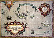
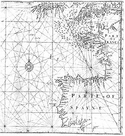
Early appearance on charts
The Azores archipelago began to appear on portolan chartPortolan chart
Portolan charts are navigational maps based on realistic descriptions of harbours and coasts. They were first made in the 14th century in Italy, Portugal and Spain...
s during the 14th C., well before its official discovery date. The first map to depict the Azores was the Medici Atlas
Medici Atlas
The Medici Atlas, also known as the Medici-Laurentian Atlas is an anonymous 14th century set of maps, probably composed by an Genoese cartographer and explicitly dated 1351, although most historians believe it was composed, or at least retouched, later...
(1351). Its depiction was was subsequently replicated in the Pizzigani brothers map of 1367, the Catalan Atlas
Catalan Atlas
The Catalan Atlas is the most important Catalan map of the medieval period. It was produced by the Majorcan cartographic school and is attributed to Cresques Abraham , a Jewish book illuminator who was self-described as being a master of the maps of the world as well as compasses...
(1375), the Pinelli–Walckenaer Atlas
Pinelli–Walckenaer Atlas
The Pinelli–Walckenaer Atlas is a late 14th-century atlas of portolan charts, explicitly dated 1384, primarily composed by an anonymous Venetian cartographer, and held by the British Library.- Background :...
(1384), the Corbitis Atlas
Corbitis Atlas
The Corbitis Atlas is a late 14th-century atlas of four portolan charts, composed by an anonymous Venetian cartographer, and currently held by the Biblioteca Nazionale Marciana in Venice, Italy....
(c. 1385–1410), the charts of Guillem Soler
Guillem Soler
Guillem Soler , sometimes given as Guillelmus Soleri, Guillermo Soler and Guglielmo Soleri, was a Majorcan cartographer of the 15th C....
(1380, 1385), Mecia de Viladestes (1413) and others. They are also listed in the Libro del Conoscimiento
Libro del Conoscimiento
The Libro del Conoscimiento is an anonymous 14th century Castilian geographical & armorial manual, written in the form of imaginary autobiographical travelogue of a Castilian mendicant friar, as he travels through the entire world, known and fanciful, from the westernmost Atlantic islands,...
(c.1380).
In these maps, the Azores are usually depicted vertically aligned, on a north-south axis, nine islands in three clusters. The island names, in order (from south to north) are usually (with their tentative translation):
bottom cluster:
- lovo or lobo ("island of wolves" (seals?), Santa MariaSanta Maria IslandSanta Maria , Portuguese for Saint Mary, is an island located in the eastern group of the Azores archipelago and the southernmost island in the Azores...
) - caprara or cabrera ("island of goats", São MiguelSão Miguel IslandSão Miguel Island , nicknamed "The Green Island", is the largest and most populous island in the Portuguese Azores archipelago. The island covers and has around 140,000 inhabitants, 45,000 of these people located in the largest city in the archipelago: Ponta Delgada.-History:In 1427, São Miguel...
),
middle cluster:
- y de brazil ("island of embers/fire", TerceiraTerceira IslandReferred to as the “Ilha Lilás” , Terceira is an island in the Azores archipelago, in the middle of the North Atlantic Ocean. It is one of the larger islands of the archipelago, with a population of 56,000 inhabitants in an area of approximately 396.75 km²...
) - li columbi ("island of pigeons", PicoPico IslandPico Island , is an island in the Central Group of the Portuguese Azores noted for its eponymous volcano, Ponta do Pico, which is the highest mountain in Portugal, the Azores, and the highest elevation of the Mid-Atlantic Ridge...
) - y de la ventura ("island of venture/winds", FaialFaial IslandFaial Island , also known in English as Fayal, is a Portuguese island of the Central Group of the Azores....
) - san zorzo ("island of St. George", São Jorge)
top cluster:
- li conigi ("island of rabbits", Flores)
- y de corvis marinis ("island of sea crows", CorvoCorvo IslandCorvo Island , literally the Island of the Crow, is the smallest and the northernmost island of the Azores archipelago and the northernmost in Macaronesia, with a population of approximately 468 inhabitants constituting the smallest single municipality in Azores and in Portugal.-History:A small...
)
It is notable that two of the names – San Zorzo and Corvis Marinis – would be transferred to the modern Azorean islands. Only Graciosa seems to be routinely missing on these maps. The Madeira
Madeira
Madeira is a Portuguese archipelago that lies between and , just under 400 km north of Tenerife, Canary Islands, in the north Atlantic Ocean and an outermost region of the European Union...
archipelago also appears on most of these same maps, with their modern names: legname (Ligurian for "wood", Madeira
Madeira
Madeira is a Portuguese archipelago that lies between and , just under 400 km north of Tenerife, Canary Islands, in the north Atlantic Ocean and an outermost region of the European Union...
), porto sancto (Porto Santo), desertas (Desertas) and salvazes (Savage Island
Savage Islands
The Savage Islands, also referred to as the Salvage Islands or the Selvagens Islands, of Sé. They are designated a Nature Reserve, comprising two areas: one on Selvagem Grande Island and the second on Selvagem Pequena Island.-Geography:...
).
The source of this information is a mystery. They could simply derived from pure legend, possibly of Andalusian
Al-Andalus
Al-Andalus was the Arabic name given to a nation and territorial region also commonly referred to as Moorish Iberia. The name describes parts of the Iberian Peninsula and Septimania governed by Muslims , at various times in the period between 711 and 1492, although the territorial boundaries...
Arab origin e.g. al-Idrisi speaks of an Atlantic island of wild goats (the Caprera?) and another of "cormorants", a scavenger bird (the "sea crows" of Corvis Marinis?) But outside their erroneous axis tilt, the Azores do seem clustered with reasonable accuracy. From this cartographic record, there seems little doubt that both Madeira and the Azores were discovered, or at least sighted, in the 14th C., well before their official discovery dates.
One (unproven) hypothesis is that the Azores were discovered in the course of a 1341 mapping expedition to the Canary Islands
Canary Islands
The Canary Islands , also known as the Canaries , is a Spanish archipelago located just off the northwest coast of mainland Africa, 100 km west of the border between Morocco and the Western Sahara. The Canaries are a Spanish autonomous community and an outermost region of the European Union...
, sponsored by King Afonso IV of Portugal
Afonso IV of Portugal
Afonso IV , called the Brave , was the seventh king of Portugal and the Algarve from 1325 until his death. He was the only legitimate son of King Denis of Portugal by his wife Elizabeth of Aragon.-Biography:...
and commanded by the Florentine Angiolino del Tegghia de Corbizzi and the Genoese Nicoloso da Recco
Nicoloso da Recco
Nicoloso da Recco was an 14th century Italian navigator from Genoa, who visited the Canary Islands in 1341 on behalf of Afonso IV of Portugal. He is credited with providing the first reliable account of the language used by the aboriginal inhabitants of the Canary Islands, the Guanches.An Italian...
. Although not quite described in the 1341 report, Madeira and the Azores might nonetheless have been seen from a distance on the expedition's return via a long sailing arc (volta do mar
Volta Do Mar
"Volta do mar", "volta do mar largo" or "volta do largo", is a navigational technique perfected by Portuguese navigators during the Age of Discovery in the late fifteenth century, using the dependable phenomenon of the great permanent wind wheel, the North Atlantic Gyre...
) from the Canary islands. Even if not discovered by the 1341 mapping expedition itself, the islands may have been found by any of the numerous Majorcan
Kingdom of Majorca
The Kingdom of Majorca was founded by James I of Aragon, also known as James The Conqueror. After the death of his first-born son Alfonso, a will was written in 1262 which created the kingdom in order to cede it to his son James...
expeditions that were launched into the Atlantic Ocean in the aftermath, destined for slaving runs on the newly-mapped Canary islands. Nonetheless, regardless of who sighted them in the 14th C., there seems to have been no follow-up until the 15th C.
Portuguese exploration
Prester John
The legends of Prester John were popular in Europe from the 12th through the 17th centuries, and told of a Christian patriarch and king said to rule over a Christian nation lost amidst the Muslims and pagans in the Orient. Written accounts of this kingdom are variegated collections of medieval...
, thereby encircling the Muslim world and driving them from northern Africa and the Holy Land. To accomplish this Infante D. Henrique derived funds from the trade in order to find a sea route to India. As leader of the religious-military organization, the Holy Order of Christ, its program of exploration, discovery, and settlement was tailored for this dual purpose.
His first adventure, in 1415, was the defeat of the Muslims at Ceuta
Ceuta
Ceuta is an autonomous city of Spain and an exclave located on the north coast of North Africa surrounded by Morocco. Separated from the Iberian peninsula by the Strait of Gibraltar, Ceuta lies on the border of the Mediterranean Sea and the Atlantic Ocean. Ceuta along with the other Spanish...
( Morocco
Morocco
Morocco , officially the Kingdom of Morocco , is a country located in North Africa. It has a population of more than 32 million and an area of 710,850 km², and also primarily administers the disputed region of the Western Sahara...
), which helped open the African coast to exploration. Henry experimented with ships and navigation during this venture, which led to designing of the caravel, a long and slender ship (by comparison) with lateen sails, that would be used by his Portuguese explorers on their long voyages. Also the navigational instruments, such as the astrolabe, quadrant, and cross-staff, were developed to fix a ship's position. His captains kept logbooks of their voyages to document their experience for the knowledge of others. They also used flat maps to record longitude and latitude thereby simplifying cartography methods. Navigation and seafaring during this period was dangerous, harsh and unforgiving; positions had to be known (in order to know one's way back), the winds, weather changes, currents changed drastically in different locations and small wooden ships could be broken at sea. Supplies of food and water could easily run out during these voyages, and disease could strike. Superstition and fear was also an important passenger on these voyages, and only a few crews were clear of the obstacles associated with sailing alone in the ocean sea. What is known is that the Portuguese Atlantic islands were not unknown; a growing body of documents had shown that the islands were known to sailors. But most importantly in the language used by Prince Henry's personal chronicler, who wrote that the Prince "ordered [them] to find the islands" (referring to the Portuguese navigators and captains), rather than just sending his fleets into the unknown to discover what they could.
The re-discovery
The exact date of this re-discovery of the Atlantic islands is not clear, though historic accounts indicate that the islands of Santa MariaSanta Maria Island
Santa Maria , Portuguese for Saint Mary, is an island located in the eastern group of the Azores archipelago and the southernmost island in the Azores...
and São Miguel
São Miguel Island
São Miguel Island , nicknamed "The Green Island", is the largest and most populous island in the Portuguese Azores archipelago. The island covers and has around 140,000 inhabitants, 45,000 of these people located in the largest city in the archipelago: Ponta Delgada.-History:In 1427, São Miguel...
were the first to be discovered by navigator Diogo de Silves
Diogo de Silves
Diogo de Silves, is the presumed name of an obscure Portuguese explorer of the Atlantic who allegedly discovered of the Azores islands in 1427....
around 1427.
One fact often debated is the origin of the name "Azores" used to identify the archipelago. By 1492, in the globe of Martin Behaim
Martin Behaim
Martin Behaim , was a German mariner, artist, cosmographer, astronomer, philosopher, geographer and explorer in service to the King of Portugal.-Biography:The Behaim family had immigrated to Nuremberg because of religious persecution around...
, the eastern and central group of islands were referred to as Insulae Azore ("Islands of the Azores"), while the islands of western group were called the Insulae Flores ("Islands of Flowers"). Similarly, older nautical charts had identified them as the Ilhas Afortunadas ("The Fortunate Islands") or Ilhas de São Brandão ("The Islands of Saint Brendan"). The use of mythical names in local naming became a theme; in São Miguel and Pico there are communities called Sete Cidades, on Terceira, a peninsula along the southern coast is referred to as Monte Brasil, and the name Mosteiros is used on both islands of São Miguel and Flores. There are also many examples of re-using names from island to island (for example, Cedros, São Pedro, Feteiras or Calheta). But three theories that have developed on the naming of the archipelago:
- the classical theory attributes the naming to the presence of diurnal birds of prey (some say goshawksAccipiterThe genus Accipiter is a group of birds of prey in the family Accipitridae, many of which are named as goshawks and sparrowhawks. They can be anatomically distinguished from their relatives by the lack of a procoracoid foramen. Two small and aberrant species usually placed here do possess a large...
, while others species of eagleAccipitridaeThe Accipitridae, one of the two major families within the order Accipitriformes , are a family of small to large birds with strongly hooked bills and variable morphology based on diet. They feed on a range of prey items from insects to medium-sized mammals, with a number feeding on carrion and a...
), identified by Portuguese sailors at the time of discovery. But this theory has been discredited for the following reasons, since the only bird of prey identified as nesting in the archipelago is the common buzzardCommon BuzzardThe Common Buzzard is a medium to large bird of prey, whose range covers most of Europe and extends into Asia. It is usually resident all year, except in the coldest parts of its range, and in the case of one subspecies.-Description:...
(Buteo bueto rothschildi), but it was only introduced during the period of colonization and settlement. Other possibilities: that sailors may have confused existing migratory birds for these birds of prey, the these adventurers may have used colloquial names and attributed them to these species, or that some specie of bird of prey may have become extinct since colonization; - the naming of the islands may have been an homage of the discoverer Gonçalo Velho Cabral to Santa Maria of Açores, patron saint of the parish of Açores, in the municipality of Celorico da BeiraCelorico da BeiraCelorico da Beira is a municipality in Portugal with a total area of 247.2 km² and a total population of 8,752 inhabitants.The municipality is composed of 22 parishes, and is located in Guarda District.Main town: Celorico da Beira, near the Mondego River....
, District of Guarda; - finally, Azores may have been a Portuguese-variant of the GenoveseGenoaGenoa |Ligurian]] Zena ; Latin and, archaically, English Genua) is a city and an important seaport in northern Italy, the capital of the Province of Genoa and of the region of Liguria....
or FlorentineFlorenceFlorence is the capital city of the Italian region of Tuscany and of the province of Florence. It is the most populous city in Tuscany, with approximately 370,000 inhabitants, expanding to over 1.5 million in the metropolitan area....
azzurre or azzorre, which translate to "blue" and may refer to those sailors' stories of the mythical "Ilhas Azuis". In fact, the blue-green vegetation on the islands of the Azores appear blue, even at a close distance. The Portuguese word for "blue" is similarly azul.
It is clear that after 1420, regular expeditions captained by Gonçalo Velho Cabral, Diogo de Silves
Diogo de Silves
Diogo de Silves, is the presumed name of an obscure Portuguese explorer of the Atlantic who allegedly discovered of the Azores islands in 1427....
and other mariners began to the east and south of continental Portugal. On August 15, 1432, a small sailing vessel with a dozen crew members, disembarked on the island that would bear the name Santa Maria (owing to its supposed day of its "rediscovery", the Assumption Day of the Virgin Mary). With their beginnings in the eastern group of islands, the explorers advanced quickly into the rest of the archipelago, finally reaching the more westerly islands (Flores and Corvo) by about 1450 at a time when populations were already relatively large The first expeditions, apart from coastal observations and an occasional landing were limited, and in most cases involved the deliberate disembarking of herd animals (sheep, goats and/or cattle), pigs and chickens on the discovered islands, as a way of providing future settlers with some means of subsistence. There is also a reference to the purposeful settling of a group of slaves at the end of the 1430s, in the area of Povoação on the island of São Miguel.
Settlement
The "official" colonization of the archipelago began in Santa Maria, where the first settlement was constructed in the area of Báia dos Anjos (in the north of the island), and quickly moved to the southern coast (to the area that is not the modern town of Vila do PortoVila do Porto
Vila do Porto is the single municipality, the name of the main town and one of the civil parishes on the island of Santa Maria, in the Portuguese Autonomous Region of Azores...
). Settlers quickly arrived from the provinces of Algarve and Alentejo as Gonçalo Velho's nephew and heir, João Soares de Albergaria
João Soares de Albergaria
João Soares de Albergaria , also referred to as João Soares or João Soares Velho, was the second Portuguese Captain-Donatário of the islands of Santa Maria and São Miguel, who succeeded his maternal uncle Gonçalo Velho Cabral in the title...
, advertised and promoted settlement on the island. In the following centuries settlers from other European countries would arrive, most notably from Northern France
France
The French Republic , The French Republic , The French Republic , (commonly known as France , is a unitary semi-presidential republic in Western Europe with several overseas territories and islands located on other continents and in the Indian, Pacific, and Atlantic oceans. Metropolitan France...
and Flanders
Flanders
Flanders is the community of the Flemings but also one of the institutions in Belgium, and a geographical region located in parts of present-day Belgium, France and the Netherlands. "Flanders" can also refer to the northern part of Belgium that contains Brussels, Bruges, Ghent and Antwerp...
.
By 1440, other settlements had developed along the river-valleys and coastal inlets of São Miguel, Terceira, Faial and Pico, supported by game animals and fishing. An abundance of potable water sources, along with fertile volcanic soils, made the islands attractive and easy to colonize, and the growing wheat market would support an export economy (along with various plant species that allowed the development of the dye industry in the colonies).
Christopher Columbus
Christopher Columbus
Christopher Columbus was an explorer, colonizer, and navigator, born in the Republic of Genoa, in northwestern Italy. Under the auspices of the Catholic Monarchs of Spain, he completed four voyages across the Atlantic Ocean that led to general European awareness of the American continents in the...
stopped on Santa Maria after his 1493 voyage to America. After being mistaken for a pirate, he was taken prisoner and was only set free after officials justified his landing.
The island of São Miguel was apparently populated by 1444. The population came mostly from the regions of Estremadura
Estremadura Province (historical)
Estremadura Province is one of the six historical provinces of Portugal....
, Alentejo and Algarve. The colonists spread themselves along the coastline in areas where conditions of accessibility and farming were best. The fertlity of the Azores contributed to its population expansion, as the islands were soon exporting wheat to the Portuguese garrison in North Africa and of sugar cane and dyes to Flanders
Flanders
Flanders is the community of the Flemings but also one of the institutions in Belgium, and a geographical region located in parts of present-day Belgium, France and the Netherlands. "Flanders" can also refer to the northern part of Belgium that contains Brussels, Bruges, Ghent and Antwerp...
. Later oranges were grown and exported to the British Isles
British Isles
The British Isles are a group of islands off the northwest coast of continental Europe that include the islands of Great Britain and Ireland and over six thousand smaller isles. There are two sovereign states located on the islands: the United Kingdom of Great Britain and Northern Ireland and...
. The area was also frequently subjected to pirate attacks.
During these times Ponta Delgada
Ponta Delgada
Ponta Delgada is a city and municipality on the island of São Miguel in the archipelago of the Azores, an autonomous region of Portugal. It includes 44,403 residents in the urban area, and approximately 20,113 inhabitants in the three central parishes that comprise the historical city: São Pedro,...
became the capital. The first capital was Vila Franca do Campo
Vila Franca do Campo
Vila Franca do Campo is a town and a municipality in the southern part of the island of São Miguel in the Portuguese Autonomous Region of the Azores...
, but when it was destroyed in 1522 Ponta Delgata assumed the position. It became the first city on the island in 1546.
Terceira Island
Terceira Island
Referred to as the “Ilha Lilás” , Terceira is an island in the Azores archipelago, in the middle of the North Atlantic Ocean. It is one of the larger islands of the archipelago, with a population of 56,000 inhabitants in an area of approximately 396.75 km²...
was the third island to be discovered, and its name literally means "Third Island". It was originally called the Island of Jesus Christ and was first settled in 1450. Graciosa Island was settled shortly afterward from settlers from Terceira.
Iberian Union
The residents of Terceira, who mostly settled in Porto JudeuPorto Judeu
Porto Judeu, which means "Jewish Port" in Portuguese, is a parish in the municipality of Angra do Heroísmo on the island of Terceira in the Azores. The population in 2001 was 2425, its population density was 80.11/km², and the land area is 30.27 km²....
and Praia da Vitória
Praia da Vitória
Praia da Vitória is a municipality in Portugal's Autonomous Region of the Azores. The second largest administrative division on the island of Terceira, Praia da Vitória occupies the northern coast of the island and extends halfway into the interior having at its frontiers Pico Alto and the shield...
and along the coastline, took a brave stand against King Philip II of Spain
Philip II of Spain
Philip II was King of Spain, Portugal, Naples, Sicily, and, while married to Mary I, King of England and Ireland. He was lord of the Seventeen Provinces from 1556 until 1581, holding various titles for the individual territories such as duke or count....
upon his ascension to the Portuguese throne in 1580. They, along with most of the rest of the Azores, believed that António, Prior of Crato
António, Prior of Crato
António, Prior of Crato , was a grandson of King Manuel I of Portugal, claimant of the Portuguese throne during the 1580 dynastic crisis, who was King of Portugal as António I of Portugal during 33 days in the continent in 1580, and, after the crowning of Philip II of Spain as King of Portugal,...
was the rightful successor, and defeated the Spanish at the Battle of Salga
Battle of Salga
The Battle of Salga occurred on 25 July 1581, along the Bay of Salga and around the coastal part of the parish of Vila de São Sebastião, island of Terceira in the Portuguese Azores, between Spanish and Portuguese forces...
in 1581.
In 1583, Philip tried again at defeating the Azoreans. He sent his combined Iberian fleet to clear the French traders from the Azores, decisively hanging his prisoners-of-war from the yardarms and contributing to the "Black Legend
Black Legend
The Black Legend refers to a style of historical writing that demonizes Spain and in particular the Spanish Empire in a politically motivated attempt to morally disqualify Spain and its people, and to incite animosity against Spanish rule...
". The Azores were the second-to-last part of the Portuguese empire to resist Philip's reign over Portugal (Macau
Macau
Macau , also spelled Macao , is, along with Hong Kong, one of the two special administrative regions of the People's Republic of China...
being the last), Azores was returned to Portuguese control with the end of the Iberian Union
Iberian Union
The Iberian union was a political unit that governed all of the Iberian Peninsula south of the Pyrenees from 1580–1640, through a dynastic union between the monarchies of Portugal and Spain after the War of the Portuguese Succession...
, not by the military efforts, as these were already in Restoration War
Portuguese Restoration War
Portuguese Restoration War was the name given by nineteenth-century 'romantic' historians to the war between Portugal and Spain that began with the Portuguese revolution of 1640 and ended with the Treaty of Lisbon . The revolution of 1640 ended the sixty-year period of dual monarchy in Portugal...
efforts in the mainland, but by the people attacking a well-fortified Castilian guarnition.
The Azores served as a port of call
Port of Call
-Synopsis:Berit, a young woman living in a working-class port town begins a relationship with Gösta, a sailor newly returned from overseas and intent upon staying on land...
for the Spanish galleons during their occupation. In December of 1640 the Portuguese monarchy was restored and the islands again became a Portuguese possession.
Liberal wars
The 1820 civil war in Portugal had strong repercussions in the Azores. In 1829, in Vila da Praia, the liberalsLiberalism
Liberalism is the belief in the importance of liberty and equal rights. Liberals espouse a wide array of views depending on their understanding of these principles, but generally, liberals support ideas such as constitutionalism, liberal democracy, free and fair elections, human rights,...
won over the absolutists, making Terceira the main headquarters of the new Portuguese regime and also where the Council of Regency (Conselho de Regência) of Mary II of Portugal was established.
Beginning in 1868, Portugal
Portugal
Portugal , officially the Portuguese Republic is a country situated in southwestern Europe on the Iberian Peninsula. Portugal is the westernmost country of Europe, and is bordered by the Atlantic Ocean to the West and South and by Spain to the North and East. The Atlantic archipelagos of the...
issued its stamps overprinted with "AÇORES" for use in the islands. Between 1892 and 1906, it also issued separate stamps for the three administrative districts of the time.
From 1836 to 1976, the archipelago was divided into three districts, quite equivalent (except in area) to those in the Portuguese mainland. The division was arbitrary, and didn’t follow the natural island groups, rather reflecting the location of each district capital on the three main cities (neither of each on the western group).
- Angra consisted of Terceira, São Jorge, and Graciosa, with the capital at Angra do HeroísmoAngra do HeroísmoAngra do Heroísmo , locally referred to as Angra, is a municipality and city on the island of Terceira, within the Portuguese autonomous region of the Azores. The municipal area has a population of 35,581 and an area of . Along with Praia da Vitória to the north, it is one of two municipal...
on Terceira. - Horta consisted of Pico, Faial, Flores, and Corvo, with the capital at HortaHorta (Azores)Horta is a single municipality and city in the western part of the Archipealgo of the Azores, encompassing the island of Faial. Horta has a population of about approximately 15,038 people and an area of 173.1 square kilometers. The population density is about 88 persons per square kilometer...
on Faial. - Ponta Delgada consisted of São Miguel and Santa Maria, with the capital at Ponta DelgadaPonta DelgadaPonta Delgada is a city and municipality on the island of São Miguel in the archipelago of the Azores, an autonomous region of Portugal. It includes 44,403 residents in the urban area, and approximately 20,113 inhabitants in the three central parishes that comprise the historical city: São Pedro,...
on São Miguel.
20th century
During the Second World WarWorld War II
World War II, or the Second World War , was a global conflict lasting from 1939 to 1945, involving most of the world's nations—including all of the great powers—eventually forming two opposing military alliances: the Allies and the Axis...
, in 1943, the Portuguese dictator Salazar
António de Oliveira Salazar
António de Oliveira Salazar, GColIH, GCTE, GCSE served as the Prime Minister of Portugal from 1932 to 1968. He also served as acting President of the Republic briefly in 1951. He founded and led the Estado Novo , the authoritarian, right-wing government that presided over and controlled Portugal...
leased bases in the Azores to the British. This represented a change in policy. Previously the Portuguese government only allowed German U-boats and navy ships to refuel there. This was a key turning point in the Battle of the Atlantic, allowing the Allies to provide aerial coverage in the middle of the Atlantic. This helped them to hunt U-boats and protect convoys.
In 1944, American forces constructed a small and short-lived air base on the island of Santa Maria. In 1945, a new base was founded on the island of Terceira and is currently known as Lajes Field
Lajes Field
Lajes Field or Lajes Air Base , officially designated Air Base No. 4 , is a multi-use air field, home to the Portuguese Air Force Base Aérea Nº4 and Azores Air Zone Command , a United States Air Force detachment , and a regional air passenger terminal located near Lajes...
. It was founded in an area called Lajes, a broad, flat sea terrace that had been a farm. Lajes Field is a plateau rising out of the sea on the northeast corner of the island. This air force base is a joint American and Portuguese venture. Lajes Field has, and continues to support US and Portuguese military operations. During the Cold War
Cold War
The Cold War was the continuing state from roughly 1946 to 1991 of political conflict, military tension, proxy wars, and economic competition between the Communist World—primarily the Soviet Union and its satellite states and allies—and the powers of the Western world, primarily the United States...
, the US Navy P-3 Orion
P-3 Orion
The Lockheed P-3 Orion is a four-engine turboprop anti-submarine and maritime surveillance aircraft developed for the United States Navy and introduced in the 1960s. Lockheed based it on the L-188 Electra commercial airliner. The aircraft is easily recognizable by its distinctive tail stinger or...
anti-submarine squadrons patrolled the North Atlantic for Soviet submarines and surface spy vessels. Since its inception, Lajes Field has been used for refuelling aircraft bound for Europe, and more recently, the Middle East. The US Army operates a small fleet of military ships in the harbor of Praia da Vitória
Praia da Vitória
Praia da Vitória is a municipality in Portugal's Autonomous Region of the Azores. The second largest administrative division on the island of Terceira, Praia da Vitória occupies the northern coast of the island and extends halfway into the interior having at its frontiers Pico Alto and the shield...
, three kilometers southeast of Lajes Field. The airfield also has a small commercial terminal handling scheduled and chartered passenger flights from other islands in the archipelago, Europe, and North America.
Carnation Revolution
Following the Carnation RevolutionCarnation Revolution
The Carnation Revolution , also referred to as the 25 de Abril , was a military coup started on 25 April 1974, in Lisbon, Portugal, coupled with an unanticipated and extensive campaign of civil resistance...
in 1976, the Azores became an Autonomous Region within Portugal
Autonomous regions of Portugal
The two Autonomous Regions of Portugal are the Azores and Madeira...
, along with Madeira
Madeira
Madeira is a Portuguese archipelago that lies between and , just under 400 km north of Tenerife, Canary Islands, in the north Atlantic Ocean and an outermost region of the European Union...
, when the a new regional constitution
Political status of the Autonomous Region of the Azores
The political status of the Autonomous Region of the Azores is the standard paralegal constitutional framework for the autonomy of the Portuguese archipelago of the Azores...
was implemented and the Azorean districts were suppressed.