
Corvo Island
Encyclopedia
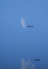
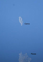
Corvo Island literally the Island of the Crow, is the smallest and the northernmost island of the Azores
archipelago
and the northernmost in Macaronesia
, with a population of approximately 468 inhabitants (in 2006) constituting the smallest single municipality in Azores and in Portugal
.
(earthen structures carved into rocks, that were used for burials) were discovered on the island of Corvo, indicating a history of settlement that may date back 2000 years, and alluding to a presence on the island before the Portuguese.
The history of the Azores is linked to non-official exploration during the period of the late 13th century, resulting in maps, such as the Genoves
Atlas Medici from 1351, mentioning obscure islands in an undefined Atlantic
archipelago
. The Medici Atlas refers to an Insula Corvi Marini , in a seven island archipelago, but it is improbable that it refers specifically to Corvo, although the island's name could have originated from this atlas. It is likely that the name referred to the two islands of Corvo and Flores, which also appeared on the later Spanish Mapa Catalão of 1375.
It was during Portuguese "official history" that the navigator Diogo de Teive
discovered both islands of the Western Group on his 1452 regress from the Banks of Newfoundland
following his second voyage of exploration. Subsequently, the Portuguese Court when referring to the new Ilhas das Flores began to identify Corvo as Ilha de Santa Iria , but other nautical charts continued to refer to this island as Ilhéu das Flores , Ilha da Estátua , Ilha do Farol or Ilha de São Tomás .
Settlement of the island occurred unsuccessfully in the intervening years: it was not until 1580 when a permanent settlement became viable.
A religious parish of Corvo was finally constituted in 1674, and then on 20 June 1832, integrated into a functioning civilian administration.
 The island is located on the North American Plate, west of the Mid-Atlantic Ridge on a sea-mount of approximately 1.5-1.0 million years. The islands of Corvo and Flores emerged from a submarine mount oriented along a north-northeast to south-southwest, while Corvo is controlled by a faults oriented north to south, parallel to the mid-Atlantic Ridge, and transform faults oriented west to east which crosscut secondary cones on outer slopes. The island formed from a 5 km diameter central volcano (Monte Gorde) that emerged around 730,000 years ago, whose central cone was approximately 1000 meters in altitude. The crater collapsed 430,000 years ago during a Plinian eruption
, forming a subsidence caldera (2000 meters in diameter and 300 metres depth), referred to as the Caldeirão. Within the caldera are several cinder and spatter cones (20–30 m in height) giving rise to small lakes, peat bogs, and islets (two long and five rounded). The highest point on the island, the Morro dos Homens
, crowns the southern rim of the Caldeirão at 718 meters above sea level.
Two main volcanic complexes are usually recognized:
While the initial phases were dominated by basaltic lava flows and pyroclastic deposits, the final phase was characterized by pumice, surges, lahars, and pyroclastic flows characteristic of Plinian and sub-Plinian eruptions.
Shear cliffs dominate the coastal areas, the exception being along the southern margin which is composed of ancient lava flows. The western cliffs, with an almost vertical slope rises 700 meters above sea level; one of the major coastal elevations in the Atlantic. Remnants of the ancient volcano are partially preserved in the southern and eastern flanks of the island (which retain altitudes between 500 and 700 meters above seas level). In addition to marine erosion, the island is constantly eroded by strong northeast and western winds. In the south, secondary cinder cones, such as Coroínha, Morro da Fonte, Grotão da Castelhana and Coroa do Pico, are visibly preserved with little erosion, and responsible for many basaltic flows that formed the southern lava fajã (10 to 60 meters above sea level). The last eruption took place about 80-100,000 years ago in the vicinity of Vila Nova do Corvo.
In the extreme northeast, along the Ponta Torrais there are two small islets, Ilhéu dos Torrais and the Ilhéu do Torrão, in addition to several submarine reefs, that are dangerous to navigation.
The southern coast, referred to as Enseada de Nossa Senhora do Rosário, is the location of three ports, constructed at various times for diverse needs: Porto Novo (currently not utilized), the Porto do Boqueirão and Porto da Casa (the largest and the island's commercial port). Portinho da Areia, on the extreme west of the southern coast (at the end of the airport's runway) is the only beach and principal swimming area on the island.
Dairy production is the primary activity, although the raising of pigs and poultry is also common, and cheese one of the primary commercialized products. Until the 1960s, the raising of sheep and the commercialization of wool was also important on the island. This was until a change in forestry policy forced many farmers to vacate uncultivated lands, lands that were routinely used to graze sheep. It was quickly the end of the wool industry on the island, an industry that been integral to the islands small export industry.
aircraft, big enough to handle the low volume of traffic to the island (weather permitting).
Azores
The Archipelago of the Azores is composed of nine volcanic islands situated in the middle of the North Atlantic Ocean, and is located about west from Lisbon and about east from the east coast of North America. The islands, and their economic exclusion zone, form the Autonomous Region of the...
archipelago
Archipelago
An archipelago , sometimes called an island group, is a chain or cluster of islands. The word archipelago is derived from the Greek ἄρχι- – arkhi- and πέλαγος – pélagos through the Italian arcipelago...
and the northernmost in Macaronesia
Macaronesia
Macaronesia is a modern collective name for several groups of islands in the North Atlantic Ocean near Europe and North Africa belonging to three countries: Portugal, Spain, and Cape Verde...
, with a population of approximately 468 inhabitants (in 2006) constituting the smallest single municipality in Azores and in Portugal
Portugal
Portugal , officially the Portuguese Republic is a country situated in southwestern Europe on the Iberian Peninsula. Portugal is the westernmost country of Europe, and is bordered by the Atlantic Ocean to the West and South and by Spain to the North and East. The Atlantic archipelagos of the...
.
History
A small number of HypogeaHypogeum
Hypogeum or hypogaeum literally means "underground", from Greek hypo and gaia . It usually refers to an underground, non-Christian temple or a tomb...
(earthen structures carved into rocks, that were used for burials) were discovered on the island of Corvo, indicating a history of settlement that may date back 2000 years, and alluding to a presence on the island before the Portuguese.
The history of the Azores is linked to non-official exploration during the period of the late 13th century, resulting in maps, such as the Genoves
Genoa
Genoa |Ligurian]] Zena ; Latin and, archaically, English Genua) is a city and an important seaport in northern Italy, the capital of the Province of Genoa and of the region of Liguria....
Atlas Medici from 1351, mentioning obscure islands in an undefined Atlantic
Atlantic Ocean
The Atlantic Ocean is the second-largest of the world's oceanic divisions. With a total area of about , it covers approximately 20% of the Earth's surface and about 26% of its water surface area...
archipelago
Archipelago
An archipelago , sometimes called an island group, is a chain or cluster of islands. The word archipelago is derived from the Greek ἄρχι- – arkhi- and πέλαγος – pélagos through the Italian arcipelago...
. The Medici Atlas refers to an Insula Corvi Marini , in a seven island archipelago, but it is improbable that it refers specifically to Corvo, although the island's name could have originated from this atlas. It is likely that the name referred to the two islands of Corvo and Flores, which also appeared on the later Spanish Mapa Catalão of 1375.
It was during Portuguese "official history" that the navigator Diogo de Teive
Diogo de Teive
Diogo de Teive was a captain and squire to the House of Infante D. Henrique during the Portuguese period of discovery.On January 1, 1451 he disembarked on the island of Terceira in the Azores from which he made his base. He realized two voyages of exploration to the West of the archipelago...
discovered both islands of the Western Group on his 1452 regress from the Banks of Newfoundland
Newfoundland and Labrador
Newfoundland and Labrador is the easternmost province of Canada. Situated in the country's Atlantic region, it incorporates the island of Newfoundland and mainland Labrador with a combined area of . As of April 2011, the province's estimated population is 508,400...
following his second voyage of exploration. Subsequently, the Portuguese Court when referring to the new Ilhas das Flores began to identify Corvo as Ilha de Santa Iria , but other nautical charts continued to refer to this island as Ilhéu das Flores , Ilha da Estátua , Ilha do Farol or Ilha de São Tomás .
Settlement of the island occurred unsuccessfully in the intervening years: it was not until 1580 when a permanent settlement became viable.
A religious parish of Corvo was finally constituted in 1674, and then on 20 June 1832, integrated into a functioning civilian administration.
Physical Geography
Plinian eruption
Plinian eruptions, also known as 'Vesuvian eruptions', are volcanic eruptions marked by their similarity to the eruption of Mount Vesuvius in AD 79 ....
, forming a subsidence caldera (2000 meters in diameter and 300 metres depth), referred to as the Caldeirão. Within the caldera are several cinder and spatter cones (20–30 m in height) giving rise to small lakes, peat bogs, and islets (two long and five rounded). The highest point on the island, the Morro dos Homens
Morro dos Homens
Morro dos Homens is the highest mountain of Corvo Island, Azores, Portugal....
, crowns the southern rim of the Caldeirão at 718 meters above sea level.
Two main volcanic complexes are usually recognized:
- The Basal Complex - the oldest formative structures, that includes pyroclastic submarine tuff cones, around the southwest and northern sea cliffs. In some areas, specifically along the western, northern and north-east, the island is cut by faults extending from the Upper Complexes;
- The Upper Complex (Complex Superior 1 and 2) - divided into two volcanic units of pre- and post-caldera episodes; the Complex 1 (or pre-caldera) is represented by sub-aerial volcanism, characterized by both explosive and effusive volcanism. This phase is characterized by a succession of basaltic lavas in the base, and developing into mixture of basaltic and Hawaiian lavas in later phases. The secondary (Complex 2) formations occupy 90% of the island, and pertain to the central caldera, including pumice and explosive particulars that are a mixture of escoria lava of a basaltic and Hawaiian in nature. The most recent of the deposits correspond to pyroclastic and phreatomagmaticPhreatomagmatic eruptionPhreatomagmatic eruptions are defined as juvenile forming eruptions as a result of interaction between water and magma. They are different from magmatic and phreatic eruptions. The products of phreatomagmatic eruptions contain juvenile clasts, unlike phreatic eruptions, and are the result of...
pyroclastic material associated with secondary cones.
While the initial phases were dominated by basaltic lava flows and pyroclastic deposits, the final phase was characterized by pumice, surges, lahars, and pyroclastic flows characteristic of Plinian and sub-Plinian eruptions.
Shear cliffs dominate the coastal areas, the exception being along the southern margin which is composed of ancient lava flows. The western cliffs, with an almost vertical slope rises 700 meters above sea level; one of the major coastal elevations in the Atlantic. Remnants of the ancient volcano are partially preserved in the southern and eastern flanks of the island (which retain altitudes between 500 and 700 meters above seas level). In addition to marine erosion, the island is constantly eroded by strong northeast and western winds. In the south, secondary cinder cones, such as Coroínha, Morro da Fonte, Grotão da Castelhana and Coroa do Pico, are visibly preserved with little erosion, and responsible for many basaltic flows that formed the southern lava fajã (10 to 60 meters above sea level). The last eruption took place about 80-100,000 years ago in the vicinity of Vila Nova do Corvo.
In the extreme northeast, along the Ponta Torrais there are two small islets, Ilhéu dos Torrais and the Ilhéu do Torrão, in addition to several submarine reefs, that are dangerous to navigation.
Climate
Like many of the other Azorean islands, the climate is humid, with 915.7 mm of precipitation annually, comfortable although generally windy. Temperatures are 17.6°C in Vila do Porto, with a variance between 14°C in February to 20°C in August. In the higher elevations fog is common and almost permanent. Due to maritime agitation, particular in the western coast, there is elevated erosion along the coast. The relative humidity is between 74% in October and 85% in June, when fog is more frequent (referred to as the Fogs of São João).Human Geography
There is one urban center on the island: Vila do Corvo. Principally, it is a collection of many residential homes, interspersed with commercial businesses located on the southern one-third of the island. Functionally, by law, Vila do Porto is the only Portuguese top-level municipality without a civil parish. The urbanized area is divided between the village, the Corvo Aerodrome, and the island's ports (being the primary links to the other islands in the archipelago). The lands immediately around the settlement are small zones along the eastern coast (Quintas and Fojo) that can sustain cultivation of some crops and fruit trees, and where some older trees have survived settlement; the best pasture-lands are located in the north in the zone of Terras Altas.The southern coast, referred to as Enseada de Nossa Senhora do Rosário, is the location of three ports, constructed at various times for diverse needs: Porto Novo (currently not utilized), the Porto do Boqueirão and Porto da Casa (the largest and the island's commercial port). Portinho da Areia, on the extreme west of the southern coast (at the end of the airport's runway) is the only beach and principal swimming area on the island.
Economy
Subsistence agriculture has predominated on the island since it was first settled. It currently occupies 17.5% of the area of the municipality, and concentrated on small parcels in the eastern half of the island and along the northern parts of Vila do Corvo. In this patchwork of volcanic hedge-rows, farmers concentrate on semi-permanent crops (potatoes, some cereals, including wheat and citrus orchards).Dairy production is the primary activity, although the raising of pigs and poultry is also common, and cheese one of the primary commercialized products. Until the 1960s, the raising of sheep and the commercialization of wool was also important on the island. This was until a change in forestry policy forced many farmers to vacate uncultivated lands, lands that were routinely used to graze sheep. It was quickly the end of the wool industry on the island, an industry that been integral to the islands small export industry.
Transportation
The island is serviced by the Corvo Airport located on the southern margin of the island between the village and southern ocean ports. Inter-island flights are handled by SATA Air Azores: there are no direct flights to Corvo from outside the archipelago. Until recently, the airport was serviced by one Dornier Do 228Dornier Do 228
The Dornier 228 is a twin-turboprop STOL utility aircraft, manufactured by Dornier GmbH from 1981 until 1998. In 1983, Hindustan Aeronautics bought a production licence and manufactures the 228 for the Asian market sphere. Approximately 270 Do 228 were built at Oberpfaffenhofen, Germany and...
aircraft, big enough to handle the low volume of traffic to the island (weather permitting).