
B roads in Zone 5 of the Great Britain numbering scheme
Encyclopedia
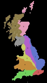
Great Britain
Great Britain or Britain is an island situated to the northwest of Continental Europe. It is the ninth largest island in the world, and the largest European island, as well as the largest of the British Isles...
of lesser importance than A roads. See the article Great Britain road numbering scheme
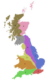
Great Britain road numbering scheme
The Great Britain road numbering scheme is a numbering scheme used to classify and identify all roads in Great Britain. Each road is given a single letter, which represents the road's category, and a subsequent number, with a length of between 1 and 4 digits. Originally introduced to arrange...
for the rationale behind the numbers allocated.
Zone 5 (3 digits)
| Road | From | To | Notes |
|---|---|---|---|
| B500 | A40 A40 road The A40 is a major trunk road connecting London to Fishguard, Wales and officially called The London to Fishguard Trunk Road in all legal documents and Acts... at Holborn Circus Holborn Circus Holborn Circus is a famous location in London, on the boundary between Holborn and Smithfield. Holborn Circus is a roundabout.On one side lies the Church of St Andrew, Holborn, an ancient Guild Church, that survived the Great Fire of London. However, the parochial authority decided, nevertheless,... |
A1 at Barbican station Barbican station Barbican is a London Underground station serving the Barbican Estate and Centre in the City of London. It is on the Circle, Hammersmith & City and Metropolitan lines between and , in Travelcard Zone 1. Thameslink trains to and from Moorgate via Barbican ceased in March 2009.-History:The station... |
Charterhouse Street and Long Lane around Smithfield Market |
| B501 | A401 at Islington Islington Islington is a neighbourhood in Greater London, England and forms the central district of the London Borough of Islington. It is a district of Inner London, spanning from Islington High Street to Highbury Fields, encompassing the area around the busy Upper Street... |
B500 Charterhouse Street at Smithfield Market | St John Street, except for the section north of Rosebery Avenue which is part of the A401 |
| B502 | A4200 at Russell Square Russell Square Russell Square is a large garden square in Bloomsbury, in the London Borough of Camden. It is near the University of London's main buildings and the British Museum. To the north is Woburn Place and to the south-east is Southampton Row... |
B144 Bath Street in Finsbury Finsbury Finsbury is a district of central London, England. It lies immediately north of the City of London and Clerkenwell, west of Shoreditch, and south of Islington and City Road. It is in the south of the London Borough of Islington. The Finsbury Estate is in the western part of the district... |
This road is split into two parts by the A201 and A401 at Mount Pleasant |
| B504 | A5202 at St Pancras St Pancras, London St Pancras is an area of London. For many centuries the name has been used for various officially-designated areas, but now is used informally and rarely having been largely superseded by several other names for overlapping districts.-Ancient parish:... |
B502 at Bloomsbury Bloomsbury -Places:* Bloomsbury is an area in central London.* Bloomsbury , related local government unit* Bloomsbury, New Jersey, New Jersey, USA* Bloomsbury , listed on the NRHP in Maryland... |
Northern-section passes St Pancras International St Pancras railway station St Pancras railway station, also known as London St Pancras and since 2007 as St Pancras International, is a central London railway terminus celebrated for its Victorian architecture. The Grade I listed building stands on Euston Road in St Pancras, London Borough of Camden, between the... on the West side and is Southbound-only for through traffic. |
| B506 | A501 at Great Portland Street Great Portland Street Great Portland Street is a street in the West End of London. Linking Oxford Street with Albany Street and the busy A501 Marylebone Road and Euston Road, the road forms the boundary between Fitzrovia to the east and Marylebone to the west... station |
A400 at Goodge Street | Great Portland Street and Mortimer Street east of Regent Street. |
| B507 | A501 at Marylebone Marylebone Marylebone is an affluent inner-city area of central London, located within the City of Westminster. It is sometimes written as St. Marylebone or Mary-le-bone.... |
B510 at Kilburn | Lisson Grove and includes the famous Abbey Road Abbey Road (street) Abbey Road is a thoroughfare located in the borough of Camden and the City of Westminster in London, running roughly northwest to southeast through St. John's Wood, near Lord's Cricket Ground... |
| B509 | A502 at Chalk Farm Chalk Farm Chalk Farm is an area of north London, England. It lies directly to the north of Camden Town and its underground station is the closest tube station to the nearby, upmarket neighbourhood of Primrose Hill.... |
A5 A5 road The A5 is a major road in England and Wales. It is also the first Roman built road in England hence the name Roman Road. It runs for about from London, England to Holyhead, Wales, following in part a section of the Roman Iter II route which later took the Anglo-Saxon name Watling... at Kilburn |
Adelaide Road and Belsize Road, passes through Swiss Cottage Swiss Cottage Swiss Cottage is a district of the London Borough of Camden in London, England. Thedistrict is located north-west of Charing Cross. It is centred on the junction of Avenue Road and Finchley Road and is the location of Swiss Cottage tube station.-Etymology:... |
| B510 | A41 A41 road The A41 is a formerly-major trunk road in England that links London and Birkenhead, although it has now largely been superseded by motorways. It passes through or near various towns and cities including Watford, Hemel Hempstead, Aylesbury, Solihull, Birmingham, West Bromwich, Wolverhampton,... at Child's Hill (Fortune Green) |
A5 A5 road The A5 is a major road in England and Wales. It is also the first Roman built road in England hence the name Roman Road. It runs for about from London, England to Holyhead, Wales, following in part a section of the Roman Iter II route which later took the Anglo-Saxon name Watling... at Kilburn |
Along Fortune Green Road and West End Lane through West Hampstead West Hampstead West Hampstead is an area in northwest London, England, situated between Childs Hill to the north, Frognal and Hampstead to the north-east, Swiss Cottage to the east, and South Hampstead to the south. Until the late 19th century, the locale was a small village called West End... . Terminates at Quex Road while Abbey Road is the B507 |
| B511 | A41 A41 road The A41 is a formerly-major trunk road in England that links London and Birkenhead, although it has now largely been superseded by motorways. It passes through or near various towns and cities including Watford, Hemel Hempstead, Aylesbury, Solihull, Birmingham, West Bromwich, Wolverhampton,... at Swiss Cottage Swiss Cottage Swiss Cottage is a district of the London Borough of Camden in London, England. Thedistrict is located north-west of Charing Cross. It is centred on the junction of Avenue Road and Finchley Road and is the location of Swiss Cottage tube station.-Etymology:... |
A502 Hampstead Hampstead Hampstead is an area of London, England, north-west of Charing Cross. Part of the London Borough of Camden in Inner London, it is known for its intellectual, liberal, artistic, musical and literary associations and for Hampstead Heath, a large, hilly expanse of parkland... station |
Fitzjohns Avenue and some of Heath Street |
| B512 | A400 at Mornington Crescent Mornington Crescent (street) Mornington Crescent is also a street off the A4 near Heathrow Airport.Mornington Crescent is a street in Camden, London, England. It was built in the 1820s, on a greenfield site just to the north of central London. The crescent was named after the Earl of Mornington, brother of the Duke of Wellington... |
A5202 at St Pancras Hospital St Pancras Hospital St Pancras Hospital is a public hospital in the St Pancras/Somers Town area of London, near Camden Town. The hospital is controlled by the Camden Primary Care Trust and specialises in geriatric and psychiatric medicine.... |
Crowndale Road |
| B514 | A5200 at Kings Cross Kings Cross, London King's Cross is an area of London partly in the London Borough of Camden and partly in the London Borough of Islington. It is an inner-city district located 2.5 miles north of Charing Cross. The area formerly had a reputation for being a red light district and run-down. However, rapid regeneration... |
A5203 at Barnsbury Barnsbury Barnsbury is an area of north London in the London Borough of Islington, in the N1 postal districts.The name is a corruption of villa de Iseldon Berners , being so called after the Berners family: powerful medieval manorial lords who gained ownership of a large part of Islington after the Norman... |
Copenhagen Street |
| B515 | A1 at Holloway Holloway, London Holloway is an inner-city district in the London Borough of Islington located north of Charing Cross and follows for the most part, the line of the Holloway Road . At the centre of Holloway is the Nag's Head area... |
A1 at Islington Islington Islington is a neighbourhood in Greater London, England and forms the central district of the London Borough of Islington. It is a district of Inner London, spanning from Islington High Street to Highbury Fields, encompassing the area around the busy Upper Street... |
Liverpool Road. Passes through residential-Islington. As this road is an alternative to the A1, it attracts rat-runners, therefore they have introduced a 20 mph speed limit throughout and traffic-calming (speed humps) to enforce it. |
| B517 | A502 in Chalk Farm Chalk Farm Chalk Farm is an area of north London, England. It lies directly to the north of Camden Town and its underground station is the closest tube station to the nearby, upmarket neighbourhood of Primrose Hill.... |
B518 Hampstead Hampstead Hampstead is an area of London, England, north-west of Charing Cross. Part of the London Borough of Camden in Inner London, it is known for its intellectual, liberal, artistic, musical and literary associations and for Hampstead Heath, a large, hilly expanse of parkland... at the one-way system |
This is an alternative route to Hampstead to the A502 that passes through Malden Road |
| B518 | A502 at the Royal Free Hospital Royal Free Hospital The Royal Free Hospital is a major teaching hospital in Hampstead, London, England and part of the Royal Free Hampstead NHS Trust.... , Hampstead Hampstead Hampstead is an area of London, England, north-west of Charing Cross. Part of the London Borough of Camden in Inner London, it is known for its intellectual, liberal, artistic, musical and literary associations and for Hampstead Heath, a large, hilly expanse of parkland... (Pond Street) |
A400 Kentish Town Kentish Town Kentish Town is an area of north west London, England in the London Borough of Camden.-History:The most widely accepted explanation of the name of Kentish Town is that it derived from 'Ken-ditch' meaning the 'bed of a waterway'... , at the Forum (Highgate Road) |
Route passes Gospel Oak station effectively running close to the South border of Hampstead Heath Hampstead Heath Hampstead Heath is a large, ancient London park, covering . This grassy public space sits astride a sandy ridge, one of the highest points in London, running from Hampstead to Highgate, which rests on a band of London clay... |
| B519 | A1 in Highgate Highgate Highgate is an area of North London on the north-eastern corner of Hampstead Heath.Highgate is one of the most expensive London suburbs in which to live. It has an active conservation body, the Highgate Society, to protect its character.... , N6 and another end in Archway, N19 |
A502 at Hampstead Hampstead Hampstead is an area of London, England, north-west of Charing Cross. Part of the London Borough of Camden in Inner London, it is known for its intellectual, liberal, artistic, musical and literary associations and for Hampstead Heath, a large, hilly expanse of parkland... |
This road is unusual in that it has 3 parts that merge at the top of Highgate Hill |
| B521 | A40 at Holborn Holborn Holborn is an area of Central London. Holborn is also the name of the area's principal east-west street, running as High Holborn from St Giles's High Street to Gray's Inn Road and then on to Holborn Viaduct... Circus |
A5201 Clerkenwell Clerkenwell Clerkenwell is an area of central London in the London Borough of Islington. From 1900 to 1965 it was part of the Metropolitan Borough of Finsbury. The well after which it was named was rediscovered in 1924. The watchmaking and watch repairing trades were once of great importance... Road |
Hatton Garden Hatton Garden Hatton Garden is a street and area near Holborn in London, England. It is most famous for being London’s jewellery quarter and centre of the UK diamond trade, but the area is also now home to a diverse range of media and creative businesses.... |
| B525 | Swiss Cottage Swiss Cottage Swiss Cottage is a district of the London Borough of Camden in London, England. Thedistrict is located north-west of Charing Cross. It is centred on the junction of Avenue Road and Finchley Road and is the location of Swiss Cottage tube station.-Etymology:... |
Regents Park | Avenue Road |
| B526 | A422 A422 road The A422 is an "A" road for east-west journeys in south central England, connecting the county towns of Bedford and Worcester by way of Milton Keynes, Buckingham, Banbury and Stratford-upon-Avon. For most of its length, is a narrow single carriageway.... at Newport Pagnell Newport Pagnell Newport Pagnell is a town in the Borough of Milton Keynes , England. It is separated by the M1 motorway from Milton Keynes itself, though part of the same urban area... , Buckinghamshire Buckinghamshire Buckinghamshire is a ceremonial and non-metropolitan home county in South East England. The county town is Aylesbury, the largest town in the ceremonial county is Milton Keynes and largest town in the non-metropolitan county is High Wycombe.... |
A45 A45 road The A45 is a major road in England. It runs east from Birmingham past the National Exhibition Centre and the M42, then bypasses Coventry and Rugby, where it briefly merges with the M45 until it continues to Daventry... /A508 A508 road The A508 is a short A-class road for north/south journeys in south central England, forming the route from Market Harborough in Leicestershire, via Northampton, to Old Stratford, north-west of Milton Keynes.... junction, Northampton Northampton Northampton is a large market town and local government district in the East Midlands region of England. Situated about north-west of London and around south-east of Birmingham, Northampton lies on the River Nene and is the county town of Northamptonshire. The demonym of Northampton is... |
Parallel to M1 motorway M1 motorway The M1 is a north–south motorway in England primarily connecting London to Leeds, where it joins the A1 near Aberford. While the M1 is considered to be the first inter-urban motorway to be completed in the United Kingdom, the first road to be built to motorway standard in the country was the... (formerly part of the A50 A50 road The A50 is a major trunk road in England. It runs from Warrington to Leicester; however, it was once a much longer route.-Current route:... ) |
| B530 | A507 A507 road The A507 is an A-class road in England, linking the M1 motorway near Milton Keynes to the A10 at Buntingford. Beginning at junction 13 of the M1, the road heads east past Ridgmont to Ampthill. Here it passes between Ampthill and its close neighbour Flitwick, essentially separating the two. After... at Ampthill Ampthill Ampthill is a small town and civil parish in Bedfordshire, England, between Bedford and Luton, with a population of about 6,000. It is administered by Central Bedfordshire Council. A regular market has taken place on Thursdays for centuries.-History:... , Bedfordshire |
A6/A421 A421 road The A421 is an important road for east/west journeys across England. Together with the A428, the A43 and A34, it forms the route from Cambridge through Milton Keynes to Oxford... , Bedford Bedford Bedford is the county town of Bedfordshire, in the East of England. It is a large town and the administrative centre for the wider Borough of Bedford. According to the former Bedfordshire County Council's estimates, the town had a population of 79,190 in mid 2005, with 19,720 in the adjacent town... |
The only direct link between Flitwick/Ampthill and Bedford. |
| B531 | A5134 at Kempston Kempston Kempston is a town and civil parish located in Bedfordshire, England. Once known as the largest village in England, Kempston is now a town with its own town council. It has a population of about 20,000, and together with Bedford, it forms an urban area with around 100,000 inhabitants, which is the... , Bedfordshire |
A5141 in Bedford Bedford Bedford is the county town of Bedfordshire, in the East of England. It is a large town and the administrative centre for the wider Borough of Bedford. According to the former Bedfordshire County Council's estimates, the town had a population of 79,190 in mid 2005, with 19,720 in the adjacent town... town centre |
straight for its entire length |
| B540 | B519 Highgate Highgate Highgate is an area of North London on the north-eastern corner of Hampstead Heath.Highgate is one of the most expensive London suburbs in which to live. It has an active conservation body, the Highgate Society, to protect its character.... Village, North London |
A103 A103 road The A103 is an A road in London, England. It runs from Lower Holloway to Hornsey.... Crouch End Crouch End Crouch End is an area of north London, in the London Borough of Haringey.- Location :Crouch End is in a valley between Harringay to the east, Hornsey, Muswell Hill and Wood Green to the north, Finsbury Park and Archway to the south and Highgate to the west... |
Heads along Hornsey Lane, over the A1 at the Archway Bridge |
| B550 | B519 Highgate Highgate Highgate is an area of North London on the north-eastern corner of Hampstead Heath.Highgate is one of the most expensive London suburbs in which to live. It has an active conservation body, the Highgate Society, to protect its character.... Village, North London |
A1000 A1000 road The A1000 is a main road in the United Kingdom, running north from Highgate, North London for approximately to Welwyn where it joins the A1 motorway. It incorporates part of the main medieval route out of London, and runs through Finchley, Whetstone, Chipping Barnet and Monken Hadley... Whetstone, London Whetstone, London -Buses:* 34 - Barnet Church to Walthamstow Central bus/tube/railway station* 125 - Winchmore Hill to Finchley Central* 234 - Barnet to Highgate Wood * 251 - Edgware bus/tube station to Arnos Grove tube station... |
Southwood Lane, Muswell Hill Road, Muswell Hill Broadway, Colney Hatch Lane and Friern Barnet Lane |
| B551 | A41 A41 road The A41 is a formerly-major trunk road in England that links London and Birkenhead, although it has now largely been superseded by motorways. It passes through or near various towns and cities including Watford, Hemel Hempstead, Aylesbury, Solihull, Birmingham, West Bromwich, Wolverhampton,... at Hendon Hendon Hendon is a London suburb situated northwest of Charing Cross.-History:Hendon was historically a civil parish in the county of Middlesex. The manor is described in Domesday , but the name, 'Hendun' meaning 'at the highest hill', is earlier... |
A502 at Brent Green, Hendon Hendon Hendon is a London suburb situated northwest of Charing Cross.-History:Hendon was historically a civil parish in the county of Middlesex. The manor is described in Domesday , but the name, 'Hendun' meaning 'at the highest hill', is earlier... |
along Queens Road |
| B552 | A504 at Hendon Hendon Hendon is a London suburb situated northwest of Charing Cross.-History:Hendon was historically a civil parish in the county of Middlesex. The manor is described in Domesday , but the name, 'Hendun' meaning 'at the highest hill', is earlier... |
A411 at Arkley Arkley Arkley is a village in the London Borough of Barnet. It is located north north-west of Charing Cross, and at above sea level is one of the highest points in London.... |
Runs through North Hendon and Mill Hill Village, runs along the A5109 for a short while at Highwood Hill then up Hendon Wood Lane to Arkley |
| B560 | A422 A422 road The A422 is an "A" road for east-west journeys in south central England, connecting the county towns of Bedford and Worcester by way of Milton Keynes, Buckingham, Banbury and Stratford-upon-Avon. For most of its length, is a narrow single carriageway.... at Stagsden Stagsden Stagsden is a small but historic village and civil parish located in northwest Bedfordshire, near the Buckinghamshire border. Situated on the main route between nearby Bedford and Milton Keynes, the village was bypassed by the A422 in April 1992, to allow the increasing amount of traffic to avoid... , Bedfordshire |
A5134 at Kempston Kempston Kempston is a town and civil parish located in Bedfordshire, England. Once known as the largest village in England, Kempston is now a town with its own town council. It has a population of about 20,000, and together with Bedford, it forms an urban area with around 100,000 inhabitants, which is the... , Bedfordshire |
|
| B565 | A509 A509 road The A509 is a short A-class road for north-south journeys in south central England, forming the route from Kettering in Northamptonshire to the M1 and A5 in Milton Keynes.... at Olney, Buckinghamshire Buckinghamshire Buckinghamshire is a ceremonial and non-metropolitan home county in South East England. The county town is Aylesbury, the largest town in the ceremonial county is Milton Keynes and largest town in the non-metropolitan county is High Wycombe.... |
A428 A428 road The A428 road is a major road in central and eastern England. It connects the cities of Coventry and Cambridge by way of the county towns of Northampton and Bedford.-Coventry - Northampton:... at Cold Brayfield Cold Brayfield Cold Brayfield is a village and civil parish in the Borough of Milton Keynes, Buckinghamshire, England. It is about three miles east of Olney, on the Bedfordshire border. Nearby places are Lavendon and Turvey .Cold Brayfield is probably the place named as 'Bragenfelda' in a charter of 967... , Buckinghamshire |
|
| B569 | Old A6 road at Rushden Rushden Rushden is a town and civil parish in the county of Northamptonshire, England.The parish of Rushden covers an area of some and is part of the district of East Northamptonshire. The population of Rushden was estimated at around 28,368, making it the fifth largest town in the county... |
A509 A509 road The A509 is a short A-class road for north-south journeys in south central England, forming the route from Kettering in Northamptonshire to the M1 and A5 in Milton Keynes.... at Wollaston Wollaston, Northamptonshire Wollaston is a large village in the borough of Wellingborough. in Eastern Northamptonshire, England. The name is derived from the Saxon "Wulfaf's Town" - named after a Saxon chief of that name.-Wollaston Today:... near Wellingborough Wellingborough Wellingborough is a market town and borough in Northamptonshire, England, situated some from the county town of Northampton. The town is situated on the north side of the River Nene, most of the older town is sited on the flanks of the hills above the river's current flood plain... |
|
| B582 | A6 at Sainsbury's in Oadby, Leicestershire | A447 near Nailstone, Leicestershire | |
| B585 | A447 near Cadeby, Leicestershire Cadeby, Leicestershire Cadeby is a village and civil parish in the Hinckley and Bosworth district of Leicestershire, England, about 6 miles north of Hinckley, close to Newbold Verdon and Market Bosworth. According to the 2001 census it had a population of 177.... |
A511 A511 road The A511 road is a stretch of mainly single-carriageway road which runs northwest from junction 22 of the M1 motorway in Leicestershire, England to join the A50 between Uttoxeter and Derby.... between Coalville Coalville Coalville is a town in North West Leicestershire, England, with a population estimated in 2003 to be almost 33,000. It is situated on the A511 trunk road between Leicester and Burton upon Trent, close to junction 22 of the M1 motorway where the A511 meets the A50 between Ashby-de-la-Zouch and... and M1 M1 motorway The M1 is a north–south motorway in England primarily connecting London to Leeds, where it joins the A1 near Aberford. While the M1 is considered to be the first inter-urban motorway to be completed in the United Kingdom, the first road to be built to motorway standard in the country was the... , Leicestershire |
Rerouted; formerly, via Coalville to A512 at Thringstone; this section now declassified |
| B587 | A514 near Stanton by Bridge Stanton by Bridge Stanton by Bridge is a village and civil parish in the English county of Derbyshire.-Description:St Michael's Church is on some of the highest ground. The church mostly dates from the 13th and 14th centuries, though with some Norman stonework... , Leicestershire |
A511 A511 road The A511 road is a stretch of mainly single-carriageway road which runs northwest from junction 22 of the M1 motorway in Leicestershire, England to join the A50 between Uttoxeter and Derby.... east of Ashby-de-la-Zouch Ashby-de-la-Zouch Ashby-de-la-Zouch, — Zouch being pronounced "Zoosh" — often shortened to Ashby, is a small market town and civil parish in North West Leicestershire, England, within the National Forest. It is twinned with Pithiviers in north-central France.... , Leicestershire |
Rerouted; formerly, via Whitwick Whitwick Whitwick is a village in Leicestershire, England and is an ancient parish which formerly included the equally historic villages of Thringstone and Swannington. It was an important manor in the Middle Ages, which once included Bardon and Markfield, parts of Hugglescote, Donington le Heath, Ratby,... to A50 at Markfield; this section now declassified |
| B588 (defunct) | A6 at Hathern Hathern Hathern is a large village and civil parish in the Charnwood district of Leicestershire, England. The village itself is located in the north of the district, and is just north of Loughborough. It is served by the A6. The parish has a population of about 1,800. Nearby places are Dishley, Long... , Leicestershire |
A512 A512 road The A512 is an A road entirely in Leicestershire, UK. It links the primary destination of Loughborough with the M1, A42 road, and the town of Ashby de la Zouch.... south of Shepshed Shepshed Shepshed, often known until 1888 as Sheepshed, is a town in Leicestershire, England with a population of around 14,000 people... , Leicestershire |
Now declassified, no longer a B road |
| B591 | A512 A512 road The A512 is an A road entirely in Leicestershire, UK. It links the primary destination of Loughborough with the M1, A42 road, and the town of Ashby de la Zouch.... south of Shepshed Shepshed Shepshed, often known until 1888 as Sheepshed, is a town in Leicestershire, England with a population of around 14,000 people... , Leicestershire |
A50 west of M1 Junction 22, Leicestershire | Rerouted; incorporates sections of former B5330 and B5350. Formerly: east (from near Copt Oak) to A6 at Quorn, Leicestershire Quorn, Leicestershire Quorn is a village in Leicestershire, England, situated next to the university town of Loughborough. Quorn's name was shortened from Quorndon in 1889, to avoid postal difficulties owing to its similarity to the name of another village, Quarndon, a few miles away. Its original name is said to derive... , and west from A50 to Ibstock Ibstock Ibstock is a village and civil parish about south of Coalville in North West Leicestershire, England. The village is on the A447 road Between Coalville and Hinckley.... and beyond; both these sections now declassified. |
Zone 5 (4 digits)
| Road | From | To | Notes |
|---|---|---|---|
| B5006 | B586 at Measham Measham Measham is a village in Leicestershire, near the Staffordshire and Derbyshire border, located just off the A42 just south of Ashby-de-la-Zouch, and within the National Forest... |
A514 at Ticknall Ticknall Ticknall is a small village and civil parish in South Derbyshire, England. Situated on the A514 road, close to Melbourne, it has three pubs, several small businesses, and a primary school. Two hundred years ago it was considerably larger and noisier with lime quarries, tramways and potteries. Coal... |
|
| B5008 | Winshill Winshill Winshill is a suburb to the east of the town of Burton upon Trent, in the borough of East Staffordshire, England.Flanked to the north and east by the South Derbyshire border, historically the parish of Winshill had always been part of Derbyshire until it was transferred to Staffordshire in the late... , Staffordshire |
A50/A38 A38 road The A38, part of which is also known as the Devon Expressway, is a major A-class trunk road in England.The road runs from Bodmin in Cornwall to Mansfield in Nottinghamshire. It is long, making it one of the longest A-roads in England. It was formerly known as the Leeds — Exeter Trunk Road,... north of Willington Willington, Derbyshire Willington is a village and civil parish in South Derbyshire, England. The 2001 Census recorded a parish population of 2,604.-Geography:Willington is on the River Trent about southwest of Derby... , Derbyshire |
|
| B5012 | A34 Ringway in Cannock Cannock Cannock is the most populous of three towns in the district of Cannock Chase in the central southern part of the county of Staffordshire in the West Midlands region of England.... , Staffordshire |
A449 A449 road The A449 is a major road in the United Kingdom. It runs north from junction 24 of the M4 motorway at Newport in South Wales to Stafford in Staffordshire.... Wolverhampton Road in Penkridge Penkridge Penkridge is a market town and ancient parish in Staffordshire, England with a population of 7,836 . Many locals refer to it as a village, although it has a long history as an ecclesiastical and commercial centre. Its main distinction in the Middle Ages was as the site of an important collegiate... , Staffordshire |
|
| B5013 | A51 at Rugeley Rugeley Rugeley is a historic market town in the county of Staffordshire, England. It lies on the northern edge of Cannock Chase, and is situated roughly midway between the towns of Stafford, Cannock, Lichfield and Uttoxeter... , Staffordshire |
A518 A518 road The A518 is a road in the United Kingdom which runs from Uttoxeter, Staffordshire to Telford, Shropshire via Stafford and Newport. Between Uttoxeter and Stafford it is a single carriageway, with a staggered junction with the dual carriageway A51... near Uttoxeter Uttoxeter Uttoxeter is a historic market town in Staffordshire, in the West Midlands region of England. The current population is approximately 13,711, though new developments in the town will increase this figure. Uttoxeter lies close to the River Dove and is near the cities of Stoke-on-Trent, Derby and... , Staffordshire |
Crosses Blithfield Reservoir Blithfield Reservoir Blithfield Reservoir is a large drinking water reservoir in South Staffordshire, England, owned by South Staffordshire Water.Some 800 acres of reservoir was formed on land sold by Baron Bagot to the South Staffordshire Water Company in the 1940s. Blithfield Reservoir was opened by H.M... causeway |
| B5014 | A515 A515 road The A515 is a primary route in England. It runs 48 miles from Lichfield, Staffordshire to Buxton, Derbyshire.-Route:The A515 begins off the A51 road just outside Lichfield. It crosses the Trent and Mersey Canal and passes through the villages of Kings Bromley and Yoxall. As it crosses the River... near Lichfield Lichfield Lichfield is a cathedral city, civil parish and district in Staffordshire, England. One of eight civil parishes with city status in England, Lichfield is situated roughly north of Birmingham... , Staffordshire |
B5013 at Abbots Bromley Abbots Bromley Abbots Bromley is a village in Staffordshire, England. It is famous for the annual Abbots Bromley Horn Dance. It is also the home of one of the Woodard Schools, Abbots Bromley School for Girls... , Staffordshire |
Joins the A513 at Handsacre Handsacre Handsacre is a village in Staffordshire, England. It is adjacent to the larger village of Armitage.It is roughly five miles north of the city of Lichfield and 3 miles south of the town of Rugeley.-Village Services:... |
| B5020 | A6 at Kirk Langley Kirk Langley Kirk Langley is a village in Derbyshire. The village is four miles north of Derby and two miles south east of Brailsford on the A52 road. There are in fact two villages: Kirk Langley and Meynell Langley.... , Derbyshire |
A516 at Mickleover Mickleover Mickleover is a suburb located two miles west of the city centre and is the most westerly suburb of the City of Derby in the United Kingdom.-History:... , Derby Derby Derby , is a city and unitary authority in the East Midlands region of England. It lies upon the banks of the River Derwent and is located in the south of the ceremonial county of Derbyshire. In the 2001 census, the population of the city was 233,700, whilst that of the Derby Urban Area was 229,407... |
|
| B5021 | B5020 at Mickleover Mickleover Mickleover is a suburb located two miles west of the city centre and is the most westerly suburb of the City of Derby in the United Kingdom.-History:... , Derby Derby Derby , is a city and unitary authority in the East Midlands region of England. It lies upon the banks of the River Derwent and is located in the south of the ceremonial county of Derbyshire. In the 2001 census, the population of the city was 233,700, whilst that of the Derby Urban Area was 229,407... |
Littleover Littleover Littleover is a large suburb of Derby, England situated between Rose Hill, Normanton, Sunny Hill, South Derbyshire and Mickleover about three miles south west of Derby city centre.-History:The history of the name of Littleover is simple... , Derby Derby Derby , is a city and unitary authority in the East Midlands region of England. It lies upon the banks of the River Derwent and is located in the south of the ceremonial county of Derbyshire. In the 2001 census, the population of the city was 233,700, whilst that of the Derby Urban Area was 229,407... |
Only 1 km long |
| B5023 | A6 at Duffield, Derbyshire | A5012 A5012 road The A5012 road is a main road in the south of the English county of Derbyshire.Around in length it connects two primary north-south routes, the A6 at Cromford and the A515 between Buxton and Ashbourne... (Via Gellia) east of Ible Ible Ible is a hamlet in Derbyshire, England, just within the Peak District National Park.It is located near the Via Gellia valley, the historic market town of Wirksworth and village of Bonsall.... |
By way of Idridgehay Idridgehay Idridgehay is a village in the English county of Derbyshire. -Geography:Idridehay lies south of the town Wirksworth west of the town of Belper in the valley of the River Ecclesbourne. Idridgehay Green is immediately to its west and the hamlet of Ireton Wood a mile to its south.-Transport:The... and Wirksworth Wirksworth Wirksworth is a small market town in Derbyshire, England, with a population of over 9,000.The population of the Wirksworth area including Cromford, Bolehill and Middleton-by-Wirksworth is about 12,000. Wirksworth is listed in the Domesday Book in 1086. Within it is the source of the River... |
| B5026 | A34 in Stone Stone, Staffordshire Stone is an old market town in Staffordshire, England, situated about seven miles north of Stafford, and around seven miles south of the city of Stoke-on-Trent. It is the second town, after Stafford itself, in the Borough of Stafford, and has long been of importance from the point of view of... , Staffordshire Staffordshire Staffordshire is a landlocked county in the West Midlands region of England. For Eurostat purposes, the county is a NUTS 3 region and is one of four counties or unitary districts that comprise the "Shropshire and Staffordshire" NUTS 2 region. Part of the National Forest lies within its borders... |
A51 in Pipe Gate, Shropshire Shropshire Shropshire is a county in the West Midlands region of England. For Eurostat purposes, the county is a NUTS 3 region and is one of four counties or unitary districts that comprise the "Shropshire and Staffordshire" NUTS 2 region. It borders Wales to the west... |
Main Road from Stone Stone, Staffordshire Stone is an old market town in Staffordshire, England, situated about seven miles north of Stafford, and around seven miles south of the city of Stoke-on-Trent. It is the second town, after Stafford itself, in the Borough of Stafford, and has long been of importance from the point of view of... to Eccleshall |
| B5027 | A520 in Stone Stone, Staffordshire Stone is an old market town in Staffordshire, England, situated about seven miles north of Stafford, and around seven miles south of the city of Stoke-on-Trent. It is the second town, after Stafford itself, in the Borough of Stafford, and has long been of importance from the point of view of... , Staffordshire Staffordshire Staffordshire is a landlocked county in the West Midlands region of England. For Eurostat purposes, the county is a NUTS 3 region and is one of four counties or unitary districts that comprise the "Shropshire and Staffordshire" NUTS 2 region. Part of the National Forest lies within its borders... |
A518 in Uttoxeter Uttoxeter Uttoxeter is a historic market town in Staffordshire, in the West Midlands region of England. The current population is approximately 13,711, though new developments in the town will increase this figure. Uttoxeter lies close to the River Dove and is near the cities of Stoke-on-Trent, Derby and... , Staffordshire Staffordshire Staffordshire is a landlocked county in the West Midlands region of England. For Eurostat purposes, the county is a NUTS 3 region and is one of four counties or unitary districts that comprise the "Shropshire and Staffordshire" NUTS 2 region. Part of the National Forest lies within its borders... |
Starts at Stone Stone, Staffordshire Stone is an old market town in Staffordshire, England, situated about seven miles north of Stafford, and around seven miles south of the city of Stoke-on-Trent. It is the second town, after Stafford itself, in the Borough of Stafford, and has long been of importance from the point of view of... High Street and also has a spur that meets the A51 in Stone. |
| B5035 | Ashbourne Ashbourne, Derbyshire Ashbourne is a small market town in the Derbyshire Dales, England. It has a population of 10,302.The town advertises itself as 'The Gateway to Dovedale'.- Local customs :... |
South Wingfield South Wingfield South Wingfield is a village in the Scarsdale Hundred of Derbyshire, England, and is now part of the district council area of Amber Valley.An ex-mining village, it has a mixed community. Its most famous landmark is Wingfield Manor, a ruined manor house built around 1450. It is situated about from... |
via Wirksworth Wirksworth Wirksworth is a small market town in Derbyshire, England, with a population of over 9,000.The population of the Wirksworth area including Cromford, Bolehill and Middleton-by-Wirksworth is about 12,000. Wirksworth is listed in the Domesday Book in 1086. Within it is the source of the River... |
| B5038 | A34 at Trentham Trentham, Staffordshire Trentham is a suburb of Stoke-on-Trent, located to the south-west of the city centre and to the south of the neighbouring town of Newcastle-under-Lyme. Although the majority of Trentham is within the city limits, it is mostly separated from the main urban area by surrounding open space and the... , Stoke-on-Trent Stoke-on-Trent Stoke-on-Trent , also called The Potteries is a city in Staffordshire, England, which forms a linear conurbation almost 12 miles long, with an area of . Together with the Borough of Newcastle-under-Lyme Stoke forms The Potteries Urban Area... |
A519 A519 road The A519 is a road in the United Kingdom that runs between Newcastle-under-Lyme, Staffordshire and Newport, Shropshire.At Newport it meets the A518 and A41... at Hanchurch |
Only 1 mile long; used as a shortcut to M6 M6 motorway The M6 motorway runs from junction 19 of the M1 at the Catthorpe Interchange, near Rugby via Birmingham then heads north, passing Stoke-on-Trent, Manchester, Preston, Carlisle and terminating at the Gretna junction . Here, just short of the Scottish border it becomes the A74 which continues to... J15 |
| B5044 | A525 A525 road The A525 is major route from Rhyl in North Wales to Newcastle-under-Lyme in England. On the way, it passes near to Denbigh, through Ruthin, through Wrexham and near Whitchurch.It is dual carriageway just south of Rhyl... at Keele Keele Keele is a village and civil parish in northern Staffordshire, England. It is approximately three miles west of Newcastle-under-Lyme, and is close to the village of Silverdale... , Staffordshire |
Newcastle-Under-Lyme Newcastle-under-Lyme Newcastle-under-Lyme is a market town in Staffordshire, England, and is the principal town of the Borough of Newcastle-under-Lyme. It is part of The Potteries Urban Area and North Staffordshire. In the 2001 census the town had a population of 73,944... |
|
| B5053 | A515 A515 road The A515 is a primary route in England. It runs 48 miles from Lichfield, Staffordshire to Buxton, Derbyshire.-Route:The A515 begins off the A51 road just outside Lichfield. It crosses the Trent and Mersey Canal and passes through the villages of Kings Bromley and Yoxall. As it crosses the River... south of Buxton Buxton Buxton is a spa town in Derbyshire, England. It has the highest elevation of any market town in England. Located close to the county boundary with Cheshire to the west and Staffordshire to the south, Buxton is described as "the gateway to the Peak District National Park"... |
Froghall | |
| B5054 | A515 A515 road The A515 is a primary route in England. It runs 48 miles from Lichfield, Staffordshire to Buxton, Derbyshire.-Route:The A515 begins off the A51 road just outside Lichfield. It crosses the Trent and Mersey Canal and passes through the villages of Kings Bromley and Yoxall. As it crosses the River... |
B5053 north of Warslow Warslow Warslow is a small village in Staffordshire, England. It is located in the Peak District National Park about north of Ashbourne.Although in the county of Staffordshire, the village lies close to the Derbyshire border, and in fact has a Derbyshire postal address, i.e... , Staffordshire. |
|
| B5055 | A515 A515 road The A515 is a primary route in England. It runs 48 miles from Lichfield, Staffordshire to Buxton, Derbyshire.-Route:The A515 begins off the A51 road just outside Lichfield. It crosses the Trent and Mersey Canal and passes through the villages of Kings Bromley and Yoxall. As it crosses the River... west of Monyash Monyash Monyash is a village in the Derbyshire Peak District about five miles west of Bakewell.Monyash lies at an elevation of 300m above sea level, and has a population of about 280 people. The village is located in a shallow hollow in the limestone plateau at the head of Lathkill Dale, which starts just... |
Bakewell Bakewell Bakewell is a small market town in the Derbyshire Dales district of Derbyshire, England, deriving its name from 'Beadeca's Well'. It is the only town included in the Peak District National Park, and is well known for the local confection Bakewell Pudding... |
by way of Over Haddon Over Haddon Over Haddon is a small village in Derbyshire, England. It is located near the small town of Bakewell, near the B5055 road.Over Haddon overlooks Lathkill Dale and the River Lathkill, which may be crossed by a clapper bridge on a footpath running south from the village. It has two churches, a public... |
| B5056 | A6 west of Rowsley Rowsley Rowsley is a village on the A6 road in the English county of Derbyshire.It is at the point where the River Wye flows into the River Derwent and prospered from mills on both.-Overview:... , Derbyshire |
A515 A515 road The A515 is a primary route in England. It runs 48 miles from Lichfield, Staffordshire to Buxton, Derbyshire.-Route:The A515 begins off the A51 road just outside Lichfield. It crosses the Trent and Mersey Canal and passes through the villages of Kings Bromley and Yoxall. As it crosses the River... south of Fenny Bentley Fenny Bentley Fenny Bentley is a village close to Dovedale, Derbyshire, England. It lies two north of Ashbourne, on the A515 Buxton to Ashbourne Road.The Church of St Edmund at Fenny Bentley probably dates back to the 14th century but it was very heavily restored in the 19th century when the spire was added to... |
by way of Longcliffe Longcliffe Longcliffe is a crossroads hamlet in the English county of Derbyshire.Longliffe lies on the B5056 road where it is crossed by the Brassington-Elton road. The Midshires Way long-distance footpath skirts the south and west of Longcliffe.- External links :... , Grangemill Grangemill Grangemill is a busy crossroads village in the English county of Derbyshire. It is made up of a cluster of houses, a farm and a pub called the Hollybush. There is a former cheese factory in the village, and the workings of this are still on display.... (crosses A5012 A5012 road The A5012 road is a main road in the south of the English county of Derbyshire.Around in length it connects two primary north-south routes, the A6 at Cromford and the A515 between Buxton and Ashbourne... ) and Winster Winster Winster is a former lead-mining village in the Derbyshire Dales about from Matlock and from Bakewell at an altitude of approx . The village, which lies within the Peak District National Park, has a large number of listed buildings, including the Market House open daily as a National Trust... |
| B5057 | A632 south of Chesterfield Chesterfield Chesterfield is a market town and a borough of Derbyshire, England. It lies north of Derby, on a confluence of the rivers Rother and Hipper. Its population is 70,260 , making it Derbyshire's largest town... |
B5056 west of Winster Winster Winster is a former lead-mining village in the Derbyshire Dales about from Matlock and from Bakewell at an altitude of approx . The village, which lies within the Peak District National Park, has a large number of listed buildings, including the Market House open daily as a National Trust... |
|
| B5061 | A5 in Telford Telford Telford is a large new town in the borough of Telford and Wrekin and ceremonial county of Shropshire, England, approximately east of Shrewsbury, and west of Birmingham... , Shropshire |
B4380 near Atcham Atcham Atcham is a village, ecclesiastical parish and civil parish in Shropshire, England. It is situated on the B4380 , 5 miles south east of Shrewsbury. The River Severn flows around the village... and Wroxeter Wroxeter Wroxeter is a village in Shropshire, England. It forms part of the civil parish of Wroxeter and Uppington and is located in the Severn Valley about south-east of Shrewsbury.-History:... , Shropshire |
Mostly follows the original route of the end of Watling Street Watling Street Watling Street is the name given to an ancient trackway in England and Wales that was first used by the Britons mainly between the modern cities of Canterbury and St Albans. The Romans later paved the route, part of which is identified on the Antonine Itinerary as Iter III: "Item a Londinio ad... |
| B5062 | A5112 A5112 road The A5112 is a road in Shropshire, England that runs north-south through the town of Shrewsbury. It runs around the town centre, to the east, and acts as a quicker route through the town than going via the town centre.... at Sundorne Sundorne Sundorne is a suburb of the town of Shrewsbury, county town of Shropshire. It is located 2 km north of the town centre. The B5062 road begins at Heathgates Roundabout and is called Sundorne Road in the Sundorne area, before crossing the Shrewsbury by-pass at Sundorne Roundabout and heading east... , Shrewsbury Shrewsbury Shrewsbury is the county town of Shropshire, in the West Midlands region of England. Lying on the River Severn, it is a civil parish home to some 70,000 inhabitants, and is the primary settlement and headquarters of Shropshire Council... |
A41 A41 road The A41 is a formerly-major trunk road in England that links London and Birkenhead, although it has now largely been superseded by motorways. It passes through or near various towns and cities including Watford, Hemel Hempstead, Aylesbury, Solihull, Birmingham, West Bromwich, Wolverhampton,... near Newport Newport, Shropshire Newport is a market town in the borough of Telford and Wrekin and ceremonial county of Shropshire, England. It lies some north of Telford and some west of Stafford sitting on the Shropshire/Staffordshire border... , Shropshire |
Intersects the A49 A49 road The A49 is a major road in western England, which traverses the Welsh Marches region. It runs north from Ross-on-Wye in Herefordshire via Hereford, Leominster, Ludlow, Shrewsbury and Whitchurch, then continues through central Cheshire to Warrington and Wigan before terminating at its junction with... (the Shrewsbury by-pass) and A442 A442 road The A442 is a main road which passes through the counties of Worcestershire and Shropshire, in the West Midlands region of England.-Route:From Droitwich in Worcestershire it runs towards Kidderminster where it meets the A449 from Worcester... |
| B5063 | A495 at Welshampton Welshampton Welshampton is a small village located on the A495 road in Shropshire, England, near to the town of Ellesmere. It is adjacent to the villages of Lyneal and Colemere which comprise part of the so-called 'North Shropshire Lake District', all of which is within walking distance of Welshampton... , near Ellesmere Ellesmere, Shropshire Ellesmere is a small market town near Oswestry in north Shropshire, England, notable for its proximity to a number of prominent lakes, the Meres.-History:... , Shropshire |
A442 A442 road The A442 is a main road which passes through the counties of Worcestershire and Shropshire, in the West Midlands region of England.-Route:From Droitwich in Worcestershire it runs towards Kidderminster where it meets the A449 from Worcester... near Wellington Wellington, Shropshire Wellington is a town in the unitary authority of Telford and Wrekin and ceremonial county of Shropshire, England and now forms part of the new town of Telford. The population of the parish of Wellington was recorded as 20,430 in the 2001 census, making it the third largest town in Shropshire if... , Shropshire |
Intersects the A49 A49 road The A49 is a major road in western England, which traverses the Welsh Marches region. It runs north from Ross-on-Wye in Herefordshire via Hereford, Leominster, Ludlow, Shrewsbury and Whitchurch, then continues through central Cheshire to Warrington and Wigan before terminating at its junction with... , A53 A53 road The A53 is a primary route in northern England, that runs from Buxton in Derbyshire to Shrewsbury in Shropshire.-Route of Road:The A53 begins in the centre of Buxton off the A6 road, before meeting the A515 road at a roundabout. Out of the town, it has a junction with the A54 road before... and passes through Wem Wem Wem is a small market town in Shropshire, England. It is the administrative centre for the northern area committee of Shropshire Council, which has its headquarters at Edinburgh House in the centre of Wem. Wem railway station is on the Shrewsbury to Crewe railway line... |
| B5066 | A34 Queensway at Stafford Stafford Stafford is the county town of Staffordshire, in the West Midlands region of England. It lies approximately north of Wolverhampton and south of Stoke-on-Trent, adjacent to the M6 motorway Junction 13 to Junction 14... |
A520 Windmill Road at Meir Heath Meir Heath Meir Heath is a suburb in Stoke-on-Trent, Staffordshire situated on a hilltop between Meir and Rough Close, 2½ miles from Barlaston and only 5 miles from Stone.It is located in the Borough of Stafford.... , Staffordshire |
Intersects the A513 and A51 A51 road The A51 is a road in England running from Kingsbury in Warwickshire to Chester. The road follows the following route:*Kingsbury*Tamworth*Lichfield*Rugeley *Little Haywood*Great Haywood*Weston*Sandon... |
| B5068 | Ellesmere, Shropshire Ellesmere, Shropshire Ellesmere is a small market town near Oswestry in north Shropshire, England, notable for its proximity to a number of prominent lakes, the Meres.-History:... |
St Martin's, Shropshire St Martin's, Shropshire The border village and civil parish of St Martin's is in Shropshire, England, just north of Oswestry and east of Chirk.-History:The ancient Parish of St Martin's was made up of the townships of Ifton, Wiggington, Bronygarth and Weston Rhyn. Each of these townships bordered Wales, with the River... |
|
| B5069 | A41 A41 road The A41 is a formerly-major trunk road in England that links London and Birkenhead, although it has now largely been superseded by motorways. It passes through or near various towns and cities including Watford, Hemel Hempstead, Aylesbury, Solihull, Birmingham, West Bromwich, Wolverhampton,... at Hampton Heath, Cheshire |
A483 A483 road The A483 is a major road in the United Kingdom, running from Swansea in Wales to Chester in England, although the official title is the Swansea to Manchester Trunk Road.-Swansea:... south of Oswestry Oswestry Oswestry is a town and civil parish in Shropshire, England, close to the Welsh border. It is at the junction of the A5, A483, and A495 roads.... , Shropshire |
By way of Malpas Malpas, Cheshire Malpas is a large village which used to be a market town, and it is also a civil parish in the unitary authority of Cheshire West and Chester and the ceremonial county of Cheshire, England. The parish lies on the border with Shropshire and Wales... , Worthenbury, Bangor-on-Dee Bangor-on-Dee Bangor-on-Dee is a local government community, the lowest tier of local government, part of Wrexham County Borough in Wales. It is a village in the ancient district of Maelor in Wales, situated on the banks of the River Dee... and Overton-on-Dee Overton-on-Dee Overton-on-Dee is a small rural town and a local government community, the lowest tier of local government, part of Wrexham County Borough in Wales.... . Although this road starts and ends in England much of it is in Wales. |
| B5070 | St Martin's, Shropshire St Martin's, Shropshire The border village and civil parish of St Martin's is in Shropshire, England, just north of Oswestry and east of Chirk.-History:The ancient Parish of St Martin's was made up of the townships of Ifton, Wiggington, Bronygarth and Weston Rhyn. Each of these townships bordered Wales, with the River... |
A5 north of Chirk Chirk Chirk is a small town and local government community, the lowest tier of local government, part of Wrexham County Borough in Wales. It has a population of over 4,000.... , Clwyd |
|
| B5071 | A534 in Crewe, Cheshire | A529 near Hatherton | |
| B5072 | M54 M54 motorway The M54 is a 23 mile east-west motorway in the English counties of Shropshire and Staffordshire. It is also referred to as the Telford Motorway, after the road's primary westbound destination, the new town of Telford... Junction 5 |
A5223 at Lawley | |
| B5074 | A54 A54 road The A54 road is a road linking Chester in Cheshire, England with Buxton in Derbyshire. The road follows the route:*Chester*Winsford*Middlewich*Holmes Chapel*Congleton*Buxton... at Winsford Winsford Winsford is a town and civil parish within the unitary authority of Cheshire West and Chester and the ceremonial county of Cheshire, England. It lies on the River Weaver south of Northwich and west of Middlewich, and grew around the salt mining industry after the river was canalised in the... |
A500 A500 road The A500 is a major primary A road in Staffordshire and Cheshire, England. It is dual carriageway for most of its length and connects Nantwich, junctions 16 and 15 of the M6 motorway with the city of Stoke-on-Trent... /A51 A51 road The A51 is a road in England running from Kingsbury in Warwickshire to Chester. The road follows the following route:*Kingsbury*Tamworth*Lichfield*Rugeley *Little Haywood*Great Haywood*Weston*Sandon... at Nantwich Nantwich Nantwich is a market town and civil parish in the Borough of Cheshire East and the ceremonial county of Cheshire, England. The town gives its name to the parliamentary constituency of Crewe and Nantwich... |
|
| B5075 | A559 at Northwich Northwich Northwich is a town and civil parish in the unitary authority of Cheshire West and Chester and the ceremonial county of Cheshire, England. It lies in the heart of the Cheshire Plain, at the confluence of the rivers Weaver and Dane... , Cheshire |
A559 at Higher Marston, Cheshire | |
| B5076 | A530 A530 road The A530 road is a road linking the A525 east of Whitchurch, Shropshire, England with the A559 east of Northwich, in Cheshire. The road follows the route:*A525*Nantwich*Crewe*Middlewich*A559... at Bradfield Green, Cheshire |
A532 in Crewe | |
| B5077 | A532 at Crewe Green Crewe Green Crewe Green is a small village and civil parish in the unitary authority of Cheshire East and the ceremonial county of Cheshire, England. The village lies 1½ miles to the east of the centre of Crewe... , Cheshire |
A5011 in Alsager Alsager Alsager is a town and civil parish in the unitary authority of Cheshire East and the ceremonial county of Cheshire, England, to the north-west of the city of Stoke-on-Trent, and east of the railway town of Crewe... , Cheshire |
|
| B5078 | A533 north of Alsager | Junction 16, M6 M6 motorway The M6 motorway runs from junction 19 of the M1 at the Catthorpe Interchange, near Rugby via Birmingham then heads north, passing Stoke-on-Trent, Manchester, Preston, Carlisle and terminating at the Gretna junction . Here, just short of the Scottish border it becomes the A74 which continues to... |
Split into two sections by B5077 |
| B5079 | A533 at Elworth Elworth Elworth is a village and a suburb of Sandbach, Cheshire, England approximately one mile to the east. Elworth has a church, several pubs and a few shops. It also has the railway station serving Sandbach and is on the railway line between Crewe and Manchester. There is a canal running to the... , Cheshire |
Wheelock, Cheshire | |
| B5081 | A50 A50 road The A50 is a major trunk road in England. It runs from Warrington to Leicester; however, it was once a much longer route.-Current route:... south of Knutsford Knutsford Knutsford is a town and civil parish in the unitary authority area of Cheshire East and the ceremonial county of Cheshire, in North West England... , Cheshire |
Middlewich Middlewich Middlewich is a market town in the unitary authority of Cheshire East and the ceremonial county of Cheshire, England. It is east of the city of Chester, east of Winsford, southeast of Northwich and northwest of Sandbach.... |
|
| B5082 | A559 at Northwich Northwich Northwich is a town and civil parish in the unitary authority of Cheshire West and Chester and the ceremonial county of Cheshire, England. It lies in the heart of the Cheshire Plain, at the confluence of the rivers Weaver and Dane... , Cheshire |
A50 A50 road The A50 is a major trunk road in England. It runs from Warrington to Leicester; however, it was once a much longer route.-Current route:... between Cranage and Allostock |
|
| B5085 | A537 at Knutsford Knutsford Knutsford is a town and civil parish in the unitary authority area of Cheshire East and the ceremonial county of Cheshire, in North West England... , Cheshire |
A34 at Alderley Edge Alderley Edge Alderley Edge is a village and civil parish within the unitary authority of Cheshire East and the ceremonial county of Cheshire, England. According to the 2001 census the parish had a population of 4,409.... , Cheshire |
|
| B5086 | B5085 at Alderley Edge Alderley Edge Alderley Edge is a village and civil parish within the unitary authority of Cheshire East and the ceremonial county of Cheshire, England. According to the 2001 census the parish had a population of 4,409.... , Cheshire |
A538 at Wilmslow Wilmslow -Economy:Wilmslow is well known, like Alderley Edge, for having many famous residents, notably footballers, stars of Coronation Street and rich North West businessmen. The town is part of the so-called Golden Triangle in the north west together with Alderley Edge and Prestbury... , Cheshire |
Route of A34 south of Wilmslow town centre before Wilmslow bypass |
| B5087 | A537 A537 road The A537 is a road linking Knutsford, Cheshire and Buxton, Derbyshire. Part of the route includes the Cat and Fiddle Road, one of the most dangerous in Great Britain.-Route:... at Macclesfield Macclesfield Macclesfield is a market town within the unitary authority of Cheshire East, the county palatine of Chester, also known as the ceremonial county of Cheshire, England. The population of the Macclesfield urban sub-area at the time of the 2001 census was 50,688... , Cheshire |
A535 A535 road The A535 road is a non-primary route in England that runs from Holmes Chapel, Cheshire to Alderley Edge, Cheshire.It passes through the Dane River valley... at Alderley Edge, Cheshire |
This road has no been 'extended' by re-classifing the bypassed section of the A34 in Alderly Edge to A5087 until the junction with the A535. |
| B5088 | A536 at Macclesfield, Cheshire | A537 at Macclesfield, Cheshire | Oxford Road, runs from traffic lights at Park Lane / Ivy Lane junction to roundabout with A537. |
| B5090 | Bootle Bootle Bootle is a town within the Metropolitan Borough of Sefton in Merseyside, England, and a 'Post town' in the L postcode area. Formally known as Bootle-cum-Linacre, the town is 4 miles to the north of Liverpool city centre, and has a total resident population of 77,640.Historically part of... , Merseyside |
Bootle, Merseyside | Oriel Road. <½km long |
| B5090 | Tytherington Tytherington, Cheshire Tytherington near Macclesfield in Cheshire, England is now a residential area. It was once very much a rural setting, with its own stone mansion named 'Tytherington Hall' or 'House', built by the wife of William Brocklehurst in the 19th century... , Cheshire |
Bollington Bollington Bollington is a small rural town and civil parish in the county of Cheshire, , England, in the unitary authority of Cheshire East. It is located east of Prestbury. In the Middle Ages it was part of the Earl of Chester's manor of Macclesfield., and the ancient parish of Prestbury... Cheshire |
Tytherington Lane, Bollington Road, Henshall Road, Wellington Road, Palmerston Street |
| B5091 | A538 at Prestbury Prestbury, Cheshire Prestbury is a village, civil parish and ecclesiastical parish in the unitary authority of Cheshire East and the ceremonial county of Cheshire, England. Prestbury is a long, narrow parish covering 1,165 hectares to the west of the Peak Park foothills and to the east of the sandstone ridge which is... , Cheshire |
B5090 in Bollington Cheshire | |
| B5106 | Conwy Conwy Conwy is a walled market town and community in Conwy County Borough on the north coast of Wales. The town, which faces Deganwy across the River Conwy, formerly lay in Gwynedd and prior to that in Caernarfonshire. Conwy has a population of 14,208... , North Wales |
Betws-y-coed Betws-y-Coed Betws-y-Coed is a village and community in the Conwy valley in Conwy County Borough, Wales. It has a population of 534. The name Betws or Bettws is generally thought to be derived from the Anglo-Saxon Old English 'bed-hus' - i.e. a bead-house - a house of prayer, or oratory... |
A mile south of Trefriw Trefriw Trefriw is a village in Conwy County Borough, Wales. It lies on the river Conwy in North Wales, a few miles south of the site of the Roman fort of Canovium, sited at Caerhun. The parish population in 2001 was 924.... a spur crosses the river Conwy River Conwy The River Conwy is a river in north Wales. From its source to its discharge in Conwy Bay it is a little over long. "Conwy" is sometimes Anglicized as "Conway."... to join the A470 at Llanrwst Llanrwst Llanrwst is a small town and community on the A470 road and the River Conwy in Conwy County Borough, Wales. It takes its name from the 5th century to 6th century Saint Grwst, and the original parish church in Cae Llan was replaced by the 12th-century church.... |
| B5108 | A5025 A5025 road The A5025 is a British 'A' road that runs from Llanfairpwllgwyngyll to Valley in Anglesey, Wales. It runs up the east, north and finally north-west side of the island via several places including Benllech and Amlwch. In all the road is around long... at Benllech Benllech __FORCETOC__Benllech is a small town on the Isle of Anglesey in Wales. It is in the community of Llanfair-Mathafarn-Eithaf, which has a population of 3,408... , Isle of Anglesey |
B5110 at Brynteg, Anglesey Brynteg, Anglesey Brynteg is a crossroads village and post town on the Isle of Anglesey, North Wales.Bryteg is located on the east of the island on the B5108 and B5110 roads due west of the coastal resort of Benllech. It gives its name to an electoral ward of the island's council.-See also:*Storws Wen Golf Club... |
|
| B5110 | A5025 A5025 road The A5025 is a British 'A' road that runs from Llanfairpwllgwyngyll to Valley in Anglesey, Wales. It runs up the east, north and finally north-west side of the island via several places including Benllech and Amlwch. In all the road is around long... north of Benllech Benllech __FORCETOC__Benllech is a small town on the Isle of Anglesey in Wales. It is in the community of Llanfair-Mathafarn-Eithaf, which has a population of 3,408... , Isle of Anglesey |
Llangefni Llangefni Llangefni is the county town of Anglesey in Wales and contains the principal offices of the Isle of Anglesey County Council. According to the United Kingdom Census 2001, the population of Llangefni was 4,662 people and it is the second largest settlement on the island... |
By way of Marianglas and Brynteg Brynteg, Anglesey Brynteg is a crossroads village and post town on the Isle of Anglesey, North Wales.Bryteg is located on the east of the island on the B5108 and B5110 roads due west of the coastal resort of Benllech. It gives its name to an electoral ward of the island's council.-See also:*Storws Wen Golf Club... |
| B5115 | A55 A55 road The A55, also known as the North Wales Expressway, is a major road in Britain. Its entire length is a dual carriageway primary route, with the exception of the point where it crosses the Britannia Bridge over the Menai Strait. All junctions are grade separated except for two roundabouts — one... at Colwyn Bay Colwyn Bay - Demography :Prior to local government reorganisation on 1 April 1974 Colwyn Bay was a municipal borough with a population of c.25,000, but in 1974 this designation disappeared leaving five separate parishes, known as communities in Wales, of which the one bearing the name Colwyn Bay encompassed... |
A546 at Tywyn Tywyn Tywyn is a town and seaside resort on the Cardigan Bay coast of southern Gwynedd , in north Wales. The name derives from the Welsh tywyn and the town is sometimes referred to as Tywyn Meirionnydd... |
|
| B5122 | A55 A55 road The A55, also known as the North Wales Expressway, is a major road in Britain. Its entire length is a dual carriageway primary route, with the exception of the point where it crosses the Britannia Bridge over the Menai Strait. All junctions are grade separated except for two roundabouts — one... at Pantasaph Pantasaph Pantasaph is a small village in Flintshire, north-east Wales, two miles south of Holywell. It is notable for its large Franciscan Retreat Centre on the main street.... |
A541 A541 road The A541 is an A road in North Wales. The road starts on the A525 in Trefnant, between St Asaph and Denbigh, and ends in Wrexham. On the way it passes the town of Mold. It also passes through many villages. In northern-central Wrexham it joins the B5101 road.... at Afon-wen Afon-wen Afonwen is a town in Flintshire, Wales. It is situated just under four miles from the A55 North Wales Expressway and on the A541 Mold-Denbigh road... |
|
| B5124 | Blackpool Blackpool Blackpool is a borough, seaside town, and unitary authority area of Lancashire, in North West England. It is situated along England's west coast by the Irish Sea, between the Ribble and Wyre estuaries, northwest of Preston, north of Liverpool, and northwest of Manchester... , Lancashire |
Bispham Bispham, Blackpool Bispham is a village roughly one-and-a-half miles north of Blackpool town centre on the Fylde coast in the county of Lancashire, England.-Geography and administration:... , Lancashire |
Old route of A587 which was rerouted along the former B5264 |
| B5126 | B5129 at Shotton Shotton, Flintshire Shotton is a town in Flintshire, north Wales, lying on the River Dee. The name derives from the Old Norse words sjò and tùn . It is continuous with the towns of Connah's Quay and Queensferry in what is called Deeside... |
A5119 at Northop Northop Northop is a small village situated in Flintshire, Wales, approximately 12 miles west of the city of Chester, mid-way between Mold and Flint, and situated just off junction 33 of the A55 North Wales Expressway. At the 2001 Census, the population of Northop was 2,983.The village is home to two... |
|
| B5129 | A5104 at Saltney Saltney Saltney is a small town in Flintshire, Wales. It is immediately to the west of the border with Cheshire in England and is contiguous with the Chester urban area.The name is derived from the former salt marshes on which it is built, lying on the River Dee... |
A548 at Kelsterton | |
| B5132 | A41 A41 road The A41 is a formerly-major trunk road in England that links London and Birkenhead, although it has now largely been superseded by motorways. It passes through or near various towns and cities including Watford, Hemel Hempstead, Aylesbury, Solihull, Birmingham, West Bromwich, Wolverhampton,... at Eastham Eastham, Merseyside Eastham is a village and an electoral ward of the Metropolitan Borough of Wirral, in Merseyside, England. It is situated on the Wirral Peninsula, to the south of Bromborough... |
A51 A51 road The A51 is a road in England running from Kingsbury in Warwickshire to Chester. The road follows the following route:*Kingsbury*Tamworth*Lichfield*Rugeley *Little Haywood*Great Haywood*Weston*Sandon... at Stamford Mill |
|
| B5133 | Hooton, Cheshire Hooton, Cheshire Hooton is a village in the unitary authority of Cheshire West and Chester and the ceremonial county of Cheshire, England in the south of the Wirral Peninsula near Ellesmere Port.- History :... |
A540 A540 road The A540 is a non-primary road that runs from Chester, Cheshire to Hoylake, Wirral. It is the only road in the series A54X that is within England .... at Windle Hill, Cheshire |
|
| B5134 | Neston, Cheshire | A540 A540 road The A540 is a non-primary road that runs from Chester, Cheshire to Hoylake, Wirral. It is the only road in the series A54X that is within England .... east of Neston |
|
| B5135 | Neston, Cheshire | A540 A540 road The A540 is a non-primary road that runs from Chester, Cheshire to Hoylake, Wirral. It is the only road in the series A54X that is within England .... north of Neston |
|
| B5136 | Neston, Cheshire | A41 A41 road The A41 is a formerly-major trunk road in England that links London and Birkenhead, although it has now largely been superseded by motorways. It passes through or near various towns and cities including Watford, Hemel Hempstead, Aylesbury, Solihull, Birmingham, West Bromwich, Wolverhampton,... near Tranmere Tranmere, Merseyside Tranmere is a suburb of Birkenhead, on the Wirral Peninsula, England. Administratively, it is also a ward of the Metropolitan Borough of Wirral. Before local government reorganisation on 1 April 1974, it was part of the County Borough of Birkenhead, within the geographical county of Cheshire... , Wirral Metropolitan Borough of Wirral The Metropolitan Borough of Wirral is a metropolitan borough of Merseyside, in North West England. It has a population of 311,200, and encompasses of the northern part of the Wirral Peninsula. Major settlements include Birkenhead, Wallasey, Bebington, Heswall, Hoylake and West Kirby. The city of... |
Includes section of former A41 bypassed by New Ferry/Rock Ferry bypass. All three roads at T-junction in New Ferry are B5136. Gap between Bebington and Clatterbridge accounted for by B5137 and B5151. |
| B5137 | M53 M53 motorway The M53 is a motorway in the Metropolitan Borough of Wirral and Cheshire on the Wirral Peninsula in England. It can also be referred to as the Mid Wirral Motorway... at Bebington Bebington Bebington is a small town and electoral ward within the Metropolitan Borough of Wirral, in Merseyside, England. It lies south of Liverpool and west southwest of Manchester, along the River Mersey on the eastern side of the Wirral Peninsula... |
A41 A41 road The A41 is a formerly-major trunk road in England that links London and Birkenhead, although it has now largely been superseded by motorways. It passes through or near various towns and cities including Watford, Hemel Hempstead, Aylesbury, Solihull, Birmingham, West Bromwich, Wolverhampton,... at Bromborough Bromborough Bromborough is a large village within the Metropolitan Borough of Wirral, in Merseyside, England. It is situated on the Wirral Peninsula, to the south of Bebington and to the north of Eastham... |
|
| B5138 | Heswall Heswall Heswall is a town in Wirral, in the county of Merseyside, England. Administratively, it is a ward of the Metropolitan Borough of Wirral. At the time of the 2001 Census, the total population of the ward was 16,012 , which included the nearby villages of Barnston and Gayton... , Wirral Metropolitan Borough of Wirral The Metropolitan Borough of Wirral is a metropolitan borough of Merseyside, in North West England. It has a population of 311,200, and encompasses of the northern part of the Wirral Peninsula. Major settlements include Birkenhead, Wallasey, Bebington, Heswall, Hoylake and West Kirby. The city of... |
Thingwall Thingwall Thingwall is a village on the Wirral Peninsula, England. The village is situated to the south west of Birkenhead and north east of Heswall. It is part of the Pensby & Thingwall Ward of the Metropolitan Borough of Wirral and is situated within the parliamentary constituency of Wirral West... , Wirral Metropolitan Borough of Wirral The Metropolitan Borough of Wirral is a metropolitan borough of Merseyside, in North West England. It has a population of 311,200, and encompasses of the northern part of the Wirral Peninsula. Major settlements include Birkenhead, Wallasey, Bebington, Heswall, Hoylake and West Kirby. The city of... |
|
| B5139 | Upton Upton, Merseyside Upton is a village in the parish of Overchurch on the Wirral Peninsula, England, situated close to Birkenhead. At the 2001 Census, the population was 15,731 , although as a ward of the Metropolitan Borough of Wirral, encompassing a larger area, it was recorded as 16,200.-History:Upton was... , Wirral Metropolitan Borough of Wirral The Metropolitan Borough of Wirral is a metropolitan borough of Merseyside, in North West England. It has a population of 311,200, and encompasses of the northern part of the Wirral Peninsula. Major settlements include Birkenhead, Wallasey, Bebington, Heswall, Hoylake and West Kirby. The city of... |
A540 A540 road The A540 is a non-primary road that runs from Chester, Cheshire to Hoylake, Wirral. It is the only road in the series A54X that is within England .... at West Kirby West Kirby West Kirby is a town on the north-west corner of the coast of the Wirral Peninsula, England, at the mouth of the River Dee across from the Point of Ayr in North Wales. To the north-east of the town lies Hoylake, with the suburbs of Grange and Newton to the east, and the village of Caldy to the... , Wirral, Merseyside |
|
| B5140 | Caldy Caldy Caldy is a village on the Wirral Peninsula, England, located to the south east of West Kirby. It is part of the West Kirby & Thurstaston Ward of the Metropolitan Borough of Wirral and is situated in the parliamentary constituency of Wirral West... , Wirral Metropolitan Borough of Wirral The Metropolitan Borough of Wirral is a metropolitan borough of Merseyside, in North West England. It has a population of 311,200, and encompasses of the northern part of the Wirral Peninsula. Major settlements include Birkenhead, Wallasey, Bebington, Heswall, Hoylake and West Kirby. The city of... |
B5139 at Frankby Frankby Frankby is a hamlet on the Wirral Peninsula, England and is located between Greasby and West Kirby. It is part of the Greasby, Frankby & Irby Ward of the Metropolitan Borough of Wirral and is situated in the parliamentary constituency of Wirral West... , Wirral, Merseyside |
|
| B5141 | Caldy Caldy Caldy is a village on the Wirral Peninsula, England, located to the south east of West Kirby. It is part of the West Kirby & Thurstaston Ward of the Metropolitan Borough of Wirral and is situated in the parliamentary constituency of Wirral West... , Wirral Metropolitan Borough of Wirral The Metropolitan Borough of Wirral is a metropolitan borough of Merseyside, in North West England. It has a population of 311,200, and encompasses of the northern part of the Wirral Peninsula. Major settlements include Birkenhead, Wallasey, Bebington, Heswall, Hoylake and West Kirby. The city of... |
A540 A540 road The A540 is a non-primary road that runs from Chester, Cheshire to Hoylake, Wirral. It is the only road in the series A54X that is within England .... at West Kirby West Kirby West Kirby is a town on the north-west corner of the coast of the Wirral Peninsula, England, at the mouth of the River Dee across from the Point of Ayr in North Wales. To the north-east of the town lies Hoylake, with the suburbs of Grange and Newton to the east, and the village of Caldy to the... , Wirral, Merseyside |
|
| B5142 | A554 in Egremont, Merseyside Egremont, Merseyside Egremont is an area of the town of Wallasey, on the Wirral Peninsula, England. It is bordered by New Brighton to the north, Liscard to the west and Seacombe to the south.-History:... |
A551 in Liscard Liscard Liscard is an area of the town of Wallasey, in the Metropolitan Borough of Wirral, Merseyside, England. The most centrally located of Wallasey's townships, it is the main shopping area of the town, with many shops located in the Cherry Tree Shopping Centre... , Merseyside |
Number duplicated |
| B5142 | B5153 in Weaverham Weaverham right|thumb|200px|Map of civil parish of Weaverham within former borough of Vale RoyalWeaverham is a village and civil parish in the Borough of Cheshire West and Chester and the ceremonial county of Cheshire in England. Just off the A49, it is just to the west of Northwich and south of the River... , Cheshire |
A49 A49 road The A49 is a major road in western England, which traverses the Welsh Marches region. It runs north from Ross-on-Wye in Herefordshire via Hereford, Leominster, Ludlow, Shrewsbury and Whitchurch, then continues through central Cheshire to Warrington and Wigan before terminating at its junction with... 1 km north of Weaverham |
Number duplicated |
| B5143 | A554 in New Brighton New Brighton, Merseyside New Brighton is a seaside resort forming part of the town of Wallasey, in the Metropolitan Borough of Wirral, in the metropolitan county of Merseyside, England. It is located at the northeastern tip of the Wirral Peninsula, within the historic county boundaries of Cheshire, and has sandy beaches... , Merseyside |
A551 in Liscard Liscard Liscard is an area of the town of Wallasey, in the Metropolitan Borough of Wirral, Merseyside, England. The most centrally located of Wallasey's townships, it is the main shopping area of the town, with many shops located in the Cherry Tree Shopping Centre... , Merseyside |
|
| B5144 | A554 in Seacombe Seacombe Seacombe is a district of the town of Wallasey, on the Wirral Peninsula, England. Administratively, Seacombe is a ward of the Metropolitan Borough of Wirral. Before local government reorganisation in 1 April 1974, it was part of the County Borough of Wallasey, within the geographical county of... , Merseyside |
A551 in Seacombe, Merseyside | Number duplicated |
| B5144 | B5153 in Weaverham Weaverham right|thumb|200px|Map of civil parish of Weaverham within former borough of Vale RoyalWeaverham is a village and civil parish in the Borough of Cheshire West and Chester and the ceremonial county of Cheshire in England. Just off the A49, it is just to the west of Northwich and south of the River... , Cheshire |
A49 A49 road The A49 is a major road in western England, which traverses the Welsh Marches region. It runs north from Ross-on-Wye in Herefordshire via Hereford, Leominster, Ludlow, Shrewsbury and Whitchurch, then continues through central Cheshire to Warrington and Wigan before terminating at its junction with... ½km south of Weaverham |
Number duplicated |
| B5145 | A551 in Wallasey Wallasey Wallasey is a town within the Metropolitan Borough of Wirral, in Merseyside, England, on the mouth of the River Mersey, at the northeastern corner of the Wirral Peninsula... , Merseyside |
A551 in Seacombe Seacombe Seacombe is a district of the town of Wallasey, on the Wirral Peninsula, England. Administratively, Seacombe is a ward of the Metropolitan Borough of Wirral. Before local government reorganisation in 1 April 1974, it was part of the County Borough of Wallasey, within the geographical county of... , Merseyside |
|
| B5146 | A5030 in Birkenhead Birkenhead Birkenhead is a town within the Metropolitan Borough of Wirral in Merseyside, England. It is on the Wirral Peninsula, along the west bank of the River Mersey, opposite the city of Liverpool... , Merseyside |
A5029 in Birkenhead, Merseyside | |
| B5147 | Birkenhead Central railway station Birkenhead Central railway station Birkenhead Central is a railway station serving the town of Birkenhead, Wirral, England. Situated on the south side of Birkenhead town centre, it lies on the Chester and Ellesmere Port branches of the Wirral Line, part of the Merseyrail network... , Merseyside |
B5148, Tranmere Tranmere, Merseyside Tranmere is a suburb of Birkenhead, on the Wirral Peninsula, England. Administratively, it is also a ward of the Metropolitan Borough of Wirral. Before local government reorganisation on 1 April 1974, it was part of the County Borough of Birkenhead, within the geographical county of Cheshire... , Merseyside |
|
| B5148 | A552 in Birkenhead Birkenhead Birkenhead is a town within the Metropolitan Borough of Wirral in Merseyside, England. It is on the Wirral Peninsula, along the west bank of the River Mersey, opposite the city of Liverpool... , Merseyside |
B5149 near Bebington Bebington Bebington is a small town and electoral ward within the Metropolitan Borough of Wirral, in Merseyside, England. It lies south of Liverpool and west southwest of Manchester, along the River Mersey on the eastern side of the Wirral Peninsula... , Merseyside |
|
| B5149 | A41 A41 road The A41 is a formerly-major trunk road in England that links London and Birkenhead, although it has now largely been superseded by motorways. It passes through or near various towns and cities including Watford, Hemel Hempstead, Aylesbury, Solihull, Birmingham, West Bromwich, Wolverhampton,... near Tranmere Tranmere, Merseyside Tranmere is a suburb of Birkenhead, on the Wirral Peninsula, England. Administratively, it is also a ward of the Metropolitan Borough of Wirral. Before local government reorganisation on 1 April 1974, it was part of the County Borough of Birkenhead, within the geographical county of Cheshire... , Merseyside |
B5136, Bebington Bebington Bebington is a small town and electoral ward within the Metropolitan Borough of Wirral, in Merseyside, England. It lies south of Liverpool and west southwest of Manchester, along the River Mersey on the eastern side of the Wirral Peninsula... , Merseyside |
|
| B5150 | B5151 at Higher Bebington | B5148 near Bebington | |
| B5151 | Bidston Bidston Bidston is a suburb of Birkenhead, on the Wirral Peninsula, England. Administratively, it is also a ward of the Metropolitan Borough of Wirral. Before local government reorganisation on 1 April 1974, it was part of the County Borough of Birkenhead, within the geographical county of Cheshire... , Merseyside |
A540 south of Willaston Willaston, Ellesmere Port and Neston Willaston is a village on the Wirral Peninsula, Cheshire, England. Centred on a village green, it is located in the unitary authority of Cheshire West and Chester between Neston and Ellesmere Port, just south of the boundary with the Metropolitan Borough of Wirral... , Cheshire |
|
| B5152 | Frodsham Frodsham Frodsham is a market town and civil parish in the unitary authority of Cheshire West and Chester and the ceremonial county of Cheshire, England. Its population is 8,982. It is approximately south of Runcorn, 16 miles south of Liverpool, and approximately south-west of Manchester... |
Cotebrook | |
| B5153 | B5152 south of Frodsham Frodsham Frodsham is a market town and civil parish in the unitary authority of Cheshire West and Chester and the ceremonial county of Cheshire, England. Its population is 8,982. It is approximately south of Runcorn, 16 miles south of Liverpool, and approximately south-west of Manchester... |
A559 in Greenbank, Northwich Northwich Northwich is a town and civil parish in the unitary authority of Cheshire West and Chester and the ceremonial county of Cheshire, England. It lies in the heart of the Cheshire Plain, at the confluence of the rivers Weaver and Dane... |
|
| B5155 | Silver Jubilee Bridge, Runcorn Runcorn Runcorn is an industrial town and cargo port within the borough of Halton in the ceremonial county of Cheshire, England. In 2009, its population was estimated to be 61,500. The town is on the southern bank of the River Mersey where the estuary narrows to form Runcorn Gap. Directly to the north... |
Halton Brook | |
| B5166 | A538 roundabout, Wilmslow, Cheshire | A6144 in Ashton on Mersey, Greater Manchester | In Wilmslow, the first half mile is the old A34 road prior to the construction of the Wilmslow bypass |
| B5171 | B5178 in Belle Vale, Liverpool | A561 in Garston Garston, Merseyside Garston is a district of Liverpool, Merseyside, England. It is bordered by Aigburth, Allerton, and Speke.-History:Gaerstun, meaning 'grazing settlement' or 'grazing farm' in Old English, is one possible root of the name.... , Liverpool |
|
| B5172 | B5136 at Rock Ferry Rock Ferry Rock Ferry is an area of Birkenhead on the Wirral Peninsula, England. Administratively it is a ward of the Metropolitan Borough of Wirral. Before local government reorganisation on 1 April 1974, it was part of the county of Cheshire... , Merseyside |
B5148 near Rock Ferry | Crosses B5149 |
| B5173 | B5342 nr. Sefton Park/Toxteth, Liverpool | A57, Kensington, Liverpool | |
| B5174 | A562 nr. Toxteth, Liverpool | A561 nr. Dingle, Liverpool | |
| B5175 | A562 nr. Toxteth, Liverpool | A562 nr. Sefton Park, Liverpool | |
| B5177 | A561 in Toxteth Toxteth Toxteth is an inner city area of Liverpool, England. Located to the south of the city, Toxteth is bordered by Liverpool City Centre, Dingle, Edge Hill, Wavertree and Aigburth.-Description:... , Liverpool |
B5175 in Toxteth Toxteth Toxteth is an inner city area of Liverpool, England. Located to the south of the city, Toxteth is bordered by Liverpool City Centre, Dingle, Edge Hill, Wavertree and Aigburth.-Description:... , Liverpool |
Upper Warwick Street |
| B5178 | Edge Hill, Liverpool Liverpool Liverpool is a city and metropolitan borough of Merseyside, England, along the eastern side of the Mersey Estuary. It was founded as a borough in 1207 and was granted city status in 1880... |
A562 east of Widnes Widnes Widnes is an industrial town within the borough of Halton, in Cheshire, England, with an urban area population of 57,663 in 2004. It is located on the northern bank of the River Mersey where the estuary narrows to form the Runcorn Gap. Directly to the south across the Mersey is the town of Runcorn... |
|
| B5179 | A562 in Wavertree Wavertree Wavertree is an area of Liverpool, in Merseyside, England, and is a Liverpool City Council ward. It is bordered by a number of districts to the south and east of Liverpool city centre from Toxteth, Edge Hill, Fairfield, Old Swan, Childwall and Mossley Hill.... , Liverpool |
A5080 near Old Swan Old Swan Old Swan is an inner-city area of Liverpool, Merseyside, England and a Liverpool City Council Ward. It is located fairly centrally in the city, bordered by Stoneycroft, Broadgreen, Fairfield and Wavertree... , Liverpool |
|
| B5180 | A562 near Mossley Hill Mossley Hill Mossley Hill is a district of Liverpool, Merseyside, England and a Liverpool City Council Ward. It is located to the south of the city, bordered by Aigburth, Wavertree, Childwall and Allerton. At the 2001 Census, the Mossley Hill ward had a population which was recorded at 12,650.-Notable... , Liverpool |
B5171 in Allerton Allerton, Merseyside Allerton is a suburb of Liverpool, in Merseyside, England. It is located southeast of Liverpool city centre, bordered by Mossley Hill, Woolton, Hunts Cross and Garston.... , Liverpool |
Mather Avenue |
| B5181 | A536 Park Lane in Macclesfield Chesire | A537 in Macclesfield | Churchill Way |
| B5182 | Liverpool | Vauxhall, Liverpool | Pall Mall |
| B5186 | Liverpool, A5047 | A59, Kirkdale, Liverpool | St Anne Street and Norton Street |
| B5187 | Norris Green Norris Green Norris Green is a large housing estate and council ward in Liverpool, Merseyside, England. At the 2001 Census it had a population of 17,784.-History:... , Merseyside |
Black Bull, Merseyside | |
| B5188 | A5049, Newsham Park, Liverpool | A57 A57 road The A57 is a major road in England. It runs east from Liverpool to Lincoln, via Warrington, Cadishead, Irlam, Patricroft, Eccles, Salford and Manchester, then through the Pennines over the Snake Pass , around the Ladybower Reservoir, through Sheffield and past Worksop... , Kensington, Liverpool |
|
| B5189 | A5049 at Tuebrook Tuebrook Tuebrook is an area of inner-city Liverpool, Merseyside, England. At the 2001 Census the population was recorded as 14,490.-Toponymy:The origin of the name may be Tew Brook, which was a tributary of the Alt... , Liverpool |
A5080 at Broadgreen, Merseyside | Split by A57 at Old Swan |
| B5192 | A5027 at Saughall Massie Saughall Massie Saughall Massie is a village on the Wirral Peninsula, England. It is bordered by Greasby, Meols, Moreton and Upton. The village is part of the Moreton West & Saughall Massie Ward of the Metropolitan Borough of Wirral and the parliamentary constituency of Wallasey... , Merseyside |
B5139 at Grange, between Frankby and West Kirby | |
| B5193 | Crosby, Merseyside Crosby, Merseyside Crosby is a town in the Metropolitan Borough of Sefton, in Merseyside, England. Historically part of Lancashire it is situated north of Bootle, south of Southport, Formby and west of Netherton-History:... |
Ince Blundell Ince Blundell Ince Blundell is a village and civil parish in the Metropolitan Borough of Sefton on Merseyside, England but historically in Lancashire. It is situated to the north of Liverpool on the A565 road and to the east of the village of Hightown... , Merseyside |
|
| B5194 | M57 M57 motorway The M57 motorway, also known as the Liverpool Outer Ring Road, is a road in England. Designed as a bypass road for Liverpool, it is long and links various towns east of the city, as well as the M62 and M58 motorways.-Route:... Junction 4 near Croxteth Croxteth Croxteth is a suburb of Liverpool, Merseyside, England and a Liverpool City Council Ward. Although housing in the area is predominantly modern, the suburb has some notable history. It is known locally as "Crocky"... , Merseyside |
M57 Junction 2 near Prescot Prescot Prescot is a town and civil parish, within the Metropolitan Borough of Knowsley in Merseyside, England. It is 8 miles to the east of Liverpool city centre and lies within the historic boundaries of Lancashire. At the 2001 Census, the population was 11,184 .Prescot marks the beginning of the... , Merseyside |
|
| B5195 | Formby Formby Formby is a town and civil parish in the Metropolitan Borough of Sefton in Merseyside, England. It has a population of approximately 25,000.... , Merseyside |
A59 A59 road The A59 is a major road in the United Kingdom that runs from Liverpool in Merseyside, to York in North Yorkshire.-Merseyside:The A59 begins in the centre of Liverpool at the mouth of the Birkenhead Tunnel, and heads north out of the city, first as Scotland Road in Vauxhall, then Kirkdale Road,... near Ormskirk Ormskirk Ormskirk is a market town in West Lancashire, England. It is situated north of Liverpool city centre, northwest of St Helens, southeast of Southport and southwest of Preston.-Geography and administration:... |
|
| B5197 | Ormskirk Ormskirk Ormskirk is a market town in West Lancashire, England. It is situated north of Liverpool city centre, northwest of St Helens, southeast of Southport and southwest of Preston.-Geography and administration:... , Lancashire |
A506 near Ashworth Hospital, east of Maghull Maghull Maghull is a town and civil parish within the Metropolitan Borough of Sefton, in Merseyside, England. The town is located eight miles north of the City of Liverpool and south of Ormskirk in West Lancashire. The area of Moss Side also contains HM Prison Kennet and Ashworth Hospital. Maghull had a... |
|
| B5199 | A58 A58 road The A58 is a major road in northern England that runs between Prescot, Merseyside and Wetherby, West Yorkshire.It runs north east from Prescot on the outskirts of Liverpool via St Helens, Ashton-in-Makerfield, Hindley, Westhoughton, Bolton, Bury, Heywood, Rochdale and Littleborough then over the... /M57 M57 motorway The M57 motorway, also known as the Liverpool Outer Ring Road, is a road in England. Designed as a bypass road for Liverpool, it is long and links various towns east of the city, as well as the M62 and M58 motorways.-Route:... Junction 2 near Prescot Prescot Prescot is a town and civil parish, within the Metropolitan Borough of Knowsley in Merseyside, England. It is 8 miles to the east of Liverpool city centre and lies within the historic boundaries of Lancashire. At the 2001 Census, the population was 11,184 .Prescot marks the beginning of the... |
A5080 at Huyton Huyton Huyton is a suburb of Liverpool within the Metropolitan Borough of Knowsley, with some parts belonging to the borough of Liverpool in Merseyside, England. It is part of the Liverpool Urban Area and has close associations with its neighbour, Roby, having both formerly been part of the Huyton with... , Merseyside |
|
| B5200 | Prescot Prescot Prescot is a town and civil parish, within the Metropolitan Borough of Knowsley in Merseyside, England. It is 8 miles to the east of Liverpool city centre and lies within the historic boundaries of Lancashire. At the 2001 Census, the population was 11,184 .Prescot marks the beginning of the... , Merseyside |
Prescot Prescot Prescot is a town and civil parish, within the Metropolitan Borough of Knowsley in Merseyside, England. It is 8 miles to the east of Liverpool city centre and lies within the historic boundaries of Lancashire. At the 2001 Census, the population was 11,184 .Prescot marks the beginning of the... |
West Street — Kemble Street |
| B5201 | A57 A57 road The A57 is a major road in England. It runs east from Liverpool to Lincoln, via Warrington, Cadishead, Irlam, Patricroft, Eccles, Salford and Manchester, then through the Pennines over the Snake Pass , around the Ladybower Reservoir, through Sheffield and past Worksop... at Whiston Whiston, Merseyside Whiston is a large village and civil parish within the Metropolitan Borough of Knowsley on Merseyside, England. At the 2001 Census the population was recorded as 13,629... Hospital, Merseyside |
B5205 at Crank, near Rainford Rainford Rainford is a village and civil parish within Metropolitan Borough of St Helens, in Merseyside, England. It is around north of St Helens. At the 2001 Census the population of the civil parish was 8,344.... |
|
| B5202 | A580 A580 road The A580 is a primary A road in England that connects Walton, near Liverpool and Salford, near Manchester and known officially as Liverpool-East Lancashire Road. Locally, the road is shortened to the "East Lancs". The road was designed and built to provide better access to the Port of Liverpool for... near Kirkby Kirkby Kirkby is a town in the Metropolitan Borough of Knowsley in the metropolitan county of Merseyside in England. The town was developed from the 1950s through 1970s as a means to house the overspill of Liverpool. It is situated roughly north of Huyton, the administrative HQ of the borough and about... , Merseyside |
B5194 in Knowsley (village) Knowsley (village) Knowsley is a large village and civil parish within the Metropolitan Borough of Knowsley in Merseyside, England. It is more commonly known as Knowsley Village.... |
Only approx. 1 km long |
| B5203 | A570 A570 road The A570 is a primary route in northern England, that runs from St Helens to Southport. The road begins at junction 7 of the M62 motorway in Merseyside, and runs in a northerly direction as a dual carriageway through the centre of St Helens, meeting the A58 road, then the A580 road to the north of... near Rainford Rainford Rainford is a village and civil parish within Metropolitan Borough of St Helens, in Merseyside, England. It is around north of St Helens. At the 2001 Census the population of the civil parish was 8,344.... , Merseyside |
B5201 at Gillar's Green near Eccleston Eccleston, Merseyside Eccleston is a civil parish within the Metropolitan Borough of St Helens, Merseyside, England. According to the 2001 Census it had a population of 10,528.... |
|
| B5204 | B5413 near Rainhill Rainhill Rainhill is a large village and civil parish of the Metropolitan Borough of St Helens, in Merseyside, England.Historically a part of Lancashire, Rainhill was formerly a township within the ecclesiastical parish of Prescot, and hundred of West Derby... , Merseyside |
A572 A572 road The A572 is a main road serving the Greater Manchester and Merseyside areas, running from Swinton to St Helens via Leigh and Newton-le-Willows.- Route:... near Earlestown Earlestown Earlestown forms the western part of Newton-le-Willows, a town in the Metropolitan Borough of St Helens, in Merseyside, England. At the 2001 Census the population was recorded as 10,274.-History:... |
|
| B5205 | B5203 in Rainford Rainford Rainford is a village and civil parish within Metropolitan Borough of St Helens, in Merseyside, England. It is around north of St Helens. At the 2001 Census the population of the civil parish was 8,344.... , Merseyside |
A571 in Billinge | |
| B5206 | Orrell Orrell, Greater Manchester Orrell is an area of the Metropolitan Borough of Wigan, Greater Manchester, England. The area is contiguous to the town of Wigan itself and the centre of the district is situated to the west of the town centre... , Greater Manchester Greater Manchester Greater Manchester is a metropolitan county in North West England, with a population of 2.6 million. It encompasses one of the largest metropolitan areas in the United Kingdom and comprises ten metropolitan boroughs: Bolton, Bury, Oldham, Rochdale, Stockport, Tameside, Trafford, Wigan, and the... |
A571 near Billinge | |
| B5207 | A571 at Billinge | A574 A574 road The A574 is a road in England, running through the borough of Warrington before terminating at the end of Butts Bridge in Leigh, Greater Manchester... at Culcheth Culcheth Culcheth is a large village approximately 6 miles north-east of Warrington, England. It is the principal settlement in Culcheth and Glazebury civil parish. The village has many amenities which make it a popular place to live. These include a library, a village hall, sports facilities, two... |
|
| B5208 | A5267 in Birkdale, Merseyside | A565 A565 road The A565 is a road in England that runs from Liverpool in Merseyside to Tarleton in Lancashire. It is a primary route linking the town of Southport to Liverpool and to Preston .... , Southport Southport Southport is a seaside town in the Metropolitan Borough of Sefton in Merseyside, England. During the 2001 census Southport was recorded as having a population of 90,336, making it the eleventh most populous settlement in North West England... , Merseyside |
|
| B5209 | A572 A572 road The A572 is a main road serving the Greater Manchester and Merseyside areas, running from Swinton to St Helens via Leigh and Newton-le-Willows.- Route:... at Haydock Haydock Haydock is a village within the Metropolitan Borough of St Helens, in Merseyside, England. It contains all of the Haydock electoral ward and a section of the Blackbrook electoral ward. The village is located roughly mid-way between Liverpool and Manchester, close to the junction of the M6 motorway... |
A599 at Newton-le-Willows Newton-le-Willows Newton-le-Willows is a small market town within the Metropolitan Borough of St Helens, in Merseyside, England. Historically a part of Lancashire, it is situated about midway between the cities of Manchester and Liverpool, to the east of St Helens, to the north of Warrington and to the south of... |
|
| B5215 | A572 A572 road The A572 is a main road serving the Greater Manchester and Merseyside areas, running from Swinton to St Helens via Leigh and Newton-le-Willows.- Route:... at Leigh, Greater Manchester |
A577 A577 road - Route :The A577 starts at A572 in Boothstown, where it climbs uphill and over the A580 and into Tyldesley. It meets the A5082, then climbs up to Atherton. The road then meets A579 and passes the A578. The road heads into Hindley, crossing the A58 and goes into Wigan. It passes the JJB Stadium... at Atherton, Greater Manchester |
Formerly the A579, until the Atherleigh Way bypass opened |
| B5233 | B5261 near St. Annes, Lancashire | St. Annes, Lancashire | |
| B5235 | B5215 at Howe Bridge, Atherton, Greater Manchester | A6 at Wingates, Westhoughton, Greater Manchester | Intersects the A579, A577 and A58. |
| B5238 | A49 A49 road The A49 is a major road in western England, which traverses the Welsh Marches region. It runs north from Ross-on-Wye in Herefordshire via Hereford, Leominster, Ludlow, Shrewsbury and Whitchurch, then continues through central Cheshire to Warrington and Wigan before terminating at its junction with... south of Wigan |
A673 at Horwich Horwich Horwich is a town and civil parish within the Metropolitan Borough of Bolton, in Greater Manchester, England. It is southeast of Chorley, northwest of Bolton and northwest from the city of Manchester. It lies at the southern edge of the West Pennine Moors with the M61 motorway close to the... |
|
| B5239 | A6, near M61 M61 motorway The M61 motorway is a motorway in North West England. It runs from the M60 motorway northwest of Manchester and heads northwest past Bolton and Chorley to join the M6 just north of the junction between the M6 and M65 motorways to the south of Preston.... J6 |
A49 at Standish Standish, Greater Manchester Standish is a village within the Metropolitan Borough of Wigan, in Greater Manchester, England. It is located on the A49 road between the towns of Chorley and Wigan, a short distance from Junction 27 of the M6 motorway.... |
|
| B5240 | A570 A570 road The A570 is a primary route in northern England, that runs from St Helens to Southport. The road begins at junction 7 of the M62 motorway in Merseyside, and runs in a northerly direction as a dual carriageway through the centre of St Helens, meeting the A58 road, then the A580 road to the north of... (near M58 M58 motorway The M58 is a motorway passing through Merseyside and Lancashire, terminating in Greater Manchester, England. It is 12 miles long and provides a link between the M6 motorway and the area north of Liverpool.-Route:... J3) west of Skelmersdale Skelmersdale Skelmersdale is a town in West Lancashire, England. It lies on high-ground on the River Tawd, to the west of Wigan, to the northeast of Liverpool, south-southwest of Preston. As of 2006, Skelmersdale had a population of 38,813, down from 41,000 in 2004. The town is known locally as Skem.The... , Lancashire Lancashire Lancashire is a non-metropolitan county of historic origin in the North West of England. It takes its name from the city of Lancaster, and is sometimes known as the County of Lancaster. Although Lancaster is still considered to be the county town, Lancashire County Council is based in Preston... |
A5209 east of Burscough Burscough Burscough is a village and civil parish within West Lancashire in North West England, to the north of both Ormskirk and Skelmersdale.-Growth:... , Lancashire |
|
| B5241 | A59 A59 road The A59 is a major road in the United Kingdom that runs from Liverpool in Merseyside, to York in North Yorkshire.-Merseyside:The A59 begins in the centre of Liverpool at the mouth of the Birkenhead Tunnel, and heads north out of the city, first as Scotland Road in Vauxhall, then Kirkdale Road,... at Burscough, Lancashire |
A5209 at Burscough, Lancashire | Only about ½ mile long |
| B5242 | A59 A59 road The A59 is a major road in the United Kingdom that runs from Liverpool in Merseyside, to York in North Yorkshire.-Merseyside:The A59 begins in the centre of Liverpool at the mouth of the Birkenhead Tunnel, and heads north out of the city, first as Scotland Road in Vauxhall, then Kirkdale Road,... near Burscough, Lancashire |
A570 A570 road The A570 is a primary route in northern England, that runs from St Helens to Southport. The road begins at junction 7 of the M62 motorway in Merseyside, and runs in a northerly direction as a dual carriageway through the centre of St Helens, meeting the A58 road, then the A580 road to the north of... at Scarisbrick Scarisbrick Scarisbrick is a village and civil parish in West Lancashire, England. It is spread out along the A570 so there is no real village centre, though the junction with the A5147 is close to the geographic centre... , Lancashire |
|
| B5243 | A570 A570 road The A570 is a primary route in northern England, that runs from St Helens to Southport. The road begins at junction 7 of the M62 motorway in Merseyside, and runs in a northerly direction as a dual carriageway through the centre of St Helens, meeting the A58 road, then the A580 road to the north of... at Scarisbrick Scarisbrick Scarisbrick is a village and civil parish in West Lancashire, England. It is spread out along the A570 so there is no real village centre, though the junction with the A5147 is close to the geographic centre... , Lancashire |
B5208 at Birkdale Birkdale Birkdale is a village and district in the southern part of the conurbation of the town of Southport, within the Metropolitan Borough of Sefton, Merseyside, though historically in Lancashire, in the north-west of England. The village is located on the Irish Sea coast, approximately a mile away from... , Merseyside |
|
| B5244 | A5267 at Churchtown Churchtown, Sefton - Education :Churchtown has one primary school which is situated on St Cuthbert's Road and access is also available via Botanic Gardens The school is a "community school" but is closely associated with St Cuthbert's Church... , Merseyside |
A565 A565 road The A565 is a road in England that runs from Liverpool in Merseyside to Tarleton in Lancashire. It is a primary route linking the town of Southport to Liverpool and to Preston .... at Crossens Crossens Crossens is the northernmost district of the town of Southport, Merseyside, England and part of the ancient parish of North Meols. Whilst most of the village is now within Merseyside, part of northern Crossens known as Fiddlers Ferry, is in West Lancashire... , Merseyside |
|
| B5245 | A565 A565 road The A565 is a road in England that runs from Liverpool in Merseyside to Tarleton in Lancashire. It is a primary route linking the town of Southport to Liverpool and to Preston .... in Southport Southport Southport is a seaside town in the Metropolitan Borough of Sefton in Merseyside, England. During the 2001 census Southport was recorded as having a population of 90,336, making it the eleventh most populous settlement in North West England... , Merseyside |
A5267 in Southport, Merseyside | Incorporates most of Southport Promenade |
| B5246 | A565 A565 road The A565 is a road in England that runs from Liverpool in Merseyside to Tarleton in Lancashire. It is a primary route linking the town of Southport to Liverpool and to Preston .... at Mere Brow Mere Brow Mere Brow is a small village in Lancashire, England, situated between Tarleton and Banks, just off the A565 road. It is 6 miles east of Southport and 10 miles south west of Preston. It is administered by the West Lancashire District Council and the Tarleton parish council... , Lancashire |
A5209 at Parbold Parbold Parbold is a large commuter village and civil parish in the county of Lancashire, England.-Local government:The 83 hectares of the 'urban settlement' of Parbold has a population of 2,700. This settlement forms part of the larger Parbold ward Parbold is a large commuter village and civil parish in... , Lancashire Lancashire Lancashire is a non-metropolitan county of historic origin in the North West of England. It takes its name from the city of Lancaster, and is sometimes known as the County of Lancaster. Although Lancaster is still considered to be the county town, Lancashire County Council is based in Preston... |
By way of Rufford Rufford, Lancashire -Population :-Economy:The village is largely rural with little or no industry. The farmland is grade one agricultural land. In the early 20th century the village was described as "one of the prettiest in South Lancashire" and was a destination for day trips from neighbouring towns... , where it crosses A59 A59 road The A59 is a major road in the United Kingdom that runs from Liverpool in Merseyside, to York in North Yorkshire.-Merseyside:The A59 begins in the centre of Liverpool at the mouth of the Birkenhead Tunnel, and heads north out of the city, first as Scotland Road in Vauxhall, then Kirkdale Road,... |
| B5247 | A581 at Croston Croston -External links:**** chorley.gov.uk.... , Lancashire |
A59 A59 road The A59 is a major road in the United Kingdom that runs from Liverpool in Merseyside, to York in North Yorkshire.-Merseyside:The A59 begins in the centre of Liverpool at the mouth of the Birkenhead Tunnel, and heads north out of the city, first as Scotland Road in Vauxhall, then Kirkdale Road,... near Bretherton Bretherton Bretherton is a small village and civil parish in the Borough of Chorley, Lancashire, England situated to the south west of Leyland and east of Tarleton. Its name suggests pre-conquest origins and its early history was closely involved with the manor house Bank Hall and the families who lived there... , Lancashire Lancashire Lancashire is a non-metropolitan county of historic origin in the North West of England. It takes its name from the city of Lancaster, and is sometimes known as the County of Lancaster. Although Lancaster is still considered to be the county town, Lancashire County Council is based in Preston... |
|
| B5248 | B5247 at Bretherton Bretherton Bretherton is a small village and civil parish in the Borough of Chorley, Lancashire, England situated to the south west of Leyland and east of Tarleton. Its name suggests pre-conquest origins and its early history was closely involved with the manor house Bank Hall and the families who lived there... , Lancashire |
A6 at Whittle-le-Woods Whittle-le-Woods Whittle-le-Woods is a village and civil parish of the Borough of Chorley in Lancashire, England. Residents of Whittle-le-Woods are called Whittlers.... , Lancashire Lancashire Lancashire is a non-metropolitan county of historic origin in the North West of England. It takes its name from the city of Lancaster, and is sometimes known as the County of Lancaster. Although Lancaster is still considered to be the county town, Lancashire County Council is based in Preston... |
|
| B5249 | B5247 in Croston Croston -External links:**** chorley.gov.uk.... , Lancashire |
A581, 1 mile east of Croston | |
| B5250 | A5209 (M6 M6 motorway The M6 motorway runs from junction 19 of the M1 at the Catthorpe Interchange, near Rugby via Birmingham then heads north, passing Stoke-on-Trent, Manchester, Preston, Carlisle and terminating at the Gretna junction . Here, just short of the Scottish border it becomes the A74 which continues to... J27), Shevington Shevington Shevington is a village and civil parish within the Metropolitan Borough of Wigan, in Greater Manchester, England.Lying within the historic county boundaries of Lancashire, Shevington lies approximately from Wigan town centre and at the 2001 census had a population of 9,786.-Topynomy:Shevington, a... Moor, Greater Manchester |
A581 near Newtown, Lancashire | |
| B5251 | Chorley Chorley Chorley is a market town in Lancashire, in North West England. It is the largest settlement in the Borough of Chorley. The town's wealth came principally from the cotton industry... , Lancashire Lancashire Lancashire is a non-metropolitan county of historic origin in the North West of England. It takes its name from the city of Lancaster, and is sometimes known as the County of Lancaster. Although Lancaster is still considered to be the county town, Lancashire County Council is based in Preston... |
A49 near Coppull Coppull Coppull is a village and civil parish in Lancashire, England. It is part of the borough of Chorley, lies around above sea level and has a population of around 7,600. It is bounded by Whittle Brook, Clancutt Brook, the River Yarrow, Eller Brook, Hic-Bibi Brook and Stars Brook... , Lancashire |
|
| B5252 | A6 in Chorley Chorley Chorley is a market town in Lancashire, in North West England. It is the largest settlement in the Borough of Chorley. The town's wealth came principally from the cotton industry... , Lancashire |
Euxton Euxton Euxton is a village and civil parish of the Borough of Chorley, in Lancashire, England. The village is pronounced "Exton") and is situated just to the south of Leyland, and to the west of Chorley.-Early Industry:... , Lancashire |
|
| B5253 | A581 near Ulnes Walton Ulnes Walton Ulnes Walton is a village and civil parish of the Borough of Chorley in Lancashire, England. According to the United Kingdom Census 2001 it has a population of 2,048.The village is also the location of two prisons... , Lancashire |
A582 near Farington Farington Farington is a small village and civil parish in the South Ribble local government district of Lancashire, England.-Geography:Situated to the immediate north of Leyland, Farington consists of villages, farms and mossland, modern residential development and an industrial area around the Leyland... , Lancashire |
|
| B5254 | A582 at Penwortham Penwortham -Landmarks:Penwortham Priory was built for the Rawsthorne family and redesigned by the Cumbrian architect George Webster. The priory was demolished due to the rapid expansion of the area and the need for new housing... , Lancashire |
Leyland Leyland, Lancashire Leyland is a town in the South Ribble borough of Lancashire, England, approximately six miles south of the city of Preston.Throughout the 20th and 21st century, the community has seen a large growth in industry, population and farming, due to the establishment of Leyland Motors, housing... , Lancashire |
|
| B5255 | Leyland Leyland, Lancashire Leyland is a town in the South Ribble borough of Lancashire, England, approximately six miles south of the city of Preston.Throughout the 20th and 21st century, the community has seen a large growth in industry, population and farming, due to the establishment of Leyland Motors, housing... , Lancashire |
A49 near Clayton-le-Woods Clayton-le-Woods Clayton-le-Woods is a large village and civil parish of the Borough of Chorley, in Lancashire, England. According to the United Kingdom Census 2001 it has a population of 14,528.-Geography:... , Lancashire |
Defunct, replaced by extension of B5256. |
| B5256 | A675 at Hoghton Hoghton Hoghton is a small village and civil parish of the Borough of Chorley in Lancashire, England. According to the United Kingdom Census 2001 it has a population of 867... , Lancashire |
Leyland Leyland, Lancashire Leyland is a town in the South Ribble borough of Lancashire, England, approximately six miles south of the city of Preston.Throughout the 20th and 21st century, the community has seen a large growth in industry, population and farming, due to the establishment of Leyland Motors, housing... , Lancashire |
|
| B5257 | B5254 at Lostock Hall Lostock Hall Lostock Hall is a small suburban village within the South Ribble borough of Lancashire, England. It is located on the south side of the River Ribble, some south of Preston and north of Leyland. It is bordered on its southeastern side by the interchange for the M6, M61 and M65 motorways... , Lancashire |
B6258 at Bamber Bridge Bamber Bridge Bamber Bridge is a village to the south of Preston, Lancashire, England. The name derives from the Old English 'bēam' and 'brycg', which probably means "tree-trunk bridge". It is mentioned in an undated medieval document. The village is often referred to as "Brig" by residents... , Lancashire |
|
| B5259 | Lytham, Lancashire | Kirkham Kirkham, Lancashire Kirkham, or as it once was known, Kirkam-in-Amounderness is a town and civil parish in the Borough of Fylde in Lancashire, England, midway between Blackpool and Preston and adjacent to the smaller town of Wesham. It owes its existence to Carr Hill upon which it was built and which was the location... , Lancashire |
|
| B5260 | Kirkham Kirkham, Lancashire Kirkham, or as it once was known, Kirkam-in-Amounderness is a town and civil parish in the Borough of Fylde in Lancashire, England, midway between Blackpool and Preston and adjacent to the smaller town of Wesham. It owes its existence to Carr Hill upon which it was built and which was the location... , Lancashire |
Singleton Singleton, Lancashire Singleton is a village and civil parish in Lancashire, England. It is situated on the coastal plain called The Fylde. It is located south-east of Poulton le Fylde, and as of the 2001 census had a population of 877... , Lancashire |
|
| B5261 | Blackpool Blackpool Blackpool is a borough, seaside town, and unitary authority area of Lancashire, in North West England. It is situated along England's west coast by the Irish Sea, between the Ribble and Wyre estuaries, northwest of Preston, north of Liverpool, and northwest of Manchester... , Lancashire |
Lytham, Lancashire | |
| B5262 | Blackpool Blackpool Blackpool is a borough, seaside town, and unitary authority area of Lancashire, in North West England. It is situated along England's west coast by the Irish Sea, between the Ribble and Wyre estuaries, northwest of Preston, north of Liverpool, and northwest of Manchester... , Lancashire |
Squires Gate, Blackpool, Lancashire | |
| B5264 | Bispham Bispham, Blackpool Bispham is a village roughly one-and-a-half miles north of Blackpool town centre on the Fylde coast in the county of Lancashire, England.-Geography and administration:... , Lancashire |
Layton, Blackpool, Lancashire | Defunct, now part of A587 |
| B5265 | Blackpool Blackpool Blackpool is a borough, seaside town, and unitary authority area of Lancashire, in North West England. It is situated along England's west coast by the Irish Sea, between the Ribble and Wyre estuaries, northwest of Preston, north of Liverpool, and northwest of Manchester... Promenade, Lancashire |
Layton, Blackpool, Lancashire | |
| B5266 | Blackpool Blackpool Blackpool is a borough, seaside town, and unitary authority area of Lancashire, in North West England. It is situated along England's west coast by the Irish Sea, between the Ribble and Wyre estuaries, northwest of Preston, north of Liverpool, and northwest of Manchester... , Lancashire |
Singleton Singleton, Lancashire Singleton is a village and civil parish in Lancashire, England. It is situated on the coastal plain called The Fylde. It is located south-east of Poulton le Fylde, and as of the 2001 census had a population of 877... , Lancashire |
|
| B5268 | Little Carleton, Lancashire | A585 A585 road The A585 is a primary road in England which runs from Kirkham to Fleetwood in Lancashire.The road runs a total distance of just under , on a mixture of rural and urban residential/commercial streets... near Fleetwood Fleetwood Fleetwood is a town within the Wyre district of Lancashire, England, lying at the northwest corner of the Fylde. It had a population of 26,840 people at the 2001 Census. It forms part of the Greater Blackpool conurbation. The town was the first planned community of the Victorian era... , Lancashire |
|
| B5269 | Thistleton Thistleton, Lancashire Greenhalgh-with-Thistleton is a civil parish on The Fylde in Lancashire, England. It has a population of 462.The parish is in the Borough of Fylde, and contains the hamlets of Greenhalgh, Thistleton, Esprick and Corner Row. It is part of the ward of Singleton and Greenhalgh, which elects one... , Lancashire |
Longridge Longridge Longridge is a small town and civil parish in the borough of Ribble Valley in Lancashire, England. It is situated north-east of the city of Preston, at the western end of Longridge Fell, a long ridge above the River Ribble. Its nearest neighbours are Grimsargh and the Roman town of Ribchester , ... , Lancashire |
|
| B5270 | A588 A588 road The A588 is a road in England, which runs from Poulton-le-Fylde to Lancaster in Lancashire. It is the primary route serving the Over Wyre areas of the Fylde.... near Preesall Preesall Preesall is a town and civil parish in Lancashire, England. The parish covers the eastern bank of the estuary of the River Wyre, including Knott End-on-Sea, Pilling Lane and the village of Preesall itself... , Lancashire |
Knott End-on-Sea Knott End-on-Sea Knott End-on-Sea is a village in Lancashire, England, situated on the southern side of Morecambe Bay, across the Wyre estuary from Fleetwood. Although there is no through road , the village is in fact the main commercial centre for the Over Wyre area... , Lancashire |
|
| B5271 | A590 A590 road The A590 is a trunk road in southern Cumbria, in the north-west of England. It runs north-east to south-west from M6 junction 36, through the towns of Ulverston and Barrow-in-Furness to terminate at Vickerstown on Walney Island. The road is a mixture of dual carriageway and single carriageway,... at Lindale, Cumbria |
B5277 east of Grange-over-Sands Grange-over-Sands Grange-over-Sands is a town and civil parish by the sea – with a wide tidal range, hence the "sands" name – in Cumbria, England. Historically, Grange-over-Sands was part of the County of Lancashire until 1974, when Cumbria was created under Local Government re-organisation which absorbed the area... , Cumbria |
|
| B5272 | A6 near Scorton Scorton, Lancashire Scorton is a small village near the River Wyre, in the Wyre district of Lancashire, England. It is located north of Garstang. The name means "farmstead near a ditch or ravine"-Background:... , Lancashire |
A588 A588 road The A588 is a road in England, which runs from Poulton-le-Fylde to Lancaster in Lancashire. It is the primary route serving the Over Wyre areas of the Fylde.... at Cockerham Cockerham Cockerham is a small village and civil parish within the City of Lancaster in Lancashire, England. It is south of Lancaster and north-northwest of Preston... , Lancashire |
|
| B5273 | Heysham Heysham Heysham is a large coastal village near Lancaster in the county of Lancashire, England. Overlooking Morecambe Bay, it is a ferry port with services to the Isle of Man and Ireland. Heysham is the site of two nuclear power stations which are landmarks visible from hills in the surrounding area... , Lancashire |
Scale Hall, Lancaster Lancaster, Lancashire Lancaster is the county town of Lancashire, England. It is situated on the River Lune and has a population of 45,952. Lancaster is a constituent settlement of the wider City of Lancaster, local government district which has a population of 133,914 and encompasses several outlying towns, including... , Lancashire |
|
| B5275 | Bare, Lancashire | Torrisholme Torrisholme Torrisholme is a village near Morecambe, Lancashire, on the North West coast of England. In the 2001 census the Torrisholme Ward had a population of 6,758 living in 3,118 households.Torrisholme was referred to as Toredholme in the Domesday Book.... , Lancashire |
|
| B5276 | A570 A570 road The A570 is a primary route in northern England, that runs from St Helens to Southport. The road begins at junction 7 of the M62 motorway in Merseyside, and runs in a northerly direction as a dual carriageway through the centre of St Helens, meeting the A58 road, then the A580 road to the north of... at Kew, Southport Southport Southport is a seaside town in the Metropolitan Borough of Sefton in Merseyside, England. During the 2001 census Southport was recorded as having a population of 90,336, making it the eleventh most populous settlement in North West England... |
A5267 near Southport, Merseyside | |
| B5277 | Meathop (junction with A590 [Meathop Roundabout]) | Flookburgh Flookburgh Flookburgh is an ancient village on the Cartmel peninsula in Cumbria, until 1974 part of Lancashire. Being close to Morecambe Bay, fishing plays a big part in village life. Cockle and shrimp fishermen still venture out onto the sands every day, nowadays using specially adapted tractors.Flookburgh... (becomes B5278) |
|
| B5278 | Flookburgh Flookburgh Flookburgh is an ancient village on the Cartmel peninsula in Cumbria, until 1974 part of Lancashire. Being close to Morecambe Bay, fishing plays a big part in village life. Cockle and shrimp fishermen still venture out onto the sands every day, nowadays using specially adapted tractors.Flookburgh... (becomes B5277) |
Haverthwaite Haverthwaite Haverthwaite is a small village and civil parish in the Furness region of Cumbria. It is also within the boundaries of the Lake District National Park. It is located several miles east of Ulverston and is near the southern end of Windermere... (junction with A590) |
|
| B5280 | B5245, Southport | A565 at Hesketh Park, Southport | |
| B5281 | A590 A590 road The A590 is a trunk road in southern Cumbria, in the north-west of England. It runs north-east to south-west from M6 junction 36, through the towns of Ulverston and Barrow-in-Furness to terminate at Vickerstown on Walney Island. The road is a mixture of dual carriageway and single carriageway,... , Ulverston Ulverston Ulverston is a market town and civil parish in the South Lakeland district of Cumbria in north-west England. Historically part of Lancashire, the town is located in the Furness area, close to the Lake District, and just north of Morecambe Bay.... (Tank Square roundabout / Brewery Street) |
A5092, Gawthwaite | The route is split in Ulverston with two separate roads designated 'B5281'. This is due to Ulverston's one-way system |
| B5282 | A6 at Milnthorpe Milnthorpe Milnthorpe is a large village within the South Lakeland district of Cumbria, England. Straddling the A6 road, the town contains several old hostelries and hosts a market in The Square every Friday... |
Arnside Arnside Arnside is a village and civil parish in Cumbria, England. It faces the estuary of the River Kent on the north eastern corner of Morecambe Bay, within the Arnside and Silverdale Area of Outstanding Natural Beauty... |
|
| B5284 | A5074 on the eastern shore of Windermere | Roundabout with the A591 A591 road The A591 is a major road in Cumbria, in the north-west of England. The stretch of the road between Windermere and Keswick has been voted Britain's Favourite Road.-Route:... and A5284 roads west of Kendal Kendal Kendal, anciently known as Kirkby in Kendal or Kirkby Kendal, is a market town and civil parish within the South Lakeland District of Cumbria, England... |
|
| B5285 | Coniston Coniston, Cumbria Coniston is a village and civil parish in the Furness region of Cumbria, England. It is located in the southern part of the Lake District National Park, between Coniston Water, the third longest lake in the Lake District, and Coniston Old Man; about north east of Barrow-in-Furness.-Geography and... |
A5074 on the eastern shore of Windermere Windermere (lake) Windermere is the largest natural lake in England. It is a ribbon lake formed in a glacial trough after the retreat of ice at the start of the current interglacial. It has been one of the country’s most popular places for holidays and summer homes since the arrival of the Kendal and Windermere... |
The road crosses Windermere on the Windermere Ferry Windermere Ferry The Windermere Ferry is a vehicular cable ferry which crosses Windermere, a lake in the English county of Cumbria. The route forms part of the B5285 road and crosses the lake at about its mid-point, from Ferry Nab in Bowness-on-Windermere to Far Sawrey, a distance of some... |
| B5286 | B5285 near Hawkshead Hawkshead Hawkshead is a village and civil parish in the Cumbria, England. It is one of the main tourist honeypots in the South Lakeland area, and is dependent on the local tourist trade... |
A593 near Ambleside Ambleside Ambleside is a town in Cumbria, in North West England.Historically within the county of Westmorland, it is situated at the head of Windermere, England's largest lake... |
|
| B5287 | Dove Cottage Dove Cottage Dove Cottage is a house on the edge of Grasmere in the Lake District. It is best known as the home of the poet William Wordsworth and his sister Dorothy Wordsworth from December 1799 to May 1808, where they spent over eight years of "plain living, but high thinking"... roundabout with A591 A591 road The A591 is a major road in Cumbria, in the north-west of England. The stretch of the road between Windermere and Keswick has been voted Britain's Favourite Road.-Route:... , east of Grasmere Grasmere Grasmere is a village, and popular tourist destination, in the centre of the English Lake District. It takes its name from the adjacent lake, and is associated with the Lake Poets... |
A591 north east of Grasmere | Off-shoot of the A591 running through Grasmere |
| B5289 | B5291 in Low Lorton | A66 near Keswick Keswick, Cumbria Keswick is a market town and civil parish within the Borough of Allerdale in Cumbria, England. It had a population of 4,984, according to the 2001 census, and is situated just north of Derwent Water, and a short distance from Bassenthwaite Lake, both in the Lake District National Park... |
Major traffic artery within Lake District Lake District The Lake District, also commonly known as The Lakes or Lakeland, is a mountainous region in North West England. A popular holiday destination, it is famous not only for its lakes and its mountains but also for its associations with the early 19th century poetry and writings of William Wordsworth... , connecting Derwent Water Derwent Water Derwentwater is one of the principal bodies of water in the Lake District National Park in north west England. It lies wholly within the Borough of Allerdale, in the county of Cumbria.... , Borrowdale Borrowdale Borrowdale is a valley and civil parish in the English Lake District in the Borough of Allerdale in Cumbria, England.Borrowdale lies within the historic county boundaries of Cumberland, and is sometimes referred to as Cumberland Borrowdale in order to distinguish it from another Borrowdale in the... , Buttermere Buttermere Buttermere is a lake in the English Lake District in North West England. The adjacent village of Buttermere takes its name from the lake. Historically within the former county of Cumberland, the lake is now within the county of Cumbria. It is owned by the National Trust, forming part of their... and Crummock Water Crummock Water Crummock Water is a lake in the Lake District in Cumbria, North West England situated between Buttermere to the south and Loweswater to the north. Crummock Water is two and a half miles long, three quarters of a mile wide and 140ft deep. The River Cocker is considered to start at the north of the... . Reaches 356m (1,167 ft) at Honister Pass Honister Pass The Honister Pass, also known as Honister Hause, is a mountain pass in the English Lake District. It is located on the B5289 road, linking Seatoller, in the valley of Borrowdale, to Gatesgarth at the southern end of Buttermere... |
| B5290 | A588 A588 road The A588 is a road in England, which runs from Poulton-le-Fylde to Lancaster in Lancashire. It is the primary route serving the Over Wyre areas of the Fylde.... at Conder Green |
Glasson Dock Glasson Dock Glasson Dock, also known as Glasson, is a village in England, south of Lancaster, at the mouth of the River Lune. It is in the City of Lancaster district of Lancashire.-History:... |
|
| B5292 | A66 at Braithwaite Braithwaite Braithwaite is a village in the northern Lake District, in Cumbria, England. Historically within Cumberland, it lies just to the west of Keswick and to the east of the Grisedale Pike ridge, in the Borough of Allerdale. It forms part of the civil parish of Above Derwent.The eastern end of the... near Keswick |
Cockermouth Cockermouth -History:The Romans created a fort at Derventio, now the adjoining village of Papcastle, to protect the river crossing, which had become located on a major route for troops heading towards Hadrian's Wall.... |
Route goes over Whinlatter Pass Whinlatter Pass The Whinlatter Pass is a mountain pass in the English Lake District. It is located on the B5292 road linking Braithwaite, to the west of Keswick, with High Lorton to the south of Cockermouth.... |
| B5299 | A596 at Aspatria Aspatria Aspatria is a small town and civil parish in Cumbria, England, and lies half way between Maryport and Wigton, on the A596. Historically within Cumberland, it is about away from the coast. It is approximately seven miles from the northern boundary of the Lake District, and located to the south east... , Cumbria Cumbria Cumbria , is a non-metropolitan county in North West England. The county and Cumbria County Council, its local authority, came into existence in 1974 after the passage of the Local Government Act 1972. Cumbria's largest settlement and county town is Carlisle. It consists of six districts, and in... |
Carlisle | via Mealsgate Mealsgate -Location:Mealsgate is situated on the old Roman Road between Carlisle and the Roman fort of Derventio at Papcastle . This road is now known as the A595.-Railway Connection:... (A595), Caldbeck Caldbeck Caldbeck is a village and civil parish in the Borough of Allerdale, Cumbria, England. Historically within Cumberland, the village had 714 inhabitants according to the census of 2001. It lies on the northern edge of the Lake District. The nearest town is Wigton, 6 miles north east of the village... and Dalston Dalston Dalston is a district of north-east London, England, located in the London Borough of Hackney. It is situated northeast of Charing Cross. The area is identified in the London Plan as one of 35 major centres in Greater London... |
| B5300 | A596 A596 road The A596 is a primary route in Cumbria, in northern England, that runs between Thursby and Workington. For its entirety the A596 parallels the A595, and meets the A595 at both ends. The A596 begins its course at a roundabout junction with the A595 at Thursby, before continuing past the towns of... north of Maryport, Cumbria |
Silloth Silloth Silloth is a port town and civil parish in Cumbria, England. It sits on the shoreline of the Solway Firth, west of Carlisle. It has a population of 2,932.... |
By way of Allonby Allonby Allonby is a village on the coast of the Allerdale district in Cumbria, England. The village is on the B5300 road five miles north of Maryport and eight miles south of Silloth.... and Beckfoot Beckfoot Beckfoot is a village in Cumbria, England.Were you looking for Beckfoot School?... |
| B5305 | B5302 at Wigton Wigton Wigton is a small market town and civil parish outside the Lake District, in the administrative county of Cumbria in England, and traditionally in Cumberland. It is the bustling and thriving centre of the Solway Plain, situated between the Caldbeck Fells and the Solway coast... |
A6 at Plumpton Head | |
| B5309 | A530 north of Middlewich Middlewich Middlewich is a market town in the unitary authority of Cheshire East and the ceremonial county of Cheshire, England. It is east of the city of Chester, east of Winsford, southeast of Northwich and northwest of Sandbach.... , Cheshire |
A54 A54 road The A54 road is a road linking Chester in Cheshire, England with Buxton in Derbyshire. The road follows the route:*Chester*Winsford*Middlewich*Holmes Chapel*Congleton*Buxton... east of Middlewich |
|
| B5318 | A5058 A5058 road The A5058 road, known as Queens Drive for much of its length, is a major ring road in Liverpool. It is that part of the A5058 that connects Breeze Hill in Bootle, at the intersection with the A59, with Aigburth Vale in Allerton. The road was designed by civil engineer John Alexander... in Bootle Bootle Bootle is a town within the Metropolitan Borough of Sefton in Merseyside, England, and a 'Post town' in the L postcode area. Formally known as Bootle-cum-Linacre, the town is 4 miles to the north of Liverpool city centre, and has a total resident population of 77,640.Historically part of... |
A5056 in Bootle | Brasenose Road |
| B5319 | A59 at Ormskirk Ormskirk Ormskirk is a market town in West Lancashire, England. It is situated north of Liverpool city centre, northwest of St Helens, southeast of Southport and southwest of Preston.-Geography and administration:... |
A59 at Ormskirk | Bypassed former route of A59 through central Ormskirk |
| B5321 | Lancaster Lancaster, Lancashire Lancaster is the county town of Lancashire, England. It is situated on the River Lune and has a population of 45,952. Lancaster is a constituent settlement of the wider City of Lancaster, local government district which has a population of 133,914 and encompasses several outlying towns, including... |
Morecambe Morecambe Morecambe is a resort town and civil parish within the City of Lancaster in Lancashire, England. As of 2001 it has a resident population of 38,917. It faces into Morecambe Bay... |
|
| B5324 | A6 at Hathern Hathern Hathern is a large village and civil parish in the Charnwood district of Leicestershire, England. The village itself is located in the north of the district, and is just north of Loughborough. It is served by the A6. The parish has a population of about 1,800. Nearby places are Dishley, Long... , Leicestershire |
A512 A512 road The A512 is an A road entirely in Leicestershire, UK. It links the primary destination of Loughborough with the M1, A42 road, and the town of Ashby de la Zouch.... near Coleorton Coleorton Coleorton is a village and civil parish in North West Leicestershire, England. It is situated on the A512 road approximately 2 miles east of Ashby de la Zouch... , Leicestershire |
|
| B5327 | Leicester Leicester Leicester is a city and unitary authority in the East Midlands of England, and the county town of Leicestershire. The city lies on the River Soar and at the edge of the National Forest... |
A563 Leicester ring road near Beaumont Leys | Formerly continued to A50 at Markfield, this section mainly declassified though part now A5630 |
| B5328 (defunct) | Former B675 in Barrow-upon-Soar, Leicestershire | Former B5327 in Anstey, Leicestershire Anstey, Leicestershire Anstey is a large semi-industrialised village in Leicestershire, England, located north west of Leicester in the borough of Charnwood. Its population was about 6,000 at the 2001 census although this is likely to have increased... |
Now declassified, no longer a B road |
| B5329 (defunct) | Former B587 in Whitwick Whitwick Whitwick is a village in Leicestershire, England and is an ancient parish which formerly included the equally historic villages of Thringstone and Swannington. It was an important manor in the Middle Ages, which once included Bardon and Markfield, parts of Hugglescote, Donington le Heath, Ratby,... , Leicestershire |
Former A50 in Coalville Coalville Coalville is a town in North West Leicestershire, England, with a population estimated in 2003 to be almost 33,000. It is situated on the A511 trunk road between Leicester and Burton upon Trent, close to junction 22 of the M1 motorway where the A511 meets the A50 between Ashby-de-la-Zouch and... , Leicestershire |
Now declassified, no longer a B road |
| B5330 (defunct) | Former B588 in Shepshed Shepshed Shepshed, often known until 1888 as Sheepshed, is a town in Leicestershire, England with a population of around 14,000 people... , Leicestershire |
B5328 in Cropston Cropston Cropston is a village within the civil parish of Thurcaston & Cropston, part of the Charnwood Borough of Leicestershire, England. It is on the edge of Charnwood Forest, and lies close to Bradgate Park. The village itself is small, with the older properties close to the crossroads of Reservoir and... , Leicestershire |
Part incorporated into rerouted B591; remainder declassified |
| B5337 | Northwich Northwich Northwich is a town and civil parish in the unitary authority of Cheshire West and Chester and the ceremonial county of Cheshire, England. It lies in the heart of the Cheshire Plain, at the confluence of the rivers Weaver and Dane... inner ring road |
Also recorded as A5509 | |
| B5339 | Liverpool Liverpool Liverpool is a city and metropolitan borough of Merseyside, England, along the eastern side of the Mersey Estuary. It was founded as a borough in 1207 and was granted city status in 1880... City Centre |
Liverpool City Centre | Ranelagh Street and Hanover Street |
| B5340 | A57 A57 road The A57 is a major road in England. It runs east from Liverpool to Lincoln, via Warrington, Cadishead, Irlam, Patricroft, Eccles, Salford and Manchester, then through the Pennines over the Snake Pass , around the Ladybower Reservoir, through Sheffield and past Worksop... in Kensington, Liverpool Kensington, Liverpool Kensington is an inner city area of Liverpool, England. It is located immediately to the east of Liverpool city centre, and is bordered by Everton to the north, Fairfield to the east and Edge Hill to the south.... |
A5047 in Kensington, Liverpool | Hall Lane |
| B5342 | B5175 nr. Sefton Park, Liverpool | A561 nr. Dingle, Liverpool | |
| B5343 | Skelwith Bridge Skelwith Bridge Skelwith Bridge is a small village in the southern area of the Lake District in Cumbria, North West England. It is located around 3 miles south of Grasmere and is nearby the waterfalls of Skelwith Force and Colwith Force. The nearest lakes to the village are Elter Water to the north-west and... |
Middle Fell Farm, Great Langdale Great Langdale Great Langdale is a valley in the Lake District National Park in the county of Cumbria, in the northwest of England. It is often simply referred to as Langdale, the epithet Great distinguishing it from the neighbouring valley of Little Langdale.... |
|
| B5344 | A595 A595 road The A595 is a primary route in Cumbria, in northern England that starts in Carlisle, passes through Whitehaven, and goes close to Workington, Cockermouth and Wigton. It passes Sellafield and Ravenglass before ending at the Dalton-in-Furness by-pass, in southern Cumbria, where it joins the A590... near Gosforth Gosforth, Cumbria Gosforth is a village and civil parish in the Lake District, in the Borough of Copeland in Cumbria, England. It is situated on the A595 road between Whitehaven and Barrow-in-Furness. It has a population of 1,230.... |
A595 east of Drigg Drigg Drigg is a village situated in the civil parish of Drigg and Carleton on the West Cumbria coast of the Irish Sea and on the boundary of the Lake District National Park in the county of Cumbria, England.... |
Serves the villages of Drigg and Seascale Seascale Seascale is a village and civil parish on the Irish Sea coast of Cumbria in north-west England.-History:The place-name indicates that it was inhabited by Norse settlers, probably before 1000 AD. It is derived from skali, meaning in Norse a wooden hut or shelter... |
| B5350 (defunct) | A6 in Loughborough Loughborough Loughborough is a town within the Charnwood borough of Leicestershire, England. It is the seat of Charnwood Borough Council and is home to Loughborough University... , Leicestershire |
B591 near Copt Oak Copt Oak Copt Oak is a place in Leicestershire in England. It is in the North West Leicestershire district, near Bawdon Lodge, Charley and Ulverscroft.In its name, "cop" is an old English word for "head", i.e... , Leicestershire |
South-western part incorporated into rerouted B591; remainder declassified |
| B5351 (defunct) | Former A6 in Mountsorrel Mountsorrel Mountsorrel is a village in Leicestershire on the River Soar, just south of Loughborough with a population in 2001 of 6,662 inhabitants.-Geography:... , Leicestershire |
Former B5328 in Rothley, Leicestershire | Declassified |
| B5355 | A5018 at Winsford Winsford Winsford is a town and civil parish within the unitary authority of Cheshire West and Chester and the ceremonial county of Cheshire, England. It lies on the River Weaver south of Northwich and west of Middlewich, and grew around the salt mining industry after the river was canalised in the... , Cheshire |
A54 A54 road The A54 road is a road linking Chester in Cheshire, England with Buxton in Derbyshire. The road follows the route:*Chester*Winsford*Middlewich*Holmes Chapel*Congleton*Buxton... at Winsford railway station Winsford railway station Winsford railway station serves the town of Winsford in Cheshire, England.It is a staffed station which has a hourly service throughout the day with a few exceptions.... |
|
| B5358 | A5102 near Wilmslow Wilmslow -Economy:Wilmslow is well known, like Alderley Edge, for having many famous residents, notably footballers, stars of Coronation Street and rich North West businessmen. The town is part of the so-called Golden Triangle in the north west together with Alderley Edge and Prestbury... , Cheshire |
A34 A34 road The A34 is a major road in England. It runs from the A6042 in Salford to Winchester in Hampshire. It forms a large part of the major trunk route from Southampton, via Oxford, to Birmingham, The Potteries and Manchester... north of Heald Green Heald Green Heald Green is a suburb of Stockport, Greater Manchester, England. It is situated in the south-west of the borough and is bordered by Gatley and Cheadle to the north, Cheadle Hulme to the east, Handforth and Styal to the south and Wythenshawe to the west... , Stockport Stockport Stockport is a town in Greater Manchester, England. It lies on elevated ground southeast of Manchester city centre, at the point where the rivers Goyt and Tame join and create the River Mersey. Stockport is the largest settlement in the metropolitan borough of the same name... |
The route of the A34 prior to mid 1990's Wilmslow / Handforth bypass |
| B5366 | A426 A426 road The A426 road is a road in England which runs from the city of Leicester to the market town of Southam in Warwickshire via the towns of Lutterworth and Rugby.-History:... , Raw Dykes, Leicester |
B582 St. Thomas Road, Wigston, Leicestershire | Main subsidiary route into Leicester City Center. Also crosses A563, used as a diversionary route when the A426 is disrupted. |
| B5371 | A50 A50 road The A50 is a major trunk road in England. It runs from Warrington to Leicester; however, it was once a much longer route.-Current route:... at Kidsgrove Kidsgrove Kidsgrove is a town in the borough of Newcastle-under-Lyme, Staffordshire, England, near the border with Cheshire. It forms part of The Potteries Urban Area in North Staffordshire, along with Stoke-on-Trent and Newcastle-under-Lyme. It has a population of 24,112... , Cheshire |
A34 at Butt Lane near Kidsgrove | |
| B5388 | A509 A509 road The A509 is a short A-class road for north-south journeys in south central England, forming the route from Kettering in Northamptonshire to the M1 and A5 in Milton Keynes.... at Olney, Buckinghamshire Buckinghamshire Buckinghamshire is a ceremonial and non-metropolitan home county in South East England. The county town is Aylesbury, the largest town in the ceremonial county is Milton Keynes and largest town in the non-metropolitan county is High Wycombe.... |
A428 A428 road The A428 road is a major road in central and eastern England. It connects the cities of Coventry and Cambridge by way of the county towns of Northampton and Bedford.-Coventry - Northampton:... at Yardley Hastings Yardley Hastings Yardley Hastings is a village in the English county of Northamptonshire. It is located south-east of the county town of Northampton and is skirted on its south side by the main A428 road to Bedford.-History:... , Northamptonshire Northamptonshire Northamptonshire is a landlocked county in the English East Midlands, with a population of 629,676 as at the 2001 census. It has boundaries with the ceremonial counties of Warwickshire to the west, Leicestershire and Rutland to the north, Cambridgeshire to the east, Bedfordshire to the south-east,... |
|
| B5390 | Blackpool Blackpool Blackpool is a borough, seaside town, and unitary authority area of Lancashire, in North West England. It is situated along England's west coast by the Irish Sea, between the Ribble and Wyre estuaries, northwest of Preston, north of Liverpool, and northwest of Manchester... , Lancashire |
Blackpool, Lancashire | |
| B5391 | A559 near Northwich Northwich Northwich is a town and civil parish in the unitary authority of Cheshire West and Chester and the ceremonial county of Cheshire, England. It lies in the heart of the Cheshire Plain, at the confluence of the rivers Weaver and Dane... , Cheshire |
M6 M6 motorway The M6 motorway runs from junction 19 of the M1 at the Catthorpe Interchange, near Rugby via Birmingham then heads north, passing Stoke-on-Trent, Manchester, Preston, Carlisle and terminating at the Gretna junction . Here, just short of the Scottish border it becomes the A74 which continues to... J19 |
|
| B5392 | Macclesfield Macclesfield Macclesfield is a market town within the unitary authority of Cheshire East, the county palatine of Chester, also known as the ceremonial county of Cheshire, England. The population of the Macclesfield urban sub-area at the time of the 2001 census was 50,688... , Cheshire |
Jodrell Bank, Cheshire | |
| B5393 | A56 A56 road The A56 is a road in England which extends between the city of Chester in Cheshire and the village of Broughton in North Yorkshire. The road contains a mixture of single and dual carriageway sections, and traverses environments as diverse as the dense urban sprawl of inner city Manchester and the... near Frodsham Frodsham Frodsham is a market town and civil parish in the unitary authority of Cheshire West and Chester and the ceremonial county of Cheshire, England. Its population is 8,982. It is approximately south of Runcorn, 16 miles south of Liverpool, and approximately south-west of Manchester... , Cheshire |
A54 A54 road The A54 road is a road linking Chester in Cheshire, England with Buxton in Derbyshire. The road follows the route:*Chester*Winsford*Middlewich*Holmes Chapel*Congleton*Buxton... near Tarvin Tarvin Tarvin is a village in the unitary authority of Cheshire West and Chester and the ceremonial county of Cheshire, England. It had a population of 2,693 people at the 2001 UK census, and the ward covers about .-Location:... , Cheshire |
|
| B5394 | A56 A56 road The A56 is a road in England which extends between the city of Chester in Cheshire and the village of Broughton in North Yorkshire. The road contains a mixture of single and dual carriageway sections, and traverses environments as diverse as the dense urban sprawl of inner city Manchester and the... at Frodsham Frodsham Frodsham is a market town and civil parish in the unitary authority of Cheshire West and Chester and the ceremonial county of Cheshire, England. Its population is 8,982. It is approximately south of Runcorn, 16 miles south of Liverpool, and approximately south-west of Manchester... , Cheshire |
B5152 at Frodsham, Cheshire | Fluin Lane, Frodsham |
| B5395 | Malpas, Cheshire Malpas, Cheshire Malpas is a large village which used to be a market town, and it is also a civil parish in the unitary authority of Cheshire West and Chester and the ceremonial county of Cheshire, England. The parish lies on the border with Shropshire and Wales... |
Whitchurch, Shropshire Whitchurch, Shropshire Whitchurch is a market town in Shropshire, England on the border between England and Wales. It is the oldest continuously inhabited town in Shropshire. According to the 2001 Census, the population of the town is 8,673, with a more recent estimate putting the population of the town at 8,934... |
|
| B5401 (defunct) | B5324 near Long Whatton Long Whatton Long Whatton is a village in the English county of Leicestershire. It is south of East Midlands Airport, off Junctions 23 and 23A of the M1 motorway, and has easy access to Loughborough via the A6 and to Shepshed, Ashby de la Zouch and Kegworth.... , Leicestershire |
A453 A453 road The A453 road was formerly the main trunk road connecting the English cities of Nottingham and Birmingham. However, the middle section of this mainly single-carriageway road has largely been downgraded to B roads or unclassified roads following the construction of the parallel M42-A42 link around... near Diseworth Diseworth Diseworth is a village in the English county of Leicestershire. It is south of East Midlands Airport and off Junction 23A of the M1 motorway.A village of some 670 residents, it is located 14 km to the north-west of Loughborough and 2.5 km to the south-east of Castle Donington... , Leicestershire |
Now declassified, no longer a B road |
| B5404 | A5 Watling Street at Wilnecote Wilnecote Wilnecote is an English housing district about 3 km south east of Tamworth, Staffordshire. It is one of the largest communities in the town.... , Staffordshire (just off M42 M42 motorway The M42 motorway is a major road in England. The motorway runs north east from Bromsgrove in Worcestershire to just south west of Ashby-de-la-Zouch in Leicestershire, passing Redditch, Solihull, the National Exhibition Centre and Tamworth on the way. The section between the M40 and M6 road forms... J10) |
A51 A51 road The A51 is a road in England running from Kingsbury in Warwickshire to Chester. The road follows the following route:*Kingsbury*Tamworth*Lichfield*Rugeley *Little Haywood*Great Haywood*Weston*Sandon... at Hopwas Hopwas Hopwas is a village in Staffordshire, England. It lies just over west of Tamworth and east of Lichfield. It is situated where the A51 road crosses both the River Tame and the Coventry Canal... , Staffordshire |
Includes part of the original A5 Watling Street Watling Street Watling Street is the name given to an ancient trackway in England and Wales that was first used by the Britons mainly between the modern cities of Canterbury and St Albans. The Romans later paved the route, part of which is identified on the Antonine Itinerary as Iter III: "Item a Londinio ad... , now bypassed through Tamworth Tamworth Tamworth is a town and local government district in Staffordshire, England, located north-east of Birmingham city centre and north-west of London. The town takes its name from the River Tame, which flows through the town, as does the River Anker... |
| B5405 | A519 A519 road The A519 is a road in the United Kingdom that runs between Newcastle-under-Lyme, Staffordshire and Newport, Shropshire.At Newport it meets the A518 and A41... at Woodseaves Woodseaves Woodseaves is a village in Staffordshire, England.It lies in the civil parish of High Offley and is situated on the A519 road and lies at the south-west end of the B5405 road, which leads to Great Bridgeford. Nearby are the villages of Gnosall and Norbury, the hamlets of Knightley and High Offley,... , Staffordshire |
A5013 at Great Bridgeford Great Bridgeford Great Bridgeford is a village in Staffordshire, England. It lies on the A5013 and is the point where the B5405 meets the A5013.The village lies on the West Coast Main Line railway and contains a village hall, and two tennis courts.... , Staffordshire |
|
| B5407 | A5147 in Lydiate Lydiate -Future:In 2009 planning permission was sought to be a marina on the Leeds and Liverpool Canal by Bells Lane.-Notable residents:*Ian Callaghan, former professional footballer, owned an insurance agency near the Weld Blundell.... , Merseyside |
A59 A59 road The A59 is a major road in the United Kingdom that runs from Liverpool in Merseyside, to York in North Yorkshire.-Merseyside:The A59 begins in the centre of Liverpool at the mouth of the Birkenhead Tunnel, and heads north out of the city, first as Scotland Road in Vauxhall, then Kirkdale Road,... at Aughton Chase, nr. Lydiate |
|
| B5408 | A6 in Blackrod Blackrod Blackrod is a settlement and civil parish of the Metropolitan Borough of Bolton, in Greater Manchester, England. It is north-northeast of Wigan and west of Bolton and, according to the United Kingdom Census 2001, has a population of 5,300.... , Manchester Road, Bolton |
A6 Blackrod, Chorley Road, Bolton Bolton Bolton is a town in Greater Manchester, in the North West of England. Close to the West Pennine Moors, it is north west of the city of Manchester. Bolton is surrounded by several smaller towns and villages which together form the Metropolitan Borough of Bolton, of which Bolton is the... |
|
| B5409 | Rossall Rossall Rossall is a settlement in Lancashire, England and a suburb of the market town of Fleetwood. It is situated on a coastal plain called The Fylde.-Early history:... , Lancashire |
A585 A585 road The A585 is a primary road in England which runs from Kirkham to Fleetwood in Lancashire.The road runs a total distance of just under , on a mixture of rural and urban residential/commercial streets... near Fleetwood Fleetwood Fleetwood is a town within the Wyre district of Lancashire, England, lying at the northwest corner of the Fylde. It had a population of 26,840 people at the 2001 Census. It forms part of the Greater Blackpool conurbation. The town was the first planned community of the Victorian era... , Lancashire |
|
| B5411 | Preston, Lancashire | B5269 near Woodplumpton Woodplumpton Woodplumpton is a village and civil parish in the City of Preston, Lancashire, England, located north of Preston.-Geography:It is part of the Fylde, a flat area of land between the Forest of Bowland and the Lancashire coast.-Community:... , Lancashire |
|
| B5412 | Cleveleys Cleveleys Cleveleys is a town on the Fylde Coast of Lancashire, England, about 4 miles north of Blackpool and 2 miles south of Fleetwood... , Lancashire |
Thornton Thornton, Lancashire Thornton is a village on the Fylde, in Lancashire, England, about four miles north of Blackpool and two miles south of Fleetwood. It is in the Borough of Wyre... , Lancashire |
|
| B5413 | Rainhill Rainhill Rainhill is a large village and civil parish of the Metropolitan Borough of St Helens, in Merseyside, England.Historically a part of Lancashire, Rainhill was formerly a township within the ecclesiastical parish of Prescot, and hundred of West Derby... , Merseyside |
A58 A58 road The A58 is a major road in northern England that runs between Prescot, Merseyside and Wetherby, West Yorkshire.It runs north east from Prescot on the outskirts of Liverpool via St Helens, Ashton-in-Makerfield, Hindley, Westhoughton, Bolton, Bury, Heywood, Rochdale and Littleborough then over the... west of St Helens St Helens, Merseyside St Helens is a large town in Merseyside, England. It is the largest settlement and administrative centre of the Metropolitan Borough of St Helens with a population of just over 100,000, part of an urban area with a total population of 176,843 at the time of the 2001 Census... |
|
| B5419 | Widnes Widnes Widnes is an industrial town within the borough of Halton, in Cheshire, England, with an urban area population of 57,663 in 2004. It is located on the northern bank of the River Mersey where the estuary narrows to form the Runcorn Gap. Directly to the south across the Mersey is the town of Runcorn... , Cheshire |
A569 at Lea Green railway station Lea Green railway station Lea Green railway station is a railway station in St Helens, Merseyside, England, around three miles from the town centre near to the suburb of Clock Face. It is situated on the northern route of the Liverpool to Manchester Line . It is operated by Northern Rail... , St Helens St Helens, Merseyside St Helens is a large town in Merseyside, England. It is the largest settlement and administrative centre of the Metropolitan Borough of St Helens with a population of just over 100,000, part of an urban area with a total population of 176,843 at the time of the 2001 Census... |
Formerly the A568 |
| B5420 | Menai Bridge Menai Bridge Menai Bridge is a small town and community on the Isle of Anglesey in north Wales. It overlooks the Menai Strait and lies by the Menai Suspension Bridge, built in 1826 by Thomas Telford... |
Llangefni Llangefni Llangefni is the county town of Anglesey in Wales and contains the principal offices of the Isle of Anglesey County Council. According to the United Kingdom Census 2001, the population of Llangefni was 4,662 people and it is the second largest settlement on the island... |
by way of Penmynydd Penmynydd Penmynydd is a village on Anglesey situated on a slight hill on the B5420 road between Menai Bridge and Llangefni, at... |
| B5421 | Waterloo, Merseyside | Seaforth, Merseyside Seaforth, Merseyside Seaforth is a district within the Metropolitan Borough of Sefton, Merseyside, England. It is located to the north of Liverpool, between Bootle and Waterloo.-History:... |
|
| B5422 | Maghull Maghull Maghull is a town and civil parish within the Metropolitan Borough of Sefton, in Merseyside, England. The town is located eight miles north of the City of Liverpool and south of Ormskirk in West Lancashire. The area of Moss Side also contains HM Prison Kennet and Ashworth Hospital. Maghull had a... , Merseyside |
Litherland Litherland Litherland is a suburban village in the Metropolitan Borough of Sefton, Merseyside, England. It was formerly an urban district, which included Seaforth and Ford... , Merseyside |
Bifurcates in Maghull |
| B5424 | A565 A565 road The A565 is a road in England that runs from Liverpool in Merseyside to Tarleton in Lancashire. It is a primary route linking the town of Southport to Liverpool and to Preston .... north of Formby Formby Formby is a town and civil parish in the Metropolitan Borough of Sefton in Merseyside, England. It has a population of approximately 25,000.... , Merseyside |
A565 south of Formby Formby Formby is a town and civil parish in the Metropolitan Borough of Sefton in Merseyside, England. It has a population of approximately 25,000.... , Merseyside |
|
| B5429 | A5151 at Rhuddlan Rhuddlan Rhuddlan is a town and community in the county of Denbighshire , in north Wales. It is situated to the south of the coastal town of Rhyl and overlooks the River Clwyd. The town gave its name to the Welsh district of Rhuddlan from 1974 to 1996... |
A494 A494 road The A494 is an important trunk road in Wales. The road runs between "Drome Corner" at the intersection of the A548 and A550 by RAF Sealand, Queensferry and the A470 at Dolgellau, Gwynedd.-Beginnings:... at Pandy'r Capel |
|
| B5444 | A4217 A4217 road -Route description:The A4217 begins at the Parc Tawe and Quay Parade bridges in Swansea city centre and continues north along Pentreguinea Road, which is shared with the A4067 road... near Pentrechwyth Pentrechwyth Pentrechwyth is a village in Swansea, Wales falling within the Bon-y-maen ward. The village approximates to the built up area around Jersey Road just uphill from the junction with the A4217 road and most recently the Copper Quarter development on the old Addis site.... |
A4217 A4217 road -Route description:The A4217 begins at the Parc Tawe and Quay Parade bridges in Swansea city centre and continues north along Pentreguinea Road, which is shared with the A4067 road... in Winch Wen Winch Wen Winch Wen is a suburban district in the Bon-y-maen ward of the City and County of Swansea, Wales. It lies some 3.5 miles north-east of Swansea city centre.... |
anomalously numbered, area served by B5444 is bypassed by the A4217 |
| B5470 B5470 road The B5470 is a road in England, running from Chapel-en-le-Frith, Derbyshire to Macclesfield, Cheshire via Whaley Bridge, Derbyshire. The hilly and winding section between Whaley Bridge and Macclesfield is often called ‘The Highwayman’ after a prominent roadside pub... |
Chapel-en-le-Frith Chapel-en-le-Frith Chapel-en-le-Frith is a small town in Derbyshire, England, on the edge of the Peak District near the border with Cheshire, from Manchester. Dubbed "The Capital of the Peak District", the settlement was established by the Normans in the 12th century, originally as a hunting lodge within the Forest... |
Macclesfield Macclesfield Macclesfield is a market town within the unitary authority of Cheshire East, the county palatine of Chester, also known as the ceremonial county of Cheshire, England. The population of the Macclesfield urban sub-area at the time of the 2001 census was 50,688... |
by way of Whaley Bridge Whaley Bridge Whaley Bridge is a small town and civil parish in the High Peak district of Derbyshire, England, situated on the River Goyt. Whaley Bridge is approximately south of Manchester, north of Buxton , east of Macclesfield and west of Sheffield, and had a population of 6,226 at the 2001 census. This... - |
| B5477 | A551 in Wallasey Wallasey Wallasey is a town within the Metropolitan Borough of Wirral, in Merseyside, England, on the mouth of the River Mersey, at the northeastern corner of the Wirral Peninsula... , Merseyside |
A554 in Wallasey, Merseyside | |
| B5477 | A49 A49 road The A49 is a major road in western England, which traverses the Welsh Marches region. It runs north from Ross-on-Wye in Herefordshire via Hereford, Leominster, Ludlow, Shrewsbury and Whitchurch, then continues through central Cheshire to Warrington and Wigan before terminating at its junction with... at Little Stretton Little Stretton, Shropshire Little Stretton is a village in Shropshire, England.It lies on the B5477 to the south of the town of Church Stretton ; similarly, the small village of All Stretton lies to the north of Church Stretton on the same road... , Shropshire Shropshire Shropshire is a county in the West Midlands region of England. For Eurostat purposes, the county is a NUTS 3 region and is one of four counties or unitary districts that comprise the "Shropshire and Staffordshire" NUTS 2 region. It borders Wales to the west... |
A49 northeast of All Stretton All Stretton All Stretton is a village and civil parish in Shropshire, England.-Geography:All Stretton lies about a mile to the north of the market town of Church Stretton, on the old Shrewsbury Road - the county town is 12 miles to the north. Similarly, the small village of Little Stretton lies to the south... , Shropshire |
Was until 2004 the northern section of the B4370; it is anomalously numbered Anomalously numbered roads in Great Britain In the Great Britain road numbering scheme, Great Britain is divided into numbered zones, the boundaries of which are usually defined by single-digit roads. The first digit of a road's number should be the number of the zone it occupies... |
| B5500 | A34 at Newcastle-under-Lyme Newcastle-under-Lyme Newcastle-under-Lyme is a market town in Staffordshire, England, and is the principal town of the Borough of Newcastle-under-Lyme. It is part of The Potteries Urban Area and North Staffordshire. In the 2001 census the town had a population of 73,944... |
A531 A531 road The A531 is non-primary route in England that runs from Madeley Heath in Staffordshire to join the A500 close to Weston near Crewe, Cheshire.... at Balterley Heath Balterley Heath Balterley Heath is a village in Cheshire, England.... |
Former A52 A52 road The A52 is a major road in the East Midlands, England. It runs east from the junction with the A53 at Newcastle-under-Lyme near Stoke-on-Trent via Ashbourne, Derby, Stapleford, Nottingham, West Bridgford, Bingham, Grantham, Boston and Skegness before terminating on the east Lincolnshire coast at... now bypassed by the A500 A500 road The A500 is a major primary A road in Staffordshire and Cheshire, England. It is dual carriageway for most of its length and connects Nantwich, junctions 16 and 15 of the M6 motorway with the city of Stoke-on-Trent... |