
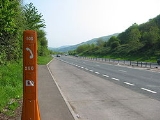
A449 road
Encyclopedia

United Kingdom
The United Kingdom of Great Britain and Northern IrelandIn the United Kingdom and Dependencies, other languages have been officially recognised as legitimate autochthonous languages under the European Charter for Regional or Minority Languages...
. It runs north from junction 24 of the M4 motorway
M4 motorway
The M4 motorway links London with South Wales. It is part of the unsigned European route E30. Other major places directly accessible from M4 junctions are Reading, Swindon, Bristol, Newport, Cardiff and Swansea...
at Newport
Newport
Newport is a city and unitary authority area in Wales. Standing on the banks of the River Usk, it is located about east of Cardiff and is the largest urban area within the historic county boundaries of Monmouthshire and the preserved county of Gwent...
in South Wales
South Wales
South Wales is an area of Wales bordered by England and the Bristol Channel to the east and south, and Mid Wales and West Wales to the north and west. The most densely populated region in the south-west of the United Kingdom, it is home to around 2.1 million people and includes the capital city of...
to Stafford
Stafford
Stafford is the county town of Staffordshire, in the West Midlands region of England. It lies approximately north of Wolverhampton and south of Stoke-on-Trent, adjacent to the M6 motorway Junction 13 to Junction 14...
in Staffordshire
Staffordshire
Staffordshire is a landlocked county in the West Midlands region of England. For Eurostat purposes, the county is a NUTS 3 region and is one of four counties or unitary districts that comprise the "Shropshire and Staffordshire" NUTS 2 region. Part of the National Forest lies within its borders...
.
The southern section of the road, between Ross on Wye and Newport forms part of the trunk route from the English Midlands
English Midlands
The Midlands, or the English Midlands, is the traditional name for the area comprising central England that broadly corresponds to the early medieval Kingdom of Mercia. It borders Southern England, Northern England, East Anglia and Wales. Its largest city is Birmingham, and it was an important...
to South Wales, avoiding the Severn Bridge
Severn Bridge
The Severn Bridge is a suspension bridge spanning the River Severn between South Gloucestershire, just north of Bristol, England, and Monmouthshire in South Wales, via Beachley, a peninsula between the River Severn and River Wye estuary. It is the original Severn road crossing between England and...
Newport - Ross-on-Wye
The A449 starts on the M4M4 motorway
The M4 motorway links London with South Wales. It is part of the unsigned European route E30. Other major places directly accessible from M4 junctions are Reading, Swindon, Bristol, Newport, Cardiff and Swansea...
at the Coldra Interchange (J24) in Newport and is dual carriageway all the way to Raglan
Raglan, Monmouthshire
Raglan is a village in Monmouthshire, south east Wales, United Kingdom. It is located some 9 miles south-west of Monmouth, midway between Monmouth and Abergavenny on the A40 road very near to the junction with the A449 road...
. The section from the A40
A40 road
The A40 is a major trunk road connecting London to Fishguard, Wales and officially called The London to Fishguard Trunk Road in all legal documents and Acts...
junction at Raglan to the A472 junction at Usk
Usk
Usk is a small town in Monmouthshire, Wales, situated 10 miles northeast of Newport.The River Usk flows through the town and is spanned by an ancient, arched stone bridge at the western entrance to the town. A castle above the town overlooks the ancient Anglo-Welsh border crossing - the river can...
, known as the New Midlands Road, was one of the first sections to be dualled, opening on 16 October 1970. Between Raglan and Ross-on-Wye
Ross-on-Wye
Ross-on-Wye is a small market town with a population of 10,089 in southeastern Herefordshire, England, located on the River Wye, and on the northern edge of the Forest of Dean.-History:...
the A449 is concurrent
Concurrency (road)
A concurrency, overlap, or coincidence in a road network is an instance of one physical road bearing two or more different highway, motorway, or other route numbers...
with the A40.
Ross-on-Wye - Worcester
The road becomes quite twisty on departing Ross-on-Wye, but straightens out a little before arriving at LedburyLedbury
Ledbury is a town in Herefordshire, England, lying east of Hereford, and south of the Malvern Hills.Today, Ledbury is a thriving market town in rural England. The town has a large number of timber framed buildings, in particular along Church Lane and High Street. One of Ledbury's most outstanding...
. The road turns northwards upon crossing into Worcestershire
Worcestershire
Worcestershire is a non-metropolitan county, established in antiquity, located in the West Midlands region of England. For Eurostat purposes it is a NUTS 3 region and is one of three counties that comprise the "Herefordshire, Worcestershire and Warwickshire" NUTS 2 region...
at Little Malvern
Little Malvern
Little Malvern is a small village and a civil parish on the lower slopes of the Malvern Hills south of Malvern Wells, near Great Malvern, the major centre of the area often referred to as The Malverns. in Worcestershire, England. It contains a Romanesque church called Little Malvern Priory, after...
and skirts the eastern slopes of the Malvern Hills
Malvern Hills
The Malvern Hills are a range of hills in the English counties of Worcestershire, Herefordshire and a small area of northern Gloucestershire, dominating the surrounding countryside and the towns and villages of the district of Malvern...
through the town of Great Malvern
Great Malvern
Great Malvern is an area of Malvern, Worcestershire, England. It is the historical centre of the town, and the location of the headquarters buildings of the of Malvern Town Council, the governing body of the Malvern civil parish, and Malvern Hills District council of the county of...
. It then crosses Worcester's
Worcester
The City of Worcester, commonly known as Worcester, , is a city and county town of Worcestershire in the West Midlands of England. Worcester is situated some southwest of Birmingham and north of Gloucester, and has an approximate population of 94,000 people. The River Severn runs through the...
ring road, the A4440, at a roundabout near Powick
Powick
Powick is a Worcestershire village two miles south of the city of Worcester and four miles north of Great Malvern, close to the River Teme. It is a civil parish of the Malvern Hills District, and it includes the village of Callow End and the hamlets of Bastonford, Clevelode, Colletts Green, and...
.
Worcester - Wolverhampton
North of WorcesterWorcester
The City of Worcester, commonly known as Worcester, , is a city and county town of Worcestershire in the West Midlands of England. Worcester is situated some southwest of Birmingham and north of Gloucester, and has an approximate population of 94,000 people. The River Severn runs through the...
, a spur road of the same number heads towards the M5
M5 motorway
The M5 is a motorway in England. It runs from a junction with the M6 at West Bromwich near Birmingham to Exeter in Devon. Heading south-west, the M5 runs east of West Bromwich and west of Birmingham through Sandwell Valley...
Junction 6, while the main route continues towards Kidderminster
Kidderminster
Kidderminster is a town, in the Wyre Forest district of Worcestershire, England. It is located approximately seventeen miles south-west of Birmingham city centre and approximately fifteen miles north of Worcester city centre. The 2001 census recorded a population of 55,182 in the town...
, concurrent with the A38
A38 road
The A38, part of which is also known as the Devon Expressway, is a major A-class trunk road in England.The road runs from Bodmin in Cornwall to Mansfield in Nottinghamshire. It is long, making it one of the longest A-roads in England. It was formerly known as the Leeds — Exeter Trunk Road,...
. Between Claines
Claines
Claines is a small village just to the north of Worcester, England, on the left bank of the River Severn. Claines is situated in the heart of Worcestershire on the A449 between Worcester and Kidderminster. It has a church which dates from the 10th Century....
and Hartlebury
Hartlebury
Hartlebury is a village in Worcestershire, England. It is a few miles south of Kidderminster and is in Wychavon district. The village registered a population of 2,549 in the Census 2001.The railway station is about half a mile to the east of the village....
the A449 is once again dual carriageway, but many safety improvements have left the road with a single lane each way and 50 mi/h speed restriction. The road becomes urban again while passing to the east of Kidderminster, forming a natural bypass for the town. It then heads north into Staffordshire
Staffordshire
Staffordshire is a landlocked county in the West Midlands region of England. For Eurostat purposes, the county is a NUTS 3 region and is one of four counties or unitary districts that comprise the "Shropshire and Staffordshire" NUTS 2 region. Part of the National Forest lies within its borders...
, passing between Kinver
Kinver
Kinver is a large village in South Staffordshire district, Staffordshire, England. It is in the far south-west of the county, at the end of the narrow finger of land surrounded by the counties of Shropshire, Worcestershire and the West Midlands. The nearest towns are Stourbridge in the West...
and Stourbridge
Stourbridge
Stourbridge is a town within the Metropolitan Borough of Dudley, in the West Midlands of England. Historically part of Worcestershire, Stourbridge was a centre of glass making, and today includes the suburbs of Amblecote, Lye, Norton, Oldswinford, Pedmore, Wollaston, Wollescote and Wordsley The...
and crossing the A458
A458 road
The A458 is a route on the UK highway network that runs from Mallwyd, near Machynlleth, in Wales, to Halesowen, near Stourbridge, in England. On the way it passes through Welshpool, Shrewsbury, Much Wenlock, Bridgnorth and Stourbridge.-Welshpool to Shrewsbury:...
at Stourton. The A491
A491 road
The A491 is an A road in Zone 4 of the Great Britain numbering scheme.-History:The road north of Oldswinford forms part of an ancient road, probably of Anglo-Saxon origin, joining the burhs of Worcester and Stafford...
meets it just north of Kingswinford
Kingswinford
Kingswinford is a suburban area in the West Midlands.Historically within Staffordshire, the area is mentioned in the Domesday Book its name relates to a ford for the King's swine - Latin Swinford Regis. The current significance is probably in tourism, education and housing...
. Continuing northwards, it passes Wombourne
Wombourne
Wombourne is a very large village and civil parish located in the district of South Staffordshire, in the county of Staffordshire, 4 miles south-west of Wolverhampton. Local affairs are run by a parish council. At the 2001 census it had a population of 13,691...
(becoming dual carriageway once more) before turning sharply north-east into the outskirts of Wolverhampton
Wolverhampton
Wolverhampton is a city and metropolitan borough in the West Midlands, England. For Eurostat purposes Walsall and Wolverhampton is a NUTS 3 region and is one of five boroughs or unitary districts that comprise the "West Midlands" NUTS 2 region...
and meeting the Ring Road
Wolverhampton Ring Road
The city of Wolverhampton, West Midlands, England has a Ring Road which encircles the city centre. It is just over in circumference. Technically, the route is listed as "Inner Ring Road", although only a tiny section of the "Outer Ring Road" was ever constructed, and only a single of the two...
.
Wolverhampton - Stafford
The road resumes its journey northwards, passing Molineux StadiumMolineux stadium
Molineux Stadium is a Premier League football stadium situated in Whitmore Reans, Wolverhampton, England. It has been the home ground of Wolverhampton Wanderers Football Club since 1889, and has a long and illustrious history as the first 'new build' stadium in Football League history, one of the...
(home of Wolverhampton Wanderers F.C.
Wolverhampton Wanderers F.C.
Wolverhampton Wanderers Football Club is an English professional association football club that represents the city of Wolverhampton in the West Midlands region. They are members of the Premier League, the highest level of English football. The club was founded in 1877 and since 1889 has played at...
) and leaving the city just south of Junction 2 of the M54
M54 motorway
The M54 is a 23 mile east-west motorway in the English counties of Shropshire and Staffordshire. It is also referred to as the Telford Motorway, after the road's primary westbound destination, the new town of Telford...
. It originally ran through the centre of Wolverhampton until the 1970s, when all roads within the new ring road were declassified. Around the same time, the section of Waterloo Road on which Molineux Stadium stands was declassified and the A459 Upper Stafford Street and Lower Stafford Street became part of the A449.
From there it forms part of the link between the M54 and the M6
M6 motorway
The M6 motorway runs from junction 19 of the M1 at the Catthorpe Interchange, near Rugby via Birmingham then heads north, passing Stoke-on-Trent, Manchester, Preston, Carlisle and terminating at the Gretna junction . Here, just short of the Scottish border it becomes the A74 which continues to...
North. It crosses the A5 at the Gailey Roundabout near the village of Gailey
Gailey, Staffordshire
Gailey is a small village in Staffordshire, England. It is at the junction of the A5 and A449 roads, and is on the boundary of the parishes of Brewood and Coven and Penkridge, in South Staffordshire....
, a short distance west of M6 Junction 12, at which point it reverts to a single carriageway. It passes through Penkridge
Penkridge
Penkridge is a market town and ancient parish in Staffordshire, England with a population of 7,836 . Many locals refer to it as a village, although it has a long history as an ecclesiastical and commercial centre. Its main distinction in the Middle Ages was as the site of an important collegiate...
before crossing the M6 at Junction 13, reaching its terminus at its junction with the A34 in Stafford.
Originally turnpiked
Turnpike trust
Turnpike trusts in the United Kingdom were bodies set up by individual Acts of Parliament, with powers to collect road tolls for maintaining the principal highways in Britain from the 17th but especially during the 18th and 19th centuries...
under an Act of 1760, the Wolverhampton-Stafford road was part of the historic London-Liverpool coach route. Notoriously narrow in the 19th century, much of it was turned into dual carriageway between the world wars. The Gailey Roundabout was improved in 1929 and again in 1937, removing parts of the churchyard and the historic Spread Eagle Inn (although the latter was replaced by a new building). Widening at Penkridge between 1932 and 1934 reshaped the western part of the town, resulting in the demolition of many ancient buildings.. The dual carriageway between Wolverhampton and Gailey was constructed between 1936 and 1939.
Former Routes
- The original routing of the road was from Bromsgrove - Stourbridge – Wolverhampton – Stafford
- The villages of Hartlebury and OmbersleyOmbersleyThe village of Ombersley is in the Wychavon District Council area of Worcestershire.The first known reference to the village was the granting of a Charter to Abbot Egwin, later Saint Egwin, of Evesham Abbey in 706 AD. This was the Charter of King Æthelweard of the Hwicce, which granted twelve...
have been bypassed - Part of Ledbury is now bypassed
- Between Raglan and Newport the A449 used to run along a now mostly unclassified road to the west, terminating at junction 25 of the M4