
1999 Atlantic hurricane season
Encyclopedia
The 1999 Atlantic hurricane season officially began on June 1, 1999, and lasted until November 30, 1999. These dates conventionally delimit the period of each year when most tropical cyclone
s form in the Atlantic basin
.
The 1999 season
set a record by having five storms reach Category 4 strength, which was later tied by the 2005 season
. Hurricane Floyd
was the deadliest United States hurricane since Hurricane Agnes
in 1972, killing 57 people and causing billions in damage as it moved northward along the Atlantic coast. Hurricane Lenny
killed 17 as it tracked eastward across the Caribbean
, the first hurricane known to do so for an extended time. Lenny, reaching peak winds of 155 mi/h just 13 days before the end of the season, was the strongest Atlantic hurricane in the month of November. The deadliest storm of the season by far, however, was a weak tropical depression in October that caused devastating floods in Mexico.
(ACE) rating of 177. ACE is, broadly speaking, a measure of the power of the hurricane multiplied by the length of time it existed, so storms that last a long time, as well as particularly strong hurricanes, have high ACEs. ACE is only calculated for full advisories on tropical systems at or exceeding 34 knots (39 mph, 63 km/h) or tropical storm strength.
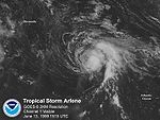
in the central Atlantic Ocean in early June. While moving northward, it generated convection, and developed a small low-level circulation. Based on increased outflow
and organization, it was classified as Tropical Depression One on June 11, and the next day it strengthened into Tropical Storm Arlene under generally favorable conditions while several hundred miles southeast of Bermuda
. Initially it had characteristics of a subtropical cyclone
, although gradually it attained the structure of a typical tropical cyclone
. The storm moved roughly northwestward, reaching peak winds of 60 mi/h on June 13.
Originally, Arlene was expected to pass near Bermuda
, which prompted a tropical storm warning
, although no impact was reported on the island. By the time it neared the island, it was weakening due to increasing wind shear
and cooler water temperatures. On June 17, it weakened to a depression as it passed within 115 miles (185.1 km) of Bermuda. Arlene dissipated on June 18 as it was absorbed into a frontal zone about 280 miles (450.6 km) north-north east of Bermuda.
by 1800 UTC on 2 July. The depression quickly reached its peak intensity with winds of 35 mph (55 km/h) and a minimum pressure
of 1004 mbars
(29.6 inHg). Around 0400 UTC 3 July, the center of the depression crossed the coast of Mexico about 35 n mi south-southeast of Tuxpan. A few hours later, the cyclone weakened to dissipation over the mountains of Mexico
.
The depression dropped heavy rain on the area amounting to a maximum of 20.37 in (517.4 mm) at Tanzabaca, Mexico. Roughly 14.6 in (370.8 mm) of this fell in a 24-hour span. No damage was reported in relation to Tropical Depression Two.
on August 18 reached tropical storm strength and received the name Bret late on August 19. Bret moved north, and strengthened into a 145 mph (130 km/h) Category 4 hurricane
on August 22. As it approached Texas
, Bret turned to the northwest, and made landfall as a Category 3 hurricane at Padre Island
on August 23, becoming the first major hurricane to hit Texas since Hurricane Alicia
in 1983. The storm continued inland and dissipated over northern Mexico on August 25. Damage is estimated at $60 million (1999 USD; $ USD), which is rather low for a hurricane of this intensity. Hurricane Bret made landfall in the sparsely populated Kenedy County, Texas, missing Brownsville, Texas
, to its south and Corpus Christi, Texas
, to its north. The hurricane dissipated quickly after its last advisory for the city of Laredo, Texas
.
Along the Texas coastline, Bret threatened several cities, resulting in the evacuation of 180,000 residents. Numerous shelters were opened throughout the region and prisons were evacuated. In nearby Mexico, roughly 7,000 people evacuated the coastline ahead of the storm. Bret made landfall in a sparsely populated region, resulting in relatively little damage in comparison to its intensity. Nevertheless, seven people were killed by the storm, four in Texas and three in Mexico. Most of the deaths were due to car accidents caused by slick roads. In all, the storm caused $15 million (1999 USD; $ USD) in damages.
moved westward off the coast of Africa. With low pressures and gradually organizing convection, the wave spawned Tropical Depression Four in the eastern Atlantic. Initially it failed to intensify due to wind shear, and the center became ill-defined and difficult to locate on August 20. After passing south of Cape Verde, the depression intensified into Tropical Storm Cindy as the convection became concentrated around the center. Because of a strong ridge to its north, Cindy moved generally westward at first, though by August 21 it turned to the northwest as the ridge began to weaken. Banding features gradually increased as outflow improved, and late on August 21, Cindy was upgraded to a hurricane.
After reaching hurricane status, an increase in wind shear caused the center to be sheared from the convection, and Cindy quickly weakened to a tropical storm. Nearly two days later, high wind shear remained as the winds decreased to 60 mph (96.6 km/h). The shear decreased on August 24, and the convection increased over the center. By late on August 25, Cindy regained hurricane status. A ragged eye appeared on satellite imagery on August 27, and early on August 28 it attained major hurricane status. Cindy turned north-northwestward, now showing a well-defined eye
, and reached category 4 intensity with winds of 140 mph (220 km/h). Turning northward, the storm remained at peak intensity until August 30 when wind shear became prominent again, and Cindy began to weaken. On August 31, Cindy was downgraded to a tropical storm, and later that day it merged with a large extratropical storm northwest of the Azores
. There were no reports of damage or fatalities.
through North Carolina
coastlines. While east of Florida Dennis reached its peaked as a Category 2 hurricane, though the wind field never resembled a classical tightly wound hurricane. The eyewall was around 35 miles (56.3 km) wide at its height. Dennis weakened as it continued northeastward, but still brought hurricane force winds to the North Carolina coast on August 30.
Hurricane Dennis eventually became involved with a cold front, causing vertical shear and cool, dry air to impact the circulation. A ridge of high pressure to its north caused Dennis to stall, leading the cyclone to weaken to a tropical storm on September 1 over the unfavorable conditions. Dennis soon strengthened again as it turned to the west-northwest, and made landfall near Harkers Island, North Carolina
, on September 5 just below hurricane strength. The storm rapidly weakened over land, and turned northward through Virginia. It became extratropical on September 7, and was absorbed by a larger extratropical on September 8 over Canada
. In all the storm was responsible for producing hurricane-force winds along the North Carolina coast along with beach erosion
. The hurricane caused $157 million in damage, and killed four people. The heavy rains from Dennis also set the stage for destructive flood
ing from Hurricane Floyd
about two weeks later.
confirmed its development. On the first advisory, the National Hurricane Center named the system Emily, and with winds estimated at 65 mph (105 km/h), the storm was forecast to attain hurricane status quickly.
The National Hurricane Center later discovered that the estimated winds in Emily were too high, and its peak winds were only 50 mph (85 km/h). Subsequently, it began a steady weakening trend due to increasing wind shear
. It became very disorganized, weakening to minimal tropical storm intensity. Emily briefly restrengthened on August 27, although approaching Hurricane Cindy caused the system to weaken further. On August 28, the storm deteriorated to tropical depression status, and shortly thereafter Emily was absorbed by Hurricane Cindy. It never affected land.
At 1200 UTC on September 6, the depression made landfall near La Pesca, Tamaulipas
with winds of 35 mph (55 km/h). The depression weakened while moving, and both radar and satellite noted only a poorly-defined center of circulation. As a result, the National Hurricane Center issued its final advisory of the depression at 1500 UTC on September 7. The intensity forecast predicted the depression would strengthen to a tropical storm shortly before landfall, as a result, the government of Mexico issued a tropical storm warning for Tampico to Matamoros, Tamaulipas
, Mexico. The storm caused heavy rainfall, though damage and death totals are unknown. In Texas
, the depression produced light rainfall, peaking at 3.35 in (85.1 mm) in Harlingen, Texas
.
that was first named on September 8 while about 863 mi (1389 km) east of the Leeward Islands. Floyd slowly intensified and headed west-northwest, staying well north of the Lesser Antilles
. On September 11, Floyd turned and began moving almost due west and began to strengthen. On September 13, Floyd was a strong Category 4 hurricane with winds of 155 mi/h, just short of reaching Category 5.
At this point, Hurricane Floyd was just east of the Bahamas. Floyd weakened slightly as it moved into the islands, striking Eleuthera Island and later making landfall on Abaco Island on September 14 while at the low end of the Category 4 range. Floyd turned north and paralleled the coast of Florida until making landfall near Cape Fear as a Category 2 storm on September 16. It returned to the ocean near Norfolk, Virginia
, and traveled up the coasts of the Delmarva Peninsula
and New Jersey
as a tropical storm. It passed over Long Island
and into New England
.
Floyd caused record rainfall across the east coast, with Wilmington, North Carolina
, and Philadelphia, Pennsylvania
, setting 24-hour rainfall records of 15 in (381 mm) and 6.63 in (168.4 mm) in respectively. Portions of New England had rainfall totals nearing 11 in (279.4 mm). Floyd generated 9 to 10 ft (2.7 to 3 m) storm surges across North Carolina. There are 57 deaths directly blamed on Floyd, 56 in the United States and one on Grand Bahama
. Most of the deaths were due to freshwater flooding in North Carolina. Floyd was one of the costliest hurricanes on record, with an estimated $4.5 billion (1999 USD; $ USD) in damage.
Gert caused isolated instances of hurricane force winds on Bermuda, but damage there was limited to coastal erosion. No deaths are directly attributable to Gert, although two people drowned in Maine
when a large wave swept them into the ocean. This wave may have been generated by Gert, despite being thousands of miles away from Maine at the time.
on September 20. Shortly after, Harvey made landfall at Everglades City, Florida on September 21 with peak winds of 55 mi/h and a pressure of 999 mbar (29.5 inHg). After passing over Florida, Harvey merged with an extratropical cyclone over the northern Bahamas on September 22.
Harvey was responsible for no deaths. Molasses Reef, Florida had a peak gust of 70 mi/h. Two tornadoes were associated with Harvey, one of which uproofed a house in Collier County
. Damage was estimated at $15 million.
and Cape Verde
. It moved erratically to the west-northwest without developing. While this was going on, the low-level circulation was mostly on the west side of the convection, due to a lower-level trough to the depression's north. Convection diminished and dissipated on October 8 as the low level circulation became less well-defined. However, the remnant low-level cloud swirl could be tracked going west-northwest for several days afterwards, until dissipating completely north of the Lesser Antilles
.
. It headed north and passed over the Isle of Youth and western Cuba
on October 14. While over the Straits of Florida
, Irene reached hurricane strength. The next day, it made landfall at Key West, Florida
, and again near Cape Sable
, Florida
. Half a day later, Irene moved back over water near Jupiter, Florida
as a minimal hurricane. It slowly strengthened as it paralleled the Florida through North Carolina. When Irene interacted with a trough from the west while over the warm Gulf Stream waters, the hurricane rapidly intensified to a peak of 110 mi/h, but it accelerated to the northeast, weakening over the cooler waters of the North Atlantic. On October 19, Irene became extratropical near Newfoundland, and was absorbed by an extratropical low shortly thereafter.
Irene dropped heavy rainfall throughout its path, especially in Cuba and Florida. Rainfall on Cuba peaked at 35.6 inches (905 mm) in Manaca-Iznaga, while the rest of the island reported more than 7 inches (178 mm). Flooding resulted more the heavy rains, damaging more than 27,000 homes and caused significant affects to banana plantations and sugar cane fields. Hurricane forces winds were also reported in Havana
. There is no estimated damage toll, however, there were four fatalities reported. Total damage in Florida was around $800 million (1999 USD). There were no direct deaths in the United States that are attributed to Irene, though there were eight indirect deaths. Damage in Cuba is not known. Irene also contributed slightly to ongoing flood problems in North Carolina
in the aftermath of Hurricane Floyd
.
, Saint-Barthélemy and St. Martin
on October 20 and October 21. Over a foot of rain fell on St. Martin. It weakened to a tropical storm as it approached the U.S. Virgin Islands and as it neared Puerto Rico
, Jose turned to the north-northeast. Jose remained on a near-straight line track into the north Atlantic until it lost its tropical characteristics on October 25. It then merged with a non-tropical system. Jose caused one death in Antigua and one in St. Martin. Extensive damage was reported in St. Martin from flooding and mud slides, but no dollar value is attached to this. Damage to the affected US areas was minimal.
as a tropical depression on October 27. On October 28, Hurricane Hunters
reported well-defined circulation near Panama
. The storm moved northwest and became Tropical Storm Katrina in the early afternoon hours on October 29. Just barely reaching tropical storm status, the storm was only a tropical storm for six hours. The storm weakened to a tropical depression in the mid-evening hours of the same day. It made landfall at Puerto Cabezas
, Nicaragua
, during the time it was a tropical storm. The storm only made things slightly harder for the people of Nicaragua
who were still recovering from Hurricane Mitch
, which struck Nicaragua almost exactly one year earlier. The storm dissipated over the Yucatán Peninsula on November 1 as it was absorbed by a cold front.
Katrina dropped heavy rainfall across, which was reported between 10 and 15 inches (250 to 375 mm) throughout Nicaragua and Honduras. As a result of the flooding, roughly 1,200 people were evacuated to emergency shelters in Honduras. Flooding also damage five bridges in Honduras, and the cities of Tocoa and Trujillo were isolated as the Aguán
and Siline rivers overflowed their banks. Katrina also destroyed water pipes that were replaced shortly after destruction from Hurricane Mitch. Damage from Katrina was minimal, totaling to only $9,000 (1999 USD). Shortly before dissipating, Katrina dropped moderate rainfall across the Yucatan Peninsula
and eastern Mexico, peaking at 6.32 in (161 mm) in Cunduacán
.
. Later that day, the National Hurricane Center upgraded Lenny to a Category 2 hurricane on the Saffir-Simpson Hurricane scale. It weakened back to a Category 1 storm, only to rapidly strengthen to its maximum pressure
just as it made landfall on the south coast of Saint Croix on November 17. As a weakening but slow moving storm, Lenny made landfall at Saint Martin
, Anguilla
, Saint-Barthélemy, and Antigua
on November 18 and November 19. Lenny weakened to a tropical depression in the open Atlantic two days later and dissipated on November 23.
Lenny brought more heavy rains to areas in the Leeward Islands that had been affected by Hurricane Jose
just one month earlier, and brought more damage to areas struck by Hurricane Georges
the previous year. Lenny also brought damaging surf
to western shores of the entire Eastern Caribbean island chain, resulting in significant damage on a number of the islands. Many residents had to evacuate their homes as huge waves threatened — and in a number of cases (such as in St. Lucia) destroyed many buildings. There are seventeen deaths directly attributed to Lenny, including two in Colombia
. Damage to the islands was considerable, totaling at $330 million United States dollars.
Lenny's 155 mph (249.4 km/h) peak, just below Category 5 intensity on the Saffir-Simpson Hurricane Scale, makes it the strongest November hurricane on record in the Atlantic basin, although records before 1944 remain incomplete.
. It is the same list used for the 1993 season
. A storm was named Lenny for the first (and only) time in 1999. Names that were not assigned are marked in .
retired two names in the spring of 2000: Floyd and Lenny. They were replaced in the 2005 season
by Franklin and Lee.
Tropical cyclone
A tropical cyclone is a storm system characterized by a large low-pressure center and numerous thunderstorms that produce strong winds and heavy rain. Tropical cyclones strengthen when water evaporated from the ocean is released as the saturated air rises, resulting in condensation of water vapor...
s form in the Atlantic basin
Atlantic Basin
The Atlantic Basin is the Atlantic Ocean.Atlantic Basin may also refer to:* Atlantic Basin Iron Works, an ironworks that operated in Brooklyn, New York, in the early to mid-20th century...
.
The 1999 season
Atlantic hurricane season
The Atlantic hurricane season is the period in a year when hurricanes usually form in the Atlantic Ocean. Tropical cyclones in the North Atlantic are called hurricanes, tropical storms, or tropical depressions. In addition, there have been several storms over the years that have not been fully...
set a record by having five storms reach Category 4 strength, which was later tied by the 2005 season
2005 Atlantic hurricane season
The 2005 Atlantic hurricane season was the most active Atlantic hurricane season in recorded history, repeatedly shattering numerous records. The impact of the season was widespread and ruinous with an estimated 3,913 deaths and record damage of about $159.2 billion...
. Hurricane Floyd
Hurricane Floyd
Hurricane Floyd was the sixth named storm, fourth hurricane, and third major hurricane in the 1999 Atlantic hurricane season. Floyd triggered the third largest evacuation in US history when 2.6 million coastal residents of five states were ordered from their homes as it approached...
was the deadliest United States hurricane since Hurricane Agnes
Hurricane Agnes
Hurricane Agnes was the first tropical storm and first hurricane of the 1972 Atlantic hurricane season. A rare June hurricane, it made landfall on the Florida Panhandle before moving northeastward and ravaging the Mid-Atlantic region as a tropical storm...
in 1972, killing 57 people and causing billions in damage as it moved northward along the Atlantic coast. Hurricane Lenny
Hurricane Lenny
Hurricane Lenny was the strongest November Atlantic hurricane on record. It was the twelfth tropical storm, eighth hurricane, and record-breaking fifth Category 4 hurricane in the 1999 Atlantic hurricane season. Lenny formed on November 13 in the western Caribbean Sea, and maintained an...
killed 17 as it tracked eastward across the Caribbean
Caribbean
The Caribbean is a crescent-shaped group of islands more than 2,000 miles long separating the Gulf of Mexico and the Caribbean Sea, to the west and south, from the Atlantic Ocean, to the east and north...
, the first hurricane known to do so for an extended time. Lenny, reaching peak winds of 155 mi/h just 13 days before the end of the season, was the strongest Atlantic hurricane in the month of November. The deadliest storm of the season by far, however, was a weak tropical depression in October that caused devastating floods in Mexico.
Season summary
The season's activity was reflected with a high cumulative accumulated cyclone energyAccumulated cyclone energy
Accumulated cyclone energy is a measure used by the National Oceanic and Atmospheric Administration to express the activity of individual tropical cyclones and entire tropical cyclone seasons, particularly the North Atlantic hurricane season. It uses an approximation of the energy used by a...
(ACE) rating of 177. ACE is, broadly speaking, a measure of the power of the hurricane multiplied by the length of time it existed, so storms that last a long time, as well as particularly strong hurricanes, have high ACEs. ACE is only calculated for full advisories on tropical systems at or exceeding 34 knots (39 mph, 63 km/h) or tropical storm strength.
Tropical Storm Arlene
A mid- to upper-level low developed along the tail end of a diffuse frontWeather front
A weather front is a boundary separating two masses of air of different densities, and is the principal cause of meteorological phenomena. In surface weather analyses, fronts are depicted using various colored lines and symbols, depending on the type of front...
in the central Atlantic Ocean in early June. While moving northward, it generated convection, and developed a small low-level circulation. Based on increased outflow
Outflow (meteorology)
Outflow, in meteorology, is air that flows outwards from a storm system. It is associated with ridging, or anticyclonic flow. In the low levels of the troposphere, outflow radiates from thunderstorms in the form of a wedge of rain-cooled air, which is visible as a thin rope-like cloud on weather...
and organization, it was classified as Tropical Depression One on June 11, and the next day it strengthened into Tropical Storm Arlene under generally favorable conditions while several hundred miles southeast of Bermuda
Bermuda
Bermuda is a British overseas territory in the North Atlantic Ocean. Located off the east coast of the United States, its nearest landmass is Cape Hatteras, North Carolina, about to the west-northwest. It is about south of Halifax, Nova Scotia, Canada, and northeast of Miami, Florida...
. Initially it had characteristics of a subtropical cyclone
Subtropical cyclone
A subtropical cyclone is a weather system that has some characteristics of a tropical and an extratropical cyclone. As early as the 1950s, meteorologists were unclear whether they should be characterized as tropical or extratropical cyclones. They were officially recognized by the National...
, although gradually it attained the structure of a typical tropical cyclone
Tropical cyclone
A tropical cyclone is a storm system characterized by a large low-pressure center and numerous thunderstorms that produce strong winds and heavy rain. Tropical cyclones strengthen when water evaporated from the ocean is released as the saturated air rises, resulting in condensation of water vapor...
. The storm moved roughly northwestward, reaching peak winds of 60 mi/h on June 13.
Originally, Arlene was expected to pass near Bermuda
Bermuda
Bermuda is a British overseas territory in the North Atlantic Ocean. Located off the east coast of the United States, its nearest landmass is Cape Hatteras, North Carolina, about to the west-northwest. It is about south of Halifax, Nova Scotia, Canada, and northeast of Miami, Florida...
, which prompted a tropical storm warning
Tropical cyclone warnings and watches
Warnings and watches are two levels of alert issued by national weather forecasting bodies to coastal areas threatened by the imminent approach of a tropical cyclone of tropical storm or hurricane intensity. They are notices to the local population and civil authorities to make appropriate...
, although no impact was reported on the island. By the time it neared the island, it was weakening due to increasing wind shear
Wind shear
Wind shear, sometimes referred to as windshear or wind gradient, is a difference in wind speed and direction over a relatively short distance in the atmosphere...
and cooler water temperatures. On June 17, it weakened to a depression as it passed within 115 miles (185.1 km) of Bermuda. Arlene dissipated on June 18 as it was absorbed into a frontal zone about 280 miles (450.6 km) north-north east of Bermuda.
Tropical Depression Two
This depression formed from a tropical wave that was tracked from the coast of Africa on 20 June. As the wave moved into the extreme western Caribbean on 30 June, a broad cyclonic turning was noted. The system moved over the Yucatan peninsula on 1 July, and a weak low pressure area entered the Bay of Campeche early on 2 July. Later that day, deep convection became more organized over the extreme southwest Gulf of Mexico. A ship reported northwesterly winds of about 30 mph (48.3 km/h), which indicated the development of a tropical depressionTropical cyclone scales
Tropical systems are officially ranked on one of several tropical cyclone scales according to their maximum sustained winds and in what oceanic basin they are located...
by 1800 UTC on 2 July. The depression quickly reached its peak intensity with winds of 35 mph (55 km/h) and a minimum pressure
Atmospheric pressure
Atmospheric pressure is the force per unit area exerted into a surface by the weight of air above that surface in the atmosphere of Earth . In most circumstances atmospheric pressure is closely approximated by the hydrostatic pressure caused by the weight of air above the measurement point...
of 1004 mbars
Bar (unit)
The bar is a unit of pressure equal to 100 kilopascals, and roughly equal to the atmospheric pressure on Earth at sea level. Other units derived from the bar are the megabar , kilobar , decibar , centibar , and millibar...
(29.6 inHg). Around 0400 UTC 3 July, the center of the depression crossed the coast of Mexico about 35 n mi south-southeast of Tuxpan. A few hours later, the cyclone weakened to dissipation over the mountains of Mexico
Mexico
The United Mexican States , commonly known as Mexico , is a federal constitutional republic in North America. It is bordered on the north by the United States; on the south and west by the Pacific Ocean; on the southeast by Guatemala, Belize, and the Caribbean Sea; and on the east by the Gulf of...
.
The depression dropped heavy rain on the area amounting to a maximum of 20.37 in (517.4 mm) at Tanzabaca, Mexico. Roughly 14.6 in (370.8 mm) of this fell in a 24-hour span. No damage was reported in relation to Tropical Depression Two.
Hurricane Bret
A tropical depression that formed in the Bay of CampecheBay of Campeche
The Bay of Campeche is the southern bight of the Gulf of Mexico. It is surrounded on three sides by the Mexican states of Campeche, Tabasco and Veracruz. It was named by Francisco Hernández de Córdoba and Antonio de Alaminos during their expedition in 1517...
on August 18 reached tropical storm strength and received the name Bret late on August 19. Bret moved north, and strengthened into a 145 mph (130 km/h) Category 4 hurricane
Saffir-Simpson Hurricane Scale
The Saffir–Simpson Hurricane Scale , or the Saffir–Simpson Hurricane Wind Scale , classifies hurricanes — Western Hemisphere tropical cyclones that exceed the intensities of tropical depressions and tropical storms — into five categories distinguished by the intensities of their sustained winds...
on August 22. As it approached Texas
Texas
Texas is the second largest U.S. state by both area and population, and the largest state by area in the contiguous United States.The name, based on the Caddo word "Tejas" meaning "friends" or "allies", was applied by the Spanish to the Caddo themselves and to the region of their settlement in...
, Bret turned to the northwest, and made landfall as a Category 3 hurricane at Padre Island
Padre Island
Padre Island is part of the U.S. state of Texas. The island is located on Texas' southern coast of the Gulf of Mexico and is famous for its white sandy beaches at the south end...
on August 23, becoming the first major hurricane to hit Texas since Hurricane Alicia
Hurricane Alicia
Hurricane Alicia was the costliest tropical cyclone in the Atlantic since Hurricane Agnes in 1972. Alicia was the third depression, the first tropical storm, and the only major hurricane of the 1983 Atlantic hurricane season...
in 1983. The storm continued inland and dissipated over northern Mexico on August 25. Damage is estimated at $60 million (1999 USD; $ USD), which is rather low for a hurricane of this intensity. Hurricane Bret made landfall in the sparsely populated Kenedy County, Texas, missing Brownsville, Texas
Brownsville, Texas
Brownsville is a city in the southernmost tip of the state of Texas, in the United States. It is located on the northern bank of the Rio Grande, directly north and across the border from Matamoros, Tamaulipas, Mexico. Brownsville is the 16th largest city in the state of Texas with a population of...
, to its south and Corpus Christi, Texas
Corpus Christi, Texas
Corpus Christi is a coastal city in the South Texas region of the U.S. state of Texas. The county seat of Nueces County, it also extends into Aransas, Kleberg, and San Patricio counties. The MSA population in 2008 was 416,376. The population was 305,215 at the 2010 census making it the...
, to its north. The hurricane dissipated quickly after its last advisory for the city of Laredo, Texas
Laredo, Texas
Laredo is the county seat of Webb County, Texas, United States, located on the north bank of the Rio Grande in South Texas, across from Nuevo Laredo, Tamaulipas, Mexico. According to the 2010 census, the city population was 236,091 making it the 3rd largest on the United States-Mexican border,...
.
Along the Texas coastline, Bret threatened several cities, resulting in the evacuation of 180,000 residents. Numerous shelters were opened throughout the region and prisons were evacuated. In nearby Mexico, roughly 7,000 people evacuated the coastline ahead of the storm. Bret made landfall in a sparsely populated region, resulting in relatively little damage in comparison to its intensity. Nevertheless, seven people were killed by the storm, four in Texas and three in Mexico. Most of the deaths were due to car accidents caused by slick roads. In all, the storm caused $15 million (1999 USD; $ USD) in damages.
Hurricane Cindy
On August 18, a tropical waveTropical wave
Tropical waves, easterly waves, or tropical easterly waves, also known as African easterly waves in the Atlantic region, are a type of atmospheric trough, an elongated area of relatively low air pressure, oriented north to south, which move from east to west across the tropics causing areas of...
moved westward off the coast of Africa. With low pressures and gradually organizing convection, the wave spawned Tropical Depression Four in the eastern Atlantic. Initially it failed to intensify due to wind shear, and the center became ill-defined and difficult to locate on August 20. After passing south of Cape Verde, the depression intensified into Tropical Storm Cindy as the convection became concentrated around the center. Because of a strong ridge to its north, Cindy moved generally westward at first, though by August 21 it turned to the northwest as the ridge began to weaken. Banding features gradually increased as outflow improved, and late on August 21, Cindy was upgraded to a hurricane.
After reaching hurricane status, an increase in wind shear caused the center to be sheared from the convection, and Cindy quickly weakened to a tropical storm. Nearly two days later, high wind shear remained as the winds decreased to 60 mph (96.6 km/h). The shear decreased on August 24, and the convection increased over the center. By late on August 25, Cindy regained hurricane status. A ragged eye appeared on satellite imagery on August 27, and early on August 28 it attained major hurricane status. Cindy turned north-northwestward, now showing a well-defined eye
Eye (cyclone)
The eye is a region of mostly calm weather found at the center of strong tropical cyclones. The eye of a storm is a roughly circular area and typically 30–65 km in diameter. It is surrounded by the eyewall, a ring of towering thunderstorms where the second most severe weather of a cyclone...
, and reached category 4 intensity with winds of 140 mph (220 km/h). Turning northward, the storm remained at peak intensity until August 30 when wind shear became prominent again, and Cindy began to weaken. On August 31, Cindy was downgraded to a tropical storm, and later that day it merged with a large extratropical storm northwest of the Azores
Azores
The Archipelago of the Azores is composed of nine volcanic islands situated in the middle of the North Atlantic Ocean, and is located about west from Lisbon and about east from the east coast of North America. The islands, and their economic exclusion zone, form the Autonomous Region of the...
. There were no reports of damage or fatalities.
Hurricane Dennis
Dennis was traced to a tropical wave moving off the African coast on August 17. Moving west-northwestward, the wave strengthened into a tropical depression on August 23, and then into a tropical storm the following day. Located at the eastern end of an elongated trough, Dennis was affected by westerly shear. Despite the unfavorable conditions, the storm intensified, and reached hurricane status on August 26 over the Bahamas. Due a trough, Dennis moved very erratically. After passing through the Bahamas, Dennis entered an area more favorable for intensification, and strengthened into a Category 2 hurricane on August 28. A trough brought Dennis north and northeastward, causing it to parallel the FloridaFlorida
Florida is a state in the southeastern United States, located on the nation's Atlantic and Gulf coasts. It is bordered to the west by the Gulf of Mexico, to the north by Alabama and Georgia and to the east by the Atlantic Ocean. With a population of 18,801,310 as measured by the 2010 census, it...
through North Carolina
North Carolina
North Carolina is a state located in the southeastern United States. The state borders South Carolina and Georgia to the south, Tennessee to the west and Virginia to the north. North Carolina contains 100 counties. Its capital is Raleigh, and its largest city is Charlotte...
coastlines. While east of Florida Dennis reached its peaked as a Category 2 hurricane, though the wind field never resembled a classical tightly wound hurricane. The eyewall was around 35 miles (56.3 km) wide at its height. Dennis weakened as it continued northeastward, but still brought hurricane force winds to the North Carolina coast on August 30.
Hurricane Dennis eventually became involved with a cold front, causing vertical shear and cool, dry air to impact the circulation. A ridge of high pressure to its north caused Dennis to stall, leading the cyclone to weaken to a tropical storm on September 1 over the unfavorable conditions. Dennis soon strengthened again as it turned to the west-northwest, and made landfall near Harkers Island, North Carolina
Harkers Island, North Carolina
Harkers Island is a census-designated place in Carteret County, North Carolina, United States. The population of Harkers Island was 1,623 at the 2007 census. Harkers Island is unincorporated and receives most public services, including law enforcement and public education, from Carteret County....
, on September 5 just below hurricane strength. The storm rapidly weakened over land, and turned northward through Virginia. It became extratropical on September 7, and was absorbed by a larger extratropical on September 8 over Canada
Canada
Canada is a North American country consisting of ten provinces and three territories. Located in the northern part of the continent, it extends from the Atlantic Ocean in the east to the Pacific Ocean in the west, and northward into the Arctic Ocean...
. In all the storm was responsible for producing hurricane-force winds along the North Carolina coast along with beach erosion
Erosion
Erosion is when materials are removed from the surface and changed into something else. It only works by hydraulic actions and transport of solids in the natural environment, and leads to the deposition of these materials elsewhere...
. The hurricane caused $157 million in damage, and killed four people. The heavy rains from Dennis also set the stage for destructive flood
Flood
A flood is an overflow of an expanse of water that submerges land. The EU Floods directive defines a flood as a temporary covering by water of land not normally covered by water...
ing from Hurricane Floyd
Hurricane Floyd
Hurricane Floyd was the sixth named storm, fourth hurricane, and third major hurricane in the 1999 Atlantic hurricane season. Floyd triggered the third largest evacuation in US history when 2.6 million coastal residents of five states were ordered from their homes as it approached...
about two weeks later.
Tropical Storm Emily
The origins of Emily were from a tropical wave that moved off of the African coast in mid-August, which was in a series of tropical waves that also spawned Hurricanes Cindy and Dennis. As the wave continued westward, an area of convection developed along it, which gradually organized. It is estimated it developed into a tropical depression at 0600 UTC on August 24, although advisories were not issued at the time. Within six hours, the depression intensified into a tropical storm, and later that day Hurricane HuntersHurricane Hunters
The Hurricane Hunters are aircraft that fly into tropical cyclones in the North Atlantic Ocean and Northeastern Pacific Ocean for the specific purpose of directly measuring weather data in and around those storms. In the United States, the Air Force, Navy, and NOAA units have all participated in...
confirmed its development. On the first advisory, the National Hurricane Center named the system Emily, and with winds estimated at 65 mph (105 km/h), the storm was forecast to attain hurricane status quickly.
The National Hurricane Center later discovered that the estimated winds in Emily were too high, and its peak winds were only 50 mph (85 km/h). Subsequently, it began a steady weakening trend due to increasing wind shear
Wind shear
Wind shear, sometimes referred to as windshear or wind gradient, is a difference in wind speed and direction over a relatively short distance in the atmosphere...
. It became very disorganized, weakening to minimal tropical storm intensity. Emily briefly restrengthened on August 27, although approaching Hurricane Cindy caused the system to weaken further. On August 28, the storm deteriorated to tropical depression status, and shortly thereafter Emily was absorbed by Hurricane Cindy. It never affected land.
Tropical Depression Seven
A strong monsoon-type flow interacted with a tropical wave in the Bay of Campeche. Early on September 5, satellite imagery indicated a well-defined low-level circulation in the Bay of Campeche. As a result, the system was classified as Tropical Depression Seven late on September 5. The NHC guidance computer model showed the depression heading north-northwestward. By 0000 UTC on September 6, the depression attained its peak intensity with maximum sustained winds of 35 mph (55 km/h) and a minimum barometric pressure of 1006 mbar (29.7 inHg). Shortly thereafter, the center of circulation of the depression became difficult to locate, but is was likely heading north-northwestward. Despite almost no deep convection and its close proximity to land, the SHIPS model predicted further intensification, due to warm sea surface temperatures.At 1200 UTC on September 6, the depression made landfall near La Pesca, Tamaulipas
La Pesca, Tamaulipas
La Pesca is a small town in the Mexican state of Tamaulipas. It is located on the Gulf of Mexico, at the mouth of the Río Soto La Marina, between the Laguna Madre to the north and the Laguna Morales to the south....
with winds of 35 mph (55 km/h). The depression weakened while moving, and both radar and satellite noted only a poorly-defined center of circulation. As a result, the National Hurricane Center issued its final advisory of the depression at 1500 UTC on September 7. The intensity forecast predicted the depression would strengthen to a tropical storm shortly before landfall, as a result, the government of Mexico issued a tropical storm warning for Tampico to Matamoros, Tamaulipas
Matamoros, Tamaulipas
Matamoros, officially known as Heroica Matamoros, is a city in the northeastern part of Tamaulipas, in the country of Mexico. It is located on the southern bank of the Rio Grande, directly across the border from Brownsville, Texas, in the United States. Matamoros is the second largest and second...
, Mexico. The storm caused heavy rainfall, though damage and death totals are unknown. In Texas
Texas
Texas is the second largest U.S. state by both area and population, and the largest state by area in the contiguous United States.The name, based on the Caddo word "Tejas" meaning "friends" or "allies", was applied by the Spanish to the Caddo themselves and to the region of their settlement in...
, the depression produced light rainfall, peaking at 3.35 in (85.1 mm) in Harlingen, Texas
Harlingen, Texas
Harlingen is a city in Cameron County in the heart of the Rio Grande Valley of south Texas, United States, about from the coast of the Gulf of Mexico. The city covers more than , and is the second largest city in Cameron County and the sixth largest in the Rio Grande Valley...
.
Hurricane Floyd
Hurricane Floyd was a large and powerful Cape Verde-type hurricaneCape Verde-type hurricane
A Cape Verde-type hurricane is an Atlantic hurricane that develops near the Cape Verde islands, off the west coast of Africa. The average hurricane season has about two Cape Verde-type hurricanes, which are usually the largest and most intense storms of the season because they often have plenty of...
that was first named on September 8 while about 863 mi (1389 km) east of the Leeward Islands. Floyd slowly intensified and headed west-northwest, staying well north of the Lesser Antilles
Lesser Antilles
The Lesser Antilles are a long, partly volcanic island arc in the Western Hemisphere. Most of its islands form the eastern boundary of the Caribbean Sea with the Atlantic Ocean, with the remainder located in the southern Caribbean just north of South America...
. On September 11, Floyd turned and began moving almost due west and began to strengthen. On September 13, Floyd was a strong Category 4 hurricane with winds of 155 mi/h, just short of reaching Category 5.
At this point, Hurricane Floyd was just east of the Bahamas. Floyd weakened slightly as it moved into the islands, striking Eleuthera Island and later making landfall on Abaco Island on September 14 while at the low end of the Category 4 range. Floyd turned north and paralleled the coast of Florida until making landfall near Cape Fear as a Category 2 storm on September 16. It returned to the ocean near Norfolk, Virginia
Norfolk, Virginia
Norfolk is an independent city in the Commonwealth of Virginia in the United States. With a population of 242,803 as of the 2010 Census, it is Virginia's second-largest city behind neighboring Virginia Beach....
, and traveled up the coasts of the Delmarva Peninsula
Delmarva Peninsula
The Delmarva Peninsula is a large peninsula on the East Coast of the United States, occupied by most of Delaware and portions of Maryland and Virginia...
and New Jersey
New Jersey
New Jersey is a state in the Northeastern and Middle Atlantic regions of the United States. , its population was 8,791,894. It is bordered on the north and east by the state of New York, on the southeast and south by the Atlantic Ocean, on the west by Pennsylvania and on the southwest by Delaware...
as a tropical storm. It passed over Long Island
Long Island
Long Island is an island located in the southeast part of the U.S. state of New York, just east of Manhattan. Stretching northeast into the Atlantic Ocean, Long Island contains four counties, two of which are boroughs of New York City , and two of which are mainly suburban...
and into New England
New England
New England is a region in the northeastern corner of the United States consisting of the six states of Maine, New Hampshire, Vermont, Massachusetts, Rhode Island, and Connecticut...
.
Floyd caused record rainfall across the east coast, with Wilmington, North Carolina
Wilmington, North Carolina
Wilmington is a port city in and is the county seat of New Hanover County, North Carolina, United States. The population is 106,476 according to the 2010 Census, making it the eighth most populous city in the state of North Carolina...
, and Philadelphia, Pennsylvania
Philadelphia, Pennsylvania
Philadelphia is the largest city in the Commonwealth of Pennsylvania and the county seat of Philadelphia County, with which it is coterminous. The city is located in the Northeastern United States along the Delaware and Schuylkill rivers. It is the fifth-most-populous city in the United States,...
, setting 24-hour rainfall records of 15 in (381 mm) and 6.63 in (168.4 mm) in respectively. Portions of New England had rainfall totals nearing 11 in (279.4 mm). Floyd generated 9 to 10 ft (2.7 to 3 m) storm surges across North Carolina. There are 57 deaths directly blamed on Floyd, 56 in the United States and one on Grand Bahama
Grand Bahama
Grand Bahama is one of the northernmost of the islands of the Bahamas, and the closest major island to the United States, lying off the state of Florida. Grand Bahama is the fifth largest island in the Bahamas island chain of approximately 700 islands and 2,400 cays...
. Most of the deaths were due to freshwater flooding in North Carolina. Floyd was one of the costliest hurricanes on record, with an estimated $4.5 billion (1999 USD; $ USD) in damage.
Hurricane Gert
Gert formed from an African tropical wave several hundred miles west of Cape Verde on September 12. Gert's track arced across the Atlantic, and it became a strong Category 4 storm on September 16. Gert threatened Bermuda as a weakening Category 2 storm, but turned away to the north-northeast. On September 23, Gert became extratropical and merged with another low pressure system off the coast of Newfoundland.Gert caused isolated instances of hurricane force winds on Bermuda, but damage there was limited to coastal erosion. No deaths are directly attributable to Gert, although two people drowned in Maine
Maine
Maine is a state in the New England region of the northeastern United States, bordered by the Atlantic Ocean to the east and south, New Hampshire to the west, and the Canadian provinces of Quebec to the northwest and New Brunswick to the northeast. Maine is both the northernmost and easternmost...
when a large wave swept them into the ocean. This wave may have been generated by Gert, despite being thousands of miles away from Maine at the time.
Tropical Storm Harvey
Tropical Storm Harvey formed in the eastern Gulf of Mexico about 345 miles (555.2 km) west-southwest of St. Petersburg, FloridaSt. Petersburg, Florida
St. Petersburg is a city in Pinellas County, Florida, United States. It is known as a vacation destination for both American and foreign tourists. As of 2008, the population estimate by the U.S. Census Bureau is 245,314, making St...
on September 20. Shortly after, Harvey made landfall at Everglades City, Florida on September 21 with peak winds of 55 mi/h and a pressure of 999 mbar (29.5 inHg). After passing over Florida, Harvey merged with an extratropical cyclone over the northern Bahamas on September 22.
Harvey was responsible for no deaths. Molasses Reef, Florida had a peak gust of 70 mi/h. Two tornadoes were associated with Harvey, one of which uproofed a house in Collier County
Collier County, Florida
Collier County is a county located in the U.S. state of Florida. As of 2000, the population was 251,377. The U.S. Census Bureau 2007 estimate for the county is 315,839...
. Damage was estimated at $15 million.
Tropical Depression Eleven
A tropical wave organized into Tropical Depression Eleven in the Bay of Campeche on October 4. Under weak steering currents, it drifted southward, then westward, remaining weak due to a broad surface trough over the eastern Gulf of Mexico. The depression merged with the trough on October 6, though tropical storm force winds remained over coastal waters. The depression's large, unorganized circulation, in combination with previous rainfall along the Mexican coastline, resulted in the worst flooding in at least 40 years for the region with at least 384 casualties attributed to the resulting flood.Tropical Depression Twelve
Tropical Depression Twelve developed from a tropical wave on October 6 between the Lesser AntillesLesser Antilles
The Lesser Antilles are a long, partly volcanic island arc in the Western Hemisphere. Most of its islands form the eastern boundary of the Caribbean Sea with the Atlantic Ocean, with the remainder located in the southern Caribbean just north of South America...
and Cape Verde
Cape Verde
The Republic of Cape Verde is an island country, spanning an archipelago of 10 islands located in the central Atlantic Ocean, 570 kilometres off the coast of Western Africa...
. It moved erratically to the west-northwest without developing. While this was going on, the low-level circulation was mostly on the west side of the convection, due to a lower-level trough to the depression's north. Convection diminished and dissipated on October 8 as the low level circulation became less well-defined. However, the remnant low-level cloud swirl could be tracked going west-northwest for several days afterwards, until dissipating completely north of the Lesser Antilles
Lesser Antilles
The Lesser Antilles are a long, partly volcanic island arc in the Western Hemisphere. Most of its islands form the eastern boundary of the Caribbean Sea with the Atlantic Ocean, with the remainder located in the southern Caribbean just north of South America...
.
Hurricane Irene
Irene formed on October 12 from a broad trough of low pressure while south of the Isle of YouthIsle of Youth
Isla de la Juventud is the second-largest Cuban island and the seventh-largest island in the West Indies . The island has an area and is 100 km south of the island of Cuba, across the Gulf of Batabanó...
. It headed north and passed over the Isle of Youth and western Cuba
Cuba
The Republic of Cuba is an island nation in the Caribbean. The nation of Cuba consists of the main island of Cuba, the Isla de la Juventud, and several archipelagos. Havana is the largest city in Cuba and the country's capital. Santiago de Cuba is the second largest city...
on October 14. While over the Straits of Florida
Straits of Florida
The Straits of Florida, Florida Straits, or Florida Strait is a strait located south-southeast of the North American mainland, generally accepted to be between the Gulf of Mexico and the Atlantic Ocean, and between the Florida Keys and Cuba. The strait carries the Florida Current, the beginning of...
, Irene reached hurricane strength. The next day, it made landfall at Key West, Florida
Key West, Florida
Key West is a city in Monroe County, Florida, United States. The city encompasses the island of Key West, the part of Stock Island north of U.S. 1 , Sigsbee Park , Fleming Key , and Sunset Key...
, and again near Cape Sable
Cape Sable
Cape Sable, Florida is the southernmost point of the US mainland and mainland Florida. It is located in southwestern Florida, in Monroe County, and is part of the Everglades National Park. The cape is a peninsula issuing from the southeastern part of the Florida mainland, running west and curving...
, Florida
Florida
Florida is a state in the southeastern United States, located on the nation's Atlantic and Gulf coasts. It is bordered to the west by the Gulf of Mexico, to the north by Alabama and Georgia and to the east by the Atlantic Ocean. With a population of 18,801,310 as measured by the 2010 census, it...
. Half a day later, Irene moved back over water near Jupiter, Florida
Jupiter, Florida
Jupiter is a town located in Palm Beach County, Florida. As of the 2000 census, the town had a total population of 39,328. The estimate population for 2009 is 50,606. As of 2006, the population had grown to 50,028, according to the University of Florida, Bureau of Economic and Business Research....
as a minimal hurricane. It slowly strengthened as it paralleled the Florida through North Carolina. When Irene interacted with a trough from the west while over the warm Gulf Stream waters, the hurricane rapidly intensified to a peak of 110 mi/h, but it accelerated to the northeast, weakening over the cooler waters of the North Atlantic. On October 19, Irene became extratropical near Newfoundland, and was absorbed by an extratropical low shortly thereafter.
Irene dropped heavy rainfall throughout its path, especially in Cuba and Florida. Rainfall on Cuba peaked at 35.6 inches (905 mm) in Manaca-Iznaga, while the rest of the island reported more than 7 inches (178 mm). Flooding resulted more the heavy rains, damaging more than 27,000 homes and caused significant affects to banana plantations and sugar cane fields. Hurricane forces winds were also reported in Havana
Havana
Havana is the capital city, province, major port, and leading commercial centre of Cuba. The city proper has a population of 2.1 million inhabitants, and it spans a total of — making it the largest city in the Caribbean region, and the most populous...
. There is no estimated damage toll, however, there were four fatalities reported. Total damage in Florida was around $800 million (1999 USD). There were no direct deaths in the United States that are attributed to Irene, though there were eight indirect deaths. Damage in Cuba is not known. Irene also contributed slightly to ongoing flood problems in North Carolina
North Carolina
North Carolina is a state located in the southeastern United States. The state borders South Carolina and Georgia to the south, Tennessee to the west and Virginia to the north. North Carolina contains 100 counties. Its capital is Raleigh, and its largest city is Charlotte...
in the aftermath of Hurricane Floyd
Hurricane Floyd
Hurricane Floyd was the sixth named storm, fourth hurricane, and third major hurricane in the 1999 Atlantic hurricane season. Floyd triggered the third largest evacuation in US history when 2.6 million coastal residents of five states were ordered from their homes as it approached...
.
Hurricane Jose
Jose formed on October 8 while 400 miles (643.7 km) east of the Windward Islands. The storm quickly strengthened into a hurricane and over 2,000 people were evacuated from islands in its path. It moved northwest, and as the hurricane passed over AntiguaAntigua and Barbuda
Antigua and Barbuda is a twin-island nation lying between the Caribbean Sea and the Atlantic Ocean. It consists of two major inhabited islands, Antigua and Barbuda, and a number of smaller islands...
, Saint-Barthélemy and St. Martin
Saint Martin
Saint Martin is an island in the northeast Caribbean, approximately east of Puerto Rico. The 87 km2 island is divided roughly 60/40 between France and the Kingdom of the Netherlands ; however, the Dutch side has the larger population. It is one of the smallest sea islands divided between...
on October 20 and October 21. Over a foot of rain fell on St. Martin. It weakened to a tropical storm as it approached the U.S. Virgin Islands and as it neared Puerto Rico
Puerto Rico
Puerto Rico , officially the Commonwealth of Puerto Rico , is an unincorporated territory of the United States, located in the northeastern Caribbean, east of the Dominican Republic and west of both the United States Virgin Islands and the British Virgin Islands.Puerto Rico comprises an...
, Jose turned to the north-northeast. Jose remained on a near-straight line track into the north Atlantic until it lost its tropical characteristics on October 25. It then merged with a non-tropical system. Jose caused one death in Antigua and one in St. Martin. Extensive damage was reported in St. Martin from flooding and mud slides, but no dollar value is attached to this. Damage to the affected US areas was minimal.
Tropical Storm Katrina
Katrina formed in the southern CaribbeanCaribbean
The Caribbean is a crescent-shaped group of islands more than 2,000 miles long separating the Gulf of Mexico and the Caribbean Sea, to the west and south, from the Atlantic Ocean, to the east and north...
as a tropical depression on October 27. On October 28, Hurricane Hunters
Hurricane Hunters
The Hurricane Hunters are aircraft that fly into tropical cyclones in the North Atlantic Ocean and Northeastern Pacific Ocean for the specific purpose of directly measuring weather data in and around those storms. In the United States, the Air Force, Navy, and NOAA units have all participated in...
reported well-defined circulation near Panama
Panama
Panama , officially the Republic of Panama , is the southernmost country of Central America. Situated on the isthmus connecting North and South America, it is bordered by Costa Rica to the northwest, Colombia to the southeast, the Caribbean Sea to the north and the Pacific Ocean to the south. The...
. The storm moved northwest and became Tropical Storm Katrina in the early afternoon hours on October 29. Just barely reaching tropical storm status, the storm was only a tropical storm for six hours. The storm weakened to a tropical depression in the mid-evening hours of the same day. It made landfall at Puerto Cabezas
Puerto Cabezas
Puerto Cabezas is a municipality in, and capital of, the North Atlantic Coast department of Nicaragua....
, Nicaragua
Nicaragua
Nicaragua is the largest country in the Central American American isthmus, bordered by Honduras to the north and Costa Rica to the south. The country is situated between 11 and 14 degrees north of the Equator in the Northern Hemisphere, which places it entirely within the tropics. The Pacific Ocean...
, during the time it was a tropical storm. The storm only made things slightly harder for the people of Nicaragua
Nicaragua
Nicaragua is the largest country in the Central American American isthmus, bordered by Honduras to the north and Costa Rica to the south. The country is situated between 11 and 14 degrees north of the Equator in the Northern Hemisphere, which places it entirely within the tropics. The Pacific Ocean...
who were still recovering from Hurricane Mitch
Hurricane Mitch
Hurricane Mitch was the most powerful hurricane and the most destructive of the 1998 Atlantic hurricane season, with maximum sustained winds of 180 mph . The storm was the thirteenth tropical storm, ninth hurricane, and third major hurricane of the season. Along with Hurricane Georges, Mitch...
, which struck Nicaragua almost exactly one year earlier. The storm dissipated over the Yucatán Peninsula on November 1 as it was absorbed by a cold front.
Katrina dropped heavy rainfall across, which was reported between 10 and 15 inches (250 to 375 mm) throughout Nicaragua and Honduras. As a result of the flooding, roughly 1,200 people were evacuated to emergency shelters in Honduras. Flooding also damage five bridges in Honduras, and the cities of Tocoa and Trujillo were isolated as the Aguán
Aguán River
The Aguán River is a river in Honduras. It rises in the Yoro region to the west of San Lorenzo and briefly runs south before turning East-North-East, passing San Lorenzo, Olanchito and Tocoa before entering the Caribbean Sea east of Puerto Castilla.The river is 240 kilometres in length...
and Siline rivers overflowed their banks. Katrina also destroyed water pipes that were replaced shortly after destruction from Hurricane Mitch. Damage from Katrina was minimal, totaling to only $9,000 (1999 USD). Shortly before dissipating, Katrina dropped moderate rainfall across the Yucatan Peninsula
Yucatán Peninsula
The Yucatán Peninsula, in southeastern Mexico, separates the Caribbean Sea from the Gulf of Mexico, with the northern coastline on the Yucatán Channel...
and eastern Mexico, peaking at 6.32 in (161 mm) in Cunduacán
Cunduacán
Cunduacán is a municipality in the central portion of the state of Tabasco, in Mexico. It is located at about 18°4'0"North, 93°10'0"West.It is located in the Grijalva River Region, Chontalpa subregion. Its name originates from the Mayan cum-ua-cán, which means "place of corn and serpents", which is...
.
Hurricane Lenny
Hurricane Lenny was a damaging late season hurricane first named on November 13 while in the western Caribbean Sea. Lenny tracked generally east over the Caribbean, and is the only storm recorded to have done so for an extended period of time and by November 15, Lenny had intensified to hurricane strength and was just south of JamaicaJamaica
Jamaica is an island nation of the Greater Antilles, in length, up to in width and 10,990 square kilometres in area. It is situated in the Caribbean Sea, about south of Cuba, and west of Hispaniola, the island harbouring the nation-states Haiti and the Dominican Republic...
. Later that day, the National Hurricane Center upgraded Lenny to a Category 2 hurricane on the Saffir-Simpson Hurricane scale. It weakened back to a Category 1 storm, only to rapidly strengthen to its maximum pressure
Atmospheric pressure
Atmospheric pressure is the force per unit area exerted into a surface by the weight of air above that surface in the atmosphere of Earth . In most circumstances atmospheric pressure is closely approximated by the hydrostatic pressure caused by the weight of air above the measurement point...
just as it made landfall on the south coast of Saint Croix on November 17. As a weakening but slow moving storm, Lenny made landfall at Saint Martin
Saint Martin
Saint Martin is an island in the northeast Caribbean, approximately east of Puerto Rico. The 87 km2 island is divided roughly 60/40 between France and the Kingdom of the Netherlands ; however, the Dutch side has the larger population. It is one of the smallest sea islands divided between...
, Anguilla
Anguilla
Anguilla is a British overseas territory and overseas territory of the European Union in the Caribbean. It is one of the most northerly of the Leeward Islands in the Lesser Antilles, lying east of Puerto Rico and the Virgin Islands and directly north of Saint Martin...
, Saint-Barthélemy, and Antigua
Antigua
Antigua , also known as Waladli, is an island in the West Indies, in the Leeward Islands in the Caribbean region, the main island of the country of Antigua and Barbuda. Antigua means "ancient" in Spanish and was named by Christopher Columbus after an icon in Seville Cathedral, Santa Maria de la...
on November 18 and November 19. Lenny weakened to a tropical depression in the open Atlantic two days later and dissipated on November 23.
Lenny brought more heavy rains to areas in the Leeward Islands that had been affected by Hurricane Jose
Hurricane Jose (1999)
Hurricane Jose was a Category 2 hurricane that affected the Leeward Islands between October 20 and October 25, 1999. It was the tenth named storm, and eighth hurricane of the 1999 Atlantic hurricane season. Jose formed on October 17 while east of the Windward Islands. The storm quickly...
just one month earlier, and brought more damage to areas struck by Hurricane Georges
Hurricane Georges
Hurricane Georges was a very destructive, powerful and long-lived Cape Verde-type Category 4 hurricane. Georges was the seventh tropical storm, fourth hurricane, and second major hurricane of the 1998 Atlantic hurricane season...
the previous year. Lenny also brought damaging surf
Breaking wave
In fluid dynamics, a breaking wave is a wave whose amplitude reaches a critical level at which some process can suddenly start to occur that causes large amounts of wave energy to be transformed into turbulent kinetic energy...
to western shores of the entire Eastern Caribbean island chain, resulting in significant damage on a number of the islands. Many residents had to evacuate their homes as huge waves threatened — and in a number of cases (such as in St. Lucia) destroyed many buildings. There are seventeen deaths directly attributed to Lenny, including two in Colombia
Colombia
Colombia, officially the Republic of Colombia , is a unitary constitutional republic comprising thirty-two departments. The country is located in northwestern South America, bordered to the east by Venezuela and Brazil; to the south by Ecuador and Peru; to the north by the Caribbean Sea; to the...
. Damage to the islands was considerable, totaling at $330 million United States dollars.
Lenny's 155 mph (249.4 km/h) peak, just below Category 5 intensity on the Saffir-Simpson Hurricane Scale, makes it the strongest November hurricane on record in the Atlantic basin, although records before 1944 remain incomplete.
Storm names
The following names were used for named storms that formed in the north Atlantic in 1999. The names not retired from this list were used again in the 2005 season2005 Atlantic hurricane season
The 2005 Atlantic hurricane season was the most active Atlantic hurricane season in recorded history, repeatedly shattering numerous records. The impact of the season was widespread and ruinous with an estimated 3,913 deaths and record damage of about $159.2 billion...
. It is the same list used for the 1993 season
1993 Atlantic hurricane season
The 1993 Atlantic hurricane season was a period in the annual formation of tropical cyclones. It officially began on June 1, 1993, and lasted until November 30, 1993. These dates conventionally delimit the period of each year when most tropical cyclones form in the Atlantic basin...
. A storm was named Lenny for the first (and only) time in 1999. Names that were not assigned are marked in .
|
Tropical Storm Harvey (1999) Tropical Storm Harvey was a moderately strong tropical storm that caused extensive flooding across south Florida during the 1999 Atlantic hurricane season. The eleventh named storm and second tropical cyclone of the season, Harvey developed from a tropical wave in the Gulf of Mexico on September 19... Hurricane Irene (1999) Hurricane Irene was a hurricane that produced somewhat heavy damage across southern Florida during the 1999 Atlantic hurricane season. The ninth tropical storm and the sixth hurricane of the season, Irene developed in the western Caribbean Sea on October 13 from a tropical wave. It moved northward,... Hurricane Jose (1999) Hurricane Jose was a Category 2 hurricane that affected the Leeward Islands between October 20 and October 25, 1999. It was the tenth named storm, and eighth hurricane of the 1999 Atlantic hurricane season. Jose formed on October 17 while east of the Windward Islands. The storm quickly... Tropical Storm Katrina (1999) Tropical Storm Katrina was a short-lived, weak tropical cyclone that produced minor damage across areas previously devastated by Hurricane Mitch in 1998... Hurricane Lenny Hurricane Lenny was the strongest November Atlantic hurricane on record. It was the twelfth tropical storm, eighth hurricane, and record-breaking fifth Category 4 hurricane in the 1999 Atlantic hurricane season. Lenny formed on November 13 in the western Caribbean Sea, and maintained an... |
Retirement
The World Meteorological OrganizationWorld Meteorological Organization
The World Meteorological Organization is an intergovernmental organization with a membership of 189 Member States and Territories. It originated from the International Meteorological Organization , which was founded in 1873...
retired two names in the spring of 2000: Floyd and Lenny. They were replaced in the 2005 season
2005 Atlantic hurricane season
The 2005 Atlantic hurricane season was the most active Atlantic hurricane season in recorded history, repeatedly shattering numerous records. The impact of the season was widespread and ruinous with an estimated 3,913 deaths and record damage of about $159.2 billion...
by Franklin and Lee.
Season effects
This is a table of the storms in 1999 and their landfall(s), if any. Deaths in parentheses are additional and indirect (an example of an indirect death would be a traffic accident), but are still storm-related. Damage and deaths include totals while the storm was extratropical or a wave or low.See also
- List of Atlantic hurricanes
- List of Atlantic hurricane seasons
- 1999 Pacific hurricane season1999 Pacific hurricane seasonThe 1999 Pacific hurricane season officially started on May 15, 1999 in the eastern Pacific, and on June 1, 1999 in the central Pacific, and lasted until November 30, 1999. These dates conventionally delimit the period of each year when most tropical cyclones form in the northeastern Pacific...
- 1999 Pacific typhoon season1999 Pacific typhoon seasonThe 1999 Pacific typhoon season has no official bounds; it ran year-round in 1999, but most tropical cyclones tend to form in the northwestern Pacific Ocean between May and November...
- 1999 North Indian Ocean cyclone season1999 North Indian Ocean cyclone seasonThe 1999 North Indian Ocean cyclone season was an event in the annual cycle of tropical cyclone formation. The North Indian Ocean cyclone season has no official bounds, but cyclones tend to form between April and December, with peaks in May and November...
- South-West Indian Ocean cyclone seasons: 1998–991998–99 South-West Indian Ocean cyclone seasonThe 1998–99 South-West Indian Ocean cyclone season was an annual event of tropical cyclone formation. According to the Joint Typhoon Warning Center it started on July 1, 1998 and ended on June 30, 1999. These dates conventionally delimit the period of each year when most tropical cyclones form in...
, 1999–00 - Australian region cyclone seasons: 1998–991998–99 Australian region cyclone seasonThe 1998–99 Australian region cyclone season was an event in the ongoing cycle of tropical cyclone formation. It began on 1 November 1998 and ended on 30 April 1999...
, 1999–00 - South Pacific cyclone seasons: 1998–991998–99 South Pacific cyclone seasonThe 1998–99 South Pacific cyclone season was a near average tropical cyclone seasons, with 8 tropical cyclones occurring within the South Pacific Ocean basin between 160°E and 120°W. Despite the season starting on November 1, the first tropical system of the season did not form until December 1,...
, 1999–00