

Bay of Campeche
Encyclopedia

Bight (geography)
In geography, bight has two meanings. A bight can be simply a bend or curve in any geographical feature—usually a bend or curve in the line between land and water....
of the Gulf of Mexico
Gulf of Mexico
The Gulf of Mexico is a partially landlocked ocean basin largely surrounded by the North American continent and the island of Cuba. It is bounded on the northeast, north and northwest by the Gulf Coast of the United States, on the southwest and south by Mexico, and on the southeast by Cuba. In...
. It is surrounded on three sides by the Mexican
Mexico
The United Mexican States , commonly known as Mexico , is a federal constitutional republic in North America. It is bordered on the north by the United States; on the south and west by the Pacific Ocean; on the southeast by Guatemala, Belize, and the Caribbean Sea; and on the east by the Gulf of...
states
States of Mexico
The United Mexican States is a federal republic formed by 32 federal entities .According to the Constitution of 1917, the states of the federation are free and sovereign. Each state has their own congress and constitution, while the Federal District has only limited autonomy with a local Congress...
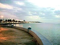
of Campeche
Campeche
Campeche is one of the 31 states which, with the Federal District, comprise the 32 Federal Entities of Mexico. Located in Southeast Mexico, it is bordered by the states of Yucatán to the north east, Quintana Roo to the east, and Tabasco to the south west...
, Tabasco
Tabasco
Tabasco officially Estado Libre y Soberano de Tabasco is one of the 31 states which, with the Federal District, comprise the 32 Federal Entities of Mexico. It is divided in 17 municipalities and its capital city is Villahermosa....
and Veracruz
Veracruz
Veracruz, formally Veracruz de Ignacio de la Llave officially Estado Libre y Soberano de Veracruz de Ignacio de la Llave , is one of the 31 states that, along with the Federal District, comprise the 32 federative entities of Mexico. It is divided in 212 municipalities and its capital city is...
. It was named by Francisco Hernández de Córdoba
Francisco Hernández de Córdoba (discoverer of Yucatán)
Francisco Hernández de Córdoba was a Spanish conquistador, known to history mainly for the ill-fated expedition he led in 1517, in the course of which the first European accounts of the Yucatán Peninsula were compiled.-1517 Expedition:...
and Antonio de Alaminos during their expedition in 1517.
Oil resource
The Cantarell ComplexCantarell Field
Cantarell Field or Cantarell Complex is an aging supergiant oil field in Mexico. It was discovered in 1976 by a fisherman, Rudesindo Cantarell. It was placed on nitrogen injection in 2000, and production peaked at in 2003. In terms of cumulative production to date, it is by far the largest oil...
of five oil field
Oil field
An oil field is a region with an abundance of oil wells extracting petroleum from below ground. Because the oil reservoirs typically extend over a large area, possibly several hundred kilometres across, full exploitation entails multiple wells scattered across the area...
s lies beneath the Bay of Campeche. It is the second most productive oil field in the world, supplying about two thirds of Mexico's crude oil output. On June 3, 1979, Ixtoc I, an exploratory oil well located in the bay, suffered a blowout that caused a catastrophic explosion, resulting in what has been ranked as the third largest unintentional oil spill in history. The area of the bay is 6000 square mile and maximum depth of the bay is approximately 180 feet (54.9 m).
Miscellaneous information
Atlantic Ocean
The Atlantic Ocean is the second-largest of the world's oceanic divisions. With a total area of about , it covers approximately 20% of the Earth's surface and about 26% of its water surface area...
hurricanes. The bay is also considered the eastern border on the main migration routes for birds in the Americas.