
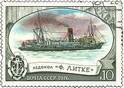
Icebreaker Feodor Litke
Encyclopedia
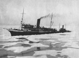
The icebreaker Fyodor Litke (SKR-18) was active in the Soviet era in the Arctic
Arctic
The Arctic is a region located at the northern-most part of the Earth. The Arctic consists of the Arctic Ocean and parts of Canada, Russia, Greenland, the United States, Norway, Sweden, Finland, and Iceland. The Arctic region consists of a vast, ice-covered ocean, surrounded by treeless permafrost...
, until the late 1950s. It was built in 1909 in England
England
England is a country that is part of the United Kingdom. It shares land borders with Scotland to the north and Wales to the west; the Irish Sea is to the north west, the Celtic Sea to the south west, with the North Sea to the east and the English Channel to the south separating it from continental...
for the Saint Lawrence River
Saint Lawrence River
The Saint Lawrence is a large river flowing approximately from southwest to northeast in the middle latitudes of North America, connecting the Great Lakes with the Atlantic Ocean. It is the primary drainage conveyor of the Great Lakes Basin...
service and initially named CGC Earl Grey after Albert Grey
Albert Grey, 4th Earl Grey
Albert Henry George Grey, 4th Earl Grey was a British nobleman and politician who served as Governor General of Canada, the ninth since Canadian Confederation....
, Governor General of Canada
Governor General of Canada
The Governor General of Canada is the federal viceregal representative of the Canadian monarch, Queen Elizabeth II...
. After four years in Canada
Canada
Canada is a North American country consisting of ten provinces and three territories. Located in the northern part of the continent, it extends from the Atlantic Ocean in the east to the Pacific Ocean in the west, and northward into the Arctic Ocean...
it was sold to the Russia
Russia
Russia or , officially known as both Russia and the Russian Federation , is a country in northern Eurasia. It is a federal semi-presidential republic, comprising 83 federal subjects...
n government and eventually renamed Fyodor Litke in honour of the Arctic explorer Fyodor Petrovich Litke
Fyodor Petrovich Litke
Count Fyodor Petrovich Litke , born Friedrich Benjamin Lütke, was a Russian navigator, geographer, and Arctic explorer. He became a count in 1866, and an admiral in 1855. He was a Corresponding Member , Honorable Member , and President of the Russian Academy of Science in St.Petersburg...
.
The LitkeName of the ship was usually reduced to Litke, omitting Fyodor. became famous for its Arctic operations in 1932—1935, survived World War II
World War II
World War II, or the Second World War , was a global conflict lasting from 1939 to 1945, involving most of the world's nations—including all of the great powers—eventually forming two opposing military alliances: the Allies and the Axis...
and was retired in 1958 after nearly 50 years of service. Unlike conventional icebreaker
Icebreaker
An icebreaker is a special-purpose ship or boat designed to move and navigate through ice-covered waters. Although the term usually refers to ice-breaking ships, it may also refer to smaller vessels .For a ship to be considered an icebreaker, it requires three traits most...
s that crush ice with their own weight from above, Litke belonged to an older generation of vessels, relying on ramming
Ramming
In warfare, ramming is a technique that was used in air, sea and land combat. The term originated from battering ram, a siege weapon used to bring down fortifications by hitting it with the force of the ram's momentum...
and cutting ice without any downward movement. For this reason, Litke was uniquely classified as an ice-cutter or icebreaking steamship , rather than a true icebreaker.
CGC Earl Grey
Albert GreyAlbert Grey, 4th Earl Grey
Albert Henry George Grey, 4th Earl Grey was a British nobleman and politician who served as Governor General of Canada, the ninth since Canadian Confederation....
, the ninth Governor General of Canada
Governor General of Canada
The Governor General of Canada is the federal viceregal representative of the Canadian monarch, Queen Elizabeth II...
, paid his first visit to the Hudson Bay
Hudson Bay
Hudson Bay , sometimes called Hudson's Bay, is a large body of saltwater in northeastern Canada. It drains a very large area, about , that includes parts of Ontario, Quebec, Saskatchewan, Alberta, most of Manitoba, southeastern Nunavut, as well as parts of North Dakota, South Dakota, Minnesota,...
area in 1910, returning home in a luxuriously-appointed suite on board an icebreaker bearing his name, the CGC Earl Grey. Grey was interested in the construction of a coastal railroad, establishing new seaports (including Port Nelson
Port Nelson
Port Nelson may refer to:* Port Nelson, Manitoba* Port Nelson, Newfoundland and Labrador* Port Nelson, Australia* Port Nelson, New Zealand...
) and charting the waters of Hudson Bay.
CGC Earl Grey was built in 1909 in Barrow-in-Furness
Barrow-in-Furness
Barrow-in-Furness is an industrial town and seaport which forms about half the territory of the wider Borough of Barrow-in-Furness in the county of Cumbria, England. It lies north of Liverpool, northwest of Manchester and southwest from the county town of Carlisle...
for the Saint Lawrence River
Saint Lawrence River
The Saint Lawrence is a large river flowing approximately from southwest to northeast in the middle latitudes of North America, connecting the Great Lakes with the Atlantic Ocean. It is the primary drainage conveyor of the Great Lakes Basin...
winter service as an "icebreaking freight and passenger steamer". Its engine was just 30% less powerful than the engine of Yermak
Icebreaker Yermak
Yermak was a Russian and later Soviet icebreaker, the first polar icebreaker in the world, having a strengthened hull shaped to ride over and crush pack ice....
, the largest true icebreaker of the period, although Yermak was slower due to a bulky ice-crushing layout. Earl Grey was equipped with a clipper
Clipper
A clipper was a very fast sailing ship of the 19th century that had three or more masts and a square rig. They were generally narrow for their length, could carry limited bulk freight, small by later 19th century standards, and had a large total sail area...
style Stanley bow, giving it a yacht
Yacht
A yacht is a recreational boat or ship. The term originated from the Dutch Jacht meaning "hunt". It was originally defined as a light fast sailing vessel used by the Dutch navy to pursue pirates and other transgressors around and into the shallow waters of the Low Countries...
-like appearance and its owners claimed it to be the "First Canadian ice fighting machine". Later Russian crew members praised its living quarter luxuries but scorned the substandard shower room. The ship also rolled excessively, even on relatively calm seas.
Canada and the Russian Civil WarRussian Civil WarThe Russian Civil War was a multi-party war that occurred within the former Russian Empire after the Russian provisional government collapsed to the Soviets, under the domination of the Bolshevik party. Soviet forces first assumed power in Petrograd The Russian Civil War (1917–1923) was a...
Earl Grey continued service between CharlottetownCharlottetown
Charlottetown is a Canadian city. It is both the largest city on and the provincial capital of Prince Edward Island, and the county seat of Queens County. Named after Queen Charlotte, the wife of George III, Charlottetown was first incorporated as a town in 1855 and designated as a city in 1885...
and Pictou until the outbreak of World War I
World War I
World War I , which was predominantly called the World War or the Great War from its occurrence until 1939, and the First World War or World War I thereafter, was a major war centred in Europe that began on 28 July 1914 and lasted until 11 November 1918...
. In 1914 she was sold to the Imperial Russian
Russian Empire
The Russian Empire was a state that existed from 1721 until the Russian Revolution of 1917. It was the successor to the Tsardom of Russia and the predecessor of the Soviet Union...
government and renamed the Canada, operating in the Arkhangelsk
Arkhangelsk
Arkhangelsk , formerly known as Archangel in English, is a city and the administrative center of Arkhangelsk Oblast, Russia. It lies on both banks of the Northern Dvina River near its exit into the White Sea in the north of European Russia. The city spreads for over along the banks of the river...
area from 9 October 1914. Canada and another Canadian icebreaker, the Lintrose (Sadko
Icebreaker Sadko
Icebreaker Sadko was a Russian and Soviet icebreaker ship of 3,800 tonnes displacement. She was named after Sadko, a hero of a Russian bylina....
in Russian service) were key in extending the navigation season around Murmansk
Murmansk
Murmansk is a city and the administrative center of Murmansk Oblast, Russia. It serves as a seaport and is located in the extreme northwest part of Russia, on the Kola Bay, from the Barents Sea on the northern shore of the Kola Peninsula, not far from Russia's borders with Norway and Finland...
in 1914 to the end of January 1915, escorting a total of 146 British transports with military supplies.
In 1918—1920, when general Evgenii Miller
Evgenii Miller
Evgeny Karlovich Miller was a Russian general and one of the leaders of the anti-communist White Army during and after Russian Civil War.-Biography:...
controlled Arkhangelsk, the Canada remained in port, loyal to Miller's government. However, on 16 February 1920, when a defeated Miller was evacuating the city, the Canada and the Ivan Susanin refused to cooperate with the white forces and stayed in Solombala harbor.
Canada, now in the hands of local commissars who were leaning towards the Bolsheviks, was armed and sailed out to sea, becoming trapped in ice after chasing and intercepting a convoy on the morning of February 21. An Artillery duel between Canada and Miller's icebreaker Minin was probably the only sea battle ever to take place between icebreakers, and ended in favor of Miller. Canada retreated due to hull damage and the Bolsheviks blamed the failure on commissars Petrov and Nikolayev, who could have negotiated with the fugitives.
Fyodor Litke
The new Bolshevik owners changed the name of Canada to III International and eventually to Fyodor Litke - after Fyodor Petrovich LitkeFyodor Petrovich Litke
Count Fyodor Petrovich Litke , born Friedrich Benjamin Lütke, was a Russian navigator, geographer, and Arctic explorer. He became a count in 1866, and an admiral in 1855. He was a Corresponding Member , Honorable Member , and President of the Russian Academy of Science in St.Petersburg...
, the notable Arctic explorer, geographer, and tutor of Grand Duke Konstantin Nikolayevich of Russia
Grand Duke Konstantin Nikolayevich of Russia
Grand Duke Konstantin Nikolayevich of Russia was the second son of Tsar Nicholas I of Russia.During the reign of his brother Alexander II, Konstantin was an admiral of the Russian fleet and reformed the Russian Navy. He was also an instrumental figure in the emancipation of the serfs...
.
1929 expedition
In 1926, a team of Soviet explorers equipped with three years of supplies landed on Wrangel IslandWrangel Island
Wrangel Island is an island in the Arctic Ocean, between the Chukchi Sea and East Siberian Sea. Wrangel Island lies astride the 180° meridian. The International Date Line is displaced eastwards at this latitude to avoid the island as well as the Chukchi Peninsula on the Russian mainland...
. The clear waters which had facilitated the 1926 landing were followed by years of continuous heavy ice. Attempts to reach Wrangel Island by sea failed and it was feared that the team would not survive their fourth winter.
In 1929 Litke, as one of the most capable Soviet icebreakers, was chosen for a rescue operation. It sailed from Sevastopol
Sevastopol
Sevastopol is a city on rights of administrative division of Ukraine, located on the Black Sea coast of the Crimea peninsula. It has a population of 342,451 . Sevastopol is the second largest port in Ukraine, after the Port of Odessa....
with captain Konstantin Dublitsky in command, reaching Vladivostok
Vladivostok
The city is located in the southern extremity of Muravyov-Amursky Peninsula, which is about 30 km long and approximately 12 km wide.The highest point is Mount Kholodilnik, the height of which is 257 m...
on 4 July 1929. In Vladivostok, all the Black Sea
Black Sea
The Black Sea is bounded by Europe, Anatolia and the Caucasus and is ultimately connected to the Atlantic Ocean via the Mediterranean and the Aegean seas and various straits. The Bosphorus strait connects it to the Sea of Marmara, and the strait of the Dardanelles connects that sea to the Aegean...
sailors were relieved and replaced with local crew. Ten days later Litke sailed to the North, passed through the Bering Strait
Bering Strait
The Bering Strait , known to natives as Imakpik, is a sea strait between Cape Dezhnev, Chukotka Autonomous Okrug, Russia, the easternmost point of the Asian continent and Cape Prince of Wales, Alaska, USA, the westernmost point of the North American continent, with latitude of about 65°40'N,...
safely and attempted to pass De Long Strait
De Long Strait
The De Long Strait separates Wrangel Island from the Siberian mainland. It is very broad, its minimum width being 141 km, between Cape Blossom at the southwestern tip of Wrangel Island and Cape Billings, close to Gytkhelen, Chukotka.Technically, more than a strait in the proper sense of the...
in order to approach the island from the south. On August 8 a scout plane reported seeing impassable ice in the strait, and Litke turned north, heading to Herald Island
Herald Island (Arctic)
Herald Island or Gerald Island is a small, isolated Russian island in the Chukchi Sea, to the east of Wrangel Island. It rises in sheer cliffs, making it quite inaccessible, either by ship or by plane. The only sliver of shoreline is at its northwestern point, where the cliffs have crumbled into...
. It failed to escape the mounting ice and on August 12 the captain shut down the engines in order to save coal and had to wait two weeks until ice pressure eased up. Making only a few hundred meters a day, Litke reached the settlement on August 28. On September 5, Litke went to sea once more, bringing all the 'islanders' to safety. This operation earned Litke the order of the Red Banner of Labour
Order of the Red Banner of Labour
The Order of the Red Banner of Labour was an order of the Soviet Union for accomplishments in labour and civil service. It is the labour counterpart of the military Order of the Red Banner. A few institutions and factories, being the pride of Soviet Union, also received the order.-History:The Red...
(January 20, 1930), as well as memorial badges for the crew.
1932: First Dalstroy campaign
From 1932 until 1933 Litke was employed by DalstroyDalstroy
Dalstroy , also known as Far North Construction Trust, was an organization set up in 1931 by the Soviet NKVD in order to manage road construction and the mining of gold in the Chukotka region of the Russian Far East, now known as Kolyma. Initially it was established as State Trust for Road and...
, which was an NKVD
NKVD
The People's Commissariat for Internal Affairs was the public and secret police organization of the Soviet Union that directly executed the rule of power of the Soviets, including political repression, during the era of Joseph Stalin....
organization in charge of Far Eastern gold mining. The gold mines were separated from Magadan
Magadan
Magadan is a port town on the Sea of Okhotsk and gateway to the Kolyma region. It is the administrative center of Magadan Oblast , in the Russian Far East. Founded in 1929 on the site of an earlier settlement from the 1920s, it was granted the status of town in 1939...
Harbor by virtually impassable mountains; however, the mines could be reached from the Arctic coast of Chukchi Sea
Chukchi Sea
Chukchi Sea is a marginal sea of the Arctic Ocean. It is bounded on the west by the De Long Strait, off Wrangel Island, and in the east by Point Barrow, Alaska, beyond which lies the Beaufort Sea. The Bering Strait forms its southernmost limit and connects it to the Bering Sea and the Pacific...
by river - if the ships managed to break through from Bering Strait
Bering Strait
The Bering Strait , known to natives as Imakpik, is a sea strait between Cape Dezhnev, Chukotka Autonomous Okrug, Russia, the easternmost point of the Asian continent and Cape Prince of Wales, Alaska, USA, the westernmost point of the North American continent, with latitude of about 65°40'N,...
to Kolyma River
Kolyma River
The Kolyma River is a river in northeastern Siberia, whose basin covers parts of the Sakha Republic, Chukotka Autonomous Okrug, and Magadan Oblast of Russia. Itrises in the mountains north of Okhotsk and Magadan, in the area of and...
inlet. On 23 January 1932, the government assigned Litke and a smaller icebreaker, the Davydov, to guide Arctic convoys with over 13,000 tonnes of supplies, over 1000 passengers and numerous small river craft, to the Kolyma
Kolyma
The Kolyma region is located in the far north-eastern area of Russia in what is commonly known as Siberia but is actually part of the Russian Far East. It is bounded by the East Siberian Sea and the Arctic Ocean in the north and the Sea of Okhotsk to the south...
settlements. The plan also considered the possibility that the ships would be trapped in the ice for the winter of 1932—1933, and they were supplied sufficiently to survive 14 months. Formation of the first convoy was delayed owing to the lack of Arctic-ready transport ships that had to be assembled from the Black Sea
Black Sea
The Black Sea is bounded by Europe, Anatolia and the Caucasus and is ultimately connected to the Atlantic Ocean via the Mediterranean and the Aegean seas and various straits. The Bosphorus strait connects it to the Sea of Marmara, and the strait of the Dardanelles connects that sea to the Aegean...
and Baltic Sea
Baltic Sea
The Baltic Sea is a brackish mediterranean sea located in Northern Europe, from 53°N to 66°N latitude and from 20°E to 26°E longitude. It is bounded by the Scandinavian Peninsula, the mainland of Europe, and the Danish islands. It drains into the Kattegat by way of the Øresund, the Great Belt and...
fleets, or built at the Dalzavod yards in Vladivostok
Vladivostok
The city is located in the southern extremity of Muravyov-Amursky Peninsula, which is about 30 km long and approximately 12 km wide.The highest point is Mount Kholodilnik, the height of which is 257 m...
.
Ships of the first large convoy - Litke, six transport ships and a motor schooner
Schooner
A schooner is a type of sailing vessel characterized by the use of fore-and-aft sails on two or more masts with the forward mast being no taller than the rear masts....
, towing 26 smaller craft and carrying 867 passengers, most of them convicts, - sailed from Vladivostok
Vladivostok
The city is located in the southern extremity of Muravyov-Amursky Peninsula, which is about 30 km long and approximately 12 km wide.The highest point is Mount Kholodilnik, the height of which is 257 m...
individually between June 27 and July 5, 1932. The Litke, under the command of captain Nikolay Nikolayev, sailed on July 2. Due to delays in Vladivostok, the convoy missed the optimal, calm period (June) and faced heavy storms in the Sea of Okhotsk
Sea of Okhotsk
The Sea of Okhotsk is a marginal sea of the western Pacific Ocean, lying between the Kamchatka Peninsula on the east, the Kuril Islands on the southeast, the island of Hokkaidō to the far south, the island of Sakhalin along the west, and a long stretch of eastern Siberian coast along the west and...
. Two 500-tonne welded
Welding
Welding is a fabrication or sculptural process that joins materials, usually metals or thermoplastics, by causing coalescence. This is often done by melting the workpieces and adding a filler material to form a pool of molten material that cools to become a strong joint, with pressure sometimes...
barges towed by the Litke suffered hull cracks as early in the voyage as the La Perouse Strait
La Perouse Strait
La Pérouse Strait is a strait dividing the southern part of the Russian island of Sakhalin from the northern part of the Japanese island of Hokkaidō, and connecting the Sea of Japan on the west with the Sea of Okhotsk on the east....
and had to be repaired in rough seas. The Litke arrived in Petropavlovsk
Petropavlovsk
Petropavlovsk may refer to:*Petropavlovsk plc, a mining company listed on the London Stock Exchange-Ships:*Battleship Petropavlovsk , Imperial Russia...
on July 10, making an average 7 knots with only 4 out of its 6 boiler
Boiler
A boiler is a closed vessel in which water or other fluid is heated. The heated or vaporized fluid exits the boiler for use in various processes or heating applications.-Materials:...
s working.4 out of 6 boilers were normally used in clear water. 5 or 6 were used in heavy ice only. In the following week it resupplied from a Japan
Japan
Japan is an island nation in East Asia. Located in the Pacific Ocean, it lies to the east of the Sea of Japan, China, North Korea, South Korea and Russia, stretching from the Sea of Okhotsk in the north to the East China Sea and Taiwan in the south...
ese coaler, taking special precautions to block any contacts between Soviet and Japanese crews. The sailing to Provideniya
Provideniya
Provideniya , is an urban-type settlement situated on Komsomolskaya Bay, part of Provideniya Bay in the northeastern part of Chukotka Autonomous Okrug, Russia. It is located across the Bering Strait from Alaska, and is very close to the International Date Line. The town is served by Provideniya...
(July 18—26) was uneventful, except for a minor storm off Cape Olutorsky, once again damaging the barges.
While the convoy assembled in a formation off Cape Dezhnev
Cape Dezhnev
Cape Dezhnyov or Cape Dezhnev is a cape that forms the eastmost mainland point of Eurasia. It is located on the Chukchi Peninsula in the very thinly populated Chukotka Autonomous Okrug of Russia. This cape is located between the Bering Sea and the Chukchi Sea, across from Cape Prince of Wales in...
, two larger transports, the Anadyr and the Suchan, attempted to head west to Kolyma
Kolyma
The Kolyma region is located in the far north-eastern area of Russia in what is commonly known as Siberia but is actually part of the Russian Far East. It is bounded by the East Siberian Sea and the Arctic Ocean in the north and the Sea of Okhotsk to the south...
on their own. They were stopped by heavy ice; Litke released them on July 31 and immediately returned to Cape Dezhnev. Most of August was spent seeking ice-free westward passages. With scout planes grounded by bad weather till August 15, the ships moved by trial and error around impassable ice formations. The Litke, with half of the transports, headed west, making 12 to 25 miles (40.2 km) a day; the other transports were relieved from a possibly fatal attempt for them.
The convoy reached Ambarchik Bay (Kolyma inlet) on September 4. Ambarchik became the main "port of entry
Port of entry
In general, a port of entry is a place where one may lawfully enter a country. It typically has a staff of people who check passports and visas and inspect luggage to assure that contraband is not imported. International airports are usually ports of entry, as are road and rail crossings on a...
" for the prisoners of Kolyma
Kolyma
The Kolyma region is located in the far north-eastern area of Russia in what is commonly known as Siberia but is actually part of the Russian Far East. It is bounded by the East Siberian Sea and the Arctic Ocean in the north and the Sea of Okhotsk to the south...
for the next decade. A P Bochek, the leader of the expedition, cited the efforts of the Litke as the main factor in the operation's success. However, the convoy ultimately failed to unload its cargo - 18 out of the 20 days in Ambarchik anchorage were stormy, so 5,980 of the 10,890 tonnes of cargo were left in the holds. Thus it was decided to relocate the transports to a safe winter anchorage in Chaunskaya Bay
Chaunskaya Bay
The Chaunskaya Bay or Chaun Bay is an Arctic bay in the East Siberian Sea, in the Chaunsky District of Chukotka, northeast Siberia.The bay is open to the north and is 140 km in length. Its maximum width is 110 km. Its mouth is defined by Cape Shelagsky to the east and an unnamed part of...
; however the short journey was plagued by increasingly heavier ice that damaged Litkes rudder
Rudder
A rudder is a device used to steer a ship, boat, submarine, hovercraft, aircraft or other conveyance that moves through a medium . On an aircraft the rudder is used primarily to counter adverse yaw and p-factor and is not the primary control used to turn the airplane...
on September 26. Divers confirmed that the damage could be fixed only in a dry dock
Dry dock
A drydock is a narrow basin or vessel that can be flooded to allow a load to be floated in, then drained to allow that load to come to rest on a dry platform...
. The Litke could now only sail accompanied by a tugboat
Tugboat
A tugboat is a boat that maneuvers vessels by pushing or towing them. Tugs move vessels that either should not move themselves, such as ships in a crowded harbor or a narrow canal,or those that cannot move by themselves, such as barges, disabled ships, or oil platforms. Tugboats are powerful for...
.
Between October 2-—7, the crippled Litke was busy clearing a passage to the Uritsky off Cape Shelagsky. Fearing that the Litke itself would be trapped away from the convoy, Bochek and his staff ordered that it cease its efforts. The Litke joined the main forces in Chaun Bay, preparing to stay there for the long Arctic winter. On October 31, the Litke was fully prepared for the winter; it still carried 500 tonnes of coal, with 150 allocated for heating at the anchorage. Its large luxurious saloons were used for propaganda and entertainment assemblies for the whole convoy. Meanwhile, the morale of its crew was plummeting. The ship surgeon and cook were relieved from duty for absenteeism
Absenteeism
Absenteeism is a habitual pattern of absence from a duty or obligation. Traditionally, absenteeism has been viewed as an indicator of poor individual performance, as well as a breach of an implicit contract between employee and employer; it was seen as a management problem, and framed in economic...
.
1933: Chelyuskin disaster
After a winter in Chaun bay, the Litke was declared seaworthy again on June 20, 1933. On June 28, the Litke assisted two transports, beached by a storm, and on July 1 sailed once more to attempt to release the Uritsky from the ice. On this occasion Litke carried 450 tonnes of coal - enough to last for seven days in heavy ice. To save fuel, she moved in a start-stop manner, shutting down her boilers for days on end when ice density or fog forced her to idle. On July 18 the Litke finally approached the Uritsky and both ships safely reached Kolyma Inlet on July 21. Meanwhile, the fleet in Chaun Bay finally unloaded their cargoes and on August 16, the Litke, along with the Anadyr, sailed to VladivostokVladivostok
The city is located in the southern extremity of Muravyov-Amursky Peninsula, which is about 30 km long and approximately 12 km wide.The highest point is Mount Kholodilnik, the height of which is 257 m...
, picking up other stranded ships on their way. The short run to the Bering Strait was a hazardous operation, and numerous ships again became trapped in the ice with fuel running low. As the coastal ice grew heavier, the convoy had to turn north, and reached Vankarem
Vankarem
Vankarem is a village in Shmidtovsky District of Chukotka Autonomous Okrug, in the Far Eastern Federal District of Russia, situated on Cape Vankarem on the coast of the Chukchi Sea...
only on September 13. Later in September, the convoy, in small isolated groups, was stuck in coastal ice east of Vankarem. Litke, the only icebreaker in the Chukotka
Chukchi Peninsula
The Chukchi Peninsula, Chukotka Peninsula or Chukotski Peninsula , at about 66° N 172° W, is the northeastern extremity of Asia. Its eastern end is at Cape Dezhnev near the village of Uelen. It is bordered by the Chukchi Sea to the north, the Bering Sea to the south, and the Bering Strait to the...
area, managed to get them through, but sustained wear and damage from the ice was gradually reducing her capability.
At the same time , attempting a single-season passage from Murmansk
Murmansk
Murmansk is a city and the administrative center of Murmansk Oblast, Russia. It serves as a seaport and is located in the extreme northwest part of Russia, on the Kola Bay, from the Barents Sea on the northern shore of the Kola Peninsula, not far from Russia's borders with Norway and Finland...
to Vladivostok, was stuck in ice in the same area, off Cape Koluchin. On September 22, while attempting to clear a passage for three ships trapped in the ice, the Litke again damaged its rudder
Rudder
A rudder is a device used to steer a ship, boat, submarine, hovercraft, aircraft or other conveyance that moves through a medium . On an aircraft the rudder is used primarily to counter adverse yaw and p-factor and is not the primary control used to turn the airplane...
and propeller, hardly escaping entrapment in the ice itself, and had to retreat to clear water in Provideniya
Provideniya
Provideniya , is an urban-type settlement situated on Komsomolskaya Bay, part of Provideniya Bay in the northeastern part of Chukotka Autonomous Okrug, Russia. It is located across the Bering Strait from Alaska, and is very close to the International Date Line. The town is served by Provideniya...
bay. In the middle of October, Cheluskin was firmly trapped in solid pack ice and drifting westward through the Chukchi Sea
Chukchi Sea
Chukchi Sea is a marginal sea of the Arctic Ocean. It is bounded on the west by the De Long Strait, off Wrangel Island, and in the east by Point Barrow, Alaska, beyond which lies the Beaufort Sea. The Bering Strait forms its southernmost limit and connects it to the Bering Sea and the Pacific...
. The Litke, protecting a far larger convoy, had to complete her mission at the cost of leaving the Cheluskin alone in the Arctic.
On October 10, the Litke reached Cape Dezhnev in clear water, but the next day ice floes pushed it back, westward. Two transports, the Schmidt and the Sverdlovsk, were nearly crushed by the ice and had to be rescued at all costs. When Litke reached Cape Dezhnev again on October 14, she suffered multiple hull cracks, a damaged rudder, lost propeller blades and most importantly, her right shaft was warped to the point that it rendered the right engine useless. At half power, the Litke could not break through thick ice and had to retreat to Provideniya. On October 26 the Sverslovsk and the Schmidt managed to break through and all three ships arrived in Providenya on November 2. Meanwhile, the Cheluskin, drifting in the pack ice off Cape Dezhnev, became the subject of a massive propaganda campaign and its rescue became a national emergency.
On November 5, the Litke, still crippled, offered help by radio. Otto Schmidt
Otto Schmidt
Otto Yulyevich Schmidt was a Soviet scientist, mathematician, astronomer, geophysicist, statesman, academician, Hero of the USSR , and member of the Communist Party.-Biography:He was born in Mogilev, Russian Empire...
, aware of the Litkes condition, at first declined the offer. Five days later, however, a desperate Schmidt himself radioed Litke for help, hoping that an icebreaker and explosive blasting could clear a passage through three-quarters of a mile of thick ice. The Litke put to sea without a proper refit and in the next few days she was damaged to the point when the captain considered beaching her onto the Alaska
Alaska
Alaska is the largest state in the United States by area. It is situated in the northwest extremity of the North American continent, with Canada to the east, the Arctic Ocean to the north, and the Pacific Ocean to the west and south, with Russia further west across the Bering Strait...
coast to save his own crew. Schmidt let the Litke abort her mission on November 17, when the two ships were separated by 30 miles (48.3 km). The Litke, assisting the Smolensk and other transports south of Bering Strait, reached Petropavlovsk on December 14, and after two weeks of makeshift repairs, finally sailed to Vladivostok for an overhaul, arriving there on January 4, 1934.
The Litke was refitted in Japan while the Cheluskin sank in February 1934, crushed by the ice it had been trapped in. Contemporary authors directly link the Litkes failure in November 1933 to the wear and damage it had sustained after two Dalstroy seasons.
1934 expedition
Northern Sea Route
The Northern Sea Route is a shipping lane officially defined by Russian legislation from the Atlantic Ocean to the Pacific Ocean specifically running along the Russian Arctic coast from Murmansk on the Barents Sea, along Siberia, to the Bering Strait and Far East. The entire route lies in Arctic...
, east to west, in one season. In the following season it escorted the first freighters to make the passage in the opposite direction. Since then, hundreds of vessels have completed the passage in both directions.
This time, captain Dublitsky was in overall charge of the convoy, with captain Nikolay Nikolaev in command of the ship and professor Vladimir Wiese
Vladimir Wiese
Professor Vladimir Yulyevich Vize , was a Russian scientist of German descent who devoted his life to the study of the Arctic ice pack...
in charge of the scientific programme. The Litke sailed from Vladivostok
Vladivostok
The city is located in the southern extremity of Muravyov-Amursky Peninsula, which is about 30 km long and approximately 12 km wide.The highest point is Mount Kholodilnik, the height of which is 257 m...
on 28 June 1934 and passed the Bering Strait
Bering Strait
The Bering Strait , known to natives as Imakpik, is a sea strait between Cape Dezhnev, Chukotka Autonomous Okrug, Russia, the easternmost point of the Asian continent and Cape Prince of Wales, Alaska, USA, the westernmost point of the North American continent, with latitude of about 65°40'N,...
on the morning of 13 July. She was considerably delayed by ice at the De Long Strait
De Long Strait
The De Long Strait separates Wrangel Island from the Siberian mainland. It is very broad, its minimum width being 141 km, between Cape Blossom at the southwestern tip of Wrangel Island and Cape Billings, close to Gytkhelen, Chukotka.Technically, more than a strait in the proper sense of the...
but on 2 August she was able to enter the Laptev Sea
Laptev Sea
The Laptev Sea is a marginal sea of the Arctic Ocean. It is located between the northern coast of Siberia, the Taimyr Peninsula, Severnaya Zemlya and the New Siberian Islands. Its northern boundary passes from the Arctic Cape to a point with co-ordinates of 79°N and 139°E, and ends at the Anisiy...
.
As she approached the Taymyr
Taymyr Peninsula
The Taymyr Peninsula is a peninsula in the Far North of Russia, in the Siberian Federal District, that forms the northernmost part of mainland Eurasia and Asia...
coast, the Litke again encountered ice. By the evening of 11 August, whilst she was manoeuvering among heavy floes, the Litke spotted the masts and funnels of three trapped ships close to the Komsomolskaya Pravda Islands
Komsomolskaya Pravda Islands
The Komsomolskaya Pravda Islands are a group of islands covered with tundra vegetation, shingle and ice. They were known as Ostrova Samuila before the 1917 Russian Revolution and then they were renamed after Komsomolskaya Pravda, being for a while the only island group in the world named after a...
. These were the Pravda
Steamer Pravda
Steamer Pravda was a Soviet merchant freighter of about 3,100 tonnes displacement, which was active in the Soviet Arctic during the 1930s. This ship had been normally used for carrying timber. It was named after Soviet newspaper Pravda....
, the Volodarskiy
Steamer Volodarskiy
Steamer Volodarskiy was a Soviet freighter of about 3,100 tonnes displacement which was active in the Arctic during the 1930s. This ship had been normally used for carrying timber.The Volodarskiy was named after V...
and the Tovarich Stalin
Steamer Tovarich Stalin
Steamer Tovarishch Stalin was a Soviet freighter of about 3,100 tonnes displacement, active in the Arctic during the 1930s....
. They appeared dead ahead, separated from the Litke by 10 kilometers of solid sea ice. After a week of breaking through the ice, the Litke succeeded in rescuing the freighters at the cost of major damage to the structure of her hull. The freed freighters went their separate ways: the Stalin followed Litke west to Arkhangelsk
Arkhangelsk
Arkhangelsk , formerly known as Archangel in English, is a city and the administrative center of Arkhangelsk Oblast, Russia. It lies on both banks of the Northern Dvina River near its exit into the White Sea in the north of European Russia. The city spreads for over along the banks of the river...
via Vilkitsky Strait
Vilkitsky Strait
Vilkitsky Strait is a strait between the Taimyr Peninsula and Bolshevik Island in the Severnaya Zemlya archipelago. The strait connects the Kara and Laptev Seas. The length of the Vilkitsky Strait is 104 km, the width – approx. 55 km, and the depth – between 32 and 210 m. It is...
while the Volodarskiy headed east towards the mouths of the Lena
Lena River
The Lena is the easternmost of the three great Siberian rivers that flow into the Arctic Ocean . It is the 11th longest river in the world and has the 9th largest watershed...
and the Pravda southwards to Nordvik
Nordvik (Laptev Sea)
Nordvik was a harbor-port in the Khatanga Gulf at the mouth of the Khatanga River. It was located on the Uryung Tumus Peninsula, west of a bay called Nordvik Bay . Formerly there was a small town and a penal colony next to the harbour, called Nordvik...
.
Dublitsky, Nikolayev and Wiese received a welcoming address from Joseph Stalin
Joseph Stalin
Joseph Vissarionovich Stalin was the Premier of the Soviet Union from 6 May 1941 to 5 March 1953. He was among the Bolshevik revolutionaries who brought about the October Revolution and had held the position of first General Secretary of the Communist Party of the Soviet Union's Central Committee...
on September 23, 1934 and became public celebrities.
1935—1938
In 1935, Litke escorted two transports, the Vantzetti and the Iskra, through the Northern Route west to east. They sailed from Leningrad on July 8 and arrived at Vladivostok on October 8, 1935. At the same time the Anadyr and the Stalingrad made the east-to-west journey, reaching Leningrad on October 16. The Rabochiy made a near-double trip from ArkhangelskArkhangelsk
Arkhangelsk , formerly known as Archangel in English, is a city and the administrative center of Arkhangelsk Oblast, Russia. It lies on both banks of the Northern Dvina River near its exit into the White Sea in the north of European Russia. The city spreads for over along the banks of the river...
to Kolyma
Kolyma
The Kolyma region is located in the far north-eastern area of Russia in what is commonly known as Siberia but is actually part of the Russian Far East. It is bounded by the East Siberian Sea and the Arctic Ocean in the north and the Sea of Okhotsk to the south...
and back.
In 1936, the Litke was temporarily relieved from NKVD
NKVD
The People's Commissariat for Internal Affairs was the public and secret police organization of the Soviet Union that directly executed the rule of power of the Soviets, including political repression, during the era of Joseph Stalin....
duties. The Litke, under the command of captain Yury Khlebnikov and the overall management of Otto Schmidt, completed a purely military operation - clearing the Arctic passage for the destroyers Stalin and Voykov, dispatched from Kronstadt
Kronstadt
Kronstadt , also spelled Kronshtadt, Cronstadt |crown]]" and Stadt for "city"); is a municipal town in Kronshtadtsky District of the federal city of St. Petersburg, Russia, located on Kotlin Island, west of Saint Petersburg proper near the head of the Gulf of Finland. Population: It is also...
via the Northern Route to join the Pacific Fleet. Litke, sailing from Arkhangelsk, reached Novaya Zemlya
Novaya Zemlya
Novaya Zemlya , also known in Dutch as Nova Zembla and in Norwegian as , is an archipelago in the Arctic Ocean in the north of Russia and the extreme northeast of Europe, the easternmost point of Europe lying at Cape Flissingsky on the northern island...
on August 1. Here, the convoy picked up more transports and oil tankers and the destroyers reached Vladivostok
Vladivostok
The city is located in the southern extremity of Muravyov-Amursky Peninsula, which is about 30 km long and approximately 12 km wide.The highest point is Mount Kholodilnik, the height of which is 257 m...
in October 1936. The operation nearly ended in a disaster when the oil-powered destroyers ran short of fuel in stormy weather in the Sea of Okhotsk. Mechanics managed to burn wheat flour
Wheat flour
Wheat flour is a powder made from the grinding of wheat used for human consumption. More wheat flour is produced than any other flour. Wheat varieties are called "clean," "white," or "brown" if they have high gluten content, and they are called "soft" or "weak" flour if gluten content is low...
to maintain minimum boiler pressure. Meanwhile, in the season of 1936, as many as 16 ships traversed the Northern Route.
The season of 1937 was intended to be far more successful than past seasons in terms of the tonnage and number of ships making the Arctic passage; however, many of the ships attempting it were not fully suited to Arctic conditions. Two convoys, led by the Litke and the Lenin
Lenin (icebreaker)
Icebreaker Lenin, built at Newcastle upon Tyne and completed in June 1917, was the largest Russian icebreaker of her time. Her design was supervised by Russian naval architect and author Yevgeny Zamyatin. This icebreaker was named St...
, as well as the Krasin
Krasin (1916 icebreaker)
The first icebreaker Krasin was built for the Imperial Russian Navy as Svyatogor. She had a long, distinguished career in rescue operations, as well as a pathfinder and explorer of the Northern Sea Route...
, scrambled to rescue them and were trapped in the ice themselves, off Khatanga Gulf
Khatanga Gulf
The Khatanga Gulf or Khatanga Bay is a large tidal estuary in the Laptev Sea. It is relatively narrow, its length being 220 km with a maximum width of 54 km....
, for the winter. Through bad planning, weather and bad luck, 25 of the 64 ships underway on the Northern Route in 1937 were out of action - at least until next spring; one, the Rabochiy, was lost. Only in April 1938 did the Krasin, resupplied from the coastal coal dumps, break through and release the Litke and its transports. The failures of 1937 were used as a pretext for replacing the Northern Sea Route management, and at least 673 men fell victims to the Great Purge
Great Purge
The Great Purge was a series of campaigns of political repression and persecution in the Soviet Union orchestrated by Joseph Stalin from 1936 to 1938...
. The Glavsevmorput
Chief Directorate of the Northern Sea Route
The Chief Directorate of the Northern Sea Route , also known as Glavsevmorput, was a Soviet government organization in charge of the naval Northern Sea Route, established in January 1932 and dissolved in 1964.-History:The organization traces its roots to AO Komseveroput, a shipping company...
was limited to maintaining coastal navigation, its auxiliary function relegated to Dalstroy and other organizations.
1941—1945: World War IIWorld War IIWorld War II, or the Second World War , was a global conflict lasting from 1939 to 1945, involving most of the world's nations—including all of the great powers—eventually forming two opposing military alliances: the Allies and the Axis...
In the late summer of 1941, the Litke was armed with artillery at Severodvinsk shipyard No. 402, acquired the frigateFrigate
A frigate is any of several types of warship, the term having been used for ships of various sizes and roles over the last few centuries.In the 17th century, the term was used for any warship built for speed and maneuverability, the description often used being "frigate-built"...
pennant number
Pennant number
In the modern Royal Navy, and other navies of Europe and the Commonwealth, ships are identified by pennant numbers...
SKR-18 and was assigned to the newly formed Northern Unit of the White Sea Flotilla. The Litke served the rest of 1941 in its principal function, guiding Arctic convoys in the Eastern sector (from the White Sea to Dudinka
Dudinka
Dudinka is a town and the administrative center of Taymyrsky Dolgano-Nenetsky District of Krasnoyarsk Krai, Russia. It was the administrative center of Taymyr Autonomous Okrug, which was merged into Krasnoyarsk Krai on January 1, 2007. It is a port in the lower reaches of the Yenisei River,...
). In the winter of 1941-1942 it cleared the frozen approaches to Arkhangelsk for the Atlantic convoys. This seasonal work pattern - deep Arctic in summer, White Sea in winter, two refits at shipyard No. 402 - continued throughout the war. Sailing in the western Arctic could be as dangerous as in the Far East; for example, in February 1942 the Litke failed to clear a passage to Indiga Bay and its convoy had to return to Iokanga, making it vulnerable to German air and submarine attacks.

Operation Wunderland
Operation Wunderland was a large-scale operation undertaken in summer 1942 by the Kriegsmarine during World War II in the waters of the Northern Sea Route close to the Arctic Ocean...
, on August 20, 1942, German
Kriegsmarine
The Kriegsmarine was the name of the German Navy during the Nazi regime . It superseded the Kaiserliche Marine of World War I and the post-war Reichsmarine. The Kriegsmarine was one of three official branches of the Wehrmacht, the unified armed forces of Nazi Germany.The Kriegsmarine grew rapidly...
the German submarine U-456 (Lt. Captain Teichert) tried to sink the Litke off Belushya Guba
Belushya Guba
Belushya Guba is an urban locality and the administrative center of Novaya Zemlya District of Arkhangelsk Oblast, Russia, located in the southwestern portion of the Southern Island of the Novaya Zemlya arctic archipelago. Population:...
in the Barents Sea
Barents Sea
The Barents Sea is a marginal sea of the Arctic Ocean, located north of Norway and Russia. Known in the Middle Ages as the Murman Sea, the sea takes its current name from the Dutch navigator Willem Barents...
by firing torpedoes at it, but was unsuccessful. On August 26, the German heavy cruiser Admiral Scheer succeeded in destroying the coal dump in Dikson
Dikson
Dikson Island , initially Dickson, is the name of an island in Krasnoyarsk Krai, Russia, situated in the Kara Sea near the mouth of the Yenisei River. A nearby urban-type settlement of Dikson, which functions as a port and hydrometeorological centre is located at...
. The Litke and the icebreaker Taimyr were summoned to lead an emergency convoy of coal barges, saving the town from extinction.
In the same summer of 1943 the icebreaker Joseph Stalin
Icebreaker Joseph Stalin
The Icebreaker Joseph Stalin was the first Soviet icebreaker built at a domestic shipyard.Owing to many delays, it took over two years to finish. It was built at the Ordzhonikidze Yard in Leningrad between 1937 and 1938....
, recently refitted in Seattle, escorted three transports from the United States
United States
The United States of America is a federal constitutional republic comprising fifty states and a federal district...
to Tiksi
Tiksi
Tiksi is an urban locality and the administrative center of Bulunsky District of the Sakha Republic, Russia, situated on the Arctic Ocean coast. Population: It is one of the principal ports for accessing the Laptev Sea...
. Here, the Litke awaited the arrival of this convoy which would double Stalin's ice-breaking capacity. However, the threat of German submarines and bottom mines scattered in the shallow coastal passage caused a delay until the Navy could assemble an adequate defensive escort.
Two transports of VA-18 convoy - standing for Vilkitsky Strait
Vilkitsky Strait
Vilkitsky Strait is a strait between the Taimyr Peninsula and Bolshevik Island in the Severnaya Zemlya archipelago. The strait connects the Kara and Laptev Seas. The length of the Vilkitsky Strait is 104 km, the width – approx. 55 km, and the depth – between 32 and 210 m. It is...
to Arkhangelsk - the Arkhangelsk and the Kirov, and a minesweeper
Minesweeper (ship)
A minesweeper is a small naval warship designed to counter the threat posed by naval mines. Minesweepers generally detect then neutralize mines in advance of other naval operations.-History:...
, were destroyed by submarines in the Kara Sea
Kara Sea
The Kara Sea is part of the Arctic Ocean north of Siberia. It is separated from the Barents Sea to the west by the Kara Strait and Novaya Zemlya, and the Laptev Sea to the east by the Severnaya Zemlya....
on September 30 and October 1. The surviving transports of VA-18 convoy were left behind in Dikson
Dikson (urban-type settlement)
Dikson is an urban locality in Taymyrsky Dolgano-Nenetsky District of Krasnoyarsk Krai, Russia. Population: Dikson is the northernmost port in Russia and one of the northernmost settlements in the world. It is located so far north that one may experience complete darkness with no civil twilight...
, but the Navy could not afford to leave the icebreakers there for the whole Arctic winter because they were needed in western ports to assist the Atlantic convoys. Despite an increasing submarine presence, the Litke and the Stalin sailed west from Tiksi to Arkhangelsk with a minesweeper escort, codenamed Convoy AB-66.AB acronym stands for Deep Arctic to White Sea A deep sea route via Amderma
Amderma
Amderma is an urban-type settlement in Nenets Autonomous Okrug, Russia, located 490 km from Naryan-Mar on the coast of Kara Sea. It was established in 1933. Population: 650 ; 5,100 ; 2,900 . Fluorite deposits are located in the vicinity of Amderma, but the mines have been abandoned since...
and the Kara Strait
Kara Strait
The Kara Strait or Kara Gates is a 56 km wide channel of water between the southern end of Novaya Zemlya and the northern tip of Vaygach Island...
was safe from bottom mines, but at least 600 of 1100 nautical miles (2,037.2 km) of it were packed with 'young' ice, slowing down the convoy and consuming fuel (the Litke sailed with only 900 tonnes of coal and 290 tonnes of water). The second leg of the journey was almost entirely in pack ice (eliminating the submarine threat).
On November 11, AB-66 reached open water and was joined by a defensive destroyer
Destroyer
In naval terminology, a destroyer is a fast and maneuverable yet long-endurance warship intended to escort larger vessels in a fleet, convoy or battle group and defend them against smaller, powerful, short-range attackers. Destroyers, originally called torpedo-boat destroyers in 1892, evolved from...
escort (Convoy AB-55). Six more destroyers sailed from Arkhangelsk
Arkhangelsk
Arkhangelsk , formerly known as Archangel in English, is a city and the administrative center of Arkhangelsk Oblast, Russia. It lies on both banks of the Northern Dvina River near its exit into the White Sea in the north of European Russia. The city spreads for over along the banks of the river...
and Iokanga to protect AB-55 in home waters. On November 16 the destroyers intercepted a German submarine and sighted a Ju-88
Junkers Ju 88
The Junkers Ju 88 was a World War II German Luftwaffe twin-engine, multi-role aircraft. Designed by Hugo Junkers' company through the services of two American aviation engineers in the mid-1930s, it suffered from a number of technical problems during the later stages of its development and early...
aircraft; both intruders were forced to abort their missions. Two more submarines were intercepted by the minesweepers and the convoy reached Severodvinsk
Severodvinsk
Severodvinsk is a city in the north of Arkhangelsk Oblast, Russia, located in the delta of the Northern Dvina River, west of Arkhangelsk. Administratively, it is incorporated as a town of oblast significance . Municipally, it is incorporated as Severodvinsk Urban Okrug. The city was founded as...
without casualties on November 18, 1943. According to Soviet reports, the total count of AB-55 and AB-66 stands at two submarines sunk and two damaged. More importantly, the Litke and the Stalin proved the viability of extending polar navigation into October; their observation of young ice formation in October 1943 changed the previously held perception of the phenomenon.
Post-war service
In 1947-1948 the Litke was refitted by MerseysideMerseyside
Merseyside is a metropolitan county in North West England, with a population of 1,365,900. It encompasses the metropolitan area centred on both banks of the lower reaches of the Mersey Estuary, and comprises five metropolitan boroughs: Knowsley, St Helens, Sefton, Wirral, and the city of Liverpool...
yards and continued Arctic exploration. Two campaigns (1948 and 1955) were completely dedicated to hydrographic studies of Arctic seas. In 1955, the Litke set a world record by reaching 83°11', or only 440 nautical miles (814.9 km) from the North Pole
North Pole
The North Pole, also known as the Geographic North Pole or Terrestrial North Pole, is, subject to the caveats explained below, defined as the point in the northern hemisphere where the Earth's axis of rotation meets its surface...
"with normal propulsion and steering" and safely returning to her home port (the Fram
Fram
Fram is a ship that was used in expeditions of the Arctic and Antarctic regions by the Norwegian explorers Fridtjof Nansen, Otto Sverdrup, Oscar Wisting, and Roald Amundsen between 1893 and 1912...
went even further, to 86°14' - but was completely trapped in ice and unable to turn back). The 1955 expedition was also notable for locating the deepest known point of the Arctic Ocean
Arctic Ocean
The Arctic Ocean, located in the Northern Hemisphere and mostly in the Arctic north polar region, is the smallest and shallowest of the world's five major oceanic divisions...
, named the Litke Depression (5449 m), and drilling geological samples from the ocean floor.
After a long career, the Litke was towed to the Murmansk
Murmansk
Murmansk is a city and the administrative center of Murmansk Oblast, Russia. It serves as a seaport and is located in the extreme northwest part of Russia, on the Kola Bay, from the Barents Sea on the northern shore of the Kola Peninsula, not far from Russia's borders with Norway and Finland...
scrapyard in August 1958 and broken up in 1960. She remained listed by Lloyd's Register
Lloyd's Register
The Lloyd's Register Group is a maritime classification society and independent risk management organisation providing risk assessment and mitigation services and management systems certification. Historically, as Lloyd's Register of Shipping, it was a specifically maritime organisation...
until 1961.