

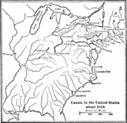
List of canals in the United States
Encyclopedia
Canal
Canals are man-made channels for water. There are two types of canal:#Waterways: navigable transportation canals used for carrying ships and boats shipping goods and conveying people, further subdivided into two kinds:...
s in the United States
United States
The United States of America is a federal constitutional republic comprising fifty states and a federal district...
:
Transportation canals in operation
- Augusta CanalAugusta CanalThe Augusta Canal is a historic canal located in Augusta, Georgia. The canal connects two points of the Savannah River. It was devised to harness the power of the fall line of the Savannah River for mills, to provide transportation of goods, and to provide drinking water for the city...
- Cal-Sag Channel (ChicagoChicagoChicago is the largest city in the US state of Illinois. With nearly 2.7 million residents, it is the most populous city in the Midwestern United States and the third most populous in the US, after New York City and Los Angeles...
) - Canaveral Barge Canal (Merritt Island, FloridaMerritt Island, FloridaMerritt Island is a census-designated place in Brevard County, Florida, United States. It is located on the east coast of the state on the Atlantic Ocean. As of the 2000 census, the population was 36,090. It is part of the Palm Bay – Melbourne – Titusville, Florida Metropolitan Statistical Area...
) - Cape Cod CanalCape Cod CanalThe Cape Cod Canal is an artificial waterway traversing the narrow neck of land that joins Cape Cod to mainland Massachusetts.Part of the Atlantic Intracoastal Waterway, the canal is roughly 17.4 miles long and connects Cape Cod Bay in the north to Buzzards Bay in the south...
(MassachusettsMassachusettsThe Commonwealth of Massachusetts is a state in the New England region of the northeastern United States of America. It is bordered by Rhode Island and Connecticut to the south, New York to the west, and Vermont and New Hampshire to the north; at its east lies the Atlantic Ocean. As of the 2010...
, part of the ICWIntracoastal WaterwayThe Intracoastal Waterway is a 3,000-mile waterway along the Atlantic and Gulf coasts of the United States. Some lengths consist of natural inlets, salt-water rivers, bays, and sounds; others are artificial canals...
) - Cape May CanalCape May CanalThe Cape May Canal is a waterway that stretches nearly three miles from Cape May Harbor to the Delaware Bay, at the southern tip of Cape May County, New Jersey. The canal was constructed by the United States Army Corps of Engineers during World War II to provide a protected route to avoid German...
(New JerseyNew JerseyNew Jersey is a state in the Northeastern and Middle Atlantic regions of the United States. , its population was 8,791,894. It is bordered on the north and east by the state of New York, on the southeast and south by the Atlantic Ocean, on the west by Pennsylvania and on the southwest by Delaware...
, part of the ICWIntracoastal WaterwayThe Intracoastal Waterway is a 3,000-mile waterway along the Atlantic and Gulf coasts of the United States. Some lengths consist of natural inlets, salt-water rivers, bays, and sounds; others are artificial canals...
) - Cascades Canal
- Cayuga-Seneca CanalCayuga-Seneca CanalThe Cayuga–Seneca Canal is a canal in New York, USA. It is now part of the New York State Canal System.The Cayuga–Seneca Canal connects the Erie Canal to Cayuga Lake and Seneca Lake. It is approximately long.-History:...
- Champlain CanalChamplain CanalThe Champlain Canal is a canal that connects the south end of Lake Champlain to the Hudson River in New York. It was simultaneously constructed with the Erie Canal and is now part of the New York State Canal System and the Lakes to Locks Passage....
- Chesapeake and Delaware CanalChesapeake and Delaware CanalThe Chesapeake and Delaware Canal is a 14-mile long, 450-foot wide and 40-foot deep ship canal that cuts across the states of Maryland and Delaware, in the United States. It connects the waters of the Delaware River with those of the Chesapeake Bay and the Port of Baltimore...
(MarylandMarylandMaryland is a U.S. state located in the Mid Atlantic region of the United States, bordering Virginia, West Virginia, and the District of Columbia to its south and west; Pennsylvania to its north; and Delaware to its east...
and DelawareDelawareDelaware is a U.S. state located on the Atlantic Coast in the Mid-Atlantic region of the United States. It is bordered to the south and west by Maryland, and to the north by Pennsylvania...
, part of the ICWIntracoastal WaterwayThe Intracoastal Waterway is a 3,000-mile waterway along the Atlantic and Gulf coasts of the United States. Some lengths consist of natural inlets, salt-water rivers, bays, and sounds; others are artificial canals...
) - Chicago Sanitary and Ship CanalChicago Sanitary and Ship CanalThe Chicago Sanitary and Ship Canal, historically known as the Chicago Drainage Canal, is the only shipping link between the Great Lakes and the Mississippi River system, by way of the Illinois and Des Plaines Rivers...
, part of the Illinois WaterwayIllinois WaterwayThe Illinois Waterway system consists of of water from the mouth of the Calumet River to the mouth of the Illinois River at Grafton, Illinois. It is a system of rivers, lakes, and canals which provide a shipping connection from the Great Lakes to the Gulf of Mexico via the Mississippi River. The... - Dismal Swamp CanalDismal Swamp CanalThe Dismal Swamp Canal is located along the eastern edge of the Great Dismal Swamp in Virginia and North Carolina in the United States. It is the oldest continually operating man-made canal in the United States, opened in 1805...
(VirginiaVirginiaThe Commonwealth of Virginia , is a U.S. state on the Atlantic Coast of the Southern United States. Virginia is nicknamed the "Old Dominion" and sometimes the "Mother of Presidents" after the eight U.S. presidents born there...
and North CarolinaNorth CarolinaNorth Carolina is a state located in the southeastern United States. The state borders South Carolina and Georgia to the south, Tennessee to the west and Virginia to the north. North Carolina contains 100 counties. Its capital is Raleigh, and its largest city is Charlotte...
, part of the ICWIntracoastal WaterwayThe Intracoastal Waterway is a 3,000-mile waterway along the Atlantic and Gulf coasts of the United States. Some lengths consist of natural inlets, salt-water rivers, bays, and sounds; others are artificial canals...
) - Delaware Division of the Pennsylvania CanalPennsylvania Canal (Delaware Division)The Delaware Division of the Pennsylvania Canal, more commonly called the Delaware Canal, runs from the Lehigh River at Easton south to Bristol...
(partially active) - Erie CanalErie CanalThe Erie Canal is a waterway in New York that runs about from Albany, New York, on the Hudson River to Buffalo, New York, at Lake Erie, completing a navigable water route from the Atlantic Ocean to the Great Lakes. The canal contains 36 locks and encompasses a total elevation differential of...
(New YorkNew YorkNew York is a state in the Northeastern region of the United States. It is the nation's third most populous state. New York is bordered by New Jersey and Pennsylvania to the south, and by Connecticut, Massachusetts and Vermont to the east...
) - Gowanus CanalGowanus CanalThe Gowanus Canal, also known as the Gowanus Creek Canal, is a canal in the New York City borough of Brooklyn, geographically on the westernmost portion of Long Island...
(Brooklyn) - Great Lakes WaterwayGreat Lakes WaterwayThe Great Lakes Waterway is a system of channels and canals that makes all of the Great Lakes accessible to oceangoing vessels. Its principal civil engineering components are the Welland Canal, bypassing Niagara Falls between Lake Ontario and Lake Erie, and the Soo Locks, bypassing the rapids of...
, (borders CanadaCanadaCanada is a North American country consisting of ten provinces and three territories. Located in the northern part of the continent, it extends from the Atlantic Ocean in the east to the Pacific Ocean in the west, and northward into the Arctic Ocean...
) including the Saint Marys Falls CanalSoo LocksThe Soo Locks are a set of parallel locks which enable ships to travel between Lake Superior and the lower Great Lakes. They are located on the St. Marys River between Lake Superior and Lake Huron, between the Upper Peninsula of the US state of Michigan and the Canadian province of Ontario... - Harlem River Ship CanalHarlem River Ship CanalThe Harlem River Ship Canal is a channel connecting the Hudson River and Spuyten Duyvil Creek to the Harlem River in New York City, separating the neighborhood of Marble Hill from the island of Manhattan...
- Inland Waterway
- Indiana Harbor and Ship CanalIndiana Harbor and Ship CanalThe Indiana Harbor and Ship Canal is an artificial waterway on the southwest shore of Lake Michigan, in East Chicago, Indiana which connects the Grand Calumet River to Lake Michigan. It consists of two branch canals, the 1.25 mile Lake George Branch and the 2 mile long Grand Calumet River Branch...
- Industrial CanalIndustrial CanalThe Industrial Canal is a 5.5 mile waterway in New Orleans, Louisiana, United States. The waterway's proper name, as used by the U.S. Army Corps of Engineers and on NOAA nautical charts, is Inner Harbor Navigation Canal...
(Inner Harbor Navigation Canal, New Orleans) - Intracoastal WaterwayIntracoastal WaterwayThe Intracoastal Waterway is a 3,000-mile waterway along the Atlantic and Gulf coasts of the United States. Some lengths consist of natural inlets, salt-water rivers, bays, and sounds; others are artificial canals...
, includes several independent canals- Galveston and Brazos Canal, see also: Houston Ship ChannelHouston Ship ChannelThe Houston Ship Channel, located in Houston, Texas, is part of the Port of Houston—one of the United States's busiest seaports. The channel is the conduit for ocean-going vessels between the Houston-area shipyards and the Gulf of Mexico.-Overview:...
- Galveston and Brazos Canal, see also: Houston Ship Channel
- Lake Washington Ship CanalLake Washington Ship CanalThe Lake Washington Ship Canal, which runs through the City of Seattle, Washington, connects the fresh water body of Lake Washington with the salt water inland sea of Puget Sound. The Ship Canal includes a series of locks, modeled after the Panama Canal, to accommodate the different water levels...
(SeattleSeattle, WashingtonSeattle is the county seat of King County, Washington. With 608,660 residents as of the 2010 Census, Seattle is the largest city in the Northwestern United States. The Seattle metropolitan area of about 3.4 million inhabitants is the 15th largest metropolitan area in the country...
) - Louisville and Portland CanalLouisville and Portland CanalThe Louisville and Portland Canal was a canal bypassing the Falls of the Ohio in the Ohio River near Louisville, Kentucky. It opened in 1830, and was operated by the Louisville and Portland Canal Company until 1874, and became the McAlpine Locks and Dam in 1962 after heavy modernization.Although...
- Mississippi River Gulf Outlet (LouisianaLouisianaLouisiana is a state located in the southern region of the United States of America. Its capital is Baton Rouge and largest city is New Orleans. Louisiana is the only state in the U.S. with political subdivisions termed parishes, which are local governments equivalent to counties...
) - Oswego CanalOswego CanalThe Oswego Canal is a canal in the New York State Canal System located in New York, United States. Opened in 1828, it is 23.7 miles in length, and connects the Erie Canal at Three Rivers to Lake Ontario at Oswego...
- Point Pleasant CanalPoint Pleasant CanalThe Point Pleasant Canal is a canal in Point Pleasant, New Jersey. It was completed in late 1925 to connect the Manasquan Inlet and Manasquan River with Bay Head Harbor on the northern end of the Barnegat Bay...
(New Jersey, part of the ICWIntracoastal WaterwayThe Intracoastal Waterway is a 3,000-mile waterway along the Atlantic and Gulf coasts of the United States. Some lengths consist of natural inlets, salt-water rivers, bays, and sounds; others are artificial canals...
) - Port Townsend Ship CanalPort Townsend Ship CanalThe Port Townsend Ship Canal links Port Townsend Bay with Oak Bay in Jefferson County, Washington. Prior to construction this area was occupied by a broad sand flat and backshore marsh....
- Portage Lake Canal
- Sacramento Deep Water Ship ChannelSacramento Deep Water Ship ChannelThe Sacramento Deep Water Ship Channel is a canal from the Port of Sacramento in Sacramento, California to the Sacramento River, which flows into San Francisco Bay. It was completed by the United States Army Corps of Engineers in 1963...
- Soo LocksSoo LocksThe Soo Locks are a set of parallel locks which enable ships to travel between Lake Superior and the lower Great Lakes. They are located on the St. Marys River between Lake Superior and Lake Huron, between the Upper Peninsula of the US state of Michigan and the Canadian province of Ontario...
- St. Clair Flats Canal
- St Lawrence Seaway
- Shinnecock CanalShinnecock CanalThe Shinnecock Canal is a canal that cuts across the South Fork of Long Island at Hampton Bays, New York. At long, it connects Great Peconic Bay and the north fork of Long Island with Shinnecock Bay and the Atlantic Ocean...
- Sturgeon Bay Ship CanalSturgeon Bay Ship CanalThe Sturgeon Bay Ship Canal is a shipping canal connecting Sturgeon Bay on Green Bay with Lake Michigan, across the Door Peninsula, at the city of Sturgeon Bay, Wisconsin....
- Tennessee-Tombigbee WaterwayTennessee-Tombigbee WaterwayThe Tennessee–Tombigbee Waterway is a 234-mile man-made, artificial waterway that extends from the Tennessee River to the junction of the Black Warrior-Tombigbee River system near Demopolis, Alabama, United States. The Tenneessee-Tombigbee Waterway links commercial navigation from the nation’s...
The United States
United States
The United States of America is a federal constitutional republic comprising fifty states and a federal district...
also constructed the Panama Canal
Panama Canal
The Panama Canal is a ship canal in Panama that joins the Atlantic Ocean and the Pacific Ocean and is a key conduit for international maritime trade. Built from 1904 to 1914, the canal has seen annual traffic rise from about 1,000 ships early on to 14,702 vessels measuring a total of 309.6...
on territory it controlled.
Abandoned transportation canals
- Alexandria Canal (Virginia)
- Allegheny Portage RailroadAllegheny Portage RailroadThe Allegheny Portage Railroad was the first railroad constructed through the Allegheny Mountains in central Pennsylvania, United States. It was a series of 10 inclines, approximately long, and operated from 1834 to 1854...
- Bald Eagle and Spring Creek NavigationBald Eagle and Spring Creek NavigationThe Bald Eagle and Spring Creek Navigation Company was a canal company in central Pennsylvania intended to link the iron industry of Bellefonte, Pennsylvania, with the Pennsylvania canal system. Opened for half its length in 1837, the remainder of the canal was not completed until 1848...
(Pennsylvania) - Bank's Canal (Virginia)
- Beardstown and Sangamon CanalBeardstown and Sangamon CanalThe Beardstown and Sangamon Canal was a canal plan developed in the mid-1830s, with avid backing by Abraham Lincoln, then an Illinois state legislator, to make large portions of the Sangamon River between Springfield, Illinois, and Beardstown, Illinois, navigable via a canal to the junction with...
- Bellows Falls Canal
- Blackstone CanalBlackstone CanalThe Blackstone Canal was a waterway linking Worcester, Massachusetts, to Providence, Rhode Island through the Blackstone Valley via a series of locks and canals during the early 19th century.-History:...
(Rhode IslandRhode IslandThe state of Rhode Island and Providence Plantations, more commonly referred to as Rhode Island , is a state in the New England region of the United States. It is the smallest U.S. state by area...
/MassachusettsMassachusettsThe Commonwealth of Massachusetts is a state in the New England region of the northeastern United States of America. It is bordered by Rhode Island and Connecticut to the south, New York to the west, and Vermont and New Hampshire to the north; at its east lies the Atlantic Ocean. As of the 2010...
) - Brunswick-Altamaha Canal (Glynn Co., Georgia)
- Cascade Locks and CanalCascade Locks and CanalThe Cascade Locks and Canal was a navigation project on the Columbia River between the U.S. states of Oregon and Washington, completed in 1896. It allowed the steamboats of the Columbia River to bypass the Cascades Rapids, and thereby opened a passage from the lower parts of the river as far as The...
- Celilo CanalCelilo CanalCelilo Canal was a canal connecting two points of the Columbia River between the states of Oregon and Washington, U.S. just east of The Dalles....
- Chemung CanalChemung CanalThe Chemung Canal is a former canal in New York, USA. The canal connected Seneca Lake at Watkins Glen to the Chemung River at Elmira, New York. Its larger significance was to connect New York's Erie Canal system with Pennsylvania's Susquehanna River watershed....
(New York) - Chenango CanalChenango CanalThe Chenango Canal was a towpath canal that was built and operated in the mid-19th century in Upstate New York in the United States. It was 97 miles long and for much of its course followed the Chenango River, from Binghamton on the south end to Utica on the north end...
(New York) - Chesapeake and Ohio CanalChesapeake and Ohio CanalThe Chesapeake and Ohio Canal, abbreviated as the C&O Canal, and occasionally referred to as the "Grand Old Ditch," operated from 1831 until 1924 parallel to the Potomac River in Maryland from Cumberland, Maryland to Washington, D.C. The total length of the canal is about . The elevation change of...
- Clinton-Kalamazoo CanalClinton-Kalamazoo CanalThe Clinton–Kalamazoo Canal is an abandoned canal in Michigan that was only partially completed. The canal was to connect Lake St. Clair with Lake Michigan. The inspiration came from the success of the Erie Canal in New York, which was completed in 1825...
(partially completed) - Codorus NavigationCodorus NavigationThe Codorus Navigation Company, based in York in south-central Pennsylvania, was formed in 1829 to make a navigable waterway along Codorus Creek from York to the Susquehanna River, a distance of...
(Pennsylvania) - Columbia CanalColumbia CanalThe Columbia Canal is the surviving canal of a series of canals built by the State of South Carolina in 1824 using the labor of Irish immigrants to provide a direct water routes between the upstate settlements and the towns on the fall line. It is on the Congaree and Broad Rivers in Columbia,...
(South Carolina) - Conewago CanalConewago CanalThe Conewago Canal, on the west bank of the Susquehanna River below York Haven, Pennsylvania, south of Harrisburg in York County, enabled late 18th and early 19th century rivercraft to safely bypass rapids at Conewago Falls. Work on the canal of less than began in 1793 and was completed in 1797...
(Pennsylvania) - Culpeper Gold Mine Canal (Virginia)
- Conestoga Navigation (Pennsylvania)
- Cross-Florida Barge Canal (partially completed)
- Cumberland and Oxford CanalCumberland and Oxford CanalThe Cumberland and Oxford Canal was opened in 1832 to connect the largest lakes of southern Maine with the seaport of Portland, Maine. The canal followed the Presumpscot River from Sebago Lake through the towns of Standish, Windham, Gorham, and Westbrook. The Canal diverged from the river at...
(MaineMaineMaine is a state in the New England region of the northeastern United States, bordered by the Atlantic Ocean to the east and south, New Hampshire to the west, and the Canadian provinces of Quebec to the northwest and New Brunswick to the northeast. Maine is both the northernmost and easternmost...
1821-1873) - Deep Run Canal (Virginia)
- Delaware and Hudson CanalDelaware and Hudson CanalThe Delaware and Hudson Canal was the first venture of the Delaware and Hudson Canal Company, which later developed the Delaware and Hudson Railway...
- Delaware & Raritan Canal (New JerseyNew JerseyNew Jersey is a state in the Northeastern and Middle Atlantic regions of the United States. , its population was 8,791,894. It is bordered on the north and east by the state of New York, on the southeast and south by the Atlantic Ocean, on the west by Pennsylvania and on the southwest by Delaware...
) - Delaware Division of the Pennsylvania CanalPennsylvania Canal (Delaware Division)The Delaware Division of the Pennsylvania Canal, more commonly called the Delaware Canal, runs from the Lehigh River at Easton south to Bristol...
(partially active) - Des Moines Rapids Canal
- Enfield Falls CanalEnfield Falls CanalEnfield Falls Canal is a canal that was built to circumvent the shallows at Enfield Falls on the Connecticut River. It is situated along the west side of the river, adjacent to the towns Suffield and Windsor Locks of Hartford County in the state of Connecticut, USA...
(ConnecticutConnecticutConnecticut is a state in the New England region of the northeastern United States. It is bordered by Rhode Island to the east, Massachusetts to the north, and the state of New York to the west and the south .Connecticut is named for the Connecticut River, the major U.S. river that approximately...
) - Fredericksburg's Canal (Virginia)
- Ficklin's Canal (VirginiaVirginiaThe Commonwealth of Virginia , is a U.S. state on the Atlantic Coast of the Southern United States. Virginia is nicknamed the "Old Dominion" and sometimes the "Mother of Presidents" after the eight U.S. presidents born there...
) - Fox-Wisconsin WaterwayFox-Wisconsin WaterwayThe Fox–Wisconsin Waterway is a waterway formed by the Fox and Wisconsin Rivers. First used by European settlers in 1673 during the expedition of Marquette & Joliet, it was one of the principal routes used by travelers between the Great Lakes and the Mississippi River until the completion of the...
(WisconsinWisconsinWisconsin is a U.S. state located in the north-central United States and is part of the Midwest. It is bordered by Minnesota to the west, Iowa to the southwest, Illinois to the south, Lake Michigan to the east, Michigan to the northeast, and Lake Superior to the north. Wisconsin's capital is...
) (partially restored) - Farmington CanalFarmington CanalThe Farmington Canal, also known as the New Haven and Northampton Canal, was a major private canal built in the early 19th century to provide water transportation from New Haven into the interior of Connecticut, Massachusetts and beyond. Its Massachusetts segment was known as the Hampshire and...
(ConnecticutConnecticutConnecticut is a state in the New England region of the northeastern United States. It is bordered by Rhode Island to the east, Massachusetts to the north, and the state of New York to the west and the south .Connecticut is named for the Connecticut River, the major U.S. river that approximately...
) - Franklin Line (Pennsylvania)
- Genesee Valley CanalGenesee RiverThe Genesee River is a North American river flowing northward through the Twin Tiers of Pennsylvania and New York. The river provided the original power for the Rochester area's 19th century mills and still provides hydroelectric power for downtown Rochester....
(New YorkNew YorkNew York is a state in the Northeastern region of the United States. It is the nation's third most populous state. New York is bordered by New Jersey and Pennsylvania to the south, and by Connecticut, Massachusetts and Vermont to the east...
) - Hampshire and Hampden CanalHampshire and Hampden CanalThe Hampshire and Hampden Canal was the Massachusetts segment of an canal that once connected New Haven, Connecticut to the Connecticut River north of Northampton, Massachusetts...
(MassachusettsMassachusettsThe Commonwealth of Massachusetts is a state in the New England region of the northeastern United States of America. It is bordered by Rhode Island and Connecticut to the south, New York to the west, and Vermont and New Hampshire to the north; at its east lies the Atlantic Ocean. As of the 2010...
) - Hennepin CanalHennepin CanalThe Hennepin Canal Parkway State Park, also just called the Hennepin Canal, is an abandoned waterway in northwest Illinois, between the Mississippi River at Rock Island and the Illinois River near Hennepin. The entire canal is listed on the National Register of Historic Places.Opened in 1907, the...
- Hocking CanalHocking CanalThe Hocking Canal was a small 19th Century canal in southern Ohio that once linked Athens to Lancaster and the Ohio and Erie Canal, but was destroyed by flooding and never rebuilt...
- Illinois and Michigan CanalIllinois and Michigan CanalThe Illinois and Michigan Canal ran from the Bridgeport neighborhood in Chicago on the Chicago River to LaSalle-Peru, Illinois, on the Illinois River. It was finished in 1848 when Chicago Mayor James Hutchinson Woodworth presided over its opening; and it allowed boat transportation from the Great...
- Indiana Central CanalIndiana Central CanalThe Indiana Central Canal was a canal intended to connect the Wabash and Erie Canal to the Ohio River. It was funded by the Mammoth Internal Improvement Act, Indiana's attempt to take part in the canal-building craze, started by the Erie Canal. $3.5 million was allocated for the project, the...
- James River and Kanawha CanalJames River and Kanawha CanalThe James River and Kanawha Canal was a canal in Virginia, which was built to facilitate shipments of passengers and freight by water between the western counties of Virginia and the coast....
(only Virginia portion completed) - Junction CanalJunction CanalThe Junction Canal was a canal in the states of New York and Pennsylvania in the United States. The canal was also called the Arnot Canal, after the name of its principal stockholder, John Arnot of Elmira, New York. The canal was built and operated by a private stock company. The canal was partly...
(New York and Pennsylvania) - Landsford CanalLandsford CanalThe Landford Canal was the farthest upstream of a series of canals built on the Catawba and Wateree Rivers to provide a direct water route between the upstate settlements and the towns on the fall line. It is located along the Catawba River in Chester County and Lancaster County west of Lancaster...
(South CarolinaSouth CarolinaSouth Carolina is a state in the Deep South of the United States that borders Georgia to the south, North Carolina to the north, and the Atlantic Ocean to the east. Originally part of the Province of Carolina, the Province of South Carolina was one of the 13 colonies that declared independence...
) - Lehigh CanalLehigh CanalThe Lehigh Canal was constructed by the Lehigh Coal & Navigation Company to carry anthracite from the upper Lehigh Valley to the urban markets of the northeast, especially Philadelphia...
(Pennsylvania) - Leiper CanalLeiper CanalEarly in the 19th century, the Leiper Canal ran about along Crum Creek in Delaware County, Pennsylvania. George Leiper, who financed the canal, used it between 1829 and 1852 to haul stone in flat-bottomed boats from his quarry near Springfield to the navigable Delaware River at Eddystone. The...
(Pennsylvania) - Little Falls Canal
- Love CanalLove CanalLove Canal was a neighborhood in Niagara Falls, New York, located in the white collar LaSalle section of the city. It officially covers 36 square blocks in the far southeastern corner of the city, along 99th Street and Read Avenue...
- Main Line of Public WorksMain Line of Public WorksThe Main Line of Public Works was a railroad and canal system built by the Commonwealth of Pennsylvania in the 19th century. It ran from Philadelphia west through Harrisburg and across the state to Pittsburgh and connected with other divisions of the Pennsylvania Canal...
(Pennsylvania) - Miami CanalMiami CanalThe Miami Canal, or C-6 Canal, flows from Lake Okeechobee in the U.S. state of Florida to its terminus at the Miami River, which flows through downtown Miami. The canal flows in a south and southeasterly direction for approximately 77 miles, and passes through three counties: Broward, Palm Beach,...
- Miami and Erie CanalMiami and Erie CanalThe Miami and Erie Canal was a canal that connected the Ohio River in Cincinnati, Ohio with Lake Erie in Toledo, Ohio. Construction on the canal began in 1825 and was completed in 1845. It consisted of 19 aqueducts, three guard locks, and 103 canal locks. Each lock measured by and they...
olivia canal - Middlesex CanalMiddlesex CanalThe Middlesex Canal was a 27-mile barge canal connecting the Merrimack River with the port of Boston. When operational it was 30 feet wide, and 3 feet deep, with 20 locks, each 80 feet long and between 10 and 11 feet wide...
- Milan Canal
- Morris CanalMorris CanalThe Morris Canal was an anthracite-carrying canal that incorporated a series of water-driven inclined planes in its course across northern New Jersey in the United States. It was in use for about a century — from the late 1820s to the 1920s....
(New JerseyNew JerseyNew Jersey is a state in the Northeastern and Middle Atlantic regions of the United States. , its population was 8,791,894. It is bordered on the north and east by the state of New York, on the southeast and south by the Atlantic Ocean, on the west by Pennsylvania and on the southwest by Delaware...
) - Ohio and Erie CanalOhio and Erie CanalThe Ohio Canal or Ohio and Erie Canal was a canal constructed in the 1820s and early 1830s. It connected Akron, Summit County, with the Cuyahoga River near its mouth on Lake Erie in Cleveland, Cuyahoga County, and a few years later, with the Ohio River near Portsmouth, Scioto County, and then...
- Pawtucket CanalPawtucket CanalCompleted in 1796, the Pawtucket Canal was originally built as a transportation canal to circumvent the Pawtucket Falls of the Merrimack River in East Chelmsford, Massachusetts. In the early 1820s it became a major component of the Lowell power canal system...
- Pennsylvania CanalPennsylvania CanalPennsylvania Canal refers generally to a complex system of canals, dams, locks, tow paths, aqueducts, and other infrastructure including, in some cases, railroads in Pennsylvania...
- Pennsylvania and Ohio CanalPennsylvania and Ohio CanalThe Pennsylvania and Ohio Canal, also known as the P & O Canal, the Cross Cut Canal and the Mahoning Canal was a shipping canal which operated from 1840 until 1877...
- Portage CanalPortage CanalThe Portage Canal was built to connect the Fox River and Wisconsin River at Portage, Wisconsin along the Fox-Wisconsin Waterway.Numerous attempts were made to build the thin Wisconsin-Fox connection through the marshy land, beginning in 1837 with the formation of the "Portage Canal Company"...
- Powell's Canal (Virginia)
- Rapidan Canal of The Rappahannock Navigation VirginiaVirginiaThe Commonwealth of Virginia , is a U.S. state on the Atlantic Coast of the Southern United States. Virginia is nicknamed the "Old Dominion" and sometimes the "Mother of Presidents" after the eight U.S. presidents born there...
- Sandy and Beaver CanalSandy and Beaver CanalThe Sandy and Beaver Canal ran from the Ohio and Erie Canal at Bolivar, Ohio, to the Ohio River at Glasgow, Pennsylvania. It had 90 locks, was chartered in 1828 and completed in 1848. However, the middle section of the canal had many problems from the beginning and fell into disrepair...
(Pennsylvania and Ohio) - Santee CanalSantee CanalThe Santee Canal was one of the earliest canals built in the United States. It was built to provide a direct water route between Charleston and Columbia, the new South Carolina state capital.- History :...
- Savannah Ogeechee Canal
- Schuylkill Navigation (Pennsylvania)
- Skinker's Canal (Virginia)
- Snake Castle Canal (VirginiaVirginiaThe Commonwealth of Virginia , is a U.S. state on the Atlantic Coast of the Southern United States. Virginia is nicknamed the "Old Dominion" and sometimes the "Mother of Presidents" after the eight U.S. presidents born there...
) - South Hadley CanalSouth Hadley CanalThe South Hadley Canal was a canal along the Connecticut River in South Hadley, Massachusetts. It is said to be the earliest navigable canal in the United States, with operation commencing in 1795....
- Spring Valley Canal (VirginiaVirginiaThe Commonwealth of Virginia , is a U.S. state on the Atlantic Coast of the Southern United States. Virginia is nicknamed the "Old Dominion" and sometimes the "Mother of Presidents" after the eight U.S. presidents born there...
) - Susquehanna and Tidewater CanalSusquehanna and Tidewater CanalThe Susquehanna and Tidewater Canal between Wrightsville, Pennsylvania, and Havre de Grace, Maryland, at the head of Chesapeake Bay, provided an interstate shipping alternative to 19th-century arks, rafts, and boats plying the difficult waters of the lower Susquehanna River...
(Pennsylvania and Maryland) - Susquehanna Canal (Maryland)
- Suwanee CanalSuwanee CanalThe Suwanee Canal was an attempt to drain large portions of the Okefenokee Swamp in Georgia via a canal.In 1889, the Georgia General Assembly authorized the Governor to sell the land containing the Okefenokee Swamp to the highest bidder....
- Taylor's Canal (Virginia)
- Union CanalUnion Canal (Pennsylvania)The Union Canal was a towpath canal that existed in southeastern Pennsylvania in the United States during the 19th century. First proposed in 1690 to connect Philadelphia with the Susquehanna River, it ran approximately 75 mi from Middletown on the Susquehanna below Harrisburg to Reading on...
- Wabash and Erie CanalWabash and Erie CanalThe Wabash and Erie Canal was a shipping canal that linked the Great Lakes to the Ohio River via an artificial waterway. The canal provided traders with access from the Great Lakes all the way to the Gulf of Mexico...
- Walhonding CanalWalhonding CanalThe Walhonding Canal was a canal in Coshocton County, Ohio that was used as a feeder canal for the Ohio and Erie Canal. A small canal, at only long, it was wholly contained within Coshocton County, following the Mohican River from Cavallo south to the confluence with the Kokosing River, which...
- Washington City CanalWashington City CanalThe Washington City Canal operated from 1815 until the mid-1850s in Washington, D.C. The canal connected the Anacostia River, called the "Eastern Branch" at that time, to Tiber Creek, the Potomac River, and later the Chesapeake and Ohio Canal...
- Warren County CanalWarren County CanalThe Warren County Canal was a branch of the Miami and Erie Canal in southwestern Ohio about in length that connected the Warren County seat of Lebanon to the main canal at Middletown in the mid-19th century. Lebanon was at the crossroads of two major roads, the highway from Cincinnati to Columbus...
(OhioOhioOhio is a Midwestern state in the United States. The 34th largest state by area in the U.S.,it is the 7th‑most populous with over 11.5 million residents, containing several major American cities and seven metropolitan areas with populations of 500,000 or more.The state's capital is Columbus...
) - Wheatley's Canal (VirginiaVirginiaThe Commonwealth of Virginia , is a U.S. state on the Atlantic Coast of the Southern United States. Virginia is nicknamed the "Old Dominion" and sometimes the "Mother of Presidents" after the eight U.S. presidents born there...
) - Whitewater CanalWhitewater CanalThe Whitewater Canal, which was built between 1836 and 1847, spanned a distance of seventy-six miles and stretched from Lawrenceburg, Indiana on the Ohio River to Hagerstown, Indiana.-Birth of a canal:...
(IndianaIndianaIndiana is a US state, admitted to the United States as the 19th on December 11, 1816. It is located in the Midwestern United States and Great Lakes Region. With 6,483,802 residents, the state is ranked 15th in population and 16th in population density. Indiana is ranked 38th in land area and is...
) - Wiconisco CanalWiconisco CanalThe Wiconisco Canal was a 19th century transportation waterway, about long, in Dauphin County in the U.S. state of Pennsylvania. Running along the east bank of the Susquehanna River between Millersburg and Duncan's Island at the mouth of the Juniata River, the canal overcame about of...
(Pennsylvania)
Irrigation, industrial and drainage canals
- All-American CanalAll-American CanalThe All-American Canal is an long aqueduct, located in southeastern California. It conveys water from the Colorado River into the Imperial Valley and to nine cities. It is the Imperial Valley's only water source, and replaced the Alamo Canal, which was located mostly in Mexico...
- American CanalAmerican CanalThe American Canal is an irrigation canal in the Upper Rio Grande Valley near El Paso, Texas. The canal acquires water from the Rio Grande from the American Diversion Dam at the Texas-New Mexico-Mexico border, 2 miles northwest of El Paso...
- California AqueductCalifornia AqueductThe Governor Edmund G. Brown California Aqueduct is a system of canals, tunnels, and pipelines that conveys water collected from the Sierra Nevada Mountains and valleys of Northern- and Central California to Southern California. The Department of Water Resources operates and maintains the...
- Central Arizona Project AqueductCentral Arizona Project AqueductThe Central Arizona Project is a 336 mi diversion canal in Arizona in the United States. The aqueduct diverts water from the Colorado River from Lake Havasu City near Parker into central and southern Arizona. The CAP is the largest and most expensive aqueduct system ever constructed in the...
- Coachella CanalCoachella CanalThe Coachella Canal is a aqueduct that conveys Colorado River water for irrigation from the All-American Canal to the Coachella Valley in Riverside County, California....
- Colorado River AqueductColorado River AqueductThe Colorado River Aqueduct, or CRA, is a water conveyance in Southern California in the United States, operated by the Metropolitan Water District of Southern California . The aqueduct impounds water from the Colorado River at Lake Havasu on the California-Arizona border west across the Mojave...
- Contra Costa CanalContra Costa CanalThe Contra Costa Canal is a aqueduct in the U.S. state of California. It is part of the Central Valley Project managed by the United States Bureau of Reclamation to divert Sacramento-San Joaquin Delta water as far as Martinez, California in Central Contra Costa County. The Contra Costa Canal is...
- Delta-Mendota CanalDelta-Mendota CanalThe Delta–Mendota Canal is a aqueduct in central California. It is part of the Central Valley Project and its purpose is to replace the water in the San Joaquin River that is diverted into Madera Canal and Friant-Kern Canal at Friant Dam. The canal begins at the C.W. Bill Jones Pumping Plant ,...
- Dundee Canal (New Jersey)
- Edison Sault Power CanalEdison Sault Power CanalThe Edison Sault Power Canal supplies the Edison Sault hydroelectric plant, in Sault Ste. Marie, Michigan. Excavation of the canal began in September 1898 and was completed in June 1902.-Physical features:...
- El Paso Canal
- Franklin Canal (Texas)Franklin Canal (Texas)The Franklin Canal is an irrigation canal in the Upper Rio Grande Valley near El Paso, Texas. The canal acquires water from the Rio Grande via the American Canal. The canal is long with a capacity of 325 cubic feet per second. Though the canal was privately constructed in 1889, it was acquired by...
- Friant-Kern CanalFriant-Kern CanalThe Friant-Kern Canal is a Central Valley Project aqueduct managed by the United States Bureau of Reclamation in Central California to convey water to augment irrigation capacity in Fresno, Tulare, and Kern counties....
- Hillsboro CanalHillsboro CanalThe Hillsboro Canal is located in the southeastern portion of Florida within the South Florida Water Management District, and for much of its length forms the border between Broward and Palm Beach counties; however, its western end is entirely in Palm Beach County. It begins at Lake Okeechobee at...
- Inter-California Canal
- Los Angeles AqueductLos Angeles AqueductThe Los Angeles Aqueduct system comprising the Los Angeles Aqueduct and the Second Los Angeles Aqueduct, is a water conveyance system operated by the Los Angeles Department of Water and Power...
- Loup CanalLoup CanalThe Loup Canal is a hydroelectric and irrigation canal located in eastern Nebraska, United States. The canal is owned and managed by Loup Power District, a public power electric utility....
- Madera CanalMadera CanalThe Madera Canal is a aqueduct in the U.S. state of California. It is part of the Central Valley Project managed by the United States Bureau of Reclamation to convey water north to augment irrigation capacity in Madera County, California. It was also the subject of the United States Supreme...
- Miami CanalMiami CanalThe Miami Canal, or C-6 Canal, flows from Lake Okeechobee in the U.S. state of Florida to its terminus at the Miami River, which flows through downtown Miami. The canal flows in a south and southeasterly direction for approximately 77 miles, and passes through three counties: Broward, Palm Beach,...
- North New River Canal
- Riverside Canal (El Paso)Riverside Canal (El Paso)The Riverside Canal is an irrigation canal in El Paso County beginning southeast of El Paso, Texas. The canal acquires water from the Riverside Diversion Dam on the Rio Grande River southeast of El Paso. The canal is managed by the US Bureau of Reclamation. The canal extends for with a capacity...
- Salt River ProjectSalt River ProjectThe Salt River Project is the umbrella name for two separate entities: the Salt River Project Agricultural Improvement and Power District, an agency of the state of Arizona that serves as an electrical utility for the Phoenix metropolitan area, and the Salt River Valley Water Users' Association, a...
Canals (Arizona) - St. Lucie Canal
- Tamiami CanalTamiami CanalThe Tamiami Canal or C-4 Canal, is located in southern Florida in the United States. It flows in a west to east direction from the western part of the state in the Everglades past the Miami International Airport to a salinity control center near the Miami River...
- Texas irrigation canalsTexas Irrigation CanalsThere are many irrigation canals in Texas. The majority of large canal networks are in the Rio Grande Valley and the Gulf Coast, though smaller systems are located throughout the state. Canals provide water to dry climates to irrigate crops....
- West Palm Beach Canal
Natural inlets
Lynn CanalLynn Canal
Lynn Canal is an inlet into the mainland of southeast Alaska.Lynn Canal runs about from the inlets of the Chilkat River south to Chatham Strait and Stephens Passage...
and Portland Canal
Portland Canal
The Portland Canal is an arm of Portland Inlet, one of the principal inlets of the British Columbia Coast. It is approximately long. The Portland Canal forms part of the border between southeastern Alaska and British Columbia. The name of the entire inlet in the Nisga'a language is K'alii...
in Alaska
Alaska
Alaska is the largest state in the United States by area. It is situated in the northwest extremity of the North American continent, with Canada to the east, the Arctic Ocean to the north, and the Pacific Ocean to the west and south, with Russia further west across the Bering Strait...
and Hood Canal
Hood Canal
Hood Canal is a fjord forming the western lobe, and one of the four main basins, of Puget Sound in the state of Washington. Hood Canal is not a canal in the sense of being a man-made waterway—it is a natural waterway.-Geography:...
in Washington are natural inlets that use the name canal.
See also
- List of canals