

List of autopistas and autovías in Spain
Encyclopedia
The Spanish motorway network is the fourth largest in the world by length, after the United States
, China
and Canada
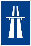
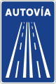
. As of 2008, there are 15152 km (9,415 mi) of High Capacity Roads (Sp. Vías de Gran Capacidad) in the country. There are two main types of such roads, autopista
s and autovía
s, which historically differed in the strictness of the standards they are held up to.
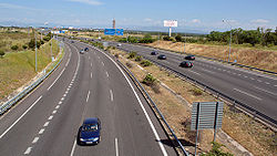
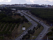
 The distinction between two kinds of high capacity roads is mainly a historical one, seldom with practical consequences for most but the oldest motorways. Both kinds are divided highways with full access control
and at least two lanes per direction. General speed limits for both are mandated by the Spanish Traffic Law as 60 km/h (37 mph)-120 km/h (75 mph), though there are groups that ask for the latter to be raised to 140 km/h (87 mph). Specific limits may be imposed based on road, meteorologic or traffic conditions.
Autopista
s are specifically reserved for automobile travel, so all vehicles not able to sustain at least 60 km/h (37 mph) are banned from them. Thus, they may not be an upgrade to an older road, since the Spanish legislation requires an alternate route to be provided for such vehicles. Many, but not all, autopistas are toll roads, which also mandates an alternate toll-free route (though not necessarily a freeway) under the Spanish laws. An example is the AP-2
toll autopista, which links Zaragoza
with Barcelona
through the Monegros desert
. In this case, the alternative is the N-II, the national road that preceded the A-2 autovía.
On the other hand, autovía
s are usually (though not always) upgrades from older roads, and never toll roads. In general, slow vehicles like bicycle
s and agricultural machinery are allowed under certain restrictions so as to not disrupt the traffic excessively or cause any danger. Furthermore, an autovía will most likely follow the original road very closely, only deviating from it to avoid direct penetration into towns (which are looped around in variantes). Thus, the upgraded road usually serves as the base for one of the two directions of the new autovía, which means the turns can be steeper than in autopistas. All in all, an autovía:
However, most of the situations listed here only apply to the oldest autovías, and mainly to the radial A-1 through A-6 plus the A-42 near their endpoints, which were the first to be twinned in the 60s into dual carriageway
s (with at-level intersections) and then were upgraded to limited-access freeways in the 70s-80s, keeping most of their old route unchanged except where the old national road ventured into towns. In those cases, the freeway would make a semi-loop called a variante around the town, leaving the old national road as the access between the freeway and the town.
New autovías usually have perfectly normal acceleration and deceleration lanes, very safe turns and transitable shoulders. Thus, the practical difference between a "new" autovía and a generic autopista is mainly the frequency of exits, which is usually higher in an autovía - upgraded from an old road with many crosses - than in a new, purpose-designed autopista with fewer preconditions imposed on it.
and the Basque Country
, the only autonomous communities which have been transferred full powers over all roads in their territories. Usually, the DGC manages all road maintenance, but in the case of the tolled
autopistas, the management is commonly delegated to the concession
aire company.
Traditionally, purpose-built autopistas or autovías were assigned names starting with A plus one or two numbers describing their general orientation, while upgraded autovías kept their original names. Thus, the freeway that is currently known as A-5 was still reported as N-V in road signs for years after the upgrade was completed, making it difficult for drivers to know in advance which roads had become autovías. However, in 2003 all Spanish motorways were uniformly renamed with the following criteria:
All such names are posted in white letters on blue background, like: A-49 . Note that none of these naming and coloring requisites affect roads under the authority of the Autonomous Communities
. For example, the A-8 road in the Basque Country is a tolled autopista, as are the C-16, C-32 and C-33 in Catalonia. Other communities such as Madrid do follow the convention, and have names as MP-203 for a tolled road and M-501 for a free autovía. Furthermore, roads unter the authority of the Andalusian government
also start with A, but they have longer numeric codes and different coloring.
*: in construction — †: planned
concept.
*: under construction
in the early 1980s led to the transfer of many roads to the new regional authorities. Since then, several of those roads have been upgraded to motorway level in order to ensure the internal vertebration of the region, or to provide alternative high-capacity routes to those managed by the national government when those were inadequate or saturated. All of the old comarcal roads (C-nnn) comprising the secondary network were transferred to the Autonomous Communities, splitting them up as necessary; while the national roads (N-nnn) that formed the primary network were mostly kept by the State.
The level of control each community has over its road network varies: the Basque Country
and Navarre
have received the titularity of nearly all roads in their territories, while in other communities the regional network coexists with and complements the national one. Whatever the extension of the road network under its control, all communities have full powers over naming and identification of their roads, provided no name conflicts with a national road or a regional road of a neighbouring community.
is very extensive, as the territory itself spans nearly a fifth of Spain. There are no special codes for identifying highways: upgraded roads usually keep their name and sign color (orange, green or yellow). However, confusion sometimes arises due to the fact that most regional roads start with the letter A (for Andalucía), which is also used by the national government for highways.
*: planned/in construction
has only very recently started building its own highway network. The first span was opened to traffic just in 2008, and there are at least three more highways in study. Due to the limited financial capabilities of the Aragón regional government, many of them might be built as toll road
s. At least two more highway projects are linked to the Gran Scala
project.
*: in construction — †: planned
s in between ranges such as the Picos de Europa
.
Vertebral Asturian motorways have identifiers in the style of national ones, that is, white text on blue background, while roads in process of upgrading keep their old nomenclature until the full route is completed. Such is the case, for example, with the AS-III, which is an upgrade of the AS-17. The prefix is always AS, and Roman numerals are used.
*: planned/in construction
were transferred to the regional government when the Autonomous Community was formed, and several are now under the competence of the several Island Councils (Consell Insular). The prefix denotes the island, and the second letter (if any) is lowercase. Autopista identifiers are white on blue background, while twinned roads closer to the autovía category keep their identifiers.
The lack of highways in several islands should not be taken as a sign of underdevelopment: the road network is well kept, and where highways have not been deemed necessary, expressways
are built for an easier upgrade.
has received full powers over most roads in its territory, including the national roads that comprised the primary network, and nowadays only the AP-1 and the AP-68 are under the direct authority of the Spanish government as part of the Red de carreteras del Estado (National Road Network). Currently, roads are managed by the three Diputaciones Forales of the Basque provinces.
The fact that such transfer took place before the thorough renaming of national roads and highways in 2003 makes the naming of transferred "national" highways inconsistent with the national network: the A-1 is still called the N-I in the Basque Country, and the same identifier (A-8) applies to the tolled and toll-free parts of the Autopista del Cantábrico in Biscay. Furthermore, new highways built since then by the provinces have one of the following prefixes: A for Álava
-Araba, BI for Biscay
(Vizcaya-Bizkaia) or GI for Guipúzcoa-Gipuzkoa.
*: in construction — †: planned
are under the authority of either the regional government or one of the several Island Councils (Cabildo Insular). The prefix denotes the island, and identifiers are usually white on blue background.
has completed one autovía and has at least five more in varied states of advanced planning and building. In the flat La Mancha
, relief does not usually require costly tunnels and bridges, though the region does contain several nature reserve
s including the Tablas de Daimiel National Park
wetlands. Highway identifiers are white on blue background.
*: in construction — †: planned
has a dense road network, but until recently most of its highways had been part of the national system. The terrain is varied, from the plains of the Meseta to the rugosities of the Montes de León, and archeological remains abound. Regional highways are renamed to A-nnn, always with three digits to avoid clashes with the national network, but usually keeping the original number of the upgraded regional road CL-nnn. Identifiers are white on blue background.
*: in construction — †: planned
is severely held back in such a development by a highly mountainous terrain that multiplies the cost of building any kind of expressway. Thus, its population is served by the national highway network supplemented by regional conventional roads.
has a thorough regional road network, with several highways managed by the Generalitat de Catalunya
. Also, the state-owned highways previously known as A-16 through A-19 were transferred to the Catalan government and renamed according to the new regional guidelines enacted in 2004. Highway identifiers are white on blue background.
*: in construction — †: planned
has a terrain that can be considered favourable for a regional highway plan, as the interior is mostly flat. However, the fact that its northern and north-eastern borders are blocked by mountain range
s with typical elevations of 1100 metres (3,608.9 ft) over the main mesa
, combined with the mentioned demographics of the territory (Extremadura ranks the 5th community in Spain by land area, but only the 12th by population, and none of its cities reach 200,000 inhabitants) has traditionally limited the penetration of even the national highway network.
Nevertheless, the community is in an excellent position for connections between Spain and Portugal (the national highway A-5 reaches Portugal through Badajoz
in Extremadura), and in the last decade, the regional government has revealed an ambitious plan that would create four to six regional highways. In addition to the vertebration of the Extremaduran territory, some of these roads are explicitly meant to provide alternative routes to the two national highways in the region (A-5 and A-66), establishing connections between them and an additional route to Portugal to the north of the current one.
It is the policy of the regional government to avoid twinning existing roads (and thus replacing them with the upgraded autovía), so instead all autovías are built from scratch even if they are parallel to the old road. All Extremaduran highways are currently named EX-An, with white identifiers on blue background. Some of them have branches named EX-An-Rm, which also have white-on-blue identifiers, but such branches need not be highways themselves even if they are built concurrently with the main road.
*: in construction — †: planned
because of its orographic similarities, Galicia is a hilly but not mountainous region with an approximate population of 3M people. Its highway network mainly functions as the terminal part of trips, since the vertebral function is mainly coped by the national system. Identifiers start with AG (for Autovía/Autoestrada galega) and are white on blue background.
*: in construction — †: planned
has just started planning regional highways of its own. After an initial plan to upgrade the LR-134 road (Calahorra
—Arnedo
) was downgraded to a simple twinning with roundabout intersections, a study is now being drawn to build at least a true highway connecting the national highways AP-68 and A-12, with a possible projection into the south of the community. Another highway would provide access from the regional capital beltway to the tolled AP-68.
*: in construction — †: planned
ranks the 3rd community by population, and is by far the most densely populated
. Even though it contains the centre of the national radial highway system, the Madrid regional government (traditionally more committed to the expansion of the Metro system
) has dedicated vast resources during the last decade to upgrade the regional road network and, where necessary, create new high-capacity roads that both complement the national system and vertebrate zones of the community not covered by the national network.
Madrid regional highways have codes that are no different from other regional roads, with orange, green and yellow backgrounds, even for newly-built highways like the M-45. Usually, the upgrade of long roads, twinned or not, to the motorway level is not undertaken at once, so the list below only contains the itinerary for the spans that actually run as highways or have been planned to. For example, the M-506 is "broken" at its connection with the M-419 and the A-42 by a succession of roundabout
s until the link with the R-4, so in the list it is separated in two highway stretches.
*: in construction — †: planned
All in all, the autonomous government is investing heavily in its highway network, both for trips along the coast and inland-coast connectivity. Due to the expansion of the regional network that this effort is expected to produce, Murcia has recently implemented a new naming scheme for its regional highways, more in accordance with the national network. When the renaming is complete, all highways will be identified by white-on-blue names that start with RM (for Región de Murcia).
*: in construction — †: planned
is another community with full powers over most roads in its territory. However, in contrast to the neighbouring Basque Country
, the regional government has decided to keep the identifiers of some highways — namely, those which were part of a national highway before being transferred — in sync with the national system. The only road in Navarrese territory not under the authority of the regional government is the national toll highway AP-68 (Autopista Vasco-Aragonesa), which was kept by the state to avoid a four-pronged management by the concessionaire and the Basque, Navarrese and Spanish governments.
*: in construction — †: planned
has a varied orography, from great plains to prelitoral mountain ranges, and a territory of generally high ecological value. Nevertheless, the regional government has pushed for a rich and tupid highway network, building connections between the various national highways that serve the Community and beltways for the provincial capitals.
Like highways in Madrid and Andalusia, Valencian regional motorways do not have special identifiers different from other autonomic roads, so orange, green and yellow backgrounds are possible. All identifiers are prefixed with CV for Comunitat Valenciana, the official name of the region.
The regional highway CV-10 is currently being expanded to the limit with Catalonia
and will be transferred to the national Government as a new stretch of the A-7 (Autovía del Mediterráneo). The same applies to the CV-40 highway.
*: in construction — †: planned
United States
The United States of America is a federal constitutional republic comprising fifty states and a federal district...
, China
China
Chinese civilization may refer to:* China for more general discussion of the country.* Chinese culture* Greater China, the transnational community of ethnic Chinese.* History of China* Sinosphere, the area historically affected by Chinese culture...
and Canada
Canada
Canada is a North American country consisting of ten provinces and three territories. Located in the northern part of the continent, it extends from the Atlantic Ocean in the east to the Pacific Ocean in the west, and northward into the Arctic Ocean...
. As of 2008, there are 15152 km (9,415 mi) of High Capacity Roads (Sp. Vías de Gran Capacidad) in the country. There are two main types of such roads, autopista
Autopista
Autopista refers to a controlled-access highway in various Spanish-speaking countries*Autopistas and autovías of Spain*Autopistas of Mexico*Autopistas of Puerto Rico*Autopistas of Chile...
s and autovía
Autovía
An autovía is one of two classes of major highway in the Spanish road system similar to a motorway. It is akin to the autopista, the other major highway class, but has fewer features and is never a toll road. Some distinguishing features of an autovía are that it must be divided by a median, it...
s, which historically differed in the strictness of the standards they are held up to.
Differences between autopista and autovía
Limited-access road
A limited-access road known by various terms worldwide, including limited-access highway, dual-carriageway and expressway, is a highway or arterial road for high-speed traffic which has many or most characteristics of a controlled-access highway , including limited or no access to adjacent...
and at least two lanes per direction. General speed limits for both are mandated by the Spanish Traffic Law as 60 km/h (37 mph)-120 km/h (75 mph), though there are groups that ask for the latter to be raised to 140 km/h (87 mph). Specific limits may be imposed based on road, meteorologic or traffic conditions.
Autopista
Autopista
Autopista refers to a controlled-access highway in various Spanish-speaking countries*Autopistas and autovías of Spain*Autopistas of Mexico*Autopistas of Puerto Rico*Autopistas of Chile...
s are specifically reserved for automobile travel, so all vehicles not able to sustain at least 60 km/h (37 mph) are banned from them. Thus, they may not be an upgrade to an older road, since the Spanish legislation requires an alternate route to be provided for such vehicles. Many, but not all, autopistas are toll roads, which also mandates an alternate toll-free route (though not necessarily a freeway) under the Spanish laws. An example is the AP-2
Autopista AP-2
The Autopista AP-2 is a highway in the north of Spain that connects the northern coast with the eastern coast of the country. This highway, known as the Autopista del Nordeste , starts at the city of Zaragoza, passes Lleida and ends at El Vendrell, 70 kilometers west of Barcelona. It is a toll...
toll autopista, which links Zaragoza
Zaragoza
Zaragoza , also called Saragossa in English, is the capital city of the Zaragoza Province and of the autonomous community of Aragon, Spain...
with Barcelona
Barcelona
Barcelona is the second largest city in Spain after Madrid, and the capital of Catalonia, with a population of 1,621,537 within its administrative limits on a land area of...
through the Monegros desert
Monegros
Los Monegros is a comarca in Aragon, Spain. It is located within the provinces of Zaragoza and Huesca. The area is prone to chronic droughts, and much of the area is badlands....
. In this case, the alternative is the N-II, the national road that preceded the A-2 autovía.
On the other hand, autovía
Autovía
An autovía is one of two classes of major highway in the Spanish road system similar to a motorway. It is akin to the autopista, the other major highway class, but has fewer features and is never a toll road. Some distinguishing features of an autovía are that it must be divided by a median, it...
s are usually (though not always) upgrades from older roads, and never toll roads. In general, slow vehicles like bicycle
Bicycle
A bicycle, also known as a bike, pushbike or cycle, is a human-powered, pedal-driven, single-track vehicle, having two wheels attached to a frame, one behind the other. A person who rides a bicycle is called a cyclist, or bicyclist....
s and agricultural machinery are allowed under certain restrictions so as to not disrupt the traffic excessively or cause any danger. Furthermore, an autovía will most likely follow the original road very closely, only deviating from it to avoid direct penetration into towns (which are looped around in variantes). Thus, the upgraded road usually serves as the base for one of the two directions of the new autovía, which means the turns can be steeper than in autopistas. All in all, an autovía:
- Allows traffic banned from an autopista, like bicycles. However, if the autovía is built as a new road instead of an upgrade to an older one, this traffic may be banned too.
- May have little to no shoulders, which are then marked with a solid line instead of the broken line of a transitable shoulder.
- May have acceleration and deceleration lanes that are much shorter than those of autopistas.
- May have tighter turns and steeper gradients than an autopista is allowed.
- If space-constrained, it may even have bus stops on a service lane in the autovía itself, as opposed to requiring them to be placed on a service lane physically separated from the main road.
However, most of the situations listed here only apply to the oldest autovías, and mainly to the radial A-1 through A-6 plus the A-42 near their endpoints, which were the first to be twinned in the 60s into dual carriageway
Dual carriageway
A dual carriageway is a class of highway with two carriageways for traffic travelling in opposite directions separated by a central reservation...
s (with at-level intersections) and then were upgraded to limited-access freeways in the 70s-80s, keeping most of their old route unchanged except where the old national road ventured into towns. In those cases, the freeway would make a semi-loop called a variante around the town, leaving the old national road as the access between the freeway and the town.
New autovías usually have perfectly normal acceleration and deceleration lanes, very safe turns and transitable shoulders. Thus, the practical difference between a "new" autovía and a generic autopista is mainly the frequency of exits, which is usually higher in an autovía - upgraded from an old road with many crosses - than in a new, purpose-designed autopista with fewer preconditions imposed on it.
 |
 |
State-managed motorways
Most of the high capacity roads in Spain are under the authority of the General Roads Directorate (Sp. Dirección General de Carreteras) of the Ministry of Public Works, a department of the central Government of Spain, with the exceptions of NavarreNavarre
Navarre , officially the Chartered Community of Navarre is an autonomous community in northern Spain, bordering the Basque Country, La Rioja, and Aragon in Spain and Aquitaine in France...
and the Basque Country
Basque Country (autonomous community)
The Basque Country is an autonomous community of northern Spain. It includes the Basque provinces of Álava, Biscay and Gipuzkoa, also called Historical Territories....
, the only autonomous communities which have been transferred full powers over all roads in their territories. Usually, the DGC manages all road maintenance, but in the case of the tolled
Toll road
A toll road is a privately or publicly built road for which a driver pays a toll for use. Structures for which tolls are charged include toll bridges and toll tunnels. Non-toll roads are financed using other sources of revenue, most typically fuel tax or general tax funds...
autopistas, the management is commonly delegated to the concession
Concession (contract)
A concession is a business operated under a contract or license associated with a degree of exclusivity in business within a certain geographical area. For example, sports arenas or public parks may have concession stands. Many department stores contain numerous concessions operated by other...
aire company.
Traditionally, purpose-built autopistas or autovías were assigned names starting with A plus one or two numbers describing their general orientation, while upgraded autovías kept their original names. Thus, the freeway that is currently known as A-5 was still reported as N-V in road signs for years after the upgrade was completed, making it difficult for drivers to know in advance which roads had become autovías. However, in 2003 all Spanish motorways were uniformly renamed with the following criteria:
- Interurban motorways are named "A-" plus two numbers, except for the six radial roads stemming from Madrid which are named A-1 through A-6. An exception to this naming rule is the radial autopistas R-2 through R-5
- Beltways are named with a one or two letter code identifying the city they orbit, plus two digits indicative of the general distance. For example, the M-50 is further from the city of Madrid than the M-40.
- City access motorways are named similarly to beltways, like TO-21 for a freeway leaving the A-40Autovía A-40The Autovía A-40 is a gradual upgrade of the N-400 a highway in Castile, Spain. The road runs from Toledo to Cuenca.After junction 73 of Autovía A-42 the road as N-400 heads east along the south bank of the Rio Tajo. At Aranjuez it crosses the Autovía A-4 and Autovía R-4. It follows the A-4 before...
towards ToledoToledo, SpainToledo's Alcázar became renowned in the 19th and 20th centuries as a military academy. At the outbreak of the Spanish Civil War in 1936 its garrison was famously besieged by Republican forces.-Economy:...
. - Tolled roads add a "P" before the dash, and must be clearly identified as such in road signs.
All such names are posted in white letters on blue background, like: A-49 . Note that none of these naming and coloring requisites affect roads under the authority of the Autonomous Communities
Autonomous communities of Spain
An autonomous community In other languages of Spain:*Catalan/Valencian .*Galician .*Basque . The second article of the constitution recognizes the rights of "nationalities and regions" to self-government and declares the "indissoluble unity of the Spanish nation".Political power in Spain is...
. For example, the A-8 road in the Basque Country is a tolled autopista, as are the C-16, C-32 and C-33 in Catalonia. Other communities such as Madrid do follow the convention, and have names as MP-203 for a tolled road and M-501 for a free autovía. Furthermore, roads unter the authority of the Andalusian government
Andalusia
Andalusia is the most populous and the second largest in area of the autonomous communities of Spain. The Andalusian autonomous community is officially recognised as a nationality of Spain. The territory is divided into eight provinces: Huelva, Seville, Cádiz, Córdoba, Málaga, Jaén, Granada and...
also start with A, but they have longer numeric codes and different coloring.
Interurban motorways
The roads listed below form the backbone of the Spanish high capacity network, connecting all provincial capitals and other major towns and destinations. Until recently, the network suffered from a high radiality, which collapsed the several Madrid beltways and the roads into the city and region. Since the 2000s, an effort to improve the situation was made based on two actions:- Build a new set of radial autopistas (named R-n instead of A-n) complementary to the old radial autovías near Madrid. Such tolled autopistas would form a new system of accesses to the capital that merges with their autovía counterparts far from Madrid. The main advantage to these roads is that they allow true fast travel from the first kilometer, while the radial autovías near Madrid (among the oldest autovía stretches in Spain) frequently go through populations, have constant entries and exits and suffer several other conditions which both jam them and make their first kilometres limited to speeds well under the normal 120 km/h (75 mph) limit.
- Invest heavily in de-radialization efforts that create true cross-country high-capacity axes without passing through Madrid. For example, the A-66Autovía A-66The Autovía A-66 is a major highway in western Spain. It also forms part of the European Route E803. The road is an upgrade of the N-630 which is being undertaken section by section. The route roughly corresponds to the ancient Roman 'Silver Route' from the mines of northern Spain to the...
(Autovía Ruta de la Plata) which connects the southern Andalusia with the northwest area of the country, or the A-43Autovía A-43The Autovía A-43 is a highway in Spain.It currently comprises a southern by-pass of Ciudad Real and link to the Autovía A-4. It is a proposed upgrade of the N-430....
which will connect the western Extremadura region with the east of Spain.
| Signal | Denomination | Itinerary |
|---|---|---|
| A-1 | Autovía del Norte Autovía A-1 The Autovía A-1 is a Spanish autovía route which starts in Madrid and ends in Irun. It replaced the former main road from Madrid to France the N-I.... |
Madrid Madrid Madrid is the capital and largest city of Spain. The population of the city is roughly 3.3 million and the entire population of the Madrid metropolitan area is calculated to be 6.271 million. It is the third largest city in the European Union, after London and Berlin, and its metropolitan... (M-30 Autopista de Circunvalación M-30 The M-30 orbital motorway circles the central districts of Madrid, the capital city of Spain. It is the innermost ring road of the Spanish city. Outer rings are named M-40, M-45 and M-50.... , M-40 Autopista de Circunvalación M-40 The M-40, in Spanish transport, is a Madrid orbital motorway, similar to the M25 motorway in London, or the Boulevard Périphérique in Paris. It is the second-outermost of the Madrid orbital highways, the M-30 being the closest to the centre of Madrid. It has a total length of , looping around... ) — Alcobendas Alcobendas Alcobendas is a city located in the Community of Madrid, central Spain. It is located roughly 13 km north of Madrid and 7 km from the Barajas International Airport. It includes a central urban zone, a recently built district known as Valdelasfuentes, La Moraleja and El Soto de la... /San Sebastián de los Reyes San Sebastián de los Reyes San Sebastián de los Reyes is a municipality in the Community of Madrid in Spain. Founded in 1492, it is located 20 km north of Madrid. The city is twinned with Baunatal in Germany. It is geographically joined with neighboring Alcobendas and they share a common RENFE commuter line to Madrid Atocha... (M-12) — M-50 — El Molar (R-1) — Aranda de Duero Aranda de Duero Aranda de Duero is a Spanish town and municipality in the south of the province of Burgos, autonomous community of Castile and León. It has a population of roughly 33,000 people. The post code for the town is 09400. The closest airport is in Valladolid.... (A-11 Autovía A-11 The Autovía A-11 is a highway in SpainIt runs between Soria and Quintanilha in Portugal in the Rio Duero valley. It supersedes the N-122.It is currently in construction.... ) — Burgos Burgos Burgos is a city of northern Spain, historic capital of Castile. It is situated at the edge of the central plateau, with about 178,966 inhabitants in the city proper and another 20,000 in its suburbs. It is the capital of the province of Burgos, in the autonomous community of Castile and León... West (BU-30) — AP-1 Autopista AP-1 The Autopista AP-1 is a Spanish autopista route which starts near Burgos and ends near Armiñón. This toll road has a total length of .... — Burgos Northeast (BU-30) — N-I/AP-1 |
R-1  |
Autopista Radial 1 | Madrid (M-12) — † — M-50 — † — El Molar (A-1) |
| AP-1 |
Autopista del Norte Autopista AP-1 The Autopista AP-1 is a Spanish autopista route which starts near Burgos and ends near Armiñón. This toll road has a total length of .... |
Burgos (A-1) — N-I/A-1 — Briviesca — Pancorbo — Miranda de Ebro Miranda de Ebro Miranda de Ebro is a city on the Ebro river in the province of Burgos in the autonomous community of Castile and León, Spain. It is located in the north-eastern part of the province, on the border with the province of Álava and the autonomous community of La Rioja... (AP-68) — Armiñón (N-I/A-1) |
| A-2 | Autovía del Nordeste Autovía A-2 The Autovía A-2 is a Spanish autovía and autopista route which starts in Madrid and ends in Barcelona. It replaces the former N-II.- Sections :- Major cities crossed:*Madrid*Guadalajara*Zaragoza*Fraga*Lleida... |
Madrid (M-30, M-40, M-22) — Coslada Coslada Coslada is a city in the autonomous community of Madrid. , the mayor of Coslada is Raul Lopez Vaquero .The Dry Port of the Community of Madrid is located in Coslada, which turns the city into a strategic point. The majority of the companies which transport important commodities that operate in... /San Fernando de Henares — Torrejón de Ardoz Torrejón de Ardoz Torrejón de Ardoz is a town in the urban area of Madrid, Spain that has about 110,000 inhabitants.It is a town 20 km east of Madrid on the NII highway . It is essentially a dormitory town, mostly consisting of apartments. It can be reached by bus from Av... (M-50) — Alcalá de Henares Alcalá de Henares Alcalá de Henares , meaning Citadel on the river Henares, is a Spanish city, whose historical centre is one of UNESCO's World Heritage Sites, and one of the first bishoprics founded in Spain... (M-203/M-100) — Guadalajara Guadalajara, Spain Guadalajara is a city and municipality in the autonomous community of Castile-La Mancha, Spain, and in the natural region of La Alcarria. It is the capital of the province of Guadalajara. It is located roughly 60 km northeast of Madrid on the Henares River, and has a population of 83,789... (R-2) — Medinaceli Medinaceli Medinaceli is a municipality and town in the province of Soria . Its name derives from the Arabic toponym madīnat sālim . The town is named after one Salim bin Waral, head of a Masmuda Berber family which settled there in the 8th century.... (A-15) — Zaragoza Zaragoza Zaragoza , also called Saragossa in English, is the capital city of the Zaragoza Province and of the autonomous community of Aragon, Spain... (Z-40, A-68) — AP-2 Fraga Fraga Fraga is the major town of the comarca of Bajo Cinca in the province of Huesca, Aragon, Spain. It is located by the river Cinca.King Alfonso I of Aragon died at its walls in 1134 while trying to conquer it... — AP-2 — Lleida Lleida Lleida is a city in the west of Catalonia, Spain. It is the capital city of the province of Lleida, as well as the largest city in the province and it had 137,387 inhabitants , including the contiguous municipalities of Raimat and Sucs. The metro area has about 250,000 inhabitants... (A-22, LL-11) — Cervera (C-25) — Martorell (AP-7) — B-23 — L'Hospitalet de Llobregat L'Hospitalet de Llobregat L'Hospitalet de Llobregat or briefly L'Hospitalet is a city to the immediate southwest of Barcelona in Catalonia, Spain, and the second largest in Catalonia by population... (B-10) Tordera Tordera Tordera is a town in the comarca of Maresme, province of Barcelona, Catalonia, Spain, situated 64 km from Barcelona and 36 km from Girona on the edge of the Montnegre natural park... (C-32) — * — Caldes de Malavella Caldes de Malavella Caldes de Malavella is a municipality of the comarca of Selva in Catalonia, Spain. As of 2001, its population is 4,225.The place was formerly very famous for its thermal baths.-External links:*... — Fornells de la Selva Fornells de la Selva Fornells de la Selva is a village in the province of Girona and autonomous community of Catalonia, Spain.-References:... — † — Girona Girona Girona is a city in the northeast of Catalonia, Spain at the confluence of the rivers Ter, Onyar, Galligants and Güell, with an official population of 96,236 in January 2009. It is the capital of the province of the same name and of the comarca of the Gironès... — † — Figueres Figueres Figueres is the capital of the comarca of Alt Empordà, in the province of Girona, Catalonia, Spain.The town is the birthplace of artist Salvador Dalí, and houses the Teatre-Museu Gala Salvador Dalí, a large museum designed by Dalí himself which attracts many visitors... — † — France |
| R-2 |
Autopista Radial 2 | Madrid (M-40 Autopista de Circunvalación M-40 The M-40, in Spanish transport, is a Madrid orbital motorway, similar to the M25 motorway in London, or the Boulevard Périphérique in Paris. It is the second-outermost of the Madrid orbital highways, the M-30 being the closest to the centre of Madrid. It has a total length of , looping around... )—M-50—Guadalajara A-2 |
| AP-2 |
Autopista del Nordeste Autopista AP-2 The Autopista AP-2 is a highway in the north of Spain that connects the northern coast with the eastern coast of the country. This highway, known as the Autopista del Nordeste , starts at the city of Zaragoza, passes Lleida and ends at El Vendrell, 70 kilometers west of Barcelona. It is a toll... |
Zaragoza—Lleida—El Vendrell El Vendrell El Vendrell is a town located in Tarragona, Catalonia, Spain, in a wine-growing region. It is wedged between the Mediterranean and the Litoral mountain ranges... |
| A-3 | Autovía del Este Autovía A-3 The Autovía A-3 is a Spanish autovía which starts in Madrid and ends in Valencia.- Sections :- Major cities crossed:*Madrid*Arganda del Rey*Tarancón*Honrubia*Motilla del Palancar*Minglanilla*Utiel*Requena... |
Madrid (M-30)—Atalaya del Cañavate Atalaya del Cañavate Atalaya del Cañavate is a municipality in Cuenca, Castile-La Mancha, Spain. It has a population of 130.... —Valencia Valencia (city in Spain) Valencia or València is the capital and most populous city of the autonomous community of Valencia and the third largest city in Spain, with a population of 809,267 in 2010. It is the 15th-most populous municipality in the European Union... |
| R-3 |
Autopista Radial 3 | Madrid (M-30)—Arganda del Rey Arganda del Rey Arganda del Rey is a municipality in Madrid, Spain. It is connected to Madrid by metro line 9, underground.-History:The first definitive habitation in the area dates back to the Arabic presence in the Iberian Peninsula... (A-3)—*—Tarancón Tarancón Tarancón is a municipality located in the province of Cuenca, Castile-La Mancha, Spain. According to the 2004 census , the municipality has a population of 12,696 inhabitants.... (A-3) |
| A-4 | Autovía del Sur Autovía A-4 The Autovía A-4 or Autopista AP-4 is a Spanish autovía and autopista route which starts in Madrid and ends in Cádiz.... |
Madrid (M-30)—Córdoba Córdoba, Spain -History:The first trace of human presence in the area are remains of a Neanderthal Man, dating to c. 32,000 BC. In the 8th century BC, during the ancient Tartessos period, a pre-urban settlement existed. The population gradually learned copper and silver metallurgy... —Seville Seville Seville is the artistic, historic, cultural, and financial capital of southern Spain. It is the capital of the autonomous community of Andalusia and of the province of Seville. It is situated on the plain of the River Guadalquivir, with an average elevation of above sea level... , Jerez de la Frontera Jerez de la Frontera Jerez de la Frontera is a municipality in the province of Cádiz in the autonomous community of Andalusia, in southwestern Spain, situated midway between the sea and the mountains. , the city, the largest in the province, had 208,896 inhabitants; it is the fifth largest in Andalusia... —A-48 Autovía A-48 The Autovía A-48 is a highway in Andalucia, Spain.It follows the route of the N-340 around the southern tip of Spain it is currently under construction.... |
| R-4 |
Autopista Radial 4 | Madrid (M-50)—Aranjuez Aranjuez Aranjuez is a town lying 48 km south of Madrid, in the southern part of the Community of Madrid. It is located at the confluence of the Tagus and Jarama rivers, 48 km from Toledo. As of 2009, it has a population of 54,055.-History:... —Ocaña (A-4/A-40/AP-36) |
| AP-4 |
Autopista del Sur Autopista AP-4 The Autopista A-4 is a Spanish autopista route which starts in Seville and ends in Cádiz.The Autopista AP-4; with toll, has a total length of 123.80 km.... |
Seville—Cádiz Cádiz Cadiz is a city and port in southwestern Spain. It is the capital of the homonymous province, one of eight which make up the autonomous community of Andalusia.... |
| A-5 | Autovía del Suroeste Autovía A-5 The Autovía A-5 is a Spanish autovía which starts in Madrid and ends in Badajoz. It is part of the European Road E90.- Sections :- Major cities crossed:*Madrid*Alcorcón*Móstoles*Navalcarnero... |
Madrid (M-30)—Mérida Mérida, Spain Mérida is the capital of the autonomous community of Extremadura, western central Spain. It has a population of 57,127 . The Archaeological Ensemble of Mérida is a UNESCO World Heritage site since 1993.- Climate :... —Badajoz Badajoz Badajoz is the capital of the Province of Badajoz in the autonomous community of Extremadura, Spain, situated close to the Portuguese border, on the left bank of the river Guadiana, and the Madrid–Lisbon railway. The population in 2007 was 145,257.... —Portugal |
| R-5 |
Autopista Radial 5 | Madrid (M-40)—Navalcarnero Navalcarnero Navalcarnero is a municipality in the Community of Madrid, Spain, located about 31 km from Madrid.Sights include the church of Inmaculada Concepción.-History:... (A-5) |
| A-6 | Autovía del Noroeste Autovía A-6 The Autovía A-6 or Autopista AP-6 is a Spanish autovía and autopista route which starts in Madrid and ends in Arteixo .... |
Madrid—Villalba Collado Villalba Collado Villalba is a municipality in the Community of Madrid, Spain. It is located 39 kilometres north-west of Madrid the capital city of Spain, at an altitude of 917m above sea level. It has a population density of about 2,184.49 hab./km². The climate of Collado Villalba is... , Adanero Adanero Adanero is a municipality located in the province of Ávila, Castile and León, Spain. According to the 2004 census , the municipality has a population of 322 inhabitants.... —Tordesillas Tordesillas Tordesillas is a town and municipality in the province of Valladolid, Castile and León, central Spain.It is located 25 km southwest of the provincial capital, Valladolid at an elevation of 704 meters. The population was c. 9,000 in 2009.... —Benavente Benavente, Zamora Benavente is a municipality in the north of the province of Zamora, in the autonomous community Castile and León of Spain. It has about 20,000 inhabitants.... —Lugo Lugo Lugo is a city in northwestern Spain, in the autonomous community of Galicia. It is the capital of the province of Lugo. The municipality had a population of 97,635 in 2010, which makes is the fourth most populated city in Galicia.-Population:... —A Coruña A Coruña A Coruña or La Coruña is a city and municipality of Galicia, Spain. It is the second-largest city in the autonomous community and seventeenth overall in the country... |
| AP-6 |
Autopista del Noroeste Autopista AP-6 The Autopista AP-6 is a Spanish autopista route which starts in Collado Villalba and ends in Adanero .The Autopista AP-6; with toll, has a total length of 72.19 km.... |
Villalba—Adanero |
| A-7 | Autovía del Mediterráneo Autovía A-7 The Autovía A-7 is a Spanish autovía which starts in La Jonquera, near the French frontier and ends in Algeciras.... |
Puçol Puçol Puçol is a Valencian municipality located in the region of the Horta Nord. It currently has 19,018 inhabitants, of whom 9,468 are men and 9,550 are women .Borders El Puig south and Sagunt to the north.- Geography :... —Valencia—Silla Silla Silla was one of the Three Kingdoms of Korea, and one of the longest sustained dynasties in... , Crevillent Crevillent Crevillent is a town and municipality located in the Alicante province, part of the Valencian Community, Spain. It is situated in the comarca of Baix Vinalopó, and lies at the foot of the hill range known locally as Serra de Crevillent... —Murcia Murcia -History:It is widely believed that Murcia's name is derived from the Latin words of Myrtea or Murtea, meaning land of Myrtle , although it may also be a derivation of the word Murtia, which would mean Murtius Village... —Almería Almería Almería is a city in Andalusia, Spain, on the Mediterranean Sea. It is the capital of the province of the same name.-Toponym:Tradition says that the name Almería stems from the Arabic المرية Al-Mariyya: "The Mirror", comparing it to "The Mirror of the Sea"... —*—Málaga Málaga Málaga is a city and a municipality in the Autonomous Community of Andalusia, Spain. With a population of 568,507 in 2010, it is the second most populous city of Andalusia and the sixth largest in Spain. This is the southernmost large city in Europe... —Algeciras Algeciras Algeciras is a port city in the south of Spain, and is the largest city on the Bay of Gibraltar . Port of Algeciras is one of the largest ports in Europe and in the world in three categories: container,... |
| AP-7 |
Autopista del Mediterráneo Autopista AP-7 The Autopista AP-7 is a Spanish autopista . It is a toll motorway that runs along the Mediterranean coast of Spain.AP-7 has two different sections :... |
France—La Jonquera La Jonquera La Jonquera is a municipality in the comarca of l'Alt Empordà, in Catalonia, Spain. It is situated just by the border with France, with the municipalty of Le Perthus.-History:... —Girona Girona Girona is a city in the northeast of Catalonia, Spain at the confluence of the rivers Ter, Onyar, Galligants and Güell, with an official population of 96,236 in January 2009. It is the capital of the province of the same name and of the comarca of the Gironès... —Barcelona—Tarragona Tarragona Tarragona is a city located in the south of Catalonia on the north-east of Spain, by the Mediterranean. It is the capital of the Spanish province of the same name and the capital of the Catalan comarca Tarragonès. In the medieval and modern times it was the capital of the Vegueria of Tarragona... —Puçol, Silla—Alicante Alicante Alicante or Alacant is a city in Spain, the capital of the province of Alicante and of the comarca of Alacantí, in the south of the Valencian Community. It is also a historic Mediterranean port. The population of the city of Alicante proper was 334,418, estimated , ranking as the second-largest... , Crevillent—Cartagena Cartagena, Spain Cartagena is a Spanish city and a major naval station located in the Region of Murcia, by the Mediterranean coast, south-eastern Spain. As of January 2011, it has a population of 218,210 inhabitants being the Region’s second largest municipality and the country’s 6th non-Province capital... —*—Vera, Málaga—Guadiaro Guadiaro The Guadiaro is a river in the Spanish provinces of Cádiz and Málaga in the autonomous community of Andalusia, Spain. It flows southward from the Sierra Bermeja through the Sierra de Grazalema and discharges into the Mediterranean at Sotogrande. The river is notable for having some of the only... |
| A-8 | Autovía del Cantábrico Autovía A-8 The Autovía A-8 is a highway that connects all the regions on the Northern Coast of Spain. It is known as the Autovía del Cantábrico and connects Baamonde and Bilbao, where it continues as the Autopista AP-8 to the French border... |
Bilbao Bilbao Bilbao ) is a Spanish municipality, capital of the province of Biscay, in the autonomous community of the Basque Country. With a population of 353,187 , it is the largest city of its autonomous community and the tenth largest in Spain... —Torrelavega Torrelavega Torrelavega is a municipality and important industrial and commercial hub in the single province Autonomous Community of Cantabria in northern Spain.... —Gijón Gijón Gijón , officially Gijón / Xixón, is a coastal industrial city and a municipality in the autonomous community of Asturias in Spain. Early mediaeval texts mention it as "Gigia". It was an important regional Roman city, although the area has been settled since earliest history... —*—Bahamonde |
| AP-9 |
Autopista del Atlántico Autopista AP-9 The Autopista A-9 is a highway in Galicia, Spain. It is known as the Autopista do Atlántico and runs from the Portugal border at the Rio Miño. It heads north via Tui, Vigo and a junction with the Autovía A-52. After Vigo the road crosses the Ría de Vigo, onto the Peninsula de Morrazo and passing... |
Ferrol—A Coruña—Santiago Santiago de Compostela Santiago de Compostela is the capital of the autonomous community of Galicia, Spain.The city's Cathedral is the destination today, as it has been throughout history, of the important 9th century medieval pilgrimage route, the Way of St. James... —Pontevedra Pontevedra Pontevedra is a city in the north-west of the Iberian Peninsula. It is the capital of both the comarca and province of Pontevedra, in Galicia . It is also the capital of its own municipality which is, in fact, often considered as an extension of the actual city... —Vigo Vigo Vigo is a city and municipality in north-west Spain, in Galicia, situated on the ria of the same name on the Atlantic Ocean.-Population:... —Tui Tui, Galicia Tui , in Spanish Tuy, is a town in Galicia , in the province of Pontevedra. It is located on the left bank of the Minho River, facing the Portuguese town of Valença.... —Portugal |
| A-11 | Autovía del Duero Autovía A-11 The Autovía A-11 is a highway in SpainIt runs between Soria and Quintanilha in Portugal in the Rio Duero valley. It supersedes the N-122.It is currently in construction.... |
Soria Soria Soria is a city in north-central Spain, the capital of the province of Soria in the autonomous community of Castile and León. , the municipality has a population of c. 39,500 inhabitants, nearly 40% of the population of the province... –*–Valladolid Valladolid Valladolid is a historic city and municipality in north-central Spain, situated at the confluence of the Pisuerga and Esgueva rivers, and located within three wine-making regions: Ribera del Duero, Rueda and Cigales... –Zamora—*—Portugal |
| A-12 | Autovía del Camino de Santiago Autovía A-12 The Autovía A-12 is a highway in Spain known as the Autovía del Camino de Santiago between Pamplona and Burgos.It is currently under construction and follows the route of the N-111 passing via Logroño and Burgos where it becomes the Autovía A-231.... |
Pamplona Pamplona Pamplona is the historial capital city of Navarre, in Spain, and of the former kingdom of Navarre.The city is famous worldwide for the San Fermín festival, from July 6 to 14, in which the running of the bulls is one of the main attractions... —Logroño Logroño Logroño is a city in northern Spain, on the Ebro River. It is the capital of the autonomous community of La Rioja, formerly known as La Rioja Province.The population of Logroño in 2008 was 153,736 and a metropolitan population of nearly 197,000 inhabitants... —*—Burgos—León León, Spain León is the capital of the province of León in the autonomous community of Castile and León, situated in the northwest of Spain. Its city population of 136,985 makes it the largest municipality in the province, accounting for more than one quarter of the province's population... |
| A-13 | Autovía A-13 N-111 The N-111 is a highway in Spain. It connects Pamplona with Madrid.It commences at Pamplona with a junction on the Autovía A-15 . It heads south west to Logroño in the Ebro valley crossing the Sierra de Izco by the Puerto del Pardón then it crosses the Rio Arga and the Estella with the... |
Acceso Sureste-Nordeste de Logroño—*—Soria |
| A-14 | Autovía A-14 N-230 The N-230 connects Lleida to Vielha, the Vall d'Aran and France.It passes through Benabarre, the Vall del Noguera Ribagorçana and the Vielha tunnel . The road is to be up-graded to the Autovía A-14.... |
Lleida—*—Vielha—*—France |
| A-15 | Autovía de Navarra Autovía A-15 The Autovía A-15 is a highway in Spain from Tudela to San Sebastián.The road sets off in the N-I from Andoain, south of San Sebastián. It heads south east by the Aralar Range crossing the green mountainous region of north-eastern Navarre past the stream Larraun until Irurtzun, where a more rolling... |
Medinaceli Medinaceli Medinaceli is a municipality and town in the province of Soria . Its name derives from the Arabic toponym madīnat sālim . The town is named after one Salim bin Waral, head of a Masmuda Berber family which settled there in the 8th century.... —*—Soria—*—Pamplona—Villabona Villabona Villabona is a village of over 5500 inhabitants in the comarca of Tolosaldea, Gipuzkoa province, Basque Country, Spain. It has a urban area, close to the Oria River, and a rural area, Amasa, around which the village originally formed. Villabona is located in the Oria Valley, in the foothills of... |
| A-21 | Autovía del Pirineo Autovía A-21 The Spanish Autovía A-21 is a proposed highway between Jaca, in Aragon, and Pamplona, in Navarre.It follows or is an upgrade of the N-240 and will link the Autovía A-15 east of Pamplona with the Autovía A-23 at Jaca providing a link through the southern Pyrenees and the pass from France to Zaragoza.... |
Pamplona—*—Jaca Jaca Jaca is a city of northeastern Spain near the border with France, in the midst of the Pyrenees in the province of Huesca... |
| A-22 | Autovía Huesca-Lleida Autovía A-22 Autovía A-22 or Autovía Huesca-Lleida is an upgrade of a section of the existing N-240 Spanish road, managed by the Spanish Government, between Huesca, the second largest city in Aragón and Lleida, a provincial capital in Catalonia... |
Lleida—*—Huesca Huesca Huesca is a city in north-eastern Spain, within the autonomous community of Aragon. It is also the capital of the Spanish province of the same name and the comarca of Hoya de Huesca.... |
| A-23 | Autovía Mudéjar Autovía A-23 The Autovía A-23 is a highway in Aragon, Spain.It is an upgrade of the N-330 and N-234. It starts in Huesca then heads south to Zaragoza. Thereafter it follows the rio Jiloca south to Teruel through the Sierra d'Espada to the coast at Sagunto.... |
Sagunto Sagunto Sagunto or Sagunt is an ancient city in Eastern Spain, in the modern fertile comarca of Camp de Morvedre in the province of Valencia. It is located in a hilly site, c. 30 km north of Valencia, close to the Costa del Azahar on the Mediterranean Sea... —Teruel Teruel Teruel is a town in Aragon, eastern Spain, and the capital of Teruel Province. It has a population of 34,240 in 2006 making it one of the least populated provincial capitals in the country... —Zaragoza—Huesca—*—Somport Somport Somport is a mountain pass in the central Pyrenees on the border of France and Spain. The pass, whose name is derived from the Latin Summus portus, was one of the most popular routes for crossing the mountains for soldiers, merchants, and St... —*—France |
| A-24 | Autovía Daroca-Burgos Autovía A-24 The Autovía A-24 is a proposed highway in Aragon, Spain between Daroca and Burgos.It follows or is an upgrade of the N-234 and will link the Autovía A-23 east of Daroca with the Autovía A-2 and Autopista AP-1 at Burgos.... |
Daroca Daroca Daroca is a city and municipality in the province of Zaragoza, Aragon, Spain, situated to the south of the city of Zaragoza. It is the center of a judicial district.... —*—Calatayud Calatayud Calatayud is a city and municipality in the province of Zaragoza in Aragón, Spain lying on the river Jalón, in the midst of the Sistema Ibérico mountain range. It is the second-largest city in the province after the capital, Zaragoza, and the largest town in Aragón other than the three provincial... —*—Soria—*—Burgos |
| A-25 | Autovía A-25 | Alcolea—Monreal |
| A-26 | Autovía del Eje Pirenaico Autovía A-26 Autovía A-26 is a long-term project of the Spanish government to upgrade the N-260 national road, also known as Eje Pirenaico or Eix Pirenenc .... |
Besalú Besalú Besalú is a town in the comarca of Garrotxa, in Catalonia, Spain.The town's importance was greater in the early Middle Ages, as capital of the county of Besalú, whose territory was roughly the same size as the current comarca of Garrotxa but sometime extended as far as Corbières, Aude, in France.... —Olot Olot Olot is the capital of the comarca of the Garrotxa, in the province of Girona, Catalonia, Spain.- Etymology :The etymology of Olot is not clear and there are several hypotheses... |
| A-27 | Autovía Tarragona-Lleida Autovía A-27 Autovía A-27 or Autovía Tarragona-Lleida is the planned upgrade of a section of the actual N-240 Spanish road, managed by the Spanish Government, between Tarragona and Lleida .... |
Tarragona—*—Montblanc Montblanc, Tarragona Montblanc s the capital of the Catalan comarca Conca de Barberà, in the Spanish province of Tarragona.The Prades Mountains are located in the vicinity of this municipality.-History:The area around Montblanc has been inhabited for thousands of years... |
| A-28 | Autovía de la Alcarria | Guadalajara—Tarancón |
| A-30 | Autovía de Murcia Autovía A-30 The Autovía A-30 is a freeway in eastern Spain.It connects Albacete with Murcia where it crosses Autopista AP-7. to end in Cartagena on a junction with the CA31.... |
Albacete Albacete Albacete is a city and municipality in southeastern Spain, 258 km southeast of Madrid, the capital of the province of Albacete in the autonomous community of Castile-La Mancha. The municipality had a population of c. 169,700 in 2009.... —Murcia—Cartagena |
| A-31 | Autovía de Alicante | Atalaya del Cañavate—Albacete—Alicante Alicante Alicante or Alacant is a city in Spain, the capital of the province of Alicante and of the comarca of Alacantí, in the south of the Valencian Community. It is also a historic Mediterranean port. The population of the city of Alicante proper was 334,418, estimated , ranking as the second-largest... |
| A-32 | Autovía Linares-Albacete Autovía A-32 The Autovía A-32, also known as the Autovía de Levante is a highway in Spain.It has been re-numbered from the N-332,N-330 and N-430. It connects Jaén with Albacete where it joins the Autovía A-30.... |
Bailén Bailen Bailen may refer to:* Bailén, a town in Jaén, Spain* Battle of Bailén of 1808* General Emilio Aguinaldo, Cavite, a town in the Philippines, which was formerly known as Bailen... —*—Linares—*—Albacete |
| A-33 | Autovía Cieza-Font de la Figuera Autovía A-33 The Autovía A-33 is a proposed highway in Murcia, Spain between Cieza and Font de la Figuera.It follows or is an upgrade of the N-344 and will link the Autovía A-30 east of Cieza with the Autovía A-31/Autovía A-35 at Font de la Figuera north east of Murcia.... |
Cieza Cieza, Murcia Cieza is a town and municipality in Spain, in the autonomous community of Murcia. It is the capital of the Vega Alta comarca, an old form of provincial subdivision). Its current population is around 40,000... —*—Yecla Yecla Yecla is a town and municipality in eastern Spain, in the extreme north of the autonomous community of Murcia, located 96 km from the capital of the region, Murcia.... —*—Font de la Figuera |
| A-34 | Autovía A-34 Autovía A-34 The Autovía A-34 is a highway in Spain. It has yet to be built but is an up-grade of the N-340.... |
L'Hospitalet de l'Infant—*—Vila-Seca Vila-seca Vila-seca is a municipality of the comarca of Tarragonès, in the province of Tarragona, in Catalonia, Spain. The historical name was Vila-seca de Solcina and since the 80's known as Vila-seca i Salou until Salou was segregated from Vila-seca on 1989, however the municipality includes the urban... |
| A-35 | Autovía Almansa-Játiva Autovía A-35 The Autovía A-35 is a highway in the province of Valencia, Spain.It connects Xàtiva and the N-340/ CV-40 to Almansa and the N-330 otherwise known as the Autovía de Levante.... |
Almansa Almansa Almansa is a Spanish town and municipality in the province of Albacete, part of the autonomous community of Castile-La Mancha. The municipality borders with Alicante, Valencia and Murcia... —Játiva |
| AP-36 |
Autopista Ocaña-La Roda Autopista AP-36 The Autopista AP-36 is a highway in Spain south of Madrid.It connects the N-400, Autovía A-4 and Autovía R-4 at Ocaña to the Autovía A-31 at La Roda. It follows the route of the N-301. There are junctions with the N-420 and N-310. The AP-36 was opened in July 2006.- External links:*... |
Ocaña Ocaña, Spain Ocaña, a town and municipality of central Spain, in the province of Toledo. It is located on the extreme north of the tableland known as the Mesa de Ocaña, and has a station on the railway from Aranjuez to Cuenca.-History:... —La Roda La Roda La Roda is a village located in the autonomous community of Castile-La Mancha, Province of Albacete, Spain.-Description:The village has a population of around 15000 people. It is an important industrial town. Its most famous building is the church which dates from the 15th century.Its main culinary... |
| AP-37 |
Autopista Alicante-Murcia | Alicante Alicante Alicante or Alacant is a city in Spain, the capital of the province of Alicante and of the comarca of Alacantí, in the south of the Valencian Community. It is also a historic Mediterranean port. The population of the city of Alicante proper was 334,418, estimated , ranking as the second-largest... —Murcia Murcia -History:It is widely believed that Murcia's name is derived from the Latin words of Myrtea or Murtea, meaning land of Myrtle , although it may also be a derivation of the word Murtia, which would mean Murtius Village... |
| A-40 | Autovía de Castilla-La Mancha Autovía A-40 The Autovía A-40 is a gradual upgrade of the N-400 a highway in Castile, Spain. The road runs from Toledo to Cuenca.After junction 73 of Autovía A-42 the road as N-400 heads east along the south bank of the Rio Tajo. At Aranjuez it crosses the Autovía A-4 and Autovía R-4. It follows the A-4 before... |
Ávila—*—Maqueda Maqueda Maqueda is a Spanish town located 80 kilometers from Madrid and 45 kilometers from Toledo. Located within the autonomous community Castilla-La Mancha and the province of Toledo, Maqueda is located in the comarca of Torrijos... —Toledo Toledo, Spain Toledo's Alcázar became renowned in the 19th and 20th centuries as a military academy. At the outbreak of the Spanish Civil War in 1936 its garrison was famously besieged by Republican forces.-Economy:... —*—Cuenca—*—Teruel |
| AP-41 |
Autopista AP-41 Autopista AP-41 The Autopista AP-41 is a proposed highway in central Spain. The first section from Madrid to Toledo has been completed. The road is due to follow the N-401 and N-420. It passes via the Ciudad Real. The road duplicates the Autovía A-4.... |
Madrid (R-5)—Toledo, Almadén—*—Espiel |
| A-42 | Autovía de Toledo Autovía A-42 The Autovía A-43 is a highway in Castile, Spain. It connects Madrid to Toledo. It is also known as the Carretera de Toledo.It has been superseded by the Autopista AP-41 between Madrid and Toledo. It continues south east of Toledo as an upgrade of the CM-400 passing along the Sierra de Nambroca... |
Madrid—Toledo |
| A-43 | Autovía Extremadura-Comunidad Valenciana Autovía A-43 The Autovía A-43 is a highway in Spain.It currently comprises a southern by-pass of Ciudad Real and link to the Autovía A-4. It is a proposed upgrade of the N-430.... |
Mérida—*—Ciudad Real—*—Atalaya del Cañavate (A-3) |
| A-44 | Autovía de Sierra Nevada Autovía A-44 The Autovía A-44 is a highway in Andalucia, Spain. It is also known as the Autovía de Granada / Sierra Nevada.It starts on the coast at Motril at the junction of the N340 initially being called the N-323. It heads up the gorge of the Rio Guadalfeo into the Valle de Lecrin with Las Alpujarras to the... |
Bailén—Jaén Jaén, Spain Jaén is a city in south-central Spain, the name is derived from the Arabic word Jayyan, . It is the capital of the province of Jaén. It is located in the autonomous community of Andalusia.... —Granada Granada Granada is a city and the capital of the province of Granada, in the autonomous community of Andalusia, Spain. Granada is located at the foot of the Sierra Nevada mountains, at the confluence of three rivers, the Beiro, the Darro and the Genil. It sits at an elevation of 738 metres above sea... —Motril Motril Motril is a town and municipality on the Mediterranean coast in the province of Granada, Spain.Motril is the second largest town in the province, with a population of 59,163 as of 2008... |
| A-45 | Autovía de Málaga Autovía A-45 The Autovía A-45 is a highway in Andalucia, Spain. It is also known as Autovía de Malaga. It was formerly numbered N-331.It connects Malaga to Cordoba. It heads north up the Rio Guadalmedina valley to Antequera where it has a junction with the Autovía A-92. Thereafter it is the N-331 as the... |
Córdoba—Málaga |
| AP-46 |
Autopista AP-46 | Alto de las Pedrizas—*—Málaga |
| A-48 | Autovía A-48 Autovía A-48 The Autovía A-48 is a highway in Andalucia, Spain.It follows the route of the N-340 around the southern tip of Spain it is currently under construction.... |
Cádiz—Algeciras Algeciras Algeciras is a port city in the south of Spain, and is the largest city on the Bay of Gibraltar . Port of Algeciras is one of the largest ports in Europe and in the world in three categories: container,... |
| A-49 | Autovía del Quinto Centenario Autovía A-49 The Autopista A-49 is a major highway in Andalusia, Spain. It connects Seville with the border of Portugal. It is also European route E1.... |
Seville—Huelva Huelva Huelva is a city in southwestern Spain, the capital of the province of Huelva in the autonomous region of Andalusia. It is located along the Gulf of Cadiz coast, at the confluence of the Odiel and Tinto rivers. According to the 2010 census, the city has a population of 149,410 inhabitants. The... —Ayamonte Ayamonte Ayamonte is a town and municipality located in the province of Huelva, Spain. According to the 2005 census, the city has a population of 18,001 inhabitants.-Location and history:... —Portugal |
| A-50 | Autovía de la Cultura Autovía A-50 The Autovía A-50 is a highway of approximately 100 kilometers in central Spain between Salamanca and Ávila.Because it is not the doubling of the N501 it replaces, it is build as a new road, so you can not value it as an upgrade of the N501.... |
Ávila–*–Salamanca Salamanca Salamanca is a city in western Spain, in the community of Castile and León. Because it is known for its beautiful buildings and urban environment, the Old City was declared a UNESCO World Heritage Site in 1988. It is the most important university city in Spain and is known for its contributions to... |
| AP-51 |
Conexión Ávila Autopista AP-51 The Autovía A-51 is a proposed highway in central Spain between Ávila and the Autopista AP-6.... |
Villacastín Villacastín Villacastín is a municipality located in the province of Segovia, Castile and León, Spain. According to the 2004 census , the municipality has a population of 1,572 inhabitants.- People :... –Ávila |
| A-52 | Autovía de las Rías Bajas Autovía A-52 The A-52 is a highway in western Spain. It starts at Vigo heads east from the town crossing the Autopista AP-9 and then the N-550/Autovía A-55. It then goes over the Rio Tea running parallel to the N-120 and along the Rio Miño. At Ourense the road turns south out of the valley in conjunction... |
Benavente Benavente, Zamora Benavente is a municipality in the north of the province of Zamora, in the autonomous community Castile and León of Spain. It has about 20,000 inhabitants.... –Orense–Vigo |
| AP-53 |
Autopista Central Gallega Autopista AP-53 The Autopista A-53 is a highway in north western Spain. It links Santiago de Compostela to Ourense and follows the N-525. It starts to the south east of Santiago at a junction with the Autopista AP-9 . It passes the Castle Pazo de Oca and Lalín... |
Orense–Santiago |
| A-54 | Autovía A-54 Autovía A-54 The Autovía A-54 is a freeway in Spain. It connects Santiago de Compostela with its airport with junctions onto the N-550, N-634 and N-547.This 4-lane newly designed freeway has just begun its construction process as of February 17, 2009. It will link Lugo and Santiago de Compostela . ... |
Lugo–*–Santiago |
| A-55 | Autovía A-55 Autovía A-55 The Autovía A-55 is a highway in western Spain. It is an upgrade of the southern end of the N-550 between Vigo and the Portugal Border.... |
Vigo–Tui–Portugal |
| A-56 | Autovía A-56 Autovía A-56 The Autovía A-56 is a proposed highway in north western Spain. It is planned as a new, safe, 4-lane alternative to the N-540 between Ourense and Lugo. It will connect the Autovía A-55 with the Autovía A-6. Construction has begun as of October 2008 in a 10 km. stretch located on the border... |
Guntín de Pallares–*–Orense |
| A-57 | Autovía A-57 Autovía A-57 The Autovía A-57 is a highway in western Spain to the south of Vigo. It connects the Autopista AP-9 and Autovía A-52 with Airport of Vigo.... |
La Cañiza–*–Pontevedra |
| A-58 | Autovía A-58 Autovía A-58 The Autovía A-58 is a proposed highway in Spain. It will connect the World Heritage Sites of Cáceres and Trujillo and the Autovía A-5 and Autovía A-66.... |
Trujillo Trujillo, Spain Trujillo is a Spanish city of 9860 inhabitants , located in the province of Cáceres, in the Extremadura region. Famous for its monuments, it is a premier resort in Extremadura. It was the birthplace of Francisco Pizarro and his brothers, conquerors of Peru, as well as of Francisco de Orellana... –*–Cáceres Cáceres, Spain Cáceres is the capital of the same name province, in the autonomous community of Extremadura, Spain. , its population was 91,131 inhabitants. The municipio has a land area of 1,750.33 km², and is the largest in geographical extension in Spain.... |
| A-59 | Autovía A-59 | — |
| A-60 | Autovía A-60 Autovía A-60 The Autovía A-60 is a proposed highway in Central Spain between Valladolid and Leon. It will be an upgrade of the N-601.... |
Valladolid–*–León |
| AP-61 |
Conexión Segovia Autopista AP-61 The Autopista AP-61 is a highway in central Spain.It connects the Autopista AP-6 to Segovia. It is a replacement for the N-603 and connects to the N-110.... |
San Rafael–Segovia Segovia Segovia is a city in Spain, the capital of Segovia Province in the autonomous community of Castile and León. It is situated north of Madrid, 30 minutes by high speed train. The municipality counts some 55,500 inhabitants.-Etymology:... |
| A-62 | Autovía de Castilla Autovía A-62 The Autovía A-62 is a highway in Spain. It connects the Portuguese Border with Salamanca, Valladolid and Burgos. It is part of the European route E-80.... |
Burgos–Valladolid–Salamanca–Fuentes de Oñoro Fuentes de Oñoro Fuentes de Oñoro is a village and municipality in the province of Salamanca, western Spain, part of the autonomous community of Castile-Leon. It is located 124 kilometres from the provincial capital city of Salamanca and has a population of 1436 people.... –Portugal |
| A-63 | Autovía A-63 Autovía A-63 The Autovía A-63 is a highway in Asturias, Spain. It connects its capital, Oviedo, with Canero on the Atlantic coast via La Espina. It follows the N-634.... |
Oviedo Oviedo Oviedo is the capital city of the Principality of Asturias in northern Spain. It is also the name of the municipality that contains the city.... –La Espina La Espina La Espina is one of 28 parishes in Salas, a municipality within the province and autonomous community of Asturias, in northern Spain.It is in size, with a population of 558.-Villages:* Ablanedo * Cotariello... |
| A-64 | Autovía A-64 Autovía A-64 The Autovía A-64 is a highway in Spain. It connects the Autovía A-64 junction 367 km with Oviedo.It heads south east through the Tunnel Fabares, then meets the N-634 before heading west to Oviedo and ending at the Autovía A-66.... |
Villaviciosa Villaviciosa, Asturias Villaviciosa is a town and in the autonomous community of Asturias, Spain. It is situated on the central eastern coastline, and borders the Asturian municipalities of Gijón and Siero to the west, Sariego, Nava, Cabranes and Piloña to the south and to Colunga to the east. The total area is 271 km²... –Oviedo |
| A-65 | Autovía A-65 Autovía A-65 The Autovía A-65 is a proposed upgrade of the N-630 is a highway in central Spain. It connects Benavente with Palencia.It starts at junction 257 km on the Autovía A-6 north of Madrid in the Tierra de Campos. It heads east and after 39 km reaches Becilla de Valeraduey and a junction... |
Benavente–*–Palencia Palencia Palencia is a city south of Tierra de Campos, in north-northwest Spain, the capital of the province of Palencia in the autonomous community of Castile-Leon... |
| A-66 | Autovía Ruta de la Plata Autovía A-66 The Autovía A-66 is a major highway in western Spain. It also forms part of the European Route E803. The road is an upgrade of the N-630 which is being undertaken section by section. The route roughly corresponds to the ancient Roman 'Silver Route' from the mines of northern Spain to the... |
Northern span: Gijón (A-8) — AS-II — Oviedo (A-66a, A-63) — AP-66/N-630 Southern span: La Robla (N-630) — † — León (AP-66/AP-71, A-231) — Benavente (A-52/A-6) — * — Zamora (A-11) — Salamanca (A-62) — Plasencia (EX-A1) — Cáceres — Mérida (A-5) — Seville (SE-30) |
| AP-66 |
Autopista Ruta de la Plata | Campomanes (A-66/N-630) — León (A-66/AP-71) |
| A-67 | Autovía Cantabria-Meseta Autovía A-67 The Autovía A-67 is a highway in north west Spain. It connects the Cantabrian Atlantic Coast at Santander to Palencia. It follows the route of the N-611.... |
Santander Santander, Cantabria The port city of Santander is the capital of the autonomous community and historical region of Cantabria situated on the north coast of Spain. Located east of Gijón and west of Bilbao, the city has a population of 183,446 .-History:... –*–Palencia–Venta de Baños Venta de Baños Venta de Baños is a village and municipality of about 5,880 located in El Cerrato, in the province of Palencia, part of the autonomous community of Castile and León, central Spain. It is located south of the provincial capital, Palencia. Noteworthy monuments include its Visigothic church of San... |
| AP-68 |
Autopista Vasco-aragonesa Autopista AP-68 The Autopista AP-68 is a highway in Spain. It connects Zaragoza with Bilbao via Tudela, Calahorra and Logroño.It has junctions with Autovía A-2, Autovía A-15, Autovía A-1 and ending at the Autovía A-8.... |
Bilbao–Logroño–Zaragoza |
| AP-69 |
Autopista Dos Mares Autopista AP-69 The Autopista AP-69 is a proposed highway in Spain. It is planned to connect Reinosa and the Atlantic coast with the Autopista AP-68 at Miranda de Ebro east of Burgos. It will be an up-grade of the N-232.... |
Cantabria Cantabria Cantabria is a Spanish historical region and autonomous community with Santander as its capital city. It is bordered on the east by the Basque Autonomous Community , on the south by Castile and León , on the west by the Principality of Asturias, and on the north by the Cantabrian Sea.Cantabria... –*–Pancorbo Pancorbo Pancorbo is a municipality located in the province of Burgos, Castile and León, Spain. According to the 2004 census , the municipality has a population of 464 inhabitants.... –*–Haro Haro, La Rioja Haro is a town and municipality in the northwest of La Rioja province in northern Spain. It is known for its fine red wine and every year the Haro Wine Festival is held where locals hold a wine battle.... |
| AP-71 |
Autopista León-Astorga Autopista AP-71 The Autopista AP-71 is a highway in the province of Leon, Spain. It connects the cities of Astorga and Leon.It starts at a junction with the Autovía A-6 and heads north east parallel to the N-120 to Leon and the Autovía A-66 south west of the city.... |
León–Astorga |
| A-72 | Autovía A-72 Autovía A-72 The Autovía A-72 is a proposed highway in Spain. It will connect the Autovía A-56 with the N-120.... |
Monforte de Lemos Monforte de Lemos Monforte de Lemos is a city and municipality in northwestern Spain, in the province of Lugo, Galicia. It covers an area of 200 km² and lies 62 km from Lugo. As of 2005 it had a population of 19,472. It is located in a valley between the shores of Sil River and Miño River, in the area... –*–Chantada Chantada Chantada, is a municipality in the province of Lugo, Galicia, Spain.... |
| A-73 | Autovía A-73 Autovía A-73 The Autovía A-73 is a proposed upgrade of the N-623 and N-627 is a highway in central Spain. It will connect Burgos with Aguilar de Campoo and the Autovía A-67.... |
Burgos–*–Aguilar de Campoo Aguilar de Campoo Aguilar de Campoo is a town in the province of Palencia, autonomous community of Castile and León, Spain. It is close to the River Pisuerga.-History:In 1255 Alfonso X the Wise declared it Villa Realenga... |
| A-74 | Autovía A-74 Autovía A-74 The Autovía A-74 is a proposed road from Autovía A-43 south of Ciudad Real to Almadén and its Mercury mines.... |
Almadén Almadén Almadén, Spain, is a town and municipality in the province of Ciudad Real, within the autonomous community of Castile-La Mancha. The town is located at 4° 49' W and 38° 46' N and is 589 meters above sea level. Almadén is approximately 200 km south of Madrid in the Sierra Morena... –*–Autovía A-43 Autovía A-43 The Autovía A-43 is a highway in Spain.It currently comprises a southern by-pass of Ciudad Real and link to the Autovía A-4. It is a proposed upgrade of the N-430.... |
| A-75 | Autovía A-75 Autovía A-75 The Autovía A-75 is a highway in north-western Spain. It connects the A-52 motorway near the Spanish municipality of Verín with the Portuguese Auto-estrada A24 near Chaves. The highway runs roughly parallel to the national road N-532, connecting to it before the last Spanish municipality, Feces de... |
Verín Verín Verín is a small city in the Autonomous Community of Galicia, Spain located in the southeast of the province of Ourense. The population of the concello is about 14,433. It is located 70 kilometers east of the provincial capital of Ourense and 15 kilometers north of the Portuguese city of Chaves... (A-52)–Feces de Abajo on the Portuguese border. |
| A-76 | Autovía A-76 Autovía A-76 The Autovía A-76 is a proposed initial upgrade of the N-120, a highway in northern Spain. There are another alternatives for this project to communicate these two northern cities, Ponferrada and Ourense... |
Ponferrada Ponferrada Ponferrada is a city in the province of León, Castile and León, Spain. It lies on the Sil River, a tributary of the river Miño, in the El Bierzo valley, completely surrounded by mountains. It is the last major town along the French route of the Way of St. James before it reaches its destination... –*–Orense |
| A-78 | Autovía A-7 Autovía A-7 The Autovía A-7 is a Spanish autovía which starts in La Jonquera, near the French frontier and ends in Algeciras.... 8 |
Crevillente–Elche |
| A-79 | Autovía A-7 Autovía A-7 The Autovía A-7 is a Spanish autovía which starts in La Jonquera, near the French frontier and ends in Algeciras.... 9 |
Alicante–Elche |
| A-80 | Autovía del Sella Autovía A-80 The Autovía A-80 is a proposed upgrade of the N-634 a highway in northern Spain. It will connect the costal resort of Ribadesella and the Autovía A-8 with Cangas de Onis. The N-625 then heads south to Leon, and the N-634 west to Oviedo.... |
Ribadesella Ribadesella Ribadesella Ribadesella is a small municipality in the Autonomous Community of the Principality of Asturias, Spain. Known for its location on the Cantabrian Sea, as well as for the outlet of the River Sella, Ribadesella is a town that forms part of the Picos de Europa... –*–Cangas de Onís Cangas de Onis Cangas de Onís is a municipality in the eastern part of the province and autonomous community of Asturias in the northwest of Spain. The capital of the municipality is also Cangas de Onís.... |
| A-91 | Autovía A-91 | Puerto Lumbreras Puerto Lumbreras Puerto Lumbreras is a Spanish municipality in the autonomous community of Murcia. It has a population of 12,881 and an area of 139 km² .-External links:* *... –Vélez Rubio |
*: in construction — †: planned
Beltways, city accesses and urban highways
Most beltways, full or partial, have originated from the upgrading of one or several roads reaching the town to the autovía level, as the several variantes looping around the town were joined in a single beltway that received a new naming such as TO-20 or Z-40. The list below only contains roads that are recognized as autovías or autopistas for at least part of its length, thus disqualifying urban arteries with at-grade intersections or unrestricted direct access to the main lanes, which are better represented by the dual carriagewayDual carriageway
A dual carriageway is a class of highway with two carriageways for traffic travelling in opposite directions separated by a central reservation...
concept.
| Region | Signal | Type | Denomination | Itinerary |
|---|---|---|---|---|
| A Coruña A Coruña A Coruña or La Coruña is a city and municipality of Galicia, Spain. It is the second-largest city in the autonomous community and seventeenth overall in the country... |
AC-10 | Urban highway | Autovía AC-10 | AC-11—AC-12 |
| AC-11 | Urban highway | Autovía AC-11 | Avda. Alfonso Molina | |
| AC-12 | Access road | Autovía AC-12 | San Pedro de Nos (N-VI)—A Coruña docks | |
| AC-14 | Access road | Southern access from A-6 | A-6—A Coruña | |
| Alicante Alicante Alicante or Alacant is a city in Spain, the capital of the province of Alicante and of the comarca of Alacantí, in the south of the Valencian Community. It is also a historic Mediterranean port. The population of the city of Alicante proper was 334,418, estimated , ranking as the second-largest... |
A-70 | Partial beltway | Circunvalacion de Alicante Autovía A-70 The Autovía A-70 is a highway in Alicante, Spain. It is a short section of the Autopista AP-7, toll free it is an effective by-pass for Alicante. It runs between the N-340 to the Autovía A-31.... |
Campello (AP-7)—Elche (A-7) |
| A-77 | Access road | North east route to Alicante Autovía A-77 The Autovía A-77 is a highway in south eastern Spain. It will connects Alicante City Centre with the Autovía A-36 and Autovía A-7. It commences at the Gran Via north west of the city centre.... |
Alicante (A-70)—A-7 | |
| Almería Almería Almería is a city in Andalusia, Spain, on the Mediterranean Sea. It is the capital of the province of the same name.-Toponym:Tradition says that the name Almería stems from the Arabic المرية Al-Mariyya: "The Mirror", comparing it to "The Mirror of the Sea"... |
AL-12 | Access road | Eastern access to Almería | El Toyo (A-7)—Airport—Almería |
| AL-14 | Access road | Almería docks access | A-7—Almería docks | |
| Ávila | A-51 | Partial beltway | Circunvalación de Ávila | AP-51—N-110 |
| Avilés Avilés Avilés is a city in Asturias, Spain. Avilés is with Oviedo and Gijón, one of the main towns in the Principality of Asturias.The town occupies the flattest land in the municipality, in a land that belonged to the sea, surrounded by small promontories, all of them having an altitude of less than... |
AI-81 | Access road | Eastern access to Avilés | A-8—Avilés |
| Barcelona Barcelona Barcelona is the second largest city in Spain after Madrid, and the capital of Catalonia, with a population of 1,621,537 within its administrative limits on a land area of... |
B-10 | Urban highway | Ronda Litoral | — |
| B-20 | Urban highway | Ronda de Dalt | — | |
| B-21 | Access road | Second access to Barcelona Airport | * | |
| B-22 | Access road | Access to Barcelona Airport | C-32—C-31—Barcelona Airport | |
| B-23 | Access road | Autovía B-23 | Molins de Rei (AP-2, AP-7)—B-20—Avda. Diagonal | |
| B-24 | Access road | Autovía B-24 Autovia B-24 The Autovia B-24 is a highway in Spain. The road connects Barcelona to the towns of Penedès.It starts at a junction with the Autovía A-2 south of the City centre. The road is under construction and will form an upgrade of the start of the N-340.... |
Vallirana (N-340)—Molins de Rei (A-2) | |
| B-30 | Urban highway | Calzadas laterales AP-7 | Molins de Rei (A-2)—C-58 | |
| B-40 | Partial beltway | Autovía Orbital de Barcelona | Abrera (AP-7)—La Roca del Vallés (C-60) | |
| Burgos Burgos Burgos is a city of northern Spain, historic capital of Castile. It is situated at the edge of the central plateau, with about 178,966 inhabitants in the city proper and another 20,000 in its suburbs. It is the capital of the province of Burgos, in the autonomous community of Castile and León... |
BU-11 | Access road | Autovía BU-11 | A-1,BU-30—Burgos |
| BU-30 | Beltway | Circunvalación de Burgos | A-1 Madrid—A-62—A-231—*—N-623—A-1 Vitoria—AP-1 | |
| Cádiz Cádiz Cadiz is a city and port in southwestern Spain. It is the capital of the homonymous province, one of eight which make up the autonomous community of Andalusia.... |
CA-30 | Partial beltway | Circunvalación de Jerez de la Frontera | Cádiz Airport (A-4)—A-480—N-IVa—*—A-381 |
| CA-31 | Access road | Northern access to El Puerto de Santa María | A-4—El Puerto de Santa María | |
| CA-32 | Access road | Southern access to El Puerto de Santa María | AP-4—El Puerto de Santa María | |
| CA-33 | Access road | Autovía CA-33 | San Fernando (A-4, A-48)—Cádiz | |
| CA-34 | Access road | Autovía CA-34 | — | |
| CA-35 | Access road | Autovía CA-35 | Puerto Real (AP-4)—Cádiz | |
| Cartagena Cartagena, Spain Cartagena is a Spanish city and a major naval station located in the Region of Murcia, by the Mediterranean coast, south-eastern Spain. As of January 2011, it has a population of 218,210 inhabitants being the Region’s second largest municipality and the country’s 6th non-Province capital... |
CT-31 | Access road | Western access to Cartagena | AP-7 (815)—Cartagena |
| CT-32 | Access road | Eastern access to Cartagena | A-30—AP-7 (800) | |
| CT-33 | Access road | Access to Cartagena docks | A-30—Cartagena docks | |
| CT-34 | Access road | Access to Escombreras | A-30—Escombreras Valley industrial area | |
| Castellón de la Plana Castellón de la Plana Castellón de la Plana or Castelló de la Plana is the capital city of the province of Castelló, in the Valencian Community, Spain, in the east of the Iberian Peninsula, on the Costa del Azahar by the Mediterranean Sea... |
CS-22 | Access road | Access to Castellón docks | N-340—Castellón docks |
| Córdoba Córdoba, Spain -History:The first trace of human presence in the area are remains of a Neanderthal Man, dating to c. 32,000 BC. In the 8th century BC, during the ancient Tartessos period, a pre-urban settlement existed. The population gradually learned copper and silver metallurgy... |
CO-31 | Partial beltway | Ronda Norte | N-432—A-4 |
| Cuenca Cuenca, Spain -History:When the Iberian peninsula was part of the Roman Empire there were several important settlements in the province, such as Segóbriga, Ercávica and Gran Valeria... |
CU-11 | Access road | Autovía CU-11 | A-40—Cuenca (Avda. República Argentina) |
| Elche | EL-20 | Partial beltway | Circunvalación de Elche | A-7—CV-85 |
| Gijón Gijón Gijón , officially Gijón / Xixón, is a coastal industrial city and a municipality in the autonomous community of Asturias in Spain. Early mediaeval texts mention it as "Gigia". It was an important regional Roman city, although the area has been settled since earliest history... |
GJ-81 | Access road | Autopista GJ-81 | A-8—Calle de Sanz Crespo |
| Granada Granada Granada is a city and the capital of the province of Granada, in the autonomous community of Andalusia, Spain. Granada is located at the foot of the Sierra Nevada mountains, at the confluence of three rivers, the Beiro, the Darro and the Genil. It sits at an elevation of 738 metres above sea... |
GR-14 | Access road | Western access to Motril port | A-7—Motril Motril Motril is a town and municipality on the Mediterranean coast in the province of Granada, Spain.Motril is the second largest town in the province, with a population of 59,163 as of 2008... port |
| GR-16 | Access road | Eastern access to Motril port | A-7—Motril port | |
| GR-30 | Partial beltway | Circunvalación de Granada | A-44—A-92—*—N-432—*—GR-43—*—A-92G—*—A-44 | |
| GR-43 | Access road | North-western access to Granada | Pinos Puente (N-432)—*—Granada (A-92G) | |
| Huelva Huelva Huelva is a city in southwestern Spain, the capital of the province of Huelva in the autonomous region of Andalusia. It is located along the Gulf of Cadiz coast, at the confluence of the Odiel and Tinto rivers. According to the 2010 census, the city has a population of 149,410 inhabitants. The... |
H-30 | Partial beltway | Autovía H-30 | N-441—H-31—Huelva docks (N-442) |
| H-31 | Access road | Autovía H-31 | A-49—Huelva (H-30) | |
| Jaén Jaén, Spain Jaén is a city in south-central Spain, the name is derived from the Arabic word Jayyan, . It is the capital of the province of Jaén. It is located in the autonomous community of Andalusia.... |
J-12 | Access road | Northern access to Jaén | A-316—Jaén |
| León | LE-12 | Access road | Autovía LE-12 | LE-30—LE-20 |
| LE-30 | Partial beltway | Circunvalación de León | A-66—N-630—LE-12 | |
| Lleida Lleida Lleida is a city in the west of Catalonia, Spain. It is the capital city of the province of Lleida, as well as the largest city in the province and it had 137,387 inhabitants , including the contiguous municipalities of Raimat and Sucs. The metro area has about 250,000 inhabitants... |
LL-11 | Access road | Eastern access to Lleida | A-2—Lleida (LL-12) |
| LL-12 | Access road | Southern access to Lleida | AP-2—Lleida (LL-11) | |
| Logroño Logroño Logroño is a city in northern Spain, on the Ebro River. It is the capital of the autonomous community of La Rioja, formerly known as La Rioja Province.The population of Logroño in 2008 was 153,736 and a metropolitan population of nearly 197,000 inhabitants... |
LO-20 | Partial beltway | Circunvalación de Logroño | AP-68—N-232 |
| Lugo Lugo Lugo is a city in northwestern Spain, in the autonomous community of Galicia. It is the capital of the province of Lugo. The municipality had a population of 97,635 in 2010, which makes is the fourth most populated city in Galicia.-Population:... |
LU-11 | Access road | Autovía LU-11 | A-6—Lugo |
| Madrid Madrid Madrid is the capital and largest city of Spain. The population of the city is roughly 3.3 million and the entire population of the Madrid metropolitan area is calculated to be 6.271 million. It is the third largest city in the European Union, after London and Berlin, and its metropolitan... |
M-11 | Access road | Western access to Barajas Airport | M-30—M-40—M-12—M-14 |
| M-12 |
Access road | Eje Aeropuerto | M-40—M-11—Airport terminal 4—A-1 | |
| M-13 | Access road | Autovía M-13 | M-14—M-12 | |
| M-14 | Access road | Southern access to Barajas Airport | M-40—A-2—Airport terminals 1, 2, 3—M-13 | |
| M-21 | Access road | Autovía M-21 | M-40—M-14—M-22—M-216—M-50 | |
| M-23 | Access road | Enlace O'Donnell—R-3 | Madrid (O'Donnell St.)—M-30—R-3—M-40 | |
| M-30 | Urban highway | Calle 30 Autopista de Circunvalación M-30 The M-30 orbital motorway circles the central districts of Madrid, the capital city of Spain. It is the innermost ring road of the Spanish city. Outer rings are named M-40, M-45 and M-50.... |
A-1/M-11—A-2—M-23—A-3—A-4—A-42—A-5—M-500—A-6—M-40—M-607—A-1/M-11 | |
| M-31 | Access road | Autovía M-31 | M-40—M-45—M-50 | |
| M-40 | Beltway | Autopista de Circunvalación M-40 Autopista de Circunvalación M-40 The M-40, in Spanish transport, is a Madrid orbital motorway, similar to the M25 motorway in London, or the Boulevard Périphérique in Paris. It is the second-outermost of the Madrid orbital highways, the M-30 being the closest to the centre of Madrid. It has a total length of , looping around... |
A-1—R-2—M-11—M-12—A-2/M-21/M-14—M-201—M-23/R-3—A-3—M-31—A-4—A-42—R-5—M-45—A-5—M-501—M-503—A-6—M-30—M-607—A-1 | |
| M-50 | Beltway | Autopista de Circunvalación M-50 | A-1—R-2—M-111—A-2—M-21—M-206—M-45—R-3—A-3—M-31—M-301—A-4—R-4—A-42—M-409—M-407—R-5—M-506—A-5—M-501—M-503—M-505—A-6—*—M-607—*—A-1 | |
| Málaga Málaga Málaga is a city and a municipality in the Autonomous Community of Andalusia, Spain. With a population of 568,507 in 2010, it is the second most populous city of Andalusia and the sixth largest in Spain. This is the southernmost large city in Europe... |
MA-21 | Access road | Autovía de Torremolinos | Torremolinos (A-7) — Málaga Airport Málaga Airport Málaga Airport , also known as Malaga Costa Del Sol Airport and Pablo Ruiz Picasso Airport, is the fourth busiest airport in Spain after Madrid-Barajas, Barcelona and Palma de Mallorca. It is an important airport for Spanish tourism as it is the main international airport serving the Costa Del Sol.... — Málaga |
| MA-24 | Access road | Eastern access to Málaga | Rincón de la Victoria (A-7) — N-340 — MA-113 — Málaga (A-7) | |
| MA-40 | Partial beltway | Hiperronda de Málaga | Torremolinos (A-7) — * — A-404 — * — A-357 — * — AP-46 — * — Málaga (A-7) | |
| Murcia Murcia -History:It is widely believed that Murcia's name is derived from the Latin words of Myrtea or Murtea, meaning land of Myrtle , although it may also be a derivation of the word Murtia, which would mean Murtius Village... |
MU-30 | Partial beltway | Circunvalación de Murcia | Murcia (A-30) — N-340a — A-7 — C-415 |
| Oviedo Oviedo Oviedo is the capital city of the Principality of Asturias in northern Spain. It is also the name of the municipality that contains the city.... |
O-11 | Access road | Eastern access to Oviedo | A-66 — Oviedo (Ronda Sur) |
| O-12 | Access road | Western access to Oviedo | A-66 — Oviedo (León Avenue) | |
| A-66a | Access road | Autovía A-66a | A-66 — Oviedo (Gen. Elorza St.) | |
| Palencia Palencia Palencia is a city south of Tierra de Campos, in north-northwest Spain, the capital of the province of Palencia in the autonomous community of Castile-Leon... |
P-11 | Access road | Southern access to Palencia | A-67 — Palencia (Madrid Avenue) |
| Pontevedra Pontevedra Pontevedra is a city in the north-west of the Iberian Peninsula. It is the capital of both the comarca and province of Pontevedra, in Galicia . It is also the capital of its own municipality which is, in fact, often considered as an extension of the actual city... |
PO-10 | Partial beltway | Autovía PO-10 | PO-11 — AP-9 — N-550 |
| PO-11 | Access road | Access to Marín | PO-10 — Marín (port) | |
| Puertollano Puertollano Puertollano is an industrial city in province of Ciudad Real, Castile-La Mancha, Spain. It is situated on the AVE High Speed Train line linking Madrid and Seville . The city has a population of 51,842 .- Legend of the lie :... |
PT-10 | Access road | Northern access to Puertollano | A-41 — Puertollano |
| Santander Santander, Cantabria The port city of Santander is the capital of the autonomous community and historical region of Cantabria situated on the north coast of Spain. Located east of Gijón and west of Bilbao, the city has a population of 183,446 .-History:... |
S-10 | Access road | Eastern access to Santander | A-8 — S-30 — CA-141 — N-635 — Santander Airport Santander Airport Santander Airport is an international airport near Santander, Spain and the only airport in Cantabria. The airport has been extended and refurbished in the last couple of years. In 2009 the airport handled 958,157 passengers and 18,753 flights, far more than in 1995 when it handled only 180,000... — A-67 — Santander (N-623, Castilla Avenue) |
| S-20 | Access road | Western access to Santander | A-67 — S-30 — Santander (Constitución Avenue) | |
| S-30 | Beltway | Santander Bay Ronda | S-20 — A-67 — * — N-623 — * — S-10 | |
| Santiago de Compostela Santiago de Compostela Santiago de Compostela is the capital of the autonomous community of Galicia, Spain.The city's Cathedral is the destination today, as it has been throughout history, of the important 9th century medieval pilgrimage route, the Way of St. James... |
SC-11 | Access road | Southern access to Santiago | AP-53/AP-9 — SC-20 |
| SC-20 | Urban highway | Autovía SC-20 | N-550 — A-54 — AP-9 — SC-11 | |
| SC-21 | Access road | Access to Santiago Airport | A-54 — Santiago de Compostela Airport Santiago de Compostela Airport Santiago de Compostela Airport - Lavacolla is one of the three international airports in Galicia, Spain. It is located in Lavacolla, a town in the outskirts of Galicia's capital city, Santiago de Compostela. In 2010, 2,172,869 passengers passed through it.... |
|
| Seville Seville Seville is the artistic, historic, cultural, and financial capital of southern Spain. It is the capital of the autonomous community of Andalusia and of the province of Seville. It is situated on the plain of the River Guadalquivir, with an average elevation of above sea level... |
SE-30 | Urban highway | Ronda de circunvalación SE-30 | A-4 (North) — A-92 — A-396 — N-IV — A-4 (South) — A-8058 — A-49 — SE-20 |
| SE-40 | Beltway | Ronda de circunvalación metropolitana | * | |
| Soria Soria Soria is a city in north-central Spain, the capital of the province of Soria in the autonomous community of Castile and León. , the municipality has a population of c. 39,500 inhabitants, nearly 40% of the population of the province... |
SO-20 | Partial beltway | Autovía SO-20 | A-15 — N-122 — N-234 |
| Tarragona Tarragona Tarragona is a city located in the south of Catalonia on the north-east of Spain, by the Mediterranean. It is the capital of the Spanish province of the same name and the capital of the Catalan comarca Tarragonès. In the medieval and modern times it was the capital of the Vegueria of Tarragona... |
T-11 | Urban highway | Autovía Tarragona-Reus Autovía T-11 Autovía T-11 is a 17,3 km long primary highway in Catalonia connecting Reus and Tarragona.... |
Tarragona (N-241) — A-7 — AP-7 — Reus Airport Reus Airport -Incidents and accidents:* On 20 July 1970, a Condor Boeing 737-100 which was approaching Reus Airport, collided with a privately owned Piper Cherokee light aircraft near Tarragona, Spain. The Piper subsequently crashed, resulting in the death of the three persons on board... — C-14/T-315 — Reus (T-310) — N-420a |
| Toledo Toledo, Spain Toledo's Alcázar became renowned in the 19th and 20th centuries as a military academy. At the outbreak of the Spanish Civil War in 1936 its garrison was famously besieged by Republican forces.-Economy:... |
TO-20 | Partial beltway | Circunvalación de Toledo | N-403a — TO-21 — A-42 — AP-41/TO-22 |
| TO-21 | Access road | Western access to Toledo | A-40 (West) — TO-20 | |
| TO-22 | Access road | Eastern access to Toledo | TO-20 — AP-41 | |
| Valencia | V-11 | Access road | Access to Valencia Airport | A-3 — Valencia Airport Valencia Airport Valencia Airport in Manises , also known as Manises Airport, is the 8th busiest Spanish airport in terms of passengers and second in the region after Alicante. It is situated west of the city of Valencia. The airport has flight connections to about 15 European countries and 4.9 million passengers... |
| V-21 | Access road | North-Eastern access to Valencia | A-7/V-23 — CV-32 — Valencia (Ronda Nord) | |
| V-23 | Access road | Access to Sagunto | A-7/V-21 — A-23 — Sagunto | |
| V-30 | Urban highway | Autovía V-30 | CV-500 — V-31 — CV-36 — A-3 — CV-30 — V-11 — A-7 | |
| V-31 | Access road | Southern access to Valencia | A-7 — V-30 | |
| Valladolid Valladolid Valladolid is a historic city and municipality in north-central Spain, situated at the confluence of the Pisuerga and Esgueva rivers, and located within three wine-making regions: Ribera del Duero, Rueda and Cigales... |
VA-11 | Access road | Eastern access to Valladolid | A-11 — VA-30 — Valladolid (Soria Avenue) |
| VA-21 | Access road | Southern access to Valladolid | N-601 — VA-30 — VA-20 — Valladolid (Madrid Avenue) | |
| VA-20 | Partial beltway | Ronda de Valladolid | — | |
| VA-30 | Partial beltway | Autovía VA-30 | * | |
| Zamora Zamora, Spain Zamora is a city in Castile and León, Spain, the capital of the province of Zamora. It lies on a rocky hill in the northwest, near the frontier with Portugal and crossed by the Duero river, which is some 50 km downstream as it reaches the Portuguese frontier... |
ZA-12 | Access road | Eastern access to Zamora | A-11 (East) — Zamora (N-122) |
| Zaragoza Zaragoza Zaragoza , also called Saragossa in English, is the capital city of the Zaragoza Province and of the autonomous community of Aragon, Spain... |
Z-32 | Access road | Western access to Zaragoza | N-403a — TO-21 — A-42 — AP-41/TO-22 |
| Z-40 | Beltway | Cuarto cinturón de Zaragoza | A-2 (West) — AP-68 — A-23 (North)/A-2 (East) — A-68 — A-23 (South) — A-2 (South) | |
| Z-50 | Partial beltway | Quinto cinturón de Zaragoza | A-2 (East) — A-68 — * |
*: under construction
Regional-managed motorways
The formation of the several Autonomous CommunitiesAutonomous communities of Spain
An autonomous community In other languages of Spain:*Catalan/Valencian .*Galician .*Basque . The second article of the constitution recognizes the rights of "nationalities and regions" to self-government and declares the "indissoluble unity of the Spanish nation".Political power in Spain is...
in the early 1980s led to the transfer of many roads to the new regional authorities. Since then, several of those roads have been upgraded to motorway level in order to ensure the internal vertebration of the region, or to provide alternative high-capacity routes to those managed by the national government when those were inadequate or saturated. All of the old comarcal roads (C-nnn) comprising the secondary network were transferred to the Autonomous Communities, splitting them up as necessary; while the national roads (N-nnn) that formed the primary network were mostly kept by the State.
The level of control each community has over its road network varies: the Basque Country
Basque Country (autonomous community)
The Basque Country is an autonomous community of northern Spain. It includes the Basque provinces of Álava, Biscay and Gipuzkoa, also called Historical Territories....
and Navarre
Navarre
Navarre , officially the Chartered Community of Navarre is an autonomous community in northern Spain, bordering the Basque Country, La Rioja, and Aragon in Spain and Aquitaine in France...
have received the titularity of nearly all roads in their territories, while in other communities the regional network coexists with and complements the national one. Whatever the extension of the road network under its control, all communities have full powers over naming and identification of their roads, provided no name conflicts with a national road or a regional road of a neighbouring community.
Andalusia
The regional highway network of AndalusiaAndalusia
Andalusia is the most populous and the second largest in area of the autonomous communities of Spain. The Andalusian autonomous community is officially recognised as a nationality of Spain. The territory is divided into eight provinces: Huelva, Seville, Cádiz, Córdoba, Málaga, Jaén, Granada and...
is very extensive, as the territory itself spans nearly a fifth of Spain. There are no special codes for identifying highways: upgraded roads usually keep their name and sign color (orange, green or yellow). However, confusion sometimes arises due to the fact that most regional roads start with the letter A (for Andalucía), which is also used by the national government for highways.
| Signal | Type | Denomination | Itinerary |
|---|---|---|---|
| A-92 | Interurban | Autovía A-92 Autovía A-92 The Autovía A-92 is a highway in Andalusia, Spain. It is a major east–west route running north of the Sierra Nevada and is known as the Carretera Sevilla a Granada and Autovía de Andalucia.... |
Seville Seville Seville is the artistic, historic, cultural, and financial capital of southern Spain. It is the capital of the autonomous community of Andalusia and of the province of Seville. It is situated on the plain of the River Guadalquivir, with an average elevation of above sea level... — Granada Granada Granada is a city and the capital of the province of Granada, in the autonomous community of Andalusia, Spain. Granada is located at the foot of the Sierra Nevada mountains, at the confluence of three rivers, the Beiro, the Darro and the Genil. It sits at an elevation of 738 metres above sea... — Almería Almería Almería is a city in Andalusia, Spain, on the Mediterranean Sea. It is the capital of the province of the same name.-Toponym:Tradition says that the name Almería stems from the Arabic المرية Al-Mariyya: "The Mirror", comparing it to "The Mirror of the Sea"... |
| A-92G | City access | Autovía A-92G | Santa Fe (A-92) — Granada |
| A-92M | Interurban | Autovía A-92M | Salinas industrial development (A-92) — Pedrizas pass (A-45/AP-46) |
| A-92N | Interurban | Autovía A-92N | Guadix Guadix Guadix, a city of southern Spain, in the province of Granada; on the left bank of the river Guadix, a sub-tributary of the Guadiana Menor, and on the Madrid-Valdepeñas-Almería railway... (A-92) — Vélez-Rubio Vélez-Rubio Vélez-Rubio is a municipality in the province of Almería, in the autonomous community of Andalusia, Spain.-History:There are people living there from 30,000 years ago, but the present location is from the 15th-16th centuries, when some Moriscos and some Christians came to live in the present Fatín... (A-91) |
| A-306 | Interurban | Autovía A-306 | El Carpio (A-4) — * — Torredonjimeno (A-316) |
| A-308 | Interurban | Autovía A-308 | Iznalloz (A-44) — * — Darro (A-92) |
| A-316 / A-318 | Interurban | Autovía del Olivar Autovía A-316 The Autovía A-316 is a highway in Andalusia, Spain.The road starts at a junction with the N-322 at Úbeda. It heads south west through the olive groves to Jaén crossing the Rio Guadalquivir. It ends with a junction with the N-432 at Alcaudete. To the west the N-316 and A340 connect to the Autovía... |
Úbeda Úbeda Úbeda is a town in the province of Jaén in Spain's autonomous community of Andalusia, with some 35,600 inhabitants. Both this city and the neighboring city of Baeza benefited from extensive patronage in the early 16th century resulting in the construction of a series of Renaissance style palaces... — Baena Baena Baena is a town of Andalucia, southern Spain, in the province of Córdoba; 32 miles by road south east of the city of Córdoba. Population of the town is 20000 people. Baena is picturesquely situated near the river Marbella, on the slope of a hill crowned with a castle, which formerly belonged to the... — * — Jaén Jaén, Spain Jaén is a city in south-central Spain, the name is derived from the Arabic word Jayyan, . It is the capital of the province of Jaén. It is located in the autonomous community of Andalusia.... (A-44) — Martos — * — Lucena (A-45) — Estepa Estepa Estepa is a municipality in the extreme south-east of the province of Seville. Its population was 12,397 inhabitants in 2007. The town is located north of the Sierra del Becerro mountains.-History:... (A-92) |
| A-334 | Interurban | Autovía del Almanzora | Purchena — * — Fines — Albox — El Cucador — * — A-7 |
| A-357 | Interurban | Autovía del Guadalhorce | Zalea — * — Casapalma — MA-40 — Málaga Málaga Málaga is a city and a municipality in the Autonomous Community of Andalusia, Spain. With a population of 568,507 in 2010, it is the second most populous city of Andalusia and the sixth largest in Spain. This is the southernmost large city in Europe... (A-7) |
| A-376 | Interurban | Autovía A-376 | Seville (SE-30) — Alcalá de Guadaira/Dos Hermanas — Utrera |
| A-381 | Interurban | Autovía A-381 Autovía A-381 The Autovía A-381 is a highway in Andalucia, Spain.It connects Algeciras with Jerez de la Frontera taking a spectacular route through the Parque Natural de los Alcornocales.-External links:**... |
Jerez de la Frontera Jerez de la Frontera Jerez de la Frontera is a municipality in the province of Cádiz in the autonomous community of Andalusia, in southwestern Spain, situated midway between the sea and the mountains. , the city, the largest in the province, had 208,896 inhabitants; it is the fifth largest in Andalusia... (AP-4) — Los Barrios (A-7) |
| A-382 | Interurban | Autovía A-382 | Jerez de la Frontera (AP-4) — Arcos de la Frontera |
| A-383 | City access | Autovía del Higuerón | A-7 — La Línea de la Concepción La Línea de la Concepción La Línea de la Concepción is a town in Spain, in the province of Cádiz in Andalucia. It lies on the eastern isthmus of the Bay of Gibraltar on the border with the British overseas territory of Gibraltar, with which it has close economic and social links... |
| A-395 | City access | Ronda Sur de Granada | A-44 — Granada |
| A-480 | Interurban | Autovía A-480 | Sanlúcar de Barrameda Sanlúcar de Barrameda Sanlúcar de Barrameda is a city in the northwest of Cádiz province, part of the autonomous community of Andalucía in southern Spain. Sanlúcar is located on the left bank at the mouth of the Guadalquivir River opposite the Doñana National Park, 52 km from the provincial capital Cádiz and... — Jerez de la Frontera (A-4) |
| A-483 | Interurban | Autovía A-483 | Bollullos Par del Condado (A-49) — Almonte Almonte, Spain -External links:* - Sistema de Información Multiterritorial de Andalucía* - Digital News for Almonte, El Rocío and Matalascañas... |
| A-497 | Interurban | Autovía A-497 | Huelva — Punta Umbría |
| A-8057 | Urban | Variante de Mairena | San Juan de Aznalfarache (A-8058) — Mairena |
| A-8058 | Urban | Autovía A-8058 | Seville (SE-30) — San Juan de Aznalfarache (A-8057) |
*: planned/in construction
Aragón
The community of AragónAragon
Aragon is a modern autonomous community in Spain, coextensive with the medieval Kingdom of Aragon. Located in northeastern Spain, the Aragonese autonomous community comprises three provinces : Huesca, Zaragoza, and Teruel. Its capital is Zaragoza...
has only very recently started building its own highway network. The first span was opened to traffic just in 2008, and there are at least three more highways in study. Due to the limited financial capabilities of the Aragón regional government, many of them might be built as toll road
Toll road
A toll road is a privately or publicly built road for which a driver pays a toll for use. Structures for which tolls are charged include toll bridges and toll tunnels. Non-toll roads are financed using other sources of revenue, most typically fuel tax or general tax funds...
s. At least two more highway projects are linked to the Gran Scala
Gran Scala
Gran Scala is a huge European project to build a "destination city of leisure for all ages" on a site in the desert of Los Monegros, near Ontiñena, in the province of Huesca, Spain. The project includes the construction of 32 casinos, 70 hotels, five theme parks and a town of 100,000 inhabitants...
project.
| Signal | Type | Denomination | Itinerary |
|---|---|---|---|
| ARA-A1 | Partial beltway | Quinto cinturón de Zaragoza | N-II/AP-2 — A-68 |
| ARA-AP2 |
Interurban | Autopista ARA-AP2 | Cariñena (A-23) — † — A-2 — † — ARA-AP4 — † — Mallén Mallén Mallén is a municipality located in the province of Zaragoza, Aragon, Spain. According to the 2010 census the municipality has a population of 3074 inhabitants. Its postal code is 50550.... (AP-68/N-232) |
| ARA-A3 / A-127 | Interurban | Autovía ARA-A3 | Gallur Gallur Gallur is a small town and municipality in the Spanish Autonomical Region of Aragón, province of Zaragoza.The town of Gallur is located on a plain which stretches from the West Bank until the Moncayo High River Ebro, in the so-called Somontano Moncayo, seated on the right bank.... (AP-68/N-232) — † — Ejea de los Caballeros |
| ARA-AP4 |
Interurban | Autopista ARA-AP4 | Tarazona Tarazona Tarazona is a municipality in the Spanish province of Zaragoza, in the autonomous community of Aragon. It is the seat of the Roman Catholic Diocese of Tarazona and the capital of the Tarazona y el Moncayo Aragonese comarca.- History :... (A-11) — † — ARA-AP2 |
| A-131 / A-230 | Interurban | Still unnamed | Huesca Huesca Huesca is a city in north-eastern Spain, within the autonomous community of Aragon. It is also the capital of the Spanish province of the same name and the comarca of Hoya de Huesca.... — † — Huesca-Pirineos Airport — † — Sariñena Sariñena Sariñena is a municipality in the province of Huesca, Aragon, Spain. It is located in the Monegros comarca, near the Sierra de Alcubierre range.The Baroque monastery of Nuestra Señora de las Fuentes is located in the municipal term.-Villages:*Sariñena town... — † — Gran Scala Gran Scala Gran Scala is a huge European project to build a "destination city of leisure for all ages" on a site in the desert of Los Monegros, near Ontiñena, in the province of Huesca, Spain. The project includes the construction of 32 casinos, 70 hotels, five theme parks and a town of 100,000 inhabitants... — † — Bujaraloz Bujaraloz Bujaraloz is a municipality located in the province of Zaragoza, Aragon, Spain. According to the 2004 census , the municipality has a population of 1,002 inhabitants.- External links :*.... (AP-2/N-II) |
| A-130 | Interurban | Still unnamed | Barbastro Barbastro Barbastro is a city in the Somontano county, province of Huesca, Spain... (A-22) — † — Ontiñena Ontiñena Ontiñena or Ontinyena is a municipality located in the province of Huesca, Aragon, Spain. According to the 2004 census , the municipality has a population of 623 inhabitants.... — † — Gran Scala — † — Caspe Caspe Caspe or Casp is a historic town and municipality in the province of Zaragoza, in the autonomous community of Aragon, Spain. It is situated some 100 km to the east of the provincial capital, Zaragoza.-History:... (AP-2/N-II) |
*: in construction — †: planned
Asturias
The highway network in the mountainous Principality of Asturias is severely limited by the complexity of its relief, with a dense network of river valleyRiver Valley
River Valley is the name of an urban planning area within the Central Area, Singapore's central business district.The River Valley Planning Area is defined by the region bounded by Orchard Boulevard, Devonshire Road and Eber Road to the north, Oxley Rise and Mohamed Sultan Road to the east, Martin...
s in between ranges such as the Picos de Europa
Picos de Europa
The Picos de Europa is a range of mountains 20 km inland from the northern coast of Spain, located in the Autonomous Communities of Asturias, Cantabria and Castile and León, forming part of the Cantabrian Mountains...
.
Vertebral Asturian motorways have identifiers in the style of national ones, that is, white text on blue background, while roads in process of upgrading keep their old nomenclature until the full route is completed. Such is the case, for example, with the AS-III, which is an upgrade of the AS-17. The prefix is always AS, and Roman numerals are used.
| Signal | Type | Denomination | Itinerary |
|---|---|---|---|
| AS-I | Interurban | Autovía minera | Mieres (A-66) — A-64 — Gijón Gijón Gijón , officially Gijón / Xixón, is a coastal industrial city and a municipality in the autonomous community of Asturias in Spain. Early mediaeval texts mention it as "Gigia". It was an important regional Roman city, although the area has been settled since earliest history... (A-8) |
| AS-II | Interurban | Autovía industrial | Oviedo Oviedo Oviedo is the capital city of the Principality of Asturias in northern Spain. It is also the name of the municipality that contains the city.... — AS-III — Gijón |
| AS-III / AS-17 | Interurban | Autovía del Nalón | Avilés Avilés Avilés is a city in Asturias, Spain. Avilés is with Oviedo and Gijón, one of the main towns in the Principality of Asturias.The town occupies the flattest land in the municipality, in a land that belonged to the sea, surrounded by small promontories, all of them having an altitude of less than... (A-8) — * — Llanera — AS-II — A-66 |
| AS-117 | City access | Autovía AS-117 | AS-I — Langreo |
*: planned/in construction
Balearic Islands
All of the roads in the Balearic IslandsBalearic Islands
The Balearic Islands are an archipelago of Spain in the western Mediterranean Sea, near the eastern coast of the Iberian Peninsula.The four largest islands are: Majorca, Minorca, Ibiza and Formentera. The archipelago forms an autonomous community and a province of Spain with Palma as the capital...
were transferred to the regional government when the Autonomous Community was formed, and several are now under the competence of the several Island Councils (Consell Insular). The prefix denotes the island, and the second letter (if any) is lowercase. Autopista identifiers are white on blue background, while twinned roads closer to the autovía category keep their identifiers.
The lack of highways in several islands should not be taken as a sign of underdevelopment: the road network is well kept, and where highways have not been deemed necessary, expressways
Two-lane freeway
A two-lane expressway is an expressway with only one lane in each direction, and usually no median barrier. It may be built that way because of constraints, or may be intended for expansion once traffic volumes rise. The term super two is often used by roadgeeks for this type of road, but traffic...
are built for an easier upgrade.
| Signal | Type | Denomination | Itinerary |
|---|---|---|---|
| E-20 | Beltway | Circumval·lació d'Eivissa | C-733 — Ibiza Airport Ibiza Airport Ibiza Airport is the airport serving the Balearic islands of Ibiza and Formentera in Spain, used by 95% of all people who arrive at or depart from these two islands... |
| Ma-1 | Interurban | Autopista de Ponent | Palma port — Peguera |
| Ma-13 | Interurban | Autopista Ma-13 | Palma (Ma-20) — Sa Pobla |
| Ma-15 | Interurban | Autovía Ma-15 | Palma (Ma-30) — Manacor Manacor Manacor is a town and municipality on the Mediterranean island of Majorca, part of the Spanish autonomous community of the Balearic Islands. It is one of the biggest municipalities in Majorca. It has tourist areas like Porto Cristo, site of the famous Caves of Drach, and Calas de Mallorca. Manacor... |
| Ma-19 | Interurban | Autopista de Llevant | Palma — Llucmajor |
| Ma-20 | Interurban | Via de Cintura | Ma-1 — Ma-13 — Ma-19 |
Basque Country
A special case together with Navarre, the Basque CountryBasque Country (autonomous community)
The Basque Country is an autonomous community of northern Spain. It includes the Basque provinces of Álava, Biscay and Gipuzkoa, also called Historical Territories....
has received full powers over most roads in its territory, including the national roads that comprised the primary network, and nowadays only the AP-1 and the AP-68 are under the direct authority of the Spanish government as part of the Red de carreteras del Estado (National Road Network). Currently, roads are managed by the three Diputaciones Forales of the Basque provinces.
The fact that such transfer took place before the thorough renaming of national roads and highways in 2003 makes the naming of transferred "national" highways inconsistent with the national network: the A-1 is still called the N-I in the Basque Country, and the same identifier (A-8) applies to the tolled and toll-free parts of the Autopista del Cantábrico in Biscay. Furthermore, new highways built since then by the provinces have one of the following prefixes: A for Álava
Álava
Álava is a province of Spain and a historical territory of the Basque Country, heir of the ancient Lord of Álava. Its capital city is Vitoria-Gasteiz which is also the capital of the autonomous community...
-Araba, BI for Biscay
Biscay
Biscay is a province of Spain and a historical territory of the Basque Country, heir of the ancient Lord of Biscay. Its capital city is Bilbao...
(Vizcaya-Bizkaia) or GI for Guipúzcoa-Gipuzkoa.
| Signal | Type | Denomination | Itinerary |
|---|---|---|---|
| AP-1 |
Interurban | Autopista de Vitoria a Irún por Eibar Autopista AP-1 The Autopista AP-1 is a Spanish autopista route which starts near Burgos and ends near Armiñón. This toll road has a total length of .... |
Vitoria airport (N-622/N-624) — N-240 — Arrasate-Mondragón (GI-632) — Vergara-Bergara Bergara Bergara is a town located in the province of Gipuzkoa, in the autonomous community of Basque Country, in the north of Spain.An Enlightened center of education operated by the Real Sociedad Bascongada de Amigos del País , it was the place where Faustino Elhuyar discovered wolfram.During the Carlist... (GI-632, GI-627) — Eibar Éibar Eibar is a city and municipality within the province of Gipuzkoa, in the Basque Country of Spain. The city was chartered by Alfonso XI of Castile in 1346... (joins AP-8 up to Irún) |
| A-8 AP-8 |
Interurban | Autopista del Cantábrico Autopista AP-8 The Autopista AP-8 is a highway in the north of Spain and crosses the Basque Country from east to west. It is known as the Autopista del Cantábrico and connects the French Border with Bilbao... |
Cantabria/Basque Country border — Bilbao Bilbao Bilbao ) is a Spanish municipality, capital of the province of Biscay, in the autonomous community of the Basque Country. With a population of 353,187 , it is the largest city of its autonomous community and the tenth largest in Spain... (AP-68) — Eibar Éibar Eibar is a city and municipality within the province of Gipuzkoa, in the Basque Country of Spain. The city was chartered by Alfonso XI of Castile in 1346... (AP-1) — San Sebastián-Donostia San Sebastián Donostia-San Sebastián is a city and municipality located in the north of Spain, in the coast of the Bay of Biscay and 20 km away from the French border. The city is the capital of Gipuzkoa, in the autonomous community of the Basque Country. The municipality’s population is 186,122 , and its... (GI-20 West) — Hernani Hernani, Spain Hernani is a town and municipality located in the province of Gipuzkoa, in the Basque Country, Spain. It is located at Latitude: 43° 16' 0N , Longitude: 1° 58' 0W. Hernani has an altitude of 200 ft .-External links:* and Basque.* Basque, , and .... (GI-131) — Rentería-Errenteria (GI-20 East) — Irún Irun Irun is a town of the Bidasoa-Txingudi region in the province of Gipuzkoa in the Basque Autonomous Community, Spain... — Spain/France border (A63 A63 autoroute The A63 autoroute is a motorway in southwest France. It is made up of two sections; the northern one is toll-free, connecting Bordeaux with Belin-Béliet. The southern section is operated by ASF and links Bordeaux to the border with Spain... ) |
| BI-30 |
Partial beltway | Variante Sur Metropolitana de Bilbao | A-8 — * — BI-636 — * — AP-68 — * — A-8 |
| BI-631 | Interurban | Autovía BI-631 | Bilbao — Mungía |
| BI-636 | Interurban | Corridor del Cadagua | Bilbao (A-8) — Gueñes |
| BI-637 | Interurban | Autovía BI-637 | Barakaldo Barakaldo Barakaldo , is a municipality in the Basque Country in Spain. It is located in the Biscay province, administratively included in the "Basque Autonomous Community", on the left bank of the Estuary of Bilbao.Barakaldo is part of Bilbao's metropolitan area , and its official population... (N-637) — Getxo Getxo Getxo is a town located in the province of Biscay, in the autonomous community of the Basque Country, in the north of Spain.It is part of the metropolitan area of Bilbao , and has about 83,000 inhabitants... |
| BI-644 | Access road | Autovía BI-644 | Santurtzi Santurtzi Santurtzi is a port town in the province of Biscay, in the autonomous community of Basque Country, Spain. It is located in the Bilbao Abra bay, near the mouth of the Nervión river, on its left bank, 14km downriver from Bilbao and forms part of the Greater Bilbao agglomeration... (A-8) — Bilbao port |
| GI-11 | City access | Autovía GI-11 | Lasarte-Oria (N-I) — GI-20 |
| GI-20 | Urban | Variante de Donostia-San Sebastián | AP-8 West — GI-11 — GI-21 — GI-636 — AP-8 East |
| GI-131 | Interurban | Autovía del Urumea | Andoain (N-I) — * — Urnieta — AP-8 — San Sebastián-Donostia |
| GI-632 | Interurban | Autovía GI-632 | Vergara-Bergara (AP-1) — * — Zumarraga — Beasain (N-I) |
| N-I | Interurban | Autovía de Etxegarate Autovía A-1 The Autovía A-1 is a Spanish autovía route which starts in Madrid and ends in Irun. It replaced the former main road from Madrid to France the N-I.... /Autovía del Norte |
Burgos/Álava border (A-1) — Vitoria-Gasteiz (N-622/N-240) — Álava/Navarre border (A-1), Navarre/Álava border (A-1) — Beasain (GI-632) — A-15 — Andoain (GI-131) — Lasarte-Oria (GI-11/AP-8) |
| N-102 | City access | Western access to Vitoria/Gasteiz | N-I — Vitoria-Gasteiz |
| N-240 | Interurban | Autovía N-240 | Vitoria-Gasteiz (N-I) — AP-1 — * — Galdakao (A-8) |
| N-622 | Interurban | Autovía de Altube | Vitoria-Gasteiz (N-I) — AP-1/N-624 — AP-68 |
| N-624 | Access road | Access to Vitoria Airport | AP-1/N-622 — Vitoria Airport Vitoria Airport Vitoria Airport is an airport near Vitoria-Gasteiz, in the Basque Country of Spain.-Airlines and destinations:At the present, there aren't scheduled flights from VIT.-Cargo airlines:-External links:*... |
| N-637 | Urban | Asúa Valley corridor | Barakaldo (A-8) — BI-637 — BI-634 — Galdakao (A-8) |
*: in construction — †: planned
Canary Islands
Following the example of the other insular community in Spain, all roads in the Canary IslandsCanary Islands
The Canary Islands , also known as the Canaries , is a Spanish archipelago located just off the northwest coast of mainland Africa, 100 km west of the border between Morocco and the Western Sahara. The Canaries are a Spanish autonomous community and an outermost region of the European Union...
are under the authority of either the regional government or one of the several Island Councils (Cabildo Insular). The prefix denotes the island, and identifiers are usually white on blue background.
| Signal | Type | Denomination | Itinerary |
|---|---|---|---|
| FV-2 | Interurban | Autovía FV-2 | Puerto del Rosario Puerto del Rosario Puerto del Rosario is a Canarian municipality in the northern portion of the island of Fuerteventura in the Las Palmas province in the Canary Islands. Puerto del Rosario is also the capital of the island of Fuerteventura since 1835. The population is 28,357 , with a density of 39.43/km² which is... — Fuerteventura Airport, Barranco del Vachuelo — Marabu |
| GC-1 | Interurban & urban | Autopista GC-1 | Las Palmas de Gran Canaria Las Palmas de Gran Canaria Las Palmas de Gran Canaria commonly known as Las Palmas is the political capital, jointly with Santa Cruz, the most populous city in the Autonomous Community of the Canary Islands and the ninth largest city in Spain, with a population of 383,308 in 2010. Nearly half of the people of the island... — GC-2 — GC-3 — Telde — Gran Canaria Airport — Arinaga — Maspalomas — Puerto Rico |
| GC-2 | Interurban | Autopista GC-2 | Las Palmas de Gran Canaria (GC-1) — GC-20 — Bañaderos, Santa María de Guía — Gáldar |
| GC-3 | Interurban | Autopista GC-3 | Jacomar (GC-300) — GC-23 — GC-31 — GC-4 — GC-1 |
| GC-4 | Interurban | Autovía GC-4 | San Francisco de Paula (GC-3) — Monte Lentiscal |
| GC-23 | Urban | Autovía GC-23 | GC-2 — GC-3 |
| GC-31 | City access | Autovía GC-31 | GC-3 — Las Palmas de Gran Canaria (GC-1) |
| LZ-2 | Interurban | Autovía LZ-2 | Arrecife Arrecife Arrecife is a city in the Canary Islands situated in the centre-east of the island of Lanzarote of which it has been the capital since 1852. The city owes its name to the rock reef which covers the beach located in the city... — Lanzarote Airport |
| TF-1 | Interurban | Autopista del Sur | Santa Cruz de Tenerife Santa Cruz de Tenerife Santa Cruz de Tenerife is the capital , second-most populous city of the Autonomous Community of the Canary Islands and the 21st largest city in Spain, with a population of 222,417 in 2009... (TF-5) — TF-4 — TF-2 — Candelaria — Tenerife South Airport Tenerife South Airport Tenerife South Airport , previously known as Tenerife South-Reina Sofia Airport, is one of two international airports located on the island of Tenerife, the largest of the Canary Islands . Between its opening and the end of 2006, a total of 173,912,207 passengers passed through the airport... — Adeje |
| TF-2 | Urban | Autopista TF-2 | TF-5 — TF-1 |
| TF-4 | City access | Autovía TF-4 | TF-1 — Santa Cruz de Tenerife Santa Cruz de Tenerife Santa Cruz de Tenerife is the capital , second-most populous city of the Autonomous Community of the Canary Islands and the 21st largest city in Spain, with a population of 222,417 in 2009... |
| TF-5 | Interurban | Autopista del Norte TF5 Motorway The TF5 Motorway is a motorway in the Canary Islands, north of Tenerife running from Santa Cruz de Tenerife to Puerto de la Cruz.... |
Santa Cruz de Tenerife Santa Cruz de Tenerife Santa Cruz de Tenerife is the capital , second-most populous city of the Autonomous Community of the Canary Islands and the 21st largest city in Spain, with a population of 222,417 in 2009... (TF-1) — TF-2 — San Cristóbal de la Laguna San Cristóbal de la Laguna San Cristóbal de La Laguna is a city and municipality in the northern part of the island of Tenerife in the Province of Santa Cruz de Tenerife, on the Canary Islands . The city is third-most populous city of the archipelago and second-most populous city of the island. It is a suburban area of the... — Tenerife North Airport — Puerto de la Cruz |
| TF-11 | Interurban | Autovía TF-11 | Fishing docks — San Andrés |
Castile-La Mancha
Another community that has recently started building its own high capacity road network, Castile-La ManchaCastile-La Mancha
Castile-La Mancha is an autonomous community of Spain. Castile-La Mancha is bordered by Castile and León, Madrid, Aragon, Valencia, Murcia, Andalusia, and Extremadura. It is one of the most sparsely populated of Spain's autonomous communities...
has completed one autovía and has at least five more in varied states of advanced planning and building. In the flat La Mancha
La Mancha
La Mancha is a natural and historical region or greater comarca located on an arid, fertile, elevated plateau of central Spain, south of Madrid, stretching between the Montes de Toledo and the western spurs of the Serrania de Cuenca. It is bounded on the south by the Sierra Morena and on the north...
, relief does not usually require costly tunnels and bridges, though the region does contain several nature reserve
Nature reserve
A nature reserve is a protected area of importance for wildlife, flora, fauna or features of geological or other special interest, which is reserved and managed for conservation and to provide special opportunities for study or research...
s including the Tablas de Daimiel National Park
Tablas de Daimiel National Park
Tablas de Daimiel National Park is a nature reserve in south-central Spain on La Mancha plain in the province of Ciudad Real. It is a wetland in an arid part of Spain. Tablas de Daimiel is the smallest of Spain's fourteen national parks...
wetlands. Highway identifiers are white on blue background.
| Signal | Type | Denomination | Itinerary |
|---|---|---|---|
| CM-40 | Partial beltway | Ronda Suroeste de Toledo | A-40 (West) — * — TO-21 — * — CM-42 — * — N-400 |
| CM-41 | Interurban | Autovía de La Sagra | Valmojado (A-5) — * — Illescas (A-42/AP-41) — * — Borox — * — Seseña Seseña Seseña is a municipality located in the province of Toledo, Castile-La Mancha, Spain. According to the 2009 census , the municipality had a population of 16,231.-Residencial Francisco Hernando:... (R-4/A-4) Borox — * — Añover de Tajo |
| CM-42 | Interurban | Autovía de los Viñedos | Toledo Toledo, Spain Toledo's Alcázar became renowned in the 19th and 20th centuries as a military academy. At the outbreak of the Spanish Civil War in 1936 its garrison was famously besieged by Republican forces.-Economy:... (TO-20) — CM-40 — N-401 — Nambroca — Consuegra — Madridejos (A-4) — Alcázar de San Juan — Tomelloso Tomelloso Tomelloso is a municipality in the province of Ciudad Real, Castile-La Mancha, Spain. It has a population of 33,548 .-Main sights:*Posada de los Portales *Town Hall, rebuilt in 1904... (A-43) |
| CM-43 | Interurban | Autovía de la Solana | Manzanares (A-4) — * — La Solana — † — Albacete Albacete Albacete is a city and municipality in southeastern Spain, 258 km southeast of Madrid, the capital of the province of Albacete in the autonomous community of Castile-La Mancha. The municipality had a population of c. 169,700 in 2009.... (A-32) |
| CM-44 | Interurban | Autovía del Júcar | Cuenca Cuenca, Spain -History:When the Iberian peninsula was part of the Roman Empire there were several important settlements in the province, such as Segóbriga, Ercávica and Gran Valeria... (A-40) — † — Motilla del Palancar (A-3) — † — Albacete (A-32) |
| CM-45 | Interurban | Autovía IV Centenario | Ciudad Real Ciudad Real Ciudad Real is a city in Castile-La Mancha, Spain, with a population of c. 74,000. It is the capital of the province of Ciudad Real. It has a stop on the AVE high-speed rail line and has begun to grow as a long-distance commuter suburb of Madrid, located 115 miles to the north. A high capacity... (A-41) — * — Almagro — * — Valdepeñas (A-4) — † — Alcaraz (A-32) |
*: in construction — †: planned
Castile and León
The largest community in Spain by land area, Castile and LeónCastile and León
Castile and León is an autonomous community in north-western Spain. It was so constituted in 1983 and it comprises the historical regions of León and Old Castile...
has a dense road network, but until recently most of its highways had been part of the national system. The terrain is varied, from the plains of the Meseta to the rugosities of the Montes de León, and archeological remains abound. Regional highways are renamed to A-nnn, always with three digits to avoid clashes with the national network, but usually keeping the original number of the upgraded regional road CL-nnn. Identifiers are white on blue background.
| Signal | Type | Denomination | Itinerary |
|---|---|---|---|
| A-125 | Interurban | Autovía A-125 | La Bañeza La Bañeza La Bañeza is a municipality located in the province of León, Castile and León, Spain. According to the 2010 census , the municipality has a population of 11,050 inhabitants.It is the capital of the region of Tierra de La Bañeza.... (A-6) — * — Puebla de Sanabria Puebla de Sanabria Puebla de Sanabria is a small town located in the north-eastern part of the province of Zamora in Spain, between the rivers Tera and Castro.It is the economic and political centre of the comarca of Sanabria.-History:... (A-52) — † — Spain/Portugal border (N103) |
| A-231 | Interurban | Autovía del Camino de Santiago Autovía A-231 The Autovía A-231 is a highway in Spain known as the Autovía del Camino de Santiago between Burgos and León.It is currently under construction and follows the route of the N-120 passing via Logroño and Burgos where it becomes the Autovía A-12.... |
Burgos Burgos Burgos is a city of northern Spain, historic capital of Castile. It is situated at the edge of the central plateau, with about 178,966 inhabitants in the city proper and another 20,000 in its suburbs. It is the capital of the province of Burgos, in the autonomous community of Castile and León... (BU-30/A-62) — Osorno (A-67) — Sahagún Sahagún Sahagún can refer to:*Sahagún, Spain, a town and monastery in Léon, Spain. Cradle of the Mudéjar architecture*Sahagún, Córdoba, the second town in population in Córdoba Department, Colombia, also called "The Cultural City of Cordoba"People... — A-66 |
| A-510 | Interurban | Autovía A-510 | Salamanca Salamanca Salamanca is a city in western Spain, in the community of Castile and León. Because it is known for its beautiful buildings and urban environment, the Old City was declared a UNESCO World Heritage Site in 1988. It is the most important university city in Spain and is known for its contributions to... (SA-20) — * — Alba de Tormes Alba de Tormes Alba de Tormes is a municipality in the province of Salamanca, western Spain, part of the autonomous community of Castile-Leon. The town is on the River Tormes upstream from the city of Salamanca. Alba gave its name to one of Spain's most important dukedoms. St Teresa of Ávila died at a convent... |
| A-601 | Interurban | Autovía de Pinares | Valladolid Valladolid Valladolid is a historic city and municipality in north-central Spain, situated at the confluence of the Pisuerga and Esgueva rivers, and located within three wine-making regions: Ribera del Duero, Rueda and Cigales... (VA-30) — Cuéllar Cuéllar Cuéllar is a large town and local government district in the autonomous community of Castile and León, in Spain. It had a population of 9,841 in 2008.... — Segovia Segovia Segovia is a city in Spain, the capital of Segovia Province in the autonomous community of Castile and León. It is situated north of Madrid, 30 minutes by high speed train. The municipality counts some 55,500 inhabitants.-Etymology:... (N-110) |
| A-610 | Interurban | Autovía A-610 | Palencia Palencia Palencia is a city south of Tierra de Campos, in north-northwest Spain, the capital of the province of Palencia in the autonomous community of Castile-Leon... (A-67) — Magaz de Pisuerga (A-62) — † — Aranda de Duero Aranda de Duero Aranda de Duero is a Spanish town and municipality in the south of the province of Burgos, autonomous community of Castile and León. It has a population of roughly 33,000 people. The post code for the town is 09400. The closest airport is in Valladolid.... (A-1) |
| A-631 | Interurban | Autovía de La Espina | Ponferrada Ponferrada Ponferrada is a city in the province of León, Castile and León, Spain. It lies on the Sil River, a tributary of the river Miño, in the El Bierzo valley, completely surrounded by mountains. It is the last major town along the French route of the Way of St. James before it reaches its destination... (A-6) — * — Toreno — † — Villablino — † — Los Barrios de Luna (AP-66) |
*: in construction — †: planned
Cantabria
The only community without a high-capacity network of its own, CantabriaCantabria
Cantabria is a Spanish historical region and autonomous community with Santander as its capital city. It is bordered on the east by the Basque Autonomous Community , on the south by Castile and León , on the west by the Principality of Asturias, and on the north by the Cantabrian Sea.Cantabria...
is severely held back in such a development by a highly mountainous terrain that multiplies the cost of building any kind of expressway. Thus, its population is served by the national highway network supplemented by regional conventional roads.
Catalonia
The second most populated community in Spain, CataloniaCatalonia
Catalonia is an autonomous community in northeastern Spain, with the official status of a "nationality" of Spain. Catalonia comprises four provinces: Barcelona, Girona, Lleida, and Tarragona. Its capital and largest city is Barcelona. Catalonia covers an area of 32,114 km² and has an...
has a thorough regional road network, with several highways managed by the Generalitat de Catalunya
Generalitat de Catalunya
The Generalitat of Catalonia is the institution under which the autonomous community of Catalonia is politically organised. It consists of the Parliament, the President of the Generalitat of Catalonia and the Government of Catalonia....
. Also, the state-owned highways previously known as A-16 through A-19 were transferred to the Catalan government and renamed according to the new regional guidelines enacted in 2004. Highway identifiers are white on blue background.
| Signal | Type | Denomination | Itinerary |
|---|---|---|---|
| C-14 | Interurban | Autovía C-14 Autovia C-14 The C-14 is a highway in Catalonia, Spain from La Seu d'Urgell to Salou through Reus. Nowadays is a highway from Salou to Reus and in the future the rest of the C-14 road will be upgraded to a highway. The N-145 from La Seu d'Urgell to Andorra will be added to C-14 too.... |
Reus Reus Reus is the capital of the comarca of Baix Camp, in the province of Tarragona, in Catalonia, Spain. The area has always been an important producer of wines and spirits, and gained continental importance at the time of the Phylloxera plague... (T-11) — Alcover |
| C-16 |
Interurban | Eix del Llobregat | Barcelona Barcelona Barcelona is the second largest city in Spain after Madrid, and the capital of Catalonia, with a population of 1,621,537 within its administrative limits on a land area of... (Via Augusta/B-20) — Sant Cugat del Vallès Sant Cugat del Vallès Sant Cugat del Vallès is a town and municipality north of Barcelona in Catalonia, Spain. In antiquity known as Castrum Octavianum, it is named after Saint Cucuphas, who is said to have been martyred on the spot now occupied by its medieval monastery.Sant Cugat has seen its population increase in... (AP-7) — Rubí Rubí Rubí is a Mexican telenovela that aired on Televisa in 2004. The plot is based on a short story by Yolanda Vargas Dulché, published as a serial on the 1960's Mexican comic book Lágrimas, Risas y Amor... — Terrassa Terrassa Terrassa is a city in the east central region of Catalonia, Spain, in the comarca of Vallès Occidental, of which it is the co-capital along with Sabadell, the historic capital.... — Manresa Manresa Manresa is the capital of the Comarca of Bages, located in the geographic centre of Catalonia, Spain, and crossed by the river Cardener. It is an industrial area with textile, metallurgical, and glass industries. The houses of Manresa are arranged around the basilica of Santa María de la Seo.... (C-25) — Berga — † — Puigcerdá Puigcerdà Puigcerdà is the capital of the Catalan comarca of Cerdanya, in the province of Girona, Catalonia, northern Spain, near the river Segre and the border with France .- History :... — † — France (N20 Route nationale 20 The Route nationale 20 is a trunk road between Paris and the frontier with Spain heading south through the heart of France and passing through the Cathedral City of Orléans and Toulouse. The road forks at Col de Puymorens with one branch being the Route nationale 22 which leads to Andorra... ) |
| C-17 | Urban & interurban | Eix del Congost | Barcelona Barcelona Barcelona is the second largest city in Spain after Madrid, and the capital of Catalonia, with a population of 1,621,537 within its administrative limits on a land area of... (Meridiana Avenue/B-20) — C-33/C-58 — Montcada — C-33/C-59 — Montmeló Montmeló Montmeló is a municipality in the comarca of Vallès Oriental in Catalonia, Spain. It contains the Circuit de Catalunya, which is the home of the Formula One Spanish Grand Prix and the MotoGP Catalan Grand Prix.- Demography :-References:... (C-33/AP-7 North) — Granollers Granollers Granollers is a city near Barcelona, in Catalonia, Spain. It is the capital and most densely populated city of the comarca of Vallès Oriental.Granollers is a bustling business centre, and many industries are located there... — Vic Vic Vic is the capital of the comarca of Osona, in the Barcelona Province, Catalonia, Spain. Vic's location, only 69 km far from Barcelona and 60 km from Girona, has made it one of the most important towns in central Catalonia.-History:... (C-25) — Manlleu Manlleu Manlleu is a town and municipality in the comarca of Osona, in the province of Barcelona, Catalonia, northern Spain.Manlleu is located in a large plain, La Plana de Vic, at around 460 metres above sea level on average. The highest point is Puig Agut church at around 594 m above the sea level... (C-37) — Torelló — * — Ripoll Ripoll Ripoll is the capital of the comarca of Ripollès, in the province of Girona, Catalonia, Spain. It is located on confluence of the Ter River and its tributary Freser, next to the Pyrenees near the French border... |
| C-25 | Interurban | Eix Transversal | Cervera Cervera Cervera is the capital of the comarca of Segarra, in the province of Lleida, Catalonia, Spain. The title Compte de Cervera is a courtesy title, formerly part of the Crown of Aragon, that has been revived for Felipe, Prince of Asturias.... (A-2) — * — Manresa (C-16) — * — Vic (C-17) — Vic Vic Vic is the capital of the comarca of Osona, in the Barcelona Province, Catalonia, Spain. Vic's location, only 69 km far from Barcelona and 60 km from Girona, has made it one of the most important towns in central Catalonia.-History:... (C-25) — * — AP-7/Girona Airport — * — Riudellots de la Selva Riudellots de la Selva Riudellots de la Selva is a municipality in the comarca of the Selva in Catalonia, Spain. It is situated in the basin of the Onyar river, on the A-7 autopista and the main N-II road, and is served by a RENFE railway station on the line between Barcelona and Girona and the GE-672 road.The Gothic... (A-2) |
| C-31 | Interurban | Eix Costaner | Castelldefels Castelldefels Castelldefels is a town in the Baix Llobregat comarca, in the province of Barcelona, in Catalonia, Spain and part of the Metropolitan Area of Barcelona. Its population is 63.151 .-Geography and location:... (C-32) — Barcelona Airport — El Prat de Llobregat El Prat de Llobregat El Prat de Llobregat , commonly known as El Prat, is a municipality in the comarca of Baix Llobregat inCatalonia, Spain. It is situated in the delta of the Llobregat river on the right bank, bordering the coast of the Mediterranean Sea between Barcelona and Viladecans. More than a quarter of the... — L'Hospitalet de Llobregat L'Hospitalet de Llobregat L'Hospitalet de Llobregat or briefly L'Hospitalet is a city to the immediate southwest of Barcelona in Catalonia, Spain, and the second largest in Catalonia by population... (B-10) — Barcelona (Gran Vía de les Corts Catalanes) Barcelona (Gran Vía de les Corts Catalanes) — B-10 — Badalona Badalona Badalona is a city in eastern Catalonia, Spain. It is located in the comarca of the Barcelonès, near the city of Barcelona and part of its metropolitan area. It is situated on the left bank of the small Besòs River and on the Mediterranean Sea, backed by the Serra de la Marina mountain range... — Montgat Montgat Montgat is a municipality in the comarca of the Maresme inCatalonia, Spain. It is situated on the coast between Badalona and El Masnou, to the north-east of... (C-32) Santa Cristina d'Aro Santa Cristina d'Aro Santa Cristina d'Aro is a small town in the Aro valley at the junction of the road from Girona/Barcelona to Sant Feliu de Guíxols and Palamós. It is home to a number of workers in the nearby holiday resorts. The Costa Brava golf course is on the outskirts of the town.The municipality includes... (C-65) — Platja d'Aro — * — Palamós Palamós Palamós is a town and municipality in the Mediterranean Costa Brava, located in the comarca of Baix Empordà, in the province of Girona, Catalonia, Spain.... — Palafrugell Palafrugell Palafrugell is a municipality in the Mediterranean Costa Brava, located near Palamós in the comarca of Baix Empordà, in the province of Girona, Catalonia, Spain. With 22,365 inhabitants it is the largest city of its comarca... |
| C-31B | Interurban | Autovía C-31B | Tarragona Tarragona Tarragona is a city located in the south of Catalonia on the north-east of Spain, by the Mediterranean. It is the capital of the Spanish province of the same name and the capital of the Catalan comarca Tarragonès. In the medieval and modern times it was the capital of the Vegueria of Tarragona... — Salou Salou Salou is a municipality of the comarca of Tarragonès, in the province of Tarragona, in Catalonia, Spain. The city is approximately 10km from Tarragona and Reus on the Costa Daurada and 112km from Barcelona... |
| C-31C | City access | Autovía C-31C | Sant Boi de Llobregat Sant Boi de Llobregat Sant Boi de Llobregat is a town of 80,000 inhabitants in the Barcelona province in Catalonia, located aside the Llobregat river.The town distributes its territory into six districts: Ciutat Cooperativa-Molí Nou, Marianao-Can Paulet, Barri Centre, Vinyets-Molí Vell, Camps Blancs-Canons-Orioles and... — El Prat de Llobregat (C-31) |
| C-31D | City access | Autopista C-31D | C-32 — Mataró Mataró Mataró is the capital and largest city of the comarca of the Maresme, in the province of Barcelona, Catalonia Autonomous Community, Spain. It is located on the Costa del Maresme, to the south of Costa Brava, between Cabrera de Mar and Sant Andreu de Llavaneres, to the north-east of Barcelona. , it... (Porta Laietana) |
| C-32 |
Interurban | Corridor del Mediterrani | Autopista Pau Casals: El Vendrell El Vendrell El Vendrell is a town located in Tarragona, Catalonia, Spain, in a wine-growing region. It is wedged between the Mediterranean and the Litoral mountain ranges... (AP-7) — Calafell — Cunit Cunit Cunit is a coastal town on the Golden Coast in the Baix Penedès region part of the province of Tarragona in Catalonia, Spain.-Location and site:... — Vilanova i la Geltrú Vilanova i la Geltrú Vilanova i la Geltrú is a city in the province of Barcelona, Catalonia, Spain and the capital of the Garraf comarca. Originally a fishing port, the city has a growing population of approximately 66,000, and is situated 40 km south-west of Barcelona, with the more famous coastal resort of... — Sitges Sitges *Church of Sant Bartolomeu i Santa Tecla . It houses two Gothic sepulchres , belonging to the an older church located on the same site... — Castelldefels (C-31) — B-22 — L'Hospitalet de Llobregat (B-10/B-20) Autopista del Maresme: Montgat (C-31) — Mataró Mataró Mataró is the capital and largest city of the comarca of the Maresme, in the province of Barcelona, Catalonia Autonomous Community, Spain. It is located on the Costa del Maresme, to the south of Costa Brava, between Cabrera de Mar and Sant Andreu de Llavaneres, to the north-east of Barcelona. , it... (C-31D/C-60) — Arenys de Mar Arenys de Mar Arenys de Mar , and de mar for by the sea as opposed to Arenys de Munt town inland) is one of the main municipalities of the comarca of Maresme, Barcelona Province, Catalonia, Spain. It is situated on the coast between Sant Vicenç de Montalt and Canet de Mar... — Sant Pol de Mar Sant Pol de Mar Sant Pol de Mar is a municipality in the comarca of Maresme inCatalonia, Spain. It is located on the coast between Canet de Mar and Calella... — Palafolls — Tordera Tordera Tordera is a town in the comarca of Maresme, province of Barcelona, Catalonia, Spain, situated 64 km from Barcelona and 36 km from Girona on the edge of the Montnegre natural park... (N-II) — † — Lloret de Mar Lloret de Mar Lloret de Mar is a Mediterranean coastal town in Catalonia and one of the most popular holiday resorts on the Costa Brava. It is 40 kilometres from Girona and 75 kilometres from Barcelona and therefore easily accessible... — † — Tossa de Mar Tossa de Mar Tossa de Mar is a municipality in Catalonia, Spain, located on the Costa Brava, about 103 kilometres north of Barcelona and 100 kilometres south of the French border... |
| C-33 |
Interurban | Access to Barcelona from AP-7 Autopista C-33 The Autopista C-33 is a highway in Catalonia.It connects the Autopista AP-7 north of Barcelona to the City Centre and the Autovía C-17.For the 1992 Summer Olympics when the highway was known as A-17, it was used as part of the road team time trial cycling event that started and ended at the Circuit... |
Barcelona (C-17/C-58) — Mollet del Vallés Mollet del Vallès Mollet del Vallès is a municipality in the comarca of the Vallès Oriental in Catalonia, Spain. It is situated in the valley of the Besòs river, and is an important communications hub from Barcelona towards the north: the AP-7 Motorway passes through the municipality, as do the RENFE railway lines... (C-17/C-59) — Montmeló (AP-7) |
| C-35 | Interurban | Autovía C-35 Autovia C-35 The C-35 is a highway in Catalonia, Spain. It connects the Costa Brava with the Autopista AP-7 to Barcelona.The road starts at the junction with the Autovia C-65 and then heads west to the south of Llagostera to Vidreres. This section is being upgraded to Autovia standard... |
Vidreres (AP-7/A-2) — Llagostera (C-65) |
| C-58 | Interurban | Autopista del Vallès | Barcelona (B-10/B-20) — C-33 — Cerdanyola del Vallès Cerdanyola del Vallès Cerdanyola del Vallès is a municipality in the comarca of the Vallès Occidental in Catalonia . It is situated in the on the north side of the Collserola ridge. The town is served by the A-7 and C-58 autopistes, the N-150 road and the RENFE railway commuter lines R4, R7 and railway regional line Ca4... — AP-7 — Sabadell Airport Sabadell Airport Sabadell Airport is located next to the city of Sabadell, from Barcelona's city center. This, and the Cuatro Vientos Airport, are the most important airports for general aviation in Spain. There are more than 200 aircraft registered in this airport, doing around 150.000 operations per year... — Sabadell Sabadell Sabadell is the second largest city in the comarca of the Vallès Occidental in Catalonia, Spain. It is in the south of the comarca, on the River Ripoll, 20 km north-west of Barcelona... /Sant Quirze del Vallès Sant Quirze del Vallès Sant Quirze del Vallès is a town in the comarca of the Vallès Occidental, province of Barcelona, Spain.... — Terrassa Terrassa Terrassa is a city in the east central region of Catalonia, Spain, in the comarca of Vallès Occidental, of which it is the co-capital along with Sabadell, the historic capital.... (Vallès Avenue) — C-16 |
| C-60 | Interurban | Autovía C-60 Autovia C-60 The Autovia C-60, also known as the Autovia Mataró-Granollers is a highway in Catalonia, Spain. This is a freeway that connects Mataró and Granollers .... |
Mataró Mataró Mataró is the capital and largest city of the comarca of the Maresme, in the province of Barcelona, Catalonia Autonomous Community, Spain. It is located on the Costa del Maresme, to the south of Costa Brava, between Cabrera de Mar and Sant Andreu de Llavaneres, to the north-east of Barcelona. , it... (C-32) — La Roca del Vallès (AP-7) |
| C-65 | Interurban | Autovia C-65 Autovia C-65 The C-65 is a highway linking Junction 7 of the Autopista AP-7 and the resorts of the Costa Brava.It passes to the south of Girona, Quart, Cassà de Selva, Llagostera, Santa Cristina d'Aro and Sant Feliu de Guíxols. The road has been upgraded in parts to Autovia grade... |
Santa Cristina d'Aro (C-31) — Llagostera (C-35) — † — Girona Girona Girona is a city in the northeast of Catalonia, Spain at the confluence of the rivers Ter, Onyar, Galligants and Güell, with an official population of 96,236 in January 2009. It is the capital of the province of the same name and of the comarca of the Gironès... (A-2) |
| C-66 | Interurban | Autovía C-66 | Sarrià de Ter (AP-7) — Banyoles Banyoles Banyoles is a city of 17,309 inhabitants located in the province of Girona in northeastern Catalonia, Spain.The town is the capital of the Catalan comarca "Pla de l'Estany"... (C-31) — † — Besalú Besalú Besalú is a town in the comarca of Garrotxa, in Catalonia, Spain.The town's importance was greater in the early Middle Ages, as capital of the county of Besalú, whose territory was roughly the same size as the current comarca of Garrotxa but sometime extended as far as Corbières, Aude, in France.... (A-26) |
| C-68 | Interurban | Autovía C-68 | Figueres Figueres Figueres is the capital of the comarca of Alt Empordà, in the province of Girona, Catalonia, Spain.The town is the birthplace of artist Salvador Dalí, and houses the Teatre-Museu Gala Salvador Dalí, a large museum designed by Dalí himself which attracts many visitors... (AP-7) — * — Roses |
*: in construction — †: planned
Extremadura
A sparsely populated community, ExtremaduraExtremadura
Extremadura is an autonomous community of western Spain whose capital city is Mérida. Its component provinces are Cáceres and Badajoz. It is bordered by Portugal to the west...
has a terrain that can be considered favourable for a regional highway plan, as the interior is mostly flat. However, the fact that its northern and north-eastern borders are blocked by mountain range
Mountain range
A mountain range is a single, large mass consisting of a succession of mountains or narrowly spaced mountain ridges, with or without peaks, closely related in position, direction, formation, and age; a component part of a mountain system or of a mountain chain...
s with typical elevations of 1100 metres (3,608.9 ft) over the main mesa
Mesa
A mesa or table mountain is an elevated area of land with a flat top and sides that are usually steep cliffs. It takes its name from its characteristic table-top shape....
, combined with the mentioned demographics of the territory (Extremadura ranks the 5th community in Spain by land area, but only the 12th by population, and none of its cities reach 200,000 inhabitants) has traditionally limited the penetration of even the national highway network.
Nevertheless, the community is in an excellent position for connections between Spain and Portugal (the national highway A-5 reaches Portugal through Badajoz
Badajoz
Badajoz is the capital of the Province of Badajoz in the autonomous community of Extremadura, Spain, situated close to the Portuguese border, on the left bank of the river Guadiana, and the Madrid–Lisbon railway. The population in 2007 was 145,257....
in Extremadura), and in the last decade, the regional government has revealed an ambitious plan that would create four to six regional highways. In addition to the vertebration of the Extremaduran territory, some of these roads are explicitly meant to provide alternative routes to the two national highways in the region (A-5 and A-66), establishing connections between them and an additional route to Portugal to the north of the current one.
It is the policy of the regional government to avoid twinning existing roads (and thus replacing them with the upgraded autovía), so instead all autovías are built from scratch even if they are parallel to the old road. All Extremaduran highways are currently named EX-An, with white identifiers on blue background. Some of them have branches named EX-An-Rm, which also have white-on-blue identifiers, but such branches need not be highways themselves even if they are built concurrently with the main road.
| Signal | Type | Denomination | Itinerary |
|---|---|---|---|
| EX-A1 | Interurban | Autovía EX-A1 | Navalmoral de la Mata Navalmoral de la Mata Navalmoral de la Mata is a municipality located in the province of Cáceres, Extremadura, western Spain. In 2009, the municipality had a population of 17,228 inhabitants.-History:... (A-5) — Malpartida de Plasencia Malpartida de Plasencia Malpartida de Plasencia is a municipality located in the province of Cáceres, Extremadura, Spain. According to the 2006 census , the municipality has a population of 4410 inhabitants.... — Plasencia Plasencia Plasencia is a walled market city in the province of Cáceres, Extremadura, Western Spain. , it had a population of 41,447.Situated on the bank of the Jerte River, Plasencia has a historic quarter that is a consequence of the city's strategic location along the Silver Route, or Ruta de la Plata... (A-66) — * — Coria — * — Moraleja — † — Spain/Portugal border (N103) |
| EX-A2 | Interurban | Autovía EX-A2 | Miajadas Miajadas Miajadas is a municipality located in the province of Cáceres, Extremadura, Spain. According to the 2005 census , the municipality has a population of 10107 inhabitants.... (A-5) — Don Benito Don Benito Don Benito is a small Spanish city in the Badajoz province, Extremadura, near the left bank of the Guadiana river.- Overview :Don Benito has 35,564 people, being part of an urban area with the Villanueva de la Serena only 5 km away.... (EX-A2-R1) — Villanueva de la Serena Villanueva de la Serena Villanueva de la Serena is a city in Badajoz Province, Extremadura, Spain. It has a population of 26,111 and forms part of a larger urban area with the neighbouring town of Don Benito.... (EX-A2-R2) |
| EX-A3 | Interurban | Autovía EX-A3 | Zafra Zafra Zafra is a town situated in the Province of Badajoz , and the capital of the comarca of Zafra - Río Bodión. It has a population of 16,242, according to the figures of 2009.... (A-66) — * — Jerez de los Caballeros Jerez de los Caballeros Jerez de los Caballeros is a town of south-western Spain, in the province of Badajoz. It is situated on two heights overlooking the River Ardila, a tributary of the Guadiana, 12 miles east of the Portuguese frontier. The old town is surrounded by a Moorish wall with six gates. The newer portion is... |
| EX-A4 | Interurban | Autovía EX-A4 | Cáceres Cáceres, Spain Cáceres is the capital of the same name province, in the autonomous community of Extremadura, Spain. , its population was 91,131 inhabitants. The municipio has a land area of 1,750.33 km², and is the largest in geographical extension in Spain.... (A-66) — † — Badajoz (A-5) |
*: in construction — †: planned
Galicia
Often compared to ScotlandScotland
Scotland is a country that is part of the United Kingdom. Occupying the northern third of the island of Great Britain, it shares a border with England to the south and is bounded by the North Sea to the east, the Atlantic Ocean to the north and west, and the North Channel and Irish Sea to the...
because of its orographic similarities, Galicia is a hilly but not mountainous region with an approximate population of 3M people. Its highway network mainly functions as the terminal part of trips, since the vertebral function is mainly coped by the national system. Identifiers start with AG (for Autovía/Autoestrada galega) and are white on blue background.
| Signal | Type | Denomination | Itinerary |
|---|---|---|---|
| AG-11 | Interurban | Autovía del Barbanza | Rianxo Rianxo Rianxo is a port town in Galicia, Spain, in the Province of A Coruña. It has a population of a little over 11,000 and its two main industries are fishing and tourism. The town's yearly celebration of Our Lady of Guadalupe is popular with tourists. Rianxo was the birthplace of several influential... (AP-9) — Boiro — Ribeira |
| AG-41 | Interurban | Autovía del Salnés | Meis Meis This entry is about the Spanish municipality. For the Greek island see Kastellórizo.Meis is a municipality in Galicia, Spain in the province of Pontevedra.Meis can also be referred to as a name originating from Germany.... (AP-9) — Sanxenxo Sanxenxo Sanxenxo is a municipality in Galicia, Spain in the province of Pontevedra.It is a popular tourism destination. Sanxenxo is widely regarded as the best and certainly the most exclusive beach resort in Galicia.... — * — O Grove O Grove O Grove , Ogrobe is a municipality belonging to the province of Pontevedra, in Galicia, Spain.A peninsula that faces the Atlantic Ocean and the shores of O Salnés valley, enclosed by the southern Galician estuaries, the so-called "Rías Baixas".... |
| AG-51 | Access road | Access to PLISAN | A-52 — † — Salvaterra-As Neves Industrial and Logistic Platform (PLISAN, Plataforma Logístico-Industrial Salvaterra-As Neves) |
| AG-52 | Interurban | Autovía AG-52 | Tui Tui, Galicia Tui , in Spanish Tuy, is a town in Galicia , in the province of Pontevedra. It is located on the left bank of the Minho River, facing the Portuguese town of Valença.... (A-55) — † — Tomiño Tomiño Tomiño is a municipality in Galicia, Spain in the province of Pontevedra. It is located on the Minho River.... |
| AG-53 | Interurban | Autoestrada Central Galega | Dozón Dozón Dozón is a municipality in Galicia, Spain in the province of Pontevedra.... (AP-53) — Cea — Maside Maside Maside is a municipality in Ourense in the Galicia region of north-west Spain.... (AG-54) — A-52 |
| AG-54 | Access road | Access to O Carballiño | Maside (AG-53) — O Carballiño O Carballiño O Carballiño is a municipality in the Spanish province of Ourense. It has a population of 12521 and an area of 54 km².... |
| AG-55 |
Interurban | Autoestrada da Costa da Morte | A Coruña A Coruña A Coruña or La Coruña is a city and municipality of Galicia, Spain. It is the second-largest city in the autonomous community and seventeenth overall in the country... — Arteixo Arteixo Arteixo is a municipality of Spain in the Province of A Coruña, in the autonomous community of Galicia. Its area is 93.76 km² and its population is 29,762... (A-6) — Laracha — Carballo Carballo Carballo is a municipality of Spain in the Province of A Coruña, in the autonomous community of Galicia.The seafood company Calvo is headquartered here.... — † — Fisterra Fisterra Fisterra , in Spanish usually Finisterre, is a municipality in the province of A Coruña, in the autonomous community of Galicia, Spain. Fisterra is on Cape Finisterre, the final destination for many pilgrims on the Way of St. James.... |
| AG-56 | Interurban | Autovía AG-56 | Santiago de Compostela Santiago de Compostela Santiago de Compostela is the capital of the autonomous community of Galicia, Spain.The city's Cathedral is the destination today, as it has been throughout history, of the important 9th century medieval pilgrimage route, the Way of St. James... (AP-9) — Brión Brión Brión is a municipality of Spain in the Province of A Coruña, in the autonomous community of Galicia. It has an area of , and a population of 7,347 inhabitants .-References:... — Gundín — * — Noia Noia Noia is a town and municipality in Galicia, Spain. It has a population of 14,947 inhabitants , being situated in the Province of A Coruña, some 20 miles west of Santiago de Compostela near the mouth of the Tambre river.... |
| AG-57 |
Interurban | Autoestrada do Val Miñor | Vigo Vigo Vigo is a city and municipality in north-west Spain, in Galicia, situated on the ria of the same name on the Atlantic Ocean.-Population:... (VG-20) — AG-57N — Ramallosa — * — Baiona Baiona, Pontevedra Baiona is a municipality in Galicia, Spain, in the province of Pontevedra.Baiona is a tourist town with a medieval historical center situated by the outlet of the Vigo Bay. Its population of just over 11,000 rises to around 45,000 in the summer, if one includes tourists... |
| AG-57N | Access road | Autovía AG-57N | AG-57 — Nigrán Nigrán Nigrán is a municipality of Galicia, Spain in the province of Pontevedra, near Vigo, the most important town in Galicia.- External links :******... |
| AG-58 | Access road | Autovía AG-58 | AG-59 — Cacheiras |
| AG-59 | Access road | Autovía AG-59 | Santiago de Compostela (AP-53) — AG-58 — Raris — * — Pontevea — * — A Estrada A Estrada A Estrada is a municipality of the Pontevedra province in Galicia in northwestern Spain. It is located some 15 miles southeast of Santiago de Compostela. A Estrada is the chief town of a densely-populated mountainous district; its industries are agriculture, stockbreeding, and the manufacture of... |
| AG-64 | Interurban | Autovía AG-64 | Ferrol — Rio do Pozo industrial development — Narón Narón Narón is a municipality in Ferrolterra, Galicia .Geographically, the town is very close to the Atlantic Ocean. The city of Ferrol is 5 km away... — As Pontes de García Rodríguez As Pontes de García Rodríguez As Pontes de García Rodríguez is a municipality in the Comarca of Eume, in North-western Spain, in the province of A Coruña, in the autonomous community of Galicia. It is the largest council in the province.-Economy:... — * — Vilalba Vilalba Vilalba, is a municipality in Galicia , specifically in the province of Lugo.- Journalistic Tradition :Villalba had during the 20th century a rich journalistic tradition that began in 1902 with the Ideal Villalbés, a newspaper handwritten by the poet and journalist Antonio García Hermida... (A-8) |
*: in construction — †: planned
La Rioja
The small and mountainous region of La RiojaLa Rioja (Spain)
La Rioja is an autonomous community and a province of northern Spain. Its capital is Logroño. Other cities and towns in the province include Calahorra, Arnedo, Alfaro, Haro, Santo Domingo de la Calzada, and Nájera.-History:...
has just started planning regional highways of its own. After an initial plan to upgrade the LR-134 road (Calahorra
Calahorra
Calahorra, , La Rioja, Spain is a municipality in the comarca of Rioja Baja, near the border with Navarre on the right bank of the Ebro. During ancient Roman times, Calahorra was a municipium known as Calagurris.-Location:...
—Arnedo
Arnedo
Arnedo is the third largest town in La Rioja, Spain. It is located near Calahorra, and has a population of about 14,500 people.Its economy is based on the shoe industry.-History:The area of Arnedo has been inhabited as early as the Neolithic Age...
) was downgraded to a simple twinning with roundabout intersections, a study is now being drawn to build at least a true highway connecting the national highways AP-68 and A-12, with a possible projection into the south of the community. Another highway would provide access from the regional capital beltway to the tolled AP-68.
| Signal | Type | Denomination | Itinerary |
|---|---|---|---|
| LR-111 | Interurban | Autovía LR-111 | Haro Haro, La Rioja Haro is a town and municipality in the northwest of La Rioja province in northern Spain. It is known for its fine red wine and every year the Haro Wine Festival is held where locals hold a wine battle.... (AP-68) — † — Santo Domingo de la Calzada Santo Domingo de la Calzada Santo Domingo de la Calzada is a municipality in La Rioja, Spain, situated on the banks of the Oja River. Its name refers to its founder, Dominic de la Calzada, who built a bridge, hospital, and hotel here for pilgrims on the Way of St. James. The town's Cathedral of Santo Domingo de la Calzada... (A-12) — † — Ezcaray Ezcaray Ezcaray is a town and municipality in the Oja Valley in the La Rioja region of northern Spain.The name is of Basque origin.The town is situated at the base of the San Lorenzo peak and is 13 km from the Valdezcaray ski area.-External links:*... |
| LR-250 | Access road | Autovía LR-250 | Logroño Logroño Logroño is a city in northern Spain, on the Ebro River. It is the capital of the autonomous community of La Rioja, formerly known as La Rioja Province.The population of Logroño in 2008 was 153,736 and a metropolitan population of nearly 197,000 inhabitants... (LO-20+A-12) — † — Villamediana de Iregua (AP-68) |
*: in construction — †: planned
Madrid
The region containing the capital city of Spain, MadridMadrid (autonomous community)
The Community of Madrid is one of the seventeen autonomous communities of Spain. It is located at the center of the country, the Iberian Peninsula, and the Castilian Central Plateau . The community is also conterminous with the province of Madrid and contains the capital of Spain, which is also...
ranks the 3rd community by population, and is by far the most densely populated
Population density
Population density is a measurement of population per unit area or unit volume. It is frequently applied to living organisms, and particularly to humans...
. Even though it contains the centre of the national radial highway system, the Madrid regional government (traditionally more committed to the expansion of the Metro system
Madrid Metro
The Madrid Metro is a metro system serving the city of Madrid, capital of Spain. The system is the sixth longest metro in the world though Madrid is approximately the fiftieth most populous metropolitan area in the world...
) has dedicated vast resources during the last decade to upgrade the regional road network and, where necessary, create new high-capacity roads that both complement the national system and vertebrate zones of the community not covered by the national network.
Madrid regional highways have codes that are no different from other regional roads, with orange, green and yellow backgrounds, even for newly-built highways like the M-45. Usually, the upgrade of long roads, twinned or not, to the motorway level is not undertaken at once, so the list below only contains the itinerary for the spans that actually run as highways or have been planned to. For example, the M-506 is "broken" at its connection with the M-419 and the A-42 by a succession of roundabout
Roundabout
A roundabout is the name for a road junction in which traffic moves in one direction around a central island. The word dates from the early 20th century. Roundabouts are common in many countries around the world...
s until the link with the R-4, so in the list it is separated in two highway stretches.
| Signal | Type | Denomination | Itinerary |
|---|---|---|---|
| M-45 | Partial beltway | Autopista M-45 | Madrid Madrid Madrid is the capital and largest city of Spain. The population of the city is roughly 3.3 million and the entire population of the Madrid metropolitan area is calculated to be 6.271 million. It is the third largest city in the European Union, after London and Berlin, and its metropolitan... /Leganés Leganés Leganés is a city in central Spain. Part of the greater Madrid conurbation - mainly a satellite-city with a population of 186,066 it is located about 11 km southwest of the city centre.... (M-40) — R-5 — A-42/M-402 — A-4 — M-301 — M-31 — A-3 — R-3 — Coslada Coslada Coslada is a city in the autonomous community of Madrid. , the mayor of Coslada is Raul Lopez Vaquero .The Dry Port of the Community of Madrid is located in Coslada, which turns the city into a strategic point. The majority of the companies which transport important commodities that operate in... — San Fernando de Henares (M-206) — M-50 |
| M-61 |
Partial beltway | Autopista M-61 | San Sebastián de los Reyes San Sebastián de los Reyes San Sebastián de los Reyes is a municipality in the Community of Madrid in Spain. Founded in 1492, it is located 20 km north of Madrid. The city is twinned with Baunatal in Germany. It is geographically joined with neighboring Alcobendas and they share a common RENFE commuter line to Madrid Atocha... (M-50/A-1) — † — Alcobendas Alcobendas Alcobendas is a city located in the Community of Madrid, central Spain. It is located roughly 13 km north of Madrid and 7 km from the Barajas International Airport. It includes a central urban zone, a recently built district known as Valdelasfuentes, La Moraleja and El Soto de la... (M-607/M-616) — † — Las Rozas de Madrid Las Rozas de Madrid Las Rozas de Madrid is one of the larger townships and municipalities in the autonomous community of Madrid, Spain, with an area of between 58.8 and 59.14 km²... (M-50/A-6) |
| M-100 | Interurban | Autovía M-100 | San Sebastián de los Reyes (A-1) — † — M-106/M-111 — † — Cobeña Cobeña Cobeña is a town and muniipality in the Community of Madrid, Spain, located approximately 27 km north-east of Madrid. Cobeña is set between three hills, surrounded by vast kilometres of crop fields. The ground is made of layers of clay and sand, which allow water to flow in subterranean... — † — Daganzo de Arriba Daganzo de Arriba Daganzo de Arriba is a Spanish town located in the Autonomous Community of Madrid. It has a population of 7,895.... — * — R-2 — A-2/M-203 |
| M-121 | Interurban | Autovía M-121 | Alcalá de Henares Alcalá de Henares Alcalá de Henares , meaning Citadel on the river Henares, is a Spanish city, whose historical centre is one of UNESCO's World Heritage Sites, and one of the first bishoprics founded in Spain... (A-2) — † — Meco Meco Meco is an American record producer and musician, as well as the name of a band or production team based around him... |
| M-203 |
Interurban | Autopista eje Este | Mejorada del Campo Mejorada del Campo Mejorada del Campo is a town located about 20km from Madrid. The town has a self built cathedral which is still under construction of one former monk, Justo Gallego Martínez.-External links:* by Aliocha and by Alessio Rigo de Righi**... (R-3) — * — Soto de Aldovea — M-224 — A-2/M-100 |
| M-206 | Interurban | Autovía M-206 | Torrejón de Ardoz Torrejón de Ardoz Torrejón de Ardoz is a town in the urban area of Madrid, Spain that has about 110,000 inhabitants.It is a town 20 km east of Madrid on the NII highway . It is essentially a dormitory town, mostly consisting of apartments. It can be reached by bus from Av... — * — Loeches Loeches Loeches is a municipality of the Community of Madrid, Spain.... |
| M-402 | Urban | Autovía M-402 | Madrid (Villaverde, A-42) — * — Leganés (ParqueSur mall) — † — Leganés (M-406) |
| M-404 | Interurban | Autovía M-404 | Navalcarnero Navalcarnero Navalcarnero is a municipality in the Community of Madrid, Spain, located about 31 km from Madrid.Sights include the church of Inmaculada Concepción.-History:... (A-5/M-600) — * — R-5 — * — El Álamo — * — Serranillos del Valle (AP-41) — * — Griñón Griñón Griñón is a municipality of the Community of Madrid, Spain.-External links:... (M-407) — * — Torrejón de la Calzada (A-42) — * — R-4 — * — Valdemoro Valdemoro Valdemoro is a municipal district, located in the Southern zone of the autonomous community of Madrid, Spain. Located 27 kilometers from the capital, Valdemoro is officially part of the comarca of La Sagra, though it is generally also included in the Madrid metropolitan area.The municipality has... (A-4) — * — Ciempozuelos Ciempozuelos Ciempozuelos is a town in Spain. It is located in the south of the Community of Madrid. It had a population of 17,769 in 2005 Its origins appear to be Moorish and the name refers to the number of wells that existed in the town. It is clearly not as well-known as its neighbours Chinchón and Aranjuez... |
| M-406 | Interurban & beltway | Autovía M-406 | Leganés (*M-402) — M-409 — M-407 — Alcorcón Alcorcón Alcorcón is a city in the metropolitan area of Madrid, Spain; , it had a population of 168,229. It is located 13 km to the south-west of Madrid.... (A-5/M-40) |
| M-407 | Interurban | Autovía M-407 | Leganés (M-406) — * — M-50 — * — Fuenlabrada Fuenlabrada Fuenlabrada is a city and municipality located in the Madrid Metropolitan Area, Community of Madrid, Spain. It is located to the southwest of the community, 22,5 km far from the capital, and had a population of 197,836 in 2009. Is the fourth biggest town of Madrid after the capital, Móstoles... (M-506) — M-410 — Griñón (M-404) |
| M-409 | Interurban | Autovía M-409 | Leganés (M-406) — M-50 — Fuenlabrada |
| M-423 | Interurban | Autovía M-423 | Pinto Pinto -General:*Conspiracy of the Pintos, a rebellion against Portuguese rule in Goa, India in 1787*Ford Pinto , a subcompact car manufactured by the Ford Motor Company for the North American market... (M-506) — Valdemoro (M-404/R-4) |
| M-500 | Interurban | Carretera de Castilla | Madrid (M-30) — M-503 — A-6 |
| M-501 | Interurban | Autovía de los Pantanos Autovía M-501 The M-501 highway is an autovía in the Spanish region of Madrid. It is managed by the Madrid regional government as a primary road in the Madrid network... |
M-40/M-511 — Boadilla del Monte Boadilla del Monte Boadilla del Monte is a town in Spain. It is located in the center of the Community of Madrid. It had a population of 41,807 in 2008.-External links:* * *... (M-50) — Villaviciosa de Odón (M-506) — Brunete Brunete Brunete is a town outside Madrid, Spain. There was a major battle fought there during the Spanish Civil War. The battle, while a stalemate, was seen as a tactical victory for the Spanish Nationalist Forces. Francisco Franco is known to have gone hunting there during his rule.It is located... (M-600) — Chapinería Chapinería Chapinería is a municipality of the Community of Madrid, Spain.-External links:... (M-510) — Navas del Rey Navas del Rey Navas del Rey is a municipality of the Community of Madrid, Spain.... |
| M-503 | Interurban | Autovía eje Noroeste | M-500 — * — Pozuelo de Alarcón Pozuelo de Alarcón Pozuelo de Alarcón is a suburb of over 85,000 inhabitants near the city of Madrid, capital of Spain. It is surrounded by large Mediterranean pine-tree forests: la Casa de Campo, el Monte del Pardo and el Monte del Pilar... — M-40 — M-50 — Villanueva del Pardillo Villanueva del Pardillo Villanueva del Pardillo is a municipality of the Community of Madrid, Spain.... — Villanueva de la Cañada Villanueva de la Cañada Villanueva de la Cañada is a municipality in Spain, located 30 km west of the city of Madrid.Population : 14 809.-General references:*- External links :... (M-600) |
| M-506 | Interurban & urban | Autovía M-506 | Western stretch: Villaviciosa de Odón (M-501) — † — Alcorcón (M-50/A-5) — Móstoles (M-50) — M-407 — Fuenlabrada (M-405/M-413) — M-419 Eastern stretch: R-4 — Pinto (A-4) — M-423 — Warner Madrid Theme Park Parque Warner Madrid Parque Warner Madrid is a theme park located 25 km southeast of Madrid, Spain, in the municipality of San Martín de la Vega... — † — San Martín de la Vega San Martín de la Vega San Martín de la Vega is a town in Spain. It is located in the Comarca de Las Vegas, in the Community of Madrid. It had a population of 18,256 in 2009.It is home to the church of Natividad de Nuestra Señora .-External links:*... — † — Arganda del Rey Arganda del Rey Arganda del Rey is a municipality in Madrid, Spain. It is connected to Madrid by metro line 9, underground.-History:The first definitive habitation in the area dates back to the Arabic presence in the Iberian Peninsula... (A-3/M-300) |
| M-509 | Interurban | Autovía M-509 | M-50 — * — Villanueva del Pardillo |
| M-600 | Interurban | Autovía M-600 | Villanueva de la Cañada (M-503) — † — Brunete (M-501) — † — Sevilla la Nueva — † — Navalcarnero (A-5/M-404) |
| M-607 | Interurban | Autovía de Colmenar | Madrid (M-30) — M-40 — Alcobendas (M-616) — Tres Cantos Tres Cantos Tres Cantos is a township and municipality located in the autonomous community of Madrid, Spain, some 22 km north of the capital city, Madrid. As a "satellite city" of Madrid which was conceived by urban planners as recently as the 1970s, it is the youngest incorporated municipality in Spain, with... — Colmenar Viejo Colmenar Viejo Colmenar Viejo is a town of about 44,000 inhabitants, located in the Community of Madrid, Spain, 30 kilometers north of Madrid on the M-607 motorway.-Main sights:The most important tourist attractions places in Colmenar Viejo are:... (M-609) |
| M-609 | Interurban | Autovía M-609 | Colmenar Viejo (M-607) — * — Soto del Real Soto del Real Soto del Real, whose former name was Chozas de la Sierra, is a town and municipality in the northern area of the autonomous Community of Madrid which had 8,294 inhabitants in 2009.... |
*: in construction — †: planned
Murcia
The coastal region of Murcia is an important touristic destination in Spain. Its nearly 1,5M inhabitants are mainly concentrated in the eastern part of the community, from Murcia city to the coast, while inland zones of Yecla, Jumilla and Caravaca de la Cruz are more sparsely populated. The national highway network provides good connectivity along the coast, with three highways links with Andalusia (A-91, A-7 and the tolled AP-7) and another three with the Valencian Community (A-7 and the tolled AP-7 and AP-37), but only the A-30 motorway connects Murcia with inland Spain. It is thus the goal of the regional government to provide alternative highway corridors that connect the inland border of Murcia to the coastal zones.All in all, the autonomous government is investing heavily in its highway network, both for trips along the coast and inland-coast connectivity. Due to the expansion of the regional network that this effort is expected to produce, Murcia has recently implemented a new naming scheme for its regional highways, more in accordance with the national network. When the renaming is complete, all highways will be identified by white-on-blue names that start with RM (for Región de Murcia).
| Signal | Type | Denomination | Itinerary |
|---|---|---|---|
| RM-1 | Interurban | Autovía RM-1 | San Javier San Javier, Murcia San Javier is a small town and municipality in the autonomous community and province of Murcia in southeastern Spain. The municipality is situated at the northern end of Murcia's Mediterranean coastline, the Costa Cálida. It is best known for its international airport located there, Murcia-San... (AP-7) — Zeneta (MU-30/RM-30/†AP-37) |
| RM-2 | Interurban | Autovía RM-2 | Alhama Alhama de Murcia Alhama de Murcia is a Spanish municipality in the autonomous community of the Region of Murcia.-External links:*... (A-7) — RM-23 — Fuente Álamo Fuente Álamo de Murcia Fuente Álamo de Murcia is a town and municipality in the Region of Murcia, southern Spain. It is situated 22 km northwest of Cartagena and 35 km south west of Murcia... (MU-602) — Cartagena Cartagena, Spain Cartagena is a Spanish city and a major naval station located in the Region of Murcia, by the Mediterranean coast, south-eastern Spain. As of January 2011, it has a population of 218,210 inhabitants being the Region’s second largest municipality and the country’s 6th non-Province capital... (A-30) |
| RM-3 | Interurban | Autovía RM-3 | Totana Totana Totana is a municipality of the Region of Murcia province in Spain. It has a population of about 25,000 people.- External links :***... (A-7) — RM-23 — Mazarrón Mazarrón Mazarrón is a municipality in the autonomous community and province of Murcia, southeastern Spain. The municipality has an area of , and a population of more than 34,351 inhabitants... (AP-7) |
| RM-11 | Interurban | Autovía RM-11 | Lorca Lorca Lorca is a municipality and town in the autonomous community of Murcia in southeastern Spain, 36 miles southwest of the city of Murcia. It had a population of 92,694 in 2010, up from the 2001 census total of 77,477. Lorca is the municipality with the second-largest surface area in Spain with... (A-7) — N-332 — Águilas Águilas Águilas is a municipality and seaport of southeastern Spain, in the province of Murcia. It is situated at the southern end of Murcia's Mediterranean coastline, otherwise known as the Costa Cálida, near the border with the Province of Almería.... (AP-7) |
| RM-12 | Access road | Autovía de La Manga | Cartagena (AP-7/CT-32) — El Algar (N-332) — La Manga del Mar Menor |
| RM-15 | Interurban | Autovía del Noroeste | Alcantarilla Alcantarilla Alcantarilla is a town and municipality in southeastern Spain, in the Autonomous Community of the Region of Murcia. The town is only 7 km away from the capital of the region, the city of Murcia, and one of its peculiarities is that it is completely surrounded by "pedanías" of the municipality... (MU-30/A-7) — Mula Mula, Spain Mula is a municipality in the center of the autonomous community of Region of Murcia in southeastern Spain, with nearly 17,076 inhabitants . It is best-known for the tamboradas held during the Holy Week... — Caravaca de la Cruz Caravaca de la Cruz Caravaca de la Cruz is a town and municipality of southeastern Spain in the province of Murcia, near the left bank of the River Argos, a tributary of the Segura. This city is the capital of the northwest Region of Murcia. It has a population of 26,449 as of 2010... (C-415/RM-714) |
| RM-19 | Access road | Autovía del Mar Menor | A-30 — Polaris World Polaris World Polaris World is a holiday resort company centred around golf courses designed by Nicklaus Design - the golf course design and development firm set up by Jack Nicklaus and his sons... — San Javier (AP-7) |
| RM-23 | Interurban | Autovía de conexión RM-23 | RM-2 — RM-3 |
| RM-30 | Partial beltway | Ronda Este de Murcia | Santomera Santomera Santomera is a Spanish municipality in the autonomous community of Murcia. It has a population of 13,919 and an area of 44.2 km².-External links:*... (A-7/RM-414) — Zeneta (MU-30/RM-1/†AP-37) |
| RM-36 | Partial beltway | Ronda Transversal de Cartagena | N-332 — † — N-301a — F-36 |
| RM-414 | Interurban | Autovía RM-414 | Santomera (A-7/RM-30) — † — Yecla Yecla Yecla is a town and municipality in eastern Spain, in the extreme north of the autonomous community of Murcia, located 96 km from the capital of the region, Murcia.... — † — Almansa (Castilla-La Mancha, A-31) |
| RM-714 | Interurban | Autovía RM-714 | Jumilla Jumilla Jumilla is a municipality in southeastern Spain. It is located in the province of Murcia, close to the town of Yecla.-Economy:Jumilla is home to the world's largest photovoltaic solar power farm, with an installed peak power capacity of 20 megawatts. The solar farm consists of 120,000 solar... — † — A-30 — † — Calasparra Calasparra Calasparra is a municipality in the autonomous community of Murcia, Spain.- Geography :Calasparra has an area of 193 km² and a population of 9,700 . Between 2004 and 2006 more than 2,000 British immigrants bought new homes off-plan, built on 3 new urbanisations sateliting the town, with more... — † — Caravaca de la Cruz (RM-15/C-415) |
*: in construction — †: planned
Navarre
The Foral Community of NavarreNavarre
Navarre , officially the Chartered Community of Navarre is an autonomous community in northern Spain, bordering the Basque Country, La Rioja, and Aragon in Spain and Aquitaine in France...
is another community with full powers over most roads in its territory. However, in contrast to the neighbouring Basque Country
Basque Country (autonomous community)
The Basque Country is an autonomous community of northern Spain. It includes the Basque provinces of Álava, Biscay and Gipuzkoa, also called Historical Territories....
, the regional government has decided to keep the identifiers of some highways — namely, those which were part of a national highway before being transferred — in sync with the national system. The only road in Navarrese territory not under the authority of the regional government is the national toll highway AP-68 (Autopista Vasco-Aragonesa), which was kept by the state to avoid a four-pronged management by the concessionaire and the Basque, Navarrese and Spanish governments.
| Signal | Type | Denomination | Itinerary |
|---|---|---|---|
| A-1 | Interurban | Autovía del Norte Autovía A-1 The Autovía A-1 is a Spanish autovía route which starts in Madrid and ends in Irun. It replaced the former main road from Madrid to France the N-I.... |
Álava Álava Álava is a province of Spain and a historical territory of the Basque Country, heir of the ancient Lord of Álava. Its capital city is Vitoria-Gasteiz which is also the capital of the autonomous community... /Navarre border — Ziordia Ziordia Ziordia is a town and municipality located in the province and autonomous community of Navarre, northern Spain.-External links:*... — Altsasu (A-10) — Navarre/Guipúzcoa limit |
| A-10 | Interurban | Autovía de la Barranca Autovía A-10 The Autovia A-10 is a highway in Navarre, north western Spain. It was created by re-numbering the N240.The road links the Autovía A-15 and the Autovía A-1.... |
Irurtzun Irurtzun Irurtzun is a town and municipality located in the province and autonomous community of Navarre, northern Spain.-External links:*... (A-15/AP-15) — Irañeta Irañeta Irañeta is a town and municipality located in the province and autonomous community of Navarre, northern Spain.-External links:*... — Lakuntza Lakuntza Lakuntza is a town and municipality located in the autonomous community of Navarra, in northern Spain.-External links:*... — Arbizu Arbizu Arbizu is a village and municipality in the province and autonomous community of Navarre, northern Spain, neighbouring Etxarri-Aranatz. Its traditional "fiesta" falls on June 24, St. John's day, and is noted for the feast held in the main square.... — Etxarri-Aranatz Etxarri-Aranatz Etxarri-Aranatz is a town and municipality located in the province and autonomous community of Navarre, northern Spain. Etxarri-Aranatz was founded in 1312.-External links:*... — Altsasu (A-1) |
| A-12 | Interurban | Autovía del Camino de Santiago Autovía A-12 The Autovía A-12 is a highway in Spain known as the Autovía del Camino de Santiago between Pamplona and Burgos.It is currently under construction and follows the route of the N-111 passing via Logroño and Burgos where it becomes the Autovía A-231.... |
Zizur Mayor Zizur Mayor Zizur Mayor is a municipality in the Spanish autonomous community of Navarra, Northern Spain.It's located near the capital city of Navarra .... (A-15) — Puente la Reina Puente La Reina Puente La Reina is a town and municipality located in the autonomous community of Navarra, in northern Spain.... — Estella-Lizarra — Los Arcos Los Arcos Los Arcos is a town and municipality located in the province and the autonomous community of Navarre, northern Spain.-External links:*... — Lazagurría Lazagurría Lazagurría is a town and municipality located in the province and autonomous community of Navarre, northern Spain.-External links:*... — Viana Viana, Spain Viana is a town and municipality located in the province and autonomous community of Navarre, northern Spain. Cesare Borgia is buried there. Francisco Gonzalez de Ibarra, a missionary active in Southern California between 1820 and 1840 was a native of Viana, born there in 1782.**... — * — Navarre/La Rioja La Rioja (Spain) La Rioja is an autonomous community and a province of northern Spain. Its capital is Logroño. Other cities and towns in the province include Calahorra, Arnedo, Alfaro, Haro, Santo Domingo de la Calzada, and Nájera.-History:... border (LO-20/A-12) |
| A-15 | Interurban | Autovía A-15 Autovía A-15 The Autovía A-15 is a highway in Spain from Tudela to San Sebastián.The road sets off in the N-I from Andoain, south of San Sebastián. It heads south east by the Aralar Range crossing the green mountainous region of north-eastern Navarre past the stream Larraun until Irurtzun, where a more rolling... |
Ronda de Pamplona Oeste (beltway): Noain (AP-15/A-21) — PA-30 — Pamplona-Iruña Pamplona Pamplona is the historial capital city of Navarre, in Spain, and of the former kingdom of Navarre.The city is famous worldwide for the San Fermín festival, from July 6 to 14, in which the running of the bulls is one of the main attractions... (PA-31) — Zizur Mayor (A-12) — Orkoyen — Berriozar Berriozar Berriozar is a town and municipality located in the province and autonomous community of Navarre, northern Spain.-Notable residents:All members of rock band Marea come from Berriozar.-External links:*... (PA-34) — AP-15 Autovía de Leitzaran: Irurtzun (A-10/AP-15) — Lekunberri Lekunberri, Spain Lekunberri is a municipality located in the province and autonomous community of Navarre , northern Spain. It is situated in the northwestern portion of the province, some 30 km from the provincial capital, Pamplona... — Azpirotz — Areso Areso Areso is a town and municipality located in the province and autonomous community of Navarre, northern Spain.-External links:*... — Navarre/Guipúzcoa border |
| AP-15 |
Interurban | Autopista AP-15 | Southern stretch: AP-68 — A-68 — Castejón Castejón Castejón is a town and municipality located in the province and autonomous community of Navarre, northern Spain.Castejón is home to Spain's largest photovoltaic power plant , which opened in 2006 .-External links:*... (N-113) — Tafalla Tafalla Tafalla is a town and municipality located in the province and autonomous community of Navarre, northern Spain.-External links:**... (NA-132) — Pueyo Pueyo Pueyo is a town located in the province and autonomous community of Navarre, northern Spain.-External links:*... — Baranoain/Garinoain — NA-601/N-121 — Noain (A-15/A-21) Northern stretch: A-15 — PA-34 — Sarasate (N-240a) — Irurtzun (A-10/A-15) |
| A-21 | Interurban | Autovía del Pirineo Autovía A-21 The Spanish Autovía A-21 is a proposed highway between Jaca, in Aragon, and Pamplona, in Navarre.It follows or is an upgrade of the N-240 and will link the Autovía A-15 east of Pamplona with the Autovía A-23 at Jaca providing a link through the southern Pyrenees and the pass from France to Zaragoza.... |
Noain (A-15/AP-15) — Monreal Monreal, Navarre Monreal is a town and municipality located in the province and autonomous community of Navarre, northern Spain. It had a population of 295 in 2002... — Ibargoiti Ibargoiti Ibargoiti is a town and municipality located in the province and autonomous community of Navarre, northern Spain.-External links:*... — * — Liédena Liédena Liédena is a town and municipality located in the province and autonomous community of Navarre, northern Spain.-External links:*... — * — Yesa Yesa Yesa is a town and municipality located in the province and autonomous community of Navarre, in Northern Spain.-External links:*... — * — Navarre/Huesca Huesca Huesca is a city in north-eastern Spain, within the autonomous community of Aragon. It is also the capital of the Spanish province of the same name and the comarca of Hoya de Huesca.... border |
| A-68 | Interurban | Autovía del Ebro | Zaragoza Zaragoza Zaragoza , also called Saragossa in English, is the capital city of the Zaragoza Province and of the autonomous community of Aragon, Spain... /Navarre border (N-232) — Cortes — Fontellas Fontellas Fontellas is a town and municipality located in the province and autonomous community of Navarre, northern Spain.-External links:*... (NA-134) — Tudela Tudela, Navarre Tudela is a municipality in Spain, the second city of the autonomous community of Navarre. Its population is around 35,000. Tudela is sited in the Ebro valley. Fast trains running on two-track electrified railways serve the city and two freeways join close to it... (AP-68) — Liédena Liédena Liédena is a town and municipality located in the province and autonomous community of Navarre, northern Spain.-External links:*... — AP-15/N-232 |
| PA-30 | Partial beltway | Ronda de Pamplona | A-15 — Pamplona (PA-31) — Aranguren Aranguren Aranguren is a town and municipality located in the province and autonomous community of Navarre, northern Spain.-External links:**... — PA-33 — Olaz — NA-150 |
| PA-34 | Access road | Western access to Pamplona | AP-15 — Berriozar (A-15) — Pamplona-Iruña (N-240) |
*: in construction — †: planned
Valencian Community
The fourth Spanish autonomous community by population and a preferred tourist destination, the Valencian CommunityValencian Community
The Valencian Community is an autonomous community of Spain located in central and south-eastern Iberian Peninsula. Its capital and largest city is Valencia...
has a varied orography, from great plains to prelitoral mountain ranges, and a territory of generally high ecological value. Nevertheless, the regional government has pushed for a rich and tupid highway network, building connections between the various national highways that serve the Community and beltways for the provincial capitals.
Like highways in Madrid and Andalusia, Valencian regional motorways do not have special identifiers different from other autonomic roads, so orange, green and yellow backgrounds are possible. All identifiers are prefixed with CV for Comunitat Valenciana, the official name of the region.
The regional highway CV-10 is currently being expanded to the limit with Catalonia
Catalonia
Catalonia is an autonomous community in northeastern Spain, with the official status of a "nationality" of Spain. Catalonia comprises four provinces: Barcelona, Girona, Lleida, and Tarragona. Its capital and largest city is Barcelona. Catalonia covers an area of 32,114 km² and has an...
and will be transferred to the national Government as a new stretch of the A-7 (Autovía del Mediterráneo). The same applies to the CV-40 highway.
| Signal | Type | Denomination | Itinerary |
|---|---|---|---|
| CV-10 | Interurban | Autovía de la Plana | Nules Nules Nules is a town in eastern Spain, in the province of Castellón . Located 18 km to the south of the province's capital, at 13 m over sea level, it has 13,750 inhabitants , living in Nules Town, Nules Beach and Mascarell.... (A-7/N-340) — Betxí — CV-20 — Castellón de la Plana Castellón de la Plana Castellón de la Plana or Castelló de la Plana is the capital city of the province of Castelló, in the Valencian Community, Spain, in the east of the Iberian Peninsula, on the Costa del Azahar by the Mediterranean Sea... (CV-17) — CV-16 — Borriol — La Pobla Tornesa — Cabanes — * — Vilanova d'Alcolea — † — La Jana — † — Castellón/Tarragona Tarragona Tarragona is a city located in the south of Catalonia on the north-east of Spain, by the Mediterranean. It is the capital of the Spanish province of the same name and the capital of the Catalan comarca Tarragonès. In the medieval and modern times it was the capital of the Vegueria of Tarragona... border |
| CV-18 | Interurban | Autovía CV-18 | Castellón de la Plana (CV-197) — † — Almazora — * — Burriana Burriana Borriana or Burriana is a town in eastern Spain, in the province of Castellón, part of the autonomous community of Valencia. Its population exceeds 34,000, some of them recent immigrants from North Africa and Eastern Europe .... — † — Nules (N-340) |
| CV-30 | Partial beltway | Ronda Nord de València | V-30 — Paterna Paterna Paterna is a municipality in the province of Valencia in the Valencian Community, Spain. It is located northeast of the comarca of La Huerta de Valencia, 5 km northwest of Valencia, and on the left bank of the river Turia... (CV-31) — Valencia (CV-35) — † — Alboraia Alboraia Alboraya or Alboraia is a town and municipality of the province of Valencia, Spain. It is situated very close to the city of Valencia.... — † — V-21 |
| CV-31 | Urban | Distribuïdor Nord | Paterna (CV-30) — CV-365 — Burjassot Burjassot Burjassot is a municipality in the comarca of Horta Nord in the Valencian Community, Spain. The footballer José Carlos Cerveró was born there on 11th December 1979.... (CV-35) |
| CV-32 | Interurban | Eix de la Gombalda | Massalfassar Massalfassar Massalfassar is a municipality in the comarca of Horta Nord in the Valencian Community, Spain.... (V-21) — * — Massamagrell Massamagrell Massamagrell is a municipality in the comarca of Horta Nord in the Valencian Community, Spain.... /Museros Museros Museros is a municipality in the comarca of Horta Nord in the Valencian Community, Spain.... (CV-300) — † — A-7 |
| CV-33 | Interurban | Distribuïdor Sud | Torrent Torrent, Valencia Torrent is a city located within the metropolitan area of the city of Valencia, Spain. It is the largest municipality of the Horta Sud comarca, with 79,843 inhabitants . It is situated some 7 km from Valencia city proper, to which it is connected via the... (CV-366) — Albal Albal Albal is a municipality in the comarca of Horta Sud in the Valencian Community, Spain.-External links:*... |
| CV-35 | Urban & interurban | Autovía de Ademuz | Valencia (CV-30) — Burjassot (CV-61/CV-365) — A-7 — San Antonio de Benagéber San Antonio de Benagéber San Antonio de Benagéber, , is a municipality in the comarca of Camp de Túria in the Valencian Community, Spain.- Geography:The municipality of San Antonio de Benagéber it is located at 14 km... — La Pobla de Vallbona La Pobla de Vallbona La Pobla de Vallbona is a town in the province of Valencia and autonomous community of Valencian Community, Spain.... — CV-50 — Llíria Llíria Llíria or Liria is a medium sized town off the CV35 motorway to the north of Valencia, Spain. Known as Edeta in ancient Iberian times, it is the musical capital of the region.-Location:... |
| CV-36 | Iinterurban | Autovía de Torrent | Valencia (Camí Nou de Picanya) — Picanya Picanya Picanya is a municipality in the comarca of Horta Sud in the Valencian Community, Spain.... (CV-366) — Torrent — Alaquàs Alaquàs Alaquàs is a municipality in the comarca of Horta Oest in the Valencian Community, Spain.-Etymology:The town's name is of Arabic origin, coming from al-quas, meaning the arcs which is believed to be a reference to a bridge of Moorish origin near the town.-Local politics:Alaquàs is located in... — El Mas del Jutge — A-7 |
| CV-40 | Interurban | Autovía CV-40 | Xàtiva Xàtiva Xàtiva is a town in eastern Spain, in the province of Valencia, on the right bank of the river Albaida and at the junction of the Valencia–Murcia and Valencia Albacete railways.... (A-7) — Ontinyent — Albaida Albaida, Valencia Albaida is a municipality in the comarca of Vall d'Albaida in the Valencian Community, Spain.-External links:*... — * — Cocentaina Cocentaina Cocentaina is a town located in the comarca of Comtat, in the province of Alicante, Spain. The city is located between the mountainous Serra de Mariola national park and the Serpis river.The economy of Cocentaina is chiefly based on the textile industry.... — * — Alcoi — * — A-7 |
| CV-60 | Interurban | Autovía CV-60 | L'Olleria L'Olleria L'Olleria is a municipality in the comarca of Vall d'Albaida in the Valencian Community, Spain. It is famous by its glass manufacturing activity, especially blown glass. L'Olleria is an important industrial site in the Vall d'Albaida area.... (CV-40) — † — Alfarrasí Alfarrasí Alfarrasí is a municipality in the comarca of Vall d'Albaida in the Valencian Community, Spain.... (N-340) — † — CV-610 — Gandía Gandia Gandia is a city and municipality in the Valencian Community, Eastern Spain on the Mediterranean. Gandia is located on the Costa del Azahar, 65 km south of Valencia and 96 km north of Alicante.... (CV-600) |
| CV-70 | Interurban | Autovía CV-70 | Alcoi (A-7) — † — Polop Polop The Barony of Polop is an ancient Spanish hereditary lordship in the Kingdom of Valencia under the Crown of Aragon , similar in some respects to the English feudal barony and the Scottish feudal lordship... (N-340) — † — Benidorm Benidorm Benidorm is a coastal town and municipality located in the comarca of Marina Baixa, in the province of Alicante, Valencian community, Spain, by the Western Mediterranean.... (AP-7) |
| CV-80 | Interurban | Autovía CV-80 | Sax Sax, Alicante Sax is a municipality in the comarca of Alt Vinalopó, province of Alicante, Valencian Community.-History:There are archaeological findings in the area dating to the Bronze Age, as well as an Iberian necropolis and remains of Roman villas.... (A-31) — Castalla Castalla Castalla is a town located in the comarca of L'Alcoià, in the province of Alicante, Spain. Castalla is located in a mountainous area, 35 km from Alicante.... — A-7 |
| CV-365 | Urban | Northeastern access to Paterna | Burjassot (CV-35) — CV-31 — V-11/V-30 |
| CV-500 | Urban | Autovía del Saler | Valencia (Alcalde Reig Street) — V-30 — El Saler |
| CV-864 | Partial beltway | Ronda Sud de Elx | EL-20 — † — CV-866 |
*: in construction — †: planned