
List of Alberta provincial highways
Encyclopedia
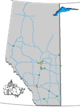
This is a list of provincial highways in Alberta
. Alberta's provincial highway network comprised nearly 31000 km (19,262.6 mi) of highways as of 2009, of which 24851 km (15,441.7 mi) were paved.
All of Alberta's provincial highways are maintained by Alberta Transportation (AT), a department of the Government of Alberta, and all of them have been designated by AT as 'Primary Highways' since 2000/2001. The Primary Highways are divided into two series, the "1-216 Series" makes up Alberta's core highway network, has the highest traffic volume, and are mostly paved. The "500-986 Series", formerly known as the "Secondary Highways", provide more local access, and include a large number of gravel highways.
 Alberta’s 1 to 216 Series of Primary Highways are Alberta’s main highways. Prior to 2000/2001, this highway series was designated simply as Alberta’s "Primary Highways" network. However, it was redesignated by Alberta Transportation as the "Primary Highways, 1 to 216 Series" when Alberta’s former "Secondary Highways" network was redesignated as Alberta’s "Primary Highways, 500 to 986 Series" network in 2000/2001. The redesignation of both highway networks was triggered when jurisdiction over the former "Secondary Highways" network was transferred from municipalities to the Province. Despite the redesignation, the 1 to 216 Series and the 500 to 986 Series of Primary Highways are still commonly referred to as "Primary Highways" and "Secondary Highways" respectively by the public, municipalities, politicians, the media and even other provincial ministries.
The 1 to 216 Series of Primary Highways are numbered from 1 to 100, with the exception of the ring road
s around Calgary and Edmonton, which are numbered 201 and 216, denoting their bypass linkages between highways 2 & 1 and 2 & 16 respectively.
All or portions of Highways 1, 2, 3, 4, 9, 16, 28, 28A, 35, 43, 49, and 63 are considered Core Routes of Canada’s National Highway System (NHS). Highway 28 from Highway 63 to Cold Lake is considered a NHS feed route and Highway 58 between Rainbow Lake and Highway 88 is considered a NHS Northern/Remote Route.
Highways 1, 2, 3, 4, 16, and 43 are considered Alberta’s most important interprovincial and international highways and are divided highway
s (expressway
s) or freeways for much or all of their length. Speed limits are generally 100 km/h (62.1 mph) except on some divided highways and freeways which are 110 kilometres per hour (68.4 mph) or on Highways 1 and 16 through the Banff and Jasper National Parks which can be 90 km/h (55.9 mph).
The Highway 15/28A/28/63 corridor between Edmonton and Fort McMurray is considered one of Alberta’s most important intraprovincial highways. A twinning program is currently underway between Boyle and Fort McMurray. Highway 63 from Fort McMurray north to the Suncor and Syncrude oil sands operations is also twinned.
Although only Highways 1, 2, 3, 4, 15, 16, 43, 63, 100, 201, and 216 are twinned (expressways) for most of their length, the vast majority of Alberta’s Primary Highway Series are two-lanes paved, while segments of Highways 40, 58, 68, and 88 remain as gravel.

Alberta's 500 to 986 Series of Primary Highways are generally considered local or rural highways. Prior to 2000/2001, this highway series was under municipal jurisdiction and was previously known as Alberta’s ‘Secondary Highway’ network. Over a short period of time in 2000 and 2001, responsibility and funding of this highway network was transferred to the Province, particularly Alberta Transportation. Concurrent with the transfer, the designation of the ‘Secondary Highways’ network was changed to the ‘Primary Highways, 500 to 986 Series’ network to reflect that they were now under provincial jurisdiction. As a result, the Province’s ‘Primary Highways’ network was also redesignated as the ‘Primary Highways, 1 to 216 Series’ network. Despite the change in jurisdiction and the redesignation, this series of highways is still commonly referred to as ‘Secondary Highways’ by the public, municipalities, politicians, the media and even other provincial ministries.
The 500 to 986 Series of Primary Highways is divided into three sub-series:
Some of these highways are paved, while others are entirely or partially gravel. Rural speed limits range from 80 km/h (49.7 mph) to 100 km/h (62.1 mph).
is a potential reaignment of Hwy 1, Hwy 16X will be a realignment of Hwy 16, and Hwy 986
is an extension of Hwy 686). Highway 1X between Cochrane and Canmore, which is a short spur route connecting Highway 1 and Highway 1A, is an exception to the typical roles of the 900 and X series highways, as well as Highway 10X, which is also a spur.
Alberta
Alberta is a province of Canada. It had an estimated population of 3.7 million in 2010 making it the most populous of Canada's three prairie provinces...
. Alberta's provincial highway network comprised nearly 31000 km (19,262.6 mi) of highways as of 2009, of which 24851 km (15,441.7 mi) were paved.
All of Alberta's provincial highways are maintained by Alberta Transportation (AT), a department of the Government of Alberta, and all of them have been designated by AT as 'Primary Highways' since 2000/2001. The Primary Highways are divided into two series, the "1-216 Series" makes up Alberta's core highway network, has the highest traffic volume, and are mostly paved. The "500-986 Series", formerly known as the "Secondary Highways", provide more local access, and include a large number of gravel highways.
Primary Highways, 1-216 Series
The 1 to 216 Series of Primary Highways are numbered from 1 to 100, with the exception of the ring road
Ring road
A ring road, orbital motorway, beltway, circumferential highway, or loop highway is a road that encircles a town or city...
s around Calgary and Edmonton, which are numbered 201 and 216, denoting their bypass linkages between highways 2 & 1 and 2 & 16 respectively.
All or portions of Highways 1, 2, 3, 4, 9, 16, 28, 28A, 35, 43, 49, and 63 are considered Core Routes of Canada’s National Highway System (NHS). Highway 28 from Highway 63 to Cold Lake is considered a NHS feed route and Highway 58 between Rainbow Lake and Highway 88 is considered a NHS Northern/Remote Route.
Highways 1, 2, 3, 4, 16, and 43 are considered Alberta’s most important interprovincial and international highways and are divided highway
Divided Highway
Divided Highway is a compilation album by American rock band The Doobie Brothers, released in 2003. . All tracks are taken from the albums Cycles and Brotherhood .-Track listing:...
s (expressway
Limited-access road
A limited-access road known by various terms worldwide, including limited-access highway, dual-carriageway and expressway, is a highway or arterial road for high-speed traffic which has many or most characteristics of a controlled-access highway , including limited or no access to adjacent...
s) or freeways for much or all of their length. Speed limits are generally 100 km/h (62.1 mph) except on some divided highways and freeways which are 110 kilometres per hour (68.4 mph) or on Highways 1 and 16 through the Banff and Jasper National Parks which can be 90 km/h (55.9 mph).
The Highway 15/28A/28/63 corridor between Edmonton and Fort McMurray is considered one of Alberta’s most important intraprovincial highways. A twinning program is currently underway between Boyle and Fort McMurray. Highway 63 from Fort McMurray north to the Suncor and Syncrude oil sands operations is also twinned.
| 00 10 20 30 40 50 60 70 100 |
|---|
Although only Highways 1, 2, 3, 4, 15, 16, 43, 63, 100, 201, and 216 are twinned (expressways) for most of their length, the vast majority of Alberta’s Primary Highway Series are two-lanes paved, while segments of Highways 40, 58, 68, and 88 remain as gravel.
| Markers | Highway | Other names | Description | Length (km) |
|---|---|---|---|---|
 |
Highway 1 | Trans-Canada Highway Trans-Canada Highway The Trans-Canada Highway is a federal-provincial highway system that joins the ten provinces of Canada. It is, along with the Trans-Siberian Highway and Australia's Highway 1, one of the world's longest national highways, with the main route spanning 8,030 km... |
from British Columbia British Columbia British Columbia is the westernmost of Canada's provinces and is known for its natural beauty, as reflected in its Latin motto, Splendor sine occasu . Its name was chosen by Queen Victoria in 1858... border near Lake Louise Lake Louise, Alberta Lake Louise is a hamlet in Alberta, Canada within Improvement District No. 9 Banff . It is named for the nearby Lake Louise, which in turn was named after the Princess Louise Caroline Alberta , the fourth daughter of Queen Victoria, and the wife of John Campbell, the 9th Duke of Argyll, who was the... to Saskatchewan Saskatchewan Saskatchewan is a prairie province in Canada, which has an area of . Saskatchewan is bordered on the west by Alberta, on the north by the Northwest Territories, on the east by Manitoba, and on the south by the U.S. states of Montana and North Dakota.... border near Walsh Walsh, Alberta Walsh is a hamlet in Alberta, Canada, within Cypress County.It is located along the Trans-Canada Highway, immediately west of the Saskatchewan border, and has an elevation of .The hamlet is located in census division No... |
536 |
 |
Highway 1A | Bow Valley Parkway | •Lake Louise Lake Louise, Alberta Lake Louise is a hamlet in Alberta, Canada within Improvement District No. 9 Banff . It is named for the nearby Lake Louise, which in turn was named after the Princess Louise Caroline Alberta , the fourth daughter of Queen Victoria, and the wife of John Campbell, the 9th Duke of Argyll, who was the... to Banff Banff, Alberta Banff is a town within Banff National Park in Alberta, Canada. It is located in Alberta's Rockies along the Trans-Canada Highway, approximately west of Calgary and east of Lake Louise.... |
64 |
| Bow Valley Trail | •Canmore Canmore, Alberta Canmore is a town in Alberta, Canada, located approximately west of the City of Calgary near the southeast boundary of Banff National Park. It is located in the Bow Valley within Alberta's Rockies. The town shares a border with Kananaskis Country to the west and south and the Municipal District of... to Calgary Calgary Calgary is a city in the Province of Alberta, Canada. It is located in the south of the province, in an area of foothills and prairie, approximately east of the front ranges of the Canadian Rockies... |
89 | ||
| 17 Avenue SE, Calgary International Avenue, Calgary International Avenue is a Business Revitalization Zone in Calgary, Alberta. The district is centered on 17th Avenue S.E. in the neighbourhood of Forest Lawn in the east of the city. The district was created in 1993 to celebrate the rich cultural diversity that exists in east central Calgary... |
•Calgary Calgary Calgary is a city in the Province of Alberta, Canada. It is located in the south of the province, in an area of foothills and prairie, approximately east of the front ranges of the Canadian Rockies... to Chestermere Chestermere, Alberta Chestermere is a town adjacent to the City of Calgary in the Province of Alberta, Canada within Rocky View County. It is largely a bedroom community of Calgary and is a member municipality of the Calgary Regional Partnership... |
4.4 | ||
 |
Highway 1X | Connects Highway 1 to Highway 1A, east of Exshaw Exshaw, Alberta Exshaw is a hamlet in Alberta, Canada within Municipal District of Bighorn No. 8. Located approximately west of downtown Calgary and east of Canmore, Exshaw is situated within the Bow River valley north of the Bow River.... |
4.2 | |
 |
Highway 2 | •Queen Elizabeth II Highway (Calgary to Edmonton only) •Northern Woods and Water Route Northern Woods and Water Route The Northern Woods and Water Route is a route through northern British Columbia, Alberta, Saskatchewan and Manitoba. As early as the 1950s community groups came together to establish a northern travel route; this was proposed as the Northern Yellowhead Transportation Route... (Athabasca to Donnelly only) |
United States United States The United States of America is a federal constitutional republic comprising fifty states and a federal district... border at Carway Carway, Alberta Carway is a hamlet in southern Alberta, Canada within Cardston County. It is an entry point into Montana at Port of Peigan. Just on the other side of the border is the Blackfeet Indian Reservation in Glacier County, Montana.... to Highway 43 north of Grande Prairie Grande Prairie, Alberta Grande Prairie is a city in the northwestern part of the province of Alberta in Western Canada. It is located on the southern edge of the Peace River Country . The city is surrounded by the County of Grande Prairie No... |
1,261 |
 |
Highway 2A | •High River High River, Alberta High River is a town in southwestern Alberta, Canada with a population of 10,716. It is south of the city of Calgary, at the junction of Alberta Highways 2 and 23... to Aldersyde Aldersyde, Alberta Aldersyde is a hamlet in Alberta, Canada within the Municipal District of Foothills No. 31. Located between Highway 2 and Highway 2A south of Highway 7, the hamlet is approximately southeast of Okotoks, north of High River and south of Calgary. A Canadian Pacific Railway line runs through the... |
15.9 | |
| •Okotoks Okotoks, Alberta Okotoks is a town situated on the Sheep River, south of Calgary, Alberta, Canada. The town is a member of the Calgary Regional Partnership, a cooperative of communities within the Calgary Region. Okotoks has become a popular bedroom community for the City of Calgary... to Highway 2 |
11.4 | |||
| •Highway 2 to Calgary Calgary Calgary is a city in the Province of Alberta, Canada. It is located in the south of the province, in an area of foothills and prairie, approximately east of the front ranges of the Canadian Rockies... |
5.2 | |||
| •south of Crossfield Crossfield, Alberta Crossfield is a town in southern Alberta, Canada within Rocky View County.Crossfield is located 43 kilometers or north of the City of Calgary, on Highway 2.... to Bowden Bowden, Alberta Bowden is a town in central Alberta, Canada. It is located in Red Deer County, south of Red Deer, on the Queen Elizabeth II Highway.- Geography :Nearby communities are Innisfail , James River Bridge , Huxley and Olds .... |
67 | |||
| •Innisfail Innisfail, Alberta Innisfail is a town in central Alberta, Canada. It is located in the Calgary-Edmonton Corridor, south of Red Deer at the junction of Highway 2 and Highway 54.... to Highway 595 in Red Deer Red Deer, Alberta Red Deer is a city in Central Alberta, Canada. It is located near the midpoint of the Calgary-Edmonton Corridor and is surrounded by Red Deer County. It is Alberta's third-most-populous city – after Calgary and Edmonton. The city is located in aspen parkland, a region of rolling hills... |
26 | |||
| •Red Deer Red Deer, Alberta Red Deer is a city in Central Alberta, Canada. It is located near the midpoint of the Calgary-Edmonton Corridor and is surrounded by Red Deer County. It is Alberta's third-most-populous city – after Calgary and Edmonton. The city is located in aspen parkland, a region of rolling hills... to north of Lacombe Lacombe, Alberta Lacombe is a city in Alberta, Canada. It is located north of Red Deer, the nearest major city, and south of Edmonton, the nearest metropolitan area... |
25 | |||
| •Morningside Morningside, Alberta Morningside is a hamlet in central Alberta, Canada within Lacombe County. It is located just east of Highway 2 at the intersection of Highway 2A and Highway 604, approximately north of Red Deer.- Demographics :... to Leduc Leduc, Alberta - Demographics :The population of the City of Leduc according to its 2011 municipal census is 24,139, a 3.6% increase over its 2010 municipal census population of 23,293.... |
85 | |||
| •Hondo Hondo, Alberta Hondo is an unincorporated community in northern Alberta within the Municipal District of Lesser Slave River No. 124, located east of Highway 2, northwest of Edmonton.... to Smith Smith, Alberta Smith is a hamlet in northern Alberta, Canada within the Municipal District of Lesser Slave River No. 124. It is located on Highway 2A, approximately northwest of Edmonton, at the confluence of the Lesser Slave River and the Athabasca River.- History :... |
14.7 | |||
| •Triangle to Highway 49 near the Little Smoky River Little Smoky River Little Smoky River is a river in west-central Alberta, Canada. It is a tributary of the Smoky River.-Course:The river originates in the foothills of the Canadian Rockies, west of Grande Cache and flows in a north-east direction throghout the foothills. Upon reaching the open prairie, it meanders... |
28 | |||
| •Roma Junction to Grimshaw Grimshaw, Alberta Grimshaw is a town in northern Alberta located west of the Town of Peace River at the junction of Highway 35, Highway 2, and bypass Highway 2A, and the Mackenzie Northern Railway... |
11.7 | |||
 |
Highway 3 Crowsnest Highway The Crowsnest Highway, also known as the Interprovincial or, in British Columbia, the Southern Trans-Provincial, is an east-west highway, in length, through the southern parts of British Columbia and Alberta, providing the shortest highway connection between British Columbia's Lower Mainland and... |
Crowsnest Highway Crowsnest Highway The Crowsnest Highway, also known as the Interprovincial or, in British Columbia, the Southern Trans-Provincial, is an east-west highway, in length, through the southern parts of British Columbia and Alberta, providing the shortest highway connection between British Columbia's Lower Mainland and... |
British Columbia British Columbia British Columbia is the westernmost of Canada's provinces and is known for its natural beauty, as reflected in its Latin motto, Splendor sine occasu . Its name was chosen by Queen Victoria in 1858... border at Crowsnest Pass Crowsnest Pass, Alberta The Municipality of Crowsnest Pass is a specialized municipality located in the Crowsnest Pass of the Rocky Mountains in southwest Alberta, Canada. The municipality formed as a result of the amalgamation of five municipalities – the Village of Bellevue, the Town of Blairmore, Town of Coleman, the... to Highway 1 and Highway 41A at Medicine Hat |
323 |
 |
Highway 3A Alberta Highway 3A Highway 3A is a spur of the Crowsnest Highway in four different segments within southern Alberta. All four segments are previous alignments of the Crowsnest Highway.... |
•alternative to Highway 3 west of Lundbreck Lundbreck, Alberta Lundbreck is a hamlet in southern Alberta, Canada within the Municipal District of Pincher Creek No. 9. It is located on the south side of Highway 3, approximately east of the southern terminus of Highway 22, east of the Municipality of Crowsnest Pass, west of the Village of Cowley and west of... |
3.6 | |
| •alternative to Highway 3 through Monarch Monarch, Alberta Monarch is a hamlet in southern Alberta, Canada within the County of Lethbridge. It is located on Highway 3A, approximately northwest of Lethbridge.- Climate :- References :... |
7.9 | |||
| •Westside Drive, Lethbridge Lethbridge Lethbridge is a city in the province of Alberta, Canada, and the largest city in southern Alberta. It is Alberta's fourth-largest city by population after Calgary, Edmonton and Red Deer, and the third-largest by area after Calgary and Edmonton. The nearby Canadian Rockies contribute to the city's... |
0.7 | |||
| •alternative to Highway 3 through Barnwell Barnwell, Alberta Barnwell is a village in southern Alberta, Canada. It is located west of Taber and east of Lethbridge along the Crowsnest Highway, in the Municipal District of Taber.-History:... |
6.8 | |||
 |
Highway 4 | Red Coat Trail Red Coat Trail The Red Coat Trail is a route that approximates the path taken in 1874 by the North-West Mounted Police in their quest to bring law and order to the Canadian West.-Travel route:... |
United States United States The United States of America is a federal constitutional republic comprising fifty states and a federal district... border at Coutts Coutts, Alberta Coutts is a village in Alberta and the location of one of the busiest Canada – US border crossings in western Canada. It connects Highway 4 to Interstate 15, an important trade route between Alberta, American states along I-15, and Mexico.In 2004, a joint border facility opened in Coutts-Sweet... to Highway 5 in Lethbridge Lethbridge Lethbridge is a city in the province of Alberta, Canada, and the largest city in southern Alberta. It is Alberta's fourth-largest city by population after Calgary, Edmonton and Red Deer, and the third-largest by area after Calgary and Edmonton. The nearby Canadian Rockies contribute to the city's... |
90 |
 |
Highway 5 | Waterton Park Waterton Lakes National Park Waterton Lakes National Park is a national park located in the southwest corner of Alberta, Canada, and borders Glacier National Park in Montana, USA. Waterton was Canada's fourth national park, formed in 1895 and named after Waterton Lake, in turn after the Victorian naturalist and conservationist... to Highway 3 Crowsnest Highway The Crowsnest Highway, also known as the Interprovincial or, in British Columbia, the Southern Trans-Provincial, is an east-west highway, in length, through the southern parts of British Columbia and Alberta, providing the shortest highway connection between British Columbia's Lower Mainland and... in Lethbridge Lethbridge Lethbridge is a city in the province of Alberta, Canada, and the largest city in southern Alberta. It is Alberta's fourth-largest city by population after Calgary, Edmonton and Red Deer, and the third-largest by area after Calgary and Edmonton. The nearby Canadian Rockies contribute to the city's... |
130 | |
 |
Highway 6 | United States United States The United States of America is a federal constitutional republic comprising fifty states and a federal district... border at Chief Mountain Chief Mountain, Alberta Chief Mountain is an unincorporated community in southern Alberta in Improvement District No. 4, on Highway 6, southwest of Lethbridge.... to Highway 3 Crowsnest Highway The Crowsnest Highway, also known as the Interprovincial or, in British Columbia, the Southern Trans-Provincial, is an east-west highway, in length, through the southern parts of British Columbia and Alberta, providing the shortest highway connection between British Columbia's Lower Mainland and... near Pincher Station Pincher Station, Alberta Pincher Station, once known as Pincher City, is a hamlet in southern Alberta, Canada within the Municipal District of Pincher Creek No. 9. It is located on Highway 3, approximately southwest of Lethbridge.- References :... |
72 | |
 |
Highway 7 | Cowboy Trail in Black Diamond Black Diamond, Alberta Black Diamond is a sister town to Turner Valley. There exists a three-kilometer trail next to the roadway between Black Diamond and Turner Valley named the Friendship Trail. It has a hospital, shops, hotels and residences, an elementary school [K-6] and highschool [7-12] as well a hockey rink and... to Highways 2 and 547 near Aldersyde Aldersyde, Alberta Aldersyde is a hamlet in Alberta, Canada within the Municipal District of Foothills No. 31. Located between Highway 2 and Highway 2A south of Highway 7, the hamlet is approximately southeast of Okotoks, north of High River and south of Calgary. A Canadian Pacific Railway line runs through the... |
27 | |
 |
Highway 8 | Glenmore Trail | Cowboy Trail near Redwood Meadows Redwood Meadows, Alberta Redwood Meadows is a unique community known as a townsite in Alberta, Canada – the only townsite recognized by Alberta Municipal Affairs at this time.... to Highway 2 (Deerfoot Trail Deerfoot Trail Deerfoot Trail is a freeway section of the Queen Elizabeth II Highway in Calgary, Alberta, Canada. It was formerly known as Blackfoot Trail Freeway, but was renamed to honour the first Native American to win the marathon.... ) in Calgary Calgary Calgary is a city in the Province of Alberta, Canada. It is located in the south of the province, in an area of foothills and prairie, approximately east of the front ranges of the Canadian Rockies... |
40 |
 |
Highway 9 | Inverlake on Trans-Canada Highway to Saskatchewan Saskatchewan Saskatchewan is a prairie province in Canada, which has an area of . Saskatchewan is bordered on the west by Alberta, on the north by the Northwest Territories, on the east by Manitoba, and on the south by the U.S. states of Montana and North Dakota.... border west of Alsask Alsask, Saskatchewan Alsask is part of the Heartland Regional Health Authority with SaskHealth reporting Alsask as having a population of 148 -Climate:Alsask experiences a semi-arid climate . Winters are long, cold and dry, while summers are short and warm... |
326 | |
 |
Highway 10 | Hoo Doo Trail | Highways 9 and 56 in Drumheller Drumheller, Alberta Drumheller is a town within the Red Deer River valley in the badlands of east-central Alberta, Canada. It is located northeast of Calgary... to Western Monarch |
35 |
 |
Highway 11 | David Thompson David Thompson (explorer) David Thompson was an English-Canadian fur trader, surveyor, and map-maker, known to some native peoples as "Koo-Koo-Sint" or "the Stargazer"... Highway |
Icefields Parkway at Saskatchewan River Crossing Saskatchewan River Crossing, Alberta Saskatchewan River Crossing is a place name in western Alberta, Canada. It is located in the administrative area Improvement District No. 9 , at the junction between Icefields Parkway and David Thompson Highway.... to Highway 12 at Nevis Nevis, Alberta Nevis is a hamlet in central Alberta, Canada within the County of Stettler No. 6. It is located on Highway 12, approximately southeast Alix and west of Erskine. It has an elevation of .... |
320 |
 |
Highway 11A Alberta Highway 11A Highway 11A is the name of two alternate routes off Alberta Highway 11. The Rocky Mountain House section is referred to as 11A:02 by Alberta Transportation, while 11A:06 runs from Sylvan Lake to Red Deer.- Rocky Mountain House :... |
•Highway 11 to Rocky Mountain House Rocky Mountain House, Alberta Rocky Mountain House is a town in west-central Alberta, Canada, approximately west of the City of Red Deer. It is located at the confluence of the Clearwater and North Saskatchewan Rivers, and at the crossroads of Highway 22 and Highway 11 .- History :The town has a long history dating to the... |
11.7 | |
| •Sylvan Lake Sylvan Lake, Alberta Sylvan Lake is a town in central Alberta, Canada. It is located west of the City of Red Deer along Highway 11 or Highway 11A. It is situated on the southeast edge of Sylvan Lake, a long freshwater lake, in Red Deer County.... to Red Deer Red Deer, Alberta Red Deer is a city in Central Alberta, Canada. It is located near the midpoint of the Calgary-Edmonton Corridor and is surrounded by Red Deer County. It is Alberta's third-most-populous city – after Calgary and Edmonton. The city is located in aspen parkland, a region of rolling hills... |
17.4 | |||
 |
Highway 12 | Cowboy Trail near Frisco to Saskatchewan Saskatchewan Saskatchewan is a prairie province in Canada, which has an area of . Saskatchewan is bordered on the west by Alberta, on the north by the Northwest Territories, on the east by Manitoba, and on the south by the U.S. states of Montana and North Dakota.... border at Compeer Compeer, Alberta Compeer is a hamlet in east-central Alberta, Canada within Special Area No. 4. It is located on an abandoned track of the Railink Central Western railway, north of Highway 12 and west of the Alberta–Saskatchewan border. It is approximately east of Altario.... |
364 | |
 |
Highway 13 | Alder Flats Alder Flats, Alberta Alder Flats is a hamlet in central Alberta, Canada within the County of Wetaskiwin No. 10. It is located west of Highway 22 at the western terminus of Highway 13, approximately southwest of Edmonton.- References :... (west of Cowboy Trail) to Saskatchewan Saskatchewan Saskatchewan is a prairie province in Canada, which has an area of . Saskatchewan is bordered on the west by Alberta, on the north by the Northwest Territories, on the east by Manitoba, and on the south by the U.S. states of Montana and North Dakota.... border near Hayter |
366 | |
 |
Highway 13A | •Through Ma-Me-O Beach Ma-Me-O Beach, Alberta Ma-Me-O Beach, Alberta, is a summer village located on a small sandy beach on the southeast shore of Pigeon Lake, in Alberta, Canada. It is located approximately 100 kilometres southwest of Edmonton, Alberta, Canada. The winter population is about 90 people... |
7.4 | |
| •Bypass wholly within and the responsibility of the City of Camrose Camrose, Alberta Camrose is a city in central Alberta, Canada, amid some of the richest farmland in the prairies. It is a relatively small city which originally grew up along a railroad and now grows along Highway 13. Camrose is a scenic community with many parks, leading to its moniker "The Rose City"... |
8.1 | |||
 |
Highway 14 | Poundmaker Trail | Highway 2 (Calgary Trail/Gateway Boulevard) in Edmonton Edmonton Edmonton is the capital of the Canadian province of Alberta and is the province's second-largest city. Edmonton is located on the North Saskatchewan River and is the centre of the Edmonton Capital Region, which is surrounded by the central region of the province.The city and its census... to Saskatchewan Saskatchewan Saskatchewan is a prairie province in Canada, which has an area of . Saskatchewan is bordered on the west by Alberta, on the north by the Northwest Territories, on the east by Manitoba, and on the south by the U.S. states of Montana and North Dakota.... border near Roros |
257 |
 |
Highway 15 | Highway 16 (Yellowhead Trail) in Edmonton Edmonton Edmonton is the capital of the Canadian province of Alberta and is the province's second-largest city. Edmonton is located on the North Saskatchewan River and is the centre of the Edmonton Capital Region, which is surrounded by the central region of the province.The city and its census... to Highway 16 south of Mundare Mundare, Alberta Mundare is a small town in central Alberta, Canada. It is located east of Edmonton and west of Vegreville, at the intersection of Highway 15 and Highway 855, north of the Yellowhead Highway... |
92 | |
 |
Highway 16 | Yellowhead Highway Yellowhead Highway The Yellowhead Highway is a major east-west highway connecting the four western Canadian provinces of British Columbia, Alberta, Saskatchewan, and Manitoba. Although part of the Trans-Canada Highway system, the highway should not be confused with the more southerly, originally-designated... |
British Columbia British Columbia British Columbia is the westernmost of Canada's provinces and is known for its natural beauty, as reflected in its Latin motto, Splendor sine occasu . Its name was chosen by Queen Victoria in 1858... border near Decoigne to Saskatchewan Saskatchewan Saskatchewan is a prairie province in Canada, which has an area of . Saskatchewan is bordered on the west by Alberta, on the north by the Northwest Territories, on the east by Manitoba, and on the south by the U.S. states of Montana and North Dakota.... border at Lloydminster Lloydminster Lloydminster is a Canadian city which has the unusual geographic distinction of straddling the provincial border between Alberta and Saskatchewan... |
641 |
 |
Highway 16A | •Evansburg Evansburg, Alberta Evansburg is a hamlet in west-central Alberta, Canada, within Yellowhead County. It is located on Highway 16A, approximately west of Edmonton and east of Edson. The hamlet is adjacent to the Pembina River and the Pembina River Provincial Park.... and Entwistle Entwistle, Alberta Entwistle is a hamlet in Alberta, Canada within Parkland County. It is located at the Yellowhead Highway's intersection with Highway 22/Highway 16A, approximately west of Edmonton on the Yellowhead Highway... |
13.6 | |
| Parkland Highway | •Highway 16 to Edmonton Edmonton Edmonton is the capital of the Canadian province of Alberta and is the province's second-largest city. Edmonton is located on the North Saskatchewan River and is the centre of the Edmonton Capital Region, which is surrounded by the central region of the province.The city and its census... via Stony Plain Stony Plain, Alberta Stony Plain is a large town in rural Alberta, Canada, just west of Edmonton.Stony Plain is a rapidly growing town with strong historical roots. It is located west of Spruce Grove and surrounded by Parkland County. The town is governed by one mayor and six councillors. The region is dominated by... and Spruce Grove Spruce Grove, Alberta Spruce Grove is a city in the vicinity of Edmonton, Alberta. Like nearby Stony Plain it is surrounded by Parkland County.With a population of 24,646, Spruce Grove is the 11th largest city in Alberta. The Horizon Stage Performing Arts Centre is the local theatre, and its TransAlta Tri Leisure Centre... |
35 | ||
| •Through Vegreville Vegreville, Alberta -Notable Vegrevillans :*Brent Severyn, former NHL defenseman*Cam Cole, Canadian sports writer*Laurence Decore, lawyer, former mayor of Edmonton, Alberta, and former leader of the Alberta Liberal Party*Roderick Fraser, former president of the University of Alberta... |
8.7 | |||
 |
Highway 17 | Saskatchewan Saskatchewan Saskatchewan is a prairie province in Canada, which has an area of . Saskatchewan is bordered on the west by Alberta, on the north by the Northwest Territories, on the east by Manitoba, and on the south by the U.S. states of Montana and North Dakota.... border near Killarney Lake to Onion Lake, Saskatchewan |
134 | |
 |
Highway 18 | Highway 43 at Green Court Green Court, Alberta Green Court is a hamlet in central Alberta, Canada within Lac Ste. Anne County. It is located at the intersection of Highway 43 and Highway 18, approximately northwest of Edmonton.- References :... to Highways 63 and 656 near Thorhild Thorhild, Alberta Thorhild is a hamlet in Alberta, Canada within the County of Thorhild No. 7. It is located at the intersection of Highway 18 and Highway 827, approximately north of the City of Edmonton.... |
162 | |
 |
Highway 19 | Highway 60 near Devon Devon, Alberta Devon is a town in the province of Alberta, Canada, situated southwest of Edmonton, the provincial capital, and located along the banks of the North Saskatchewan River.- History :Devon owes its existence to one of the largest oil discoveries in the world... to Highways 2 and 625 near Nisku |
12.3 | |
 |
Highway 20 | Highway 11 in Sylvan Lake Sylvan Lake, Alberta Sylvan Lake is a town in central Alberta, Canada. It is located west of the City of Red Deer along Highway 11 or Highway 11A. It is situated on the southeast edge of Sylvan Lake, a long freshwater lake, in Red Deer County.... to Highway 39 at Alsike Alsike, Alberta Alsike is an unincorporated place in central Alberta in Leduc County, located on Highway 39, Highway 22. It is west of Leduc.Alsike is notable for its horse farms and dude ranches... |
110 | |
 |
Highway 20A | Rimbey to Highway 20 | 1.6 | |
 |
Highway 21 | Trans-Canada Highway near Strathmore Strathmore, Alberta Strathmore is a town located along the Trans-Canada Highway in southern Alberta, Canada, east of the city of Calgary, within the boundaries of Wheatland County.- History :... to Highway 15 in Fort Saskatchewan Fort Saskatchewan, Alberta Fort Saskatchewan is a city in Alberta, Canada, located northeast of downtown Edmonton, Alberta's capital city, along the North Saskatchewan River. Fort Saskatchewan is part of the Edmonton Census Metropolitan Area and is one of 24 municipalities on the Capital Region Board... |
328 | |
 |
Highway 22 | Cowboy Trail | Highway 3 near Lundbreck Lundbreck, Alberta Lundbreck is a hamlet in southern Alberta, Canada within the Municipal District of Pincher Creek No. 9. It is located on the south side of Highway 3, approximately east of the southern terminus of Highway 22, east of the Municipality of Crowsnest Pass, west of the Village of Cowley and west of... to Highway 18 near Mayerthorpe Mayerthorpe, Alberta Mayerthorpe is a town in the census division 13, central Alberta, Canada. It is located at the intersection of Highway 43 and Cowboy Trail , north-west from Edmonton.-History:... |
584 |
 |
Highway 23 | Highway 3 near Monarch Monarch, Alberta Monarch is a hamlet in southern Alberta, Canada within the County of Lethbridge. It is located on Highway 3A, approximately northwest of Lethbridge.- Climate :- References :... to Highway 2A in High River High River, Alberta High River is a town in southwestern Alberta, Canada with a population of 10,716. It is south of the city of Calgary, at the junction of Alberta Highways 2 and 23... |
145 | |
| Highway 24 | Highway 23 to the Trans-Canada Highway near Cheadle Cheadle, Alberta Cheadle is a hamlet in Alberta, Canada, within Wheatland County. It is located on Highway 24, south of the Highway 1 and approximately east of the City of Calgary.... |
70 | ||
| Highway 25 | Lethbridge Lethbridge Lethbridge is a city in the province of Alberta, Canada, and the largest city in southern Alberta. It is Alberta's fourth-largest city by population after Calgary, Edmonton and Red Deer, and the third-largest by area after Calgary and Edmonton. The nearby Canadian Rockies contribute to the city's... to Enchant Enchant, Alberta Enchant is a hamlet in southern Alberta, Canada within the Municipal District of Taber. It is located on Highway 526 and the Canadian Pacific Railway, between Vauxhall and Lomond. It has an elevation of .The hamlet is located in census division No... |
72 | ||
| Highway 26 | Camrose Camrose, Alberta Camrose is a city in central Alberta, Canada, amid some of the richest farmland in the prairies. It is a relatively small city which originally grew up along a railroad and now grows along Highway 13. Camrose is a scenic community with many parks, leading to its moniker "The Rose City"... to Viking Viking, Alberta - Notable people :*Cory Clouston - former head coach of the Ottawa Senators*Don Mazankowski - former cabinet minister under Joe Clark and Brian Mulroney... |
81 | ||
| Highway 27 | Sundre Sundre, Alberta Sundre is a town in central Alberta, Canada. It is located in Mountain View County, northwest from Calgary, along the Cowboy Trail in the Canadian Rockies foothills.... to Morrin Morrin, Alberta Morrin is a village in central Alberta, Canada. It is located 26 km north of the town of Drumheller, along Highway 27 and the Railink Central Western railway.... |
139 | ||
 |
Highway 28 | Edmonton Edmonton Edmonton is the capital of the Canadian province of Alberta and is the province's second-largest city. Edmonton is located on the North Saskatchewan River and is the centre of the Edmonton Capital Region, which is surrounded by the central region of the province.The city and its census... to Cold Lake Cold Lake, Alberta Cold Lake is a city in northeastern Alberta, Canada, named after the lake it is situated near.-Geography:The city is situated in Alberta's "Lakeland" district, 300 km northeast of Edmonton, near the Alberta-Saskatchewan provincial border. The area surrounding the city is sparsely populated,... , via Smoky Lake Smoky Lake, Alberta Smoky Lake is a town in central Alberta, Canada. It is located northeast of Edmonton at the junction of Highway 28 and Highway 855. It lies between the North Saskatchewan River, Smoky Creek and White Earth Creek. Long Lake Provincial Park is located north of the town.- Demographics :In 2006,... |
293 | |
 |
Highway 28A | 17 Street NE, Edmonton Edmonton Edmonton is the capital of the Canadian province of Alberta and is the province's second-largest city. Edmonton is located on the North Saskatchewan River and is the centre of the Edmonton Capital Region, which is surrounded by the central region of the province.The city and its census... |
Highway 15 to Gibbons | 17.7 |
| Highway 29 Alberta Highway 29 Highway 29 is a east–west highway located in east–central Alberta.Highway 29 was established in 2006 by renumbering portions of Highway 637, Highway 45, Highway 860, Highway 36, and Highway 28 between Highway 15, approximately northwest of the Town of Lamont, and Highway 41, approximately east of... |
Lamont to St. Paul St. Paul, Alberta St. Paul is a town in east-central Alberta, Canada. It was formerly called St. Paul de Métis and was originally a French-Catholic settlement and mission to the Metis people.... and Highway 41 |
152 | ||
| Highway 31 Alberta Highway 31 Highway 31 is a north–south highway located in central Alberta.Highway 31 starts at Highway 16, east of the Hamlet of Gainford, and ends to the south at the Summer Village of Seba Beach. The highway then continues south as Highway 759.- External links :... |
Seba Beach Seba Beach, Alberta Seba Beach is a summer village located west of Edmonton in Alberta, Canada. The main employer to those within the village and surrounding area is the Sundance Generating Plant, a coal-fired power plant located on the south side of the lake, owned and operated by TransAlta Utilities.A large... to Gainford Gainford, Alberta Gainford is a hamlet in Alberta, Canada within Parkland County. It is located approximately west of Edmonton and has an elevation of .The hamlet is located in census division No... |
3.9 | ||
| Highway 32 | Carrot Creek Carrot Creek, Alberta Carrot Creek is an unincorporated community in central Alberta in Yellowhead County, located south of Highway 16, west of Spruce Grove.... on Yellowhead Highway Yellowhead Highway The Yellowhead Highway is a major east-west highway connecting the four western Canadian provinces of British Columbia, Alberta, Saskatchewan, and Manitoba. Although part of the Trans-Canada Highway system, the highway should not be confused with the more southerly, originally-designated... to Swan Hills Swan Hills, Alberta Swan Hills is a town in northern Alberta, Canada. It is located north of Whitecourt at the junction of Highway 32 and Grizzly Trail. Swan Hills is located in Municipal District of Big Lakes within census Division No... |
148 | ||
 |
Highway 33 | Grizzly Trail | Gunn Gunn, Alberta Gunn is a hamlet in Alberta, Canada within Lac Ste. Anne County. It is located west of the junction of Highway 43 and Highway 33 on the northeast shore of Lac Ste. Anne. It is approximately northwest of Edmonton and has an elevation of .... to Swan Valley |
219 |
 |
Highway 35 Alberta Highway 35 Alberta Highway 35, which forms the majority of Alberta's portion of the Mackenzie Highway, is a north–south highway in northwest Alberta.... |
Mackenzie Highway Mackenzie Highway The Mackenzie Highway is a Canadian highway in northern Alberta and the Northwest Territories. It begins as Alberta Highway 2 at Mile Zero in Grimshaw, Alberta... |
Grimshaw Grimshaw, Alberta Grimshaw is a town in northern Alberta located west of the Town of Peace River at the junction of Highway 35, Highway 2, and bypass Highway 2A, and the Mackenzie Northern Railway... to Northwest Territories Northwest Territories The Northwest Territories is a federal territory of Canada.Located in northern Canada, the territory borders Canada's two other territories, Yukon to the west and Nunavut to the east, and three provinces: British Columbia to the southwest, and Alberta and Saskatchewan to the south... border near Indian Cabins Indian Cabins, Alberta Indian Cabins is an unincorporated community in northern Alberta in Mackenzie County, located on Highway 35, north of High Level.... |
465 |
 |
Highway 36 | Veterans Memorial Highway | Warner Warner, Alberta Warner is a village in southern Alberta, Canada. It is located in County of Warner, approximately 65 km south of the city of Lethbridge. Warner is a farming community. Warner is situated at the intersection of Highway 4 and Highway 36, about 38 km north of the Montana border and... to Lac La Biche |
641 |
 |
Highway 37 | North of Edmonton Edmonton Edmonton is the capital of the Canadian province of Alberta and is the province's second-largest city. Edmonton is located on the North Saskatchewan River and is the centre of the Edmonton Capital Region, which is surrounded by the central region of the province.The city and its census... , from Onoway Onoway, Alberta Onoway is a town in central Alberta, Canada. It is located west of Edmonton at the junction of Highway 37 and Highway 43.The Canadian National Railway tracks run through the town, which is situated immediately east of Lac Ste. Anne and south of the Sturgeon River. Onoway built and opened a new... to Fort Saskatchewan Fort Saskatchewan, Alberta Fort Saskatchewan is a city in Alberta, Canada, located northeast of downtown Edmonton, Alberta's capital city, along the North Saskatchewan River. Fort Saskatchewan is part of the Edmonton Census Metropolitan Area and is one of 24 municipalities on the Capital Region Board... |
67 | |
 |
Highway 38 | Redwater Redwater, Alberta Redwater is a town in northern Alberta, Canada. It is located north of Edmonton on Highway 38, in Sturgeon County. Its population, as of 2006, was 2,192.Redwater is placed in the federal riding of Westlock—St... to Deerland |
25 | |
 |
Highway 39 | Drayton Valley to Leduc Leduc, Alberta - Demographics :The population of the City of Leduc according to its 2011 municipal census is 24,139, a 3.6% increase over its 2010 municipal census population of 23,293.... |
91 | |
 |
Highway 40 | •Bighorn Highway •Kananaskis Trail |
•Crowsnest Pass Crowsnest Pass, Alberta The Municipality of Crowsnest Pass is a specialized municipality located in the Crowsnest Pass of the Rocky Mountains in southwest Alberta, Canada. The municipality formed as a result of the amalgamation of five municipalities – the Village of Bellevue, the Town of Blairmore, Town of Coleman, the... through Kananaskis Village Kananaskis Village, Alberta Kananaskis Village is an unincorporated community in Alberta's Rockies within the Kananaskis Country park system in the Kananaskis Improvement District of Alberta, Canada. It is located approximately south of the Trans-Canada Highway , west of Highway 40 via Mt. Allan Drive and Centennial Drive... to Hwy 579 west of Water Valley Water Valley, Alberta Water Valley is an unincorporated community within Mountain View County, Alberta, Canada. Situated amongst the foothills of the Canadian Rockies, Water Valley is approximately from the City of Calgary, along Highway 579 west of Highway 22... |
300 |
| Forestry Trunk Road | •Lovett River Lovett River The Lovett River is a short river in the Alberta foothills. The Lovett is an early tributary of the Pembina River, itself a major tributary of the Athabasca River. The Lovett River was formerly known as the Little Pembina River, but to avoid confusion its name was changed. The new name was... through Grande Cache Grande Cache, Alberta Grande Cache is a town in west-central Alberta, Canada, located northwest of Hinton and west of Edmonton. It is located in the Municipal District of Greenview, between Highway 40 and the Smoky River, at the northern border of Alberta's Rockies... to Grande Prairie Grande Prairie, Alberta Grande Prairie is a city in the northwestern part of the province of Alberta in Western Canada. It is located on the southern edge of the Peace River Country . The city is surrounded by the County of Grande Prairie No... |
434 | ||
 |
Highway 41 | Buffalo Trail | United States United States The United States of America is a federal constitutional republic comprising fifty states and a federal district... border at Wild Horse Wild Horse, Alberta Wild Horse is an unincorporated community in southern Alberta within Cypress County, Canada. It is situated on Highway 41, south-west of Medicine Hat.... to La Corey La Corey, Alberta La Corey is a hamlet in central Alberta, Canada within the Municipal District of Bonnyville No. 87, located on Highway 55 approximately west of Cold Lake.- References :... |
694 |
 |
Highway 41A | Medicine Hat to Highway 41 | 14.5 | |
 |
Highway 42 | Penhold Penhold, Alberta Penhold is a town in central Alberta, Canada. Penhold is surrounded by the county of Red Deer No. 23, south of Red Deer at the junction of Highway 2A and Highway 42. It is located north of Calgary, along the Red Deer River... to Lousana Lousana, Alberta Lousana is a hamlet in central Alberta, Canada within Red Deer County. It is located east of the junction of Highway 21 and Highway 42, approximately southeast of Red Deer.- References :... |
44 | |
 |
Highway 43 | British Columbia British Columbia British Columbia is the westernmost of Canada's provinces and is known for its natural beauty, as reflected in its Latin motto, Splendor sine occasu . Its name was chosen by Queen Victoria in 1858... border near Demmitt Demmitt, Alberta Demmitt is a hamlet in northern Alberta, Canada within the County of Grande Prairie No. 1. It is located on Highway 43, approximately northwest of Grande Prairie.- References :... to Manly Corner on Yellowhead Highway Yellowhead Highway The Yellowhead Highway is a major east-west highway connecting the four western Canadian provinces of British Columbia, Alberta, Saskatchewan, and Manitoba. Although part of the Trans-Canada Highway system, the highway should not be confused with the more southerly, originally-designated... |
520 | |
| Highway 44 | Yellowhead Highway Yellowhead Highway The Yellowhead Highway is a major east-west highway connecting the four western Canadian provinces of British Columbia, Alberta, Saskatchewan, and Manitoba. Although part of the Trans-Canada Highway system, the highway should not be confused with the more southerly, originally-designated... near Spruce Grove Spruce Grove, Alberta Spruce Grove is a city in the vicinity of Edmonton, Alberta. Like nearby Stony Plain it is surrounded by Parkland County.With a population of 24,646, Spruce Grove is the 11th largest city in Alberta. The Horizon Stage Performing Arts Centre is the local theatre, and its TransAlta Tri Leisure Centre... to Hondo Hondo, Alberta Hondo is an unincorporated community in northern Alberta within the Municipal District of Lesser Slave River No. 124, located east of Highway 2, northwest of Edmonton.... |
185 | ||
| Highway 45 | Bruderheim Bruderheim, Alberta Bruderheim is a town in central Alberta, Canada. It is located just north of the junction of Highway 15 and Highway 45, north-east of Edmonton.-Demographics:... to Saskatchewan Saskatchewan Saskatchewan is a prairie province in Canada, which has an area of . Saskatchewan is bordered on the west by Alberta, on the north by the Northwest Territories, on the east by Manitoba, and on the south by the U.S. states of Montana and North Dakota.... border near Alcurve Alcurve, Alberta Alcurve is an unincorporated community in central Alberta, Canada within the County of Vermilion River. It is located west of the Alberta–Saskatchewan border on Highway 45, approximately north of Lloydminster.... |
231 | ||
| Highway 47 | Coalspur Coalspur, Alberta Coalspur is an abandoned coal-mining community in Yellowhead County, Alberta. Situated in the Alberta foothills, the community was home to a substantial coal mine, and acted as a transportation hub for the Alberta Coal Branch. The community began after a group of British financiers founded the... to Edson Edson, Alberta Edson is a town in west-central Alberta, Canada. It is located in Yellowhead County, west of Edmonton along the Yellowhead Highway and east of the intersection with Highway 47.- History :left|thumb|200px|Welcome Sign... |
60 | ||
| Highway 49 | •Spirit River Highway •Northern Woods and Water Route Northern Woods and Water Route The Northern Woods and Water Route is a route through northern British Columbia, Alberta, Saskatchewan and Manitoba. As early as the 1950s community groups came together to establish a northern travel route; this was proposed as the Northern Yellowhead Transportation Route... |
British Columbia British Columbia British Columbia is the westernmost of Canada's provinces and is known for its natural beauty, as reflected in its Latin motto, Splendor sine occasu . Its name was chosen by Queen Victoria in 1858... border near Bay Tree Bay Tree, Alberta Bay Tree is an unincorporated community in northern Alberta in Saddle Hills County, located on Highway 49, northwest of Grande Prairie.-External links:*... to Valleyview Valleyview, Alberta -History:*Late 1800s: The first visitors to the area arrived, seeking natives to exchange goods for furs. The trading was good and a Hudson’s Bay post was established on Sturgeon Lake... |
266 | |
| Highway 50 | Tees Tees, Alberta Tees is a hamlet in central Alberta, Canada within Lacombe County. It is located north of Highway 12, approximately northeast of Red Deer.- References :... to Mirror Mirror, Alberta Mirror is a hamlet in central Alberta, Canada within Lacombe County. It is located at the junction of Highway 50 and Highway 21, approximately east of Lacombe.It was named for The Daily Mirror of London, England.... |
14 | ||
 |
Highway 52 | Welling Station Welling Station, Alberta Welling Station is a hamlet in southern Alberta, Canada within Cardston County.Welling Station is located on the southeast side of Highway 5 approximately south of Highway 5's intersection with Highway 52. The hamlet is approximately south of Welling, south of Lethbridge, west of Raymond and ... to Craddock Craddock, Alberta Craddock is a former unincorporated community in southern Alberta, Canada within the County of Warner No. 5. It is located between the villages of Stirling and Hamlet of New Dayton, approximately southeast of the City of Lethbridge on Highway 4.- History :... |
24 | |
| Highway 53 | Highway 22 to Highway 36 through Rimbey, Ponoka Ponoka, Alberta Ponoka is a town in the province of Alberta, Canada. It is situated in the south/central parkland region of rolling hills. Industries are agriculture , and oil and gas production... , Bashaw Bashaw, Alberta Bashaw is a town in central Alberta located at the junction of Highway 21 and Highway 53. Formerly one of the most recognizable sources of cheese production in Alberta, the Bashaw cheese plant has been closed since the spring of 2002.-Demographics:... , and Forestburg Forestburg, Alberta - External links :*... |
223 | ||
| Highway 54 Alberta Highway 54 Highway 54 is an east–west highway located in central Alberta. It is in length, starting at Highway 22 west of the Village of Caroline and ending at Exit 365 of Highway 2 at the south end of the Town of Innisfail.... |
Caroline Caroline, Alberta Caroline is a village in central Alberta, Canada. It is located southwest of Red Deer. It is most famous for being the hometown of figure skater Kurt Browning, for whom the local ice rink is named.- Demographics :... to Innisfail Innisfail, Alberta Innisfail is a town in central Alberta, Canada. It is located in the Calgary-Edmonton Corridor, south of Red Deer at the junction of Highway 2 and Highway 54.... |
56 | ||
 |
Highway 55 | Northern Woods and Water Route Northern Woods and Water Route The Northern Woods and Water Route is a route through northern British Columbia, Alberta, Saskatchewan and Manitoba. As early as the 1950s community groups came together to establish a northern travel route; this was proposed as the Northern Yellowhead Transportation Route... |
Athabasca Athabasca, Alberta Athabasca is a town in northern Alberta, Canada. It lies north of Edmonton on Highway 2, on the banks of the Athabasca River. It is the centre of Athabasca County. Until 1913 it was known as Athabasca Landing.- History :... to Saskatchewan Saskatchewan Saskatchewan is a prairie province in Canada, which has an area of . Saskatchewan is bordered on the west by Alberta, on the north by the Northwest Territories, on the east by Manitoba, and on the south by the U.S. states of Montana and North Dakota.... border near Cherry Grove Cherry Grove, Alberta Cherry Grove is a hamlet in central Alberta, Canada within the Municipal District of Bonnyville No. 87, located north of Highway 55, approximately southeast of Cold Lake.- References :... |
264 |
| Highway 56 | Crowfoot on Trans-Canada Highway Trans-Canada Highway The Trans-Canada Highway is a federal-provincial highway system that joins the ten provinces of Canada. It is, along with the Trans-Siberian Highway and Australia's Highway 1, one of the world's longest national highways, with the main route spanning 8,030 km... to Camrose Camrose, Alberta Camrose is a city in central Alberta, Canada, amid some of the richest farmland in the prairies. It is a relatively small city which originally grew up along a railroad and now grows along Highway 13. Camrose is a scenic community with many parks, leading to its moniker "The Rose City"... |
246 | ||
| Highway 58 | Rainbow Lake Rainbow Lake, Alberta Rainbow Lake is a small town in northern Alberta, Canada. It is located west of High Level at the end of Highway 58, in MacKenzie County.The town carries the name of the nearby lake, formed on the Hay River, that was so called due to its curved shape.... to Wentzel River Extension from Wentzel River to Garden River Garden River, Alberta Garden River, also known as Garden Creek, is an unincorporated community in northern Alberta, Canada within Wood Buffalo National Park. It is located on the north shore of the Peace River at the terminus of Garden River Road, a future extension of Highway 58, approximately east of the Town of High... was announced in May, 2009 |
285 | ||
| Highway 59 | Brainard to Sexsmith Sexsmith, Alberta Sexsmith is a town in northern Alberta, Canada. It is located on Highway 2, north of the city of Grande Prairie.Sexsmith is located in the Peace River Country region of Alberta, and as such sits in one of the most fertile growing areas in the province... |
63 | ||
 |
Highway 60 | Devonian Way | Calmar Calmar, Alberta Calmar is a town in central Alberta, Canada. It is located in Leduc County, on Highway 39, south-west from Edmonton.-Demographics:The population of the Town of Calmar according to its 2009 municipal census is 2,033.... to Winterburn |
36 |
 |
Highway 61 | Red Coat Trail Red Coat Trail The Red Coat Trail is a route that approximates the path taken in 1874 by the North-West Mounted Police in their quest to bring law and order to the Canadian West.-Travel route:... |
Stirling Stirling, Alberta Stirling is a village in the County of Warner No. 5, Alberta, Canada. The village is located on Highway 4, approximately southeast of Lethbridge and northwest of the United States-Canada border.... to Manyberries Manyberries, Alberta - References :... |
147 |
 |
Highway 62 | United States United States The United States of America is a federal constitutional republic comprising fifty states and a federal district... border near Del Bonita Del Bonita, Alberta Del Bonita is a hamlet in southern Alberta, Canada within Cardston County. It is located at the junction of Highway 62 and Highway 501, north of the United States border and approximately south of Magrath.... to Magrath Magrath, Alberta Magrath is a town in Cardston County, Alberta, Canada. Its 2006 population was 2,081. Magrath is located near the Canadian Rockies and is south of Lethbridge and south of Calgary.- History :... |
52 | |
 |
Highway 63 | Highway 28 near Radway Radway, Alberta Radway is a hamlet in central Alberta, Canada within the County of Thorhild No. 7. It is located southeast of Highway 28, approximately northeast of Fort Saskatchewan and northeast of Edmonton, the provincial capital.- References :... to Fort McKay |
426 | |
| Highway 64 | British Columbia British Columbia British Columbia is the westernmost of Canada's provinces and is known for its natural beauty, as reflected in its Latin motto, Splendor sine occasu . Its name was chosen by Queen Victoria in 1858... border near Bear Canyon Bear Canyon, Alberta Bear Canyon is an unincorporated community in northern Alberta in Clear Hills County, located north of the Peace River, northwest of Grande Prairie.... to Fairview |
126 | ||
 |
Highway 64A | Highway 64 to Fairview | 6.6 | |
| Highway 66 | Don Getty Wildland Provincial Park to Bragg Creek Bragg Creek, Alberta Bragg Creek is a hamlet in southern Alberta under the jurisdiction of Rocky View County in Division No. 6. It is also recognized as a designated place by Statistics Canada.... |
27 | ||
| Highway 68 | Sibbald Creek Trail | Highway 40 and Bow Valley Provincial Park Bow Valley Provincial Park Bow Valley Provincial Park is a provincial park located in Alberta, Canada. Established in 1959 in the arch of Bow River, at the confluence with Kananaskis River, the park is one park of many within the Kananaskis Country park system.... to Cheenaka on Trans-Canada Highway Trans-Canada Highway The Trans-Canada Highway is a federal-provincial highway system that joins the ten provinces of Canada. It is, along with the Trans-Siberian Highway and Australia's Highway 1, one of the world's longest national highways, with the main route spanning 8,030 km... |
37 | |
| Highway 69 Alberta Highway 69 Highway 69 is a short east–west highway in northern Alberta.In the west, Highway 69 begins at its intersection with Highway 63 at the south end of Fort McMurray, passing the Fort McMurray Airport and ending at a Canadian National rail yard south of Saprae Creek and the Clearwater River.- External... |
Fort McMurray Fort McMurray, Alberta Fort McMurray is an urban service area in the Regional Municipality of Wood Buffalo in Alberta, Canada. It was previously incorporated as a city on September 1, 1980. It became an urban service area when it amalgamated with Improvement District No. 143 on April 1, 1995 to create the Municipality... to Saprae Creek Saprae Creek, Alberta Saprae Creek is a hamlet in northern Alberta, Canada within the Regional Municipality of Wood Buffalo. It is located north of Highway 69, approximately east of Fort McMurray.- Demographics :... |
14.3 | ||
| Highway 72 | Crossfield Crossfield, Alberta Crossfield is a town in southern Alberta, Canada within Rocky View County.Crossfield is located 43 kilometers or north of the City of Calgary, on Highway 2.... to Beiseker Beiseker, Alberta Beiseker is a village in the Province of Alberta, Canada. It is approximately northeast of Calgary. It is considered to be an outermost part of the Calgary Region and is included within Calgary's Census Metropolitan Area... |
33 | ||
| Highway 88 | Bicentennial Highway | Slave Lake Slave Lake, Alberta Slave Lake is a town in northern Alberta, Canada, in the Municipal District of Lesser Slave River No. 124. It is located on the southeast shore of Lesser Slave Lake at the junction of Highway 2 and Highway 88.... to Fort Vermilion Fort Vermilion, Alberta Fort Vermilion is a hamlet in northern Alberta, Canada within Mackenzie County.Established in 1788, Fort Vermilion shares the title of oldest European settlement in Alberta with Fort Chipewyan. Fort Vermilion contains many modern amenities to serve its inhabitants as well as the surrounding rural... and Highway 58 |
428 | |
 |
Highway 93 Icefields Parkway The Icefields Parkway , also known as Highway 93 north, is a scenic road in Alberta, Canada. It parallels the Continental Divide, traversing the rugged landscape of the Canadian Rockies, travelling through Banff National Park and Jasper National Park. It links Lake Louise with Jasper to the north.... |
•Banff-Windermere Highway •Icefields Parkway Icefields Parkway The Icefields Parkway , also known as Highway 93 north, is a scenic road in Alberta, Canada. It parallels the Continental Divide, traversing the rugged landscape of the Canadian Rockies, travelling through Banff National Park and Jasper National Park. It links Lake Louise with Jasper to the north.... |
from the British Columbia border to Highway 1, then along the Icefields Parkway Icefields Parkway The Icefields Parkway , also known as Highway 93 north, is a scenic road in Alberta, Canada. It parallels the Continental Divide, traversing the rugged landscape of the Canadian Rockies, travelling through Banff National Park and Jasper National Park. It links Lake Louise with Jasper to the north.... from Lake Louise Lake Louise, Alberta Lake Louise is a hamlet in Alberta, Canada within Improvement District No. 9 Banff . It is named for the nearby Lake Louise, which in turn was named after the Princess Louise Caroline Alberta , the fourth daughter of Queen Victoria, and the wife of John Campbell, the 9th Duke of Argyll, who was the... to Jasper Jasper, Alberta Jasper is a specialized municipality in western Alberta, Canada. It is the commercial centre of Jasper National Park, located in the Canadian Rockies in the Athabasca River valley.... |
266 |
 |
Highway 93A | •Alternative to Highway 93 south of Jasper Jasper, Alberta Jasper is a specialized municipality in western Alberta, Canada. It is the commercial centre of Jasper National Park, located in the Canadian Rockies in the Athabasca River valley.... |
1.8 | |
| •Alternative to Highway 93 further south of Jasper Jasper, Alberta Jasper is a specialized municipality in western Alberta, Canada. It is the commercial centre of Jasper National Park, located in the Canadian Rockies in the Athabasca River valley.... providing access to Marmot Basin Marmot Basin Marmot Basin is an alpine ski area located in Alberta's Jasper National Park. It has offered a broad variety of basin and glade skiing since it first served enthusiasts in 1961 with a single rope tow driven by a truck engine.... , Mount Edith Cavell Mount Edith Cavell Mount Edith Cavell is a mountain located in the Athabasca River and Astoria River valleys of Jasper National Park, Canada. The mountain was named in 1916 for Edith Cavell, an English nurse and spy executed by the Germans during World War I for having helped allied soldiers escape from occupied... , and Athabasca Falls Athabasca Falls Athabasca Falls is a waterfall in Jasper National Park on the upper Athabasca River, approximately 30 kilometres south of the townsite of Jasper, Alberta, and just west of the Icefields Parkway... |
24 | |||
 |
Highway 100 | Sherwood Park Freeway | Edmonton Edmonton Edmonton is the capital of the Canadian province of Alberta and is the province's second-largest city. Edmonton is located on the North Saskatchewan River and is the centre of the Edmonton Capital Region, which is surrounded by the central region of the province.The city and its census... to Sherwood Park Sherwood Park, Alberta Sherwood Park is a large hamlet in Alberta, Canada within Strathcona County that is recognized as an urban service area. It is located adjacent to the City of Edmonton's eastern boundary, generally south of Highway 16 , west of Highway 21 and north of Highway 630... |
4.2 |
 |
Highway 201 | Stoney Trail | Calgary Calgary Calgary is a city in the Province of Alberta, Canada. It is located in the south of the province, in an area of foothills and prairie, approximately east of the front ranges of the Canadian Rockies... Ring Road (under construction) |
44 |
 |
Highway 216 | Anthony Henday Drive | Edmonton Edmonton Edmonton is the capital of the Canadian province of Alberta and is the province's second-largest city. Edmonton is located on the North Saskatchewan River and is the centre of the Edmonton Capital Region, which is surrounded by the central region of the province.The city and its census... Ring Road (under construction) |
69 |
Primary Highways, 500-986 Series
| 500 520 540 560 580 600 620 640 660 680 700 730 750 760 780 800 820 840 850 860 880 900 920 |
|---|
Alberta's 500 to 986 Series of Primary Highways are generally considered local or rural highways. Prior to 2000/2001, this highway series was under municipal jurisdiction and was previously known as Alberta’s ‘Secondary Highway’ network. Over a short period of time in 2000 and 2001, responsibility and funding of this highway network was transferred to the Province, particularly Alberta Transportation. Concurrent with the transfer, the designation of the ‘Secondary Highways’ network was changed to the ‘Primary Highways, 500 to 986 Series’ network to reflect that they were now under provincial jurisdiction. As a result, the Province’s ‘Primary Highways’ network was also redesignated as the ‘Primary Highways, 1 to 216 Series’ network. Despite the change in jurisdiction and the redesignation, this series of highways is still commonly referred to as ‘Secondary Highways’ by the public, municipalities, politicians, the media and even other provincial ministries.
The 500 to 986 Series of Primary Highways is divided into three sub-series:
- The 500/600 Highways are west-east roads where the numbering increases northward from the Montana border to the Northwest Territories border.
- The 700/800 Highways are south-north roads where numbering increases eastward from the British Columbia border to the Saskatchewan border.
- The 900 Highways are newer or planned roads that have been established for future consideration as, or as potential extensions or re-alignments of, the 1-216 Highway Series.
Some of these highways are paved, while others are entirely or partially gravel. Rural speed limits range from 80 km/h (49.7 mph) to 100 km/h (62.1 mph).
500
| Marker | Hwy # | Other names | Description | Length (km) |
|---|---|---|---|---|
| 500 | Two sections | •From Hwy 4 in Coutts Coutts, Alberta Coutts is a village in Alberta and the location of one of the busiest Canada – US border crossings in western Canada. It connects Highway 4 to Interstate 15, an important trade route between Alberta, American states along I-15, and Mexico.In 2004, a joint border facility opened in Coutts-Sweet... , to Range Road 135 |
19.3 | |
| •From Hwy 501 north of Writing-on-Stone Provincial Park Writing-on-Stone Provincial Park Writing-on-Stone Provincial Park is located about 100 kilometres southeast of Lethbridge, Alberta, Canada or 44 kilometres east of the community of Milk River, and straddles the Milk River itself. It is one of the largest areas of protected prairie in the Alberta park system, and serves as both a... , through Aden Aden, Alberta Aden is a Canada - United States border crossing in Forty Mile County, Alberta. It is a Canadian port of entry from Montana Secondary Highway 409, Montana, United States, to Alberta Highway 880, Alberta, Canada... , to Hwy 880 |
43 | |||
| 501 Alberta Highway 501 Alberta Provincial Highway No. 501 is a highway in the province of Alberta, Canada. It runs west-east from Highway 5 east of Mountain View as gravel to Cardston, then pavement through Del Bonita and Milk River to Highway 879, then gravel again to the Saskatchewan border.It is also known as 9 Avenue... |
9 Avenue, Cardston Cardston, Alberta -Demographics:The population of the Town of Cardston according to its 2007 municipal census is 3,578.In 2006, it had a population of 3,452 living in 1,234 dwellings, a 0.7% decrease from 2001... ; Centre Avenue, Milk River Milk River, Alberta Milk River is a town in the province of Alberta, Canada, located on and named after the Milk River, which flows immediately to its south. It is south of Lethbridge, and from the Canada-U.S. border. It is primarily a service centre for the many farms and cattle ranches which surround... ; Red Coat Trail Red Coat Trail The Red Coat Trail is a route that approximates the path taken in 1874 by the North-West Mounted Police in their quest to bring law and order to the Canadian West.-Travel route:... |
From Hwy 5 east of Mountain View Mountain View, Alberta Mountain View is a hamlet in Alberta, Canada within Cardston County. It is located along Highway 5 approximately west of Cardston and east of Waterton Lakes National Park near the United States border.... , through Cardston Cardston, Alberta -Demographics:The population of the Town of Cardston according to its 2007 municipal census is 3,578.In 2006, it had a population of 3,452 living in 1,234 dwellings, a 0.7% decrease from 2001... & Milk River Milk River, Alberta Milk River is a town in the province of Alberta, Canada, located on and named after the Milk River, which flows immediately to its south. It is south of Lethbridge, and from the Canada-U.S. border. It is primarily a service centre for the many farms and cattle ranches which surround... , to Saskatchewan Highway 13 Saskatchewan Highway 13 Highway 13 is a highway in the Canadian province of Saskatchewan. It runs from the Alberta border until it transitions into Highway 2 at the Manitoba border near Antler. Highway 13 is about 676 km long.Highway 13 passes through Shaunavon, Assiniboia, Weyburn, Redvers and Carlyle... , follows the Red Coat Trail Red Coat Trail The Red Coat Trail is a route that approximates the path taken in 1874 by the North-West Mounted Police in their quest to bring law and order to the Canadian West.-Travel route:... east of Hwy 889 |
301 | |
| 503 | From Hwy 5 east of Cardston Cardston, Alberta -Demographics:The population of the Town of Cardston according to its 2007 municipal census is 3,578.In 2006, it had a population of 3,452 living in 1,234 dwellings, a 0.7% decrease from 2001... , along the north side of Woolford Provincial Park Woolford Provincial Park Woolford Provincial Park is a provincial park in Alberta, Canada, located east of Cardston, west of Highway 503.The park is situated along St. Mary River at an elevation of and has a surface of .-Activities:... , to Hwy 820 |
18.2 | ||
| 504 | From Hwy 4 & Hwy 36 in Warner Warner, Alberta Warner is a village in southern Alberta, Canada. It is located in County of Warner, approximately 65 km south of the city of Lethbridge. Warner is a farming community. Warner is situated at the intersection of Highway 4 and Highway 36, about 38 km north of the Montana border and... , to Hwy 877 |
29 | ||
| 505 | From Hwy 6 south of Pincher Creek Pincher Creek, Alberta Pincher Creek is a town in the southwest of Alberta, Canada. It is located immediately east of the Canadian Rockies in the centre of ranching country, north of Waterton Lakes National Park.The town's mayor is Ernie Olsen.- History :... , to Hwy 5 in Spring Coulee Spring Coulee, Alberta Spring Coulee is a hamlet in southern Alberta, Canada within Cardston County, located east of Highway 5, approximately southwest of Lethbridge.-History:... |
72 | ||
| 506 | From Hwy 62 south of Magrath Magrath, Alberta Magrath is a town in Cardston County, Alberta, Canada. Its 2006 population was 2,081. Magrath is located near the Canadian Rockies and is south of Lethbridge and south of Calgary.- History :... , to Hwy 4 through McNab McNab, Alberta McNab is a former unincorporated community in southern Alberta, Canada within the County of Warner No. 5. It is located on Highway 506 between the Hamlet of New Dayton and the Village of Warner, approximately southeast of the City of Lethbridge.... north of Warner Warner, Alberta Warner is a village in southern Alberta, Canada. It is located in County of Warner, approximately 65 km south of the city of Lethbridge. Warner is a farming community. Warner is situated at the intersection of Highway 4 and Highway 36, about 38 km north of the Montana border and... |
46 | ||
| 507 | Main Street, Pincher Creek Pincher Creek, Alberta Pincher Creek is a town in the southwest of Alberta, Canada. It is located immediately east of the Canadian Rockies in the centre of ranching country, north of Waterton Lakes National Park.The town's mayor is Ernie Olsen.- History :... |
From Hwy 3 west of Lundbreck Lundbreck, Alberta Lundbreck is a hamlet in southern Alberta, Canada within the Municipal District of Pincher Creek No. 9. It is located on the south side of Highway 3, approximately east of the southern terminus of Highway 22, east of the Municipality of Crowsnest Pass, west of the Village of Cowley and west of... , through Pincher Creek Pincher Creek, Alberta Pincher Creek is a town in the southwest of Alberta, Canada. It is located immediately east of the Canadian Rockies in the centre of ranching country, north of Waterton Lakes National Park.The town's mayor is Ernie Olsen.- History :... , to Hwy 810 north of Glenwood Glenwood, Alberta Glenwood is a village in southern Alberta, Canada. It is located north of the town of Cardston, in Cardston County.Glenwood is located in the Cardston County. The village was named for a man named Glen Edward Wood. The founder of the village was Edward J. Wood, successor to Mormon leader Charles... |
73 | |
| 508 | From Hwy 5 south of Lethbridge, to Hwy 4 | 8.2 | ||
| 509 | From Hwy 2 in Stand Off Stand Off, Alberta Stand Off is an unincorporated community in southern Alberta within Cardston County, located on Highway 2, southwest of Lethbridge.... , to Hwy 3 west of Coalhurst |
48 | ||
| 510 | From Hwy 3 in Cowley Cowley, Alberta Cowley is a village in the Municipal District of Pincher Creek, Alberta. It is located west of Lethbridge in Southern Alberta.It was settled in the 1880s and was named by a rancher... , north around Oldman River Reservoir, to Hwy 785 north of Pincher Creek, Alberta Pincher Creek, Alberta Pincher Creek is a town in the southwest of Alberta, Canada. It is located immediately east of the Canadian Rockies in the centre of ranching country, north of Waterton Lakes National Park.The town's mayor is Ernie Olsen.- History :... |
24 | ||
| 511 | From Hwy 2 south of Fort Macleod Fort Macleod, Alberta Fort Macleod is a town in the southwest corner of the province of Alberta, Canada. It was founded as a North-West Mounted Police barracks, and is named in honour of the North-West Mounted Police Colonel James Macleod. The town's current mayor is Shawn Patience.- History and heritage preservation... , to Hwy 509 in Blood I.R. 148 Blood 148, Alberta Blood 148 is an indian reserve in Alberta, Canada. It is inhabited by the Blood first nation and was established under the provisions of the Treaty 7... |
28 | ||
| 512 | 1 Avenue S, Lethbridge | From Hwy 3 in Lethbridge, south around Coaldale Coaldale, Alberta Coaldale is a town in southern Alberta, Canada, located east of Lethbridge, along the Crowsnest Highway.- Attractions :The main attractions are the Alberta Birds of Prey Centre, the Land o' Lakes Golf Course, and the Gem of the West Museum.... , to Hwy 3 |
28 | |
| 513 | From Hwy 36 south of Taber, to Hwy 877 | 29 | ||
| 514 | From Range Road 41, along the north side of Cypress Hills Interprovincial Park Cypress Hills Interprovincial Park Cypress Hills Interprovincial Park is an interprovincial park straddling the southern Alberta-Saskatchewan border, located southeast of Medicine Hat... , to Hwy 41 |
12.7 | ||
| 515 | From Hwy 41 north of Cypress Hills Interprovincial Park Cypress Hills Interprovincial Park Cypress Hills Interprovincial Park is an interprovincial park straddling the southern Alberta-Saskatchewan border, located southeast of Medicine Hat... , to Saskatchewan Highway 724 Saskatchewan Highway 724 Highway 724 is a highway in the Canadian province of Saskatchewan. It runs from Highway 614 to the Alberta border, where it continues eastward as Highway 515. Highway 724 is about 81 km long.... |
25 | ||
| 519 | Rogers Avenue, Picture Butte Picture Butte, Alberta Picture Butte is a town in southern Alberta, Canada. It is located north of the city of Lethbridge. It claims the title of "Livestock Feeding Capital of Canada."... |
From Hwy 2 in Granum, through Nobleford Nobleford, Alberta Nobleford is a village in southern Alberta, Canada and serves primarily as bedroom community of Lethbridge. It is located 32 km north of the city of Lethbridge.- History :... & Picture Butte Picture Butte, Alberta Picture Butte is a town in southern Alberta, Canada. It is located north of the city of Lethbridge. It claims the title of "Livestock Feeding Capital of Canada."... , to Hwy 845 |
65 | |
| 520 | 43 Avenue, Claresholm Claresholm, Alberta Claresholm is a town located within southern Alberta, Canada. It is located on Highway 2, approximately northwest of the City of Lethbridge and south of the City of Calgary. The town is the seat of the Municipal District of Willow Creek No... |
From Hwy 22, through Claresholm Claresholm, Alberta Claresholm is a town located within southern Alberta, Canada. It is located on Highway 2, approximately northwest of the City of Lethbridge and south of the City of Calgary. The town is the seat of the Municipal District of Willow Creek No... & Barons Barons, Alberta Barons is a village in southern Alberta, Canada. It is located north of Lethbridge along Highway 23.A scene in a Superman movie was filmed at Barons.- History :... , to Hwy 843 |
105 | |
| 521 | From Hwy 25 north of Turin, to Hwy 864 south of Vauxhall Vauxhall, Alberta Vauxhall is a town in southern Alberta, Canada. It is located in the Municipal District of Taber, in the prairie land between Bow River and Oldman River.... |
21 | ||
| 522 | From Hwy 843 north of Picture Butte Picture Butte, Alberta Picture Butte is a town in southern Alberta, Canada. It is located north of the city of Lethbridge. It claims the title of "Livestock Feeding Capital of Canada."... , to Hwy 845 south of Lomond |
11.5 | ||
| 523 | From Range Road 84, to Hwy 3 in Medicine Hat Medicine Hat, Alberta Medicine Hat, known to locals as "The Hat", is a city of 61,097 people located in the southeastern part of the province of Alberta, Canada. It is enclaved within Cypress County along with the nearby Town of Redcliff, although neither is part of the county.... |
26 | ||
| 524 | From Hwy 864, through Vauxhall Vauxhall, Alberta Vauxhall is a town in southern Alberta, Canada. It is located in the Municipal District of Taber, in the prairie land between Bow River and Oldman River.... & Hays Hays, Alberta Hays is a hamlet in southern Alberta, Canada within the Municipal District of Taber. It is located at the intersection of Highway 524 and Highway 875 between Vauxhall and Redcliff. The Bow River is to the north of the hamlet and the Oldman River is approximately to the south... , to Hwy 1 west of Redcliff Redcliff, Alberta Redcliff is a town in southern Alberta, Canada within Cypress County. Bordering the City of Medicine Hat to the south and east, the town is bisected by Highway 1 and is located on the north bank of the South Saskatchewan River.... |
106 | ||
| 525 | From Hwy 875 in Rolling Hills Rolling Hills, Alberta Rolling Hills is a hamlet in southern Alberta, Canada within the County of Newell. Rolling Hills was founded in 1939 by the Prairie Farm Rehabilitation Administration with settlers from dried out regions of Saskatchewan and Alberta.- Industry :... , to Hwy 524 |
28 | ||
| 526 | From Hwy 845, through Enchant Enchant, Alberta Enchant is a hamlet in southern Alberta, Canada within the Municipal District of Taber. It is located on Highway 526 and the Canadian Pacific Railway, between Vauxhall and Lomond. It has an elevation of .The hamlet is located in census division No... , to Hwy 36 north of Vauxhall Vauxhall, Alberta Vauxhall is a town in southern Alberta, Canada. It is located in the Municipal District of Taber, in the prairie land between Bow River and Oldman River.... |
39 | ||
| 527 | From Willow Creek Provincial Park Willow Creek Provincial Park Willow Creek Provincial Park is a provincial park in Alberta, Canada.The Wilson Creek Natural Area is an extension of the park. It is located in Willow Creek No... , to Hwy 2 in Stavely Stavely, Alberta Stavely is a farming community in southern Alberta, Canada. It is located south of Calgary on Highway 2 and east of Willow Creek Provincial Park.... |
14.1 | ||
| 528 | From Hwy 41 north of Medicine Hat Medicine Hat, Alberta Medicine Hat, known to locals as "The Hat", is a city of 61,097 people located in the southeastern part of the province of Alberta, Canada. It is enclaved within Cypress County along with the nearby Town of Redcliff, although neither is part of the county.... , to Saskatchewan Highway 728 |
19.4 | ||
| 529 | From Hwy 2 north of Stavely Stavely, Alberta Stavely is a farming community in southern Alberta, Canada. It is located south of Calgary on Highway 2 and east of Willow Creek Provincial Park.... , to Hwy 845 south of Lomond |
78 | ||
| 530 | From Hwy 36 south of Scandia, to Hwy 875 north of Rolling Hills Rolling Hills, Alberta Rolling Hills is a hamlet in southern Alberta, Canada within the County of Newell. Rolling Hills was founded in 1939 by the Prairie Farm Rehabilitation Administration with settlers from dried out regions of Saskatchewan and Alberta.- Industry :... |
20 | ||
| 531 | From Hwy 842, to Hwy 845 in Lomond | 17.9 | ||
| 532 | From Hwy 40 north of Don Getty Wildland Provincial Park, to Hwy 22 | 26 | ||
| 533 | From Hwy 22, through Nanton Nanton, Alberta Nanton is a town in southern Alberta, Canada. Nanton was named after Sir Augustus Meredith Nanton, of Winnipeg who directed firms that offered financing for farms and ranches throughout the west... , to Hwy 804 |
63 | ||
| 534 | Elizabeth Street, Vulcan Vulcan, Alberta Vulcan is a town located midway between the cities of Calgary and Lethbridge on Highway 23, in the prairies of southern Alberta, Canada. The population of the town was 1,940 in 2006, and the population of the county, which is also named Vulcan, was 3,718. The town's economy is mainly tourism and... |
From Hwy 804 east of Nanton Nanton, Alberta Nanton is a town in southern Alberta, Canada. Nanton was named after Sir Augustus Meredith Nanton, of Winnipeg who directed firms that offered financing for farms and ranches throughout the west... , through Vulcan Vulcan, Alberta Vulcan is a town located midway between the cities of Calgary and Lethbridge on Highway 23, in the prairies of southern Alberta, Canada. The population of the town was 1,940 in 2006, and the population of the county, which is also named Vulcan, was 3,718. The town's economy is mainly tourism and... , to Hwy 842 |
40 | |
| 535 | From Hwy 873 east of Lake Newell Lake Newell Lake Newell is a large lake in southern Alberta, Canada. It is located south of the city of Brooks, east of Veteran Highway. The man-made reservoir was filled in 1914 through the construction of the Bassano Dam. It was named after T.H. Newell, a landowner and irrigation expert... , to Hwy 876 south of Tilley Tilley, Alberta Tilley is a village in southern Alberta, Canada. It is located within the County of Newell approximately 22 km southeast of the City of Brooks and 78 km northwest of the City of Medicine Hat.- Demographics :... |
16.6 | ||
| 537 | From Hwy 41 south of Hilda Hilda, Alberta Hilda is a hamlet in southern Alberta, Canada within Cypress County, located east of Highway 41, approximately northeast of Medicine Hat.In 1910, the post master named the post office "Hilda" after his infant daughter.- References :... , to Saskatchewan Highway 371 Saskatchewan Highway 371 Highway 371 is a highway in the Canadian province of Saskatchewan. It runs from Highway 21 near Fox Valley and Richmound intil it transitions into Alberta Highway 537. Highway 371 is about 42 km long.-Intersections from east to west:... |
6.5 | ||
| 539 | From Hwy 531 & Hwy 845 in Lomond, to Hwy 36 south of Brooks Brooks, Alberta Brooks is a city in southeast Alberta, Canada surrounded by the County of Newell. It is located on Highway 1 and the Canadian Pacific Railway, approximately southeast of Calgary, and northwest of Medicine Hat. The city has an elevation of .- History :The area that is now Brooks was originally... |
56 | ||
| 540 | From Hwy 22 south of Longview Longview, Alberta Longview is a village in southern Alberta, Canada. It is located in the Canadian Rockies foothills, on Cowboy Trail, 32 km west of High River and 64 km south of Calgary... , to Hwy 2 north of Cayley Cayley, Alberta Cayley is a hamlet in southern Alberta, Canada within the Municipal District of Foothills No. 31. It is also recognized as a designated place by Statistics Canada.... |
35 | ||
| 541 | From Hwy 40 south of Elbow-Sheep Wildland Provincial Park Elbow-Sheep Wildland Provincial Park Elbow-Sheep Wildland Provincial Park is a provincial park and wildlife reserve located in the Kananaskis Country in south-western Alberta, Canada.-Activities:... , to Hwy 22 in Longview Longview, Alberta Longview is a village in southern Alberta, Canada. It is located in the Canadian Rockies foothills, on Cowboy Trail, 32 km west of High River and 64 km south of Calgary... |
43 | ||
| 542 | •From Hwy 23 & Hwy 24 north of Vulcan Vulcan, Alberta Vulcan is a town located midway between the cities of Calgary and Lethbridge on Highway 23, in the prairies of southern Alberta, Canada. The population of the town was 1,940 in 2006, and the population of the county, which is also named Vulcan, was 3,718. The town's economy is mainly tourism and... , to Hwy 842 west of Milo |
23 | ||
| Cassils Road, Brooks Brooks, Alberta Brooks is a city in southeast Alberta, Canada surrounded by the County of Newell. It is located on Highway 1 and the Canadian Pacific Railway, approximately southeast of Calgary, and northwest of Medicine Hat. The city has an elevation of .- History :The area that is now Brooks was originally... |
•From Hwy 36, to Hwy 1 in Brooks Brooks, Alberta Brooks is a city in southeast Alberta, Canada surrounded by the County of Newell. It is located on Highway 1 and the Canadian Pacific Railway, approximately southeast of Calgary, and northwest of Medicine Hat. The city has an elevation of .- History :The area that is now Brooks was originally... |
10.5 | ||
| 543 | From Hwy 22 south of Black Diamond Black Diamond, Alberta Black Diamond is a sister town to Turner Valley. There exists a three-kilometer trail next to the roadway between Black Diamond and Turner Valley named the Friendship Trail. It has a hospital, shops, hotels and residences, an elementary school [K-6] and highschool [7-12] as well a hockey rink and... , to Hwy 2A in High River High River, Alberta High River is a town in southwestern Alberta, Canada with a population of 10,716. It is south of the city of Calgary, at the junction of Alberta Highways 2 and 23... |
25 | ||
| 544 | From Hwy 36 south of Duchess Duchess, Alberta Duchess is a village in southern Alberta, Canada, located north of Brooks, across from Trans-Canada Highway, in the County of Newell.The village was named for Duchess Louise Marguerite. It is mainly a ranching community.- Demographics :... , to Hwy 884 Alberta Highway 884 Alberta Provincial Highway No. 884 is a highway in the province of Alberta, Canada. It runs south-north from Highway 1 in Suffield to Highway 13 in Amisk, between Highway 36 and Highway 41. This route is also known as 3 Street E in Youngstown.... |
57 | ||
| 545 | From Hwy 41, to Saskatchewan Highway 321 Saskatchewan Highway 321 Highway 321 is a highway in the Canadian province of Saskatchewan. It runs from Highway 21 near Liebenthal to the Alberta border, where it becomes Highway 545. Highway 321 is about 34 km long.... west of Burstall, Saskatchewan Burstall, Saskatchewan Burstall is a small town in southwestern Saskatchewan, Canadawith a population of approximately 500. During summer the local Lions Club organizes an activity known as Summer Slam. The main economies in the area are natural gas as well as wheat and cattle farming. The area was originally settled by... |
6.5 | ||
| 546 | Sunset Boulevard, Turner Valley Turner Valley, Alberta Turner Valley is a town in Alberta, Canada. It is located southwest of Calgary.Situated on Highway 22 , the town was once the centre of an oil and natural gas boom. For 30 years, the Turner Valley Oilfields was a major supplier of oil and gas and the largest producer in the British Empire, but is... |
From Range Road 42, to Hwy 22 (Main Street) in Turner Valley Turner Valley, Alberta Turner Valley is a town in Alberta, Canada. It is located southwest of Calgary.Situated on Highway 22 , the town was once the centre of an oil and natural gas boom. For 30 years, the Turner Valley Oilfields was a major supplier of oil and gas and the largest producer in the British Empire, but is... |
30 | |
| 547 | 6 Avenue, Gleichen Gleichen, Alberta Gleichen is a hamlet in southeast Alberta, Canada within Wheatland County. It is located adjacent to the Siksika Nation at the intersection of Highway 1 and Highway 547, approximately southeast of Strathmore.- History :... |
From Hwy 2, Hwy 2A, & Hwy 7 north of Aldersyde Aldersyde, Alberta Aldersyde is a hamlet in Alberta, Canada within the Municipal District of Foothills No. 31. Located between Highway 2 and Highway 2A south of Highway 7, the hamlet is approximately southeast of Okotoks, north of High River and south of Calgary. A Canadian Pacific Railway line runs through the... , to Hwy 1 in Gleichen Gleichen, Alberta Gleichen is a hamlet in southeast Alberta, Canada within Wheatland County. It is located adjacent to the Siksika Nation at the intersection of Highway 1 and Highway 547, approximately southeast of Strathmore.- History :... |
77 | |
| 549 | Elizabeth Street, Okotoks Okotoks, Alberta Okotoks is a town situated on the Sheep River, south of Calgary, Alberta, Canada. The town is a member of the Calgary Regional Partnership, a cooperative of communities within the Calgary Region. Okotoks has become a popular bedroom community for the City of Calgary... |
From Range Road 44, to Hwy 2A (Northridge Drive) in Okotoks Okotoks, Alberta Okotoks is a town situated on the Sheep River, south of Calgary, Alberta, Canada. The town is a member of the Calgary Regional Partnership, a cooperative of communities within the Calgary Region. Okotoks has become a popular bedroom community for the City of Calgary... |
47 | |
| 550 | From Hwy 1 east of Bassano Bassano, Alberta Bassano is a town in Alberta, Canada. It is located on the Trans-Canada Highway approximately east of Calgary and northwest of Medicine Hat. It is also on the main line of the Canadian Pacific Railway... , through Rosemary Rosemary, Alberta Rosemary is a village in southern Alberta. It is located 30 km north-west of the city of Brooks and 14 km north of the Trans-Canada Highway. It is home to one school and several businesses.- Demographics :... , to Hwy 36 & Hwy 873 west of Duchess Duchess, Alberta Duchess is a village in southern Alberta, Canada, located north of Brooks, across from Trans-Canada Highway, in the County of Newell.The village was named for Duchess Louise Marguerite. It is mainly a ranching community.- Demographics :... |
35 | ||
| 552 | Two sections | •From Hwy 2A at south Calgary Calgary Calgary is a city in the Province of Alberta, Canada. It is located in the south of the province, in an area of foothills and prairie, approximately east of the front ranges of the Canadian Rockies... limits, to Hwy 549 west of Okotoks Okotoks, Alberta Okotoks is a town situated on the Sheep River, south of Calgary, Alberta, Canada. The town is a member of the Calgary Regional Partnership, a cooperative of communities within the Calgary Region. Okotoks has become a popular bedroom community for the City of Calgary... |
13.0 | |
| •From Hwy 2 & Hwy 2A south of Calgary Calgary Calgary is a city in the Province of Alberta, Canada. It is located in the south of the province, in an area of foothills and prairie, approximately east of the front ranges of the Canadian Rockies... , to Hwy 547 & Hwy 799 east of Aldersyde Aldersyde, Alberta Aldersyde is a hamlet in Alberta, Canada within the Municipal District of Foothills No. 31. Located between Highway 2 and Highway 2A south of Highway 7, the hamlet is approximately southeast of Okotoks, north of High River and south of Calgary. A Canadian Pacific Railway line runs through the... |
33 | |||
| 555 | From Hwy 884 Alberta Highway 884 Alberta Provincial Highway No. 884 is a highway in the province of Alberta, Canada. It runs south-north from Highway 1 in Suffield to Highway 13 in Amisk, between Highway 36 and Highway 41. This route is also known as 3 Street E in Youngstown.... in Jenner Jenner, Alberta Jenner is a hamlet in southern Alberta, Canada within Special Area No. 2. It is located approximately northeast of Highway 1 and northeast of Brooks.- References :... , to Hwy 41 |
85 | ||
| 556 | From Hwy 862 south of Gem Gem, Alberta Gem is a hamlet in southern Alberta, Canada within the County of Newell. It is located approximately north of Highway 1 and northwest of Brooks.- References :... , to Hwy 36 north of Duchess Duchess, Alberta Duchess is a village in southern Alberta, Canada, located north of Brooks, across from Trans-Canada Highway, in the County of Newell.The village was named for Duchess Louise Marguerite. It is mainly a ranching community.- Demographics :... |
19.0 | ||
| 560 Alberta Highway 560 Alberta Provincial Highway No. 560 is a highway in the province of Alberta, Canada. It runs west-east from the east Calgary boundary at 84 Street SE , north along the city boundary to Range Road 284, across Highway 791 south of Chestermere to the southern terminus of the northern section of Highway... |
Glenmore Trail | From 84 Street SE (Range Road 290) at east Calgary Calgary Calgary is a city in the Province of Alberta, Canada. It is located in the south of the province, in an area of foothills and prairie, approximately east of the front ranges of the Canadian Rockies... limits, to Hwy 797 (Centre Street) in Langdon Langdon, Alberta Langdon is a hamlet in southern Alberta, Canada under the jurisdiction of Rocky View County.At an elevation of , Langdon is located east of the City of Calgary at the intersection of Highways 560 and 797, south of the Trans Canada Highway and north of Highway 22X.The hamlet is located in census... |
16.3 | |
| 561 | Two sections | •From Hwy 1 east of Strathmore Strathmore, Alberta Strathmore is a town located along the Trans-Canada Highway in southern Alberta, Canada, east of the city of Calgary, within the boundaries of Wheatland County.- History :... , through Hussar, to Hwy 862 north of Gem Gem, Alberta Gem is a hamlet in southern Alberta, Canada within the County of Newell. It is located approximately north of Highway 1 and northwest of Brooks.- References :... |
69 | |
| •From Hwy 36, through Cessford Cessford, Alberta Cessford is a hamlet in southern Alberta, Canada within Special Area No. 2. It is located approximately east of Highway 36 and northeast of Brooks.- References :... , to Hwy 884 Alberta Highway 884 Alberta Provincial Highway No. 884 is a highway in the province of Alberta, Canada. It runs south-north from Highway 1 in Suffield to Highway 13 in Amisk, between Highway 36 and Highway 41. This route is also known as 3 Street E in Youngstown.... |
51 | |||
| 562 | From Hwy 41, to Saskatchewan border north of Empress Empress, Alberta - See also :*List of communities in Alberta*List of villages in Alberta*Monarchy in Alberta- References :... |
13.6 | ||
| 563 Alberta Highway 563 Alberta Provincial Highway No. 563 is a short highway in the province of Alberta, Canada. It runs mostly west-east from Highway 1 exit 172 at Range Road 31 to Calgary city limits at Range Road 24... |
Old Banff Coach Road | From Hwy 1 at Range Road 31, to 101 Street SW (Range Road 24) at west Calgary Calgary Calgary is a city in the Province of Alberta, Canada. It is located in the south of the province, in an area of foothills and prairie, approximately east of the front ranges of the Canadian Rockies... limits. The maximum speed limit on this highway is 60 km/h |
6.2 | |
| 564 Alberta Highway 564 Alberta Provincial Highway No. 564 is a highway in the province of Alberta, Canada. It runs mostly west-east from the east Calgary boundary , through no town or village, through Wintering Hills, then north to Highway 569 south of the Red Deer River and Drumheller... |
Country Hills Boulevard Country Hills Boulevard Country Hills Boulevard is a major arterial road in Calgary, Alberta. It is notably one of the few routes north of 16 Avenue N that is mostly continuous from the west end of the city to the east end. East of Calgary, Country Hills Boulevard continues as Alberta Highway 564... , Calgary Calgary Calgary is a city in the Province of Alberta, Canada. It is located in the south of the province, in an area of foothills and prairie, approximately east of the front ranges of the Canadian Rockies... |
From east Calgary Calgary Calgary is a city in the Province of Alberta, Canada. It is located in the south of the province, in an area of foothills and prairie, approximately east of the front ranges of the Canadian Rockies... limits, to Hwy 569 north of Wintering Hills |
126 | |
| 566 Alberta Highway 566 Alberta Provincial Highway No. 566 is a highway in the province of Alberta, Canada. It runs west-east between Calgary and Airdrie, from Highway 772 to Highway 9 between the hamlets of Kathyrn and Keoma.... |
From Hwy 772 Alberta Highway 772 Alberta Provincial Highway No. 772 is a highway in the province of Alberta, Canada. It runs south-north from 144 Avenue NW at north Calgary limits to Highway 574 south of Madden. It provides residents north of Calgary with an artery to the city.- Km by km description :Starting from the south end... north of Calgary & southwest of Airdrie Airdrie, Alberta Airdrie is a city in Alberta, Canada, located just north of Calgary within the Calgary–Edmonton Corridor. The City of Airdrie is part of Calgary's Census Metropolitan Area and a member community of the Calgary Regional Partnership . Due to its proximity to Calgary, Airdrie's population has been... , to Hwy 9 between Kathyrn Kathyrn, Alberta Kathyrn is a hamlet in southern Alberta under the jurisdiction of Rocky View County.Kathyrn is located approximately 32 km northeast of Downtown Calgary on Highway 566, 1.6 km west of Highway 9. A Canadian National Railway line runs northeast through Kathyrn towards Three Hills.Neil McKay, a... and Keoma Keoma, Alberta Keoma is a hamlet in southern Alberta under the jurisdiction of Rocky View County.Keoma is located approximately 35 km northeast of Downtown Calgary, on Highway 566, 2.0 km east of Highway 9 and 19 km north of the Trans-Canada Highway.Keoma is an Indian name for “over there”, far away... |
34 | ||
| 567 | Veterans Boulevard, Airdrie Airdrie, Alberta Airdrie is a city in Alberta, Canada, located just north of Calgary within the Calgary–Edmonton Corridor. The City of Airdrie is part of Calgary's Census Metropolitan Area and a member community of the Calgary Regional Partnership . Due to its proximity to Calgary, Airdrie's population has been... |
From Hwy 22 north of Cochrane Cochrane, Alberta Cochrane is a town in the Canadian province of Alberta. The town is located 18 km west of the Calgary city limits along Highway 1A. With a population of 15,424 , Cochrane is the second largest town in Alberta and one of the fastest growing communities in Canada... , through Airdrie Airdrie, Alberta Airdrie is a city in Alberta, Canada, located just north of Calgary within the Calgary–Edmonton Corridor. The City of Airdrie is part of Calgary's Census Metropolitan Area and a member community of the Calgary Regional Partnership . Due to its proximity to Calgary, Airdrie's population has been... , to Hwy 9 south of Irricana Irricana, Alberta Irricana is a town in southern Alberta, Canada. It is located in the wide-open spaces of the Canadian prairies, northeast of Calgary, and west of the Drumheller badlands off Highway 9.... |
64 | |
| 569 | From Hwy 841 and Rosebud River Rosebud River Rosebud River is a river in Alberta, Canada. It is a major tributary of the Red Deer River. The river passes through agricultural lands and ranchland for most of its course, and through badlands in its final reaches... east of Rosebud Rosebud, Alberta Rosebud, Alberta is a hamlet in southern Alberta, Canada within Wheatland County. It is located on Highway 840, approximately northeast of Calgary and southwest of Drumheller... through Dalum Dalum, Alberta Dalum is an unincorporated community in Alberta, Canada. It is situated 15 kilometres south of Drumheller, Alberta, at the intersection of Highway 569 and Highway 56, at an elevation of . It was established by a Danish group called the Dansk Folksamfund.... to Hwy 10 & Hwy 570 in Drumheller Drumheller, Alberta Drumheller is a town within the Red Deer River valley in the badlands of east-central Alberta, Canada. It is located northeast of Calgary... |
28 | ||
| 570 | From Hwy 10 & Hwy 569 in Drumheller Drumheller, Alberta Drumheller is a town within the Red Deer River valley in the badlands of east-central Alberta, Canada. It is located northeast of Calgary... , to Saskatchewan Highway 44 Saskatchewan Highway 44 Highway 44 is a highway in the Canadian province of Saskatchewan. It runs from Highway 7 near Alsask to Highway 11 near Davidson. Highway 44 is about 331 km long.... north of Acadia Valley Acadia Valley, Alberta Acadia Valley is a hamlet in southeast Alberta within the Municipal District of Acadia No. 134. It is the seat for the M.D. of Acadia No. 34.Acadia Valley is located along the Buffalo Highway between Oyen and Medicine Hat and has an elevation of... |
187 | ||
| 573 | From Hwy 10 in Drumheller Drumheller, Alberta Drumheller is a town within the Red Deer River valley in the badlands of east-central Alberta, Canada. It is located northeast of Calgary... , to Hwy 851 at Little Fish Lake Provincial Park Little Fish Lake Provincial Park Little Fish Lake Provincial Park is a provincial park in Alberta, Canada, located east from Drumheller, on the shore of Little Fish Lake.The park is situated at an elevation of and has a surface of... |
24 | ||
| 574 | From Hwy 22 east of Bottrel Bottrel, Alberta Bottrel is a hamlet in southern Alberta under the jurisdiction of Rocky View County.Bottrel is located approximately 65 km northwest of Calgary, just off Highway 22. Bottrel features a historic general store with campground.... , through Madden Madden, Alberta Madden is a hamlet in southern Alberta under the jurisdiction of Rocky View County.Madden is located approximately north of Downtown Calgary on Highway 574, west of the Town of Crossfield on Highway 2A and west of Highway 2 .... , to Hwy 2A in Crossfield Crossfield, Alberta Crossfield is a town in southern Alberta, Canada within Rocky View County.Crossfield is located 43 kilometers or north of the City of Calgary, on Highway 2.... |
33 | ||
| 575 | South Dinosaur Trail | From Hwy 791, through Acme Acme, Alberta Acme is a village in south-central Alberta, Canada. It is located northeast of Calgary, Alberta. It was the first village to be incorporated in Kneehill County.... & Carbon Carbon, Alberta Carbon is a village in central Alberta, Canada.It is located in Kneehill County, west of Drumheller and northeast of Calgary, along Highway 836, each of Highway 21 on Highway 575... , to Hwy 9 & Hwy 56 in Drumheller Drumheller, Alberta Drumheller is a town within the Red Deer River valley in the badlands of east-central Alberta, Canada. It is located northeast of Calgary... . Part of the South Dinosaur Trail along the south side of the Red Deer River Red Deer River The Red Deer River is a river in Alberta, Canada. It is a major tributary of the South Saskatchewan River.Red Deer River has a total length of and a drainage area of... , from Hwy 837 to Hwy 9 (5 Street E) |
80 | |
| 576 | From Hwy 9 & Hwy 56 in Drumheller Drumheller, Alberta Drumheller is a town within the Red Deer River valley in the badlands of east-central Alberta, Canada. It is located northeast of Calgary... , to Hwy 851 |
29 | ||
| 577 | From Hwy 36 south of Hanna Hanna, Alberta Hanna is a town in east-central Alberta, Canada.The town's main industries are agriculture, oil production, tourism, and coal mining. It is the centre of a large trading area called Short Grass County and is the home of approximately 200 businesses... , to Sheerness Power Plant |
9.7 | ||
| 579 | From Hwy 40 & Hwy 734 Alberta Highway 734 Alberta Provincial Highway No. 734 is a highway in western Alberta, Canada that travels through the forested foothills of the Rocky Mountains. It is formerly part of Forestry Trunk Road and is still colloquially referred to as such.... , through Water Valley Water Valley, Alberta Water Valley is an unincorporated community within Mountain View County, Alberta, Canada. Situated amongst the foothills of the Canadian Rockies, Water Valley is approximately from the City of Calgary, along Highway 579 west of Highway 22... , to Hwy 22 south of Cremona Cremona, Alberta Cremona is a village in central Alberta, Canada. It is located north of Cochrane and west of Carstairs, along the Cowboy Trail .- Demographics :In 2006, Cremona had a population of 463 living in 198 dwellings, a 11.6% increase from 2001... |
49 | ||
| 580 | From Hwy 22 in Cremona Cremona, Alberta Cremona is a village in central Alberta, Canada. It is located north of Cochrane and west of Carstairs, along the Cowboy Trail .- Demographics :In 2006, Cremona had a population of 463 living in 198 dwellings, a 11.6% increase from 2001... , to Hwy 2A south of Carstairs Carstairs, Alberta Carstairs is a town in central Alberta, Canada. It is located on Highway 2A, south of the provincial capital, Edmonton, and north of Calgary, the nearest major city. The closest neighbouring communities are the towns of Didsbury and Crossfield... |
29 | ||
| 581 | From Hwy 2A in Carstairs Carstairs, Alberta Carstairs is a town in central Alberta, Canada. It is located on Highway 2A, south of the provincial capital, Edmonton, and north of Calgary, the nearest major city. The closest neighbouring communities are the towns of Didsbury and Crossfield... , to Hwy 791 |
18.6 | ||
| 582 | 26 Avenue, Didsbury Didsbury, Alberta Didsbury is a town in central Alberta, Canada, at the foothills of the Rocky Mountains.Located next to Alberta Highway 2A, near the Queen Elizabeth II Highway, Didsbury is within the Calgary-Edmonton corridor. Didsbury is approximately the half-way point between the cities of Calgary and Red... |
From Hwy 22, through Didsbury Didsbury, Alberta Didsbury is a town in central Alberta, Canada, at the foothills of the Rocky Mountains.Located next to Alberta Highway 2A, near the Queen Elizabeth II Highway, Didsbury is within the Calgary-Edmonton corridor. Didsbury is approximately the half-way point between the cities of Calgary and Red... , to Hwy 21 & Hwy 27 south of Three Hills Three Hills, Alberta Three Hills is a town located in the southern part of the province of Alberta, Canada. It is so named because of the three highly visible hills that are situated to its north.-History:... |
90 | |
| 583 | 2 Street N, Three Hills Three Hills, Alberta Three Hills is a town located in the southern part of the province of Alberta, Canada. It is so named because of the three highly visible hills that are situated to its north.-History:... |
From Hwy 805, through Three Hills Three Hills, Alberta Three Hills is a town located in the southern part of the province of Alberta, Canada. It is so named because of the three highly visible hills that are situated to its north.-History:... , to Hwy 836 |
36 | |
| 584 | Main Avenue, Sundre Sundre, Alberta Sundre is a town in central Alberta, Canada. It is located in Mountain View County, northwest from Calgary, along the Cowboy Trail in the Canadian Rockies foothills.... |
From Hwy 734 Alberta Highway 734 Alberta Provincial Highway No. 734 is a highway in western Alberta, Canada that travels through the forested foothills of the Rocky Mountains. It is formerly part of Forestry Trunk Road and is still colloquially referred to as such.... , to Hwy 22 (Center Street) & Hwy 27 in Sundre Sundre, Alberta Sundre is a town in central Alberta, Canada. It is located in Mountain View County, northwest from Calgary, along the Cowboy Trail in the Canadian Rockies foothills.... |
44 | |
| 585 | 1 Avenue, Trochu Trochu, Alberta -Demographics:The population of the Town of Trochu according to its 2009 municipal census is 1,113.In 2006, Trochu had a population of 1,005 living in 450 dwellings, a 2.7% decrease from 2001... |
From Hwy 21 in Trochu Trochu, Alberta -Demographics:The population of the Town of Trochu according to its 2009 municipal census is 1,113.In 2006, Trochu had a population of 1,005 living in 450 dwellings, a 2.7% decrease from 2001... , to Hwy 56 between Morrin Morrin, Alberta Morrin is a village in central Alberta, Canada. It is located 26 km north of the town of Drumheller, along Highway 27 and the Railink Central Western railway.... & Big Valley Big Valley, Alberta Big Valley is a village in central Alberta south east of Red Deer. It is located south of Stettler and north of Drumheller on Highway 56 in the County of Stettler.- Ranching era :... |
39 | |
| 586 | From Hwy 36 north of Hanna Hanna, Alberta Hanna is a town in east-central Alberta, Canada.The town's main industries are agriculture, oil production, tourism, and coal mining. It is the centre of a large trading area called Short Grass County and is the home of approximately 200 businesses... , to Hwy 884 Alberta Highway 884 Alberta Provincial Highway No. 884 is a highway in the province of Alberta, Canada. It runs south-north from Highway 1 in Suffield to Highway 13 in Amisk, between Highway 36 and Highway 41. This route is also known as 3 Street E in Youngstown.... south of Veteran Veteran, Alberta Veteran is a village in central Alberta, Canada. It is located 200 km east of the City of Red Deer.Veteran is located on Highway 12, 25 km from Consort to the east, and 26 km from Coronation to the west. It is lies at the cross roads of Township 352 and Range Road... |
67 | ||
| 587 | From Hwy 22 at James River Bridge James River (Alberta) The James River is a medium-sized river in central Alberta. It is a tributary of the Red Deer River.Species of fish commonly found: Brown trout,Rainbow trout,Mountain whitefish,Northern Pike and a few others. It forms in the Rocky Mountains and flows eastward before joining the Red Deer River. The... , through Bowden Bowden, Alberta Bowden is a town in central Alberta, Canada. It is located in Red Deer County, south of Red Deer, on the Queen Elizabeth II Highway.- Geography :Nearby communities are Innisfail , James River Bridge , Huxley and Olds .... , to Hwy 21 in Huxley Huxley, Alberta Huxley is a hamlet in southern Alberta, Canada within Kneehill County. It is located approximately northeast of Calgary, Alberta.- References :... |
98 | ||
| 589 | From Hwy 56 south of Big Valley Big Valley, Alberta Big Valley is a village in central Alberta south east of Red Deer. It is located south of Stettler and north of Drumheller on Highway 56 in the County of Stettler.- Ranching era :... , to Hwy 855 Alberta Highway 855 Alberta Provincial Highway No. 855 is a highway in the province of Alberta, Canada. It runs south-north from Highway 9 west of Hanna to Highway 55 and Highway 63 in Atmore. It provides access to rural areas, and is gravel at both its south and north ends... in Endiang Endiang, Alberta Endiang, Alberta is a hamlet in Alberta, Canada within the County of Stettler No. 6. It is located approximately southeast of Stettler, Alberta.... |
39 | ||
| 590 | From Hwy 2 in Innisfail Innisfail, Alberta Innisfail is a town in central Alberta, Canada. It is located in the Calgary-Edmonton Corridor, south of Red Deer at the junction of Highway 2 and Highway 54.... to Hwy 56 in Big Valley Big Valley, Alberta Big Valley is a village in central Alberta south east of Red Deer. It is located south of Stettler and north of Drumheller on Highway 56 in the County of Stettler.- Ranching era :... |
83 | ||
| 591 | From Hwy 734 Alberta Highway 734 Alberta Provincial Highway No. 734 is a highway in western Alberta, Canada that travels through the forested foothills of the Rocky Mountains. It is formerly part of Forestry Trunk Road and is still colloquially referred to as such.... , to Hwy 22 & Hwy 54 Alberta Highway 54 Highway 54 is an east–west highway located in central Alberta. It is in length, starting at Highway 22 west of the Village of Caroline and ending at Exit 365 of Highway 2 at the south end of the Town of Innisfail.... west of Caroline Caroline, Alberta Caroline is a village in central Alberta, Canada. It is located southwest of Red Deer. It is most famous for being the hometown of figure skater Kurt Browning, for whom the local ice rink is named.- Demographics :... |
31 | ||
| 592 | From Hwy 781, to Hwy 2A & Hwy 42 in Penhold Penhold, Alberta Penhold is a town in central Alberta, Canada. Penhold is surrounded by the county of Red Deer No. 23, south of Red Deer at the junction of Highway 2A and Highway 42. It is located north of Calgary, along the Red Deer River... |
15.3 | ||
| 593 | From Hwy 850 south of Botha Botha, Alberta Botha is a village in central Alberta, Canada. It is located east of Stettler.-Demographics:In 2006, Botha had a population of 185 living in 75 dwellings, a 0.5% decrease from 2001. The Village has an area of and a population density of 169.9 inhabitants per square kilometer.-External links:*... , to Hwy 853 north of Byemoor |
16.1 | ||
| 594 | From Hwy 835 south of Erskine Erskine, Alberta Erskine is a hamlet in Alberta, Canada within the County of Stettler No. 6. It is located approximately west of Stettler, south of Rochon Sands and east of Red Deer... , to Hwy 56 south of Stettler Stettler, Alberta Stettler is a town in Alberta, Canada. It is located east of Red Deer at the junction of Highway 12 and Highway 56. The town is located in the eastern region of central Alberta and nicknamed "The Heart of Alberta."- History :... |
11.3 | ||
| 595 | 19 Street, Red Deer Red Deer, Alberta Red Deer is a city in Central Alberta, Canada. It is located near the midpoint of the Calgary-Edmonton Corridor and is surrounded by Red Deer County. It is Alberta's third-most-populous city – after Calgary and Edmonton. The city is located in aspen parkland, a region of rolling hills... ; Delburne Road |
From Hwy 2A (Gaetz Avenue), along the south side of Red Deer Red Deer, Alberta Red Deer is a city in Central Alberta, Canada. It is located near the midpoint of the Calgary-Edmonton Corridor and is surrounded by Red Deer County. It is Alberta's third-most-populous city – after Calgary and Edmonton. The city is located in aspen parkland, a region of rolling hills... , to Hwy 21 north of Delburne Delburne, Alberta Delburne is a village in the central Alberta east of Red Deer.Named for Delia Mewburn, sister of pioneer physician F.H. Mewburn. Delburne is a quaint agricultural community located in the center of Alberta's scenic Parkland region... |
38 | |
| 597 | From Hwy 2 west of Blackfalds, to Hwy 815 in Joffre Joffre, Alberta Joffre is a hamlet in central Alberta, Canada within Lacombe County. It is located north of Highway 11, approximately northeast of Red Deer.- Demographics :The population of Joffre according to Lacombe County's 2008 municipal census is 195.... |
21 | ||
| 598 | 52 Avenue, Rocky Mountain House Rocky Mountain House, Alberta Rocky Mountain House is a town in west-central Alberta, Canada, approximately west of the City of Red Deer. It is located at the confluence of the Clearwater and North Saskatchewan Rivers, and at the crossroads of Highway 22 and Highway 11 .- History :The town has a long history dating to the... |
From Hwy 11, Hwy 22, & Hwy 752 in Rocky Mountain House Rocky Mountain House, Alberta Rocky Mountain House is a town in west-central Alberta, Canada, approximately west of the City of Red Deer. It is located at the confluence of the Clearwater and North Saskatchewan Rivers, and at the crossroads of Highway 22 and Highway 11 .- History :The town has a long history dating to the... , to Hwy 761 in Leslieville Leslieville, Alberta Leslieville is a hamlet in Alberta, Canada within Clearwater County. It is located east of Rocky Mountain House along the Canadian National Railway and has an elevation of .... |
23 | |
| 599 | 50 Avenue, Castor Castor, Alberta Castor is a town in the Canadian province of Alberta. It is intersected by Highway 12 and Highway 861, east of the city of Red Deer, at an elevation .It was incorporated July 13, 1910... |
From Hwy 861 (45 Street) in Castor Castor, Alberta Castor is a town in the Canadian province of Alberta. It is intersected by Highway 12 and Highway 861, east of the city of Red Deer, at an elevation .It was incorporated July 13, 1910... , to Hwy 41 south of Czar Czar, Alberta Czar is a village in central Alberta. It is located west of the Saskatchewan border, at the intersection of Highway 13, Buffalo Trail and the CPR tracks.-Demographics:... |
75 | |
600
| Marker | Hwy # | Other names | Description | Length (km) |
|---|---|---|---|---|
| 600 | From Hwy 41 south of Czar Czar, Alberta Czar is a village in central Alberta. It is located west of the Saskatchewan border, at the intersection of Highway 13, Buffalo Trail and the CPR tracks.-Demographics:... , to Hwy 13 & Hwy 899 in Provost Provost, Alberta Provost is a town in central Alberta, Canada. It is located at the junction of Highway 13 and Highway 899, west of the Alberta-Saskatchewan border.... |
43 | ||
| 601 | From Hwy 11 south of Alix Alix, Alberta Alix is a village in central Alberta east of Red Deer. Its village mascot is the Alix-Gator, who is featured prominently on many signs and businesses.... , to Hwy 855 Alberta Highway 855 Alberta Provincial Highway No. 855 is a highway in the province of Alberta, Canada. It runs south-north from Highway 9 west of Hanna to Highway 55 and Highway 63 in Atmore. It provides access to rural areas, and is gravel at both its south and north ends... north of Halkirk Halkirk, Alberta Halkirk is a village in central Alberta, Canada within the County of Paintearth No. 18. It is located east of Red Deer at the intersection of Highway 12 and Highway 855. Founded in 1912, Halkirk was named after Halkirk, Scotland.- Demographics :... |
77 | ||
| 602 | From Hwy 36 in Alliance Alliance, Alberta Alliance is a village in central Alberta, Canada. Established as a station on a Canadian National line in 1916, Alliance became a village in 1918. It is located on Highway 602, approximately east of Red Deer... , to Hwy 872 north of Brownfield Brownfield, Alberta Brownfield is a hamlet in central Alberta, Canada within the County of Paintearth No. 18. It is located approximately north of Highway 12 and southeast of Camrose.- Education :*- References :... |
28 | ||
| 603 | From Hwy 884 Alberta Highway 884 Alberta Provincial Highway No. 884 is a highway in the province of Alberta, Canada. It runs south-north from Highway 1 in Suffield to Highway 13 in Amisk, between Highway 36 and Highway 41. This route is also known as 3 Street E in Youngstown.... , to Hwy 13 in Hughenden Hughenden, Alberta Hughenden is a village in central Alberta, Canada. It is located 49 km south of Wainwright, in the Municipal District of Provost, along Highway 13.-Demographics:The population of the Village of Hughenden according to its 2008 municipal census is 266.... |
6.0 | ||
| 604 | From Hwy 792 east of Gull Lake Gull Lake (Alberta) Gull Lake is a large lake in central Alberta, Canada. It is a popular recreational lake with its southern shores boasting large sandy beaches. Gull Lake is centrally located between Edmonton and Calgary and lies in two counties, Ponoka County and Lacombe County... , to Hwy 2A in Morningside Morningside, Alberta Morningside is a hamlet in central Alberta, Canada within Lacombe County. It is located just east of Highway 2 at the intersection of Highway 2A and Highway 604, approximately north of Red Deer.- Demographics :... |
18.8 | ||
| 605 | From Hwy 821, to Hwy 21 & Hwy 53 in Bashaw Bashaw, Alberta Bashaw is a town in central Alberta located at the junction of Highway 21 and Highway 53. Formerly one of the most recognizable sources of cheese production in Alberta, the Bashaw cheese plant has been closed since the spring of 2002.-Demographics:... |
23 | ||
| 607 | From Hwy 761, to Hwy 20 south of Bluffton Bluffton, Alberta Bluffton is a hamlet in central Alberta, Canada within Ponoka County. It is located northeast of Highway 20, approximately northwest of Red Deer.- References :... |
17.7 | ||
| 608 | •From Hwy 36 & Hwy 53 east of Forestburg Forestburg, Alberta - External links :*... , to Hwy 872 south of Hardisty Hardisty, Alberta Hardisty, Alberta is a town in Flagstaff County in Alberta, Canada. It is located in east-central Alberta, from the Saskatchewan border, near the crossroads of Highway 13 and Highway 881, in the Battle River Valley.- History :... |
28 | ||
| 49 Avenue, Amisk Amisk, Alberta Amisk is a village in east central Alberta, Canada.The name comes from amisk , the Cree word for "beaver".The site was surveyed by the Canadian Pacific Railway in 1906. That same year settlers from the United States, Scandinavia and Great Britain arrived. The first general store was built in 1907,... |
•From Range Road 95 east of Battle River, to Hwy 884 Alberta Highway 884 Alberta Provincial Highway No. 884 is a highway in the province of Alberta, Canada. It runs south-north from Highway 1 in Suffield to Highway 13 in Amisk, between Highway 36 and Highway 41. This route is also known as 3 Street E in Youngstown.... in Amisk Amisk, Alberta Amisk is a village in east central Alberta, Canada.The name comes from amisk , the Cree word for "beaver".The site was surveyed by the Canadian Pacific Railway in 1906. That same year settlers from the United States, Scandinavia and Great Britain arrived. The first general store was built in 1907,... |
14.6 | ||
| 609 | 2 Street S, Edberg Edberg, Alberta Edberg is a village in central Alberta approximately south of Camrose.- Demographics :In 2006, Edberg had a population of 155 living in 63 dwellings, a 3.3% increase from 2001. The village has a land area of and a population density of .... |
From Hwy 21 north of Ferintosh Ferintosh, Alberta Ferintosh is a small village in central Alberta, Canada located about south of Camrose, and southeast of Edmonton. The town itself is situated on Little Beaver Lake.... , through Edberg Edberg, Alberta Edberg is a village in central Alberta approximately south of Camrose.- Demographics :In 2006, Edberg had a population of 155 living in 63 dwellings, a 3.3% increase from 2001. The village has a land area of and a population density of .... , to Hwy 854 in Rosalind Rosalind, Alberta Rosalind is a village located in the prairies of central Alberta, Canada. It is located on Highway 854, approximately southeast of Edmonton and southeast of Camrose, the closest major trading centre.... |
42 | |
| 610 | 49 Avenue, Edgerton Edgerton, Alberta Edgerton is a village in central Alberta, Canada. it is located east of Wainwright.-Demographics:The population of the Village of Edgerton according to its 2007 municipal census is 393.... ; 5 Avenue, Chauvin Chauvin, Alberta Chauvin is a village in east central Alberta, Canada. It is located east of Wainwright, and west of the Saskatchewan border. It is also the home of Susie the Softball, the worlds largest softball.-Demographics:... |
From Hwy 14 east of Wainwright Wainwright, Alberta Wainwright is a town on the prairies of east-central Alberta, Canada.It is located on the north side of the Canadian National Railway, with CFB Wainwright located on the southwest side. The town lies south of Vermilion, in the Battle River valley, along Highway 41, called the Buffalo Trail.... , through Edgerton Edgerton, Alberta Edgerton is a village in central Alberta, Canada. it is located east of Wainwright.-Demographics:The population of the Village of Edgerton according to its 2007 municipal census is 393.... & Chauvin Chauvin, Alberta Chauvin is a village in east central Alberta, Canada. It is located east of Wainwright, and west of the Saskatchewan border. It is also the home of Susie the Softball, the worlds largest softball.-Demographics:... , to Hwy 17 & Saskatchewan Highway 680 Saskatchewan Highway 680 Highway 680 is a highway in the Canadian province of Saskatchewan. It runs from the Lipton Access Road near Devaint to Highway 54 near Divide. Highway 680 is about 69 km long.... |
49 | |
| 611 | From Hwy 20 at Hoadley Hoadley, Alberta Hoadley is a hamlet in central Alberta, Canada within Ponoka County. It is located on Highway 20, approximately west of Wetaskiwin.- References :... , through Hobbema Hobbema, Alberta Hobbema is an unincorporated community in central Alberta, Canada, a portion of which is designated a hamlet within Ponoka County. It is located near the intersection of Highway 2A and Highway 611, approximately south of the City of Edmonton.... , to Hwy 21 between Ferintosh Ferintosh, Alberta Ferintosh is a small village in central Alberta, Canada located about south of Camrose, and southeast of Edmonton. The town itself is situated on Little Beaver Lake.... & New Norway New Norway, Alberta New Norway is a small rural village located in the central prairies of Alberta, Canada. Named in 1895 and properly established in 1909, it is located on Hwy 21, approximately 100 kilometres SSE of Edmonton and 22 kilometres SW of Camrose, the closest major trading center.With a population of over... |
99 | ||
| 613 | 40 Avenue, Wetaskiwin | From Hwy 2A (56 Street) & Hwy 13 in Wetaskiwin, to Hwy 822 | 8.1 | |
| 614 | From Hwy 41 north of Wainwright Wainwright, Alberta Wainwright is a town on the prairies of east-central Alberta, Canada.It is located on the north side of the Canadian National Railway, with CFB Wainwright located on the southwest side. The town lies south of Vermilion, in the Battle River valley, along Highway 41, called the Buffalo Trail.... , to Hwy 894 |
34 | ||
| 616 | From Range Road 71 in Buck Creek Buck Creek, Alberta Buck Creek is a hamlet in central Alberta, Canada within Brazeau County, located west of Highway 22, approximately southwest of Edmonton.- References :... , through Breton Breton, Alberta Breton is a village in central Alberta, Canada. It is located southwest of Edmonton. Originally called Keystone, it was established in 1909 by a group of African-American immigrants as a block settlement. The town is named after former Alberta MLA Douglas Breton.It has one High School and one... , north around Pigeon Lake Pigeon Lake (Alberta) Pigeon Lake is a large lake in central Alberta, Canada. It is a popular recreation lake, with some shores having sandy beaches and others having steeper banks that are less suitable to "beach activities". Pigeon Lake is located close to large communities such as Edmonton, Leduc and Wetaskiwin... , through Pipestone Pipestone, Alberta Pipestone is an unincorporated community in central Alberta in Wetaskiwin County, located west of Highway 2, northwest of Wetaskiwin.... & Millet Millet, Alberta Millet in a town in central Alberta, Canada. It is located approximately south of Alberta's capital city of Edmonton. The town has won nationally in the Communities in Bloom competition and markets its beautiful setting.... , to Hwy 21 in Armena |
147 | ||
| 617 | From Hwy 21 in Hay Lakes Hay Lakes, Alberta Hay Lakes is a village in central Alberta, Canada. It is located along Highway 21, north of Camrose and south-east of Edmonton.-Demographics:The population of the Village of Hay Lakes according to its 2008 municipal census is 429.... , to Hwy 834 north of Round Hill |
28 | ||
| 619 | 51 Avenue, Viking Viking, Alberta - Notable people :*Cory Clouston - former head coach of the Ottawa Senators*Don Mazankowski - former cabinet minister under Joe Clark and Brian Mulroney... |
From Hwy 36 (54 Street) in Viking Viking, Alberta - Notable people :*Cory Clouston - former head coach of the Ottawa Senators*Don Mazankowski - former cabinet minister under Joe Clark and Brian Mulroney... , to Hwy 17 south of Lloydminster Lloydminster Lloydminster is a Canadian city which has the unusual geographic distinction of straddling the provincial border between Alberta and Saskatchewan... |
126 | |
| 620 | From Brazeau Reservoir Brazeau Reservoir Brazeau Reservoir is a large man made reservoir in Alberta, Canada.It is located in Brazeau County of central Alberta, south-west of Drayton Valley.... , through Lodgepole Lodgepole, Alberta Lodgepole is a hamlet in central Alberta, Canada within Brazeau County, located approximately west of Highway 22 and southwest of Edmonton.- References :... , to Hwy 22 in Drayton Valley |
53 | ||
| 621 | Center Avenue, Rocky Rapids Rocky Rapids, Alberta Rocky Rapids is a hamlet in central Alberta, Canada within Brazeau County. It is located east of Highway 22, approximately north of Drayton Valley.- Economy :Located within the Pembina oil field, the economy of Rocky Rapids is based mostly on oil and gas.... |
From Hwy 753 in Cynthia Cynthia, Alberta Cynthia is a hamlet in central Alberta, Canada within Brazeau County, located approximately south of Highway 16 and southwest of Edmonton.- References :... , to Hwy 22 in Rocky Rapids Rocky Rapids, Alberta Rocky Rapids is a hamlet in central Alberta, Canada within Brazeau County. It is located east of Highway 22, approximately north of Drayton Valley.- Economy :Located within the Pembina oil field, the economy of Rocky Rapids is based mostly on oil and gas.... |
30 | |
| 622 | From Hwy 770, through Telfordville Telfordville, Alberta Telfordville is a hamlet in central Alberta, Canada within Leduc County. It is located just off of Highway 622, approximately west of Leduc.- Demographics :The population of Telfordville according to Leduc County's 2005 municipal census is 29.... , to Hwy 39 north of Thorsby Thorsby, Alberta Thorsby is a village in central Alberta, Canada. It is located 38 km west of the city of Leduc, along Highway 39. Pigeon Lake and Pigeon Lake Provincial Park are located 20 km south of the community.- Demographics :... |
21 | ||
| 623 | Rollyview Road | From 50 Street in Leduc Leduc, Alberta - Demographics :The population of the City of Leduc according to its 2011 municipal census is 24,139, a 3.6% increase over its 2010 municipal census population of 23,293.... , to Hwy 617 south of Miquelon Lake Provincial Park Miquelon Lake Provincial Park Miquelon Lake Provincial Park is a provincial park located in Alberta, Canada.The park was established on May 20, 1958.-External links:... |
48 | |
| 624 | From Hwy 22, to Hwy 759 south of Tomahawk | 14.3 | ||
| 625 | 20 Avenue, Nisku | From Hwy 2 & Hwy 19 in Nisku, to Hwy 21 east of Beaumont | 20 | |
| 626 | From Hwy 834 in Tofield Tofield, Alberta Tofield is a town in central Alberta, Canada. It is located east of Edmonton at the junction of Highway 14, Highway 834, and Highway 626. Beaverhill Lake lies immediately north-east of the community.... , south around Beaverhill Lake Beaverhill Lake Beaverhill Lake is a large dried up lake in central Alberta, Canada. It is a site of regional importance in the Western Hemisphere Shorebird Reserve Network. It is managed by the Canadian Wildlife Service division of Environment Canada.... , to Hwy 857 south of Vegreville Vegreville, Alberta -Notable Vegrevillans :*Brent Severyn, former NHL defenseman*Cam Cole, Canadian sports writer*Laurence Decore, lawyer, former mayor of Edmonton, Alberta, and former leader of the Alberta Liberal Party*Roderick Fraser, former president of the University of Alberta... |
43 | ||
| 627 Alberta Highway 627 Alberta Provincial Highway No. 627 is a highway in the province of Alberta, Canada. It runs west-east through rural parts of Parkland County. It begins at Highway 759 about 12km south of Seba Beach and heads due east until terminating at Winterburn Road... |
Garden Valley Road | From Hwy 759 north of Tomahawk, to 215 Street (Range Road 260) at west Edmonton Edmonton Edmonton is the capital of the Canadian province of Alberta and is the province's second-largest city. Edmonton is located on the North Saskatchewan River and is the centre of the Edmonton Capital Region, which is surrounded by the central region of the province.The city and its census... limits |
70 | |
| 628 Alberta Highway 628 Alberta Provincial Highway No. 628 is a highway in the province of Alberta, Canada. It runs west-east through the Edmonton Capital Region in two sections. The first 19 km section runs from the town of Stony Plain to the Edmonton city limits at 231 Street... |
79 Avenue, Stony Plain Stony Plain, Alberta Stony Plain is a large town in rural Alberta, Canada, just west of Edmonton.Stony Plain is a rapidly growing town with strong historical roots. It is located west of Spruce Grove and surrounded by Parkland County. The town is governed by one mayor and six councillors. The region is dominated by... ; Whitemud Drive Whitemud Drive Whitemud Drive is the main east-west freeway in southern Edmonton, Alberta, Canada. It is one of few roads in Edmonton that has controlled access and limited at-grade intersections with traffic signals. It currently functions as a freeway between Anthony Henday Drive in the west and Anthony Henday... |
•From Hwy 779 Alberta Highway 779 Alberta Provincial Highway No. 779 is a highway in the province of Alberta, Canada. It runs south-north from Highway 627 to Highway 37 west of Calahoo. Stony Plain is the only settlement the highway passes through... in Stony Plain Stony Plain, Alberta Stony Plain is a large town in rural Alberta, Canada, just west of Edmonton.Stony Plain is a rapidly growing town with strong historical roots. It is located west of Spruce Grove and surrounded by Parkland County. The town is governed by one mayor and six councillors. The region is dominated by... , to 231 Street (Range Road 261) at west Edmonton Edmonton Edmonton is the capital of the Canadian province of Alberta and is the province's second-largest city. Edmonton is located on the North Saskatchewan River and is the centre of the Edmonton Capital Region, which is surrounded by the central region of the province.The city and its census... limits |
19.1 | |
| •From Hwy 216 at east Edmonton Edmonton Edmonton is the capital of the Canadian province of Alberta and is the province's second-largest city. Edmonton is located on the North Saskatchewan River and is the centre of the Edmonton Capital Region, which is surrounded by the central region of the province.The city and its census... limits, to Hwy 21 south of Sherwood Park Sherwood Park, Alberta Sherwood Park is a large hamlet in Alberta, Canada within Strathcona County that is recognized as an urban service area. It is located adjacent to the City of Edmonton's eastern boundary, generally south of Highway 16 , west of Highway 21 and north of Highway 630... . |
6.4 | |||
| 629 | From Hwy 824 north of South Cooking Lake (settlement) South Cooking Lake, Alberta South Cooking Lake is a hamlet in Alberta, Canada within Strathcona County. It is located on Highway 14, approximately southeast of Sherwood Park.... , south of Half Moon Lake Half Moon Lake, Alberta Although the lake is surrounded by private land, visitors to Strathcona County will find the commercially run Half Moon Lake Resort at the south end of the lake, which provides access to the lake... , north of Cooking Lake, to Range Road 212 in Collingwood Cove Collingwood Cove, Alberta Collingwood Cove is a hamlet in Alberta, Canada within Strathcona County. It is located at the terminus of Highway 629, approximately southeast of Sherwood Park.... |
9.5 | ||
| 630 Alberta Highway 630 Alberta Provincial Highway No. 630 is a highway in the province of Alberta, Canada. It runs west-east from Highway 216 between Edmonton and Sherwood Park to Highway 14 west of Tofield. It takes commuters from Strathcona County's many acreages to the city core... |
Wye Road | From Sherwood Park Fwy & Anthony Henday Dr west of Sherwood Park Sherwood Park, Alberta Sherwood Park is a large hamlet in Alberta, Canada within Strathcona County that is recognized as an urban service area. It is located adjacent to the City of Edmonton's eastern boundary, generally south of Highway 16 , west of Highway 21 and north of Highway 630... , to Hwy 14 & Hwy 833 west of Tofield Tofield, Alberta Tofield is a town in central Alberta, Canada. It is located east of Edmonton at the junction of Highway 14, Highway 834, and Highway 626. Beaverhill Lake lies immediately north-east of the community.... |
46 | |
| 631 | From Hwy 16 west of Vegreville Vegreville, Alberta -Notable Vegrevillans :*Brent Severyn, former NHL defenseman*Cam Cole, Canadian sports writer*Laurence Decore, lawyer, former mayor of Edmonton, Alberta, and former leader of the Alberta Liberal Party*Roderick Fraser, former president of the University of Alberta... , to Hwy 41 north of Vermilion Vermilion, Alberta Vermilion is a town in Vermilion River County, central Alberta, Canada. It is located along Highway 41 and Highway 16 .The economy is largely service industry to agriculture.... |
90 | ||
| 633 Alberta Highway 633 Alberta Provincial Highway No. 633 is a highway in the province of Alberta, Canada. It runs west-east from Highway 757 just north of Highway 16 to Highway 2 in St. Albert. It runs through the summer villages on the north side of Isle Lake, and the south side of Lac Ste. Anne. It is also known as... |
Villeneuve Road | From Hwy 757 west of Gainford Gainford, Alberta Gainford is a hamlet in Alberta, Canada within Parkland County. It is located approximately west of Edmonton and has an elevation of .The hamlet is located in census division No... , north around Isle Lake & south of Lac Ste. Anne Lac Ste. Anne (Alberta) Lac Ste. Anne is a large lake in central Alberta, Canada. It is located in Lac Ste. Anne County, along Highway 43, 75 km west of Edmonton.... , to Hwy 2 (St. Albert Trail St. Albert Trail St. Albert Trail is a major arterial road connecting the cities of Edmonton and St. Albert, Alberta, Canada.The route begins as Groat Road, and becomes St. Albert Trail at 118 Avenue . At the interchange with Yellowhead Trail, the road becomes part of Alberta Highway 2... ) in St. Albert St. Albert, Alberta St. Albert is a suburban city in Alberta, located northwest of Edmonton, on the Sturgeon River. It was originally settled as a Métis community, and is now the second largest city in the Edmonton area. St... |
89 | |
| 640 | From Hwy 41 south of Elk Point Elk Point, Alberta Elk Point is a town located in the east central part of the Canadian province of Alberta. It is located on Highway 41.A number of oil related businesses have located in Elk Point. Agriculture is also important in the Elk Point area.... , to Hwy 893 south of Heinsburg Heinsburg, Alberta Heinsburg is a hamlet in central Alberta, Canada within the County of St. Paul No. 19. It is located approximately north of Highway 45 and northwest of Lloydminster.- References :... |
24 | ||
| 641 | From Hwy 897 Alberta Highway 897 Alberta Provincial Highway No. 897 is a highway in the province of Alberta, Canada. It runs south-north in two sections, from Highway 14 north of Edgerton to Highway 55 south of Cold Lake, then from Kingsway at the west CFB Cold Lake limits to where Township Road 651 would be, west of Cold Lake... , through Tulliby Lake Tulliby Lake, Alberta Tulliby Lake is a hamlet in central Alberta, Canada within the County of Vermilion River. It is located approximately north of Highway 45 and northwest of Lloydminster.- Climate :- References :... , to Hwy 17 & Saskatchewan Highway 797 Saskatchewan Highway 797 Highway 797 is a highway in the Canadian province of Saskatchewan. It runs from Frenchman Butte, taking over from the Frenchman Butte Access Road, to Alberta Highway 17/Saskatchewan Highway 17 on the Alberta border. Highway 797 is about 30 km long.Highway 797 passes near Fort Pitt, and the... in Onion Lake, Saskatchewan |
23 | ||
| 642 | 100 Avenue, Morinville Morinville, Alberta Morinville is a town in central Alberta, Canada. It is located north of Edmonton on Highway 2.- History :Morinville was settled by Father Morin, an Oblate missionary, who brought many French settlers in the late 1800s, followed by several German pioneers—hence its many French and German families... |
From Hwy 777 north of Onoway Onoway, Alberta Onoway is a town in central Alberta, Canada. It is located west of Edmonton at the junction of Highway 37 and Highway 43.The Canadian National Railway tracks run through the town, which is situated immediately east of Lac Ste. Anne and south of the Sturgeon River. Onoway built and opened a new... , past Sunrise Beach Sunrise Beach, Alberta Sunrise Beach is a summer village in Alberta, Canada. It is located on the western shore of Sandy Lake, south of Sandy Beach.-Demographics:In 2006, Sunrise Beach had a population of 170 living in 127 dwellings, a 78.9% increase from 2001. The summer village has a land area of and a population... & through Sandy Beach Sandy Beach, Alberta Sandy Beach is a summer village in Alberta, Canada. It is located around Sandy Lake, north-west from Edmonton along Highway 642.- Demographics :... at Sandy Lake (Lac Ste. Anne County), through Morinville Morinville, Alberta Morinville is a town in central Alberta, Canada. It is located north of Edmonton on Highway 2.- History :Morinville was settled by Father Morin, an Oblate missionary, who brought many French settlers in the late 1800s, followed by several German pioneers—hence its many French and German families... , to Hwy 28 west of Bon Accord Bon Accord, Alberta Bon Accord is a town in central Alberta, Canada. It is located north of downtown Edmonton on highway 28.-Demographics:In 2006, Bon Accord had a population of 1,534 living in 500 dwellings, a 0.1% increase from 2001. The town has a land area of and a population density of .-External links:*... |
42 | |
| 643 | 53 Avenue, Gibbons | From Hwy 28A in Gibbons, to Hwy 38 south of Redwater Redwater, Alberta Redwater is a town in northern Alberta, Canada. It is located north of Edmonton on Highway 38, in Sturgeon County. Its population, as of 2006, was 2,192.Redwater is placed in the federal riding of Westlock—St... |
21 | |
| 644 | 48 Avenue, Redwater Redwater, Alberta Redwater is a town in northern Alberta, Canada. It is located north of Edmonton on Highway 38, in Sturgeon County. Its population, as of 2006, was 2,192.Redwater is placed in the federal riding of Westlock—St... |
From Hwy 38 (44 Street) in Redwater Redwater, Alberta Redwater is a town in northern Alberta, Canada. It is located north of Edmonton on Highway 38, in Sturgeon County. Its population, as of 2006, was 2,192.Redwater is placed in the federal riding of Westlock—St... , to Hwy 829 |
4.9 | |
| 645 | From Hwy 45 east of Andrew Andrew, Alberta -External links:**... , to Hwy 860 at Sandy Lake (County of Two Hills) |
18.0 | ||
| 646 | From Hwy 29 Alberta Highway 29 Highway 29 is a east–west highway located in east–central Alberta.Highway 29 was established in 2006 by renumbering portions of Highway 637, Highway 45, Highway 860, Highway 36, and Highway 28 between Highway 15, approximately northwest of the Town of Lamont, and Highway 41, approximately east of... & Hwy 36, through Lafond Lafond, Alberta Lafond is a hamlet in northern Alberta, Canada within the County of St. Paul No. 19. It is located east of Highway 36, approximately northwest of Lloydminster.- References :... & Elk Point Elk Point, Alberta Elk Point is a town located in the east central part of the Canadian province of Alberta. It is located on Highway 41.A number of oil related businesses have located in Elk Point. Agriculture is also important in the Elk Point area.... , along the south side of Whitney Lakes Provincial Park Whitney Lakes Provincial Park Whitney Lakes Provincial Park is a provincial park located in Alberta, Canada. It is located in the southeastern part of St. Paul County No. 19.It was established on June 23, 1982.-See also:*List of Alberta provincial parks... , to Hwy 897 Alberta Highway 897 Alberta Provincial Highway No. 897 is a highway in the province of Alberta, Canada. It runs south-north in two sections, from Highway 14 north of Edgerton to Highway 55 south of Cold Lake, then from Kingsway at the west CFB Cold Lake limits to where Township Road 651 would be, west of Cold Lake... south of Frog Lake Frog Lake, Alberta Frog Lake is a small Cree community about a two and half hour drive east of Edmonton, Alberta, Canada. Frog Lake has 2,454 band members as of August, 2007... |
88 | ||
| 647 | From Hwy 751, to Hwy 22 south of Mayerthorpe Mayerthorpe, Alberta Mayerthorpe is a town in the census division 13, central Alberta, Canada. It is located at the intersection of Highway 43 and Cowboy Trail , north-west from Edmonton.-History:... |
17.8 | ||
| 651 | 50 Avenue, Legal | From Hwy 33 north of Birch Cove Birch Cove, Alberta Birch Cove is a summer village in Alberta, Canada. It is located between Highway 33 and Lac la Nonne, north-west of Edmonton.The village is administered by Lac Ste. Anne County in central Alberta.- Demographics :... , north around Lac la Nonne Lac la Nonne Lac la Nonne is a lake in central Alberta, Canada. It is located between Lac Ste. Anne County and Barrhead County, 85 km north-west from Edmonton, east of the Grizzly Trail.... , through Busby Busby, Alberta Busby is a hamlet in central Alberta, Canada within Westlock County. It is located on Highway 651, approximately northwest of Edmonton and west of Highway 2.- History :... & Legal, north around Lily Lake, to Hwy 28 west of Redwater Redwater, Alberta Redwater is a town in northern Alberta, Canada. It is located north of Edmonton on Highway 38, in Sturgeon County. Its population, as of 2006, was 2,192.Redwater is placed in the federal riding of Westlock—St... |
82 | |
| 652 | From Hwy 857 north of Willingdon Willingdon, Alberta Willingdon is a village in central Alberta, Canada. It is located in Two Hills County, 117 km northeast of the city of Edmonton.- Demographics :... , through Saddle Lake Saddle Lake, Alberta Saddle Lake is a settlement in central Alberta. It is located on the Saddle Lake 125 Indian Reserve and is governed by the Saddle Lake Cree Nation.The Saddle Lake Nation is a Treaty 6 nation, from the Cree language group... , to Hwy 29 Alberta Highway 29 Highway 29 is a east–west highway located in east–central Alberta.Highway 29 was established in 2006 by renumbering portions of Highway 637, Highway 45, Highway 860, Highway 36, and Highway 28 between Highway 15, approximately northwest of the Town of Lamont, and Highway 41, approximately east of... & Hwy 36 west of St. Paul St. Paul, Alberta St. Paul is a town in east-central Alberta, Canada. It was formerly called St. Paul de Métis and was originally a French-Catholic settlement and mission to the Metis people.... |
40 | ||
| 654 | From Hwy 757 north of Sangudo Sangudo, Alberta Sangudo is a hamlet in Alberta, Canada within Lac Ste. Anne County. It is located on Highway 43 and the Pembina River, approximately northwest of Edmonton.... , along Hwy 33 south of Barrhead Barrhead, Alberta Barrhead is a town in central Alberta, Canada, within the County of Barrhead No. 11. It is located along the Paddle River and at the intersection of Highway 33 and Highway 18, approximately northwest of the City of Edmonton... , to Hwy 777 |
64 | ||
| 655 | From Range Road 70, north around Thunder Lake Provincial Park Thunder Lake Provincial Park Thunder Lake Provincial Park is a provincial park located in Alberta, Canada.Located 140 km west of Edmonton, on the shore of Thunder Lake, the park features setting for boating, water-skiing, swimming, running, fishing and camping. The nearest town is Barrhead approximately 16 km west.The park is... , to Hwy 18 east of Thunder Lake Thunder Lake, Alberta Thunder Lake is a hamlet in central Alberta within the County of Barrhead No. 11, located north of Highway 18 and approximately northwest of St. Albert.- References :... |
17.9 | ||
| 656 | From Hwy 18 & Hwy 63 east of Thorhild Thorhild, Alberta Thorhild is a hamlet in Alberta, Canada within the County of Thorhild No. 7. It is located at the intersection of Highway 18 and Highway 827, approximately north of the City of Edmonton.... , to Hwy 831 north of Waskatenau Waskatenau, Alberta Waskatenau is a village in central Alberta, Canada. It is located in Smoky Lake County, 90 km northeast of the city of Edmonton.-Demographics:... |
14.7 | ||
| 657 | From Hwy 41 in Kehiwin I.R. 123 Kehiwin 123 Kehiwin 123 is an Indian reserve in Alberta. It is located southwest of Cold Lake. It is at an elevation of .-References:... , south around Muriel Lake, to Hwy 659 east of Bonnyville Bonnyville, Alberta Bonnyville, Alberta is a town situated in east-central Alberta between the City of Cold Lake and the Town of St. Paul. It is the seat of the Municipal District of Bonnyville No... |
39 | ||
| 658 | From Hwy 43 south of Blue Ridge Blue Ridge, Alberta Blue Ridge is a hamlet in northwest Alberta, Canada within Woodlands County. It is located on Highway 658, north of Highway 43 and south of the Athabasca River... , to Hwy 33 west of Fort Assiniboine |
59 | ||
| 659 | 50 Avenue, Bonnyville Bonnyville, Alberta Bonnyville, Alberta is a town situated in east-central Alberta between the City of Cold Lake and the Town of St. Paul. It is the seat of the Municipal District of Bonnyville No... |
From Hwy 28 in Bonnyville Bonnyville, Alberta Bonnyville, Alberta is a town situated in east-central Alberta between the City of Cold Lake and the Town of St. Paul. It is the seat of the Municipal District of Bonnyville No... , to Hwy 897 Alberta Highway 897 Alberta Provincial Highway No. 897 is a highway in the province of Alberta, Canada. It runs south-north in two sections, from Highway 14 north of Edgerton to Highway 55 south of Cold Lake, then from Kingsway at the west CFB Cold Lake limits to where Township Road 651 would be, west of Cold Lake... south of Cold Lake I.R. 149 Cold Lake 149 Cold Lake 149 is an Indian reserve in Alberta.-References:... |
27 | |
| 660 | From Hwy 881 Alberta Highway 881 Alberta Provincial Highway No. 881 is a highway in the province of Alberta, Canada. It runs south-north in two sections, from Highway 13 in Hardisty to Highway 55, then from Highway 55 in Lac La Biche to Highway 63 south of Fort McMurray. There is a break between the two sections, where Highway 55... , through Glendon Glendon, Alberta Glendon is a village in northern Alberta north of St. Paul.In 1993, the town unveiled its roadside tribute to the perogy. Their "Giant Perogy," complete with fork, is 25 feet tall. It is one of the Giants of the Prairies. Next to the roadside attraction is the Perogy Cafe, which serves... , to Hwy 28 east of Bonnyville Bonnyville, Alberta Bonnyville, Alberta is a town situated in east-central Alberta between the City of Cold Lake and the Town of St. Paul. It is the seat of the Municipal District of Bonnyville No... |
40 | ||
| 661 | From Hwy 33 in Fort Assiniboine, along the north side of Fort Assiniboine Sandhills Wildland Provincial Park, through Dapp Dapp, Alberta Dapp is a hamlet in central Alberta, Canada within Westlock County. It is located west of Highway 44, approximately northwest of St. Albert.- Notable residents :* Greg Polis, professional ice hockey player , 1970s- References :... & Newbrook Newbrook, Alberta Newbrook is a hamlet in central Alberta, Canada within the County of Thorhild No. 7. It is located at the junction of Highway 63 and Highway 661, approximately northeast of Thorhild and south of Boyle. It has an elevation of .... , to Hwy 831 |
160 | ||
| 663 Alberta Highway 663 Alberta Provincial Highway No. 663 is a highway in the province of Alberta, Canada. It runs west-east from Highway 44 near Fawcett, runs concurrent with Highway 2 and Highway 63 to Boyle. Then to a concurrency with Highway 55 in Lac La Biche before extending north around Lakeland Provincial Park... |
Taylor Road, Boyle Boyle, Alberta Boyle is a village in northern Alberta, Canada within Athabasca County. It is located on Highway 63, approximately north of Edmonton.Boyle is named after former Alberta Minister of Education Justice John R... ; 88 Avenue Lac La Biche |
From Hwy 44 in Fawcett Fawcett, Alberta Fawcett is a hamlet in central Alberta, Canada within Westlock County. It is located on Highway 44, approximately northwest of Edmonton.- Notable people :... , through Boyle Boyle, Alberta Boyle is a village in northern Alberta, Canada within Athabasca County. It is located on Highway 63, approximately north of Edmonton.Boyle is named after former Alberta Minister of Education Justice John R... & Lac La Biche, north around Lakeland Provincial Park Lakeland Provincial Park Lakeland Provincial Park and Lakeland Provincial Recreation Area are located east of Lac La Biche, Alberta, Canada, in Lac La Biche County.... , to Touchwood Lake |
201 | |
| 665 | From Hwy 43 south of Valleyview Valleyview, Alberta -History:*Late 1800s: The first visitors to the area arrived, seeking natives to exchange goods for furs. The trading was good and a Hudson’s Bay post was established on Sturgeon Lake... , to Hwy 747 |
30 | ||
| 666 Alberta Highway 666 Alberta Provincial Highway No. 666 is a highway in the province of Alberta, Canada. It runs mostly west-east, on mostly existing township and range roads in the M.D. of Greenview in Northern Alberta, for 37 km. The name highway 666 is often avoided, due to its association with the Number of... |
From Range Road 85, through Grovedale Grovedale, Alberta Grovedale is a hamlet in northern Alberta, Canada within the Municipal District of Greenview No. 16. It is located on Highway 666 south of Grande Prairie... , to Hwy 40 south of Grande Prairie Grande Prairie, Alberta Grande Prairie is a city in the northwestern part of the province of Alberta in Western Canada. It is located on the southern edge of the Peace River Country . The city is surrounded by the County of Grande Prairie No... |
37 | ||
| 667 | From Hwy 722 south of Beaverlodge, to Hwy 43 | 6.6 | ||
| 668 | 37 Avenue, Grande Prairie Grande Prairie, Alberta Grande Prairie is a city in the northwestern part of the province of Alberta in Western Canada. It is located on the southern edge of the Peace River Country . The city is surrounded by the County of Grande Prairie No... |
From 108 Street (Hwy 40), along the south side of Grande Prairie Grande Prairie, Alberta Grande Prairie is a city in the northwestern part of the province of Alberta in Western Canada. It is located on the southern edge of the Peace River Country . The city is surrounded by the County of Grande Prairie No... , to Resources Road (Range Road 60) |
3.4 | |
| 669 | From Hwy 49 in Valleyview Valleyview, Alberta -History:*Late 1800s: The first visitors to the area arrived, seeking natives to exchange goods for furs. The trading was good and a Hudson’s Bay post was established on Sturgeon Lake... , to Hwy 747 |
23 | ||
| 670 | 132 Avenue, Grande Prairie Grande Prairie, Alberta Grande Prairie is a city in the northwestern part of the province of Alberta in Western Canada. It is located on the southern edge of the Peace River Country . The city is surrounded by the County of Grande Prairie No... |
From Hwy 40 (100 Street) in Grande Prairie Grande Prairie, Alberta Grande Prairie is a city in the northwestern part of the province of Alberta in Western Canada. It is located on the southern edge of the Peace River Country . The city is surrounded by the County of Grande Prairie No... , to Hwy 43 & Hwy 733 west of Bezanson Bezanson, Alberta Bezanson is a hamlet in northern Alberta, Canada within the County of Grande Prairie No. 1. It is located approximately east of Grande Prairie on Highway 43, west of the Smoky River.- History :... |
30 | |
| 671 | From British Columbia border, through Goodfare Goodfare, Alberta Goodfare is a hamlet in northern Alberta, Canada within the County of Grande Prairie No. 1. It is located on Highway 671, approximately west of Highway 43 and northwest of Grande Prairie.... , to Hwy 43 north of Beaverlodge |
33 | ||
| 672 | From Range Road 123, through Hythe Hythe, Alberta Hythe is a village in northern Alberta, Canada. It is located approximately 54 km west of Grande Prairie, the nearest major urban centre, on Highway 43. It is located in the centre of the Peace River Country, and supports a rural agricultural economy. It has an elementary school and a junior high... , to Hwy 2 south of Sexsmith Sexsmith, Alberta Sexsmith is a town in northern Alberta, Canada. It is located on Highway 2, north of the city of Grande Prairie.Sexsmith is located in the Peace River Country region of Alberta, and as such sits in one of the most fertile growing areas in the province... |
62 | ||
| 674 | From Hwy 2 & Hwy 59 in Sexsmith Sexsmith, Alberta Sexsmith is a town in northern Alberta, Canada. It is located on Highway 2, north of the city of Grande Prairie.Sexsmith is located in the Peace River Country region of Alberta, and as such sits in one of the most fertile growing areas in the province... , to Hwy 773 |
24 | ||
| 676 | From Hwy 736 north of DeBolt Debolt, Alberta DeBolt is a hamlet in northern Alberta, Canada within the Municipal District of Greenview No. 16. The hamlet's name is often mistakenly spelled Debolt, even by Statistics Canada. It was named after the DeBolt family, who settled the area in 1919.The hamlet is located in census division No... , to Hwy 49 north of Valleyview Valleyview, Alberta -History:*Late 1800s: The first visitors to the area arrived, seeking natives to exchange goods for furs. The trading was good and a Hudson’s Bay post was established on Sturgeon Lake... |
60 | ||
| 677 | From Hwy 724, through Woking, to Hwy 733 | 44 | ||
| 679 | From Hwy 49 south of Donnelly, along south side of Winagami Lake Provincial Park Winagami Lake Provincial Park Winagami Lake Provincial Park is a provincial park located in Alberta, Canada. It is located on three sides of the Winagami Lake, and is accessible from Highway 2, 30 km north from High Prairie.Winagami Wildland Park is an extension of the park.... , to Hwy 750 north of Grouard Grouard, Alberta Grouard, also known as Grouard Mission, is a hamlet in northern Alberta within the Municipal District of Big Lakes. It is located north of Highway 2, approximately northeast of Grande Prairie.... |
69 | ||
| 680 | From Hwy 725 in Blueberry Mountain Blueberry Mountain, Alberta Blueberry Mountain is an unincorporated community in northwestern Alberta in Saddle Hills County, located on Highway 725, north of Grande Prairie.The community is located east from Moonshine Lake Provincial Park, at an elevation of .-External links:*... , to Hwy 727 north of Spirit River Spirit River, Alberta Spirit River is a town in northern Alberta, Canada. It is located north of Grande Prairie at the junction of Highway 49 and Highway 731.The community is largely agricultural, being located in the fertile Peace Country. Together with neighboring Rycroft, it is a service centre for the oil and gas... |
14.6 | ||
| 681 | From Hwy 719 north of Bonanza Bonanza, Alberta Bonanza is an unincorporated community in Alberta, Canada.It is located in census division No. 19 and is administered by Saddle Hills County.- Demographics :Statistics Canada has not recently published a population for Bonanza.... , through Silver Valley Silver Valley, Alberta Silver Valley is an unincorporated community in northern Alberta within Saddle Hills County, located north of Highway 43, northwest of Grande Prairie.... , to Hwy 725 |
48 | ||
| 682 | From Hwy 729, to Hwy 64 & Hwy 64A west of Fairview | 23 | ||
| 683 | From Hwy 744 south of Marie Reine Marie Reine, Alberta Marie Reine is a hamlet in northwest Alberta, Canada within Northern Sunrise County. It is located approximately south of the Town of Peace River on four quarter sections split by Highway 744.... , south of Greene Valley Provincial Park Greene Valley Provincial Park Greene Valley Provincial Park is a provincial park east of the Town of Peace River Alberta in the Northern Sunrise County. It was designated by the Provincial Government a provincial park on June 6, 2000.... , to Hwy 2 in Nampa Nampa, Alberta Nampa is a village in northwestern Alberta located 27 km south of the Town of Peace River, along Highway 2. Heart River crosses the Highway 2 just north of community... |
9.8 | ||
| 684 | Shaftesbury Trail (90 Street), Peace River Peace River, Alberta Peace River is a town in northwestern Alberta, Canada, situated along the banks of the Peace River, at its confluence with the Smoky River, the Heart River and Pat's Creek. It is located northwest of Edmonton, and northeast of Grande Prairie, along Highway 2. The Peace River townsite is nearly ... |
From Hwy 2 south of Grimshaw Grimshaw, Alberta Grimshaw is a town in northern Alberta located west of the Town of Peace River at the junction of Highway 35, Highway 2, and bypass Highway 2A, and the Mackenzie Northern Railway... , along the north side of Peace River (river) Peace River (Canada) The Peace River is a river in Canada that originates in the Rocky Mountains of northern British Columbia and flows to the northeast through northern Alberta. The Peace River flows into the Slave River, a tributary of the Mackenzie River. The Mackenzie is the 12th longest river in the world,... , to Hwy 2 in Peace River (town) Peace River, Alberta Peace River is a town in northwestern Alberta, Canada, situated along the banks of the Peace River, at its confluence with the Smoky River, the Heart River and Pat's Creek. It is located northwest of Edmonton, and northeast of Grande Prairie, along Highway 2. The Peace River townsite is nearly ... |
31 | |
| 685 | 50 Avenue (Wilcox Road), Grimshaw Grimshaw, Alberta Grimshaw is a town in northern Alberta located west of the Town of Peace River at the junction of Highway 35, Highway 2, and bypass Highway 2A, and the Mackenzie Northern Railway... |
From Hwy 729, through Hines Creek Hines Creek, Alberta HInes Creek is a village in northern Alberta, Canada. It is located 67 km west of Grimshaw and 28 km north of Fairview, along Highway 64.- Demographics :The population of the Village of Hines Creek according to its 2010 municipal census is 396.... , to Hwy 2 (51 Street) in Grimshaw Grimshaw, Alberta Grimshaw is a town in northern Alberta located west of the Town of Peace River at the junction of Highway 35, Highway 2, and bypass Highway 2A, and the Mackenzie Northern Railway... |
87 | |
| 686 | From Hwy 88 in Red Earth Creek Red Earth Creek, Alberta Red Earth Creek is a hamlet in Alberta, Canada within the Municipal District of Opportunity No. 17. It is located east of Highway 88, between the Town of Slave Lake and the Hamlet of Fort Vermilion, and has an elevation of .... , north around Peerless Lake (lake), through Peerless Lake (hamlet) Peerless Lake, Alberta Peerless Lake is an unincorporated community in northern Alberta, Canada. It is located on the northeastern shore of Peerless Lake, approximately northeast of Red Earth Creek, and has an elevation of .... , to Trout Lake Trout Lake, Alberta Trout Lake is an unincorporated community in northern Alberta within the Municipal District of Opportunity No. 17, located east of Highway 88, northeast of Grande Prairie.... |
89 | ||
| 688 | From Hwy 2 south of Peace River Peace River, Alberta Peace River is a town in northwestern Alberta, Canada, situated along the banks of the Peace River, at its confluence with the Smoky River, the Heart River and Pat's Creek. It is located northwest of Edmonton, and northeast of Grande Prairie, along Highway 2. The Peace River townsite is nearly ... , to Hwy 986 Alberta Highway 986 Alberta Provincial Highway No. 986 is an east-west highway in northern Alberta, Canada. It spans approximately from Highway 35 to Highway 88 .... |
24 | ||
| 689 | From Range Road 10, to Hwy 35 Alberta Highway 35 Alberta Highway 35, which forms the majority of Alberta's portion of the Mackenzie Highway, is a north–south highway in northwest Alberta.... in Dixonville Dixonville, Alberta Dixonville is a hamlet in Alberta, Canada within the County of Northern Lights. It is located along the Mackenzie Highway , approximately north of Grimshaw. It has an elevation of .... |
24 | ||
| 690 | From Hwy 35 Alberta Highway 35 Alberta Highway 35, which forms the majority of Alberta's portion of the Mackenzie Highway, is a north–south highway in northwest Alberta.... south of North Star North Star, Alberta North Star is a hamlet in northern Alberta, Canada within the County of Northern Lights. It is located on the Mackenzie Highway , approximately south of Manning. It has an elevation of .The hamlet is located in census division No... , to Hwy 743 in Deadwood Deadwood, Alberta Deadwood is a hamlet in Alberta, Canada within the County of Northern Lights. It is located on Highway 690, approximately east of the Mackenzie Highway , north of Peace River and southeast of Manning.- History :... |
11.3 | ||
| 691 | 10 Avenue SE, Manning Manning, Alberta Manning is a town in northern Alberta, Canada. It is known as the "Land of the Mighty Moose". It is located on Highway 35 north of Peace River on the Notikewin River.Manning is a service centre for the local agriculture, forestry and gas industries... |
From Hwy 35 Alberta Highway 35 Alberta Highway 35, which forms the majority of Alberta's portion of the Mackenzie Highway, is a north–south highway in northwest Alberta.... (Main Street) in Manning Manning, Alberta Manning is a town in northern Alberta, Canada. It is known as the "Land of the Mighty Moose". It is located on Highway 35 north of Peace River on the Notikewin River.Manning is a service centre for the local agriculture, forestry and gas industries... , to Hwy 741 |
14.9 | |
| 692 | From Hwy 35 Alberta Highway 35 Alberta Highway 35, which forms the majority of Alberta's portion of the Mackenzie Highway, is a north–south highway in northwest Alberta.... north of Manning Manning, Alberta Manning is a town in northern Alberta, Canada. It is known as the "Land of the Mighty Moose". It is located on Highway 35 north of Peace River on the Notikewin River.Manning is a service centre for the local agriculture, forestry and gas industries... , to Range Road 210 |
27 | ||
| 695 | From Range Road 243 in Keg River, to Range Road 200 in Carcajou Carcajou, Alberta Carcajou is an unincorporated community in Alberta, Canada. It is located in northern Alberta, on the banks of the Peace River, north of Manning. Carcajou is a French word meaning wolverine.Carcajou is located in census division No... |
56 | ||
| 697 | From Hwy 35 Alberta Highway 35 Alberta Highway 35, which forms the majority of Alberta's portion of the Mackenzie Highway, is a north–south highway in northwest Alberta.... north of Paddle Prairie, ferry across Peace River Peace River (Canada) The Peace River is a river in Canada that originates in the Rocky Mountains of northern British Columbia and flows to the northeast through northern Alberta. The Peace River flows into the Slave River, a tributary of the Mackenzie River. The Mackenzie is the 12th longest river in the world,... , through La Crête La Crete, Alberta La Crete is a hamlet in northern Alberta, Canada within Mackenzie County. It is located on Highway 697, approximately southeast of High Level and north of Edmonton, Alberta.The hamlet is located in census division No... , to Hwy 88 west of Fort Vermilion Fort Vermilion, Alberta Fort Vermilion is a hamlet in northern Alberta, Canada within Mackenzie County.Established in 1788, Fort Vermilion shares the title of oldest European settlement in Alberta with Fort Chipewyan. Fort Vermilion contains many modern amenities to serve its inhabitants as well as the surrounding rural... |
119 | ||
700
| Marker | Hwy # | Other names | Description | Length (km) |
|---|---|---|---|---|
| 717 | From British Columbia border, through Bear Canyon Bear Canyon, Alberta Bear Canyon is an unincorporated community in northern Alberta in Clear Hills County, located north of the Peace River, northwest of Grande Prairie.... , to Hwy 64 west of Cleardale Cleardale, Alberta Cleardale is a hamlet in northern Alberta, Canada within Clear Hills County. It is located on Highway 64 approximately east of the British Columbia border and northwest of Fairview.The hamlet is located in census division No... |
24 | ||
| 719 | From Hwy 49, through Bonanza Bonanza, Alberta Bonanza is an unincorporated community in Alberta, Canada.It is located in census division No. 19 and is administered by Saddle Hills County.- Demographics :Statistics Canada has not recently published a population for Bonanza.... , to Hwy 681 |
13.5 | ||
| 721 | From Hwy 43 in Hythe Hythe, Alberta Hythe is a village in northern Alberta, Canada. It is located approximately 54 km west of Grande Prairie, the nearest major urban centre, on Highway 43. It is located in the centre of the Peace River Country, and supports a rural agricultural economy. It has an elementary school and a junior high... , to Hwy 59 west of Valhalla Centre Valhalla Centre, Alberta Valhalla Centre is a hamlet in northern Alberta, Canada within the County of Grande Prairie No. 1.It is located in the Peace River Country at the junction of Highway 59 and Highway 723, northeast of the Village of Hythe and west of the Town of Sexsmith. It is approximately east of the British... |
7.7 | ||
| 722 | 8 Avenue W, Beaverlodge | From Range Road 121, through Elmworth Elmworth, Alberta Elmworth is a hamlet in northern Alberta, Canada within the County of Grande Prairie No. 1. It is located on Highway 722 north of the Wapiti River and east of the British Columbia border. It has an elevation of . The Elmworth gas field stretches west and south of the hamlet.The hamlet is located in... , to Hwy 43 in Beaverlodge |
36 | |
| 723 | From Hwy 43 east of Beaverlodge, to Hwy 59 in Valhalla Centre Valhalla Centre, Alberta Valhalla Centre is a hamlet in northern Alberta, Canada within the County of Grande Prairie No. 1.It is located in the Peace River Country at the junction of Highway 59 and Highway 723, northeast of the Village of Hythe and west of the Town of Sexsmith. It is approximately east of the British... |
24 | ||
| 724 | From Hwy 43 at Wembley Wembley, Alberta Wembley is a town in northern Alberta, Canada. It is located west of Grande Prairie at the junction of Highway 43 and Highway 724. A resident of Wembley is known as a "Wemblian", or "Wembleyite".-Demographics:In 2001, the town population was 1,542.... , through La Glace La Glace, Alberta La Glace is a hamlet in northern Alberta, Canada within the County of Grande Prairie No. 1. It is located along Highway 59 between Sexsmith and Valhalla Centre and has an elevation of .... , to Hwy 677 |
47 | ||
| 725 | From Hwy 49, through Moonshine Lake Provincial Park Moonshine Lake Provincial Park Moonshine Lake Provincial Park is a provincial park located in Alberta, Canada.Located 27 km west and 7 km north of Spirit River, on Highway 49.-External links:**... & Blueberry Mountain Blueberry Mountain, Alberta Blueberry Mountain is an unincorporated community in northwestern Alberta in Saddle Hills County, located on Highway 725, north of Grande Prairie.The community is located east from Moonshine Lake Provincial Park, at an elevation of .-External links:*... , to Hwy 681 |
23 | ||
| 726 | From Hwy 64, to Township Road 870 in Worsley Worsley, Alberta Worsley is a hamlet in northern Alberta, Canada within Clear Hills County. It is located in the Peace Country, at the northern end of Highway 726, approximately north of Highway 64, northwest of Hines Creek and east of the British Columbia border... |
16.2 | ||
| 727 | From Hwy 49 west of Spirit River Spirit River, Alberta Spirit River is a town in northern Alberta, Canada. It is located north of Grande Prairie at the junction of Highway 49 and Highway 731.The community is largely agricultural, being located in the fertile Peace Country. Together with neighboring Rycroft, it is a service centre for the oil and gas... , to Hwy 680 |
19.9 | ||
| 729 | From Hwy 682 west of Fairview, to Hwy 685 west of Hines Creek Hines Creek, Alberta HInes Creek is a village in northern Alberta, Canada. It is located 67 km west of Grimshaw and 28 km north of Fairview, along Highway 64.- Demographics :The population of the Village of Hines Creek according to its 2010 municipal census is 396.... |
16.5 | ||
| 730 | From Hwy 64, to Eureka River Eureka River, Alberta Eureka River is an unincorporated community in northern Alberta in Clear Hills County, located north of Highway 64, north of Grande Prairie.-References:... |
12.5 | ||
| 731 | From Hwy 677 west of Woking, to Hwy 49 in Spirit River Spirit River, Alberta Spirit River is a town in northern Alberta, Canada. It is located north of Grande Prairie at the junction of Highway 49 and Highway 731.The community is largely agricultural, being located in the fertile Peace Country. Together with neighboring Rycroft, it is a service centre for the oil and gas... |
21 | ||
| 732 | 113 Street, Fairview | From Hwy 2 (100 Avenue) & Hwy 64A in Fairview, to Hwy 685 east of Hines Creek Hines Creek, Alberta HInes Creek is a village in northern Alberta, Canada. It is located 67 km west of Grimshaw and 28 km north of Fairview, along Highway 64.- Demographics :The population of the Village of Hines Creek according to its 2010 municipal census is 396.... |
17.0 | |
| 733 | From Hwy 43 & Hwy 670 in Bezanson Bezanson, Alberta Bezanson is a hamlet in northern Alberta, Canada within the County of Grande Prairie No. 1. It is located approximately east of Grande Prairie on Highway 43, west of the Smoky River.- History :... , to Wanham Wanham, Alberta Wanham is a hamlet in northern Alberta, Canada within Birch Hills County. It is located east of Rycroft along Highway 49 and approximately north of Grande Prairie, in the farmlands of Peace River Country... north of Hwy 49 |
58 | ||
| 734 Alberta Highway 734 Alberta Provincial Highway No. 734 is a highway in western Alberta, Canada that travels through the forested foothills of the Rocky Mountains. It is formerly part of Forestry Trunk Road and is still colloquially referred to as such.... |
Forestry Trunk Road | From Hwy 40 & Hwy 579 46 km from Hwy 1A, through the Rocky Mountains Rocky Mountains The Rocky Mountains are a major mountain range in western North America. The Rocky Mountains stretch more than from the northernmost part of British Columbia, in western Canada, to New Mexico, in the southwestern United States... Forest, to Hwy 40 at Lovett River Lovett River The Lovett River is a short river in the Alberta foothills. The Lovett is an early tributary of the Pembina River, itself a major tributary of the Athabasca River. The Lovett River was formerly known as the Little Pembina River, but to avoid confusion its name was changed. The new name was... 11 km north of Elk River I.R. 233 Alexis Elk River Indian Reserve 233 Alexis Elk River Indian Reserve 233 is an Indian reserve in Alberta... & 105 km from Hwy 16 |
293 | |
| 735 | 3 Street W, Whitelaw Whitelaw, Alberta Whitelaw is a hamlet in northern Alberta, Canada within the Municipal District of Fairview No. 136. It is located north of Highway 2, approximately northeast of Grande Prairie.- References :... |
From Hwy 2 in Whitelaw Whitelaw, Alberta Whitelaw is a hamlet in northern Alberta, Canada within the Municipal District of Fairview No. 136. It is located north of Highway 2, approximately northeast of Grande Prairie.- References :... , to Hwy 685 |
30 | |
| 736 | From Hwy 43 in DeBolt Debolt, Alberta DeBolt is a hamlet in northern Alberta, Canada within the Municipal District of Greenview No. 16. The hamlet's name is often mistakenly spelled Debolt, even by Statistics Canada. It was named after the DeBolt family, who settled the area in 1919.The hamlet is located in census division No... , to Hwy 676 |
30 | ||
| 737 | 1 Street, Brownvale Brownvale, Alberta Brownvale is a hamlet in northern Alberta, Canada within the Municipal District of Peace No. 135. It is located on Highway 737 less than off Highway 2, approximately southwest of the Town of Peace River and southwest of Grimshaw... |
From Hwy 2 in Brownvale Brownvale, Alberta Brownvale is a hamlet in northern Alberta, Canada within the Municipal District of Peace No. 135. It is located on Highway 737 less than off Highway 2, approximately southwest of the Town of Peace River and southwest of Grimshaw... , north around Queen Elizabeth Provincial Park Queen Elizabeth Provincial Park Queen Elizabeth Provincial Park is a provincial park in Alberta, Canada, located north-west of Grimshaw in northern Alberta, west of the junction of Highway 2 and Mackenzie Highway.... , to Hwy 35 Alberta Highway 35 Alberta Highway 35, which forms the majority of Alberta's portion of the Mackenzie Highway, is a north–south highway in northwest Alberta.... north of Grimshaw Grimshaw, Alberta Grimshaw is a town in northern Alberta located west of the Town of Peace River at the junction of Highway 35, Highway 2, and bypass Highway 2A, and the Mackenzie Northern Railway... |
35 | |
| 739 | 50 Street, Eaglesham Eaglesham, Alberta Eaglesham is a hamlet in northern Alberta, Canada within Birch Hills County, located north of Highway 49, approximately northeast of Grande Prairie.... |
From Hwy 49, through Eaglesham Eaglesham, Alberta Eaglesham is a hamlet in northern Alberta, Canada within Birch Hills County, located north of Highway 49, approximately northeast of Grande Prairie.... , to Township Road 790 |
9.7 | |
| 740 | From Hwy 49, through Tangent Tangent, Alberta Tangent is a hamlet in northern Alberta, Canada within Birch Hills County, located north of Highway 49, approximately northeast of Grande Prairie.- References :... , ferry across Peace River Peace River (Canada) The Peace River is a river in Canada that originates in the Rocky Mountains of northern British Columbia and flows to the northeast through northern Alberta. The Peace River flows into the Slave River, a tributary of the Mackenzie River. The Mackenzie is the 12th longest river in the world,... , to Hwy 684 south of Grimshaw Grimshaw, Alberta Grimshaw is a town in northern Alberta located west of the Town of Peace River at the junction of Highway 35, Highway 2, and bypass Highway 2A, and the Mackenzie Northern Railway... |
55 | ||
| 741 | From Hwy 691 east of Manning Manning, Alberta Manning is a town in northern Alberta, Canada. It is known as the "Land of the Mighty Moose". It is located on Highway 35 north of Peace River on the Notikewin River.Manning is a service centre for the local agriculture, forestry and gas industries... , to Township Road 944 west of Notikewin Provincial Park Notikewin Provincial Park Notikewin Provincial Park is a provincial park located in northwestern Alberta, Canada, 37 km east of Manning.The park is located at the confluence of the Peace River and Notikewin River. Crummy Lake is also located in the park... |
36 | ||
| 742 | Spray Lakes Spray Valley Provincial Park Spray Valley Provincial Park is a provincial park located east of the Rocky Mountains, along the Spray River in western Alberta, Canada.The park is part of the Kananaskis Country park system Spray Valley Provincial Park is a provincial park located east of the Rocky Mountains, along the Spray River... Road; Three Sisters Three Sisters (Alberta) The Three Sisters are a trio of peaks near Canmore, Alberta, Canada. They are known individually as Big Sister , Middle Sister and Little Sister .... Parkway |
From Spray Lakes Road & Ken Ritchie Way, through Canmore Canmore, Alberta Canmore is a town in Alberta, Canada, located approximately west of the City of Calgary near the southeast boundary of Banff National Park. It is located in the Bow Valley within Alberta's Rockies. The town shares a border with Kananaskis Country to the west and south and the Municipal District of... , to Hwy 1 |
8.2 | |
| 743 | 74 Street, Peace River Peace River, Alberta Peace River is a town in northwestern Alberta, Canada, situated along the banks of the Peace River, at its confluence with the Smoky River, the Heart River and Pat's Creek. It is located northwest of Edmonton, and northeast of Grande Prairie, along Highway 2. The Peace River townsite is nearly ... |
From Hwy 2, in Peace River Peace River, Alberta Peace River is a town in northwestern Alberta, Canada, situated along the banks of the Peace River, at its confluence with the Smoky River, the Heart River and Pat's Creek. It is located northwest of Edmonton, and northeast of Grande Prairie, along Highway 2. The Peace River townsite is nearly ... , to Hwy 690 in Deadwood Deadwood, Alberta Deadwood is a hamlet in Alberta, Canada within the County of Northern Lights. It is located on Highway 690, approximately east of the Mackenzie Highway , north of Peace River and southeast of Manning.- History :... |
73 | |
| 744 | Judah Hill Road | From Hwy 676, through Girouxville Girouxville, Alberta Girouxville is a village in northern Alberta, Canada, located south of the town of Peace River.- Demographics :According to the 2006 census:* population of 282 living in 139 dwellings, a 7.8% decrease from 2001.* land area of... & Marie-Reine, to Hwy 2 in Peace River Peace River, Alberta Peace River is a town in northwestern Alberta, Canada, situated along the banks of the Peace River, at its confluence with the Smoky River, the Heart River and Pat's Creek. It is located northwest of Edmonton, and northeast of Grande Prairie, along Highway 2. The Peace River townsite is nearly ... |
95 | |
| 747 | From Hwy 665 east of Valleyview Valleyview, Alberta -History:*Late 1800s: The first visitors to the area arrived, seeking natives to exchange goods for furs. The trading was good and a Hudson’s Bay post was established on Sturgeon Lake... , to Hwy 2A west of High Prairie |
58 | ||
| 748 | 20 Avenue, Edson Edson, Alberta Edson is a town in west-central Alberta, Canada. It is located in Yellowhead County, west of Edmonton along the Yellowhead Highway and east of the intersection with Highway 47.- History :left|thumb|200px|Welcome Sign... |
•From Hwy 947 Alberta Highway 947 Alberta Provincial Highway No. 947 is a designated north-south highway in northern Alberta, Canada that is partially constructed. Once fully constructed, the entire highway will span approximately from Highway 16 to Highway 43... , through Edson Edson, Alberta Edson is a town in west-central Alberta, Canada. It is located in Yellowhead County, west of Edmonton along the Yellowhead Highway and east of the intersection with Highway 47.- History :left|thumb|200px|Welcome Sign... , to Hwy 32 north of Peers Peers, Alberta Peers is a hamlet in west-central Alberta, Canada within Yellowhead County. It is located on Highway 32, north of the Yellowhead Highway and approximately northeast of Edson.Statistics Canada recognizes Peers as a designated place.... |
69 | |
| Spur (25 Street, Edson Edson, Alberta Edson is a town in west-central Alberta, Canada. It is located in Yellowhead County, west of Edmonton along the Yellowhead Highway and east of the intersection with Highway 47.- History :left|thumb|200px|Welcome Sign... ) |
•From Hwy 16, to Hwy 748 (20 Avenue) in Edson | 1.5 | ||
| 749 | 48 Street, High Prairie | From West Prairie River, through High Prairie, to Hwy 679 east of Winagami Lake Provincial Park Winagami Lake Provincial Park Winagami Lake Provincial Park is a provincial park located in Alberta, Canada. It is located on three sides of the Winagami Lake, and is accessible from Highway 2, 30 km north from High Prairie.Winagami Wildland Park is an extension of the park.... |
45 | |
| 750 | From Hwy 2 east of Enilda Enilda, Alberta Enilda is a hamlet in northern Alberta within the Municipal District of Big Lakes, located west of Highway 49, approximately northeast of Grande Prairie.... , through the Sucker Creek Cree First Nation Sucker Creek Cree First Nation Sucker Creek Cree First Nation is a Cree nation located along the shore of Lesser Slave Lake near Enilda, Alberta. It is a Treaty 8 nation.-Notable members:*Harold Cardinal*Linsay Willier*Lorne Cardinal... & Atikameg Atikameg, Alberta Atikameg is a settlement in Alberta, Canada. It is located along Highway 750, north-east from High Prairie. It lies on the north-western shore of Utikuma Lake at an elevation of .... , north around Utikuma Lake Utikuma Lake Utikuma Lake is a large lake in north-central Alberta, Canada. It is located north of the Lesser Slave Lake, between the Bicentennial Highway and Highway 750.... , to Hwy 88 south of Red Earth Creek Red Earth Creek, Alberta Red Earth Creek is a hamlet in Alberta, Canada within the Municipal District of Opportunity No. 17. It is located east of Highway 88, between the Town of Slave Lake and the Hamlet of Fort Vermilion, and has an elevation of .... |
104 | ||
| 751 | From Hwy 16, through MacKay MacKay, Alberta MacKay is a hamlet in west-central Alberta, Canada within Yellowhead County. It is located on the Yellowhead Highway approximately east of Edson.Statistics Canada recognizes MacKay as a designated place.- Demographics :... , to Hwy 43 east of Whitecourt Whitecourt, Alberta Whitecourt is a town in Alberta, Canada within Woodlands County. It is located northwest of Edmonton and southeast of Grande Prairie at the junction of Highway 43 and Highway 32 and has an elevation of .... |
63 | ||
| 752 | 52 Avenue, Rocky Mountain House Rocky Mountain House, Alberta Rocky Mountain House is a town in west-central Alberta, Canada, approximately west of the City of Red Deer. It is located at the confluence of the Clearwater and North Saskatchewan Rivers, and at the crossroads of Highway 22 and Highway 11 .- History :The town has a long history dating to the... |
From Hwy 734 Alberta Highway 734 Alberta Provincial Highway No. 734 is a highway in western Alberta, Canada that travels through the forested foothills of the Rocky Mountains. It is formerly part of Forestry Trunk Road and is still colloquially referred to as such.... , to Hwy 11, Hwy 22, & Hwy 598 in Rocky Mountain House Rocky Mountain House, Alberta Rocky Mountain House is a town in west-central Alberta, Canada, approximately west of the City of Red Deer. It is located at the confluence of the Clearwater and North Saskatchewan Rivers, and at the crossroads of Highway 22 and Highway 11 .- History :The town has a long history dating to the... |
63 | |
| 753 | From Hwy 620 in Lodgepole Lodgepole, Alberta Lodgepole is a hamlet in central Alberta, Canada within Brazeau County, located approximately west of Highway 22 and southwest of Edmonton.- References :... , through Cynthia Cynthia, Alberta Cynthia is a hamlet in central Alberta, Canada within Brazeau County, located approximately south of Highway 16 and southwest of Edmonton.- References :... , to Hwy 16 west of Wildwood Wildwood, Alberta Wildwood is a hamlet in west-central Alberta, Canada within Yellowhead County. It is located on the Yellowhead Highway , approximately west of Edmonton and east of Edson. The Yellowhead Highway's intersection with Cowboy Trail is east of the hamlet... |
61 | ||
| 754 | From Hwy 88 north of Lesser Slave Lake Provincial Park Lesser Slave Lake Provincial Park Lesser Slave Lake Provincial Park is a provincial park and birdwatching area located in north-central Alberta, Canada.The park is located on the north-eastern shore of the Lesser Slave Lake , 12 km north from the town of Slave Lake on Highway 88.*... , past Hwy 813, to Township Road 810 in Wabasca |
98 | ||
| 756 | From Hwy 11 west of Rocky Mountain House Rocky Mountain House, Alberta Rocky Mountain House is a town in west-central Alberta, Canada, approximately west of the City of Red Deer. It is located at the confluence of the Clearwater and North Saskatchewan Rivers, and at the crossroads of Highway 22 and Highway 11 .- History :The town has a long history dating to the... , to the south Crimson Lake Provincial Park Crimson Lake Provincial Park Crimson Lake received its name from the striking colours of the setting sun reflecting on the surface of its waters seen by an earlier trapper. It is a small, clear, shallow lake set in the meeting spot of foothills pine forests, aspen parkland, bog and muskeg ecosystems... limits |
3.4 | ||
| 757 | From Hwy 16 west of Gainford Gainford, Alberta Gainford is a hamlet in Alberta, Canada within Parkland County. It is located approximately west of Edmonton and has an elevation of .The hamlet is located in census division No... , through Sangudo Sangudo, Alberta Sangudo is a hamlet in Alberta, Canada within Lac Ste. Anne County. It is located on Highway 43 and the Pembina River, approximately northwest of Edmonton.... , to Hwy 18 |
52 | ||
| 758 | White Avenue | From Hwy 66, through Bragg Creek Provincial Park Bragg Creek Provincial Park Bragg Creek Provincial Park is a provincial park in the Rocky Mountains, in Alberta, Canada, at the eastern edge of Kananaskis Country. The park is located near the Elbow River and includes facilities for picnicking, hiking, and fishing.... , to Hwy 22 in Bragg Creek Bragg Creek, Alberta Bragg Creek is a hamlet in southern Alberta under the jurisdiction of Rocky View County in Division No. 6. It is also recognized as a designated place by Statistics Canada.... , west of the Tsuu T'ina Nation Tsuu T'ina Nation The Tsuu T'ina Nation is a First Nation in Canada. Their territory is located on the Indian reserve Tsuu T'ina Nation 145, whose east side is adjacent to the southwest city limits of Calgary, Alberta... |
4.7 | |
| 759 | From Hwy 39, through Tomahawk, to Hwy 31 Alberta Highway 31 Highway 31 is a north–south highway located in central Alberta.Highway 31 starts at Highway 16, east of the Hamlet of Gainford, and ends to the south at the Summer Village of Seba Beach. The highway then continues south as Highway 759.- External links :... in Seba Beach Seba Beach, Alberta Seba Beach is a summer village located west of Edmonton in Alberta, Canada. The main employer to those within the village and surrounding area is the Sundance Generating Plant, a coal-fired power plant located on the south side of the lake, owned and operated by TransAlta Utilities.A large... |
40 | ||
| 760 | 5 Street SE, Sundre Sundre, Alberta Sundre is a town in central Alberta, Canada. It is located in Mountain View County, northwest from Calgary, along the Cowboy Trail in the Canadian Rockies foothills.... |
From Township Road 320 in Bergen Bergen, Alberta Bergen is an unincorporated community in the northwest quadrant of Mountain View County, Alberta, Canada. The community and its surrounding rural area is recognized as a rural neighbourhood by Mountain View County under the same name.... , to Hwy 22 (Main Avenue) in Sundre Sundre, Alberta Sundre is a town in central Alberta, Canada. It is located in Mountain View County, northwest from Calgary, along the Cowboy Trail in the Canadian Rockies foothills.... |
9.9 | |
| 761 | Two sections | •From Hwy 54 Alberta Highway 54 Highway 54 is an east–west highway located in central Alberta. It is in length, starting at Highway 22 west of the Village of Caroline and ending at Exit 365 of Highway 2 at the south end of the Town of Innisfail.... east of Caroline Caroline, Alberta Caroline is a village in central Alberta, Canada. It is located southwest of Red Deer. It is most famous for being the hometown of figure skater Kurt Browning, for whom the local ice rink is named.- Demographics :... , through Leslieville Leslieville, Alberta Leslieville is a hamlet in Alberta, Canada within Clearwater County. It is located east of Rocky Mountain House along the Canadian National Railway and has an elevation of .... , to Hwy 607 west of Bluffton Bluffton, Alberta Bluffton is a hamlet in central Alberta, Canada within Ponoka County. It is located northeast of Highway 20, approximately northwest of Red Deer.- References :... . With a 3.2 km section still to be constructed over Weich Creek |
80 | |
| •From Hwy 13 east of Buck Lake, to Hwy 616 west of Breton Breton, Alberta Breton is a village in central Alberta, Canada. It is located southwest of Edmonton. Originally called Keystone, it was established in 1909 by a group of African-American immigrants as a block settlement. The town is named after former Alberta MLA Douglas Breton.It has one High School and one... |
16.7 | |||
| 762 | From Hwy 549 west of Millarville, west around Brown-Lowery Provincial Park Brown-Lowery Provincial Park Brown-Lowery is a provincial park in Alberta, Canada. It is located northwest of Turner Valley and south-west of Calgary.The park has a surface of and is situated at an elevation of... , to Hwy 22 & Hwy 66 in Bragg Creek Bragg Creek, Alberta Bragg Creek is a hamlet in southern Alberta under the jurisdiction of Rocky View County in Division No. 6. It is also recognized as a designated place by Statistics Canada.... |
22 | ||
| 763 | From Hwy 655 north of Thunder Lake Provincial Park Thunder Lake Provincial Park Thunder Lake Provincial Park is a provincial park located in Alberta, Canada.Located 140 km west of Edmonton, on the shore of Thunder Lake, the park features setting for boating, water-skiing, swimming, running, fishing and camping. The nearest town is Barrhead approximately 16 km west.The park is... , to Hwy 33 south of Fort Assiniboine |
17.6 | ||
| 764 | From Hwy 43 in Cherhill Cherhill, Alberta Cherhill is a hamlet in Alberta, Canada within Lac Ste. Anne County. It is located along Highway 43, approximately east of Mayerthorpe and northwest of Edmonton.The hamlet is located in census division No... , to Hwy 18 south of Thunder Lake Provincial Park Thunder Lake Provincial Park Thunder Lake Provincial Park is a provincial park located in Alberta, Canada.Located 140 km west of Edmonton, on the shore of Thunder Lake, the park features setting for boating, water-skiing, swimming, running, fishing and camping. The nearest town is Barrhead approximately 16 km west.The park is... |
30 | ||
| 765 | From Hwy 16, through Darwell Darwell, Alberta Darwell is an unincorporated community in central Alberta in Lac Ste. Anne County, located north of Highway 16, northwest of Edmonton.... , west around Lac Ste. Anne Lac Ste. Anne (Alberta) Lac Ste. Anne is a large lake in central Alberta, Canada. It is located in Lac Ste. Anne County, along Highway 43, 75 km west of Edmonton.... , to Hwy 43 west of Glenevis Glenevis, Alberta Glenevis is a hamlet in central Alberta, Canada within Lac Ste. Anne County. It is located on Highway 43, approximately northwest of Edmonton.- References :... |
24 | ||
| 766 | Lochend Road; 48 Street, Eckville Eckville, Alberta Eckville is a town in central Alberta, Canada. It is located west of Red Deer on Highway 766 just north of Highway 11.- History :Eckville gets its name from the founder Arthur E.T. Eckford, the landowner of the original Eckville. Eckville relocated to its current location in 1912, after the... |
From Hwy 1A west of Calgary Calgary Calgary is a city in the Province of Alberta, Canada. It is located in the south of the province, in an area of foothills and prairie, approximately east of the front ranges of the Canadian Rockies... , west around Gleniffer Lake Gleniffer Lake (Alberta) Gleniffer Lake is an artificial lake in central Alberta, Canada.The lake is formed along the Red Deer River upstream of the Dickson Dam.It lies at an elevation of , and is approximately long and wide. This lake is located south of Highway 54 and east of the Cowboy Trail, west of Innisfail,... , through Eckville Eckville, Alberta Eckville is a town in central Alberta, Canada. It is located west of Red Deer on Highway 766 just north of Highway 11.- History :Eckville gets its name from the founder Arthur E.T. Eckford, the landowner of the original Eckville. Eckville relocated to its current location in 1912, after the... , to Hwy 53 west of Rimbey. With a 4.1 km section still to be constructed over the Red Deer River Red Deer River The Red Deer River is a river in Alberta, Canada. It is a major tributary of the South Saskatchewan River.Red Deer River has a total length of and a drainage area of... |
171 | |
| 769 | From Hwy 18, north of Barrhead Barrhead, Alberta Barrhead is a town in central Alberta, Canada, within the County of Barrhead No. 11. It is located along the Paddle River and at the intersection of Highway 33 and Highway 18, approximately northwest of the City of Edmonton... , through Neerlandia Neerlandia, Alberta Neerlandia is a hamlet in central Alberta, Canada within the County of Barrhead No. 11. Neerlandia is situated along Highway 769 and Township Road 615A between Mellowdale and Vega, north of Barrhead and northwest of Westlock.... , to Hwy 661 |
23 | ||
| 770 | 50 Street, Warburg Warburg, Alberta Warburg is a village in central Alberta, Canada. It is located 58 km west of the city of Leduc, along Highway 39.-Demographics:The population of the Village of Warburg according to its 2009 municipal census is 696.... |
From Hwy 616 east of Breton Breton, Alberta Breton is a village in central Alberta, Canada. It is located southwest of Edmonton. Originally called Keystone, it was established in 1909 by a group of African-American immigrants as a block settlement. The town is named after former Alberta MLA Douglas Breton.It has one High School and one... , through Warburg Warburg, Alberta Warburg is a village in central Alberta, Canada. It is located 58 km west of the city of Leduc, along Highway 39.-Demographics:The population of the Village of Warburg according to its 2009 municipal census is 696.... & Carvel Carvel, Alberta Carvel is a hamlet in Alberta, Canada within Parkland County. It is located on Highway 770, approximately west of Edmonton.Carvel's largest building is the St... , to Hwy 16 & Hwy 43 |
60 | |
| 771 | From Hwy 20 north of Bentley Bentley, Alberta Bentley is a town located 28 km north-west of Red Deer, in the province of Alberta, Canada.It was named in honour of George Bentley, an early homesteader.-History:... , west around Gull Lake Gull Lake (Alberta) Gull Lake is a large lake in central Alberta, Canada. It is a popular recreational lake with its southern shores boasting large sandy beaches. Gull Lake is centrally located between Edmonton and Calgary and lies in two counties, Ponoka County and Lacombe County... & Pigeon Lake Pigeon Lake (Alberta) Pigeon Lake is a large lake in central Alberta, Canada. It is a popular recreation lake, with some shores having sandy beaches and others having steeper banks that are less suitable to "beach activities". Pigeon Lake is located close to large communities such as Edmonton, Leduc and Wetaskiwin... , to Hwy 616 |
80 | ||
| 772 Alberta Highway 772 Alberta Provincial Highway No. 772 is a highway in the province of Alberta, Canada. It runs south-north from 144 Avenue NW at north Calgary limits to Highway 574 south of Madden. It provides residents north of Calgary with an artery to the city.- Km by km description :Starting from the south end... |
Symons Valley Road | From Township Road 261 (176 Avenue NW) at north Calgary Calgary Calgary is a city in the Province of Alberta, Canada. It is located in the south of the province, in an area of foothills and prairie, approximately east of the front ranges of the Canadian Rockies... limits, to Hwy 574 in Madden Madden, Alberta Madden is a hamlet in southern Alberta under the jurisdiction of Rocky View County.Madden is located approximately north of Downtown Calgary on Highway 574, west of the Town of Crossfield on Highway 2A and west of Highway 2 .... |
31 | |
| 774 | From Castle Mountain Resort Castle Mountain Resort Castle Mountain is a ski resort located in the Westcastle Valley of southwest Alberta, Canada in the Rocky Mountains. It is approximately from Calgary and the Calgary International Airport; from Lethbridge; and west of Pincher Creek... , to Hwy 507 in Beaver Mines Beaver Mines, Alberta Beaver Mines is a hamlet in southern Alberta, Canada within the Municipal District of Pincher Creek No. 9. It is located in the foothills of the Canadian Rockies on Highway 507, approximately west of Pincher Creek.- History :... |
27 | ||
| 775 | From Beauvais Lake Provincial Park Beauvais Lake Provincial Park Beauvais Lake Provincial Park is a provincial park located west Pincher Creek, Alberta, Canada. The park contains mountain scenery and is also visited for rainbow trout fishing.-See also:*List of Alberta provincial parks*List of Canadian provincial parks... , to Hwy 507 west of Pincher Creek Pincher Creek, Alberta Pincher Creek is a town in the southwest of Alberta, Canada. It is located immediately east of the Canadian Rockies in the centre of ranching country, north of Waterton Lakes National Park.The town's mayor is Ernie Olsen.- History :... |
8.0 | ||
| 776 | From Hwy 18 between Barrhead Barrhead, Alberta Barrhead is a town in central Alberta, Canada, within the County of Barrhead No. 11. It is located along the Paddle River and at the intersection of Highway 33 and Highway 18, approximately northwest of the City of Edmonton... & Westlock Westlock, Alberta Westlock is a town in central Alberta, Canada. Founded in 1913, the town is primarily an agricultural, business, and government administration centre serving communities and rural areas within surrounding Westlock County.- Geography :... , to Hwy 661 between Neerlandia Neerlandia, Alberta Neerlandia is a hamlet in central Alberta, Canada within the County of Barrhead No. 11. Neerlandia is situated along Highway 769 and Township Road 615A between Mellowdale and Vega, north of Barrhead and northwest of Westlock.... & Dapp Dapp, Alberta Dapp is a hamlet in central Alberta, Canada within Westlock County. It is located west of Highway 44, approximately northwest of St. Albert.- Notable residents :* Greg Polis, professional ice hockey player , 1970s- References :... |
19.4 | ||
| 777 | From Hwy 37 in Onoway Onoway, Alberta Onoway is a town in central Alberta, Canada. It is located west of Edmonton at the junction of Highway 37 and Highway 43.The Canadian National Railway tracks run through the town, which is situated immediately east of Lac Ste. Anne and south of the Sturgeon River. Onoway built and opened a new... , to Hwy 18 west of Westlock Westlock, Alberta Westlock is a town in central Alberta, Canada. Founded in 1913, the town is primarily an agricultural, business, and government administration centre serving communities and rural areas within surrounding Westlock County.- Geography :... |
59 | ||
| 778 | 52 Street, Thorsby Thorsby, Alberta Thorsby is a village in central Alberta, Canada. It is located 38 km west of the city of Leduc, along Highway 39. Pigeon Lake and Pigeon Lake Provincial Park are located 20 km south of the community.- Demographics :... |
From Hwy 616 north of Pigeon Lake Pigeon Lake (Alberta) Pigeon Lake is a large lake in central Alberta, Canada. It is a popular recreation lake, with some shores having sandy beaches and others having steeper banks that are less suitable to "beach activities". Pigeon Lake is located close to large communities such as Edmonton, Leduc and Wetaskiwin... , to Hwy 39 in Thorsby Thorsby, Alberta Thorsby is a village in central Alberta, Canada. It is located 38 km west of the city of Leduc, along Highway 39. Pigeon Lake and Pigeon Lake Provincial Park are located 20 km south of the community.- Demographics :... |
15.1 | |
| 779 Alberta Highway 779 Alberta Provincial Highway No. 779 is a highway in the province of Alberta, Canada. It runs south-north from Highway 627 to Highway 37 west of Calahoo. Stony Plain is the only settlement the highway passes through... |
Fifth Meridian Dominion Land Survey The Dominion Land Survey is the method used to divide most of Western Canada into one-square-mile sections for agricultural and other purposes. It is based on the layout of the Public Land Survey System used in the United States, but has several differences... ; 48 Street, Stony Plain Stony Plain, Alberta Stony Plain is a large town in rural Alberta, Canada, just west of Edmonton.Stony Plain is a rapidly growing town with strong historical roots. It is located west of Spruce Grove and surrounded by Parkland County. The town is governed by one mayor and six councillors. The region is dominated by... |
From Hwy 627 Alberta Highway 627 Alberta Provincial Highway No. 627 is a highway in the province of Alberta, Canada. It runs west-east through rural parts of Parkland County. It begins at Highway 759 about 12km south of Seba Beach and heads due east until terminating at Winterburn Road... , through Stony Plain Stony Plain, Alberta Stony Plain is a large town in rural Alberta, Canada, just west of Edmonton.Stony Plain is a rapidly growing town with strong historical roots. It is located west of Spruce Grove and surrounded by Parkland County. The town is governed by one mayor and six councillors. The region is dominated by... , to Hwy 37 west of Calahoo Calahoo, Alberta Calahoo is a hamlet in Alberta, Canada within Sturgeon County. It is located on Highway 37 near the Sturgeon River, approximately northwest of Edmonton's city limits. It has an elevation of .... |
30 | |
| 780 | From Hwy 13A east of Ma-Me-O Beach Ma-Me-O Beach, Alberta Ma-Me-O Beach, Alberta, is a summer village located on a small sandy beach on the southeast shore of Pigeon Lake, in Alberta, Canada. It is located approximately 100 kilometres southwest of Edmonton, Alberta, Canada. The winter population is about 90 people... , to Hwy 616 east of Silver Beach Silver Beach, Alberta Silver Beach is a summer village in Alberta, Canada. It is located on the eastern shore of Pigeon Lake, west from Wetaskiwin.-Demographics:In 2006, Silver Beach had a population of 47 living in 35 dwellings, a 20.5% increase from 2001. The summer village has a land area of and a population density... |
8.4 | ||
| 781 | 50 Street, Sylvan Lake Sylvan Lake, Alberta Sylvan Lake is a town in central Alberta, Canada. It is located west of the City of Red Deer along Highway 11 or Highway 11A. It is situated on the southeast edge of Sylvan Lake, a long freshwater lake, in Red Deer County.... |
From Hwy 54 Alberta Highway 54 Highway 54 is an east–west highway located in central Alberta. It is in length, starting at Highway 22 west of the Village of Caroline and ending at Exit 365 of Highway 2 at the south end of the Town of Innisfail.... northwest of Innisfail Innisfail, Alberta Innisfail is a town in central Alberta, Canada. It is located in the Calgary-Edmonton Corridor, south of Red Deer at the junction of Highway 2 and Highway 54.... , to Lakeshore Drive in Sylvan Lake Sylvan Lake, Alberta Sylvan Lake is a town in central Alberta, Canada. It is located west of the City of Red Deer along Highway 11 or Highway 11A. It is situated on the southeast edge of Sylvan Lake, a long freshwater lake, in Red Deer County.... |
25 | |
| 783 | From Hwy 543 west of High River High River, Alberta High River is a town in southwestern Alberta, Canada with a population of 10,716. It is south of the city of Calgary, at the junction of Alberta Highways 2 and 23... , to Hwy 2A & Hwy 7 in Okotoks Okotoks, Alberta Okotoks is a town situated on the Sheep River, south of Calgary, Alberta, Canada. The town is a member of the Calgary Regional Partnership, a cooperative of communities within the Calgary Region. Okotoks has become a popular bedroom community for the City of Calgary... |
11.3 | ||
| 785 | Macleod Street, Pincher Creek Pincher Creek, Alberta Pincher Creek is a town in the southwest of Alberta, Canada. It is located immediately east of the Canadian Rockies in the centre of ranching country, north of Waterton Lakes National Park.The town's mayor is Ernie Olsen.- History :... |
From Hwy 6 (Waterton Avenue) in Pincher Creek Pincher Creek, Alberta Pincher Creek is a town in the southwest of Alberta, Canada. It is located immediately east of the Canadian Rockies in the centre of ranching country, north of Waterton Lakes National Park.The town's mayor is Ernie Olsen.- History :... , across the Oldman River Reservoir dam, north around Peigan I.R. 147 Peigan 147 Peigan 147 is an Indian reserve in Alberta. It is located southwest of Lethbridge. It is at an elevation of .-References:... , to Hwy 2 west of Fort Macleod Fort Macleod, Alberta Fort Macleod is a town in the southwest corner of the province of Alberta, Canada. It was founded as a North-West Mounted Police barracks, and is named in honour of the North-West Mounted Police Colonel James Macleod. The town's current mayor is Shawn Patience.- History and heritage preservation... |
63 | |
| 786 | From Hwy 507 east of Pincher Creek Pincher Creek, Alberta Pincher Creek is a town in the southwest of Alberta, Canada. It is located immediately east of the Canadian Rockies in the centre of ranching country, north of Waterton Lakes National Park.The town's mayor is Ernie Olsen.- History :... , to Hwy 3 in Brocket Brocket, Alberta Brocket is a settlement in Peigan 147, in southern Alberta located on the Highway 3, between Pincher Creek and Fort Macleod. It is the main community on the Peigan reserve.-Demographics:... |
9.7 | ||
| 791 | From Hwy 22X in Indus Indus, Alberta Indus is a hamlet in southern Alberta under the jurisdiction of Rocky View County.Indus is located approximately 6.1 km east of the City of Calgary's eastern limits and 24 km southeast of Downtown Calgary on Highway 791, 0.6 km north of Highway 22X.Indus is home to a recreation complex that... , through Delacour Delacour, Alberta Delacour is a hamlet in southern Alberta under the jurisdiction of Rocky View County. It is located approximately east of the City of Calgary, and from its downtown. The hamlet features a creek valley setting and The Canal at Delacour Golf Club.- History :... , to Hwy 590 east of Innisfail Innisfail, Alberta Innisfail is a town in central Alberta, Canada. It is located in the Calgary-Edmonton Corridor, south of Red Deer at the junction of Highway 2 and Highway 54.... |
130 | ||
| 792 | From Hwy 12 east of Gull Lake Gull Lake (Alberta) Gull Lake is a large lake in central Alberta, Canada. It is a popular recreational lake with its southern shores boasting large sandy beaches. Gull Lake is centrally located between Edmonton and Calgary and lies in two counties, Ponoka County and Lacombe County... , to Township 454 north of the Battle River |
50 | ||
| 795 | 50 Street, Calmar Calmar, Alberta Calmar is a town in central Alberta, Canada. It is located in Leduc County, on Highway 39, south-west from Edmonton.-Demographics:The population of the Town of Calmar according to its 2009 municipal census is 2,033.... |
From Hwy 53 west of Ponoka Ponoka, Alberta Ponoka is a town in the province of Alberta, Canada. It is situated in the south/central parkland region of rolling hills. Industries are agriculture , and oil and gas production... , to Hwy 39 (50 Avenue) in Calmar Calmar, Alberta Calmar is a town in central Alberta, Canada. It is located in Leduc County, on Highway 39, south-west from Edmonton.-Demographics:The population of the Town of Calmar according to its 2009 municipal census is 2,033.... |
72 | |
| 797 | •From Hwy 552, to the south bank of the Bow River Bow River The Bow River is a river in the Canadian province of Alberta. It is a tributary of the South Saskatchewan River, and is considered the headwater of the Nelson River.... |
2.9 | ||
| Centre Street, Langdon Langdon, Alberta Langdon is a hamlet in southern Alberta, Canada under the jurisdiction of Rocky View County.At an elevation of , Langdon is located east of the City of Calgary at the intersection of Highways 560 and 797, south of the Trans Canada Highway and north of Highway 22X.The hamlet is located in census... |
•From Hwy 560 Alberta Highway 560 Alberta Provincial Highway No. 560 is a highway in the province of Alberta, Canada. It runs west-east from the east Calgary boundary at 84 Street SE , north along the city boundary to Range Road 284, across Highway 791 south of Chestermere to the southern terminus of the northern section of Highway... (Glenmore Trail) in Langdon Langdon, Alberta Langdon is a hamlet in southern Alberta, Canada under the jurisdiction of Rocky View County.At an elevation of , Langdon is located east of the City of Calgary at the intersection of Highways 560 and 797, south of the Trans Canada Highway and north of Highway 22X.The hamlet is located in census... , to Hwy 1 & Hwy 9 |
6.5 | ||
| 799 | From Hwy 23, through Blackie Blackie, Alberta Blackie is a hamlet in Alberta, Canada within the Municipal District of Foothills No. 31. It is located approximately southeast of Calgary on Highway 799.- History :... , to Hwy 547 & Hwy 552 east of Aldersyde Aldersyde, Alberta Aldersyde is a hamlet in Alberta, Canada within the Municipal District of Foothills No. 31. Located between Highway 2 and Highway 2A south of Highway 7, the hamlet is approximately southeast of Okotoks, north of High River and south of Calgary. A Canadian Pacific Railway line runs through the... |
16.2 | ||
800
| Marker | Hwy # | Other names | Description | Length (km) |
|---|---|---|---|---|
| 800 | From Hwy 5 west of Mountain View Mountain View, Alberta Mountain View is a hamlet in Alberta, Canada within Cardston County. It is located along Highway 5 approximately west of Cardston and east of Waterton Lakes National Park near the United States border.... , through Hill Spring Hill Spring, Alberta Hill Spring is a village in southern Alberta, Canada. It is located 32 km west of Cardston and 43 km south-east of Pincher Creek, in the Canadian Rockies foothills. It has often been misspelled Hillspring, including the Canada 2006 Census.... , to Hwy 505 |
21 | ||
| 801 | From Hwy 44 & Hwy 661, to the south Cross Lake Provincial Park Cross Lake Provincial Park Cross Lake Provincial Park is a provincial park in Alberta, Canada, located west from Athabasca and north of Westlock.The park is situated at an elevation of and has a surface of . It completely surrounds Steele Lake... limits |
32 | ||
| 803 | From Hwy 28 west of Bon Accord Bon Accord, Alberta Bon Accord is a town in central Alberta, Canada. It is located north of downtown Edmonton on highway 28.-Demographics:In 2006, Bon Accord had a population of 1,534 living in 500 dwellings, a 0.1% increase from 2001. The town has a land area of and a population density of .-External links:*... , to Hwy 651 east of Legal |
13.6 | ||
| 804 | From Hwy 533 east of Nanton Nanton, Alberta Nanton is a town in southern Alberta, Canada. Nanton was named after Sir Augustus Meredith Nanton, of Winnipeg who directed firms that offered financing for farms and ranches throughout the west... , through Brant Brant, Alberta Brant is a hamlet in southern Alberta, Canada within Vulcan County. It is located south of Highway 23, approximately southeast of Calgary.- References :... , to Hwy 23 |
24 | ||
| 805 | From Hwy 583, through Torrington & Wimborne Wimborne, Alberta Wimborne is a hamlet in southern Alberta, Canada within Kneehill County. It is located approximately southeast from Red Deer.- References :... , to Hwy 590 east of Innisfail Innisfail, Alberta Innisfail is a town in central Alberta, Canada. It is located in the Calgary-Edmonton Corridor, south of Red Deer at the junction of Highway 2 and Highway 54.... |
36 | ||
| 806 | Pacific Avenue, Acme Acme, Alberta Acme is a village in south-central Alberta, Canada. It is located northeast of Calgary, Alberta. It was the first village to be incorporated in Kneehill County.... |
From Hwy 9 & Hwy 72 in Beiseker Beiseker, Alberta Beiseker is a village in the Province of Alberta, Canada. It is approximately northeast of Calgary. It is considered to be an outermost part of the Calgary Region and is included within Calgary's Census Metropolitan Area... , through Acme Acme, Alberta Acme is a village in south-central Alberta, Canada. It is located northeast of Calgary, Alberta. It was the first village to be incorporated in Kneehill County.... & Linden Linden, Alberta Linden is a village located in Kneehill County, Alberta, in the central part of the province. It is located 28 km southwest of Three Hills and 26 km north of Beiseker.... , to Hwy 583 west of Three Hills Three Hills, Alberta Three Hills is a town located in the southern part of the province of Alberta, Canada. It is so named because of the three highly visible hills that are situated to its north.-History:... |
37 | |
| 808 | From Hwy 595 east of Red Deer Red Deer, Alberta Red Deer is a city in Central Alberta, Canada. It is located near the midpoint of the Calgary-Edmonton Corridor and is surrounded by Red Deer County. It is Alberta's third-most-populous city – after Calgary and Edmonton. The city is located in aspen parkland, a region of rolling hills... , to Hwy 11 south of the Red Deer River Red Deer River The Red Deer River is a river in Alberta, Canada. It is a major tributary of the South Saskatchewan River.Red Deer River has a total length of and a drainage area of... |
4.7 | ||
| 810 | From Hwy 505 in Glenwood Glenwood, Alberta Glenwood is a village in southern Alberta, Canada. It is located north of the town of Cardston, in Cardston County.Glenwood is located in the Cardston County. The village was named for a man named Glen Edward Wood. The founder of the village was Edward J. Wood, successor to Mormon leader Charles... , to Hwy 3 west of Fort Macleod Fort Macleod, Alberta Fort Macleod is a town in the southwest corner of the province of Alberta, Canada. It was founded as a North-West Mounted Police barracks, and is named in honour of the North-West Mounted Police Colonel James Macleod. The town's current mayor is Shawn Patience.- History and heritage preservation... |
42 | ||
| 811 | 6 Avenue, Fort Macleod Fort Macleod, Alberta Fort Macleod is a town in the southwest corner of the province of Alberta, Canada. It was founded as a North-West Mounted Police barracks, and is named in honour of the North-West Mounted Police Colonel James Macleod. The town's current mayor is Shawn Patience.- History and heritage preservation... |
From Hwy 2 & Hwy 3 in Fort Macleod Fort Macleod, Alberta Fort Macleod is a town in the southwest corner of the province of Alberta, Canada. It was founded as a North-West Mounted Police barracks, and is named in honour of the North-West Mounted Police Colonel James Macleod. The town's current mayor is Shawn Patience.- History and heritage preservation... , to Hwy 519 east of Granum |
17.5 | |
| 812 | From Hwy 663 Alberta Highway 663 Alberta Provincial Highway No. 663 is a highway in the province of Alberta, Canada. It runs west-east from Highway 44 near Fawcett, runs concurrent with Highway 2 and Highway 63 to Boyle. Then to a concurrency with Highway 55 in Lac La Biche before extending north around Lakeland Provincial Park... , to Hwy 2 east of Sunset Beach Sunset Beach, Alberta Sunset Beach is a summer village in Alberta, Canada. It is located on the eastern shore of Baptiste Lake.- Demographics :In 2006, Sunset Beach had a population of 88 living in 108 dwellings, a 76.0% increase from 2001. The summer village has a land area of and a population density of .... |
18.1 | ||
| 813 | 45 Street, Athabasca Athabasca, Alberta Athabasca is a town in northern Alberta, Canada. It lies north of Edmonton on Highway 2, on the banks of the Athabasca River. It is the centre of Athabasca County. Until 1913 it was known as Athabasca Landing.- History :... |
From Hwy 2 (50 Avenue) in Athabasca Athabasca, Alberta Athabasca is a town in northern Alberta, Canada. It lies north of Edmonton on Highway 2, on the banks of the Athabasca River. It is the centre of Athabasca County. Until 1913 it was known as Athabasca Landing.- History :... , east around Calling Lake Calling Lake Calling Lake is a large lake in north-central Alberta, Canada.It has a total area of and is located in a large bend of the Athabasca River, 60 km north of the town of Athabasca on Highway 813.... , west around Sandy Lake (M.D. of Opportunity), & north around South Wabasca Lake, through Calling Lake & Sandy Lake Sandy Lake, Alberta Sandy Lake, also known as Pelican Mountain, is a hamlet in Alberta, Canada within the Municipal District of Opportunity No. 17. It is located on Highway 813, between Calling Lake and Wabasca. It has an elevation of .... , to Hwy 754 in Wabasca |
172 | |
| 814 Alberta Highway 814 Alberta Provincial Highway No. 814 is a highway in the province of Alberta, Canada. It runs south-north from Highway 13 in Wetaskiwin to Beaumont town limits at Hwy 625. This highway used to extend to Edmonton limits, until the Beaumont government took control of the road. This extension is the... |
47 Street, Wetaskiwin; 50 Street, Beaumont | From Hwy 13 in Wetaskiwin, to Hwy 625 in Beaumont | 42 | |
| 815 | From Hwy 11 east of Red Deer Red Deer, Alberta Red Deer is a city in Central Alberta, Canada. It is located near the midpoint of the Calgary-Edmonton Corridor and is surrounded by Red Deer County. It is Alberta's third-most-populous city – after Calgary and Edmonton. The city is located in aspen parkland, a region of rolling hills... , through Joffre Joffre, Alberta Joffre is a hamlet in central Alberta, Canada within Lacombe County. It is located north of Highway 11, approximately northeast of Red Deer.- Demographics :The population of Joffre according to Lacombe County's 2008 municipal census is 195.... , to Hwy 53 in Ponoka Ponoka, Alberta Ponoka is a town in the province of Alberta, Canada. It is situated in the south/central parkland region of rolling hills. Industries are agriculture , and oil and gas production... |
43 | ||
| 816 | From Hwy 590 through Pine Lake Pine Lake, Alberta Pine Lake is an unincorporated community in the province of Alberta.-Name:Pine Lake got its name from the adjacent lake, the lake used to be known as Ghost Pine Lake from a native legend.-History:The Pine Lake post office opened in 1895... , to Hwy 595 east of Red Deer Red Deer, Alberta Red Deer is a city in Central Alberta, Canada. It is located near the midpoint of the Calgary-Edmonton Corridor and is surrounded by Red Deer County. It is Alberta's third-most-populous city – after Calgary and Edmonton. The city is located in aspen parkland, a region of rolling hills... |
24 | ||
| 817 | Wheatland Trail, Strathmore Strathmore, Alberta Strathmore is a town located along the Trans-Canada Highway in southern Alberta, Canada, east of the city of Calgary, within the boundaries of Wheatland County.- History :... |
From Hwy 24 east of Carseland Carseland, Alberta Carseland is a hamlet in Alberta, Canada within Wheatland County. It is located on Highway 24, approximately south of Cheadle, Alberta and south of Strathmore.It is within Alberta Census Division No... , through Strathmore Strathmore, Alberta Strathmore is a town located along the Trans-Canada Highway in southern Alberta, Canada, east of the city of Calgary, within the boundaries of Wheatland County.- History :... , to Hwy 564 Alberta Highway 564 Alberta Provincial Highway No. 564 is a highway in the province of Alberta, Canada. It runs mostly west-east from the east Calgary boundary , through no town or village, through Wintering Hills, then north to Highway 569 south of the Red Deer River and Drumheller... in Ardenode Ardenode, Alberta Ardenode is a ghost town in southern Alberta in Wheatland County, located east of Highway 9, northeast of Calgary.-See also:*List of ghost towns in Alberta... |
36 | |
| 820 | From Hwy 501 Alberta Highway 501 Alberta Provincial Highway No. 501 is a highway in the province of Alberta, Canada. It runs west-east from Highway 5 east of Mountain View as gravel to Cardston, then pavement through Del Bonita and Milk River to Highway 879, then gravel again to the Saskatchewan border.It is also known as 9 Avenue... east of Cardston Cardston, Alberta -Demographics:The population of the Town of Cardston according to its 2007 municipal census is 3,578.In 2006, it had a population of 3,452 living in 1,234 dwellings, a 0.7% decrease from 2001... , to Hwy 5 west of Spring Coulee Spring Coulee, Alberta Spring Coulee is a hamlet in southern Alberta, Canada within Cardston County, located east of Highway 5, approximately southwest of Lethbridge.-History:... |
32 | ||
| 821 | From Hwy 12 in Tees Tees, Alberta Tees is a hamlet in central Alberta, Canada within Lacombe County. It is located north of Highway 12, approximately northeast of Red Deer.- References :... , to Hwy 53 east of Ponoka Ponoka, Alberta Ponoka is a town in the province of Alberta, Canada. It is situated in the south/central parkland region of rolling hills. Industries are agriculture , and oil and gas production... |
23 | ||
| 822 | From Hwy 53 west of Bashaw Bashaw, Alberta Bashaw is a town in central Alberta located at the junction of Highway 21 and Highway 53. Formerly one of the most recognizable sources of cheese production in Alberta, the Bashaw cheese plant has been closed since the spring of 2002.-Demographics:... , through Gwynne Gwynne, Alberta Gwynne is a hamlet in central Alberta, Canada within the County of Wetaskiwin No. 10. It is located on Highway 13, approximately east of Wetaskiwin.- References :... , to Hwy 616, east of Millet Millet, Alberta Millet in a town in central Alberta, Canada. It is located approximately south of Alberta's capital city of Edmonton. The town has won nationally in the Communities in Bloom competition and markets its beautiful setting.... |
42 | ||
| 824 | From Hwy 14 west of South Cooking Lake South Cooking Lake, Alberta South Cooking Lake is a hamlet in Alberta, Canada within Strathcona County. It is located on Highway 14, approximately southeast of Sherwood Park.... , through Ardrossan Ardrossan, Alberta Ardrossan is a hamlet in Alberta, Canada within Strathcona County. It is located on Highway 824, approximately east of Sherwood Park.Ardrossan has been identified as a growth hamlet and a concept plan has been approved that will see another of land developed for residential purposes.The... , to Hwy 16 |
17.3 | ||
| 825 | From Hwy 37 west of Fort Saskatchewan, to Hwy 643 east of Gibbons. | 14.2 | ||
| 827 | 2 Street, Thorhild Thorhild, Alberta Thorhild is a hamlet in Alberta, Canada within the County of Thorhild No. 7. It is located at the intersection of Highway 18 and Highway 827, approximately north of the City of Edmonton.... |
From Hwy 28, through Egremont Egremont, Alberta Egremont is a hamlet in central Alberta, Canada within the County of Thorhild No. 7. It is located north of Highway 28, approximately north of Fort Saskatchewan.- References :... & Thorhild Thorhild, Alberta Thorhild is a hamlet in Alberta, Canada within the County of Thorhild No. 7. It is located at the intersection of Highway 18 and Highway 827, approximately north of the City of Edmonton.... , to Hwy 55 east of Athabasca Athabasca, Alberta Athabasca is a town in northern Alberta, Canada. It lies north of Edmonton on Highway 2, on the banks of the Athabasca River. It is the centre of Athabasca County. Until 1913 it was known as Athabasca Landing.- History :... |
83 | |
| 829 | From Hwy 644 east of Redwater Redwater, Alberta Redwater is a town in northern Alberta, Canada. It is located north of Edmonton on Highway 38, in Sturgeon County. Its population, as of 2006, was 2,192.Redwater is placed in the federal riding of Westlock—St... , to Hwy 28 & Hwy 63 west of Radway Radway, Alberta Radway is a hamlet in central Alberta, Canada within the County of Thorhild No. 7. It is located southeast of Highway 28, approximately northeast of Fort Saskatchewan and northeast of Edmonton, the provincial capital.- References :... |
9.8 | ||
| 830 | From Hwy 630 Alberta Highway 630 Alberta Provincial Highway No. 630 is a highway in the province of Alberta, Canada. It runs west-east from Highway 216 between Edmonton and Sherwood Park to Highway 14 west of Tofield. It takes commuters from Strathcona County's many acreages to the city core... east of Sherwood Park Sherwood Park, Alberta Sherwood Park is a large hamlet in Alberta, Canada within Strathcona County that is recognized as an urban service area. It is located adjacent to the City of Edmonton's eastern boundary, generally south of Highway 16 , west of Highway 21 and north of Highway 630... , through Josephburg Josephburg, Alberta Josephburg is a hamlet in Alberta, Canada within Strathcona County. It is located on Highway 830, east of Fort Saskatchewan. It is in close proximity to Alberta's Industrial Heartland, home to petrochemical industries.... , to Hwy 38 north of Bruderheim Bruderheim, Alberta Bruderheim is a town in central Alberta, Canada. It is located just north of the junction of Highway 15 and Highway 45, north-east of Edmonton.-Demographics:... |
47 | ||
| 831 | 50 Av & 48 St, Lamont; Lakeview Road, Boyle Boyle, Alberta Boyle is a village in northern Alberta, Canada within Athabasca County. It is located on Highway 63, approximately north of Edmonton.Boyle is named after former Alberta Minister of Education Justice John R... |
From Township Road 550 at the north Elk Island National Park Elk Island National Park Elk Island National Park , is one of 43 national parks and park reserves administered by the Parks Canada Agency. This “island of conservation” is located 35 km east of Edmonton, Alberta along the Yellowhead Highway, which nearly bisects the park... limits, through Lamont, Star Star, Alberta Star is a hamlet in central Alberta, Canada within Lamont County. It is located on Highway 831, approximately north of Lamont and south of Highway 45.- See also :*List of communities in Alberta*List of hamlets in Alberta*Edna-Star Colony- References :... , & Waskatenau Waskatenau, Alberta Waskatenau is a village in central Alberta, Canada. It is located in Smoky Lake County, 90 km northeast of the city of Edmonton.-Demographics:... , west of Long Lake Provincial Park Long Lake Provincial Park (Alberta) Long Lake Provincial Park is a provincial park located in Alberta, Canada.Long Lake is located one and one half hours from Edmonton along Highway 831, south of the village of Boyle and northeast of the hamlet of Newbrook, within the County of Thorhild.... , to Hwy 63 & Hwy 663 Alberta Highway 663 Alberta Provincial Highway No. 663 is a highway in the province of Alberta, Canada. It runs west-east from Highway 44 near Fawcett, runs concurrent with Highway 2 and Highway 63 to Boyle. Then to a concurrency with Highway 55 in Lac La Biche before extending north around Lakeland Provincial Park... (Taylor Road) in Boyle Boyle, Alberta Boyle is a village in northern Alberta, Canada within Athabasca County. It is located on Highway 63, approximately north of Edmonton.Boyle is named after former Alberta Minister of Education Justice John R... |
100 | |
| 833 | 53 Street, Camrose Camrose, Alberta Camrose is a city in central Alberta, Canada, amid some of the richest farmland in the prairies. It is a relatively small city which originally grew up along a railroad and now grows along Highway 13. Camrose is a scenic community with many parks, leading to its moniker "The Rose City"... |
From Hwy 13 (48 Avenue) in Camrose Camrose, Alberta Camrose is a city in central Alberta, Canada, amid some of the richest farmland in the prairies. It is a relatively small city which originally grew up along a railroad and now grows along Highway 13. Camrose is a scenic community with many parks, leading to its moniker "The Rose City"... , to Hwy 14 & Hwy 630 Alberta Highway 630 Alberta Provincial Highway No. 630 is a highway in the province of Alberta, Canada. It runs west-east from Highway 216 between Edmonton and Sherwood Park to Highway 14 west of Tofield. It takes commuters from Strathcona County's many acreages to the city core... west of Tofield Tofield, Alberta Tofield is a town in central Alberta, Canada. It is located east of Edmonton at the junction of Highway 14, Highway 834, and Highway 626. Beaverhill Lake lies immediately north-east of the community.... |
44 | |
| 834 | 47 Street, Tofield Tofield, Alberta Tofield is a town in central Alberta, Canada. It is located east of Edmonton at the junction of Highway 14, Highway 834, and Highway 626. Beaverhill Lake lies immediately north-east of the community.... |
From Hwy 13 and Hwy 56 east of Camrose Camrose, Alberta Camrose is a city in central Alberta, Canada, amid some of the richest farmland in the prairies. It is a relatively small city which originally grew up along a railroad and now grows along Highway 13. Camrose is a scenic community with many parks, leading to its moniker "The Rose City"... , through Round Hill & Tofield Tofield, Alberta Tofield is a town in central Alberta, Canada. It is located east of Edmonton at the junction of Highway 14, Highway 834, and Highway 626. Beaverhill Lake lies immediately north-east of the community.... , west around Beaverhill Lake Beaverhill Lake Beaverhill Lake is a large dried up lake in central Alberta, Canada. It is a site of regional importance in the Western Hemisphere Shorebird Reserve Network. It is managed by the Canadian Wildlife Service division of Environment Canada.... , to Hwy 15 in Chipman Chipman, Alberta Chipman is a village in central Alberta, Canada within Lamont County and Census Division No. 10. It is located on Highway 15, approximately 11 km southeast of Lamont, 22 km northwest of Mundare, 70 km east of Edmonton, and 30 km northeast of the Yellowhead Highway entrance... |
87 | |
| 835 | From Hwy 590 west of Big Valley Big Valley, Alberta Big Valley is a village in central Alberta south east of Red Deer. It is located south of Stettler and north of Drumheller on Highway 56 in the County of Stettler.- Ranching era :... , through Erskine Erskine, Alberta Erskine is a hamlet in Alberta, Canada within the County of Stettler No. 6. It is located approximately west of Stettler, south of Rochon Sands and east of Red Deer... , to Buffalo Lake Buffalo Lake (Alberta) Buffalo Lake is a large lake in central Alberta. It is located in at the limit between Camrose County, Stettler County and Lacombe County, 40 km east of Red Deer.... at Rochon Sands |
48 | ||
| 836 | Rosebud Street, Carbon Carbon, Alberta Carbon is a village in central Alberta, Canada.It is located in Kneehill County, west of Drumheller and northeast of Calgary, along Highway 836, each of Highway 21 on Highway 575... |
From Hwy 9 west of Drumheller Drumheller, Alberta Drumheller is a town within the Red Deer River valley in the badlands of east-central Alberta, Canada. It is located northeast of Calgary... , through Carbon Carbon, Alberta Carbon is a village in central Alberta, Canada.It is located in Kneehill County, west of Drumheller and northeast of Calgary, along Highway 836, each of Highway 21 on Highway 575... , to Hwy 585 east of Trochu Trochu, Alberta -Demographics:The population of the Town of Trochu according to its 2009 municipal census is 1,113.In 2006, Trochu had a population of 1,005 living in 450 dwellings, a 2.7% decrease from 2001... |
59 | |
| 837 | South Dinosaur Trail | From Hwy 575 west of Drumheller Drumheller, Alberta Drumheller is a town within the Red Deer River valley in the badlands of east-central Alberta, Canada. It is located northeast of Calgary... , to Hwy 27 west of Morrin Morrin, Alberta Morrin is a village in central Alberta, Canada. It is located 26 km north of the town of Drumheller, along Highway 27 and the Railink Central Western railway.... . Part of the South Dinosaur Trail along the west side of the Red Deer River Red Deer River The Red Deer River is a river in Alberta, Canada. It is a major tributary of the South Saskatchewan River.Red Deer River has a total length of and a drainage area of... , from Hwy 575 to Township Road 304 |
23 | |
| 838 | North Dinosaur Trail | From Hwy 9 & Hwy 56 (Bridge Street) in Drumheller Drumheller, Alberta Drumheller is a town within the Red Deer River valley in the badlands of east-central Alberta, Canada. It is located northeast of Calgary... , along the north side of the Red Deer River Red Deer River The Red Deer River is a river in Alberta, Canada. It is a major tributary of the South Saskatchewan River.Red Deer River has a total length of and a drainage area of... , Bleriot Ferry Bleriot Ferry The Bleriot Ferry is a ferry in Alberta, Canada. It links the two sections of the North Dinosaur Trail as it crosses the Red Deer River from Kneehill County on the west, to Starland County on the east... across the Red Deer River, to Hwy 837 |
26 | |
| 839 | From Hwy 27 west of Morrin Morrin, Alberta Morrin is a village in central Alberta, Canada. It is located 26 km north of the town of Drumheller, along Highway 27 and the Railink Central Western railway.... , to Hwy 585 in Rumsey Rumsey, Alberta Rumsey is a hamlet in southern Alberta, Canada within Starland County. It is located west of Highway 56, approximately southeast of Red Deer.- References :... |
23 | ||
| 840 | From Hwy 561, through Standard Standard, Alberta Standard is a village located in the southern part of the province of Alberta, Canada. It is situated within the County of Wheatland, approximately east of the city of Calgary. The Canadian Pacific Railway tracks pass south of the village. The village was originally settled by Danish immigrants... & Rosebud Rosebud, Alberta Rosebud, Alberta is a hamlet in southern Alberta, Canada within Wheatland County. It is located on Highway 840, approximately northeast of Calgary and southwest of Drumheller... , to Hwy 9 west of Drumheller Drumheller, Alberta Drumheller is a town within the Red Deer River valley in the badlands of east-central Alberta, Canada. It is located northeast of Calgary... |
41 | ||
| 841 | From Hwy 569 & Rosebud River east of Rosebud Rosebud, Alberta Rosebud, Alberta is a hamlet in southern Alberta, Canada within Wheatland County. It is located on Highway 840, approximately northeast of Calgary and southwest of Drumheller... , to Hwy 9 west of Drumheller Drumheller, Alberta Drumheller is a town within the Red Deer River valley in the badlands of east-central Alberta, Canada. It is located northeast of Calgary... |
8.6 | ||
| 842 | From Hwy 529 north of Little Bow Provincial Park Little Bow Provincial Park Little Bow Provincial Park is a provincial park located near the town of Vulcan and the village of Champion in Alberta, Canada.The park is situated at an elevation of and has a surface of , on Travers Reservoir, an artificial lake formed on Little Bow River, a tributary of the Oldman River. The... , west around McGregor Lake McGregor Lake McGregor Lake is an elongated reservoir in Southern Alberta. McGregor Lake was created in 1920 by the completion of two dams bracketing Snake Lake in Snake Valley... , through Milo, the Siksika Nation Siksika Nation The Siksika Nation is a First Nation in southern Alberta, Canada. The name Siksiká comes from the Blackfoot words sik and iká , with a connector s between the two words. The plural form of Siksiká is Siksikáwa... , Cluny, & Chancellor Chancellor, Alberta Chancellor is a hamlet in southern Alberta, Canada within Wheatland County. It is located approximately north of Highway 1 and east of Calgary.- References :... , to Hwy 564 Alberta Highway 564 Alberta Provincial Highway No. 564 is a highway in the province of Alberta, Canada. It runs mostly west-east from the east Calgary boundary , through no town or village, through Wintering Hills, then north to Highway 569 south of the Red Deer River and Drumheller... |
118 | ||
| 843 | 43 Street, Lethbridge Lethbridge Lethbridge is a city in the province of Alberta, Canada, and the largest city in southern Alberta. It is Alberta's fourth-largest city by population after Calgary, Edmonton and Red Deer, and the third-largest by area after Calgary and Edmonton. The nearby Canadian Rockies contribute to the city's... ; 4 Street S, Picture Butte Picture Butte, Alberta Picture Butte is a town in southern Alberta, Canada. It is located north of the city of Lethbridge. It claims the title of "Livestock Feeding Capital of Canada."... |
From 62 Avenue N (Township Road 94) at north Lethbridge Lethbridge Lethbridge is a city in the province of Alberta, Canada, and the largest city in southern Alberta. It is Alberta's fourth-largest city by population after Calgary, Edmonton and Red Deer, and the third-largest by area after Calgary and Edmonton. The nearby Canadian Rockies contribute to the city's... limits, through Picture Butte Picture Butte, Alberta Picture Butte is a town in southern Alberta, Canada. It is located north of the city of Lethbridge. It claims the title of "Livestock Feeding Capital of Canada."... , to Hwy 552. With a 7.3 km section still to be constructed over the Oldman River Oldman River The Oldman River is a river in southern Alberta, Canada. It flows roughly west to east from the Rocky Mountains, through the communities of Fort Macleod, Lethbridge, Taber, and on to Grassy Lake, where it joins with the Bow River to form the South Saskatchewan River, which eventually drains into... |
45 | |
| 844 | From Hwy 506 west of the Milk River Ridge Reservoir Milk River Ridge Reservoir Milk River Ridge Reservoir is an artificial lake in southern Alberta, Canada. It is located about south-east of Lethbridge, along Highway 506, west of Highway 4 and is a popular spot for summer activities.... , to Hwy 52 west of Raymond Raymond, Alberta Raymond is a town in Warner County, Alberta, Canada. It is located in southern Alberta south of Lethbridge on Highway 52. Raymond is known for its annual rodeo and its large Mormon population... |
9.1 | ||
| 845 | Broadway, Raymond Raymond, Alberta Raymond is a town in Warner County, Alberta, Canada. It is located in southern Alberta south of Lethbridge on Highway 52. Raymond is known for its annual rodeo and its large Mormon population... ; 20 St, Coaldale Coaldale, Alberta Coaldale is a town in southern Alberta, Canada, located east of Lethbridge, along the Crowsnest Highway.- Attractions :The main attractions are the Alberta Birds of Prey Centre, the Land o' Lakes Golf Course, and the Gem of the West Museum.... ; 1 Av, Lomond |
From Hwy 52 (2 Avenue N) in Raymond Raymond, Alberta Raymond is a town in Warner County, Alberta, Canada. It is located in southern Alberta south of Lethbridge on Highway 52. Raymond is known for its annual rodeo and its large Mormon population... , through Coaldale Coaldale, Alberta Coaldale is a town in southern Alberta, Canada, located east of Lethbridge, along the Crowsnest Highway.- Attractions :The main attractions are the Alberta Birds of Prey Centre, the Land o' Lakes Golf Course, and the Gem of the West Museum.... , to Hwy 531 & Hwy 539 in Lomond |
102 | |
| 846 | 1 Street, Stirling Stirling, Alberta Stirling is a village in the County of Warner No. 5, Alberta, Canada. The village is located on Highway 4, approximately southeast of Lethbridge and northwest of the United States-Canada border.... |
From Hwy 52 east of Raymond Raymond, Alberta Raymond is a town in Warner County, Alberta, Canada. It is located in southern Alberta south of Lethbridge on Highway 52. Raymond is known for its annual rodeo and its large Mormon population... , to Hwy 4 & Hwy 61 in Stirling Stirling, Alberta Stirling is a village in the County of Warner No. 5, Alberta, Canada. The village is located on Highway 4, approximately southeast of Lethbridge and northwest of the United States-Canada border.... |
6.9 | |
| 848 | From Hwy 564 Alberta Highway 564 Alberta Provincial Highway No. 564 is a highway in the province of Alberta, Canada. It runs mostly west-east from the east Calgary boundary , through no town or village, through Wintering Hills, then north to Highway 569 south of the Red Deer River and Drumheller... , through Dorothy Dorothy, Alberta Dorothy is a hamlet in southern Alberta, Canada within Special Area No. 2. It is located approximately east Highway 56 and northwest of Brooks.- References :... , to Hwy 573 west of Little Fish Lake Provincial Park Little Fish Lake Provincial Park Little Fish Lake Provincial Park is a provincial park in Alberta, Canada, located east from Drumheller, on the shore of Little Fish Lake.The park is situated at an elevation of and has a surface of... |
19.8 | ||
| 849 | From Hwy 10 in Drumheller, through Michichi Michichi, Alberta Michichi is a hamlet in southern Alberta, Canada within Starland County. It is located south of Highway 9, approximately northeast of Calgary.- References :... , to Hwy 9 |
31 | ||
| 850 | From Hwy 593, through Botha Botha, Alberta Botha is a village in central Alberta, Canada. It is located east of Stettler.-Demographics:In 2006, Botha had a population of 185 living in 75 dwellings, a 0.5% decrease from 2001. The Village has an area of and a population density of 169.9 inhabitants per square kilometer.-External links:*... & Red Willow Red Willow, Alberta Red Willow is a hamlet in central Alberta, Canada within the County of Stettler No. 6. It is located on Highway 850, approximately northeast of Stettler and south of Donalda. It has an elevation of .... , to Hwy 53 in Donalda |
51 | ||
| 851 | From Hwy 573 at Little Fish Lake Provincial Park Little Fish Lake Provincial Park Little Fish Lake Provincial Park is a provincial park in Alberta, Canada, located east from Drumheller, on the shore of Little Fish Lake.The park is situated at an elevation of and has a surface of... , through the Hand Hills & Delia Delia, Alberta Delia is a village in southern Alberta, located northeast of Drumheller. It is a small farming community 1 km off of Highway 9, located just North of the beautiful Handhills. It was named for Delia Davis, wife of Alvin L... , to Hwy 589 west of Byemoor |
81 | ||
| 852 | From Hwy 12 in Gadsby Gadsby, Alberta Gadsby is a small village in central Alberta, Canada, located east of Red Deer. Gadsby is officially the smallest village in Alberta. It was incorporated in 1909.-Name:... , to Hwy 601 |
16.3 | ||
| 853 | From Hwy 589 in Byemoor, to Hwy 593 | 19.4 | ||
| 854 | 46 Street, Ryley Ryley, Alberta Ryley is a village in central Alberta, Canada. It is located in Beaver County, along Highway 14 between the City of Edmonton and the Town of Viking... |
From Hwy 53 east of Donalda, through Rosalind Rosalind, Alberta Rosalind is a village located in the prairies of central Alberta, Canada. It is located on Highway 854, approximately southeast of Edmonton and southeast of Camrose, the closest major trading centre.... , Bawlf Bawlf, Alberta Bawlf is a Canadian village in Alberta, located east-southeast of Camrose. Founded in 1905 as a stop on the Canadian Pacific Railway line, it was named after Nicholas Bawlf, who was then president of the Winnipeg Grain Exchange.... , & Ryley Ryley, Alberta Ryley is a village in central Alberta, Canada. It is located in Beaver County, along Highway 14 between the City of Edmonton and the Town of Viking... , to Hwy 626 east of Beaverhill Lake Beaverhill Lake Beaverhill Lake is a large dried up lake in central Alberta, Canada. It is a site of regional importance in the Western Hemisphere Shorebird Reserve Network. It is managed by the Canadian Wildlife Service division of Environment Canada.... |
91 | |
| 855 Alberta Highway 855 Alberta Provincial Highway No. 855 is a highway in the province of Alberta, Canada. It runs south-north from Highway 9 west of Hanna to Highway 55 and Highway 63 in Atmore. It provides access to rural areas, and is gravel at both its south and north ends... |
Lougheed Av, Heisler Heisler, Alberta Heisler is a village in central Alberta, Canada. It is located 23 km south of Daysland and 20 km north of Forestburg.- Demographics :The population of the Village of Heisler according to its 2010 municipal census is 150.... ; 45 St, Daysland; 54 St, Holden Holden, Alberta Holden is a village in central Alberta, Canada. It is located south of Vegreville. The village is named after former Alberta MLA James Holden.-Demographics:... ; Sawchuk St, Mundare Mundare, Alberta Mundare is a small town in central Alberta, Canada. It is located east of Edmonton and west of Vegreville, at the intersection of Highway 15 and Highway 855, north of the Yellowhead Highway... ; 50 St, Andrew Andrew, Alberta -External links:**... & Smoky Lake Smoky Lake, Alberta Smoky Lake is a town in central Alberta, Canada. It is located northeast of Edmonton at the junction of Highway 28 and Highway 855. It lies between the North Saskatchewan River, Smoky Creek and White Earth Creek. Long Lake Provincial Park is located north of the town.- Demographics :In 2006,... |
From Hwy 9 west of Hanna Hanna, Alberta Hanna is a town in east-central Alberta, Canada.The town's main industries are agriculture, oil production, tourism, and coal mining. It is the centre of a large trading area called Short Grass County and is the home of approximately 200 businesses... , through Endiang Endiang, Alberta Endiang, Alberta is a hamlet in Alberta, Canada within the County of Stettler No. 6. It is located approximately southeast of Stettler, Alberta.... , Halkirk Halkirk, Alberta Halkirk is a village in central Alberta, Canada within the County of Paintearth No. 18. It is located east of Red Deer at the intersection of Highway 12 and Highway 855. Founded in 1912, Halkirk was named after Halkirk, Scotland.- Demographics :... , Heisler Heisler, Alberta Heisler is a village in central Alberta, Canada. It is located 23 km south of Daysland and 20 km north of Forestburg.- Demographics :The population of the Village of Heisler according to its 2010 municipal census is 150.... , Daysland, Holden Holden, Alberta Holden is a village in central Alberta, Canada. It is located south of Vegreville. The village is named after former Alberta MLA James Holden.-Demographics:... , Mundare Mundare, Alberta Mundare is a small town in central Alberta, Canada. It is located east of Edmonton and west of Vegreville, at the intersection of Highway 15 and Highway 855, north of the Yellowhead Highway... , Andrew Andrew, Alberta -External links:**... , & Smoky Lake Smoky Lake, Alberta Smoky Lake is a town in central Alberta, Canada. It is located northeast of Edmonton at the junction of Highway 28 and Highway 855. It lies between the North Saskatchewan River, Smoky Creek and White Earth Creek. Long Lake Provincial Park is located north of the town.- Demographics :In 2006,... , to Hwy 55 & Hwy 63 in Atmore Atmore, Alberta Atmore is a hamlet in Alberta, Canada within Athabasca County. It is located at the junction of Highway 55 and Highway 63, west of Lac La Biche, east of Athabasca and south of Fort McMurray.... |
389 | |
| 856 | 53 Street, Forestburg Forestburg, Alberta - External links :*... ; Country Road, Strome Strome, Alberta Strome is a village in East Central Alberta, Canada. It is located 58 km east of the city of Camrose, along Highway 13.- Demographics :In 2006, Strome had a population of 252 living in 114 dwellings, a 7.7% decrease from 2001... |
From Hwy 53 (44 Avenue) in Forestburg Forestburg, Alberta - External links :*... , to Hwy 13 in Strome Strome, Alberta Strome is a village in East Central Alberta, Canada. It is located 58 km east of the city of Camrose, along Highway 13.- Demographics :In 2006, Strome had a population of 252 living in 114 dwellings, a 7.7% decrease from 2001... |
26 | |
| 857 | Bruce Road; 50 Av & 60 St, Vegreville Vegreville, Alberta -Notable Vegrevillans :*Brent Severyn, former NHL defenseman*Cam Cole, Canadian sports writer*Laurence Decore, lawyer, former mayor of Edmonton, Alberta, and former leader of the Alberta Liberal Party*Roderick Fraser, former president of the University of Alberta... ; 50 Av, Willingdon Willingdon, Alberta Willingdon is a village in central Alberta, Canada. It is located in Two Hills County, 117 km northeast of the city of Edmonton.- Demographics :... |
From Hwy 26, through Bruce Bruce, Alberta Bruce is a hamlet in Alberta, Canada within Beaver County. It is located along Highway 14 between Viking and Ryley, approximately east of Edmonton, and has an elevation of .... , Vegreville Vegreville, Alberta -Notable Vegrevillans :*Brent Severyn, former NHL defenseman*Cam Cole, Canadian sports writer*Laurence Decore, lawyer, former mayor of Edmonton, Alberta, and former leader of the Alberta Liberal Party*Roderick Fraser, former president of the University of Alberta... , & Willingdon Willingdon, Alberta Willingdon is a village in central Alberta, Canada. It is located in Two Hills County, 117 km northeast of the city of Edmonton.- Demographics :... , to Hwy 28 south of Bellis Bellis, Alberta Bellis is a hamlet in central Alberta, Canada within Smoky Lake County. It is located west of Highway 36, approximately northeast of Edmonton.The hamlet's name derives from the "white woods", referring to the local birch and poplars.- References :... |
128 | |
| 858 | 100 Central Street, Plamondon | From Hwy 55, through Plamondon, north around Lac la Biche, to Hwy 881 Alberta Highway 881 Alberta Provincial Highway No. 881 is a highway in the province of Alberta, Canada. It runs south-north in two sections, from Highway 13 in Hardisty to Highway 55, then from Highway 55 in Lac La Biche to Highway 63 south of Fort McMurray. There is a break between the two sections, where Highway 55... north of Lac La Biche |
55 | |
| 859 | From Hwy 652 west of Saddle Lake Saddle Lake, Alberta Saddle Lake is a settlement in central Alberta. It is located on the Saddle Lake 125 Indian Reserve and is governed by the Saddle Lake Cree Nation.The Saddle Lake Nation is a Treaty 6 nation, from the Cree language group... , to Hwy 28 & Hwy 36 in Vilna Vilna, Alberta Vilna is a historic village in central Alberta, Canada.Vilna is located in Smoky Lake County, on Highway 28, northeast of the city of Edmonton... |
15.7 | ||
| 860 | From Hwy 29 Alberta Highway 29 Highway 29 is a east–west highway located in east–central Alberta.Highway 29 was established in 2006 by renumbering portions of Highway 637, Highway 45, Highway 860, Highway 36, and Highway 28 between Highway 15, approximately northwest of the Town of Lamont, and Highway 41, approximately east of... east of Hairy Hill Hairy Hill, Alberta Hairy Hill is a hamlet in Alberta, Canada within the County of Two Hills No. 21. It is located on Highway 45, approximately east of Edmonton.- References :... , to Hwy 645 at Sandy Lake (County of Two Hills) |
9.1 | ||
| 861 | 45 Street, Castor Castor, Alberta Castor is a town in the Canadian province of Alberta. It is intersected by Highway 12 and Highway 861, east of the city of Red Deer, at an elevation .It was incorporated July 13, 1910... |
From Hwy 12 (48 Avenue) in Castor Castor, Alberta Castor is a town in the Canadian province of Alberta. It is intersected by Highway 12 and Highway 861, east of the city of Red Deer, at an elevation .It was incorporated July 13, 1910... , through Galahad, to Hwy 53 east of Forestburg Forestburg, Alberta - External links :*... |
42 | |
| 862 | From Hwy 550 west of Rosemary Rosemary, Alberta Rosemary is a village in southern Alberta. It is located 30 km north-west of the city of Brooks and 14 km north of the Trans-Canada Highway. It is home to one school and several businesses.- Demographics :... , through Gem Gem, Alberta Gem is a hamlet in southern Alberta, Canada within the County of Newell. It is located approximately north of Highway 1 and northwest of Brooks.- References :... , Finnegan Ferry across the Red Deer River Red Deer River The Red Deer River is a river in Alberta, Canada. It is a major tributary of the South Saskatchewan River.Red Deer River has a total length of and a drainage area of... , to Hwy 9 west of Hanna Hanna, Alberta Hanna is a town in east-central Alberta, Canada.The town's main industries are agriculture, oil production, tourism, and coal mining. It is the centre of a large trading area called Short Grass County and is the home of approximately 200 businesses... |
115 | ||
| 864 | Park Road, Taber | From Hwy 3 (46 Avenue) in Taber, to Hwy 524 west of Vauxhall Vauxhall, Alberta Vauxhall is a town in southern Alberta, Canada. It is located in the Municipal District of Taber, in the prairie land between Bow River and Oldman River.... |
34 | |
| 866 | From Hwy 28 & Hwy 36 east of Spedden Spedden, Alberta Spedden is a hamlet in central Alberta, Canada within Smoky Lake County. It is located north of Highway 36, approximately southwest of Cold Lake.- References :... , to Hwy 55 south of Lac La Biche |
46 | ||
| 867 | From Hwy 28 east of Ashmont Ashmont, Alberta Ashmont, Alberta is a hamlet in northern Alberta, Canada within the County of St. Paul No. 19. It is located near the intersection of Highway 28 and Highway 36, approximately northwest of the Town of St. Paul. It has an elevation is .... , to Hwy 55 |
39 | ||
| 869 | 50 Street, Sedgewick Sedgewick, Alberta Sedgewick is a town in central Alberta, Canada. It is located east of Camrose at the junction of Highway 13 and Highway 869. The Canadian Pacific Railway runs through the town.-Demographics:... |
From Hwy 608, to Hwy 13 in Sedgewick Sedgewick, Alberta Sedgewick is a town in central Alberta, Canada. It is located east of Camrose at the junction of Highway 13 and Highway 869. The Canadian Pacific Railway runs through the town.-Demographics:... |
23 | |
| 870 | Main Street, Kinsella Kinsella, Alberta - References :... ; 53 Street, Innisfree |
From Hwy 13 in Lougheed Lougheed, Alberta Lougheed is a village in central Alberta, Canada. It is located 94 km south-east of Camrose, along Highway 13.- Demographics :The population of the Village of Lougheed according to its 2010 municipal census is 254, a 5.8% increase over its 2009 municipal census population of 240.In 2006,... , through Kinsella Kinsella, Alberta - References :... & Innisfree, to Hwy 45 east of Musidora Musidora, Alberta Musidora is a hamlet in central Alberta, Canada within the County of Two Hills No. 21. It is located on Highway 45, approximately northwest of Lloydminster.- References :... |
111 | |
| 872 | From Hwy 586 west of Kirkpatrick Lake, through Coronation Coronation, Alberta Coronation is a small town in east-central Alberta, Canada. It is located at the intersection of Highway 12 and Highway 872, approximately west of the Saskatchewan border. The economy is supported primarily by farming, ranching, and the oil patch... & Brownfield Brownfield, Alberta Brownfield is a hamlet in central Alberta, Canada within the County of Paintearth No. 18. It is located approximately north of Highway 12 and southeast of Camrose.- Education :*- References :... , to Hwy 13 west of Hardisty Hardisty, Alberta Hardisty, Alberta is a town in Flagstaff County in Alberta, Canada. It is located in east-central Alberta, from the Saskatchewan border, near the crossroads of Highway 13 and Highway 881, in the Battle River Valley.- History :... |
97 | ||
| 873 | 7 St E & 2 St W, Brooks Brooks, Alberta Brooks is a city in southeast Alberta, Canada surrounded by the County of Newell. It is located on Highway 1 and the Canadian Pacific Railway, approximately southeast of Calgary, and northwest of Medicine Hat. The city has an elevation of .- History :The area that is now Brooks was originally... ; Railway Av, Duchess Duchess, Alberta Duchess is a village in southern Alberta, Canada, located north of Brooks, across from Trans-Canada Highway, in the County of Newell.The village was named for Duchess Louise Marguerite. It is mainly a ranching community.- Demographics :... |
From Range Road 162 in Rainier, east around Lake Newell Lake Newell Lake Newell is a large lake in southern Alberta, Canada. It is located south of the city of Brooks, east of Veteran Highway. The man-made reservoir was filled in 1914 through the construction of the Bassano Dam. It was named after T.H. Newell, a landowner and irrigation expert... , through Brooks Brooks, Alberta Brooks is a city in southeast Alberta, Canada surrounded by the County of Newell. It is located on Highway 1 and the Canadian Pacific Railway, approximately southeast of Calgary, and northwest of Medicine Hat. The city has an elevation of .- History :The area that is now Brooks was originally... & Duchess Duchess, Alberta Duchess is a village in southern Alberta, Canada, located north of Brooks, across from Trans-Canada Highway, in the County of Newell.The village was named for Duchess Louise Marguerite. It is mainly a ranching community.- Demographics :... , to Hwy 36 & Hwy 550 |
60 | |
| 875 | From Hwy 36 south of Vauxhall Vauxhall, Alberta Vauxhall is a town in southern Alberta, Canada. It is located in the Municipal District of Taber, in the prairie land between Bow River and Oldman River.... , through Hays Hays, Alberta Hays is a hamlet in southern Alberta, Canada within the Municipal District of Taber. It is located at the intersection of Highway 524 and Highway 875 between Vauxhall and Redcliff. The Bow River is to the north of the hamlet and the Oldman River is approximately to the south... & Rolling Hills Rolling Hills, Alberta Rolling Hills is a hamlet in southern Alberta, Canada within the County of Newell. Rolling Hills was founded in 1939 by the Prairie Farm Rehabilitation Administration with settlers from dried out regions of Saskatchewan and Alberta.- Industry :... , to Hwy 1 west of Tilley Tilley, Alberta Tilley is a village in southern Alberta, Canada. It is located within the County of Newell approximately 22 km southeast of the City of Brooks and 78 km northwest of the City of Medicine Hat.- Demographics :... |
82 | ||
| 876 | Centre Street, Tilley Tilley, Alberta Tilley is a village in southern Alberta, Canada. It is located within the County of Newell approximately 22 km southeast of the City of Brooks and 78 km northwest of the City of Medicine Hat.- Demographics :... |
From Hwy 535, through Tilley Tilley, Alberta Tilley is a village in southern Alberta, Canada. It is located within the County of Newell approximately 22 km southeast of the City of Brooks and 78 km northwest of the City of Medicine Hat.- Demographics :... & Patricia Patricia, Alberta Patricia is a hamlet in southern Alberta, Canada within the County of Newell. It is located approximately north of Highway 1 and northeast of Brooks.... , west around Dinosaur Provincial Park Dinosaur Provincial Park Dinosaur Provincial Park is a UNESCO World Heritage Site located about two and a half hours drive southeast of Calgary, Alberta, Canada or , about a half hour drive, northeast of Brooks.... , through Wardlow Wardlow, Alberta Wardlow is a hamlet in southern Alberta, Canada within Special Area No. 2. It is located approximately east of Highway 36 and northeast of Brooks.- References :... & Cessford Cessford, Alberta Cessford is a hamlet in southern Alberta, Canada within Special Area No. 2. It is located approximately east of Highway 36 and northeast of Brooks.- References :... , to Hwy 570 south of Sunnynook Sunnynook, Alberta Sunnynook is a hamlet in southern Alberta, Canada within Special Area No. 2. It is located approximately east of Highway 36 and northeast of Brooks.- References :... |
100 | |
| 877 | Salvage Avenue, Grassy Lake Grassy Lake, Alberta Grassy Lake is a hamlet in Alberta, Canada within the Municipal District of Taber. It is located on the Crowsnest Highway , between Burdett and Taber. It has an elevation of .... |
From Hwy 501 Alberta Highway 501 Alberta Provincial Highway No. 501 is a highway in the province of Alberta, Canada. It runs west-east from Highway 5 east of Mountain View as gravel to Cardston, then pavement through Del Bonita and Milk River to Highway 879, then gravel again to the Saskatchewan border.It is also known as 9 Avenue... east of Milk River Milk River, Alberta Milk River is a town in the province of Alberta, Canada, located on and named after the Milk River, which flows immediately to its south. It is south of Lethbridge, and from the Canada-U.S. border. It is primarily a service centre for the many farms and cattle ranches which surround... , through Skiff, to Hwy 3 (1 Street S) in Grassy Lake Grassy Lake, Alberta Grassy Lake is a hamlet in Alberta, Canada within the Municipal District of Taber. It is located on the Crowsnest Highway , between Burdett and Taber. It has an elevation of .... |
81 | |
| 879 | Main Street, Foremost Foremost, Alberta - See also :* List of communities in Alberta* List of villages in Alberta* Foremost Formation* Foremost Airport- External links :* * AlbertaFirst.... |
From Hwy 501 Alberta Highway 501 Alberta Provincial Highway No. 501 is a highway in the province of Alberta, Canada. It runs west-east from Highway 5 east of Mountain View as gravel to Cardston, then pavement through Del Bonita and Milk River to Highway 879, then gravel again to the Saskatchewan border.It is also known as 9 Avenue... , through Foremost Foremost, Alberta - See also :* List of communities in Alberta* List of villages in Alberta* Foremost Formation* Foremost Airport- External links :* * AlbertaFirst.... , west of Bow Island, to Hwy 524 |
98 | |
| 880 | From Montana Secondary Highway 409 (Whitlash Road) at the Aden crossing Aden, Alberta Aden is a Canada - United States border crossing in Forty Mile County, Alberta. It is a Canadian port of entry from Montana Secondary Highway 409, Montana, United States, to Alberta Highway 880, Alberta, Canada... , to Hwy 501 Alberta Highway 501 Alberta Provincial Highway No. 501 is a highway in the province of Alberta, Canada. It runs west-east from Highway 5 east of Mountain View as gravel to Cardston, then pavement through Del Bonita and Milk River to Highway 879, then gravel again to the Saskatchewan border.It is also known as 9 Avenue... |
25 | ||
| 881 Alberta Highway 881 Alberta Provincial Highway No. 881 is a highway in the province of Alberta, Canada. It runs south-north in two sections, from Highway 13 in Hardisty to Highway 55, then from Highway 55 in Lac La Biche to Highway 63 south of Fort McMurray. There is a break between the two sections, where Highway 55... |
49 St, Hardisty Hardisty, Alberta Hardisty, Alberta is a town in Flagstaff County in Alberta, Canada. It is located in east-central Alberta, from the Saskatchewan border, near the crossroads of Highway 13 and Highway 881, in the Battle River Valley.- History :... ; 53 St, Irma Irma, Alberta Irma is a village in central Alberta, Canada. It is located northwest of Wainwright and 178 km southeast of Edmonton along Highway 14 and Highway 881.-History:... ; 47 St, Mannville Mannville, Alberta Mannville is a village in central Alberta, Canada. It is located at the intersection of the Yellowhead Highway and Highway 881, approximately west of Vermilion and east of Edmonton... ; 50 St, Myrnam Myrnam, Alberta Myrnam is a village in east central Alberta, Canada. It is located approximately east of the capital city, Edmonton, and about east-south-east of the town of Two Hills. Its economic base is mixed farming, cattle farming, and grain farming.-History:... ; 40 St, St. Paul St. Paul, Alberta St. Paul is a town in east-central Alberta, Canada. It was formerly called St. Paul de Métis and was originally a French-Catholic settlement and mission to the Metis people.... |
•From Hwy 13 in Hardisty Hardisty, Alberta Hardisty, Alberta is a town in Flagstaff County in Alberta, Canada. It is located in east-central Alberta, from the Saskatchewan border, near the crossroads of Highway 13 and Highway 881, in the Battle River Valley.- History :... , through Irma Irma, Alberta Irma is a village in central Alberta, Canada. It is located northwest of Wainwright and 178 km southeast of Edmonton along Highway 14 and Highway 881.-History:... , Mannville Mannville, Alberta Mannville is a village in central Alberta, Canada. It is located at the intersection of the Yellowhead Highway and Highway 881, approximately west of Vermilion and east of Edmonton... , Myrnam Myrnam, Alberta Myrnam is a village in east central Alberta, Canada. It is located approximately east of the capital city, Edmonton, and about east-south-east of the town of Two Hills. Its economic base is mixed farming, cattle farming, and grain farming.-History:... , St. Paul St. Paul, Alberta St. Paul is a town in east-central Alberta, Canada. It was formerly called St. Paul de Métis and was originally a French-Catholic settlement and mission to the Metis people.... , & St. Vincent St. Vincent, Alberta St. Vincent is a hamlet in northern Alberta, Canada within the County of St. Paul No. 19. It is located north of Highway 28, approximately southwest of Cold Lake.... , to Hwy 55 |
216 | |
| 101 Avenue, Lac La Biche | •From Hwy 55 and Hwy 36 in Lac La Biche, east around Lac la Biche, west around the Cold Lake Air Weapons Range, through Conklin Conklin, Alberta Conklin is a hamlet in northern Alberta, Canada within the Regional Municipality of Wood Buffalo. It is located on Highway 881 between Fort McMurray and Lac La Biche. It has an elevation of .The hamlet is located in census division No... & Anzac Anzac, Alberta Anzac is a hamlet in northern Alberta, Canada within the Regional Municipality of Wood Buffalo. It is located on Highway 881 along the east shore of Gregoire Lake, approximately southeast of Fort McMurray.... , south around Gregoire Lake Gregoire Lake (Alberta) Gregoire Lake is a lake in Alberta, Canada. It is part of the Athabasca River Basin.It is located in the wetlands of northern Alberta, adjacent to Highway 63, between Fort McMurray and Lac la Biche. Until 1940 it was known as Willow Lake.... , through Gregoire Lake Provincial Park Gregoire Lake Provincial Park Gregoire Lake Provincial Park is a provincial park in Alberta, Canada. It is located close to Highway 63, between Fort McMurray and Lac la Biche, on the northern shore of Gregoire Lake.The park is situated at an elevation of and has a surface of... , to Hwy 63 south of Fort McMurray |
266 | ||
| 882 | 4 Street E, Glendon Glendon, Alberta Glendon is a village in northern Alberta north of St. Paul.In 1993, the town unveiled its roadside tribute to the perogy. Their "Giant Perogy," complete with fork, is 25 feet tall. It is one of the Giants of the Prairies. Next to the roadside attraction is the Perogy Cafe, which serves... |
From Hwy 28, through Glendon Glendon, Alberta Glendon is a village in northern Alberta north of St. Paul.In 1993, the town unveiled its roadside tribute to the perogy. Their "Giant Perogy," complete with fork, is 25 feet tall. It is one of the Giants of the Prairies. Next to the roadside attraction is the Perogy Cafe, which serves... , to Hwy 660 |
9.7 | |
| 883 | From Hwy 14 west of Fabyan Fabyan, Alberta Fabyan is a hamlet in central Alberta, Canada within the Municipal District of Wainwright No. 61. It is located on Highway 14, approximately southwest of Lloydminster.- References :... , to Hwy 41 north of Wainwright Wainwright, Alberta Wainwright is a town on the prairies of east-central Alberta, Canada.It is located on the north side of the Canadian National Railway, with CFB Wainwright located on the southwest side. The town lies south of Vermilion, in the Battle River valley, along Highway 41, called the Buffalo Trail.... |
21 | ||
| 884 Alberta Highway 884 Alberta Provincial Highway No. 884 is a highway in the province of Alberta, Canada. It runs south-north from Highway 1 in Suffield to Highway 13 in Amisk, between Highway 36 and Highway 41. This route is also known as 3 Street E in Youngstown.... |
3 Street E, Youngstown Youngstown, Alberta Youngstown is a village in southern Alberta, Canada with Special Area No. 3. The village refers to itself as a Sportsman's Paradise due to plenty of wild game and trout fishing in the area.- Demographics :... |
From Hwy 1 in Suffield Suffield, Alberta Suffield is a hamlet in southern Alberta, Canada within Cypress County. It is located on the Trans-Canada Highway approximately northwest of Medicine Hat.- History :... , through Ralston Ralston, Alberta The Crown Village of Ralston is located on CFB Suffield within Cypress County in southern Alberta, Canada, approximately north of the Hamlet of Suffield. Approval was given in August 1947 for the construction of 60 prefabricated housing units for scientists, technologists, and military personnel... , along the west side of CFB Suffield CFB Suffield Canadian Forces Base Suffield , is the largest Canadian Forces Base and the largest Commonwealth military training base in the world... , through Jenner Jenner, Alberta Jenner is a hamlet in southern Alberta, Canada within Special Area No. 2. It is located approximately northeast of Highway 1 and northeast of Brooks.- References :... , Youngstown Youngstown, Alberta Youngstown is a village in southern Alberta, Canada with Special Area No. 3. The village refers to itself as a Sportsman's Paradise due to plenty of wild game and trout fishing in the area.- Demographics :... , & Veteran Veteran, Alberta Veteran is a village in central Alberta, Canada. It is located 200 km east of the City of Red Deer.Veteran is located on Highway 12, 25 km from Consort to the east, and 26 km from Coronation to the west. It is lies at the cross roads of Township 352 and Range Road... , to Hwy 13 in Amisk Amisk, Alberta Amisk is a village in east central Alberta, Canada.The name comes from amisk , the Cree word for "beaver".The site was surveyed by the Canadian Pacific Railway in 1906. That same year settlers from the United States, Scandinavia and Great Britain arrived. The first general store was built in 1907,... |
280 | |
| 885 | From Hwy 501 Alberta Highway 501 Alberta Provincial Highway No. 501 is a highway in the province of Alberta, Canada. It runs west-east from Highway 5 east of Mountain View as gravel to Cardston, then pavement through Del Bonita and Milk River to Highway 879, then gravel again to the Saskatchewan border.It is also known as 9 Avenue... west of Pakowki Lake Pakowki Lake Pakowki Lake is an endorheic lake in Alberta, Canada located south of Etzikom, Alberta and not far north is the former town site of Pakowki which may have received it's name from the lake.... , through Etzikom, to Hwy 3 east of Bow Island |
76 | ||
| 886 | 1 Street W, Cereal Cereal, Alberta -Demographics:In 2006, Cereal had a population of 126 living in 68 dwellings, a 32.6% decrease from 2001. The Village has a land area of and a population density of .-External links:*... ; 44 Street, Consort Consort, Alberta Consort is a village in eastern Alberta, Canada. It is located at the intersection of Highway 12 and Highway 41, approximately southeast of Edmonton, northeast of Calgary, and west of Saskatoon. The Saskatchewan border is approximately to the east.... |
From Hwy 555 west of Buffalo Buffalo, Alberta Buffalo is a ghost town in Alberta, Canada. It is located on Highway 555, between Empress and Duchess, south of the Red Deer River, at an elevation of .... , through Cereal Cereal, Alberta -Demographics:In 2006, Cereal had a population of 126 living in 68 dwellings, a 32.6% decrease from 2001. The Village has a land area of and a population density of .-External links:*... , to Hwy 12 (48 Avenue) & Hwy 41 in Consort Consort, Alberta Consort is a village in eastern Alberta, Canada. It is located at the intersection of Highway 12 and Highway 41, approximately southeast of Edmonton, northeast of Calgary, and west of Saskatoon. The Saskatchewan border is approximately to the east.... |
142 | |
| 887 | Red Coat Trail Red Coat Trail The Red Coat Trail is a route that approximates the path taken in 1874 by the North-West Mounted Police in their quest to bring law and order to the Canadian West.-Travel route:... |
From Hwy 501 Alberta Highway 501 Alberta Provincial Highway No. 501 is a highway in the province of Alberta, Canada. It runs west-east from Highway 5 east of Mountain View as gravel to Cardston, then pavement through Del Bonita and Milk River to Highway 879, then gravel again to the Saskatchewan border.It is also known as 9 Avenue... east of Pakowki Lake Pakowki Lake Pakowki Lake is an endorheic lake in Alberta, Canada located south of Etzikom, Alberta and not far north is the former town site of Pakowki which may have received it's name from the lake.... , through Orion, to Hwy 3 in Seven Persons, follows the Red Coat Trail Red Coat Trail The Red Coat Trail is a route that approximates the path taken in 1874 by the North-West Mounted Police in their quest to bring law and order to the Canadian West.-Travel route:... south of Hwy 61 |
77 | |
| 889 | From Hwy 501 Alberta Highway 501 Alberta Provincial Highway No. 501 is a highway in the province of Alberta, Canada. It runs west-east from Highway 5 east of Mountain View as gravel to Cardston, then pavement through Del Bonita and Milk River to Highway 879, then gravel again to the Saskatchewan border.It is also known as 9 Avenue... east of Pakowki Lake Pakowki Lake Pakowki Lake is an endorheic lake in Alberta, Canada located south of Etzikom, Alberta and not far north is the former town site of Pakowki which may have received it's name from the lake.... , through Manyberries Manyberries, Alberta - References :... , to Township Road 70 |
29 | ||
| 892 | Main Street, Ardmore Ardmore, Alberta Ardmore, Alberta is a hamlet in northern Alberta, Canada within the Municipal District of Bonnyville No. 87. It is located approximately east of Bonnyville along Highway 28 and has an elevation is .- Demographics :... |
From Hwy 659, through Ardmore Ardmore, Alberta Ardmore, Alberta is a hamlet in northern Alberta, Canada within the Municipal District of Bonnyville No. 87. It is located approximately east of Bonnyville along Highway 28 and has an elevation is .- Demographics :... , to Township Road 643 west of Cold Lake Cold Lake, Alberta Cold Lake is a city in northeastern Alberta, Canada, named after the lake it is situated near.-Geography:The city is situated in Alberta's "Lakeland" district, 300 km northeast of Edmonton, near the Alberta-Saskatchewan provincial border. The area surrounding the city is sparsely populated,... |
31 | |
| 893 | From Hwy 619, through Islay Islay, Alberta Islay is a hamlet in central Alberta, Canada within the County of Vermilion River. It is located north of Highway 16, approximately west of Lloydminster.- References :... & Dewberry Dewberry, Alberta - Demographics :The population of the Village of Dewberry according to its 2010 municipal census is 219, a 5.2% decrease from its 2008 municipal census population of 231.... , to Hwy 646 in Heinsburg Heinsburg, Alberta Heinsburg is a hamlet in central Alberta, Canada within the County of St. Paul No. 19. It is located approximately north of Highway 45 and northwest of Lloydminster.- References :... |
72 | ||
| 894 | 53 Street, Edgerton Edgerton, Alberta Edgerton is a village in central Alberta, Canada. it is located east of Wainwright.-Demographics:The population of the Village of Edgerton according to its 2007 municipal census is 393.... |
From Hwy 610 (49 Avenue) in Edgerton Edgerton, Alberta Edgerton is a village in central Alberta, Canada. it is located east of Wainwright.-Demographics:The population of the Village of Edgerton according to its 2007 municipal census is 393.... , to Township Road 470 |
32 | |
| 895 | From Hwy 570, to Hwy 41 in Oyen Oyen, Alberta -Demographics:The population of the Town of Oyen according to its 2009 municipal census is 1,190.In 2006, Oyen had a population of 1,015 living in 404 dwellings, a 0.5% decrease from 2001. The town has a land area of and a population density of .-External links:... |
14.4 | ||
| 897 Alberta Highway 897 Alberta Provincial Highway No. 897 is a highway in the province of Alberta, Canada. It runs south-north in two sections, from Highway 14 north of Edgerton to Highway 55 south of Cold Lake, then from Kingsway at the west CFB Cold Lake limits to where Township Road 651 would be, west of Cold Lake... |
Two Sections | •From Hwy 14 north of Edgerton Edgerton, Alberta Edgerton is a village in central Alberta, Canada. it is located east of Wainwright.-Demographics:The population of the Village of Edgerton according to its 2007 municipal census is 393.... , through Paradise Valley Paradise Valley, Alberta - Facilities :There are several churches and a K-12 school in Paradise Valley. There is a public arena and curling rink on the north side of town that also houses a cafe.The Village Office, Post Office, Firehall and Village shop are all located downtown... , Kitscoty Kitscoty, Alberta The Village of Kitscoty is situated at the junction of Highway 16 and Highway 897 . The village is located approximately midway between Edmonton and Saskatoon . In addition, the village is within short commuting distance of Lloydminster... , Marwayne Marwayne, Alberta Marwayne is a village in central Alberta, Canada. It is located north-west of the city of Lloydminster and west of the Saskatchewan border.... , & Frog Lake Frog Lake, Alberta Frog Lake is a small Cree community about a two and half hour drive east of Edmonton, Alberta, Canada. Frog Lake has 2,454 band members as of August, 2007... , east around Cold Lake I.R. 149 Cold Lake 149 Cold Lake 149 is an Indian reserve in Alberta.-References:... , to Hwy 55 south of Cold Lake (city) Cold Lake, Alberta Cold Lake is a city in northeastern Alberta, Canada, named after the lake it is situated near.-Geography:The city is situated in Alberta's "Lakeland" district, 300 km northeast of Edmonton, near the Alberta-Saskatchewan provincial border. The area surrounding the city is sparsely populated,... |
186 | |
| •From the west CFB Cold Lake CFB Cold Lake Canadian Forces Base Cold Lake , commonly referred to as CFB Cold Lake, is a Canadian Forces Base located within the City of Cold Lake, Alberta. It is operated as an air force base by the Royal Canadian Air Force and is one of two bases in the country using the CF-18 Hornet fighter/interceptor... limits north of Beaver River Beaver River (Canada) Beaver River is a large river in east-central Alberta and central Saskatchewan, Canada.Beaver River has a catchment area of 14,500 km2 in Alberta, where it drains the lake system in Lac La Biche County... , west around Cold Lake (lake) Cold Lake (Alberta) Cold Lake is a large lake in Northern Alberta and Saskatchewan, Canada. The lake straddles the Alberta/Saskatchewan border, and has a water area of . It is also one of the deepest lakes in Alberta with a maximum depth of . It has around 24 known species of fish in it and is a major ice fishing lake... , to where Township Road 651 would be west of Cold Lake Provincial Park Cold Lake Provincial Park Cold Lake Provincial Park is a provincial park in north eastern Alberta, Canada.It is located 3km east of the city of Cold Lake, on Highway 28, and extends to the Saskatchewan border.... |
23 | |||
| 899 | Two Sections | •From 3 Avenue in Empress Empress, Alberta - See also :*List of communities in Alberta*List of villages in Alberta*Monarchy in Alberta- References :... to Hwy 562 |
2.0 | |
| •From Hwy 570 north of Acadia Valley Acadia Valley, Alberta Acadia Valley is a hamlet in southeast Alberta within the Municipal District of Acadia No. 134. It is the seat for the M.D. of Acadia No. 34.Acadia Valley is located along the Buffalo Highway between Oyen and Medicine Hat and has an elevation of... , through Altario Altario, Alberta Altario is a hamlet in east-central Alberta, Canada within Special Area No. 4. It is located on Highway 899 just north of Highway 12, approximately east of Kirriemuir and west of Compeer.... , Bodo Bodo, Alberta Bodo is a hamlet in central Alberta, Canada within the Municipal District of Provost No. 52. It is located approximately south of Highway 13 and east of Red Deer.- References :... , & Provost Provost, Alberta Provost is a town in central Alberta, Canada. It is located at the junction of Highway 13 and Highway 899, west of the Alberta-Saskatchewan border.... , to Hwy 610 west of Chauvin Chauvin, Alberta Chauvin is a village in east central Alberta, Canada. It is located east of Wainwright, and west of the Saskatchewan border. It is also the home of Susie the Softball, the worlds largest softball.-Demographics:... |
189 | |||
900 and X series
The roads in the 900 and X series are typically highways that are planned realignments, potential realignments currently under consideration, or extensions of existing highways. The numbers applied to each highway in the 900 and X series are derived from the highway that is planned to be realigned or extended (i.e. Hwy 901Alberta Highway 901
Alberta Provincial Highway No. 901 is an east-west highway in southern Alberta, Canada. It spans approximately from Highway 24 to Highway 1 ....
is a potential reaignment of Hwy 1, Hwy 16X will be a realignment of Hwy 16, and Hwy 986
Alberta Highway 986
Alberta Provincial Highway No. 986 is an east-west highway in northern Alberta, Canada. It spans approximately from Highway 35 to Highway 88 ....
is an extension of Hwy 686). Highway 1X between Cochrane and Canmore, which is a short spur route connecting Highway 1 and Highway 1A, is an exception to the typical roles of the 900 and X series highways, as well as Highway 10X, which is also a spur.
| Marker | Hwy # | Status | Description | Length (km) |
|---|---|---|---|---|
| 901 Alberta Highway 901 Alberta Provincial Highway No. 901 is an east-west highway in southern Alberta, Canada. It spans approximately from Highway 24 to Highway 1 .... |
Constructed (potential realignment) |
This is a continuation of Highway 22X (Marquis of Lorne Trail), from the intersection with Highway 24 east of Calgary Calgary Calgary is a city in the Province of Alberta, Canada. It is located in the south of the province, in an area of foothills and prairie, approximately east of the front ranges of the Canadian Rockies... , through the Siksika Nation Siksika Nation The Siksika Nation is a First Nation in southern Alberta, Canada. The name Siksiká comes from the Blackfoot words sik and iká , with a connector s between the two words. The plural form of Siksiká is Siksikáwa... , to Highway 1 east of Gleichen Gleichen, Alberta Gleichen is a hamlet in southeast Alberta, Canada within Wheatland County. It is located adjacent to the Siksika Nation at the intersection of Highway 1 and Highway 547, approximately southeast of Strathmore.- History :... . It is anticipated that this highway, along with Highway 22X, will be renumbered either after the 22X/901 corridor is fully twinned, or after Calgary's ring road (Hwy 201) is completed. The Province is currently considering Highway 22X/901 as a potential realignment of Highway 1 between Calgary and Gleichen. |
40 | |
| rowspan=3| | 3X | Proposed realignment |
A proposed south bypass around Crowsnest Pass Crowsnest Pass, Alberta The Municipality of Crowsnest Pass is a specialized municipality located in the Crowsnest Pass of the Rocky Mountains in southwest Alberta, Canada. The municipality formed as a result of the amalgamation of five municipalities – the Village of Bellevue, the Town of Blairmore, Town of Coleman, the... . From Hwy 3 at Crowsnest Lake Crowsnest Pass Crowsnest Pass is a high mountain pass across the Continental Divide of the Canadian Rockies on the Alberta/British Columbia border.-Geography:... west of Crowsnest Pass, south around Crowsnest Pass, to Hwy 3 between Crowsnest Pass and Bellevue Bellevue, Alberta Bellevue is an urban community in the Rocky Mountains within the Municipality of Crowsnest Pass in southwest Alberta, Canada. It was formerly incorporated as a village prior to 1979 when it amalgamated with four other municipalities to form Crowsnest Pass.... . |
17.0 |
| Proposed realignment |
A proposed realignment of Hwy 3, bringing it further south between Hwy 6 & Hwy 785, north of Pincher Creek Pincher Creek, Alberta Pincher Creek is a town in the southwest of Alberta, Canada. It is located immediately east of the Canadian Rockies in the centre of ranching country, north of Waterton Lakes National Park.The town's mayor is Ernie Olsen.- History :... . |
6.1 | ||
| Proposed realignment |
A proposed north bypass around Lethbridge Lethbridge Lethbridge is a city in the province of Alberta, Canada, and the largest city in southern Alberta. It is Alberta's fourth-largest city by population after Calgary, Edmonton and Red Deer, and the third-largest by area after Calgary and Edmonton. The nearby Canadian Rockies contribute to the city's... . From Hwy 3 & Range Road 230 west of Lethbridge, along Township Road 95, to Hwy 3 & Hwy 512. |
38 | ||
| 4X | Proposed extension |
A proposed east bypass around Lethbridge Lethbridge Lethbridge is a city in the province of Alberta, Canada, and the largest city in southern Alberta. It is Alberta's fourth-largest city by population after Calgary, Edmonton and Red Deer, and the third-largest by area after Calgary and Edmonton. The nearby Canadian Rockies contribute to the city's... . From Hwy 4 & Range Road 205 east of Lethbridge, along between Range Roads 205 & 210, to Hwy 3X east of Lethbridge. |
15.3 | |
| 6X | Proposed realignment |
A proposed east bypass around Pincher Creek Pincher Creek, Alberta Pincher Creek is a town in the southwest of Alberta, Canada. It is located immediately east of the Canadian Rockies in the centre of ranching country, north of Waterton Lakes National Park.The town's mayor is Ernie Olsen.- History :... . From Hwy 6 & Township Road 62 south of Pincher Creek, along Range Road 301 (Hwy 507), to Hwy 3X north of Pincher Creek. |
6.1 | |
| 11X | Proposed realignment |
A proposed north bypass around East Red Deer Red Deer, Alberta Red Deer is a city in Central Alberta, Canada. It is located near the midpoint of the Calgary-Edmonton Corridor and is surrounded by Red Deer County. It is Alberta's third-most-populous city – after Calgary and Edmonton. The city is located in aspen parkland, a region of rolling hills... . From Hwy 11 (67 Street) & Range Road 272 (30 Avenue) in Red Deer, to Hwy 11 & Range Road 264 east of Red Deer. |
7.4 | |
| rowspan=3| | 16X | Proposed realignment |
A proposed south bypass around Hinton Hinton, Alberta Hinton is a town in west-central Alberta, Canada.It is located in Yellowhead County, northeast of Jasper and about west of Alberta's capital city, Edmonton, at the intersection of Yellowhead and Bighorn Highway, in the Athabasca River valley.-History:... . From Hwy 16 & Hwy 40 west of Hinton, south around Hinton, to Hwy 16 east of Hinton. |
12.0 |
| Proposed realignment |
A proposed south bypass around Edson Edson, Alberta Edson is a town in west-central Alberta, Canada. It is located in Yellowhead County, west of Edmonton along the Yellowhead Highway and east of the intersection with Highway 47.- History :left|thumb|200px|Welcome Sign... . From Hwy 16 & 72 Street in Edson, south around Edson, to Hwy 16 east of Edson. |
7.6 | ||
| Proposed realignment |
A proposed south bypass around Lloydminster Lloydminster Lloydminster is a Canadian city which has the unusual geographic distinction of straddling the provincial border between Alberta and Saskatchewan... . From Hwy 16 west of Lloydminster, along Township Road 491, to Hwy 17 (Saskatchewan border) south of Lloydminster. |
12.6 | ||
| 921 Alberta Highway 921 Alberta Provincial Highway No. 921 is a designated future north-south highway in central Alberta, Canada. Consisting of two future segments, the highway will be approximately in length, not including a future concurrency along Highway 11 , once constructed.- Route description :In the south,... |
Proposed realignment |
From the intersection of Hwy 21 & Hwy 595 north of Delburne Delburne, Alberta Delburne is a village in the central Alberta east of Red Deer.Named for Delia Mewburn, sister of pioneer physician F.H. Mewburn. Delburne is a quaint agricultural community located in the center of Alberta's scenic Parkland region... , across the Red Deer River Red Deer River The Red Deer River is a river in Alberta, Canada. It is a major tributary of the South Saskatchewan River.Red Deer River has a total length of and a drainage area of... , along Range Road 235, to Hwy 11. |
10.8 | |
| Proposed realignment |
From Highway 11 (west of its current intersection with Highway 21) north along Range Road 223, to the intersection of Highway 21 & Highway 12 southeast of Alix Alix, Alberta Alix is a village in central Alberta east of Red Deer. Its village mascot is the Alix-Gator, who is featured prominently on many signs and businesses.... . |
4.6 | ||
 |
22X | Constructed (potential realignment) |
A spur of Highway 22, Highway 22X (also Spruce Meadows Trail & Marquis of Lorne Trail) runs through south Calgary Calgary Calgary is a city in the Province of Alberta, Canada. It is located in the south of the province, in an area of foothills and prairie, approximately east of the front ranges of the Canadian Rockies... from Priddis east through Indus Indus, Alberta Indus is a hamlet in southern Alberta under the jurisdiction of Rocky View County.Indus is located approximately 6.1 km east of the City of Calgary's eastern limits and 24 km southeast of Downtown Calgary on Highway 791, 0.6 km north of Highway 22X.Indus is home to a recreation complex that... to Hwy 24. It is anticipated that this highway, along with Highway 901 Alberta Highway 901 Alberta Provincial Highway No. 901 is an east-west highway in southern Alberta, Canada. It spans approximately from Highway 24 to Highway 1 .... , will be renumbered either after the 22X/901 corridor is fully twinned, or after Calgary's ring road (Hwy 201) is completed. The Province is currently considering Highway 22X/901 as a potential realignment of Highway 1 between Calgary and Gleichen. |
54 |
 |
43X | Partially constructed (proposed realignment) |
A proposed northwest bypass around Grande Prairie Grande Prairie, Alberta Grande Prairie is a city in the northwestern part of the province of Alberta in Western Canada. It is located on the southern edge of the Peace River Country . The city is surrounded by the County of Grande Prairie No... . From Hwy 43 west of Grande Prairie, along Range Road 70 and Township Road 722, to existing Hwy 43 & Hwy 2 interchange. The first 4 kilometres (2.5 mi) of the bypass from Range Road 63/116 Street to Hwy 43/2 opened to traffic on July 30, 2010 to a twinned standard. |
13.5 |
| Proposed realignment |
A proposed south bypass around Whitecourt Whitecourt, Alberta Whitecourt is a town in Alberta, Canada within Woodlands County. It is located northwest of Edmonton and southeast of Grande Prairie at the junction of Highway 43 and Highway 32 and has an elevation of .... . From Hwy 43 at 50 Avenue, north of Hwy 32 and McLeod River McLeod River Mcleod River is a significant river in west-central Alberta, Canada. It forms in the foothills of the Canadian Rockies, and is a major tributary of the Athabasca River.-Course:... , along Beaver Creek, to Hwy 43 & Range Road 115. |
8.9 | ||
| 947 Alberta Highway 947 Alberta Provincial Highway No. 947 is a designated north-south highway in northern Alberta, Canada that is partially constructed. Once fully constructed, the entire highway will span approximately from Highway 16 to Highway 43... |
Constructed extension |
This alignment is a possible future extension of Highway 47, from Highway 43 east of Fox Creek Fox Creek, Alberta Fox Creek is a town in northwest Alberta, Canada. It is located on Highway 43, approximately northwest of Edmonton and southeast of Grande Prairie, and has an elevation of .... , south to the Athabasca River Athabasca River The Athabasca River originates from the Columbia Glacier of the Columbia Icefield in Jasper National Park in Alberta, Canada... . This resource road feeds traffic to the Kaybob South gas plant and other oil/gas facilities in the area. |
20 | |
| Proposed extension |
An extension of Highway 47 and Highway 947 from the intersection of Highway 47 & Highway 16 west of Edson Edson, Alberta Edson is a town in west-central Alberta, Canada. It is located in Yellowhead County, west of Edmonton along the Yellowhead Highway and east of the intersection with Highway 47.- History :left|thumb|200px|Welcome Sign... , to the Athabasca River Athabasca River The Athabasca River originates from the Columbia Glacier of the Columbia Icefield in Jasper National Park in Alberta, Canada... . |
70 | ||
| 986 Alberta Highway 986 Alberta Provincial Highway No. 986 is an east-west highway in northern Alberta, Canada. It spans approximately from Highway 35 to Highway 88 .... |
Constructed extension |
This is a continuation of Highway 686, from Highway 35 Alberta Highway 35 Alberta Highway 35, which forms the majority of Alberta's portion of the Mackenzie Highway, is a north–south highway in northwest Alberta.... north of Grimshaw Grimshaw, Alberta Grimshaw is a town in northern Alberta located west of the Town of Peace River at the junction of Highway 35, Highway 2, and bypass Highway 2A, and the Mackenzie Northern Railway... , east north of Peace River Peace River, Alberta Peace River is a town in northwestern Alberta, Canada, situated along the banks of the Peace River, at its confluence with the Smoky River, the Heart River and Pat's Creek. It is located northwest of Edmonton, and northeast of Grande Prairie, along Highway 2. The Peace River townsite is nearly ... , across the Peace River Peace River (Canada) The Peace River is a river in Canada that originates in the Rocky Mountains of northern British Columbia and flows to the northeast through northern Alberta. The Peace River flows into the Slave River, a tributary of the Mackenzie River. The Mackenzie is the 12th longest river in the world,... , through Cadotte Lake Cadotte Lake, Alberta Cadotte Lake is an unincorporated community in northern Alberta, Canada within Northern Sunrise County. It is located on the northern shore of the homonymous lake, along Highway 986, east of Peace River and west of the Bicentennial Highway .... , Little Buffalo, and Loon Lake I.R. Loon Lake, Alberta Loon Lake is a First Nations settlement within the Loon Lake 235 Indian reserve in northern Alberta, Canada. It is located on the eastern shore of the lake, west of Highway 88. It has an elevation of .... , to Highway 88 south of Red Earth Creek Red Earth Creek, Alberta Red Earth Creek is a hamlet in Alberta, Canada within the Municipal District of Opportunity No. 17. It is located east of Highway 88, between the Town of Slave Lake and the Hamlet of Fort Vermilion, and has an elevation of .... and Highway 686. |
158 | |
Former highways
This is a list of defunct Alberta provincial highways. They have either been renamed, or are no longer provincially maintained.| Current Marker | Former Name | Current Names | Description | Length (km) |
|---|---|---|---|---|
|
Highway 14X | Highway 216 (Anthony Henday Dr) | From Hwy 14 & Hwy 628 Alberta Highway 628 Alberta Provincial Highway No. 628 is a highway in the province of Alberta, Canada. It runs west-east through the Edmonton Capital Region in two sections. The first 19 km section runs from the town of Stony Plain to the Edmonton city limits at 231 Street... (Whitemud Drive Whitemud Drive Whitemud Drive is the main east-west freeway in southern Edmonton, Alberta, Canada. It is one of few roads in Edmonton that has controlled access and limited at-grade intersections with traffic signals. It currently functions as a freeway between Anthony Henday Drive in the west and Anthony Henday... ) between Edmonton Edmonton Edmonton is the capital of the Canadian province of Alberta and is the province's second-largest city. Edmonton is located on the North Saskatchewan River and is the centre of the Edmonton Capital Region, which is surrounded by the central region of the province.The city and its census... & Sherwood Park Sherwood Park, Alberta Sherwood Park is a large hamlet in Alberta, Canada within Strathcona County that is recognized as an urban service area. It is located adjacent to the City of Edmonton's eastern boundary, generally south of Highway 16 , west of Highway 21 and north of Highway 630... , to Hwy 16. Was renumbered Highway 216 in the 1990s, and signed as a part of Anthony Henday Drive in 2010. |
9.7 |
|
Highway 16X | Highway 16 (Yellowhead Highway Yellowhead Highway The Yellowhead Highway is a major east-west highway connecting the four western Canadian provinces of British Columbia, Alberta, Saskatchewan, and Manitoba. Although part of the Trans-Canada Highway system, the highway should not be confused with the more southerly, originally-designated... ) |
From Hwy 16 (now Hwy 16A & Parkland Highway) east of Carvel Carvel, Alberta Carvel is a hamlet in Alberta, Canada within Parkland County. It is located on Highway 770, approximately west of Edmonton.Carvel's largest building is the St... , through Spruce Grove Spruce Grove, Alberta Spruce Grove is a city in the vicinity of Edmonton, Alberta. Like nearby Stony Plain it is surrounded by Parkland County.With a population of 24,646, Spruce Grove is the 11th largest city in Alberta. The Horizon Stage Performing Arts Centre is the local theatre, and its TransAlta Tri Leisure Centre... , to Hwy 2 (170 Street 170 Street, Edmonton 170 Street is a major arterial road in west Edmonton, Alberta, Canada. It serves residential, commercial and industrial areas.Gervais / Hebert Road is a major arterial road in south St. Albert, Alberta, Canada. It serves residential and commercial areas.The portion of 170 Street between Whitemud... ) & Hwy 16 (Yellowhead Trail) in Edmonton Edmonton Edmonton is the capital of the Canadian province of Alberta and is the province's second-largest city. Edmonton is located on the North Saskatchewan River and is the centre of the Edmonton Capital Region, which is surrounded by the central region of the province.The city and its census... . Renumbered from Highway 16X to Highway 16, when the original Highway 16 (through Stony Plain Stony Plain, Alberta Stony Plain is a large town in rural Alberta, Canada, just west of Edmonton.Stony Plain is a rapidly growing town with strong historical roots. It is located west of Spruce Grove and surrounded by Parkland County. The town is governed by one mayor and six councillors. The region is dominated by... & Spruce Grove Spruce Grove, Alberta Spruce Grove is a city in the vicinity of Edmonton, Alberta. Like nearby Stony Plain it is surrounded by Parkland County.With a population of 24,646, Spruce Grove is the 11th largest city in Alberta. The Horizon Stage Performing Arts Centre is the local theatre, and its TransAlta Tri Leisure Centre... ) was renumbered Highway 16A & Parkland Highway, in 1997. |
36 |
|
Highway 17 | Highway 43 | Hwy 17 from Hwy 16 west of the Town of Stony Plain Stony Plain, Alberta Stony Plain is a large town in rural Alberta, Canada, just west of Edmonton.Stony Plain is a rapidly growing town with strong historical roots. It is located west of Spruce Grove and surrounded by Parkland County. The town is governed by one mayor and six councillors. The region is dominated by... to the Town of Whitecourt Whitecourt, Alberta Whitecourt is a town in Alberta, Canada within Woodlands County. It is located northwest of Edmonton and southeast of Grande Prairie at the junction of Highway 43 and Highway 32 and has an elevation of .... was renumbered to Hwy 43 in the mid-1940s. |
154 |
|
Highway 21A | Hwy 11 (D. Thompson Hwy); Twp Rd 390 | From Hwy 11 & Hwy 21, to Hwy 12 in Nevis Nevis, Alberta Nevis is a hamlet in central Alberta, Canada within the County of Stettler No. 6. It is located on Highway 12, approximately southeast Alix and west of Erskine. It has an elevation of .... , became part of Highway 11 in the 1990s. |
4.9 |
| Highway 26 Highway 21A Highway 21 |
Highway 806; Highway 575; Highway 836 | Hwy 26 from Hwy 9 near the Village of Beiseker Beiseker, Alberta Beiseker is a village in the Province of Alberta, Canada. It is approximately northeast of Calgary. It is considered to be an outermost part of the Calgary Region and is included within Calgary's Census Metropolitan Area... north to the Village of Acme Acme, Alberta Acme is a village in south-central Alberta, Canada. It is located northeast of Calgary, Alberta. It was the first village to be incorporated in Kneehill County.... , then east to the Village of Carbon Carbon, Alberta Carbon is a village in central Alberta, Canada.It is located in Kneehill County, west of Drumheller and northeast of Calgary, along Highway 836, each of Highway 21 on Highway 575... , and then south back to Hwy 9 was de-designated in the early 1970/71. Subsequently, the first two segments were re-designated as Hwy 806 and Hwy 575 in 1972/73 and the third segment was re-designated as Hwy 836 in 1993/94. Prior to 1962/63, the portion of Hwy 26 from Hwy 21 to Hwy 9 via Acme was numbered Hwy 21A, while prior to 1958/59, the portion of Hwy 21A from Hwy 21 to Hwy 9 via Acme was numbered Hwy 21. |
53 | |
|
Highway 28X | Highway 55 | Hwy 28X from Hwy 28 south of the City of Cold Lake Cold Lake, Alberta Cold Lake is a city in northeastern Alberta, Canada, named after the lake it is situated near.-Geography:The city is situated in Alberta's "Lakeland" district, 300 km northeast of Edmonton, near the Alberta-Saskatchewan provincial border. The area surrounding the city is sparsely populated,... to the Saskatchewan Saskatchewan Saskatchewan is a prairie province in Canada, which has an area of . Saskatchewan is bordered on the west by Alberta, on the north by the Northwest Territories, on the east by Manitoba, and on the south by the U.S. states of Montana and North Dakota.... /Alberta border became part of Hwy 55 in the late 1970s concurrently when, or shortly after, the balance of Hwy 55 was designated from the City of Cold Lake to Athabasca Athabasca, Alberta Athabasca is a town in northern Alberta, Canada. It lies north of Edmonton on Highway 2, on the banks of the Athabasca River. It is the centre of Athabasca County. Until 1913 it was known as Athabasca Landing.- History :... . |
13.6 |
 |
Highway 29 | Range Road 15; Township Road 530 | From Spring Lake Spring Lake, Alberta Spring Lake is a village in central Alberta, Canada. It is located on the eastern shore of Spring Lake, 20 km west of Spruce Grove and 40 km west of the city of Edmonton... (formerly Edmonton Beach) to Highway 16A/Parkland Highway Stony Plain Road Stony Plain Road is a major arterial road in west Edmonton, Alberta, Canada. Parkland Highway is an alternative route to the corresponding section of Alberta Highway 16 in Parkland County.-Parkland Highway:... (formerly Highway 16) west of Stony Plain Stony Plain, Alberta Stony Plain is a large town in rural Alberta, Canada, just west of Edmonton.Stony Plain is a rapidly growing town with strong historical roots. It is located west of Spruce Grove and surrounded by Parkland County. The town is governed by one mayor and six councillors. The region is dominated by... . Dropped by the province in the mid-1980s. |
5.7 |
|
Highway 30 | Range Road 42; Range Road 35 | From Kapasiwin Kapasiwin, Alberta Kapasiwin, formerly Kepasiwin and Wabamun Beach, is a summer village in Alberta, Canada. It is located in the eastern shore of Wabamun Lake, south of Wabamun Lake Provincial Park and the Yellowhead Highway... to Highway 16 east of Wabamun Wabamun, Alberta Wabamun is a village located west of Edmonton in central Alberta, Canada.- Demographics :The population of the Village of Wabamun according to its 2009 municipal census is 662.... . Not picked up by the province in 2000. |
3.5 |
| Highway 33 | Highway 633 Alberta Highway 633 Alberta Provincial Highway No. 633 is a highway in the province of Alberta, Canada. It runs west-east from Highway 757 just north of Highway 16 to Highway 2 in St. Albert. It runs through the summer villages on the north side of Isle Lake, and the south side of Lac Ste. Anne. It is also known as... ; Range Road 32 |
Hwy 33 from Hwy 43 south of the Town of Onoway Onoway, Alberta Onoway is a town in central Alberta, Canada. It is located west of Edmonton at the junction of Highway 37 and Highway 43.The Canadian National Railway tracks run through the town, which is situated immediately east of Lac Ste. Anne and south of the Sturgeon River. Onoway built and opened a new... to Alberta Beach Alberta Beach, Alberta Alberta Beach is a village in central Alberta, Canada, west of Edmonton. It is located on the southeast shore of Lac Ste. Anne, approximately west of Highway 43 and north of Highway 633.... was renumbered from Hwy 33 to Hwy 633 in the early 1980s. |
10.4 | |
|
Highway 34 | Highway 43; Highway 49 | From Hwy 2 north of Grande Prairie Grande Prairie, Alberta Grande Prairie is a city in the northwestern part of the province of Alberta in Western Canada. It is located on the southern edge of the Peace River Country . The city is surrounded by the County of Grande Prairie No... at Four Mile Corner, through Bezanson Bezanson, Alberta Bezanson is a hamlet in northern Alberta, Canada within the County of Grande Prairie No. 1. It is located approximately east of Grande Prairie on Highway 43, west of the Smoky River.- History :... and Debolt Debolt, Alberta DeBolt is a hamlet in northern Alberta, Canada within the Municipal District of Greenview No. 16. The hamlet's name is often mistakenly spelled Debolt, even by Statistics Canada. It was named after the DeBolt family, who settled the area in 1919.The hamlet is located in census division No... , to Hwy 43 in Valleyview Valleyview, Alberta -History:*Late 1800s: The first visitors to the area arrived, seeking natives to exchange goods for furs. The trading was good and a Hudson’s Bay post was established on Sturgeon Lake... . Became part of Highway 43, when 76 km section of Hwy 43 (Valleyview to Donnelly) became Highway 49, and 92 km section of Hwy 2 (BC border to Grande Prairie) became part of Hwy 43 on 1 March 1998. |
104 |
|
Highway 38 | 156 Street NW 156 Street, Edmonton 156 Street is a major arterial road in west Edmonton, and east St. Albert, Alberta, Canada. In Edmonton, 156 Street runs through the old town of Jasper Place, and Edmonton's west industrial district. St. Albert names their roads, rather than numbering them, even if a street runs straight from... |
Hwy 38 from Stony Plain Road Stony Plain Road Stony Plain Road is a major arterial road in west Edmonton, Alberta, Canada. Parkland Highway is an alternative route to the corresponding section of Alberta Highway 16 in Parkland County.-Parkland Highway:... (formerly Hwy 16A) to 79 Avenue NW (now Whitemud Drive Whitemud Drive Whitemud Drive is the main east-west freeway in southern Edmonton, Alberta, Canada. It is one of few roads in Edmonton that has controlled access and limited at-grade intersections with traffic signals. It currently functions as a freeway between Anthony Henday Drive in the west and Anthony Henday... ) serving the former Town of Jasper Place Jasper Place, Alberta Jasper Place is a community in what is now west Edmonton, Alberta, Canada. At one time, it was an independent municipality known as the Town of Jasper Place.Following the Second World War, its population swelled rapidly... (now City of Edmonton Edmonton Edmonton is the capital of the Canadian province of Alberta and is the province's second-largest city. Edmonton is located on the North Saskatchewan River and is the centre of the Edmonton Capital Region, which is surrounded by the central region of the province.The city and its census... ) was de-designated in 1962/63. |
3.2 |
| Highway 40 | Highway 501 Alberta Highway 501 Alberta Provincial Highway No. 501 is a highway in the province of Alberta, Canada. It runs west-east from Highway 5 east of Mountain View as gravel to Cardston, then pavement through Del Bonita and Milk River to Highway 879, then gravel again to the Saskatchewan border.It is also known as 9 Avenue... ; Range Road 241A |
Hwy 40 from the Montana Montana Montana is a state in the Western United States. The western third of Montana contains numerous mountain ranges. Smaller, "island ranges" are found in the central third of the state, for a total of 77 named ranges of the Rocky Mountains. This geographical fact is reflected in the state's name,... /Alberta border to Hwy 2 south of the Town of Cardston Cardston, Alberta -Demographics:The population of the Town of Cardston according to its 2007 municipal census is 3,578.In 2006, it had a population of 3,452 living in 1,234 dwellings, a 0.7% decrease from 2001... was renumbered to Hwy 501 Alberta Highway 501 Alberta Provincial Highway No. 501 is a highway in the province of Alberta, Canada. It runs west-east from Highway 5 east of Mountain View as gravel to Cardston, then pavement through Del Bonita and Milk River to Highway 879, then gravel again to the Saskatchewan border.It is also known as 9 Avenue... . |
23.5 | |
|
Highway 46 | Highway 63; Highway 55 | From Hwy 28 west of the Hamlet of Radway Radway, Alberta Radway is a hamlet in central Alberta, Canada within the County of Thorhild No. 7. It is located southeast of Highway 28, approximately northeast of Fort Saskatchewan and northeast of Edmonton, the provincial capital.- References :... to the Hamlet of Lac La Biche. Segments became part of Hwy 63 and Hwy 55 in the late 1970s concurrently when, or shortly after, Hwy 55 was designated from the Saskatchewan Saskatchewan Saskatchewan is a prairie province in Canada, which has an area of . Saskatchewan is bordered on the west by Alberta, on the north by the Northwest Territories, on the east by Manitoba, and on the south by the U.S. states of Montana and North Dakota.... /Alberta border to Athabasca Athabasca, Alberta Athabasca is a town in northern Alberta, Canada. It lies north of Edmonton on Highway 2, on the banks of the Athabasca River. It is the centre of Athabasca County. Until 1913 it was known as Athabasca Landing.- History :... . |
153 |
|
Highway 48 | Highway 41 | From the Montana Montana Montana is a state in the Western United States. The western third of Montana contains numerous mountain ranges. Smaller, "island ranges" are found in the central third of the state, for a total of 77 named ranges of the Rocky Mountains. This geographical fact is reflected in the state's name,... /Alberta border near Wild Horse Wild Horse, Alberta Wild Horse is an unincorporated community in southern Alberta within Cypress County, Canada. It is situated on Highway 41, south-west of Medicine Hat.... to Hwy 1 west of the Hamlet of Irvine Irvine, Alberta Irvine is a hamlet in Alberta, Canada within Cypress County. It is located approximately east of Medicine Hat on Highway 1 and has an elevation of .The hamlet is located in census division No. 1 and in the federal riding of Medicine Hat.... . Became part of Hwy 41 in the late 1970s or early 1980s. |
114 |
|
Highway 51 | Highway 12; Township Road 404 | From Hwy 22 north of Rocky Mountain House Rocky Mountain House, Alberta Rocky Mountain House is a town in west-central Alberta, Canada, approximately west of the City of Red Deer. It is located at the confluence of the Clearwater and North Saskatchewan Rivers, and at the crossroads of Highway 22 and Highway 11 .- History :The town has a long history dating to the... , to Hwy 12 & Hwy 20 west of Bentley Bentley, Alberta Bentley is a town located 28 km north-west of Red Deer, in the province of Alberta, Canada.It was named in honour of George Bentley, an early homesteader.-History:... . Became part of Highway 12 when the original Highway 12 (from Bentley, through Rimbey & Breton Breton, Alberta Breton is a village in central Alberta, Canada. It is located southwest of Edmonton. Originally called Keystone, it was established in 1909 by a group of African-American immigrants as a block settlement. The town is named after former Alberta MLA Douglas Breton.It has one High School and one... , to Alsike Alsike, Alberta Alsike is an unincorporated place in central Alberta in Leduc County, located on Highway 39, Highway 22. It is west of Leduc.Alsike is notable for its horse farms and dude ranches... ) became part of Highway 20 in the 1980s. |
59 |
|
Highway 57 | Highway 22; Highway 39 | From Hwy 16 & Hwy 16A in Entwistle Entwistle, Alberta Entwistle is a hamlet in Alberta, Canada within Parkland County. It is located at the Yellowhead Highway's intersection with Highway 22/Highway 16A, approximately west of Edmonton on the Yellowhead Highway... , through Drayton Valley, to Hwy 20 & Hwy 39 in Alsike Alsike, Alberta Alsike is an unincorporated place in central Alberta in Leduc County, located on Highway 39, Highway 22. It is west of Leduc.Alsike is notable for its horse farms and dude ranches... . 55 km section became part of Highway 22, and 27 km section became part of Highway 39 in the 1970s. |
82 |
.png) |
Highway 67 | Highway 88 (Bicentennial Hwy) | From Hwy 2 in Slave Lake Slave Lake, Alberta Slave Lake is a town in northern Alberta, Canada, in the Municipal District of Lesser Slave River No. 124. It is located on the southeast shore of Lesser Slave Lake at the junction of Highway 2 and Highway 88.... , through Lesser Slave Lake Provincial Park Lesser Slave Lake Provincial Park Lesser Slave Lake Provincial Park is a provincial park and birdwatching area located in north-central Alberta, Canada.The park is located on the north-eastern shore of the Lesser Slave Lake , 12 km north from the town of Slave Lake on Highway 88.*... , Red Earth Creek Red Earth Creek, Alberta Red Earth Creek is a hamlet in Alberta, Canada within the Municipal District of Opportunity No. 17. It is located east of Highway 88, between the Town of Slave Lake and the Hamlet of Fort Vermilion, and has an elevation of .... and Fort Vermilion Fort Vermilion, Alberta Fort Vermilion is a hamlet in northern Alberta, Canada within Mackenzie County.Established in 1788, Fort Vermilion shares the title of oldest European settlement in Alberta with Fort Chipewyan. Fort Vermilion contains many modern amenities to serve its inhabitants as well as the surrounding rural... , before crossing the Peace River Peace River (Canada) The Peace River is a river in Canada that originates in the Rocky Mountains of northern British Columbia and flows to the northeast through northern Alberta. The Peace River flows into the Slave River, a tributary of the Mackenzie River. The Mackenzie is the 12th longest river in the world,... , to Hwy 58. Renumbered Highway 88 in 1988. |
427 |
| Highway 92 Highway 992 |
Highway 892 | Hwy 992 from Hwy 28 west of the Hamlet of Ardmore Ardmore, Alberta Ardmore, Alberta is a hamlet in northern Alberta, Canada within the Municipal District of Bonnyville No. 87. It is located approximately east of Bonnyville along Highway 28 and has an elevation is .- Demographics :... to northeast of Moore Lake, approximately 10 km (6.2 mi) north of Hwy 55, was renumbered to Hwy 92 in the early 1980s and renumbered again to Hwy 892 in the mid-1980s. |
24 | |
|
Highway 517 | From Hwy 40 south of Bob Creek Wildland Provincial Park, along the south side of Oldman River Oldman River The Oldman River is a river in southern Alberta, Canada. It flows roughly west to east from the Rocky Mountains, through the communities of Fort Macleod, Lethbridge, Taber, and on to Grassy Lake, where it joins with the Bow River to form the South Saskatchewan River, which eventually drains into... , to Hwy 22. Not picked up by the province in 2000. |
22 | |
|
Highway 565 | Township Road 254 | From Hwy 895 (Range Road 43) south of Oyen Oyen, Alberta -Demographics:The population of the Town of Oyen according to its 2009 municipal census is 1,190.In 2006, Oyen had a population of 1,015 living in 404 dwellings, a 0.5% decrease from 2001. The town has a land area of and a population density of .-External links:... , to Hwy 41 in Acadia Valley Acadia Valley, Alberta Acadia Valley is a hamlet in southeast Alberta within the Municipal District of Acadia No. 134. It is the seat for the M.D. of Acadia No. 34.Acadia Valley is located along the Buffalo Highway between Oyen and Medicine Hat and has an elevation of... . Not picked up by the province in 2000. |
19.0 |
|
Highway 596 | Township Road 381 | From Hwy 781 south of Sylvan Lake Sylvan Lake, Alberta Sylvan Lake is a town in central Alberta, Canada. It is located west of the City of Red Deer along Highway 11 or Highway 11A. It is situated on the southeast edge of Sylvan Lake, a long freshwater lake, in Red Deer County.... , to Hwy 11 west of Red Deer Red Deer, Alberta Red Deer is a city in Central Alberta, Canada. It is located near the midpoint of the Calgary-Edmonton Corridor and is surrounded by Red Deer County. It is Alberta's third-most-populous city – after Calgary and Edmonton. The city is located in aspen parkland, a region of rolling hills... . Dropped by the province in 2000s. |
18.2 |
| Highway 615 | Highway 26; Township Road 470 | From Hwy 36 south of Viking Viking, Alberta - Notable people :*Cory Clouston - former head coach of the Ottawa Senators*Don Mazankowski - former cabinet minister under Joe Clark and Brian Mulroney... , to Hwy 14 west of Kinsella Kinsella, Alberta - References :... . Became part of Highway 26 in 2009. |
14.0 | |
|
Highway 636 | Josephburg Rd; Twp Rd 550; North Av, Josephburg Josephburg, Alberta Josephburg is a hamlet in Alberta, Canada within Strathcona County. It is located on Highway 830, east of Fort Saskatchewan. It is in close proximity to Alberta's Industrial Heartland, home to petrochemical industries.... |
From Hwy 15 in Fort Saskatchewan, to Hwy 830 in Josephburg Josephburg, Alberta Josephburg is a hamlet in Alberta, Canada within Strathcona County. It is located on Highway 830, east of Fort Saskatchewan. It is in close proximity to Alberta's Industrial Heartland, home to petrochemical industries.... . Not picked up by the province in 2000. |
7.7 |
| Highway 637 | Highway 29 Alberta Highway 29 Highway 29 is a east–west highway located in east–central Alberta.Highway 29 was established in 2006 by renumbering portions of Highway 637, Highway 45, Highway 860, Highway 36, and Highway 28 between Highway 15, approximately northwest of the Town of Lamont, and Highway 41, approximately east of... ; Township Road 554 |
From Hwy 15 west of Lamont, through Hairy Hill Hairy Hill, Alberta Hairy Hill is a hamlet in Alberta, Canada within the County of Two Hills No. 21. It is located on Highway 45, approximately east of Edmonton.- References :... , to Hwy 36 in Duvernay Duvernay, Alberta Duvernay is a hamlet in central Alberta, Canada within the County of Two Hills No. 21. It is located at the intersection of Highway 36 and Highway 29, approximately southwest of St. Paul.- References :... . Became part of Highway 29 Alberta Highway 29 Highway 29 is a east–west highway located in east–central Alberta.Highway 29 was established in 2006 by renumbering portions of Highway 637, Highway 45, Highway 860, Highway 36, and Highway 28 between Highway 15, approximately northwest of the Town of Lamont, and Highway 41, approximately east of... in 2006. |
75 | |
| Highway 649 | Hwy 654; Twp Rd 572/573 | From Hwy 757 north of Sangudo Sangudo, Alberta Sangudo is a hamlet in Alberta, Canada within Lac Ste. Anne County. It is located on Highway 43 and the Pembina River, approximately northwest of Edmonton.... , along the north side of Pembina River Pembina River (Alberta) Pembina is a river in central Alberta, Canada. It is a tributary of the Athabasca River.Pembina is a Canadian French name for the high bush cranberry . The river gives the name to the Pembina oil field,an oil and gas producing region centered around Drayton Valley... , to Hwy 764. 6.9 km section became part of Highway 654, and 8.4 km section dropped by province. |
15.3 | |
|
Highway 650 | Township Road 570 | From Hwy 33 north of Rich Valley Rich Valley, Alberta Rich Valley is a hamlet in central Alberta, Canada within Lac Ste. Anne County. It is located on Highway 33, approximately northwest of Edmonton.- References :... , to Hwy 44 in Alcomdale Alcomdale, Alberta Alcomdale is a hamlet in central Alberta, Canada within Sturgeon County. It is located on Highway 44, approximately northwest of Edmonton's city limits.- History :... . Not picked up by the province in 2000. |
34 |
|
Highway 720 | Rge Rd 123; Twp Rd 734; Rge Rd 125 | From Hwy 671 west of Goodfare Goodfare, Alberta Goodfare is a hamlet in northern Alberta, Canada within the County of Grande Prairie No. 1. It is located on Highway 671, approximately west of Highway 43 and northwest of Grande Prairie.... , through Horse Lake I.R. 152B Horse Lakes 152b Horse Lakes 152b is an Indian reserve in Alberta. It is located northwest of Grande Prairie. It is at an elevation of .-References:... , to Hwy 43 west of Hwy 59. Not picked up by the province in 2000. |
22 |
|
Highway 734 | Forestry Trunk Road | Originally two sections, section from Hwy 40 east of Grande Cache Grande Cache, Alberta Grande Cache is a town in west-central Alberta, Canada, located northwest of Hinton and west of Edmonton. It is located in the Municipal District of Greenview, between Highway 40 and the Smoky River, at the northern border of Alberta's Rockies... , to Hwy 43 east of Grande Prairie Grande Prairie, Alberta Grande Prairie is a city in the northwestern part of the province of Alberta in Western Canada. It is located on the southern edge of the Peace River Country . The city is surrounded by the County of Grande Prairie No... , not picked up by the province in 2000. |
169 |
|
Highway 742 | Smith-Dorrien Horace Smith-Dorrien General Sir Horace Lockwood Smith-Dorrien GCB, GCMG, DSO, ADC was a British soldier and commander of the British II Corps and Second Army of the BEF during World War I.-Early life and career:... / Spray Trail, Kananaskis Kananaskis Improvement District Kananaskis Improvement District is an improvement district in Alberta, Canada. It is located within Alberta's Rockies, sharing much of its boundaries with Kananaskis Country.The administrative centre of the improvement district is Kananaskis Village.... ; (Spray Lakes Road, Canmore Canmore, Alberta Canmore is a town in Alberta, Canada, located approximately west of the City of Calgary near the southeast boundary of Banff National Park. It is located in the Bow Valley within Alberta's Rockies. The town shares a border with Kananaskis Country to the west and south and the Municipal District of... ) |
Originally 70 km, closed road section from Hwy 40 in Peter Lougheed Provincial Park Peter Lougheed Provincial Park Peter Lougheed Provincial Park is a provincial park located in Alberta, Canada. The park is located in Kananaskis Country approximately 90 km west of Calgary, along the Kananaskis Trail.... , along the north side of Lower Kananaskis Lake Lower Kananaskis Lake Lower Kananaskis Lake is a natural lake that was turned into a reservoir in Kananaskis Country in Alberta, Canada.Lower Kananaskis Lake is in Peter Lougheed Provincial Park along with the Upper Kananaskis Lake.... & Smith-Dorrien Horace Smith-Dorrien General Sir Horace Lockwood Smith-Dorrien GCB, GCMG, DSO, ADC was a British soldier and commander of the British II Corps and Second Army of the BEF during World War I.-Early life and career:... Creek, along the east side of Spray Lakes Spray Valley Provincial Park Spray Valley Provincial Park is a provincial park located east of the Rocky Mountains, along the Spray River in western Alberta, Canada.The park is part of the Kananaskis Country park system Spray Valley Provincial Park is a provincial park located east of the Rocky Mountains, along the Spray River... , to Ken Ritchie Way at Canmore Canmore, Alberta Canmore is a town in Alberta, Canada, located approximately west of the City of Calgary near the southeast boundary of Banff National Park. It is located in the Bow Valley within Alberta's Rockies. The town shares a border with Kananaskis Country to the west and south and the Municipal District of... boundary, not picked up by the province in 2000. |
62 |
|
Highway 745 | Little Smoky Road; Range Road 215 | From Hwy 43 in Little Smoky Little Smoky, Alberta Little Smoky is a hamlet in northwest Alberta, Canada within the Municipal District of Greenview No. 16. It is located on Highway 43, approximately south of Valleyview and northwest of Fox Creek. The hamlet is adjacent to the Little Smoky River.... , to Hwy 665 south of Valleyview Valleyview, Alberta -History:*Late 1800s: The first visitors to the area arrived, seeking natives to exchange goods for furs. The trading was good and a Hudson’s Bay post was established on Sturgeon Lake... . Dropped by the province. |
29 |
|
Highway 746 | Range Road 200/195 | From Hwy 2A, 1.6 km concurrency with Hwy 679, to Hwy 2 (3 Avenue NW) in McLennan McLennan, Alberta McLennan is a town in northern Alberta, Canada. It is located north of High Prairie on Highway 2.The town lies on the southern shore of Kimiwan Lake, and north of Winagami Lake... . Not picked up by the province in 2000. |
29 |
|
Highway 773 | 37 Street SW, Calgary Calgary Calgary is a city in the Province of Alberta, Canada. It is located in the south of the province, in an area of foothills and prairie, approximately east of the front ranges of the Canadian Rockies... |
From Hwy 549 west of Okotoks Okotoks, Alberta Okotoks is a town situated on the Sheep River, south of Calgary, Alberta, Canada. The town is a member of the Calgary Regional Partnership, a cooperative of communities within the Calgary Region. Okotoks has become a popular bedroom community for the City of Calgary... , to Hwy 22X (Spruce Meadow Trail) at south Calgary Calgary Calgary is a city in the Province of Alberta, Canada. It is located in the south of the province, in an area of foothills and prairie, approximately east of the front ranges of the Canadian Rockies... limits. Dropped by the province in the 2000s. |
17.9 |
|
Highway 782 | Centre Street N, Calgary Centre Street (Calgary) Centre Street is a major road in Calgary, Alberta.The northern part extends from the Bow River to Bergen Road/Beddington Drive, after which it becomes a local arterial street before it becomes unavailable to private vehicular traffic north of Bergen Crescent... |
From 144 Avenue N (Township Road 260), to Hwy 566 Alberta Highway 566 Alberta Provincial Highway No. 566 is a highway in the province of Alberta, Canada. It runs west-east between Calgary and Airdrie, from Highway 772 to Highway 9 between the hamlets of Kathyrn and Keoma.... west of Balzac Balzac, Alberta Balzac is a hamlet in the southern portion of the Canadian province of Alberta, in Rocky View County. It is located immediately west of Queen Elizabeth II Highway, at the intersection with Highway 566, north of Calgary city centre and south of Airdrie.... . Handed to Calgary when city limits expanded in 2007. |
3.2 |
|
Highway 788 | Golden Spike Rd; Calahoo Rd; Rge Rd 273 | From Hwy 628 Alberta Highway 628 Alberta Provincial Highway No. 628 is a highway in the province of Alberta, Canada. It runs west-east through the Edmonton Capital Region in two sections. The first 19 km section runs from the town of Stony Plain to the Edmonton city limits at 231 Street... west of Edmonton Edmonton Edmonton is the capital of the Canadian province of Alberta and is the province's second-largest city. Edmonton is located on the North Saskatchewan River and is the centre of the Edmonton Capital Region, which is surrounded by the central region of the province.The city and its census... , through Spruce Grove Spruce Grove, Alberta Spruce Grove is a city in the vicinity of Edmonton, Alberta. Like nearby Stony Plain it is surrounded by Parkland County.With a population of 24,646, Spruce Grove is the 11th largest city in Alberta. The Horizon Stage Performing Arts Centre is the local theatre, and its TransAlta Tri Leisure Centre... , to Township Road 540 west of Villeneuve Villeneuve, Alberta Villeneuve is a hamlet in central Alberta, Canada within Sturgeon County. It is located on Highway 44, approximately northwest of Edmonton's city limits.- Demographics :... . Dropped by the province, and Hwy 16 crossing closed in the 2000s. |
12.9 |
| Highway 794 | Hwy 44; Rge Rd 265/264; 104 Av, Westlock Westlock, Alberta Westlock is a town in central Alberta, Canada. Founded in 1913, the town is primarily an agricultural, business, and government administration centre serving communities and rural areas within surrounding Westlock County.- Geography :... |
From Hwy 16 west of Edmonton Edmonton Edmonton is the capital of the Canadian province of Alberta and is the province's second-largest city. Edmonton is located on the North Saskatchewan River and is the centre of the Edmonton Capital Region, which is surrounded by the central region of the province.The city and its census... , through Villeneuve Villeneuve, Alberta Villeneuve is a hamlet in central Alberta, Canada within Sturgeon County. It is located on Highway 44, approximately northwest of Edmonton's city limits.- Demographics :... , Rivière Qui Barre Rivière Qui Barre, Alberta Rivière Qui Barre is a hamlet in central Alberta, Canada within Sturgeon County. It is located west of Highway 44, approximately northwest of Edmonton's city limits.- Demographics :... , & Alcomdale Alcomdale, Alberta Alcomdale is a hamlet in central Alberta, Canada within Sturgeon County. It is located on Highway 44, approximately northwest of Edmonton's city limits.- History :... , to Hwy 18 (100 Street) in Westlock Westlock, Alberta Westlock is a town in central Alberta, Canada. Founded in 1913, the town is primarily an agricultural, business, and government administration centre serving communities and rural areas within surrounding Westlock County.- Geography :... . Became part of Highway 44 in 1999. |
66 | |
|
Highway 847 | Rge Rd 184; 11 St, Bassano Bassano, Alberta Bassano is a town in Alberta, Canada. It is located on the Trans-Canada Highway approximately east of Calgary and northwest of Medicine Hat. It is also on the main line of the Canadian Pacific Railway... |
From Township Road 200, to Hwy 1 in Bassano Bassano, Alberta Bassano is a town in Alberta, Canada. It is located on the Trans-Canada Highway approximately east of Calgary and northwest of Medicine Hat. It is also on the main line of the Canadian Pacific Railway... . Not picked up by the province in 2000. |
15.2 |
|
Highway 940 | Hwy 40 (Bighorn Hwy); Forestry Trunk Rd | Unimproved sections of the Forestry Trunk Road. Became part of Highway 40 in 2000. |
Park access roads
A park access road (PAR) is an access route managed by Alberta Transportation that connects provincial parks to designated provincial highways. The following is a list of all park access roads in Alberta as of May, 2010.| PAR No. | Connecting Highway | Destination | |Length (km) |
|---|---|---|---|
| 101 | Highway 25 | Park Lake Provincial Park Park Lake Provincial Park Park Lake Provincial Park is a provincial park located in Alberta, Canada, north of Lethbridge.The park surrounds Park Lake, and is situated at an elevation of and has a surface of... |
6.768 |
| 102 | Highway 756 | Crimson Lake Provincial Park Crimson Lake Provincial Park Crimson Lake received its name from the striking colours of the setting sun reflecting on the surface of its waters seen by an earlier trapper. It is a small, clear, shallow lake set in the meeting spot of foothills pine forests, aspen parkland, bog and muskeg ecosystems... |
1.841 |
| 103 | Highway 873 | Kinbrook Island Provincial Park Kinbrook Island Provincial Park Kinbrook Island Provincial Park is a provincial park in Alberta, Canada.The park is situated at an elevation of and has a surface of . It was established on November 14, 1951 and is maintained by Alberta Community Development.... |
1.766 |
| 104 | Highway 831 | Long Lake Provincial Park Long Lake Provincial Park (Alberta) Long Lake Provincial Park is a provincial park located in Alberta, Canada.Long Lake is located one and one half hours from Edmonton along Highway 831, south of the village of Boyle and northeast of the hamlet of Newbrook, within the County of Thorhild.... |
1.531 |
| 106 | Highway 2 | Queen Elizabeth Provincial Park Queen Elizabeth Provincial Park Queen Elizabeth Provincial Park is a provincial park in Alberta, Canada, located north-west of Grimshaw in northern Alberta, west of the junction of Highway 2 and Mackenzie Highway.... |
5.147 |
| 107 | Highway 18 Highway 763 |
Thunder Lake Provincial Park Thunder Lake Provincial Park Thunder Lake Provincial Park is a provincial park located in Alberta, Canada.Located 140 km west of Edmonton, on the shore of Thunder Lake, the park features setting for boating, water-skiing, swimming, running, fishing and camping. The nearest town is Barrhead approximately 16 km west.The park is... |
2.538 |
| 108 | Highway 679 | Winagami Lake Provincial Park Winagami Lake Provincial Park Winagami Lake Provincial Park is a provincial park located in Alberta, Canada. It is located on three sides of the Winagami Lake, and is accessible from Highway 2, 30 km north from High Prairie.Winagami Wildland Park is an extension of the park.... |
2.772 |
| 109 | Highway 623 | Miquelon Lake Provincial Park Miquelon Lake Provincial Park Miquelon Lake Provincial Park is a provincial park located in Alberta, Canada.The park was established on May 20, 1958.-External links:... |
0.086 |
| 110 | Highway 529 | Little Bow Provincial Park Little Bow Provincial Park Little Bow Provincial Park is a provincial park located near the town of Vulcan and the village of Champion in Alberta, Canada.The park is situated at an elevation of and has a surface of , on Travers Reservoir, an artificial lake formed on Little Bow River, a tributary of the Oldman River. The... |
1.756 |
| 113 | Highway 43 | Williamson Provincial Park Williamson Provincial Park Williamson Provincial Park is a small provincial park in north-western Alberta, Canada.The park is situated on the southern shore of Sturgeon Lake, 19km west of Valleyview on Highway 43.... |
1.652 |
| 115 | Highway 41 | Cypress Hills Provincial Park | 2.376 |
| 116 | Highway 567 | Big Hill Springs Provincial Park Big Hill Springs Provincial Park Big Hill Springs Provincial Park is a provincial park in Alberta, Canada. It is located 10 km north of Cochrane, 6km from Highway 22 on Highway 567, in Rocky View County.... |
2.372 |
| 117 | Highway 43 | Saskatoon Island Provincial Park Saskatoon Island Provincial Park Saskatoon Island Provincial Park is a provincial park located in northern Alberta, Canada. It is located west of Grande Prairie in the Peace River Country, on the southern shore of Saskatoon Lake.-History:... |
3.808 |
| 120 | Highway 28 | Garner Lake Provincial Park Garner Lake Provincial Park Garner Lake Provincial Park is a provincial park located in Alberta, Canada.Garner Orchid Fen Natural Area is an extension of the park.-Activities:The following activities are available in the park:... |
4.782 |
| 121 | Highway 41 | Gooseberry Lake Provincial Park Gooseberry Lake Provincial Park Gooseberry Lake Provincial Park is a provincial park in Alberta, Canada, located north from Consort and south from Czar, immediately east of Buffalo Trail.... |
1.618 |
| 123 | Highway 40 | William A. Switzer Provincial Park William A. Switzer Provincial Park William A. Switzer Provincial Park is a provincial park in Alberta, Canada.It is located on both sides of the Bighorn Highway, between Grande Cache and Hinton. Various campgrounds are maintained on the shores of Gregg Lake, Cache Lake, Blue Lake and Jarvis Lake.The park is situated in the Canadian... |
2.795 |
| 124 | Highway 20 | Jarvis Bay Provincial Park Jarvis Bay Provincial Park Jarvis Bay Provincial Park is a provincial park in Alberta, Canada, located north from Sylvan Lake and west from Red Deer, along Highway 20.The park is situated on the eastern shores of Sylvan Lake, at an elevation of and has a surface of... |
0.547 |
| 127 | Highway 771 | Pigeon Lake Provincial Park Pigeon Lake Provincial Park Pigeon Lake Provincial Park is a provincial park located in Alberta, Canada.The park is located on the south-western shore of Pigeon Lake. It was established on May 26, 1967.-External links:* - Pigeon Lake Provincial Park... |
1.147 |
| 129 | Highway 881 Alberta Highway 881 Alberta Provincial Highway No. 881 is a highway in the province of Alberta, Canada. It runs south-north in two sections, from Highway 13 in Hardisty to Highway 55, then from Highway 55 in Lac La Biche to Highway 63 south of Fort McMurray. There is a break between the two sections, where Highway 55... |
Sir Winston Churchill Provincial Park Sir Winston Churchill Provincial Park Sir Winston Churchill Provincial Park is a provincial park located in Alberta, Canada.The park was established on September 29, 1952.-External links:* - Sir Winston Churchill Provincial Park... |
2.073 |
| 130 | Highway 544 | Dinosaur Provincial Park Dinosaur Provincial Park Dinosaur Provincial Park is a UNESCO World Heritage Site located about two and a half hours drive southeast of Calgary, Alberta, Canada or , about a half hour drive, northeast of Brooks.... |
16.836 |
| 131 | Highway 503 | Woolford Provincial Park Woolford Provincial Park Woolford Provincial Park is a provincial park in Alberta, Canada, located east of Cardston, west of Highway 503.The park is situated along St. Mary River at an elevation of and has a surface of .-Activities:... |
1.808 |
| 132 | Highway 500 | Writing-on-Stone Provincial Park Writing-on-Stone Provincial Park Writing-on-Stone Provincial Park is located about 100 kilometres southeast of Lethbridge, Alberta, Canada or 44 kilometres east of the community of Milk River, and straddles the Milk River itself. It is one of the largest areas of protected prairie in the Alberta park system, and serves as both a... |
0.883 |
| 133 | Highway 21 | Dry Island Buffalo Jump Provincial Park Dry Island Buffalo Jump Provincial Park Dry Island Buffalo Jump Provincial Park is a provincial park in Central Alberta, Canada, located about southeast of Red Deer and east of Trochu. The park is situated along the Red Deer River and features badlands topography... |
17.965 |
| 134 | Highway 527 | Willow Creek Provincial Park Willow Creek Provincial Park Willow Creek Provincial Park is a provincial park in Alberta, Canada.The Wilson Creek Natural Area is an extension of the park. It is located in Willow Creek No... |
1.747 |
| 135 | Highway 43 | Young's Point Provincial Park Young's Point Provincial Park Young's Point Provincial Park is a provincial park located in north western Alberta, CanadaIt is located on the north shore of Sturgeon Lake, 23 km west of Valleyview, a short distance from Highway 43.-Activities:... |
9.562 |
| 136 | Highway 2 | Police Outpost Provincial Park Police Outpost Provincial Park Police Outpost Provincial Park is a provincial park in southern Alberta, Canada, located south of Cardston.The park was established on April 21, 1970. It is situated on the Canada/United States border, on the shores of Outpost Lake, at an elevation of... |
20.287 |
| 138 | Highway 28 | Cold Lake Provincial Park Cold Lake Provincial Park Cold Lake Provincial Park is a provincial park in north eastern Alberta, Canada.It is located 3km east of the city of Cold Lake, on Highway 28, and extends to the Saskatchewan border.... |
1.355 |
| 142 | Highway 32 | Carson-Pegasus Provincial Park Carson-Pegasus Provincial Park Carson-Pegasus Provincial Park is a provincial park located in central Alberta, Canada within Woodlands County.The park is located around McLeod Lake and Little McLeod Lake , approximately north of Whitecourt... |
4.143 |
| 143 | Highway 750 | Hilliard's Bay Provincial Park Hilliard's Bay Provincial Park Hilliard's Bay Provincial Park is a provincial park in Alberta, Canada. It is located from High Prairie, on the north-western shore of Lesser Slave Lake in northern Alberta.The park is situated at an elevation of and has a surface of... |
10.841 |
| 150 | Highway 660 | Moose Lake Provincial Park Moose Lake Provincial Park Moose Lake Provincial Park is a provincial park in northern Alberta, Canada, located west of Bonnyville.The park is situated around Moose Lake, at an elevation of and has a surface of... |
1.121 |
| 152 | Highway 22 | Chain Lakes Provincial Park Chain Lakes Provincial Park Chain Lakes Provincial Park is a provincial park located in the foothills of the Rocky Mountains near Nanton, Alberta, Canada. It was established along the Chain Lakes Reservoir. The Cowboy Trail runs along the eastern boundary of the park.... |
1.216 |
Urban approach roads
An urban approach road (UAR) is an access route managed by Alberta Transportation that connects urbanized areas to designated provincial highways. The following is a list of all urban approach roads in Alberta as of May, 2010.| UAR No. | Connecting Highway | Destination | |Length (km) |
|---|---|---|---|
| 55 | Highway 56 | Big Valley Big Valley, Alberta Big Valley is a village in central Alberta south east of Red Deer. It is located south of Stettler and north of Drumheller on Highway 56 in the County of Stettler.- Ranching era :... |
1.579 |
| 56 | Highway 45 | Dewberry Dewberry, Alberta - Demographics :The population of the Village of Dewberry according to its 2010 municipal census is 219, a 5.2% decrease from its 2008 municipal census population of 231.... |
1.703 |
| 57 | Highway 45 | Clandonald Clandonald, Alberta Clandonald is a hamlet in central Alberta, Canada within the County of Vermilion River. It is located approximately north of Highway 16 and northwest of Lloydminster.- References :... |
2.84 |
| 68 | Highway 43 | Rochfort Bridge Rochfort Bridge, Alberta Rochfort Bridge is a hamlet in Alberta, Canada within Lac Ste. Anne County. It is located approximately northwest of Edmonton and east of Mayerthorpe.... |
0.763 |
| 71 | Highway 21 | Huxley Huxley, Alberta Huxley is a hamlet in southern Alberta, Canada within Kneehill County. It is located approximately northeast of Calgary, Alberta.- References :... |
0.557 |
| 73 | Highway 44 | Pibroch Pibroch, Alberta Pibroch is a hamlet in central Alberta, Canada within Westlock County. It is located west of Highway 44, approximately northwest of Edmonton.- References :... |
1.419 |
| 74 | Highway 28 | Waskatenau Waskatenau, Alberta Waskatenau is a village in central Alberta, Canada. It is located in Smoky Lake County, 90 km northeast of the city of Edmonton.-Demographics:... |
0.805 |
| 79 | Highway 2 | Vimy Vimy, Alberta Vimy is a hamlet in central Alberta, Canada within Westlock County. It is located east of Highway 2, approximately north of Edmonton.- References :... |
1.374 |
| 81 | Highway 44 | Jarvie Jarvie, Alberta Jarvie is a hamlet in central Alberta, Canada within Westlock County. It is located west of Highway 44, approximately northwest of Edmonton.- References :... |
1.626 |
| 82 | Highway 44 | Flatbush Flatbush, Alberta Flatbush is a hamlet in northern Alberta, Canada within the Municipal District of Lesser Slave River No. 124. It is located south of Highway 44, approximately northwest of Edmonton.- References :... |
3.248 |
| 83 | Highway 44 | Fawcett Fawcett, Alberta Fawcett is a hamlet in central Alberta, Canada within Westlock County. It is located on Highway 44, approximately northwest of Edmonton.- Notable people :... |
0.953 |
| 84 | Highway 43 | Onoway Onoway, Alberta Onoway is a town in central Alberta, Canada. It is located west of Edmonton at the junction of Highway 37 and Highway 43.The Canadian National Railway tracks run through the town, which is situated immediately east of Lac Ste. Anne and south of the Sturgeon River. Onoway built and opened a new... |
0.938 |
| 86 | Highway 13 | Hughenden Hughenden, Alberta Hughenden is a village in central Alberta, Canada. It is located 49 km south of Wainwright, in the Municipal District of Provost, along Highway 13.-Demographics:The population of the Village of Hughenden according to its 2008 municipal census is 266.... |
0.382 |
| 87 | Highway 13 | Metiskow Metiskow, Alberta Metiskow is a hamlet in central Alberta, Canada within the Municipal District of Provost No. 52. It is located southwest of Highway 13, approximately southwest of Lloydminster.- References :... |
2.955 |
| 88 | Highway 12 | Tees Tees, Alberta Tees is a hamlet in central Alberta, Canada within Lacombe County. It is located north of Highway 12, approximately northeast of Red Deer.- References :... |
0.35 |
| 89 | Highway 21 | Elnora Elnora, Alberta Elnora is a village in central Alberta, Canada north of Three Hills.- Demographics :The population of the Village of Elnora according to its 2011 municipal census is 320, a 3.2% increase from its 2010 municipal census population of 310.... |
3.267 |
| 90 | Highway 21 | Lousana Lousana, Alberta Lousana is a hamlet in central Alberta, Canada within Red Deer County. It is located east of the junction of Highway 21 and Highway 42, approximately southeast of Red Deer.- References :... |
3.634 |
| 96 | Highway 28 | Bonnyville Beach Bonnyville Beach, Alberta Bonnyville Beach is a summer village in Alberta, Canada. It is located in the municipal district of Bonnyville No. 87.-Demographics:In 2006, Bonnyville Beach had a population of 97 living in 69 dwellings, a 31.1% increase from 2001. The summer village has a land area of and a population density of... |
3.296 |
| 104 | Highway 28 | Warspite Warspite, Alberta Warspite is a hamlet in Alberta, Canada within Smoky Lake County. It is located on Highway 28, between the Town of Smoky Lake and Village of Waskatenau. It has an elevation of .... |
0.825 |
| 108 | Highway 13 | Cadogan Cadogan, Alberta Cadogan is a hamlet in central Alberta, Canada within the Municipal District of Provost No. 52. It is located south of Highway 13, approximately southwest of Lloydminster.- References :... |
10.527 |
| 110 | Highway 36 | Scandia | 2.068 |
| 111 | Highway 12 | Clive Clive, Alberta Clive is a village in central Alberta, Canada. It is located 15 minutes east of Lacombe and only 30 minutes from Red Deer.- Demographics :The population of the Village of Clive according to its 2007 municipal census is 610.... |
1.087 |
| 113 | Highway 27 | Morrin Morrin, Alberta Morrin is a village in central Alberta, Canada. It is located 26 km north of the town of Drumheller, along Highway 27 and the Railink Central Western railway.... |
0.815 |
| 114 | Highway 54 Alberta Highway 54 Highway 54 is an east–west highway located in central Alberta. It is in length, starting at Highway 22 west of the Village of Caroline and ending at Exit 365 of Highway 2 at the south end of the Town of Innisfail.... |
Dickson Dickson, Alberta Dickson is a hamlet in central Alberta, Canada within Red Deer County. It is located approximately west of Innisfail near the Dickson Dam and Gleniffer Lake. It is within Census Division No. 8.- History :... |
3.225 |
| 115 | Highway 16 | Evansburg Evansburg, Alberta Evansburg is a hamlet in west-central Alberta, Canada, within Yellowhead County. It is located on Highway 16A, approximately west of Edmonton and east of Edson. The hamlet is adjacent to the Pembina River and the Pembina River Provincial Park.... |
1.033 |
| 116 | Highway 28 | Vilna Vilna, Alberta Vilna is a historic village in central Alberta, Canada.Vilna is located in Smoky Lake County, on Highway 28, northeast of the city of Edmonton... |
1.118 |
| 122 | Highway 9 | Craigmyle Craigmyle, Alberta Craigmyle is a hamlet in Alberta, Canada within Starland County. It is located between the towns of Delia and Hanna.- References :... |
2.279 |
| 124 | Highway 2 | Widewater Widewater, Alberta Widewater is a hamlet in northern Alberta, Canada within the Municipal District of Lesser Slave River No. 124. It is located on Highway 2, approximately northwest of Edmonton.- References :... |
0.584 |
| 125 | Highway 2 | Kinuso Kinuso, Alberta Kinuso is a hamlet in northern Alberta, Canada within the Municipal District of Big Lakes, and surrounded by the Swan River Indian Reserve... |
1.838 |
| 128 | Highway 597 | Blackfalds | 1.008 |
| 133 | Highway 21 | Rockyford Rockyford, Alberta Rockyford is a village in southern Alberta, Canada. It is located 88 km east of the city of Calgary and 56 km south-west of Drumheller.- Demographics :... |
8.251 |
| 136 | Highway 2 | Donnelly | 0.257 |
| 137 | Highway 36 | Galahad | 6.517 |
| 139 | Highway 41 | Empress Empress, Alberta - See also :*List of communities in Alberta*List of villages in Alberta*Monarchy in Alberta- References :... |
10.048 |
| 141 | Highway 9 | Beiseker Beiseker, Alberta Beiseker is a village in the Province of Alberta, Canada. It is approximately northeast of Calgary. It is considered to be an outermost part of the Calgary Region and is included within Calgary's Census Metropolitan Area... |
0.475 |
| 144 | Highway 9 | Irricana Irricana, Alberta Irricana is a town in southern Alberta, Canada. It is located in the wide-open spaces of the Canadian prairies, northeast of Calgary, and west of the Drumheller badlands off Highway 9.... |
0.879 |
| 150 | Highway 29 Alberta Highway 29 Highway 29 is a east–west highway located in east–central Alberta.Highway 29 was established in 2006 by renumbering portions of Highway 637, Highway 45, Highway 860, Highway 36, and Highway 28 between Highway 15, approximately northwest of the Town of Lamont, and Highway 41, approximately east of... |
Hairy Hill Hairy Hill, Alberta Hairy Hill is a hamlet in Alberta, Canada within the County of Two Hills No. 21. It is located on Highway 45, approximately east of Edmonton.- References :... |
0.884 |
| 154 | Highway 41 | Hilda Hilda, Alberta Hilda is a hamlet in southern Alberta, Canada within Cypress County, located east of Highway 41, approximately northeast of Medicine Hat.In 1910, the post master named the post office "Hilda" after his infant daughter.- References :... |
4.947 |
| 155 | Highway 45 | Derwent Derwent, Alberta Derwent is a hamlet in central Alberta, Canada within the County of Two Hills No. 21. It is located on Highway 45, approximately north of Vermilion.Derwent dissolved from village status to become a hamlet on September 1, 2010... |
0.669 |
| 156 | Highway 28 | Smoky Lake Smoky Lake, Alberta Smoky Lake is a town in central Alberta, Canada. It is located northeast of Edmonton at the junction of Highway 28 and Highway 855. It lies between the North Saskatchewan River, Smoky Creek and White Earth Creek. Long Lake Provincial Park is located north of the town.- Demographics :In 2006,... |
0.886 |
| 158 | Highway 28 | Radway Radway, Alberta Radway is a hamlet in central Alberta, Canada within the County of Thorhild No. 7. It is located southeast of Highway 28, approximately northeast of Fort Saskatchewan and northeast of Edmonton, the provincial capital.- References :... |
0.618 |
| 160 | Highway 2 | Tawatinaw Tawatinaw, Alberta Tawatinaw is a hamlet in Alberta, Canada within Westlock County. It is located on Township Road 614, east of Highway 2 and approximately north of the City of Edmonton.- Amenities :... |
2.778 |
| 161 | Highway 23 | Carmangay | 0.735 |
| 164 | Highway 11 | Benalto Benalto, Alberta Benalto is a hamlet in central Alberta, Canada within Red Deer County. It is located approximately west of the Town of Sylvan Lake nestled within rolling parklands... |
1.501 |
| 165 | Highway 20 | Bluffton Bluffton, Alberta Bluffton is a hamlet in central Alberta, Canada within Ponoka County. It is located northeast of Highway 20, approximately northwest of Red Deer.- References :... |
1.695 |
| 166 | Highway 2 | Joussard Joussard, Alberta Joussard is a hamlet in northern Alberta within the Municipal District of Big Lakes, located north of Highway 2, approximately east of Grande Prairie.- References :... |
2.188 |
| 167 | Highway 2 | Canyon Creek Canyon Creek, Alberta Canyon Creek is a hamlet in northern Alberta, Canada within the Municipal District of Lesser Slave River No. 124. It is located on Highway 2, approximately east of Grande Prairie.- References :... |
0.456 |
| 168 | Highway 41 | Schuler Schuler, Alberta Schuler is a hamlet in southern Alberta, Canada within Cypress County, located east of Highway 41, approximately northeast of Medicine Hat.- History :... |
4.781 |
| 170 | Highway 2 | Faust Faust, Alberta Faust is a hamlet in northern Alberta within the Municipal District of Big Lakes, located north of Highway 2, approximately northwest of Edmonton .- References :... |
0.895 |
| 171 | Highway 61 | Wrentham Wrentham, Alberta Wrentham is a hamlet in southern Alberta, Canada within the County of Warner No. 5. It is located southeast of the intersection of the Veteran Memorial Highway and the historic Red Coat Trail , approximately east of the Village of Stirling, south of the Town of Taber and west of the Village of... |
0.913 |
| 172 | Highway 21 | New Sarepta New Sarepta, Alberta New Sarepta is a hamlet in central Alberta, Canada, within Leduc County. It is located approximately east of the City of Leduc along Highway 21.... |
3.507 |
| 174 | Highway 2 | Enilda Enilda, Alberta Enilda is a hamlet in northern Alberta within the Municipal District of Big Lakes, located west of Highway 49, approximately northeast of Grande Prairie.... |
0.463 |
| 175 | Highway 13 | Winfield Winfield, Alberta Winfield is a hamlet in Alberta, Canada within the County of Wetaskiwin No. 10. It is located at the intersection of Highway 13 and Highway 20, approximately west of Wetaskiwin.- Climate :- External links :* - from Alberta Municipal Affairs and Housing... |
1.147 |
| 178 | Highway 41 | Acadia Valley Acadia Valley, Alberta Acadia Valley is a hamlet in southeast Alberta within the Municipal District of Acadia No. 134. It is the seat for the M.D. of Acadia No. 34.Acadia Valley is located along the Buffalo Highway between Oyen and Medicine Hat and has an elevation of... |
0.913 |
| 180 | Highway 28 | Ashmont Ashmont, Alberta Ashmont, Alberta is a hamlet in northern Alberta, Canada within the County of St. Paul No. 19. It is located near the intersection of Highway 28 and Highway 36, approximately northwest of the Town of St. Paul. It has an elevation is .... |
0.932 |
| 181 | Highway 617 | Hay Lakes Hay Lakes, Alberta Hay Lakes is a village in central Alberta, Canada. It is located along Highway 21, north of Camrose and south-east of Edmonton.-Demographics:The population of the Village of Hay Lakes according to its 2008 municipal census is 429.... |
0.682 |
| 185 | Highway 69 Alberta Highway 69 Highway 69 is a short east–west highway in northern Alberta.In the west, Highway 69 begins at its intersection with Highway 63 at the south end of Fort McMurray, passing the Fort McMurray Airport and ending at a Canadian National rail yard south of Saprae Creek and the Clearwater River.- External... |
Fort McMurray Airport Fort McMurray Airport Fort McMurray Airport is located southeast of Fort McMurray, Alberta, Canada. It has seen a rise in business over the last 10 years due to an economic boom in the Athabasca Oil Sands, which are north of Fort McMurray. Now the fifth largest city in Alberta, the population of Fort McMurray has... |
3.026 |
| 187 | Highway 21 | Swalwell Swalwell, Alberta Swalwell is a hamlet in southern Alberta, Canada within Kneehill County. It is located approximately northeast of Calgary and west of Highway 21. It is located on Canadian National Railway's Three Hills Subdivision between Three Hills and Beiseker. Swalwell has an elevation of .The hamlet is... |
5.519 |
| 189 | Highway 13 | Gwynne Gwynne, Alberta Gwynne is a hamlet in central Alberta, Canada within the County of Wetaskiwin No. 10. It is located on Highway 13, approximately east of Wetaskiwin.- References :... |
0.328 |
| 197 | Highway 32 | Peers Peers, Alberta Peers is a hamlet in west-central Alberta, Canada within Yellowhead County. It is located on Highway 32, north of the Yellowhead Highway and approximately northeast of Edson.Statistics Canada recognizes Peers as a designated place.... |
0.164 |
| 199 | Highway 16 | Ranfurly Ranfurly, Alberta Ranfurly is a hamlet in central Alberta, Canada within the County of Minburn No. 27. It is located north of Highway 16, approximately east of Edmonton.- References :... |
0.651 |
| 205 | Highway 3 | Kipp | 1.76 |
| 206 | Highway 21 | Bashaw Bashaw, Alberta Bashaw is a town in central Alberta located at the junction of Highway 21 and Highway 53. Formerly one of the most recognizable sources of cheese production in Alberta, the Bashaw cheese plant has been closed since the spring of 2002.-Demographics:... |
0.891 |
| 210 | Highway 56 | Meeting Creek Meeting Creek, Alberta Meeting Creek is a hamlet in central Alberta, Canada within Camrose County, located west of Highway 56, approximately south of Camrose.- Demographics :The population of Meeting Creek according to Camrose County's 2008 municipal census is 30.... |
1.365 |
| 212 | Highway 49 | Guy Guy, Alberta Guy is a hamlet in northern Alberta, Canada within the Municipal District of Smoky River No. 130. It is located on Highway 49, approximately northeast of Grande Prairie.- References :... |
0.829 |
| 213 | Highway 36 | Kikino | 4.225 |
| 214 | Highway 2 | Bluesky Bluesky, Alberta Bluesky is a hamlet in Alberta, Canada within the Municipal District of Fairview No. 136. It is located along Highway 2, east of Fairview in northern Alberta.... |
0.418 |
| 216 | Highway 16 | Minburn Minburn, Alberta Minburn is a village in central Alberta, Canada. It is located 37 km west of Vermilion and 143 km east of the city of Edmonton, along the Yellowhead Highway and the Canadian National Railway.-Demographics:... |
0.774 |
| 217 | Highway 28 | Bellis Bellis, Alberta Bellis is a hamlet in central Alberta, Canada within Smoky Lake County. It is located west of Highway 36, approximately northeast of Edmonton.The hamlet's name derives from the "white woods", referring to the local birch and poplars.- References :... |
2.264 |
| 220 | Highway 41 | Czar Czar, Alberta Czar is a village in central Alberta. It is located west of the Saskatchewan border, at the intersection of Highway 13, Buffalo Trail and the CPR tracks.-Demographics:... |
0.801 |
| 221 | Highway 21 | Delburne Delburne, Alberta Delburne is a village in the central Alberta east of Red Deer.Named for Delia Mewburn, sister of pioneer physician F.H. Mewburn. Delburne is a quaint agricultural community located in the center of Alberta's scenic Parkland region... |
0.942 |
| 224 | Highway 63 | Abee Abee, Alberta Abee is a hamlet in Alberta, Canada within the County of Thorhild No. 7. It is located on the Canadian National Railway and Highway 63, approximately northeast of Thorhild and south of Boyle. It has an elevation of .- History :... |
0.248 |
| 225 | Highway 55 | Rich Lake Rich Lake, Alberta Rich Lake is an unincorporated community in northern Alberta within Lac La Biche County, located north of Highway 55, west of Cold Lake.... |
1.443 |
| 227 | Highway 35 Alberta Highway 35 Alberta Highway 35, which forms the majority of Alberta's portion of the Mackenzie Highway, is a north–south highway in northwest Alberta.... |
High Level Airport High Level Airport High Level Airport, , is located north northwest of High Level, Alberta, Canada.-External links:* on COPA's Places to Fly airport directory... |
1.374 |
| 236 | Highway 29 Alberta Highway 29 Highway 29 is a east–west highway located in east–central Alberta.Highway 29 was established in 2006 by renumbering portions of Highway 637, Highway 45, Highway 860, Highway 36, and Highway 28 between Highway 15, approximately northwest of the Town of Lamont, and Highway 41, approximately east of... |
St. Edouard St. Edouard, Alberta St. Edouard is a hamlet in northern Alberta, Canada within the County of St. Paul No. 19. It is located south of Highway 28, approximately southwest of Cold Lake.- References :... |
0.929 |
| 238 | Highway 2 | Berwyn Berwyn, Alberta Berwyn is a village in northwestern Alberta, Canada. It is located approximately west of the Town of Peace River, southwest of the Town of Grimshaw, and northeast of the Duncan's First Nation reserve.... |
0.598 |
See also
- Transportation in CalgaryTransportation in CalgaryThe city of Calgary, Alberta, has a large transportation network that encompasses a variety of road, rail, air, public transit, and pedestrian infrastructure. Calgary is also a major Canadian transportation centre and a central cargo hub for freight in and out of north-western North America...
- Transportation in EdmontonTransportation in EdmontonThe city of Edmonton, Alberta, has a transportation network fairly typical for a Canadian city of its size, involving most modes of transport including, but certainly not limited to, air, rail, road and public transit....
- Transportation in LethbridgeTransportation in LethbridgeThere are many forms of transportation in Lethbridge, Alberta, including highways and public transit. Lethbridge's airport is Lethbridge County Airport , which is a short drive south of the city boundary...
External links
- Alberta Roads Website by Julian MacDonald.
- AltaRoads (Alberta Roads) – Presenting the Official Alberta Road Map Series
- 2010 Provincial Highways 1 - 216 Series Progress Chart (map, 8 MB) by Alberta Transportation.
- 2010 Provincial Highways 500 - 986 Series Progress Chart (map, 8 MB) by Alberta Transportation.