
Alberta Highway 666
Encyclopedia
Alberta Provincial Highway No. 666 is a highway in the province of Alberta
, Canada
. It runs mostly west-east, on mostly existing township and range roads in the M.D. of Greenview
in Northern Alberta
, for 37 km. The name highway 666 is often avoided, due to its association with the Number of the Beast
. However, Alberta numbers its west-east minor highways from south to north, and decided not to skip 666 despite skipping numerous other numbers.
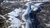
 It starts on Range Road 85 at a creek crossing, south from there Weyerhaeuser Canada Corporation maintains a network of forestry roads, extending approximately 100 km (62.1 mi) south to the Two Lakes Provincial Park
and Nose Mountain camping areas, and further to the 30 m (98.4 ft) high Kakwa Falls on the Kakwa River
. Highway 666 travels north east on Township Road 692, Range Road 82, and Township Road 700, to the hamlet of Grovedale
. It then follows the south bank of Wapiti River
, with O'Brien Provincial Park
in between, before meeting up with Highway 40. The Highway 40 bridge over Wapiti River south of Grande Prairie
also crosses Highway 666, and with separate northbound and southbound exits to Hwy 666, it makes a Trumpet/Directional-T hybrid.
It is used by Forestry and the Oil and Gas industry working in the area of the Wapiti River valley, as well as for recreational use (two summer campgrounds are open in this wilderness area). It is paved for its entire length.
Alberta
Alberta is a province of Canada. It had an estimated population of 3.7 million in 2010 making it the most populous of Canada's three prairie provinces...
, Canada
Canada
Canada is a North American country consisting of ten provinces and three territories. Located in the northern part of the continent, it extends from the Atlantic Ocean in the east to the Pacific Ocean in the west, and northward into the Arctic Ocean...
. It runs mostly west-east, on mostly existing township and range roads in the M.D. of Greenview
Greenview No. 16, Alberta
The Municipal District of Greenview No. 16 is a municipal district in northwest Alberta, Canada.It covers the full extent of Census Division 18. The municipal seat is in Valleyview.- Demographics :...
in Northern Alberta
Northern Alberta
Northern Alberta is a region located in the Canadian province of Alberta.Its primary industry is oil and gas, with large heavy oil reserves being exploited at the Athabasca Oil Sands and Wabasca Area in the east of the region...
, for 37 km. The name highway 666 is often avoided, due to its association with the Number of the Beast
Number of the Beast
The Number of the Beast is a term in the Book of Revelation, of the New Testament, that is associated with the first Beast of Revelation chapter 13, the Beast of the sea. In most manuscripts of the New Testament and in English translations of the Bible, the number of the Beast is...
. However, Alberta numbers its west-east minor highways from south to north, and decided not to skip 666 despite skipping numerous other numbers.
Route description
Two Lakes Provincial Park
Two Lakes Provincial Park is a provincial park in Alberta, Canada, located south of Grande Prairie, south of Highway 666 and an additional south on forestry roads, where 4WD is recommended for access....
and Nose Mountain camping areas, and further to the 30 m (98.4 ft) high Kakwa Falls on the Kakwa River
Kakwa River
Kakwa River is a river in western Alberta, Canada. It is a major tributary of the Smoky River.Tourism along the river revolves around bull trout fishing and white water rafting. Kakwa Falls are developed in the course of the river, over a high ledge formed by an outcrop of the Cadomin Formation....
. Highway 666 travels north east on Township Road 692, Range Road 82, and Township Road 700, to the hamlet of Grovedale
Grovedale, Alberta
Grovedale is a hamlet in northern Alberta, Canada within the Municipal District of Greenview No. 16. It is located on Highway 666 south of Grande Prairie...
. It then follows the south bank of Wapiti River
Wapiti River
Wapiti River is a river in eastern British Columbia and western Alberta, Canada. It is a major tributary of the Smoky River, located in the southern area of the Peace River Basin.Wapiti is named after the Cree word for elk .-Course:...
, with O'Brien Provincial Park
O'Brien Provincial Park
O'Brien Provincial Park is a provincial park in Alberta, Canada, located south from Grande Prairie, on Highway 666.The park is situated in the Wapiti River valley, at an elevation of and has a surface of...
in between, before meeting up with Highway 40. The Highway 40 bridge over Wapiti River south of Grande Prairie
Grande Prairie, Alberta
Grande Prairie is a city in the northwestern part of the province of Alberta in Western Canada. It is located on the southern edge of the Peace River Country . The city is surrounded by the County of Grande Prairie No...
also crosses Highway 666, and with separate northbound and southbound exits to Hwy 666, it makes a Trumpet/Directional-T hybrid.
It is used by Forestry and the Oil and Gas industry working in the area of the Wapiti River valley, as well as for recreational use (two summer campgrounds are open in this wilderness area). It is paved for its entire length.
Major intersections
Starting from the west end of Highway 666:| County | km Exit number An exit number is a number assigned to a road junction, usually an exit from a freeway. It is usually marked on the same sign as the destinations of the exit, as well as a sign in the gore.... |
Intersecting road | Notes | Coordinates |
|---|---|---|---|---|
| M.D. of Greenview Greenview No. 16, Alberta The Municipal District of Greenview No. 16 is a municipal district in northwest Alberta, Canada.It covers the full extent of Census Division 18. The municipal seat is in Valleyview.- Demographics :... |
0 | Creek | South to Two Lakes Provincial Park Two Lakes Provincial Park Two Lakes Provincial Park is a provincial park in Alberta, Canada, located south of Grande Prairie, south of Highway 666 and an additional south on forestry roads, where 4WD is recommended for access.... |
54°57′3"N 119°11′44"W |
| 1 | Township Road 692 | 54°58′0"N 119°11′17"W | ||
| 6 | Range Road 82 | 54°58′21"N 119°7′11"W | ||
| 12 | Township Road 700 | 55°1′30"N 119°6′48"W | ||
| 29 | Range Road 64 | Grovedale Grovedale, Alberta Grovedale is a hamlet in northern Alberta, Canada within the Municipal District of Greenview No. 16. It is located on Highway 666 south of Grande Prairie... |
55°1′24"N 118°51′55"W | |
| 32 | Road | O'Brien Provincial Park O'Brien Provincial Park O'Brien Provincial Park is a provincial park in Alberta, Canada, located south from Grande Prairie, on Highway 666.The park is situated in the Wapiti River valley, at an elevation of and has a surface of... |
55°3′18"N 118°51′27"W | |
| 37 | SB to WB | 55°4′16"N 118°48′7"W | ||
| NB to WB, EB to NB, EB to SB | 55°4′18"N 118°47′46"W |