
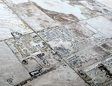
Langdon, Alberta
Encyclopedia
Langdon is a hamlet
Hamlet (place)
A hamlet is usually a rural settlement which is too small to be considered a village, though sometimes the word is used for a different sort of community. Historically, when a hamlet became large enough to justify building a church, it was then classified as a village...
in southern Alberta
Alberta
Alberta is a province of Canada. It had an estimated population of 3.7 million in 2010 making it the most populous of Canada's three prairie provinces...
, Canada
Canada
Canada is a North American country consisting of ten provinces and three territories. Located in the northern part of the continent, it extends from the Atlantic Ocean in the east to the Pacific Ocean in the west, and northward into the Arctic Ocean...
under the jurisdiction of Rocky View County.
At an elevation of 1005 metres (3,297.2 ft), Langdon is located 12 kilometres (7.5 mi) east of the City of Calgary
Calgary
Calgary is a city in the Province of Alberta, Canada. It is located in the south of the province, in an area of foothills and prairie, approximately east of the front ranges of the Canadian Rockies...
at the intersection of Highways 560
Alberta Highway 560
Alberta Provincial Highway No. 560 is a highway in the province of Alberta, Canada. It runs west-east from the east Calgary boundary at 84 Street SE , north along the city boundary to Range Road 284, across Highway 791 south of Chestermere to the southern terminus of the northern section of Highway...
(Glenmore Trail) and 797, 6.4 kilometres (4 mi) south of the Trans Canada Highway and 6.5 kilometres (4 mi) north of Highway 22X.
The hamlet is located in census division
Census division
Census division is an official term in Canada and the United States. The census divisions of Canada are second-level census geographic unit, below provinces and territories, and above "census subdivisions" and "dissemination areas". In provinces where they exist, the census division may correspond...
No. 6
Division No. 6, Alberta
Division No. 6 is a census division in Alberta, Canada. Surrounding the City of Calgary, the majority of the division comprises Alberta's Calgary Region, while the northern portion of the division is located within central Alberta. The division also forms the southern segment of the...
and in the federal riding
Alberta federal electoral districts
As of 2006, the province of Alberta has 28 electoral districts represented in the Canadian House of Commons.*Calgary Centre*Calgary Centre-North*Calgary East*Calgary Northeast*Calgary Southeast*Calgary Southwest*Calgary West*Calgary—Nose Hill*Crowfoot...
of Crowfoot
Crowfoot (electoral district)
Crowfoot is a federal electoral district in Alberta, Canada, that has been represented in the Canadian House of Commons since 1968.It is in the central part of the province, and is named in honour of Chief Crowfoot, leader of the Blackfoot First Nations in the 19th century.This electoral district...
.
Langdon is one of the fastest growing hamlets in the Calgary Region
Calgary Region
The Calgary Region is an area centred around Calgary, Alberta, Canada. It consists of the City of Calgary, Rocky View County and the municipalities it encloses, and the Municipal District of Foothills No. 31 and the municipalities it encloses. The Calgary Census Metropolitan Area and Calgary...
and Alberta.
History
Langdon was named for R.B. Langdon of Langdon & Shepard, Canadian Pacific RailwayCanadian Pacific Railway
The Canadian Pacific Railway , formerly also known as CP Rail between 1968 and 1996, is a historic Canadian Class I railway founded in 1881 and now operated by Canadian Pacific Railway Limited, which began operations as legal owner in a corporate restructuring in 2001...
subcontracting firm who built a section of the line just east of Calgary
Calgary
Calgary is a city in the Province of Alberta, Canada. It is located in the south of the province, in an area of foothills and prairie, approximately east of the front ranges of the Canadian Rockies...
. Both the Langdon and Shepard stations took their names from these men. Langdon was one of two people to turn the first sod in the settlement in 1882. A year later, a railway station was set up in a boxcar and named after him.
A post office was established on January 1, 1890. By the year 1905, Langdon and nearby Cheadle
Cheadle, Alberta
Cheadle is a hamlet in Alberta, Canada, within Wheatland County. It is located on Highway 24, south of the Highway 1 and approximately east of the City of Calgary....
were of equal size, and were both important stops along the CPR
Canadian Pacific Railway
The Canadian Pacific Railway , formerly also known as CP Rail between 1968 and 1996, is a historic Canadian Class I railway founded in 1881 and now operated by Canadian Pacific Railway Limited, which began operations as legal owner in a corporate restructuring in 2001...
rail line.
The community of Langdon became known as the “good luck town” because in the twenty-five years between 1883 and 1908, there was not one death. It was also considered lucky because it was situated on the railroad’s horseshoe shaped turnaround.
After a long period of stagnation, Langdon began to grow again in the 1990s and 2000s, with a number of major residential developments under way. This is due to its proximity to Calgary, and like other towns near Calgary, it is becoming a bedroom community.
A new commercial development currently under construction is being designed as a reconstruction of the way Langdon's main street looked in 1908..
Amenities
Due to its close proximity to Calgary, Langdon has been rather slow in developing its local amenities. However, it now boasts most of the basic needs of a community its size, including the well utilized Langdon School (K-8), a bakery/deli, pharmacy, gas station/grocery store, various restaurants, and other assorted merchants.As of 2007 Langdon also has a golf course in its borders. Boulder Creek Golf Course is located at the southern edge of the hamlet.
Demographics
As of 2006, Langdon had a total population of 2,595 living in 811 dwellings. With a land area of 3.33 km² (1.3 sq mi), it has a population densityPopulation density
Population density is a measurement of population per unit area or unit volume. It is frequently applied to living organisms, and particularly to humans...
of 779.3 /km2.
These figures were derived from summing Langdon's urban area Statistics Canada
Statistics Canada
Statistics Canada is the Canadian federal government agency commissioned with producing statistics to help better understand Canada, its population, resources, economy, society, and culture. Its headquarters is in Ottawa....
data with its designated place
Designated place
A designated place or DPL is a type of community or populated area identified by Statistics Canada for statistical purposes. DPLs are delineated for each decennial census as the statistical counterparts of incorporated places such as cities, towns and villages.DPLs are communities that lack...
Statistics Canada data. More specifically:
- the Langdon urban area had a total population of 2,380 living in 739 dwellings within a land area of 1.8 km² (0.694983885466563 sq mi), resulting in a population densityPopulation densityPopulation density is a measurement of population per unit area or unit volume. It is frequently applied to living organisms, and particularly to humans...
of 1322.2 /km2; and - the Langdon designated place had a total population of 215 living in 72 dwellings within a land area of 1.53 km² (0.590736302646579 sq mi), resulting in a population densityPopulation densityPopulation density is a measurement of population per unit area or unit volume. It is frequently applied to living organisms, and particularly to humans...
of 140.1 /km2.
Langdon's urban area and designated place boundaries are contiguous with no overlaps.
Industry Canada shows that Langdon's greater rural area had a total population of 2,376 living in 777 dwellings in 2001. With a land area of 142.7 km² (55.1 sq mi), its greater rural area had a population density
Population density
Population density is a measurement of population per unit area or unit volume. It is frequently applied to living organisms, and particularly to humans...
of 6 /km2.