
Sundre, Alberta
Encyclopedia
Sundre is a town in central Alberta
Central Alberta
Central Alberta is a region located in the Canadian province of Alberta.Central Alberta is the most densely populated rural area in the province...
, Canada
Canada
Canada is a North American country consisting of ten provinces and three territories. Located in the northern part of the continent, it extends from the Atlantic Ocean in the east to the Pacific Ocean in the west, and northward into the Arctic Ocean...
. It is located in Mountain View County
Mountain View County, Alberta
Mountain View County is a municipal district in Division No. 6 in the central Alberta, Canada. It is located between the cities of Calgary and Red Deer within the Calgary-Edmonton corridor. Mountain View County is a member of the Central Alberta Economic Partnership, Alberta Association of...
, 130 km (80.8 mi) northwest from Calgary
Calgary
Calgary is a city in the Province of Alberta, Canada. It is located in the south of the province, in an area of foothills and prairie, approximately east of the front ranges of the Canadian Rockies...
, along the Cowboy Trail in the Canadian Rockies
Canadian Rockies
The Canadian Rockies comprise the Canadian segment of the North American Rocky Mountains range. They are the eastern part of the Canadian Cordillera, extending from the Interior Plains of Alberta to the Rocky Mountain Trench of British Columbia. The southern end borders Idaho and Montana of the USA...
foothills.
Sundre takes its name from a town in Norway, the original home of Nels T. Hagen, the town's first postmaster, who arrived in 1906. Sundre became a village in 1950, and a town in 1956.
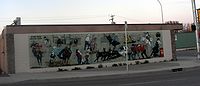
Main industries in the area are petroleum production, forestry, agriculture, and ranching.
Demographics
House
A house is a building or structure that has the ability to be occupied for dwelling by human beings or other creatures. The term house includes many kinds of different dwellings ranging from rudimentary huts of nomadic tribes to free standing individual structures...
, a 10.6% increase from 2001. The town has a land area of 7.65 km² (3 sq mi) and a population density
Population density
Population density is a measurement of population per unit area or unit volume. It is frequently applied to living organisms, and particularly to humans...
of 329.3 /km2.