
Wrentham, Alberta
Encyclopedia
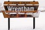
Wrentham is a hamlet
Hamlet (place)
A hamlet is usually a rural settlement which is too small to be considered a village, though sometimes the word is used for a different sort of community. Historically, when a hamlet became large enough to justify building a church, it was then classified as a village...
in southern Alberta
Southern Alberta
Southern Alberta is a region located in the Canadian province of Alberta. As of the year 2004, the region's population was approximately 272,017. The primary cities are Lethbridge and Medicine Hat...
, Canada
Canada
Canada is a North American country consisting of ten provinces and three territories. Located in the northern part of the continent, it extends from the Atlantic Ocean in the east to the Pacific Ocean in the west, and northward into the Arctic Ocean...
within the County of Warner No. 5
Warner County No. 5, Alberta
The County of Warner No. 5 is a municipal district in southern Alberta, Canada.It is located in Census Division 2, just north of the United States border. Warner was organised as a rural municipality since 1912, and established in the actual borders since 1954. The seat of the municipality is...
. It is located southeast of the intersection of the Veteran Memorial Highway (Highway 36) and the historic Red Coat Trail (Highway 61), approximately 25 kilometres (15.5 mi) east of the Village of Stirling
Stirling, Alberta
Stirling is a village in the County of Warner No. 5, Alberta, Canada. The village is located on Highway 4, approximately southeast of Lethbridge and northwest of the United States-Canada border....
, 30 kilometres (18.6 mi) south of the Town of Taber and 55 kilometres (34.2 mi) west of the Village of Foremost
Foremost, Alberta
- See also :* List of communities in Alberta* List of villages in Alberta* Foremost Formation* Foremost Airport- External links :* * AlbertaFirst....
.
The hamlet was named by the C.P.R. after Wrentham
Wrentham, Suffolk
Wrentham is a village in the north-east of the English county of Suffolk. Wrentham is located about 2 miles from the coast along the A12 trunk road...
, a village in Suffolk, England.
The hamlet is located in census division
Census division
Census division is an official term in Canada and the United States. The census divisions of Canada are second-level census geographic unit, below provinces and territories, and above "census subdivisions" and "dissemination areas". In provinces where they exist, the census division may correspond...
No. 2
Division No. 2, Alberta
Division No. 2 is a census division in Alberta, Canada. It is located in the south-central portion of southern Alberta and includes the City of Lethbridge.- Census subdivisions :...
and in the federal riding
Alberta federal electoral districts
As of 2006, the province of Alberta has 28 electoral districts represented in the Canadian House of Commons.*Calgary Centre*Calgary Centre-North*Calgary East*Calgary Northeast*Calgary Southeast*Calgary Southwest*Calgary West*Calgary—Nose Hill*Crowfoot...
of Lethbridge
Lethbridge (electoral district)
Lethbridge is a federal electoral district in Alberta, Canada, that has been represented in the Canadian House of Commons since 1917...
.
Demographics
Statistics Canada has not recently published a population for Wrentham.Industry Canada shows that Wrentham's greater rural area had a total population of 439 living in 103 dwellings in 2001. With a land area of 503.2 km² (194.3 sq mi), its greater rural area has a population density
Population density
Population density is a measurement of population per unit area or unit volume. It is frequently applied to living organisms, and particularly to humans...
of 2 /km2.
Regional attractions
Devil's Coulee Dinosaur Heritage Museum:The Devil's Coulee Dinosaur Heritage Museum
Devil's Coulee Dinosaur Heritage Museum
Devil's Coulee Dinosaur Heritage Museum, located in Warner, Alberta, Canada, is a key historic site in southern Alberta. In 1997, ten fossilized dinosaur eggs, believed to have come from a Hadrosaur, specifically a Hypacrosaurus were found at Devil's Coulee site...
features a Hadrosaur (duck-billed dinosaur) nest and embryo, ancient fossils, dinosaur models, located in the Warner
Warner, Alberta
Warner is a village in southern Alberta, Canada. It is located in County of Warner, approximately 65 km south of the city of Lethbridge. Warner is a farming community. Warner is situated at the intersection of Highway 4 and Highway 36, about 38 km north of the Montana border and...
.
Galt Historic Railway Park:
The Galt Historic Railway Park
Galt Historic Railway Park
The Galt Historic Railway Park, collects, preserves, restores, exhibits and interprets artifacts which represent the history and social impact of the "steam" era in southern Alberta and the coal era with emphasis on Galt Railway and the 1890 International Train Station Depot North West Territories...
located 1 km north of Stirling
Stirling, Alberta
Stirling is a village in the County of Warner No. 5, Alberta, Canada. The village is located on Highway 4, approximately southeast of Lethbridge and northwest of the United States-Canada border....
is another popular museum which displays of life and travel in the 1880s to 1920s are set up in the restored 1890 North West Territories International Train Station from Coutts, Alberta
Coutts, Alberta
Coutts is a village in Alberta and the location of one of the busiest Canada – US border crossings in western Canada. It connects Highway 4 to Interstate 15, an important trade route between Alberta, American states along I-15, and Mexico.In 2004, a joint border facility opened in Coutts-Sweet...
, and Sweetgrass, Montana
Sweetgrass, Montana
Sweet Grass is an unincorporated community in Toole County, Montana, United States, on the Canada-US border. It is the northern terminus of Interstate 15, an important route connecting western Canada, the western United States, and Mexico.In 2004, a joint border facility opened at the Sweetgrass...
. The station was moved to the current location near Stirling in 2000 and is in the process of restoration. Future plans include moving the 1915 Ogilvie grain elevator from Wrentham for display along the station in the 36 acres (145,687 m²) park, and developing a railcar dining car facility using vintage Canadian Pacific Railway
Canadian Pacific Railway
The Canadian Pacific Railway , formerly also known as CP Rail between 1968 and 1996, is a historic Canadian Class I railway founded in 1881 and now operated by Canadian Pacific Railway Limited, which began operations as legal owner in a corporate restructuring in 2001...
dining cars.
Stirling Agricultural Village:
Stirling Agricultural Village
Stirling Agricultural Village
Stirling Agricultural Village is a National Historic Site of Canada, and was listed as one of only three communities in Canada designated as a National Historic Site because of the community’s well preserved settlement pattern that follows the Plat of Zion model...
is a National Historic Site of Canada, and was listed as one of only three communities in Canada
Canada
Canada is a North American country consisting of ten provinces and three territories. Located in the northern part of the continent, it extends from the Atlantic Ocean in the east to the Pacific Ocean in the west, and northward into the Arctic Ocean...
designated as a National Historic Site because of the community’s well preserved settlement pattern that follows the Plat of Zion model. Located within the village are two museums and the Michelsen Farmstead
Michelsen Farmstead
The Andreas Michelsen Farmstead, originally built in 1902 by Andreas himself as a two room house. In 1912 the house was added onto, to make 7 rooms in total, little has changed since...
, a totally restored 1900s home showcasing rural life in Alberta in the 1930s. Listed as a Provincial Historic Site in 2001., and the Galt Historic Railway Park.
Warner elevator row:
The Warner elevator row
Warner elevator row
Warner elevator row is a row of historic wood-cribbed grain elevators with six elevators all standing in a row from south to north, alongside the Canadian Pacific Railway, that travels from Great Falls, Montana to Lethbridge, Alberta, on the east entrance of the village of Warner, Alberta, Canada...
is a row of historic wood-cribed grain elevators. A total of six elevators still stand in a row from south to north alongside the Canadian Pacific Railway
Canadian Pacific Railway
The Canadian Pacific Railway , formerly also known as CP Rail between 1968 and 1996, is a historic Canadian Class I railway founded in 1881 and now operated by Canadian Pacific Railway Limited, which began operations as legal owner in a corporate restructuring in 2001...
on the east entrance of the village of Warner
Warner, Alberta
Warner is a village in southern Alberta, Canada. It is located in County of Warner, approximately 65 km south of the city of Lethbridge. Warner is a farming community. Warner is situated at the intersection of Highway 4 and Highway 36, about 38 km north of the Montana border and...
. Due to the loss of a vast amount of Alberta's many grain elevators, the elevator row in Warner remains the very last row of elevators in Alberta. Only two elevator rows remain in Canada, the other located in Inglis, Manitoba
Inglis elevator row
Inglis elevator row is a row of five grain elevators standing in a row from south to north alongside the former Canadian Pacific Railway track bed, on the southeast edge of the village of Inglis, Manitoba, Canada. Because so many grain elevators have been demolished throughout Western Canada, only...
.
Waterton Lakes National Park
Waterton Lakes National Park
Waterton Lakes National Park
Waterton Lakes National Park is a national park located in the southwest corner of Alberta, Canada, and borders Glacier National Park in Montana, USA. Waterton was Canada's fourth national park, formed in 1895 and named after Waterton Lake, in turn after the Victorian naturalist and conservationist...
is a National Park located in the extreme southwest corner of Alberta, Canada, 40 km west of Cardston
Cardston, Alberta
-Demographics:The population of the Town of Cardston according to its 2007 municipal census is 3,578.In 2006, it had a population of 3,452 living in 1,234 dwellings, a 0.7% decrease from 2001...
, and borders Glacier National Park
Glacier National Park (Canada)
Glacier National Park is one of seven national parks in British Columbia, and is part of a system of 43 parks and park reserves across Canada. It protects a portion of the Columbia Mountains. It also contains the Rogers Pass National Historic Site, designated for its importance in the construction...
in Montana, USA. Waterton Lake
Waterton Lake
Waterton Lake is a mountain lake in southern Alberta, Canada and northern Montana, USA. The lake is composed of two bodies of water, connected by a shallow channel known locally as the Bosphorus. The two parts are referred to as Lower Wateron Lake, and Upper Waterton Lake, the latter of which is...
s was Canada's fourth National Park formed in 1895. The Rocky Mountains
Rocky Mountains
The Rocky Mountains are a major mountain range in western North America. The Rocky Mountains stretch more than from the northernmost part of British Columbia, in western Canada, to New Mexico, in the southwestern United States...
rise suddenly out of the rolling prairies in the park. Amid the peaks are the three Waterton Lake
Waterton Lake
Waterton Lake is a mountain lake in southern Alberta, Canada and northern Montana, USA. The lake is composed of two bodies of water, connected by a shallow channel known locally as the Bosphorus. The two parts are referred to as Lower Wateron Lake, and Upper Waterton Lake, the latter of which is...
s, carved out of the rock by ancient glacier
Glacier
A glacier is a large persistent body of ice that forms where the accumulation of snow exceeds its ablation over many years, often centuries. At least 0.1 km² in area and 50 m thick, but often much larger, a glacier slowly deforms and flows due to stresses induced by its weight...
s.
Writing On Stone Provincial Park
Writing-on-Stone Provincial Park
Writing-on-Stone Provincial Park
Writing-on-Stone Provincial Park is located about 100 kilometres southeast of Lethbridge, Alberta, Canada or 44 kilometres east of the community of Milk River, and straddles the Milk River itself. It is one of the largest areas of protected prairie in the Alberta park system, and serves as both a...
, is one of the largest areas of protected prairie in the Alberta park system, and serves as both a nature preserve and protection for the largest concentration of rock art
Rock art
Rock art is a term used in archaeology for any human-made markings made on natural stone. They can be divided into:*Petroglyphs - carvings into stone surfaces*Pictographs - rock and cave paintings...
, created by Plains People. There are over 50 rock art sites, with thousands of figures, as well as numerous archeological sites.