
Red Coat Trail
Encyclopedia
route that approximates the path taken in 1874 by the North-West Mounted Police in their quest to bring law and order to the Canadian West.
Travel route
A number of highways in southern ManitobaManitoba
Manitoba is a Canadian prairie province with an area of . The province has over 110,000 lakes and has a largely continental climate because of its flat topography. Agriculture, mostly concentrated in the fertile southern and western parts of the province, is vital to the province's economy; other...
, Saskatchewan
Saskatchewan
Saskatchewan is a prairie province in Canada, which has an area of . Saskatchewan is bordered on the west by Alberta, on the north by the Northwest Territories, on the east by Manitoba, and on the south by the U.S. states of Montana and North Dakota....
and Alberta
Alberta
Alberta is a province of Canada. It had an estimated population of 3.7 million in 2010 making it the most populous of Canada's three prairie provinces...
roughly follow the original route.
In Alberta, the trail follows Highways 3, 4, 61, 889, and 501
Alberta Highway 501
Alberta Provincial Highway No. 501 is a highway in the province of Alberta, Canada. It runs west-east from Highway 5 east of Mountain View as gravel to Cardston, then pavement through Del Bonita and Milk River to Highway 879, then gravel again to the Saskatchewan border.It is also known as 9 Avenue...
.
In Saskatchewan
Saskatchewan
Saskatchewan is a prairie province in Canada, which has an area of . Saskatchewan is bordered on the west by Alberta, on the north by the Northwest Territories, on the east by Manitoba, and on the south by the U.S. states of Montana and North Dakota....
, Highway 13
Saskatchewan Highway 13
Highway 13 is a highway in the Canadian province of Saskatchewan. It runs from the Alberta border until it transitions into Highway 2 at the Manitoba border near Antler. Highway 13 is about 676 km long.Highway 13 passes through Shaunavon, Assiniboia, Weyburn, Redvers and Carlyle...
is designated as Red Coat Trail. The travel corridor from the Manitoba—Saskatchewan border to Winnipeg
Winnipeg
Winnipeg is the capital and largest city of Manitoba, Canada, and is the primary municipality of the Winnipeg Capital Region, with more than half of Manitoba's population. It is located near the longitudinal centre of North America, at the confluence of the Red and Assiniboine Rivers .The name...
follows Manitoba PTH 2.Winnipeg: Established 1738 as Fort Rouge
Fort Rouge (fortification)
Fort Rouge was a fort located on the Assiniboine River in Manitoba, Canada, on the site of what is now the city of Winnipeg. Its exact location is unknown. Its name in English means "red fort"....
; renamed 1822 Fort Garry
Fort Garry
Fort Garry, also known as Upper Fort Garry, was a Hudson's Bay Company trading post at the confluence of the Red and Assiniboine rivers in what is now downtown Winnipeg. It was established in 1822 on or near the site of the North West Company's Fort Gibraltar. Fort Garry was named after Nicholas...
; incorporated in 1873 as the City of Winnipeg
Winnipeg
Winnipeg is the capital and largest city of Manitoba, Canada, and is the primary municipality of the Winnipeg Capital Region, with more than half of Manitoba's population. It is located near the longitudinal centre of North America, at the confluence of the Red and Assiniboine Rivers .The name...
.
Alberta
Near Fort MacLeodFort Macleod, Alberta
Fort Macleod is a town in the southwest corner of the province of Alberta, Canada. It was founded as a North-West Mounted Police barracks, and is named in honour of the North-West Mounted Police Colonel James Macleod. The town's current mayor is Shawn Patience.- History and heritage preservation...
, the traffic volume is between 4,200 and 7,900 vehicles per day (vpd) according to the 2007 Average Annual Daily Traffic report which is quite consistent for the decade. The area is a short grass prairie ecosystem
Ecosystem
An ecosystem is a biological environment consisting of all the organisms living in a particular area, as well as all the nonliving , physical components of the environment with which the organisms interact, such as air, soil, water and sunlight....
with black soils and is conducive to grain growing. Located at the junction of Hwy 2 and the Red Coat Trail, Fort Macleod
Fort Macleod, Alberta
Fort Macleod is a town in the southwest corner of the province of Alberta, Canada. It was founded as a North-West Mounted Police barracks, and is named in honour of the North-West Mounted Police Colonel James Macleod. The town's current mayor is Shawn Patience.- History and heritage preservation...
currently has a population of over 3,000 residents Head-Smashed-In Buffalo Jump
Head-Smashed-In Buffalo Jump
Head-Smashed-In Buffalo Jump is a buffalo jump located where the foothills of the Rocky Mountains begin to rise from the prairie 18 km northwest of Fort Macleod, Alberta, Canada on highway 785...
is a major attraction 20 miles (32.2 km) northwest of town. Between Fort Macleod, and Lethbridge, the Red Coat Trail runs concurrent
Concurrency (road)
A concurrency, overlap, or coincidence in a road network is an instance of one physical road bearing two or more different highway, motorway, or other route numbers...
with the Crowsnest Highway
Crowsnest Highway
The Crowsnest Highway, also known as the Interprovincial or, in British Columbia, the Southern Trans-Provincial, is an east-west highway, in length, through the southern parts of British Columbia and Alberta, providing the shortest highway connection between British Columbia's Lower Mainland and...
traveling through the Porcupine Hills, the Coyote Flats, and a ghost town named Pearce only marked by a railway crossing and a few farms. D.M. Wilson says it best, "beneath the Highway's pavement is perhaps 50 metres (164 ft) of glacial till consisting of sand and gravel, clays and boulder clays, humped into hills by the las continental glacier perhaps as it melted away to the northward some 11,000 years ago, overlaying some 10000 feet (3,048 m) of sedimentary Púleozoic and Mesozoic strata which themselves rest on Precambrian granites. Beyond the low ridge on the far side of the cut-bank'd Oldman, an enormously rich bed of lacustrine loam began attracting settlers in the early 19-aughts and rewards so well still the agriucltural efforts of their descendants....the hills are actually longitudinal dunes of loess
Loess
Loess is an aeolian sediment formed by the accumulation of wind-blown silt, typically in the 20–50 micrometre size range, twenty percent or less clay and the balance equal parts sand and silt that are loosely cemented by calcium carbonate...
picked up from a nearby lakebed..." The highway raises in elevation between the Oldman River and the Belly River watersheds and to the north of the highway is the CP Rail High Level trestle bridge of 1909. Currently the bridge has a well-developed trail system through the river valley and the Helen Schuler Coulee Center and Sir Alexander Galt Museum are located nearby. The Hwy 3A
Alberta Highway 3A
Highway 3A is a spur of the Crowsnest Highway in four different segments within southern Alberta. All four segments are previous alignments of the Crowsnest Highway....
alternate route carries traffic across the Oldman River on a 1997 four-lane traffic which re-routed the highway from its old course over the 1957 narrow bridge. This area features a sandstone quarry which was used for construction projects as early as 1904 and a defunct community known as Nevarre changing names to Staunton. AB Hwy 3A continues on to the village of Monarch which is just north of the confluence of the Oldman River and Belly rivers and halfway between Fort Macleod and Lethbridge. North of Monarch on Hwy 23 and west of the village, the traffic volume is around 500 AADT, however following the Red Coat Trail into Lethbridge, the volume increases to over 5,000 vpd. Between Monarch and Coalhurst, the Red Coat Trail is a twinned highway
Dual carriageway
A dual carriageway is a class of highway with two carriageways for traffic travelling in opposite directions separated by a central reservation...
and between Coalhurst, and Lethbridge a multilane divided highway. West of Coalhurst, traffic volume is about 15,000 vpd, and to the east rises to approximately 18,000 vpd. Oil, flax, wheat and sugar beets are the staples of the agricultural economy supplemented by gas and oil in 1974 which replaced the sugar beet harvests. The city
City
A city is a relatively large and permanent settlement. Although there is no agreement on how a city is distinguished from a town within general English language meanings, many cities have a particular administrative, legal, or historical status based on local law.For example, in the U.S...
of Lethbridge, is locagted at the junction of AB Hwy 4, Hwy 5 and Hwy 3. Travel along the Red Coat Trail corridor leaves Hwy 3 and continues on Hwy 4 south east towards Stirling
Stirling, Alberta
Stirling is a village in the County of Warner No. 5, Alberta, Canada. The village is located on Highway 4, approximately southeast of Lethbridge and northwest of the United States-Canada border....
, with a traffic volume around 5,500 vpd. Whence at Stirling, the Red Coat Trail travel corridor leaves Hwy 4 and now continues east along Hwy 61 towards the small hamlet of Wrentham
Wrentham, Alberta
Wrentham is a hamlet in southern Alberta, Canada within the County of Warner No. 5. It is located southeast of the intersection of the Veteran Memorial Highway and the historic Red Coat Trail , approximately east of the Village of Stirling, south of the Town of Taber and west of the Village of...
at the junction of Hwy 36. Between Stirling and Wrentham the traffic volume declines to an AADT of about 550 vpd on a secondary undivided paved highway. The Red Coat Trail runs parallel and north of the Etzikom Coulee and Crow Indian Lake and to the north of the Red Coat Trail are the Chin Lakes and the Chin Reservoir. Coulees are meltwater channels produced by glacier meltoff forming long river valleys. A number of these coulees are dry or almost dry, and some such as the Chin Lakes have been formed by the Chin Reservoir. The weather of southeast Alberta is warmer than the rest of the province, with lower annual precipitation creating a grassland ecoregion. At the junction of the Red Coat Trail and Hwy 877 is the small hamlet of Skiff, population 10, with a declining AADT between 350 to 400 vpd. The village of Foremost
Foremost, Alberta
- See also :* List of communities in Alberta* List of villages in Alberta* Foremost Formation* Foremost Airport- External links :* * AlbertaFirst....
is located at the junction with Hwy 879 near 40 miles (64.4 km) park, and Writing-on-Stone Provincial Park. Etzikom on the intersection of the Red Coat Trail and AB Hwy 855
Alberta Highway 855
Alberta Provincial Highway No. 855 is a highway in the province of Alberta, Canada. It runs south-north from Highway 9 west of Hanna to Highway 55 and Highway 63 in Atmore. It provides access to rural areas, and is gravel at both its south and north ends...
features the Etzikom Museum and the Canadian National Historical Windmill Center. Orion, a small hamlet with a population of less than 10 residents, is located at the intersection of AB Hwy 887 and the Red Coat Trail. The traffic between Orion and the Saskatchewan border is very low averaging between 70 to 100 vpd. Manyberries
Manyberries, Alberta
- References :...
is located at the eastern terminus of AB Hwy 61 travel on the Red Coat Trail continues south on Hwy 889 a secondary connector road to meet with Hwy 501
Alberta Highway 501
Alberta Provincial Highway No. 501 is a highway in the province of Alberta, Canada. It runs west-east from Highway 5 east of Mountain View as gravel to Cardston, then pavement through Del Bonita and Milk River to Highway 879, then gravel again to the Saskatchewan border.It is also known as 9 Avenue...
, a secondary gravel highway to the Alberta—Saskatchewan border.
Saskatchewan
There are 36 communities along the 676 kilometres (420 mi) of the Saskatchewan portion of the Red Coat Trail which would be one approximately every 20 kilometres (12.4 mi) apart, and there are 59 at grade intersections with primary and secondary highways which would be a junction approximately every 10 kilometres (6.2 mi). The highway volume beginning in Saskatchewan along the Red Coat Trail about 45 vpd on a class 4 gravel highway.SK Hwy 615 provides access north to Fort Walsh National Historic Park
Fort Walsh
Fort Walsh is a National Historic Site of Canada that was a North-West Mounted Police fort and the site of the Cypress Hills Massacre. Administered by Parks Canada, it forms a constituent part of Cypress Hills Interprovincial Park....
and the highest point of land in Saskatchewan. Travel is mainly east through the province of Saskatchewan on the Red Coat Trail which is continuous on SK Hwy 13 which is a secondary paved undivided highway until Weyburn
Weyburn, Saskatchewan
Weyburn is a city in southeastern Saskatchewan, Canada. It is located on the Souris River southeast of the provincial capital of Regina and is north of the border with the United States. The name is reputedly a corruption of the Scottish "wee burn," referring to a small creek. The city is...
. It is at the Consul
Consul, Saskatchewan
Consul is a small village located in the Rural Municipality of Reno No. 51 in the extreme southwest of Saskatchewan, Canada along the Redcoat Trail. It features one of the last existing grain elevators in the region.-Demographics:...
intersection of highways that the Red Coat Trail changes to a thin membrane surface undivided highway where the traffic volume increases to about 80 vpd. Travel continues north east until the junction with SK Hwy 21
Saskatchewan Highway 21
Highway 21 is a highway in the Canadian province of Saskatchewan. It runs from Montana Secondary Highway 233 at the United States border near Willow Creek to Highway 950/Highway 919 within the Meadow Lake Provincial Park. Highway 21 is about 722 km long.Highway 21 passes through the major...
which provides access to Cypress Hills Provincial Park and Maple Creek
Maple Creek, Saskatchewan
-History:After the North-West Mounted Police had been established at Fort Walsh, settlers began to explore the Cypress Hills area, living along the creeks and doing small-scale ranching. The Department of the Interior was operating a First Nations farm on the Maple Creek, a few miles south from...
. The Red Coat Trail continues east after this intersection on a class 3 granular pavement highway and traffic here increases to an AADT of 270 vpd. There is a junction with SK Hwy 18
Saskatchewan Highway 18
Highway 18 is a highway in the Canadian province of Saskatchewan. It runs from Highway 13 near Robsart to the Manitoba border near Gainsborough, where it becomes Highway 3. Highway 18 is about 714 km long.-Communities along the route:...
before the highway turns north again to arrive at the intersection of SK Hwy 614
Saskatchewan Highway 614
Highway 614 is a highway in the Canadian province of Saskatchewan. It runs from Highway 18 near Loomis to Highway 1 near Piapot. Highway 614 is about 110 km long....
and the town of Eastend
Eastend, Saskatchewan
-Infrastructure:The Saskatchewan Transportation Company provides intercity passenger and parcel express service to Eastend.-Attractions:Local Attractions:...
, which has the nickname Dino Country where a Tyrannosauraus rex
Tyrannosaurus
Tyrannosaurus meaning "tyrant," and sauros meaning "lizard") is a genus of coelurosaurian theropod dinosaur. The species Tyrannosaurus rex , commonly abbreviated to T. rex, is a fixture in popular culture. It lived throughout what is now western North America, with a much wider range than other...
was discovered spawning the T. rex Discovery Centre. A number of ancient fauna paleontological
Paleontology
Paleontology "old, ancient", ὄν, ὀντ- "being, creature", and λόγος "speech, thought") is the study of prehistoric life. It includes the study of fossils to determine organisms' evolution and interactions with each other and their environments...
dig sites exist in southern Saskatchewan.
This area of the Red Coat Trail receives an increase of traffic wherein about 300 vpd travel the Red Coat Trail east of Eastend and over 650 vpd east of town resulting in an upgrade to asphalt concrete
Asphalt concrete
Asphalt concrete is a composite material commonly used in construction projects such as road surfaces, airports and parking lots. It consists of asphalt and mineral aggregate mixed together, then laid down in layers and compacted...
road construction. The traffic volume entering Shaunavon is about 600 vpd, and the AADT increases to over 1,000 vpd heading north on the SK Hwy 37 and Red Coat Trail concurrency. SK Hwy 37 provides access to the town of Gull Lake
Gull Lake, Saskatchewan
-History:The history of the Gull Lake community dates back to 1906, when a development company Conrad and Price acquired and surveyed the town site and subdivided it into blocks. Unlike most other towns located along the C.P.R. main line, Gull Lake was not planned and established by the railroad....
and in 9.4 kilometres (5.8 mi), the Red Coat Trail turns east on a thin membrane surface class 2 highway bearing between 150 to 250 vpd. The Red Coat Trail is upgraded to a class 5 granular pavement as traffic can reach a high of 530 vpd east of this SK Hwy 4
Saskatchewan Highway 4
Highway 4 is a major highway in the Canadian province of Saskatchewan. It runs from U.S. Route 191 at the United States border near Monchy to Highway 224/Highway 904 at Meadow Lake Provincial Park. Highway 4 is about 653 km long....
intersection. To the north west of the SK Hwy 58
Saskatchewan Highway 58
Highway 58 is an oiled surface highway in the Canadian province of Saskatchewan which handles approximately 100 vehicles per day. It runs from Highway 18 3 kilometers west of Fir Mountain until Highway 1/Highway 19 near Chaplin in the South-Central area of the province. Highway 58 is about 132...
junction is Thomson Lake which is a man made lake used for recreational and reservoir purposes becoming the first regional park of Saskatchewan. Lafleche
Lafleche, Saskatchewan
Lafleche is a small community in southwest Saskatchewan, Canada. As of 2006, the population of Lafleche is 370.-Community profile:In 1913 the Canadian Pacific Railway came to Lafleche. In 1937 after eight consecutive crop failures, the once prosperous Lafleche district was near rock bottom...
at the junction with SK Hwy 58
Saskatchewan Highway 58
Highway 58 is an oiled surface highway in the Canadian province of Saskatchewan which handles approximately 100 vehicles per day. It runs from Highway 18 3 kilometers west of Fir Mountain until Highway 1/Highway 19 near Chaplin in the South-Central area of the province. Highway 58 is about 132...
, and east of this junction the AADT increases to over 600 vpd. The Louis Pierre Gravel National Historic Marker commemorates history at the north end of SK Hwy 58, and the Cripple Creek Provincial Historic Marker is located at the junction with the Red Coat Trail (the southern terminus of SK Hwy 58]].
The terrain of the Missouri Coteau features low hummocky, undulating, rolling hills, potholes, and grasslands. This physiographic region of Saskatchewan is the uplands Missouri Coteau, a part of the Great Plains Province or Alberta Plateau Region which extends across the south east corner of the province of Saskatchewan. SK Hwy 2
Saskatchewan Highway 2
Highway 2 is a provincial highway in the Canadian province of Saskatchewan. It is the longest Saskatchewan Highway, at 809 km . The highway is partially divided and undivided. However, only about near Moose Jaw, near Chamberlain, and near Prince Albert are divided highway...
and SK Hwy 717
Saskatchewan Highway 717
Highway 717 is a highway in the Canadian province of Saskatchewan. It runs from Highway 2 near Assiniboia to Highway 334 near Kayville. Highway 717 is about 68 km long....
come together at the town of Assinibioia
Assiniboia, Saskatchewan
Assiniboia is a town in south central Saskatchewan, Canada. It is located south-southwest of Moose Jaw beside Highway 2 and Highway 13.-History:...
. Just to the west of Assiniboia the traffic volume increases to about 1,000 vpd and to the east of town, the volume decreases to about 800 vpd and the majority of the highway is class 3 granular pavement.
The intersection with SK Hwy 621 north
Saskatchewan Highway 621
Highway 621 is a highway in the Canadian province of Saskatchewan. It is in two segments. The southern segment runs from Highway 13 to Highway 306 near Lewvan, and the northern segment runs from Highway 33 near Lajord to Highway 48...
is passed before arriving at the city
City
A city is a relatively large and permanent settlement. Although there is no agreement on how a city is distinguished from a town within general English language meanings, many cities have a particular administrative, legal, or historical status based on local law.For example, in the U.S...
of Weyburn
Weyburn, Saskatchewan
Weyburn is a city in southeastern Saskatchewan, Canada. It is located on the Souris River southeast of the provincial capital of Regina and is north of the border with the United States. The name is reputedly a corruption of the Scottish "wee burn," referring to a small creek. The city is...
which is on the intersection of SK Hwy 35
Saskatchewan Highway 35
Highway 35 is a paved undivided provincial highway in the Canadian province of Saskatchewan. It runs from the US Border near Port of Oungre to a dead end near the north shore of Tobin Lake. Saskatchewan Highway 35 SK Hwy 35) is about long. The CanAm Highway comprises Saskatchewan Highways 35,...
, SK Hwy 39
Saskatchewan Highway 39
Highway 39 is a provincial paved undivided highway located in the southern portion of the Canadian province of Saskatchewan connecting North Portal and Moose Jaw in the north. This is a primary Saskatchewan highway maintained by the provincial and national governments providing a major trucking...
, the CanAm Highway
CanAm Highway
CanAm Highway passes through these states in the United States; Texas, New Mexico, Colorado, Wyoming, South Dakota, North Dakota, as well as the province of Saskatchewan, Canada. The international Can-Am Highway travels along U.S. Route 85 and Interstate 25, connecting Mexico to Canada through...
. Weyburn
Weyburn, Saskatchewan
Weyburn is a city in southeastern Saskatchewan, Canada. It is located on the Souris River southeast of the provincial capital of Regina and is north of the border with the United States. The name is reputedly a corruption of the Scottish "wee burn," referring to a small creek. The city is...
, the opportunity city, has also been dubbed the Soo Line City due its connection with Chicago
Chicago
Chicago is the largest city in the US state of Illinois. With nearly 2.7 million residents, it is the most populous city in the Midwestern United States and the third most populous in the US, after New York City and Los Angeles...
on the Soo Line of the Canadian Pacific Railway CPR
Canadian Pacific Railway
The Canadian Pacific Railway , formerly also known as CP Rail between 1968 and 1996, is a historic Canadian Class I railway founded in 1881 and now operated by Canadian Pacific Railway Limited, which began operations as legal owner in a corporate restructuring in 2001...
. The city of 9,433 people is situated on SK Hwy 35
Saskatchewan Highway 35
Highway 35 is a paved undivided provincial highway in the Canadian province of Saskatchewan. It runs from the US Border near Port of Oungre to a dead end near the north shore of Tobin Lake. Saskatchewan Highway 35 SK Hwy 35) is about long. The CanAm Highway comprises Saskatchewan Highways 35,...
, SK Hwy 39, and SK Hwy 13. absorbed the small towns of Exon and Converge into the city. Weyburn is located astride the Williston geological Basin which contains oil deposits, and several wells operate in the vicinity. There are roadside attractions featured here such as a large Lighthouse water tower, wheat sheaves and Prairie Lily. Weyburn is situated near the upper delta of the 470 miles (756.4 km) long Souris River. The Souris River continues southeast through North Dakota eventually meeting the Assiniboine River in Manitoba.
The Red Coat Trail is primarily ashpalt concrete between SK Hwy 6 and SK Hwy 47 where traffic volume reaches about 1,450 vpd east of Weyburn, and over 3,500 vpd within the city on this class 2 highway. There is a short stretch of granular pavement before SK Hwy 9
Saskatchewan Highway 9
Highway 9, Highway 9 is a provincial paved undivided highway in the Canadian province of Saskatchewan. It runs from North Dakota Highway 8 at the US border near Port of Northgate until it transitions into Provincial Road 283 at the Manitoba border...
where the traffic volume falls to about 1,700 vpd, rising to about 2,400 vpd near Carlyle
Carlyle, Saskatchewan
-Entertainment:The Bear Claw Casino & Hotel is located near Carlyle.The Shackshakers is a recording musical group that was formed in Carlyle by Shawn Nagy in 1988.-Climate:-Notable people:* Brenden Morrow - hockey player* Eliza Beatty - Silver Cross Mother...
.
The town of Carlyle is at the intersection with SK Hwy 9, which provides access north to Moose Mountain Provincial Park
Moose Mountain Provincial Park
Moose Mountain Provincial Park is a Provincial Park, located in southeastern Saskatchewan 24 km north of the town of Carlyle. It is one of Saskatchewan's few parks with towns on the inside of the park. The only town in Moose Mountain is Kenosee Lake....
and Cannington Manor Provincial Historic Park. Before the Manitoba
Manitoba
Manitoba is a Canadian prairie province with an area of . The province has over 110,000 lakes and has a largely continental climate because of its flat topography. Agriculture, mostly concentrated in the fertile southern and western parts of the province, is vital to the province's economy; other...
border the Red Coat Trail is granular pavement with traffic volume below 1,000 vpd. Manor
Manor, Saskatchewan
- See also :* List of communities in Saskatchewan* Villages of Saskatchewan-External links:*********-Footnotes:...
on SK Hwy 603
Saskatchewan Highway 603
Highway 603 is a highway in the Canadian province of Saskatchewan. It runs from Highway 18 to Highway 48 near Wawota. Highway 603 is about 89 km long.Highway 603 also passes near the communities of Auburnton, Manor, and Service....
, Antler River, Wauchope
Wauchope, Saskatchewan
Wauchope is a small hamlet in the southeast corner of the Canadian province of Saskatchewan. It is located between the towns of Manor and Redvers, and is situated on the Saskatchewan Highway 13...
on SK Hwy 601
Saskatchewan Highway 601
Highway 601 is a highway in the Canadian province of Saskatchewan. It runs from Highway 1 near Raymore to Township Road 183 near Airsville. Highway 601 is about 60 km long.Highway 601 also connects with Highway 635....
, Redvers on SK Hwy 9
Saskatchewan Highway 9
Highway 9, Highway 9 is a provincial paved undivided highway in the Canadian province of Saskatchewan. It runs from North Dakota Highway 8 at the US border near Port of Northgate until it transitions into Provincial Road 283 at the Manitoba border...
, Gainsborough Creek and finally Antler
Antler, Saskatchewan
Antler is a village in southeastern Saskatchewan, Canada, approximately 120 km east of Estevan and 3 km from the Manitoba border.-Demographics:...
on SK Hwy 600
Saskatchewan Highway 600
Highway 600 is a highway in the Canadian province of Saskatchewan. It runs from Highway 18 near Gainsborough to Township Road 174. Highway 600 is about 202 km long....
are the last localities in Saskatchewan before Manitoba.
Manitoba
In Manitoba 19 communities populate the Red Coat Trail between the Saskatchewan border and WinnipegWinnipeg
Winnipeg is the capital and largest city of Manitoba, Canada, and is the primary municipality of the Winnipeg Capital Region, with more than half of Manitoba's population. It is located near the longitudinal centre of North America, at the confluence of the Red and Assiniboine Rivers .The name...
. There are also 33 at grade intersections with numbered provincial highways and roads on this 349.2 kilometres (217 mi) portion of the Red Coat Trail in Manitoba.
History
Early travelers had two rivers to ford without bridge or ferry between Fort MacLeod and Coal Banks, one at Monarch and the other at Coal Banks.Lethbridge post office was so named in 1885, previously named Coal Banks or Coalbanks. Lethbridge also had other names such as steep banks, the place of black rocks, painted rock, red painted rock, medicine stone, where they slaughtered the Cree, the coal Bank, and Sheran's Ferry crossing amongst others. Pioneers travelled the pioneer trails across the grasslands during the 19th century created by travellers, first nations and fur traders. The grasslands area of today was still forested in the 19th century and land would need to be cleared and broken for agricultural homesteads and roads. In the 19th century southern Saskatchewan was known as an extension of the Greater Yellow Grass Marsh. The Dominion Land surveyors marked the quarter sections of Manitoba in 1874–1875 and of Saskatchewan in 1881 and homesteaders began tilling their homesteads and fencing their quarter-sections. Travel transferred from prairie trail to road allowances set by the surveyors. Rural municipalities set road bosses and crews to grade the roads and to fill in the low areas. Walking plows would till the soil that was to be moved by the fresnoes, which was a scraper pulled with two horses. Those who worked on roads would have lowered taxes. Later crews would work with four-horse scrapers followed by crawler tractors which could pull even larger graders and scrapers. The rural municipality would work out a system of road work for the various ratepayers, and pathmasters or road crew foremen were appointed to oversee the statute labour conducted. Road sections were constructed from one stopping place to the next, where a stopping place was a settler's home who had built additional accommodation for travelers. Ferries were primarily used to cross rivers and creeks, and these often afforded stopping places. Approximately 1890 the piers were set for the first highway bridge across the Belly RiverOldman River
The Oldman River is a river in southern Alberta, Canada. It flows roughly west to east from the Rocky Mountains, through the communities of Fort Macleod, Lethbridge, Taber, and on to Grassy Lake, where it joins with the Bow River to form the South Saskatchewan River, which eventually drains into...
.The current name for the Belly River is the Oldman River The first car in Alberta was owned by F.W. Cochrane of Macleod in 1901. These first electric and steam driven cars were set with a high clearance and were able to travel a prairie trail and follow in ruts, soon cars were gasoline powered. Lethbridge was subject to flooding in the early 20th century, the years 1902, 1907 and 1908, uplifting houses, barns, bridges and trees. During the May 1902 flooding a house floating in the river removed the east span of the bridge which was under repair when the June 1902 flood removed the centre span of the bridge. The Territorial Department of Public Works decided upon a steel bridge set upon concrete piers and received a $50.000 grant for construction from the Dominion Government. The floor of the bridge was wood planking across the 16 feet (4.9 m) wide bridge. To the north of the Red Coat Trail is the Canadian Pacific Railway (CPR)
Canadian Pacific Railway
The Canadian Pacific Railway , formerly also known as CP Rail between 1968 and 1996, is a historic Canadian Class I railway founded in 1881 and now operated by Canadian Pacific Railway Limited, which began operations as legal owner in a corporate restructuring in 2001...
trestle bridge or the CP Rail High Level Bridge. This 1891 feet (576.4 m) long, 150 feet (45.7 m) high trestle bridge across the Oldman River was constructed between 1908 and 1909. In 1910, the Lethbridge Board of Trade was claiming that the government maintains the main roads and bridges and that the roads were good with few hills. The speed limit of this era for automobiles was 25 miles per hour, yet settlers still used horse and automobile for transport. In 1910, travel across the prairies was by rail, of which there were five branches of rail line branching out from Lethbridge, a divisional and terminal point. The Weyburn branch of the Canadian Pacific Railway (CPR)
Canadian Pacific Railway
The Canadian Pacific Railway , formerly also known as CP Rail between 1968 and 1996, is a historic Canadian Class I railway founded in 1881 and now operated by Canadian Pacific Railway Limited, which began operations as legal owner in a corporate restructuring in 2001...
was under construction in 1910 as well, which eventually connected Winnipeg and Lethbridge. In 1910, taxes were set at six and a quarter cents per acre and homesteaders could work on the road crew to help with this payment. A driver and one team of horses could earn C$5.00 per day, and a driver with two teams of horses could earn $7.00 for a day's labour, where a day would be nine hours in duration. It was not until 1912 that the Board of Highway Commissioners was created to authorise road grants for improvements. One of the first traffic bridges across the Oldman River near Monarch, Alberta, was erected in 1913. Red shale can still be seen of the Taylor coal mine (1916–1925) constructed in the upper river bank north of the Lethbridge, Ab traffic bridge. By the early 1920s most residents had cars for transport. In the 1920s roads were gravelled, gravel loaded by shovel, and hauled with horse and wagon, so that automobiles would not become mired down in mud in the low-lying areas. However, the gravel was too thick, and loose gravel meant horses needed to be shoed and cars would careen wildly over the road, and so therefore the grass trail alongside the road was used instead. The Department of Public Works fixed this problem by mixing clay with the gravel. This era was followed by four-horse teams pulling a sulky plow across the roads, eliminating ruts and forming a hard and level surface to drive upon. The 1920s were indeed years of road work; however in these pioneering days there was little background or guidelines to go by. Early road work consisted of levelling roads and filling in low spots which would collect water to make travel easier by the first automobiles. Road ways and road allowances could either be purchased or leased from the homesteader who was proving up that farmland. A challenge to rural municipality councilors was the removal of rocks from the road allowance. Government grants were set out for road construction where the ratepayers of the rural municipality came together in road camps for improvements and there were also Road Day Competitions held. The road would divert around sloughs, hills, and other diversions to make the travel easier for horse and cart. In 1921 Highway 13 was graded up through the low areas around the Carlyle area. A foreman could earn between C$6.00 and 7.00 for a day, a graderman could earn between $4.50 and 5.00 per day, labourers in 1921 would earn $4.00 to 450 per day. A driver of a single team of horses could earn between $7.50 and 88.00 per day, and a driver with a double team of horses could earn up to $10.00 to 10.50 in a day. The Relief Roadwork Program of 1928 which initiated roadwork on Highway 13. Those local residents with four horses and a grader initially maintained the highway. During the depression years of the dirty thirties, roadwork continued and the highways were widened, gravelled and paved. Gravel was laid on highways in the early 1930s which alleviated being mired in the mud during rainy weather; however during dry weather, gravel roads produced great quantities of dust, reducing visibility. In 1930, the Manitoba provincial government constructed Highway 2 with hard surfacing to follow. Road crew wages changed to hourly in 1932, where a foreman of a road crew could now earn 35 cents an hour, a man with a two-horse team 45 to 50 cents an hour and a driver with four horses could earn 65 to 70 cents an hour, and labourers could now bring in 25 cents an hour. In Saskatchewan, Carlyle was established for example as the area headquarters which supervised six Department of Highway road crews along Highway 13. The crews would remove snow and ice during winter months, and during the summer months conduct road allowance mowing, ensure drainage, attend to sign and guard rail repair. During the 1940s Pearce, Alberta, was home to a CPR station, village, and the British Commonseath Air Training Program featuring the No. 36 Elementary Flying School. In 1943, tractor operator scrapers termed tumble bugs, were available to rural municipalities. After World War II
World War II
World War II, or the Second World War , was a global conflict lasting from 1939 to 1945, involving most of the world's nations—including all of the great powers—eventually forming two opposing military alliances: the Allies and the Axis...
, rural municipalities equipment such as crawler tractors, scrapers and graders could be purchased. As of 1949 the early steel bridge across the Oldman River in Lethbridge was replaced. Winter still proved a challenge in the 1950s and roads could be blocked. bombardiers, and early passenger ski doo could be employed for emergency transportation. In 1952, a general standard was established wherein the provincial government paid 60% and the rural municipalities the remainder for road planning and improvements. Bridges over 100 feet (30.5 m) in length would be paid entirely by the province; shorter bridge costs would be jointly shared. MB Hwy 2 was constructed to the modern highway able to carry high-speed vehicles, and steel culverts have replaced the early wooded bridges. A very narrow traffic bridge was constructed in 1957 across the Oldman near Monarch, Alberta, replacing the 1913 predecessor, and currently gives a route to cyclers while the truckers and vehicular traffic currently use the new four-lane bridge. It wasn't until the 1960s that these gravel highways were oiled to reduce the dust clouds; however these oiled surfaces could not bear heavy loads of commercial traffic. In 1968, the Department of Highways was established in the town of Cadillac. During the 1970s, the SK Hwy 13
Saskatchewan Highway 13
Highway 13 is a highway in the Canadian province of Saskatchewan. It runs from the Alberta border until it transitions into Highway 2 at the Manitoba border near Antler. Highway 13 is about 676 km long.Highway 13 passes through Shaunavon, Assiniboia, Weyburn, Redvers and Carlyle...
was extended between Eastend
Eastend, Saskatchewan
-Infrastructure:The Saskatchewan Transportation Company provides intercity passenger and parcel express service to Eastend.-Attractions:Local Attractions:...
and the Alberta border as part of the Red River Trail corridor. It was also in the 1970s that the highway was paved to withstand heavy loads as potash was being mined in Esterhazy
Esterhazy, Saskatchewan
Esterhazy is a town in the southeastern portion of the province of Saskatchewan, Canada, located 83 km southeast of Yorkton along Highways 22 and 80. The town is located within the rural municipality of Fertile Belt No...
and the oil highways were breaking under the added weight. "Extensive flood control programs have created reservoirs, parks and waterfowl centres along the Souris River." near Weyburn, Sk. Between 1988 and 1995, the Rafferty-Alameda Project was constructed to alleviate spring flooding problems created by the Souris River. The Red Coat Trail travels across the Oldman River near Monarch Alberta on a pre-stressed four-lane concrete bridge which was completed in 1997. "Highway 13, also known as the Red Coat Trail, has seen a significant amount of upgrading in recent years. The transformation of this highway between the Manitoba border and Cadillac, SK from a thin membrane surface (TMS) to a paved standard is nearing completion. In the 2004 construction season, 39 kilometres (24.2 mi) will be improved; in 2003 almost 70 kilometres (43.5 mi)was upgraded or resurfaced; and in the 2002 construction season 70 kilometres (43.5 mi) of Highway 13 was upgraded or resurfaced."
Red Coat Trail history
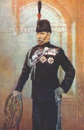
Sir John A. MacdonaldJohn A. Macdonald
Sir John Alexander Macdonald, GCB, KCMG, PC, PC , QC was the first Prime Minister of Canada. The dominant figure of Canadian Confederation, his political career spanned almost half a century...
read the bill to create the North-West Mounted Police in 1873, which was passed in May of that year. Recruitment of men for the police force began in September 1873 and they assembled at Fort Dufferin, Manitoba
Emerson, Manitoba
Emerson is a town in south central Manitoba, Canada, with a population of 655. The town is named after writer Ralph Waldo Emerson.Emerson is located on the east bank of the Red River, just north of the border with the United States at the point where Manitoba, Minnesota, and North Dakota meet. ...
.Fort Dufferin, Manitoba is now at the location of Emerson, Manitoba
Emerson, Manitoba
Emerson is a town in south central Manitoba, Canada, with a population of 655. The town is named after writer Ralph Waldo Emerson.Emerson is located on the east bank of the Red River, just north of the border with the United States at the point where Manitoba, Minnesota, and North Dakota meet. ...
The border between the United States
United States
The United States of America is a federal constitutional republic comprising fifty states and a federal district...
and Canada
Canada
Canada is a North American country consisting of ten provinces and three territories. Located in the northern part of the continent, it extends from the Atlantic Ocean in the east to the Pacific Ocean in the west, and northward into the Arctic Ocean...
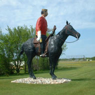
was surveyed in 1872. On July 8, 1874, these trained men were despatched on their western journey. There is a museum and the 1884 NWMP Barracks Site at Fort Macleod which preserves the NWMP history at the Fort, supplemented by a RCMP musical ride which is held yearly in commemoration. Healy and Hamilton built Fort Whoop Up 8 miles (12.9 km) miles from the current location of Lethbridge near the confluence of the St. Mary and Belly Rivers. (Today the location of Fort Whoop Up is signified by a historical cairn marker.) Colonel Macleod of the Royal Northwest Mounted Police (RNWMP)
Royal Canadian Mounted Police
The Royal Canadian Mounted Police , literally ‘Royal Gendarmerie of Canada’; colloquially known as The Mounties, and internally as ‘The Force’) is the national police force of Canada, and one of the most recognized of its kind in the world. It is unique in the world as a national, federal,...
presented Healy and Hamilton with an offer to purchase Fort Whoop Up which they declined. RNWMP were established at Coal Banks in 1885 forming K Division under the command of Superintendent A.R. McDonnell. This site in the Porcupine Hills was the coal mining site of Lethbridge. The Red Coats of 1874 had the option to settle on ranches following their three-year term with the RNWMP. Grasslands National Park
Grasslands National Park
Grasslands National Park is one of Canada's newer national parks, located in southern Saskatchewan, and one of 43 parks and park reserves in Canada's national park system...
near Ponteix, Sk features NWMP trail markers amidst the Killdeer Badlands. Wood Mountain Post was established in 1874 to reduce cattle rustling, whisky trading, which was completed post haste, and the NWMP post closed in 1875. Following his victory against the U.S. cavalry in the 1876 Battle of the Little Bighorn
Battle of the Little Bighorn
The Battle of the Little Bighorn, also known as Custer's Last Stand and, by the Indians involved, as the Battle of the Greasy Grass, was an armed engagement between combined forces of Lakota, Northern Cheyenne and Arapaho people against the 7th Cavalry Regiment of the United States Army...
, Sitting Bull and about 5,000 of his followers sought sanctuary in the Wood Mountain, Sk
Wood Mountain, Saskatchewan
Wood Mountain is a village in Old Post Rural Municipality 43, Saskatchewan, Canada. The town's name is derived from the Red River Metis word "Monatagne de Bois" , due to the abundance of poplar trees in the otherwise barren region...
area. Superintendent James Walsh
James Morrow Walsh
James Morrow Walsh, was a North West Mounted Police officer and the first Commissioner of the Yukon Territory....
from Fort Walsh
Fort Walsh
Fort Walsh is a National Historic Site of Canada that was a North-West Mounted Police fort and the site of the Cypress Hills Massacre. Administered by Parks Canada, it forms a constituent part of Cypress Hills Interprovincial Park....
left the Cypress Hills
Cypress Hills
The Cypress Hills are a region of hills in southwestern Saskatchewan and southeastern Alberta, Canada.The highest point in Saskatchewan at is located at Lookout Point in the Cypress Hills.-Name:...
area to talk to Sitting Bull. 22 NWMP police officer accompanied by Walsh set up a new Wood Mountain detachment, Walsh remained here with the men until his transfer to Fort Qu'Appelle
Fort Qu'Appelle, Saskatchewan
These figures do not include the substantial population living along the shores of the Fishing Lakes.-Origins:The current site is the third Fort Qu'Appelle. The first was a North West Company trading post , also in the valley but near what is now the Saskatchewan-Manitoba border...
in 1880. The Hudson's Bay Trading Post site was replaced with Chapel Coulee, Metis village of Chapel Coulee, which was later where the NWMP established a post in 1879 and small detachment from Fort Walsh. In 1887, the detachment moved to the banks of the White Mud River the current location of Eastend, Sk as many of their concernts were alleviated, the whisky trade had ceased, the North-West Rebellion
North-West Rebellion
The North-West Rebellion of 1885 was a brief and unsuccessful uprising by the Métis people of the District of Saskatchewan under Louis Riel against the Dominion of Canada...
of 1885 was over, and Sitting Bull
Sitting Bull
Sitting Bull Sitting Bull Sitting Bull (Lakota: Tȟatȟáŋka Íyotake (in Standard Lakota Orthography), also nicknamed Slon-he or "Slow"; (c. 1831 – December 15, 1890) was a Hunkpapa Lakota Sioux holy man who led his people as a tribal chief during years of resistance to United States government policies...
, a Hunkpapa
Hunkpapa
The Hunkpapa are a Native American group, one of the seven council fires of the Lakota Sioux tribe. The name Húŋkpapȟa is a Sioux word meaning "Head of the Circle"...
Lakota Sioux
Sioux
The Sioux are Native American and First Nations people in North America. The term can refer to any ethnic group within the Great Sioux Nation or any of the nation's many language dialects...
holy man surrendered to American forces and returned to the United States
United States
The United States of America is a federal constitutional republic comprising fifty states and a federal district...
in 1881.The White Mud River is currently known as the Frenchman River
Town
A town is a human settlement larger than a village but smaller than a city. The size a settlement must be in order to be called a "town" varies considerably in different parts of the world, so that, for example, many American "small towns" seem to British people to be no more than villages, while...
of Redvers, SK, along the Red Coat Trail, is named after General
General
A general officer is an officer of high military rank, usually in the army, and in some nations, the air force. The term is widely used by many nations of the world, and when a country uses a different term, there is an equivalent title given....
Sir Redvers Henry Buller
Redvers Buller
General Sir Redvers Henry Buller VC GCB GCMG was an English recipient of the Victoria Cross, the highest and most prestigious award for gallantry in the face of the enemy that can be awarded to British and Commonwealth forces....
VC
Victoria Cross
The Victoria Cross is the highest military decoration awarded for valour "in the face of the enemy" to members of the armed forces of various Commonwealth countries, and previous British Empire territories....
GCB
Order of the Bath
The Most Honourable Order of the Bath is a British order of chivalry founded by George I on 18 May 1725. The name derives from the elaborate mediæval ceremony for creating a knight, which involved bathing as one of its elements. The knights so created were known as Knights of the Bath...
GCMG
Order of St Michael and St George
The Most Distinguished Order of Saint Michael and Saint George is an order of chivalry founded on 28 April 1818 by George, Prince Regent, later George IV of the United Kingdom, while he was acting as Prince Regent for his father, George III....
(1839–1908). The Boundary Commission Trail is an earlier route used from Winnipeg for travel east.
Major intersections from west to east
Extra reading
----