

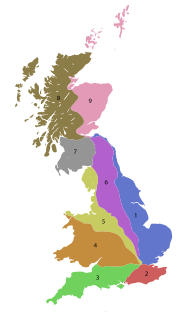
A roads in Zone 6 of the Great Britain numbering scheme
Encyclopedia
Great Britain
Great Britain or Britain is an island situated to the northwest of Continental Europe. It is the ninth largest island in the world, and the largest European island, as well as the largest of the British Isles...
starting east of the A6 and A7 roads and west of the A1 (road beginning with 6).
Single- and double-digit roads
| Road | From | To | Notes |
|---|---|---|---|
| Luton Luton Luton is a large town and unitary authority of Bedfordshire, England, 30 miles north of London. Luton and its near neighbours, Dunstable and Houghton Regis, form the Luton/Dunstable Urban Area with a population of about 250,000.... |
Carlisle | Originally London to Carlisle, starting from the A1 at Barnet. | |
| Loughborough Loughborough Loughborough is a town within the Charnwood borough of Leicestershire, England. It is the seat of Charnwood Borough Council and is home to Loughborough University... |
Doncaster Doncaster Doncaster is a town in South Yorkshire, England, and the principal settlement of the Metropolitan Borough of Doncaster. The town is about from Sheffield and is popularly referred to as "Donny"... |
||
| Derby Derby Derby , is a city and unitary authority in the East Midlands region of England. It lies upon the banks of the River Derwent and is located in the south of the ceremonial county of Derbyshire. In the 2001 census, the population of the city was 233,700, whilst that of the Derby Urban Area was 229,407... |
Thirsk Thirsk Thirsk is a small market town and civil parish in the Hambleton district of North Yorkshire, England. The local travel links are located a mile from the town centre to Thirsk railway station and to Durham Tees Valley Airport... |
||
| Leeds Leeds Leeds is a city and metropolitan borough in West Yorkshire, England. In 2001 Leeds' main urban subdivision had a population of 443,247, while the entire city has a population of 798,800 , making it the 30th-most populous city in the European Union.Leeds is the cultural, financial and commercial... |
Manchester Manchester Manchester is a city and metropolitan borough in Greater Manchester, England. According to the Office for National Statistics, the 2010 mid-year population estimate for Manchester was 498,800. Manchester lies within one of the UK's largest metropolitan areas, the metropolitan county of Greater... |
Former main Trans Pennine route from Lancashire Lancashire Lancashire is a non-metropolitan county of historic origin in the North West of England. It takes its name from the city of Lancaster, and is sometimes known as the County of Lancaster. Although Lancaster is still considered to be the county town, Lancashire County Council is based in Preston... to Yorkshire Yorkshire Yorkshire is a historic county of northern England and the largest in the United Kingdom. Because of its great size in comparison to other English counties, functions have been increasingly undertaken over time by its subdivisions, which have also been subject to periodic reform... , most of the traffic now uses the M62 motorway M62 motorway The M62 motorway is a west–east trans-Pennine motorway in Northern England, connecting the cities of Liverpool and Hull via Manchester and Leeds. The road also forms part of the unsigned Euroroutes E20 and E22... , which follows roughly the same route between Manchester and Leeds, but extends to Hull Kingston upon Hull Kingston upon Hull , usually referred to as Hull, is a city and unitary authority area in the ceremonial county of the East Riding of Yorkshire, England. It stands on the River Hull at its junction with the Humber estuary, 25 miles inland from the North Sea. Hull has a resident population of... and Liverpool Liverpool Liverpool is a city and metropolitan borough of Merseyside, England, along the eastern side of the Mersey Estuary. It was founded as a borough in 1207 and was granted city status in 1880... |
|
| Leeds Leeds Leeds is a city and metropolitan borough in West Yorkshire, England. In 2001 Leeds' main urban subdivision had a population of 443,247, while the entire city has a population of 798,800 , making it the 30th-most populous city in the European Union.Leeds is the cultural, financial and commercial... |
Kingston upon Hull Kingston upon Hull Kingston upon Hull , usually referred to as Hull, is a city and unitary authority area in the ceremonial county of the East Riding of Yorkshire, England. It stands on the River Hull at its junction with the Humber estuary, 25 miles inland from the North Sea. Hull has a resident population of... |
||
| Leeds Leeds Leeds is a city and metropolitan borough in West Yorkshire, England. In 2001 Leeds' main urban subdivision had a population of 443,247, while the entire city has a population of 798,800 , making it the 30th-most populous city in the European Union.Leeds is the cultural, financial and commercial... |
Scarborough | Main road from West Yorkshire West Yorkshire West Yorkshire is a metropolitan county within the Yorkshire and the Humber region of England with a population of 2.2 million. West Yorkshire came into existence as a metropolitan county in 1974 after the passage of the Local Government Act 1972.... to the East Coast. Is briefly A64(M) as part of Leeds Inner Ring Road Leeds Inner Ring Road The Leeds Inner Ring Road is part-motorway and part-A roads in Leeds, West Yorkshire, England, which forms a ring road around the city centre. It has six different road numbers that are all sections of longer roads... . |
|
| Leeds Leeds Leeds is a city and metropolitan borough in West Yorkshire, England. In 2001 Leeds' main urban subdivision had a population of 443,247, while the entire city has a population of 798,800 , making it the 30th-most populous city in the European Union.Leeds is the cultural, financial and commercial... |
Kendal Kendal Kendal, anciently known as Kirkby in Kendal or Kirkby Kendal, is a market town and civil parish within the South Lakeland District of Cumbria, England... |
Trans Pennine route. | |
| Grangetown Grangetown, North Yorkshire Grangetown is a township in the borough of Redcar and Cleveland and the ceremonial county of North Yorkshire, England. It is situated on the outskirts of Middlesbrough between the town and ICI Wilton. It is approximately 3.3 miles east of Middlesbrough centre and 4.4 miles from Redcar. Although... |
Workington Workington Workington is a town, civil parish and port on the west coast of Cumbria, England, at the mouth of the River Derwent. Lying within the Borough of Allerdale, Workington is southwest of Carlisle, west of Cockermouth, and southwest of Maryport... |
||
| Bowes Bowes Bowes is a village in County Durham, England. Located in the Pennine hills, it is situated close to Barnard Castle. It is built around the medieval Bowes Castle.-Civic history:... |
Crathorne Crathorne, North Yorkshire Crathorne is a village and civil parish in Hambleton district of North Yorkshire, England. The River Leven flows through the parish. The A19 used to run through the village before a dual carriageway was built in 1975... |
||
| Darlington Darlington Darlington is a market town in the Borough of Darlington, part of the ceremonial county of County Durham, England. It lies on the small River Skerne, a tributary of the River Tees, not far from the main river. It is the main population centre in the borough, with a population of 97,838 as of 2001... |
Edinburgh Edinburgh Edinburgh is the capital city of Scotland, the second largest city in Scotland, and the eighth most populous in the United Kingdom. The City of Edinburgh Council governs one of Scotland's 32 local government council areas. The council area includes urban Edinburgh and a rural area... |
||
| Denton Burn Denton Burn Denton Burn is an area situated to the west of the city centre of Newcastle upon Tyne in England, United Kingdom. It is officially designated a suburb of the city, where it is linked to Carlisle by the A69 and A1 roads... |
Carlisle |
Triple-digit roads
| Road | From | To | Notes |
|---|---|---|---|
| Hitchin Hitchin Hitchin is a town in Hertfordshire, England, with an estimated population of 30,360.-History:Hitchin is first noted as the central place of the Hicce people mentioned in a 7th century document, the Tribal Hidage. The tribal name is Brittonic rather than Old English and derives from *siccā, meaning... |
Bedford Bedford Bedford is the county town of Bedfordshire, in the East of England. It is a large town and the administrative centre for the wider Borough of Bedford. According to the former Bedfordshire County Council's estimates, the town had a population of 79,190 in mid 2005, with 19,720 in the adjacent town... |
||
| Derby Derby Derby , is a city and unitary authority in the East Midlands region of England. It lies upon the banks of the River Derwent and is located in the south of the ceremonial county of Derbyshire. In the 2001 census, the population of the city was 233,700, whilst that of the Derby Urban Area was 229,407... Inner Ring Road Ring road A ring road, orbital motorway, beltway, circumferential highway, or loop highway is a road that encircles a town or city... |
|||
| Hitchin Hitchin Hitchin is a town in Hertfordshire, England, with an estimated population of 30,360.-History:Hitchin is first noted as the central place of the Hicce people mentioned in a 7th century document, the Tribal Hidage. The tribal name is Brittonic rather than Old English and derives from *siccā, meaning... |
Ware | ||
| Bedford Bedford Bedford is the county town of Bedfordshire, in the East of England. It is a large town and the administrative centre for the wider Borough of Bedford. According to the former Bedfordshire County Council's estimates, the town had a population of 79,190 in mid 2005, with 19,720 in the adjacent town... |
Cambridge Cambridge The city of Cambridge is a university town and the administrative centre of the county of Cambridgeshire, England. It lies in East Anglia about north of London. Cambridge is at the heart of the high-technology centre known as Silicon Fen – a play on Silicon Valley and the fens surrounding the... |
Section from Sandy Sandy, Bedfordshire Sandy is a small market town and civil parish in Bedfordshire, England. It is between Cambridge and Bedford, and on the A1 road from London to Edinburgh. The area is dominated by a range of hills known as the Sand Hills. The River Ivel runs through Sandy. The dedication of the Anglican church is to... to New Wimpole (on the A1198) downgraded to B1042. |
|
| A604 | Unused | Used to run from Kettering Kettering Kettering is a market town in the Borough of Kettering, Northamptonshire, England. It is situated about from London. Kettering is mainly situated on the west side of the River Ise, a tributary of the River Nene which meets at Wellingborough... to Harwich Harwich Harwich is a town in Essex, England and one of the Haven ports, located on the coast with the North Sea to the east. It is in the Tendring district. Nearby places include Felixstowe to the northeast, Ipswich to the northwest, Colchester to the southwest and Clacton-on-Sea to the south... . Now superseded by the A14, A1307, A1017, A1124, A133 and A120 A120 road The A120 is an important trunk road in southern England. It follows the course of Stane Street, a Roman road from Standon, Hertfordshire at its western terminus to Colchester... . Historically, the Godmanchester to Colchester Colchester Colchester is an historic town and the largest settlement within the borough of Colchester in Essex, England.At the time of the census in 2001, it had a population of 104,390. However, the population is rapidly increasing, and has been named as one of Britain's fastest growing towns. As the... section was the original A132. |
|
| A14 Junction 13 | Hobbs Lot Bridge, near Guyhirn Guyhirn Guyhirn is a small village near the town of Wisbech in Cambridgeshire, England. The village sits on the northern bank of the River Nene.Guyhirn is found at a junction of two sizeable "A" roads, where the A141 leaves the A47.-Origin of the name:... |
||
| Stamford Stamford, Lincolnshire Stamford is a town and civil parish within the South Kesteven district of the county of Lincolnshire, England. It is approximately to the north of London, on the east side of the A1 road to York and Edinburgh and on the River Welland... |
West Bridgford West Bridgford West Bridgford is a town in the Rushcliffe borough of Nottinghamshire, England. It lies immediately south of the city of Nottingham, delimited by the River Trent; this proximity means that it forms a continuous urban area with Nottingham, effectively makes West Bridgford a suburb of the city, and... |
||
| Leicester Leicester Leicester is a city and unitary authority in the East Midlands of England, and the county town of Leicestershire. The city lies on the River Soar and at the edge of the National Forest... |
Lincoln Lincoln, Lincolnshire Lincoln is a cathedral city and county town of Lincolnshire, England.The non-metropolitan district of Lincoln has a population of 85,595; the 2001 census gave the entire area of Lincoln a population of 120,779.... |
||
| Newstead Newstead, Nottinghamshire Newstead is a small village and civil parish in Nottinghamshire, England, situated between Nottingham and Mansfield in the Borough of Gedling. It is a former coal mining village, and was previously called Newstead Colliery Village. Lord Byron, the poet, lived at nearby Newstead Abbey. The parish... |
Derby Derby Derby , is a city and unitary authority in the East Midlands region of England. It lies upon the banks of the River Derwent and is located in the south of the ceremonial county of Derbyshire. In the 2001 census, the population of the city was 233,700, whilst that of the Derby Urban Area was 229,407... |
||
| Nottingham Nottingham Nottingham is a city and unitary authority in the East Midlands of England. It is located in the ceremonial county of Nottinghamshire and represents one of eight members of the English Core Cities Group... |
Belper Belper Belper is a town and civil parish in the local government district of Amber Valley in Derbyshire, England.-Geography:Belper is situated eight miles north of Derby and is centred in the valley of the River Derwent... |
||
| Nottingham Nottingham Nottingham is a city and unitary authority in the East Midlands of England. It is located in the ceremonial county of Nottinghamshire and represents one of eight members of the English Core Cities Group... |
Ambergate Ambergate Ambergate is a village in Derbyshire, England, where the River Amber joins the River Derwent.Until the early nineteenth century it was known as Toadmoor, with no more than a few artisans' cottages. The southerly half of the village was still shown as such on the Ordnance Survey's maps.It is about ... |
||
| Nottingham Nottingham Nottingham is a city and unitary authority in the East Midlands of England. It is located in the ceremonial county of Nottinghamshire and represents one of eight members of the English Core Cities Group... |
Mansfield Mansfield Mansfield is a town in Nottinghamshire, England. It is the main town in the Mansfield local government district. Mansfield is a part of the Mansfield Urban Area.... |
||
| Nottingham Nottingham Nottingham is a city and unitary authority in the East Midlands of England. It is located in the ceremonial county of Nottinghamshire and represents one of eight members of the English Core Cities Group... |
Newark-on-Trent Newark-on-Trent Newark-on-Trent is a market town in Nottinghamshire in the East Midlands region of England. It stands on the River Trent, the A1 , and the East Coast Main Line railway. The origins of the town are possibly Roman as it lies on an important Roman road, the Fosse Way... |
Runs via Southwell | |
| A613 | Nuthall Nuthall Nuthall is a village located in Nottinghamshire, England, neighbouring Kimberley, Watnall, Cinderhill and Basford.It is part of the Borough of Broxtowe.... |
Alfreton Alfreton Alfreton is a town and civil parish in Amber Valley, Derbyshire, England, adjoining the Bolsover and North East Derbyshire districts. It was formerly a Norman Manor and later an Urban District. The population of the Alfreton Ward was 7,928 at the 2001 Census... |
Downgraded to the B600 |
| Calverton Calverton, Nottinghamshire Calverton is a village in Nottinghamshire, England, situated approximately 8 miles from Nottingham.The inventor of the stocking frame, William Lee, was born here in the 16th century... |
Bridlington Bridlington Bridlington is a seaside resort, minor sea fishing port and civil parish on the Holderness Coast of the North Sea, in the East Riding of Yorkshire, England. It has a static population of over 33,000, which rises considerably during the tourist season... |
||
| Near Clay Cross Clay Cross Clay Cross is a former mining town and civil parish in the North East Derbyshire district of Derbyshire, England, about six miles south of Chesterfield. It is directly on the A61, the former Roman road Ryknield Street... |
Matlock | ||
| Newark-on-Trent Newark-on-Trent Newark-on-Trent is a market town in Nottinghamshire in the East Midlands region of England. It stands on the River Trent, the A1 , and the East Coast Main Line railway. The origins of the town are possibly Roman as it lies on an important Roman road, the Fosse Way... |
Huddersfield Huddersfield Huddersfield is a large market town within the Metropolitan Borough of Kirklees, in West Yorkshire, England, situated halfway between Leeds and Manchester. It lies north of London, and south of Bradford, the nearest city.... |
||
| Chesterfield Chesterfield Chesterfield is a market town and a borough of Derbyshire, England. It lies north of Derby, on a confluence of the rivers Rother and Hipper. Its population is 70,260 , making it Derbyshire's largest town... |
Newark-on-Trent Newark-on-Trent Newark-on-Trent is a market town in Nottinghamshire in the East Midlands region of England. It stands on the River Trent, the A1 , and the East Coast Main Line railway. The origins of the town are possibly Roman as it lies on an important Roman road, the Fosse Way... |
||
| Clowne Clowne Clowne is a village and civil parish in the Bolsover district of Derbyshire, England. It forms part of the Bolsover constituency. Clowne lies north east of Chesterfield and south west of Worksop. It is mentioned in the Domesday Book as Clune... |
Rotherham Rotherham Rotherham is a town in South Yorkshire, England. It lies on the River Don, at its confluence with the River Rother, between Sheffield and Doncaster. Rotherham, at from Sheffield City Centre, is surrounded by several smaller settlements, which together form the wider Metropolitan Borough of... |
||
| Bakewell Bakewell Bakewell is a small market town in the Derbyshire Dales district of Derbyshire, England, deriving its name from 'Beadeca's Well'. It is the only town included in the Peak District National Park, and is well known for the local confection Bakewell Pudding... |
Worksop Worksop Worksop is the largest town in the Bassetlaw district of Nottinghamshire, England on the River Ryton at the northern edge of Sherwood Forest. It is about east-south-east of the City of Sheffield and its population is estimated to be 39,800... |
||
| Ranby Ranby, Nottinghamshire Ranby is a small village in the north of Nottinghamshire, next to the Chesterfield Canal and adjacent to the A1. It is known for its two schools, the prep school Ranby House and the primary school Ranby Primary School, and the nearby church All Saints Babworth.Ranby Prison is located on the A620 to... |
Beckingham Beckingham, Nottinghamshire Beckingham is a village and civil parish in the Bassetlaw district of Nottinghamshire, England, about three miles west of Gainsborough, Lincolnshire. According to the 2001 census it had a population of 1,168.... |
||
| Sheffield Sheffield Sheffield is a city and metropolitan borough of South Yorkshire, England. Its name derives from the River Sheaf, which runs through the city. Historically a part of the West Riding of Yorkshire, and with some of its southern suburbs annexed from Derbyshire, the city has grown from its largely... |
Baslow Baslow Baslow is a village in Derbyshire, England, in the Peak District, lying between Sheffield and Bakewell. It is situated on the River Derwent just north of Chatsworth House. A seventeenth century bridge spans the river in the village, alongside which is a contemporary toll house... |
||
| Chapel-en-le-Frith Chapel-en-le-Frith Chapel-en-le-Frith is a small town in Derbyshire, England, on the edge of the Peak District near the border with Cheshire, from Manchester. Dubbed "The Capital of the Peak District", the settlement was established by the Normans in the 12th century, originally as a hunting lodge within the Forest... |
Baslow Baslow Baslow is a village in Derbyshire, England, in the Peak District, lying between Sheffield and Bakewell. It is situated on the River Derwent just north of Chatsworth House. A seventeenth century bridge spans the river in the village, alongside which is a contemporary toll house... |
||
| Glossop Glossop Glossop is a market town within the Borough of High Peak in Derbyshire, England. It lies on the Glossop Brook, a tributary of the River Etherow, about east of the city of Manchester, west of the city of Sheffield. Glossop is situated near Derbyshire's county borders with Cheshire, Greater... |
Chapel-en-le-Frith Chapel-en-le-Frith Chapel-en-le-Frith is a small town in Derbyshire, England, on the edge of the Peak District near the border with Cheshire, from Manchester. Dubbed "The Capital of the Peak District", the settlement was established by the Normans in the 12th century, originally as a hunting lodge within the Forest... |
Prior to rerouting of the A6 via Chapel-en-le-Frith Chapel-en-le-Frith Chapel-en-le-Frith is a small town in Derbyshire, England, on the edge of the Peak District near the border with Cheshire, from Manchester. Dubbed "The Capital of the Peak District", the settlement was established by the Normans in the 12th century, originally as a hunting lodge within the Forest... this used to go as far as Buxton Buxton Buxton is a spa town in Derbyshire, England. It has the highest elevation of any market town in England. Located close to the county boundary with Cheshire to the west and Staffordshire to the south, Buxton is described as "the gateway to the Peak District National Park"... |
|
| Sheffield Sheffield Sheffield is a city and metropolitan borough of South Yorkshire, England. Its name derives from the River Sheaf, which runs through the city. Historically a part of the West Riding of Yorkshire, and with some of its southern suburbs annexed from Derbyshire, the city has grown from its largely... |
A623 | Rerouted following collapse of part of the route | |
| Glossop Glossop Glossop is a market town within the Borough of High Peak in Derbyshire, England. It lies on the Glossop Brook, a tributary of the River Etherow, about east of the city of Manchester, west of the city of Sheffield. Glossop is situated near Derbyshire's county borders with Cheshire, Greater... |
Heaton Chapel Heaton Chapel Heaton Chapel is an area in the northern part of Stockport, Greater Manchester, England. It borders the Manchester districts of Levenshulme to the north, the Stockport districts of Heaton Moor to the west, Reddish and Heaton Norris to the east and Heaton Mersey to the west and south... |
||
| Hazel Grove Hazel Grove -Education:Hazel Grove has a number of primary schools and Hazel Grove High School, the local high school. Some do decide to go to other local high schools, such as local Marple Hall, in neighbouring village Marple. The main primary schools in the area are, Hazel Grove Primary School, Torkington... |
Rochdale Rochdale Rochdale is a large market town in Greater Manchester, England. It lies amongst the foothills of the Pennines on the River Roch, north-northwest of Oldham, and north-northeast of the city of Manchester. Rochdale is surrounded by several smaller settlements which together form the Metropolitan... |
Between Oldham and Rochdale runs as the A627(M) | |
| Hollingworth Hollingworth Hollingworth is a village within the Metropolitan Borough of Tameside, in Greater Manchester, England. It is about twelve miles east of Manchester on the Derbyshire border at Glossop... |
Pontefract Pontefract Pontefract is an historic market town in West Yorkshire, England. Traditionally in the West Riding, near the A1 , the M62 motorway and Castleford. It is one of the five towns in the metropolitan borough of the City of Wakefield and has a population of 28,250... |
Trans Pennine route. | |
| Rotherham Rotherham Rotherham is a town in South Yorkshire, England. It lies on the River Don, at its confluence with the River Rother, between Sheffield and Doncaster. Rotherham, at from Sheffield City Centre, is surrounded by several smaller settlements, which together form the wider Metropolitan Borough of... |
Skipton Skipton Skipton is a market town and civil parish within the Craven district of North Yorkshire, England. It is located along the course of both the Leeds and Liverpool Canal and the River Aire, on the south side of the Yorkshire Dales, northwest of Bradford and west of York... |
||
| Sheffield Sheffield Sheffield is a city and metropolitan borough of South Yorkshire, England. Its name derives from the River Sheaf, which runs through the city. Historically a part of the West Riding of Yorkshire, and with some of its southern suburbs annexed from Derbyshire, the city has grown from its largely... |
M18 Junction 4 | ||
| Greenland | Louth Louth, Lincolnshire Louth is a market town and civil parish within the East Lindsey district of Lincolnshire, England.-Geography:Known as the "capital of the Lincolnshire Wolds", it is situated where the ancient trackway Barton Street crosses the River Lud, and has a total resident population of 15,930.The Greenwich... |
||
| Matlock | Cuckney Cuckney Cuckney is a small village in the Bassetlaw district of Nottinghamshire, between Worksop and Market Warsop.The A60 road connects Market Warsop and Cuckney via Cuckney Hill.-History:... |
||
| Rotherham Rotherham Rotherham is a town in South Yorkshire, England. It lies on the River Don, at its confluence with the River Rother, between Sheffield and Doncaster. Rotherham, at from Sheffield City Centre, is surrounded by several smaller settlements, which together form the wider Metropolitan Borough of... |
New Lodge New Lodge, South Yorkshire New Lodge is a village in the metropolitan borough of Barnsley in South Yorkshire, England.The ' New Lodge' estate is located to the north of Barnsley on the A61 near Athersley.... |
||
| Maltby Maltby, South Yorkshire Maltby is a town and civil parish of 17,247 inhabitants in the Metropolitan Borough of Rotherham, South Yorkshire, England, situated in a rural area about 7 miles east of Rotherham and 12 miles north-east of Sheffield... |
A638 A638 road The A638 is a main road in England that runs between the A1 at Markham Moor in Nottinghamshire and Chain Bar Junction 26 of the M62 motorway south of Bradford in West Yorkshire.... near Retford Retford Retford is a market town in Nottinghamshire in the East Midlands of England, located 31 miles from the city of Nottingham, and 23 miles west of Lincoln, in the district of Bassetlaw. The town is situated in a valley with the River Idle and the Chesterfield Canal running through the centre of the... |
||
| Manchester Manchester Manchester is a city and metropolitan borough in Greater Manchester, England. According to the Office for National Statistics, the 2010 mid-year population estimate for Manchester was 498,800. Manchester lies within one of the UK's largest metropolitan areas, the metropolitan county of Greater... |
Doncaster Doncaster Doncaster is a town in South Yorkshire, England, and the principal settlement of the Metropolitan Borough of Doncaster. The town is about from Sheffield and is popularly referred to as "Donny"... |
Trans Pennine route. | |
| Denby Dale Denby Dale Denby Dale is a village and civil parish in the metropolitan borough of Kirklees in West Yorkshire, England, to the South East of Huddersfield. As a civil parish it covers the villages of Denby Dale, Lower Denby, Upper Denby, Upper Cumberworth, Lower Cumberworth, Skelmanthorpe, Emley, Emley... |
Wakefield Wakefield Wakefield is the main settlement and administrative centre of the City of Wakefield, a metropolitan district of West Yorkshire, England. Located by the River Calder on the eastern edge of the Pennines, the urban area is and had a population of 76,886 in 2001.... |
||
| Gawber Gawber Gawber is an area of the Metropolitan Borough of Barnsley in South Yorkshire, England.... |
Grange Moor Grange Moor Grange Moor is a village between Huddersfield and Wakefield in Kirklees, West Yorkshire, England. The village is represented on Kirkburton Parish council and is in the Kirkburton ward of Kirklees Council.... |
||
| A1 at Markham Moor | M62 M62 motorway The M62 motorway is a west–east trans-Pennine motorway in Northern England, connecting the cities of Liverpool and Hull via Manchester and Leeds. The road also forms part of the unsigned Euroroutes E20 and E22... Chain Bar junction |
Formerly the A1 but renumbered after the construction of the A1 Retford Retford Retford is a market town in Nottinghamshire in the East Midlands of England, located 31 miles from the city of Nottingham, and 23 miles west of Lincoln, in the district of Bassetlaw. The town is situated in a valley with the River Idle and the Chesterfield Canal running through the centre of the... bypass (Markham Moor Markham Moor Markham Moor is a village which lies five miles south of the town of Retford in the county of Nottinghamshire. Markham Moor lies on the junction between the A1, A638 and A57 roads... to Blyth Blyth, Nottinghamshire Blyth is a village in the Bassetlaw district of the county of Nottinghamshire, in the East Midlands, north west of East Retford, on the River Ryton.-Geography:... ) and the A1(M) Doncaster bypass (Blyth to Carcroft Carcroft Carcroft is a rural village part of the Metropolitan Borough of Doncaster, South Yorkshire, England. The village is roughly six miles north north west of Doncaster.-Geography:... ) |
|
| Skellow Skellow Skellow is a village in rural South Yorkshire part of the Metropolitan Borough of Doncaster. The village is roughly six miles north north west of Doncaster... |
Leeds Leeds Leeds is a city and metropolitan borough in West Yorkshire, England. In 2001 Leeds' main urban subdivision had a population of 443,247, while the entire city has a population of 798,800 , making it the 30th-most populous city in the European Union.Leeds is the cultural, financial and commercial... |
||
| Rochdale Rochdale Rochdale is a large market town in Greater Manchester, England. It lies amongst the foothills of the Pennines on the River Roch, north-northwest of Oldham, and north-northeast of the city of Manchester. Rochdale is surrounded by several smaller settlements which together form the Metropolitan... |
Huddersfield Huddersfield Huddersfield is a large market town within the Metropolitan Borough of Kirklees, in West Yorkshire, England, situated halfway between Leeds and Manchester. It lies north of London, and south of Bradford, the nearest city.... |
Trans Pennine route. | |
| Huddersfield Huddersfield Huddersfield is a large market town within the Metropolitan Borough of Kirklees, in West Yorkshire, England, situated halfway between Leeds and Manchester. It lies north of London, and south of Bradford, the nearest city.... |
Bradford Bradford Bradford lies at the heart of the City of Bradford, a metropolitan borough of West Yorkshire, in Northern England. It is situated in the foothills of the Pennines, west of Leeds, and northwest of Wakefield. Bradford became a municipal borough in 1847, and received its charter as a city in 1897... |
Main road between Huddersfield and Bradford. | |
| Wakefield Wakefield Wakefield is the main settlement and administrative centre of the City of Wakefield, a metropolitan district of West Yorkshire, England. Located by the River Calder on the eastern edge of the Pennines, the urban area is and had a population of 76,886 in 2001.... |
Garforth Garforth Garforth is a town within the City of Leeds metropolitan borough, in West Yorkshire, England. The 2001 Census lists 23,892 residents in the Garforth and Swillington ward - 80.57% of which are homeowners, 20% more than the average for Leeds. Garforth itself has 15,394 of those people... |
||
| M62 M62 motorway The M62 motorway is a west–east trans-Pennine motorway in Northern England, connecting the cities of Liverpool and Hull via Manchester and Leeds. The road also forms part of the unsigned Euroroutes E20 and E22... Junction 23 |
Leeds Leeds Leeds is a city and metropolitan borough in West Yorkshire, England. In 2001 Leeds' main urban subdivision had a population of 443,247, while the entire city has a population of 798,800 , making it the 30th-most populous city in the European Union.Leeds is the cultural, financial and commercial... |
||
| Dewsbury Dewsbury Dewsbury is a minster town in the Metropolitan Borough of Kirklees, in West Yorkshire, England. It is to the west of Wakefield, east of Huddersfield and south of Leeds... |
Denholme Clough | ||
| Crofton Crofton, West Yorkshire Crofton is a village near Wakefield in West Yorkshire, England. It is located roughly to the south east of the city and is roughly to the west of the town of Pontefract and from the town of Featherstone.-History:... |
Snaith Snaith Snaith is a town in the East Riding of Yorkshire local government area of England. It is situated approximately west of Goole on the A1041 road at its junction with the A645 road... |
Joins the A638 Road A638 road The A638 is a main road in England that runs between the A1 at Markham Moor in Nottinghamshire and Chain Bar Junction 26 of the M62 motorway south of Bradford in West Yorkshire.... at Crofton and this continues to Wakefield Wakefield Wakefield is the main settlement and administrative centre of the City of Wakefield, a metropolitan district of West Yorkshire, England. Located by the River Calder on the eastern edge of the Pennines, the urban area is and had a population of 76,886 in 2001.... . |
|
| Halifax Halifax, West Yorkshire Halifax is a minster town, within the Metropolitan Borough of Calderdale in West Yorkshire, England. It has an urban area population of 82,056 in the 2001 Census. It is well-known as a centre of England's woollen manufacture from the 15th century onward, originally dealing through the Halifax Piece... |
Burnley Burnley Burnley is a market town in the Burnley borough of Lancashire, England, with a population of around 73,500. It lies north of Manchester and east of Preston, at the confluence of the River Calder and River Brun.... |
||
| Leeds Leeds Leeds is a city and metropolitan borough in West Yorkshire, England. In 2001 Leeds' main urban subdivision had a population of 443,247, while the entire city has a population of 798,800 , making it the 30th-most populous city in the European Union.Leeds is the cultural, financial and commercial... |
Halifax Halifax, West Yorkshire Halifax is a minster town, within the Metropolitan Borough of Calderdale in West Yorkshire, England. It has an urban area population of 82,056 in the 2001 Census. It is well-known as a centre of England's woollen manufacture from the 15th century onward, originally dealing through the Halifax Piece... |
Britain United Kingdom The United Kingdom of Great Britain and Northern IrelandIn the United Kingdom and Dependencies, other languages have been officially recognised as legitimate autochthonous languages under the European Charter for Regional or Minority Languages... 's first High Occupancy Vehicle Lane (HOV lane). |
|
| Liversedge Liversedge Liversedge is a township in the former parish of Birstall, in the metropolitan borough of Kirklees, West Yorkshire, England. Liversedge lies between Cleckheaton and Heckmondwike about southwest of Leeds.-Settlements within Liversedge:... |
Hipperholme Hipperholme Hipperholme is a village in the Calderdale area of West Yorkshire, England, located between the towns of Halifax and Brighouse. It is located on the busy A58 road and includes Hipperholme Grammar School, a local private school.... |
||
| Wakefield Wakefield Wakefield is the main settlement and administrative centre of the City of Wakefield, a metropolitan district of West Yorkshire, England. Located by the River Calder on the eastern edge of the Pennines, the urban area is and had a population of 76,886 in 2001.... |
Keighley Keighley Keighley is a town and civil parish within the metropolitan borough of the City of Bradford in West Yorkshire, England. It is situated northwest of Bradford and is at the confluence of the River Aire and the River Worth... |
||
| Liversedge Liversedge Liversedge is a township in the former parish of Birstall, in the metropolitan borough of Kirklees, West Yorkshire, England. Liversedge lies between Cleckheaton and Heckmondwike about southwest of Leeds.-Settlements within Liversedge:... |
East Bierley | ||
| Dewsbury Dewsbury Dewsbury is a minster town in the Metropolitan Borough of Kirklees, in West Yorkshire, England. It is to the west of Wakefield, east of Huddersfield and south of Leeds... |
Gomersal Gomersal Gomersal is a village in the metropolitan county of West Yorkshire, England. It is south of Bradford, east of Cleckheaton, and north of Heckmondwike and close to the River Spen.... |
||
| Dewsbury Dewsbury Dewsbury is a minster town in the Metropolitan Borough of Kirklees, in West Yorkshire, England. It is to the west of Wakefield, east of Huddersfield and south of Leeds... |
Leeds Leeds Leeds is a city and metropolitan borough in West Yorkshire, England. In 2001 Leeds' main urban subdivision had a population of 443,247, while the entire city has a population of 798,800 , making it the 30th-most populous city in the European Union.Leeds is the cultural, financial and commercial... |
||
| Tingley Tingley Tingley is a settlement in West Yorkshire, England, forming part of the parish of West Ardsley and of the City of Leeds metropolitan borough.It is situated midway between Leeds, Wakefield and Bradford but is considered part of Morley... |
Oulton Oulton, West Yorkshire Oulton is a village in the City of Leeds metropolitan borough, West Yorkshire, England, between Leeds and Wakefield. It is at the junction of the A639 and A642 roads. Though now adjoining the village of Woodlesford, it was once quite separate... |
||
| near Crofton Crofton, West Yorkshire Crofton is a village near Wakefield in West Yorkshire, England. It is located roughly to the south east of the city and is roughly to the west of the town of Pontefract and from the town of Featherstone.-History:... |
Castleford Castleford Castleford is the largest of the "five towns" district in the metropolitan borough of the City of Wakefield, in West Yorkshire, England. It is near Pontefract, and has a population of 37,525 according to the 2001 Census, but has seen a rise in recent years and is now around 45-50,000. To the north... |
||
| Castleford Castleford Castleford is the largest of the "five towns" district in the metropolitan borough of the City of Wakefield, in West Yorkshire, England. It is near Pontefract, and has a population of 37,525 according to the 2001 Census, but has seen a rise in recent years and is now around 45-50,000. To the north... |
Aberford Aberford Aberford is a large village and civil parish on the eastern outskirts of the City of Leeds metropolitan borough in West Yorkshire, England. It has a population of 1,059 according to the 2001 census... |
||
| Shipley Shipley, West Yorkshire Shipley is a town in West Yorkshire, England, by the River Aire and the Leeds and Liverpool Canal, north of Bradford and north-west of Leeds.... |
Leeds Leeds Leeds is a city and metropolitan borough in West Yorkshire, England. In 2001 Leeds' main urban subdivision had a population of 443,247, while the entire city has a population of 798,800 , making it the 30th-most populous city in the European Union.Leeds is the cultural, financial and commercial... |
||
| Bradford Bradford Bradford lies at the heart of the City of Bradford, a metropolitan borough of West Yorkshire, in Northern England. It is situated in the foothills of the Pennines, west of Leeds, and northwest of Wakefield. Bradford became a municipal borough in 1847, and received its charter as a city in 1897... |
A59 A59 road The A59 is a major road in the United Kingdom that runs from Liverpool in Merseyside, to York in North Yorkshire.-Merseyside:The A59 begins in the centre of Liverpool at the mouth of the Birkenhead Tunnel, and heads north out of the city, first as Scotland Road in Vauxhall, then Kirkdale Road,... east of Knaresborough Knaresborough Knaresborough is an old and historic market town, spa town and civil parish in the Borough of Harrogate, North Yorkshire, England, located on the River Nidd, four miles east of the centre of Harrogate.-History:... |
||
| Tadcaster Tadcaster Tadcaster is a market town and civil parish in the Selby district of North Yorkshire, England. Lying on the Great North Road approximately east of Leeds and west of York. It is the last town on the River Wharfe before it joins the River Ouse about downstream... |
Otley Otley -Transport:The main roads through the town are the A660 to the south east, which connects Otley to Bramhope, Adel and Leeds city centre, and the A65 to the west, which goes to Ilkley and Skipton. The A6038 heads to Guiseley, Shipley and Bradford, connecting with the A65... |
||
| Leeds Leeds Leeds is a city and metropolitan borough in West Yorkshire, England. In 2001 Leeds' main urban subdivision had a population of 443,247, while the entire city has a population of 798,800 , making it the 30th-most populous city in the European Union.Leeds is the cultural, financial and commercial... |
Burley in Wharfedale Burley in Wharfedale Burley-in-Wharfedale, is a village in the county of West Yorkshire, England. Along with Menston, Burley is part of Wharfedale Ward in the metropolitan borough of the City of Bradford . It lies on the A65, approximately fourteen miles north-west of the centre of Leeds and nine miles north of... |
||
| Wetherby Wetherby Wetherby is a market town and civil parish within the metropolitan borough of the City of Leeds, in West Yorkshire, England. It stands on the River Wharfe, and has been for centuries a crossing place and staging post on the Great North Road, being mid-way between London and Edinburgh... |
Harrogate Harrogate Harrogate is a spa town in North Yorkshire, England. The town is a tourist destination and its visitor attractions include its spa waters, RHS Harlow Carr gardens, and Betty's Tea Rooms. From the town one can explore the nearby Yorkshire Dales national park. Harrogate originated in the 17th... |
||
| Manchester Manchester Manchester is a city and metropolitan borough in Greater Manchester, England. According to the Office for National Statistics, the 2010 mid-year population estimate for Manchester was 498,800. Manchester lies within one of the UK's largest metropolitan areas, the metropolitan county of Greater... |
Droylsden Droylsden Droylsden is a town within the Metropolitan Borough of Tameside, in Greater Manchester, England. It is to the east of Manchester city centre, and west-southwest of Ashton-under-Lyne, it has a population of 23,172.... |
||
| Failsworth Failsworth At Failsworth lies north-northwest of London. It shares common boundaries with Manchester and Oldham, on its west and northeast respectively. Failsworth is traversed by the A62 road, from Manchester to Oldham, the heavy rail line of the Oldham Loop and the Rochdale Canal, which crosses the... |
Newhey Newhey Newhey is a suburban village in the Milnrow area of the Metropolitan Borough of Rochdale, in Greater Manchester, England... |
||
| Manchester Manchester Manchester is a city and metropolitan borough in Greater Manchester, England. According to the Office for National Statistics, the 2010 mid-year population estimate for Manchester was 498,800. Manchester lies within one of the UK's largest metropolitan areas, the metropolitan county of Greater... |
Rochdale Rochdale Rochdale is a large market town in Greater Manchester, England. It lies amongst the foothills of the Pennines on the River Roch, north-northwest of Oldham, and north-northeast of the city of Manchester. Rochdale is surrounded by several smaller settlements which together form the Metropolitan... |
||
| Manchester Manchester Manchester is a city and metropolitan borough in Greater Manchester, England. According to the Office for National Statistics, the 2010 mid-year population estimate for Manchester was 498,800. Manchester lies within one of the UK's largest metropolitan areas, the metropolitan county of Greater... |
Ainsworth Ainsworth, Greater Manchester Ainsworth is a small village—effectively a suburb—within the Metropolitan Borough of Bury, in Greater Manchester, England. It lies on the western fringe of Bury, northwest of Radcliffe, and east of Bolton... Junction with A58 A58 road The A58 is a major road in northern England that runs between Prescot, Merseyside and Wetherby, West Yorkshire.It runs north east from Prescot on the outskirts of Liverpool via St Helens, Ashton-in-Makerfield, Hindley, Westhoughton, Bolton, Bury, Heywood, Rochdale and Littleborough then over the... |
||
| Pendlebury Pendlebury Pendlebury is a suburban town in the City of Salford, in Greater Manchester, England. It lies to the northwest of Manchester city centre, northwest of Salford, and southeast of Bolton.... |
Langho Langho Langho is a small rural village north of Blackburn in the Ribble Valley, Lancashire, England. It is part of the parish of Billington and Langho. The village is linked with Blackburn and Clitheroe by the A666 road and is served by Langho railway station on the Ribble Valley Line. To the north,... |
||
| Kearsley Kearsley Kearsley is a town within the Metropolitan Borough of Bolton, in Greater Manchester, England. Historically within Lancashire, it lies about 7½ miles northwest of Manchester,5.5 miles south-west of Bury, and about 3¾ miles south of Bolton.It is bounded on the west by Walkden, the east by... |
Whitefield Whitefield, Greater Manchester Whitefield is a town within the Metropolitan Borough of Bury, in Greater Manchester, England. It lies on undulating ground in the Irwell Valley, along the south bank of the River Irwell, south-southeast of Bury, and to the north-northwest of the city of Manchester... |
||
| Middleton Middleton, Greater Manchester Middleton is a town within the Metropolitan Borough of Rochdale, in Greater Manchester, England. It stands on the River Irk, south-southwest of Rochdale, and north-northeast of the city of Manchester... |
Greenfield Greenfield, Greater Manchester Greenfield is a village in the Saddleworth parish of the Metropolitan Borough of Oldham in Greater Manchester, England. It is east of Oldham, and east-northeast of the city of Manchester... |
||
| Ashton-under-Lyne Ashton-under-Lyne Ashton-under-Lyne is a market town in the Metropolitan Borough of Tameside, Greater Manchester, England. Historically a part of Lancashire, it lies on the north bank of the River Tame, on undulating land at the foothills of the Pennines... |
Diggle Diggle, Greater Manchester Diggle is a village within the Saddleworth parish of the Metropolitan Borough of Oldham, in Greater Manchester, England. The village is situated on the moorlands of the Pennine hills.... |
||
| Oldham Oldham Oldham is a large town in Greater Manchester, England. It lies amid the Pennines on elevated ground between the rivers Irk and Medlock, south-southeast of Rochdale, and northeast of the city of Manchester... |
Worston Worston Worston is a small linear village and civil parish in Lancashire, England. The village is north-west of Pendle Hill, east of Clitheroe, and is in the Ribble Valley district. As it is only a small village, with a population of 76 as of the 2001 census, it has no parish council, but instead has a... |
||
| Oldham Oldham Oldham is a large town in Greater Manchester, England. It lies amid the Pennines on elevated ground between the rivers Irk and Medlock, south-southeast of Rochdale, and northeast of the city of Manchester... |
Ripponden Ripponden Ripponden is a village and civil parish within the Metropolitan Borough of Calderdale, in West Yorkshire, England, near Halifax, on the River Ryburn. It is the site of a Roman settlement, and there is a Roman Road over nearby Blackstone Edge, a rocky ridge of Millstone Grit... |
||
| Bolton Bolton Bolton is a town in Greater Manchester, in the North West of England. Close to the West Pennine Moors, it is north west of the city of Manchester. Bolton is surrounded by several smaller towns and villages which together form the Metropolitan Borough of Bolton, of which Bolton is the... |
Heath Charnock Heath Charnock Heath Charnock is a small village and civil parish of the Borough of Chorley in Lancashire, England. It is adjacent to Adlington and Anderton. According to the United Kingdom Census 2001 it has a population of 2,065.-History:... |
||
| Chorley Chorley Chorley is a market town in Lancashire, in North West England. It is the largest settlement in the Borough of Chorley. The town's wealth came principally from the cotton industry... |
Blackburn | ||
| Bolton Bolton Bolton is a town in Greater Manchester, in the North West of England. Close to the West Pennine Moors, it is north west of the city of Manchester. Bolton is surrounded by several smaller towns and villages which together form the Metropolitan Borough of Bolton, of which Bolton is the... |
Walton-le-Dale Walton-le-Dale Walton-le-Dale is a village in the Borough of South Ribble, in Lancashire, England. It lies on south bank of the River Ribble, and the south-side of the city of Preston, adjacent to Bamber Bridge.-Toponymy:... |
||
| Hunger Hill | Bolton Bolton Bolton is a town in Greater Manchester, in the North West of England. Close to the West Pennine Moors, it is north west of the city of Manchester. Bolton is surrounded by several smaller towns and villages which together form the Metropolitan Borough of Bolton, of which Bolton is the... |
||
| Blackburn | Samlesbury Samlesbury Samlesbury is a small village and civil parish in the South Ribble borough of Lancashire, England. Samlesbury Hall, a historic house, is located in the village as well as Samlesbury Aerodrome... |
||
| Blackburn | Padiham Padiham Padiham is a small town and civil parish on the River Calder, about west of Burnley and south of Pendle Hill, in Lancashire, England. It is part of the Borough of Burnley but also has its own town council with varied powers.-History:... |
||
| Blackburn | Burnley Burnley Burnley is a market town in the Burnley borough of Lancashire, England, with a population of around 73,500. It lies north of Manchester and east of Preston, at the confluence of the River Calder and River Brun.... |
||
| Rochdale Rochdale Rochdale is a large market town in Greater Manchester, England. It lies amongst the foothills of the Pennines on the River Roch, north-northwest of Oldham, and north-northeast of the city of Manchester. Rochdale is surrounded by several smaller settlements which together form the Metropolitan... |
Whalley Whalley, Lancashire Whalley is a large village in the Ribble Valley on the banks of the River Calder in Lancashire, England. It is overlooked by Whalley Nab, a large picturesque wooded hill over the river from the village.... |
||
| Haslingden Haslingden Haslingden is a small town in Rossendale, Lancashire, England. It is north of Manchester. The name means 'valley of the hazels', though the town is in fact set on a high and windy hill. In the early 20th century Haslingden had the status of a municipal borough, but following local government... |
Todmorden Todmorden Todmorden is a market town and civil parish, located 17 miles from Manchester, within the Metropolitan Borough of Calderdale, in West Yorkshire, England. It forms part of the Upper Calder Valley and has a total population of 14,941.... |
||
| Bent Gate Bent Gate Bent Gate is a suburb of Haslingden, Lancashire, England. It is located approximately one mile south of Haslingden town centre. Bent Gate is also the name and location of Haslingden Cricket Club's ground.... |
Long Preston Long Preston Long Preston is a village and civil parish in the Craven district of North Yorkshire, England, in the Yorkshire Dales. It lies along the A65 road, and is 12 miles from the larger town of Skipton and four miles from the town of Settle... |
Part of the road is the most dangerous in the UK | |
| Heysham Heysham Heysham is a large coastal village near Lancaster in the county of Lancashire, England. Overlooking Morecambe Bay, it is a ferry port with services to the Isle of Man and Ireland. Heysham is the site of two nuclear power stations which are landmarks visible from hills in the surrounding area... |
Kirkby Stephen Kirkby Stephen Kirkby Stephen is a civil parish and small market town in Cumbria, in North West England which historically, is part of Westmorland. The town is located on the A685, surrounded by sparsely populated hill country, and about from the two nearest larger towns, Kendal and Penrith... |
||
| Kendal Kendal Kendal, anciently known as Kirkby in Kendal or Kirkby Kendal, is a market town and civil parish within the South Lakeland District of Cumbria, England... |
A19 east of Ellerbeck Ellerbeck Ellerbeck is a small village and civil parish in the Hambleton district of North Yorkshire, England.Ellerbeck lies on the A684 road between Northallerton and the A19 near Osmotherley... |
||
| Kendal Kendal Kendal, anciently known as Kirkby in Kendal or Kirkby Kendal, is a market town and civil parish within the South Lakeland District of Cumbria, England... |
Brough Brough, Cumbria Brough, sometimes known as Brough under Stainmore, is a village and civil parish in the Eden district of Cumbria, England, on the western fringe of the Pennines near Stainmore. The village is on the A66 trans-Pennine road, and the Swindale Beck, and is about south east of Appleby-in-Westmorland... |
||
| Penrith Penrith, Cumbria Penrith was an urban district between 1894 and 1974, when it was merged into Eden District.The authority's area was coterminous with the civil parish of Penrith although when the council was abolished Penrith became an unparished area.... |
Haydon Bridge Haydon Bridge Haydon Bridge is a village in Northumberland, England, with a population of about 2000. Its most distinctive features are the two bridges crossing the River South Tyne; the picturesque original bridge for which the village was named and a modern bridge which used to carry the A69 road... |
||
| Ingleton Ingleton, North Yorkshire Ingleton is a village and civil parish in the Yorkshire Dales in North Yorkshire, England. It is famous for walking, hiking and caving. Favourite walks are the Ingleton Waterfalls Trail and the climb up Ingleborough which is one of the famous Three Peaks. Directly from the village visitors can... |
Cantsfield Cantsfield Cantsfield is a hamlet and civil parish in the City of Lancaster, in Lancashire, England, near the boundary with North Yorkshire. It is situated near the River Greta and on the A687 road near the junction with the A683. The parish had a population of 76 as of the 2001 census... |
||
| Barnard Castle Barnard Castle Barnard Castle is an historical town in Teesdale, County Durham, England. It is named after the castle around which it grew up. It sits on the north side of the River Tees, opposite Startforth, south southwest of Newcastle upon Tyne, south southwest of Sunderland, west of Middlesbrough and ... |
Bowburn Bowburn Bowburn is a village in County Durham, England. It is situated about to the south-east of Durham, on the A177, between Coxhoe to the south-east, and High Shincliffe to the north-west.It is part of the Cassop-cum-Quarrington parish.- History :... |
||
| M6 M6 motorway The M6 motorway runs from junction 19 of the M1 at the Catthorpe Interchange, near Rugby via Birmingham then heads north, passing Stoke-on-Trent, Manchester, Preston, Carlisle and terminating at the Gretna junction . Here, just short of the Scottish border it becomes the A74 which continues to... Junction 44 |
Hartlepool Hartlepool Hartlepool is a town and port in North East England.It was founded in the 7th century AD, around the Northumbrian monastery of Hartlepool Abbey. The village grew during the Middle Ages and developed a harbour which served as the official port of the County Palatine of Durham. A railway link from... |
||
| Crook Crook, County Durham Crook is a market town in County Durham, England. It is situated about 10 miles south-west of Durham.Crook lies a couple of miles north of the River Wear, on the A690 from Durham... |
Sunderland | ||
| Consett Consett Consett is a town in the northwest of County Durham, England, about southwest of Newcastle upon Tyne. It is home to 27,394 .Consett sits high on the edge of the Pennines. In 1841, it was a village community of only 145, but it was about to become a boom town: below the ground was coking coal and... |
Durham Durham Durham is a city in north east England. It is within the County Durham local government district, and is the county town of the larger ceremonial county... |
||
| Castleside Castleside Castleside is a village in County Durham, in England. It is situated a short distance to the south-west of Consett. The village centre is located on the main A68 road which runs between Edinburgh and Darlington and the village crossroads allow easy access to Consett, the North Pennines and Stanhope... |
A1 near Gateshead Gateshead Gateshead is a town in Tyne and Wear, England and is the main settlement in the Metropolitan Borough of Gateshead. Historically a part of County Durham, it lies on the southern bank of the River Tyne opposite Newcastle upon Tyne and together they form the urban core of Tyneside... |
||
| Leadgate Leadgate, County Durham Leadgate is a village in County Durham, in England. It is situated to the north-east of Consett. The Roman road Dere Street runs straight through the middle of Leadgate.... |
Chester-le-Street Chester-le-Street Chester-le-Street is a town in County Durham, England. It has a history going back to Roman times when it was called Concangis. The town is located south of Newcastle upon Tyne and west of Sunderland on the River Wear... |
||
| Consett Consett Consett is a town in the northwest of County Durham, England, about southwest of Newcastle upon Tyne. It is home to 27,394 .Consett sits high on the edge of the Pennines. In 1841, it was a village community of only 145, but it was about to become a boom town: below the ground was coking coal and... |
A1 near MetroCentre | ||
| Newcastle-upon-Tyne | Hexham Hexham Hexham is a market town and civil parish in Northumberland, England, located south of the River Tyne, and was the administrative centre for the Tynedale district from 1974 to 2009. The three major towns in Tynedale were Hexham, Prudhoe and Haltwhistle, although in terms of population, Prudhoe was... |
Part was proposed to be the A695(M) Shields Road Motorway | |
| Otterburn Otterburn, Northumberland Otterburn is a small village in Northumberland, England, northwest of Newcastle Upon Tyne on the banks of the River Rede, near the confluence of the Otter Burn, from which the village derives its name. It lies within the Cheviot Hills about from the Scottish border... |
Newcastle-upon-Tyne | ||
| Morpeth Morpeth, Northumberland Morpeth is the county town of Northumberland, England. It is situated on the River Wansbeck which flows east through the town. The town is from the A1, which bypasses it. Since 1981, it has been the administrative centre of the County of Northumberland. In the 2001 census the town had a population... |
Oxton Oxton, Scottish Borders Oxton is a rural village in the Scottish Borders area of Scotland, just off the A68. The small town of Lauder is 4.5 miles to the south, Edinburgh city centreis about 23 miles to the north. Other towns include Dalkeith .... |
||
| Berwick Berwick-upon-Tweed Berwick-upon-Tweed or simply Berwick is a town in the county of Northumberland and is the northernmost town in England, on the east coast at the mouth of the River Tweed. It is situated 2.5 miles south of the Scottish border.... |
Hawick Hawick Hawick is a town in the Scottish Borders of south east Scotland. It is south-west of Jedburgh and south-southeast of Selkirk. It is one of the farthest towns from the sea in Scotland, in the heart of Teviotdale, and the biggest town in the former county of Roxburghshire. Hawick's architecture is... |
||
| Selkirk | Kelso |
Four-digit roads (60xx)
| Road | From | To | Notes |
|---|---|---|---|
| Henlow Camp Henlow Henlow is a village and civil parish in the district of Central Bedfordshire in Bedfordshire, England.RAF Henlow, is located nearby, but is in fact nearer to the village of Stondon... |
Biggleswade Biggleswade Biggleswade is a market town and civil parish located on the River Ivel in Bedfordshire, England. It is well served by transport routes, being close to the A1 road between London and the North, as well as having a railway station on the main rail link North from London .-Geography:Located about 40... |
||
| Stapleford Stapleford, Nottinghamshire -External links:***... |
Bulwell Bulwell Bulwell is an English market town approximately northwest of Nottingham city centre, on the northern edge of the city. The United Kingdom Census 2001 showed there were almost 30,000 people living in the Bulwell area, accounting for over 10% of the population of the city of Nottingham.-Early... |
||
| Barton Seagrave Barton Seagrave Barton Seagrave is a village and civil parish in the Kettering borough of Northamptonshire, England. The Domesday Book records the village name as Bertone. The village is a suburb of Kettering and about south-east of the town centre... |
Oakham Oakham -Oakham's horseshoes:Traditionally, members of royalty and peers of the realm who visited or passed through the town had to pay a forfeit in the form of a horseshoe... |
Joins A14 opposite A6 | |
| Loughborough Loughborough Loughborough is a town within the Charnwood borough of Leicestershire, England. It is the seat of Charnwood Borough Council and is home to Loughborough University... |
Loughborough railway station Loughborough railway station Loughborough railway station serves the town of Loughborough in Leicestershire, England. Situated on the Midland Main Line, 20 km north of Leicester, the station lies to the north-east of the town centre.... |
Loughborough Ring Road | |
| Nottingham Nottingham Nottingham is a city and unitary authority in the East Midlands of England. It is located in the ceremonial county of Nottinghamshire and represents one of eight members of the English Core Cities Group... |
Derby Derby Derby , is a city and unitary authority in the East Midlands region of England. It lies upon the banks of the River Derwent and is located in the south of the ceremonial county of Derbyshire. In the 2001 census, the population of the city was 233,700, whilst that of the Derby Urban Area was 229,407... |
||
| Hathern Hathern Hathern is a large village and civil parish in the Charnwood district of Leicestershire, England. The village itself is located in the north of the district, and is just north of Loughborough. It is served by the A6. The parish has a population of about 1,800. Nearby places are Dishley, Long... |
Melton Mowbray Melton Mowbray Melton Mowbray is a town in the Melton borough of Leicestershire, England. It is to the northeast of Leicester, and southeast of Nottingham... |
||
| Codnor Codnor Codnor is a Derbyshire village in the Amber Valley district, and a former mining community, with a population of nearly 5,000. It is approximately 12 miles from the city of Derby and 14 miles from Nottingham by road.-History:... |
Bramcote Bramcote Bramcote is a settlement in the Broxtowe district of Nottinghamshire, about five miles west of Nottingham. It was a separate village but is now a suburb of Greater Nottingham. Originally one of the main roads between the cities of Nottingham and Derby passed through the village centre... |
||
| Broad Marsh Centre | Victoria Centre Victoria Centre, Nottingham The Victoria Centre is a shopping centre in Nottingham, England. Its four main anchor stores are John Lewis, House of Fraser, Boots and Next. Other notable stores are The Entertainer, Topshop, Republic, Monsoon, Swarovski, GAP, Tesco Metro and HMV.... |
Nottingham Inner Ring Road | |
| Mansfield Mansfield Mansfield is a town in Nottinghamshire, England. It is the main town in the Mansfield local government district. Mansfield is a part of the Mansfield Urban Area.... |
Mansfield Mansfield Mansfield is a town in Nottinghamshire, England. It is the main town in the Mansfield local government district. Mansfield is a part of the Mansfield Urban Area.... |
Mansfield Inner Circle | |
| Chorlton-cum-Hardy Chorlton-cum-Hardy Chorlton-cum-Hardy is a suburban area of the city of Manchester, England. It is known locally as Chorlton. It is situated about four miles southwest of Manchester city centre. Pronunciation varies: and are both common.... |
Cheetham | An Eastern Loop around Manchester | |
| Nottingham Nottingham Nottingham is a city and unitary authority in the East Midlands of England. It is located in the ceremonial county of Nottinghamshire and represents one of eight members of the English Core Cities Group... (Meadow Lane) |
Gamston Gamston, Rushcliffe Gamston is a civil parish and a suburb of West Bridgford, in the Rushcliffe district of Nottinghamshire, England. It is situated approximately south-east of Nottingham and is part of the West Bridgford postcode of NG2.... |
||
| Bamford Bamford Bamford is a village in the Derbyshire Peak District, England, close to the River Derwent. To the north-east is Bamford Edge, and to the south-east the location of the water treatment works covering the Ladybower, Derwent and Howden Reservoirs. Though locally Bamford is described as being in the... |
Bamford Bamford Bamford is a village in the Derbyshire Peak District, England, close to the River Derwent. To the north-east is Bamford Edge, and to the south-east the location of the water treatment works covering the Ladybower, Derwent and Howden Reservoirs. Though locally Bamford is described as being in the... |
Defunct | |
| Ladybower Reservoir Ladybower Reservoir Ladybower Reservoir is a large Y-shaped reservoir, the lowest of three in the Upper Derwent Valley in Derbyshire, England. The River Ashop flows into the reservoir from the west; the River Derwent flows south, initially through Howden Reservoir, then Derwent Reservoir, and finally through Ladybower... |
Bamford Bamford Bamford is a village in the Derbyshire Peak District, England, close to the River Derwent. To the north-east is Bamford Edge, and to the south-east the location of the water treatment works covering the Ladybower, Derwent and Howden Reservoirs. Though locally Bamford is described as being in the... |
This number also occurs in Kettering Kettering Kettering is a market town in the Borough of Kettering, Northamptonshire, England. It is situated about from London. Kettering is mainly situated on the west side of the River Ise, a tributary of the River Nene which meets at Wellingborough... , Northamptonshire |
|
| Kettering Kettering Kettering is a market town in the Borough of Kettering, Northamptonshire, England. It is situated about from London. Kettering is mainly situated on the west side of the River Ise, a tributary of the River Nene which meets at Wellingborough... Bypass |
Northampton Rd, Kettering | This number also occurs in Bamford | |
| Corby Corby Corby Town is a town and borough located in the county of Northamptonshire. Corby Town is 23 miles north-east of the county town, Northampton. The borough had a population of 53,174 at the 2001 Census; the town on its own accounted for 49,222 of this figure... |
Great Oakley Great Oakley, Northamptonshire Great Oakley is a small village situated approximately two miles from Corby and five miles from Kettering. It is represented on Corby Borough Council by one councillor.... |
||
| Hayfield Hayfield Hayfield is a village and civil parish in the Borough of High Peak, in the county of Derbyshire, England. The village lies approximately east of New Mills, south of Glossop and north of Buxton by road.... |
Newtown, New Mills New Mills New Mills is a town in Derbyshire, England approximately south-east of Stockport and from Manchester. It is sited at the confluence of the rivers Goyt and Sett, on the border of Cheshire. The town stands above the Torrs, a deep gorge, cut through Woodhead Hill Sandstone of the Carboniferous period... |
||
| Glossop Glossop Glossop is a market town within the Borough of High Peak in Derbyshire, England. It lies on the Glossop Brook, a tributary of the River Etherow, about east of the city of Manchester, west of the city of Sheffield. Glossop is situated near Derbyshire's county borders with Cheshire, Greater... |
Charlestown, Glossop | Linking the A57 with the A624. Glossop Town Road. | |
| Bredbury Bredbury Bredbury is a suburban town within the Metropolitan Borough of Stockport, in Greater Manchester, England, located south east of Manchester, east of Stockport and south west of Hyde... |
Ashton-under-Lyne Ashton-under-Lyne Ashton-under-Lyne is a market town in the Metropolitan Borough of Tameside, Greater Manchester, England. Historically a part of Lancashire, it lies on the north bank of the River Tame, on undulating land at the foothills of the Pennines... |
||
| Mottram in Longdendale Mottram in Longdendale Mottram in Longdendale is an unparished village within the Metropolitan Borough of Tameside, in Greater Manchester, England. It lies in the valley of Longdendale, on the border with Derbyshire and close to the Peak District neighbouring Broadbottom and Hattersley. Mottram in Longdendale Parish was... |
Stalybridge Stalybridge Stalybridge is a town in the Metropolitan Borough of Tameside in Greater Manchester, England, with a population of 22,568. Historically a part of Cheshire, it is east of Manchester city centre and northwest of Glossop. With the construction of a cotton mill in 1776, Stalybridge became one of... |
||
| Nottingham Nottingham Nottingham is a city and unitary authority in the East Midlands of England. It is located in the ceremonial county of Nottinghamshire and represents one of eight members of the English Core Cities Group... |
Nottingham | A Short stretch of road in Nottingham Nottingham Nottingham is a city and unitary authority in the East Midlands of England. It is located in the ceremonial county of Nottinghamshire and represents one of eight members of the English Core Cities Group... city centre |
|
| Ashford-in-the-Water Ashford-in-the-Water Ashford-in-the-Water is a village in the Derbyshire Peak District, England, and on the River Wye. It is known for the quarrying of Ashford Black Marble , and for the Maiden's Garlands made to mark the deaths of virgins in the village until 1801. Some of these are preserved in the parish church... |
A619 near Bakewell Bakewell Bakewell is a small market town in the Derbyshire Dales district of Derbyshire, England, deriving its name from 'Beadeca's Well'. It is the only town included in the Peak District National Park, and is well known for the local confection Bakewell Pudding... |
Acts as a by-pass for Bakewell Bakewell Bakewell is a small market town in the Derbyshire Dales district of Derbyshire, England, deriving its name from 'Beadeca's Well'. It is the only town included in the Peak District National Park, and is well known for the local confection Bakewell Pudding... |
|
| South East Rotherham Rotherham Rotherham is a town in South Yorkshire, England. It lies on the River Don, at its confluence with the River Rother, between Sheffield and Doncaster. Rotherham, at from Sheffield City Centre, is surrounded by several smaller settlements, which together form the wider Metropolitan Borough of... |
South West Rotherham | ||
| A628 A628 road The A628 is a major road in the north of England connecting Greater Manchester and South Yorkshire by crossing the Pennine chain of hills by way of the Woodhead Pass through the Peak District National Park. The height and the exposure of the road often creates problems during poor weather in winter... South East of Hemsworth Hemsworth Hemsworth is a small town and civil parish on the edge of West Yorkshire, England. It forms part of the City of Wakefield, and has a population of 13,311.... |
A1 - A639 intersection at Barnsdale Bar (South of Pontefract) | Recently opened (2009) Hemsworth - A1 Link Road | |
| Mexborough Mexborough Mexborough is a town in the metropolitan borough of Doncaster, South Yorkshire, England, situated on the north bank of the River Don west of its confluence with the River Dearne... |
Swinton Swinton, South Yorkshire Swinton is a suburban town within the Metropolitan Borough of Rotherham, in South Yorkshire, England on part of the west bank of the River Don... |
||
| Wath upon Dearne | Conisbrough Conisbrough Conisbrough is a town within the Metropolitan Borough of Doncaster, in South Yorkshire, England. It is located roughly midway between Doncaster and Rotherham, and is built alongside the River Don at... |
||
| A628 at Woodhead | Honley Honley Honley is a large village in West Yorkshire, England near to Holmfirth and Huddersfield situated on the banks of the River Holme in the Holme Valley. In 2001 it had a population of 5,897 according to the census.-Education:... |
||
| Brighouse Brighouse Brighouse is a town within the Metropolitan Borough of Calderdale, in West Yorkshire, England. It is situated on the River Calder, east of Halifax in the Pennines. It is served by Junction 25 of the M62 motorway and Brighouse railway station on the Caldervale Line and Huddersfield Line. In the... |
A629 near Elland Elland Elland is a market town in Calderdale, in the county of West Yorkshire, England, south of Halifax, by the River Calder and the Calder and Hebble Navigation. The area of Elland was called Elant in the Domesday Book... |
||
| A58 near Sowerby Bridge Sowerby Bridge Sowerby Bridge is a market town that lies within the Upper Calder Valley in the district of Calderdale in the county of West Yorkshire, in northern England.-Geography:Sowerby Bridge is situated on the edge of Halifax, about three miles from its centre... |
A629 near Greetland Greetland Greetland is a village in the metropolitan borough of Calderdale in West Yorkshire, England. It is located west of nearby Elland and south of Halifax.-Local history:The village may have been the site of a Roman settlement named Cambodunum... |
||
| Horwich Horwich Horwich is a town and civil parish within the Metropolitan Borough of Bolton, in Greater Manchester, England. It is southeast of Chorley, northwest of Bolton and northwest from the city of Manchester. It lies at the southern edge of the West Pennine Moors with the M61 motorway close to the... |
Horwich | ||
| Morley Morley, West Yorkshire Morley is a market town and civil parish within the metropolitan borough of the City of Leeds, in West Yorkshire, England. It lies approximately south-west of Leeds city centre. Together with Drighlington, Gildersome, Churwell, Tingley and East/West Ardsley, the town had a population of 47,579 in... |
Tingley Tingley Tingley is a settlement in West Yorkshire, England, forming part of the parish of West Ardsley and of the City of Leeds metropolitan borough.It is situated midway between Leeds, Wakefield and Bradford but is considered part of Morley... |
||
| A563/A6 at Belgrave Belgrave, Leicestershire Belgrave is an electoral ward and administrative division of the city of Leicester, England, consisting of the Leicester suburb of Belgrave in its entirety.... |
A6 at Stoneygate Stoneygate Stoneygate is part of the City of Leicester, England.Situated on the south-east side of the city some two miles from the centre, Stoneygate is a mainly residential suburb characterised by its large Victorian houses... |
A 5-mile ring-road east of Leicester Leicester Leicester is a city and unitary authority in the East Midlands of England, and the county town of Leicestershire. The city lies on the River Soar and at the edge of the National Forest... city centre |
|
| Castleford Castleford Castleford is the largest of the "five towns" district in the metropolitan borough of the City of Wakefield, in West Yorkshire, England. It is near Pontefract, and has a population of 37,525 according to the 2001 Census, but has seen a rise in recent years and is now around 45-50,000. To the north... |
Castleford | ||
| Littleborough | Haworth Haworth Haworth is a rural village in the City of Bradford metropolitan borough of West Yorkshire, England. It is located amongst the Pennines, southwest of Keighley and west of Bradford. The surrounding areas include Oakworth and Oxenhope... |
||
| Steeton Steeton with Eastburn Steeton with Eastburn is a civil parish within the City of Bradford Metropolitan District, West Yorkshire, England. According to the 2001 census the parish had a population of 4,277. The parish includes the villages of Steeton and Eastburn.... |
Addingham Addingham Addingham is a village and civil parish in the English county of West Yorkshire. It is situated on the A65, west of Ilkley, north west of Bradford and around north west of Leeds. It is located in the valley of the River Wharfe and is only from the Yorkshire Dales National Park... |
||
| Keighley Keighley Keighley is a town and civil parish within the metropolitan borough of the City of Bradford in West Yorkshire, England. It is situated northwest of Bradford and is at the confluence of the River Aire and the River Worth... |
Keighley Keighley Keighley is a town and civil parish within the metropolitan borough of the City of Bradford in West Yorkshire, England. It is situated northwest of Bradford and is at the confluence of the River Aire and the River Worth... |
||
| Halifax Halifax, West Yorkshire Halifax is a minster town, within the Metropolitan Borough of Calderdale in West Yorkshire, England. It has an urban area population of 82,056 in the 2001 Census. It is well-known as a centre of England's woollen manufacture from the 15th century onward, originally dealing through the Halifax Piece... |
Bradford Bradford Bradford lies at the heart of the City of Bradford, a metropolitan borough of West Yorkshire, in Northern England. It is situated in the foothills of the Pennines, west of Leeds, and northwest of Wakefield. Bradford became a municipal borough in 1847, and received its charter as a city in 1897... |
||
| Shipley Shipley, West Yorkshire Shipley is a town in West Yorkshire, England, by the River Aire and the Leeds and Liverpool Canal, north of Bradford and north-west of Leeds.... |
Otley Otley -Transport:The main roads through the town are the A660 to the south east, which connects Otley to Bramhope, Adel and Leeds city centre, and the A65 to the west, which goes to Ilkley and Skipton. The A6038 heads to Guiseley, Shipley and Bradford, connecting with the A65... |
||
| Harrogate Harrogate Harrogate is a spa town in North Yorkshire, England. The town is a tourist destination and its visitor attractions include its spa waters, RHS Harlow Carr gardens, and Betty's Tea Rooms. From the town one can explore the nearby Yorkshire Dales national park. Harrogate originated in the 17th... |
Harrogate | ||
| Manchester Manchester Manchester is a city and metropolitan borough in Greater Manchester, England. According to the Office for National Statistics, the 2010 mid-year population estimate for Manchester was 498,800. Manchester lies within one of the UK's largest metropolitan areas, the metropolitan county of Greater... |
Salford City of Salford The City of Salford is a city and metropolitan borough of Greater Manchester, England. It is named after its largest settlement, Salford, but covers a far larger area which includes the towns of Eccles, Swinton-Pendlebury, Walkden and Irlam which apart from Irlam each have a population of over... |
||
| Manchester Manchester Manchester is a city and metropolitan borough in Greater Manchester, England. According to the Office for National Statistics, the 2010 mid-year population estimate for Manchester was 498,800. Manchester lies within one of the UK's largest metropolitan areas, the metropolitan county of Greater... |
Manchester | Forms the western section of the Manchester & Salford Inner Relief Route | |
| Pendlebury Pendlebury Pendlebury is a suburban town in the City of Salford, in Greater Manchester, England. It lies to the northwest of Manchester city centre, northwest of Salford, and southeast of Bolton.... |
Heaton Park Heaton Park Heaton Park, covering an area variously reported as , 247 hectares, , over and is the biggest park in Greater Manchester, England and one of the biggest municipal parks in Europe. The park comprises the grounds of a Grade I listed, neoclassical 18th century country house, Heaton Hall... |
||
| Heywood Heywood, Greater Manchester Heywood is a town within the Metropolitan Borough of Rochdale, in Greater Manchester, England. It lies on the south bank of the River Roch and is east of Bury, west-southwest of Rochdale, and north of the city of Manchester. The town of Middleton lies to the south, whilst to the north is the... |
Middleton Middleton, Greater Manchester Middleton is a town within the Metropolitan Borough of Rochdale, in Greater Manchester, England. It stands on the River Irk, south-southwest of Rochdale, and north-northeast of the city of Manchester... |
||
| Oldham Oldham Oldham is a large town in Greater Manchester, England. It lies amid the Pennines on elevated ground between the rivers Irk and Medlock, south-southeast of Rochdale, and northeast of the city of Manchester... |
Oldham | ||
| A670 near Mossley Mossley Mossley is a small town and civil parish within the Metropolitan Borough of Tameside, in Greater Manchester, England. The town is located in the upper section of the Tame valley in the foothills of the Pennines, northeast of Ashton-under-Lyne and east of Manchester.Mossley has the distinction of... |
A669 near Lydgate Lydgate, Greater Manchester Lydgate is one of the Saddleworth villages in the Metropolitan Borough of Oldham, in Greater Manchester, England.... |
||
| Greenfield Greenfield, Greater Manchester Greenfield is a village in the Saddleworth parish of the Metropolitan Borough of Oldham in Greater Manchester, England. It is east of Oldham, and east-northeast of the city of Manchester... |
Greenfield | smallest A road in Britain, less than half a mile long | |
| Uppermill Uppermill Uppermill is a village in Saddleworth—a civil parish of the Metropolitan Borough of Oldham, in Greater Manchester, England, historically a part of the West Riding of Yorkshire. It lies on the River Tame in a valley amongst the South Pennines, east of Oldham, and east-northeast of Manchester... |
Denshaw Denshaw Denshaw is a village in Saddleworth—a civil parish of the Metropolitan Borough of Oldham, in Greater Manchester, England. It lies by the source of the River Tame, high amongst the Pennines above the village of Delph, northeast of Oldham, and north-northwest of Uppermill... |
||
| Kearsley Kearsley Kearsley is a town within the Metropolitan Borough of Bolton, in Greater Manchester, England. Historically within Lancashire, it lies about 7½ miles northwest of Manchester,5.5 miles south-west of Bury, and about 3¾ miles south of Bolton.It is bounded on the west by Walkden, the east by... |
A56 near Bury Bury Bury is a town in Greater Manchester, England. It lies on the River Irwell, east of Bolton, west-southwest of Rochdale, and north-northwest of the city of Manchester... |
||
| Knaresborough Knaresborough Knaresborough is an old and historic market town, spa town and civil parish in the Borough of Harrogate, North Yorkshire, England, located on the River Nidd, four miles east of the centre of Harrogate.-History:... |
Boroughbridge Boroughbridge Boroughbridge is a small town and civil parish in the Harrogate district of North Yorkshire, England. It is situated northwest of York. Until its bypass was built, it was on the main A1 road from London to Edinburgh... |
||
| Bolton Bolton Bolton is a town in Greater Manchester, in the North West of England. Close to the West Pennine Moors, it is north west of the city of Manchester. Bolton is surrounded by several smaller towns and villages which together form the Metropolitan Borough of Bolton, of which Bolton is the... |
Bolton | ||
| Rochdale Rochdale Rochdale is a large market town in Greater Manchester, England. It lies amongst the foothills of the Pennines on the River Roch, north-northwest of Oldham, and north-northeast of the city of Manchester. Rochdale is surrounded by several smaller settlements which together form the Metropolitan... |
Rochdale | ||
| A675 in Riley Green Riley Green Riley Green is a hamlet in the Borough of Chorley, Lancashire, England. It is located at the junction of the A675 and A6061 roads, between Preston, Blackburn and Chorley. The hamlet consists of a small number of houses and two pubs - the Royal Oak on the A6061, and the Boatyard on the A675 beside... , Lancashire |
A674 near Feniscowles Feniscowles Feniscowles is a village in the unitary authority of Blackburn with Darwen, Lancashire, England. It is situated approximately west of Blackburn... , Lancashire |
||
| A674 in Feniscowles, Blackburn | A666 in Ewood, Blackburn | The A6062 passes through Livesey Livesey Livesey is a civil parish in the unitary borough of Blackburn with Darwen, in the ceremonial county of Lancashire, England.Lying to the south west of Blackburn, Livesey contains most of the suburb of Cherry Tree, including its railway station and the majority of the village of Feniscowles... and is called Livesey Branch Road for its entire length. The road was originally a turnpike road built in 1810 as a branch of the Blackburn & Bolton Trust. |
|
| Preston | Deepdale Deepdale Deepdale is a stadium in the Deepdale area of Preston, England, the home of Preston North End F.C. and, up to 2010, England's National Football Museum. Preston North End are one of the founder members of the Football League.- History :... , Preston |
||
| A681 in Stacksteads Stacksteads Stacksteads is a village between the towns Bacup and Waterfoot in Rossendale, Lancashire, England. Stacksteads includes a quarry called Lee Quarry which has also been transformed into a mountain bike trail.-History:... , Lancashire |
A671 in Britannia Britannia, Lancashire Britannia is a suburb of Bacup in the Rossendale borough of Lancashire, England. It lies on the course of two major roads and has a school and a nature reserve. Rochdale is to the south. Inchfield Moor in West Yorkshire is to the east.... , Lancashire |
Near Bacup Bacup Bacup is a town within the Rossendale borough of Lancashire, England. It is located amongst the South Pennines, along Lancashire's eastern boundary with West Yorkshire. The town sits within a rural setting in the Forest of Rossendale, amongst the steep-sided upper-Irwell Valley, through which the... |
|
| Kildwick Kildwick Kildwick, or Kildwick-in-Craven, is a village and civil parish of the District of Craven in North Yorkshire, England. It is situated between Skipton and Keighley and has a population of 191... , North Yorkshire North Yorkshire North Yorkshire is a non-metropolitan or shire county located in the Yorkshire and the Humber region of England, and a ceremonial county primarily in that region but partly in North East England. Created in 1974 by the Local Government Act 1972 it covers an area of , making it the largest... |
Hapton, Lancashire Hapton, Lancashire Hapton is a village and civil parish in the borough of Burnley, in the English county of Lancashire. The village is west of Burnley town centre, and has a railway station on the East Lancashire Line. It has a population of 3,769... |
Via Padihamm, Colne Colne Colne is the second largest town and civil parish in the Borough of Pendle in Lancashire, England, with a population of 20,118. It lies at the eastern end of the M65, 6 miles north-east of Burnley, with Nelson immediately adjacent, in the Aire Gap with two main roads leading into the Yorkshire... |
|
| Skipton Skipton Skipton is a market town and civil parish within the Craven district of North Yorkshire, England. It is located along the course of both the Leeds and Liverpool Canal and the River Aire, on the south side of the Yorkshire Dales, northwest of Bradford and west of York... |
Skipton | ||
| Carnforth Carnforth - References :... |
Crooklands Crooklands Crooklands is a village in South Lakeland, Cumbria, England, south of Kendal on the A65 road. The Lancaster Canal and Peasey Beck pass through Crooklands... |
||
| Brampton Brampton, Carlisle, Cumbria Brampton is a small market town and civil parish within the City of Carlisle district of Cumbria, England about 9 miles east of Carlisle and 2 miles south of Hadrian's Wall. It is situated off the A69 road which bypasses it... |
Gretna Gretna, Dumfries and Galloway Gretna is a town in Dumfries and Galloway, Scotland. Because they are near the Anglo-Scottish border, nearby Gretna Green and to a lesser extent Gretna, are historically linked to weddings because of the more liberal marriage laws in Scotland... |
||
| Heighington Heighington, County Durham Heighington is a village in the borough of Darlington and ceremonial county of County Durham, England. It is situated between Darlington and Shildon, near Newton Aycliffe. One of its most significant features is St Michael's Church that sits in the middle of an exceptionally fine and large village... |
Bishop Auckland Bishop Auckland Bishop Auckland is a market town and civil parish in County Durham in north east England. It is located about northwest of Darlington and southwest of Durham at the confluence of the River Wear with its tributary the River Gaunless... |
||
| Sutton in Ashfield | Darlton Darlton Darlton is a small village and civil parish in Nottinghamshire, England. It is on the A57 road about north-east of Tuxford.The Church of England parish church of St Giles is 12th century and is in the Transitional style. In 1855 it was heavily restored by the architect T.C... |
||
| Lanchester Lanchester, County Durham Lanchester is a village and civil parish in County Durham, England, and was in the former district of Derwentside . It is to the west of the city of Durham and from the former steel town of Consett, and has a population of slightly over 4,000 people.Although there was a small drift mine on the... |
Sunniside Sunniside, Gateshead Sunniside is a large village in the Metropolitan Borough of Gateshead, England just south of Whickham, and is at one end of the Tanfield Railway. It has a large park and also a busy Front Street with a collection of shops and amenities, which include a local co-operative store, a premier... |
||
| Blackburn | M65 M65 motorway The M65 is a motorway in Lancashire, England. It runs from just south of Preston through the major junction of the M6 and M61 motorways, east past Darwen, Blackburn, Accrington, Burnley, Nelson and ends at Colne.-History:... at Guide Guide, Lancashire Guide is a village on the edge of Blackburn, in Lancashire. It is located south of the town centre, and the M65 motorway passes around the south and east of the village with junction five situated immediately to the southwest of the village.... |
Previously numbered A6177. Was originally B6232 | |
| Blackburn | Blackburn | Blackburn Town Centre Orbital Route | |
| Hexham Hexham Hexham is a market town and civil parish in Northumberland, England, located south of the River Tyne, and was the administrative centre for the Tynedale district from 1974 to 2009. The three major towns in Tynedale were Hexham, Prudhoe and Haltwhistle, although in terms of population, Prudhoe was... |
A68 road | ||
| Scotswood Bridge Scotswood Bridge Scotswood Bridge is one of the main bridges crossing the River Tyne in North East England. It links the west end of Newcastle upon Tyne on the north bank of the river with the MetroCentre and Blaydon in Gateshead on the south bank... |
Throckley Throckley Throckley is a village, located approximately 11 km west of Newcastle upon Tyne, in North East England. Hadrian's Wall passes through the village, its course traced by the village's main road, Hexham Road.... |
||
| Corby Corby Corby Town is a town and borough located in the county of Northamptonshire. Corby Town is 23 miles north-east of the county town, Northampton. The borough had a population of 53,174 at the 2001 Census; the town on its own accounted for 49,222 of this figure... |
Corby | ||
| Hawick Hawick Hawick is a town in the Scottish Borders of south east Scotland. It is south-west of Jedburgh and south-southeast of Selkirk. It is one of the farthest towns from the sea in Scotland, in the heart of Teviotdale, and the biggest town in the former county of Roxburghshire. Hawick's architecture is... |
Carter Bar Carter Bar The Carter Bar is the point at which the A68 crosses the England-Scotland border and forms a pass located at the top of Redesdale in the Cheviot Hills at an altitude of . The first sizeable Scottish town is Jedburgh approximately north. Other nearby Scottish towns include Hawick away and Kelso... (A68) |
||
| Whiteburn Whiteburn Whiteburn are an audio production team based in South London formed by Dave Needham and Dan Cook.-History:They first met in 1992 when Dave became lead Guitarist in the band “Psycho Circus” of which Dan was the drummer... |
Kelso | ||
| Bonjedward | Bonjedward | ||
| Galashiels Galashiels Galashiels is a burgh in the Scottish Borders, on the Gala Water river. The name is often shortened to "Gala" .Galashiels is a major commercial centre for the Scottish Borders... |
Newtown St Boswells | Used as the link to the A68, bypassing Melrose | |
| Fordel | Haddington Haddington, East Lothian The Royal Burgh of Haddington is a town in East Lothian, Scotland. It is the main administrative, cultural and geographical centre for East Lothian, which was known officially as Haddingtonshire before 1921. It lies about east of Edinburgh. The name Haddington is Anglo-Saxon, dating from the 6th... |
||
| Leadburn | Wallyford Wallyford Wallyford is a village in East Lothian, Scotland. It is close to the larger town of Musselburgh and approximately 7 miles east of Edinburgh.-Amenities:... |
||
| Edinburgh Edinburgh Edinburgh is the capital city of Scotland, the second largest city in Scotland, and the eighth most populous in the United Kingdom. The City of Edinburgh Council governs one of Scotland's 32 local government council areas. The council area includes urban Edinburgh and a rural area... |
Musselburgh Musselburgh Musselburgh is the largest settlement in East Lothian, Scotland, on the coast of the Firth of Forth, six miles east of Edinburgh city centre.-History:... |
||
| Spondon Spondon Spondon is a ward within the city of Derby. Prior to this, Spondon was a separate village which dated from before the Domesday Book of 1086.-Description:The name Spondon is Anglo-Saxon and describes a gravelly hill.... |
Giltbrook Giltbrook Giltbrook is a village situated approximately 10 kilometres West-northwest of Nottingham and within close reach of junction 26 of the M1 motorway. It is part of Greasley ward, which had a population of 6,076 in 2001.... |
||
| Bingham Bingham, Nottinghamshire Bingham is a market town in the Rushcliffe borough of Nottinghamshire, England.-Geography:With a population of around 9,000 people it lies about nine miles east of Nottingham, a similar distance south-west of Newark-on-Trent and west of Grantham. It is situated where the A46 intersects the A52... |
Warren Hill, near Farnsfield Farnsfield Farnsfield is a village and civil parish in Nottinghamshire in Sherwood Forest. It is in the local government district of Newark and Sherwood.... , Nottinghamshire Nottinghamshire Nottinghamshire is a county in the East Midlands of England, bordering South Yorkshire to the north-west, Lincolnshire to the east, Leicestershire to the south, and Derbyshire to the west... |
||
| Kettering Kettering Kettering is a market town in the Borough of Kettering, Northamptonshire, England. It is situated about from London. Kettering is mainly situated on the west side of the River Ise, a tributary of the River Nene which meets at Wellingborough... |
Kettering | ||
| Bolton Bolton Bolton is a town in Greater Manchester, in the North West of England. Close to the West Pennine Moors, it is north west of the city of Manchester. Bolton is surrounded by several smaller towns and villages which together form the Metropolitan Borough of Bolton, of which Bolton is the... |
Halliwell Halliwell, Greater Manchester Halliwell is predominantly a residential area of Bolton, Greater Manchester, England. It gives its name to an electoral ward of the wider Metropolitan Borough of Bolton. Halliwell lies about to the north west of Bolton town centre and is bounded by Tonge Moor to the east and Heaton to the south... |
Four-digit roads (61xx and higher)
| Road | From | To | Notes |
|---|---|---|---|
| Rivelin, Sheffield Sheffield Sheffield is a city and metropolitan borough of South Yorkshire, England. Its name derives from the River Sheaf, which runs through the city. Historically a part of the West Riding of Yorkshire, and with some of its southern suburbs annexed from Derbyshire, the city has grown from its largely... |
Hillsborough Hillsborough, South Yorkshire Hillsborough is an electoral ward which includes the districts of Malin Bridge, Owlerton, Wadsley and Wisewood. It is one of the 28 electoral wards in City of Sheffield, England. It is located in the northwestern part of the city and covers an area of 4.6 km2... , Sheffield Sheffield Sheffield is a city and metropolitan borough of South Yorkshire, England. Its name derives from the River Sheaf, which runs through the city. Historically a part of the West Riding of Yorkshire, and with some of its southern suburbs annexed from Derbyshire, the city has grown from its largely... |
||
| A61 at Greenhill | A616 at Deepcar | ||
| Hathershaw Hathershaw Hathershaw is an urban area of Oldham, in Greater Manchester, England. It occupies a hillside to the immediate south of Oldham's town centre, and is bound by the districts of Coppice and Fitton Hill, on the northwest and southeast respectively... |
Prestwich Prestwich Prestwich is a town within the Metropolitan Borough of Bury, in Greater Manchester, England. It lies close to the River Irwell, north of Manchester city centre, north of Salford and south of Bury.... |
||
| Earlston Earlston Earlston , formerly Ercildoune, is a civil parish and market town in the county of Berwickshire, within the Scottish Borders. It is situated on the River Leader in Lauderdale, Scotland.-Early history:... |
Berwick-upon-Tweed Berwick-upon-Tweed Berwick-upon-Tweed or simply Berwick is a town in the county of Northumberland and is the northernmost town in England, on the east coast at the mouth of the River Tweed. It is situated 2.5 miles south of the Scottish border.... |
||
| Dalkeith Dalkeith Dalkeith is a town in Midlothian, Scotland, lying on the River North Esk. It was granted a burgh of barony in 1401 and a burgh of regality in 1540... |
Portobello Portobello, Edinburgh Portobello is a beach resort located three miles to the east of the city centre of Edinburgh, along the coast of the Firth of Forth, in Scotland. It is now a suburb of Edinburgh, with a promenade fronting on to the wide sand beach.... |
||
| A643 near Brighouse Brighouse Brighouse is a town within the Metropolitan Borough of Calderdale, in West Yorkshire, England. It is situated on the River Calder, east of Halifax in the Pennines. It is served by Junction 25 of the M62 motorway and Brighouse railway station on the Caldervale Line and Huddersfield Line. In the... |
A62 at Bradley Bradley, West Yorkshire Bradley is a district of Huddersfield, West Yorkshire, England, 3 miles north-east of the town centre. It is generally just off the A62 Leeds Road and west of the River Colne and the Huddersfield Broad Canal... |
||
| Scotch Corner Scotch Corner Scotch Corner is an important junction of the A1 and A66 trunk roads near Richmond, North Yorkshire, England. It has been described as "the modern gateway to Cumbria, the North East and Scotland".-Geography:... |
Ripon Ripon Ripon is a cathedral city, market town and successor parish in the Borough of Harrogate, North Yorkshire, England, located at the confluence of two streams of the River Ure in the form of the Laver and Skell. The city is noted for its main feature the Ripon Cathedral which is architecturally... |
||
| Sheffield Sheffield Sheffield is a city and metropolitan borough of South Yorkshire, England. Its name derives from the River Sheaf, which runs through the city. Historically a part of the West Riding of Yorkshire, and with some of its southern suburbs annexed from Derbyshire, the city has grown from its largely... |
Rotherham Rotherham Rotherham is a town in South Yorkshire, England. It lies on the River Don, at its confluence with the River Rother, between Sheffield and Doncaster. Rotherham, at from Sheffield City Centre, is surrounded by several smaller settlements, which together form the wider Metropolitan Borough of... |
||
| Beeston, Leeds Leeds Leeds is a city and metropolitan borough in West Yorkshire, England. In 2001 Leeds' main urban subdivision had a population of 443,247, while the entire city has a population of 798,800 , making it the 30th-most populous city in the European Union.Leeds is the cultural, financial and commercial... |
Bramley, Leeds Leeds Leeds is a city and metropolitan borough in West Yorkshire, England. In 2001 Leeds' main urban subdivision had a population of 443,247, while the entire city has a population of 798,800 , making it the 30th-most populous city in the European Union.Leeds is the cultural, financial and commercial... |
Part of the Leeds Outer Ring Road Leeds Outer Ring Road The Leeds Outer Ring Road is a main road that runs around most of the perimeter of the city of Leeds, West Yorkshire, England. The ring road is approximately long and consists of single and dual carriageways.... . |
|
| Coldstream Coldstream Coldstream is a small town in the Borders district of Scotland. It lies on the north bank of the River Tweed in Berwickshire, while Northumberland in England lies to the south bank, with Cornhill-on-Tweed the nearest village... |
Grantshouse Grantshouse Grantshouse is a small village in Berwickshire in the Scottish Borders of Scotland. It lies on the A1, and its nearest railway stations are Dunbar to the north and Berwick-upon-Tweed to the south.- External links :**]**... |
||
| Burnley Burnley Burnley is a market town in the Burnley borough of Lancashire, England, with a population of around 73,500. It lies north of Manchester and east of Preston, at the confluence of the River Calder and River Brun.... |
Reedley Reedley, Lancashire Reedley Hallows or Reedley is a civil parish in the Borough of Pendle in Lancashire, England. It is a suburb of Burnley, and has a population of 1,994.... |
||
| Thrapston Thrapston Thrapston is a small town in Northamptonshire, England. It is the headquarters of the East Northamptonshire district, and in 2001 had a population of 4,855. By 2006, this was estimated to be over 5,700.... |
Rockingham Rockingham, Northamptonshire Rockingham is a village and civil parish in the Corby district of Northamptonshire, England. It is just north of Corby, close by the border with Leicestershire and Rutland, near to Great Easton and Caldecott... |
||
| Mansfield Mansfield Mansfield is a town in Nottinghamshire, England. It is the main town in the Mansfield local government district. Mansfield is a part of the Mansfield Urban Area.... |
Mansfield Woodhouse Mansfield Woodhouse Mansfield Woodhouse is a large village about 2 kilometres north of Mansfield itself, in Nottinghamshire, England. With a history dating back before the Romans, it is still noteworthy for its stone built town centre... |
||
| Wansford | Wansford | ||
| Beardwood Beardwood Beardwood is a village suburb of Blackburn in Lancashire, England.It is relatively close to the village of Mellor, and has a local high school. It is a few miles away from Blackburn Town Centre.... |
Whitebirk Whitebirk Whitebirk is a suburb in the east of Blackburn, in Lancashire, England. Most of the suburb is in Blackburn with Darwen, a unitary area, with the east of the suburb being in the borough of Hyndburn. Whitebirk is part of the Blackburn urban area.... |
Part of the Blackburn Ring Road | |
| A647 | M1 M1 motorway The M1 is a north–south motorway in England primarily connecting London to Leeds, where it joins the A1 near Aberford. While the M1 is considered to be the first inter-urban motorway to be completed in the United Kingdom, the first road to be built to motorway standard in the country was the... Junction 46 |
Part of the Leeds Outer Ring Road Leeds Outer Ring Road The Leeds Outer Ring Road is a main road that runs around most of the perimeter of the city of Leeds, West Yorkshire, England. The ring road is approximately long and consists of single and dual carriageways.... . |
|
| Morcott Morcott Morcott is a village in the county of Rutland in the East Midlands of England. It is located about seven miles south-east of Oakham on the A47 and A6121 roads.The village railway station on the branch line between Seaton and Luffenham closed in 1966... |
Bourne Bourne, Lincolnshire Bourne is a market town and civil parish on the western edge of the Fens, in the District of South Kesteven in southern Lincolnshire, England.-The town:... |
||
| South East Rotherham Rotherham Rotherham is a town in South Yorkshire, England. It lies on the River Don, at its confluence with the River Rother, between Sheffield and Doncaster. Rotherham, at from Sheffield City Centre, is surrounded by several smaller settlements, which together form the wider Metropolitan Borough of... |
North Rotherham | ||
| Musselburgh Musselburgh Musselburgh is the largest settlement in East Lothian, Scotland, on the coast of the Firth of Forth, six miles east of Edinburgh city centre.-History:... |
Fordel | ||
| Welwyn Welwyn Welwyn is a village and civil parish in Hertfordshire, England. The parish also includes the villages of Digswell and Oaklands. It is sometimes called Old Welwyn to distinguish it from the newer settlement of Welwyn Garden City, about a mile to the south.-History:Situated in the valley of the... |
Welwyn | ||
| Lenton Lenton, Nottingham Lenton is an area of the City of Nottingham in the county of Nottinghamshire, England. Politically, it falls within the Nottingham South constituency. Most of the area lies within the electoral ward of "Dunkirk and Lenton", however the "Lenton Triangle" area, considered by most residents to be part... |
Mapperley Park | ||
| Low Snaygill | Skipton Skipton Skipton is a market town and civil parish within the Craven district of North Yorkshire, England. It is located along the course of both the Leeds and Liverpool Canal and the River Aire, on the south side of the Yorkshire Dales, northwest of Bradford and west of York... Bypass |
||
| Measborough Dike | Pogmoor Pogmoor Pogmoor is an area of the metropolitan borough of Barnsley in South Yorkshire, England. It is located to the west of Barnsley, and just north of junction 37 of the M1 motorway.... |
||
| Part of the Sheffield Inner Ring Road Sheffield Inner Ring Road Sheffield Inner Ring Road is a dual-carriageway circling central Sheffield, South Yorkshire, England. Built from the 1960s onwards the Ring Road connects to the Sheffield Parkway, which itself connects with the M1 motorway... |
|||
| M1 M1 motorway The M1 is a north–south motorway in England primarily connecting London to Leeds, where it joins the A1 near Aberford. While the M1 is considered to be the first inter-urban motorway to be completed in the United Kingdom, the first road to be built to motorway standard in the country was the... junction 30, near Barlborough Barlborough Barlborough is a village and civil parish in the Bolsover district of Derbyshire, England. According to the 2001 census it had a population of 3,018. The village is near junction 30 of the M1 motorway and is about five miles north of Bolsover... |
M1 M1 motorway The M1 is a north–south motorway in England primarily connecting London to Leeds, where it joins the A1 near Aberford. While the M1 is considered to be the first inter-urban motorway to be completed in the United Kingdom, the first road to be built to motorway standard in the country was the... junction 36, near Hoyland Hoyland Hoyland is a town near Barnsley in Northern England. The town developed from the hamlets of Upper Hoyland, Hoyland, and Hoyland Common.The town has also been known as Nether Hoyland. That name was given to it when to prevent confusion with High Hoyland. When the urban district council was formed... |
via Sheffield City Centre Sheffield City Centre Sheffield City Centre—often just referred to as town—is a district of the City of Sheffield, and part of the Sheffield Central ward. It includes the area that is within a radius of roughly of Sheffield Cathedral, and is encircled by the Inner Ring Road—a circular route started in the late 1960s... |
|
| Richmond Richmond, North Yorkshire Richmond is a market town and civil parish on the River Swale in North Yorkshire, England and is the administrative centre of the district of Richmondshire. It is situated on the edge of the Yorkshire Dales National Park, and serves as the Park's main tourist centre... |
A1 | ||
| Aderlady | Haddington Haddington, East Lothian The Royal Burgh of Haddington is a town in East Lothian, Scotland. It is the main administrative, cultural and geographical centre for East Lothian, which was known officially as Haddingtonshire before 1921. It lies about east of Edinburgh. The name Haddington is Anglo-Saxon, dating from the 6th... |
||
| Sowerby Bridge Sowerby Bridge Sowerby Bridge is a market town that lies within the Upper Calder Valley in the district of Calderdale in the county of West Yorkshire, in northern England.-Geography:Sowerby Bridge is situated on the edge of Halifax, about three miles from its centre... |
Sowerby Bridge | ||
| Ashton-under-Lyne Ashton-under-Lyne Ashton-under-Lyne is a market town in the Metropolitan Borough of Tameside, Greater Manchester, England. Historically a part of Lancashire, it lies on the north bank of the River Tame, on undulating land at the foothills of the Pennines... |
Guide Bridge | Most of its route is the Ashton-under-Lyne Northern By-Pass | |
| Letchworth Letchworth Letchworth Garden City, commonly known as Letchworth, is a town and civil parish in Hertfordshire, England. The town's name is taken from one of the three villages it surrounded - all of which featured in the Domesday Book. The land used was first purchased by Quakers who had intended to farm the... |
Baldock Baldock Baldock is a historic market town in the local government district of North Hertfordshire in the ceremonial county of Hertfordshire, England where the River Ivel rises. It lies north of London, southeast of Bedford, and north northwest of the county town of Hertford... |
||
| Sowerby Bridge Sowerby Bridge Sowerby Bridge is a market town that lies within the Upper Calder Valley in the district of Calderdale in the county of West Yorkshire, in northern England.-Geography:Sowerby Bridge is situated on the edge of Halifax, about three miles from its centre... |
Halifax Halifax, West Yorkshire Halifax is a minster town, within the Metropolitan Borough of Calderdale in West Yorkshire, England. It has an urban area population of 82,056 in the 2001 Census. It is well-known as a centre of England's woollen manufacture from the 15th century onward, originally dealing through the Halifax Piece... |
||
| Manchester Manchester Manchester is a city and metropolitan borough in Greater Manchester, England. According to the Office for National Statistics, the 2010 mid-year population estimate for Manchester was 498,800. Manchester lies within one of the UK's largest metropolitan areas, the metropolitan county of Greater... |
Deansgate Deansgate Deansgate is a main road through the city centre of Manchester, England. It runs roughly north–south in a near straight route through the western part of the city centre and is the longest road in the city centre at over one mile long.... |
||
| Lymm Lymm Lymm is a large village and civil parish within the Warrington borough of Cheshire, in North West England. Lymm was an urban district of Cheshire from 1894 to 1974. The civil parish of Lymm incorporates the hamlets of Booths Hill, Broomedge, Church Green, Deansgreen, Heatley, Heatley Heath, Little... |
Stretford Stretford Stretford is a town within the Metropolitan Borough of Trafford, in Greater Manchester, England. Lying on flat ground between the River Mersey and the Manchester Ship Canal, it is to the southwest of Manchester city centre, south-southwest of Salford and northeast of Altrincham... |
Includes the Carrington Spur, formerly the A6144(M) A6144(M) motorway The A6144 was a motorway in Carrington, Greater Manchester, England. It was rare among motorways in that it was entirely single carriageway, the only motorway of its kind in the UK. The others are dual carriageway for at least some of their length.... |
|
| Daubhill | Fernhill Gate | ||
| Clay Cross Clay Cross Clay Cross is a former mining town and civil parish in the North East Derbyshire district of Derbyshire, England, about six miles south of Chesterfield. It is directly on the A61, the former Roman road Ryknield Street... |
M1 M1 motorway The M1 is a north–south motorway in England primarily connecting London to Leeds, where it joins the A1 near Aberford. While the M1 is considered to be the first inter-urban motorway to be completed in the United Kingdom, the first road to be built to motorway standard in the country was the... |
||
| Ravenscliffe Ravenscliffe, West Yorkshire Ravenscliffe is an area in the Eccleshill ward of the city of Bradford District, in the English county of West Yorkshire. Ravenscliffe is located to the west of Fagley Beck and to the east of the A658 road.-References:... |
Bolton, Bradford | ||
| Bradford Bradford Bradford lies at the heart of the City of Bradford, a metropolitan borough of West Yorkshire, in Northern England. It is situated in the foothills of the Pennines, west of Leeds, and northwest of Wakefield. Bradford became a municipal borough in 1847, and received its charter as a city in 1897... |
Bradford | ||
| Rotherham Rotherham Rotherham is a town in South Yorkshire, England. It lies on the River Don, at its confluence with the River Rother, between Sheffield and Doncaster. Rotherham, at from Sheffield City Centre, is surrounded by several smaller settlements, which together form the wider Metropolitan Borough of... |
Sheffield Sheffield Sheffield is a city and metropolitan borough of South Yorkshire, England. Its name derives from the River Sheaf, which runs through the city. Historically a part of the West Riding of Yorkshire, and with some of its southern suburbs annexed from Derbyshire, the city has grown from its largely... |
||
| Bradford Bradford Bradford lies at the heart of the City of Bradford, a metropolitan borough of West Yorkshire, in Northern England. It is situated in the foothills of the Pennines, west of Leeds, and northwest of Wakefield. Bradford became a municipal borough in 1847, and received its charter as a city in 1897... |
Bradford | ||
| M18 motorway Junction 3 | Doncaster Doncaster Doncaster is a town in South Yorkshire, England, and the principal settlement of the Metropolitan Borough of Doncaster. The town is about from Sheffield and is popularly referred to as "Donny"... |
||
| Rishton Rishton Rishton is a small town in the Hyndburn district of Lancashire, England, about west of Clayton-le-Moors and north-east of Blackburn. It was an urban district from 1894 to 1974.... |
Accrington Accrington Accrington is a town in Lancashire, within the borough of Hyndburn. It lies about east of Blackburn, west of Burnley, north of Manchester city centre and is situated on the mostly culverted River Hyndburn... |
||
| Durkar Durkar Durkar is a small village in the southwestern suburbs of the City of Wakefield, West Yorkshire, England. It is bordered by the parish of Crigglestone to the southwest and Kettlethorpe to the east. It is under the local administration of Crigglestone Parish Council with authoritative powers... |
Milnthorpe Milnthorpe Milnthorpe is a large village within the South Lakeland district of Cumbria, England. Straddling the A6 road, the town contains several old hostelries and hosts a market in The Square every Friday... |
||
| A625 A625 road The A625 is a rural road which runs through north Derbyshire and the Peak District. First named Ecclesall Road, it begins at the Moore Street roundabout in Sheffield and runs southwesterly towards Hathersage after a change in name to Hathersage Road... |
Castleton | Part of the former route of the A625 | |
| Mansfield Mansfield Mansfield is a town in Nottinghamshire, England. It is the main town in the Mansfield local government district. Mansfield is a part of the Mansfield Urban Area.... |
Rainworth Rainworth Rainworth is a village which is split between the Newark and Sherwood and the Mansfield districts of Nottinghamshire, England.To the north of Rainworth is the village of Clipstone and to the east are the villages of Bilsthorpe and Farnsfield. Mansfield lies two miles to the west. The village of... |
||
| Milnrow Milnrow Milnrow is a suburban town within the Metropolitan Borough of Rochdale, in Greater Manchester, England. It lies on the River Beal at the foothills of the South Pennines, and forms a continuous urban area with Rochdale... |
Rochdale Rochdale Rochdale is a large market town in Greater Manchester, England. It lies amongst the foothills of the Pennines on the River Roch, north-northwest of Oldham, and north-northeast of the city of Manchester. Rochdale is surrounded by several smaller settlements which together form the Metropolitan... |
||
| M1 M1 motorway The M1 is a north–south motorway in England primarily connecting London to Leeds, where it joins the A1 near Aberford. While the M1 is considered to be the first inter-urban motorway to be completed in the United Kingdom, the first road to be built to motorway standard in the country was the... Junction 36 |
Shafton Shafton Shafton is a civil parish in the Metropolitan Borough of Barnsley in South Yorkshire, England, on the border with West Yorkshire. At the 2001 census it had a population of 2,840. The parish contains the villages of Shafton and Shafton Two Gates.... |
||
| Nottingham Nottingham Nottingham is a city and unitary authority in the East Midlands of England. It is located in the ceremonial county of Nottinghamshire and represents one of eight members of the English Core Cities Group... |
Nottingham | ||
| Woodthorpe Woodthorpe, Nottinghamshire Woodthorpe is a suburban area of Arnold, Nottinghamshire. It is part of the Borough of Gedling and lies just next to the city boundary. It is next to the areas of Mapperley, Daybrook, Sherwood and the main Arnold area.... , Arnold Arnold, Nottinghamshire Arnold is a suburb of Nottingham, England. It is to the north-east of the city boundary, and is in the local government district of Gedling. It has only had a market since 1968, and had a number of factories associated with the hosiery industry... |
Gedling Gedling, Nottinghamshire Gedling is a village in Nottinghamshire, England, that is now a suburb of Greater Nottingham. It is situated four miles north-east of Nottingham city centre in the NG4 postcode... , Carlton Carlton, Nottinghamshire Carlton is a suburb to the east of the city of Nottingham in the borough of Gedling. It is close to Sneinton, Bakersfield, Mapperley, and St Anns. It is near the River Trent and has an NG4 postcode... |
||
| Lenton Abbey Lenton Abbey Lenton Abbey is a location in Nottingham, in the Wollaton East and Lenton Abbey ward of Nottingham City Council.Lenton Abbey adjoins Wollaton, Beeston and the University of Nottingham.There is a Church of England church St. Barnabas' Church, Lenton Abbey.... |
Beeston Beeston, Nottinghamshire Beeston is a town in Nottinghamshire, England. It is southwest of Nottingham city centre. Although typically regarded as a suburb of the City of Nottingham, and officially designated as part of the Nottingham Urban Area, for local government purposes it is in the borough of Broxtowe, lying outside... |
||
| Arnold Arnold, Nottinghamshire Arnold is a suburb of Nottingham, England. It is to the north-east of the city boundary, and is in the local government district of Gedling. It has only had a market since 1968, and had a number of factories associated with the hosiery industry... |
Wollaton Wollaton Wollaton is an area in the western part of Nottingham, England. It is home to Wollaton Hall with its museum, deer park, lake, walks and golf course... |
Part of the Nottingham Nottingham Nottingham is a city and unitary authority in the East Midlands of England. It is located in the ceremonial county of Nottinghamshire and represents one of eight members of the English Core Cities Group... Ring Road, linking the A52 A52 road The A52 is a major road in the East Midlands, England. It runs east from the junction with the A53 at Newcastle-under-Lyme near Stoke-on-Trent via Ashbourne, Derby, Stapleford, Nottingham, West Bridgford, Bingham, Grantham, Boston and Skegness before terminating on the east Lincolnshire coast at... west of the city to the A60 north of the city. |
|
| Trent Bridge Trent Bridge Trent Bridge is a Test, One-day international and County cricket ground located in West Bridgford, Nottinghamshire, England and is also the headquarters of Nottinghamshire County Cricket Club. As well as International cricket and Nottinghamshire's home games, the ground has hosted the Finals Day of... |
Nottingham Nottingham Nottingham is a city and unitary authority in the East Midlands of England. It is located in the ceremonial county of Nottinghamshire and represents one of eight members of the English Core Cities Group... |
||
| M62 M62 motorway The M62 motorway is a west–east trans-Pennine motorway in Northern England, connecting the cities of Liverpool and Hull via Manchester and Leeds. The road also forms part of the unsigned Euroroutes E20 and E22... Junction 32 |
Castleford Castleford Castleford is the largest of the "five towns" district in the metropolitan borough of the City of Wakefield, in West Yorkshire, England. It is near Pontefract, and has a population of 37,525 according to the 2001 Census, but has seen a rise in recent years and is now around 45-50,000. To the north... Asda Asda Asda Stores Ltd is a British supermarket chain which retails food, clothing, general merchandise, toys and financial services. It also has a mobile telephone network, , Asda Mobile... |
||
| Kettering Kettering Kettering is a market town in the Borough of Kettering, Northamptonshire, England. It is situated about from London. Kettering is mainly situated on the west side of the River Ise, a tributary of the River Nene which meets at Wellingborough... |
Kettering |