
Greenfield, Greater Manchester
Overview
Saddleworth
Saddleworth is a civil parish of the Metropolitan Borough of Oldham in Greater Manchester, England. It comprises several villages and hamlets amongst the west side of the Pennine hills: Uppermill, Greenfield, Dobcross, Delph, Diggle and others...
parish of the Metropolitan Borough of Oldham
Metropolitan Borough of Oldham
The Metropolitan Borough of Oldham is a metropolitan borough of Greater Manchester, England. It has a population of 219,600, and spans . The borough is named after its largest town, Oldham, but also includes the outlying towns of Chadderton, Failsworth, Royton and Shaw and Crompton, the village of...
in Greater Manchester
Greater Manchester
Greater Manchester is a metropolitan county in North West England, with a population of 2.6 million. It encompasses one of the largest metropolitan areas in the United Kingdom and comprises ten metropolitan boroughs: Bolton, Bury, Oldham, Rochdale, Stockport, Tameside, Trafford, Wigan, and the...
, England. It is 4 miles (6.4 km) east of Oldham
Oldham
Oldham is a large town in Greater Manchester, England. It lies amid the Pennines on elevated ground between the rivers Irk and Medlock, south-southeast of Rochdale, and northeast of the city of Manchester...
, and 13 miles (21 km) east-northeast of the city of Manchester
Manchester
Manchester is a city and metropolitan borough in Greater Manchester, England. According to the Office for National Statistics, the 2010 mid-year population estimate for Manchester was 498,800. Manchester lies within one of the UK's largest metropolitan areas, the metropolitan county of Greater...
. It lies in a broad rural area amongst the South Pennines
South Pennines
South Pennines is a region of moorland and hill country in northern England lying towards the southern end of the Pennines. It is bounded to the west by the Forest of Rossendale and the Yorkshire Dales to the north...
, and borders the Peak District National Park.
Lying within the ancient county boundaries
Historic counties of England
The historic counties of England are subdivisions of England established for administration by the Normans and in most cases based on earlier Anglo-Saxon kingdoms and shires...
of the West Riding of Yorkshire
West Riding of Yorkshire
The West Riding of Yorkshire is one of the three historic subdivisions of Yorkshire, England. From 1889 to 1974 the administrative county, County of York, West Riding , was based closely on the historic boundaries...
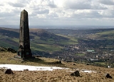
, Greenfield is mainly situated on and around two roads in the Chew Valley in the Pennines
Pennines
The Pennines are a low-rising mountain range, separating the North West of England from Yorkshire and the North East.Often described as the "backbone of England", they form a more-or-less continuous range stretching from the Peak District in Derbyshire, around the northern and eastern edges of...
. One of these roads is the main A635 road
A635 road
The A635 is a main road that runs between Manchester and Doncaster running east–west through Stalybridge, Saddleworth Moor, Holmfirth and Barnsley....
from Ashton-under-Lyne
Ashton-under-Lyne
Ashton-under-Lyne is a market town in the Metropolitan Borough of Tameside, Greater Manchester, England. Historically a part of Lancashire, it lies on the north bank of the River Tame, on undulating land at the foothills of the Pennines...
to Holmfirth
Holmfirth
Holmfirth is a small town located on the A6024 Woodhead Road in the Holme Valley, within the Metropolitan Borough of Kirklees, West Yorkshire, England. Centred upon the confluence of the Holme and Ribble rivers, Holmfirth is south of Huddersfield and from Glossop. It mostly consists of...
.
A Roman road
Roman road
The Roman roads were a vital part of the development of the Roman state, from about 500 BC through the expansion during the Roman Republic and the Roman Empire. Roman roads enabled the Romans to move armies and trade goods and to communicate. The Roman road system spanned more than 400,000 km...
passes along the Saddleworth hills, from the fort of Ardotalia
Ardotalia
Ardotalia is a Roman fort in Gamesley, near Glossop in Derbyshire, England .Ardotalia was constructed by Cohors Primae Frisiavonum—The First Cohort of Frisiavones. Evidence for the existence of this unit exists not only from the building stone found at the site but also from various diplomas and...
in Glossop
Glossop
Glossop is a market town within the Borough of High Peak in Derbyshire, England. It lies on the Glossop Brook, a tributary of the River Etherow, about east of the city of Manchester, west of the city of Sheffield. Glossop is situated near Derbyshire's county borders with Cheshire, Greater...
to Castleshaw Roman fort
Castleshaw Roman fort
Castleshaw Roman fort was a fort in the Roman province of Britannia. Although there is no evidence to substantiate the claim, it has been suggested that Castleshaw Roman fort is the site of Rigodunum, a Brigantian settlement. The remains of the fort are located on Castle Hill on the eastern side of...
.
Unanswered Questions