

Glossop
Encyclopedia
Glossop is a market town
Market town
Market town or market right is a legal term, originating in the medieval period, for a European settlement that has the right to host markets, distinguishing it from a village and city...
within the Borough of High Peak in Derbyshire
Derbyshire
Derbyshire is a county in the East Midlands of England. A substantial portion of the Peak District National Park lies within Derbyshire. The northern part of Derbyshire overlaps with the Pennines, a famous chain of hills and mountains. The county contains within its boundary of approx...
, England
England
England is a country that is part of the United Kingdom. It shares land borders with Scotland to the north and Wales to the west; the Irish Sea is to the north west, the Celtic Sea to the south west, with the North Sea to the east and the English Channel to the south separating it from continental...
. It lies on the Glossop Brook, a tributary of the River Etherow
River Etherow
The River Etherow is a river in northern England, and a tributary of the River Goyt. Although now passing through South Yorkshire, Derbyshire and Greater Manchester, it historically formed the ancient county boundary between Cheshire and Derbyshire. The upper valley is known as Longdendale...
, about 15 miles (24 km) east of the city of Manchester
Manchester
Manchester is a city and metropolitan borough in Greater Manchester, England. According to the Office for National Statistics, the 2010 mid-year population estimate for Manchester was 498,800. Manchester lies within one of the UK's largest metropolitan areas, the metropolitan county of Greater...
, 24 miles (39 km) west of the city of Sheffield
Sheffield
Sheffield is a city and metropolitan borough of South Yorkshire, England. Its name derives from the River Sheaf, which runs through the city. Historically a part of the West Riding of Yorkshire, and with some of its southern suburbs annexed from Derbyshire, the city has grown from its largely...
. Glossop is situated near Derbyshire's county borders with Cheshire
Cheshire
Cheshire is a ceremonial county in North West England. Cheshire's county town is the city of Chester, although its largest town is Warrington. Other major towns include Widnes, Congleton, Crewe, Ellesmere Port, Runcorn, Macclesfield, Winsford, Northwich, and Wilmslow...
, Greater Manchester
Greater Manchester
Greater Manchester is a metropolitan county in North West England, with a population of 2.6 million. It encompasses one of the largest metropolitan areas in the United Kingdom and comprises ten metropolitan boroughs: Bolton, Bury, Oldham, Rochdale, Stockport, Tameside, Trafford, Wigan, and the...
, South Yorkshire
South Yorkshire
South Yorkshire is a metropolitan county in the Yorkshire and the Humber region of England. It has a population of 1.29 million. It consists of four metropolitan boroughs: Barnsley, Doncaster, Rotherham, and City of Sheffield...
and West Yorkshire
West Yorkshire
West Yorkshire is a metropolitan county within the Yorkshire and the Humber region of England with a population of 2.2 million. West Yorkshire came into existence as a metropolitan county in 1974 after the passage of the Local Government Act 1972....
. It is between 150 and 300 m (492.1 and 984.3 ft) above mean sea level, and uses the tagline "the gateway to the Peak District National Park". Like nearby Buxton
Buxton
Buxton is a spa town in Derbyshire, England. It has the highest elevation of any market town in England. Located close to the county boundary with Cheshire to the west and Staffordshire to the south, Buxton is described as "the gateway to the Peak District National Park"...
, it differs from other areas of the borough in that it is an unparished area
Unparished area
In England, an unparished area is an area that is not covered by a civil parish. Most urbanised districts of England are either entirely or partly unparished. Many towns and some cities in otherwise rural districts are also unparished areas and therefore no longer have a town council or city...
, and this distinction defines its boundaries. It has a total resident population of 32,428 according to the 2001 census.
Historically the name Glossop refers to the small hamlet that gave its name to an ancient parish recorded in the Domesday Book
Domesday Book
Domesday Book , now held at The National Archives, Kew, Richmond upon Thames in South West London, is the record of the great survey of much of England and parts of Wales completed in 1086...
of 1086, and then the manor
Manorialism
Manorialism, an essential element of feudal society, was the organizing principle of rural economy that originated in the villa system of the Late Roman Empire, was widely practiced in medieval western and parts of central Europe, and was slowly replaced by the advent of a money-based market...
given by William I of England
William I of England
William I , also known as William the Conqueror , was the first Norman King of England from Christmas 1066 until his death. He was also Duke of Normandy from 3 July 1035 until his death, under the name William II...
to William Peverel
William Peverel
William Peverell , was a Norman knight, and is shown in 'The Battle Abbey Roll' to have fought at the Battle of Hastings.-Biography:...
. It refers to the municipal borough
Municipal borough
Municipal boroughs were a type of local government district which existed in England and Wales between 1835 and 1974, in Northern Ireland from 1840 to 1973 and in the Republic of Ireland from 1840 to 2002...
created in 1866, and the unparished urban area within two local government wards. The area now known as Glossop approximates to the villages that used to be called Glossopdale, on the lands of the Howard family, Dukes of Norfolk
Duke of Norfolk
The Duke of Norfolk is the premier duke in the peerage of England, and also, as Earl of Arundel, the premier earl. The Duke of Norfolk is, moreover, the Earl Marshal and hereditary Marshal of England. The seat of the Duke of Norfolk is Arundel Castle in Sussex, although the title refers to the...
. Originally known as a centre of wool processing, Glossop rapidly expanded in the late 18th century when it specialised in the production and printing of calico, a coarse cotton. Under the benign patronage of the Howards and other mill-owning families the villages became a mill town with many chapels and churches, its fortunes tied to the cotton industry
Textile manufacture during the Industrial Revolution
The industrial revolution changed the nature of work and society. Opinion varies as to the exact date, but it is estimated that the First Industrial Revolution took place between 1750 and 1850, and the second phase or Second Industrial Revolution between 1860 and 1900. The three key drivers in...
.
Architecturally the area is dominated by buildings constructed of the local sandstone. There remain two significant former cotton mills and the Dinting
Dinting
Dinting is a district of Glossop in Derbyshire, England. It is a small village and has no shops; the nearest are in neighbouring Glossop or Hadfield. However, there is a small primary school, Dinting C of E, located near the viaduct. The village is served by Dinting railway station...
railway viaduct. Strong rivalry between various Christian denominations has left a legacy of chapels, churches and their associated schools in the town and associated villages of Glossopdale. Close to the county borders of Greater Manchester, Glossop has transport links to Manchester, making the area popular for commuters. Glossop and the western area of High Peak fall within Greater Manchester's sphere of influence by way of some transport being provided by Transport for Greater Manchester.
Toponymy and definition
The name Glossop is thought to be of Saxon origin, named during the AnglesAngles
The Angles is a modern English term for a Germanic people who took their name from the ancestral cultural region of Angeln, a district located in Schleswig-Holstein, Germany...
' settlement in the 7th century, and derived from Glott's Hop - where hop could mean a valley, a small valley in a larger valley system, or a piece of land enclosed by marshes and Glott was probably a chieftain's name. Because of its size and location, Glossop had many definitions. The village of Glossop is now called Old Glossop. Howard Town and Milltown gained importance. They were named New Town and then Glossop. Local government reorganisations had caused the Glossopdale villages to be promoted to a municipal borough and then have that status removed. Land has been added to Glossop and other lands removed. From a small settlement it became an ancient parish, a manor, a borough, and a township. Currently two county divisions in High Peak Borough, Derbyshire, have Glossop as part of their names.
Roman and Saxon
There is evidence of a Bronze Age burial site on Shire Hill (near Old GlossopOld Glossop
Old Glossop is a parish village and the original part of the town of Glossop in the High Peak area of Derbyshire, England, about 15 miles east of Manchester and 23 miles from Sheffield...
) and other possibly prehistoric remains at Torside (on the slopes of Bleaklow
Bleaklow
Bleaklow is a high, largely peat covered, gritstone moorland, just north of Kinder Scout, across the Snake Pass , in the Derbyshire High Peak near the town of Glossop...
). The Romans
Roman Britain
Roman Britain was the part of the island of Great Britain controlled by the Roman Empire from AD 43 until ca. AD 410.The Romans referred to the imperial province as Britannia, which eventually comprised all of the island of Great Britain south of the fluid frontier with Caledonia...
arrived in 78 AD. At that time the area was within the territory of the Brigantes
Brigantes
The Brigantes were a Celtic tribe who in pre-Roman times controlled the largest section of what would become Northern England, and a significant part of the Midlands. Their kingdom is sometimes called Brigantia, and it was centred in what was later known as Yorkshire...
tribe, whose main base was in Yorkshire
Yorkshire
Yorkshire is a historic county of northern England and the largest in the United Kingdom. Because of its great size in comparison to other English counties, functions have been increasingly undertaken over time by its subdivisions, which have also been subject to periodic reform...
. The Romans built a road over the Pennines that descended into the Etherow valley along Doctor's Gate, and in the late first century a fort, Ardotalia
Ardotalia
Ardotalia is a Roman fort in Gamesley, near Glossop in Derbyshire, England .Ardotalia was constructed by Cohors Primae Frisiavonum—The First Cohort of Frisiavones. Evidence for the existence of this unit exists not only from the building stone found at the site but also from various diplomas and...
, on high ground above the river in present day Gamesley
Gamesley
Gamesley is a residential area within the Borough of High Peak in Derbyshire, England, west of Glossop and north of New Mills. It lies close to the River Etherow which is the boundary with Tameside in Greater Manchester.-Early:...
. The site of this fort was rediscovered in 1771 by an amateur historian, John Watson
John Watson (antiquary)
John Watson was an English clergyman and antiquary.-Life:The son of Legh Watson of Lyme Handley in the parish of Prestbury, Cheshire, by his wife Hester, daughter of John Yates of Swinton, Lancashire, he was born at Lyme Handley 26 March 1725, and educated at the grammar schools of Eccles, Wigan...
. It subsequently acquired the name "Melandra Castle". The extensive site has been excavated, revealing fort walls, a shrine and the fort headquarters. The area has been landscaped to provide parking and picnic areas. The prehistoric earthworks of Torside Castle are visible on Harrop Moss just north west of Bleaklow Head above the Longdendale Valley.
Medieval
William I of EnglandWilliam I of England
William I , also known as William the Conqueror , was the first Norman King of England from Christmas 1066 until his death. He was also Duke of Normandy from 3 July 1035 until his death, under the name William II...
awarded the manor of Glossop to William Peveril
William Peverel
William Peverell , was a Norman knight, and is shown in 'The Battle Abbey Roll' to have fought at the Battle of Hastings.-Biography:...
, who began construction of Glossop Castle
Glossop Castle
Glossop Castle is located north of Glossop, off "Hilltop Road", 14 miles east of Manchester, on the A57. The site is visible from the main road, standing atop a commanding ridge. Some 16 miles South-East is Peveril Castle.-History:...
, but the entire estate was later confiscated. In 1157 Henry II of England
Henry II of England
Henry II ruled as King of England , Count of Anjou, Count of Maine, Duke of Normandy, Duke of Aquitaine, Duke of Gascony, Count of Nantes, Lord of Ireland and, at various times, controlled parts of Wales, Scotland and western France. Henry, the great-grandson of William the Conqueror, was the...
gave the manor of Glossop to Basingwerk Abbey
Basingwerk Abbey
Basingwerk Abbey is the ruin of an abbey near Holywell, Flintshire, Wales, in the care of Cadw .The abbey was founded in 1132 by Ranulph de Gernon, 2nd Earl of Chester, who brought Benedictine monks from Savigny Abbey in southern Normandy. In 1147, the abbey became part of the Cistercian Order and...
. They gained a market charter
Market town
Market town or market right is a legal term, originating in the medieval period, for a European settlement that has the right to host markets, distinguishing it from a village and city...
for Glossop in 1290, and one for Charlesworth in 1328.
In 1433, the monks leased all of Glossopdale to the Talbot family, later Earls of Shrewsbury
Earl of Shrewsbury
Earl of Shrewsbury is a hereditary title of nobility created twice in the peerage of England.-First creation, 1074:The first creation occurred in 1074 for Roger de Montgomerie, one of William the Conqueror's principal counselors...
. In 1494, an illegitimate son of the family, Dr John Talbot, was appointed vicar of Glossop. He founded a school, and paved the Roman road over the moors; this is known as Doctor's Gate.
At the Dissolution of the Monasteries
Dissolution of the Monasteries
The Dissolution of the Monasteries, sometimes referred to as the Suppression of the Monasteries, was the set of administrative and legal processes between 1536 and 1541 by which Henry VIII disbanded monasteries, priories, convents and friaries in England, Wales and Ireland; appropriated their...
in 1537 the manor of Glossop was given to the Talbot family. In 1606 it came into the ownership of the Howard family, the Dukes of Norfolk, who held it for the next 300 years. Glossop was usually given to the second son of the family.
The land was too wet and cold to be used for wheat, but was ideal for the hardy Pennine sheep
Swaledale (sheep)
Swaledale is a breed of domestic sheep named after the Yorkshire valley of Swaledale. They are found throughout the more mountainous areas of Great Britain, but particularly in County Durham, Yorkshire, and most commonly around the pennine fells of Cumbria....
, so agriculture was predominantly pastoral. Most of the land was owned by the Howards and was leasehold and it was only in Whitfield
Whitfield
-Places:Australia*Whitfield, VictoriaEngland*Whitfield, Derbyshire*Whitfield, Gloucestershire*Whitfield, Herefordshire*Whitfield, Kent*Whitfield, Northamptonshire*Whitfield, NorthumberlandHong Kong*Whitfield BarracksScotland*Whitfield, Dundee...
that there was any freehold land. The few houses were solid, built of the local stone, and allowed for the development of home industries such as wool spinning and weaving.
Industrial and civic history
The medieval economy was based on sheep pasture and the production of wool by farmers who were tenants of the Abbot of Basingwerk and later the Talbot family. During the Industrial RevolutionIndustrial Revolution
The Industrial Revolution was a period from the 18th to the 19th century where major changes in agriculture, manufacturing, mining, transportation, and technology had a profound effect on the social, economic and cultural conditions of the times...
of the 18th century Glossop became a centre for cotton spinning. A good transport network between Liverpool and Glossop brought in imported cotton which was spun by a labour force with wool spinning skills. The climate of Glossopdale provided abundant soft water that was used to power mills and finish the cloth, and also gave the humidity necessary to spin cotton under tension. Initial investment was provided by the Dukes of Norfolk. By 1740, cotton in an unspun form had been introduced to make fustian
Fustian
Fustian is a term for a variety of heavy woven, mostly cotton fabrics, chiefly prepared for menswear. It is also used to refer to pompous, inflated or pretentious writing or speech, from at least the time of Shakespeare...
s and lighter cloths.
Mills
The first mills in Glossop were woollen mills. In 1774, Richard ArkwrightRichard Arkwright
Sir Richard Arkwright , was an Englishman who, although the patents were eventually overturned, is often credited for inventing the spinning frame — later renamed the water frame following the transition to water power. He also patented a carding engine that could convert raw cotton into yarn...
opened a mill at Cromford
Cromford
Cromford is a village, two miles to the south of Matlock in the Derbyshire Dales district in Derbyshire, England. It is principally known for its historical connection with Richard Arkwright, and the Cromford Mill which he built here in 1771...
. He developed the factory system
Factory system
The factory system was a method of manufacturing first adopted in England at the beginning of the Industrial Revolution in the 1750s and later spread abroad. Fundamentally, each worker created a separate part of the total assembly of a product, thus increasing the efficiency of factories. Workers,...
and patented machines for spinning cotton and carding
Carding
Carding is a mechanical process that breaks up locks and unorganised clumps of fibre and then aligns the individual fibres so that they are more or less parallel with each other. The word is derived from the Latin carduus meaning teasel, as dried vegetable teasels were first used to comb the raw wool...
. In 1785, his patents expired and many people copied Arkwright's system and his patents, exemplified by the Derwent Valley Mills
Derwent Valley Mills
Derwent Valley Mills is a World Heritage Site along the River Derwent in Derbyshire, England, designated in December 2001. It is administered by the Derwent Valley Mills Partnership. The modern factory, or 'mill', system was born here in the 18th century to accommodate the new technology for...
. By 1788 there were over 200 Arkwright-type mills in Britain. At the same time there were 17 cotton mills in Derbyshire, principally in Glossop. By 1831 there were at least 30 mills in Glossopdale, none of which had more than 1000 spindles. The mill owners were local men: the Wagstaffs and Hadfields were freeholders from Whitfield
Whitfield, Derbyshire
Whitfield is a hamlet in Derbyshire, England. It is located south of Glossop town hall, south of Glossop Brook between Bray Clough and Hurst Brook. The urban area stretches about up the hillside. Whitfield was one of the original townships in the ancient parish of Glossop, and in the manor...
; the Shepleys, Shaws, Lees, Garlicks and Platts had farmed the dale. The Sidebottoms were from Hadfield
Hadfield, Derbyshire
Hadfield is a parish and small residential town in High Peak, Derbyshire, England. It lies very close to the River Etherow which forms the border between Derbyshire and Greater Manchester...
, the Thornleys were carpenters, and John Bennet and John Robinson were clothiers.
John Wood
John Wood (millowner)
John Wood of Marsden came to Glossop from Manchester in 1819 and bought existing woollen mills which he expanded. These were the Howard Town mills. In 1825, John Wood installed the first steam engine and power looms. The Howardtown Mills became the largest spinning weaving combine in Glossop, and...
of Marsden
Marsden, West Yorkshire
Marsden is a large village within the Metropolitan Borough of Kirklees, in West Yorkshire, England, west of Huddersfield and located at the confluence of the River Colne and the Wessenden Brook...
came from Manchester in 1819 and bought existing woollen mills which he expanded. These were the Howard Town mills. Francis Sumner
Francis Sumner (millowner)
Francis James Sumner was a Roman Catholic mill owner in Glossop. Sumner built a large business and served as Mayor of Glossop, and Deputy Lieutenant and High Sheriff of Derbyshire.-Biography:...
was a Catholic whose family had connections with Matthew Ellison, Howard's agent. He built Wren's Nest Mill. The Sidebottoms built the Waterside mill at Hadfield. In 1825, John Wood installed the first steam engine and power looms. Sumner and Sidebottom followed suit and the three mills, Wren's Nest, Howardtown and Waterside, became very large vertical combines (a vertical combine was a mill that both spun the yarn and then used it to weave cloth). With the other major families, the Shepleys, Rhodes and Platts, they dominated the dale. In 1884, the six had 82% of the spinning capacity with 892,000 spindles and 13,571 looms. Glossop was a town of very large calico mills. The calico printing factory of Edmund Potter
Edmund Potter
Edmund Potter senior , was a Manchester industrialist and MP and grandfather to Beatrix Potter.He was a unitarian and, from 1861 to 1874, Liberal MP for Carlisle. Potter moved his business to Glossop in 1825, he rebuilt Joseph Lyne's Boggart Mill, and converted it to a printworks. He moved his...
(located in Dinting Vale) in the 1850s printed 2,500,000 pieces of printed calico, of which 80% was for export. The paper industry was created by Edward Partington
Edward Partington, 1st Baron Doverdale
Edward Partington was an English industrialist.-Biography:Partington was born in Bury, England and arrived in Glossop in 1874. He, with his partner William Olive, bought the Turn Lee Mill from Thomas Hamer Ibbotson. He bought it to try out a modern method of paper manufacture using the sulphite...
who, as Olive and Partington, bought the Turn Lee Mill in 1874 to produce high-quality paper from wood pulp by the sulphite method. He expanded rapidly with mills in Salford and Barrow in Furness. He merged with Kellner of Vienna
Vienna
Vienna is the capital and largest city of the Republic of Austria and one of the nine states of Austria. Vienna is Austria's primary city, with a population of about 1.723 million , and is by far the largest city in Austria, as well as its cultural, economic, and political centre...
and was created Lord Doverdale
Edward Partington, 1st Baron Doverdale
Edward Partington was an English industrialist.-Biography:Partington was born in Bury, England and arrived in Glossop in 1874. He, with his partner William Olive, bought the Turn Lee Mill from Thomas Hamer Ibbotson. He bought it to try out a modern method of paper manufacture using the sulphite...
in 1917. He died in 1925; his factories in Charlestown created nearly 1000 jobs.
Religion and benevolence
Lord Bernard Edward Howard, 12th Duke of Norfolk rebuilt the old parish church in 1831, built All Saints Roman Catholic chapel in 1836, improved the Hurst Reservoir in 1837, and built the town hall, whose foundation stone was laid on Coronation Day 1838.
The Sheffield, Ashton-Under-Lyne and Manchester Railway
Sheffield, Ashton-Under-Lyne and Manchester Railway
The Sheffield, Ashton-under-Lyne and Manchester Railway was an early British railway company which opened in stages between 1841 and 1845 between Sheffield and Manchester via Ashton-under-Lyne...
came to Dinting in 1842, but it was the 13th Duke of Norfolk
Henry Howard, 13th Duke of Norfolk
Henry Charles Howard, 13th Duke of Norfolk, KG, PC , styled Earl of Surrey between 1815 and 1842, was a British Whig politician.-Background:...
who built the spur line to Howard Town, so that coal could be brought from the colleries at Dukinfield
Dukinfield
Dukinfield is a small town within the Metropolitan Borough of Tameside, in Greater Manchester, England. It lies in central Tameside on the south bank of the River Tame, opposite Ashton-under-Lyne, and is east of the city of Manchester...
. Glossop railway station
Glossop railway station
Glossop railway station serves the town of Glossop in Derbyshire, England and is the third busiest railway station in the county of Derbyshire after Derby and Chesterfield, with an estimated 700,000 people using the station in 2009/10....
bears the lion, the symbol of the Norfolks. Many of the street- and placenames in Glossop derive from the names and titles of the Dukes of Norfolk, such as Norfolk Square, and a cluster of residential streets off Norfolk Street that were named after Lord Henry Charles Fitzalan Howard, the 13th Duke of Norfolk
Henry Howard, 13th Duke of Norfolk
Henry Charles Howard, 13th Duke of Norfolk, KG, PC , styled Earl of Surrey between 1815 and 1842, was a British Whig politician.-Background:...
, the first Catholic MP since the reformation.
A two-storey Township Workhouse
Workhouse
In England and Wales a workhouse, colloquially known as a spike, was a place where those unable to support themselves were offered accommodation and employment...
was built between 1832 and 1834 on Bute Street . Its administration was taken over by Glossop Poor Law Union in December 1837. The workhouse buildings included a 40-bed infirmary, piggeries, and casual wards for vagrants. The workhouse later became Glossop Public Assistance Institution and from 1948 the N.H.S.
National Health Service
The National Health Service is the shared name of three of the four publicly funded healthcare systems in the United Kingdom. They provide a comprehensive range of health services, the vast majority of which are free at the point of use to residents of the United Kingdom...
Shire Hill Hospital.
The mill owners, Catholics, Anglican, Methodist and Unitarian, built reading rooms and chapels. They worked together and worshipped together with their workers. The Woods, Sidebottoms and Shepleys were Anglicans and hence Tory, and they dominated every vestry, which was the only form of local government before 1866. They built four churches St James's, Whitfield
St James' Church Glossop
St. James's Church is an Anglican church in the evangelical tradition located in the town of Glossop, Derbyshire, in the North West of England. Along with St. Luke's Church, it makes up Whitfield Parish within Derby Diocese. Rev Colin Cooper is the present Vicar of Whitfield Parish...
in 1846, St Andrew's Hadfield in 1874, Holy Trinity Dinting in 1875 and St Luke's Glossop. Francis Sumner and the Ellisons and Norfolks were Catholic and built St Charles's Hadfield and St Mary's Glossop. The smaller mill owners were Dissenters and congregated at Littlemoor Independent Chapel built in Hadfield in 1811, but they later built a further eleven chapels.
For decades there was rivalry between Edward Partington
Edward Partington, 1st Baron Doverdale
Edward Partington was an English industrialist.-Biography:Partington was born in Bury, England and arrived in Glossop in 1874. He, with his partner William Olive, bought the Turn Lee Mill from Thomas Hamer Ibbotson. He bought it to try out a modern method of paper manufacture using the sulphite...
, his friend Herbert Rhodes, and the Woods and Sidebottoms. The Woods built the public baths and laid out the park. Partington built the library. Partington built the cricket pavilion, so Samuel Hill-Woods sponsored the football club that for one season, 1899-1890, played in League Division One. He went on to be chairman of a London club, Arsenal. He was MP for High Peak from 1910–1929. Edward's son, Oswald
Oswald Partington, 2nd Baron Doverdale
Oswald Partington, 2nd Baron Doverdale was a Liberal Party politician in the United Kingdom.The second but oldest surviving son of mill-owner Edward Partington , Partington was born in Bury. Educated at Rossall School, he held a commission in the 4th Battalion of the Cheshire Regiment...
, was MP for High Peak from 1900–1910. Ann Kershaw Woods devoted herself to Anglican education and had schools built.
Cotton famine and industrial relations
In 1851, 38% of the men and 27% of the women were employed in cotton; the only alternative employment was agriculture, building, or labouring on the railway. Consequently the town was vulnerable to interruptions in the supply of cotton or the export trade. The American Civil WarAmerican Civil War
The American Civil War was a civil war fought in the United States of America. In response to the election of Abraham Lincoln as President of the United States, 11 southern slave states declared their secession from the United States and formed the Confederate States of America ; the other 25...
caused the cotton famine of 1861–4. The mill owners met together and put in place a relief programme through which they supplied food, clogs and coal to their employees. Howard increased the workforce on his estate, and public works (such as improving the domestic water supply) were undertaken. They provided unsecured loans to the workers until the cotton returned. The relationship between the owners and men was one of paternal benevolence. They lived in the same community and worshipped in the same churches. The mill owners were the local aldermen, the church elders, and led the sports teams. In the Luddite
Luddite
The Luddites were a social movement of 19th-century English textile artisans who protested – often by destroying mechanised looms – against the changes produced by the Industrial Revolution, which they felt were leaving them without work and changing their way of life...
and Chartist
Chartism
Chartism was a movement for political and social reform in the United Kingdom during the mid-19th century, between 1838 and 1859. It takes its name from the People's Charter of 1838. Chartism was possibly the first mass working class labour movement in the world...
times and the period following Peterloo, Glossop was virtually unaffected, despite its proximity to Hyde
Hyde, Greater Manchester
Hyde is a town in the Metropolitan Borough of Tameside, Greater Manchester, England. As of the 2001 census, the town had a population of 31,253. Historically part of Cheshire, it is northeast of Stockport, west of Glossop and east of Manchester....
, a radical hotbed. In the 4s 2d or swing strike it was incomers from Ashton
Ashton-under-Lyne
Ashton-under-Lyne is a market town in the Metropolitan Borough of Tameside, Greater Manchester, England. Historically a part of Lancashire, it lies on the north bank of the River Tame, on undulating land at the foothills of the Pennines...
who stopped the Glossop mills. The rivalry in Glossop was not based on class, but on religious groups.
Modern (20th century)
The decline of cotton spinningCotton-spinning machinery
Cotton-spinning machinery refers to machines which process prepared cotton roving into workable yarn or thread. Such machinery can be dated back centuries. During the 18th and 19th centuries, as part of the Industrial Revolution cotton-spinning machinery was developed to bring mass production to...
has resulted in the closure of many of the town's mills. The Howard family sold the Glossop Estate in 1925 and donated large areas to the people of Glossop. Manor Park was the location of the family's Manor House
Manor house
A manor house is a country house that historically formed the administrative centre of a manor, the lowest unit of territorial organisation in the feudal system in Europe. The term is applied to country houses that belonged to the gentry and other grand stately homes...
and gardens. The recession of 1929
Great Depression
The Great Depression was a severe worldwide economic depression in the decade preceding World War II. The timing of the Great Depression varied across nations, but in most countries it started in about 1929 and lasted until the late 1930s or early 1940s...
hit Glossop very hard: in 1929 the unemployment rate was 14%, and in 1931 it was 55%. In Hadfield it reached 67%. National initiatives to improve housing and employment conditions largely failed, and mills fell empty and decayed. Unemployment remained at 36% in 1938. The Second World War
World War II
World War II, or the Second World War , was a global conflict lasting from 1939 to 1945, involving most of the world's nations—including all of the great powers—eventually forming two opposing military alliances: the Allies and the Axis...
changed this: military stores, metals, machine tools, munitions, rubber and essential industries moved into the empty factories and left Glossop with a more diverse range of industries.
In spite of the post-war Barlow Report and government intervention, no significant employer moved into Glossop.
Gamesley
Gamesley
Gamesley is a residential area within the Borough of High Peak in Derbyshire, England, west of Glossop and north of New Mills. It lies close to the River Etherow which is the boundary with Tameside in Greater Manchester.-Early:...
underwent considerable change in the 1960s, when a large council estate was built, mainly to house people from Manchester. These housing areas, called 'Overspill estate
Overspill estate
An overspill estate is a housing estate planned and built for the rehousing of people from decaying inner city areas usually as part of the process of slum clearance....
s', were also built in other towns surrounding Manchester.
Plans
Heritage Lottery Fund
The Heritage Lottery Fund is a fund established in the United Kingdom under the National Lottery etc. Act 1993. The Fund opened for applications in 1994. It uses money raised through the National Lottery to transform and sustain the UK’s heritage...
. It aims to open up access to the Glossop Brook, to coordinate developments in Glossop town centre, to enhance the built environment and to link the town to its wider setting. As such, the mills have become a retail development with housing, trees are to be planted along the A57
A57 road
The A57 is a major road in England. It runs east from Liverpool to Lincoln, via Warrington, Cadishead, Irlam, Patricroft, Eccles, Salford and Manchester, then through the Pennines over the Snake Pass , around the Ladybower Reservoir, through Sheffield and past Worksop...
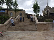
and the market square has been pedestrianised.
Governance
In the local government reorganisation of 1974 the Borough of Glossop was abolished, and since then the two levels of local government are Derbyshire County Council, based in Matlock, and High Peak Borough CouncilHigh Peak Borough Council
High Peak Borough Council is a non-metropolitan district council with borough status in the north of Derbyshire, England. It forms part of the two tier system of local government alongside Derbyshire County Council for the High Peak. The administrative base of High Peak Borough Council is split...
based in Chapel-en-le-Frith.
Glossop was included in the "South East Lancashire Special Review Area" under the Local Government Act 1958
Local Government Act 1958
The Local Government Act 1958 was an Act of the Parliament of the United Kingdom affecting local government in England and Wales outside London...
, and the Redcliffe-Maud Report
Redcliffe-Maud Report
The Redcliffe–Maud Report is the name generally given to the report published by the Royal Commission on Local Government in England 1966–1969 under the chairmanship of Lord Redcliffe-Maud.-Terms of reference and membership:...
of 1969 recommended its inclusion in a South East Lancashire–North East Cheshire
Greater Manchester
Greater Manchester is a metropolitan county in North West England, with a population of 2.6 million. It encompasses one of the largest metropolitan areas in the United Kingdom and comprises ten metropolitan boroughs: Bolton, Bury, Oldham, Rochdale, Stockport, Tameside, Trafford, Wigan, and the...
metropolitan area. Glossop was not ultimately included in the Greater Manchester area established by the Local Government Act 1972
Local Government Act 1972
The Local Government Act 1972 is an Act of Parliament in the United Kingdom that reformed local government in England and Wales on 1 April 1974....
. Local people voted to stay within the County of Derbyshire in 1973. The county council, originally based in Derby
Derby
Derby , is a city and unitary authority in the East Midlands region of England. It lies upon the banks of the River Derwent and is located in the south of the ceremonial county of Derbyshire. In the 2001 census, the population of the city was 233,700, whilst that of the Derby Urban Area was 229,407...
, moved to Matlock in the late 1950s to facilitate easier travelling to the county hall from the northern extremities such as Glossop and the High Peak.
For the county council Glossop is split between the divisions of Glossop South, Glossop North and Rural, and Etherow. Glossop North and Rural also contains the old Charlesworth and Chisworth wards that were collectively known as St John's. Etherow division contains Hadfield North, Hadfield South, Gamesley and the large and sparsely populated Tintwistle ward, which was formerly in Cheshire. These boundaries were set in 2005.
| Division | Holder | |
|---|---|---|
| Etherow | Cllr Dave Wilcox | |
| Glossop North and Rural | Cllr George Wharmby | |
| Glossop South | Cllr Jean Wharmby | |
At the district level, that is High Peak Borough Council, Glossop comprises these wards: Dinting, Gamesley, Hadfield North, Hadfield South, Old Glossop, Padfield, Howard Town, Simmondley and Whitfield. St John's represents the rural area that was formerly Glossopdale RDC and lies within the National Park. These were the wards used in the 2001 Census.
| Ward | Holder | |
|---|---|---|
| Dinting | Cllr WHARMBY, Jean | |
| Gamesley | Cllr MCKEOWN, Anthony Edward | |
| Hadfield North | Cllr MANN, Victoria Elizabeth | |
| Hadfield South | Cllr SIDDALL, Edward | |
| Hadfield South | Cllr MCKEOWN, Robert Joseph | |
| Howard Town | Cllr CLAFF, Godfrey Cllr WAUDE, Colin |
|
| Old Glossop | Cllr PARVIN, Garry | |
| Padfield | Cllr WILCOX, Ellie | |
| Tintwistle | Cllr JENNER, Patrick | |
| St. John's | Cllr WHARMBY, George | |
| Simmondley | Cllr MCCABE, Julie Ann Cllr HAKEN, John |
|
| Whitfield | Cllr OAKLEY, Graham Nigel | |
Glossop itself does not have a parish council, but Tintwistle and St John's are parished.
The Member of Parliament for the High Peak constituency
High Peak (UK Parliament constituency)
- Elections in the 2000s :- Elections in the 1990s :- Elections in the 1980s :-Elections in the 1970s:-Elections in the 1960s:...
since 2010 has been Andrew Bingham MP, representing the Conservative
Conservative Party (UK)
The Conservative Party, formally the Conservative and Unionist Party, is a centre-right political party in the United Kingdom that adheres to the philosophies of conservatism and British unionism. It is the largest political party in the UK, and is currently the largest single party in the House...
Party. His majority in the 2010 General Election was 4,677 over the Labour
Labour Party (UK)
The Labour Party is a centre-left democratic socialist party in the United Kingdom. It surpassed the Liberal Party in general elections during the early 1920s, forming minority governments under Ramsay MacDonald in 1924 and 1929-1931. The party was in a wartime coalition from 1940 to 1945, after...
candidate Caitlin Bisknell.
| Constituency | Holder | |
|---|---|---|
| High Peak | Andrew Bingham Andrew Bingham Andrew Russell Bingham is a British Conservative Party politician. He has been Member of Parliament for High Peak in Derbyshire since winning the seat at the 2010 general election.-Early life:... |
|
Historic Glossop
Historically, the ancient parish of Glossop consisted of the ten townships of the manor: Glossop, Hadfield, Padfield, Dinting, Simmondley, Whitfield, Chunal, Charlesworth, Chisworth, Ludworth and nine more: MellorMellor, Greater Manchester
Mellor is a village within the Metropolitan Borough of Stockport, in Greater Manchester, England. Mellor, situated between Marple Bridge and New Mills, runs along a tributary of the River Goyt. It extends from the start of the old turnpike road at the boundary of Marple Bridge to the current county...
, Thornsett, Rowarth
Rowarth
Rowarth is a hamlet about 2.5 miles north of New Mills in the High Peak borough of Derbyshire, England. It is on the edge of the Peak District, in the hills between New Mills and Marple Bridge. It is within the boundaries of the former town....
, Whittle
New Mills
New Mills is a town in Derbyshire, England approximately south-east of Stockport and from Manchester. It is sited at the confluence of the rivers Goyt and Sett, on the border of Cheshire. The town stands above the Torrs, a deep gorge, cut through Woodhead Hill Sandstone of the Carboniferous period...
, Beard
New Mills
New Mills is a town in Derbyshire, England approximately south-east of Stockport and from Manchester. It is sited at the confluence of the rivers Goyt and Sett, on the border of Cheshire. The town stands above the Torrs, a deep gorge, cut through Woodhead Hill Sandstone of the Carboniferous period...
, Ollersett
New Mills
New Mills is a town in Derbyshire, England approximately south-east of Stockport and from Manchester. It is sited at the confluence of the rivers Goyt and Sett, on the border of Cheshire. The town stands above the Torrs, a deep gorge, cut through Woodhead Hill Sandstone of the Carboniferous period...
, Hayfield
Hayfield
Hayfield is a village and civil parish in the Borough of High Peak, in the county of Derbyshire, England. The village lies approximately east of New Mills, south of Glossop and north of Buxton by road....
, Little Hayfield
Little Hayfield
Little Hayfield is a hamlet in the Peak District National Park, in England. It lies on the A624 between Hayfield and Glossop. Its main point of interest is the Lantern Pike pub. Sheepdog trials and fell racing take place there....
, Phoside
Hayfield
Hayfield is a village and civil parish in the Borough of High Peak, in the county of Derbyshire, England. The village lies approximately east of New Mills, south of Glossop and north of Buxton by road....
, Kinder
Hayfield
Hayfield is a village and civil parish in the Borough of High Peak, in the county of Derbyshire, England. The village lies approximately east of New Mills, south of Glossop and north of Buxton by road....
, Bugsworth, Brownside and Chinley
Chinley
Chinley is a rural village in High Peak Borough, situated on the western edge of the Peak District National Park in Derbyshire, England, with a population of around 2000. Before the railway, the area was economically dominated by agriculture and quarrying. Three textile mills were established in...
. Within the parish were the chapelries of Hayfield and Mellor. The ancient parish was in the Hundred of High Peak; it was about 16 miles (25.7 km) in length and 5 miles (8 km) wide, with an area of 31876 acres (129 km²). Beard, Ollerset, Thornsett and Whittle later formed the town of New Mills
New Mills
New Mills is a town in Derbyshire, England approximately south-east of Stockport and from Manchester. It is sited at the confluence of the rivers Goyt and Sett, on the border of Cheshire. The town stands above the Torrs, a deep gorge, cut through Woodhead Hill Sandstone of the Carboniferous period...
, while Hayfield, Little Hayfield, Phoside and Kinder joined the parish of Hayfield. The chapelry of Mellor included Mellor, Chisworth, Ludworth, Whittle and part of Thornsett.
The Manor of Glossop was made up of the territory that includes Hadfield
Hadfield, Derbyshire
Hadfield is a parish and small residential town in High Peak, Derbyshire, England. It lies very close to the River Etherow which forms the border between Derbyshire and Greater Manchester...
, Padfield
Padfield
Padfield is a small village, near Hadfield in High Peak, Derbyshire, England. The village is on the west side of the Peak District National Park, and the nearest town is Glossop where many local amenities and services are based...
, Dinting
Dinting
Dinting is a district of Glossop in Derbyshire, England. It is a small village and has no shops; the nearest are in neighbouring Glossop or Hadfield. However, there is a small primary school, Dinting C of E, located near the viaduct. The village is served by Dinting railway station...
, Simmondley
Simmondley
Simmondley is a small village near the Derbyshire town of Glossop. It hosts two pubs: the Hare and Hounds, and the Jubilee. The Hare and Hounds is situated in the south of the village at the top of Simmondley Lane. The pub is a part of the original farming community with the farmhouse, the barn and...
, Whitfield
Whitfield, Derbyshire
Whitfield is a hamlet in Derbyshire, England. It is located south of Glossop town hall, south of Glossop Brook between Bray Clough and Hurst Brook. The urban area stretches about up the hillside. Whitfield was one of the original townships in the ancient parish of Glossop, and in the manor...
, Chunal
Chunal
Chunal is a hamlet in Derbyshire, England. It is located on the A624 road, 1 mile south of Glossop. The philosopher Ludwig Wittgenstein conducted aeronautical research at Chunal during his time as an engineering research student at Manchester University...
, Charlesworth
Charlesworth, Derbyshire
Charlesworth is a village near Glossop, Derbyshire, England. It is located 2 miles south-west of Glossop's town centre and very close to the borders of Greater Manchester with the nearby village of Broadbottom in Tameside. The parish church of St John the Baptist was built in 1848-49. The...
, Chisworth
Chisworth
Chisworth is a hamlet near Glossop, Derbyshire, England. It is located 3 miles south-west of Glossop's town centre, on the south side of the Etherow valley. The parish of Chisworth was formed in 1896, out of the parish of Chisworth and Ludworth. In 1901, it had a population of 409...
, Ludworth
Ludworth, Greater Manchester
Ludworth is an area of Marple, Greater Manchester in Greater Manchester. Ludworth Civil Parish was created in 1896; it was part of Glossop Dale Rural District until 1934 when it was transferred to Chapel-en-le-Frith Rural District. In 1936 it was transferred, along with Mellor to Marple Urban...
and the village of Glossop, now called Old Glossop
Old Glossop
Old Glossop is a parish village and the original part of the town of Glossop in the High Peak area of Derbyshire, England, about 15 miles east of Manchester and 23 miles from Sheffield...
. It had an area of 11308 acres (45.8 km²), of which more than 8000 acres (32.4 km²) were classed as moorland.
The Municipal Borough of Glossop (1866–1974) contained the land within two miles of the Town Hall in Howard Town and a sliver to the north bounded by the River Etherow, an area of 3052 acres (12.4 km²). It is cited as an example of a 'millocracy' as two thirds of the elected councillors were mill owners. The remaining parishes of Charlesworth, Chisworth and Ludworth formed Glossopdale Rural District, which remained in existence till 1934 when the parishes were split, Ludworth going into Marple RDC, Chisworth and the greater part of Charlesworth joining Chapel en le Frith RDC and the smaller part—271 acres (1.1 km²)—joining Glossop.
The present community of Glossop is centred on Howardtown. It is served by the Glossopdale Area Forum and the Glossop Town Partnership.
The previous hamlet of Glossop is now known as Old Glossop.
Geography
Glossop is 184 miles (296 km) northwest of London, 15 miles (24 km) east of the city of ManchesterManchester
Manchester is a city and metropolitan borough in Greater Manchester, England. According to the Office for National Statistics, the 2010 mid-year population estimate for Manchester was 498,800. Manchester lies within one of the UK's largest metropolitan areas, the metropolitan county of Greater...
and 24 miles (38.6 km) west of the city of Sheffield
Sheffield
Sheffield is a city and metropolitan borough of South Yorkshire, England. Its name derives from the River Sheaf, which runs through the city. Historically a part of the West Riding of Yorkshire, and with some of its southern suburbs annexed from Derbyshire, the city has grown from its largely...
. It nestles in the foothills of the Pennines
Pennines
The Pennines are a low-rising mountain range, separating the North West of England from Yorkshire and the North East.Often described as the "backbone of England", they form a more-or-less continuous range stretching from the Peak District in Derbyshire, around the northern and eastern edges of...
, with Bleaklow
Bleaklow
Bleaklow is a high, largely peat covered, gritstone moorland, just north of Kinder Scout, across the Snake Pass , in the Derbyshire High Peak near the town of Glossop...
to the northeast and Kinder Scout
Kinder Scout
Kinder Scout is a moorland plateau in the Dark Peak of the Derbyshire Peak District in England. Part of the moor, at 636 m above sea level, is the highest point in the Peak District, the highest point in Derbyshire, and the highest point in the East Midlands. It is accessible from the villages of...
to the south. It lies on Glossop Brook, a tributary of the River Etherow
River Etherow
The River Etherow is a river in northern England, and a tributary of the River Goyt. Although now passing through South Yorkshire, Derbyshire and Greater Manchester, it historically formed the ancient county boundary between Cheshire and Derbyshire. The upper valley is known as Longdendale...
, in the area of peat moorland commonly known as the Dark Peak
Dark Peak
The Dark Peak is the higher, wilder northern part of the Peak District in England.It gets its name because , the underlying limestone is covered by a cap of Millstone Grit which means that in winter the soil is almost always saturated with water...
. The moors, which rise to over 600m, are cut by many deep V-shaped valleys known as cloughs, each formed by a stream known as a brook. The Shelf Brook passes through Old Glossop where it joins the Hurst Brook to form the Glossop Brook, which passes westward through Milltown, Howard Town and Dinting to the River Etherow, which in turn runs south to join the River Goyt at Marple Bridge
Marple Bridge
Marple Bridge is a village within the Metropolitan Borough of Stockport, in Greater Manchester, England. It lies on the River Goyt, which runs through the centre of the village, and is close to the town of Marple....
. Two other notable brooks are the Padfield Brook and the Gnat Hole Brook.
The Shelf Brook leads from Shelf Moor on Bleaklow down Doctor's Gate through Old Glossop to the Glossop Brook. The valley was used by the Romans
Roman Empire
The Roman Empire was the post-Republican period of the ancient Roman civilization, characterised by an autocratic form of government and large territorial holdings in Europe and around the Mediterranean....
for a road, and currently contains a bridleway. The north slope of Holden Clough and the Hurst Brook is used by the A57 road
A57 road
The A57 is a major road in England. It runs east from Liverpool to Lincoln, via Warrington, Cadishead, Irlam, Patricroft, Eccles, Salford and Manchester, then through the Pennines over the Snake Pass , around the Ladybower Reservoir, through Sheffield and past Worksop...
known as the Snake Pass
Snake Pass
The Snake Pass is the name given to the remote, higher reaches of the A57 road where it crosses the Peak District between Manchester and Sheffield in the north of England...
. The Snake Pass crosses the Pennine Way
Pennine Way
The Pennine Way is a National Trail in England. The trail runs from Edale, in the northern Derbyshire Peak District, north through the Yorkshire Dales and the Northumberland National Park and ends at Kirk Yetholm, just inside the Scottish border. The path runs along the Pennine hills, sometimes...
near Doctor's Gate Culvert (512 m above sea level) before descending to the east to Ladybower Reservoir
Ladybower Reservoir
Ladybower Reservoir is a large Y-shaped reservoir, the lowest of three in the Upper Derwent Valley in Derbyshire, England. The River Ashop flows into the reservoir from the west; the River Derwent flows south, initially through Howden Reservoir, then Derwent Reservoir, and finally through Ladybower...
along the northern side of the River Ashop
River Ashop
The River Ashop is a river in the Derbyshire Peak District, England. Its source is on Black Ashop Moor, just east of the Pennine Way, and north of Kinder Scout....
valley. Here a road leads east over Hallam Moor into Sheffield
Sheffield
Sheffield is a city and metropolitan borough of South Yorkshire, England. Its name derives from the River Sheaf, which runs through the city. Historically a part of the West Riding of Yorkshire, and with some of its southern suburbs annexed from Derbyshire, the city has grown from its largely...
, and south along the River Derwent
River Derwent, Derbyshire
The Derwent is a river in the county of Derbyshire, England. It is 66 miles long and is a tributary of the River Trent which it joins south of Derby. For half its course, the river flows through the Peak District....
into Baslow
Baslow
Baslow is a village in Derbyshire, England, in the Peak District, lying between Sheffield and Bakewell. It is situated on the River Derwent just north of Chatsworth House. A seventeenth century bridge spans the river in the village, alongside which is a contemporary toll house...
and Matlock. To the north of Glossop is Tintwistle; the River Etherow
River Etherow
The River Etherow is a river in northern England, and a tributary of the River Goyt. Although now passing through South Yorkshire, Derbyshire and Greater Manchester, it historically formed the ancient county boundary between Cheshire and Derbyshire. The upper valley is known as Longdendale...
is the boundary. Today, the Longdendale
Longdendale
Longdendale is a valley in the north of England, north of Glossop and south east of Holmfirth. The name means "long wooded valley".- Geography :...
valley forms a chain of reservoirs that provide drinking water for Manchester. At the head of the valley is Woodhead
Woodhead
Woodhead is a small and scattered settlement at the head of the Longdendale valley in Derbyshire, England, situated 18 miles from Manchester and 17 miles from Barnsley. It lies on the River Etherow and the Trans Pennine Trail...
, where the road from Huddersfield
Huddersfield
Huddersfield is a large market town within the Metropolitan Borough of Kirklees, in West Yorkshire, England, situated halfway between Leeds and Manchester. It lies north of London, and south of Bradford, the nearest city....
joins the road to Sheffield, and a three-mile railway tunnel brought the railway from Penistone
Penistone
Penistone is a small town market town and civil parish in the Metropolitan Borough of Barnsley, in South Yorkshire, England, with a population of 10,101 at the 2001 census. It lies west of the town of Barnsley and north east of Glossop, in the foothills of the Pennines...
.
Geology

Carboniferous
The Carboniferous is a geologic period and system that extends from the end of the Devonian Period, about 359.2 ± 2.5 Mya , to the beginning of the Permian Period, about 299.0 ± 0.8 Mya . The name is derived from the Latin word for coal, carbo. Carboniferous means "coal-bearing"...
Millstone Grit
Millstone Grit
Millstone Grit is the name given to any of a number of coarse-grained sandstones of Carboniferous age which occur in the Northern England. The name derives from its use in earlier times as a source of millstones for use principally in watermills...
, shale
Shale
Shale is a fine-grained, clastic sedimentary rock composed of mud that is a mix of flakes of clay minerals and tiny fragments of other minerals, especially quartz and calcite. The ratio of clay to other minerals is variable. Shale is characterized by breaks along thin laminae or parallel layering...
s and sandstone
Sandstone
Sandstone is a sedimentary rock composed mainly of sand-sized minerals or rock grains.Most sandstone is composed of quartz and/or feldspar because these are the most common minerals in the Earth's crust. Like sand, sandstone may be any colour, but the most common colours are tan, brown, yellow,...
. Glossop is on the edge of the Peak District Dome, at the southern edge of the Pennine anticline. The Variscan uplift
Variscan orogeny
The Variscan orogeny is a geologic mountain-building event caused by Late Paleozoic continental collision between Euramerica and Gondwana to form the supercontinent of Pangaea.-Naming:...
has caused much faulting and Glossopdale was the product of glacial action in the last glaciation period that exploited the weakened rocks. The steep-sided valleys of the cloughs cause significant erosion and deposition. The layers of sandstone, mudstones and shale in the bedrock act as a aquifer
Aquifer
An aquifer is a wet underground layer of water-bearing permeable rock or unconsolidated materials from which groundwater can be usefully extracted using a water well. The study of water flow in aquifers and the characterization of aquifers is called hydrogeology...
to feed the springs. The valley bottoms have a thin deposit of boulder clay
Boulder clay
Boulder clay, in geology, is a deposit of clay, often full of boulders, which is formed in and beneath glaciers and ice-sheets wherever they are found, but is in a special sense the typical deposit of the Glacial Period in northern Europe and North America...
. The brooks are fed by the peat
Peat
Peat is an accumulation of partially decayed vegetation matter or histosol. Peat forms in wetland bogs, moors, muskegs, pocosins, mires, and peat swamp forests. Peat is harvested as an important source of fuel in certain parts of the world...
y soils of the moors thus are acid (pH5.5–7.0); this means the instream wildlife is dependent on food sources from outside the channel.
Climate
Glossop experiences a temperateTemperate
In geography, temperate or tepid latitudes of the globe lie between the tropics and the polar circles. The changes in these regions between summer and winter are generally relatively moderate, rather than extreme hot or cold...
maritime climate
Oceanic climate
An oceanic climate, also called marine west coast climate, maritime climate, Cascadian climate and British climate for Köppen climate classification Cfb and subtropical highland for Köppen Cfb or Cwb, is a type of climate typically found along the west coasts at the middle latitudes of some of the...
, like much of the British Isles
British Isles
The British Isles are a group of islands off the northwest coast of continental Europe that include the islands of Great Britain and Ireland and over six thousand smaller isles. There are two sovereign states located on the islands: the United Kingdom of Great Britain and Northern Ireland and...
, with relatively cool summers and mild winters. There is regular but generally light precipitation throughout the year. Glossop has a history of flash flooding, the most recent being in 2002 when High Street West was flooded to a depth of 1 metres (3.3 ft).
Demography
Glossop has been subject to frequent boundary changes, so different analyses can be made of the same raw datasets depending on how the 'equivalent' area is interpreted, which may or may not bear the same name.| Year | 1801 | 1811 | 1821 | 1831 | 1839 | 1851 | 1861 | 1871 | 1881 | 1891 | |||
|---|---|---|---|---|---|---|---|---|---|---|---|---|---|
| Population Glossop | 3,625 | 4,012* | 6,212 | 9,631 | 14,577 | 19,587 | 21,000 | 20,673 | 19,574 | 22,416 | |||
| Glossop and Charlesworth | 2,759 | 4,012* | 5,135 | 7,897 | 12,569 | 17,454 | 19,126 | 18,508 | 21,393 | 23,493 | |||
| Source:A Vision of Britain through Time Source:Small Town Politics, 1959, A.H.Birch. pub OUP * Data set includes Chisworth and Ludworth |
|||||||||||||
| Year | 1901 | 1911 | 1921 | 1931 | 1939 | 1951 | 1961 | 1971 | 2001 | ||||
|---|---|---|---|---|---|---|---|---|---|---|---|---|---|
| Population | 21,520 | 21,688 | 20,531 | 19,509 | estimate 23,500 | 18,994 | 17,500 | 24,272 | 32,428 | ||||
| Source:A Vision of Britain through Time | |||||||||||||
Economy
Glossop was a product of the wealth of the cotton industry. Glossop's economy was linked closely with a spinning and weaving tradition which had evolved from developments in textile manufacture during the Industrial RevolutionTextile manufacture during the Industrial Revolution
The industrial revolution changed the nature of work and society. Opinion varies as to the exact date, but it is estimated that the First Industrial Revolution took place between 1750 and 1850, and the second phase or Second Industrial Revolution between 1860 and 1900. The three key drivers in...
. Before the first world war, Glossop had the headquarters of an international paper empire, the largest calico printworks in the world, a large bleach
Bleach
Bleach refers to a number of chemicals that remove color, whiten, or disinfect, often via oxidation. Common chemical bleaches include household chlorine bleach , lye, oxygen bleach , and bleaching powder...
works, and six spinning weaving
Weaving
Weaving is a method of fabric production in which two distinct sets of yarns or threads are interlaced at right angles to form a fabric or cloth. The other methods are knitting, lace making and felting. The longitudinal threads are called the warp and the lateral threads are the weft or filling...
combines with over 600,000 spindles and 12,000 looms and two niche manufacturers: grindstone
Millstone
Millstones or mill stones are used in windmills and watermills, including tide mills, for grinding wheat or other grains.The type of stone most suitable for making millstones is a siliceous rock called burrstone , an open-textured, porous but tough, fine-grained sandstone, or a silicified,...
s and industrial belt
Belt (mechanical)
A belt is a loop of flexible material used to link two or more rotating shafts mechanically. Belts may be used as a source of motion, to transmit power efficiently, or to track relative movement. Belts are looped over pulleys. In a two pulley system, the belt can either drive the pulleys in the...
s. In the 1920s, these firms were refloated on the easily available share capital
Share capital
Share capital or issued capital or capital stock refers to the portion of a company's equity that has been obtained by trading stock to a shareholder for cash or an equivalent item of capital value...
—thus were victims of the stockmarket crash. Their product lines were vulnerable to the new economic conditions.
Glossop is a market town
Market town
Market town or market right is a legal term, originating in the medieval period, for a European settlement that has the right to host markets, distinguishing it from a village and city...
within the Borough of High Peak in Derbyshire
Derbyshire
Derbyshire is a county in the East Midlands of England. A substantial portion of the Peak District National Park lies within Derbyshire. The northern part of Derbyshire overlaps with the Pennines, a famous chain of hills and mountains. The county contains within its boundary of approx...
, England
England
England is a country that is part of the United Kingdom. It shares land borders with Scotland to the north and Wales to the west; the Irish Sea is to the north west, the Celtic Sea to the south west, with the North Sea to the east and the English Channel to the south separating it from continental...
. It lies on the Glossop Brook, a tributary of the River Etherow
River Etherow
The River Etherow is a river in northern England, and a tributary of the River Goyt. Although now passing through South Yorkshire, Derbyshire and Greater Manchester, it historically formed the ancient county boundary between Cheshire and Derbyshire. The upper valley is known as Longdendale...
, about 15 miles (24 km) east of the city of Manchester
Manchester
Manchester is a city and metropolitan borough in Greater Manchester, England. According to the Office for National Statistics, the 2010 mid-year population estimate for Manchester was 498,800. Manchester lies within one of the UK's largest metropolitan areas, the metropolitan county of Greater...
, 24 miles (39 km) west of the city of Sheffield
Sheffield
Sheffield is a city and metropolitan borough of South Yorkshire, England. Its name derives from the River Sheaf, which runs through the city. Historically a part of the West Riding of Yorkshire, and with some of its southern suburbs annexed from Derbyshire, the city has grown from its largely...
. Glossop is situated near Derbyshire's county borders with Cheshire
Cheshire
Cheshire is a ceremonial county in North West England. Cheshire's county town is the city of Chester, although its largest town is Warrington. Other major towns include Widnes, Congleton, Crewe, Ellesmere Port, Runcorn, Macclesfield, Winsford, Northwich, and Wilmslow...
, Greater Manchester
Greater Manchester
Greater Manchester is a metropolitan county in North West England, with a population of 2.6 million. It encompasses one of the largest metropolitan areas in the United Kingdom and comprises ten metropolitan boroughs: Bolton, Bury, Oldham, Rochdale, Stockport, Tameside, Trafford, Wigan, and the...
, South Yorkshire
South Yorkshire
South Yorkshire is a metropolitan county in the Yorkshire and the Humber region of England. It has a population of 1.29 million. It consists of four metropolitan boroughs: Barnsley, Doncaster, Rotherham, and City of Sheffield...
and West Yorkshire
West Yorkshire
West Yorkshire is a metropolitan county within the Yorkshire and the Humber region of England with a population of 2.2 million. West Yorkshire came into existence as a metropolitan county in 1974 after the passage of the Local Government Act 1972....
. It is between 150 and 300 m (492.1 and 984.3 ft) above mean sea level, and uses the tagline "the gateway to the Peak District National Park". Like nearby Buxton
Buxton
Buxton is a spa town in Derbyshire, England. It has the highest elevation of any market town in England. Located close to the county boundary with Cheshire to the west and Staffordshire to the south, Buxton is described as "the gateway to the Peak District National Park"...
, it differs from other areas of the borough in that it is an unparished area
Unparished area
In England, an unparished area is an area that is not covered by a civil parish. Most urbanised districts of England are either entirely or partly unparished. Many towns and some cities in otherwise rural districts are also unparished areas and therefore no longer have a town council or city...
, and this distinction defines its boundaries. It has a total resident population of 32,428 according to the 2001 census.
Historically the name Glossop refers to the small hamlet that gave its name to an ancient parish recorded in the Domesday Book
Domesday Book
Domesday Book , now held at The National Archives, Kew, Richmond upon Thames in South West London, is the record of the great survey of much of England and parts of Wales completed in 1086...
of 1086, and then the manor
Manorialism
Manorialism, an essential element of feudal society, was the organizing principle of rural economy that originated in the villa system of the Late Roman Empire, was widely practiced in medieval western and parts of central Europe, and was slowly replaced by the advent of a money-based market...
given by William I of England
William I of England
William I , also known as William the Conqueror , was the first Norman King of England from Christmas 1066 until his death. He was also Duke of Normandy from 3 July 1035 until his death, under the name William II...
to William Peverel
William Peverel
William Peverell , was a Norman knight, and is shown in 'The Battle Abbey Roll' to have fought at the Battle of Hastings.-Biography:...
. It refers to the municipal borough
Municipal borough
Municipal boroughs were a type of local government district which existed in England and Wales between 1835 and 1974, in Northern Ireland from 1840 to 1973 and in the Republic of Ireland from 1840 to 2002...
created in 1866, and the unparished urban area within two local government wards. The area now known as Glossop approximates to the villages that used to be called Glossopdale, on the lands of the Howard family, Dukes of Norfolk
Duke of Norfolk
The Duke of Norfolk is the premier duke in the peerage of England, and also, as Earl of Arundel, the premier earl. The Duke of Norfolk is, moreover, the Earl Marshal and hereditary Marshal of England. The seat of the Duke of Norfolk is Arundel Castle in Sussex, although the title refers to the...
. Originally known as a centre of wool processing, Glossop rapidly expanded in the late 18th century when it specialised in the production and printing of calico, a coarse cotton. Under the benign patronage of the Howards and other mill-owning families the villages became a mill town with many chapels and churches, its fortunes tied to the cotton industry
Textile manufacture during the Industrial Revolution
The industrial revolution changed the nature of work and society. Opinion varies as to the exact date, but it is estimated that the First Industrial Revolution took place between 1750 and 1850, and the second phase or Second Industrial Revolution between 1860 and 1900. The three key drivers in...
.
Architecturally the area is dominated by buildings constructed of the local sandstone. There remain two significant former cotton mills and the Dinting
Dinting
Dinting is a district of Glossop in Derbyshire, England. It is a small village and has no shops; the nearest are in neighbouring Glossop or Hadfield. However, there is a small primary school, Dinting C of E, located near the viaduct. The village is served by Dinting railway station...
railway viaduct. Strong rivalry between various Christian denominations has left a legacy of chapels, churches and their associated schools in the town and associated villages of Glossopdale. Close to the county borders of Greater Manchester, Glossop has transport links to Manchester, making the area popular for commuters. Glossop and the western area of High Peak fall within Greater Manchester's sphere of influence by way of some transport being provided by Transport for Greater Manchester.
History
Toponymy and definition
The name Glossop is thought to be of Saxon origin, named during the AnglesAngles
The Angles is a modern English term for a Germanic people who took their name from the ancestral cultural region of Angeln, a district located in Schleswig-Holstein, Germany...
' settlement in the 7th century, and derived from Glott's Hop - where hop could mean a valley, a small valley in a larger valley system, or a piece of land enclosed by marshes and Glott was probably a chieftain's name. Because of its size and location, Glossop had many definitions. The village of Glossop is now called Old Glossop. Howard Town and Milltown gained importance. They were named New Town and then Glossop. Local government reorganisations had caused the Glossopdale villages to be promoted to a municipal borough and then have that status removed. Land has been added to Glossop and other lands removed. From a small settlement it became an ancient parish, a manor, a borough, and a township. Currently two county divisions in High Peak Borough, Derbyshire, have Glossop as part of their names.
Roman and Saxon
There is evidence of a Bronze Age burial site on Shire Hill (near Old GlossopOld Glossop
Old Glossop is a parish village and the original part of the town of Glossop in the High Peak area of Derbyshire, England, about 15 miles east of Manchester and 23 miles from Sheffield...
) and other possibly prehistoric remains at Torside (on the slopes of Bleaklow
Bleaklow
Bleaklow is a high, largely peat covered, gritstone moorland, just north of Kinder Scout, across the Snake Pass , in the Derbyshire High Peak near the town of Glossop...
). The Romans
Roman Britain
Roman Britain was the part of the island of Great Britain controlled by the Roman Empire from AD 43 until ca. AD 410.The Romans referred to the imperial province as Britannia, which eventually comprised all of the island of Great Britain south of the fluid frontier with Caledonia...
arrived in 78 AD. At that time the area was within the territory of the Brigantes
Brigantes
The Brigantes were a Celtic tribe who in pre-Roman times controlled the largest section of what would become Northern England, and a significant part of the Midlands. Their kingdom is sometimes called Brigantia, and it was centred in what was later known as Yorkshire...
tribe, whose main base was in Yorkshire
Yorkshire
Yorkshire is a historic county of northern England and the largest in the United Kingdom. Because of its great size in comparison to other English counties, functions have been increasingly undertaken over time by its subdivisions, which have also been subject to periodic reform...
. The Romans built a road over the Pennines that descended into the Etherow valley along Doctor's Gate, and in the late first century a fort, Ardotalia
Ardotalia
Ardotalia is a Roman fort in Gamesley, near Glossop in Derbyshire, England .Ardotalia was constructed by Cohors Primae Frisiavonum—The First Cohort of Frisiavones. Evidence for the existence of this unit exists not only from the building stone found at the site but also from various diplomas and...
, on high ground above the river in present day Gamesley
Gamesley
Gamesley is a residential area within the Borough of High Peak in Derbyshire, England, west of Glossop and north of New Mills. It lies close to the River Etherow which is the boundary with Tameside in Greater Manchester.-Early:...
. The site of this fort was rediscovered in 1771 by an amateur historian, John Watson
John Watson (antiquary)
John Watson was an English clergyman and antiquary.-Life:The son of Legh Watson of Lyme Handley in the parish of Prestbury, Cheshire, by his wife Hester, daughter of John Yates of Swinton, Lancashire, he was born at Lyme Handley 26 March 1725, and educated at the grammar schools of Eccles, Wigan...
. It subsequently acquired the name "Melandra Castle". The extensive site has been excavated, revealing fort walls, a shrine and the fort headquarters. The area has been landscaped to provide parking and picnic areas. The prehistoric earthworks of Torside Castle are visible on Harrop Moss just north west of Bleaklow Head above the Longdendale Valley.
Medieval
William I of EnglandWilliam I of England
William I , also known as William the Conqueror , was the first Norman King of England from Christmas 1066 until his death. He was also Duke of Normandy from 3 July 1035 until his death, under the name William II...
awarded the manor of Glossop to William Peveril
William Peverel
William Peverell , was a Norman knight, and is shown in 'The Battle Abbey Roll' to have fought at the Battle of Hastings.-Biography:...
, who began construction of Glossop Castle
Glossop Castle
Glossop Castle is located north of Glossop, off "Hilltop Road", 14 miles east of Manchester, on the A57. The site is visible from the main road, standing atop a commanding ridge. Some 16 miles South-East is Peveril Castle.-History:...
, but the entire estate was later confiscated. In 1157 Henry II of England
Henry II of England
Henry II ruled as King of England , Count of Anjou, Count of Maine, Duke of Normandy, Duke of Aquitaine, Duke of Gascony, Count of Nantes, Lord of Ireland and, at various times, controlled parts of Wales, Scotland and western France. Henry, the great-grandson of William the Conqueror, was the...
gave the manor of Glossop to Basingwerk Abbey
Basingwerk Abbey
Basingwerk Abbey is the ruin of an abbey near Holywell, Flintshire, Wales, in the care of Cadw .The abbey was founded in 1132 by Ranulph de Gernon, 2nd Earl of Chester, who brought Benedictine monks from Savigny Abbey in southern Normandy. In 1147, the abbey became part of the Cistercian Order and...
. They gained a market charter
Market town
Market town or market right is a legal term, originating in the medieval period, for a European settlement that has the right to host markets, distinguishing it from a village and city...
for Glossop in 1290, and one for Charlesworth in 1328.
In 1433, the monks leased all of Glossopdale to the Talbot family, later Earls of Shrewsbury
Earl of Shrewsbury
Earl of Shrewsbury is a hereditary title of nobility created twice in the peerage of England.-First creation, 1074:The first creation occurred in 1074 for Roger de Montgomerie, one of William the Conqueror's principal counselors...
. In 1494, an illegitimate son of the family, Dr John Talbot, was appointed vicar of Glossop. He founded a school, and paved the Roman road over the moors; this is known as Doctor's Gate.
At the Dissolution of the Monasteries
Dissolution of the Monasteries
The Dissolution of the Monasteries, sometimes referred to as the Suppression of the Monasteries, was the set of administrative and legal processes between 1536 and 1541 by which Henry VIII disbanded monasteries, priories, convents and friaries in England, Wales and Ireland; appropriated their...
in 1537 the manor of Glossop was given to the Talbot family. In 1606 it came into the ownership of the Howard family, the Dukes of Norfolk, who held it for the next 300 years. Glossop was usually given to the second son of the family.
The land was too wet and cold to be used for wheat, but was ideal for the hardy Pennine sheep
Swaledale (sheep)
Swaledale is a breed of domestic sheep named after the Yorkshire valley of Swaledale. They are found throughout the more mountainous areas of Great Britain, but particularly in County Durham, Yorkshire, and most commonly around the pennine fells of Cumbria....
, so agriculture was predominantly pastoral. Most of the land was owned by the Howards and was leasehold and it was only in Whitfield
Whitfield
-Places:Australia*Whitfield, VictoriaEngland*Whitfield, Derbyshire*Whitfield, Gloucestershire*Whitfield, Herefordshire*Whitfield, Kent*Whitfield, Northamptonshire*Whitfield, NorthumberlandHong Kong*Whitfield BarracksScotland*Whitfield, Dundee...
that there was any freehold land. The few houses were solid, built of the local stone, and allowed for the development of home industries such as wool spinning and weaving.
Industrial and civic history
The medieval economy was based on sheep pasture and the production of wool by farmers who were tenants of the Abbot of Basingwerk and later the Talbot family. During the Industrial RevolutionIndustrial Revolution
The Industrial Revolution was a period from the 18th to the 19th century where major changes in agriculture, manufacturing, mining, transportation, and technology had a profound effect on the social, economic and cultural conditions of the times...
of the 18th century Glossop became a centre for cotton spinning. A good transport network between Liverpool and Glossop brought in imported cotton which was spun by a labour force with wool spinning skills. The climate of Glossopdale provided abundant soft water that was used to power mills and finish the cloth, and also gave the humidity necessary to spin cotton under tension. Initial investment was provided by the Dukes of Norfolk. By 1740, cotton in an unspun form had been introduced to make fustian
Fustian
Fustian is a term for a variety of heavy woven, mostly cotton fabrics, chiefly prepared for menswear. It is also used to refer to pompous, inflated or pretentious writing or speech, from at least the time of Shakespeare...
s and lighter cloths.
Mills
The first mills in Glossop were woollen mills. In 1774, Richard ArkwrightRichard Arkwright
Sir Richard Arkwright , was an Englishman who, although the patents were eventually overturned, is often credited for inventing the spinning frame — later renamed the water frame following the transition to water power. He also patented a carding engine that could convert raw cotton into yarn...
opened a mill at Cromford
Cromford
Cromford is a village, two miles to the south of Matlock in the Derbyshire Dales district in Derbyshire, England. It is principally known for its historical connection with Richard Arkwright, and the Cromford Mill which he built here in 1771...
. He developed the factory system
Factory system
The factory system was a method of manufacturing first adopted in England at the beginning of the Industrial Revolution in the 1750s and later spread abroad. Fundamentally, each worker created a separate part of the total assembly of a product, thus increasing the efficiency of factories. Workers,...
and patented machines for spinning cotton and carding
Carding
Carding is a mechanical process that breaks up locks and unorganised clumps of fibre and then aligns the individual fibres so that they are more or less parallel with each other. The word is derived from the Latin carduus meaning teasel, as dried vegetable teasels were first used to comb the raw wool...
. In 1785, his patents expired and many people copied Arkwright's system and his patents, exemplified by the Derwent Valley Mills
Derwent Valley Mills
Derwent Valley Mills is a World Heritage Site along the River Derwent in Derbyshire, England, designated in December 2001. It is administered by the Derwent Valley Mills Partnership. The modern factory, or 'mill', system was born here in the 18th century to accommodate the new technology for...
. By 1788 there were over 200 Arkwright-type mills in Britain. At the same time there were 17 cotton mills in Derbyshire, principally in Glossop. By 1831 there were at least 30 mills in Glossopdale, none of which had more than 1000 spindles. The mill owners were local men: the Wagstaffs and Hadfields were freeholders from Whitfield
Whitfield, Derbyshire
Whitfield is a hamlet in Derbyshire, England. It is located south of Glossop town hall, south of Glossop Brook between Bray Clough and Hurst Brook. The urban area stretches about up the hillside. Whitfield was one of the original townships in the ancient parish of Glossop, and in the manor...
; the Shepleys, Shaws, Lees, Garlicks and Platts had farmed the dale. The Sidebottoms were from Hadfield
Hadfield, Derbyshire
Hadfield is a parish and small residential town in High Peak, Derbyshire, England. It lies very close to the River Etherow which forms the border between Derbyshire and Greater Manchester...
, the Thornleys were carpenters, and John Bennet and John Robinson were clothiers.
John Wood
John Wood (millowner)
John Wood of Marsden came to Glossop from Manchester in 1819 and bought existing woollen mills which he expanded. These were the Howard Town mills. In 1825, John Wood installed the first steam engine and power looms. The Howardtown Mills became the largest spinning weaving combine in Glossop, and...
of Marsden
Marsden, West Yorkshire
Marsden is a large village within the Metropolitan Borough of Kirklees, in West Yorkshire, England, west of Huddersfield and located at the confluence of the River Colne and the Wessenden Brook...
came from Manchester in 1819 and bought existing woollen mills which he expanded. These were the Howard Town mills. Francis Sumner
Francis Sumner (millowner)
Francis James Sumner was a Roman Catholic mill owner in Glossop. Sumner built a large business and served as Mayor of Glossop, and Deputy Lieutenant and High Sheriff of Derbyshire.-Biography:...
was a Catholic whose family had connections with Matthew Ellison, Howard's agent. He built Wren's Nest Mill. The Sidebottoms built the Waterside mill at Hadfield. In 1825, John Wood installed the first steam engine and power looms. Sumner and Sidebottom followed suit and the three mills, Wren's Nest, Howardtown and Waterside, became very large vertical combines (a vertical combine was a mill that both spun the yarn and then used it to weave cloth). With the other major families, the Shepleys, Rhodes and Platts, they dominated the dale. In 1884, the six had 82% of the spinning capacity with 892,000 spindles and 13,571 looms. Glossop was a town of very large calico mills. The calico printing factory of Edmund Potter
Edmund Potter
Edmund Potter senior , was a Manchester industrialist and MP and grandfather to Beatrix Potter.He was a unitarian and, from 1861 to 1874, Liberal MP for Carlisle. Potter moved his business to Glossop in 1825, he rebuilt Joseph Lyne's Boggart Mill, and converted it to a printworks. He moved his...
(located in Dinting Vale) in the 1850s printed 2,500,000 pieces of printed calico, of which 80% was for export. The paper industry was created by Edward Partington
Edward Partington, 1st Baron Doverdale
Edward Partington was an English industrialist.-Biography:Partington was born in Bury, England and arrived in Glossop in 1874. He, with his partner William Olive, bought the Turn Lee Mill from Thomas Hamer Ibbotson. He bought it to try out a modern method of paper manufacture using the sulphite...
who, as Olive and Partington, bought the Turn Lee Mill in 1874 to produce high-quality paper from wood pulp by the sulphite method. He expanded rapidly with mills in Salford and Barrow in Furness. He merged with Kellner of Vienna
Vienna
Vienna is the capital and largest city of the Republic of Austria and one of the nine states of Austria. Vienna is Austria's primary city, with a population of about 1.723 million , and is by far the largest city in Austria, as well as its cultural, economic, and political centre...
and was created Lord Doverdale
Edward Partington, 1st Baron Doverdale
Edward Partington was an English industrialist.-Biography:Partington was born in Bury, England and arrived in Glossop in 1874. He, with his partner William Olive, bought the Turn Lee Mill from Thomas Hamer Ibbotson. He bought it to try out a modern method of paper manufacture using the sulphite...
in 1917. He died in 1925; his factories in Charlestown created nearly 1000 jobs.
Religion and benevolence
Lord Bernard Edward Howard, 12th Duke of Norfolk rebuilt the old parish church in 1831, built All Saints Roman Catholic chapel in 1836, improved the Hurst Reservoir in 1837, and built the town hall, whose foundation stone was laid on Coronation Day 1838.
The Sheffield, Ashton-Under-Lyne and Manchester Railway
Sheffield, Ashton-Under-Lyne and Manchester Railway
The Sheffield, Ashton-under-Lyne and Manchester Railway was an early British railway company which opened in stages between 1841 and 1845 between Sheffield and Manchester via Ashton-under-Lyne...
came to Dinting in 1842, but it was the 13th Duke of Norfolk
Henry Howard, 13th Duke of Norfolk
Henry Charles Howard, 13th Duke of Norfolk, KG, PC , styled Earl of Surrey between 1815 and 1842, was a British Whig politician.-Background:...
who built the spur line to Howard Town, so that coal could be brought from the colleries at Dukinfield
Dukinfield
Dukinfield is a small town within the Metropolitan Borough of Tameside, in Greater Manchester, England. It lies in central Tameside on the south bank of the River Tame, opposite Ashton-under-Lyne, and is east of the city of Manchester...
. Glossop railway station
Glossop railway station
Glossop railway station serves the town of Glossop in Derbyshire, England and is the third busiest railway station in the county of Derbyshire after Derby and Chesterfield, with an estimated 700,000 people using the station in 2009/10....
bears the lion, the symbol of the Norfolks. Many of the street- and placenames in Glossop derive from the names and titles of the Dukes of Norfolk, such as Norfolk Square, and a cluster of residential streets off Norfolk Street that were named after Lord Henry Charles Fitzalan Howard, the 13th Duke of Norfolk
Henry Howard, 13th Duke of Norfolk
Henry Charles Howard, 13th Duke of Norfolk, KG, PC , styled Earl of Surrey between 1815 and 1842, was a British Whig politician.-Background:...
, the first Catholic MP since the reformation.
A two-storey Township Workhouse
Workhouse
In England and Wales a workhouse, colloquially known as a spike, was a place where those unable to support themselves were offered accommodation and employment...
was built between 1832 and 1834 on Bute Street . Its administration was taken over by Glossop Poor Law Union in December 1837. The workhouse buildings included a 40-bed infirmary, piggeries, and casual wards for vagrants. The workhouse later became Glossop Public Assistance Institution and from 1948 the N.H.S.
National Health Service
The National Health Service is the shared name of three of the four publicly funded healthcare systems in the United Kingdom. They provide a comprehensive range of health services, the vast majority of which are free at the point of use to residents of the United Kingdom...
Shire Hill Hospital.
The mill owners, Catholics, Anglican, Methodist and Unitarian, built reading rooms and chapels. They worked together and worshipped together with their workers. The Woods, Sidebottoms and Shepleys were Anglicans and hence Tory, and they dominated every vestry, which was the only form of local government before 1866. They built four churches St James's, Whitfield
St James' Church Glossop
St. James's Church is an Anglican church in the evangelical tradition located in the town of Glossop, Derbyshire, in the North West of England. Along with St. Luke's Church, it makes up Whitfield Parish within Derby Diocese. Rev Colin Cooper is the present Vicar of Whitfield Parish...
in 1846, St Andrew's Hadfield in 1874, Holy Trinity Dinting in 1875 and St Luke's Glossop. Francis Sumner and the Ellisons and Norfolks were Catholic and built St Charles's Hadfield and St Mary's Glossop. The smaller mill owners were Dissenters and congregated at Littlemoor Independent Chapel built in Hadfield in 1811, but they later built a further eleven chapels.
For decades there was rivalry between Edward Partington
Edward Partington, 1st Baron Doverdale
Edward Partington was an English industrialist.-Biography:Partington was born in Bury, England and arrived in Glossop in 1874. He, with his partner William Olive, bought the Turn Lee Mill from Thomas Hamer Ibbotson. He bought it to try out a modern method of paper manufacture using the sulphite...
, his friend Herbert Rhodes, and the Woods and Sidebottoms. The Woods built the public baths and laid out the park. Partington built the library. Partington built the cricket pavilion, so Samuel Hill-Woods sponsored the football club that for one season, 1899-1890, played in League Division One. He went on to be chairman of a London club, Arsenal. He was MP for High Peak from 1910–1929. Edward's son, Oswald
Oswald Partington, 2nd Baron Doverdale
Oswald Partington, 2nd Baron Doverdale was a Liberal Party politician in the United Kingdom.The second but oldest surviving son of mill-owner Edward Partington , Partington was born in Bury. Educated at Rossall School, he held a commission in the 4th Battalion of the Cheshire Regiment...
, was MP for High Peak from 1900–1910. Ann Kershaw Woods devoted herself to Anglican education and had schools built.
Cotton famine and industrial relations
In 1851, 38% of the men and 27% of the women were employed in cotton; the only alternative employment was agriculture, building, or labouring on the railway. Consequently the town was vulnerable to interruptions in the supply of cotton or the export trade. The American Civil WarAmerican Civil War
The American Civil War was a civil war fought in the United States of America. In response to the election of Abraham Lincoln as President of the United States, 11 southern slave states declared their secession from the United States and formed the Confederate States of America ; the other 25...
caused the cotton famine of 1861–4. The mill owners met together and put in place a relief programme through which they supplied food, clogs and coal to their employees. Howard increased the workforce on his estate, and public works (such as improving the domestic water supply) were undertaken. They provided unsecured loans to the workers until the cotton returned. The relationship between the owners and men was one of paternal benevolence. They lived in the same community and worshipped in the same churches. The mill owners were the local aldermen, the church elders, and led the sports teams. In the Luddite
Luddite
The Luddites were a social movement of 19th-century English textile artisans who protested – often by destroying mechanised looms – against the changes produced by the Industrial Revolution, which they felt were leaving them without work and changing their way of life...
and Chartist
Chartism
Chartism was a movement for political and social reform in the United Kingdom during the mid-19th century, between 1838 and 1859. It takes its name from the People's Charter of 1838. Chartism was possibly the first mass working class labour movement in the world...
times and the period following Peterloo, Glossop was virtually unaffected, despite its proximity to Hyde
Hyde, Greater Manchester
Hyde is a town in the Metropolitan Borough of Tameside, Greater Manchester, England. As of the 2001 census, the town had a population of 31,253. Historically part of Cheshire, it is northeast of Stockport, west of Glossop and east of Manchester....
, a radical hotbed. In the 4s 2d or swing strike it was incomers from Ashton
Ashton-under-Lyne
Ashton-under-Lyne is a market town in the Metropolitan Borough of Tameside, Greater Manchester, England. Historically a part of Lancashire, it lies on the north bank of the River Tame, on undulating land at the foothills of the Pennines...
who stopped the Glossop mills. The rivalry in Glossop was not based on class, but on religious groups.
Modern (20th century)
The decline of cotton spinningCotton-spinning machinery
Cotton-spinning machinery refers to machines which process prepared cotton roving into workable yarn or thread. Such machinery can be dated back centuries. During the 18th and 19th centuries, as part of the Industrial Revolution cotton-spinning machinery was developed to bring mass production to...
has resulted in the closure of many of the town's mills. The Howard family sold the Glossop Estate in 1925 and donated large areas to the people of Glossop. Manor Park was the location of the family's Manor House
Manor house
A manor house is a country house that historically formed the administrative centre of a manor, the lowest unit of territorial organisation in the feudal system in Europe. The term is applied to country houses that belonged to the gentry and other grand stately homes...
and gardens. The recession of 1929
Great Depression
The Great Depression was a severe worldwide economic depression in the decade preceding World War II. The timing of the Great Depression varied across nations, but in most countries it started in about 1929 and lasted until the late 1930s or early 1940s...
hit Glossop very hard: in 1929 the unemployment rate was 14%, and in 1931 it was 55%. In Hadfield it reached 67%. National initiatives to improve housing and employment conditions largely failed, and mills fell empty and decayed. Unemployment remained at 36% in 1938. The Second World War
World War II
World War II, or the Second World War , was a global conflict lasting from 1939 to 1945, involving most of the world's nations—including all of the great powers—eventually forming two opposing military alliances: the Allies and the Axis...
changed this: military stores, metals, machine tools, munitions, rubber and essential industries moved into the empty factories and left Glossop with a more diverse range of industries.
In spite of the post-war Barlow Report and government intervention, no significant employer moved into Glossop.
Gamesley
Gamesley
Gamesley is a residential area within the Borough of High Peak in Derbyshire, England, west of Glossop and north of New Mills. It lies close to the River Etherow which is the boundary with Tameside in Greater Manchester.-Early:...
underwent considerable change in the 1960s, when a large council estate was built, mainly to house people from Manchester. These housing areas, called 'Overspill estate
Overspill estate
An overspill estate is a housing estate planned and built for the rehousing of people from decaying inner city areas usually as part of the process of slum clearance....
s', were also built in other towns surrounding Manchester.
Plans
Heritage Lottery Fund
The Heritage Lottery Fund is a fund established in the United Kingdom under the National Lottery etc. Act 1993. The Fund opened for applications in 1994. It uses money raised through the National Lottery to transform and sustain the UK’s heritage...
. It aims to open up access to the Glossop Brook, to coordinate developments in Glossop town centre, to enhance the built environment and to link the town to its wider setting. As such, the mills have become a retail development with housing, trees are to be planted along the A57
A57 road
The A57 is a major road in England. It runs east from Liverpool to Lincoln, via Warrington, Cadishead, Irlam, Patricroft, Eccles, Salford and Manchester, then through the Pennines over the Snake Pass , around the Ladybower Reservoir, through Sheffield and past Worksop...
and the market square has been pedestrianised.
Governance
In the local government reorganisation of 1974 the Borough of Glossop was abolished, and since then the two levels of local government are Derbyshire County Council, based in Matlock, and High Peak Borough CouncilHigh Peak Borough Council
High Peak Borough Council is a non-metropolitan district council with borough status in the north of Derbyshire, England. It forms part of the two tier system of local government alongside Derbyshire County Council for the High Peak. The administrative base of High Peak Borough Council is split...
based in Chapel-en-le-Frith.
Glossop was included in the "South East Lancashire Special Review Area" under the Local Government Act 1958
Local Government Act 1958
The Local Government Act 1958 was an Act of the Parliament of the United Kingdom affecting local government in England and Wales outside London...
, and the Redcliffe-Maud Report
Redcliffe-Maud Report
The Redcliffe–Maud Report is the name generally given to the report published by the Royal Commission on Local Government in England 1966–1969 under the chairmanship of Lord Redcliffe-Maud.-Terms of reference and membership:...
of 1969 recommended its inclusion in a South East Lancashire–North East Cheshire
Greater Manchester
Greater Manchester is a metropolitan county in North West England, with a population of 2.6 million. It encompasses one of the largest metropolitan areas in the United Kingdom and comprises ten metropolitan boroughs: Bolton, Bury, Oldham, Rochdale, Stockport, Tameside, Trafford, Wigan, and the...
metropolitan area. Glossop was not ultimately included in the Greater Manchester area established by the Local Government Act 1972
Local Government Act 1972
The Local Government Act 1972 is an Act of Parliament in the United Kingdom that reformed local government in England and Wales on 1 April 1974....
. Local people voted to stay within the County of Derbyshire in 1973. The county council, originally based in Derby
Derby
Derby , is a city and unitary authority in the East Midlands region of England. It lies upon the banks of the River Derwent and is located in the south of the ceremonial county of Derbyshire. In the 2001 census, the population of the city was 233,700, whilst that of the Derby Urban Area was 229,407...
, moved to Matlock in the late 1950s to facilitate easier travelling to the county hall from the northern extremities such as Glossop and the High Peak.
For the county council Glossop is split between the divisions of Glossop South, Glossop North and Rural, and Etherow. Glossop North and Rural also contains the old Charlesworth and Chisworth wards that were collectively known as St John's. Etherow division contains Hadfield North, Hadfield South, Gamesley and the large and sparsely populated Tintwistle ward, which was formerly in Cheshire. These boundaries were set in 2005.
| Division | Holder | |
|---|---|---|
| Etherow | Cllr Dave Wilcox | |
| Glossop North and Rural | Cllr George Wharmby | |
| Glossop South | Cllr Jean Wharmby | |
At the district level, that is High Peak Borough Council, Glossop comprises these wards: Dinting, Gamesley, Hadfield North, Hadfield South, Old Glossop, Padfield, Howard Town, Simmondley and Whitfield. St John's represents the rural area that was formerly Glossopdale RDC and lies within the National Park. These were the wards used in the 2001 Census.
| Ward | Holder | |
|---|---|---|
| Dinting | Cllr WHARMBY, Jean | |
| Gamesley | Cllr MCKEOWN, Anthony Edward | |
| Hadfield North | Cllr MANN, Victoria Elizabeth | |
| Hadfield South | Cllr SIDDALL, Edward | |
| Hadfield South | Cllr MCKEOWN, Robert Joseph | |
| Howard Town | Cllr CLAFF, Godfrey Cllr WAUDE, Colin |
|
| Old Glossop | Cllr PARVIN, Garry | |
| Padfield | Cllr WILCOX, Ellie | |
| Tintwistle | Cllr JENNER, Patrick | |
| St. John's | Cllr WHARMBY, George | |
| Simmondley | Cllr MCCABE, Julie Ann Cllr HAKEN, John |
|
| Whitfield | Cllr OAKLEY, Graham Nigel | |
Glossop itself does not have a parish council, but Tintwistle and St John's are parished.
The Member of Parliament for the High Peak constituency
High Peak (UK Parliament constituency)
- Elections in the 2000s :- Elections in the 1990s :- Elections in the 1980s :-Elections in the 1970s:-Elections in the 1960s:...
since 2010 has been Andrew Bingham MP, representing the Conservative
Conservative Party (UK)
The Conservative Party, formally the Conservative and Unionist Party, is a centre-right political party in the United Kingdom that adheres to the philosophies of conservatism and British unionism. It is the largest political party in the UK, and is currently the largest single party in the House...
Party. His majority in the 2010 General Election was 4,677 over the Labour
Labour Party (UK)
The Labour Party is a centre-left democratic socialist party in the United Kingdom. It surpassed the Liberal Party in general elections during the early 1920s, forming minority governments under Ramsay MacDonald in 1924 and 1929-1931. The party was in a wartime coalition from 1940 to 1945, after...
candidate Caitlin Bisknell.
| Constituency | Holder | |
|---|---|---|
| High Peak | Andrew Bingham Andrew Bingham Andrew Russell Bingham is a British Conservative Party politician. He has been Member of Parliament for High Peak in Derbyshire since winning the seat at the 2010 general election.-Early life:... |
|
Historic Glossop
Historically, the ancient parish of Glossop consisted of the ten townships of the manor: Glossop, Hadfield, Padfield, Dinting, Simmondley, Whitfield, Chunal, Charlesworth, Chisworth, Ludworth and nine more: MellorMellor, Greater Manchester
Mellor is a village within the Metropolitan Borough of Stockport, in Greater Manchester, England. Mellor, situated between Marple Bridge and New Mills, runs along a tributary of the River Goyt. It extends from the start of the old turnpike road at the boundary of Marple Bridge to the current county...
, Thornsett, Rowarth
Rowarth
Rowarth is a hamlet about 2.5 miles north of New Mills in the High Peak borough of Derbyshire, England. It is on the edge of the Peak District, in the hills between New Mills and Marple Bridge. It is within the boundaries of the former town....
, Whittle
New Mills
New Mills is a town in Derbyshire, England approximately south-east of Stockport and from Manchester. It is sited at the confluence of the rivers Goyt and Sett, on the border of Cheshire. The town stands above the Torrs, a deep gorge, cut through Woodhead Hill Sandstone of the Carboniferous period...
, Beard
New Mills
New Mills is a town in Derbyshire, England approximately south-east of Stockport and from Manchester. It is sited at the confluence of the rivers Goyt and Sett, on the border of Cheshire. The town stands above the Torrs, a deep gorge, cut through Woodhead Hill Sandstone of the Carboniferous period...
, Ollersett
New Mills
New Mills is a town in Derbyshire, England approximately south-east of Stockport and from Manchester. It is sited at the confluence of the rivers Goyt and Sett, on the border of Cheshire. The town stands above the Torrs, a deep gorge, cut through Woodhead Hill Sandstone of the Carboniferous period...
, Hayfield
Hayfield
Hayfield is a village and civil parish in the Borough of High Peak, in the county of Derbyshire, England. The village lies approximately east of New Mills, south of Glossop and north of Buxton by road....
, Little Hayfield
Little Hayfield
Little Hayfield is a hamlet in the Peak District National Park, in England. It lies on the A624 between Hayfield and Glossop. Its main point of interest is the Lantern Pike pub. Sheepdog trials and fell racing take place there....
, Phoside
Hayfield
Hayfield is a village and civil parish in the Borough of High Peak, in the county of Derbyshire, England. The village lies approximately east of New Mills, south of Glossop and north of Buxton by road....
, Kinder
Hayfield
Hayfield is a village and civil parish in the Borough of High Peak, in the county of Derbyshire, England. The village lies approximately east of New Mills, south of Glossop and north of Buxton by road....
, Bugsworth, Brownside and Chinley
Chinley
Chinley is a rural village in High Peak Borough, situated on the western edge of the Peak District National Park in Derbyshire, England, with a population of around 2000. Before the railway, the area was economically dominated by agriculture and quarrying. Three textile mills were established in...
. Within the parish were the chapelries of Hayfield and Mellor. The ancient parish was in the Hundred of High Peak; it was about 16 miles (25.7 km) in length and 5 miles (8 km) wide, with an area of 31876 acres (129 km²). Beard, Ollerset, Thornsett and Whittle later formed the town of New Mills
New Mills
New Mills is a town in Derbyshire, England approximately south-east of Stockport and from Manchester. It is sited at the confluence of the rivers Goyt and Sett, on the border of Cheshire. The town stands above the Torrs, a deep gorge, cut through Woodhead Hill Sandstone of the Carboniferous period...
, while Hayfield, Little Hayfield, Phoside and Kinder joined the parish of Hayfield. The chapelry of Mellor included Mellor, Chisworth, Ludworth, Whittle and part of Thornsett.
The Manor of Glossop was made up of the territory that includes Hadfield
Hadfield, Derbyshire
Hadfield is a parish and small residential town in High Peak, Derbyshire, England. It lies very close to the River Etherow which forms the border between Derbyshire and Greater Manchester...
, Padfield
Padfield
Padfield is a small village, near Hadfield in High Peak, Derbyshire, England. The village is on the west side of the Peak District National Park, and the nearest town is Glossop where many local amenities and services are based...
, Dinting
Dinting
Dinting is a district of Glossop in Derbyshire, England. It is a small village and has no shops; the nearest are in neighbouring Glossop or Hadfield. However, there is a small primary school, Dinting C of E, located near the viaduct. The village is served by Dinting railway station...
, Simmondley
Simmondley
Simmondley is a small village near the Derbyshire town of Glossop. It hosts two pubs: the Hare and Hounds, and the Jubilee. The Hare and Hounds is situated in the south of the village at the top of Simmondley Lane. The pub is a part of the original farming community with the farmhouse, the barn and...
, Whitfield
Whitfield, Derbyshire
Whitfield is a hamlet in Derbyshire, England. It is located south of Glossop town hall, south of Glossop Brook between Bray Clough and Hurst Brook. The urban area stretches about up the hillside. Whitfield was one of the original townships in the ancient parish of Glossop, and in the manor...
, Chunal
Chunal
Chunal is a hamlet in Derbyshire, England. It is located on the A624 road, 1 mile south of Glossop. The philosopher Ludwig Wittgenstein conducted aeronautical research at Chunal during his time as an engineering research student at Manchester University...
, Charlesworth
Charlesworth, Derbyshire
Charlesworth is a village near Glossop, Derbyshire, England. It is located 2 miles south-west of Glossop's town centre and very close to the borders of Greater Manchester with the nearby village of Broadbottom in Tameside. The parish church of St John the Baptist was built in 1848-49. The...
, Chisworth
Chisworth
Chisworth is a hamlet near Glossop, Derbyshire, England. It is located 3 miles south-west of Glossop's town centre, on the south side of the Etherow valley. The parish of Chisworth was formed in 1896, out of the parish of Chisworth and Ludworth. In 1901, it had a population of 409...
, Ludworth
Ludworth, Greater Manchester
Ludworth is an area of Marple, Greater Manchester in Greater Manchester. Ludworth Civil Parish was created in 1896; it was part of Glossop Dale Rural District until 1934 when it was transferred to Chapel-en-le-Frith Rural District. In 1936 it was transferred, along with Mellor to Marple Urban...
and the village of Glossop, now called Old Glossop
Old Glossop
Old Glossop is a parish village and the original part of the town of Glossop in the High Peak area of Derbyshire, England, about 15 miles east of Manchester and 23 miles from Sheffield...
. It had an area of 11308 acres (45.8 km²), of which more than 8000 acres (32.4 km²) were classed as moorland.
The Municipal Borough of Glossop (1866–1974) contained the land within two miles of the Town Hall in Howard Town and a sliver to the north bounded by the River Etherow, an area of 3052 acres (12.4 km²). It is cited as an example of a 'millocracy' as two thirds of the elected councillors were mill owners. The remaining parishes of Charlesworth, Chisworth and Ludworth formed Glossopdale Rural District, which remained in existence till 1934 when the parishes were split, Ludworth going into Marple RDC, Chisworth and the greater part of Charlesworth joining Chapel en le Frith RDC and the smaller part—271 acres (1.1 km²)—joining Glossop.
The present community of Glossop is centred on Howardtown. It is served by the Glossopdale Area Forum and the Glossop Town Partnership.
The previous hamlet of Glossop is now known as Old Glossop.
Geography
Glossop is 184 miles (296 km) northwest of London, 15 miles (24 km) east of the city of ManchesterManchester
Manchester is a city and metropolitan borough in Greater Manchester, England. According to the Office for National Statistics, the 2010 mid-year population estimate for Manchester was 498,800. Manchester lies within one of the UK's largest metropolitan areas, the metropolitan county of Greater...
and 24 miles (38.6 km) west of the city of Sheffield
Sheffield
Sheffield is a city and metropolitan borough of South Yorkshire, England. Its name derives from the River Sheaf, which runs through the city. Historically a part of the West Riding of Yorkshire, and with some of its southern suburbs annexed from Derbyshire, the city has grown from its largely...
. It nestles in the foothills of the Pennines
Pennines
The Pennines are a low-rising mountain range, separating the North West of England from Yorkshire and the North East.Often described as the "backbone of England", they form a more-or-less continuous range stretching from the Peak District in Derbyshire, around the northern and eastern edges of...
, with Bleaklow
Bleaklow
Bleaklow is a high, largely peat covered, gritstone moorland, just north of Kinder Scout, across the Snake Pass , in the Derbyshire High Peak near the town of Glossop...
to the northeast and Kinder Scout
Kinder Scout
Kinder Scout is a moorland plateau in the Dark Peak of the Derbyshire Peak District in England. Part of the moor, at 636 m above sea level, is the highest point in the Peak District, the highest point in Derbyshire, and the highest point in the East Midlands. It is accessible from the villages of...
to the south. It lies on Glossop Brook, a tributary of the River Etherow
River Etherow
The River Etherow is a river in northern England, and a tributary of the River Goyt. Although now passing through South Yorkshire, Derbyshire and Greater Manchester, it historically formed the ancient county boundary between Cheshire and Derbyshire. The upper valley is known as Longdendale...
, in the area of peat moorland commonly known as the Dark Peak
Dark Peak
The Dark Peak is the higher, wilder northern part of the Peak District in England.It gets its name because , the underlying limestone is covered by a cap of Millstone Grit which means that in winter the soil is almost always saturated with water...
. The moors, which rise to over 600m, are cut by many deep V-shaped valleys known as cloughs, each formed by a stream known as a brook. The Shelf Brook passes through Old Glossop where it joins the Hurst Brook to form the Glossop Brook, which passes westward through Milltown, Howard Town and Dinting to the River Etherow, which in turn runs south to join the River Goyt at Marple Bridge
Marple Bridge
Marple Bridge is a village within the Metropolitan Borough of Stockport, in Greater Manchester, England. It lies on the River Goyt, which runs through the centre of the village, and is close to the town of Marple....
. Two other notable brooks are the Padfield Brook and the Gnat Hole Brook.
The Shelf Brook leads from Shelf Moor on Bleaklow down Doctor's Gate through Old Glossop to the Glossop Brook. The valley was used by the Romans
Roman Empire
The Roman Empire was the post-Republican period of the ancient Roman civilization, characterised by an autocratic form of government and large territorial holdings in Europe and around the Mediterranean....
for a road, and currently contains a bridleway. The north slope of Holden Clough and the Hurst Brook is used by the A57 road
A57 road
The A57 is a major road in England. It runs east from Liverpool to Lincoln, via Warrington, Cadishead, Irlam, Patricroft, Eccles, Salford and Manchester, then through the Pennines over the Snake Pass , around the Ladybower Reservoir, through Sheffield and past Worksop...
known as the Snake Pass
Snake Pass
The Snake Pass is the name given to the remote, higher reaches of the A57 road where it crosses the Peak District between Manchester and Sheffield in the north of England...
. The Snake Pass crosses the Pennine Way
Pennine Way
The Pennine Way is a National Trail in England. The trail runs from Edale, in the northern Derbyshire Peak District, north through the Yorkshire Dales and the Northumberland National Park and ends at Kirk Yetholm, just inside the Scottish border. The path runs along the Pennine hills, sometimes...
near Doctor's Gate Culvert (512 m above sea level) before descending to the east to Ladybower Reservoir
Ladybower Reservoir
Ladybower Reservoir is a large Y-shaped reservoir, the lowest of three in the Upper Derwent Valley in Derbyshire, England. The River Ashop flows into the reservoir from the west; the River Derwent flows south, initially through Howden Reservoir, then Derwent Reservoir, and finally through Ladybower...
along the northern side of the River Ashop
River Ashop
The River Ashop is a river in the Derbyshire Peak District, England. Its source is on Black Ashop Moor, just east of the Pennine Way, and north of Kinder Scout....
valley. Here a road leads east over Hallam Moor into Sheffield
Sheffield
Sheffield is a city and metropolitan borough of South Yorkshire, England. Its name derives from the River Sheaf, which runs through the city. Historically a part of the West Riding of Yorkshire, and with some of its southern suburbs annexed from Derbyshire, the city has grown from its largely...
, and south along the River Derwent
River Derwent, Derbyshire
The Derwent is a river in the county of Derbyshire, England. It is 66 miles long and is a tributary of the River Trent which it joins south of Derby. For half its course, the river flows through the Peak District....
into Baslow
Baslow
Baslow is a village in Derbyshire, England, in the Peak District, lying between Sheffield and Bakewell. It is situated on the River Derwent just north of Chatsworth House. A seventeenth century bridge spans the river in the village, alongside which is a contemporary toll house...
and Matlock. To the north of Glossop is Tintwistle; the River Etherow
River Etherow
The River Etherow is a river in northern England, and a tributary of the River Goyt. Although now passing through South Yorkshire, Derbyshire and Greater Manchester, it historically formed the ancient county boundary between Cheshire and Derbyshire. The upper valley is known as Longdendale...
is the boundary. Today, the Longdendale
Longdendale
Longdendale is a valley in the north of England, north of Glossop and south east of Holmfirth. The name means "long wooded valley".- Geography :...
valley forms a chain of reservoirs that provide drinking water for Manchester. At the head of the valley is Woodhead
Woodhead
Woodhead is a small and scattered settlement at the head of the Longdendale valley in Derbyshire, England, situated 18 miles from Manchester and 17 miles from Barnsley. It lies on the River Etherow and the Trans Pennine Trail...
, where the road from Huddersfield
Huddersfield
Huddersfield is a large market town within the Metropolitan Borough of Kirklees, in West Yorkshire, England, situated halfway between Leeds and Manchester. It lies north of London, and south of Bradford, the nearest city....
joins the road to Sheffield, and a three-mile railway tunnel brought the railway from Penistone
Penistone
Penistone is a small town market town and civil parish in the Metropolitan Borough of Barnsley, in South Yorkshire, England, with a population of 10,101 at the 2001 census. It lies west of the town of Barnsley and north east of Glossop, in the foothills of the Pennines...
.
Geology
Carboniferous
The Carboniferous is a geologic period and system that extends from the end of the Devonian Period, about 359.2 ± 2.5 Mya , to the beginning of the Permian Period, about 299.0 ± 0.8 Mya . The name is derived from the Latin word for coal, carbo. Carboniferous means "coal-bearing"...
Millstone Grit
Millstone Grit
Millstone Grit is the name given to any of a number of coarse-grained sandstones of Carboniferous age which occur in the Northern England. The name derives from its use in earlier times as a source of millstones for use principally in watermills...
, shale
Shale
Shale is a fine-grained, clastic sedimentary rock composed of mud that is a mix of flakes of clay minerals and tiny fragments of other minerals, especially quartz and calcite. The ratio of clay to other minerals is variable. Shale is characterized by breaks along thin laminae or parallel layering...
s and sandstone
Sandstone
Sandstone is a sedimentary rock composed mainly of sand-sized minerals or rock grains.Most sandstone is composed of quartz and/or feldspar because these are the most common minerals in the Earth's crust. Like sand, sandstone may be any colour, but the most common colours are tan, brown, yellow,...
. Glossop is on the edge of the Peak District Dome, at the southern edge of the Pennine anticline. The Variscan uplift
Variscan orogeny
The Variscan orogeny is a geologic mountain-building event caused by Late Paleozoic continental collision between Euramerica and Gondwana to form the supercontinent of Pangaea.-Naming:...
has caused much faulting and Glossopdale was the product of glacial action in the last glaciation period that exploited the weakened rocks. The steep-sided valleys of the cloughs cause significant erosion and deposition. The layers of sandstone, mudstones and shale in the bedrock act as a aquifer
Aquifer
An aquifer is a wet underground layer of water-bearing permeable rock or unconsolidated materials from which groundwater can be usefully extracted using a water well. The study of water flow in aquifers and the characterization of aquifers is called hydrogeology...
to feed the springs. The valley bottoms have a thin deposit of boulder clay
Boulder clay
Boulder clay, in geology, is a deposit of clay, often full of boulders, which is formed in and beneath glaciers and ice-sheets wherever they are found, but is in a special sense the typical deposit of the Glacial Period in northern Europe and North America...
. The brooks are fed by the peat
Peat
Peat is an accumulation of partially decayed vegetation matter or histosol. Peat forms in wetland bogs, moors, muskegs, pocosins, mires, and peat swamp forests. Peat is harvested as an important source of fuel in certain parts of the world...
y soils of the moors thus are acid (pH5.5–7.0); this means the instream wildlife is dependent on food sources from outside the channel.
Climate
Glossop experiences a temperateTemperate
In geography, temperate or tepid latitudes of the globe lie between the tropics and the polar circles. The changes in these regions between summer and winter are generally relatively moderate, rather than extreme hot or cold...
maritime climate
Oceanic climate
An oceanic climate, also called marine west coast climate, maritime climate, Cascadian climate and British climate for Köppen climate classification Cfb and subtropical highland for Köppen Cfb or Cwb, is a type of climate typically found along the west coasts at the middle latitudes of some of the...
, like much of the British Isles
British Isles
The British Isles are a group of islands off the northwest coast of continental Europe that include the islands of Great Britain and Ireland and over six thousand smaller isles. There are two sovereign states located on the islands: the United Kingdom of Great Britain and Northern Ireland and...
, with relatively cool summers and mild winters. There is regular but generally light precipitation throughout the year. Glossop has a history of flash flooding, the most recent being in 2002 when High Street West was flooded to a depth of 1 metres (3.3 ft).
Demography
Glossop has been subject to frequent boundary changes, so different analyses can be made of the same raw datasets depending on how the 'equivalent' area is interpreted, which may or may not bear the same name.| Year | 1801 | 1811 | 1821 | 1831 | 1839 | 1851 | 1861 | 1871 | 1881 | 1891 | |||
|---|---|---|---|---|---|---|---|---|---|---|---|---|---|
| Population Glossop | 3,625 | 4,012* | 6,212 | 9,631 | 14,577 | 19,587 | 21,000 | 20,673 | 19,574 | 22,416 | |||
| Glossop and Charlesworth | 2,759 | 4,012* | 5,135 | 7,897 | 12,569 | 17,454 | 19,126 | 18,508 | 21,393 | 23,493 | |||
| Source:A Vision of Britain through Time Source:Small Town Politics, 1959, A.H.Birch. pub OUP * Data set includes Chisworth and Ludworth |
|||||||||||||
| Year | 1901 | 1911 | 1921 | 1931 | 1939 | 1951 | 1961 | 1971 | 2001 | ||||
|---|---|---|---|---|---|---|---|---|---|---|---|---|---|
| Population | 21,520 | 21,688 | 20,531 | 19,509 | estimate 23,500 | 18,994 | 17,500 | 24,272 | 32,428 | ||||
| Source:A Vision of Britain through Time | |||||||||||||
Economy
Glossop was a product of the wealth of the cotton industry. Glossop's economy was linked closely with a spinning and weaving tradition which had evolved from developments in textile manufacture during the Industrial RevolutionTextile manufacture during the Industrial Revolution
The industrial revolution changed the nature of work and society. Opinion varies as to the exact date, but it is estimated that the First Industrial Revolution took place between 1750 and 1850, and the second phase or Second Industrial Revolution between 1860 and 1900. The three key drivers in...
. Before the first world war, Glossop had the headquarters of an international paper empire, the largest calico printworks in the world, a large bleach
Bleach
Bleach refers to a number of chemicals that remove color, whiten, or disinfect, often via oxidation. Common chemical bleaches include household chlorine bleach , lye, oxygen bleach , and bleaching powder...
works, and six spinning weaving
Weaving
Weaving is a method of fabric production in which two distinct sets of yarns or threads are interlaced at right angles to form a fabric or cloth. The other methods are knitting, lace making and felting. The longitudinal threads are called the warp and the lateral threads are the weft or filling...
combines with over 600,000 spindles and 12,000 looms and two niche manufacturers: grindstone
Millstone
Millstones or mill stones are used in windmills and watermills, including tide mills, for grinding wheat or other grains.The type of stone most suitable for making millstones is a siliceous rock called burrstone , an open-textured, porous but tough, fine-grained sandstone, or a silicified,...
s and industrial belt
Belt (mechanical)
A belt is a loop of flexible material used to link two or more rotating shafts mechanically. Belts may be used as a source of motion, to transmit power efficiently, or to track relative movement. Belts are looped over pulleys. In a two pulley system, the belt can either drive the pulleys in the...
s. In the 1920s, these firms were refloated on the easily available share capital
Share capital
Share capital or issued capital or capital stock refers to the portion of a company's equity that has been obtained by trading stock to a shareholder for cash or an equivalent item of capital value...
—thus were victims of the stockmarket crash. Their product lines were vulnerable to the new economic conditions.
The main street comprises a variety of shops, restaurants and food outlets.
Glossop is located close to the border of the Peak National Park, and to the east are the open moorlands of the Dark Peak
Dark Peak
The Dark Peak is the higher, wilder northern part of the Peak District in England.It gets its name because , the underlying limestone is covered by a cap of Millstone Grit which means that in winter the soil is almost always saturated with water...
. The local economy benefits from the many thousands of tourists who visit the Park each year and who use Glossop as the gateway to the Peak.
Glossop Business owners Kathy Ford and Barbara Hastings-Asatourian set up Glossop Business Network in 2006 to help build and support business in Glossop. The network also supports social enterprise, not for profit organisations and charitable organisations, engaging in both fundraising and lobbying activities.
Landmarks
Wren's Nest MillsWren's Nest Mills on High Street West were built c. 1800–10, with further extensions in 1815 and 1818, the latter incorporating an octagonal tower. The present building is a small part of the original complex, which in its heyday employed 1,400 workers operating 123,000 spindles and 2541 looms. It ceased trading in 1955.
Wood's Mill, Howardtown Mills, Milltown Mills
From a group of small mills at Bridge End, John Wood built a complex of mills. Bridge End Mill was originally built in 1782 as a fulling mill. Today one mill building is being restored, and the Milltown mills lie idle.
Town Hall
Glossop Town Hall and Market House was designed in Italianate style by Sheffield architects Weightman and Hadfield. The foundation stone was laid on 28 June 1838, the Coronation Day of Queen Victoria. The buildings were opened on 10 July 1845. Cost of construction exceeded £8,500. The facilities included a lock-up with four cells heated by hot water.
Dinting Viaduct
The viaduct was built in 1845, and later reinforced with additional piers. An accident occurred in 1855, when an MS&LR passenger train was stopped by signalling on the viaduct at night. Two men and a woman mistook the parapet of the viaduct for the station platform at Hadfield, alighted from the train and fell 75 feet to their deaths.
Parish Church of All Saints
The present-day (2008) fabric of the parish church of All Saints
All Saints
All Saints' Day , often shortened to All Saints, is a solemnity celebrated on 1 November by parts of Western Christianity, and on the first Sunday after Pentecost in Eastern Christianity, in honour of all the saints, known and unknown...
is mostly of the 20th century; very little remains of the previous churches on this site.
The first mention of a church in Glossop is in the charter of 1157 conferring the manor of Glossop on Basingwerk Abbey
Basingwerk Abbey
Basingwerk Abbey is the ruin of an abbey near Holywell, Flintshire, Wales, in the care of Cadw .The abbey was founded in 1132 by Ranulph de Gernon, 2nd Earl of Chester, who brought Benedictine monks from Savigny Abbey in southern Normandy. In 1147, the abbey became part of the Cistercian Order and...
. Although the dedication of the church to All Saints may indicate an Anglo-Saxon
Anglo-Saxons
Anglo-Saxon is a term used by historians to designate the Germanic tribes who invaded and settled the south and east of Great Britain beginning in the early 5th century AD, and the period from their creation of the English nation to the Norman conquest. The Anglo-Saxon Era denotes the period of...
origin, no trace of such a church has been found. The first recorded vicar is William, of 1252. At this time the church was probably aisleless. It was altered in the 15th century when the nave
Nave
In Romanesque and Gothic Christian abbey, cathedral basilica and church architecture, the nave is the central approach to the high altar, the main body of the church. "Nave" was probably suggested by the keel shape of its vaulting...
was rebuilt with arcades
Arcade (architecture)
An arcade is a succession of arches, each counterthrusting the next, supported by columns or piers or a covered walk enclosed by a line of such arches on one or both sides. In warmer or wet climates, exterior arcades provide shelter for pedestrians....
, aisles and a still extant (2008) arch at the east end of the north aisle. In 1554 a new and taller tower with a broach spire
Broach spire
A broach spire is a type of spire, a tall pyramidal or conical structure usually on the top of a tower or a turret. A broach spire starts on a square base and is carried up to a tapering octagonal spire by means of triangular faces....
was built 3 feet west of the old tower, incorporating the east wall of the previous tower. The nave was completely rebuilt in 1831, with removal and replacement of much of the old fabric including the tracery
Tracery
In architecture, Tracery is the stonework elements that support the glass in a Gothic window. The term probably derives from the 'tracing floors' on which the complex patterns of late Gothic windows were laid out.-Plate tracery:...
of the aisle windows. The work was carried out by the firm of E. W. Drury of Sheffield, the cost far exceeding the initial estimate of £700. When the nave was rebuilt in 1914 it was discovered that the arch leading to the chancel
Chancel
In church architecture, the chancel is the space around the altar in the sanctuary at the liturgical east end of a traditional Christian church building...
had been partly made up of plaster, the wall supported by this arch had not been bonded into the existing chancel walls, and the "oak" roof bosses were also plaster. Between the pillars of the nave sleeper wall
Sleeper wall
A Sleeper Wall is a short wall used to support floor joists of a ground floor. It acts to hold the timber joists away from the potentially damp ground. It is essentially a wall in the way that it is constructed but a in the way that it functions....
s had been built to a higher level than the pillar bases. These walls appear to have been needed to counteract the effects on the church structure of a combination of excess drainage from the nearby hillside and the numerous burials inside the church. The pillars of the new nave of 1914 were superimposed on the bases of the old pillars, and the floor built up to cover the sleeper walls.
The tower and chancel were demolished and rebuilt in 1853–55, the new tower also having a broach spire. The chancel was again rebuilt in 1923, completing the architect C. M. Hadfield's plan of 1914. The present church has a nave of 5 bays, 74 feet long by 48 feet wide, with north and south aisles, and a chancel of 40 feet by 20 feet with a north aisle dedicated as St Catherine's Chapel.
Open spaces
Two public open spaces in Glossop have been given the Green Flag award
Green Flag award
The Green Flag Award is the benchmark national standard for parks and green spaces in the United Kingdom. The scheme was set up in 1996 to recognise and reward green spaces in England and Wales that met the laid down high standards...
: Manor Park close to the town centre, which commands spectacular views of the surrounding countryside, and Howard Park, which was described by the Award organisation as "a good example of visionary layout from the Victorian era retaining many original features". Harehills Park, with its riverside footpath and mature trees, has been identified by Glossop Vision as a strategic open space, and was donated by the 2nd Lord Howard of Glossop as a World War I
World War I
World War I , which was predominantly called the World War or the Great War from its occurrence until 1939, and the First World War or World War I thereafter, was a major war centred in Europe that began on 28 July 1914 and lasted until 11 November 1918...
memorial.
Transport
Roads
The main road through Glossop is the A57A57 road
The A57 is a major road in England. It runs east from Liverpool to Lincoln, via Warrington, Cadishead, Irlam, Patricroft, Eccles, Salford and Manchester, then through the Pennines over the Snake Pass , around the Ladybower Reservoir, through Sheffield and past Worksop...
. To the west, this road (with the parallel M67 motorway
M67 motorway
The M67 is a urban motorway in Greater Manchester, England which heads east from the M60 motorway passing through Denton and Hyde before ending near Mottram. It had originally conceived as the first part of a trans-Pennine motorway between Manchester and Sheffield connecting the A57 motorway to...
) leads to Manchester
Manchester
Manchester is a city and metropolitan borough in Greater Manchester, England. According to the Office for National Statistics, the 2010 mid-year population estimate for Manchester was 498,800. Manchester lies within one of the UK's largest metropolitan areas, the metropolitan county of Greater...
, while Sheffield
Sheffield
Sheffield is a city and metropolitan borough of South Yorkshire, England. Its name derives from the River Sheaf, which runs through the city. Historically a part of the West Riding of Yorkshire, and with some of its southern suburbs annexed from Derbyshire, the city has grown from its largely...
lies to the east, via the Snake Pass
Snake Pass
The Snake Pass is the name given to the remote, higher reaches of the A57 road where it crosses the Peak District between Manchester and Sheffield in the north of England...
. The B6105 leads north then east, along the Woodhead Pass
Longdendale
Longdendale is a valley in the north of England, north of Glossop and south east of Holmfirth. The name means "long wooded valley".- Geography :...
and eventually to the South Yorkshire
South Yorkshire
South Yorkshire is a metropolitan county in the Yorkshire and the Humber region of England. It has a population of 1.29 million. It consists of four metropolitan boroughs: Barnsley, Doncaster, Rotherham, and City of Sheffield...
town of Barnsley
Barnsley
Barnsley is a town in South Yorkshire, England. It lies on the River Dearne, north of the city of Sheffield, south of Leeds and west of Doncaster. Barnsley is surrounded by several smaller settlements which together form the Metropolitan Borough of Barnsley, of which Barnsley is the largest and...
and the M1 motorway
M1 motorway
The M1 is a north–south motorway in England primarily connecting London to Leeds, where it joins the A1 near Aberford. While the M1 is considered to be the first inter-urban motorway to be completed in the United Kingdom, the first road to be built to motorway standard in the country was the...
. Chapel-en-le-Frith
Chapel-en-le-Frith
Chapel-en-le-Frith is a small town in Derbyshire, England, on the edge of the Peak District near the border with Cheshire, from Manchester. Dubbed "The Capital of the Peak District", the settlement was established by the Normans in the 12th century, originally as a hunting lodge within the Forest...
and Buxton
Buxton
Buxton is a spa town in Derbyshire, England. It has the highest elevation of any market town in England. Located close to the county boundary with Cheshire to the west and Staffordshire to the south, Buxton is described as "the gateway to the Peak District National Park"...
lie to the south, along the A624.
Public transport
Public transport is coordinated by Derbyshire County Council, with rail travel and some bus services being subcontracted out to the Greater Manchester Passenger Transport ExecutiveGreater Manchester Passenger Transport Executive
Transport for Greater Manchester is the public body responsible for co-ordinating public transport services throughout Greater Manchester, in North West England. The organisation traces its origins to the Transport Act 1968, when the SELNEC Passenger Transport Executive was established to...
(GMPTE).
Rail
There are regular half-hour train services from Glossop railway stationGlossop railway station
Glossop railway station serves the town of Glossop in Derbyshire, England and is the third busiest railway station in the county of Derbyshire after Derby and Chesterfield, with an estimated 700,000 people using the station in 2009/10....
to Manchester Piccadilly station
Manchester Piccadilly station
Manchester Piccadilly is the principal railway station in Manchester, England. It serves intercity routes to London Euston, Birmingham New Street, South Wales, the south coast of England, Edinburgh and Glasgow Central, and routes throughout northern England...
and Hadfield railway station
Hadfield railway station
Hadfield railway station serves the village of Hadfield in Derbyshire, England. The station is one of the twin termini at the Derbyshire end of the Manchester-Glossop Line, the other being Glossop. It was opened by the Sheffield, Ashton-Under-Lyne and Manchester Railway in 1844.The line formerly...
along the remaining stub of the former Woodhead Line
Woodhead Line
The Woodhead Line was a railway line linking Sheffield, Penistone and Manchester in the north of England. A key feature of the route is the passage under the high moorlands of the northern Peak District through the Woodhead Tunnels...
.
A user group, the Friends of Glossop Station, are working to make the station more attractive and to encourage greater use of public transport. The trains operated on the line are three-car Class 323
British Rail Class 323
The British Rail Class 323 electric multiple units were built by Hunslet TPL from 1992-93. Forty-three 3-car units were built for inner-suburban services around Birmingham and Manchester...
Electric Multiple Units built in 1992–1993 by Hunslet TPL.
Buses
There are regular bus services running to towns in TamesideTameside
The Metropolitan Borough of Tameside is a metropolitan borough of Greater Manchester in North West England. It is named after the River Tame which flows through the borough and spans the towns of Ashton-under-Lyne, Audenshaw, Denton, Droylsden, Dukinfield, Hyde, Mossley and Stalybridge. Its western...
, to Buxton
Buxton
Buxton is a spa town in Derbyshire, England. It has the highest elevation of any market town in England. Located close to the county boundary with Cheshire to the west and Staffordshire to the south, Buxton is described as "the gateway to the Peak District National Park"...
, New Mills
New Mills
New Mills is a town in Derbyshire, England approximately south-east of Stockport and from Manchester. It is sited at the confluence of the rivers Goyt and Sett, on the border of Cheshire. The town stands above the Torrs, a deep gorge, cut through Woodhead Hill Sandstone of the Carboniferous period...
and Whaley Bridge
Whaley Bridge
Whaley Bridge is a small town and civil parish in the High Peak district of Derbyshire, England, situated on the River Goyt. Whaley Bridge is approximately south of Manchester, north of Buxton , east of Macclesfield and west of Sheffield, and had a population of 6,226 at the 2001 census. This...
, and an infrequent service to Manchester
Manchester
Manchester is a city and metropolitan borough in Greater Manchester, England. According to the Office for National Statistics, the 2010 mid-year population estimate for Manchester was 498,800. Manchester lies within one of the UK's largest metropolitan areas, the metropolitan county of Greater...
via Ashton-under-Lyne
Ashton-under-Lyne
Ashton-under-Lyne is a market town in the Metropolitan Borough of Tameside, Greater Manchester, England. Historically a part of Lancashire, it lies on the north bank of the River Tame, on undulating land at the foothills of the Pennines...
. There are infrequent services running to other towns and cities such as Macclesfield
Macclesfield
Macclesfield is a market town within the unitary authority of Cheshire East, the county palatine of Chester, also known as the ceremonial county of Cheshire, England. The population of the Macclesfield urban sub-area at the time of the 2001 census was 50,688...
, Holmfirth
Holmfirth
Holmfirth is a small town located on the A6024 Woodhead Road in the Holme Valley, within the Metropolitan Borough of Kirklees, West Yorkshire, England. Centred upon the confluence of the Holme and Ribble rivers, Holmfirth is south of Huddersfield and from Glossop. It mostly consists of...
and Huddersfield
Huddersfield
Huddersfield is a large market town within the Metropolitan Borough of Kirklees, in West Yorkshire, England, situated halfway between Leeds and Manchester. It lies north of London, and south of Bradford, the nearest city....
.
The majority of bus services in Glossop are run by Stagecoach Manchester, Speedwellbus
Speedwellbus
Speedwellbus is a bus operator based in Hyde, Greater Manchester, England. It operates a fleet of 25 buses on commercial and contracted services. Operations commenced in 2002 with a service between Glossop and Tintwistle, and were expanded with the addition of contracts from Derbyshire County...
, Bowers Coaches
Bowers Coaches
Eric W. Bowers Coaches Limited trading as Bowers is a bus operator based in the High Peak district of Derbyshire in the United Kingdom. It is currently a subsidiary of the Centrebus Group, having been so since 2007, and prior to that an independent family business...
and TM Travel
TM Travel
TM Travel is a bus operator based in Halfway, Sheffield which operates passenger bus services in South Yorkshire and Derbyshire. Founded in 1995 as a family-owned operation with one bus, by March 2008 it had expanded to become the largest independent operator in Derbyshire...
.
A list of them can be seen on the List of bus routes in Glossop page.
There are infrequent Sunday bus services to local tourist attractions such as Chatsworth House
Chatsworth House
Chatsworth House is a stately home in North Derbyshire, England, northeast of Bakewell and west of Chesterfield . It is the seat of the Duke of Devonshire, and has been home to his family, the Cavendish family, since Bess of Hardwick settled at Chatsworth in 1549.Standing on the east bank of the...
and nearby towns and villages.
Schools and further education
It will be noticed that a large proportion of the primary education is provided by the faith schools.| Primary Schools |
| All Saints RC Primary School |
| Charlesworth C of E School |
| Dinting C of E Primary School |
| Duke of Norfolk's C of E Primary School |
| Gamesley Community Primary School |
| Hadfield Infant School |
| Hadfield Nursery School |
| Padfield County Primary School |
| Simmondley Primary School |
| St Andrew's C of E Junior School |
| St Charles RC Primary School |
| St James's C of E Primary School (formerly Whitfield Primary School) |
| St Luke's C of E Primary School |
| St Margaret's RC Primary School |
| St Mary's RC Primary School |
| Secondary |
| St Philip Howard Catholic School St Philip Howard Catholic School -Background Information:St Philip Howard Catholic School is a small Roman Catholic comprehensive school in Glossop in northern Derbyshire. It traditionally provides secondary education for Catholic school children in the Glossopdale and Longdendale valleys. However, the school attracts applications... |
| Glossopdale Community College Glossopdale Community College Glossopdale Community College is a secondary school in Glossop, Derbyshire, England.-History:The school used to be the Glossop Grammar School from the 1920s, being on Talbot Road since 1959, becoming Glossop Comprehensive School in 1965 when it merged with West End Secondary Modern Glossopdale... |
| Adult Learning |
| Glossopdale Adult Community Education |
| Libraries |
| Glossop Library (Victoria Hall, Talbot Street, Glossop) |
| Hadfield Library (Station Rd, Hadfield) |
| Eric Read Community Library (Gamesley Primary School, Grindleford Grove, Gamesley) |
Sport
Glossop is the smallest town in England to have had a team in the top tier of the English football league systemEnglish football league system
The English football league system, also known as the football pyramid, is a series of interconnected leagues for association football clubs in England, with six teams from Wales also competing...
. Glossop North End
Glossop North End A.F.C.
Glossop North End A.F.C. are an English football club based in Glossop, Derbyshire. Former members of the Football League, they are currently in the North West Counties League and are members of the Derbyshire County Football Association. They play their home matches at Surrey Street, which has a...
were members of the Football League between 1898 and 1915, and around the turn of the 20th century played in Division One. The team now plays in the North West Counties Football League Premier Division. In the 2008–09 season they reached the final of the FA Vase
FA Vase
The Football Association Challenge Vase is an annual football competition for teams playing below Step 4 of the English National League System...
at Wembley Stadium
Wembley Stadium
The original Wembley Stadium, officially known as the Empire Stadium, was a football stadium in Wembley, a suburb of north-west London, standing on the site now occupied by the new Wembley Stadium that opened in 2007...
on May 10, 2009. To mark this achievement, Arsenal
Arsenal F.C.
Arsenal Football Club is a professional English Premier League football club based in North London. One of the most successful clubs in English football, it has won 13 First Division and Premier League titles and 10 FA Cups...
(with whom they retain connections due to Arsenal chairman Peter Hill-Wood
Peter Hill-Wood
Peter Denis Hill-Wood is a British businessman and the current chairman of Arsenal Football Club.-Biography:Hill-Wood was born in Kensington, London. His father, three uncles and grandfather all played first-class cricket for Derbyshire CCC. He attended Eton College where he was a classmate of...
's grandfather Sir Samuel Hill-Wood having owned and bankrolled Glossop during their run in the Football League) invited them to their state-of-the-art London Colney
London Colney
London Colney is a village and civil parish in Hertfordshire, England. It is located to the north of London, at Junction 22 of the M25 motorway....
training ground during their stay in London, to prepare for the final. Glossop lost 2–0 to Northern League
Northern League (football)
The Northern League is a football league in North East England for semi-professional and amateur teams. Having been founded in 1889, it is the oldest surviving football league in the world after the Football League....
First Division side Whitley Bay
Whitley Bay F.C.
Whitley Bay Football Club are an English football club based in the North-East of England. The present Whitley Bay Football Club was formed in 1950 and was known as Whitley Bay Athletic...
.
Performing arts
The Partington Players is an amateur theatre with a 120-seat venue in the centre of the town. It runs six plays each season and was established in 1954.Glossop Operatic and Dramatic Society is an amateur musical/drama society established in 1976.
Glossop & District Choral Society is a community choir founded in 1949 by Margaret Lomas.
Community events
Glossop CarnivalCarnival
Carnaval is a festive season which occurs immediately before Lent; the main events are usually during February. Carnaval typically involves a public celebration or parade combining some elements of a circus, mask and public street party...
and Bank Holiday
Bank Holiday
A bank holiday is a public holiday in the United Kingdom or a colloquialism for public holiday in Ireland. There is no automatic right to time off on these days, although the majority of the population is granted time off work or extra pay for working on these days, depending on their contract...
Markets are held annually in the town.
The Glossop Victorian
Victorian era
The Victorian era of British history was the period of Queen Victoria's reign from 20 June 1837 until her death on 22 January 1901. It was a long period of peace, prosperity, refined sensibilities and national self-confidence...
Weekend was the biggest weekend event in Glossop and was featured on the BBC's Songs of Praise
Songs of Praise
Songs of Praise is a BBC Television programme based around traditional Christian hymns. It is a widely watched and long-running religious television programme, one of the few peak-time free-to-air religious programmes in Europe Songs of Praise is a BBC Television programme based around traditional...
. The weekend included many activities, including a Grand Victorian Costume Competition and a Shop Window Competition. The Victorian Weekend was discontinued in 2009 due to lack of local support. Running parallel with the Victorian Weekend was Glossop Beer Festival
Beer festival
A Beer Festival is an organised event during which a variety of beers are available for tasting and purchase. Beer festivals are held in a number of countries...
, run by The Campaign for Real Ale (CAMRA) and featuring over 30 beers and a barbecue in Glossop's Labour Club
Labour Party (UK)
The Labour Party is a centre-left democratic socialist party in the United Kingdom. It surpassed the Liberal Party in general elections during the early 1920s, forming minority governments under Ramsay MacDonald in 1924 and 1929-1931. The party was in a wartime coalition from 1940 to 1945, after...
. Owing to the disrepair of municipal buildings major events planned for 2010 may be cancelled.
In recent years, Glossop has become quite well known musically for staging jazz
Jazz
Jazz is a musical style that originated at the beginning of the 20th century in African American communities in the Southern United States. It was born out of a mix of African and European music traditions. From its early development until the present, jazz has incorporated music from 19th and 20th...
and world music
World music
World music is a term with widely varying definitions, often encompassing music which is primarily identified as another genre. This is evidenced by world music definitions such as "all of the music in the world" or "somebody else's local music"...
festivals.
Glossop has a range of other cultural activities including Peak Film Society, an innovative new film club.
Glossop has a thriving indoor and outdoor market where you can buy a wide selection of goods. The indoor market is open every Thursday, Friday and Saturday, whilst the outdoor market is open every Friday and Saturday. The market traders hold regular free events such as Christmas markets and a Halloween celebration for children each year on the nearest Saturday to Halloween. 2011 dates are 29 October for Halloween and 26 November and 17 December for Christmas markets.
Emergency service provision
Calls for service in the rural areas usually increase during the summer as the population is boosted by approximately twenty million visitors each year to the Peak District and its surrounds. Winter weather on the high ground around Glossop and Kinder Scout can also cause problems for traffic and residents.State healthcare is provided for in Glossop and District by Tameside and Glossop NHS Trust. This NHS
National Health Service (England)
The National Health Service or NHS is the publicly funded healthcare system in England. It is both the largest and oldest single-payer healthcare system in the world. It is able to function in the way that it does because it is primarily funded through the general taxation system, similar to how...
trust operates Tameside General Hospital
Tameside General Hospital
Tameside General Hospital is an National Health Service hospital situated in Ashton-under-Lyne. Run by Tameside Hospital NHS Foundation Trust, it serves the surrounding area of Tameside in Greater Manchester, and the town of Glossop in Derbyshire...
, a foundation hospital, in Ashton-under-Lyne
Ashton-under-Lyne
Ashton-under-Lyne is a market town in the Metropolitan Borough of Tameside, Greater Manchester, England. Historically a part of Lancashire, it lies on the north bank of the River Tame, on undulating land at the foothills of the Pennines...
. The trust serves two separate communities because there are no district general hospitals (hospitals with Accident and Emergency Department) within the borough of High Peak, and patients would have to travel over 20 miles to another hospital within the county.
The North West Ambulance Service provides emergency medical services
Emergency medical services
Emergency medical services are a type of emergency service dedicated to providing out-of-hospital acute medical care and/or transport to definitive care, to patients with illnesses and injuries which the patient, or the medical practitioner, believes constitutes a medical emergency...
for the town from its Chapel Street Ambulance Station.
When Glossop was granted Municipal Borough Status in 1867, the Watch Committee elected to implement its own police force. Glossop Police remained independent until 1947 when they amalgamated with the Derbyshire Constabulary
Derbyshire Constabulary
Derbyshire Constabulary is the territorial police force responsible for policing the county of Derbyshire, England. The force covers an area of over with a population of just under one million.-Organisation and structure:...
. The police station on Ellison Street is staffed by statutory Police Officers from B Division of Derbyshire Constabulary. It has a custody suite, five cells and an incident room. There are also a team of volunteer Special Constables and six Police Community Support Officers.
General fire and rescue
Fire service in the United Kingdom
The fire services in the United Kingdom operate under separate legislative and administrative arrangements in England, Northern Ireland, Scotland and Wales...
cover is provided by the Derbyshire Fire and Rescue Service
Derbyshire Fire and Rescue Service
Derbyshire Fire and Rescue Service is the statutory fire and rescue service for the county of Derbyshire, England.-History:The Fire Services Act 1947 created two brigades for Derbyshire - the County Borough of Derby Fire Brigade and the Derbyshire Fire Service. In 1974, local government...
. Specialised search and rescue services are provided by the volunteer Glossop Mountain Rescue Team, part of the Peak District Mountain Rescue Organisation
Mountain rescue in England and Wales
Mountain rescue services in England and Wales operate under the umbrella association of the MREW - Mountain Rescue...
. Their remit is to 'save lives in the mountains and moorlands'.
Twin town
Bad VilbelBad Vilbel
Bad Vilbel is a spa town with many mineral waters. Bad Vilbel is the town with the most inhabitants in the Wetteraukreis district in Hessen, Germany. The city center of Bad Vilbel is located 8 km northeast of the center of Frankfurt am Main...
(Hesse
Hesse
Hesse or Hessia is both a cultural region of Germany and the name of an individual German state.* The cultural region of Hesse includes both the State of Hesse and the area known as Rhenish Hesse in the neighbouring Rhineland-Palatinate state...
, Germany
Germany
Germany , officially the Federal Republic of Germany , is a federal parliamentary republic in Europe. The country consists of 16 states while the capital and largest city is Berlin. Germany covers an area of 357,021 km2 and has a largely temperate seasonal climate...
)
Bad Vilbel is a spa town
Spa town
A spa town is a town situated around a mineral spa . Patrons resorted to spas to "take the waters" for their purported health benefits. The word comes from the Belgian town Spa. In continental Europe a spa was known as a ville d'eau...
in the Wetteraukreis
Wetteraukreis
The Wetteraukreis is a Kreis in the middle of Hesse, Germany. Neighbouring districts are Landkreis Gießen, Vogelsbergkreis, Main-Kinzig-Kreis, district-free Stadt Frankfurt, Hochtaunuskreis, Lahn-Dill-Kreis.-History:...
district of Hesse
Hesse
Hesse or Hessia is both a cultural region of Germany and the name of an individual German state.* The cultural region of Hesse includes both the State of Hesse and the area known as Rhenish Hesse in the neighbouring Rhineland-Palatinate state...
, Germany
Germany
Germany , officially the Federal Republic of Germany , is a federal parliamentary republic in Europe. The country consists of 16 states while the capital and largest city is Berlin. Germany covers an area of 357,021 km2 and has a largely temperate seasonal climate...
, 8 kilometres (5 mi) northeast of Frankfurt
Frankfurt
Frankfurt am Main , commonly known simply as Frankfurt, is the largest city in the German state of Hesse and the fifth-largest city in Germany, with a 2010 population of 688,249. The urban area had an estimated population of 2,300,000 in 2010...
.
In 1985 the Glossop-Bad Vilbel Twinning Association was established. Its aims are:
To promote and foster friendship and understanding between the people of Glossop and district and those of Bad Vilbel and district in Germany.
To encourage visits by individuals and groups to and from the linked towns, particularly by children and young people, and the development of personal contacts, and by doing so to broaden the mutual understanding of the cultural, recreational, educational and commercial activities of the linked towns.
Source: The Glossop-Bad Vilbel Twinning Association
In 1987 formal twinning ceremonies were held in both towns, with a tree being planted in Norfolk Square. The Twinning Association arranges for visitors to stay with families.
The two signatories of the charter were Cllr Catherine Holtom, the Mayor of High Peak, and Herr Gunther Biwer, Bürgermeister of Bad Vilbel.
Literature and the media
Hilaire BellocHilaire Belloc
Joseph Hilaire Pierre René Belloc was an Anglo-French writer and historian who became a naturalised British subject in 1902. He was one of the most prolific writers in England during the early twentieth century. He was known as a writer, orator, poet, satirist, man of letters and political activist...
wrote about Glossop in a letter to a Miss Hamilton in 1909: "Do you know the filthy village of Glossop? It is inhabited entirely by savages. I tried every inn in the place and found each inn worse than the last. It stinks for miles. Rather than sleep in such a den I started walking back to Manchester with a huge bag...."
Glossop is mentioned in the satirical book, England, Their England
England, Their England
England, Their England is an affectionately satirical comic novel of 1920s English urban and rural society by the Scottish writer A. G. Macdonell. It is particularly famed for its portrayal of village cricket.-Social satire:...
by A. G. Macdonell
A. G. Macdonell
Archibald Gordon Macdonell was a Scottish writer, journalist and broadcaster, whose most famous work is the gently satirical novel England, Their England .-Life and work:...
. The town and its fictional newspaper, the Glossop Evening Mail are described as the lowest rung in the journalistic profession. In The Meaning of Liff
The Meaning of Liff
The Meaning of Liff is a humorous dictionary of toponymy and etymology, written by Douglas Adams and John Lloyd, published in the United Kingdom in 1983, and the USA in 1984....
, by Douglas Adams
Douglas Adams
Douglas Noel Adams was an English writer and dramatist. He is best known as the author of The Hitchhiker's Guide to the Galaxy, which started life in 1978 as a BBC radio comedy before developing into a "trilogy" of five books that sold over 15 million copies in his lifetime, a television...
& John Lloyd
John Lloyd (writer)
John Hardress Wilfred Lloyd CBE is a British comedy writer and television producer. He is the great nephew of John Hardress Lloyd.-Early life and career:...
a Glossop is defined as a globule of hot food which lands on your friend's newly polished solid wood dining table, and in the radio show Knowing Me, Knowing You... with Alan Partridge the character "Lord Morgan" came from Glossop.
The cult television comedy The League of Gentlemen
The League of Gentlemen
The League of Gentlemen are a group of British comedians formed in 1995, best known for their radio and television series.The League of Gentlemen may also refer to:* The League of Gentlemen ,...
is filmed in neighbouring Hadfield. Students from Glossopdale Community College have appeared as extras in two shows. In one they were the audience to the Legz Akimbo theatre group in a play about homosexuality, and in the second they appeared as German students on an exchange program with their teacher, Herr Lipp.
Local media includes Glossop Life magazine, Glossop Chronicle and Glossop Advertiser.
Notable persons
- John Aston (b. 1947) — former Manchester United footballer who currently lives in the town and works in the market. He played in United's European Cup-winning team of 1968 under the management of Sir Matt Busby.
- Mark "Bez" Berry (b. 1964) — British dancer and percussionist; member and the mascot of Manchester band Happy MondaysHappy MondaysHappy Mondays are an English alternative rock band from Salford, Greater Manchester. Formed in 1980, the band's original line-up was Shaun Ryder on lead vocals, his brother Paul Ryder on bass, lead guitarist Mark Day, keyboardist Paul Davis, and drummer Gary Whelan...
— lived in PadfieldPadfieldPadfield is a small village, near Hadfield in High Peak, Derbyshire, England. The village is on the west side of the Peak District National Park, and the nearest town is Glossop where many local amenities and services are based...
, but now lives in Manchester. - Eileen CooperEileen CooperEileen Cooper is an English contemporary painter and printmaker, who makes stylised paintings of women or couples, often featuring unexpected animals...
(b. 1953) — English contemporary painter and printmaker best known for her stylised paintings of women or couples, often featuring animals (particularly tigers). - Andy CraneAndy CraneHoward Andrew 'Andy' Crane is an English television and radio presenter, best known for presenting Children's BBC , amongst many others.-Career:...
(b. 1964) — television and radio broadcaster. - Nicholas GarlickNicholas GarlickBlessed Nicholas Garlick was an English catholic priest, martyred in Derby in the reign of Queen Elizabeth I.- Early life :...
(c. 1555–24 July 1588) — English priest, martyred in the reign of Queen Elizabeth I. - John GoodallJohn GoodallJohn Goodall was a footballer who rose to fame as a centre-forward for England and for Preston North End at the time of the development of the Football League, and also became Watford's first manager in 1903...
(1863–1942) — described as football's first star player. - Stuart Hall (b. 1929) — BBC radio and television presenter.
- John Vernon LordJohn Vernon LordJohn Vernon Lord is an illustrator, author and teacher. He has illustrated many classical texts, including Aesop's Fables, The Nonsense Verse of Edward Lear; the Folio Society's Myths and Legends of the British Isles, and Epics of the Middle Ages...
(b. 1939) — well-known illustratorIllustratorAn Illustrator is a narrative artist who specializes in enhancing writing by providing a visual representation that corresponds to the content of the associated text...
and author of children’s books, such as The Giant Jam SandwichThe Giant Jam SandwichThe Giant Jam Sandwich is a children's picture book, with story and pictures by John Vernon Lord and verses by Janet Burroway. The rhyming story tells how the fictional town of Itching Down was invaded by four million wasps. The villagers decide to build a gigantic jam sandwich to trap the pesky...
, and Professor of Illustration at the University of BrightonUniversity of BrightonThe University of Brighton is an English university of the United Kingdom, with a community of over 23,000 students and 2,600 staff based on campuses in Brighton, Eastbourne and Hastings. It has one of the best teaching quality ratings in the UK and a strong research record, factors which...
. His grandfather and father owned Lord’s Café at 16 High Street West from 1901 to 1963. - L.S. Lowry (1887–1976) — artist who lived in nearby Mottram-in-Longdendale died at Woods Hospital in Glossop in 1976.
- Hilary MantelHilary MantelHilary Mary Mantel CBE , née Thompson, is an English novelist, short story writer and critic. Her work, ranging in subject from personal memoir to historical fiction, has been short-listed for major literary awards...
CBEOrder of the British EmpireThe Most Excellent Order of the British Empire is an order of chivalry established on 4 June 1917 by George V of the United Kingdom. The Order comprises five classes in civil and military divisions...
(b. 1952) — British novelist, short story writer and critic. - Dan MoneyDan MoneyDan Money is a British bobsledder who has competed since 2006. At the 2010 Winter Olympics in Vancouver, he finished 17th in the four-man event while crashing out in the two-man event whilst in 8th place....
(b. 1976) — British bobsleigherBobsleighBobsleigh or bobsled is a winter sport in which teams of two or four make timed runs down narrow, twisting, banked, iced tracks in a gravity-powered sled that are combined to calculate the final score....
who represented Great Britain at the Vancouver 2010 Winter Olympics2010 Winter OlympicsThe 2010 Winter Olympics, officially the XXI Olympic Winter Games or the 21st Winter Olympics, were a major international multi-sport event held from February 12–28, 2010, in Vancouver, British Columbia, Canada, with some events held in the suburbs of Richmond, West Vancouver and the University...
. - Paul Raymond (b. 1925–2008) — billionaire English pornographer, property developer and owner of the Raymond RevuebarRaymond RevuebarThe Raymond Revuebar was a theater and strip club at 11 Walker's Court, now The Box Soho, in the heart of London's Soho district. For many years, it was the only venue in London that offered full-frontal, on-stage nudity of the sort commonly seen in other cities in Europe and North America...
strip club and several major English erotic magazines such as RazzleRazzle (magazine)Razzle is a British soft porn magazine, founded in 1983, published by Paul Raymond Publications. It currently focuses on amateur style pornography, offering cash for any photos of "readers' wives" printed: in the past, however, several notable glamour models were featured, including minor...
and MayfairMayfair (magazine)Mayfair is a British adult magazine for men. Founded in 1965, it was designed as a response to U.S. magazines such as Playboy and Penthouse, which had recently launched in the UK. For many years it claimed the largest distribution of any men's magazine in the UK.-Fisk Publishing era:Mayfair was...
. - Kathy StaffKathy StaffKathy Staff was an English actress, well known for her work on British television...
(1928–2008) — British actress, best known for her portrayal of Nora Batty in Last of the Summer WineLast of the Summer WineLast of the Summer Wine is a British sitcom written by Roy Clarke that was broadcast on BBC One. Last of the Summer Wine premiered as an episode of Comedy Playhouse on 4 January 1973 and the first series of episodes followed on 12 November 1973. From 1983 to 2010, Alan J. W. Bell produced and...
. - Dame Vivienne Westwood DBEOrder of the British EmpireThe Most Excellent Order of the British Empire is an order of chivalry established on 4 June 1917 by George V of the United Kingdom. The Order comprises five classes in civil and military divisions...
(b. 8 April 1941) — fashion designer famous for bringing punk and new-wave fashions into the mainstream. She was born and lived in TintwistleTintwistleTintwistle is a village and civil parish in the High Peak district of the non-metropolitan county of Derbyshire, England. According to the 2001 census the parish had a population of 1,401. The village is just north of Glossop at the lower end of Longdendale Valley...
and attended Glossop Grammar School. - Andy WilmanAndy WilmanAndrew "Andy" Wilman is a British television producer who is best known as the producer of the present Top Gear show. He has also presented segments of the original Top Gear...
(b, 16 August 1962) — Co-creator and producer, BBC Top Gear, born in Glossop. - Ludwig WittgensteinLudwig WittgensteinLudwig Josef Johann Wittgenstein was an Austrian philosopher who worked primarily in logic, the philosophy of mathematics, the philosophy of mind, and the philosophy of language. He was professor in philosophy at the University of Cambridge from 1939 until 1947...
(26 April 1889–29 April 1951) — Austrian philosopher, stayed at The Grouse Inn in Glossop in 1908 while studying and working at Manchester University.