
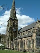
Ripponden
Overview
Calderdale
The Metropolitan Borough of Calderdale is a metropolitan borough of West Yorkshire, England, through which the upper part of the River Calder flows, and from which it takes its name...
, in West Yorkshire
West Yorkshire
West Yorkshire is a metropolitan county within the Yorkshire and the Humber region of England with a population of 2.2 million. West Yorkshire came into existence as a metropolitan county in 1974 after the passage of the Local Government Act 1972....
, England
England
England is a country that is part of the United Kingdom. It shares land borders with Scotland to the north and Wales to the west; the Irish Sea is to the north west, the Celtic Sea to the south west, with the North Sea to the east and the English Channel to the south separating it from continental...
, near Halifax
Halifax, West Yorkshire
Halifax is a minster town, within the Metropolitan Borough of Calderdale in West Yorkshire, England. It has an urban area population of 82,056 in the 2001 Census. It is well-known as a centre of England's woollen manufacture from the 15th century onward, originally dealing through the Halifax Piece...
, on the River Ryburn
River Ryburn
The River Ryburn is river in West Yorkshire, England. It flows through the villages of Rishworth, Ripponden and Triangle before flowing into the River Calder at Sowerby Bridge.-Course:...
. It is the site of a Roman settlement, and there is a Roman Road
Roman road
The Roman roads were a vital part of the development of the Roman state, from about 500 BC through the expansion during the Roman Republic and the Roman Empire. Roman roads enabled the Romans to move armies and trade goods and to communicate. The Roman road system spanned more than 400,000 km...
over nearby Blackstone Edge
Blackstone Edge
Blackstone Edge is a gritstone escarpment at 1,549 feet above sea level in an area of moorland on the Greater Manchester–West Yorkshire county boundary, England....
, a rocky ridge of Millstone Grit
Millstone Grit
Millstone Grit is the name given to any of a number of coarse-grained sandstones of Carboniferous age which occur in the Northern England. The name derives from its use in earlier times as a source of millstones for use principally in watermills...
. It has a population of 6,412.
Ripponden is the main settlement in a small group of villages; Barkisland
Barkisland
Barkisland is a village in Calderdale, West Yorkshire, England. It is east of Ripponden, south of Sowerby Bridge and south-west of Halifax town centre.-Location:...
, Ripponden, Rishworth and Soyland. The citizens of Ripponden are represented on Ripponden Parish Council. The area is a substantial part of the Ryburn Ward, itself part of Calderdale
Calderdale
The Metropolitan Borough of Calderdale is a metropolitan borough of West Yorkshire, England, through which the upper part of the River Calder flows, and from which it takes its name...
metropolitan borough.
Ripponden and its villages were formerly served by the Rishworth branch line
Rishworth Branch
The Rishworth branch was built by the Lancashire and Yorkshire Railway and linked with and served the villages of Triangle, Ripponden, Barkisland and Rishworth.-History:...
from Sowerby Bridge
Sowerby Bridge
Sowerby Bridge is a market town that lies within the Upper Calder Valley in the district of Calderdale in the county of West Yorkshire, in northern England.-Geography:Sowerby Bridge is situated on the edge of Halifax, about three miles from its centre...
; Ripponden and Barkisland railway station
Ripponden and Barkisland railway station
Ripponden and Barkisland railway station was opened by the Lancashire & Yorkshire Railway on the Rishworth Branch in 1878. Ripponden is in Calderdale, West Yorkshire, England. The Lancashire and Yorkshire railway was absorbed by the London and North Western Railway on 1 January 1922, which became...
closed to passengers in 1929 and the line was closed completely in 1958.
The area is of archaeological note for the Roman road at Blackstone edge alone and is also rich in neolithic
Neolithic
The Neolithic Age, Era, or Period, or New Stone Age, was a period in the development of human technology, beginning about 9500 BC in some parts of the Middle East, and later in other parts of the world. It is traditionally considered as the last part of the Stone Age...
and bronze age
Bronze Age
The Bronze Age is a period characterized by the use of copper and its alloy bronze as the chief hard materials in the manufacture of some implements and weapons. Chronologically, it stands between the Stone Age and Iron Age...
remains.