

U.S. Route 33
Encyclopedia
U.S. Route 33 is a United States
federal highway that runs northwest-southeast for 709 miles (1,141 km) from northern Indiana
to Richmond, Virginia
, passing through Ohio
and West Virginia
en route. Although most odd-numbered U.S. routes are north–south, US 33 is labeled east–west throughout its route except in Indiana where it is labeled north–south.
As of 2008, the highway's northern terminus is at U.S. Highway 20 in southeastern Elkhart, Indiana
. Its eastern terminus is in Richmond, Virginia
. The route formerly extended northward through South Bend, Indiana
, to St. Joseph
on Lake Michigan
in Michigan
. In Virginia, "Route 33" continues east as State Route 33 to Stingray Point, on the Chesapeake Bay
near Deltaville, Virginia
.
, US 33 is a winding road that cuts diagonally from northwest to southeast through Northeast Indiana and literally serves as Main Street
or a portion of Main Street in several cities and towns, including Elkhart, Dunlap
, Goshen
and Churubusco
.
The road is the main overland link between the Fort Wayne
and South Bend
metropolitan statistical areas.
From Elkhart, U.S. 33 continues southeast passing through the suburbs of Dunlap and Midway
before crossing State Road 15
and State Road 4
, then continues southeast toward Benton
as Lincolnway East.
Southeast of Benton, U.S. 33 intersects State Road 13
before joining with US 6
to become an east–west rural highway running for a few miles between just north of Lake Wawasee
near Syracuse
to Ligonier
at the intersection of State Road 5
, where US 33 splits from US 6 and turns south, joining SR 5 as a north–south road for a few miles before splitting off to the southeast toward Kimmell
as it enters Noble County
.
US 33 continues southeast through Noble County until it reaches Wolf Lake, where it serves as the northern terminus of State Road 109
before continuing until its intersection with State Road 9
at Merriam
just north of the Whitley County
line. In Whitley County, the road curves eastward to bypass Blue Lake before intersecting with State Road 205
in Churubusco near the county line with Allen County
as it heads toward Fort Wayne.
On the west side of Fort Wayne, US 33 joins US 30 near Interstate 69
, then follows the interstate south, intersecting with SR 14
and US 24
before turning east to follow the Interstate 469
bypass around the southwest side of Fort Wayne. At the intersection with SR 1
south of the Fort Wayne International Airport
, I-469/US 33 turns to the northeast until it intersects US 27 at the Fort Wayne suburb of Hessen Cassel
, where US 33 splits off to the southeast to follow US 27 as a combined highway toward Decatur.
At Decatur, US 33/US 27 becomes a north–south road before it intersects with US 224
and continues as such until US 33 splits off from US 27 south of Decatur and heads east toward the Ohio state line, intersecting SR 101
at Pleasant Mills
along the way.
 US 33 enters Ohio from Indiana, to the west, near Willshire
in Van Wert County as a two-lane route, continuing southeast through Mercer County
, crossing US 127
, then entering Auglaize County
, joining limited-access SR 29 briefly near St. Marys
, continuing east as a four-lane parkway, then a controlled-access highway
near Wapakoneta
, where it intersects I-75
.
East of I-75, the road once again becomes two-lane as it continues to Lakeview
and Russells Point south of Indian Lake
. At US 68 near Bellefontaine
, US 33 becomes a controlled-access highway, passing Campbell Hill, the highest point in Ohio, and continuing around Marysville
. Entering Franklin County
, the road becomes multiplexed with State Route 161, then intersects I-270
in Dublin
.
After I-270, the route loses its controlled-access status and passes though the Dublin Historic District and crosses the Scioto River
. The multiplex with Route 161 then ends, and US 33 heads south on Riverside Drive towards downtown Columbus
, following the Scioto River along the western border of Upper Arlington, where it passes Griggs Reservoir, one of the main sources of water
for Columbus. The road changes names two times in this area, first to Dublin Road at the intersection with Trabue Road, and then to Spring/Long Streets at State Route 315. The route continues south on 3rd/4th Streets and then east on Livingston Avenue, heading towards the Columbus suburb of Driving Park
.
In Bexley
, US 33 veers southeast onto College Avenue, then intersects Interstate 70
. After Petzinger Road, the route becomes a controlled-access highway, subsequently intersecting State Route 104, I-270 (for the second time), and State Route 317
(Hamilton Road). Following the Ebright Road near Blacklick Estates
, the highway continues to the southeast as a non-limited-access expressway.
Beginning at Carroll
, U.S. 33 bypasses Lancaster
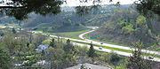
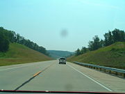
as a limited-access freeway completed in 2005. Continuing southeast, the highway enters Ohio's scenic Hocking Hills
region near Sugar Grove
as an expressway. East of Logan
, the highway again becomes limited-access for approximately 13 miles (20.9 km). As the route approaches Nelsonville
, it becomes a windy two-lane road along the Hocking River
. Further southeast towards Athens
, the expressway design resumes, followed by a brief limited-access section around Athens, where it joins the concurrent U.S. 50 and State Route 32 for about 3 miles (4.8 km). South of Athens, US 33 continues as a limited-access highway, bypassing Pomeroy
, intersecting Ohio State Route 124
and Ohio State Route 7, and continuing to the Ohio River
in Meigs County
, crossing the Ohio on the two-lane cantilever
Ravenswood Bridge
, and entering West Virginia
in Ravenswood
.

 US 33 extends 248 miles (399.1 km) in West Virginia, from the Ohio River
at Ravenswood
to the Virginia state line atop Shenandoah Mountain west of Harrisonburg, Virginia
.
Shortly after entering West Virginia and crossing the Ohio River, US 33 turns south, joining I-77 to Ripley
. The route then turns east from I-77, joining US 119 at Spencer
, then passing through rural areas of Roane
, Calhoun
, Gilmer
, and Lewis
counties.
US 33 Intersects Interstate 79 at Weston, West Virginia
. From Interstate 79 east, US 33 is a four-lane highway, part of Corridor H
of the Appalachian Development Highway System
. The four-lane segment continues on through rural areas of Upshur
, Barbour
, and Randolph
counties, nearly to Elkins
.
At Harding, US 250 joins US 33 for several miles to Elkins, where US 33 joins SR 55 and returns to a two-lane road, except for a seven-mile (11 km) section of four-lane across Kelly Mountain between Canfield
and Bowden
. Passing through the Monongahela National Forest
, US 33 crosses the Eastern Continental Divide
between Harman and Onego
at about 3240 feet (987.6 m) elevation, entering Pendleton County
, then descends the Allegheny Front
along Seneca Creek
, skirting the north end of Spruce Mountain
, at 4861 feet (1,481.6 m) the highest point of the Alleghenies.
US 33 then joins SR 28 at Seneca Rocks, West Virginia
, and continues south in the Potomac River
headwaters through scenic forest and farmland landscapes. Turning eastward from SR 28 at Judy Gap
, US 33 crosses North Fork Mountain
at about 3600 feet (1,097.3 m), with a turnout on the western slope offering a scenic view of the Germany Valley
below and the more distant Allegheny Front from Spruce Knob
to Dolly Sods
. US 220 joins US 33 for about half a mile in Franklin
. After Franklin, US 33 continues eastward through rural areas, then climbs steeply to cross Shenandoah Mountain at Dry River Gap at about 3450 feet (1,051.6 m) into Rockingham County
, Virginia
.
 U.S. Route 33 extends 139 miles (223.7 km) in Virginia from the West Virginia state line west of Harrisonburg
across the Shenandoah Valley
, Blue Ridge Mountains
, and Atlantic Piedmont
to Richmond
.
From Richmond, "Route 33" continues east as Virginia State Route 33 across the Coastal Plain
through the Tidewater region
of the Middle Peninsula
to reach the Chesapeake Bay
at Stingray Point
just east of Deltaville
.
, at the junction of the old U.S. Highway 12, was extended to a junction with Interstate 196
near Lake Michigan Beach, Michigan
, north of St. Joseph, but later truncated south of Niles, Michigan
(junction U.S. Highway 12), then in April 1998 at Elkhart, Indiana. Before its second truncation, it passed through South Bend, Indiana
. Former segments of US 33 are now known as M-63
, M-51
, and State Road 933
. Between South Bend and Fort Wayne, US 33 was part of the Lincoln Highway
.
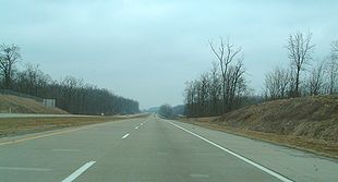
Various segments of US 33 have been improved to limited-access freeways. These include Ohio segments from St. Marys
to Wapakoneta
; Huntersville
(near Bellefontaine
) to Dublin
(a northwestern suburb of Columbus
); and bypasses around Lancaster
and Pomeroy
.
In West Virginia, US 33 from Interstate 79
near Weston
east nearly to Elkins
is four-lane, built as part of Corridor H of the Appalachian Development Highway System
. The route's steep grade up Shenandoah Mountain is easternmost West Virginia has been widened, with some sharp curves improved.
interchange near Wapakoneta to Athens, Ohio
, except for the section inside I-270
, the Columbus Beltway . An improved highway from Columbus to Athens is particularly desired, due to the lack of arterial highways in southeastern Ohio. A bypass has been proposed near Nelsonville, Ohio
.
United States
The United States of America is a federal constitutional republic comprising fifty states and a federal district...
federal highway that runs northwest-southeast for 709 miles (1,141 km) from northern Indiana
Indiana
Indiana is a US state, admitted to the United States as the 19th on December 11, 1816. It is located in the Midwestern United States and Great Lakes Region. With 6,483,802 residents, the state is ranked 15th in population and 16th in population density. Indiana is ranked 38th in land area and is...
to Richmond, Virginia
Richmond, Virginia
Richmond is the capital of the Commonwealth of Virginia, in the United States. It is an independent city and not part of any county. Richmond is the center of the Richmond Metropolitan Statistical Area and the Greater Richmond area...
, passing through Ohio
Ohio
Ohio is a Midwestern state in the United States. The 34th largest state by area in the U.S.,it is the 7th‑most populous with over 11.5 million residents, containing several major American cities and seven metropolitan areas with populations of 500,000 or more.The state's capital is Columbus...
and West Virginia
West Virginia
West Virginia is a state in the Appalachian and Southeastern regions of the United States, bordered by Virginia to the southeast, Kentucky to the southwest, Ohio to the northwest, Pennsylvania to the northeast and Maryland to the east...
en route. Although most odd-numbered U.S. routes are north–south, US 33 is labeled east–west throughout its route except in Indiana where it is labeled north–south.
As of 2008, the highway's northern terminus is at U.S. Highway 20 in southeastern Elkhart, Indiana
Elkhart, Indiana
Elkhart is a city in Elkhart County, Indiana, United States. The city is located east of South Bend, northwest of Fort Wayne, east of Chicago, and north of Indianapolis...
. Its eastern terminus is in Richmond, Virginia
Richmond, Virginia
Richmond is the capital of the Commonwealth of Virginia, in the United States. It is an independent city and not part of any county. Richmond is the center of the Richmond Metropolitan Statistical Area and the Greater Richmond area...
. The route formerly extended northward through South Bend, Indiana
South Bend, Indiana
The city of South Bend is the county seat of St. Joseph County, Indiana, United States, on the St. Joseph River near its southernmost bend, from which it derives its name. As of the 2010 Census, the city had a total of 101,168 residents; its Metropolitan Statistical Area had a population of 316,663...
, to St. Joseph
St. Joseph, Michigan
St. Joseph is a city in the US state of Michigan. It was incorporated as a village in 1834 and as a city in 1891. As of the 2000 census, the city population was 8,789. It lies on the shore of Lake Michigan, at the mouth of the St. Joseph River, about east-northeast of Chicago. It is the county...
on Lake Michigan
Lake Michigan
Lake Michigan is one of the five Great Lakes of North America and the only one located entirely within the United States. It is the second largest of the Great Lakes by volume and the third largest by surface area, after Lake Superior and Lake Huron...
in Michigan
Michigan
Michigan is a U.S. state located in the Great Lakes Region of the United States of America. The name Michigan is the French form of the Ojibwa word mishigamaa, meaning "large water" or "large lake"....
. In Virginia, "Route 33" continues east as State Route 33 to Stingray Point, on the Chesapeake Bay
Chesapeake Bay
The Chesapeake Bay is the largest estuary in the United States. It lies off the Atlantic Ocean, surrounded by Maryland and Virginia. The Chesapeake Bay's drainage basin covers in the District of Columbia and parts of six states: New York, Pennsylvania, Delaware, Maryland, Virginia, and West...
near Deltaville, Virginia
Middlesex County, Virginia
As of the census of 2000, there were 9,932 people, 4,253 households, and 2,913 families residing in the county. The population density was 76 people per square mile . There were 6,362 housing units at an average density of 49 per square mile...
.
Indiana
Beginning with its terminus at US 20 on the southeast side of ElkhartElkhart, Indiana
Elkhart is a city in Elkhart County, Indiana, United States. The city is located east of South Bend, northwest of Fort Wayne, east of Chicago, and north of Indianapolis...
, US 33 is a winding road that cuts diagonally from northwest to southeast through Northeast Indiana and literally serves as Main Street
Main Street
Main Street is the metonym for a generic street name of the primary retail street of a village, town, or small city in many parts of the world...
or a portion of Main Street in several cities and towns, including Elkhart, Dunlap
Dunlap, Indiana
Dunlap is a census-designated place in Elkhart County, Indiana, United States. The population was 6,235 at the 2010 census. Once a small farming community, by the 1980s it had become a suburb of Elkhart and Goshen, Indiana. Most of the town was destroyed by two violent F4 tornadoes during the Palm...
, Goshen
Goshen, Indiana
Goshen is a city in and the county seat of Elkhart County, Indiana, United States. It is the smaller of the two principal cities of the Elkhart-Goshen Metropolitan Statistical Area, which in turn is part of the South Bend-Elkhart-Mishawaka Combined Statistical Area. It is located in the northern...
and Churubusco
Churubusco, Indiana
Churubusco ; often shortened to Busco ), is a town located near the headwaters of the Eel River in the extreme northeast corner of Whitley County, Indiana, United States, in Smith Township, about northwest of Fort Wayne...
.
The road is the main overland link between the Fort Wayne
Fort Wayne Metropolitan Statistical Area
The Fort Wayne Metropolitan Statistical Area is a federally designated metropolitan area consisting of three counties in northeastern Indiana , anchored by the city of Fort Wayne...
and South Bend
South Bend-Mishawaka metropolitan area
The South Bend–Mishawaka Metropolitan Statistical Area, as defined by the United States Census Bureau, is an area consisting of two counties – one in northern Indiana and one in southwest Michigan, anchored by the cities of South Bend and Mishawaka in Indiana...
metropolitan statistical areas.
From Elkhart, U.S. 33 continues southeast passing through the suburbs of Dunlap and Midway
Midway, Elkhart County, Indiana
Midway is an unincorporated town in Concord Township, Elkhart County, Indiana....
before crossing State Road 15
Indiana State Road 15
State Road 15 is a north–south road in northeastern Indiana. Its southern terminus is at State Road 22 in Jonesboro. Its northern terminus is the Michigan state line north of Bristol. It is a surface highway that is mostly rural...
and State Road 4
Indiana State Road 4
State Road 4 in the U.S. State of Indiana refers to three separate disconnected surface highways in northern Indiana, although local highways that have never been part of the state highway system could in fact connect them.-Western segment:...
, then continues southeast toward Benton
Benton, Indiana
Benton is an unincorporated town in Benton Township, Elkhart County, Indiana....
as Lincolnway East.
Southeast of Benton, U.S. 33 intersects State Road 13
Indiana State Road 13
State Road 13 in the U.S. State of Indiana is a north–south highway in north-central and central Indiana that connects the area east of Indianapolis with the northern part of the state. Its northern terminus is at the Michigan state line, although starting at the interchange with the Indiana...
before joining with US 6
U.S. Route 6
U.S. Route 6 , also called the Grand Army of the Republic Highway, a name that honors an American Civil War veterans association, is a main route of the U.S. Highway system, running east-northeast from Bishop, California to Provincetown, Massachusetts. Until 1964, it continued south from Bishop to...
to become an east–west rural highway running for a few miles between just north of Lake Wawasee
Lake Wawasee
Lake Wawasee, formerly Turkey Lake, is a natural lake southeast of Syracuse in Kosciusko County, Indiana, United States. It is the largest natural lake in Indiana. It is located just east of Indiana State Road 13.-History:...
near Syracuse
Syracuse, Indiana
Syracuse is a town in Turkey Creek Township, Kosciusko County, Indiana, United States. The population was 2,810 at the 2010 census.Syracuse is the location of Lake Syracuse and the nearby, larger Lake Wawasee, in addition to several other lakes in the region.-Geography:Syracuse is located at ...
to Ligonier
Ligonier, Indiana
Ligonier is a city in Perry Township, Noble County, Indiana, United States. The population was 4,405 at the 2010 census.-Geography:Ligonier is located at ....
at the intersection of State Road 5
Indiana State Road 5
State Road 5 is a north–south road that runs through northeast Indiana. Its southern terminus is at SR 22 in Upland, and the northern terminus is at SR 120 just north of Shipshewana. The largest city along its path is Huntington...
, where US 33 splits from US 6 and turns south, joining SR 5 as a north–south road for a few miles before splitting off to the southeast toward Kimmell
Kimmell, Indiana
Kimmell is an unincorporated town in Sparta Township, Noble County, Indiana.-Geography:Kimmell is located at .The first County Seat was located in Sparta, which is now known as Kimmell. It was located on the old Fort Wayne and Goshen Trail. U.S. 33 runs through Kimmell. Just to the south of...
as it enters Noble County
Noble County, Indiana
As of the census of 2000, there were 46,275 people, 16,696 households, and 12,288 families residing in the county. The population density was 113 people per square mile . There were 18,233 housing units at an average density of 44 per square mile...
.
US 33 continues southeast through Noble County until it reaches Wolf Lake, where it serves as the northern terminus of State Road 109
Indiana State Road 109
-Southern section:The southern terminus is at U.S. Route 40 in Knightstown in Henry County. The highway runs north for about a mile, then heads northwest and intersects Interstate 70 before passing through Wilkinson in Hancock County. In Warrington it heads north into Madison County and crosses...
before continuing until its intersection with State Road 9
Indiana State Road 9
State Road 9 in the U.S. State of Indiana is a long north–south state highway in the eastern portion of Indiana. Its southern terminus is near Columbus at State Road 46, and the northern terminus is at the Michigan/Indiana border between Howe, Indiana, and Sturgis, Michigan, where it...
at Merriam
Merriam, Indiana
Merriam is an unincorporated town in Noble Township, Noble County, Indiana....
just north of the Whitley County
Whitley County, Indiana
As of the census of 2000, there were 30,707 people, 11,711 households, and 8,607 families residing in the county. The population density was 92 people per square mile . There were 12,545 housing units at an average density of 37 per square mile...
line. In Whitley County, the road curves eastward to bypass Blue Lake before intersecting with State Road 205
Indiana State Road 205
State Road 205 is a short north–south, largely rural surface highway in north-eastern Indiana. Although classified as north–south, it actually runs mostly in a north-easterly direction.-Route description:...
in Churubusco near the county line with Allen County
Allen County, Indiana
As of the census of 2000, there were 331,849 people, 128,745 households, and 86,259 families residing in the county. The population density was 505 people per square mile . There were 138,905 housing units at an average density of 211 per square mile...
as it heads toward Fort Wayne.
On the west side of Fort Wayne, US 33 joins US 30 near Interstate 69
Interstate 69
Interstate 69 is an Interstate Highway in the United States. It exists in two parts: a completed highway from Indianapolis, Indiana, northeast to the Canadian border in Port Huron, Michigan, and a mostly proposed extension southwest to the Mexican border in Texas...
, then follows the interstate south, intersecting with SR 14
Indiana State Road 14
State Road 14 is an east–west road in northern Indiana. Its western terminus is at U.S. Route 41 in Enos, and its eastern terminus is at Interstate 69 in Fort Wayne....
and US 24
U.S. Route 24
U.S. Route 24 is one of the original United States highways of 1926. It originally ran from Pontiac, Michigan, in the east to Kansas City, Missouri, in the west. Today, the highway's eastern terminus is west of Clarkston, Michigan, at an intersection with I-75 and its western terminus is near...
before turning east to follow the Interstate 469
Interstate 469
Interstate 469 is an Interstate Highway in the northeastern portion of the mid-western U.S. state of Indiana. It is an auxiliary route of parent Interstate 69 that also carries portions of US 24, US 30 and US 33 around the urban parts of Fort Wayne, Indiana...
bypass around the southwest side of Fort Wayne. At the intersection with SR 1
Indiana State Road 1
State Road 1 is a north–south state highway in the eastern portion of the U.S. state of Indiana. Its southern terminus is at U.S. Highway 50 in east-central Dearborn County, just east of Lawrenceburg. Its northern terminus is at U.S...
south of the Fort Wayne International Airport
Fort Wayne International Airport
-Top Destinations:-Airfield infrastructure:As of 2006, the airport's main Runway 5/23's usable dimensions are long and wide while the grooved-surface dimensions are long and wide, large enough to accommodate the NASA Space Shuttle orbiter, Boeing 747s, and military air mobility and aerial...
, I-469/US 33 turns to the northeast until it intersects US 27 at the Fort Wayne suburb of Hessen Cassel
Hessen Cassel, Indiana
Hessen Cassel is an unincorporated town in Marion Township, Allen County, Indiana, named for the Landgraviate of Hesse-Kassel in Germany....
, where US 33 splits off to the southeast to follow US 27 as a combined highway toward Decatur.
At Decatur, US 33/US 27 becomes a north–south road before it intersects with US 224
U.S. Route 224
U.S. Route 224 is a spur of U.S. Route 24. It currently runs for 289 miles from New Castle, Pennsylvania at Pennsylvania Route 18 to Huntington, Indiana at U.S. Route 24. It passes through the states of Pennsylvania, Ohio and Indiana...
and continues as such until US 33 splits off from US 27 south of Decatur and heads east toward the Ohio state line, intersecting SR 101
Indiana State Road 101
State Road 101 in the U.S. state of Indiana is a north–south state highway in the eastern portion of Indiana that exists in four sections with a combined length of .-First section:...
at Pleasant Mills
Pleasant Mills, Indiana
Pleasant Mills is an unincorporated community in St. Marys Township, Adams County, Indiana....
along the way.
Ohio
Willshire, Ohio
Willshire is a village in Van Wert County, Ohio, United States. The population was 463 at the 2000 census. It is included within the Van Wert, Ohio Micropolitan Statistical Area.-History:...
in Van Wert County as a two-lane route, continuing southeast through Mercer County
Mercer County, Ohio
Mercer County is a county located in the state of Ohio, United States. Its county seat is Celina and is named for Hugh Mercer, an officer in the American Revolutionary War.The Celina Micropolitan Statistical Area includes all of Mercer County.-Geography:...
, crossing US 127
U.S. Route 127
U.S. Route 127 is a long north–south United States highway in the eastern half of the United States. The southern terminus of the route is at U.S. Route 27 in Chattanooga, Tennessee. The northern terminus is at Interstate 75 near Grayling, Michigan...
, then entering Auglaize County
Auglaize County, Ohio
As of the census of 2000, there were 46,611 people, 17,376 households, and 12,771 families residing in the county. The population density was 116 people per square mile . There were 18,470 housing units at an average density of 46 per square mile...
, joining limited-access SR 29 briefly near St. Marys
St. Marys, Ohio
St. Marys is a city in Auglaize County, Ohio, United States. The population was 8,342 at the 2000 census. It is included in the Wapakoneta, Ohio, Micropolitan Statistical Area.-History:...
, continuing east as a four-lane parkway, then a controlled-access highway
Controlled-access highway
A controlled-access highway is a highway designed exclusively for high-speed vehicular traffic, with all traffic flow and ingress/egress regulated...
near Wapakoneta
Wapakoneta, Ohio
Wapakoneta is a city in and the county seat of Auglaize County, Ohio, United States with a population of 9,474 as of the 2000 U.S. census. It is the principal city of and is included in the Wapakoneta, Ohio Micropolitan S A, which is included in the Lima-Van Wert-Wapakoneta, Ohio CSA...
, where it intersects I-75
Interstate 75
Interstate 75 is a major north–south Interstate Highway in the Great Lakes and Southeastern regions of the United States. It travels from State Road 826 and State Road 924 in Hialeah, Florida to Sault Ste. Marie, Michigan, at the Ontario, Canada, border...
.
East of I-75, the road once again becomes two-lane as it continues to Lakeview
Lakeview, Ohio
Lakeview is a village in Logan County, Ohio, United States. The population was 1,074 at the 2000 census.A branch of the Logan County District Library serves the Lakeview community.-Geography:Lakeview is located at ....
and Russells Point south of Indian Lake
Indian Lake (Ohio)
Indian Lake is a reservoir in Logan County, western Ohio, in the United States. It is approximately 20 mi southeast of Lima...
. At US 68 near Bellefontaine
Bellefontaine, Ohio
Bellefontaine is a city in and the county seat of Logan County, Ohio, United States. The population was 13,069 at the 2000 census. It is the center of the Bellefontaine Micropolitan Statistical Area, as defined by the United States Census Bureau in 2003...
, US 33 becomes a controlled-access highway, passing Campbell Hill, the highest point in Ohio, and continuing around Marysville
Marysville, Ohio
Marysville is a city in and the county seat of Union County, Ohio, United States. The population was 15,942 at the 2000 census, and the Census Bureau estimated that it had risen to 17,621 by 2006.Marysville's longtime slogan is "Where the Grass is Greener"...
. Entering Franklin County
Franklin County, Ohio
Franklin County is a county located in the state of Ohio, United States. In 2010 the population was 1,163,414, making it the second largest county in Ohio and the 34th largest county in population in the United States. Franklin County is also the largest in the eight-county Columbus, Ohio...
, the road becomes multiplexed with State Route 161, then intersects I-270
Interstate 270 (Ohio)
Interstate 270 is the beltway loop freeway in the Columbus metropolitan area, commonly known locally as "The Outerbelt," or the "Jack Nicklaus Freeway." The "western" terminus of I-270, at least in terms of the zero-milepost, is at the junction with I-71 east of Grove City, Ohio...
in Dublin
Dublin, Ohio
Dublin is a city in Franklin, Delaware, and Union counties in the U.S. state of Ohio. The population was 41,751 at the 2010 census. Dublin is a suburb of Columbus, Ohio. Approximately 57,000 people live within the Dublin school district....
.
After I-270, the route loses its controlled-access status and passes though the Dublin Historic District and crosses the Scioto River
Scioto River
The Scioto River is a river in central and southern Ohio more than 231 miles in length. It rises in Auglaize County in west central Ohio, flows through Columbus, Ohio, where it collects its largest tributary, the Olentangy River, and meets the Ohio River at Portsmouth...
. The multiplex with Route 161 then ends, and US 33 heads south on Riverside Drive towards downtown Columbus
Columbus, Ohio
Columbus is the capital of and the largest city in the U.S. state of Ohio. The broader metropolitan area encompasses several counties and is the third largest in Ohio behind those of Cleveland and Cincinnati. Columbus is the third largest city in the American Midwest, and the fifteenth largest city...
, following the Scioto River along the western border of Upper Arlington, where it passes Griggs Reservoir, one of the main sources of water
Drinking water
Drinking water or potable water is water pure enough to be consumed or used with low risk of immediate or long term harm. In most developed countries, the water supplied to households, commerce and industry is all of drinking water standard, even though only a very small proportion is actually...
for Columbus. The road changes names two times in this area, first to Dublin Road at the intersection with Trabue Road, and then to Spring/Long Streets at State Route 315. The route continues south on 3rd/4th Streets and then east on Livingston Avenue, heading towards the Columbus suburb of Driving Park
Driving Park
Driving Park is an urban residential area on the Near East Side of Columbus, Ohio just south of I-70. It neighbors many notable areas including Livingston Park, Old Oaks Historic District, Bryden Road Historic District and the King-Lincoln Bronzeville District, all with the common thread of the...
.
In Bexley
Bexley, Ohio
Bexley is an affluent suburban city in Franklin County, Ohio. Founded as a village over a hundred years ago, the City of Bexley is an old, tree-lined suburb of Columbus, the state capital of Ohio, situated on the banks of Alum Creek next to Driving Park and Wolfe Park, just east of the Franklin...
, US 33 veers southeast onto College Avenue, then intersects Interstate 70
Interstate 70
Interstate 70 is an Interstate Highway in the United States that runs from Interstate 15 near Cove Fort, Utah, to a Park and Ride near Baltimore, Maryland. It was the first Interstate Highway project in the United States. I-70 approximately traces the path of U.S. Route 40 east of the Rocky...
. After Petzinger Road, the route becomes a controlled-access highway, subsequently intersecting State Route 104, I-270 (for the second time), and State Route 317
Ohio State Route 317
State Route 317 is a north–south state highway in the central portion of the U.S. state of Ohio. Its southern terminus is at U.S. Route 23 approximately south of Downtown Columbus and just outside of the city limits; its northern terminus is at U.S. Route 62 in Gahanna...
(Hamilton Road). Following the Ebright Road near Blacklick Estates
Blacklick Estates, Ohio
Blacklick Estates is a census-designated place in Franklin County, Ohio, United States: partly in Madison Township and partly in Truro Township...
, the highway continues to the southeast as a non-limited-access expressway.
Beginning at Carroll
Carroll, Ohio
Carroll is a village in Fairfield County, Ohio in the United States of America. The population was 488 at the 2000 census.-Geography:Carroll is located at ....
, U.S. 33 bypasses Lancaster
Lancaster, Ohio
Lancaster is a city in Fairfield County, Ohio, United States. As of the 2010 census, the city population was 38,780. It is located near the Hocking River, approximately southeast of Columbus, Ohio. It is the county seat of Fairfield County...
as a limited-access freeway completed in 2005. Continuing southeast, the highway enters Ohio's scenic Hocking Hills
Hocking Hills
The Hocking Hills is a deeply dissected area of the Allegheny Plateau in Ohio, primarily in Hocking County, that features cliffs, gorges, rock shelters, and waterfalls...
region near Sugar Grove
Sugar Grove, Ohio
Sugar Grove is a village in Fairfield County, Ohio, United States. The population was 448 at the 2000 census.-Geography:Sugar Grove is located at ....
as an expressway. East of Logan
Logan, Ohio
As of the census of 2000, there were 6,704 people, 2,790 households, and 1,768 families residing in the city. The population density was 2,175.2 people per square mile . There were 2,948 housing units at an average density of 956.5 per square mile...
, the highway again becomes limited-access for approximately 13 miles (20.9 km). As the route approaches Nelsonville
Nelsonville, Ohio
Nelsonville is a city in northwestern Athens County, Ohio, United States. The population was 5,230 at the 2000 census. Hocking College is located in Nelsonville.-Geography:...
, it becomes a windy two-lane road along the Hocking River
Hocking River
The Hocking River is a tributary of the Ohio River in southeastern Ohio in the United States.The Hocking flows mostly on the unglaciated Allegheny Plateau, but its headwaters are in a glaciated region...
. Further southeast towards Athens
Athens, Ohio
Athens is the largest city in, and the county seat of, Athens County, Ohio, United States. It is located along the Hocking River in the southeastern part of Ohio. A historic college town, Athens is home to Ohio University and is the principal city of the Athens, Ohio Micropolitan Statistical Area. ...
, the expressway design resumes, followed by a brief limited-access section around Athens, where it joins the concurrent U.S. 50 and State Route 32 for about 3 miles (4.8 km). South of Athens, US 33 continues as a limited-access highway, bypassing Pomeroy
Pomeroy, Ohio
Pomeroy is a village in and the county seat of Meigs County, Ohio, United States, along the Ohio River. The population was 1,966 at the 2000 census. During the late 19th century, Pomeroy was an important producer of coal and salt...
, intersecting Ohio State Route 124
Ohio State Route 124
State Route 124 is an east–west state highway in the southern portion of the U.S. state of Ohio. Its western terminus is at State Route 134 nearly southeast of Martinsville, and its eastern terminus is near the unincorporated village of Torch at the concurrency of U.S. Route 50, State Route...
and Ohio State Route 7, and continuing to the Ohio River
Ohio River
The Ohio River is the largest tributary, by volume, of the Mississippi River. At the confluence, the Ohio is even bigger than the Mississippi and, thus, is hydrologically the main stream of the whole river system, including the Allegheny River further upstream...
in Meigs County
Meigs County, Ohio
Meigs County is a county located in the state of Ohio, United States. As of the 2010 census, the population was 23,770. Its county seat is Pomeroy, and it is named for Return J. Meigs, Jr., the 4th Governor of Ohio.-Geography:...
, crossing the Ohio on the two-lane cantilever
Cantilever bridge
A cantilever bridge is a bridge built using cantilevers, structures that project horizontally into space, supported on only one end. For small footbridges, the cantilevers may be simple beams; however, large cantilever bridges designed to handle road or rail traffic use trusses built from...
Ravenswood Bridge
Ravenswood Bridge
Ravenswood Bridge is a two-lane cantilever bridge in the United States, connecting Ravenswood, West Virginia and rural Meigs County, Ohio, across the Ohio River. It has a total length of with a main span of...
, and entering West Virginia
West Virginia
West Virginia is a state in the Appalachian and Southeastern regions of the United States, bordered by Virginia to the southeast, Kentucky to the southwest, Ohio to the northwest, Pennsylvania to the northeast and Maryland to the east...
in Ravenswood
Ravenswood, West Virginia
Ravenswood is a city in Jackson County, West Virginia, United States, along the Ohio River. The population was 4,031 at the 2000 census.-Geography:Ravenswood is located at , along the Ohio River at the mouth of Sandy Creek....
.
West Virginia
Ohio River
The Ohio River is the largest tributary, by volume, of the Mississippi River. At the confluence, the Ohio is even bigger than the Mississippi and, thus, is hydrologically the main stream of the whole river system, including the Allegheny River further upstream...
at Ravenswood
Ravenswood, West Virginia
Ravenswood is a city in Jackson County, West Virginia, United States, along the Ohio River. The population was 4,031 at the 2000 census.-Geography:Ravenswood is located at , along the Ohio River at the mouth of Sandy Creek....
to the Virginia state line atop Shenandoah Mountain west of Harrisonburg, Virginia
Harrisonburg, Virginia
Harrisonburg is an independent city in the Shenandoah Valley region of Virginia in the United States. Its population as of 2010 is 48,914, and at the 2000 census, 40,468. Harrisonburg is the county seat of Rockingham County and the core city of the Harrisonburg, Virginia Metropolitan Statistical...
.
Shortly after entering West Virginia and crossing the Ohio River, US 33 turns south, joining I-77 to Ripley
Ripley, West Virginia
Ripley is a city in and the county seat of Jackson County, West Virginia, United States.-Geography:Ripley is located at , along Mill Creek....
. The route then turns east from I-77, joining US 119 at Spencer
Spencer, West Virginia
Spencer is a city in Roane County, West Virginia, United States. The population was 2,352 at the 2000 census. It is the county seat of Roane County. Spencer is the home of the annual West Virginia Black Walnut Festival. Points of interest include Charles Fork Lake, Chrystal Water and Power...
, then passing through rural areas of Roane
Roane County, West Virginia
As of the census of 2000, there were 15,446 people, 6,161 households, and 4,479 families residing in the county. The population density was 32 people per square mile . There were 7,360 housing units at an average density of 15 per square mile...
, Calhoun
Calhoun County, West Virginia
As of the census of 2000, there were 7,582 people, 3,071 households, and 2,201 families residing in the county. The population density was 27 people per square mile . There were 3,848 housing units at an average density of 14 per square mile...
, Gilmer
Gilmer County, West Virginia
As of the census of 2000, there were 7,160 people, 2,768 households, and 1,862 families residing in the county. The population density was 21 people per square mile . There were 3,621 housing units at an average density of 11 per square mile...
, and Lewis
Lewis County, West Virginia
As of the census of 2000, there were 16,919 people, 6,946 households, and 4,806 families residing in the county. The population density was 44 people per square mile . There were 7,944 housing units at an average density of 21 per square mile...
counties.
US 33 Intersects Interstate 79 at Weston, West Virginia
Weston, West Virginia
Weston is a city in Lewis County, West Virginia, United States. The population was 4,317 at the 2000 census. It is the county seat of Lewis County, and home to the West Virginia Museum of American Glass.-History:...
. From Interstate 79 east, US 33 is a four-lane highway, part of Corridor H
U.S. Route 48
U.S. Route 48 , or Corridor H, is part of the Appalachian Development Highway System. It is an east–west United States highway that runs from northern Virginia to central West Virginia.- West Virginia :...
of the Appalachian Development Highway System
Appalachian Development Highway System
The Appalachian Development Highway System is part of the Appalachian Regional Commission in the United States. See: .-History:...
. The four-lane segment continues on through rural areas of Upshur
Upshur County, West Virginia
As of the census of 2000, there were 23,404 people, 8,972 households, and 6,352 families residing in the county. The population density was 66 people per square mile . There were 10,751 housing units at an average density of 30 per square mile...
, Barbour
Barbour County, West Virginia
As of the census of 2000, there are 15,557 people, 6,123 households, and 4,365 families residing in the county. The population density is 46 people per square mile . There are 7,348 housing units at an average density of 22 per square mile...
, and Randolph
Randolph County, West Virginia
As of the census of 2000, there were 28,262 people, 11,072 households, and 7,661 families residing in the county. The population density was 27 people per square mile . There were 13,478 housing units at an average density of 13 per square mile...
counties, nearly to Elkins
Elkins, West Virginia
Elkins is a city in Randolph County, West Virginia, United States. The community was incorporated in 1890 and named in honor of Stephen Benton Elkins , a U.S. Senator from West Virginia. The population was 7,032 at the 2000 census. It is the county seat of Randolph County...
.
At Harding, US 250 joins US 33 for several miles to Elkins, where US 33 joins SR 55 and returns to a two-lane road, except for a seven-mile (11 km) section of four-lane across Kelly Mountain between Canfield
Canfield, Randolph County, West Virginia
Canfield is an unincorporated community in Randolph County, West Virginia, United States. Canfield is located along U.S. Route 33 and West Virginia Route 55 east-southeast of Elkins....
and Bowden
Bowden, West Virginia
Bowden is an unincorporated census-designated place in Randolph County, West Virginia, USA. Bowden is located on U.S. Route 33 east of Elkins. Bowden has a post office with ZIP code 26254. According to the 2010 Census, there were nine people residing at this location....
. Passing through the Monongahela National Forest
Monongahela National Forest
The Monongahela National Forest is a national forest located in the Allegheny Mountains of eastern West Virginia, USA. It protects over of federally-owned land within a proclamation boundary that includes much of the Potomac Highlands Region and portions of 10 counties.The MNF includes some...
, US 33 crosses the Eastern Continental Divide
Eastern Continental Divide
The Eastern Continental Divide, in conjunction with other continental divides of North America, demarcates two watersheds of the Atlantic Ocean: the Gulf of Mexico watershed and the Atlantic Seaboard watershed. Prior to 1760, the divide represented the boundary between British and French colonial...
between Harman and Onego
Onego, West Virginia
Onego is an unincorporated community located along Seneca Creek on U.S. Highway 33 in Pendleton County, West Virginia, USA. Onego lies within the Monongahela National Forest in the Appalachian Mountains, near Seneca Rocks....
at about 3240 feet (987.6 m) elevation, entering Pendleton County
Pendleton County, West Virginia
As of the census of 2000, there were 8,196 people, 3,350 households, and 2,355 families residing in the county. The population density was 12 people per square mile . There were 5,102 housing units at an average density of 7 per square mile...
, then descends the Allegheny Front
Allegheny Front
The Allegheny Front is the major southeast- or east-facing escarpment in the Allegheny Mountains in southern Pennsylvania, western Maryland, and eastern West Virginia, USA. The Allegheny Front delineates the Ridge-and-Valley Appalachians to its east from the Appalachian Plateau to its west...
along Seneca Creek
Seneca Creek (North Fork South Branch Potomac River)
Seneca Creek is a tributary of the North Fork of the South Branch of the Potomac River located entirely within Pendleton County, West Virginia, USA....
, skirting the north end of Spruce Mountain
Spruce Mountain (West Virginia)
Spruce Mountain, in eastern West Virginia, USA, is the highest ridge of the Allegheny Mountains. The "whale-backed" ridge extends for only about , from northeast to southwest, but several of its peaks exceed in elevation...
, at 4861 feet (1,481.6 m) the highest point of the Alleghenies.
US 33 then joins SR 28 at Seneca Rocks, West Virginia
Seneca Rocks, West Virginia
Seneca Rocks is an unincorporated community located in Pendleton County, West Virginia, USA. The community of Seneca Rocks — formerly known as Mouth of Seneca — lies along West Virginia Route 28/West Virginia Route 55 near the confluence of Seneca Creek and the North Fork South Branch Potomac...
, and continues south in the Potomac River
Potomac River
The Potomac River flows into the Chesapeake Bay, located along the mid-Atlantic coast of the United States. The river is approximately long, with a drainage area of about 14,700 square miles...
headwaters through scenic forest and farmland landscapes. Turning eastward from SR 28 at Judy Gap
Judy Gap, West Virginia
Judy Gap is an unincorporated community in Pendleton County, West Virginia, United States. Judy Gap is located at the junction of U.S. Route 33 and West Virginia Route 28 west-northwest of Franklin, just west of the mountain gap also called Judy Gap. The Judy Rocks geological formation is just to...
, US 33 crosses North Fork Mountain
North Fork Mountain
North Fork Mountain is a quartzite-capped mountain ridge in the Ridge and Valley physiographic province of the Allegheny Mountains of eastern West Virginia, USA...
at about 3600 feet (1,097.3 m), with a turnout on the western slope offering a scenic view of the Germany Valley
Germany Valley
Germany Valley is a scenic upland valley high in the Allegheny Mountains of eastern West Virginia originally settled by German farmers in the mid-18th Century...
below and the more distant Allegheny Front from Spruce Knob
Spruce Knob
Spruce Knob, at , is the highest point in the state of West Virginia and the summit of Spruce Mountain, the tallest mountain in the Alleghenies.-Overview:...
to Dolly Sods
Dolly Sods Wilderness
The Dolly Sods Wilderness — originally simply Dolly Sods — is a U.S. Wilderness Area in the Allegheny Mountains of eastern West Virginia, USA, and is part of the Monongahela National Forest of the U.S. Forest Service ....
. US 220 joins US 33 for about half a mile in Franklin
Franklin, West Virginia
Franklin is a town in Pendleton County, West Virginia, United States. The population was 797 at the 2000 census. It is the county seat of Pendleton County...
. After Franklin, US 33 continues eastward through rural areas, then climbs steeply to cross Shenandoah Mountain at Dry River Gap at about 3450 feet (1,051.6 m) into Rockingham County
Rockingham County, Virginia
As of the census of 2000, there were 67,725 people, 25,355 households, and 18,889 families residing in the county. The population density was 80 people per square mile . There were 27,328 housing units at an average density of 32 per square mile...
, Virginia
Virginia
The Commonwealth of Virginia , is a U.S. state on the Atlantic Coast of the Southern United States. Virginia is nicknamed the "Old Dominion" and sometimes the "Mother of Presidents" after the eight U.S. presidents born there...
.
Virginia
Harrisonburg, Virginia
Harrisonburg is an independent city in the Shenandoah Valley region of Virginia in the United States. Its population as of 2010 is 48,914, and at the 2000 census, 40,468. Harrisonburg is the county seat of Rockingham County and the core city of the Harrisonburg, Virginia Metropolitan Statistical...
across the Shenandoah Valley
Shenandoah Valley
The Shenandoah Valley is both a geographic valley and cultural region of western Virginia and West Virginia in the United States. The valley is bounded to the east by the Blue Ridge Mountains, to the west by the eastern front of the Ridge-and-Valley Appalachians , to the north by the Potomac River...
, Blue Ridge Mountains
Blue Ridge Mountains
The Blue Ridge Mountains are a physiographic province of the larger Appalachian Mountains range. This province consists of northern and southern physiographic regions, which divide near the Roanoke River gap. The mountain range is located in the eastern United States, starting at its southern-most...
, and Atlantic Piedmont
Piedmont (United States)
The Piedmont is a plateau region located in the eastern United States between the Atlantic Coastal Plain and the main Appalachian Mountains, stretching from New Jersey in the north to central Alabama in the south. The Piedmont province is a physiographic province of the larger Appalachian division...
to Richmond
Richmond, Virginia
Richmond is the capital of the Commonwealth of Virginia, in the United States. It is an independent city and not part of any county. Richmond is the center of the Richmond Metropolitan Statistical Area and the Greater Richmond area...
.
From Richmond, "Route 33" continues east as Virginia State Route 33 across the Coastal Plain
Atlantic Coastal Plain
The Atlantic coastal plain has both low elevation and low relief, but it is also a relatively flat landform extending from the New York Bight southward to a Georgia/Florida section of the Eastern Continental Divide, which demarcates the plain from the ACF River Basin in the Gulf Coastal Plain to...
through the Tidewater region
Tidewater region of Virginia
The Tidewater region of Virginia is the eastern portion of the Commonwealth of Virginia formally known as Hampton Roads. The term tidewater may be correctly applied to all portions of any area, including Virginia, where the water level is affected by the tides...
of the Middle Peninsula
Middle Peninsula
The Middle Peninsula is the second of three large peninsulas on the western shore of Chesapeake Bay in Virginia, in the United States. It lies between the Northern Neck and the Virginia Peninsula. This peninsula is bounded by the Rappahannock River on the north and the York River on the south...
to reach the Chesapeake Bay
Chesapeake Bay
The Chesapeake Bay is the largest estuary in the United States. It lies off the Atlantic Ocean, surrounded by Maryland and Virginia. The Chesapeake Bay's drainage basin covers in the District of Columbia and parts of six states: New York, Pennsylvania, Delaware, Maryland, Virginia, and West...
at Stingray Point
Stingray Point
Stingray Point is a small community on the Chesapeake Bay near the village of Deltaville in Middlesex County, Virginia. It is located at the eastern terminus of State Route 33. It is populated by fewer than 250 full time residents; however, during summer months that population surges as tourists...
just east of Deltaville
Deltaville, Virginia
Deltaville is a small unincorporated community on the eastern tip of Middlesex County in the eastern part of the U.S. state of Virginia. It is known for being a vacation spot for those looking for sailing, fishing, and other activities associated with the water...
.
History
US 33 formerly ended in St. Joseph, MichiganSt. Joseph, Michigan
St. Joseph is a city in the US state of Michigan. It was incorporated as a village in 1834 and as a city in 1891. As of the 2000 census, the city population was 8,789. It lies on the shore of Lake Michigan, at the mouth of the St. Joseph River, about east-northeast of Chicago. It is the county...
, at the junction of the old U.S. Highway 12, was extended to a junction with Interstate 196
Interstate 196
Interstate 196 is a long freeway spur route in the US state of Michigan linking Grand Rapids, Holland, South Haven, and Benton Harbor. I-196 is known as the Gerald R. Ford Freeway, or simply the Ford Freeway, in Kent, Ottawa, and Allegan Counties, after the 38th President of the United States,...
near Lake Michigan Beach, Michigan
Lake Michigan Beach, Michigan
Lake Michigan Beach is an unincorporated community in Berrien County in the U.S. state of Michigan. It is a census-designated place for statistical purposes, without any legal status as a municipality. The population was 1,509 at the 2000 census....
, north of St. Joseph, but later truncated south of Niles, Michigan
Niles, Michigan
Niles is a city in Berrien and Cass counties in the U.S. state of Michigan, near South Bend, Indiana. The population was 11,600 at the 2010 census. It is the greater populated of two principal cities of and included in the Niles-Benton Harbor, Michigan Metropolitan Statistical Area, which has a...
(junction U.S. Highway 12), then in April 1998 at Elkhart, Indiana. Before its second truncation, it passed through South Bend, Indiana
South Bend, Indiana
The city of South Bend is the county seat of St. Joseph County, Indiana, United States, on the St. Joseph River near its southernmost bend, from which it derives its name. As of the 2010 Census, the city had a total of 101,168 residents; its Metropolitan Statistical Area had a population of 316,663...
. Former segments of US 33 are now known as M-63
M-63 (Michigan highway)
M-63 is a state trunkline highway in the US state of Michigan that runs from M-139 at Scottdale through the cities of Benton Harbor and St. Joseph to Interstate 196/US Highway 31 at exit 7 just outside Hagar Shores. The trunkline runs through residential areas south of St. Joseph and through...
, M-51
M-51 (Michigan highway)
M-51, is a north–south state trunkline highway in the southwestern portion of the US state of Michigan. The northern terminus is on I-94 west of Paw Paw, where it continues north for less than a mile to W Red Arrow Highway as Van Buren CR 671, and the southern terminus is at the Indiana state...
, and State Road 933
State Road 933 (Indiana)
State Road 933 is a 900-series state highway in the U.S. state of Indiana, consisting of the former U.S. Route 33 within Indiana, north of the St. Joseph Valley Parkway .-Route description:...
. Between South Bend and Fort Wayne, US 33 was part of the Lincoln Highway
Lincoln Highway
The Lincoln Highway was the first road across the United States of America.Conceived and promoted by entrepreneur Carl G. Fisher, the Lincoln Highway spanned coast-to-coast from Times Square in New York City to Lincoln Park in San Francisco, originally through 13 states: New York, New Jersey,...
.
Various segments of US 33 have been improved to limited-access freeways. These include Ohio segments from St. Marys
St. Marys, Ohio
St. Marys is a city in Auglaize County, Ohio, United States. The population was 8,342 at the 2000 census. It is included in the Wapakoneta, Ohio, Micropolitan Statistical Area.-History:...
to Wapakoneta
Wapakoneta, Ohio
Wapakoneta is a city in and the county seat of Auglaize County, Ohio, United States with a population of 9,474 as of the 2000 U.S. census. It is the principal city of and is included in the Wapakoneta, Ohio Micropolitan S A, which is included in the Lima-Van Wert-Wapakoneta, Ohio CSA...
; Huntersville
Huntsville, Ohio
Huntsville is a village in Logan County, Ohio, United States. The population was 454 at the 2000 census.-Geography:Huntsville is located at ....
(near Bellefontaine
Bellefontaine, Ohio
Bellefontaine is a city in and the county seat of Logan County, Ohio, United States. The population was 13,069 at the 2000 census. It is the center of the Bellefontaine Micropolitan Statistical Area, as defined by the United States Census Bureau in 2003...
) to Dublin
Dublin, Ohio
Dublin is a city in Franklin, Delaware, and Union counties in the U.S. state of Ohio. The population was 41,751 at the 2010 census. Dublin is a suburb of Columbus, Ohio. Approximately 57,000 people live within the Dublin school district....
(a northwestern suburb of Columbus
Columbus, Ohio
Columbus is the capital of and the largest city in the U.S. state of Ohio. The broader metropolitan area encompasses several counties and is the third largest in Ohio behind those of Cleveland and Cincinnati. Columbus is the third largest city in the American Midwest, and the fifteenth largest city...
); and bypasses around Lancaster
Lancaster, Ohio
Lancaster is a city in Fairfield County, Ohio, United States. As of the 2010 census, the city population was 38,780. It is located near the Hocking River, approximately southeast of Columbus, Ohio. It is the county seat of Fairfield County...
and Pomeroy
Pomeroy, Ohio
Pomeroy is a village in and the county seat of Meigs County, Ohio, United States, along the Ohio River. The population was 1,966 at the 2000 census. During the late 19th century, Pomeroy was an important producer of coal and salt...
.
In West Virginia, US 33 from Interstate 79
Interstate 79
Interstate 79 is an Interstate Highway in the eastern United States, designated from Interstate 77 in Charleston, West Virginia to Pennsylvania Route 5 and Pennsylvania Route 290 in Erie, Pennsylvania...
near Weston
Weston, West Virginia
Weston is a city in Lewis County, West Virginia, United States. The population was 4,317 at the 2000 census. It is the county seat of Lewis County, and home to the West Virginia Museum of American Glass.-History:...
east nearly to Elkins
Elkins, West Virginia
Elkins is a city in Randolph County, West Virginia, United States. The community was incorporated in 1890 and named in honor of Stephen Benton Elkins , a U.S. Senator from West Virginia. The population was 7,032 at the 2000 census. It is the county seat of Randolph County...
is four-lane, built as part of Corridor H of the Appalachian Development Highway System
Appalachian Development Highway System
The Appalachian Development Highway System is part of the Appalachian Regional Commission in the United States. See: .-History:...
. The route's steep grade up Shenandoah Mountain is easternmost West Virginia has been widened, with some sharp curves improved.
Proposed improvements
The State of Ohio plans to eventually make US 33 a controlled-access freeway from the Interstate 75Interstate 75
Interstate 75 is a major north–south Interstate Highway in the Great Lakes and Southeastern regions of the United States. It travels from State Road 826 and State Road 924 in Hialeah, Florida to Sault Ste. Marie, Michigan, at the Ontario, Canada, border...
interchange near Wapakoneta to Athens, Ohio
Athens, Ohio
Athens is the largest city in, and the county seat of, Athens County, Ohio, United States. It is located along the Hocking River in the southeastern part of Ohio. A historic college town, Athens is home to Ohio University and is the principal city of the Athens, Ohio Micropolitan Statistical Area. ...
, except for the section inside I-270
Interstate 270 (Ohio)
Interstate 270 is the beltway loop freeway in the Columbus metropolitan area, commonly known locally as "The Outerbelt," or the "Jack Nicklaus Freeway." The "western" terminus of I-270, at least in terms of the zero-milepost, is at the junction with I-71 east of Grove City, Ohio...
, the Columbus Beltway . An improved highway from Columbus to Athens is particularly desired, due to the lack of arterial highways in southeastern Ohio. A bypass has been proposed near Nelsonville, Ohio
Nelsonville, Ohio
Nelsonville is a city in northwestern Athens County, Ohio, United States. The population was 5,230 at the 2000 census. Hocking College is located in Nelsonville.-Geography:...
.
Major intersections
- US 20 in Elkhart, IndianaElkhart, IndianaElkhart is a city in Elkhart County, Indiana, United States. The city is located east of South Bend, northwest of Fort Wayne, east of Chicago, and north of Indianapolis...
- US 6 at Ligonier, IndianaLigonier, IndianaLigonier is a city in Perry Township, Noble County, Indiana, United States. The population was 4,405 at the 2010 census.-Geography:Ligonier is located at ....
- US 30, I-69Interstate 69Interstate 69 is an Interstate Highway in the United States. It exists in two parts: a completed highway from Indianapolis, Indiana, northeast to the Canadian border in Port Huron, Michigan, and a mostly proposed extension southwest to the Mexican border in Texas...
, I-469Interstate 469Interstate 469 is an Interstate Highway in the northeastern portion of the mid-western U.S. state of Indiana. It is an auxiliary route of parent Interstate 69 that also carries portions of US 24, US 30 and US 33 around the urban parts of Fort Wayne, Indiana...
, and US 27, at points in or near Fort Wayne, IndianaFort Wayne, IndianaFort Wayne is a city in the US state of Indiana and the county seat of Allen County. The population was 253,691 at the 2010 Census making it the 74th largest city in the United States and the second largest in Indiana... - I-75Interstate 75Interstate 75 is a major north–south Interstate Highway in the Great Lakes and Southeastern regions of the United States. It travels from State Road 826 and State Road 924 in Hialeah, Florida to Sault Ste. Marie, Michigan, at the Ontario, Canada, border...
, southeast of Wapakoneta, OhioWapakoneta, OhioWapakoneta is a city in and the county seat of Auglaize County, Ohio, United States with a population of 9,474 as of the 2000 U.S. census. It is the principal city of and is included in the Wapakoneta, Ohio Micropolitan S A, which is included in the Lima-Van Wert-Wapakoneta, Ohio CSA... - U.S. Route 68U.S. Route 68U.S. Route 68 is an east–west United States highway that runs for from northwest Ohio to western Kentucky. The highway's western terminus is at U.S. Route 62 in Reidland, Kentucky. Its eastern terminus is at Interstate 75 in Findlay, Ohio...
, in Bellefontaine, OhioBellefontaine, OhioBellefontaine is a city in and the county seat of Logan County, Ohio, United States. The population was 13,069 at the 2000 census. It is the center of the Bellefontaine Micropolitan Statistical Area, as defined by the United States Census Bureau in 2003... - U.S. Route 36U.S. Route 36U.S. Route 36 is an east–west United States highway that runs for from Rocky Mountain National Park, Colorado to Uhrichsville, Ohio. The highway's western terminus is at Deer Ridge Junction, an intersection in Rocky Mountain National Park, Colorado, where it meets U.S. Route 34. Its eastern...
, in Marysville, OhioMarysville, OhioMarysville is a city in and the county seat of Union County, Ohio, United States. The population was 15,942 at the 2000 census, and the Census Bureau estimated that it had risen to 17,621 by 2006.Marysville's longtime slogan is "Where the Grass is Greener"... - U.S. Route 42U.S. Route 42U.S. Route 42 is an east–west United States highway that runs northeast-southwest for 355 miles from Cleveland, Ohio to Louisville, Kentucky. The route has several names including Pearl Road from Cleveland to Medina in Northeast Ohio, the Cincinnati and Lebanon Pike in southwestern Ohio and...
, near New California, OhioNew California, OhioNew California is a census-designated place in central Jerome Township, Union County, Ohio, United States. It is located at , at the intersection of U.S. Route 42 and Industrial Parkway, just south of 42's intersection with U.S. Route 33.-Local geography:... - I-270Interstate 270 (Ohio)Interstate 270 is the beltway loop freeway in the Columbus metropolitan area, commonly known locally as "The Outerbelt," or the "Jack Nicklaus Freeway." The "western" terminus of I-270, at least in terms of the zero-milepost, is at the junction with I-71 east of Grove City, Ohio...
, in Dublin, OhioDublin, OhioDublin is a city in Franklin, Delaware, and Union counties in the U.S. state of Ohio. The population was 41,751 at the 2010 census. Dublin is a suburb of Columbus, Ohio. Approximately 57,000 people live within the Dublin school district.... - I-670Interstate 670 (Ohio)Interstate 670 is an Interstate Highway in the U.S. state of Ohio that passes through downtown Columbus, connecting I-70 west of downtown with I-270 and US 62 near the eastern suburb of Gahanna. I-670 provides access to Port Columbus International Airport, and intersects SR 315 and I-71 downtown...
, I-71Interstate 71Interstate 71 is an Interstate Highway in the Great Lakes/Midwestern and Southeastern region of the United States. Its southern terminus is at an interchange with Interstate 64 and Interstate 65 in Louisville, Kentucky. Its northern terminus is at an interchange with Interstate 90 in Cleveland,...
, I-70Interstate 70Interstate 70 is an Interstate Highway in the United States that runs from Interstate 15 near Cove Fort, Utah, to a Park and Ride near Baltimore, Maryland. It was the first Interstate Highway project in the United States. I-70 approximately traces the path of U.S. Route 40 east of the Rocky...
, U.S. Route 23, U.S. Route 40U.S. Route 40U.S. Route 40 is an east–west United States highway. As with most routes whose numbers end in a zero, U.S. 40 once traversed the entire United States. It is one of the original 1920s U.S. Highways, and its first termini were San Francisco, California, and Atlantic City, New Jersey...
, and U.S. Route 62U.S. Route 62U.S. Route 62 runs from the US-Mexico border at El Paso, Texas to Niagara Falls, New York, near the United States-Canada border. It is the only east-west US Route that connects Mexico and Canada.Parts of U.S...
, at points in Columbus, OhioColumbus, OhioColumbus is the capital of and the largest city in the U.S. state of Ohio. The broader metropolitan area encompasses several counties and is the third largest in Ohio behind those of Cleveland and Cincinnati. Columbus is the third largest city in the American Midwest, and the fifteenth largest city... - I-270Interstate 270 (Ohio)Interstate 270 is the beltway loop freeway in the Columbus metropolitan area, commonly known locally as "The Outerbelt," or the "Jack Nicklaus Freeway." The "western" terminus of I-270, at least in terms of the zero-milepost, is at the junction with I-71 east of Grove City, Ohio...
, near Obetz, OhioObetz, OhioObetz is a village in Franklin County, Ohio, United States. The population was 3,977 at the 2000 census, and estimated to be 4,079 as of 2005. The community was formed in 1838 as a railroad junction, and incorporated in 1928.-Geography:... - U.S. Route 22U.S. Route 22U.S. Route 22 is a west–east route and is one of the original United States highways of 1926, running from Cincinnati, Ohio, at US 27, US 42, US 127, and US 52 to Newark, New Jersey, at U.S. Route 1/9 near the Newark Liberty International Airport.US 22 also carries the names of the William...
, near Lancaster, OhioLancaster, OhioLancaster is a city in Fairfield County, Ohio, United States. As of the 2010 census, the city population was 38,780. It is located near the Hocking River, approximately southeast of Columbus, Ohio. It is the county seat of Fairfield County... - U.S. Route 50U.S. Route 50U.S. Route 50 is a major east–west route of the U.S. Highway system, stretching just over from Ocean City, Maryland on the Atlantic Ocean to West Sacramento, California. Until 1972, when it was replaced by Interstate Highways west of the Sacramento area, it extended to San Francisco, near...
, near Athens, OhioAthens, OhioAthens is the largest city in, and the county seat of, Athens County, Ohio, United States. It is located along the Hocking River in the southeastern part of Ohio. A historic college town, Athens is home to Ohio University and is the principal city of the Athens, Ohio Micropolitan Statistical Area. ... - I-77Interstate 77Interstate 77 is an Interstate Highway in the eastern United States. It traverses diverse terrain, from the mountainous state of West Virginia to the rolling farmlands of North Carolina and Ohio. It largely supplants the old U.S...
, concurrent from near Ravenswood, West VirginiaRavenswood, West VirginiaRavenswood is a city in Jackson County, West Virginia, United States, along the Ohio River. The population was 4,031 at the 2000 census.-Geography:Ravenswood is located at , along the Ohio River at the mouth of Sandy Creek....
to near Ripley, West VirginiaRipley, West VirginiaRipley is a city in and the county seat of Jackson County, West Virginia, United States.-Geography:Ripley is located at , along Mill Creek.... - U.S. Route 119, concurrent from Spencer, West VirginiaSpencer, West VirginiaSpencer is a city in Roane County, West Virginia, United States. The population was 2,352 at the 2000 census. It is the county seat of Roane County. Spencer is the home of the annual West Virginia Black Walnut Festival. Points of interest include Charles Fork Lake, Chrystal Water and Power...
to Buckhannon, West VirginiaBuckhannon, West VirginiaBuckhannon is the only incorporated city in, and the county seat of, Upshur County, West Virginia, United States, and is located along the Buckhannon River. The population was 5,725 at the 2000 census. Buckhannon is home to West Virginia Wesleyan College and the West Virginia Strawberry Festival,... - I-79Interstate 79Interstate 79 is an Interstate Highway in the eastern United States, designated from Interstate 77 in Charleston, West Virginia to Pennsylvania Route 5 and Pennsylvania Route 290 in Erie, Pennsylvania...
, near Weston, West VirginiaWeston, West VirginiaWeston is a city in Lewis County, West Virginia, United States. The population was 4,317 at the 2000 census. It is the county seat of Lewis County, and home to the West Virginia Museum of American Glass.-History:... - U.S. Route 250, concurrent near Elkins, West VirginiaElkins, West VirginiaElkins is a city in Randolph County, West Virginia, United States. The community was incorporated in 1890 and named in honor of Stephen Benton Elkins , a U.S. Senator from West Virginia. The population was 7,032 at the 2000 census. It is the county seat of Randolph County...
- I-81Interstate 81Interstate 81 is an Interstate Highway in the eastern part of the United States. Its southern terminus is at Interstate 40 in Dandridge, Tennessee; its northern terminus is on Wellesley Island at the Canadian border, where the Thousand Islands Bridge connects it to Highway 401, the main freeway...
, in Harrisonburg, VirginiaHarrisonburg, VirginiaHarrisonburg is an independent city in the Shenandoah Valley region of Virginia in the United States. Its population as of 2010 is 48,914, and at the 2000 census, 40,468. Harrisonburg is the county seat of Rockingham County and the core city of the Harrisonburg, Virginia Metropolitan Statistical... - I-295Interstate 295 (Virginia)Interstate 295 is an eastern and northern bypass of the cities of Richmond and Petersburg in the U.S. state of Virginia. The southern terminus is a junction with Interstate 95 southeast of Petersburg...
, near Glen Allen, VirginiaGlen Allen, VirginiaGlen Allen is a census-designated place in Henrico County, Virginia, United States. The population was 12,562 at the 2000 census.-Geography:... - I-64Interstate 64Interstate 64 is an Interstate Highway in the Midwestern and Southeastern United States. Its western terminus is at I-70, U.S. 40, and U.S. 61 in Wentzville, Missouri. Its eastern terminus is at an interchange with I-264 and I-664 at Bowers Hill in Chesapeake, Virginia. As I-64 is concurrent with...
and US 1 in downtown Richmond, VirginiaRichmond, VirginiaRichmond is the capital of the Commonwealth of Virginia, in the United States. It is an independent city and not part of any county. Richmond is the center of the Richmond Metropolitan Statistical Area and the Greater Richmond area...