
Indiana State Road 5
Encyclopedia
State Road 5 is a north–south road that runs through northeast Indiana. Its southern terminus is at SR 22
in Upland
, and the northern terminus is at SR 120
just north of Shipshewana
. The largest city along its path is Huntington
. It is entirely a surface highway that is very rural outside of the towns.
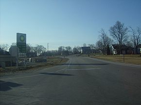 SR 5's southern terminus is at SR 22, where SR 5 heads north toward Huntington. SR 5 passes through an intersection
with State Road 18
and then through the town of Van Buren
. SR 5 passes over Interstate 69
(I-69) and then has a concurrency
with State Road 218
. SR 5 and SR 218 travel east to Warren
. Soon after the concurrency begins, SR 5 and SR 218 have an interchange
with I-69. In Warren SR 218 turns southeast and SR 5 turns northwest. North of Warren SR 5 has another interchange with I-69. SR 5 heads toward Huntington, passing through intersection with State Road 124
. In southeast Huntington SR 5 and U.S. Route 224
(US 224) have a concurrency. In Huntington US 224/SR 5 are on one-way streets with west US 224/north SR 5 on Warren Street and east US 224/south SR 5 on Cherry Street. US 224 and SR 5 heads northwest out of Huntington, then US 224 and SR 5 have an intersection with U.S. Route 24
/State Road 9
. This intersection is the western terminus of US 224.
 SR 5 heads northwest, just outside of Huntington SR 5 has an intersection with the eastern terminus of State Road 16
. SR 5 heads north until South Whitley
. In South Whitley SR 5 has a concurrency with State Road 14
and an intersection with the southern terminus of State Road 205
. SR 5 heads north out of South Whitley towards Larwill
. In Larwill SR 5 has an intersection with U.S. Route 30
. SR 5 heads north from Larwill towards Liigonier
, passing through Indian Village
and Cromwell
. South of Ligonier, SR 5 and U.S. Route 33
(US 33) have a concurrency that ends at U.S. Route 6
(US 6}. From US 6, SR 5 heads north, passing through the downtown area of Ligonier. SR 5 then leaves the town of Ligonier heading north. SR 5 heads north until Shipshewana
where SR 5 has an intersection with U.S. Route 20
(US 20), before heading into downtown Shipshewana. North of Shipshewana, SR 5 heads due north toward Michigan
. The northern terminus of SR 5 is at State Road 120
.
to Mitchell
. Following the today's route of U.S. Route 150
, U.S. Route 50
, and State Road 60
. Then between 1920 and 1926 SR 5 went from Vincennes to New Albany
following the today's route of US 150.
Another SR 5 was sign between 1927 and sometime in the 1930's, this route went from Montpelier
northwest to Akron
.
Then the route was changed to the current route of SR 5 from Warren to SR 120. In 1985 SR 5 was route to Upland on the Old State Road 221. The north terminus was at the Michigan State Line at one point, passing through Scott
.
Indiana State Road 22
State Road 22 in the U.S. state of Indiana is a major thoroughfare from Kokomo to Interstate 69. The highway is concurrent with U.S. Route 35 from Kokomo to Interstate 69.-Route description:...
in Upland
Upland, Indiana
Upland is a town in Jefferson Township, Grant County, Indiana, United States. The population was 3,845 at the 2010 census. It is most notable for being the home of Taylor University, a Christian college with 1,920 students, as of 2011.-History:...
, and the northern terminus is at SR 120
Indiana State Road 120
State Road 120 in the U.S. state of Indiana is an east–west state highway located close to the Michigan border. It runs from Elkhart in the west to the Michigan border at the eastern edge of Indiana.-Route description:...
just north of Shipshewana
Shipshewana, Indiana
Shipshewana is a town in Newbury Township, LaGrange County, Indiana, United States. The population was 658 at the 2010 census. It is the location of the Menno-Hof Amish & Mennonite Museum, which showcases the history of the Amish and Mennonite peoples....
. The largest city along its path is Huntington
Huntington, Indiana
Huntington, known as the "Lime City", is a small city in and the county seat of Huntington County, Indiana, United States. It is in Huntington Township and Union Township...
. It is entirely a surface highway that is very rural outside of the towns.
Route description
Intersection (road)
An intersection is a road junction where two or more roads either meet or cross at grade . An intersection may be 3-way - a T junction or fork, 4-way - a crossroads, or 5-way or more...
with State Road 18
Indiana State Road 18
State Road 18 in the U.S. State of Indiana is an east–west route in North Central Indiana running from the Illinois border in Benton County almost to the Ohio border, terminating at U.S. Route 27 /State Road 67 in Jay County...
and then through the town of Van Buren
Van Buren, Indiana
Van Buren is a town in Van Buren Township, Grant County, Indiana, United States. The population was 935 at the 2000 census.-Geography:Van Buren is located at ....
. SR 5 passes over Interstate 69
Interstate 69 in Indiana
Interstate 69 presently exists in two discontinuous segments in Indiana. The original highway, completed in November 1971, runs northeast from the state capital of Indianapolis, to the city of Fort Wayne, and then proceeds north to the state of Michigan...
(I-69) and then has a concurrency
Concurrency (road)
A concurrency, overlap, or coincidence in a road network is an instance of one physical road bearing two or more different highway, motorway, or other route numbers...
with State Road 218
Indiana State Road 218
Indiana State Road 218 exists in two different sections in the central part of the U.S. state of Indiana, on either side of Mississinewa Lake. The road covers a total distance of about 91 miles; the ends of the two sections are separated by about 14 miles...
. SR 5 and SR 218 travel east to Warren
Warren, Indiana
Warren is a town in Salamonie Township, Huntington County, Indiana, United States. The population of Warren at the 2010 census was 1,239.-Geography:Warren is located at , along the Salamonie River...
. Soon after the concurrency begins, SR 5 and SR 218 have an interchange
Interchange (road)
In the field of road transport, an interchange is a road junction that typically uses grade separation, and one or more ramps, to permit traffic on at least one highway to pass through the junction without directly crossing any other traffic stream. It differs from a standard intersection, at which...
with I-69. In Warren SR 218 turns southeast and SR 5 turns northwest. North of Warren SR 5 has another interchange with I-69. SR 5 heads toward Huntington, passing through intersection with State Road 124
Indiana State Road 124
State Road 124 in the U.S. state of Indiana is an east–west route in the northern part of the state. Its parent route is U.S. Route 24, but the two do not connect.-Route description:...
. In southeast Huntington SR 5 and U.S. Route 224
U.S. Route 224 in Indiana
U.S. Route 224 is a part of the United States Numbered Highway that runs from Huntington, Indiana to New Castle, Pennsylvania. In Indiana, it is a rural, two-lane route that travels in the northern part of the state. The western terminus is at U.S. Route 24, State Road 5, and State Road 9...
(US 224) have a concurrency. In Huntington US 224/SR 5 are on one-way streets with west US 224/north SR 5 on Warren Street and east US 224/south SR 5 on Cherry Street. US 224 and SR 5 heads northwest out of Huntington, then US 224 and SR 5 have an intersection with U.S. Route 24
U.S. Route 24 in Indiana
U.S. Route 24 In Indiana, US 24 runs east from the Illinois state line to Huntington. At Huntington, US 24 turns northeast and runs to Fort Wayne; it then overlaps Interstate 69 and Interstate 469 to bypass the city before entering Ohio at the state line east of Fort Wayne...
/State Road 9
Indiana State Road 9
State Road 9 in the U.S. State of Indiana is a long north–south state highway in the eastern portion of Indiana. Its southern terminus is near Columbus at State Road 46, and the northern terminus is at the Michigan/Indiana border between Howe, Indiana, and Sturgis, Michigan, where it...
. This intersection is the western terminus of US 224.
Indiana State Road 16
State Road 16 is an east–west road in Northern Indiana. Its western terminus is at U.S. Route 41 in Ade, Indiana. Its eastern terminus is at State Road 5 north of Huntington, Indiana.- Route description :...
. SR 5 heads north until South Whitley
South Whitley, Indiana
South Whitley is a town in Cleveland Township, Whitley County, Indiana, United States. The population was 1,751 at the 2010 census. South Whitley is a town in the Midwestern tradition of red brick buildings and tree-lined streets.-Geography:...
. In South Whitley SR 5 has a concurrency with State Road 14
Indiana State Road 14
State Road 14 is an east–west road in northern Indiana. Its western terminus is at U.S. Route 41 in Enos, and its eastern terminus is at Interstate 69 in Fort Wayne....
and an intersection with the southern terminus of State Road 205
Indiana State Road 205
State Road 205 is a short north–south, largely rural surface highway in north-eastern Indiana. Although classified as north–south, it actually runs mostly in a north-easterly direction.-Route description:...
. SR 5 heads north out of South Whitley towards Larwill
Larwill, Indiana
Larwill is a town in Richland Township, Whitley County, Indiana, United States. The population was 283 at the 2010 census.-Geography:Larwill is located at ....
. In Larwill SR 5 has an intersection with U.S. Route 30
U.S. Route 30 in Indiana
In the state of Indiana, U.S. Route 30 is an east–west four-lane divided highway across northern Indiana. It runs from the Illinois state line at Dyer to east of Fort Wayne at the Ohio state line. This is a distance of 151.8 miles ....
. SR 5 heads north from Larwill towards Liigonier
Ligonier, Indiana
Ligonier is a city in Perry Township, Noble County, Indiana, United States. The population was 4,405 at the 2010 census.-Geography:Ligonier is located at ....
, passing through Indian Village
Indian Village, Indiana
Indian Village is town in Clay Township, St. Joseph County, Indiana, United States. The population was 133 at the 2010 Census. It is part of the South Bend–Mishawaka, IN-MI, Metropolitan Statistical Area.-Geography:...
and Cromwell
Cromwell, Indiana
Cromwell is a town in Sparta Township, Noble County, Indiana, United States. The population was 512 at the 2010 census.-Geography:Cromwell is located at ....
. South of Ligonier, SR 5 and U.S. Route 33
U.S. Route 33 in Indiana
U.S. Route 33 is a mainly two-lane U.S. Highway running through northeast Indiana. The highway travels from southeast to northwest.-Route description:...
(US 33) have a concurrency that ends at U.S. Route 6
U.S. Route 6 in Indiana
U.S. Route 6 is a part of the United States Numbered Highway that runs from California to Provincetown, Massachusetts. In Indiana, it is a mostly rural, two-lane route that travels in the northern part of the state. However, some four-lane stretches may be found in Lake and Porter counties. For...
(US 6}. From US 6, SR 5 heads north, passing through the downtown area of Ligonier. SR 5 then leaves the town of Ligonier heading north. SR 5 heads north until Shipshewana
Shipshewana, Indiana
Shipshewana is a town in Newbury Township, LaGrange County, Indiana, United States. The population was 658 at the 2010 census. It is the location of the Menno-Hof Amish & Mennonite Museum, which showcases the history of the Amish and Mennonite peoples....
where SR 5 has an intersection with U.S. Route 20
U.S. Route 20 in Indiana
U.S. Route 20 in Indiana is a main east–west highway that is parallel to the Indiana Toll Road. The western terminus of US 20 is at the Illinois state line and the eastern terminus is at the Ohio state line. US 20 through Whiting, East Chicago, and Gary is concurrent with...
(US 20), before heading into downtown Shipshewana. North of Shipshewana, SR 5 heads due north toward Michigan
Michigan
Michigan is a U.S. state located in the Great Lakes Region of the United States of America. The name Michigan is the French form of the Ojibwa word mishigamaa, meaning "large water" or "large lake"....
. The northern terminus of SR 5 is at State Road 120
Indiana State Road 120
State Road 120 in the U.S. state of Indiana is an east–west state highway located close to the Michigan border. It runs from Elkhart in the west to the Michigan border at the eastern edge of Indiana.-Route description:...
.
History
Between 1917 and 1920 SR 5 had a route that went from VincennesVincennes, Indiana
Vincennes is a city in and the county seat of Knox County, Indiana, United States. It is located on the Wabash River in the southwestern part of the state. The population was 18,701 at the 2000 census...
to Mitchell
Mitchell, Indiana
Mitchell is a city in Lawrence County, Indiana, United States. The population was 4,567 as of the 2000 census.It is the birthplace of astronaut Gus Grissom, who flew on Liberty Bell 7, Gemini 3, and died in a launch pad fire at Kennedy Space Center in 1967....
. Following the today's route of U.S. Route 150
U.S. Route 150
U.S. Route 150 is a 571 mile long northwest-southeast United States highway, signed as east–west. It runs from U.S. Route 6 outside of Moline, Illinois to U.S. Route 25 in Mount Vernon, Kentucky .-Illinois:In the state of Illinois, U.S. 150 runs from the Quad City International Airport at U.S...
, U.S. Route 50
U.S. Route 50 in Indiana
In the U.S. state of Indiana, U.S. Route 50 is a major east–west route. It enters Indiana from Illinois and leaves Indiana into Ohio.- Route description :...
, and State Road 60
Indiana State Road 60
State Road 60 in the U.S. State of Indiana is a mostly rural, two-lane highway in the southeastern portion of the state, covering a distance of about .-Route description:...
. Then between 1920 and 1926 SR 5 went from Vincennes to New Albany
New Albany, Indiana
New Albany is a city in Floyd County, Indiana, United States, situated along the Ohio River opposite Louisville, Kentucky. In 1900, 20,628 people lived in New Albany; in 1910, 20,629; in 1920, 22,992; and in 1940, 25,414. The population was 36,372 at the 2010 census. The city is the county seat of...
following the today's route of US 150.
Another SR 5 was sign between 1927 and sometime in the 1930's, this route went from Montpelier
Montpelier, Indiana
Montpelier is an American city in Blackford County, Indiana. This small rural community, the county’s first to be platted, was established by settlers from Vermont, and is named after Vermont’s capital city – Montpelier....
northwest to Akron
Akron, Indiana
Akron is a town in Henry Township, Fulton County, Indiana, United States. The population was 1,167 at the 2010 census. Akron hosts a nationally-famous All-Americana 4th of July parade and fireworks...
.
Then the route was changed to the current route of SR 5 from Warren to SR 120. In 1985 SR 5 was route to Upland on the Old State Road 221. The north terminus was at the Michigan State Line at one point, passing through Scott
Scott, Indiana
Scott is a small unincorporated town in Van Buren Township, LaGrange County, Indiana.-Geography:Scott is located at on the Pigeon River near the Indiana Toll Road, just about a mile south of the state border with Michigan....
.