
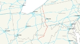
Interstate 79
Encyclopedia
Interstate 79 is an Interstate Highway in the eastern United States
, designated from Interstate 77
in Charleston, West Virginia
to Pennsylvania Route 5
and Pennsylvania Route 290
in Erie, Pennsylvania
. It is a primary thoroughfare through western Pennsylvania
and West Virginia
, as well as an important corridor to Buffalo, New York
, and the Canadian
border.
In West Virginia, Interstate 79 is known as the Jennings Randolph
Expressway. In the three most northern counties
it is signed as part of the High Tech Corridor. Through most of Pennsylvania, it is known as the Raymond P. Shafer
Highway.
|WV
|160.52
|258.49
|-
|PA
|182.72
|294.24
|-
|Total
|343.24
|552.39
|}
Except at its northern end, I-79 is located on the Allegheny Plateau
. Despite the somewhat rugged terrain, the road is relatively flat. Most of the highway is at an elevation
of about 1000 to 1200 feet (300 to 360 m) above sea level
, with some lower areas near both ends and higher areas near Sutton, West Virginia
. In the hillier areas, this flatness is achieved by curving around hills, along ridges, and in or partway up river valleys.
I-79 begins at a three-way directional Y interchange with Interstate 77 along the northwest bank of the Elk River
just northeast of Charleston. For its first 67 miles (108 km), to a point just south of Flatwoods, I-79 is located in the watershed
of the Elk River, which drains into the Kanawha River
. It crosses the Elk River twice — at Frametown
and Sutton - and never strays more than about 15 to 20 miles (25 to 30 km) from it.
From Sutton
north, Interstate 79 generally parallels the path of U.S. Route 19
. With the exception of the area between Washington
and Cranberry Township
, Pennsylvania
, I-79 functionally replaces its predecessor route. It is only in this segment, in the vicinity of Pittsburgh
, that US 19 serves a significant amount of traffic on its own.
and Fairmont
. Another five miles (8 km) opened in July 1968, extending the highway on a bypass of downtown Fairmont to Exit 137 (East Park Avenue). It was further extended 9.5 miles (15 km) towards Morgantown on October 15, 1970, bypassing more of WV 73 to Exit 146 (Goshen Road) south of that city.
Five miles of road were opened on June 29, 1973, extending I-79 from Exit 146 to Exit 148 (I-68), at which traffic was forced onto the newly-opened west end of Corridor E (now I-68) to Exit 1. A further extension of six miles (10 km), including the Uffington Bridge over the Monongahela River
southwest of Morgantown, was opened on August 30, 1973, leading north to Exit 155 (Star City
). This completed I-79 from north of Bridgeport to north of Morgantown.
To the south of Bridgeport, the first two sections were both opened on December 22, 1971. One of these ran ten miles (16 km) from Exit 51 (Frametown
) to Exit 62 (Sutton
), and the other from Exit 105 (Jane Lew) to Exit 115 (Nutter Fort
). On September 19, 1973, another 7.5 miles (12.1 km) stretch was opened, from Exit 105 (Jane Lew
) south to Exit 99 (Weston).
In 1973, significant portions of the interstate were completed. Interstate 79 opened from Exit 62 to Exit 99.
Another 23.9 miles (38.5 km), from Exit 67 (Flatwoods
) north to Exit 91 (Roanoke
), opened on November 28, 1973, along with the section from exit 115 north to exit 117 (Anmoore
), completing the route between Frametown
and Morgantown except in the Bridgeport area.
A 5.5 miles (8.9 km) extension from exit 51 south to exit 46 (Servia) opened on February 1, 1974, and County Route 11 to WV 4 near Duck
was widened to handle the increased load. On the same day, two lanes opened from exit 155 (Osage) north to the state line.
On October 16, 1974, two pieces of I-79 were opened: the other two lanes of the 6.6 miles (10.6 km) from exit 155 to the state line, and 7.1 miles (11.4 km) between exits 117 (Anmoore
) and 125 (north of Bridgeport). On the same day, the eastern end of Corridor D and the western end of Corridor E, both connecting to I-79 (at exits 119 and 148), were opened. This completed I-79 in West Virginia north of exit 46 (Servia); it was extended south to exit 25 (Amma
) in late November and to U.S. Route 119 north of Clendenin
(exit 19) on November 13, 1975. It was opened from exit 19 to exit 9 (Elkview) on November 18, 1977, and finally completed to Interstate 77 in 1979.
 The Pennsylvania State Legislature authorized the Pennsylvania Turnpike Commission
to build two extensions in the 1950s. The Northwestern Extension, authorized in 1953, was to stretch from the main Pennsylvania Turnpike
north to Erie, and would have included a lateral connection between Ohio
and New York
(later built as Interstate 90). The Southwestern Extension, authorized in 1955, was to run south from the main line near Pittsburgh to West Virginia
, connecting there with an extension of the West Virginia Turnpike
. Except for the section between Washington and the Pittsburgh area, which was included as part of Interstate 70
, the first portion of I-79 to be added to the plans was north from Pittsburgh to Erie, along the U.S. Route 19
corridor. This addition in 1957 was made possible by eliminating mileage on other routes by making them more direct. The number 79 was assigned in 1958, and an extension south along I-70 to Washington and beyond to Charleston was approved on October 18, 1961. This extension also paralleled US 19 to near Sutton, where it turned westerly to reach Charleston. (The part of US 19 from Sutton south to Interstate 77
at Beckley has since been four-laned as Corridor L of the Appalachian Development Highway System
.)
Even before any of I-79 was approved, two short urban portions were designated in September 1955: a spur from I-90 north to Erie, and a western bypass of Pittsburgh, connecting I-70 with I-80S. These routes were initially numbered 179 and 279, with I-79 passing through Pittsburgh and ending at I-90 south of Erie. I-179 was soon absorbed into I-79, but it was not until June 29, 1970 that the swap of I-79 and I-279 was approved. At the same time, I-76 was extended west from downtown Pittsburgh over former I-79 to the new location of I-79 west of Pittsburgh, so I-279 only ran north from downtown Pittsburgh. Only 1.5 years later, on December 3, 1971, I-76 was rerouted to bypass Pittsburgh
, and I-279 was extended to I-79 utilizing the former section of I-76. (In June 2009, I-376 was extended west and north of downtown Pittsburgh, and I-279 was truncated back to the section only running from downtown Pittsburgh north to I-79.) On July 25, 1975 I-79 was opened between exits 1 and 14. The last piece of I-79 between West Virginia and Erie — the Neville Island Bridge
over the Ohio River
- opened on September 3, 1976.
United States
The United States of America is a federal constitutional republic comprising fifty states and a federal district...
, designated from Interstate 77
Interstate 77
Interstate 77 is an Interstate Highway in the eastern United States. It traverses diverse terrain, from the mountainous state of West Virginia to the rolling farmlands of North Carolina and Ohio. It largely supplants the old U.S...
in Charleston, West Virginia
Charleston, West Virginia
Charleston is the capital and largest city of the U.S. state of West Virginia. It is located at the confluence of the Elk and Kanawha Rivers in Kanawha County. As of the 2010 census, it has a population of 51,400, and its metropolitan area 304,214. It is the county seat of Kanawha County.Early...
to Pennsylvania Route 5
Pennsylvania Route 5
Pennsylvania Route 5 is a westward continuation of New York State Route 5 in Pennsylvania. It runs from North East, Pennsylvania at the New York-Pennsylvania border to near Erie, a total of . The highway is called the Purple Heart Highway and mostly called Lake Road...
and Pennsylvania Route 290
Pennsylvania Route 290
Pennsylvania Route 290 is a long state highway located in the city of Erie, Pennsylvania. The western terminus of the route is at Interstate 79 and Pennsylvania Route 5 in the neighborhood of Dock Junction...
in Erie, Pennsylvania
Erie, Pennsylvania
Erie is a city located in northwestern Pennsylvania in the United States. Named for the lake and the Native American tribe that resided along its southern shore, Erie is the state's fourth-largest city , with a population of 102,000...
. It is a primary thoroughfare through western Pennsylvania
Pennsylvania
The Commonwealth of Pennsylvania is a U.S. state that is located in the Northeastern and Mid-Atlantic regions of the United States. The state borders Delaware and Maryland to the south, West Virginia to the southwest, Ohio to the west, New York and Ontario, Canada, to the north, and New Jersey to...
and West Virginia
West Virginia
West Virginia is a state in the Appalachian and Southeastern regions of the United States, bordered by Virginia to the southeast, Kentucky to the southwest, Ohio to the northwest, Pennsylvania to the northeast and Maryland to the east...
, as well as an important corridor to Buffalo, New York
Buffalo, New York
Buffalo is the second most populous city in the state of New York, after New York City. Located in Western New York on the eastern shores of Lake Erie and at the head of the Niagara River across from Fort Erie, Ontario, Buffalo is the seat of Erie County and the principal city of the...
, and the Canadian
Canada
Canada is a North American country consisting of ten provinces and three territories. Located in the northern part of the continent, it extends from the Atlantic Ocean in the east to the Pacific Ocean in the west, and northward into the Arctic Ocean...
border.
In West Virginia, Interstate 79 is known as the Jennings Randolph
Jennings Randolph
Jennings Randolph was an American politician from West Virginia. He was a member of the Democratic Party and was the last surviving member of the United States Congress to have served during the first 100 days of Franklin D. Roosevelt's administration.-Early life and career:Randolph was born in...
Expressway. In the three most northern counties
North-Central West Virginia
North-Central West Virginia is a region of the U.S. State of West Virginia. The region's largest city is Morgantown.- Counties :*Monongalia County*Marion County*Harrison County*Taylor County*Doddridge County...
it is signed as part of the High Tech Corridor. Through most of Pennsylvania, it is known as the Raymond P. Shafer
Raymond P. Shafer
Raymond Philip Shafer served as the 39th Governor of Pennsylvania from 1967 to 1971. He had previously served as Lieutenant Governor from 1963 to 1967...
Highway.
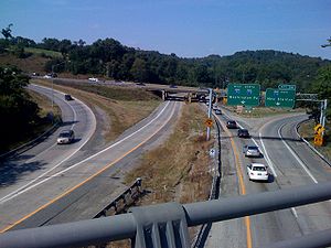
Route description
|-|WV
West Virginia
West Virginia is a state in the Appalachian and Southeastern regions of the United States, bordered by Virginia to the southeast, Kentucky to the southwest, Ohio to the northwest, Pennsylvania to the northeast and Maryland to the east...
|160.52
|258.49
|-
|PA
Pennsylvania
The Commonwealth of Pennsylvania is a U.S. state that is located in the Northeastern and Mid-Atlantic regions of the United States. The state borders Delaware and Maryland to the south, West Virginia to the southwest, Ohio to the west, New York and Ontario, Canada, to the north, and New Jersey to...
|182.72
|294.24
|-
|Total
|343.24
|552.39
|}
Except at its northern end, I-79 is located on the Allegheny Plateau
Allegheny Plateau
The Allegheny Plateau is a large dissected plateau area in western and central New York, northern and western Pennsylvania, northern and western West Virginia, and eastern Ohio...
. Despite the somewhat rugged terrain, the road is relatively flat. Most of the highway is at an elevation
Elevation
The elevation of a geographic location is its height above a fixed reference point, most commonly a reference geoid, a mathematical model of the Earth's sea level as an equipotential gravitational surface ....
of about 1000 to 1200 feet (300 to 360 m) above sea level
Sea level
Mean sea level is a measure of the average height of the ocean's surface ; used as a standard in reckoning land elevation...
, with some lower areas near both ends and higher areas near Sutton, West Virginia
Sutton, West Virginia
Sutton is a town in Braxton County, West Virginia, in the United States. The population was 1,011 at the 2000 census. It is the county seat of Braxton County. Sutton is situated at a center of transportation in West Virginia. Interstate 79, a major north-south route, connects with Appalachian...
. In the hillier areas, this flatness is achieved by curving around hills, along ridges, and in or partway up river valleys.
I-79 begins at a three-way directional Y interchange with Interstate 77 along the northwest bank of the Elk River
Elk River (West Virginia)
The Elk River is a tributary of the Kanawha River, long, in central West Virginia in the United States. Via the Kanawha and Ohio Rivers, it is part of the watershed of the Mississippi River.-Course:...
just northeast of Charleston. For its first 67 miles (108 km), to a point just south of Flatwoods, I-79 is located in the watershed
Drainage basin
A drainage basin is an extent or an area of land where surface water from rain and melting snow or ice converges to a single point, usually the exit of the basin, where the waters join another waterbody, such as a river, lake, reservoir, estuary, wetland, sea, or ocean...
of the Elk River, which drains into the Kanawha River
Kanawha River
The Kanawha River is a tributary of the Ohio River, approximately 97 mi long, in the U.S. state of West Virginia. The largest inland waterway in West Virginia, it has formed a significant industrial region of the state since the middle of the 19th century.It is formed at the town of Gauley...
. It crosses the Elk River twice — at Frametown
Frametown, West Virginia
Frametown is an unincorporated community in Braxton County, West Virginia, United States. While the heart of Frametown itself is rather small, there is a large sprawling area that considers itself to be part of the Frametown community...
and Sutton - and never strays more than about 15 to 20 miles (25 to 30 km) from it.
From Sutton
Sutton, West Virginia
Sutton is a town in Braxton County, West Virginia, in the United States. The population was 1,011 at the 2000 census. It is the county seat of Braxton County. Sutton is situated at a center of transportation in West Virginia. Interstate 79, a major north-south route, connects with Appalachian...
north, Interstate 79 generally parallels the path of U.S. Route 19
U.S. Route 19
U.S. Route 19 is a north–south U.S. Highway. Despite encroaching Interstate Highways, the route has remained a long-haul route, connecting the Gulf of Mexico with Lake Erie....
. With the exception of the area between Washington
Washington, Pennsylvania
Washington is a city in and the county seat of Washington County, Pennsylvania, United States, within the Pittsburgh Metro Area in the southwestern part of the state...
and Cranberry Township
Cranberry Township, Butler County, Pennsylvania
Cranberry Township is a township in Butler County, Pennsylvania, United States. It is classified as a Second Class Township and follows the Commonwealth of Pennsylvania Second Class Township Code. The population was 28,098 as of the 2010 census....
, Pennsylvania
Pennsylvania
The Commonwealth of Pennsylvania is a U.S. state that is located in the Northeastern and Mid-Atlantic regions of the United States. The state borders Delaware and Maryland to the south, West Virginia to the southwest, Ohio to the west, New York and Ontario, Canada, to the north, and New Jersey to...
, I-79 functionally replaces its predecessor route. It is only in this segment, in the vicinity of Pittsburgh
Pittsburgh, Pennsylvania
Pittsburgh is the second-largest city in the US Commonwealth of Pennsylvania and the county seat of Allegheny County. Regionally, it anchors the largest urban area of Appalachia and the Ohio River Valley, and nationally, it is the 22nd-largest urban area in the United States...
, that US 19 serves a significant amount of traffic on its own.
West Virginia
The first piece of I-79 in West Virginia, between Exits 125 (Saltwell Road) and 132 (South Fairmont), opened on December 21, 1967. This five-mile (8 km) section bypassed part of WV 73 between BridgeportBridgeport, West Virginia
Bridgeport is a city in Harrison County, West Virginia, United States. The population was 7,306 at the 2000 census.The town of Bridgeport had its beginning in pre-Revolutionary War times. In 1764, John Simpson entered the area and gave his name to Simpson Creek. Bridgeport was chartered in 1816....
and Fairmont
Fairmont, West Virginia
Fairmont is a city in Marion County, West Virginia, United States. Nicknamed "The Friendly City". The population was 18,704 at the 2010 census...
. Another five miles (8 km) opened in July 1968, extending the highway on a bypass of downtown Fairmont to Exit 137 (East Park Avenue). It was further extended 9.5 miles (15 km) towards Morgantown on October 15, 1970, bypassing more of WV 73 to Exit 146 (Goshen Road) south of that city.
Five miles of road were opened on June 29, 1973, extending I-79 from Exit 146 to Exit 148 (I-68), at which traffic was forced onto the newly-opened west end of Corridor E (now I-68) to Exit 1. A further extension of six miles (10 km), including the Uffington Bridge over the Monongahela River
Monongahela River
The Monongahela River is a river on the Allegheny Plateau in north-central West Virginia and southwestern Pennsylvania in the United States...
southwest of Morgantown, was opened on August 30, 1973, leading north to Exit 155 (Star City
Star City, West Virginia
Star City is a small town in Monongalia County, West Virginia, in the United States. The population was 1,366 at the 2000 census. It is included in the Morgantown, West Virginia Metropolitan Statistical Area.-Geography:...
). This completed I-79 from north of Bridgeport to north of Morgantown.
To the south of Bridgeport, the first two sections were both opened on December 22, 1971. One of these ran ten miles (16 km) from Exit 51 (Frametown
Frametown, West Virginia
Frametown is an unincorporated community in Braxton County, West Virginia, United States. While the heart of Frametown itself is rather small, there is a large sprawling area that considers itself to be part of the Frametown community...
) to Exit 62 (Sutton
Sutton, West Virginia
Sutton is a town in Braxton County, West Virginia, in the United States. The population was 1,011 at the 2000 census. It is the county seat of Braxton County. Sutton is situated at a center of transportation in West Virginia. Interstate 79, a major north-south route, connects with Appalachian...
), and the other from Exit 105 (Jane Lew) to Exit 115 (Nutter Fort
Nutter Fort, West Virginia
Nutter Fort is a town in Harrison County, West Virginia, United States, incorporated in 1923. The town is a southeastern suburb of Clarksburg, West Virginia. Since 1996, Nutter Fort has held the West Virginia Blackberry Festival during the first weekend of August. The population was 1,686 at the...
). On September 19, 1973, another 7.5 miles (12.1 km) stretch was opened, from Exit 105 (Jane Lew
Jane Lew, West Virginia
Jane Lew is a town in Lewis County, West Virginia, United States. The population was 406 at the 2000 census.-Geography:Jane Lew is located at , along Hackers Creek....
) south to Exit 99 (Weston).
In 1973, significant portions of the interstate were completed. Interstate 79 opened from Exit 62 to Exit 99.
Another 23.9 miles (38.5 km), from Exit 67 (Flatwoods
Flatwoods, West Virginia
Flatwoods is a town in Braxton County, West Virginia, United States. The population was 348 at the 2000 census. It is found at exit 67 on Interstate 79. The area immediately around the exit has in recent years been commercialized to the point where it now has an outlet mall, a hotel, several gas...
) north to Exit 91 (Roanoke
Roanoke, West Virginia
Roanoke is an unincorporated community in Lewis County, West Virginia, United States. Most of the original town is located under 60 feet of Stonewall Jackson Lake's water. A display at the Stonewall Resort State Park's lodge tells the story of the flood-plagued town that was purchased in the 1980s...
), opened on November 28, 1973, along with the section from exit 115 north to exit 117 (Anmoore
Anmoore, West Virginia
Anmoore is a town in Harrison County, West Virginia, United States. Located at the intersection of WV Rt 58 and Interstate 79. The population was 685 at the 2000 census.-Geography:Anmoore is located at ....
), completing the route between Frametown
Frametown, West Virginia
Frametown is an unincorporated community in Braxton County, West Virginia, United States. While the heart of Frametown itself is rather small, there is a large sprawling area that considers itself to be part of the Frametown community...
and Morgantown except in the Bridgeport area.
A 5.5 miles (8.9 km) extension from exit 51 south to exit 46 (Servia) opened on February 1, 1974, and County Route 11 to WV 4 near Duck
Duck, West Virginia
Duck is an unincorporated community in Clay County, West Virginia, United States. Duck is northeast of Clay. Duck has a post office with ZIP code 25063....
was widened to handle the increased load. On the same day, two lanes opened from exit 155 (Osage) north to the state line.
On October 16, 1974, two pieces of I-79 were opened: the other two lanes of the 6.6 miles (10.6 km) from exit 155 to the state line, and 7.1 miles (11.4 km) between exits 117 (Anmoore
Anmoore, West Virginia
Anmoore is a town in Harrison County, West Virginia, United States. Located at the intersection of WV Rt 58 and Interstate 79. The population was 685 at the 2000 census.-Geography:Anmoore is located at ....
) and 125 (north of Bridgeport). On the same day, the eastern end of Corridor D and the western end of Corridor E, both connecting to I-79 (at exits 119 and 148), were opened. This completed I-79 in West Virginia north of exit 46 (Servia); it was extended south to exit 25 (Amma
Amma, West Virginia
Amma is an unincorporated community in Roane County, West Virginia, United States. Its elevation is 722 feet ....
) in late November and to U.S. Route 119 north of Clendenin
Clendenin, West Virginia
Clendenin is a town in Kanawha County, West Virginia along the Elk River. The population was 1,227 at the 2010 census. Clendenin was incorporated in 1904 and named for the Clendenins, an early pioneer family in the Kanawha River Valley. Charleston, WV retains the namesake of George Clendenin's...
(exit 19) on November 13, 1975. It was opened from exit 19 to exit 9 (Elkview) on November 18, 1977, and finally completed to Interstate 77 in 1979.
Pennsylvania
Pennsylvania Turnpike Commission
The Pennsylvania Turnpike Commission was created in 1937 to construct, finance, operate and maintain the Pennsylvania Turnpike. The commission consists of five members. Four members are appointed by the Governor of Pennsylvania. The fifth member is the Pennsylvania Secretary of Transportation.In...
to build two extensions in the 1950s. The Northwestern Extension, authorized in 1953, was to stretch from the main Pennsylvania Turnpike
Pennsylvania Turnpike
The Pennsylvania Turnpike is a toll highway system operated by the Pennsylvania Turnpike Commission in the Commonwealth of Pennsylvania, United States. The three sections of the turnpike system total . The main section extends from Ohio to New Jersey and is long...
north to Erie, and would have included a lateral connection between Ohio
Ohio
Ohio is a Midwestern state in the United States. The 34th largest state by area in the U.S.,it is the 7th‑most populous with over 11.5 million residents, containing several major American cities and seven metropolitan areas with populations of 500,000 or more.The state's capital is Columbus...
and New York
New York
New York is a state in the Northeastern region of the United States. It is the nation's third most populous state. New York is bordered by New Jersey and Pennsylvania to the south, and by Connecticut, Massachusetts and Vermont to the east...
(later built as Interstate 90). The Southwestern Extension, authorized in 1955, was to run south from the main line near Pittsburgh to West Virginia
West Virginia
West Virginia is a state in the Appalachian and Southeastern regions of the United States, bordered by Virginia to the southeast, Kentucky to the southwest, Ohio to the northwest, Pennsylvania to the northeast and Maryland to the east...
, connecting there with an extension of the West Virginia Turnpike
West Virginia Turnpike
The West Virginia Turnpike is a toll road in the US state of West Virginia. It is also signed as Interstate 77 for its entire length as well as Interstate 64 from Charleston to just south of Beckley. From Beckley, the road extends south to Princeton...
. Except for the section between Washington and the Pittsburgh area, which was included as part of Interstate 70
Interstate 70
Interstate 70 is an Interstate Highway in the United States that runs from Interstate 15 near Cove Fort, Utah, to a Park and Ride near Baltimore, Maryland. It was the first Interstate Highway project in the United States. I-70 approximately traces the path of U.S. Route 40 east of the Rocky...
, the first portion of I-79 to be added to the plans was north from Pittsburgh to Erie, along the U.S. Route 19
U.S. Route 19
U.S. Route 19 is a north–south U.S. Highway. Despite encroaching Interstate Highways, the route has remained a long-haul route, connecting the Gulf of Mexico with Lake Erie....
corridor. This addition in 1957 was made possible by eliminating mileage on other routes by making them more direct. The number 79 was assigned in 1958, and an extension south along I-70 to Washington and beyond to Charleston was approved on October 18, 1961. This extension also paralleled US 19 to near Sutton, where it turned westerly to reach Charleston. (The part of US 19 from Sutton south to Interstate 77
Interstate 77
Interstate 77 is an Interstate Highway in the eastern United States. It traverses diverse terrain, from the mountainous state of West Virginia to the rolling farmlands of North Carolina and Ohio. It largely supplants the old U.S...
at Beckley has since been four-laned as Corridor L of the Appalachian Development Highway System
Appalachian Development Highway System
The Appalachian Development Highway System is part of the Appalachian Regional Commission in the United States. See: .-History:...
.)
Even before any of I-79 was approved, two short urban portions were designated in September 1955: a spur from I-90 north to Erie, and a western bypass of Pittsburgh, connecting I-70 with I-80S. These routes were initially numbered 179 and 279, with I-79 passing through Pittsburgh and ending at I-90 south of Erie. I-179 was soon absorbed into I-79, but it was not until June 29, 1970 that the swap of I-79 and I-279 was approved. At the same time, I-76 was extended west from downtown Pittsburgh over former I-79 to the new location of I-79 west of Pittsburgh, so I-279 only ran north from downtown Pittsburgh. Only 1.5 years later, on December 3, 1971, I-76 was rerouted to bypass Pittsburgh
Pennsylvania Turnpike
The Pennsylvania Turnpike is a toll highway system operated by the Pennsylvania Turnpike Commission in the Commonwealth of Pennsylvania, United States. The three sections of the turnpike system total . The main section extends from Ohio to New Jersey and is long...
, and I-279 was extended to I-79 utilizing the former section of I-76. (In June 2009, I-376 was extended west and north of downtown Pittsburgh, and I-279 was truncated back to the section only running from downtown Pittsburgh north to I-79.) On July 25, 1975 I-79 was opened between exits 1 and 14. The last piece of I-79 between West Virginia and Erie — the Neville Island Bridge
Neville Island Bridge
The Neville Island Bridge is a tied arch bridge which carries Interstate 79 and the Yellow Belt across the Ohio River and over Neville Island, west of Pittsburgh, Pennsylvania.-See also:*List of crossings of the Ohio River...
over the Ohio River
Ohio River
The Ohio River is the largest tributary, by volume, of the Mississippi River. At the confluence, the Ohio is even bigger than the Mississippi and, thus, is hydrologically the main stream of the whole river system, including the Allegheny River further upstream...
- opened on September 3, 1976.
West Virginia
| County | Location | Mile | Exit Exit number An exit number is a number assigned to a road junction, usually an exit from a freeway. It is usually marked on the same sign as the destinations of the exit, as well as a sign in the gore.... |
Destinations | Notes |
|---|---|---|---|---|---|
| Kanawha Kanawha County, West Virginia As of the census of 2000, there were 200,073 people, 86,226 households, and 55,960 families residing in the county. The population density was 222 people per square mile . There were 93,788 housing units at an average density of 104 per square mile... |
Charleston Charleston, West Virginia Charleston is the capital and largest city of the U.S. state of West Virginia. It is located at the confluence of the Elk and Kanawha Rivers in Kanawha County. As of the 2010 census, it has a population of 51,400, and its metropolitan area 304,214. It is the county seat of Kanawha County.Early... |
0.000 | Southbound exit and northbound entrance | ||
| 1.845 | 1 | ||||
| 5.047 | 5 | ||||
| Pinch Pinch, West Virginia Pinch is an unincorporated census-designated place in Kanawha County, West Virginia, United States. The population was 3,262 at the 2010 census.-Geography:Pinch is located at .... |
9.469 | 9 | |||
| Clendenin Clendenin, West Virginia Clendenin is a town in Kanawha County, West Virginia along the Elk River. The population was 1,227 at the 2010 census. Clendenin was incorporated in 1904 and named for the Clendenins, an early pioneer family in the Kanawha River Valley. Charleston, WV retains the namesake of George Clendenin's... |
19.091 | 19 | |||
| Roane Roane County, West Virginia As of the census of 2000, there were 15,446 people, 6,161 households, and 4,479 families residing in the county. The population density was 32 people per square mile . There were 7,360 housing units at an average density of 15 per square mile... |
Amma Amma, West Virginia Amma is an unincorporated community in Roane County, West Virginia, United States. Its elevation is 722 feet .... |
25 | |||
| 34 | |||||
| Clay Clay County, West Virginia -External links:***... |
39.899 | 40 | |||
| Braxton | 46 | ||||
| Frametown Frametown, West Virginia Frametown is an unincorporated community in Braxton County, West Virginia, United States. While the heart of Frametown itself is rather small, there is a large sprawling area that considers itself to be part of the Frametown community... |
51.569 | 51 | |||
| 57.607 | 57 | South end of US 19 overlap; access to New River Gorge | |||
| Sutton Sutton, West Virginia Sutton is a town in Braxton County, West Virginia, in the United States. The population was 1,011 at the 2000 census. It is the county seat of Braxton County. Sutton is situated at a center of transportation in West Virginia. Interstate 79, a major north-south route, connects with Appalachian... |
61.465 | 62 | |||
| Flatwoods Flatwoods, West Virginia Flatwoods is a town in Braxton County, West Virginia, United States. The population was 348 at the 2000 census. It is found at exit 67 on Interstate 79. The area immediately around the exit has in recent years been commercialized to the point where it now has an outlet mall, a hotel, several gas... |
67 | WV 15 ends at WV 4 south of the interchange; access to Sutton Lake Sutton Lake Sutton Lake is a reservoir on the Elk River in Braxton and Webster counties, West Virginia. Sutton Lake is located just upstream of Sutton. It was authorized by Congress in the Flood Control Act of 1938. Construction of the dam began in 1956 and was completed in 1961. The dam is high, long, and... ; North end of US 19 overlap |
|||
| Burnsville Burnsville, West Virginia Burnsville is a town in Braxton County, West Virginia, United States, at the confluence of the Little Kanawha River and Saltlick Creek. The population was 481 at the 2000 census... |
78.909 | 79 | Access to Glenville State College Glenville State College Glenville State College is a public four-year college located in Glenville, a town in the rural north-central part of the U.S. state of West Virginia.-History:... and Burnsville Dam. |
||
| Gilmer Gilmer County, West Virginia As of the census of 2000, there were 7,160 people, 2,768 households, and 1,862 families residing in the county. The population density was 21 people per square mile . There were 3,621 housing units at an average density of 11 per square mile... |
No exits in Gilmer County | ||||
| Lewis Lewis County, West Virginia As of the census of 2000, there were 16,919 people, 6,946 households, and 4,806 families residing in the county. The population density was 44 people per square mile . There were 7,944 housing units at an average density of 21 per square mile... |
90.988 | 91 | Access to Stonewall Jackson Lake State Park Stonewall Jackson Lake State Park Stonewall Jackson Lake State Park is a state park along the shores of Stonewall Jackson Lake, an impoundment on the West Fork River in the U.S. state of West Virginia. The lake is a project of the United States Army Corps of Engineers. The original park was completed in 1990 and consisted of a... |
||
| Weston Weston, West Virginia Weston is a city in Lewis County, West Virginia, United States. The population was 4,317 at the 2000 census. It is the county seat of Lewis County, and home to the West Virginia Museum of American Glass.-History:... |
96 | Access to Stonewall Jackson Lake Stonewall Jackson Lake Stonewall Jackson Lake is an impoundment on the West Fork River in Lewis County, West Virginia. The lake is a flood control project of the Pittsburgh District of the United States Army Corps of Engineers. Stonewall Resort is located along the lake's shore... and Jackson's Mill Jackson's Mill Jackson's Mill was a grist mill in West Virginia . The center of the Jackson estate stood in the peninsula formed by the confluence of Freeman's Creek and the West Fork River... |
|||
| 98.608 | 99 | Access to West Virginia Wesleyan College West Virginia Wesleyan College West Virginia Wesleyan College is a regionally accredited private, coeducational, liberal arts college in Buckhannon, West Virginia, United States. It has an enrollment of about 1,400 students from 35 U.S. states and 26 countries. The school was founded in 1890 by the West Virginia Conference of... and Davis and Elkins College Davis and Elkins College Davis & Elkins College, also known as D&E, is a small residential liberal arts college located in Elkins, West Virginia, United States. The school was founded in 1904 and is affiliated with the Presbyterian Church. It was named for Henry G. Davis and his son-in-law Stephen B. Elkins who were both... . Future western terminus of US 48 U.S. Route 48 in West Virginia The U.S. Route 48 designation has not yet been applied in West Virginia due to major segments of highway either under construction or under planning... . |
|||
| Jane Lew Jane Lew, West Virginia Jane Lew is a town in Lewis County, West Virginia, United States. The population was 406 at the 2000 census.-Geography:Jane Lew is located at , along Hackers Creek.... |
105 | Access to Jackson's Mill Jackson's Mill Jackson's Mill was a grist mill in West Virginia . The center of the Jackson estate stood in the peninsula formed by the confluence of Freeman's Creek and the West Fork River... |
|||
| Harrison Harrison County, West Virginia As of the census of 2000, there were 68,652 people, 27,867 households, and 19,088 families residing in the county. The population density was 165 people per square mile . There were 31,112 housing units at an average density of 75 per square mile... |
Lost Creek Lost Creek, West Virginia Lost Creek is a town in Harrison County, West Virginia, United States. The population was 467 at the 2000 census.-History:The Daniel Bassel House and Lost Creek Baltimore and Ohio Railroad Depot are listed on the National Register of Historic Places.... |
110 | |||
| Stonewood Stonewood, West Virginia Stonewood is a city in Harrison County, West Virginia, United States. The population was 1,815 at the 2000 census.-Geography:Stonewood is located at , along Elk Creek.... |
115.75 | 115 | Access to Alderson-Broaddus College Alderson-Broaddus College Alderson–Broaddus College — informally known as "A–B" — is a private, four-year liberal arts college affiliated with the American Baptist Churches USA and the West Virginia Baptist Convention located in Philippi, West Virginia, USA... |
||
| Clarksburg Clarksburg, West Virginia Clarksburg is a city in and the county seat of Harrison County, West Virginia, United States, in the north-central region of the state. It is the principal city of the Clarksburg, WV Micropolitan Statistical Area... |
117 | ||||
| 119 | Access to Salem International University Salem International University Salem International University is an American private university located in Salem, West Virginia, in the United States... |
||||
| 121 | |||||
| 124 | Access to Harrison/Marion Regional Airport Harrison/Marion Regional Airport North Central West Virginia Airport is a joint-use public and military airport in Harrison County, West Virginia, United States. The airport is one nautical mile northeast of the central business district of Clarksburg, West Virginia, in Bridgeport, West Virginia... and Tygart Lake State Park Tygart Lake State Park Tygart Lake State Park sits on 391 acres along the shores of Tygart Lake in Taylor County near Grafton, West Virginia, United States.-Facilities:* 20-room Tygart Lake Lodge* Lodge restaurant* 2 gift shops* Golfing* 11 cabins... |
||||
| 125 | |||||
| Marion Marion County, West Virginia | style="float:right;"|As of the census of 2000, there were 56,598 people, 23,652 households, and 15,515 families residing in the county. The population density was 183 people per square mile . There were 26,660 housing units at an average density of 86 per square mile... |
Whitehall Whitehall, West Virginia White Hall is a town in Marion County, West Virginia, United States. The population was 595 at the 2000 census. White Hall became incorporated in 1989. It was formed from many different unincorporated areas joining together to form a town. Many area, though, chose not to join White Hall... |
132.086 | 132 | ||
| Fairmont Fairmont, West Virginia Fairmont is a city in Marion County, West Virginia, United States. Nicknamed "The Friendly City". The population was 18,704 at the 2010 census... |
133 | ||||
| 135 | |||||
| 136 | – Downtown Fairmont Fairmont, West Virginia Fairmont is a city in Marion County, West Virginia, United States. Nicknamed "The Friendly City". The population was 18,704 at the 2010 census... |
Exit fully opened on December 22, 2010. | |||
| 136.660 | 137 | Access to Fairmont State University Fairmont State University Fairmont State University is a public university located in Fairmont, West Virginia, USA. Enrollment of the university is about 7,700 and offers masters degrees in business, education, teaching, criminal justice and nursing in addition to 90 baccalaureate and 50 associate degrees... and Valley Falls State Park Valley Falls State Park Valley Falls State Park is a 1,145 acre day use facility sited along both banks of the Tygart Valley River. The park is located about 7 miles south of exit 137 of I-79, near Fairmont, West Virginia.... |
|||
| 139 | Access to Prickett's Fort State Park Prickett's Fort State Park Prickett's Fort State Park is a West Virginia state park north of Fairmont, near the confluence of Prickett's Creek and the Monongahela River, and two miles from Interstate 79... |
||||
| Monongalia Monongalia County, West Virginia As of the census of 2000, there were 81,866 people, 33,446 households, and 18,495 families residing in the county. The population density was 227 people per square mile . There were 36,695 housing units at an average density of 102 per square mile... |
146 | ||||
| Morgantown Morgantown, West Virginia Morgantown is a city in Monongalia County, West Virginia. It is the county seat of Monongalia County. Placed along the banks of the Monongahela River, Morgantown is the largest city in North-Central West Virginia, and the base of the Morgantown metropolitan area... |
148.766 | 148 | - Cumberland, MD Cumberland, Maryland Cumberland is a city in the far western, Appalachian portion of Maryland, United States. It is the county seat of Allegany County, and the primary city of the Cumberland, MD-WV Metropolitan Statistical Area. At the 2010 census, the city had a population of 20,859, and the metropolitan area had a... |
Access to Mountaineer Field and Tygart Lake State Park Tygart Lake State Park Tygart Lake State Park sits on 391 acres along the shores of Tygart Lake in Taylor County near Grafton, West Virginia, United States.-Facilities:* 20-room Tygart Lake Lodge* Lodge restaurant* 2 gift shops* Golfing* 11 cabins... |
|
| Westover Westover, West Virginia Westover is a city in Monongalia County, West Virginia, United States. The population was 3,941 at the 2000 census. It is included in the Morgantown, West Virginia Metropolitan Statistical Area.-History:Westover was incorporated on October 12, 1911... |
152.502 | 152 | Access to Granville Granville, West Virginia Granville is a town in Monongalia County, West Virginia, United States. The population was 778 at the 2000 census. It is included in the Morgantown, West Virginia Metropolitan Statistical Area.-Geography:Granville is located at .... . |
||
| 154.836 | 155 | – West Virginia University West Virginia University West Virginia University is a public research university in Morgantown, West Virginia, USA. Other campuses include: West Virginia University at Parkersburg in Parkersburg; West Virginia University Institute of Technology in Montgomery; Potomac State College of West Virginia University in Keyser;... |
Access to Star City Star City, West Virginia Star City is a small town in Monongalia County, West Virginia, in the United States. The population was 1,366 at the 2000 census. It is included in the Morgantown, West Virginia Metropolitan Statistical Area.-Geography:... , Osage Osage, West Virginia Osage is an unincorporated community in Monongalia County, West Virginia, United States. It lies across the Monongahela River from Morgantown.... , and Mountaineer Field. |
||
Pennsylvania
| County | Location | Mile |
Exit Exit number An exit number is a number assigned to a road junction, usually an exit from a freeway. It is usually marked on the same sign as the destinations of the exit, as well as a sign in the gore.... |
Destinations | Notes | |
|---|---|---|---|---|---|---|
| Old | New | |||||
| Greene Greene County, Pennsylvania -Demographics:As of the census of 2000, there were 40,672 people, 15,060 households, and 10,587 families residing in the county. The population density was 71 people per square mile . There were 16,678 housing units at an average density of 29 per square mile... |
Perry Township Perry Township, Greene County, Pennsylvania Perry Township is a township in Greene County, Pennsylvania, United States. The population was 1,720 at the 2000 census.-History:It is the location of the western most point surveyed as part of the Mason-Dixon Line in 1767. In the early 19th century Perry Twp. was part of the Western frontier and... |
1 | 1 | Mount Morris Mount Morris, Pennsylvania Mount Morris is an unincorporated community in Greene County, Pennsylvania, United States.-Geography:Mount Morris is located at , on Interstate 79 near the West Virginia state line. Its elevation is 938 feet .... |
||
| Whiteley Township | 2 | 7 | Kirby, Garards Fort | |||
| Franklin Township Franklin Township, Greene County, Pennsylvania Franklin Township is a township in Greene County, Pennsylvania, United States. The population was 7,694 at the 2000 census.-Geography:According to the United States Census Bureau, the township has a total area of , of which, of it is land and of it is water.-Demographics:As of the census of... |
13.971 | 3 | 14 | Access to Waynesburg University Waynesburg University Waynesburg University is a private, university located in Waynesburg, Pennsylvania, USA. The university offers graduate and undergraduate programs in more than 70 academic concentrations, and enrolls over 2,500 students, including approximately 1,500 undergraduates.Waynesburg University was... |
||
| Washington Township Washington Township, Greene County, Pennsylvania Washington Township is a township in Greene County, Pennsylvania, United States. The population was 1,106 at the 2000 census.-Geography:According to the United States Census Bureau, the township has a total area of 27.0 square miles , of which, 27.0 square miles of it is land and... |
19.4 | 4 | 19 | , Jefferson Jefferson, Greene County, Pennsylvania Jefferson is a borough in Greene County, Pennsylvania, United States. The population was 337 at the 2000 census.-Geography:Jefferson is located at .... |
||
| Washington Washington County, Pennsylvania -Government and politics:As of November 2008, there are 152,534 registered voters in Washington County .* Democratic: 89,027 * Republican: 49,025 * Other Parties: 14,482... |
West Bethlehem Township West Bethlehem Township, Pennsylvania West Bethlehem Township is a township in Washington County, Pennsylvania, United States. The population was 1,432 at the 2000 census.-Geography:... |
23.4 | 5 | 23 | Marianna Marianna, Pennsylvania Marianna is a borough in Washington County, Pennsylvania, United States. The population was 626 at the 2000 census.-History:Marianna was built as a mining town for the Pittsburg Buffalo Company in 1907 and was incorporated in 1910. At the time of its construction, the Marianna Mine was among the... , Prosperity Prosperity, Pennsylvania Prosperity, Pennsylvania is an unincorporated community in Morris Township, Washington County, Pennsylvania, United States.... |
|
| Amwell Township Amwell Township, Pennsylvania Amwell Township is a township in Washington County, Pennsylvania, United States. The population was 3,960 at the 2000 census.-Geography:According to the United States Census Bureau, the township has a total area of , all of it land.-History:... |
30.6 | 6 | 30 | |||
| 32.9 | 7 | 33 | ||||
| South Strabane Township | 34.4 | 34 | ||||
| South end of I-70 overlap | ||||||
| 35.4 | 8 | 20 | Access to Washington & Jefferson College Washington & Jefferson College Washington & Jefferson College, also known as W & J College or W&J, is a private liberal arts college in Washington, Pennsylvania, in the United States, which is south of Pittsburgh... |
|||
| 36.4 | 7 | 19 | Signed as exits 19A (south) and 19B (north) | |||
| North end of I-70 overlap | ||||||
| 37.9 | 38 | – Wheeling, WV | ||||
| 40.3 | 8A | 40 | Meadow Lands | Northbound exit and southbound entrance | ||
| 41.1 | 8 | 41 | Race Track Road – Meadow Lands | |||
| Canonsburg | 43.4 | 9 | 43 | |||
| 45.5 | 10 | 45 | ||||
| North Strabane Township | 48.2 | 10A | 48 | Southpointe, Hendersonville | Access to California University of Pennsylvania California University of Pennsylvania California University of Pennsylvania is a public university located in California, Pennsylvania, USA. Founded in 1852, it is a member of the Pennsylvania State System of Higher Education. Cal U's enrollment is approximately 9,400.The main campus consists of about 38 buildings situated on 92 acres... 's Southpointe Campus; Access to the National Cemetery of the Alleghenies National Cemetery of the Alleghenies The National Cemetery of the Alleghenies covers in Cecil Township, Washington County, Pennsylvania approximately southwest of Pittsburgh.The cemetery was dedicated on October 9, 2005 by the United States Department of Veterans Affairs' National Cemetery Administration and is one of the newest... |
|
| 50.2 | Proposed | |||||
| Allegheny Allegheny County, Pennsylvania Allegheny County is a county in the southwestern part of the U.S. state of Pennsylvania. As of the 2010 census, the population was 1,223,348; making it the second most populous county in Pennsylvania, following Philadelphia County. The county seat is Pittsburgh... |
Bridgeville | 54.6 | 11 | 54 | ||
| South Fayette Township South Fayette Township, Pennsylvania South Fayette Township is a township in Allegheny County, Pennsylvania, United States. The population was 14,416 at the 2010 census.-Geography:... |
55.2 | 12 | 55 | Heidelberg, Kirwan Heights | ||
| Scott Township Scott Township, Allegheny County, Pennsylvania Scott Township is a township in Allegheny County, Pennsylvania, United States. The population was 17,024 at the 2010 census.-Geography:Scott Township is located at .... |
57.4 | 13 | 57 | Carnegie Carnegie, Pennsylvania Carnegie is a borough in Allegheny County, Pennsylvania, United States and is part of the Pittsburgh Metro Area. The population was 7,972 at the 2010 census.-Geography:Carnegie is located at . It is approximately southwest of Pittsburgh... |
||
| Pennsbury Village | 59.3 | 14 | 59 | , Pittsburgh International Airport Pittsburgh International Airport Pittsburgh International Airport , formerly Greater Pittsburgh Airport, Greater Pittsburgh International Airport and commonly referred to as Pittsburgh International, is a joint civil–military international airport located in the Pittsburgh suburb of Findlay Township, approximately west of... |
Signed as exits 59A (east) and 59B (west) | |
| Robinson Township | 60.4 | 16 | 60 | , Pittsburgh International Airport Pittsburgh International Airport Pittsburgh International Airport , formerly Greater Pittsburgh Airport, Greater Pittsburgh International Airport and commonly referred to as Pittsburgh International, is a joint civil–military international airport located in the Pittsburgh suburb of Findlay Township, approximately west of... |
Signed as exit 60A northbound and exits 60A (south) and 60B (north) southbound | |
| Coraopolis | 64.1 | 17 | 64 | No southbound exit | ||
| Neville Township | 64.8 | 18 | 65 | |||
| Glenfield | 66.5 | 19 | 66 | |||
| Sewickley Hills | 68.0 | 20 | 68 | Mount Nebo Road | ||
| Franklin Park | 72.1 | 21 | 72 | Southbound exit and northbound entrance | ||
| 73.3 | 22 | 73 | ||||
| Marshall Township Marshall Township, Pennsylvania Marshall Township is a township in Allegheny County, Pennsylvania, United States. The population was 6,915 at the 2010 census.-Geography:According to the United States Census Bureau, the township has a total area of 15.6 square miles , all of it land... |
75.7 | 23 | 75 | Northbound exit and southbound entrance | ||
| 75.9 | 25 | 76 | – Cranberry Cranberry Township, Butler County, Pennsylvania Cranberry Township is a township in Butler County, Pennsylvania, United States. It is classified as a Second Class Township and follows the Commonwealth of Pennsylvania Second Class Township Code. The population was 28,098 as of the 2010 census.... |
Northbound left exit and southbound entrance | ||
| Butler Butler County, Pennsylvania -Demographics:As of the census of 2000, there were 174,083 people, 65,862 households, and 46,827 families residing in the county. The population density was 221 people per square mile . There were 69,868 housing units at an average density of 89 per square mile... |
Cranberry Township Cranberry Township, Butler County, Pennsylvania Cranberry Township is a township in Butler County, Pennsylvania, United States. It is classified as a Second Class Township and follows the Commonwealth of Pennsylvania Second Class Township Code. The population was 28,098 as of the 2010 census.... |
77.2 | 77 | , Youngstown Youngstown, Ohio Youngstown is a city in the U.S. state of Ohio and the county seat of Mahoning County; it also extends into Trumbull County. The municipality is situated on the Mahoning River, approximately southeast of Cleveland and northwest of Pittsburgh, Pennsylvania... |
||
| 78.7 | 25 | 78 | , Cranberry Cranberry Township, Butler County, Pennsylvania Cranberry Township is a township in Butler County, Pennsylvania, United States. It is classified as a Second Class Township and follows the Commonwealth of Pennsylvania Second Class Township Code. The population was 28,098 as of the 2010 census.... |
|||
| Jackson Township | 83.1 | 26 | 83 | Northbound exit and southbound entrance | ||
| 85.5 | 26 | 85 | Southbound exit and northbound entrance | |||
| 87.3 | 27 | 87 | Northbound exit and southbound entrance | |||
| 88.7 | 27 | 88 | Southbound exit and northbound entrance | |||
| Muddy Creek Township | 95.8 | 28 | 96 | |||
| Worth Township Worth Township, Butler County, Pennsylvania Worth Township is a township in Butler County, Pennsylvania, United States. The population was 1,331 at the 2000 census.-Geography:According to the United States Census Bureau, the township has a total area of 25.2 square miles , of which, 24.2 square miles of it is land and... |
99.6 | 29 | 99 | |||
| 105.4 | 30 | 105 | Access to Slippery Rock University of Pennsylvania Slippery Rock University of Pennsylvania Slippery Rock University of Pennsylvania is a public, master's-level university that offers some doctoral programs in cooperation with Indiana University of Pennsylvania. Both institutions are members of the Pennsylvania State System of Higher Education... |
|||
| Lawrence | No exits in Lawrence County | |||||
| Mercer | Springfield Township | 113.7 | 31 | 113 | Access to Grove City College Grove City College Grove City College is a Christian liberal arts college in Grove City, Pennsylvania, about north of Pittsburgh. According to the College Bulletin, its stated three-fold mission is to provide an excellent education at an affordable price in a thoroughly Christian environment... and Westminster College Westminster College, Pennsylvania Westminster College is a liberal arts college located in New Wilmington, Pennsylvania, United States. Founded in 1852, it is affiliated with the Presbyterian Church... |
|
| Findley Township | 116.5 | 116 | Signed as exits 116A (east) and 116B (west) | |||
| Jackson Township | 121.1 | 33 | 121 | |||
| New Vernon Township | 130.6 | 34 | 130 | Access to Thiel College Thiel College Thiel College is a private, liberal arts, sciences and professional studies college related to the Evangelical Lutheran Church in America, Thiel provides affordable high-quality college experience with dedicated faculty, numerous leadership opportunities and a wide variety of student activities and... |
||
| Crawford | Greenwood Township Greenwood Township, Crawford County, Pennsylvania Greenwood Township is a township in Crawford County, Pennsylvania, United States. The population was 1,487 at the 2000 census.-Geography:According to the United States Census Bureau, the township has a total area of , of which, of it is land and of it is water.-Demographics:As of the census of... |
141.5 | 35 | 141 | ||
| Meadville | 147.4 | 36 | 147 | Signed as exits 147A (north/east) and 147B (south/west); access to Conneaut Lake Park Conneaut Lake Park Conneaut Lake Park is a summer amusement resort, located in Conneaut Lake, Pennsylvania, USA. It has long served as a regional tourist destination, and is loved by roller coaster enthusiasts for its classic Blue Streak coaster, which was recently classified as "historic" by the group American... and Allegheny College Allegheny College Allegheny College is a private liberal arts college located in northwestern Pennsylvania in the town of Meadville. Founded in 1815, the college has about 2,100 undergraduate students.-Early history:... |
||
| Hayfield Township | 153.9 | 37 | 154 | |||
| Erie | Washington Township Washington Township, Erie County, Pennsylvania Washington Township is a township in Erie County, Pennsylvania, United States. The population was 4,526 at the 2000 census.-Geography:According to the United States Census Bureau, the township has a total area of 45.5 square miles , of which, 45.2 square miles of it is land and... |
166.5 | 38 | 166 | Access to Edinboro University of Pennsylvania Edinboro University of Pennsylvania Edinboro University is a public liberal arts university located in Edinboro, Pennsylvania, USA and one of 14 schools associated with the Pennsylvania State System of Higher Education. The town is named after Edinburgh, Scotland. It is also not to be confused with the University of Edinburgh... |
|
| McKean Township | 174.7 | 39 | 174 | McKean McKean, Pennsylvania McKean is a borough in Erie County, Pennsylvania, United States. The population was 389 at the 2000 census. It is part of the Erie Metropolitan Statistical Area... |
||
| 178.6 | 178 | – Buffalo Buffalo, New York Buffalo is the second most populous city in the state of New York, after New York City. Located in Western New York on the eastern shores of Lake Erie and at the head of the Niagara River across from Fort Erie, Ontario, Buffalo is the seat of Erie County and the principal city of the... , Cleveland Cleveland, Ohio Cleveland is a city in the U.S. state of Ohio and is the county seat of Cuyahoga County, the most populous county in the state. The city is located in northeastern Ohio on the southern shore of Lake Erie, approximately west of the Pennsylvania border... |
Signed as exits 178A (east) and 178B (west) | |||
| Mill Creek Township Millcreek Township, Erie County, Pennsylvania Millcreek Township is a township in Erie County, Pennsylvania, United States. The population was 53,515 at the 2010 census. It is the largest suburb of Erie, Pennsylvania and the sixth-largest municipality in the state; larger than the cities of Altoona and Harrisburg.Millcreek Township is home to... |
180.5 | 41 | 180 | Access to Millcreek Mall Millcreek Mall The Millcreek Mall or Millcreek Mall Complex is a one-level shopping center located 3.4 miles southwest of downtown Erie, Pennsylvania, between Peach Street and Interstate 79, in Millcreek Township... |
||
| Erie Erie, Pennsylvania Erie is a city located in northwestern Pennsylvania in the United States. Named for the lake and the Native American tribe that resided along its southern shore, Erie is the state's fourth-largest city , with a population of 102,000... |
182.7 | 43 | 182 | Access to Erie International Airport Erie International Airport Erie International Airport / Tom Ridge Field is a public airport serving northwestern Pennsylvania and is located five miles southwest of the central business district of Erie, a city in Erie County. It features commercial service by regional airlines, connecting passengers to hubs in the... |
||
| 183.6 | 44 | 183 | Northbound exit and southbound entrance; signed as exits 183A (east) and 183B (west); access to Presque Isle State Park Presque Isle State Park Presque Isle State Park is a Pennsylvania state park on an arching sandy peninsula that juts into Lake Erie, west of the city of Erie, in Millcreek Township, Erie County, Pennsylvania, in the United States. The peninsula sweeps northeastward, surrounding Presque Isle Bay along the park's... , Waldameer Park Waldameer Park Waldameer Park and Water World is an amusement / water park in Erie, Pennsylvania located at the base of Presque Isle. Waldameer is the fourth oldest amusement park in Pennsylvania, and the tenth oldest in the United States. The park is admission-free, with a busy midway, well-appointed grounds,... , and Gannon University Gannon University Gannon University is a private, co-educational Catholic university offering associate's, bachelor's, and master's degrees, certificates and doctoral degrees and is located in Erie, Pennsylvania. Gannon University has an alumni base numbering around 31,500. Current enrollment is 4,238.Gannon's... |
|||
| Lake Erie Lake Erie Lake Erie is the fourth largest lake of the five Great Lakes in North America, and the tenth largest globally. It is the southernmost, shallowest, and smallest by volume of the Great Lakes and therefore also has the shortest average water residence time. It is bounded on the north by the... Bayfront |
Continuation beyond I-90; northbound entrance and southbound exit | |||||
Auxiliary routes
- Interstate 279Interstate 279Interstate 279 is a north–south Interstate Highway spur that lies entirely within Allegheny County, Pennsylvania. Its southern end is at Interstate 376 at the Fort Pitt Bridge in Pittsburgh, and the north end is in Franklin Park at Interstate 79...
heads southeast from Interstate 79 in Pittsburgh's northern suburbs to Interstate 376Interstate 376Interstate 376 is a major auxiliary route of the Interstate Highway System in the U.S. state of Pennsylvania, located entirely within the Allegheny Plateau. It runs from I-80 near Sharon south and east to a junction with the Pennsylvania Turnpike in Monroeville, after having crossed the Turnpike...
in downtown Pittsburgh. - Interstate 579Interstate 579Interstate 579 is a north–south Interstate Highway entirely within Pittsburgh, Pennsylvania. At long, it is short but not the shortest signed Interstate, an honor which belongs to I-375 in Michigan...
heads south from Interstate 279 in Pittsburgh's North Side to the Liberty BridgeLiberty Bridge (Pittsburgh)The Liberty Bridge, completed in 1928, connects downtown Pittsburgh, Pennsylvania to the Liberty Tunnels and the South Hills neighborhoods beyond...
and the Boulevard of the AlliesBoulevard of the AlliesThe Boulevard of the Allies is a mostly four-lane road in the U.S. state of Pennsylvania, connecting Downtown Pittsburgh with the Oakland neighborhood of the city. Because of its lengthy name, locals often refer to it as simply "The Boulevard"....
just east of downtown Pittsburgh.