

Mercer County, Ohio
Encyclopedia
Mercer County is a county located in the state
of Ohio
, United States
. Its county seat
is Celina
and is named for Hugh Mercer
, an officer in the American Revolutionary War
.
The Celina Micropolitan Statistical Area includes all of Mercer County.
, the county has a total area of 473 square miles (1,225.1 km²).463 square miles (1,200 km²) of it is land and 10 square miles (25.9 km²) of it (2.12%) is water.
of 2000, there were 40,924 people, 14,756 households, and 11,022 families residing in the county. The population density
was 88 people per square mile (34/km²). There were 15,875 housing units at an average density of 34 per square mile (13/km²). The racial makeup of the county was 98.44% White
, 0.10% Black
or African American
, 0.26% Native American
, 0.29% Asian
, 0.02% Pacific Islander
, 0.34% from other races
, and 0.56% from two or more races. 1.15% of the population were Hispanic
or Latino
of any race.
There were 14,756 households out of which 37.10% had children under the age of 18 living with them, 64.10% were married couples
living together, 7.40% had a female householder with no husband present, and 25.30% were non-families. 22.70% of all households were made up of individuals and 10.80% had someone living alone who was 65 years of age or older. The average household size was 2.74 and the average family size was 3.24.
In the county, the population was spread out with 29.60% under the age of 18, 7.90% from 18 to 24, 26.70% from 25 to 44, 21.20% from 45 to 64, and 14.50% who were 65 years of age or older. The median age was 36 years. For every 100 females there were 99.80 males. For every 100 females age 18 and over, there were 96.20 males.
The median income for a household in the county was $42,742, and the median income for a family was $50,157. Males had a median income of $35,508 versus $22,857 for females. The per capita income
for the county was $18,531. About 4.60% of families and 6.40% of the population were below the poverty line, including 6.90% of those under age 18 and 7.80% of those age 65 or over.
U.S. state
A U.S. state is any one of the 50 federated states of the United States of America that share sovereignty with the federal government. Because of this shared sovereignty, an American is a citizen both of the federal entity and of his or her state of domicile. Four states use the official title of...
of Ohio
Ohio
Ohio is a Midwestern state in the United States. The 34th largest state by area in the U.S.,it is the 7th‑most populous with over 11.5 million residents, containing several major American cities and seven metropolitan areas with populations of 500,000 or more.The state's capital is Columbus...
, United States
United States
The United States of America is a federal constitutional republic comprising fifty states and a federal district...
. Its county seat
County seat
A county seat is an administrative center, or seat of government, for a county or civil parish. The term is primarily used in the United States....
is Celina
Celina, Ohio
Celina is a city in and the county seat of Mercer County, Ohio, United States. The population was 10,303 at the 2000 census. Celina is situated on the western shores of Grand Lake St. Marys.-History:...
and is named for Hugh Mercer
Hugh Mercer
Hugh Mercer was a soldier and physician. He initially served with British forces during the Seven Years War but later became a brigadier general in the Continental Army and a close friend to George Washington...
, an officer in the American Revolutionary War
American Revolutionary War
The American Revolutionary War , the American War of Independence, or simply the Revolutionary War, began as a war between the Kingdom of Great Britain and thirteen British colonies in North America, and ended in a global war between several European great powers.The war was the result of the...
.
The Celina Micropolitan Statistical Area includes all of Mercer County.
Geography
According to the U.S. Census BureauUnited States Census Bureau
The United States Census Bureau is the government agency that is responsible for the United States Census. It also gathers other national demographic and economic data...
, the county has a total area of 473 square miles (1,225.1 km²).463 square miles (1,200 km²) of it is land and 10 square miles (25.9 km²) of it (2.12%) is water.
Adjacent counties
- Van Wert County (north)
- Auglaize CountyAuglaize County, OhioAs of the census of 2000, there were 46,611 people, 17,376 households, and 12,771 families residing in the county. The population density was 116 people per square mile . There were 18,470 housing units at an average density of 46 per square mile...
(east) - Shelby CountyShelby County, OhioAs of the census of 2000, there were 47,910 people, 17,636 households, and 13,085 families residing in the county. The population density was 117 people per square mile . There were 18,682 housing units at an average density of 46 per square mile...
(southeast) - Darke CountyDarke County, OhioAs of the census of 2000, there were 53,309 people, 20,419 households, and 14,905 families residing in the county. The population density was 89 people per square mile . There were 21,583 housing units at an average density of 36 per square mile...
(south) - Jay County, IndianaJay County, IndianaAs of the census of 2000, there were 21,806 people, 8,405 households, and 6,017 families residing in the county. The population density was 57 people per square mile . There were 9,074 housing units at an average density of 24 per square mile...
(southwest) - Adams County, IndianaAdams County, IndianaAdams County lies in northeastern Indiana in the United States and shares its eastern border with Ohio. It was officially established in 1836. The county seat is Decatur....
(northwest)
Demographics
As of the censusCensus
A census is the procedure of systematically acquiring and recording information about the members of a given population. It is a regularly occurring and official count of a particular population. The term is used mostly in connection with national population and housing censuses; other common...
of 2000, there were 40,924 people, 14,756 households, and 11,022 families residing in the county. The population density
Population density
Population density is a measurement of population per unit area or unit volume. It is frequently applied to living organisms, and particularly to humans...
was 88 people per square mile (34/km²). There were 15,875 housing units at an average density of 34 per square mile (13/km²). The racial makeup of the county was 98.44% White
Race (United States Census)
Race and ethnicity in the United States Census, as defined by the Federal Office of Management and Budget and the United States Census Bureau, are self-identification data items in which residents choose the race or races with which they most closely identify, and indicate whether or not they are...
, 0.10% Black
Race (United States Census)
Race and ethnicity in the United States Census, as defined by the Federal Office of Management and Budget and the United States Census Bureau, are self-identification data items in which residents choose the race or races with which they most closely identify, and indicate whether or not they are...
or African American
Race (United States Census)
Race and ethnicity in the United States Census, as defined by the Federal Office of Management and Budget and the United States Census Bureau, are self-identification data items in which residents choose the race or races with which they most closely identify, and indicate whether or not they are...
, 0.26% Native American
Race (United States Census)
Race and ethnicity in the United States Census, as defined by the Federal Office of Management and Budget and the United States Census Bureau, are self-identification data items in which residents choose the race or races with which they most closely identify, and indicate whether or not they are...
, 0.29% Asian
Race (United States Census)
Race and ethnicity in the United States Census, as defined by the Federal Office of Management and Budget and the United States Census Bureau, are self-identification data items in which residents choose the race or races with which they most closely identify, and indicate whether or not they are...
, 0.02% Pacific Islander
Race (United States Census)
Race and ethnicity in the United States Census, as defined by the Federal Office of Management and Budget and the United States Census Bureau, are self-identification data items in which residents choose the race or races with which they most closely identify, and indicate whether or not they are...
, 0.34% from other races
Race (United States Census)
Race and ethnicity in the United States Census, as defined by the Federal Office of Management and Budget and the United States Census Bureau, are self-identification data items in which residents choose the race or races with which they most closely identify, and indicate whether or not they are...
, and 0.56% from two or more races. 1.15% of the population were Hispanic
Race (United States Census)
Race and ethnicity in the United States Census, as defined by the Federal Office of Management and Budget and the United States Census Bureau, are self-identification data items in which residents choose the race or races with which they most closely identify, and indicate whether or not they are...
or Latino
Race (United States Census)
Race and ethnicity in the United States Census, as defined by the Federal Office of Management and Budget and the United States Census Bureau, are self-identification data items in which residents choose the race or races with which they most closely identify, and indicate whether or not they are...
of any race.
There were 14,756 households out of which 37.10% had children under the age of 18 living with them, 64.10% were married couples
Marriage
Marriage is a social union or legal contract between people that creates kinship. It is an institution in which interpersonal relationships, usually intimate and sexual, are acknowledged in a variety of ways, depending on the culture or subculture in which it is found...
living together, 7.40% had a female householder with no husband present, and 25.30% were non-families. 22.70% of all households were made up of individuals and 10.80% had someone living alone who was 65 years of age or older. The average household size was 2.74 and the average family size was 3.24.
In the county, the population was spread out with 29.60% under the age of 18, 7.90% from 18 to 24, 26.70% from 25 to 44, 21.20% from 45 to 64, and 14.50% who were 65 years of age or older. The median age was 36 years. For every 100 females there were 99.80 males. For every 100 females age 18 and over, there were 96.20 males.
The median income for a household in the county was $42,742, and the median income for a family was $50,157. Males had a median income of $35,508 versus $22,857 for females. The per capita income
Per capita income
Per capita income or income per person is a measure of mean income within an economic aggregate, such as a country or city. It is calculated by taking a measure of all sources of income in the aggregate and dividing it by the total population...
for the county was $18,531. About 4.60% of families and 6.40% of the population were below the poverty line, including 6.90% of those under age 18 and 7.80% of those age 65 or over.
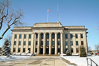
Government
Villages
|
Mendon, Ohio Mendon is a village in Mercer County, Ohio, United States. The population was 697 at the 2000 census.-History:Mendon's village hall, officially named the Mendon Town Hall, is listed on the National Register of Historic Places.-Geography:... Montezuma, Ohio Montezuma is a village in Mercer County, Ohio, United States. The population was 191 at the 2000 census.-Geography:Montezuma is located at .... Rockford, Ohio Rockford is a village in Mercer County, Ohio, United States. The population was 1,126 at the 2000 census.-Geography:Rockford is located at .... St. Henry, Ohio St. Henry is a village in Mercer County, Ohio, United States. The population was 2,271 at the 2000 census.-History:Located at the center of the village is St. Henry's Catholic Church. Completed in 1897, it is listed on the National Register of Historic Places.-Geography:St. Henry is located at... |
Townships
|
Franklin Township, Mercer County, Ohio Franklin Township is one of the fourteen townships of Mercer County, Ohio, United States. The 2000 census found 2,303 people in the township, 2,112 of whom lived in the unincorporated portions of the township.-Geography:... Gibson Township, Mercer County, Ohio Gibson Township is one of the fourteen townships of Mercer County, Ohio, United States. The 2000 census found 1,869 people in the township, 997 of whom lived in the unincorporated portions of the township.-Geography:... Granville Township, Mercer County, Ohio Granville Township is one of the fourteen townships of Mercer County, Ohio, United States. The 2000 census found 3,885 people in the township, 1,434 of whom lived in the unincorporated portions of the township.-Geography:... Hopewell Township, Mercer County, Ohio Hopewell Township is one of the fourteen townships of Mercer County, Ohio, United States. The 2000 census found 1,066 people in the township.-Geography:Located in the north central part of the county, it borders the following townships:... |
Jefferson Township, Mercer County, Ohio Jefferson Township is one of the fourteen townships of Mercer County, Ohio, United States. The 2000 census found 13,231 people in the township, 2,928 of whom lived in the unincorporated portions of the township.-Geography:... Liberty Township, Mercer County, Ohio Liberty Township is one of the fourteen townships of Mercer County, Ohio, United States. The 2000 census found 917 people in the township.-Geography:Located in the northwestern part of the county, it borders the following townships:... Marion Township, Mercer County, Ohio Marion Township is one of the fourteen townships of Mercer County, Ohio, United States. The 2000 census found 2,969 people in the township, 2,605 of whom lived in the unincorporated portions of the township.-Geography:... Recovery Township, Mercer County, Ohio Recovery Township is one of the fourteen townships of Mercer County, Ohio, United States. The 2000 census found 1,550 people in the township, 1,149 of whom lived in the unincorporated portions of the township.-Geography:... |
Union Township, Mercer County, Ohio Union Township is one of the fourteen townships of Mercer County, Ohio, United States. The 2000 census found 1,490 people in the township, 793 of whom lived in the unincorporated portions of the township.-Geography:... Washington Township, Mercer County, Ohio Washington Township is one of the fourteen townships of Mercer County, Ohio, United States. The 2000 census found 1,218 people in the township.-Geography:Located in the western part of the county, it borders the following townships:*Liberty Township - north... |
Unincorporated communities
|
Maria Stein, Ohio Maria Stein is an unincorporated community in central Marion Township, Mercer County, Ohio, United States. The community and the Maria Stein Convent lie at the center of the area known as the Land of the Cross-Tipped Churches, where a missionary priest, Father Francis de Sales Brunner,... Padua, Ohio Padua is an unincorporated community in western Washington Township, Mercer County, Ohio, United States. It lies at the intersection of State Route 49 and St. Anthony Road, west of the city of Celina, the county seat of Mercer County... Sebastian, Ohio Sebastian is an unincorporated community in northern Marion Township, Mercer County, Ohio, United States. Its elevation is 932 feet , and it is located at... |
|