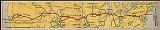
The
Lincoln Highway was the first road across the
United States of AmericaThe United States of America is a federal constitutional republic comprising fifty states and a federal district...
. Actively promoted by entrepreneur
Carl G. FisherCarl Graham Fisher was an American entrepreneur. Despite having severe astigmatism, he became a seemingly tireless pioneer and promoter of the automotive, auto racing, and real estate development industries...
, the Lincoln Highway originally spanned coast-to-coast from
Times SquareTimes Square is a major intersection in Manhattan, a borough of New York City, at the junction of Broadway and Seventh Avenue and stretching from West 42nd to West 47th Streets...
in
New York CityNew York is the most populous city in the United States, and the center of the New York metropolitan area, which is among the most populous urban areas in the world. A leading global city, New York exerts a powerful influence over worldwide commerce, finance, culture, fashion and entertainment...
to
Lincoln ParkLincoln Park in San Francisco, California was dedicated to President Abraham Lincoln in 1909 and includes about of the northwestern corner of the San Francisco Peninsula. Lincoln Park is the Western Terminus of the Lincoln Highway, the first road across the United States of America...
in
San FranciscoSan Francisco is the fourth most populous city in California and the 12th most populous city in the United States, with a 2008 estimated population of 808,976. It is the eighth most densely populated city in the U.S. and is the financial, cultural, and transportation center of the larger San...
through 13 states:
New YorkNew York is a state in the Mid-Atlantic and Northeastern regions of the United States and is the nation's third most populous. The state is bordered by New Jersey and Pennsylvania to the south, and Connecticut, Massachusetts and Vermont to the east...
,
New JerseyNew Jersey is a state in the Mid-Atlantic region of the United States. It is bordered on the north by New York, and to the east by the Hudson River, Upper New York Bay, the Kill Van Kull, Newark Bay, the Arthur Kill, Raritan Bay, Sandy Hook Bay, Westchester County, New York City, Long Island, and...
,
PennsylvaniaThe Commonwealth of Pennsylvania , often colloquially referred to as PA by natives and Northeasterners, is a state located in the Northeastern and Middle Atlantic regions of the United States...
,
OhioOhio is a Midwestern state of the United States. The thirty-fourth largest state by area in the U.S., it is the seventh-most populous with nearly 11.5 million residents...
,
IndianaIndiana is a U.S. state, the 19
th admitted to the Union. It is located in the Great Lakes region, and with approximately 6.3 million residents, is ranked 16
th in population and 17
th in population density. Indiana is ranked 38
th in land area, and is the...
,
IllinoisIllinois , the 21st state admitted to the United States of America, is the most populous and demographically diverse Midwestern state and the fifth most populous state in the nation...
,
IowaIowa is a state located in the Midwestern region of the United States of America, an area often referred to as the "American Heartland." It derives its name from the Ioway people, one of the many American Indian tribes that occupied the state at the time of European exploration. Iowa was a part of...
,
NebraskaNebraska is a state located on the Great Plains of the Midwestern United States. The state's capital is Lincoln and its largest city is Omaha....
,
ColoradoColorado is a U.S. state located in the Rocky Mountain region of the United States of America. It may also be considered to be part of the Western and Southwestern regions of the United States. Colorado entered statehood in 1876 and was nicknamed the “Centennial State”...
,
WyomingWyoming is a state in the Western United States. The majority of the state is dominated by the mountain ranges and rangelands of the Rocky Mountain West, while the easternmost section of the state includes part of a high elevation prairie region known as the High Plains. While the tenth largest...
,
UtahUtah is a western state of the United States. It was the 45th state admitted to the Union, on January 4, 1896. Approximately 80 percent of Utah's 2,736,424 people live along the Wasatch Front, centering around Salt Lake City. In contrast, vast expanses of the state are nearly uninhabited, making...
,
NevadaNevada is a state located in the western region of the United States. The capital is Carson City and the largest city is Las Vegas. The state's nickname is Silver State, due to the large number of silver deposits that were discovered and mined there...
, and
CaliforniaCalifornia is the most populous state in the United States, and the third largest by area. California is the second most populous sub-national entity in the Americas, behind only São Paulo, Brazil...
. In 1915, the "Colorado Loop" was removed, and in 1928, a realignment relocated the Lincoln Highway through the northern tip of
West VirginiaWest Virginia is a state in the Appalachian and Mid-Atlantic regions of the United States, bordered by Virginia to the southeast, Kentucky to the southwest, Ohio to the northwest, and Pennsylvania and Maryland to the northeast...
. Thus, there are a total of 14 states, 128 counties, and over 700 cities, towns and villages through which the highway passed at some time in its history.
The first officially recorded mileage for the entire Lincoln Highway was 3389 miles (5454 km) in 1913. Over the years, the road was improved and numerous realignments were made. By 1924, the Lincoln Highway had been shortened to 3142 miles (5056 km). Counting the original route and all of the subsequent realignments, there is a grand total of 5869 miles (9445 km).
Conceived in 1912 and formally dedicated October 31, 1913, the Lincoln Highway was America's first national memorial to
PresidentPresident is a title held by many leaders of organizations, companies, trade unions, universities, and countries. Etymologically, a "president" is one who presides, who sits in leadership...
Abraham LincolnAbraham Lincoln was the 16th President of the United States, serving from March 1861 until his assassination in April 1865. He successfully led his country through its greatest internal crisis, the American Civil War, preserving the Union and ending slavery...
, predating the 1922 dedication of the
Lincoln MemorialThe Lincoln Memorial is an American memorial built to honor the 16th President of the United States, Abraham Lincoln. It is located on the National Mall in Washington, D.C. and was dedicated on May 30, 1922. The architect was Henry Bacon, the sculptor of the main statue was Daniel Chester French,...
in Washington D.C. by 9 years. As the first automobile road across America, the Lincoln Highway brought great prosperity to the hundreds of cities, towns and villages along the way. Affectionately, the Lincoln Highway became known as "The Main Street Across America".
The Lincoln Highway was inspired by the
Good Roads MovementThe Good Roads Movement occurred in the United States between 1880 and 1916. Advocates for improved roads led by bicyclists turned local agitation into a national political movement....
. In turn, the Lincoln Highway inspired the National Interstate and Defense Highways Act of 1956, which was championed by
PresidentThe President of the United States is the head of state and head of government of the United States and is the highest political official in the United States by influence and recognition...
Dwight D. EisenhowerDwight David "Ike" Eisenhower was a five-star general in the United States Army and the 34th President of the United States, from 1953 until 1961. During the Second World War, he served as Supreme Commander of the Allied forces in Europe, with responsibility for planning and supervising the...
, influenced by his experiences as a young soldier crossing the country in the
1919 Army ConvoyThe Transcontinental Motor Convoys were two US Army convoys that crossed the United States from Washington, DC to the west coast. The first convoy in 1919 traveled from Washington, DC to San Francisco on the then still incomplete Lincoln Highway, the first road across America. It was the first...
on the Lincoln Highway.
The
Lincoln Highway Association (LHA), originally established in 1913 to plan, promote, and sign the highway, was re-formed in 1992 and is now dedicated to promoting and preserving the road. The LHA, with over 1100 members throughout the United States and overseas, has active state chapters in 12 Lincoln Highway states. The association maintains a national tourist center in
Franklin Grove, IllinoisFranklin Grove is a village in Lee County, Illinois, United States. The population was 1,052 at the 2000 census.-Geography:Franklin Grove is located at ....
, in a historic building built by Harry Isaac Lincoln, a cousin of
Abraham LincolnAbraham Lincoln was the 16th President of the United States, serving from March 1861 until his assassination in April 1865. He successfully led his country through its greatest internal crisis, the American Civil War, preserving the Union and ending slavery...
. The LHA holds yearly national conventions, and is governed by a board of directors with representatives from each Lincoln Highway state.
Routing
(The following information courtesy of the Lincoln Highway Association National Mapping Committee): Most of
U.S. Route 30U.S. Route 30 is an east-west main route of the system of United States Numbered Highways, with the highway traveling across the northern tier of the country. The western end of the highway is at Astoria, Oregon; the eastern end is in Atlantic City, New Jersey...
from Philadelphia to western Wyoming, portions of
Interstate 80Interstate 80 is the second-longest Interstate Highway in the United States . It connects downtown San Francisco, California, to Teaneck, New Jersey, a suburb of New York City. I-80 is the interstate that most closely approximates the route of the Lincoln Highway, the first auto trail to cross the...
in the western United States, most of
U.S. Route 50U.S. Route 50 is a major east-west route of the U.S. Highway system, stretching just over from Ocean City, Maryland on the Atlantic Ocean to West Sacramento, California. Until 1972, when it was replaced by Interstate Highways west of Sacramento, it extended to San Francisco, near the Pacific...
in Nevada and California, and most of old decommissioned
U.S. Route 40U.S. Route 40 is an east-west United States highway. As with most routes whose numbers end in a zero, U.S. 40 once traversed the entire United States. It is one of the original 1920s U.S. Highways, and its first termini were San Francisco, California, and Atlantic City, New Jersey...
in California are alignments of the Lincoln Highway. The final (1928-1930) route of the Lincoln Highway corresponds roughly to the following roads:
- 42nd Street
42nd Street is a major crosstown street in the New York City borough of Manhattan, known for its theatres, especially near the intersection with Broadway at Times Square. It is also the name of the region of the theater district near that intersection...
from the intersection of BroadwayBroadway, as the name implies, is a wide avenue in New York City, which runs the full length of Manhattan and continues into the Bronx. It is the oldest north-south main thoroughfare in the city, dating to the first New Amsterdam settlement. The name Broadway is the English literal translation of...
at Times SquareTimes Square is a major intersection in Manhattan, a borough of New York City, at the junction of Broadway and Seventh Avenue and stretching from West 42nd to West 47th Streets...
in New York CityNew York is the most populous city in the United States, and the center of the New York metropolitan area, which is among the most populous urban areas in the world. A leading global city, New York exerts a powerful influence over worldwide commerce, finance, culture, fashion and entertainment...
westward 6 blocks to the Hudson RiverThe Hudson River is a river that flows from north to south through eastern New York. It rises at Lake Tear of the Clouds, on the slopes of Mount Marcy in the Adirondack Mountains, flows past Albany, and finally forms the border between New York City and New Jersey at its mouth before emptying into...
.
- Holland Tunnel
The Holland Tunnel is a highway tunnel under the Hudson River connecting the island of Manhattan in New York City with Jersey City, New Jersey at Interstate 78 on the mainland. Unusually for an American public works project, it is not named for a government official, politician, or local hero or...
from New York City westward under the Hudson River to Jersey City, New JerseyJersey City is a city in Hudson County, New Jersey, United States. As of the United States 2000 Census, the population of Jersey City was 240,055, making it New Jersey's second-largest city, behind Newark. As of the Census Bureau's 2007 estimate, the population had grown to 242,389...
.
(Note: The Lincoln TunnelThe Lincoln Tunnel is a 1.5 mile long tunnel under the Hudson River, connecting Weehawken, New Jersey and the borough of Manhattan in New York City.-History:...
(opened in 1937), near 42nd Street, was never a part of the Lincoln Highway. In 1913, Lincoln Highway travelers crossed the Hudson River via the Weehawken Ferry from New York City to Union City, New JerseyUnion City is a city in Hudson County, New Jersey, United States. According to the United States 2000 Census, the city had a total population of 67,088, living on a land area of 3.28 km² . It is the most densely populated city in the United States, with a density of 52,977.8 per square mile -...
. In 1928, the Lincoln Highway was re-routed through the Holland Tunnel (opened in 1927) from New York City to Jersey City. However, the original Lincoln Highway Association made no attempt to map a route from Times Square to the Holland Tunnel, so today, use West StreetThe West Side Highway is a mostly-surface section of New York State Route 9A that runs from West 72nd Street along the Hudson River to the southern tip of Manhattan...
(aka West Side Highway) (not a part of the Lincoln Highway) to connect from the west end of 42nd Street down to east portal of the Holland Tunnel.)
- U.S. Route 1/9 Truck from Jersey City westward to Newark, New Jersey
Brick City redirects here. For the township in Ocean County, see Brick Township, New Jersey.Newark is the largest city in New Jersey, and the county seat of Essex County. Newark has a population of 281,402, making it the largest municipality in New Jersey and the 65th largest city in the U.S...
.
- New Jersey Route 27 from Newark southwestward to Princeton, New Jersey
Princeton, New Jersey is located in Mercer County, New Jersey, United States. Princeton University has been sited in the town since 1756. Although Princeton is a "college town", there are other important institutions in the area, including the Institute for Advanced Study, Educational Testing...
.
- U.S. Route 206
U.S. Route 206 is a north-south United States highway in New Jersey and Pennsylvania, United States. Only about a half a mile of its length is in Pennsylvania; the Milford-Montague Toll Bridge carries it over the Delaware River into New Jersey...
from Princeton southwestward to Trenton, New JerseyTrenton is the capital of the U.S. state of New Jersey and the county seat of Mercer County. As of 2007, the United States Census Bureau estimated that the City of Trenton had a population of 82,804....
.
- U.S. Route 1
U.S. Route 1 is a major north-south U.S. Highway that serves the East Coast and is the oldest highway in the United States. It runs over from Key West, Florida, north to Fort Kent, Maine, at the Canadian border. U.S. 1 generally parallels Interstate 95, though it is significantly farther west ...
from Trenton southwestward to Philadelphia, PennsylvaniaPhiladelphia is the largest city in Pennsylvania and the sixth-most-populous city in the United States.In 2008, the population of the city proper was estimated to be over 1.4 million, while the metropolitan area's population of 5.8 million made it the country's fifth-largest...
.
- U.S. Route 30
U.S. Route 30 is an east-west main route of the system of United States Numbered Highways, with the highway traveling across the northern tier of the country. The western end of the highway is at Astoria, Oregon; the eastern end is in Atlantic City, New Jersey...
from Philadelphia westward across PennsylvaniaThe Commonwealth of Pennsylvania , often colloquially referred to as PA by natives and Northeasterners, is a state located in the Northeastern and Middle Atlantic regions of the United States...
, the northern tip of West VirginiaWest Virginia is a state in the Appalachian and Mid-Atlantic regions of the United States, bordered by Virginia to the southeast, Kentucky to the southwest, Ohio to the northwest, and Pennsylvania and Maryland to the northeast...
, and westward across OhioOhio is a Midwestern state of the United States. The thirty-fourth largest state by area in the U.S., it is the seventh-most populous with nearly 11.5 million residents...
and IndianaIndiana is a U.S. state, the 19
th admitted to the Union. It is located in the Great Lakes region, and with approximately 6.3 million residents, is ranked 16
th in population and 17
th in population density. Indiana is ranked 38
th in land area, and is the...
, to Aurora, IllinoisAurora is the second largest city in Illinois, with a population of 171,782 and part of the Chicago metropolitan area. The city refers to itself as "The City of Lights" because it was one of the first cities in the United States to implement an all-electric street lighting system in 1881...
.
- Illinois Route 31
Illinois Route 31 is a north-south state road in northeastern Illinois, United States. It runs from U.S. Highway 34 in Oswego north to U.S. Highway 12, near the Wisconsin border, just south of Richmond. Illinois 31 is long.- Route description :...
from Aurora northwestward to Geneva, IllinoisGeneva is a distant suburb of Chicago located in extreme eastern Kane County, Illinois. As of the 2000 census, the city had a total population of 19,515. It is the county seat of Kane County....
.
- Illinois Route 38
Illinois Route 38 is an east-west state road that runs across northern Illinois. It runs from U.S. Route 52 in downtown Dixon to U.S. Highways 12, 20, and 45 in Westchester. This is a distance of . As Roosevelt Road it continues through Forest Park and into Cicero and Chicago before terminating at...
from Geneva westward to Sterling, IllinoisSterling is a city in Whiteside County, Illinois, United States. The population was 15,451 at the 2000 census. Formerly nicknamed "The Hardware Capital of the World", Sterling has long been associated with manufacturing and the steel industry.-Geography:...
.
- U.S. Route 30
U.S. Route 30 is an east-west main route of the system of United States Numbered Highways, with the highway traveling across the northern tier of the country. The western end of the highway is at Astoria, Oregon; the eastern end is in Atlantic City, New Jersey...
from Sterling westward across IllinoisIllinois , the 21st state admitted to the United States of America, is the most populous and demographically diverse Midwestern state and the fifth most populous state in the nation...
, IowaIowa is a state located in the Midwestern region of the United States of America, an area often referred to as the "American Heartland." It derives its name from the Ioway people, one of the many American Indian tribes that occupied the state at the time of European exploration. Iowa was a part of...
, NebraskaNebraska is a state located on the Great Plains of the Midwestern United States. The state's capital is Lincoln and its largest city is Omaha....
and WyomingWyoming is a state in the Western United States. The majority of the state is dominated by the mountain ranges and rangelands of the Rocky Mountain West, while the easternmost section of the state includes part of a high elevation prairie region known as the High Plains. While the tenth largest...
, to Granger, WyomingGranger is a town in Sweetwater County, Wyoming, United States. The population was 146 at the 2000 census.-Geography:Granger is located at ....
.
- Interstate 80
Interstate 80 is the second-longest Interstate Highway in the United States . It connects downtown San Francisco, California, to Teaneck, New Jersey, a suburb of New York City. I-80 is the interstate that most closely approximates the route of the Lincoln Highway, the first auto trail to cross the...
from Granger westward across western Wyoming and UtahUtah is a western state of the United States. It was the 45th state admitted to the Union, on January 4, 1896. Approximately 80 percent of Utah's 2,736,424 people live along the Wasatch Front, centering around Salt Lake City. In contrast, vast expanses of the state are nearly uninhabited, making...
, to West Wendover, NevadaWest Wendover is a city in Elko County, Nevada, United States. The population was 4,721 at the 2000 census. It is part of the Elko Micropolitan Statistical Area. West Wendover is located on the eastern border of Nevada and the western edge of the Great Salt Lake Desert, and is contiguous with...
.
- U.S. Route 93 Alternate
In the U.S. state of Nevada, U.S. Route 93 Alternate is an alternate route of U.S. Route 93 located in the northeast part of the state. It connects Lages Station to Wells via the town of West Wendover....
and U.S. Route 93U.S. Route 93 is a major north-south United States highway in the Western United States. The southern terminus is at U.S. Route 60 in Wickenburg, Arizona. The northern terminus is at the Canadian border north of Eureka in Lincoln County, Montana, where the roadway continues into Roosville, British...
from West Wendover southward to Ely, NevadaEly is the largest city and county seat of White Pine County, Nevada, United States. As of the 2000 census, the population was 4,041. The Clock of the Long Now is to be built near Ely.-History:...
.
- U.S. Route 50
U.S. Route 50 is a major east-west route of the U.S. Highway system, stretching just over from Ocean City, Maryland on the Atlantic Ocean to West Sacramento, California. Until 1972, when it was replaced by Interstate Highways west of Sacramento, it extended to San Francisco, near the Pacific...
from Ely westward across NevadaNevada is a state located in the western region of the United States. The capital is Carson City and the largest city is Las Vegas. The state's nickname is Silver State, due to the large number of silver deposits that were discovered and mined there...
, to 9 miles west of Fallon, NevadaFallon is a city in Churchill County, located in western Nevada, United States. The population was 7,536 at the 2000 census. It is the county seat of Churchill County and is located in the Lahontan Valley.Fallon is primarily an agricultural community...
.
- From 9 miles west of Fallon to Sacramento, California
Sacramento is the capital of the U.S. state of California, and the county seat of Sacramento County. Located along the Sacramento River and just south of the American River's confluence in California's expansive Central Valley. With a 2007 estimated population of 460,242, it is the seventh-largest...
, there are two Lincoln Highway routes over the Sierra Nevadas:
- Sierra Nevada Northern Route: U.S. Route 50 Alternate
In the U.S. state of Nevada, U.S. Route 50 Alternate is an east–west alternate route of U.S. Route 50. The highway splits from US 50 in Silver Springs, heading north to Fernley and then southeast to rejoin US 50 west of Fallon...
northwestward to Wadsworth, NevadaWadsworth is a census-designated place in Washoe County, Nevada, United States. The population was 881 at the 2000 census. It is part of the Reno–Sparks Metropolitan Statistical Area.-Geography:Wadsworth is located at ....
, then Interstate 80Interstate 80 is the second-longest Interstate Highway in the United States . It connects downtown San Francisco, California, to Teaneck, New Jersey, a suburb of New York City. I-80 is the interstate that most closely approximates the route of the Lincoln Highway, the first auto trail to cross the...
& old U.S. Route 40U.S. Route 40 is an east-west United States highway. As with most routes whose numbers end in a zero, U.S. 40 once traversed the entire United States. It is one of the original 1920s U.S. Highways, and its first termini were San Francisco, California, and Atlantic City, New Jersey...
westward over Donner PassDonner Pass is a high mountain pass in the northern Sierra Nevada, located above Donner Lake about nine miles west of Truckee, California. It is a narrow pass with a very steep approach from the east, and a gradual approach from the west.To reach California from the East, pioneer emigrants had...
and the Sierra Nevadas to Sacramento.
- Sierra Nevada Southern Route: U.S. Route 50
U.S. Route 50 is a major east-west route of the U.S. Highway system, stretching just over from Ocean City, Maryland on the Atlantic Ocean to West Sacramento, California. Until 1972, when it was replaced by Interstate Highways west of Sacramento, it extended to San Francisco, near the Pacific...
westward around Lake TahoeLake Tahoe is a large freshwater lake in the Sierra Nevada mountains of the United States. It is located along the border between California and Nevada, west of Carson City, Nevada. Lake Tahoe is the largest alpine lake in North America...
and over Echo Summit and the Sierra Nevadas to Sacramento.
- Old U.S. Route 40
U.S. Route 40 is an east-west United States highway. As with most routes whose numbers end in a zero, U.S. 40 once traversed the entire United States. It is one of the original 1920s U.S. Highways, and its first termini were San Francisco, California, and Atlantic City, New Jersey...
(with sections under Interstate 80Interstate 80 is the second-longest Interstate Highway in the United States . It connects downtown San Francisco, California, to Teaneck, New Jersey, a suburb of New York City. I-80 is the interstate that most closely approximates the route of the Lincoln Highway, the first auto trail to cross the...
) from Sacramento southwestward across CaliforniaCalifornia is the most populous state in the United States, and the third largest by area. California is the second most populous sub-national entity in the Americas, behind only São Paulo, Brazil...
's Central Valley to the University Avenue exit in Berkeley, CaliforniaBerkeley is a city on the east shore of the San Francisco Bay in Northern California, United States. Its neighbors to the south are the cities of Oakland and Emeryville. To the north is the city of Albany and the unincorporated community of Kensington...
.
- University Avenue from Interstate 80
Interstate 80 is the second-longest Interstate Highway in the United States . It connects downtown San Francisco, California, to Teaneck, New Jersey, a suburb of New York City. I-80 is the interstate that most closely approximates the route of the Lincoln Highway, the first auto trail to cross the...
westward to the Berkeley PierThe Berkeley Pier is a pier in Berkeley, California. When constructed, the pier extended 3.5 miles into San Francisco Bay from the end of University Avenue. Due to extensive filling of the bay and the creation of the Berkeley Marina, it presently extends only 2.5 miles...
.
(Note: In 1928, Lincoln Highway travelers crossed the San Francisco BaySan Francisco Bay is a shallow, productive estuary through which water draining from approximately forty percent of California, flowing in the Sacramento and San Joaquin rivers from the Sierra Nevada mountains, enters the Pacific Ocean...
via a ferry from the Berkeley Pier to the Hyde Street PierThe Hyde Street Pier is a historic ferry pier located on the northern waterfront of San Francisco, California, amidst the tourist zone of Fisherman's Wharf....
in San Francisco, CaliforniaSan Francisco is the fourth most populous city in California and the 12th most populous city in the United States, with a 2008 estimated population of 808,976. It is the eighth most densely populated city in the U.S. and is the financial, cultural, and transportation center of the larger San...
. Today, use Interstate 80Interstate 80 is the second-longest Interstate Highway in the United States . It connects downtown San Francisco, California, to Teaneck, New Jersey, a suburb of New York City. I-80 is the interstate that most closely approximates the route of the Lincoln Highway, the first auto trail to cross the...
to connect from University Avenue down to the San Francisco-Oakland Bay BridgeThe San Francisco – Oakland Bay Bridge is a complex of toll bridges in the San Francisco Bay Area of California, in the United States. Forming part of Interstate 80 and of the direct road route between San Francisco and Oakland, it carries approximately 270,000 vehicles per day on its two decks...
(opened in 1936) to cross the bay into San Francisco, then take the Embarcadero from the Bay Bridge northwestward along the waterfront to connect to the Hyde Street Pier in Fisherman's WharfFisherman's Wharf is a neighborhood and popular tourist attraction in San Francisco, California, U.S.It roughly encompasses the northern waterfront area of San Francisco from Ghirardelli Square or Van Ness Avenue east to Pier 35 or Kearny Street...
.)
- From the Hyde Street Pier in San Francisco, take:
- Hyde Street southward 2 blocks to North Point Street.
- North Point Street westward 3 blocks to Van Ness Avenue.
- Van Ness Avenue southward 16 blocks to California Street.
- California Street westward 54 blocks to 32nd Avenue.
- 32nd Avenue northward 2 blocks to El Camino del Mar.
- El Camino del Mar westward into Lincoln Park
Lincoln Park in San Francisco, California was dedicated to President Abraham Lincoln in 1909 and includes about of the northwestern corner of the San Francisco Peninsula. Lincoln Park is the Western Terminus of the Lincoln Highway, the first road across the United States of America...
and the Western Terminus.
Concept and promotion
In 1912, railroads dominated interstate transportation in America, and roadways were primarily of local interest. Outside cities, "market roads" were sometimes maintained by counties or townships, but maintenance of rural roads fell to those who lived along them. Many states had constitutional prohibitions against funding "internal improvements" such as road projects, and federal highway programs were not to become effective until 1921.
At the time, the country had about 2.2 million miles (3.5 million km) of rural roads, of which a mere 8.66 percent (190,476 miles or 306,541 km) had "improved" surfaces: gravel, stone, sand-clay, brick, shells, oiled earth, etc. Interstate roads were considered a luxury, something only for wealthy travelers who could spend weeks riding around in their automobiles.
Support for a system of improved interstate highways had been growing. For example, The New York Times in an article on August 27, 1911, gave quotes from several prominent men. "Of the Nation's leaders," it said, "none is more emphatic than Speaker Champ Clark." Furthermore, from a communication to President Robert P. Hooper of the American Automobile Association, the article quoted Clark's opinion that, "I believe the time has come for the general Government to actively and powerfully co-operate with the States in building a great system of public highways...that would bring its benefits to every citizen in the country." However, Congress as a whole was not yet ready to commit funding to such projects.
Carl G. FisherCarl Graham Fisher was an American entrepreneur. Despite having severe astigmatism, he became a seemingly tireless pioneer and promoter of the automotive, auto racing, and real estate development industries...
was an early automobile entrepreneur who was the manufacturer of Prest-O-Lite compressed carbide-gas headlights used on most early cars, and was also one of the principal investors who built the Indianapolis Speedway. He believed that the popularity of automobiles was dependent on good roads. In 1912 he began promoting his dream of a transcontinental highway, and at a September 10 dinner meeting with industry friends in
IndianapolisIndianapolis is the capital of the U.S. state of Indiana, and the county seat of Marion County, Indiana. The United States Census estimated the city's population, excluding the included towns, at 798,382 in 2008...
, he called for a coast-to-coast rock highway to be completed by May 1, 1915, in time for the Panama-Pacific International Exposition in San Francisco. He estimated the cost at about $10 million and told the group, "Let's build it before we're too old to enjoy it!" Within a month Fisher's friends had pledged $1 million.
Henry FordHenry Ford was the American founder of the Ford Motor Company and father of modern assembly lines used in mass production. His introduction of the Model T automobile revolutionized transportation and American industry. He was a prolific inventor and was awarded 161 U.S. patents...
, the biggest automaker of his day, refused to contribute because he believed the government should build America's roads.
However, contributors included former U.S. President
Theodore RooseveltTheodore Roosevelt was the 26th President of the United States. He is well remembered for his energetic persona, his range of interests and achievements, his model of masculinity, and his "cowboy" image. He was a leader of the Republican Party and founder of the short-lived Bull Moose Party...
and Thomas A. Edison, both friends of Fisher, as well as then-current President
Woodrow WilsonThomas Woodrow Wilson was the 28th President of the United States. A leading intellectual of the Progressive Era, he served as President of Princeton University from 1902 to 1910, and then as the Governor of New Jersey from 1911 to 1913...
, the first U.S. President to make frequent use of an automobile for relaxation.
Fisher and his associates chose a name for the road, naming it after one of Fisher's heroes,
Abraham LincolnAbraham Lincoln was the 16th President of the United States, serving from March 1861 until his assassination in April 1865. He successfully led his country through its greatest internal crisis, the American Civil War, preserving the Union and ending slavery...
. At first they had to consider other names, such as "The Coast-to-Coast Rock Highway" or "The Ocean-to-Ocean Highway," because the Lincoln Highway name had been reserved earlier by a group of Easterners who were seeking support to build their Lincoln Highway from Washington to Gettysburg on federal funds. When Congress turned down their proposed appropriation, the project collapsed, and Fisher's preferred name became readily available.
On July 1, 1913, the Lincoln Highway Association (LHA) was established "to procure the establishment of a continuous improved highway from the Atlantic to the Pacific, open to lawful traffic of all description without toll charges." The first goal of the LHA was to build the rock highway from
Times SquareTimes Square is a major intersection in Manhattan, a borough of New York City, at the junction of Broadway and Seventh Avenue and stretching from West 42nd to West 47th Streets...
in
New York CityNew York is the most populous city in the United States, and the center of the New York metropolitan area, which is among the most populous urban areas in the world. A leading global city, New York exerts a powerful influence over worldwide commerce, finance, culture, fashion and entertainment...
to
Lincoln ParkLincoln Park in San Francisco, California was dedicated to President Abraham Lincoln in 1909 and includes about of the northwestern corner of the San Francisco Peninsula. Lincoln Park is the Western Terminus of the Lincoln Highway, the first road across the United States of America...
in
San FranciscoSan Francisco is the fourth most populous city in California and the 12th most populous city in the United States, with a 2008 estimated population of 808,976. It is the eighth most densely populated city in the U.S. and is the financial, cultural, and transportation center of the larger San...
. The second goal was to promote the Lincoln Highway as an example to, in Fisher's words, "stimulate as nothing else could the building of enduring highways everywhere that will not only be a credit to the American people but that will also mean much to American agriculture and American commerce."
Henry JoyHenry Bourne Joy was President of the Packard Motor Car Company, and a prominent figure on both sides of prohibition.- Early life :...
was named as the LHA president, so that although Carl Fisher remained a driving force in furthering the goals of the association, it would not appear as his one-man crusade.
The first section of the Lincoln Highway to be completed and dedicated was the
EssexEssex County is a county located in the northeastern part of the U.S. state of New Jersey. As of the United States 2000 Census, the population was 793,633, ranking it second in the state after Bergen County; Essex County's population had declined to 786,147 as of the bureau's 2006 population...
and HudsonHudson County is in New Jersey, United States. Its county seat is Jersey City.-Geography and topography:According to the U.S. Census Bureau, the county has a total area of 62 square miles , of which, 47 square miles is land and 16 square miles is water...
Lincoln Highway, running along the former
Newark Plank RoadThe Newark Plank Road was a major 19th century artery between New Jersey's Hudson Waterfront and the burgeoning city of Newark, further inland across the New Jersey Meadows. As its name suggests, a plank road was constructed of wooden planks laid side-to-side on a roadbed. A charter to construct...
from
Newark, New JerseyBrick City redirects here. For the township in Ocean County, see Brick Township, New Jersey.Newark is the largest city in New Jersey, and the county seat of Essex County. Newark has a population of 281,402, making it the largest municipality in New Jersey and the 65th largest city in the U.S...
to
Jersey City, New JerseyJersey City is a city in Hudson County, New Jersey, United States. As of the United States 2000 Census, the population of Jersey City was 240,055, making it New Jersey's second-largest city, behind Newark. As of the Census Bureau's 2007 estimate, the population had grown to 242,389...
. It was dedicated on December 13, 1913 at the request of the Associated Automobile Clubs of New Jersey and the Newark Motor Club, and was named after the two counties it passed through.
Route selection and dedication
The LHA needed to determine the best and most direct route from New York City to San Francisco. East of the
Mississippi RiverThe Mississippi River is the second longest river in the United States, with a length of from its source in Lake Itasca in Minnesota to its mouth in the Gulf of Mexico....
, route selection was eased by the relatively dense road network. To scout a western route, the LHA's "Trail-Blazer" tour set out from
IndianapolisIndianapolis is the capital of the U.S. state of Indiana, and the county seat of Marion County, Indiana. The United States Census estimated the city's population, excluding the included towns, at 798,382 in 2008...
in 17 cars and 2 trucks on July 1, 1913, the same day LHA headquarters were established in
DetroitDetroit is the largest city in the U.S. state of Michigan and the seat of Wayne County. Detroit is a major port city on the Detroit River, in the Midwest region of the United States. Located north of Windsor, Ontario, Detroit is the only major U.S. city that looks south to Canada. It was founded...
. After 34 days of
IowaIowa is a state located in the Midwestern region of the United States of America, an area often referred to as the "American Heartland." It derives its name from the Ioway people, one of the many American Indian tribes that occupied the state at the time of European exploration. Iowa was a part of...
mud pits, sand drifts in
NevadaNevada is a state located in the western region of the United States. The capital is Carson City and the largest city is Las Vegas. The state's nickname is Silver State, due to the large number of silver deposits that were discovered and mined there...
and
UtahUtah is a western state of the United States. It was the 45th state admitted to the Union, on January 4, 1896. Approximately 80 percent of Utah's 2,736,424 people live along the Wasatch Front, centering around Salt Lake City. In contrast, vast expanses of the state are nearly uninhabited, making...
, overheated
radiatorsRadiators are used for cooling internal combustion engines, chiefly in automobiles but also in piston-engined aircraft, railway locomotives, motorcycles, stationary generating plant or any similar use of such an engine....
, flooded roads, cracked axles, and enthusiastic greetings in every town that thought it had a chance of being on the new highway, the tour arrived for a parade down San Francisco's Market Street before thousands of cheering residents.
The Trail-Blazers returned to Indianapolis by train, and a few weeks later on September 14, 1913 the route was announced. LHA leaders, particularly Packard president
Henry JoyHenry Bourne Joy was President of the Packard Motor Car Company, and a prominent figure on both sides of prohibition.- Early life :...
, wanted as straight a route as possible and the 3389 mile (5454 km) route announced did not necessarily follow the course of the Trail-Blazers. There were many disappointed town officials, particularly in
ColoradoColorado is a U.S. state located in the Rocky Mountain region of the United States of America. It may also be considered to be part of the Western and Southwestern regions of the United States. Colorado entered statehood in 1876 and was nicknamed the “Centennial State”...
and
KansasKansas is a state located in the Midwestern United States. It is named after the Kansas River which flows through it, which in turn was named after the Kansa tribe, who inhabited the area. The tribe's name is often said to mean "people of the wind" or "people of the south wind," although this was...
, who had greeted the Trail-Blazers and thought the tour's passage had meant their towns would be on the Highway.
Less than half the selected route was improved roadway. As segments were improved over time, the route length was reduced by about 250 miles (400 km). Several segments of the Lincoln Highway route followed historic roads:
- a road laid out by Dutch colonists of New Jersey
New Jersey is a state in the Mid-Atlantic region of the United States. It is bordered on the north by New York, and to the east by the Hudson River, Upper New York Bay, the Kill Van Kull, Newark Bay, the Arthur Kill, Raritan Bay, Sandy Hook Bay, Westchester County, New York City, Long Island, and...
before 1675
- the 1796 Lancaster Turnpike in Pennsylvania
- the Chambersburg Turnpike, over which much of the Army of Northern Virginia
The Army of Northern Virginia was the primary military force of the Confederate States of America in the Eastern Theater of the American Civil War. It was most often arrayed against the Union Army of the Potomac. Three districts were created under the Department of Northern Virginia:*Aquia...
marched to reach the Gettysburg BattlefieldThe Gettysburg Battlefield was the site of the Battle of Gettysburg, fought July 1–3, 1863, in and around the borough of Gettysburg, Pennsylvania, the county seat of Adams County, which had approximately 2,400 residents at the time. It is now the site of two Federally owned and administered...
, a part of which is traversed by the Lincoln Highway.
- a British military trail built in 1758 by General John Forbes
John Forbes was a British general in the French and Indian War. He is best known for leading the Forbes Expedition that captured the French outpost at Fort Duquesne and for naming the city of Pittsburgh, Pennsylvania after British Secretary of State William Pitt the Elder.-Early life:Forbes was...
of England from ChambersburgChambersburg is a borough in the South Central region of Pennsylvania, United States. It is miles north of Maryland and the Mason-Dixon line and southwest of Harrisburg in the Cumberland Valley, which is part of the Great Appalachian Valley. Chambersburg is the county seat of Franklin County...
to PittsburghPittsburgh is a city in and the county seat of Allegheny County, Pennsylvania, United States, and the second largest city in the state. Its population was 334,563 at the 2000 census; by 2006, it was estimated to have fallen to 312,819. The population of the seven-county metropolitan area is...
during the French and Indian WarThe French and Indian War, also known as the War of the Conquest or referred as part of the larger conflict known as the Seven Years' War, was a war fought in North America between 1754 and 1763...
, later known as the Pittsburgh Road and the Conestoga Road
- a section in Ohio
Ohio is a Midwestern state of the United States. The thirty-fourth largest state by area in the U.S., it is the seventh-most populous with nearly 11.5 million residents...
followed an ancient Indian trail known as the Ridge Road
- sections of the Mormon Trail
The Mormon Trail or Mormon Pioneer Trail is the route that members of The Church of Jesus Christ of Latter-day Saints traveled from 1846 to 1868...
- portions of the routes of the Overland Stage Line
George W. Chorpenning Jr. was a pioneer in the transportation of mail, freight, and passengers through the arid and undeveloped western regions of the United States...
and the Pony ExpressThe Pony Express was a fast mail service crossing the North American continent from St. Joseph, Missouri, to Sacramento, California, from April 1860 to October 1861...
- the Donner Pass
Donner Pass is a high mountain pass in the northern Sierra Nevada, located above Donner Lake about nine miles west of Truckee, California. It is a narrow pass with a very steep approach from the east, and a gradual approach from the west.To reach California from the East, pioneer emigrants had...
crossing of the Sierra Nevada, named after the unfortunate Donner PartyThe Donner Party was a group of California-bound American emigrants caught up in the "westering fever" of the 1840s. After becoming snowbound in the Sierra Nevada in the winter of 1846–1847, some of them resorted to cannibalism.-Party formation:...
of 1846
- an alternate Sierra Nevada crossing at Echo Summit
Echo Summit is a mountain pass located in eastern El Dorado County, California, USA. At an elevation of 7,382 ft. , it is the highest point on U.S...
following a pioneer stagecoachA stagecoach is a type of four-wheeled closed coach for passengers and goods, strongly sprung and drawn by four horses, usually four-in-hand. Widely used before the introduction of railway transport, it made regular trips between stages or stations, which were places of rest provided for stagecoach...
route
The LHA dedicated the route on October 31, 1913. Bonfires, fireworks, concerts, parades, and street dances were held in hundreds of cities in the 13 states along the route. During a dedication ceremony in Iowa, State Engineer Thomas H. MacDonald said he felt it was "…the first outlet for the road building energies of this community." He went on to advocate the creation of a system of transcontinental highways with radial routes. In 1919, MacDonald became Commissioner of the Bureau of Public Roads (BPR), a post he held until 1953, when he oversaw the early stages of the Dwight D. Eisenhower System of Interstate and Defense Highways.
Publicity
In September 1912, in a letter to a friend, Fisher wrote that "…the highways of America are built chiefly of politics, whereas the proper material is crushed rock, or concrete." The leaders of the LHA were masters of the
public relationsPublic relations is the practice of managing the communication between an organization and its publics. Public relations gains an organization or individual exposure to their audiences using topics of public interest and news items that do not require direct payment...
, and used publicity and propaganda as even more important materials.
In the early days of the effort, each contribution from a famous supporter was publicized.
Theodore RooseveltTheodore Roosevelt was the 26th President of the United States. He is well remembered for his energetic persona, his range of interests and achievements, his model of masculinity, and his "cowboy" image. He was a leader of the Republican Party and founder of the short-lived Bull Moose Party...
and
Thomas EdisonThomas Alva Edison was an American inventor, scientist and businessman who developed many devices that greatly influenced life around the world, including the phonograph, the motion picture camera, and a long-lasting, practical electric light bulb...
, both friends of Fisher, sent checks. A friendly Member of
CongressThe United States Congress is the bicameral legislature of the federal government of the United States of America, consisting of two houses, the Senate and the House of Representatives. Both senators and representatives are chosen through direct election....
arranged for a dedicated motor enthusiast, President
Woodrow WilsonThomas Woodrow Wilson was the 28th President of the United States. A leading intellectual of the Progressive Era, he served as President of Princeton University from 1902 to 1910, and then as the Governor of New Jersey from 1911 to 1913...
, to contribute US$5 whereupon he was issued Highway Certificate #1. Copies of the certificate were promptly distributed to the press.
One of the best known contributions came from a small group of
EsquimauxEskimos or Esquimaux are indigenous peoples who have traditionally inhabited the circumpolar region from eastern Siberia , across Alaska and Canada, and all of Greenland....
children in Anvik,
AlaskaAlaska is the largest state of the United States of America by area; it is situated in the northwest extremity of the North American continent, with Canada to the east, the Arctic Ocean to the north, and the Pacific Ocean to the west and south, with Russia further west across the Bering Strait...
. Their American teacher told them about Abraham Lincoln and the highway to be built in his honor, and they took up a collection and sent it to the LHA with the note, "Fourteen pennies from Anvik Esquimaux children for the Lincoln Highway." The LHA distributed pictures of the coins and the accompanying letter, and both were widely reprinted.
One of Fisher's first acts after opening LHA headquarters was to hire F. T. Grenell, city editor of the
Detroit Free PressThe Detroit Free Press is the largest daily newspaper in Detroit, Michigan, USA. The Sunday edition is titled the Sunday Free Press. It is sometimes informally referred to as the "Freep"...
, as a part-time publicity man. The Trail-Blazer tour included representatives of the
Hearst newspaper syndicateHearst Communications, Inc. is a privately-held American-based media conglomerate based in the Hearst Tower in New York City, USA. Founded by William Randolph Hearst as an owner of newspapers, the company's holdings now include a wide variety of media...
, the
Indianapolis Star and NewsThe Indianapolis Star is a daily newspaper which began publishing on June 6, 1903.It began as a morning daily paper in competition with two other Indianapolis dailies, the Indianapolis Journal and the Indianapolis Sentinel, which it eventually took over. In 1948, The Star owner Eugene C. Pulliam...
, the
Chicago TribuneThe Chicago Tribune is a major daily newspaper based in Chicago, Illinois, United States, and the flagship publication of the Tribune Company...
, and telegraph companies to help transmit their dispatches.
In preparation for the October 31 dedication ceremonies, the LHA asked clergy across the United States to discuss Abraham Lincoln in their sermons on November 2, the Sunday nearest the dedication. The LHA then distributed copies of many of the sermons, such as one by
Cardinal GibbonsJames Gibbons was an American Cardinal of the Roman Catholic Church. He served as Bishop of Richmond from 1872 to 1877, and as Archbishop of Baltimore from 1877 until his death in 1921...
who, with the dedication fresh in mind, had written that "such a highway will be a most fitting and useful monument to the memory of Lincoln."
One of the greater contributions to highway development was a well-publicized and promoted
U.S. ArmyThe United States Army is the branch of the United States Military responsible for land-based military operations. It is the largest and oldest established branch of the U.S. military and is one of seven uniformed services...
Transcontinental Motor ConvoyThe Transcontinental Motor Convoys were two US Army convoys that crossed the United States from Washington, DC to the west coast. The first convoy in 1919 traveled from Washington, DC to San Francisco on the then still incomplete Lincoln Highway, the first road across America. It was the first...
in 1919. The convoy left the
White HouseThe White House is the official residence and principal workplace of the President of the United States. Located at 1600 Pennsylvania Avenue NW in Washington, D.C., it was built between 1792 and 1800 of white-painted Aquia sandstone in the late Georgian style and has been the residence of every...
in
Washington, D.C.Washington, D.C. , formally the District of Columbia and commonly referred to as Washington, the District, or simply D.C., is the capital of the United States, founded on July 16, 1790...
on July 7, 1919, and met the Lincoln Highway route at
Gettysburg, PennsylvaniaGettysburg is a borough in and the county seat of Adams County, Pennsylvania, United States. The population was 7,490 at the 2000 census.Although known primarily as an attraction because of its proximity to the Gettysburg Battlefield, site of the Battle of Gettysburg, the borough is also known for...
. After two months of travel, the convoy reached San Francisco on September 6, 1919. Though bridges failed, vehicles broke and were sometimes stuck in mud, the convoy was greeted in communities across the country. The LHA used the convoy's difficulties to show the need for better main highways, building popular support for both local and federal funding. The convoy led to the passage of many county bond issues supporting highway construction.
One of the participants in the convoy was a young
Lt.Col.In the United States Army, Air Force, and Marine Corps, lieutenant colonel is a field grade military officer rank just above the rank of major and just below the rank of colonel. It is equivalent to the rank of commander in the other uniformed services....
EisenhowerDwight David "Ike" Eisenhower was a five-star general in the United States Army and the 34th President of the United States, from 1953 until 1961. During the Second World War, he served as Supreme Commander of the Allied forces in Europe, with responsibility for planning and supervising the...
, and it was so memorable that he devoted a chapter to it ("Through Darkest America With Truck and Tank") in his 1967 book
At Ease: Stories I Tell to Friends. That 1919 experience, and his exposure to the
autobahnAutobahn is the German word for a major high-speed road restricted to motor vehicles capable of driving at least 60 km/h and having full control of access, similar to a motorway or freeway in English-speaking countries.In most countries, it usually refers to the German autobahn specifically...
network in
GermanyGermany , officially the Federal Republic of Germany , is a country in Central Europe. It is bordered to the north by the North Sea, Denmark, and the Baltic Sea; to the east by Poland and the Czech Republic; to the south by Austria and Switzerland; and to the west by France, Luxembourg, Belgium,...
in the 1940s, found expression in 1954 when he announced his "Grand Plan" for highways. The resulting 1956 legislation created the Highway Trust Fund that accelerated construction of the
Interstate Highway SystemThe Dwight D. Eisenhower National System of Interstate and Defense Highways, commonly called the Interstate Highway System , is a network of limited-access highways in the United States that is named for President Dwight D. Eisenhower, who championed its formation...
.
Fisher's idea that the auto industry and private contributions could pay for the highway was abandoned early, and while the LHA did help finance a few short sections or roadway, the contributions of LHA founders and members were used primarily for publicity and promotion to encourage travel on the Highway, and for lobbying of officials at all levels for support construction by governments.
Early travel
According to the Association's 1916
Official Road Guide a trip from the Atlantic to the Pacific on the Lincoln Highway was "something of a sporting proposition" and might take 20 to 30 days. To make it in 30 days the motorist would need to average 18 miles (29 km) an hour for 6 hours per day, and driving was only done during daylight hours. The trip was thought to cost no more than $5 a day per person, including food, gas, oil, and even "five or six meals in hotels." Car repairs would, of course, increase the cost.
Since gasoline stations were still rare in many parts of the country, motorists were urged to top off their gasoline at every opportunity, even if they had done so recently. Motorists should wade through water before driving through to verify the depth. The list of recommended equipment included chains, a shovel, axe, jacks, tire casings and inner tubes, tools, and (of course) a pair of Lincoln Highway pennants. And, the guide offered this sage advice: "Don't wear new shoes."
Firearms were not necessary, but west of Omaha full camping equipment was recommended, and the guide warned against drinking alkali water that could cause serious cramps. In certain areas, advice was offered on getting help, for example near Fish Springs, Utah, "If trouble is experienced, build a sagebrush fire. Mr. Thomas will come with a team. He can see you 20 miles off." Later editions omitted Mr. Thomas, but westbound travelers were advised to stop at the Orr's Ranch for advice, and eastbound motorists were to check with Mr. K.C. Davis of Gold Hill, Nevada.
Seedling Miles and the Ideal Section
While the Lincoln Highway Association did not have sufficient funds to sponsor large sections of the road, starting in 1914 it did sponsor "Seedling Mile" projects. According to the 1924 LHA Guide the Seedling Miles were intended "to demonstrate the desirability of this permanent type of road construction" to rally public support for government-backed construction. The LHA convinced industry of their self-interest and was able to arrange donations of materials from the
Portland CementPortland cement is the most common type of cement in general use around the world, because it is a basic ingredient of concrete, mortar, stucco and most non-specialty grout...
Association
http://www.cement.org.
The first Seedling Mile was built in 1914 west of
MaltaMalta is a village in DeKalb County, Illinois, United States. The population was 969 at the 2000 census.-History:This town, situated far out upon the billowy prairie, remote from groves, and streams, and other attractions to the early settler, was one of the later-settled townships of the County....
, Illinois, but after years of experience the LHA began a design effort for a road section that could handle traffic 20 years into the future. Seventeen highway experts met between December 1920 and February 1921, and specified:
- a right-of-way 110 feet (33.5 m) in width
- a concrete road bed 40 feet (12.2 m) wide and 10 inches (254 mm) thick to support loads of 8,000 pounds (3,639 kg) per wheel
- curves with a minimum radius of 1,000 feet (305 m), banked for 35 mph (56 km/h), with guard rail
Guard rail, sometimes referred to as guide rail or railing, is a system designed to keep people or vehicles from straying into dangerous or off-limits areas...
s at embankments
- no grade crossings or advertising signs
- a footpath for pedestrians
The most famous Seedling Mile built to these specifications was the 1.3-mile (2 km) "Ideal Section" between
DyerDyer is a town in St. John Township, Lake County, Indiana, United States. The population was 13,895 at the 2000 census.-Geography:Dyer is located at ....
and
ScherervilleSchererville is a town in St. John Township, Lake County, Indiana, United States. It is part of the Chicago metropolitan area. The population was 24,851 at the 2000 census and an estimated 28,394 as of July 2005.- History :...
in
Lake CountyLake County is a county located in the U.S. state of Indiana. In 2000, its population was 484,564, making it Indiana's second-most populous county. The county seat is Crown Point. This county is part of Northwest Indiana and the Chicago metropolitan area....
, Indiana. With federal, state, and county funds, and a US$130,000 contribution by
United States Rubber CompanyThe United States Rubber Company was founded in Naugatuck, Connecticut in 1892. It was one of the original 12 stocks in the Dow Jones Industrial Average, and became Uniroyal Inc...
president and LHA founder C.B. Seger, the Ideal Section was built during 1922 and 1923. Magazines and newspapers called the Ideal Section a vision of the future, and highway officials from across the country visited and wrote technical papers that circulated both in the United States and overseas. The Ideal Section is still in use to this day, and has worn so well that a driver would not notice it unless the marker near the road brought it to their attention.
Federal highways
By the mid-1920s there were about 250
National auto trailThe system of auto trails was an informal network of marked routes that existed in the United States and Canada in the early part of the 20th century. Marked with colored bands on telephone poles, the trails were intended to help travellers in the early days of the automobile.Auto trails were...
s. Some were major routes, such as the Lincoln Highway, the
Jefferson HighwayThe Jefferson Highway was an automobile highway stretching through the central United States from New Orleans, Louisiana, to Winnipeg, Manitoba, Canada. The Jefferson Highway was replaced with the new numbered US Highway system in the late 1920s...
, the
National Old Trails RoadNational Old Trails Road, also known as the Ocean-to-Ocean Highway, was established in 1912, and became part of the National Auto Trail system in the United States. It was long and stretched from Baltimore, Maryland , to California...
, the
Old Spanish TrailThe Old Spanish Trail auto highway once spanned the country with a full of roadway from ocean to ocean crossing 67 counties and eight states along the Southern border of the United States. Work on the auto highway began in 1915 and, by the 1920s, the trail linked St. Augustine, Florida, to San...
, and the
Yellowstone TrailThe Yellowstone Trail was the first transcontinental automobile highway through the upper tier of states in the United States. It ran from Massachusetts to Seattle and was one of the earliest transcontinental automobile routes in the world, with significant social, political and economic effects on...
, but most were shorter. Some of the shorter routes were formed more to generate revenues for a trail association rather than for their value as a route between significant locations.
By 1925 governments had joined the roadbuilding movement, and began to assert control. Federal and state officials established the Joint Board on Interstate Highways, which proposed a numbered U.S. Highway system which would make the Trail designations obsolete, though technically the Joint Board had no authority over highway names. Increasing government support for roadbuilding was making the old road associations less important, but the LHA still had significant influence. The Secretary of the Joint Board, BPR official E. W. James, went to Detroit to gain LHA support for the numbering scheme, knowing it would be hard for smaller road associations to object if the LHA publicly supported the new plan.
The LHA preferred numbering the existing named routes, but in the end the LHA was more interested in the larger plan for roadbuilding than they were in officially retaining the name. They knew the Lincoln Highway name was fixed in the mind of the public, and James promised them that, so far as possible, the Lincoln Highway would have the number 30 for its entire route. An editorial in the February 1926 issue of
The Lincoln Forum reflected the outcome:
The states approved the new federal numbering system in November 1926 and began putting up new signs. The Lincoln Highway was not alone in being split among several numbers, but the entire routing between Philadelphia and Granger, Wyoming, was assigned "U.S. 30" per the agreement. East of Philadelphia the Lincoln Highway was part of U.S. 1, and west of Salt Lake City the route became U.S. 40 across Donner Pass. Only the segment between Granger and Salt Lake City was not part of the new numbering plan; U.S. 30 was assigned to a more northerly route toward Pocatello, Idaho. When U.S. 50 was extended to California it followed the Lincoln Highway's alternate route south of Lake Tahoe.
The last major promotional activity of the LHA took place on September 1, 1928, when at 1:00 p.m. groups of
Boy ScoutsThe Boy Scouts of America is one of the largest youth organizations in the United States, with over four million youth members in its age-related divisions...
placed approximately 2,400
concrete markersThroughout the world there are many Scouting memorials, monuments and gravesites.-Kenya:*Baden-Powell grave - Wajee Nature Park, Nyeri, Kenya, near Mount Kenya...
at sites along the route to officially mark and dedicate it to the memory of Abraham Lincoln. Less commonly known is that 4,000 metal signs for urban areas were also erected then. The markers were placed on the outer edge of the right of way at major and minor crossroads, and at reassuring intervals along uninterrupted segments. Each concrete post carried the Lincoln Highway insignia and directional arrow, and a bronze medallion with Lincoln's bust and stating "This Highway Dedicated to Abraham Lincoln".
The Lincoln Highway was not yet the imagined "rock highway" from coast to coast when the LHA ceased operating, as there were many segments that had still not been paved. Some parts were because of reroutings, such as a dispute in the early 1920s with Utah officials that forced the LHA to change routes in western Utah and eastern Nevada. Construction was underway on the final unpaved segment by the 25th anniversary of the Lincoln Highway in 1938.
Inspiration
The success of the Lincoln Highway as a road, as an inspiration to travel, and as an economic boost to the towns and states along its route, inspired other named long-distance highways, such as the
Yellowstone TrailThe Yellowstone Trail was the first transcontinental automobile highway through the upper tier of states in the United States. It ran from Massachusetts to Seattle and was one of the earliest transcontinental automobile routes in the world, with significant social, political and economic effects on...
and the National Old Trails Road. Most of these highways were not as successful as the Lincoln, and all have, to some degree, been supplanted by numbered routes or abandoned.
25th Anniversary
On June 8, 1938, President
Franklin D. RooseveltFranklin Delano Roosevelt , the only U.S. President elected to more than two terms, was a central figure in world events during the mid-20th century, leading the United States during a time of worldwide economic crisis and world war...
signed the Federal-Aid Highway Act of 1938, which called for a BPR report on the feasibility of a system of transcontinental toll roads. The "Toll Roads and Free Roads" report was the first official step toward creation of the Interstate Highway System in the United States.
The 25
th Anniversary of the Lincoln Highway was noted a month later in a July 3, 1938, nationwide radio broadcast on NBC. The program featured interviews with a number of LHA officials, and a message from Carl Fisher read by an announcer in Detroit. Fisher's statement included:
Since 1940
Fisher died about a year after the 25th Anniversary in 1940, having lost most of his fortune. In the many years since, the Lincoln Highway has remained a persistent memory:
- In New Jersey, parts of U.S. Route 1/9
U.S. Route 9 is a major U.S. highway in the northeast United States. US 9 runs from Laurel, Delaware, to the Canadian border near Champlain, New York, but plays a major role in the state of New Jersey, running from the southern tip of the state in Cape May to the George Washington Bridge in Fort...
and New Jersey Route 27 still carry the name.
- Some segments of U.S. 30 still carry the name.
- Some city streets on which the Lincoln Highway was routed still carry the street name "Lincoln Way" or "Lincolnway", including: Mishawaka, Indiana
Mishawaka is a city on the St. Joseph River and a twin city of South Bend in St. Joseph County, Indiana, United States. The population was 46,557 at the 2000 census...
; Valparaiso, IndianaValparaiso is a city in Porter County, Indiana, United States, and is the southeasternmost suburb of the Chicago metropolitan area. It is the county seat of Porter County...
; Aurora, IllinoisAurora is the second largest city in Illinois, with a population of 171,782 and part of the Chicago metropolitan area. The city refers to itself as "The City of Lights" because it was one of the first cities in the United States to implement an all-electric street lighting system in 1881...
; Ames, IowaAmes is a city located in the central part of the U.S. state of Iowa in Story County, and approximately north of Des Moines. It is the principal city of the Ames, Iowa...
; Cheyenne, WyomingCheyenne is the capital and largest city of the U.S. state of Wyoming and the county seat of Laramie County. It is the principal city of the Cheyenne, Wyoming Metropolitan Statistical Area which encompasses all of Laramie County. The population was 53,011 at the 2000 census...
; Auburn, CaliforniaAuburn is a city in the county seat of Placer County, California, United States. The current population is 13,106 as of March 2009, according to city signs. It is well-known for its California Gold Rush history. One of its most famous citizens was the poet and short-story writer Clark Ashton Smith,...
; and Galt, CaliforniaGalt is a city in Sacramento County, California, USA. It is part of the Sacramento–Arden-Arcade–Roseville Metropolitan Statistical Area. The population was 19,472 at the 2000 census...
. (Note: President Lincoln was popular, and many cities named streets after him, so not every "Lincoln Way" is in fact the Lincoln Highway. Two examples in San Francisco are Lincoln Way along the south side of Golden Gate ParkGolden Gate Park, located in San Francisco, California, is a large urban park consisting of of public grounds. Configured as a rectangle, it is similar in shape but 20% larger than Central Park in New York, to which it is often compared...
, and Lincoln Boulevard in the PresidioThe Presidio of San Francisco is a park on the northern tip of the San Francisco Peninsula in San Francisco, California, within the Golden Gate National Recreation Area. It has been a fortified location since 1776 when the Spanish made it the military center of their expansion in the area...
, neither of which were ever the Lincoln Highway.)
- Old Lincoln Highway is a secondary street in Trevose, Pennsylvania
Trevose is a neighborhood of Bensalem and Lower Southampton in Pennsylvania, which is north of and borders northeastern Philadelphia. It shares a zip code with Feasterville, PA. It is not a municipality. U.S. 1 runs through the town as well as the Pennsylvania Turnpike, but Trevose's main road is...
, using the old highway alignment.
- A few of the 3,000 Boy Scout markers can be found along the old route. In some communities, these are being re-established in cooperation with the LHA, such as West Sacramento and Davis, California.
- A stretch near Omaha, Nebraska
The Lincoln Highway in Omaha, Nebraska runs east-west from near North 183th Street and West Dodge Road in towards North 192th Street outside of Elkhorn. This section of the Lincoln Highway, one of only twenty miles that were paved with brick in Nebraska, is one of the most well-preserved in the...
paved with original brick has been preserved by the city government.
- A bridge with railings spelling out "LINCOLN HIGHWAY" remains in use as part of Route E-66 in Tama County, Iowa
Tama County is a county located in the U.S. state of Iowa. As of 2000, the population was 18,103. Its county seat is Toledo.-Geography:According to the U.S...
.
- Restaurants, motels, and gas stations in many locations still carry Lincoln-related names.
- Near Wamsutter, Wyoming
Wamsutter is a town in Sweetwater County, Wyoming, United States. The population was 261 at the 2000 census.The original inhabitants of the area were the Shoshone and Ute tribes. Westerners did not really settle in the county until the coming of the railroad in the 1860s. Originally, the town was...
, on the Continental DivideThe Continental Divide of the Americas, or merely the Continental Divide or Great Divide, is the name given to the principal, and largely mountainous, hydrological divide of the Americas that separates the watersheds that drain into the Pacific Ocean from, those river systems which drain into the...
along old U.S. 30, a monument was erected in 1938 to Henry B. Joy, an early president of the LHA, with an inscription describing Joy as one "who saw realized the dream of a continuous improved highway from the Atlantic to the Pacific." Not far from the memorial along I-80 a motorist could see an abandoned stretch of the Lincoln Highway with weeds growing through cracks in the pavement. In 2001, this monument was relocated to a place on I-80 midway between CheyenneCheyenne is the capital and largest city of the U.S. state of Wyoming and the county seat of Laramie County. It is the principal city of the Cheyenne, Wyoming Metropolitan Statistical Area which encompasses all of Laramie County. The population was 53,011 at the 2000 census...
and LaramieLaramie is a city in and the county seat of Albany County, Wyoming, United States. The population was 27,204 at the 2000 census. Located on the Laramie River in southeastern Wyoming, the city is west of Cheyenne, at the junction of Interstate 80 and U.S...
.
- At the rest area at exit 323, on I-80 east of Laramie
Laramie is a city in and the county seat of Albany County, Wyoming, United States. The population was 27,204 at the 2000 census. Located on the Laramie River in southeastern Wyoming, the city is west of Cheyenne, at the junction of Interstate 80 and U.S...
, is the highest point on I-80. Located there is a thirteen and a half foot bronze bust of Lincoln. It is mounted on a massive, thirty-five foot granite base. The monument was created in 1959 to mark the high point of the Lincoln Highway and it originally stood about half a mile west and higher along U.S RT. 30 which closely followed the path of the Lincoln Highway across this summit. It was moved to the present location in 1969 after I-80 was opened. Robert Russian, an art Professor at University of WyomingThe University of Wyoming is a land-grant university located in Laramie, Wyoming, situated on Wyoming's high Laramie Plains, at an elevation of 7,200 feet , between the Laramie and Snowy Range mountains. It is known as UW to people close to the university. The university was founded in September...
created this stern, brooding, sculpture. It was cast in 30 pieces in the favorable climate of Mexico City and assembled in WyomingWyoming is a state in the Western United States. The majority of the state is dominated by the mountain ranges and rangelands of the Rocky Mountain West, while the easternmost section of the state includes part of a high elevation prairie region known as the High Plains. While the tenth largest...
. The base is hollow and has ladders and lightning rods inside.
- On December 25, 2005, two Jersey City, New Jersey
Jersey City is a city in Hudson County, New Jersey, United States. As of the United States 2000 Census, the population of Jersey City was 240,055, making it New Jersey's second-largest city, behind Newark. As of the Census Bureau's 2007 estimate, the population had grown to 242,389...
police officers were killed when they inadvertently drove off of the Lincoln Highway Bridge. The old Lincoln Highway drawbridgeA drawbridge is a type of movable bridge typically associated with the entrance of a castle surrounded by a moat. The term is often used to describe all different types of movable bridges, like bascule bridges and lift bridges.-Castle drawbridges:...
, spanning the Hackensack RiverThe Hackensack River is a river, approximately 45 mi long, in the U.S. states of New York and New Jersey, emptying into Newark Bay, a back chamber of New York Harbor. The watershed of the river includes part of the suburban area outside New York City just west of the lower Hudson River,...
between Jersey CityJersey City is a city in Hudson County, New Jersey, United States. As of the United States 2000 Census, the population of Jersey City was 240,055, making it New Jersey's second-largest city, behind Newark. As of the Census Bureau's 2007 estimate, the population had grown to 242,389...
and KearnyKearny is a town in Hudson County, New Jersey, United States. It was named after Civil War general Philip Kearny. As of the United States 2000 Census, the town population was 40,513. The town is a suburb of the nearby city of Newark....
, was open at the time. The bridge's warning signals were not functioning and the police officers were at the scene placing flares to warn motorists of the malfunction. The bridge is part of modern-day U.S. Route 1-9 TruckU.S. Route 1/9 Truck is a United States highway in the northern part of New Jersey that stretches from the eastern edge of Newark to the Tonnelle Circle in Jersey City. It is the alternate road for U.S. Route 1/9 that trucks must use because they are prohibted from using the Pulaski Skyway, which...
.
- Will County, Illinois
Will County is a county located in the northern part of the U.S. state of Illinois. This county is part of the Chicago metropolitan area. As of 2000, the population was 502,266. In 2007, the estimated population was 673,586, making it one of the fastest growing counties in the United States. The...
has four schools named after the highway: Lincoln-Way Central High SchoolLincoln-Way Central High School or LWCHS, is a public four-year high school located approximately three miles south of Interstate 80 near the intersection of Schoolhouse Rd. and the Lincoln Highway in New Lenox, Illinois, a southern suburb of Chicago, Illinois, in the United States...
in New LenoxNew Lenox is a village in Will County, Illinois, United States. The population was 17,771 at the 2000 census, and estimated to be 23,197 as of 2005.The Northeastern Illinois Planning Commission forecasts New Lenox will have a population of 90,652 in 2030....
, Lincoln-Way East High SchoolLincoln-Way East High School or LWE, is a public four-year high school located approximately three miles south of Interstate 80 near the intersection of La Grange Road and Lincoln Highway in Frankfort, Illinois, a southern suburb of Chicago, Illinois, in the United States...
in FrankfortFrankfort is a village in Will County, Illinois, United States. The population was 10,391 at the 2000 census. The population according to Forbes.com was 16,928 in 2006. Also, according to Forbes.com, the village ranks as the 36th fastest growing suburb in the United States...
, Lincoln-Way West High School in New LenoxNew Lenox is a village in Will County, Illinois, United States. The population was 17,771 at the 2000 census, and estimated to be 23,197 as of 2005.The Northeastern Illinois Planning Commission forecasts New Lenox will have a population of 90,652 in 2030....
, and Lincoln-Way North in Frankfort. All schools are members of Lincoln-Way Community High School District 210The Lincoln-Way Community High School District was organized in 1951 by the voters residing in the townships of New Lenox, Frankfort, and Manhattan in the school district serves the communities of Frankfort, Mokena, New Lenox, Manhattan, and portions of Tinley Park and Orland Park.There are four...
.
Revitalized Lincoln Highway Association
The
Lincoln Highway Association was re-formed in 1992 with the mission, "…to identify, preserve, and improve access to the remaining portions of the Lincoln Highway and its associated historic sites." The new LHA publishes a quarterly magazine,
The Lincoln Highway Forum, and holds conferences each year in cities along the route.
90th Anniversary Lincoln Highway Cross Country Tour
In 2003 the Lincoln Highway Association sponsored the 90
th Anniversary Tour of the entire road, from Times Square in New York City to Lincoln Park in San Francisco. The tour group, led by Bob Lichty and Rosemary Rubin of LHA and sponsored by Lincoln-Mercury, set out from Times Square on August 17, 2003. Approximately 35 vintage and modern vehicles, including several new Lincolns from Lincoln-Mercury, traveled about 225 miles per day and attempted to cover as much of the original Lincoln Highway alignments as possible. The group was met by LHA chapters, car clubs, local tourism groups and community leaders throughout the route. Several Boy Scout troops along the way held ceremonies to commemorate the 75
th Anniversary of the nationwide LH route marker post erection of September 1, 1928. When the tour concluded at Lincoln Park, in front of the Palace of the Legion of Honor in San Francisco, another ceremony was held to honor both the 90
th Anniversary of the road and the
75
th anniversary of the post erections.
Lincoln Highway Driving Map CDs
In 2007, the 18 member
Lincoln Highway Association National Mapping Committee, chaired by
Paul GilgerPaul Gilger is an American architect, set designer, and playwright. He conceived the 2003 off-Broadway Jerry Herman musical revue Showtune....
, completed the research and cartography of the entire Lincoln Highway and all its subsequent realignments (totaling 5869 miles), a five-year long project. The resulting
Lincoln Highway Driving Map CDs are available for purchase through the association's
Lincoln Highway Trading Post.
Across the Continent by the Lincoln Highway
In 1914, Effie Gladding wrote
Across the Continent by the Lincoln Highway about her travel adventures on the road with her husband Thomas. Subsequently, Gladding wrote the foreword to the Lincoln Highway Association's first road guide, directing it to women motorists. Her 1914 book was the first full-size hardback book to discuss transcontinental travel, as well as the first to mention the Lincoln Highway:
By Motor to the Golden Gate
"Mistress of Etiquette"
Emily PostEmily Post was an American author on etiquette.- Background :Post was born as Emily Price in Baltimore, Maryland, into privilege as the only daughter of architect Bruce Price and his wife Josephine Lee Price. She was educated at home and attended Miss Graham's finishing school in New York, where...
was commissioned by Collier's magazine to cross the United States on the Lincoln Highway and write about it. Her son Edwin drove, and an unnamed family member joined them. Her story was published in 1916, as a book,
By Motor to the Golden Gate. Her fame came later in 1922, with the publication of her first etiquette book.
It Might Have Been Worse
Author Beatrice Massey, who was a passenger as her husband drove, travelled across the country on the Lincoln Highway in 1919. When they reached Salt Lake City, Utah, instead of taking the rough and desolate Lincoln Highway around the south end of the Salt Lake Desert, they took the even more rough and more desolate "non-Lincoln" route around the north end of the Great Salt Lake. The arduousness of that section of the trip was instrumental in the Masseys deciding to ditch their road trip in Montello, Nevada (northeast of Wells, Nevada) where they paid $196.69 to board their automobile and themselves on a train to travel the rest of the way to California. Nevertheless, an enthusiastic Beatrice Massey wrote in her 1919 travelogue
It Might Have Been Worse:
The Family Flivvers to Frisco
In 1927, humorist Frederic Van de Water wrote
The Family Flivvers to Frisco, an autobiographical account of him and his wife, a young couple from New York City, piling their belongings and their six-year-old son (dubbed the “Supercargo”) into their Model T Ford and camping their way to San Francisco on the Lincoln Highway, traveling over through twelve states in thirty-seven days. In his book, not much is made of the burden of traveling with a child who has a mind of his own. When they were forced by passing cars into a ditch near DeKalb, Illinois, Van de Water writes that his son, the Supercargo (a small irate figure in yellow oilskins),
“scrambled over the door and started to walk in the general direction of New York.” The Van de Waters travel expenses for their entire trip amounted to 247 dollars and 83 cents.
The Long, Long Trailer
In 1951, Clinton Twiss authored the famous and funny memoir
The Long, Long TrailerThe Long, Long Trailer is a novel by Clinton Twiss from the 1950s. It is about a couple who buy a new travel trailer home and spend a year traveling across the United States....
, about his adventures living in a trailer and traveling across America with his wife Merle. Many of their episodes occurred on the Lincoln Highway, including almost losing their brakes coming down off
Donner PassDonner Pass is a high mountain pass in the northern Sierra Nevada, located above Donner Lake about nine miles west of Truckee, California. It is a narrow pass with a very steep approach from the east, and a gradual approach from the west.To reach California from the East, pioneer emigrants had...
, barely squeezing across the narrow Fulton Lyons Bridge over the
Mississippi RiverThe Mississippi River is the second longest river in the United States, with a length of from its source in Lake Itasca in Minnesota to its mouth in the Gulf of Mexico....
, and getting stopped at the
Holland TunnelThe Holland Tunnel is a highway tunnel under the Hudson River connecting the island of Manhattan in New York City with Jersey City, New Jersey at Interstate 78 on the mainland. Unusually for an American public works project, it is not named for a government official, politician, or local hero or...
because trailers weren't allowed through. Twiss' book became the basis for the popular 1954 MGM
film of the same nameThe Long, Long Trailer is a novel by Clinton Twiss from the 1950s. It is about a couple who buy a new travel trailer home and spend a year traveling across the United States....
, directed by
Vincente MinnelliVincente Minnelli was a Hollywood director and stage director. His skilled integration of story, music, lighting, and design elements in a film made him the most critically respected crafter of American film musicals...
, and starring
Desi ArnazDesi Arnaz was a Cuban-American musician, actor and television producer. He gained international renown for leading a Latino music band, the Desi Arnaz Orchestra...
and
Lucille BallLucille Désirée Ball was an American comedienne, film, television, stage and radio actress, model, film and television executive, and star of the sitcoms I Love Lucy, The Lucy-Desi Comedy Hour, The Lucy Show and Here's Lucy...
. Although no filming occurred on the Lincoln Highway, early in the movie, Desi, who finds Lucy's suggestion of living in a trailer ridiculous, jokes:
"The Collinis at home! Please drop in for cocktails! You'll find us someplace along the Lincoln Highway!"
Lincoln Highway, the Main Street Across America
In April 1988, the
University of IowaThe University of Iowa is a public research university located in Iowa City, Iowa. The university is organized into eleven colleges granting undergraduate, graduate, and professional degrees...
Press published
Lincoln Highway, the Main Street Across America, a text-and-photo essay and history by Drake Hokanson. Hokanson had been intrigued by the mystery of this once-famous highway, and tried to explain the fascination with the route in an August 1985 article in
SmithsonianSmithsonian is a monthly magazine published by the Smithsonian Institution in Washington, D.C. The first issue was published in 1970. It is edited by Carey Winfrey.-History:...
magazine:
The Lincoln Highway (state-by-state series)
Author and historian Gregory Franzwa (1926-2009) wrote a state-by-state series of books about the Lincoln Highway. From 1995 through 2009, Franzwa completed seven books:
The Lincoln Highway: Iowa (1995),
The Lincoln Highway: Nebraska (1996),
The Lincoln Highway: Wyoming (1999),
The Lincoln Highway: Utah (with Jesse G. Petersen, 2003),
The Lincoln Highway: Nevada (with Jesse G. Petersen, 2004),
The Lincoln Highway: California (2006), and
The Lincoln Highway: Illinois (2009). The series is published by the
Patrice Press. Each state book contains both detailed history and USGS level maps showing the various Lincoln Highway alignments. Franzwa served as the first president of the revitalized Lincoln Highway Association, in 1992.
American Road: The Story of an Epic Transcontinental Journey at the Dawn of the Motor Age
In 2002, British author Pete Davies wrote
American Road: The Story of an Epic Transcontinental Journey at the Dawn of the Motor Age, about the
1919 Army ConvoyThe Transcontinental Motor Convoys were two US Army convoys that crossed the United States from Washington, DC to the west coast. The first convoy in 1919 traveled from Washington, DC to San Francisco on the then still incomplete Lincoln Highway, the first road across America. It was the first...
on the Lincoln Highway. About the book,
Publishers Weekly said: In his newest book, Davies (Inside the Hurricane; The Devil's Flu) offers a play-by-play account of the 1919 cross-country military caravan that doubled as a campaign for the Lincoln Highway. The potential here is extraordinary. Using the progress of the caravan and the metaphor of paving toward the future versus stagnating in the mud, Davies touches on the industrial and social factors that developed the small and mid-sized towns that line the highways and byways of the nation.
Greetings from the Lincoln Highway: America’s First Coast-to-Coast Road
In 2005,
Greetings from the Lincoln Highway: America’s First Coast-to-Coast Road, a comprehensive
coffee table bookA coffee table book is a hardcover book that is intended to sit on a coffee table or similar surface in an area where guests sit and are entertained, thus inspiring conversation or alleviating boredom. They tend to be oversized and of heavy construction, since there is no pressing need for...
by Brian Butko, became the first complete guide to the road, with maps, directions, photos, postcards, memorabilia, and histories of towns, people, and places. A mix of research and on-the-road fun, the book placed the LHA's early history in the context of roadbuilding, politics, and geography, explaining why the Lincoln followed the path it did across the US, including the oft-forgotten Colorado Loop through Denver. Butko's book also incorporated quotes from early motoring memoirs and postcard messages — sometimes funny, sometimes painfully descriptive of early motoring woes — hence the
Greetings title. Butko had previously written an exhaustive guide to the Lincoln Highway in Pennsylvania in 1996, which was revised and republished in 2002 with different photos and postcard images.
Lincoln Highway, Coast-to-Coast from Times Square to the Golden Gate: The Great American Road Trip
In July 2007, the W.W. Norton Company published
The Lincoln Highway, Coast-to-Coast from Times Square to the Golden Gate: The Great American Road Trip by
Michael WallisMichael Wallis is a journalist from Missouri and popular historian of the Western United States. He has written 10 books, including the bestsellers Route 66: The Mother Road, The Real Wild West: The 101 Ranch and the Creation of the American West, and Pretty Boy: The Life and Times of Charles...
, best-selling author of
Route 66, and voice in the movie
Cars, and Michael Williamson, twice a Pulitzer-Prize winning photographer with
The Washington Post.
Lincoln Highway Companion: A Guide to America's First Coast-to-Coast Road
Completed in 2009, Stackpole Books published
Lincoln Highway Companion: A Guide to America's First Coast-to-Coast Road, authored by Brian Butko. This handy glove-compartment guide is comprised of carefully charted maps, must-see attractions, and places to eat and sleep that are slices of pure Americana. The book covers the major thirteen states the Lincoln Highway passes through, from New York to San Francisco, as well as the little-known Colorado loop and the Washington DC feeder loop.
Lincoln Highway March (Band Score)
In 1914, the
Lincoln Highway March, a band score, was written by Lylord J. St. Claire.
Lincoln Highway (Two Step March)
In 1921, the popular two step march
Lincoln Highway was composed by
Harry J. LincolnHarry J. Lincoln was the composer of many a march and ragtime pieces, such as the Bees Wax Rag , the Lincoln Highway two step march , and the Repasz Band March . He was credited the work of authors by other names...
. The sheet music featuring an uncredited drawing of the road on the cover. Lincoln was also the publisher, and was based in Philadelphia,
PennsylvaniaThe Commonwealth of Pennsylvania , often colloquially referred to as PA by natives and Northeasterners, is a state located in the Northeastern and Middle Atlantic regions of the United States...
very near to where the highway passed through the city.
Lincoln Highway (March)
In 1922, another march titled
Lincoln Highway was composed by George B. Lutz, and published by Kramer's Music House of
Allentown, PennsylvaniaAllentown is a city located in Lehigh County, Pennsylvania, in the United States. It is Pennsylvania's third most populous city, after Philadelphia and Pittsburgh. As of the 2000 census, the city had a total population of 106,632...
.
God's Country
In 1938, composer
Harold ArlenHarold Arlen was an American composer of popular music.Having written over 500 songs, a number of which have become known the world over. In addition to being the composer of The Wizard of Oz, Arlen is a highly regarded contributor to the Great American Songbook.His 1938 song "Over the Rainbow”...
and lyricist E. Y. Harburg wrote the song
God's Country, for the finale of the MGM
musicalThe musical film is a film genre in which several songs sung by the characters are interwoven into the narrative. The songs are usually used to advance the plot or develop the film's characters, but some musical films simply plop the songs in as unrelated "specialties" - as with Carmen Miranda's...
Babes in ArmsBabes in Arms is the 1939 film version of the 1937 Broadway musical of the same name. The film version stars Mickey Rooney, Judy Garland, Charles Winninger, Guy Kibbee, June Preisser, Grace Hayes and Betty Jaynes.-Production:...
, starring
Judy GarlandJudy Garland was an American actress and singer. Through a career that spanned 45 of her 47 years, Garland attained international stardom as an actress in musical and dramatic roles, as a recording artist, and on the concert stage. Respected for her versatility, she received a Juvenile Academy...
and
Mickey RooneyMickey Rooney is an American film actor and entertainer whose film, television, and stage appearances span nearly his entire lifetime. During his career he has won multiple awards, including an Academy Award, a Golden Globe and an Emmy Award...
. The song starts with the famous lyric:
"Hey there, neighbor, goin' my way? East or west on the Lincoln Highway? Hey there Yankee, give out with a great big thank-ee; You're in God's Country!"
When You Travel the Great Lincoln Highway
The
Lincoln Highway Radio Show on NBC in the 1940s featured the theme song
When You Travel the Great Lincoln Highway. A rare surviving recording of the song can be listened to
here.
Old Thirty
In 1974, the song
Old Thirty was composed by
Bill Fries (A.K.A. C.W. McCallC.W. McCall is the pseudonym of William Dale Fries, Jr. , a singer, activist and politician known for his truck-themed outlaw country songs, which used extensive sprechgesang .-Biography:In 1973, while working as a creative director for Bozell & Jacobs, an Omaha, Nebraska...
) and Chip Davis for the album
Wolf Creek Pass. An early verse contains the lyric:
"She was known to all the truckers, As the Mighty Lincoln Highway, But to me She's still Old Thirty all the way."
Lincoln Highway Dub
In 1994, the song
Lincoln Highway Dub is an all instrumental song created by the band
SublimeSublime is an American ska punk band from Long Beach, California. Originally formed in 1986, Sublime consisted of Bradley Nowell , Bud Gaugh , and Eric Wilson . Lou Dog, Nowell's dalmatian, was the mascot of the band. Sublime achieved mainstream success with their self-titled third album...
in their album
Robbin' the HoodRobbin' the Hood is the second album by the Southern California ska-punk band Sublime, which was released in 1994.Robbin' the Hood is a Sublime album with noted low production values...
. It features elements later used in the well-known song
Santeria"Santeria" is a song by Sublime on the album Sublime. The band Sublime has reggae, rock, and mexican influences. Many would say their largest influence is the Jamaican reggae artist Bob Marley...
, also by Sublime.
Rollin' Down That Lincoln Highway
In 1996, Shadric Smith composed the country-western swing
Rollin' Down That Lincoln Highway, which was recorded in 2003 by Smith and Denny Osburn. In 2008, Smith revised some of the lyrics. The original 2003 recording of the song and the revised 2008 version can be listened to and downloaded
here.
Goin' All the Way (on the Lincoln Highway)
For the 2008 PBS documentary,
A Ride Along the Lincoln Highway, Buddy McNutt composed the song
Goin' All the Way (on the Lincoln Highway). Listen to the song
here.
Lincoln Highway Radio Show on NBC
On March 23, 1940,
NBCThe National Broadcasting Company is an American television network and former radio network headquartered in the GE Building in New York City's Rockefeller Center with additional major offices in Burbank,California...
Radio introduced a Saturday morning dramatic show called
Lincoln Highway sponsored by Shinola Polish, which featured stories of life along the route. The show's introduction contained an error in noting the Lincoln Highway was identical to U.S. 30 and ended in Portland. Many of the era's stars including
Ethel BarrymoreEthel Barrymore was an American actress and a member of the famous Barrymore family.-Early life:Ethel Barrymore was born Ethel Mae Blythe in Philadelphia, Pennsylvania, the second child of the actors Maurice Barrymore and Georgiana Drew...
,
Joe E. BrownJoseph Evans Brown was an American actor and comedian. In 1902 at the age of 10, he joined a troupe of circus tumblers known as the Five Marvellous Astons which toured the country on both the circus and vaudeville circuits. He gradually added comedy into his act and transformed himself into a...
,
Claude RainsClaude Rains was an English stage and film actor whose career spanned 47 years; he later held American citizenship. He was known for many roles in Hollywood films, among them The Invisible Man, the corrupt senator in Mr...
,
Burgess MeredithOliver Burgess Meredith , known professionally as Burgess Meredith, was an American actor. He was best-known for portraying Rocky Balboa's trainer Mickey Goldmill in the Rocky films and The Penguin in the television series Batman...
, and
Joan BennettJoan Geraldine Bennett was an American stage, film and television actress. Besides acting on the stage, Bennett appeared in more than 70 motion pictures from the era of silent movies through half a century of the sound era...
made appearances on the show, which had an audience of more than 8 million before it left the air in 1942. A rare surviving recording of the show's theme song,
When You Travel the Great Lincoln Highway, can be listened to
here
A Ride Along the Lincoln Highway on PBS
On October 29, 2008, PBS premiered the new documentary film
A Ride Along the Lincoln Highway, produced by
Rick SebakRick Sebak is an American film director and producer who lives and works in Pittsburgh, Pennsylvania, U.S..Sebak is the creator of the "scrapbook documentary" genre, many of which he has created for WQED and PBS...
with
WQEDWQED is a PBS television station based in Pittsburgh, Pennsylvania. Established April 1, 1954, it was the first community-sponsored television station in the United States as well as the fifth public TV station. WQED also became the first station to telecast classes to elementary classrooms when...
in
Pittsburgh, PennsylvaniaPittsburgh is a city in and the county seat of Allegheny County, Pennsylvania, United States, and the second largest city in the state. Its population was 334,563 at the 2000 census; by 2006, it was estimated to have fallen to 312,819. The population of the seven-county metropolitan area is...
. The Lincoln Highway Association awarded Sebak its first "Gregory M. Franzwa Award" at the 2009 LHA conference. The Franzwa Award is given to individuals who have made a significant contribution to the promotion of the Lincoln Highway. The award honors Franzwa who was a founder and the first president of the revitalized Lincoln Highway Association, in 1992.
Fording the Lincoln Highway
In 1924, the
Ford Motor CompanyThe Ford Motor Company is an American multinational corporation based in Dearborn, Michigan, a suburb of Detroit. The automaker was founded by Henry Ford and incorporated on June 16, 1903. In addition to the Ford, Lincoln, and Mercury brands, Ford also owns Volvo Cars of Sweden, and a small stake...
produced and released
Fording the Lincoln Highway. The 30 minute silent film documented the 10-millionth Model T Ford and it's promotional tour on the Lincoln Highway. The car came off the assembly line of Ford's
Highland Park Assembly PlantThe Highland Park Ford Plant was a production plant for Ford Motor Company in the city of Highland Park, Michigan, which is surrounded by Detroit. The Highland Park Ford Plant was designed by Albert Kahn in 1908 and was opened in 1910. Because of its spacious design, it set the precedent for many...
on June 15th, 1924, which was the 16th year of Model T production. The milestone flivver led parades through most of the towns and cities along the Lincoln Highway. It was driven by Ford racer Frank Kulick. Several million people are estimated to have seen the vehicle, which was greeted by governors and mayors at each stop along the route. A video clip of the film can be viewed
here.
The 10-millionth Model T is now owned by a member of the Lincoln Highway Association, Dr. Alan Hathaway of
Davenport, IowaDavenport is a city located along the Mississippi River in Scott County, Iowa, United States. Davenport is the county seat of and largest city in Scott County. As of the 2000 census, the city had a population of 98,359 and is Iowa's third-largest city. Davenport is one of the Quad Cities, along...
. Hathaway brought the car to the LHA conference in
Cedar Rapids, IowaCedar Rapids is the second largest city in the U.S. state of Iowa and is the county seat of Linn County. The city lies on both banks of the Cedar River, north of Iowa City and east of Des Moines, the largest city and state's capital. City Hall and the County Courthouse are located on Mays...
in 2006.
See also
- National Auto Trail
The system of auto trails was an informal network of marked routes that existed in the United States and Canada in the early part of the 20th century. Marked with colored bands on telephone poles, the trails were intended to help travellers in the early days of the automobile.Auto trails were...
- United States Numbered Highways
The system of United States numbered highways is an integrated system of roads and highways in the United States numbered within a nationwide grid...
- Interstate Highway System
The Dwight D. Eisenhower National System of Interstate and Defense Highways, commonly called the Interstate Highway System , is a network of limited-access highways in the United States that is named for President Dwight D. Eisenhower, who championed its formation...
- Interoceanic Highway
The Interoceanic Highway or Trans-oceanic highway is an international, transcontinental highway in Peru and Brazil that is under construction. It entails the renovation and construction of roughly 2,600 kilometers of roads and 22 bridges...
- Breezewood, Pennsylvania
Breezewood is an unincorporated town in Bedford County in south-central Pennsylvania.Along a traditional pathway for Native Americans, European settlers, and British troops during colonial times, in the early 20th century, the small valley that became known as Breezewood was a popular stopping...
- Lincoln Highway (Omaha)
The Lincoln Highway in Omaha, Nebraska runs east-west from near North 183th Street and West Dodge Road in towards North 192th Street outside of Elkhorn. This section of the Lincoln Highway, one of only twenty miles that were paved with brick in Nebraska, is one of the most well-preserved in the...
Further reading
- Butko, Brian. Greetings from the Lincoln Highway: America's First Coast-to-Coast Road. Mechanicsburg, PA: Stackpole Books, 2005.
- Kutz, Kevin. Kevin Kutz's Lincoln Highway: Paintings and Drawings. Mechanicsburg, PA: Stackpole Books, 2006.
External links