
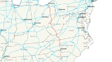
Interstate 77
Encyclopedia
Interstate 77 is an Interstate Highway in the eastern United States
. It traverses diverse terrain, from the mountainous state of West Virginia
to the rolling farmlands of North Carolina
and Ohio
. It largely supplants the old U.S. Route 21
between Cleveland, Ohio
, and Columbia, South Carolina
, as an important north–south corridor through the middle Appalachians
. The southern terminus of Interstate 77 is in Columbia at the junction with Interstate 26
. The northern terminus is in Cleveland at the junction with Interstate 90
.
The East River Mountain Tunnel
, connecting Virginia
and West Virginia, is one of only two instances in the United States where a mountain road tunnel crosses a state line. The other is the Cumberland Gap Tunnel
, connecting Tennessee
and Kentucky
.
|SC
|90
|145
|-
|NC
|105
|169
|-
||VA
|67
|108
|-
|WV
|187
|301
|-
|OH
|163
|262
|-
|Total
|611
|984
|}
After leaving the northern Columbia suburb of Blythewood, I-77 narrows to four lanes until it widens to eight lanes at Rock Hill
from Exit 77 to the North Carolina state line at I-485. The final South Carolina exit (Exit 90), takes motorists to Carowinds, a thrill theme park that was built along the North and South Carolina state line. Much of the Interstate's path through Fairfield and Chester County (north of Columbia) is uphill. This marks the changing terrain from the Midlands to the Piedmont as the road climbs the Fall Line
.
The final section of the entire length of Interstate 77 was completed in Columbia in 1995.
where the Carowinds theme park is visible. It narrows to 6 lanes on the NC side south of Charlotte
and then widens back up to 8 and 10 lanes through downtown before entering the North Carolina Piedmont
. In Charlotte it intersects Interstate 85
as well as intersecting each of the loops of Interstate 485
and Interstate 277
(twice). North of Charlotte, it skirts Lake Norman
where it narrows again to 4 lanes before passing through Huntersville
, Cornelius
, Davidson
and Mooresville
. Forty miles north of Interstate 85, at Statesville
it intersects Interstate 40
and Highway 70
. Next, it crosses over Highway 421
in Yadkin County
and continues on through Elkin
. The final intersection in the state is with a discontinuous section of Interstate 74
near Mount Airy
within sight of the Southern Blue Ridge that Interstate 77 will climb shortly after leaving the state of North Carolina.
Interstate 77 in Charlotte, North Carolina
is also known as the "Bill Lee Freeway"; this designation stretches from Exit 6 (South Tryon Street/Woodlawn Road) in Charlotte to Exit 33 (US 21 North), near Mooresville
. A 6-mile (9.6-km) portion south of the city is called the "General Younts Expressway". When I-77 crosses over I-85 (which runs in an east–west direction through the interchange), the northbound lanes are to the west of the southbound lanes.
North Carolina completed its section of Interstate 77 in 1975.

 Interstate 77 through Virginia passes through two tunnels. The Big Walker Mountain Tunnel
and the East River Mountain Tunnel
provide quick interstate access with minimal environmental disruption. For eight miles (13 km), Interstates 77 and 81
overlap near Wytheville
. This is a wrong-way concurrency, where two roads run concurrent with each other but are designated in opposite directions.
The highway passes through "Virginia's Technology Corridor" despite its very rural and isolated settings. Outside of Wytheville
, there is little in the way of development.
through the East River Mountain Tunnel
. At milepost 9, Interstate 77 becomes co-signed with the West Virginia Turnpike
for the next 88 miles (142 km), a toll road
between Princeton
and Charleston
. It is concurrent with Interstate 64
to Charleston at Beckley
. The speed limit is 70 mi/h for most of the length, with a 60 mi/h limit for the section between Marmet
and the toll plaza near Pax
.
It enters Charleston via the Yeager Bridge and passes by the state capitol complex before splitting off at a four-level junction with Interstate 64 in the downtown. Two miles north of the city center, it junctions with Interstate 79
before proceeding northward towards Ripley
and Parkersburg
. It leaves the state at Williamstown
for Ohio
.
North of Charleston, Interstate 77 is known as the "Korean War Veterans Memorial Highway". Within the city limits of Charleston, it is labeled as the "Nurse Veterans Memorial Highway" although not signed or mentioned as such. The toll-free section south of Princeton to Virginia is known as the "Hugh Ike Shott
Memorial Highway" although no signage exists to identify it as such. In practice, none of these terms are used by the general public.

at Marietta
, Interstate 77 passes through rolling Appalachian terrain.
The interchange with I-70 at Cambridge is (or at least at one time was) thought to be the largest interchange in the world, covering over 300 acres (1.2 km²) of land.
Other major Interstate Highways I-77 connects with in Ohio are I-76, I-80 (Ohio Turnpike), and I-90.
The interchange with the Ohio Turnpike was completed December 3, 2001, providing direct access; previously, traffic had to exit at Ohio State Route 21 to get to the Turnpike.
Interstate 77 is also known as the "Vietnam Veterans' of America Highway" in Ohio, and the Willow Freeway in Greater Cleveland
.
system route numbering plan in 1957. The part of Interstate 94 from Detroit northeast to Port Huron, Michigan
was originally planned as I-77 in 1957; the current I-77 was I-79. When the current Interstate 79
was added in Pennsylvania
, the I-77 designation was moved to its current route, but the I-77 in Michigan also remained in the 1958 numbering plan. It soon became part of I-94.
Originally, I-77 was to terminate at Interstate 85 in Charlotte. However, Congress, in its 1969 amendments to the Interstate
Highway Act, added an extension of I-77 from I-85, through a rapidly-growing corridor from downtown Charlotte (along an upgrading of US 21
already under construction in some places), into South Carolina
near Rock Hill
. The highway under this plan was to continue to Columbia, South Carolina
, terminating at an interchange with Interstate 20
. Collector / distributor ramps to both Alpine and Percival Roads were proposed later on to more efficiently route traffic to and from the Fort Jackson military reservation and the I-77 / I-20 corridors. Additionally, SC-277 was put on the books as well to bring southbound traffic from I-77 directly into the heart of downtown Columbia.
By the late 1970s, the southern terminus of I-77 near Columbia, South Carolina
was amended to a grade-separated interchange with SC 12 (Percival Road) with mile markers signed accordingly. This extension was completed in 1986. That same year, the first phase of an interstate spur (to be named Interstate 326) between SC 760 (Jackson Boulevard) and Interstate 26
was opened as far as Bluff Road (SC-48). 1989 saw a two-mile (3 km) extension to the east, adding interchanges at Shop Road (later SC-768) and Garner's Ferry Road / Sumter Highway (US 76/US 378).
The decision to extend I-77 from SC 12 and SC 760 (five miles between the two roads) was made before I-326 was opened, so the southern portion was never signed as such, instead re-designated by SC DOT as SC-478. The northern part of extension was completed as far as Forest Drive in early 1993, with the final 3 miles (4.8 km), including the SC-760 interchange, opened to traffic in 1995. The mile markers and exit numbers for Interstate 77 were adjusted accordingly as the extension was completed. As the Percival Road to I-26 section was under construction, southbound traffic on I-77 was detoured, by "Temporary I-77" signage, via I-20 and I-26 to bypass Columbia.
United States
The United States of America is a federal constitutional republic comprising fifty states and a federal district...
. It traverses diverse terrain, from the mountainous state of West Virginia
West Virginia
West Virginia is a state in the Appalachian and Southeastern regions of the United States, bordered by Virginia to the southeast, Kentucky to the southwest, Ohio to the northwest, Pennsylvania to the northeast and Maryland to the east...
to the rolling farmlands of North Carolina
North Carolina
North Carolina is a state located in the southeastern United States. The state borders South Carolina and Georgia to the south, Tennessee to the west and Virginia to the north. North Carolina contains 100 counties. Its capital is Raleigh, and its largest city is Charlotte...
and Ohio
Ohio
Ohio is a Midwestern state in the United States. The 34th largest state by area in the U.S.,it is the 7th‑most populous with over 11.5 million residents, containing several major American cities and seven metropolitan areas with populations of 500,000 or more.The state's capital is Columbus...
. It largely supplants the old U.S. Route 21
U.S. Route 21
U.S. Route 21 is a north–south United States highway of , from Hunting Island State Park, South Carolina to Wytheville, Virginia.-South Carolina:...
between Cleveland, Ohio
Cleveland, Ohio
Cleveland is a city in the U.S. state of Ohio and is the county seat of Cuyahoga County, the most populous county in the state. The city is located in northeastern Ohio on the southern shore of Lake Erie, approximately west of the Pennsylvania border...
, and Columbia, South Carolina
Columbia, South Carolina
Columbia is the state capital and largest city in the U.S. state of South Carolina. The population was 129,272 according to the 2010 census. Columbia is the county seat of Richland County, but a portion of the city extends into neighboring Lexington County. The city is the center of a metropolitan...
, as an important north–south corridor through the middle Appalachians
Appalachian Mountains
The Appalachian Mountains #Whether the stressed vowel is or ,#Whether the "ch" is pronounced as a fricative or an affricate , and#Whether the final vowel is the monophthong or the diphthong .), often called the Appalachians, are a system of mountains in eastern North America. The Appalachians...
. The southern terminus of Interstate 77 is in Columbia at the junction with Interstate 26
Interstate 26
Interstate 26 is a nominally east–west main route of the Interstate Highway System in the Southeastern United States. I-26 runs from the junction of U.S. Route 11W and U.S. Route 23 in Kingsport, Tennessee, generally southeastward to U.S. Route 17 in Charleston, South Carolina...
. The northern terminus is in Cleveland at the junction with Interstate 90
Interstate 90
Interstate 90 is the longest Interstate Highway in the United States at . It is the northernmost coast-to-coast interstate, and parallels US 20 for the most part. Its western terminus is in Seattle, at Edgar Martinez Drive S. near Safeco Field and CenturyLink Field, and its eastern terminus is in...
.
The East River Mountain Tunnel
East River Mountain Tunnel
The East River Mountain Tunnel is a vehicular tunnel that carries Interstate 77 and U.S. Route 52 through East River Mountain between the communities of Bluefield, West Virginia, and Rocky Gap, Virginia.-History:...
, connecting Virginia
Virginia
The Commonwealth of Virginia , is a U.S. state on the Atlantic Coast of the Southern United States. Virginia is nicknamed the "Old Dominion" and sometimes the "Mother of Presidents" after the eight U.S. presidents born there...
and West Virginia, is one of only two instances in the United States where a mountain road tunnel crosses a state line. The other is the Cumberland Gap Tunnel
Cumberland Gap Tunnel
The Cumberland Gap Tunnel is a tunnel that carries U.S. Route 25E under Cumberland Gap National Historical Park near the intersection of Kentucky, Tennessee, and Virginia. The east portal of the tunnel is in Tennessee and the west portal is in Kentucky; according to United States Geological Survey...
, connecting Tennessee
Tennessee
Tennessee is a U.S. state located in the Southeastern United States. It has a population of 6,346,105, making it the nation's 17th-largest state by population, and covers , making it the 36th-largest by total land area...
and Kentucky
Kentucky
The Commonwealth of Kentucky is a state located in the East Central United States of America. As classified by the United States Census Bureau, Kentucky is a Southern state, more specifically in the East South Central region. Kentucky is one of four U.S. states constituted as a commonwealth...
.
Route description
|-|SC
Interstate 77 in South Carolina
Interstate 77 is a north - south interstate highway, extending in the state of South Carolina, extending from the national southern terminus at an interchange with Interstate 26 near Columbia, north to the North Carolina state line near Rock Hill and Charlotte, NC.-Route description:Interstate 77...
|90
|145
|-
|NC
Interstate 77 in North Carolina
In the U.S. state of North Carolina, Interstate 77 is a Interstate Highway, which serves the city of Charlotte and the Western Piedmont.-Route description:...
|105
|169
|-
||VA
Interstate 77 in Virginia
In the U.S. state of Virginia, Interstate 77 is a north–south along the U.S. Route 52 corridor, serving Hillsville, Wytheville, and Bland...
|67
|108
|-
|WV
Interstate 77 in West Virginia
In the U.S. state of West Virginia, Interstate 77 is a major north–south Interstate highway. It extends for between Bluefield at the Virginia state line to Williamstown at the Ohio state line....
|187
|301
|-
|OH
Interstate 77 in Ohio
Interstate 77 is an Interstate Highway in the eastern United States. It traverses diverse terrain, from the mountainous state of West Virginia to the rolling farmlands of North Carolina and Ohio. It largely supplants the old U.S. Route 21 between Cleveland, Ohio, and Columbia, South Carolina, as...
|163
|262
|-
|Total
|611
|984
|}
South Carolina
I-77 begins as a eight-lane highway at I-26 in the far southeastern part of the Columbia metropolitan area. The Columbia skyline is visible from this interchange. In the Columbia area, I-77 offers easy access to Fort Jackson before meeting I-20 in the northeastern part of the city. This segment of I-77, combined with I-20 and I-26, form a beltway around Columbia, though it is not officially designated as such. In the Columbia area, the control city for northbound traffic is Charlotte, N.C., while the control city for southbound traffic is Charleston, S.C and Spartanburg, S.C. from Exit 9 to I-26.After leaving the northern Columbia suburb of Blythewood, I-77 narrows to four lanes until it widens to eight lanes at Rock Hill
Rock Hill, South Carolina
Rock Hill is the largest city in York County, South Carolina and the fourth-largest city in the state. It is also the third-largest city of the Charlotte metropolitan area, behind Charlotte and Concord, North Carolina. The population was 71,459 as of . Rock Hill has undergone rapid growth between...
from Exit 77 to the North Carolina state line at I-485. The final South Carolina exit (Exit 90), takes motorists to Carowinds, a thrill theme park that was built along the North and South Carolina state line. Much of the Interstate's path through Fairfield and Chester County (north of Columbia) is uphill. This marks the changing terrain from the Midlands to the Piedmont as the road climbs the Fall Line
Fall line
A fall line is a geomorphologic unconformity between an upland region of relatively hard crystalline basement rock and a coastal plain of softer sedimentary rock. A fall line is typically prominent when crossed by a river, for there will often be rapids or waterfalls...
.
The final section of the entire length of Interstate 77 was completed in Columbia in 1995.
North Carolina
Interstate 77 through North Carolina begins at the South Carolina state line at PinevillePineville, North Carolina
Pineville is a suburban town in the southernmost portion of Mecklenburg County, North Carolina situated in the Waxhaws district between Charlotte, North Carolina and Rock Hill, South Carolina....
where the Carowinds theme park is visible. It narrows to 6 lanes on the NC side south of Charlotte
Charlotte, North Carolina
Charlotte is the largest city in the U.S. state of North Carolina and the seat of Mecklenburg County. In 2010, Charlotte's population according to the US Census Bureau was 731,424, making it the 17th largest city in the United States based on population. The Charlotte metropolitan area had a 2009...
and then widens back up to 8 and 10 lanes through downtown before entering the North Carolina Piedmont
Piedmont (United States)
The Piedmont is a plateau region located in the eastern United States between the Atlantic Coastal Plain and the main Appalachian Mountains, stretching from New Jersey in the north to central Alabama in the south. The Piedmont province is a physiographic province of the larger Appalachian division...
. In Charlotte it intersects Interstate 85
Interstate 85
Interstate 85 is a major interstate highway in the Southeastern United States. Its current southern terminus is at an interchange with Interstate 65 in Montgomery, Alabama; its northern terminus interchanges with Interstate 95 in Petersburg, Virginia, near Richmond...
as well as intersecting each of the loops of Interstate 485
Interstate 485
Interstate 485 is an Interstate Highway and a nearly completed beltway around Charlotte, North Carolina.-Route description:The western, southern and eastern segments of the beltway are complete and open to traffic...
and Interstate 277
Interstate 277 (North Carolina)
Interstate 277 is a loop in central Charlotte, North Carolina. The southern terminus is located on the southwest side of downtown. I-277 loops around the downtown area and reconnects with I-77/U.S. 21 north of uptown...
(twice). North of Charlotte, it skirts Lake Norman
Lake Norman
Lake Norman, created between 1959 and 1964 as part of the construction of the Cowans Ford Dam by Duke Energy, is the largest manmade body of fresh water located in North Carolina.-General Information:...
where it narrows again to 4 lanes before passing through Huntersville
Huntersville, North Carolina
Huntersville is a large town in Mecklenburg and Cabarrus Counties, North Carolina, United States. The population was 46,773 at the 2010 census, which makes Huntersville the 19th largest city in North Carolina. It is located about 12 miles north of uptown Charlotte. It is thought that the town...
, Cornelius
Cornelius, North Carolina
Cornelius is a town located along Lake Norman in northern Mecklenburg County, North Carolina, United States. The population was 11,969 at the 2000 census.-Geography:Cornelius is located along Lake Norman in northern Mecklenburg County...
, Davidson
Davidson, North Carolina
Davidson is a town in Mecklenburg County in the U.S. state of North Carolina. The population was 7,139 at the 2000 census. It is home to Davidson College...
and Mooresville
Mooresville, North Carolina
Mooresville is a large suburban town in southern Iredell County, North Carolina, USA. It is in the Metrolina metro area. The population was 32,133 at the 2010 United States Census...
. Forty miles north of Interstate 85, at Statesville
Statesville, North Carolina
Statesville is a city located in Iredell County, North Carolina, United States and was named an All-America City in 1997 and 2009. The population was 24,633 at the 2010 census...
it intersects Interstate 40
Interstate 40
Interstate 40 is the third-longest major east–west Interstate Highway in the United States, after I-90 and I-80. Its western end is at Interstate 15 in Barstow, California; its eastern end is at a concurrency of U.S. Route 117 and North Carolina Highway 132 in Wilmington, North Carolina...
and Highway 70
U.S. Route 70
U.S. Route 70 is an east–west United States highway that runs for 2,385 miles from eastern North Carolina to east-central Arizona. As can be derived from its number, it is a major east–west highway of the Southern and Southwestern United States...
. Next, it crosses over Highway 421
U.S. Route 421
U.S. Route 421 is a spur route of U.S. 21. It runs for from Michigan City, Indiana, at U.S. 20, to Fort Fisher in North Carolina. The highway goes through the cities of Indianapolis, Indiana, Lexington, Kentucky, Boone, North Carolina, Winston-Salem, North Carolina, Greensboro, North Carolina and...
in Yadkin County
Yadkin County, North Carolina
- Cities and towns :*Boonville*East Bend*Jonesville*Yadkinville-Towns of the past:These towns were incorporated at one time:*Arlington, merged with Jonesville in 2001.*Hamptonville, chartered in 1818.*Huntsville, incorporated in 1792....
and continues on through Elkin
Elkin, North Carolina
Elkin is a town in Surry and Wilkes counties in the U.S. state of North Carolina, along the Yadkin River. Elkin shares its name with the surrounding township of Elkin Township...
. The final intersection in the state is with a discontinuous section of Interstate 74
Interstate 74
Interstate 74 is an Interstate Highway in the Midwestern and Southeastern United States. Its western end is at an intersection with Interstate 80 in Davenport, Iowa; the eastern end of its Midwest segment is at an intersection with Interstate 75 in Cincinnati, Ohio...
near Mount Airy
Mount Airy, North Carolina
Mount Airy is a city in Surry County, North Carolina, United States. As of the 2010 census, the city population was 10,388.-History:Mount Airy was settled in the 1750s as a stagecoach stop on the road between Winston-Salem and Galax, Virginia. It was named for a nearby plantation...
within sight of the Southern Blue Ridge that Interstate 77 will climb shortly after leaving the state of North Carolina.
Interstate 77 in Charlotte, North Carolina
Charlotte, North Carolina
Charlotte is the largest city in the U.S. state of North Carolina and the seat of Mecklenburg County. In 2010, Charlotte's population according to the US Census Bureau was 731,424, making it the 17th largest city in the United States based on population. The Charlotte metropolitan area had a 2009...
is also known as the "Bill Lee Freeway"; this designation stretches from Exit 6 (South Tryon Street/Woodlawn Road) in Charlotte to Exit 33 (US 21 North), near Mooresville
Mooresville, North Carolina
Mooresville is a large suburban town in southern Iredell County, North Carolina, USA. It is in the Metrolina metro area. The population was 32,133 at the 2010 United States Census...
. A 6-mile (9.6-km) portion south of the city is called the "General Younts Expressway". When I-77 crosses over I-85 (which runs in an east–west direction through the interchange), the northbound lanes are to the west of the southbound lanes.
North Carolina completed its section of Interstate 77 in 1975.
Virginia
Big Walker Mountain Tunnel
The Big Walker Mountain Tunnel is a vehicular tunnel in the Appalachian Mountains of Southwest Virginia that carries Interstate 77 through/under Big Walker Mountain...
and the East River Mountain Tunnel
East River Mountain Tunnel
The East River Mountain Tunnel is a vehicular tunnel that carries Interstate 77 and U.S. Route 52 through East River Mountain between the communities of Bluefield, West Virginia, and Rocky Gap, Virginia.-History:...
provide quick interstate access with minimal environmental disruption. For eight miles (13 km), Interstates 77 and 81
Interstate 81
Interstate 81 is an Interstate Highway in the eastern part of the United States. Its southern terminus is at Interstate 40 in Dandridge, Tennessee; its northern terminus is on Wellesley Island at the Canadian border, where the Thousand Islands Bridge connects it to Highway 401, the main freeway...
overlap near Wytheville
Wytheville, Virginia
Wytheville is a town in Wythe County, Virginia, United States. The population was 8,211 at the 2010 census. It is the county seat of Wythe County. The town is home to a Chautauqua Festival, held the third weekend in June every year since 1985...
. This is a wrong-way concurrency, where two roads run concurrent with each other but are designated in opposite directions.
The highway passes through "Virginia's Technology Corridor" despite its very rural and isolated settings. Outside of Wytheville
Wytheville, Virginia
Wytheville is a town in Wythe County, Virginia, United States. The population was 8,211 at the 2010 census. It is the county seat of Wythe County. The town is home to a Chautauqua Festival, held the third weekend in June every year since 1985...
, there is little in the way of development.
West Virginia
Interstate 77 enters from VirginiaVirginia
The Commonwealth of Virginia , is a U.S. state on the Atlantic Coast of the Southern United States. Virginia is nicknamed the "Old Dominion" and sometimes the "Mother of Presidents" after the eight U.S. presidents born there...
through the East River Mountain Tunnel
East River Mountain Tunnel
The East River Mountain Tunnel is a vehicular tunnel that carries Interstate 77 and U.S. Route 52 through East River Mountain between the communities of Bluefield, West Virginia, and Rocky Gap, Virginia.-History:...
. At milepost 9, Interstate 77 becomes co-signed with the West Virginia Turnpike
West Virginia Turnpike
The West Virginia Turnpike is a toll road in the US state of West Virginia. It is also signed as Interstate 77 for its entire length as well as Interstate 64 from Charleston to just south of Beckley. From Beckley, the road extends south to Princeton...
for the next 88 miles (142 km), a toll road
Toll road
A toll road is a privately or publicly built road for which a driver pays a toll for use. Structures for which tolls are charged include toll bridges and toll tunnels. Non-toll roads are financed using other sources of revenue, most typically fuel tax or general tax funds...
between Princeton
Princeton, West Virginia
Princeton is a city in Mercer County, West Virginia, United States. The population was 7,652 at the 2000 census. It is part of the Bluefield, WV-VA micropolitan area which has a population of 111,586. It is the county seat of Mercer County...
and Charleston
Charleston, West Virginia
Charleston is the capital and largest city of the U.S. state of West Virginia. It is located at the confluence of the Elk and Kanawha Rivers in Kanawha County. As of the 2010 census, it has a population of 51,400, and its metropolitan area 304,214. It is the county seat of Kanawha County.Early...
. It is concurrent with Interstate 64
Interstate 64
Interstate 64 is an Interstate Highway in the Midwestern and Southeastern United States. Its western terminus is at I-70, U.S. 40, and U.S. 61 in Wentzville, Missouri. Its eastern terminus is at an interchange with I-264 and I-664 at Bowers Hill in Chesapeake, Virginia. As I-64 is concurrent with...
to Charleston at Beckley
Beckley, West Virginia
Beckley is a city in Raleigh County, West Virginia, United States, which was founded on April 4, 1838. The 2008 population was estimated to be 16,832 by the U.S. Census Bureau. Early in its history, the town was known as Beckleyville and Raleigh Court House...
. The speed limit is 70 mi/h for most of the length, with a 60 mi/h limit for the section between Marmet
Marmet, West Virginia
Marmet is a city in Kanawha County, West Virginia, USA, along the Kanawha River.-Geography:Marmet is located at .According to the United States Census Bureau, the city has a total area of 1.5 square miles , of which, 1.4 square miles of it is land and 0.1 square miles of it is...
and the toll plaza near Pax
Pax, West Virginia
Pax is a town in Fayette County, West Virginia, United States. The population was 174 at the 2000 census.-Geography:Pax is located at ....
.
It enters Charleston via the Yeager Bridge and passes by the state capitol complex before splitting off at a four-level junction with Interstate 64 in the downtown. Two miles north of the city center, it junctions with Interstate 79
Interstate 79
Interstate 79 is an Interstate Highway in the eastern United States, designated from Interstate 77 in Charleston, West Virginia to Pennsylvania Route 5 and Pennsylvania Route 290 in Erie, Pennsylvania...
before proceeding northward towards Ripley
Ripley, West Virginia
Ripley is a city in and the county seat of Jackson County, West Virginia, United States.-Geography:Ripley is located at , along Mill Creek....
and Parkersburg
Parkersburg, West Virginia
As of the census of 2000, there were 33,099 people, 14,467 households, and 8,767 families residing in the city. In 2006 the U.S. Census Bureau estimated that Parkersburg's population had decreased 4.4% to 31,755. The population density was 2,800.5 people per square mile . There were 16,100 housing...
. It leaves the state at Williamstown
Williamstown, West Virginia
Williamstown is a city in Wood County, West Virginia, United States, along the Ohio River. It is part of the Parkersburg-Marietta-Vienna, WV-OH Metropolitan Statistical Area. The population was 2,996 at the 2000 census...
for Ohio
Ohio
Ohio is a Midwestern state in the United States. The 34th largest state by area in the U.S.,it is the 7th‑most populous with over 11.5 million residents, containing several major American cities and seven metropolitan areas with populations of 500,000 or more.The state's capital is Columbus...
.
North of Charleston, Interstate 77 is known as the "Korean War Veterans Memorial Highway". Within the city limits of Charleston, it is labeled as the "Nurse Veterans Memorial Highway" although not signed or mentioned as such. The toll-free section south of Princeton to Virginia is known as the "Hugh Ike Shott
Hugh Ike Shott
Hugh Ike Shott was a newspaper editor, pioneer broadcaster, and Republican politician in the U.S. State of West Virginia.-Career:...
Memorial Highway" although no signage exists to identify it as such. In practice, none of these terms are used by the general public.
Ohio
Entering from West VirginiaWest Virginia
West Virginia is a state in the Appalachian and Southeastern regions of the United States, bordered by Virginia to the southeast, Kentucky to the southwest, Ohio to the northwest, Pennsylvania to the northeast and Maryland to the east...
at Marietta
Marietta, Ohio
Marietta is a city in and the county seat of Washington County, Ohio, United States. During 1788, pioneers to the Ohio Country established Marietta as the first permanent American settlement of the new United States in the Northwest Territory. Marietta is located in southeastern Ohio at the mouth...
, Interstate 77 passes through rolling Appalachian terrain.
The interchange with I-70 at Cambridge is (or at least at one time was) thought to be the largest interchange in the world, covering over 300 acres (1.2 km²) of land.
Other major Interstate Highways I-77 connects with in Ohio are I-76, I-80 (Ohio Turnpike), and I-90.
The interchange with the Ohio Turnpike was completed December 3, 2001, providing direct access; previously, traffic had to exit at Ohio State Route 21 to get to the Turnpike.
Interstate 77 is also known as the "Vietnam Veterans' of America Highway" in Ohio, and the Willow Freeway in Greater Cleveland
Greater Cleveland
Greater Cleveland is a nickname for the metropolitan area surrounding Cleveland, Ohio and is part of what used to be the Connecticut Western Reserve.Northeast Ohio refers to a similar but substantially larger area as described below...
.
History
Officially designated to run from Port Huron to Charlotte, I-77 appeared on the original InterstateInterstate Highway System
The Dwight D. Eisenhower National System of Interstate and Defense Highways, , is a network of limited-access roads including freeways, highways, and expressways forming part of the National Highway System of the United States of America...
system route numbering plan in 1957. The part of Interstate 94 from Detroit northeast to Port Huron, Michigan
Port Huron, Michigan
Port Huron is a city in the U.S. state of Michigan and the county seat of St. Clair County. The population was 30,184 at the 2010 census. The city is adjacent to Port Huron Township but is administratively autonomous. It is joined by the Blue Water Bridge over the St. Clair River to Sarnia,...
was originally planned as I-77 in 1957; the current I-77 was I-79. When the current Interstate 79
Interstate 79
Interstate 79 is an Interstate Highway in the eastern United States, designated from Interstate 77 in Charleston, West Virginia to Pennsylvania Route 5 and Pennsylvania Route 290 in Erie, Pennsylvania...
was added in Pennsylvania
Pennsylvania
The Commonwealth of Pennsylvania is a U.S. state that is located in the Northeastern and Mid-Atlantic regions of the United States. The state borders Delaware and Maryland to the south, West Virginia to the southwest, Ohio to the west, New York and Ontario, Canada, to the north, and New Jersey to...
, the I-77 designation was moved to its current route, but the I-77 in Michigan also remained in the 1958 numbering plan. It soon became part of I-94.
Originally, I-77 was to terminate at Interstate 85 in Charlotte. However, Congress, in its 1969 amendments to the Interstate
Interstate Highway System
The Dwight D. Eisenhower National System of Interstate and Defense Highways, , is a network of limited-access roads including freeways, highways, and expressways forming part of the National Highway System of the United States of America...
Highway Act, added an extension of I-77 from I-85, through a rapidly-growing corridor from downtown Charlotte (along an upgrading of US 21
U.S. Route 21
U.S. Route 21 is a north–south United States highway of , from Hunting Island State Park, South Carolina to Wytheville, Virginia.-South Carolina:...
already under construction in some places), into South Carolina
South Carolina
South Carolina is a state in the Deep South of the United States that borders Georgia to the south, North Carolina to the north, and the Atlantic Ocean to the east. Originally part of the Province of Carolina, the Province of South Carolina was one of the 13 colonies that declared independence...
near Rock Hill
Rock Hill
Rock Hill is the name of some places in the United States of America:* Rock Hill, South Carolina, fourth largest city in South Carolina, population 70,000* Rock Hill, Missouri, small city in Missouri, population 5,000...
. The highway under this plan was to continue to Columbia, South Carolina
Columbia, South Carolina
Columbia is the state capital and largest city in the U.S. state of South Carolina. The population was 129,272 according to the 2010 census. Columbia is the county seat of Richland County, but a portion of the city extends into neighboring Lexington County. The city is the center of a metropolitan...
, terminating at an interchange with Interstate 20
Interstate 20
Interstate 20 is a major east–west Interstate Highway in the Southern United States. I‑20 runs 1,535 miles from near Kent, Texas, at Interstate 10 to Florence, South Carolina, at Interstate 95...
. Collector / distributor ramps to both Alpine and Percival Roads were proposed later on to more efficiently route traffic to and from the Fort Jackson military reservation and the I-77 / I-20 corridors. Additionally, SC-277 was put on the books as well to bring southbound traffic from I-77 directly into the heart of downtown Columbia.
By the late 1970s, the southern terminus of I-77 near Columbia, South Carolina
Columbia, South Carolina
Columbia is the state capital and largest city in the U.S. state of South Carolina. The population was 129,272 according to the 2010 census. Columbia is the county seat of Richland County, but a portion of the city extends into neighboring Lexington County. The city is the center of a metropolitan...
was amended to a grade-separated interchange with SC 12 (Percival Road) with mile markers signed accordingly. This extension was completed in 1986. That same year, the first phase of an interstate spur (to be named Interstate 326) between SC 760 (Jackson Boulevard) and Interstate 26
Interstate 26
Interstate 26 is a nominally east–west main route of the Interstate Highway System in the Southeastern United States. I-26 runs from the junction of U.S. Route 11W and U.S. Route 23 in Kingsport, Tennessee, generally southeastward to U.S. Route 17 in Charleston, South Carolina...
was opened as far as Bluff Road (SC-48). 1989 saw a two-mile (3 km) extension to the east, adding interchanges at Shop Road (later SC-768) and Garner's Ferry Road / Sumter Highway (US 76/US 378).
The decision to extend I-77 from SC 12 and SC 760 (five miles between the two roads) was made before I-326 was opened, so the southern portion was never signed as such, instead re-designated by SC DOT as SC-478. The northern part of extension was completed as far as Forest Drive in early 1993, with the final 3 miles (4.8 km), including the SC-760 interchange, opened to traffic in 1995. The mile markers and exit numbers for Interstate 77 were adjusted accordingly as the extension was completed. As the Percival Road to I-26 section was under construction, southbound traffic on I-77 was detoured, by "Temporary I-77" signage, via I-20 and I-26 to bypass Columbia.
Major intersections
.svg.png) Interstate 26Interstate 26Interstate 26 is a nominally east–west main route of the Interstate Highway System in the Southeastern United States. I-26 runs from the junction of U.S. Route 11W and U.S. Route 23 in Kingsport, Tennessee, generally southeastward to U.S. Route 17 in Charleston, South Carolina...
Interstate 26Interstate 26Interstate 26 is a nominally east–west main route of the Interstate Highway System in the Southeastern United States. I-26 runs from the junction of U.S. Route 11W and U.S. Route 23 in Kingsport, Tennessee, generally southeastward to U.S. Route 17 in Charleston, South Carolina...
near Columbia, South CarolinaColumbia, South CarolinaColumbia is the state capital and largest city in the U.S. state of South Carolina. The population was 129,272 according to the 2010 census. Columbia is the county seat of Richland County, but a portion of the city extends into neighboring Lexington County. The city is the center of a metropolitan....svg.png) Interstate 20Interstate 20Interstate 20 is a major east–west Interstate Highway in the Southern United States. I‑20 runs 1,535 miles from near Kent, Texas, at Interstate 10 to Florence, South Carolina, at Interstate 95...
Interstate 20Interstate 20Interstate 20 is a major east–west Interstate Highway in the Southern United States. I‑20 runs 1,535 miles from near Kent, Texas, at Interstate 10 to Florence, South Carolina, at Interstate 95...
near Columbia, South Carolina Interstate 485Interstate 485Interstate 485 is an Interstate Highway and a nearly completed beltway around Charlotte, North Carolina.-Route description:The western, southern and eastern segments of the beltway are complete and open to traffic...
in Charlotte, which is the city's outer belt Interstate 277Interstate 277 (North Carolina)Interstate 277 is a loop in central Charlotte, North Carolina. The southern terminus is located on the southwest side of downtown. I-277 loops around the downtown area and reconnects with I-77/U.S. 21 north of uptown...
in Charlotte, which is the beltway of the city's downtown area Interstate 85Interstate 85Interstate 85 is a major interstate highway in the Southeastern United States. Its current southern terminus is at an interchange with Interstate 65 in Montgomery, Alabama; its northern terminus interchanges with Interstate 95 in Petersburg, Virginia, near Richmond...
in Charlotte, North CarolinaCharlotte, North CarolinaCharlotte is the largest city in the U.S. state of North Carolina and the seat of Mecklenburg County. In 2010, Charlotte's population according to the US Census Bureau was 731,424, making it the 17th largest city in the United States based on population. The Charlotte metropolitan area had a 2009... Interstate 40Interstate 40 in North CarolinaInterstate 40 runs through the state of North Carolina from the Tennessee state line in the west to its eastern terminus in Wilmington.-Pigeon River Gorge:...
in Statesville, North CarolinaStatesville, North CarolinaStatesville is a city located in Iredell County, North Carolina, United States and was named an All-America City in 1997 and 2009. The population was 24,633 at the 2010 census... Interstate 74Interstate 74Interstate 74 is an Interstate Highway in the Midwestern and Southeastern United States. Its western end is at an intersection with Interstate 80 in Davenport, Iowa; the eastern end of its Midwest segment is at an intersection with Interstate 75 in Cincinnati, Ohio...
runs concurrently for 4 miles (6.4 km) near Mount Airy, North CarolinaMount Airy, North CarolinaMount Airy is a city in Surry County, North Carolina, United States. As of the 2010 census, the city population was 10,388.-History:Mount Airy was settled in the 1750s as a stagecoach stop on the road between Winston-Salem and Galax, Virginia. It was named for a nearby plantation... Interstate 81Interstate 81Interstate 81 is an Interstate Highway in the eastern part of the United States. Its southern terminus is at Interstate 40 in Dandridge, Tennessee; its northern terminus is on Wellesley Island at the Canadian border, where the Thousand Islands Bridge connects it to Highway 401, the main freeway...
runs concurrently for 9 miles (14.5 km) around Wytheville, VirginiaWytheville, VirginiaWytheville is a town in Wythe County, Virginia, United States. The population was 8,211 at the 2010 census. It is the county seat of Wythe County. The town is home to a Chautauqua Festival, held the third weekend in June every year since 1985....svg.png) Interstate 64Interstate 64Interstate 64 is an Interstate Highway in the Midwestern and Southeastern United States. Its western terminus is at I-70, U.S. 40, and U.S. 61 in Wentzville, Missouri. Its eastern terminus is at an interchange with I-264 and I-664 at Bowers Hill in Chesapeake, Virginia. As I-64 is concurrent with...
Interstate 64Interstate 64Interstate 64 is an Interstate Highway in the Midwestern and Southeastern United States. Its western terminus is at I-70, U.S. 40, and U.S. 61 in Wentzville, Missouri. Its eastern terminus is at an interchange with I-264 and I-664 at Bowers Hill in Chesapeake, Virginia. As I-64 is concurrent with...
in Beckley, West VirginiaBeckley, West VirginiaBeckley is a city in Raleigh County, West Virginia, United States, which was founded on April 4, 1838. The 2008 population was estimated to be 16,832 by the U.S. Census Bureau. Early in its history, the town was known as Beckleyville and Raleigh Court House...
. They stay joined until Charleston, West VirginiaCharleston, West VirginiaCharleston is the capital and largest city of the U.S. state of West Virginia. It is located at the confluence of the Elk and Kanawha Rivers in Kanawha County. As of the 2010 census, it has a population of 51,400, and its metropolitan area 304,214. It is the county seat of Kanawha County.Early...
..svg.png) Interstate 79Interstate 79Interstate 79 is an Interstate Highway in the eastern United States, designated from Interstate 77 in Charleston, West Virginia to Pennsylvania Route 5 and Pennsylvania Route 290 in Erie, Pennsylvania...
Interstate 79Interstate 79Interstate 79 is an Interstate Highway in the eastern United States, designated from Interstate 77 in Charleston, West Virginia to Pennsylvania Route 5 and Pennsylvania Route 290 in Erie, Pennsylvania...
in Charleston, West VirginiaCharleston, West VirginiaCharleston is the capital and largest city of the U.S. state of West Virginia. It is located at the confluence of the Elk and Kanawha Rivers in Kanawha County. As of the 2010 census, it has a population of 51,400, and its metropolitan area 304,214. It is the county seat of Kanawha County.Early... Interstate 70Interstate 70Interstate 70 is an Interstate Highway in the United States that runs from Interstate 15 near Cove Fort, Utah, to a Park and Ride near Baltimore, Maryland. It was the first Interstate Highway project in the United States. I-70 approximately traces the path of U.S. Route 40 east of the Rocky...
in Cambridge, OhioCambridge, OhioAs of the census of 2000, there were 11,520 people, 4,924 households, and 2,954 families residing in the city. The population density was 2,055.1 people per square mile . There were 5,585 housing units of an average density of 996.3 per square mile...- Interstate 277Interstate 277 (Ohio)Interstate 277 is a connector route linking Interstate 76 and Interstate 77 in Akron, Ohio. It was completed in 1970 and shares its entire length with U.S. Route 224.-Exit list:The entire route is in Akron, Summit County.-References:...
in Akron, OhioAkron, OhioAkron , is the fifth largest city in the U.S. state of Ohio and the county seat of Summit County. It is located in the Great Lakes region approximately south of Lake Erie along the Little Cuyahoga River. As of the 2010 census, the city had a population of 199,110. The Akron Metropolitan...
(a connector route to Interstate 76Interstate 76 (east)Interstate 76 is an Interstate Highway in the United States, running 435 miles from an interchange with Interstate 71 west of Akron, Ohio, east to Interstate 295 near Camden, New Jersey....
on the south side of Akron) - Interstate 76Interstate 76 (east)Interstate 76 is an Interstate Highway in the United States, running 435 miles from an interchange with Interstate 71 west of Akron, Ohio, east to Interstate 295 near Camden, New Jersey....
in Akron, OhioAkron, OhioAkron , is the fifth largest city in the U.S. state of Ohio and the county seat of Summit County. It is located in the Great Lakes region approximately south of Lake Erie along the Little Cuyahoga River. As of the 2010 census, the city had a population of 199,110. The Akron Metropolitan...
(I-76 runs concurrently with I-77 for a few miles in downtown Akron)  Interstate 271Interstate 271Interstate 271 is an auxiliary interstate highway in the suburbs of Cleveland and Akron in the U.S. state of Ohio. The highway is officially designated the "Cleveland Outerbelt East", but rarely referred to by that name.-Route description:...
in Richfield, OhioRichfield, OhioRichfield is a village in Summit County, Ohio, United States. The population was 3,286 at the 2000 census. The village and the adjacent Richfield Township are approximately equidistant between the downtown areas of Akron and Cleveland...
 Interstate 80Interstate 80Interstate 80 is the second-longest Interstate Highway in the United States, following Interstate 90. It is a transcontinental artery running from downtown San Francisco, California to Teaneck, New Jersey in the New York City Metropolitan Area...
/Ohio TurnpikeOhio TurnpikeThe Ohio Turnpike, officially the James W. Shocknessy Ohio Turnpike, is a -long, limited-access toll highway in the U.S. state of Ohio, serving as a primary corridor to Chicago and Pittsburgh...
in RichfieldRichfield, OhioRichfield is a village in Summit County, Ohio, United States. The population was 3,286 at the 2000 census. The village and the adjacent Richfield Township are approximately equidistant between the downtown areas of Akron and Cleveland...
/BrecksvilleBrecksville, Ohio-External links:* * *...
, OhioOhioOhio is a Midwestern state in the United States. The 34th largest state by area in the U.S.,it is the 7th‑most populous with over 11.5 million residents, containing several major American cities and seven metropolitan areas with populations of 500,000 or more.The state's capital is Columbus... Interstate 480Interstate 480 (Ohio)Interstate 480 is a loop highway that connects the Ohio Turnpike with suburban Cleveland, Ohio. The highway is officially designated the Outerbelt South Freeway, but it is rarely referred to by that name....
in Independence, OhioIndependence, OhioIndependence is a city in Cuyahoga County, Ohio, in the United States. As of the 2010 census, the city population was 7,133.-Geography:Independence is located at .According to the United States Census Bureau, the city has a total area of , all of it land.... Interstate 490Interstate 490 (Ohio)Interstate 490 is a Interstate Highway in Cleveland, Ohio. The western terminus is a junction with I-90 and I-71 on Cleveland's west side. After spanning the Cuyahoga River, the eastern terminus is a junction with East 55th Street, just east of I-77....
in Cleveland, OhioCleveland, OhioCleveland is a city in the U.S. state of Ohio and is the county seat of Cuyahoga County, the most populous county in the state. The city is located in northeastern Ohio on the southern shore of Lake Erie, approximately west of the Pennsylvania border... Interstate 90Interstate 90Interstate 90 is the longest Interstate Highway in the United States at . It is the northernmost coast-to-coast interstate, and parallels US 20 for the most part. Its western terminus is in Seattle, at Edgar Martinez Drive S. near Safeco Field and CenturyLink Field, and its eastern terminus is in...
in Cleveland, OhioCleveland, OhioCleveland is a city in the U.S. state of Ohio and is the county seat of Cuyahoga County, the most populous county in the state. The city is located in northeastern Ohio on the southern shore of Lake Erie, approximately west of the Pennsylvania border...
Auxiliary routes
- I-277Interstate 277 (North Carolina)Interstate 277 is a loop in central Charlotte, North Carolina. The southern terminus is located on the southwest side of downtown. I-277 loops around the downtown area and reconnects with I-77/U.S. 21 north of uptown...
- Charlotte, North CarolinaCharlotte, North CarolinaCharlotte is the largest city in the U.S. state of North Carolina and the seat of Mecklenburg County. In 2010, Charlotte's population according to the US Census Bureau was 731,424, making it the 17th largest city in the United States based on population. The Charlotte metropolitan area had a 2009... - I-277Interstate 277 (Ohio)Interstate 277 is a connector route linking Interstate 76 and Interstate 77 in Akron, Ohio. It was completed in 1970 and shares its entire length with U.S. Route 224.-Exit list:The entire route is in Akron, Summit County.-References:...
- Akron, OhioAkron, OhioAkron , is the fifth largest city in the U.S. state of Ohio and the county seat of Summit County. It is located in the Great Lakes region approximately south of Lake Erie along the Little Cuyahoga River. As of the 2010 census, the city had a population of 199,110. The Akron Metropolitan...