
Interstate 64
Encyclopedia
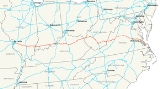
Interstate 64 is an Interstate Highway in the Midwestern and Southeastern
United States
. Its western terminus is at I-70, U.S. 40, and U.S. 61 in Wentzville, Missouri
. Its eastern terminus is at an interchange with I-264
and I-664 at Bowers Hill in Chesapeake, Virginia
. As I-64 is concurrent with U.S. 40 and U.S. 61 at its western terminus, the road itself continues as an arterial road
as part of the Avenue of the Saints
connecting St. Louis, Missouri
to St. Paul, Minnesota.
The Missouri Department of Transportation
has completed extending I-64 to I-70 in Wentzville, Missouri
.
In April 2007, construction started to rebuild 10.5 miles (16.9 km) of I-64 in St. Louis, Missouri
, from Spoede Rd. to Kingshighway. This project included repaving the entire road, rebuilding the overpasses and interchanges, adding a fourth lane between Spoede Rd. and I-170, and connecting I-64 to I-170 in all directions. Construction resulted in the complete closure of portions of the expressway in 2008 and 2009. In 2008, I-64 was closed from I-270 to I-170, re-opening December 15, 2008. Beginning December 15, 2008, I-64 from I-170 to Kingshighway Blvd. was closed. On December 7, 2009, Interstate 64 was complete in its entire length in Missouri from the Poplar Street Bridge
to I-70 in Wentzville.
|MO
|| 30.72 || 49.44
|-
|IL || 128.12 || 206.19
|-
|IN || 123.33 || 198.48
|-
|KY
|| 185.20 || 298.05
|-
|WV
|| 188.75 || 303.76
|-
|VA
|| 297.62 || 478.97
|-
|Total || 953.74 || 1,534.90
|}
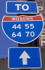
In I-64's overlaps with I-55, I-57, I-75, I-77, I-81, and I-95, I-64 does not maintain exit number continuity for any of those overlaps, as each of those four north-south routes maintain their exit numbering on their respective overlaps with I-64.
US-40, even though the road has been designated as both I-64 and US-40 since 1988. This road is also the southern-most portion of the Avenue of the Saints
. An interchange at Highway N O'Fallon, Missouri
opened on December 13, 2004. This interchange will also accommodate the future tie in of the Route 364 freeway to I-64. As of December 7, 2009, I-64 is now complete and signed all the way to Interstate 70 in Wentzville. All stoplights have been removed. The portion of Interstate 64 in St. Louis has been named the Jack Buck
Memorial Highway, in honor of the late sportscaster.
The section from IL 127 to I-57 opened on October 4, 1974. The section from IL 161 to IL 127 opened in December 1973. The section in the Metro-East
, except for a short section near I-55/70, opened on December 23, 1975. The section from US 460 (later IL 142) to US 45 opened on August 7, 1975.
/Indiana 57/Future Interstate 69) then proceeds through part of the scenic Hoosier National Forest, with exits leading to Dale
and Huntingburg
(Exits 57A-B/U.S. 231), Santa Claus
and Ferdinand
(Exit 63/Indiana 162
), French Lick
and Tell City
(Exit 79/Indiana 37
), and Indiana's first state capital, Corydon
(Exit 105/Indiana 135
).
Between Evansville and New Albany, I-64 intersects a few major north-south arterial highways, such as U.S. 231, Indiana 37
, Indiana 135
and offers access to Interstate 65
to Indianapolis
via Interstate 265
before crossing into Kentucky on the Sherman Minton Bridge
.
The 123-mile route in Indiana can be described as being somewhat winding, especially the farther east one travels within the state. The longest straightline distance along the route is the around 9 mile stretch from the Indiana 65 exit to the 26 mile marker, 1 mile east of U.S. 41. There are many points along the route where the two halves of the highway are nearly 500 feet apart, especially around the Hoosier National Forest
and points to the east. In addition, there are several points, especially in the very sharp valleys along its route in Dubois
, Perry
, Crawford
and Harrison
Counties, where the highway towers more than 100 feet above the surrounding terrain.
after construction crews found cracks in the main load bearing structural element. Mainline traffic is currently redirected to Interstate 265
, then south on Interstate 65
across the John F. Kennedy Memorial Bridge
before rejoining Interstate 64 at the Kennedy Interchange
in Louisville.

at Louisville
, paralleling the Ohio River
along the Riverfront Expressway. It intersects with several downtown interchanges before coming to the Kennedy Interchange
, where it intersects Interstate 65
and Interstate 71
in a tangle of ramps often referred to as the "Spaghetti Junction". Moving eastward, I-64 passes through Shelbyville
, Frankfort
, Midway
, Lexington
, Winchester
, and Morehead
, before leaving the state near Ashland
at Catlettsburg
. It overlaps Interstate 75
as it makes an arc around the northeast of Lexington, with the exit numbers for I-75 used for the concurrent portion. The two interstates separate a few miles northeast of Lexington. It is often called "The I-64/I-75 Southern Split".
Interstate 64 travels for 184 miles (296.1 km) within the state of West Virginia
, passing by the major towns and cities of Huntington
, Charleston
, Beckley
, and Lewisburg
. It has only two major junctions within the state: Interstate 77
in Charleston and in Beckley. It also crosses the Kanawha River
a total of four times in a 20 miles (32.2 km) stretch (twice west of Charleston, immediately before entering the downtown Charleston area, then approximately 5 miles (8 km) east of downtown Charleston).
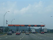
Between I-64's two junctions with I-77, I-64 and I-77 overlap. From the final crossing of the Kanawha River
east of Charleston to their split at Exit 40 south of Beckley, the two Interstates are tolled, forming a part of the West Virginia Turnpike
.
While the two expressways overlap, the exit signs are those for Interstate 77. Thus, eastbound travelers entering from Kentucky will see exit numbers increase until Exit 60, at which time Interstate 77's exit numbers are used, decreasing from Exit 100.
runs east–west through central Virginia from West Virginia via Covington
, Lexington
, Staunton
, and Charlottesville
to Richmond
. From Lexington to Staunton, it overlaps Interstate 81 (using I-81 exit numbers). From Richmond, Interstate 64 continues southeasterly through Newport News
and Hampton
to the Hampton Roads Bridge-Tunnel
, and then through Norfolk
and a small portion of Virginia Beach
to end in Chesapeake
.
I-64 itself does not reach the Oceanfront area of Virginia Beach, as it continues through the western portion of Virginia Beach as part of the circumferential Hampton Roads Beltway. At its eastern terminus, East I-64 is actually running westbound (and West I-64 eastbound), as the route forms a fishhook around Norfolk.
Access to the Oceanfront area is accomplished from I-64 via a portion of Interstate 264
, a roadway originally built as the Virginia Beach Expressway, funded by tolls
to retire revenue bonds.
I-64 had a proposed routing around the US 50 corridor in Illinois when the interstates were first planned. Local pressure pushed the routing closer to the US 460 corridor because of the cheaper cost and shorter mileage compared to the original routing.
I-64 signs started going up in August 1987 on the US 40 freeway in St. Louis. This change was made, due, in part, to truck drivers deliberately using US 40 to avoid mandatory fines for overweight trucks.
Southeastern United States
The Southeastern United States, colloquially referred to as the Southeast, is the eastern portion of the Southern United States. It is one of the most populous regions in the United States of America....
United States
United States
The United States of America is a federal constitutional republic comprising fifty states and a federal district...
. Its western terminus is at I-70, U.S. 40, and U.S. 61 in Wentzville, Missouri
Wentzville, Missouri
Wentzville is a city located in western St. Charles County, Missouri, United States. As of the 2010 census, the city had a total population of 29,070. The city's major employer is General Motors which has a full size van assembly plant located there. As the site of the county fairgrounds,...
. Its eastern terminus is at an interchange with I-264
Interstate 264 (Virginia)
Interstate 264 is an Interstate Highway in the U.S. state of Virginia. It runs from a junction with Interstate 64 and Interstate 664 near Bowers Hill in Chesapeake east into Portsmouth and through the Downtown Tunnel under the South Branch of the Elizabeth River into Norfolk...
and I-664 at Bowers Hill in Chesapeake, Virginia
Chesapeake, Virginia
As of the census of 2000, there were 199,184 people, 69,900 households, and 54,172 families residing in the city. The population density was 584.6 people per square mile . There were 72,672 housing units at an average density of 213.3 per square mile...
. As I-64 is concurrent with U.S. 40 and U.S. 61 at its western terminus, the road itself continues as an arterial road
Arterial road
An arterial road, or arterial thoroughfare, is a high-capacity urban road. The primary function of an arterial road is to deliver traffic from collector roads to freeways, and between urban centres at the highest level of service possible. As such, many arteries are limited-access roads, or feature...
as part of the Avenue of the Saints
Avenue of the Saints
The Avenue of the Saints is a highway in the Midwestern United States that connects St. Paul, Minnesota, and St. Louis, Missouri.-Missouri:Within Missouri, the Avenue of the Saints is Interstate 64, U.S...
connecting St. Louis, Missouri
St. Louis, Missouri
St. Louis is an independent city on the eastern border of Missouri, United States. With a population of 319,294, it was the 58th-largest U.S. city at the 2010 U.S. Census. The Greater St...
to St. Paul, Minnesota.
The Missouri Department of Transportation
Missouri Department of Transportation
The Missouri Department of Transportation is a state government organization in charge of maintaining public roadways of the U.S. state of Missouri.-External links:*...
has completed extending I-64 to I-70 in Wentzville, Missouri
Wentzville, Missouri
Wentzville is a city located in western St. Charles County, Missouri, United States. As of the 2010 census, the city had a total population of 29,070. The city's major employer is General Motors which has a full size van assembly plant located there. As the site of the county fairgrounds,...
.
In April 2007, construction started to rebuild 10.5 miles (16.9 km) of I-64 in St. Louis, Missouri
St. Louis, Missouri
St. Louis is an independent city on the eastern border of Missouri, United States. With a population of 319,294, it was the 58th-largest U.S. city at the 2010 U.S. Census. The Greater St...
, from Spoede Rd. to Kingshighway. This project included repaving the entire road, rebuilding the overpasses and interchanges, adding a fourth lane between Spoede Rd. and I-170, and connecting I-64 to I-170 in all directions. Construction resulted in the complete closure of portions of the expressway in 2008 and 2009. In 2008, I-64 was closed from I-270 to I-170, re-opening December 15, 2008. Beginning December 15, 2008, I-64 from I-170 to Kingshighway Blvd. was closed. On December 7, 2009, Interstate 64 was complete in its entire length in Missouri from the Poplar Street Bridge
Poplar Street Bridge
The Poplar Street Bridge, officially the Bernard F. Dickmann Bridge, completed in 1967, is a long deck girder bridge across the Mississippi River between St. Louis, Missouri and East St. Louis, Illinois...
to I-70 in Wentzville.
Route description
|-|MO
Interstate 64 in Missouri
In the U.S. state of Missouri, Interstate 64 passes through in the St. Louis area. The entire route overlaps U.S. Route 40. Because the road was a main thoroughfare in the St. Louis area before the development of the Interstate Highway System, it is not uncommon for locals to refer to the stretch...
|| 30.72 || 49.44
|-
|IL || 128.12 || 206.19
|-
|IN || 123.33 || 198.48
|-
|KY
Interstate 64 in Kentucky
In the U.S. state of Kentucky, Interstate 64 travels for passing by the major towns and cities of Louisville, Frankfort, Lexington and Ashland. It has several major junctions within the state: Interstate 65, Interstate 71, Interstate 264 and Interstate 265 in Louisville, and Interstate 75 in...
|| 185.20 || 298.05
|-
|WV
Interstate 64 in West Virginia
The alignment of Interstate 64 was to originally parallel US 60 from Charleston to the Virginia state line. This would go through environmentally sensitive areas such as Hawk's Nest and the New River Gorge area and might have disrupted the natural beauty and the isolation of the area.In 1969,...
|| 188.75 || 303.76
|-
|VA
Interstate 64 in Virginia
In the U.S. state of Virginia, Interstate 64 runs east–west through the middle of the state from West Virginia to the Hampton Roads region, a total of . It is notable for crossing the mouth of the harbor of Hampton Roads on the Hampton Roads Bridge-Tunnel, the first bridge-tunnel to...
|| 297.62 || 478.97
|-
|Total || 953.74 || 1,534.90
|}
In I-64's overlaps with I-55, I-57, I-75, I-77, I-81, and I-95, I-64 does not maintain exit number continuity for any of those overlaps, as each of those four north-south routes maintain their exit numbering on their respective overlaps with I-64.
Missouri
In Missouri, the stretch was originally labeled as the Daniel Boone Expressway then only as US-40, and as such, is still known to some locals in the St. Louis area as HighwayHighway
A highway is any public road. In American English, the term is common and almost always designates major roads. In British English, the term designates any road open to the public. Any interconnected set of highways can be variously referred to as a "highway system", a "highway network", or a...
US-40, even though the road has been designated as both I-64 and US-40 since 1988. This road is also the southern-most portion of the Avenue of the Saints
Avenue of the Saints
The Avenue of the Saints is a highway in the Midwestern United States that connects St. Paul, Minnesota, and St. Louis, Missouri.-Missouri:Within Missouri, the Avenue of the Saints is Interstate 64, U.S...
. An interchange at Highway N O'Fallon, Missouri
O'Fallon, Missouri
O'Fallon is a suburban city along Interstate 70 between Lake St. Louis and St. Peters in Saint Charles County, Missouri. It is part of the St. Louis Metropolitan Statistical Area. As of the 2010 census population of 79,329, it is the seventh largest city in the state and the largest in St. Charles...
opened on December 13, 2004. This interchange will also accommodate the future tie in of the Route 364 freeway to I-64. As of December 7, 2009, I-64 is now complete and signed all the way to Interstate 70 in Wentzville. All stoplights have been removed. The portion of Interstate 64 in St. Louis has been named the Jack Buck
Jack Buck
John Francis "Jack" Buck was an American sportscaster, best known for his work announcing Major League Baseball games of the St. Louis Cardinals. Buck received the Ford C. Frick Award from the Baseball Hall of Fame in 1987, and is honored with a star on the St. Louis Walk of Fame...
Memorial Highway, in honor of the late sportscaster.
Illinois
I-64 enters Illinois from St. Louis, Missouri, via the Poplar Street Bridge, where it overlaps I-55 and I-70 as it crosses the Mississippi River. After crossing the city of East St. Louis and the rest of suburban St. Clair County, the freeway heads southeast through rural Southern Illinois. Shortly after passing Mid-America Airport at Exit 23, I-64 enters Clinton County, then Washington County. After providing access to towns such as Carlyle, Breese, Nashville, and Centralia, the freeway overlaps I-57 through the Mt. Vernon area for approximately five miles. East of Mt. Vernon in Illinois, services along I-64 are few. The freeway crosses Jefferson, Wayne, and White counties as it progresses east toward Indiana and the Evansville area. East of the St Louis area, there are numerous oil wells dotting the landscape.The section from IL 127 to I-57 opened on October 4, 1974. The section from IL 161 to IL 127 opened in December 1973. The section in the Metro-East
Metro-East
Metro East is a region in Illinois that comprises the eastern suburbs of St. Louis, Missouri, United States. It encompasses five Southern Illinois counties in the St. Louis Metropolitan Statistical Area. The region's most populated city is Belleville at 45,000 residents...
, except for a short section near I-55/70, opened on December 23, 1975. The section from US 460 (later IL 142) to US 45 opened on August 7, 1975.
Indiana
I-64 crosses the Wabash River and enters the state of Indiana. It passes Indiana 69 and Indiana 165, and also passes under Indiana 68 (no direct interchange serves Indiana 68, though one can access said route from either Indiana 165 or 65) then passes three officially marked exits for Evansville (Indiana 65, US 41, and Interstate 164Interstate 164
Interstate 164 is a spur highway of Interstate 64 in Evansville, Indiana. Interstate 164, also known as the Robert D. Orr Highway, has a total length of...
/Indiana 57/Future Interstate 69) then proceeds through part of the scenic Hoosier National Forest, with exits leading to Dale
Dale, Indiana
Dale is a town in Carter Township, Spencer County, Indiana, United States. The population was 1,593 at the 2010 census. Founded in 1843 and initially called Elizabeth, it was renamed after Robert Dale Owen of New Harmony, the town's congressman at the time....
and Huntingburg
Huntingburg, Indiana
-Notable people:* Baseball pitcher Alex Graman was born in Huntingburg.* Milwaukee Brewers pitcher Mitch Stetter was born and raised in Huntingburg.* Retired professional basketball player Don Buse was born in Huntingburg.* Gordon St...
(Exits 57A-B/U.S. 231), Santa Claus
Santa Claus, Indiana
Santa Claus is a town in Carter, Clay and Harrison townships, Spencer County in the southwestern part of the U.S. state of Indiana, between Interstate 64 and the Ohio River. The population was 2,041 at the 2000 census.Santa Claus was established in 1854...
and Ferdinand
Ferdinand, Indiana
Ferdinand is a town in Ferdinand Township, Dubois County, Indiana, United States. The population was 2,157 at the 2010 census. It was founded in 1840 by Joseph Kundek and named after Ferdinand I of Austria....
(Exit 63/Indiana 162
Indiana State Road 162
State Road 162 in the U.S. State of Indiana is a route in Dubois and Spencer counties. Though an even-numbered route, in practice it is a north–south route for most of its length.-Route description:...
), French Lick
French Lick, Indiana
French Lick is a town in French Lick Township, Orange County, Indiana, United States. The population was 1,807 at the 2010 census. In early 2006 the French Lick Resort Casino, the state's tenth casino in the modern legalized era, opened drawing national attention to the small town.- History :French...
and Tell City
Tell City, Indiana
Tell City is a city in Troy Township, Perry County, Indiana, along the Ohio River, Indiana's southern border. The population was 7,272 at the 2010 census. The city is the county seat of Perry County.-History:...
(Exit 79/Indiana 37
Indiana State Road 37
State Road 37 in the U.S. State of Indiana is a major route in Indiana, running as a 4-lane divided highway for 110 miles of its course....
), and Indiana's first state capital, Corydon
Corydon, Indiana
Corydon is a town in Harrison Township, Harrison County, Indiana, United States, founded in 1808, and is known as Indiana's First State Capital. After Vincennes, Corydon was the second capital of the Indiana Territory from May 1, 1813, until December 11, 1816. After statehood, the town was the...
(Exit 105/Indiana 135
Indiana State Road 135
State Road 135 in the U.S. State of Indiana is a road that connects Indianapolis with the Ohio River; for the most part it is a two-lane road.-Route description:The southern terminus is the Matthew E. Welsh Bridge on the east side of Mauckport...
).
Between Evansville and New Albany, I-64 intersects a few major north-south arterial highways, such as U.S. 231, Indiana 37
Indiana State Road 37
State Road 37 in the U.S. State of Indiana is a major route in Indiana, running as a 4-lane divided highway for 110 miles of its course....
, Indiana 135
Indiana State Road 135
State Road 135 in the U.S. State of Indiana is a road that connects Indianapolis with the Ohio River; for the most part it is a two-lane road.-Route description:The southern terminus is the Matthew E. Welsh Bridge on the east side of Mauckport...
and offers access to Interstate 65
Interstate 65
Interstate 65 is a major Interstate Highway in the United States. The southern terminus is located at an intersection with Interstate 10 in Mobile, Alabama, and its northern terminus is at an interchange with Interstate 90 , U.S. Route 12, and U.S...
to Indianapolis
Indianapolis
Indianapolis is the capital of the U.S. state of Indiana, and the county seat of Marion County, Indiana. As of the 2010 United States Census, the city's population is 839,489. It is by far Indiana's largest city and, as of the 2010 U.S...
via Interstate 265
Interstate 265
Interstate 265 is an Interstate Highway ringing the Louisville, Kentucky metropolitan area, which includes southern Indiana, although the Indiana and Kentucky segments remain separate at the present time. In Kentucky it only runs through Jefferson County, from Interstate 71 in northeastern...
before crossing into Kentucky on the Sherman Minton Bridge
Sherman Minton Bridge
The Sherman Minton Bridge is a double-deck through arch bridge spanning the Ohio River, carrying I-64 and US 150 over the river between Kentucky and Indiana. The bridge connects the west side of Louisville, Kentucky to downtown New Albany, Indiana.- History :...
.
The 123-mile route in Indiana can be described as being somewhat winding, especially the farther east one travels within the state. The longest straightline distance along the route is the around 9 mile stretch from the Indiana 65 exit to the 26 mile marker, 1 mile east of U.S. 41. There are many points along the route where the two halves of the highway are nearly 500 feet apart, especially around the Hoosier National Forest
Hoosier National Forest
The Hoosier National Forest, in the hills of south central Indiana, is a property managed by the United States Forest Service. Composed of four separate sections, it has a total area of . It is headquartered in Bedford, with a regional office in Tell City...
and points to the east. In addition, there are several points, especially in the very sharp valleys along its route in Dubois
Dubois County, Indiana
Dubois County is a county located in the U.S. state of Indiana. The county seat is Jasper. As of 2010, the population was 41,889.Dubois County is part of the Jasper Micropolitan Statistical Area.-History:...
, Perry
Perry County, Indiana
Perry County is a county located in the southwestern part of the U.S. state of Indiana. As of 2010, the population was 19,338. The county seat is Tell City. It is the hilliest county as well as one of the most forested counties of in Indiana as it features more than of Hoosier National Forest...
, Crawford
Crawford County, Indiana
Crawford County is a county located in the U.S. state of Indiana. As of 2010, the population was 10,713. The county seat is English.-Geography:...
and Harrison
Harrison County, Indiana
Harrison County is a county located in the far southern part of the U.S. state of Indiana along the Ohio River. It is divided into twelve townships, and the county seat is Corydon, the former capital of Indiana. The county is part of the larger Louisville/Jefferson County, KY–IN Metropolitan...
Counties, where the highway towers more than 100 feet above the surrounding terrain.
2011 Sherman Minton Bridge Closure
On September 9, 2011, the Sherman Minton Bridge was closed down by Indiana governor Mitch DanielsMitch Daniels
Mitchell Elias "Mitch" Daniels, Jr. is the 49th and current Governor of the U.S. state of Indiana. A Republican, he began his first four-year term as governor on January 10, 2005, and was elected to his second term by an 18-point margin on November 4, 2008. Previously, he was the Director of the...
after construction crews found cracks in the main load bearing structural element. Mainline traffic is currently redirected to Interstate 265
Interstate 265
Interstate 265 is an Interstate Highway ringing the Louisville, Kentucky metropolitan area, which includes southern Indiana, although the Indiana and Kentucky segments remain separate at the present time. In Kentucky it only runs through Jefferson County, from Interstate 71 in northeastern...
, then south on Interstate 65
Interstate 65
Interstate 65 is a major Interstate Highway in the United States. The southern terminus is located at an intersection with Interstate 10 in Mobile, Alabama, and its northern terminus is at an interchange with Interstate 90 , U.S. Route 12, and U.S...
across the John F. Kennedy Memorial Bridge
John F. Kennedy Memorial Bridge
The John F. Kennedy Memorial Bridge is a seven-lane, single-deck cantilever bridge that carries Interstate 65 across the Ohio River, connecting Louisville, Kentucky and Jeffersonville, Indiana. The main span is and the bridge has a total length of...
before rejoining Interstate 64 at the Kennedy Interchange
Kennedy Interchange
The Kennedy Interchange, unofficially, though universally, referred to as Spaghetti Junction, is the intersection of Interstates 64, 65 and 71 at the northeastern edge of downtown Louisville, Kentucky, USA. It is named for the John F...
in Louisville.
Kentucky
Interstate 64 enters KentuckyKentucky
The Commonwealth of Kentucky is a state located in the East Central United States of America. As classified by the United States Census Bureau, Kentucky is a Southern state, more specifically in the East South Central region. Kentucky is one of four U.S. states constituted as a commonwealth...
at Louisville
Louisville, Kentucky
Louisville is the largest city in the U.S. state of Kentucky, and the county seat of Jefferson County. Since 2003, the city's borders have been coterminous with those of the county because of a city-county merger. The city's population at the 2010 census was 741,096...
, paralleling the Ohio River
Ohio River
The Ohio River is the largest tributary, by volume, of the Mississippi River. At the confluence, the Ohio is even bigger than the Mississippi and, thus, is hydrologically the main stream of the whole river system, including the Allegheny River further upstream...
along the Riverfront Expressway. It intersects with several downtown interchanges before coming to the Kennedy Interchange
Kennedy Interchange
The Kennedy Interchange, unofficially, though universally, referred to as Spaghetti Junction, is the intersection of Interstates 64, 65 and 71 at the northeastern edge of downtown Louisville, Kentucky, USA. It is named for the John F...
, where it intersects Interstate 65
Interstate 65
Interstate 65 is a major Interstate Highway in the United States. The southern terminus is located at an intersection with Interstate 10 in Mobile, Alabama, and its northern terminus is at an interchange with Interstate 90 , U.S. Route 12, and U.S...
and Interstate 71
Interstate 71
Interstate 71 is an Interstate Highway in the Great Lakes/Midwestern and Southeastern region of the United States. Its southern terminus is at an interchange with Interstate 64 and Interstate 65 in Louisville, Kentucky. Its northern terminus is at an interchange with Interstate 90 in Cleveland,...
in a tangle of ramps often referred to as the "Spaghetti Junction". Moving eastward, I-64 passes through Shelbyville
Shelbyville, Kentucky
As of the census of 2000, there were 10,085 people, 3,822 households, and 2,549 families residing in the city. The population density was 1,333.5 people per square mile . There were 4,117 housing units at an average density of 544.4 per square mile...
, Frankfort
Frankfort, Kentucky
Frankfort is a city in Kentucky that serves as the state capital and the county seat of Franklin County. The population was 27,741 at the 2000 census; by population it is the 5th smallest state capital in the United States...
, Midway
Midway, Kentucky
Midway is a city in Woodford County, Kentucky, United States. Its population was 1,620 at the 2000 census. It is located midway between Frankfort and Lexington along the single-track railroad between them. It is part of the Lexington-Fayette Metropolitan Statistical Area. The town is home to a...
, Lexington
Lexington, Kentucky
Lexington is the second-largest city in Kentucky and the 63rd largest in the US. Known as the "Thoroughbred City" and the "Horse Capital of the World", it is located in the heart of Kentucky's Bluegrass region...
, Winchester
Winchester, Kentucky
Winchester is a city in and the county seat of Clark County, Kentucky, United States. The population was 16,724 at the 2000 census. It is part of the Lexington-Fayette, KY Metropolitan Statistical Area.-Geography:...
, and Morehead
Morehead, Kentucky
As of the census of 2010, there were 6,845 people, households, and families residing in the city. The population density was 726.2 people per square mile. There were 2,356 housing units at an average density of 253.3 per square mile. The racial makeup of the city was 93.2% White, 3.2% African...
, before leaving the state near Ashland
Ashland, Kentucky
Ashland, formerly known as Poage Settlement, is a city in Boyd County, Kentucky, United States, nestled along the banks of the Ohio River. The population was 21,981 at the 2000 census. Ashland is a part of the Huntington-Ashland, WV-KY-OH, Metropolitan Statistical Area . As of the 2000 census, the...
at Catlettsburg
Catlettsburg, Kentucky
Catlettsburg is a city in Boyd County, Kentucky, United States and is the county seat of Boyd County. The city population was 1,960 at the 2000 census. The city's postal ZIP code serves a greater population of 10,029, which is a better reflection of the community's size. Catlettsburg is a part of...
. It overlaps Interstate 75
Interstate 75
Interstate 75 is a major north–south Interstate Highway in the Great Lakes and Southeastern regions of the United States. It travels from State Road 826 and State Road 924 in Hialeah, Florida to Sault Ste. Marie, Michigan, at the Ontario, Canada, border...
as it makes an arc around the northeast of Lexington, with the exit numbers for I-75 used for the concurrent portion. The two interstates separate a few miles northeast of Lexington. It is often called "The I-64/I-75 Southern Split".
West Virginia
Interstate 64 travels for 184 miles (296.1 km) within the state of West Virginia
West Virginia
West Virginia is a state in the Appalachian and Southeastern regions of the United States, bordered by Virginia to the southeast, Kentucky to the southwest, Ohio to the northwest, Pennsylvania to the northeast and Maryland to the east...
, passing by the major towns and cities of Huntington
Huntington, West Virginia
Huntington is a city in Cabell and Wayne counties in the U.S. state of West Virginia, along the Ohio River. Most of the city is in Cabell County, for which it is the county seat. A small portion of the city, mainly the neighborhood of Westmoreland, is in Wayne County. Its population was 49,138 at...
, Charleston
Charleston, West Virginia
Charleston is the capital and largest city of the U.S. state of West Virginia. It is located at the confluence of the Elk and Kanawha Rivers in Kanawha County. As of the 2010 census, it has a population of 51,400, and its metropolitan area 304,214. It is the county seat of Kanawha County.Early...
, Beckley
Beckley, West Virginia
Beckley is a city in Raleigh County, West Virginia, United States, which was founded on April 4, 1838. The 2008 population was estimated to be 16,832 by the U.S. Census Bureau. Early in its history, the town was known as Beckleyville and Raleigh Court House...
, and Lewisburg
Lewisburg, West Virginia
Lewisburg is a city in Greenbrier County, West Virginia, United States. The population was 3,830 at the 2010 census. It is the county seat of Greenbrier County.-Geography:Lewisburg is located at ....
. It has only two major junctions within the state: Interstate 77
Interstate 77
Interstate 77 is an Interstate Highway in the eastern United States. It traverses diverse terrain, from the mountainous state of West Virginia to the rolling farmlands of North Carolina and Ohio. It largely supplants the old U.S...
in Charleston and in Beckley. It also crosses the Kanawha River
Kanawha River
The Kanawha River is a tributary of the Ohio River, approximately 97 mi long, in the U.S. state of West Virginia. The largest inland waterway in West Virginia, it has formed a significant industrial region of the state since the middle of the 19th century.It is formed at the town of Gauley...
a total of four times in a 20 miles (32.2 km) stretch (twice west of Charleston, immediately before entering the downtown Charleston area, then approximately 5 miles (8 km) east of downtown Charleston).
Between I-64's two junctions with I-77, I-64 and I-77 overlap. From the final crossing of the Kanawha River
Kanawha River
The Kanawha River is a tributary of the Ohio River, approximately 97 mi long, in the U.S. state of West Virginia. The largest inland waterway in West Virginia, it has formed a significant industrial region of the state since the middle of the 19th century.It is formed at the town of Gauley...
east of Charleston to their split at Exit 40 south of Beckley, the two Interstates are tolled, forming a part of the West Virginia Turnpike
West Virginia Turnpike
The West Virginia Turnpike is a toll road in the US state of West Virginia. It is also signed as Interstate 77 for its entire length as well as Interstate 64 from Charleston to just south of Beckley. From Beckley, the road extends south to Princeton...
.
While the two expressways overlap, the exit signs are those for Interstate 77. Thus, eastbound travelers entering from Kentucky will see exit numbers increase until Exit 60, at which time Interstate 77's exit numbers are used, decreasing from Exit 100.
Virginia
Interstate 64 in VirginiaVirginia
The Commonwealth of Virginia , is a U.S. state on the Atlantic Coast of the Southern United States. Virginia is nicknamed the "Old Dominion" and sometimes the "Mother of Presidents" after the eight U.S. presidents born there...
runs east–west through central Virginia from West Virginia via Covington
Covington, Virginia
Covington is an independent city in the U.S. state of Virginia, located at the confluence of Jackson River and Dunlap Creek. It is in Alleghany County where it is also the county seat. The population was 5,961 in 2010. The Bureau of Economic Analysis combines the city of Covington with Alleghany...
, Lexington
Lexington, Virginia
Lexington is an independent city within the confines of Rockbridge County in the Commonwealth of Virginia. The population was 7,042 in 2010. Lexington is about 55 minutes east of the West Virginia border and is about 50 miles north of Roanoke, Virginia. It was first settled in 1777.It is home to...
, Staunton
Staunton, Virginia
Staunton is an independent city within the confines of Augusta County in the commonwealth of Virginia. The population was 23,746 as of 2010. It is the county seat of Augusta County....
, and Charlottesville
Charlottesville, Virginia
Charlottesville is an independent city geographically surrounded by but separate from Albemarle County in the Commonwealth of Virginia, United States, and named after Charlotte of Mecklenburg-Strelitz, the queen consort of King George III of the United Kingdom.The official population estimate for...
to Richmond
Richmond, Virginia
Richmond is the capital of the Commonwealth of Virginia, in the United States. It is an independent city and not part of any county. Richmond is the center of the Richmond Metropolitan Statistical Area and the Greater Richmond area...
. From Lexington to Staunton, it overlaps Interstate 81 (using I-81 exit numbers). From Richmond, Interstate 64 continues southeasterly through Newport News
Newport News, Virginia
Newport News is an independent city located in the Hampton Roads metropolitan area of Virginia. It is at the southeastern end of the Virginia Peninsula, on the north shore of the James River extending southeast from Skiffe's Creek along many miles of waterfront to the river's mouth at Newport News...
and Hampton
Hampton, Virginia
Hampton is an independent city that is not part of any county in Southeast Virginia. Its population is 137,436. As one of the seven major cities that compose the Hampton Roads metropolitan area, it is on the southeastern end of the Virginia Peninsula. Located on the Hampton Roads Beltway, it hosts...
to the Hampton Roads Bridge-Tunnel
Hampton Roads Bridge-Tunnel
The Hampton Roads Bridge-Tunnel is the -long Hampton Roads crossing for Interstate 64 and U.S. Route 60. It is a four-lane facility comprising bridges, trestles, man-made islands, and tunnels under the main shipping channels for Hampton Roads harbor in the southeastern portion of Virginia in the...
, and then through Norfolk
Norfolk, Virginia
Norfolk is an independent city in the Commonwealth of Virginia in the United States. With a population of 242,803 as of the 2010 Census, it is Virginia's second-largest city behind neighboring Virginia Beach....
and a small portion of Virginia Beach
Virginia Beach, Virginia
Virginia Beach is an independent city located in the Hampton Roads metropolitan area of Virginia, on the Atlantic Ocean at the mouth of the Chesapeake Bay...
to end in Chesapeake
Chesapeake, Virginia
As of the census of 2000, there were 199,184 people, 69,900 households, and 54,172 families residing in the city. The population density was 584.6 people per square mile . There were 72,672 housing units at an average density of 213.3 per square mile...
.
I-64 itself does not reach the Oceanfront area of Virginia Beach, as it continues through the western portion of Virginia Beach as part of the circumferential Hampton Roads Beltway. At its eastern terminus, East I-64 is actually running westbound (and West I-64 eastbound), as the route forms a fishhook around Norfolk.
Access to the Oceanfront area is accomplished from I-64 via a portion of Interstate 264
Interstate 264 (Virginia)
Interstate 264 is an Interstate Highway in the U.S. state of Virginia. It runs from a junction with Interstate 64 and Interstate 664 near Bowers Hill in Chesapeake east into Portsmouth and through the Downtown Tunnel under the South Branch of the Elizabeth River into Norfolk...
, a roadway originally built as the Virginia Beach Expressway, funded by tolls
Toll road
A toll road is a privately or publicly built road for which a driver pays a toll for use. Structures for which tolls are charged include toll bridges and toll tunnels. Non-toll roads are financed using other sources of revenue, most typically fuel tax or general tax funds...
to retire revenue bonds.
History
Elements of Interstate 64, such as the Sherman Minton bridge over the Ohio on the Indiana-Kentucky border, were completed by the early 1960s. The interstate was complete between St. Louis and Charleston with the completion of the 9th Street overpass in Louisville in December 1976.I-64 had a proposed routing around the US 50 corridor in Illinois when the interstates were first planned. Local pressure pushed the routing closer to the US 460 corridor because of the cheaper cost and shorter mileage compared to the original routing.
I-64 signs started going up in August 1987 on the US 40 freeway in St. Louis. This change was made, due, in part, to truck drivers deliberately using US 40 to avoid mandatory fines for overweight trucks.
Major intersections
- Interstate 70Interstate 70Interstate 70 is an Interstate Highway in the United States that runs from Interstate 15 near Cove Fort, Utah, to a Park and Ride near Baltimore, Maryland. It was the first Interstate Highway project in the United States. I-70 approximately traces the path of U.S. Route 40 east of the Rocky...
Wentzville, Missouri (western terminus) - Interstate 270Interstate 270 (Illinois-Missouri)Interstate 270 makes up a large portion of the outer belt freeway in the St. Louis, Missouri metropolitan area. The counterclockwise terminus of I-270 is at the junction with Interstate 55 in Mehlville, Missouri; the clockwise terminus of the freeway is at the junction with I-55 and I-70 north of...
in St. Louis County, Missouri - Interstate 170Interstate 170Interstate 170 is the designation for an interstate route in the St. Louis, Missouri metropolitan area. I-170, also known as the Inner Belt Expressway, is an highway traveling north–south through the St. Louis suburbs of Hazelwood, Berkeley, St...
in St. Louis County, Missouri - Interstate 55Interstate 55Interstate 55 is an Interstate Highway in the central United States. Its odd number indicates that it is a north–south Interstate Highway. I-55 goes from LaPlace, Louisiana at Interstate 10 to Chicago at U.S. Route 41 , at McCormick Place. A common nickname for the highway is "double...
/Interstate 70Interstate 70Interstate 70 is an Interstate Highway in the United States that runs from Interstate 15 near Cove Fort, Utah, to a Park and Ride near Baltimore, Maryland. It was the first Interstate Highway project in the United States. I-70 approximately traces the path of U.S. Route 40 east of the Rocky...
in St. Louis, MissouriSt. Louis, MissouriSt. Louis is an independent city on the eastern border of Missouri, United States. With a population of 319,294, it was the 58th-largest U.S. city at the 2010 U.S. Census. The Greater St...
(western terminus of overlap) - Interstate 55Interstate 55Interstate 55 is an Interstate Highway in the central United States. Its odd number indicates that it is a north–south Interstate Highway. I-55 goes from LaPlace, Louisiana at Interstate 10 to Chicago at U.S. Route 41 , at McCormick Place. A common nickname for the highway is "double...
/Interstate 70Interstate 70Interstate 70 is an Interstate Highway in the United States that runs from Interstate 15 near Cove Fort, Utah, to a Park and Ride near Baltimore, Maryland. It was the first Interstate Highway project in the United States. I-70 approximately traces the path of U.S. Route 40 east of the Rocky...
in East Saint Louis, Illinois (eastern terminus of overlap) - Interstate 57Interstate 57Interstate 57 is an Interstate Highway in Missouri and Illinois that parallels the old Illinois Central rail line for much of its route. It goes from Miner, Missouri, at Interstate 55 to Chicago, Illinois, at Interstate 94. I-57 essentially serves as a shortcut route for travelers headed between...
near Mount Vernon, IllinoisMount Vernon, IllinoisMount Vernon is a city located near the center of Jefferson County, Illinois, in the United States. In the 2010 census, the city's reported population was 15,277 people....
(4.14 miles (22.5 km) overlap) - U.S. Route 41U.S. Route 41U.S. Route 41 is a north–south United States Highway that runs from Miami, Florida to the Upper Peninsula of Michigan. Until 1949, the part in southern Florida, from Naples to Miami, was U.S...
near Haubstadt, IndianaHaubstadt, IndianaHaubstadt is a town in Johnson Township, Gibson County, Indiana, United States. The population was 1,529 at the 2000 census.-Geography:Haubstadt is located at ....
. - Interstate 69Interstate 69Interstate 69 is an Interstate Highway in the United States. It exists in two parts: a completed highway from Indianapolis, Indiana, northeast to the Canadian border in Port Huron, Michigan, and a mostly proposed extension southwest to the Mexican border in Texas...
/Interstate 164Interstate 164Interstate 164 is a spur highway of Interstate 64 in Evansville, Indiana. Interstate 164, also known as the Robert D. Orr Highway, has a total length of...
/Indiana 57Indiana State Road 57State Road 57 in the U.S. State of Indiana is a north–south, largely two-lane road in the southwestern portion of the state.-Route description:...
near Evansville, IndianaEvansville, IndianaEvansville is the third-largest city in the U.S. state of Indiana and the largest city in Southern Indiana. As of the 2010 census, the city had a total population of 117,429. It is the county seat of Vanderburgh County and the regional hub for both Southwestern Indiana and the...
. - U.S. Route 231U.S. Route 231U.S. Route 231 is a parallel route of U.S. Route 31. It currently runs for 912 miles from St. John, Indiana, at U.S. Route 41 to south of U.S. Route 98 in Downtown Panama City, Florida.One of its most notable landmarks is the William H...
near Dale, IndianaDale, IndianaDale is a town in Carter Township, Spencer County, Indiana, United States. The population was 1,593 at the 2010 census. Founded in 1843 and initially called Elizabeth, it was renamed after Robert Dale Owen of New Harmony, the town's congressman at the time.... - Interstate 265Interstate 265Interstate 265 is an Interstate Highway ringing the Louisville, Kentucky metropolitan area, which includes southern Indiana, although the Indiana and Kentucky segments remain separate at the present time. In Kentucky it only runs through Jefferson County, from Interstate 71 in northeastern...
near New Albany, IndianaNew Albany, IndianaNew Albany is a city in Floyd County, Indiana, United States, situated along the Ohio River opposite Louisville, Kentucky. In 1900, 20,628 people lived in New Albany; in 1910, 20,629; in 1920, 22,992; and in 1940, 25,414. The population was 36,372 at the 2010 census. The city is the county seat of... - Interstate 65Interstate 65Interstate 65 is a major Interstate Highway in the United States. The southern terminus is located at an intersection with Interstate 10 in Mobile, Alabama, and its northern terminus is at an interchange with Interstate 90 , U.S. Route 12, and U.S...
and Interstate 71Interstate 71Interstate 71 is an Interstate Highway in the Great Lakes/Midwestern and Southeastern region of the United States. Its southern terminus is at an interchange with Interstate 64 and Interstate 65 in Louisville, Kentucky. Its northern terminus is at an interchange with Interstate 90 in Cleveland,...
in Louisville, KentuckyLouisville, KentuckyLouisville is the largest city in the U.S. state of Kentucky, and the county seat of Jefferson County. Since 2003, the city's borders have been coterminous with those of the county because of a city-county merger. The city's population at the 2010 census was 741,096... - Interstate 264Interstate 264Interstate 264 is the designation for several Interstate Highways in the United States, all of which are related to Interstate 64:*Interstate 264 , a bypass of Louisville, Kentucky...
in Louisville, KentuckyLouisville, KentuckyLouisville is the largest city in the U.S. state of Kentucky, and the county seat of Jefferson County. Since 2003, the city's borders have been coterminous with those of the county because of a city-county merger. The city's population at the 2010 census was 741,096... - Interstate 265Interstate 265Interstate 265 is an Interstate Highway ringing the Louisville, Kentucky metropolitan area, which includes southern Indiana, although the Indiana and Kentucky segments remain separate at the present time. In Kentucky it only runs through Jefferson County, from Interstate 71 in northeastern...
in Louisville, KentuckyLouisville, KentuckyLouisville is the largest city in the U.S. state of Kentucky, and the county seat of Jefferson County. Since 2003, the city's borders have been coterminous with those of the county because of a city-county merger. The city's population at the 2010 census was 741,096... - Interstate 75Interstate 75Interstate 75 is a major north–south Interstate Highway in the Great Lakes and Southeastern regions of the United States. It travels from State Road 826 and State Road 924 in Hialeah, Florida to Sault Ste. Marie, Michigan, at the Ontario, Canada, border...
near Lexington, KentuckyLexington, KentuckyLexington is the second-largest city in Kentucky and the 63rd largest in the US. Known as the "Thoroughbred City" and the "Horse Capital of the World", it is located in the heart of Kentucky's Bluegrass region...
(6 mile overlap) - Interstate 77Interstate 77Interstate 77 is an Interstate Highway in the eastern United States. It traverses diverse terrain, from the mountainous state of West Virginia to the rolling farmlands of North Carolina and Ohio. It largely supplants the old U.S...
in Charleston, West VirginiaCharleston, West VirginiaCharleston is the capital and largest city of the U.S. state of West Virginia. It is located at the confluence of the Elk and Kanawha Rivers in Kanawha County. As of the 2010 census, it has a population of 51,400, and its metropolitan area 304,214. It is the county seat of Kanawha County.Early...
(northern terminus of overlap) - Interstate 77Interstate 77Interstate 77 is an Interstate Highway in the eastern United States. It traverses diverse terrain, from the mountainous state of West Virginia to the rolling farmlands of North Carolina and Ohio. It largely supplants the old U.S...
in Beckley, West VirginiaBeckley, West VirginiaBeckley is a city in Raleigh County, West Virginia, United States, which was founded on April 4, 1838. The 2008 population was estimated to be 16,832 by the U.S. Census Bureau. Early in its history, the town was known as Beckleyville and Raleigh Court House...
(southern terminus of overlap) - Interstate 81Interstate 81Interstate 81 is an Interstate Highway in the eastern part of the United States. Its southern terminus is at Interstate 40 in Dandridge, Tennessee; its northern terminus is on Wellesley Island at the Canadian border, where the Thousand Islands Bridge connects it to Highway 401, the main freeway...
near Lexington, VirginiaLexington, VirginiaLexington is an independent city within the confines of Rockbridge County in the Commonwealth of Virginia. The population was 7,042 in 2010. Lexington is about 55 minutes east of the West Virginia border and is about 50 miles north of Roanoke, Virginia. It was first settled in 1777.It is home to...
(southern terminus of overlap) - Interstate 81Interstate 81Interstate 81 is an Interstate Highway in the eastern part of the United States. Its southern terminus is at Interstate 40 in Dandridge, Tennessee; its northern terminus is on Wellesley Island at the Canadian border, where the Thousand Islands Bridge connects it to Highway 401, the main freeway...
near Staunton, VirginiaStaunton, VirginiaStaunton is an independent city within the confines of Augusta County in the commonwealth of Virginia. The population was 23,746 as of 2010. It is the county seat of Augusta County....
(northern terminus of overlap) - Interstate 195Interstate 195 (Virginia)Interstate 195 is an Interstate Highway in the U.S. state of Virginia. Known as the Beltline Expressway, the highway runs from Virginia State Route 195 , a toll road that continues south into Downtown Richmond, north to I-64 and I-95 on the northern edge of Richmond. I-195 passes through the West...
in Richmond, VirginiaRichmond, VirginiaRichmond is the capital of the Commonwealth of Virginia, in the United States. It is an independent city and not part of any county. Richmond is the center of the Richmond Metropolitan Statistical Area and the Greater Richmond area... - Interstate 95Interstate 95 in VirginiaIn the Commonwealth of Virginia, Interstate 95 runs through the state. It runs concurrently for with Interstate 64 in Richmond, and meets the northern terminus of Interstate 85 in Petersburg. Though Interstate 95 was originally planned to go straight through Washington, D.C., it was instead...
in Richmond, VirginiaRichmond, VirginiaRichmond is the capital of the Commonwealth of Virginia, in the United States. It is an independent city and not part of any county. Richmond is the center of the Richmond Metropolitan Statistical Area and the Greater Richmond area...
(4 mile overlap) - Interstate 664Interstate 664Interstate 664 is an Interstate Highway in the U.S. state of Virginia. The Interstate runs from I-64 and I-264 in Chesapeake north to I-64 in Hampton. I-664 forms the west side of the Hampton Roads Beltway, a circumferential highway serving the Hampton Roads metropolitan area...
in Hampton, VirginiaHampton, VirginiaHampton is an independent city that is not part of any county in Southeast Virginia. Its population is 137,436. As one of the seven major cities that compose the Hampton Roads metropolitan area, it is on the southeastern end of the Virginia Peninsula. Located on the Hampton Roads Beltway, it hosts... - Interstate 264Interstate 264 (Virginia)Interstate 264 is an Interstate Highway in the U.S. state of Virginia. It runs from a junction with Interstate 64 and Interstate 664 near Bowers Hill in Chesapeake east into Portsmouth and through the Downtown Tunnel under the South Branch of the Elizabeth River into Norfolk...
in Norfolk, VirginiaNorfolk, VirginiaNorfolk is an independent city in the Commonwealth of Virginia in the United States. With a population of 242,803 as of the 2010 Census, it is Virginia's second-largest city behind neighboring Virginia Beach.... - Interstate 264Interstate 264 (Virginia)Interstate 264 is an Interstate Highway in the U.S. state of Virginia. It runs from a junction with Interstate 64 and Interstate 664 near Bowers Hill in Chesapeake east into Portsmouth and through the Downtown Tunnel under the South Branch of the Elizabeth River into Norfolk...
/Interstate 664Interstate 664Interstate 664 is an Interstate Highway in the U.S. state of Virginia. The Interstate runs from I-64 and I-264 in Chesapeake north to I-64 in Hampton. I-664 forms the west side of the Hampton Roads Beltway, a circumferential highway serving the Hampton Roads metropolitan area...
in Chesapeake, VirginiaChesapeake, VirginiaAs of the census of 2000, there were 199,184 people, 69,900 households, and 54,172 families residing in the city. The population density was 584.6 people per square mile . There were 72,672 housing units at an average density of 213.3 per square mile...
Illinois
| County | Location | Mile | # Exit number An exit number is a number assigned to a road junction, usually an exit from a freeway. It is usually marked on the same sign as the destinations of the exit, as well as a sign in the gore.... |
Destinations | Notes |
|---|---|---|---|---|---|
| St. Clair St. Clair County, Illinois St. Clair County is a county located in the U.S. state of Illinois. In 1970, the U.S. Census Bureau placed the mean center of U.S. population in St. Clair County. According to the 2010 census, it has a population of 270,056, which is an increase of 5.5% from 256,082 in 2000. Its county seat is... |
East St. Louis East St. Louis, Illinois East St. Louis is a city located in St. Clair County, Illinois, USA, directly across the Mississippi River from St. Louis, Missouri in the Metro-East region of Southern Illinois. As of the 2010 census, the city had a total population of 27,006, less than one-third of its peak of 82,366 in 1950... |
0.0 | Poplar Street Bridge Poplar Street Bridge The Poplar Street Bridge, officially the Bernard F. Dickmann Bridge, completed in 1967, is a long deck girder bridge across the Mississippi River between St. Louis, Missouri and East St. Louis, Illinois... over the Mississippi River Mississippi River The Mississippi River is the largest river system in North America. Flowing entirely in the United States, this river rises in western Minnesota and meanders slowly southwards for to the Mississippi River Delta at the Gulf of Mexico. With its many tributaries, the Mississippi's watershed drains... (state line) |
||
| 0.3 | 1 | West end of IL 3 / GRR overlap | |||
| 0.3 | 13th Street, Tudor Avenue | ||||
| 0.3 | Fourth Street – East St. Louis Business District | Eastbound exit and westbound entrance | |||
| 2.0 | 2A | Third Street – Eads Bridge Eads Bridge The Eads Bridge is a combined road and railway bridge over the Mississippi River at St. Louis, connecting St. Louis and East St. Louis, Illinois.... |
Westbound exit and eastbound entrance | ||
| 2.2 | 2BC | Martin Luther King Bridge Martin Luther King Bridge (St. Louis) The Martin Luther King Bridge in St. Louis is a cantilever truss bridge of about in total length across the Mississippi River, connecting St. Louis with East St. Louis, Illinois. The bridge serves as traffic relief connecting the concurrent freeways of Interstate 55, Interstate 70, Interstate... – Downtown St. Louis |
Westbound exit and eastbound entrance; left exit is signed as exit 2B and right exit as 2C | ||
| 2.5 | 2 | – Chicago Chicago Chicago is the largest city in the US state of Illinois. With nearly 2.7 million residents, it is the most populous city in the Midwestern United States and the third most populous in the US, after New York City and Los Angeles... , Indianapolis Indianapolis Indianapolis is the capital of the U.S. state of Indiana, and the county seat of Marion County, Indiana. As of the 2010 United States Census, the city's population is 839,489. It is by far Indiana's largest city and, as of the 2010 U.S... |
East end of I-55 / I-70 / US 40 overlap | ||
| 2.7 | 3 | 9th Street | Eastbound exit only | ||
| 3.0 | 4 | 15th Street | |||
| 4.3 | 5 | 25th Street | |||
| 5.4 | 6 | Kings Highway | |||
| Washington Park Washington Park, Illinois Washington Park is a village in St. Clair County, Illinois, United States. The population was 5,345 at the 2000 census.-History:Washington Park filed for Chapter 9 bankruptcy protection in July, 2009, citing assets of less than $50,000 and debt of more than $1 million... |
6.4 | 7 | West end of US 50 overlap | ||
| Caseyville Caseyville, Illinois Caseyville is a village in St. Clair County, Illinois, United States. The population was 4,310 at the 2000 census.-Geography:Caseyville is located at .... |
8.0 | 9 | |||
| Fairview Heights Fairview Heights, Illinois Fairview Heights is a city in St. Clair County, Illinois, United States. The population was 17,078 at the 2010 census. Fairview Heights is a dominant shopping center for Southwestern Illinois and includes numerous shopping plazas and the St... |
11.6 | 12 | |||
| O'Fallon O'Fallon, Illinois O'Fallon is a city in St. Clair County, Illinois, United States, and one of the fastest-growing communities in the Metropolitan St. Louis area. As of the 2010 census, the city had a total population of 28,281. The city is the third largest city in the Metro-East and Southern Illinois... |
13.7 | 14 | O'Fallon O'Fallon, Illinois O'Fallon is a city in St. Clair County, Illinois, United States, and one of the fastest-growing communities in the Metropolitan St. Louis area. As of the 2010 census, the city had a total population of 28,281. The city is the third largest city in the Metro-East and Southern Illinois... |
||
| 15.4 | 16 | O'Fallon O'Fallon, Illinois O'Fallon is a city in St. Clair County, Illinois, United States, and one of the fastest-growing communities in the Metropolitan St. Louis area. As of the 2010 census, the city had a total population of 28,281. The city is the third largest city in the Metro-East and Southern Illinois... , Shiloh Shiloh, Illinois Shiloh is a village in St. Clair County, Illinois, United States. A 2005 census recorded a population of 11,000.-Geography:Shiloh is located at .... |
|||
| 18.2 | 19 | , Scott AFB Scott Air Force Base Scott Air Force Base is a base of the United States Air Force in St. Clair County, Illinois, near Belleville.-Overview:The base is named after Corporal Frank S. Scott, the first enlisted person to be killed in an aviation crash... |
East end of US 50 overlap; signed as exits 19A (south) and 19B (north) | ||
| Mascoutah Mascoutah, Illinois Mascoutah is a small town in St. Clair County, Illinois, United States. The population was 7,483 at the 2010 census.-Geography:Mascoutah is located at .... |
22.3 | 23 | |||
| Clinton Clinton County, Illinois -Demographics: As of the census of 2000, there were 35,535 people, 12,754 households, and 9,221 families residing in the county. The population density was 75 people per square mile . There were 13,805 housing units at an average density of 29 per square mile... |
New Baden New Baden, Illinois New Baden is a village in Clinton County, Illinois, United States. The population was 3,349 at the 2010 census.-Geography:New Baden is located at .... |
26.8 | 27 | ||
| Damiansville Damiansville, Illinois Damiansville is a village in Clinton County, Illinois, United States. The population was 368 at the 2000 census.-Geography:Damiansville is located at .... |
33.9 | 34 | Albers Albers, Illinois Albers is a village in Clinton County, Illinois, United States. The population was 878 at the 2000 census.-Geography:Albers is located at .... |
||
| Washington Washington County, Illinois Washington County is a county located in the U.S. state of Illinois. According to the 2010 census, it has a population of 14,716, which is a decrease of 2.9% from 15,148 in 2000. Its county seat is Nashville.-Geography:... |
Okawville Okawville, Illinois Okawville is a village in Washington County, Illinois, United States. The population was 1,434 at the 2010 census.-Geography:Okawville is located at... |
40.0 | 41 | ||
| 49.6 | 50 | ||||
| Richview Richview, Illinois Richview is a village in Washington County, Illinois, United States. The population was 253 at the 2010 census. Some areas around Richview were made available for homestead under the Homestead Act during the Civil War.-Geography:... |
60.5 | 61 | |||
| Jefferson Jefferson County, Illinois Jefferson County is a county located in the southern part of the U.S. state of Illinois. According to the 2010 census, it has a population of 38,827, which is a decrease of 3.0% from 40,045 in 2000... |
Woodlawn Woodlawn, Jefferson County, Illinois Woodlawn is a village in Jefferson County, Illinois, United States. The population was 698 at the 2010 census. It is part of the Mount Vernon Micropolitan Statistical Area.-Geography:... |
68.4 | 69 | Woodlawn Woodlawn, Jefferson County, Illinois Woodlawn is a village in Jefferson County, Illinois, United States. The population was 698 at the 2010 census. It is part of the Mount Vernon Micropolitan Statistical Area.-Geography:... |
|
| Mt. Vernon | 73.0 | 73 | – Chicago Chicago Chicago is the largest city in the US state of Illinois. With nearly 2.7 million residents, it is the most populous city in the Midwestern United States and the third most populous in the US, after New York City and Los Angeles... |
West end of I-57 overlap | |
| 74.6 | 95 | ||||
| 77.6 | 78 | – Memphis Memphis, Tennessee Memphis is a city in the southwestern corner of the U.S. state of Tennessee, and the county seat of Shelby County. The city is located on the 4th Chickasaw Bluff, south of the confluence of the Wolf and Mississippi rivers.... |
East end of I-57 overlap | ||
| 79.4 | 80 | ||||
| 88.4 | 89 | Belle Rive Belle Rive, Illinois Belle Rive is a village in Jefferson County, Illinois, United States. The population was 371 at the 2000 census. It is part of the Mount Vernon Micropolitan Statistical Area.-Geography:Belle Rive is located at .... , Bluford Bluford, Illinois Bluford is a village in Jefferson County, Illinois, in the United States. As of the 2000 census, the village population was 785. It is part of the Mount Vernon Micropolitan Statistical Area.-Geography:... |
|||
| Wayne | 99.1 | 100 | |||
| Mill Shoals Mill Shoals, Illinois Mill Shoals is a village in Wayne and White Counties in the U.S. state of Illinois. The population was 235 at the 2000 census.-Geography:Mill Shoals is located at .... |
110.0 | 110 | |||
| White White County, Illinois White County is a county located in the U.S. state of Illinois. According to the 2010 census, it has a population of 14,665, which is a decrease of 4.6% from 15,371 in 2000... |
Burnt Prairie Burnt Prairie, Illinois Burnt Prairie is a village in White County, Illinois, United States. The population was 58 at the 2000 census.-Geography:Burnt Prairie is located at .... |
116.6 | 117 | Burnt Prairie Burnt Prairie, Illinois Burnt Prairie is a village in White County, Illinois, United States. The population was 58 at the 2000 census.-Geography:Burnt Prairie is located at .... |
|
| Grayville Grayville, Illinois Grayville is a city in Edwards and White counties in Illinois. The population was 1,725 at the 2000 census. Grayville is the birthplace of naval hero James Meredith Helm.-Geography:Grayville is located at .... |
129.0 | 130 | |||
Indiana
| County | Location | Mile | # Exit number An exit number is a number assigned to a road junction, usually an exit from a freeway. It is usually marked on the same sign as the destinations of the exit, as well as a sign in the gore.... |
Destinations | Notes |
|---|---|---|---|---|---|
| Posey Posey County, Indiana As of the census of 2000, there were 27,061 people, 10,205 households, and 7,612 families residing in the county. The population density was 66 people per square mile . There were 11,076 housing units at an average density of 27 per square mile... |
4 | ||||
| 12 | |||||
| Vanderburgh Vanderburgh County, Indiana As of the census of 2000, there were 171,922 people, 70,623 households, and 44,421 families residing in the county. The population density was 733 people per square mile . There were 76,300 housing units at an average density of 325 per square mile... |
18 | ||||
| 25A-B | |||||
| Gibson Gibson County, Indiana Gibson County is a county located in the southwestern part of the U.S. state of Indiana and is included in the Evansville, Indiana–Kentucky Metropolitan Statistical Area. As of 2010, the population was 33,503. The county seat is Princeton.-Geography:... |
|||||
| 29A-B | , Henderson, Kentucky Henderson, Kentucky Henderson is a city in Henderson County, Kentucky, United States, along the Ohio River in the western part of the state. The population was 27,952 at the 2010 census. It is part of the Evansville Metropolitan Area often referred to as "Kentuckiana", although "Tri-State Area" or "Tri-State" are more... |
||||
| Warrick Warrick County, Indiana As of the census of 2000, there were 52,383 people, 19,438 households, and 15,181 families residing in the county. The population density was 136 people per square mile . There were 20,546 housing units at an average density of 54 per square mile... |
39 | ||||
| 54 | |||||
| Spencer Spencer County, Indiana As of the census of 2000, there were 20,391 people, 7,569 households, and 5,752 families residing in the county. The population density was 51 people per square mile . There were 8,333 housing units at an average density of 21 per square mile... |
57A-B | ||||
| Dubois Dubois County, Indiana Dubois County is a county located in the U.S. state of Indiana. The county seat is Jasper. As of 2010, the population was 41,889.Dubois County is part of the Jasper Micropolitan Statistical Area.-History:... |
63 | ||||
| Perry Perry County, Indiana Perry County is a county located in the southwestern part of the U.S. state of Indiana. As of 2010, the population was 19,338. The county seat is Tell City. It is the hilliest county as well as one of the most forested counties of in Indiana as it features more than of Hoosier National Forest... |
72 | ||||
| 79 | |||||
| Crawford Crawford County, Indiana Crawford County is a county located in the U.S. state of Indiana. As of 2010, the population was 10,713. The county seat is English.-Geography:... |
86 | ||||
| 92 | |||||
| Harrison Harrison County, Indiana Harrison County is a county located in the far southern part of the U.S. state of Indiana along the Ohio River. It is divided into twelve townships, and the county seat is Corydon, the former capital of Indiana. The county is part of the larger Louisville/Jefferson County, KY–IN Metropolitan... |
105 | ||||
| 113 | Crandall Lanesville Road – Lanesville Lanesville, Indiana Lanesville is a town in Franklin Township, Harrison County, Indiana, United States. The population was 564 at the 2010 census.-Geography:Lanesville is located at . Its elevation is 699 feet above sea level.... |
||||
| Floyd Floyd County, Indiana Floyd County is a county located in the U.S. state of Indiana. As of 2010, the population was 74,578. The county seat is New Albany. Floyd County is the county with the second smallest land area in the entire state... |
118 | ||||
| 119 | West end of US 150 overlap | ||||
| New Albany New Albany, Indiana New Albany is a city in Floyd County, Indiana, United States, situated along the Ohio River opposite Louisville, Kentucky. In 1900, 20,628 people lived in New Albany; in 1910, 20,629; in 1920, 22,992; and in 1940, 25,414. The population was 36,372 at the 2010 census. The city is the county seat of... |
121 | ||||
| 123 | |||||
| Sherman Minton Bridge Sherman Minton Bridge The Sherman Minton Bridge is a double-deck through arch bridge spanning the Ohio River, carrying I-64 and US 150 over the river between Kentucky and Indiana. The bridge connects the west side of Louisville, Kentucky to downtown New Albany, Indiana.- History :... over the Ohio River Ohio River The Ohio River is the largest tributary, by volume, of the Mississippi River. At the confluence, the Ohio is even bigger than the Mississippi and, thus, is hydrologically the main stream of the whole river system, including the Allegheny River further upstream... (state line) |
|||||
Auxiliary routes
- Spur to Evansville, IndianaEvansville, IndianaEvansville is the third-largest city in the U.S. state of Indiana and the largest city in Southern Indiana. As of the 2010 census, the city had a total population of 117,429. It is the county seat of Vanderburgh County and the regional hub for both Southwestern Indiana and the...
—I-164Interstate 164Interstate 164 is a spur highway of Interstate 64 in Evansville, Indiana. Interstate 164, also known as the Robert D. Orr Highway, has a total length of...
; known as the Robert D. OrrRobert D. OrrRobert Dunkerson Orr was an American political leader and the 45th Governor of Indiana from 1981 to 1989. He was a member of the Republican Party.-Early life:...
Highway, most of this spur will become Interstate 69Interstate 69Interstate 69 is an Interstate Highway in the United States. It exists in two parts: a completed highway from Indianapolis, Indiana, northeast to the Canadian border in Port Huron, Michigan, and a mostly proposed extension southwest to the Mexican border in Texas...
upon completion of the route to IndianapolisIndianapolis, IndianaIndianapolis is the capital of the U.S. state of Indiana, and the county seat of Marion County, Indiana. As of the 2010 United States Census, the city's population is 839,489. It is by far Indiana's largest city and, as of the 2010 U.S...
. - Louisville, KentuckyLouisville, KentuckyLouisville is the largest city in the U.S. state of Kentucky, and the county seat of Jefferson County. Since 2003, the city's borders have been coterminous with those of the county because of a city-county merger. The city's population at the 2010 census was 741,096...
—I-264Interstate 264 (Kentucky)The Henry Watterson Expressway, also known as the Georgia Davis Powers/Shawnee Expressway west of US 31W, is one of two Interstate Highways in the United States designated as Interstate 264 . It is 22.93 miles in length, and runs an open circle around central Louisville, Kentucky...
; also called the Watterson Expressway (this is the inner beltway at Louisville; the outer beltway is I-265Interstate 265Interstate 265 is an Interstate Highway ringing the Louisville, Kentucky metropolitan area, which includes southern Indiana, although the Indiana and Kentucky segments remain separate at the present time. In Kentucky it only runs through Jefferson County, from Interstate 71 in northeastern...
, also called the Gene Snyder Freeway) - Hampton RoadsHampton RoadsHampton Roads is the name for both a body of water and the Norfolk–Virginia Beach metropolitan area which surrounds it in southeastern Virginia, United States...
region around NorfolkNorfolk, VirginiaNorfolk is an independent city in the Commonwealth of Virginia in the United States. With a population of 242,803 as of the 2010 Census, it is Virginia's second-largest city behind neighboring Virginia Beach....
, VirginiaVirginiaThe Commonwealth of Virginia , is a U.S. state on the Atlantic Coast of the Southern United States. Virginia is nicknamed the "Old Dominion" and sometimes the "Mother of Presidents" after the eight U.S. presidents born there...
—I-264Interstate 264 (Virginia)Interstate 264 is an Interstate Highway in the U.S. state of Virginia. It runs from a junction with Interstate 64 and Interstate 664 near Bowers Hill in Chesapeake east into Portsmouth and through the Downtown Tunnel under the South Branch of the Elizabeth River into Norfolk...
, I-464Interstate 464Interstate 464 is an Interstate Highway in the U.S. state of Virginia. The highway runs from U.S. Route 17 and Virginia State Route 168 in Chesapeake north to I-264 in Norfolk. I-464 connects two major highway junctions in the South Hampton Roads region...
, I-564Interstate 564Interstate 564 is an Interstate Highway in the U.S. state of Virginia. Known as Admiral Taussig Boulevard, the Interstate runs from Virginia State Route 337 east to I-64 within the city of Norfolk. I-564 is the primary access highway to Naval Station Norfolk, the world's largest naval base...
, I-664Interstate 664Interstate 664 is an Interstate Highway in the U.S. state of Virginia. The Interstate runs from I-64 and I-264 in Chesapeake north to I-64 in Hampton. I-664 forms the west side of the Hampton Roads Beltway, a circumferential highway serving the Hampton Roads metropolitan area...