

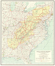
Appalachian Development Highway System
Encyclopedia

Appalachian Regional Commission
The Appalachian Regional Commission is a United States federal-state partnership that works with the people of Appalachia to create opportunities for self-sustaining economic development and improved quality of life...
in the United States
United States
The United States of America is a federal constitutional republic comprising fifty states and a federal district...
. See: current map of the ADHS.
History
President of the United States
The President of the United States of America is the head of state and head of government of the United States. The president leads the executive branch of the federal government and is the commander-in-chief of the United States Armed Forces....
’s Appalachian Regional Commission
Appalachian Regional Commission
The Appalachian Regional Commission is a United States federal-state partnership that works with the people of Appalachia to create opportunities for self-sustaining economic development and improved quality of life...
(PARC) reported to Congress
United States Congress
The United States Congress is the bicameral legislature of the federal government of the United States, consisting of the Senate and the House of Representatives. The Congress meets in the United States Capitol in Washington, D.C....
that economic growth in Appalachia
Appalachia
Appalachia is a term used to describe a cultural region in the eastern United States that stretches from the Southern Tier of New York state to northern Alabama, Mississippi, and Georgia. While the Appalachian Mountains stretch from Belle Isle in Canada to Cheaha Mountain in the U.S...
would not be possible until the region’s isolation had been overcome. Because the cost of building highways through Appalachia’s mountainous terrain was high, the region's local residents had never been served by adequate roads. The existing network of narrow, winding, two-lane roads, snaking through narrow stream valleys or over mountaintops, was slow to drive, unsafe, and in many places worn out. The nation's Interstate Highway System
Interstate Highway System
The Dwight D. Eisenhower National System of Interstate and Defense Highways, , is a network of limited-access roads including freeways, highways, and expressways forming part of the National Highway System of the United States of America...
, though extensive through the region, was designed to serve cross-country traffic rather than local residents.
The PARC report and the Appalachian governors placed top priority on a modern highway system as the key to economic development. As a result, Congress authorized the construction of the Appalachian Development Highway System (ADHS) in the Appalachian Development Act of 1965. The ADHS was designed to generate economic development in previously isolated areas, supplement the interstate system, and provide access to areas within the Region as well as to markets in the rest of the nation. The system has served its intended purpose to varying degrees of success.
Currently, the ADHS is authorized at 3090 miles (4,972.9 km), including 65 miles (104.6 km) added in January 2004 by Public Law 108-199. By the end of FY 2004, 2627 miles (4,227.7 km)—approximately 85 percent of the 3090 miles (4,972.9 km) authorized—were complete or under construction. Many of the remaining miles will be among the most expensive to build.
Corridor Z across southern Georgia
Georgia (U.S. state)
Georgia is a state located in the southeastern United States. It was established in 1732, the last of the original Thirteen Colonies. The state is named after King George II of Great Britain. Georgia was the fourth state to ratify the United States Constitution, on January 2, 1788...
is not part of the official system, but has been assigned by the Georgia Department of Transportation
Georgia Department of Transportation
The Georgia Department of Transportation is the organization in charge of developing and maintaining all state and federal roadways in the U.S. state of Georgia. In addition to highways, the department also has a limited role in developing public transportation and general aviation programs...
.
Corridor A
Corridor A is a highwayHighway
A highway is any public road. In American English, the term is common and almost always designates major roads. In British English, the term designates any road open to the public. Any interconnected set of highways can be variously referred to as a "highway system", a "highway network", or a...
in the states of Georgia
Georgia (U.S. state)
Georgia is a state located in the southeastern United States. It was established in 1732, the last of the original Thirteen Colonies. The state is named after King George II of Great Britain. Georgia was the fourth state to ratify the United States Constitution, on January 2, 1788...
and North Carolina
North Carolina
North Carolina is a state located in the southeastern United States. The state borders South Carolina and Georgia to the south, Tennessee to the west and Virginia to the north. North Carolina contains 100 counties. Its capital is Raleigh, and its largest city is Charlotte...
. It is part of the Appalachian Development Highway System, running from Interstate 285
Interstate 285
Interstate 285 is an Interstate Highway loop encircling Atlanta, Georgia, for . I-285 is also known as unsigned State Route 407 and is colloquially referred to as the Perimeter. Suburban sprawl has made it one of the most heavily traveled roadways in the United States, and portions of the highway...
north of Atlanta northeasterly to Interstate 40
Interstate 40 in North Carolina
Interstate 40 runs through the state of North Carolina from the Tennessee state line in the west to its eastern terminus in Wilmington.-Pigeon River Gorge:...
near Clyde, North Carolina
Clyde, North Carolina
Clyde is a town in Haywood County, North Carolina, United States. The 200 census recorded the population at 1,324 people. It is part of the Asheville Metropolitan Statistical Area.-Geography:Clyde is located at ....
. I-40 continues easterly past Asheville
Asheville, North Carolina
Asheville is a city in and the county seat of Buncombe County, North Carolina, United States. It is the largest city in Western North Carolina, and the 11th largest city in North Carolina. The City is home to the United States National Climatic Data Center , which is the world's largest active...
, where it meets Interstate 26
Interstate 26
Interstate 26 is a nominally east–west main route of the Interstate Highway System in the Southeastern United States. I-26 runs from the junction of U.S. Route 11W and U.S. Route 23 in Kingsport, Tennessee, generally southeastward to U.S. Route 17 in Charleston, South Carolina...
and Corridor B.
In Georgia, Corridor A travels along the State Route 400
Georgia State Route 400
Georgia State Route 400 is a highway in the U.S. state of Georgia, concurrent with U.S. Route 19 from exit 4B until its terminus just south of Dahlonega. ST 400 goes from Atlanta, at Interstate 85 , to Buckhead, Sandy Springs, Roswell, Alpharetta, Cumming, Dawson County, and Dahlonega...
freeway from I-285 to the State Route 141
Georgia State Route 141
State Route 141 is a north–south route which begins where Roswell Road and Peachtree Road split in Buckhead....
interchange
Interchange (road)
In the field of road transport, an interchange is a road junction that typically uses grade separation, and one or more ramps, to permit traffic on at least one highway to pass through the junction without directly crossing any other traffic stream. It differs from a standard intersection, at which...
southwest of Cumming
Cumming, Georgia
Cumming is a city in Forsyth County, Georgia, United States. The population was 5,430 at the 2010 census. However, places with a Cumming mailing address have a population of around 100,000...
. From there northwest between Ball Ground
Ball Ground, Georgia
Ball Ground is a city in Cherokee County, Georgia, United States. The population was 1433 at the 2010 census.Ball Ground is at the northernmost end of Georgia Interstate 575, north of Canton at exit 20 on I-575, and ending seven miles north at exit 27...
and Nelson
Nelson, Georgia
Nelson is a city partly in Pickens and mostly in Cherokee counties in the U.S. state of Georgia. As of the 2000 census, the city had a total population of 1314.City of Nelson - Pickens County...
, near the north end of Interstate 575
Interstate 575
Interstate 575 is an Interstate Highway spur route in the United States, which branches off Interstate 75 in Kennesaw and connects the metro Atlanta area with the north Georgia mountains. I-575 is also the unsigned State Route 417 and is cosigned as SR 5...
, Corridor A has not been constructed; its proposed path is near that of the cancelled Northern Arc
Outer Perimeter
The Outer Perimeter was an expressway originally planned to encircle Atlanta about 20 to 25 miles farther away from the city than the existing Perimeter Highway .-Planning:...
. It begins again with a short piece of State Route 372, becoming State Route 515
Georgia State Route 515
State Route 515 is a four-lane highway that begins at the northern terminus of I-575 at the Cherokee –Pickens county line in northern Georgia. The route was built to give motorists in the north Georgia mountains better access to Atlanta and its outlying suburbs, as opposed to the old ST 5 and...
when it meets I-575. SR 515 is a four-lane divided highway
Divided Highway
Divided Highway is a compilation album by American rock band The Doobie Brothers, released in 2003. . All tracks are taken from the albums Cycles and Brotherhood .-Track listing:...
all the way to Blairsville
Blairsville, Georgia
-Demographics:As of the census of 2000, there were 659 people, 226 households, and 101 families residing in the city. The population density was 619.7 people per square mile . There were 261 housing units at an average density of 245.4 per square mile...
. From Blairsville to North Carolina, the corridor has not been built, and SR 515 is a two-lane road.
The short North Carolina Highway 69
North Carolina Highway 69
NC 69 is a short north/south state highway in western North Carolina; it is entirely in Clay County.-Route description:NC 69 runs from the Georgia border south of Hayesville north, along the western shore of Lake Chatuge. The route crosses U.S. Route 64 before entering downtown Hayesville, where it...
takes Corridor A north to U.S. Highway 64 near Hayesville
Hayesville, North Carolina
Hayesville is a town in Clay County, North Carolina, United States. The population was 297 at the 2000 census. It is the county seat of Clay County.-Geography:Hayesville is located at ....
. Corridor A turns east on US 64, and after some two-lane sections, it becomes a four-lane highway. Corridor A switches to U.S. Highway 23
U.S. Route 23 in North Carolina
U.S. Route 23 is an north–south United States highway that runs for from the Georgia state line, near Dillard, to the Tennessee state line, near Flag Pond.-Route description:...
near Franklin
Franklin, North Carolina
Franklin is a town in Franklin Township, Macon County, North Carolina, United States, within the Nantahala National Forest. The population was 3,490 as of the 2000 census. It is the county seat of Macon County. Franklin is an official Appalachian Trail friendly destination...
, and meets the east end of Corridor K near Sylva
Sylva, North Carolina
Sylva is an incorporated town located in central Jackson County, in the Great Smoky Mountains of Western North Carolina, United States of America. As of the 2010 census, the town had a total population of 2,588. It is the county seat, having taken over from nearby Webster in 1913.-Geography:Sylva...
. From Sylva to its end at Interstate 40
Interstate 40 in North Carolina
Interstate 40 runs through the state of North Carolina from the Tennessee state line in the west to its eastern terminus in Wilmington.-Pigeon River Gorge:...
near Clyde
Clyde, North Carolina
Clyde is a town in Haywood County, North Carolina, United States. The 200 census recorded the population at 1,324 people. It is part of the Asheville Metropolitan Statistical Area.-Geography:Clyde is located at ....
, Corridor A uses the Great Smoky Mountains Expressway
Great Smoky Mountains Expressway
The Great Smoky Mountains Expressway is a four-lane divided highway in southwestern North Carolina, which runs between Interstate 40 near Canton in the east to the Nantahala National Forest near Needmore in the west. It traverses western Haywood, northern Jackson, and eastern Swain counties,...
, which carries US 23 most of the way and U.S. Highway 74 for its entire length.
Corridor A-1 uses Georgia State Route 400
Georgia State Route 400
Georgia State Route 400 is a highway in the U.S. state of Georgia, concurrent with U.S. Route 19 from exit 4B until its terminus just south of Dahlonega. ST 400 goes from Atlanta, at Interstate 85 , to Buckhead, Sandy Springs, Roswell, Alpharetta, Cumming, Dawson County, and Dahlonega...
from the point that Corridor A leaves it, at State Route 141
Georgia State Route 141
State Route 141 is a north–south route which begins where Roswell Road and Peachtree Road split in Buckhead....
near Cumming
Cumming, Georgia
Cumming is a city in Forsyth County, Georgia, United States. The population was 5,430 at the 2010 census. However, places with a Cumming mailing address have a population of around 100,000...
, northeast to State Route 53
Georgia State Route 53
State Route 53 is a west–east state route located in the northern part of the U.S. state of Georgia. The route travels from the Alabama state line west of Cave Spring northeast, then east, then southeast to State Route 15/State Route 24 Business in Watkinsville....
near Bright. SR 400 continues northeast as a four-lane highway from SR 53 to State Route 60 south of Dahlonega
Dahlonega, Georgia
Dahlonega is a city in Lumpkin County, Georgia, United States, and is its county seat. As of the 2010 census, the city had a population of 5,242....
; this section was built "with APL funds as a local access road".
Corridor B
Corridor B is a highway in the states of North CarolinaNorth Carolina
North Carolina is a state located in the southeastern United States. The state borders South Carolina and Georgia to the south, Tennessee to the west and Virginia to the north. North Carolina contains 100 counties. Its capital is Raleigh, and its largest city is Charlotte...
, Tennessee
Tennessee
Tennessee is a U.S. state located in the Southeastern United States. It has a population of 6,346,105, making it the nation's 17th-largest state by population, and covers , making it the 36th-largest by total land area...
, Virginia
Virginia
The Commonwealth of Virginia , is a U.S. state on the Atlantic Coast of the Southern United States. Virginia is nicknamed the "Old Dominion" and sometimes the "Mother of Presidents" after the eight U.S. presidents born there...
, Kentucky
Kentucky
The Commonwealth of Kentucky is a state located in the East Central United States of America. As classified by the United States Census Bureau, Kentucky is a Southern state, more specifically in the East South Central region. Kentucky is one of four U.S. states constituted as a commonwealth...
, and Ohio
Ohio
Ohio is a Midwestern state in the United States. The 34th largest state by area in the U.S.,it is the 7th‑most populous with over 11.5 million residents, containing several major American cities and seven metropolitan areas with populations of 500,000 or more.The state's capital is Columbus...
. It is part of the Appalachian Development Highway System, and generally follows U.S. Route 23 from Interstate 26
Interstate 26
Interstate 26 is a nominally east–west main route of the Interstate Highway System in the Southeastern United States. I-26 runs from the junction of U.S. Route 11W and U.S. Route 23 in Kingsport, Tennessee, generally southeastward to U.S. Route 17 in Charleston, South Carolina...
and Interstate 40
Interstate 40 in North Carolina
Interstate 40 runs through the state of North Carolina from the Tennessee state line in the west to its eastern terminus in Wilmington.-Pigeon River Gorge:...
near Asheville, North Carolina
Asheville, North Carolina
Asheville is a city in and the county seat of Buncombe County, North Carolina, United States. It is the largest city in Western North Carolina, and the 11th largest city in North Carolina. The City is home to the United States National Climatic Data Center , which is the world's largest active...
, north to Corridor C north of Portsmouth, Ohio
Portsmouth, Ohio
Portsmouth is a city in the U.S. state of Ohio and the county seat of Scioto County. The municipality is located on the northern banks of the Ohio River and east of the Scioto River in Southern Ohio. The population was 20,226 at the 2010 census.-Foundation:...
.
Corridor B uses Interstate 240
Interstate 240 (North Carolina)
Interstate 240 is a long Interstate Highway loop in the U.S. state of North Carolina. It serves as an urban connector for Asheville and runs in a half-circle around the north of the city's downtown district between exits 53B and 46B of Interstate 40...
from its south end into downtown Asheville, where it uses US 23 (current and future Interstate 26
Interstate 26
Interstate 26 is a nominally east–west main route of the Interstate Highway System in the Southeastern United States. I-26 runs from the junction of U.S. Route 11W and U.S. Route 23 in Kingsport, Tennessee, generally southeastward to U.S. Route 17 in Charleston, South Carolina...
) to Kingsport, Tennessee
Kingsport, Tennessee
Kingsport is a city located mainly in Sullivan County with some western portions in Hawkins County in the US state of Tennessee. The majority of the city lies in Sullivan County...
. The US 23 freeway ends at the Tennessee/Virginia state line, but US 23 is a four-lane divided highway
Divided Highway
Divided Highway is a compilation album by American rock band The Doobie Brothers, released in 2003. . All tracks are taken from the albums Cycles and Brotherhood .-Track listing:...
all the way through Virginia and into northeastern Kentucky.
At Grays Branch, Kentucky, Corridor B leaves US 23 to turn east on Kentucky Route 10 over the two-lane Jesse Stuart Memorial Bridge
Jesse Stuart Memorial Bridge
The Jesse Stuart Memorial Bridge is a viaduct on top of the Greenup Locks and Dam on the Ohio River. The bridge, named after author and Greenup County, Kentucky native Jesse Stuart, was completed in 1984 and carries Kentucky Route 10 from the AA Highway/U.S. 23 intersection to the bridge itself,...
into Ohio. The short Ohio State Route 253 connects the bridge to U.S. Route 52, a freeway that takes Corridor B north to Wheelersburg
Wheelersburg, Ohio
Wheelersburg is a census-designated place in Scioto County, Ohio, United States. It was founded in 1820 and was originally known as Concord. It lies along the northern banks of the Ohio River in Southern Ohio. Wheelersburg is approximately 7 miles east of Portsmouth and 14 miles west of Ironton...
. US 52 continues west to Portsmouth
Portsmouth, Ohio
Portsmouth is a city in the U.S. state of Ohio and the county seat of Scioto County. The municipality is located on the northern banks of the Ohio River and east of the Scioto River in Southern Ohio. The population was 20,226 at the 2010 census.-Foundation:...
, but the proposed alignment of Corridor B continues north and northwest along the planned Portsmouth Bypass
Ohio State Route 823
The Portsmouth Bypass is a proposed four-lane limited-access divided highway rerouting through traffic around the cities of Portsmouth and New Boston in Scioto County, Ohio, United States. In addition to providing better mobility within the local area for residents, the bypass has the potential to...
to US 23 near Lucasville
Lucasville, Ohio
Lucasville is a census-designated place in Scioto County, Ohio, United States. The population was 1,588 at the 2000 census. The village of Lucasville was laid out by Captain John Lucas in June 1819 and recorded August 7, 1819. Captain Lucas built the first tavern in the village and kept it until...
. The part of Corridor B north of SR 253 is also part of the I-73/74 North–South Corridor.
Corridor B-1 runs from Kentucky Route 10 to the north end of the Portsmouth Bypass. In Kentucky, it follows US 23 and U.S. Highway 23 Truck; after crossing the two-lane Carl Perkins Bridge into Ohio, it uses current and planned State Route 852—a western bypass of Portsmouth—and US 23. Corridors B and B-1 both end near Lucasville
Lucasville, Ohio
Lucasville is a census-designated place in Scioto County, Ohio, United States. The population was 1,588 at the 2000 census. The village of Lucasville was laid out by Captain John Lucas in June 1819 and recorded August 7, 1819. Captain Lucas built the first tavern in the village and kept it until...
, where Corridor C continues north along US 23 to Columbus
Columbus, Ohio
Columbus is the capital of and the largest city in the U.S. state of Ohio. The broader metropolitan area encompasses several counties and is the third largest in Ohio behind those of Cleveland and Cincinnati. Columbus is the third largest city in the American Midwest, and the fifteenth largest city...
.
Corridor C
Corridor C is a highwayHighway
A highway is any public road. In American English, the term is common and almost always designates major roads. In British English, the term designates any road open to the public. Any interconnected set of highways can be variously referred to as a "highway system", a "highway network", or a...
in the U.S. state
U.S. state
A U.S. state is any one of the 50 federated states of the United States of America that share sovereignty with the federal government. Because of this shared sovereignty, an American is a citizen both of the federal entity and of his or her state of domicile. Four states use the official title of...
of Ohio
Ohio
Ohio is a Midwestern state in the United States. The 34th largest state by area in the U.S.,it is the 7th‑most populous with over 11.5 million residents, containing several major American cities and seven metropolitan areas with populations of 500,000 or more.The state's capital is Columbus...
. It is part of the Appalachian Development Highway System, as well as part of U.S. Route 23, running from the north end of Corridor B near Lucasville
Lucasville, Ohio
Lucasville is a census-designated place in Scioto County, Ohio, United States. The population was 1,588 at the 2000 census. The village of Lucasville was laid out by Captain John Lucas in June 1819 and recorded August 7, 1819. Captain Lucas built the first tavern in the village and kept it until...
north to Interstate 270
Interstate 270 (Ohio)
Interstate 270 is the beltway loop freeway in the Columbus metropolitan area, commonly known locally as "The Outerbelt," or the "Jack Nicklaus Freeway." The "western" terminus of I-270, at least in terms of the zero-milepost, is at the junction with I-71 east of Grove City, Ohio...
south of Columbus
Columbus, Ohio
Columbus is the capital of and the largest city in the U.S. state of Ohio. The broader metropolitan area encompasses several counties and is the third largest in Ohio behind those of Cleveland and Cincinnati. Columbus is the third largest city in the American Midwest, and the fifteenth largest city...
. , most of the road is a four-lane divided highway
Divided Highway
Divided Highway is a compilation album by American rock band The Doobie Brothers, released in 2003. . All tracks are taken from the albums Cycles and Brotherhood .-Track listing:...
, but there are a few gaps yet to be built. Corridor C is part of the I-73/74 North–South Corridor.
Corridor C-1 is a connection from Corridor C near Chillicothe
Chillicothe, Ohio
Chillicothe is a city in and the county seat of Ross County, Ohio, United States.Chillicothe was the first and third capital of Ohio and is located in southern Ohio along the Scioto River. The name comes from the Shawnee name Chalahgawtha, meaning "principal town", as it was a major settlement of...
southeast to Corridor D near Jackson, Ohio
Jackson, Ohio
Jackson is a city in and the county seat of Jackson County, Ohio, United States. The population was 6,184 at the 2000 census.-Geography:Jackson is located at ....
, along U.S. Route 35. It has been completed as a four-lane highway.
Corridor E
Interstate 68 (I-68) is a 112.6 miles (181.2 km) Interstate highway in the U.S. states of West VirginiaWest Virginia
West Virginia is a state in the Appalachian and Southeastern regions of the United States, bordered by Virginia to the southeast, Kentucky to the southwest, Ohio to the northwest, Pennsylvania to the northeast and Maryland to the east...
and Maryland
Maryland
Maryland is a U.S. state located in the Mid Atlantic region of the United States, bordering Virginia, West Virginia, and the District of Columbia to its south and west; Pennsylvania to its north; and Delaware to its east...
, connecting in Morgantown
Morgantown, West Virginia
Morgantown is a city in Monongalia County, West Virginia. It is the county seat of Monongalia County. Placed along the banks of the Monongahela River, Morgantown is the largest city in North-Central West Virginia, and the base of the Morgantown metropolitan area...
to in Hancock
Hancock, Maryland
Hancock is a town in Washington County, Maryland, United States. The population was 1,725 at the 2000 census. The Western Maryland community is notable for being located at the narrowest part of the state...
. I-68 is also Corridor E of the Appalachian Development Highway System. From 1965 until the freeway's construction was completed in 1991, it was designated as (US 48). In Maryland, the highway is known as the National Freeway, an homage to the historic National Road
National Road
The National Road or Cumberland Road was the first major improved highway in the United States to be built by the federal government. Construction began heading west in 1811 at Cumberland, Maryland, on the Potomac River. It crossed the Allegheny Mountains and southwestern Pennsylvania, reaching...
, which parallels between Keysers Ridge
Keysers Ridge, Maryland
Keysers Ridge is an unincorporated area in northern Garrett County, Maryland. It lies to the west of Grantsville on Interstate 68 and is bounded to the northwest by the Savage River State Forest. It is primarily known for its key location on Interstate 68 and U.S. Route 40...
and Hancock
Hancock, Maryland
Hancock is a town in Washington County, Maryland, United States. The population was 1,725 at the 2000 census. The Western Maryland community is notable for being located at the narrowest part of the state...
. The freeway mainly spans rural areas, and crosses numerous mountain ridges along its route. A road cut constructed for it through Sideling Hill
Sideling Hill
Sideling Hill is a long, steep, narrow mountain ridge in the Ridge-and-Valley physiographic province of the Appalachian Mountains, located in Washington County in western Maryland and adjacent West Virginia and Pennsylvania, USA...
exposed geological features of the mountain and has become a tourist attraction.
U.S. Route 219
U.S. Route 219 in Maryland
U.S. Route 219 is a part of the U.S. Highway System that runs from Rich Creek, Virginia to West Seneca, New York. In the U.S. state of Maryland, the federal highway runs from the West Virginia state line near Red House to the Pennsylvania state line near Grantsville...
and U.S. Route 220
U.S. Route 220 in Maryland
U.S. Route 220 is a part in the U.S. Highway System that runs from Rockingham, North Carolina to Waverly, New York. In Maryland, the federal highway runs from the West Virginia state line at the Potomac River in McCoole north to the Pennsylvania state line in Dickens...
overlap
Concurrency (road)
A concurrency, overlap, or coincidence in a road network is an instance of one physical road bearing two or more different highway, motorway, or other route numbers...
with in Garrett County
Garrett County, Maryland
Garrett County is the westernmost county of the U.S. state of Maryland. Created from Allegany County, Maryland in 1872 it was the last Maryland county to be formed. It was named for John Work Garrett , railroad executive, industrialist, and financier. Garrett served as president of the Baltimore...
and Cumberland, Maryland
Cumberland, Maryland
Cumberland is a city in the far western, Appalachian portion of Maryland, United States. It is the county seat of Allegany County, and the primary city of the Cumberland, MD-WV Metropolitan Statistical Area. At the 2010 census, the city had a population of 20,859, and the metropolitan area had a...
, respectively, and U.S. Route 40
U.S. Route 40 in Maryland
U.S. Route 40 in the U.S. state of Maryland runs from western Maryland to Cecil County in the state's northeastern corner. With a total length of over , it is the longest numbered highway in Maryland. Almost half of the road overlaps with Interstate 68 or Interstate 70, while the old alignment...
overlaps with the freeway from Keysers Ridge to the eastern end of the freeway at Hancock.
The construction of began in 1965 and lasted for about 25 years, being completed on August 2, 1991. While the road was being built, it was predicted that the completion of the road would improve the economic situation along the corridor. The two largest cities connected by the highway are Morgantown and Cumberland, both with populations of fewer than 30,000 people. Despite the fact that the freeway serves no large metropolitan areas, I-68 provides a major transportation route in western Maryland and northern West Virginia and also provides an alternative to the Pennsylvania Turnpike
Pennsylvania Turnpike
The Pennsylvania Turnpike is a toll highway system operated by the Pennsylvania Turnpike Commission in the Commonwealth of Pennsylvania, United States. The three sections of the turnpike system total . The main section extends from Ohio to New Jersey and is long...
for westbound traffic from Washington, D.C.
Washington, D.C.
Washington, D.C., formally the District of Columbia and commonly referred to as Washington, "the District", or simply D.C., is the capital of the United States. On July 16, 1790, the United States Congress approved the creation of a permanent national capital as permitted by the U.S. Constitution....
and Baltimore
Baltimore
Baltimore is the largest independent city in the United States and the largest city and cultural center of the US state of Maryland. The city is located in central Maryland along the tidal portion of the Patapsco River, an arm of the Chesapeake Bay. Baltimore is sometimes referred to as Baltimore...
.
There have been several major planned road projects that would affect the freeway's corridor. These include a plan to extend I-68 to Moundsville, West Virginia
Moundsville, West Virginia
Moundsville is a city in Marshall County, West Virginia, along the Ohio River. It is part of the Wheeling Metropolitan Statistical Area. The population was 9,998 at the 2000 census. It is the county seat of Marshall County. The city was named for the Grave Creek Mound. Moundsville was settled in...
, which, due to major funding issues, is unlikely to be completed, and the plan to construct the Mon–Fayette Expressway
Mon–Fayette Expressway
The Mon–Fayette Expressway is an interstate tolled freeway that is planned to eventually link Interstate 68 near Morgantown, West Virginia with two branches to Interstate 376 near Pittsburgh, Pennsylvania...
, a toll highway
Toll road
A toll road is a privately or publicly built road for which a driver pays a toll for use. Structures for which tolls are charged include toll bridges and toll tunnels. Non-toll roads are financed using other sources of revenue, most typically fuel tax or general tax funds...
which, when completed, will meet I-68 east of Morgantown.
Corridor F
Corridor F is a highway in the states of TennesseeTennessee
Tennessee is a U.S. state located in the Southeastern United States. It has a population of 6,346,105, making it the nation's 17th-largest state by population, and covers , making it the 36th-largest by total land area...
and Kentucky
Kentucky
The Commonwealth of Kentucky is a state located in the East Central United States of America. As classified by the United States Census Bureau, Kentucky is a Southern state, more specifically in the East South Central region. Kentucky is one of four U.S. states constituted as a commonwealth...
. It is part of the Appalachian Development Highway System, running from Interstate 75
Interstate 75 in Tennessee
In the U.S. state of Tennessee, Interstate 75 runs from Chattanooga to Jellico by way of Knoxville. Interstate 75 enters the East Tennessee region following the Tennessee Valley from Georgia, all the way through Knoxville to near Lake City, then climbs into the Cumberland Mountains before crossing...
in Caryville, Tennessee
Caryville, Tennessee
Caryville is a town in Campbell County, Tennessee, United States. The population was 2,297 at the 2010 census.-Geography:Caryville is located at ....
, northeasterly to Corridor B (U.S. Highway 23) near Kentucky
Kentucky
The Commonwealth of Kentucky is a state located in the East Central United States of America. As classified by the United States Census Bureau, Kentucky is a Southern state, more specifically in the East South Central region. Kentucky is one of four U.S. states constituted as a commonwealth...
. Corridor F uses U.S. Highway 25W
U.S. Route 25
U.S. Route 25 is a north–south United States highway that runs for from Brunswick, Georgia to the Ohio state line in Covington, Kentucky.-Georgia:...
and Tennessee State Route 63 from I-75 to Corridor S (U.S. Highway 25E
U.S. Route 25E
U.S. Route 25E is the eastern branch of U.S. Route 25 from Newport, Tennessee, where US 25 splits into US 25E and US 25W, to North Corbin, Kentucky, where the two highways rejoin...
) in Harrogate, Tennessee
Harrogate, Tennessee
Harrogate is a city in Claiborne County, Tennessee, United States. The community has been known as "Harrogate" since the 19th century, but did not incorporate as a city by that name until 1993....
. There it turns northwest along US 25E, passing through the Cumberland Gap Tunnel
Cumberland Gap Tunnel
The Cumberland Gap Tunnel is a tunnel that carries U.S. Route 25E under Cumberland Gap National Historical Park near the intersection of Kentucky, Tennessee, and Virginia. The east portal of the tunnel is in Tennessee and the west portal is in Kentucky; according to United States Geological Survey...
into Kentucky. It leaves US 25E in Pineville, Kentucky
Pineville, Kentucky
Pineville is a city in Bell County, Kentucky, United States. The population was 2,093 at the 2000 census. It is the county seat of Bell County. It is located on a small strip of land between the Cumberland River and Pine Mountain.-History:...
, turning northeasterly along U.S. Highway 119, past an intersection with Corridor I (Kentucky Route 15
Kentucky Route 15
Kentucky Route 15 begins at a junction of US 119/Corridor F & Business KY 15 in Whitesburg, and terminates in Winchester at US 60. It is a major route, connecting the coalfields of the Cumberland Plateau with Lexington and other cities in the Bluegrass region. The segment from Whitesburg to KY 15...
) in Whitesburg
Whitesburg, Kentucky
Whitesburg is a city in Letcher County, Kentucky, United States. The population was 2,139 at the 2010 census. It is the county seat of Letcher County.-Culture:...
, to its end at Corridor B.
Corridor G
Corridor G is a highway in KentuckyKentucky
The Commonwealth of Kentucky is a state located in the East Central United States of America. As classified by the United States Census Bureau, Kentucky is a Southern state, more specifically in the East South Central region. Kentucky is one of four U.S. states constituted as a commonwealth...
and West Virginia
West Virginia
West Virginia is a state in the Appalachian and Southeastern regions of the United States, bordered by Virginia to the southeast, Kentucky to the southwest, Ohio to the northwest, Pennsylvania to the northeast and Maryland to the east...
that follows the route of U.S. Route 119
U.S. Route 119
U.S. Route 119, commonly abbreviated as US 119, is a spur of US 19. It is a north–south route that was an original United States highway of 1926. It is often referred to as Corridor G east of US 23 and KY 80 in Kentucky to Interstate 64 at Charleston, West Virginia.- Kentucky :US 119 is a two...
from Pikeville, Kentucky
Pikeville, Kentucky
Pikeville is a city in Pike County, Kentucky. The population was 6,903 at the 2010 census. It is the county seat of Pike County.-History:On March 25, 1822, the county's government officials decided to build a new county seat named Liberty, one and one-half mile below the mouth of the Russell Fork...
, to Charleston, West Virginia
Charleston, West Virginia
Charleston is the capital and largest city of the U.S. state of West Virginia. It is located at the confluence of the Elk and Kanawha Rivers in Kanawha County. As of the 2010 census, it has a population of 51,400, and its metropolitan area 304,214. It is the county seat of Kanawha County.Early...
. Construction on the road began in 1972 in West Virginia and 1974 in Kentucky, but it was more than two decades before the road was completed in either state. The full length of Corridor G in West Virginia was completed in 1997, but Kentucky's last segment was not opened until 2008.
Corridor I
Corridor I is a highwayHighway
A highway is any public road. In American English, the term is common and almost always designates major roads. In British English, the term designates any road open to the public. Any interconnected set of highways can be variously referred to as a "highway system", a "highway network", or a...
in the U.S. state
U.S. state
A U.S. state is any one of the 50 federated states of the United States of America that share sovereignty with the federal government. Because of this shared sovereignty, an American is a citizen both of the federal entity and of his or her state of domicile. Four states use the official title of...
of Kentucky
Kentucky
The Commonwealth of Kentucky is a state located in the East Central United States of America. As classified by the United States Census Bureau, Kentucky is a Southern state, more specifically in the East South Central region. Kentucky is one of four U.S. states constituted as a commonwealth...
. It is part of the Appalachian Development Highway System, running from Interstate 64
Interstate 64 in Kentucky
In the U.S. state of Kentucky, Interstate 64 travels for passing by the major towns and cities of Louisville, Frankfort, Lexington and Ashland. It has several major junctions within the state: Interstate 65, Interstate 71, Interstate 264 and Interstate 265 in Louisville, and Interstate 75 in...
southeasterly along the Mountain Parkway and Kentucky Route 15
Kentucky Route 15
Kentucky Route 15 begins at a junction of US 119/Corridor F & Business KY 15 in Whitesburg, and terminates in Winchester at US 60. It is a major route, connecting the coalfields of the Cumberland Plateau with Lexington and other cities in the Bluegrass region. The segment from Whitesburg to KY 15...
to Corridor F (U.S. Highway 119) in Whitesburg
Whitesburg, Kentucky
Whitesburg is a city in Letcher County, Kentucky, United States. The population was 2,139 at the 2010 census. It is the county seat of Letcher County.-Culture:...
. Corridor I meets Corridor R (Mountain Parkway) near Campton
Campton, Kentucky
As of the census of 200, there were 44 people, 16 households, and 17 families residing in the city. The population density was 33.4 people per square mile . There were 29 housing units at an average density of 212.5 per square mile . The racial makeup of the city was 99.76% White, and 0.24% from...
and future Interstate 66 (Hal Rogers Parkway
Hal Rogers Parkway
The Hal Rogers Parkway, formerly named the Daniel Boone Parkway, connects London and Hazard in southeastern Kentucky. This toll road opened in November 1971 and the tolls were removed June 1, 2003. The original extent of the highway was to be instead of today's 62.90, with that mileage to have...
and Kentucky Route 80) in Hazard
Hazard, Kentucky
As of the census of 2000, there were 4,806 people, 1,946 households, and 1,266 families residing in the city. The population density was 684.6 people per square mile . There were 2,291 housing units at an average density of 326.4 per square mile...
.
Corridor J
Corridor J is a highway in the states of TennesseeTennessee
Tennessee is a U.S. state located in the Southeastern United States. It has a population of 6,346,105, making it the nation's 17th-largest state by population, and covers , making it the 36th-largest by total land area...
and Kentucky
Kentucky
The Commonwealth of Kentucky is a state located in the East Central United States of America. As classified by the United States Census Bureau, Kentucky is a Southern state, more specifically in the East South Central region. Kentucky is one of four U.S. states constituted as a commonwealth...
. It is part of the Appalachian Development Highway System, running from the end of Interstate 24
Interstate 24
Interstate 24 is an Interstate Highway in the Midwestern and Southeastern United States. It runs diagonally from Interstate 57 to Chattanooga, Tennessee, at Interstate 75....
in Chattanooga, Tennessee
Chattanooga, Tennessee
Chattanooga is the fourth-largest city in the US state of Tennessee , with a population of 169,887. It is the seat of Hamilton County...
, north to Interstate 75 in London, Kentucky
London, Kentucky
-Education:All of the following schools are administered by the Laurel County School District.-Primary schools:* * * * * * * * * * * * -High schools:* * -Colleges:* Laurel Technical College* * -Notable natives:...
.
Corridor J uses U.S. Highway 27 from Chattanooga north to Soddy-Daisy
Soddy-Daisy, Tennessee
Soddy-Daisy is a city in Hamilton County, Tennessee, United States. The population was 11,530 at the 2000 census. The City was formed in 1969 when the communities of Soddy and Daisy, along with nearby developed areas along U.S. Highway 27, merged to form Soddy-Daisy. It is rapidly becoming a...
. There it turns northwest on State Route 111, eventually curving to the north via Dunlap
Dunlap, Tennessee
Dunlap is a city in Sequatchie County, Tennessee, United States. The population was 4,173 at the 2000 census. It is the county seat of Sequatchie County.Dunlap is part of the Chattanooga, TN–GA Metropolitan Statistical Area.-Geography:...
, Sparta
Sparta, Tennessee
Sparta is a city in White County, Tennessee, United States. The population was 4,599 at the 2000 census. It is the county seat of White County. It was the hometown of Lester Flatt of the bluegrass music legends Flatt and Scruggs.-Geography:...
, and Cookeville
Cookeville, Tennessee
Cookeville is a city in Putnam County, Tennessee, United States. The population was 23,923 at the 2000 census. of Cookeville's population was 30,435, and the combined total of those living in Cookeville's in 2010 was 65,014. It is the county seat of Putnam County and home to Tennessee...
to Livingston
Livingston, Tennessee
Livingston is a town in Overton County, Tennessee, United States. The population was 3,498 at the 2000 census. It is the county seat of Overton County...
. Then it turns northwest on State Route 52
Tennessee State Route 52
Tennessee State Route 52 is an east–west highway that crosses northern Tennessee.It extends from State Highway 49 in Robertson County to its eastern terminus at the intersection with U.S. Route 27 in Scott County....
to Celina
Celina, Tennessee
Celina is a city in and the county seat of Clay County, Tennessee, United States. The population was 1,379 at the 2000 census.-Geography:Celina is located at ....
and northeast on State Route 53 to Kentucky.
Upon crossing into Kentucky, Corridor J becomes Kentucky Route 61, heading north to Burkesville
Burkesville, Kentucky
Burkesville is a city in Cumberland County, Kentucky, United States. Nestled among the rolling foothills of Appalachia and bordered by the Cumberland River to the south and east, it is the county seat of Cumberland County...
. There it turns east on Kentucky Route 90
Kentucky Route 90
Kentucky Route 90 originates at a junction with KY 70 near I-65 in Cave City in Barren County. The route continues through Metcalfe County, Cumberland County, Clinton County, Wayne County, Pulaski...
, which it follows to Burnside
Burnside, Kentucky
Burnside is a city in Pulaski County, Kentucky, United States. The population was 637 at the 2000 census. In 2005, Burnside became the only town in Pulaski County or any adjoining county to allow the sale of alcoholic beverages in qualified establishments...
. Corridor J turns north on U.S. Highway 27 at Burnside, quickly turning northeast on Kentucky Route 914 to bypass downtown Somerset
Somerset, Kentucky
The major demographic differences between the city and the micropolitan area relate to income, housing composition and age. The micropolitan area, as compared to the incorporated city, is more suburban in flavor and has a significantly younger housing stock, a higher income, and contains most of...
and then east on Kentucky Route 80 to London
London, Kentucky
-Education:All of the following schools are administered by the Laurel County School District.-Primary schools:* * * * * * * * * * * * -High schools:* * -Colleges:* Laurel Technical College* * -Notable natives:...
.
The proposed Interstate 175 would follow Corridor J.
Until late 2005, Corridor J was to turn west just north of Cookeville along the planned State Route 451 to State Route 56 north of Baxter
Baxter, Tennessee
Baxter is a town in Putnam County, Tennessee, United States. The population was 1,279 at the 2000 census. It is part of the Cookeville, Tennessee Micropolitan Statistical Area.Though this is a small town it had its few minutes of fame when the little family store was featured in "Coal Miner's...
and then use SR 56 and SR 53 via Gainesboro
Gainesboro, Tennessee
Gainesboro is a town in Jackson County, Tennessee, United States. The population was 879 at the 2000 census. It is the county seat of Jackson County.Gainesboro is part of the Cookeville, Tennessee Micropolitan Statistical Area.-Geography:...
.
Corridor K
Corridor K is a highway in the states of TennesseeTennessee
Tennessee is a U.S. state located in the Southeastern United States. It has a population of 6,346,105, making it the nation's 17th-largest state by population, and covers , making it the 36th-largest by total land area...
and North Carolina
North Carolina
North Carolina is a state located in the southeastern United States. The state borders South Carolina and Georgia to the south, Tennessee to the west and Virginia to the north. North Carolina contains 100 counties. Its capital is Raleigh, and its largest city is Charlotte...
. It is part of the Appalachian Development Highway System and part of U.S. Routes 64
U.S. Route 64
U.S. Route 64 is an east–west United States highway that runs for 2,326 miles from eastern North Carolina to just southwest of the Four Corners in northeast Arizona. The western terminus is at U.S. Route 160 in Teec Nos Pos, Arizona. The highway's eastern terminus is at NC 12 and U.S. Route...
and 74
U.S. Route 74
U.S. Route 74 is an east–west United States highway that runs for from Cleveland, Tennessee to Wrightsville Beach, North Carolina.-Tennessee:Established in 1987, US-74 western terminus is exit 20 on I-75 in Cleveland...
. Corridor K runs from Interstate 75
Interstate 75 in Tennessee
In the U.S. state of Tennessee, Interstate 75 runs from Chattanooga to Jellico by way of Knoxville. Interstate 75 enters the East Tennessee region following the Tennessee Valley from Georgia, all the way through Knoxville to near Lake City, then climbs into the Cumberland Mountains before crossing...
near Cleveland, Tennessee
Cleveland, Tennessee
Cleveland is a city in Bradley County, Tennessee, United States. The population was 41,285 at the 2010 census. It is the county seat of Bradley County...
, northeast of Chattanooga
Chattanooga, Tennessee
Chattanooga is the fourth-largest city in the US state of Tennessee , with a population of 169,887. It is the seat of Hamilton County...
, easterly to Corridor A (U.S. Highway 23
U.S. Route 23 in North Carolina
U.S. Route 23 is an north–south United States highway that runs for from the Georgia state line, near Dillard, to the Tennessee state line, near Flag Pond.-Route description:...
) near Sylva, North Carolina
Sylva, North Carolina
Sylva is an incorporated town located in central Jackson County, in the Great Smoky Mountains of Western North Carolina, United States of America. As of the 2010 census, the town had a total population of 2,588. It is the county seat, having taken over from nearby Webster in 1913.-Geography:Sylva...
.
Corridor L
- Corridor L: Beckley, WV - Sutton, WV
Corridor L is part of the Appalachian Development Highway System in the U.S. state
U.S. state
A U.S. state is any one of the 50 federated states of the United States of America that share sovereignty with the federal government. Because of this shared sovereignty, an American is a citizen both of the federal entity and of his or her state of domicile. Four states use the official title of...
of West Virginia
West Virginia
West Virginia is a state in the Appalachian and Southeastern regions of the United States, bordered by Virginia to the southeast, Kentucky to the southwest, Ohio to the northwest, Pennsylvania to the northeast and Maryland to the east...
. It follows the path of U.S. Route 19
U.S. Route 19 in West Virginia
U.S. Route 19 in West Virginia runs through West Virginia from the Virginia state line in Bluefield, WV to the Pennsylvania state line near Mount Morris, PA.-Route:...
between Beckley
Beckley, West Virginia
Beckley is a city in Raleigh County, West Virginia, United States, which was founded on April 4, 1838. The 2008 population was estimated to be 16,832 by the U.S. Census Bureau. Early in its history, the town was known as Beckleyville and Raleigh Court House...
and Sutton
Sutton, West Virginia
Sutton is a town in Braxton County, West Virginia, in the United States. The population was 1,011 at the 2000 census. It is the county seat of Braxton County. Sutton is situated at a center of transportation in West Virginia. Interstate 79, a major north-south route, connects with Appalachian...
. By exiting onto Corridor L from Interstate 79
Interstate 79
Interstate 79 is an Interstate Highway in the eastern United States, designated from Interstate 77 in Charleston, West Virginia to Pennsylvania Route 5 and Pennsylvania Route 290 in Erie, Pennsylvania...
at milepost 57, a southbound traveler can eliminate 40 miles (64.4 km), and $2.25 in tolls, re-entering the interstate system at the West Virginia Turnpike
West Virginia Turnpike
The West Virginia Turnpike is a toll road in the US state of West Virginia. It is also signed as Interstate 77 for its entire length as well as Interstate 64 from Charleston to just south of Beckley. From Beckley, the road extends south to Princeton...
(Interstate 64
Interstate 64 in West Virginia
The alignment of Interstate 64 was to originally parallel US 60 from Charleston to the Virginia state line. This would go through environmentally sensitive areas such as Hawk's Nest and the New River Gorge area and might have disrupted the natural beauty and the isolation of the area.In 1969,...
and Interstate 77
Interstate 77 in West Virginia
In the U.S. state of West Virginia, Interstate 77 is a major north–south Interstate highway. It extends for between Bluefield at the Virginia state line to Williamstown at the Ohio state line....
) at milepost 48.
Originally this corridor was built as a four-lane divided highway
Divided Highway
Divided Highway is a compilation album by American rock band The Doobie Brothers, released in 2003. . All tracks are taken from the albums Cycles and Brotherhood .-Track listing:...
for only the half south of U.S. Route 60; however, the large amount of traffic (as part of the direct route from the cities of Toronto
Toronto
Toronto is the provincial capital of Ontario and the largest city in Canada. It is located in Southern Ontario on the northwestern shore of Lake Ontario. A relatively modern city, Toronto's history dates back to the late-18th century, when its land was first purchased by the British monarchy from...
, Buffalo
Buffalo, New York
Buffalo is the second most populous city in the state of New York, after New York City. Located in Western New York on the eastern shores of Lake Erie and at the head of the Niagara River across from Fort Erie, Ontario, Buffalo is the seat of Erie County and the principal city of the...
, and Pittsburgh to Florida
Florida
Florida is a state in the southeastern United States, located on the nation's Atlantic and Gulf coasts. It is bordered to the west by the Gulf of Mexico, to the north by Alabama and Georgia and to the east by the Atlantic Ocean. With a population of 18,801,310 as measured by the 2010 census, it...
) forced the state to rethink this plan and upgrade the northern half to four lanes as well.
High vehicle accident rates and potential revenues led to strict enforcement of traffic speed limits. The town of Summersville
Summersville, West Virginia
Summersville is a town in Nicholas County, West Virginia, United States. The population was 3,194 at the 2000 census. It is the county seat of Nicholas County.-Geography:...
has been identified as a speed trap
Speed Trap
Speed Trap is a live jazz album by Peter King, recorded at Ronnie Scott's Jazz Club in September 1994, and released in 1996 under the Ronnie Scotts Jazz House label...
by the National Motorists Association
National Motorists Association
The National Motorists Association is a grassroots organization whose revenue is membership- and donation-driven. It was created in 1982 to "to represent and protect the interests of North American motorists", and advocates a "Motorist Bill of Rights".-History:The NMA, originally called the...
.
Corridor M
Corridor M extends 200.1 miles (322 km) (including 29.9 miles (48.1 km) that are ineligible), with 102.1 miles (164.3 km) completed, from the I-70/I-76 interchange at New StantonNew Stanton, Pennsylvania
New Stanton is a borough in Westmoreland County, Pennsylvania, United States. The population was 1,906 at the 2000 census. New Stanton is often used as a control city in western parts of Pennsylvania, as I-70 joins the Pennsylvania Turnpike eastbound towards Breezewood, Pennsylvania in New...
to a junction at I-81 near the Pennsylvania Turnpike
Pennsylvania Turnpike
The Pennsylvania Turnpike is a toll highway system operated by the Pennsylvania Turnpike Commission in the Commonwealth of Pennsylvania, United States. The three sections of the turnpike system total . The main section extends from Ohio to New Jersey and is long...
at Harrisburg
Harrisburg, Pennsylvania
Harrisburg is the capital of Pennsylvania. As of the 2010 census, the city had a population of 49,528, making it the ninth largest city in Pennsylvania...
. The estimated cost to complete this corridor is $1.40 billion, including $42 million for prefinanced projects. The remaining work includes the construction of four lanes generally paralleling U.S. Route 22
U.S. Route 22 in Pennsylvania
U.S. Route 22 is an east–west route stretching from Cincinnati, Ohio in the west to Newark, New Jersey in the east. In Pennsylvania, the route runs for between the West Virginia state line at Washington County, where it is a limited-access expressway-grade route through the western suburbs...
.
Projects currently under way in Pennsylvania include:
- A 1.8 miles (2.9 km) section from SR982 to Auction Barn Road
- A 2.3 miles (3.7 km) section from Auction Barn Road to west of BlairsvilleBlairsville, Pennsylvania-External links:* * *...
- A 4.2 miles (6.8 km) section from approximately 5 miles (8 km) east of U.S. Route 119NU.S. Route 119 in PennsylvaniaU.S. Route 119 travels through Connellsville, Greensburg, and Punxsutawney, and bypasses Uniontown and Indiana. There are numerous other boroughs and villages along its route in the Keystone State. The southern entrance of US 119 is at the West Virginia state line one-half mile south of Point...
to east of Clyde - A location study on a 59.8 miles (96.2 km) section to provide four lanes between HollidaysburgHollidaysburg, PennsylvaniaHollidaysburg is a borough in Blair County, Pennsylvania, on the Juniata River, south of Altoona. It is the county seat of Blair County. It is part of the Altoona, Pennsylvania, Metropolitan Statistical Area and is one of the communities that comprises the Altoona Urban Area...
and LewistownLewistown, PennsylvaniaLewistown is a borough in and the county seat of Mifflin County, Pennsylvania, United States. It lies along the Juniata River, northwest of Harrisburg. The number of people living in the borough in 1900 was 4,451; in 1910, 8,166; and in 1940, 13,017. The population was 8,998 at the 2000 census,...
Corridor N
Corridor N runs through MarylandMaryland
Maryland is a U.S. state located in the Mid Atlantic region of the United States, bordering Virginia, West Virginia, and the District of Columbia to its south and west; Pennsylvania to its north; and Delaware to its east...
and Pennsylvania
Pennsylvania
The Commonwealth of Pennsylvania is a U.S. state that is located in the Northeastern and Mid-Atlantic regions of the United States. The state borders Delaware and Maryland to the south, West Virginia to the southwest, Ohio to the west, New York and Ontario, Canada, to the north, and New Jersey to...
. It is part of the Appalachian Development Highway System and is a designated portion of U.S. Route 219
U.S. Route 219
U.S. Route 219 is a spur of U.S. Route 19. It runs for from West Seneca, New York at an interchange with Interstate 90, to Rich Creek, Virginia, intersecting at U.S. Route 460. U.S. 219 is found in New York, Pennsylvania, Maryland, West Virginia, and Virginia...
, running from Corridor E (Interstate 68
Interstate 68
Interstate 68 is a Interstate highway in the U.S. states of West Virginia and Maryland, connecting in Morgantown to in Hancock. is also Corridor E of the Appalachian Development Highway System. From 1965 until the freeway's construction was completed in 1991, it was designated as...
/U.S. Route 40
U.S. Route 40 in Maryland
U.S. Route 40 in the U.S. state of Maryland runs from western Maryland to Cecil County in the state's northeastern corner. With a total length of over , it is the longest numbered highway in Maryland. Almost half of the road overlaps with Interstate 68 or Interstate 70, while the old alignment...
) near Grantsville, Maryland
Grantsville, Maryland
Grantsville is a town in Garrett County, Maryland, United States. The population was 619 at the 2000 census.-History:Grantsville, 1/2 mile west of the Casselman River, began as a small Amish and Mennonite settlement, called Tomlinson's or Little Crossing, along Braddock rd., which wound westward...
, north to Corridor M (U.S. Route 22
U.S. Route 22 in Pennsylvania
U.S. Route 22 is an east–west route stretching from Cincinnati, Ohio in the west to Newark, New Jersey in the east. In Pennsylvania, the route runs for between the West Virginia state line at Washington County, where it is a limited-access expressway-grade route through the western suburbs...
near Ebensburg, Pennsylvania
Ebensburg, Pennsylvania
Ebensburg is a borough located in, and is the seat of, Cambria County, Pennsylvania, west of Altoona and surrounded by Cambria Township. It is situated in the Alleghenies about 2025 feet above sea level. Ebensburg is located in a rich bituminous coal region. In the past, saw mills, tanneries,...
. There is currently an attempt in the U.S. House of Representatives to extend this corridor, in the form of House bill H.R.1544 - Corridor N Extension Act of 2011. The act would extend Corridor N north from its current terminus at Corridor M to Corridor T in southwestern New York
New York
New York is a state in the Northeastern region of the United States. It is the nation's third most populous state. New York is bordered by New Jersey and Pennsylvania to the south, and by Connecticut, Massachusetts and Vermont to the east...
. The bill has not yet been brought before Congress for debate. Currently (2011), Corridor N has been completed as a controlled-access highway
Controlled-access highway
A controlled-access highway is a highway designed exclusively for high-speed vehicular traffic, with all traffic flow and ingress/egress regulated...
from just north of Ebensburg to Somerset, Pennsylvania
Somerset, Pennsylvania
-Demographics:As of the census of 2000, there were 6,762 people, 3,035 households, and 1,717 families residing in the borough. The population density was 2,466.0 people per square mile . There were 3,313 housing units at an average density of 1,208.2 per square mile...
, with a small additional portion completed in the form of the Meyersdale
Meyersdale, Pennsylvania
Meyersdale is a borough in Somerset County, Pennsylvania, on the Casselman River, southeast of Pittsburgh. In the past, its chief industry was the mining of coal. Meyersdale was first settled as early as 1776, but the growth of the town dates from the advent of the first railroad in 1871. Coal...
bypass. No portion of the route has been improved in Maryland.
Corridor O
Corridor O is a highway in West VirginiaWest Virginia
West Virginia is a state in the Appalachian and Southeastern regions of the United States, bordered by Virginia to the southeast, Kentucky to the southwest, Ohio to the northwest, Pennsylvania to the northeast and Maryland to the east...
, Maryland
Maryland
Maryland is a U.S. state located in the Mid Atlantic region of the United States, bordering Virginia, West Virginia, and the District of Columbia to its south and west; Pennsylvania to its north; and Delaware to its east...
, and Pennsylvania
Pennsylvania
The Commonwealth of Pennsylvania is a U.S. state that is located in the Northeastern and Mid-Atlantic regions of the United States. The state borders Delaware and Maryland to the south, West Virginia to the southwest, Ohio to the west, New York and Ontario, Canada, to the north, and New Jersey to...
. It is part of the Appalachian Development Highway System, as well as part of U.S. Route 220
U.S. Route 220
U.S. Route 220 is a long U.S. Route in the eastern United States.US 220 is a spur route of U.S. Route 20 but at present, the two routes do not intersect nor do they connect via other spurs of US 20. The former U. S. Route 120, which was signed in Pennsylvania between 1926 and 1967, intersected...
, running from Corridor H (U.S. Route 48
U.S. Route 48 in West Virginia
The U.S. Route 48 designation has not yet been applied in West Virginia due to major segments of highway either under construction or under planning...
) to Corridor E (Interstate 68
Interstate 68
Interstate 68 is a Interstate highway in the U.S. states of West Virginia and Maryland, connecting in Morgantown to in Hancock. is also Corridor E of the Appalachian Development Highway System. From 1965 until the freeway's construction was completed in 1991, it was designated as...
/U.S. Route 40
U.S. Route 40 in Maryland
U.S. Route 40 in the U.S. state of Maryland runs from western Maryland to Cecil County in the state's northeastern corner. With a total length of over , it is the longest numbered highway in Maryland. Almost half of the road overlaps with Interstate 68 or Interstate 70, while the old alignment...
) near Cumberland, Maryland
Cumberland, Maryland
Cumberland is a city in the far western, Appalachian portion of Maryland, United States. It is the county seat of Allegany County, and the primary city of the Cumberland, MD-WV Metropolitan Statistical Area. At the 2010 census, the city had a population of 20,859, and the metropolitan area had a...
. The route then extends north to Interstate 80
Interstate 80 in Pennsylvania
The transcontinental Interstate 80 is designated across northern Pennsylvania as the Keystone Shortway, officially the Z.H. Confair Memorial Highway. This route was built mainly along a completely new alignment, not paralleling any earlier U.S. Routes, as a shortcut to the tolled Pennsylvania...
near Bellefonte, Pennsylvania
Bellefonte, Pennsylvania
Bellefonte is a borough in Centre County, Pennsylvania, United States. It lies about twelve miles northeast of State College and is part of the State College, Pennsylvania Metropolitan Statistical Area...
. The part north of the Pennsylvania Turnpike
Pennsylvania Turnpike
The Pennsylvania Turnpike is a toll highway system operated by the Pennsylvania Turnpike Commission in the Commonwealth of Pennsylvania, United States. The three sections of the turnpike system total . The main section extends from Ohio to New Jersey and is long...
(I-70
Interstate 70 in Pennsylvania
In the U.S. state of Pennsylvania, Interstate 70 runs east–west across the southwest part of the state serving the southern half of the Pittsburgh metropolitan area. About half of the route is concurrent with Interstate 76 along the Pennsylvania Turnpike...
/I-76
Interstate 76 (east)
Interstate 76 is an Interstate Highway in the United States, running 435 miles from an interchange with Interstate 71 west of Akron, Ohio, east to Interstate 295 near Camden, New Jersey....
) near Bedford
Bedford, Pennsylvania
Bedford is a borough in Bedford County, Pennsylvania, west of the State Capital, Harrisburg. It is the county seat of Bedford County. Bedford was established in the mid-18th century. Population counts follow: 1890, 2,242; 1900, 2,167; 1910, 2,385. The population was 3,141 at the 2000...
is also Interstate 99
Interstate 99
Interstate 99 is an intrastate Interstate Highway located in central Pennsylvania in the United States. The southern terminus of the route is at exit 146 of the Pennsylvania Turnpike north of Bedford, where the road continues south as U.S. Route 220 . The northern terminus is at...
.
Corridor O-1 begins at Corridor O at Port Matilda, Pennsylvania
Port Matilda, Pennsylvania
Port Matilda is a borough in Centre County, Pennsylvania, United States. It is part of the State College, Pennsylvania Metropolitan Statistical Area...
, and runs northwesterly along U.S. Route 322
U.S. Route 322 in Pennsylvania
U.S. Route 322 is a U.S. highway running from Cleveland, Ohio east to Atlantic City, New Jersey. In the U.S. state of Pennsylvania, the route runs from the Ohio border in West Shenango Township southeast to the Commodore Barry Bridge over the Delaware River in Chester, at which point the route...
to Interstate 80
Interstate 80 in Pennsylvania
The transcontinental Interstate 80 is designated across northern Pennsylvania as the Keystone Shortway, officially the Z.H. Confair Memorial Highway. This route was built mainly along a completely new alignment, not paralleling any earlier U.S. Routes, as a shortcut to the tolled Pennsylvania...
near Clearfield
Clearfield, Pennsylvania
Clearfield is a borough in Clearfield County, Pennsylvania, United States. The population was 6,631 at the 2000 census. It is the county seat of Clearfield County.-Geography:Clearfield is located at ....
.
Corridor P
Corridor P is a highway in PennsylvaniaPennsylvania
The Commonwealth of Pennsylvania is a U.S. state that is located in the Northeastern and Mid-Atlantic regions of the United States. The state borders Delaware and Maryland to the south, West Virginia to the southwest, Ohio to the west, New York and Ontario, Canada, to the north, and New Jersey to...
. It is part of the Appalachian Development Highway System, running from near Mackeyville, eastward to Milton
Milton, Pennsylvania
Milton is a borough in Northumberland County, Pennsylvania, on the Susquehanna River, north of Harrisburg. Settled in 1770, it was incorporated in 1817, and is governed by a charter that was revised in 1890...
.
Corridor P-1 begins at Corridor P in Milton and runs south along U.S. Route 11
U.S. Route 11 in Pennsylvania
U.S. Route 11 roughly parallels Interstate 81 in the U.S. state of Pennsylvania. It serves Harrisburg and Scranton. Between those two cities, US 11 follows the Susquehanna River, while I-81 follows a shorter route over the mountains.-Route description:...
/U.S. Route 15
U.S. Route 15 in Pennsylvania
U.S. Route 15 is a north-south U.S. Highway in Pennsylvania.-Route description:US 15 enters Pennsylvania south of Gettysburg, Adams County. The route heads to the north toward Harrisburg. It joins with U.S. 11 going along the west shore of the Susquehanna River until they split across the river...
to their interchange with U.S. Route 22
U.S. Route 22 in Pennsylvania
U.S. Route 22 is an east–west route stretching from Cincinnati, Ohio in the west to Newark, New Jersey in the east. In Pennsylvania, the route runs for between the West Virginia state line at Washington County, where it is a limited-access expressway-grade route through the western suburbs...
/U.S. Route 322
U.S. Route 322 in Pennsylvania
U.S. Route 322 is a U.S. highway running from Cleveland, Ohio east to Atlantic City, New Jersey. In the U.S. state of Pennsylvania, the route runs from the Ohio border in West Shenango Township southeast to the Commodore Barry Bridge over the Delaware River in Chester, at which point the route...
north of Harrisburg
Harrisburg, Pennsylvania
Harrisburg is the capital of Pennsylvania. As of the 2010 census, the city had a population of 49,528, making it the ninth largest city in Pennsylvania...
.
Corridor R
Corridor R is a highway in KentuckyKentucky
The Commonwealth of Kentucky is a state located in the East Central United States of America. As classified by the United States Census Bureau, Kentucky is a Southern state, more specifically in the East South Central region. Kentucky is one of four U.S. states constituted as a commonwealth...
. It is part of the Appalachian Development Highway System, running from Corridor I at the junction of the Mountain Parkway and Kentucky Route 15
Kentucky Route 15
Kentucky Route 15 begins at a junction of US 119/Corridor F & Business KY 15 in Whitesburg, and terminates in Winchester at US 60. It is a major route, connecting the coalfields of the Cumberland Plateau with Lexington and other cities in the Bluegrass region. The segment from Whitesburg to KY 15...
near Campton
Campton, Kentucky
As of the census of 200, there were 44 people, 16 households, and 17 families residing in the city. The population density was 33.4 people per square mile . There were 29 housing units at an average density of 212.5 per square mile . The racial makeup of the city was 99.76% White, and 0.24% from...
east along the Mountain Parkway and Kentucky Route 114 to Corridor B (US 23/US 460
U.S. Route 460
U.S. Route 460 is a spur of U.S. Route 60. It currently runs for 655 miles from Norfolk, Virginia at U.S. Route 60 at Ocean View to Frankfort, Kentucky at U.S. Route 60. It passes through the states of Virginia, West Virginia, and Kentucky...
) in Prestonsburg
Prestonsburg, Kentucky
Prestonsburg is a city in and the county seat of Floyd County, Kentucky, United States. It lies in the eastern part of the state, along the banks of the Levisa Fork of the Big Sandy River. It was founded in 1797 by Col. John Preston—for whom it was named—along with Solomon Stratton, Matthias...
. It forms part of a route from Lexington, Kentucky
Lexington, Kentucky
Lexington is the second-largest city in Kentucky and the 63rd largest in the US. Known as the "Thoroughbred City" and the "Horse Capital of the World", it is located in the heart of Kentucky's Bluegrass region...
to Roanoke, Virginia
Roanoke, Virginia
Roanoke is an independent city in the Mid-Atlantic U.S. state of Virginia and is the tenth-largest city in the Commonwealth. It is located in the Roanoke Valley of the Roanoke Region of Virginia. The population within the city limits was 97,032 as of 2010...
using Interstate 64
Interstate 64 in Kentucky
In the U.S. state of Kentucky, Interstate 64 travels for passing by the major towns and cities of Louisville, Frankfort, Lexington and Ashland. It has several major junctions within the state: Interstate 65, Interstate 71, Interstate 264 and Interstate 265 in Louisville, and Interstate 75 in...
, Corridor I, Corridor R, Corridor B, Corridor Q
Corridor Q
Corridor Q is a highway in the U.S. states of Kentucky, Virginia, and West Virginia. It is part of the Appalachian Development Highway System and U.S. Route 460...
, and Interstate 81
Interstate 81 in Virginia
Interstate 81 is an long highway. In the U.S. state of Virginia, I-81 runs for , making it longer in Virginia than in any other state. It stretches from the Tennessee state line near Bristol to the West Virginia state line near Winchester. U.S...
.
Corridor T
Corridor T runs through the states of New YorkNew York
New York is a state in the Northeastern region of the United States. It is the nation's third most populous state. New York is bordered by New Jersey and Pennsylvania to the south, and by Connecticut, Massachusetts and Vermont to the east...
and Pennsylvania
Pennsylvania
The Commonwealth of Pennsylvania is a U.S. state that is located in the Northeastern and Mid-Atlantic regions of the United States. The state borders Delaware and Maryland to the south, West Virginia to the southwest, Ohio to the west, New York and Ontario, Canada, to the north, and New Jersey to...
, west of Binghamton
Binghamton, New York
Binghamton is a city in the Southern Tier of New York in the United States. It is near the Pennsylvania border, in a bowl-shaped valley at the confluence of the Susquehanna and Chenango Rivers...
, and corresponds to Interstate 86, an upgrade of the existing New York State Route 17
New York State Route 17
New York State Route 17 is a state highway that extends for through the Southern Tier and Downstate regions of New York in the United States...
. An extension of the U.S. 219 Southern Expressway will also join I-86.
Known as the Southern Tier Expressway and Quickway (split by Interstate 81
Interstate 81 in New York
Interstate 81 is a part of the Interstate Highway System that runs from Dandridge, Tennessee, to the Canada – United States border at Wellesley Island in New York. In the U.S. state of New York, I-81 extends from the Pennsylvania state line southeast of Binghamton to the Canadian border...
at Binghamton, New York
Binghamton, New York
Binghamton is a city in the Southern Tier of New York in the United States. It is near the Pennsylvania border, in a bowl-shaped valley at the confluence of the Susquehanna and Chenango Rivers...
), Interstate 86 will connect Interstate 90 near Erie, Pennsylvania
Erie, Pennsylvania
Erie is a city located in northwestern Pennsylvania in the United States. Named for the lake and the Native American tribe that resided along its southern shore, Erie is the state's fourth-largest city , with a population of 102,000...
, with Interstate 87
Interstate 87
Interstate 87 is a Interstate Highway located entirely within New York State in the United States of America. I-87 is the longest intrastate Interstate highway in the Interstate Highway System. Its southern end is at the Bronx approaches of the Robert F. Kennedy Bridge in New York City...
(the New York State Thruway
New York State Thruway
The New York State Thruway is a system of limited-access highways located within the state of New York in the United States. The system, known officially as the Governor Thomas E. Dewey Thruway for former New York Governor Thomas E. Dewey, is operated by the New York State Thruway Authority and...
) near Harriman, New York
Harriman, New York
Harriman is a village in Orange County, New York, United States. The population was 2,252 at the 2000 census. It is part of the Poughkeepsie–Newburgh–Middletown, NY Metropolitan Statistical Area as well as the larger New York–Newark–Bridgeport, NY-NJ-CT-PA Combined...
. As of August 2008, it runs east from I-90 to New York State Route 352
New York State Route 352
New York State Route 352 is a state highway in the Southern Tier of New York, United States. It generally parallels the Southern Tier Expressway from the village of Riverside east through the city of Corning to the city of Elmira...
in Elmira
Elmira, New York
Elmira is a city in Chemung County, New York, USA. It is the principal city of the 'Elmira, New York Metropolitan Statistical Area' which encompasses Chemung County, New York. The population was 29,200 at the 2010 census. It is the county seat of Chemung County.The City of Elmira is located in...
, bringing the total length of highway designated as I-86 to 200 miles (322 km) (and 181 miles (291.3 km) remaining to be designated). Once completed, I-86 will stretch 388 miles (624 km) across the Southern Tier of New York from I-90 to I-87, shorter than the 460 miles (740 km) along the flatter New York State Thruway
New York State Thruway
The New York State Thruway is a system of limited-access highways located within the state of New York in the United States. The system, known officially as the Governor Thomas E. Dewey Thruway for former New York Governor Thomas E. Dewey, is operated by the New York State Thruway Authority and...
to the north.
Several sections of NY 17 are not up to freeway or Interstate Highway standards
Interstate Highway standards
Standards for Interstate Highways in the United States are defined by the American Association of State Highway and Transportation Officials in the publication A Policy on Design Standards - Interstate System...
, and need to be upgraded before I-86 can be designated along its full length. These substandard sections are located near Elmira
Elmira, New York
Elmira is a city in Chemung County, New York, USA. It is the principal city of the 'Elmira, New York Metropolitan Statistical Area' which encompasses Chemung County, New York. The population was 29,200 at the 2010 census. It is the county seat of Chemung County.The City of Elmira is located in...
, Binghamton, and the Catskill Mountains
Catskill Mountains
The Catskill Mountains, an area in New York State northwest of New York City and southwest of Albany, are a mature dissected plateau, an uplifted region that was subsequently eroded into sharp relief. They are an eastward continuation, and the highest representation, of the Allegheny Plateau...
.
I-86 currently travels 6.99 miles (11.2 km) in Pennsylvania
Pennsylvania
The Commonwealth of Pennsylvania is a U.S. state that is located in the Northeastern and Mid-Atlantic regions of the United States. The state borders Delaware and Maryland to the south, West Virginia to the southwest, Ohio to the west, New York and Ontario, Canada, to the north, and New Jersey to...
and 190 miles (306 km) in New York
New York
New York is a state in the Northeastern region of the United States. It is the nation's third most populous state. New York is bordered by New Jersey and Pennsylvania to the south, and by Connecticut, Massachusetts and Vermont to the east...
. Except for a section of about 1.5 miles (2.4 km) that dips into Pennsylvania near Waverly, New York
Waverly, Tioga County, New York
----Waverly is the largest village in Tioga County, New York, United States. It is located southeast of Elmira in the Southern Tier region. This village was incorporated as the southwest part of the town of Barton in 1854...
but is maintained by the New York State Department of Transportation
New York State Department of Transportation
The New York State Department of Transportation is responsible for the development and operation of highways, railroads, mass transit systems, ports, waterways and aviation facilities in the U.S...
, the rest of I-86 will be in New York.
Corridor U
Corridor U begins at Corridor P (U.S. Route 220) near Williamsport, PennsylvaniaWilliamsport, Pennsylvania
Williamsport is a city in and the county seat of Lycoming County, Pennsylvania in the United States. In 2009, the population was estimated at 29,304...
, and proceeds generally northward through Pennsylvania
Pennsylvania
The Commonwealth of Pennsylvania is a U.S. state that is located in the Northeastern and Mid-Atlantic regions of the United States. The state borders Delaware and Maryland to the south, West Virginia to the southwest, Ohio to the west, New York and Ontario, Canada, to the north, and New Jersey to...
and New York
New York
New York is a state in the Northeastern region of the United States. It is the nation's third most populous state. New York is bordered by New Jersey and Pennsylvania to the south, and by Connecticut, Massachusetts and Vermont to the east...
to Corridor T (Interstate 86
Interstate 86 (east)
Interstate 86 is an Interstate Highway that extends for through northwestern Pennsylvania and southern New York in the United States...
) in Elmira, New York
Elmira, New York
Elmira is a city in Chemung County, New York, USA. It is the principal city of the 'Elmira, New York Metropolitan Statistical Area' which encompasses Chemung County, New York. The population was 29,200 at the 2010 census. It is the county seat of Chemung County.The City of Elmira is located in...
. The corridor follows U.S. Route 15
U.S. Route 15 in Pennsylvania
U.S. Route 15 is a north-south U.S. Highway in Pennsylvania.-Route description:US 15 enters Pennsylvania south of Gettysburg, Adams County. The route heads to the north toward Harrisburg. It joins with U.S. 11 going along the west shore of the Susquehanna River until they split across the river...
northward from Williamsport to Tioga Junction, where it turns northeastward to follow Pennsylvania Route 328
Pennsylvania Route 328
Pennsylvania Route 328 is a long state highway located in Tioga and Bradford counties in Pennsylvania. The western terminus is at Pennsylvania Route 287 in Tioga Junction...
and New York State Route 328
New York State Route 328
New York State Route 328 is a northeast–southwest state highway located entirely within the town of Southport in Chemung County, New York, in the United States...
to Elmira.
Corridor V
Corridor V is part of the Appalachian Development Highway System. It is located in the states of MississippiMississippi
Mississippi is a U.S. state located in the Southern United States. Jackson is the state capital and largest city. The name of the state derives from the Mississippi River, which flows along its western boundary, whose name comes from the Ojibwe word misi-ziibi...
, Alabama
Alabama
Alabama is a state located in the southeastern region of the United States. It is bordered by Tennessee to the north, Georgia to the east, Florida and the Gulf of Mexico to the south, and Mississippi to the west. Alabama ranks 30th in total land area and ranks second in the size of its inland...
, and Tennessee
Tennessee
Tennessee is a U.S. state located in the Southeastern United States. It has a population of 6,346,105, making it the nation's 17th-largest state by population, and covers , making it the 36th-largest by total land area...
. Its termini are Interstate 55
Interstate 55 in Mississippi
Interstate 55 is a major north–south Interstate Highway that serves the middle of the United States. It runs from Interstate 10 in Laplace, Louisiana - about west of New Orleans to U.S. 41 in Chicago, Illinois.-Route description:...
in Batesville, Mississippi
Batesville, Mississippi
Batesville is a city in Panola County, Mississippi, United States. The population was 7,113 at the 2000 census.-History:The Land upon which present day Batesville is situated originally belonged to a Chickasaw Indian called Ish-Sho-Nu-Nah...
, and Interstate 24
Interstate 24
Interstate 24 is an Interstate Highway in the Midwestern and Southeastern United States. It runs diagonally from Interstate 57 to Chattanooga, Tennessee, at Interstate 75....
west of Chattanooga, Tennessee
Chattanooga, Tennessee
Chattanooga is the fourth-largest city in the US state of Tennessee , with a population of 169,887. It is the seat of Hamilton County...
.
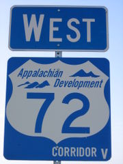
- Between Red Bay, AlabamaRed Bay, AlabamaRed Bay is a city in Franklin County, Alabama, United States. At the 2000 census the population was 3,374.-Geography:Red Bay is located at .According to the U.S...
and Fulton, MississippiFulton, MississippiFulton is a city in Itawamba County, Mississippi, United States. The population was 3,882 at the 2000 census. It is the county seat of Itawamba County.This city is part of the Tupelo Micropolitan Statistical Area.-Geography:...
(designated MS 76) - Relocated US 278U.S. Route 278U.S. Route 278 is a parallel route of U.S. Route 78. It currently runs for 1,074 miles from Hilton Head Island, South Carolina to Wickes, Arkansas at U.S. Highway 71/U.S. Highway 59. It might be notable that it is longer than its parent highway, US Hwy-78. US Hwy-278 passes through the states of...
/MS 6 between TupeloTupelo, MississippiTupelo is the largest city in and the county seat of Lee County, Mississippi, United States. It is the seventh largest city in the state of Mississippi, smaller than Meridian, and larger than Greenville. As of the 2000 United States Census, the city's population was 34,211...
and Pontotoc, MississippiPontotoc, MississippiPontotoc is a city in Pontotoc County, Mississippi, United States. Pontotoc is west of the much larger city of Tupelo. The population was 5,625 at the 2010 census...
, which is projected to be complete in 2013.
Both sections of highway are currently under design by the Mississippi Department of Transportation, with the portion that will overlap MS 25 already under construction near Fulton
Fulton, Mississippi
Fulton is a city in Itawamba County, Mississippi, United States. The population was 3,882 at the 2000 census. It is the county seat of Itawamba County.This city is part of the Tupelo Micropolitan Statistical Area.-Geography:...
.
Sections of Alabama State Route 24
Alabama State Route 24
State Route 24 is a long route in the northwestern and north-central part of the state. The western terminus of the route is near Red Bay at the Mississippi state line, where it continues as Mississippi Highway 23. The eastern terminus of the route is at the junction with State Route 67 at Decatur...
in Red Bay
Red Bay, Alabama
Red Bay is a city in Franklin County, Alabama, United States. At the 2000 census the population was 3,374.-Geography:Red Bay is located at .According to the U.S...
and just west of Russellville
Russellville, Alabama
Russellville is a city in Franklin County in the U.S. state of Alabama. At the 2000 census, the population of the city was 8,971. The city is the county seat of Franklin County.-History:...
are under construction, with completion dates for the Red Bay bypass set near the end of 2010.
Corridor V between Batesville and Fulton was also designated as National Highway System
National Highway System (United States)
The National Highway System is a network of strategic highways within the United States, including the Interstate Highway System and other roads serving major airports, ports, rail or truck terminals, railway stations, pipeline terminals and other strategic transport facilities.Individual states...
High Priority Corridor 42 and a Future Interstate Corridor as part of the 1998 Transportation Equity Act for the 21st Century
Transportation Equity Act for the 21st Century
The Transportation Equity Act for the 21st Century was enacted June 9, 1998, as Public Law 105-178. TEA-21 authorized the Federal surface transportation programs for highways, highway safety, and transit for the 6-year period 1998-2003...
; originally, Corridor 42 also included an overlap with Corridor X
Interstate 22
Interstate 22 , when it is completed, will follow the U.S. Highway 78 corridor along a 213-mile-long route from Memphis, Tennessee, to Birmingham, Alabama, as an Interstate Highway. Interstate 22 will connect Interstate 240 and Interstate 40 in the northwest with Interstate 65 and Interstate...
between Fulton and Birmingham, Alabama
Birmingham, Alabama
Birmingham is the largest city in Alabama. The city is the county seat of Jefferson County. According to the 2010 United States Census, Birmingham had a population of 212,237. The Birmingham-Hoover Metropolitan Area, in estimate by the U.S...
, but this overlap was removed in subsequent legislation. However, the portion of the route between Batesville and Tupelo is only being constructed to four-lane divided highway standards, making Interstate highway designation unlikely in the near future.
Corridor V was also designated as High Priority Corridor 11 in the National Highway System Designation Act of 1995.
Corridor X
See also
- Appalachian TrailAppalachian TrailThe Appalachian National Scenic Trail, generally known as the Appalachian Trail or simply the AT, is a marked hiking trail in the eastern United States extending between Springer Mountain in Georgia and Mount Katahdin in Maine. It is approximately long...
(Appalachian National Scenic Trail in the eastern U.S.) - Appalachian Trail ConservancyAppalachian Trail ConservancyThe Appalachian Trail Conservancy is a nonprofit organization dedicated to the conservation of the Appalachian Trail, which runs from Maine to Georgia...
(formerly the Appalachian Trail Conference)